Zeitzone:Mexikanische Pazifik-Normalzeit
Ortszeit:Dienstag, 10. November 2026 15:51
Länge:-110.7122465
Breite:26.7312935
Sonnenaufgang Heute:06:40:01
Sonnenuntergang Heute:17:36:14
Tageslänge heute:10h 56m 13s
Sonnenaufgang morgen:06:40:45
Sonnenuntergang Morgen:17:35:45
Tageslänge von morgen:10h 55m 0s

: Alle Termine anzeigen

Datum Sonnenaufgang Sonnenuntergang Tageslänge
1. Jan. 2026 07:12:31 17:41:44 10h 29m 12s
1. Feb. 2026 07:09:46 18:05:19 10h 55m 32s
1. März 2026 06:49:07 18:24:35 11h 35m 28s
1. Apr. 2026 06:15:53 18:40:24 12h 24m 30s
1. Mai 2026 05:46:43 18:55:47 13h 9m 3s
1. Juni 2026 05:31:05 19:12:56 13h 41m 51s
1. Juli 2026 05:33:44 19:21:36 13h 47m 52s
1. Aug. 2026 05:48:16 19:12:37 13h 24m 21s
1. Sep. 2026 06:03:27 18:45:55 12h 42m 28s
1. Okt. 2026 06:16:04 18:12:02 11h 55m 57s
1. Nov. 2026 06:33:00 17:42:23 11h 9m 22s
11. Nov. 2026 06:40:01 17:36:14 10h 56m 13s
12. Nov. 2026 06:40:45 17:35:45 10h 55m 0s
1. Dez. 2026 06:55:06 17:30:58 10h 35m 51s

Fotos von Sonnenaufgang und Sonnenuntergang

In memory of the US Gulf Coast - Grayton Beach, Florida by PatrickSmithPhotography, Winter 2008, here are the sparkling white sands of the US Gulf coast!  (With tea colored water from
In memory of the US Gulf Coast - Grayton Beach, Florida by PatrickSmithPhotography
John Muir Statue by K. Horn, At the John Muir National Historic Site in Martinez, California.

P8310028

CHAPTER V of My First Su
John Muir Statue by K. Horn
Colorado River by Wolfgang Staudt, Get a<a href="http://flickr.com/photos/wolfgangstaudt/2281643145/sizes/l/"> large  </a>view! 

The <
Colorado River by Wolfgang Staudt
Revolving Colorado River by Peter Böhringer, The Colorado River, rising in the Rocky Mountains and flowing generally west and south for 1,450 mil
Revolving Colorado River by Peter Böhringer
Colorado River, Marble Canyon, Navajo Nation Territory, USA. by millicand@rocketmail.com, The Colorado River (Spanish: Río Colorado) is one of the principal rivers (along with the Rio Grande
Colorado River, Marble Canyon, Navajo Nation Territory, USA. by [email protected]
Dead Horse Point State Park by ~ Floydian ~, Dead Horse Point State Park is perhaps Utah's most spectacular state park. Dead Horse Point is a pro
Dead Horse Point State Park by ~ Floydian ~
U.S. Route 89A, Navajo Bridge, Colorado River, Marble Canyon, Navajo Nation Territory, USA. by millicand@rocketmail.com, Navajo Bridge is the name of twin steel spandrel arch bridges that cross the Colorado River in the G
U.S. Route 89A, Navajo Bridge, Colorado River, Marble Canyon, Navajo Nation Territory, USA. by [email protected]
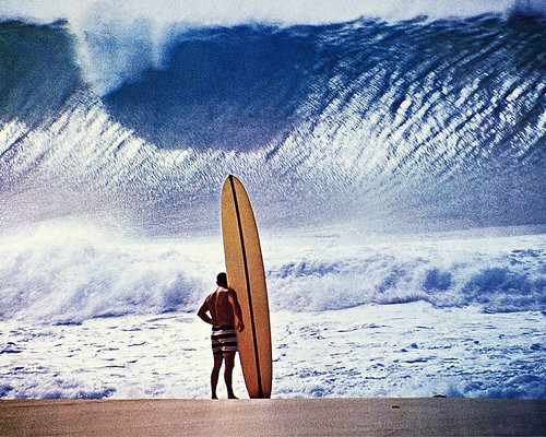
Greg Noll faces the Pipeline by Brian Howell, When I moved to Pacific Beach in April of 1970 they were still talking about it: the epic swell of w
Greg Noll faces the Pipeline by Brian Howell
Ship to ship lightening,Gulf of California by Rails West, Iam on the "big one" on the left.We are 320 000 tons and the one on the right is around 15
Ship to ship lightening,Gulf of California by Rails West
The Permian Basin, New Mexico and Texas, USA by concho cowboy, The Permian Basin is a large sedimentary basin in the southwestern part of the United States. The ba
The Permian Basin, New Mexico and Texas, USA by concho cowboy
Colorado River, Marble Canyon, Navajo Nation Territory, USA. by millicand@rocketmail.com, The Colorado River (Spanish: Río Colorado) is one of the principal rivers (along with the Rio Grande
Colorado River, Marble Canyon, Navajo Nation Territory, USA. by [email protected]
splash of color by lecates, Our third sunrise of the trip. Thought it would be smart to get right out in the rocks on the water.
splash of color by lecates
U.S. Route 89A, Navajo Bridge, Colorado River, Marble Canyon, Navajo Nation Territory, USA. by millicand@rocketmail.com, Navajo Bridge is the name of twin steel spandrel arch bridges that cross the Colorado River in the G
U.S. Route 89A, Navajo Bridge, Colorado River, Marble Canyon, Navajo Nation Territory, USA. by [email protected]
Standing Tall.......... by law_keven, Black-Necked Stilt ~ Lake Elsinore ~ Western Riverside County ~ California ~ USA ~ Sunday 6th Decemb
Standing Tall.......... by law_keven
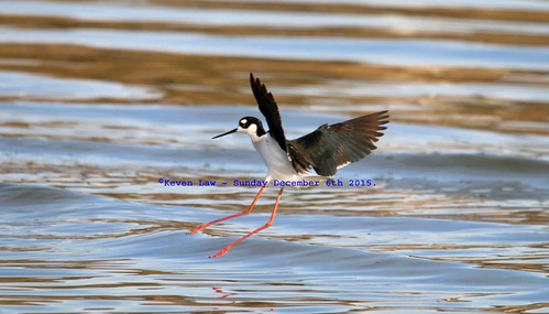
Incoming....... by law_keven, Black-Necked Stilt ~ Lake Elsinore ~ Western Riverside County ~ California ~ USA ~ Sunday 6th Decemb
Incoming....... by law_keven
Koh Phangnan Thailand Beach by Jacksoncam, Early morning Koh Phangan island 
Gulf of Thailand
Shot with Canon 5D and 20mm lens
Twitter: @jackso
Koh Phangnan Thailand Beach by Jacksoncam
Cottonseed Sunset by isaacfulford, We'll take a break from the trip postings for a day to take a look back at one of my favorite lines
Cottonseed Sunset by isaacfulford
my heart has died by larryosan, By Valerie J. Nelson

Los Angeles Times

HOLLYWOOD, Calif. — Danny Finegood, who viewed his hillside
my heart has died by larryosan
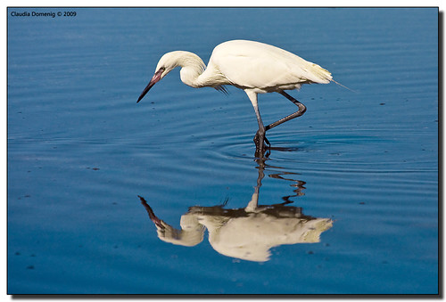
Mirror, Mirror on the Floor.... by Fraggle Red, <b><i>Reddish Egret, White Morph, JN Ding Darling National Wildlife Refuge</i>
Sanibel Island, FL</b
Mirror, Mirror on the Floor.... by Fraggle Red

Runway Alert by The National Guard, Syracuse, New York, March 1, 1953..Beginning March 1, 1953, the Air National Guard's (ANG's) 138th F
Runway Alert by The National Guard
Brown Pelican Sunset CINP DSC_4836 by JKIESECKER, Like the Channel Islands Foxes the California Brown Pelican (picture here in silhouette) are a conse
Brown Pelican Sunset CINP DSC_4836 by JKIESECKER
Dawn on the Bend by Mark P Betts, Dawn on the Bend 2011 style

We got in to Page late after being slowed by thunderstorms after the Bl
Dawn on the Bend by Mark P Betts
Pyroclasm I by Ben_Coffman, During spring break we camped for a couple of nights at this location, near Baja's Bahia de Los Ange
Pyroclasm I by Ben_Coffman
Gifts from the sea... by ElizabethNDP, I've wanted to get this shot since seeing similar shots in IG...I had found a few shells on the beac
Gifts from the sea... by ElizabethNDP
Orilla en Sombra by courtney_meier, The sun sets over the Gulf of California and sends fingers of light into the clouds over the harbor
Orilla en Sombra by courtney_meier
Crazy Horse by Dom Haughton, Even in the grounds of the hotel we couldn’t completely escape the sales pitches.  Each day as we se
Crazy Horse by Dom Haughton
Monsoon Sky by ScenicSW, Summer rainfall across the Sonoran desert at sunset, near Tucson Arizona. This is the season in whic
Monsoon Sky by ScenicSW
California (Just before sunset at the Salton Sea) - 20120114-01 by Sue Milks, The Salton Sea is a shallow, landlocked, highly-saline body of water in Riverside and Imperial count
California (Just before sunset at the Salton Sea) - 20120114-01 by Sue Milks
last sunrise by lecates, there's snow falling all over the USA at this point, and we're about to go home to that?ocean mornin
last sunrise by lecates
Land's End by Thüncher Photography, At the southernmost end of Mexico's Baja California Peninsula, lies the bustling vacation destinatio
Land's End by Thüncher Photography
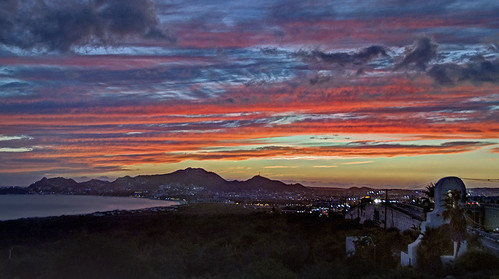
Cabo San Lucas Sunset by Terry Pridemore Worldwide Photography, This is a view over Cabo San Lucas, Mexico and the harbor. Beyond those rocky hills lies the Pacific
Cabo San Lucas Sunset by Terry Pridemore Worldwide Photography
163897 F14D Lion 210 CVN71 180606a by John Higgins (EF), 163897/AJ-210 Grumman F-14D Tomcat, VF-213 Black Lions, NAS Oceana, Carrier Air Wing 8, CVN-71 USS T
163897 F14D Lion 210 CVN71 180606a by John Higgins (EF)
A Look to the Gulf of the Farallones by TheQ!, San Francisco, CAleicamtyp240 leicam leica 28mmelmarit sanfrancisco california
A Look to the Gulf of the Farallones by TheQ!
Sun Painted Colors at Sunrise at Land's End by jeff_a_goldberg, From the bow of the National Geographic Sea Bird, I was waiting for the famous sun rise at Land's En
Sun Painted Colors at Sunrise at Land's End by jeff_a_goldberg
12 Years Ago: Ferry by Tony Pulokas, This was taken on the ferry ride from La Paz to Mazatlan.  It shows some part Baja California, but I
12 Years Ago: Ferry by Tony Pulokas
Cabo Arch at sunset by Terry Pridemore Worldwide Photography, This famous arch at the point of rocks is the dividing line between the relatively calm waters of th
Cabo Arch at sunset by Terry Pridemore Worldwide Photography
An American Avocet (Recurvirostra americana) continues to feed in the pink light of the sunset by Ron Fredrick, Photographed at Shoreline Lake, California - Standing, no cover
 
Please click twice on the image to
An American Avocet (Recurvirostra americana) continues to feed in the pink light of the sunset by Ron Fredrick
🌊 Saltonshoe Bend 🔥 by slworking2, Aerial sunset panorama on the crusty shore of Bombay Beach at the Salton Sea.

I decided that this c
🌊 Saltonshoe Bend 🔥 by slworking2
Sea of Cortez, Mexico by malcolm harris, california sunset sea clouds sunrise wow mexico bay gulf cortez bocochibampo
Sea of Cortez, Mexico by malcolm harris
Trawler, Gulf of California, a.k.a. Sea of Cortez, Mexico. by troupial, San Carlos, State of Sonora, Mexico.sancarlossonora sancarlossonoramexico sonoramexico sonora
Trawler, Gulf of California, a.k.a. Sea of Cortez, Mexico. by troupial
Last Sunset of Trip by helenehoffman, Sea of Cortex, Baja California Sur, Mexicomexico gulfofcalifornia seaofcortez desert safariendeavor
Last Sunset of Trip by helenehoffman
A celebrity by C.P. Kirkie, Just before sunset, the second half of a large intermodal train passes Andesite siding on the Shasta
A celebrity by C.P. Kirkie
on our way home by lecates, final stroll before packing for home.ocean morning travel blue sea vacation sky sun holiday beach wa
on our way home by lecates
Border Sunset by joemcmillan118, Santa Fe's longest branch line, the San Angelo Subdivision, ran 386 miles across desolate West Texas
Border Sunset by joemcmillan118
Ghosts of the Illinois Central by ericcortinas03, Early last summer, I took a trip to California's Central Valley and was able to document some of the
Ghosts of the Illinois Central by ericcortinas03
Un Nuevo Día by Demodragon, Aun en las primeras horas de la mañana la temperatura ya es muy alta en los desiertos de Sonora. El
Un Nuevo Día by Demodragon
Clearing Autumn Storm by G Dan Mitchell, <i>Clearing Autumn Storm. Yosemite Valley, California. October 28, 2016. © Copyright 2016 <a href="h
Clearing Autumn Storm by G Dan Mitchell
Just Before Sunrise by shutterfish, Fishermen launch their pangas before sunrise. Bahia Las Frailes, Baja California Sur, Mexico. Olympu
Just Before Sunrise by shutterfish
Aqua Verde Sunrise by helenehoffman, Bahia Aqua Verde, Sea of Cortez, Baja California Sur, Mexicomexico gulfofcalifornia seaofcortez sunr
Aqua Verde Sunrise by helenehoffman
Lands end at dawn by malcolm harris, View at sunrise across Bocochibampo Bay, from San Carlos, Sonora, Mexico, the home port of my sailin
Lands end at dawn by malcolm harris
Passing Summer Storm:  North American Monsoon (NAM) by Ginger H Robinson, This image is of yet another storm monsoonal storm system passing through the Rocky Mountain Front R
Passing Summer Storm: North American Monsoon (NAM) by Ginger H Robinson
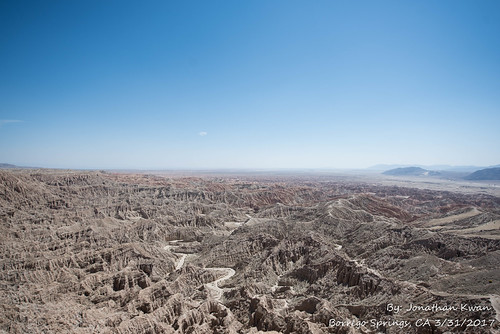
Font's Point- Borrego Springs by zerojquan85, At sunset and sunrise, the Borrego Badlands’ creased and wrinkled ridges cast bold shadows across a
Font's Point- Borrego Springs by zerojquan85
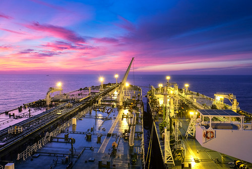
Ship to ship  cargo transfer,Gulf of Catalina ,California by Rails West, We (the bigger ship on the left) are discharging around  1 000 000 barrels of Arabian crude to the s
Ship to ship cargo transfer,Gulf of Catalina ,California by Rails West
el machorro by rey perezoso, 2011 méxico bajacalifornia sanfelipe mexicali mardecortés gulfofcalifornia mar meer sunrise mountain
el machorro by rey perezoso
Gulf of the Farallones at Sunset by auslaender1, Gulf of the Farallones is a gulf of the Pacific Ocean off the northern California coast. It extends
Gulf of the Farallones at Sunset by auslaender1
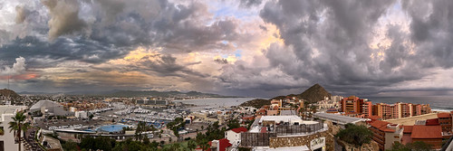
Stormy Cabo sunset by BDFri2012, Hurricane Lidia storm clouds provide for a dramatic sunset over Cabo San Lucas.  Another time where
Stormy Cabo sunset by BDFri2012
cortez dawn by david haggard, On my first trip to Baja California, I sea kayaked and camped along the Gulf of California south of
cortez dawn by david haggard
Sunset Color Over the Farralon Islands by San Francisco Gal, Farralon Islands -- San Francisco -- California

The Farallon Islands, or Farallones (from the Spani
Sunset Color Over the Farralon Islands by San Francisco Gal
End of the Day by drat2463, Another Yuma sunset, Mountains in the distance are in Mexico in the direction of the Gulf of Califor
End of the Day by drat2463
Wetland Evening Reflections by G Dan Mitchell, <em>Wetland Evening Reflections. © Copyright 2018 <a href="http://www.gdanmitchell.com/" rel="norefe
Wetland Evening Reflections by G Dan Mitchell