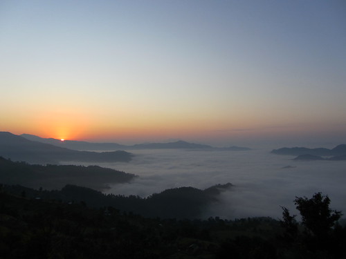
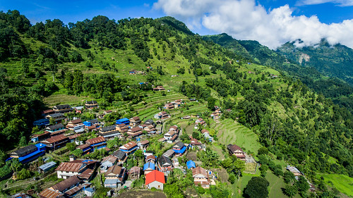
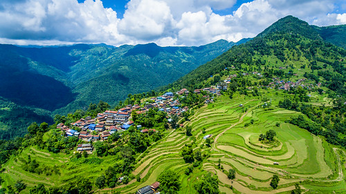
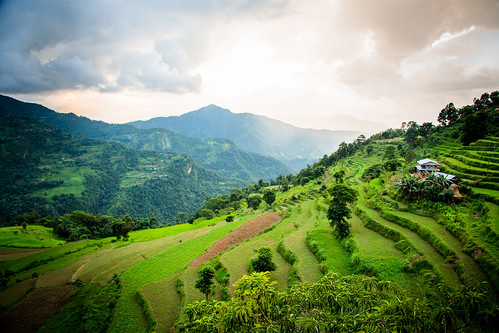
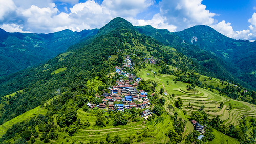
Chisapani, Nepal Sonnenaufgang Sonnenuntergang Zeiten
Location: Nepal > Western Region > Gandaki >
Zeitzone:
Asia/Katmandu
Ortszeit:
2025-07-14 17:37:46
Länge:
84.1560442
Breite:
28.1538627
Sonnenaufgang Heute:
05:21:08 AM
Sonnenuntergang Heute:
07:07:28 PM
Tageslänge heute:
13h 46m 20s
Sonnenaufgang morgen:
05:21:39 AM
Sonnenuntergang Morgen:
07:07:09 PM
Tageslänge von morgen:
13h 45m 30s
Alle Termine anzeigen
| Datum | Sonnenaufgang | Sonnenuntergang | Tageslänge |
|---|---|---|---|
| 2025-01-01 | 07:00:09 AM | 05:23:59 PM | 10h 23m 50s |
| 2025-01-02 | 07:00:23 AM | 05:24:41 PM | 10h 24m 18s |
| 2025-01-03 | 07:00:35 AM | 05:25:24 PM | 10h 24m 49s |
| 2025-01-04 | 07:00:47 AM | 05:26:07 PM | 10h 25m 20s |
| 2025-01-05 | 07:00:56 AM | 05:26:51 PM | 10h 25m 55s |
| 2025-01-06 | 07:01:04 AM | 05:27:35 PM | 10h 26m 31s |
| 2025-01-07 | 07:01:11 AM | 05:28:21 PM | 10h 27m 10s |
| 2025-01-08 | 07:01:16 AM | 05:29:06 PM | 10h 27m 50s |
| 2025-01-09 | 07:01:19 AM | 05:29:53 PM | 10h 28m 34s |
| 2025-01-10 | 07:01:21 AM | 05:30:39 PM | 10h 29m 18s |
| 2025-01-11 | 07:01:21 AM | 05:31:27 PM | 10h 30m 6s |
| 2025-01-12 | 07:01:19 AM | 05:32:14 PM | 10h 30m 55s |
| 2025-01-13 | 07:01:16 AM | 05:33:02 PM | 10h 31m 46s |
| 2025-01-14 | 07:01:12 AM | 05:33:50 PM | 10h 32m 38s |
| 2025-01-15 | 07:01:06 AM | 05:34:39 PM | 10h 33m 33s |
| 2025-01-16 | 07:00:58 AM | 05:35:28 PM | 10h 34m 30s |
| 2025-01-17 | 07:00:48 AM | 05:36:17 PM | 10h 35m 29s |
| 2025-01-18 | 07:00:37 AM | 05:37:06 PM | 10h 36m 29s |
| 2025-01-19 | 07:00:25 AM | 05:37:55 PM | 10h 37m 30s |
| 2025-01-20 | 07:00:11 AM | 05:38:44 PM | 10h 38m 33s |
| 2025-01-21 | 06:59:55 AM | 05:39:34 PM | 10h 39m 39s |
| 2025-01-22 | 06:59:38 AM | 05:40:23 PM | 10h 40m 45s |
| 2025-01-23 | 06:59:19 AM | 05:41:13 PM | 10h 41m 54s |
| 2025-01-24 | 06:58:58 AM | 05:42:02 PM | 10h 43m 4s |
| 2025-01-25 | 06:58:37 AM | 05:42:51 PM | 10h 44m 14s |
| 2025-01-26 | 06:58:13 AM | 05:43:41 PM | 10h 45m 28s |
| 2025-01-27 | 06:57:48 AM | 05:44:30 PM | 10h 46m 42s |
| 2025-01-28 | 06:57:22 AM | 05:45:19 PM | 10h 47m 57s |
| 2025-01-29 | 06:56:54 AM | 05:46:07 PM | 10h 49m 13s |
| 2025-01-30 | 06:56:25 AM | 05:46:56 PM | 10h 50m 31s |
| 2025-01-31 | 06:55:54 AM | 05:47:44 PM | 10h 51m 50s |
| 2025-02-01 | 06:55:22 AM | 05:48:33 PM | 10h 53m 11s |
| 2025-02-02 | 06:54:49 AM | 05:49:20 PM | 10h 54m 31s |
| 2025-02-03 | 06:54:14 AM | 05:50:08 PM | 10h 55m 54s |
| 2025-02-04 | 06:53:38 AM | 05:50:55 PM | 10h 57m 17s |
| 2025-02-05 | 06:53:01 AM | 05:51:42 PM | 10h 58m 41s |
| 2025-02-06 | 06:52:22 AM | 05:52:29 PM | 11h 0m 7s |
| 2025-02-07 | 06:51:42 AM | 05:53:16 PM | 11h 1m 34s |
| 2025-02-08 | 06:51:01 AM | 05:54:02 PM | 11h 3m 1s |
| 2025-02-09 | 06:50:19 AM | 05:54:47 PM | 11h 4m 28s |
| 2025-02-10 | 06:49:35 AM | 05:55:33 PM | 11h 5m 58s |
| 2025-02-11 | 06:48:50 AM | 05:56:17 PM | 11h 7m 27s |
| 2025-02-12 | 06:48:04 AM | 05:57:02 PM | 11h 8m 58s |
| 2025-02-13 | 06:47:17 AM | 05:57:46 PM | 11h 10m 29s |
| 2025-02-14 | 06:46:29 AM | 05:58:30 PM | 11h 12m 1s |
| 2025-02-15 | 06:45:40 AM | 05:59:13 PM | 11h 13m 33s |
| 2025-02-16 | 06:44:50 AM | 05:59:56 PM | 11h 15m 6s |
| 2025-02-17 | 06:43:59 AM | 06:00:39 PM | 11h 16m 40s |
| 2025-02-18 | 06:43:06 AM | 06:01:21 PM | 11h 18m 15s |
| 2025-02-19 | 06:42:13 AM | 06:02:03 PM | 11h 19m 50s |
| 2025-02-20 | 06:41:19 AM | 06:02:44 PM | 11h 21m 25s |
| 2025-02-21 | 06:40:24 AM | 06:03:25 PM | 11h 23m 1s |
| 2025-02-22 | 06:39:28 AM | 06:04:06 PM | 11h 24m 38s |
| 2025-02-23 | 06:38:32 AM | 06:04:46 PM | 11h 26m 14s |
| 2025-02-24 | 06:37:34 AM | 06:05:26 PM | 11h 27m 52s |
| 2025-02-25 | 06:36:36 AM | 06:06:05 PM | 11h 29m 29s |
| 2025-02-26 | 06:35:37 AM | 06:06:44 PM | 11h 31m 7s |
| 2025-02-27 | 06:34:37 AM | 06:07:23 PM | 11h 32m 46s |
| 2025-02-28 | 06:33:37 AM | 06:08:01 PM | 11h 34m 24s |
| 2025-03-01 | 06:32:35 AM | 06:08:39 PM | 11h 36m 4s |
| 2025-03-02 | 06:31:34 AM | 06:09:17 PM | 11h 37m 43s |
| 2025-03-03 | 06:30:31 AM | 06:09:54 PM | 11h 39m 23s |
| 2025-03-04 | 06:29:28 AM | 06:10:31 PM | 11h 41m 3s |
| 2025-03-05 | 06:28:25 AM | 06:11:07 PM | 11h 42m 42s |
| 2025-03-06 | 06:27:21 AM | 06:11:44 PM | 11h 44m 23s |
| 2025-03-07 | 06:26:16 AM | 06:12:20 PM | 11h 46m 4s |
| 2025-03-08 | 06:25:11 AM | 06:12:55 PM | 11h 47m 44s |
| 2025-03-09 | 06:24:06 AM | 06:13:31 PM | 11h 49m 25s |
| 2025-03-10 | 06:23:00 AM | 06:14:06 PM | 11h 51m 6s |
| 2025-03-11 | 06:21:54 AM | 06:14:41 PM | 11h 52m 47s |
| 2025-03-12 | 06:20:47 AM | 06:15:15 PM | 11h 54m 28s |
| 2025-03-13 | 06:19:40 AM | 06:15:50 PM | 11h 56m 10s |
| 2025-03-14 | 06:18:33 AM | 06:16:24 PM | 11h 57m 51s |
| 2025-03-15 | 06:17:25 AM | 06:16:58 PM | 11h 59m 33s |
| 2025-03-16 | 06:16:18 AM | 06:17:31 PM | 12h 1m 13s |
| 2025-03-17 | 06:15:10 AM | 06:18:05 PM | 12h 2m 55s |
| 2025-03-18 | 06:14:02 AM | 06:18:38 PM | 12h 4m 36s |
| 2025-03-19 | 06:12:53 AM | 06:19:12 PM | 12h 6m 19s |
| 2025-03-20 | 06:11:45 AM | 06:19:45 PM | 12h 8m 0s |
| 2025-03-21 | 06:10:36 AM | 06:20:17 PM | 12h 9m 41s |
| 2025-03-22 | 06:09:28 AM | 06:20:50 PM | 12h 11m 22s |
| 2025-03-23 | 06:08:19 AM | 06:21:23 PM | 12h 13m 4s |
| 2025-03-24 | 06:07:10 AM | 06:21:56 PM | 12h 14m 46s |
| 2025-03-25 | 06:06:01 AM | 06:22:28 PM | 12h 16m 27s |
| 2025-03-26 | 06:04:53 AM | 06:23:01 PM | 12h 18m 8s |
| 2025-03-27 | 06:03:44 AM | 06:23:33 PM | 12h 19m 49s |
| 2025-03-28 | 06:02:36 AM | 06:24:05 PM | 12h 21m 29s |
| 2025-03-29 | 06:01:27 AM | 06:24:38 PM | 12h 23m 11s |
| 2025-03-30 | 06:00:19 AM | 06:25:10 PM | 12h 24m 51s |
| 2025-03-31 | 05:59:11 AM | 06:25:42 PM | 12h 26m 31s |
| 2025-04-01 | 05:58:03 AM | 06:26:14 PM | 12h 28m 11s |
| 2025-04-02 | 05:56:55 AM | 06:26:47 PM | 12h 29m 52s |
| 2025-04-03 | 05:55:48 AM | 06:27:19 PM | 12h 31m 31s |
| 2025-04-04 | 05:54:41 AM | 06:27:51 PM | 12h 33m 10s |
| 2025-04-05 | 05:53:34 AM | 06:28:24 PM | 12h 34m 50s |
| 2025-04-06 | 05:52:28 AM | 06:28:56 PM | 12h 36m 28s |
| 2025-04-07 | 05:51:22 AM | 06:29:29 PM | 12h 38m 7s |
| 2025-04-08 | 05:50:16 AM | 06:30:01 PM | 12h 39m 45s |
| 2025-04-09 | 05:49:11 AM | 06:30:34 PM | 12h 41m 23s |
| 2025-04-10 | 05:48:06 AM | 06:31:06 PM | 12h 43m 0s |
| 2025-04-11 | 05:47:01 AM | 06:31:39 PM | 12h 44m 38s |
| 2025-04-12 | 05:45:57 AM | 06:32:12 PM | 12h 46m 15s |
| 2025-04-13 | 05:44:54 AM | 06:32:45 PM | 12h 47m 51s |
| 2025-04-14 | 05:43:51 AM | 06:33:18 PM | 12h 49m 27s |
| 2025-04-15 | 05:42:49 AM | 06:33:52 PM | 12h 51m 3s |
| 2025-04-16 | 05:41:47 AM | 06:34:25 PM | 12h 52m 38s |
| 2025-04-17 | 05:40:46 AM | 06:34:59 PM | 12h 54m 13s |
| 2025-04-18 | 05:39:46 AM | 06:35:32 PM | 12h 55m 46s |
| 2025-04-19 | 05:38:46 AM | 06:36:06 PM | 12h 57m 20s |
| 2025-04-20 | 05:37:47 AM | 06:36:40 PM | 12h 58m 53s |
| 2025-04-21 | 05:36:49 AM | 06:37:14 PM | 13h 0m 25s |
| 2025-04-22 | 05:35:51 AM | 06:37:48 PM | 13h 1m 57s |
| 2025-04-23 | 05:34:54 AM | 06:38:23 PM | 13h 3m 29s |
| 2025-04-24 | 05:33:58 AM | 06:38:57 PM | 13h 4m 59s |
| 2025-04-25 | 05:33:03 AM | 06:39:32 PM | 13h 6m 29s |
| 2025-04-26 | 05:32:09 AM | 06:40:06 PM | 13h 7m 57s |
| 2025-04-27 | 05:31:15 AM | 06:40:41 PM | 13h 9m 26s |
| 2025-04-28 | 05:30:23 AM | 06:41:16 PM | 13h 10m 53s |
| 2025-04-29 | 05:29:31 AM | 06:41:51 PM | 13h 12m 20s |
| 2025-04-30 | 05:28:41 AM | 06:42:27 PM | 13h 13m 46s |
| 2025-05-01 | 05:27:51 AM | 06:43:02 PM | 13h 15m 11s |
| 2025-05-02 | 05:27:02 AM | 06:43:37 PM | 13h 16m 35s |
| 2025-05-03 | 05:26:14 AM | 06:44:13 PM | 13h 17m 59s |
| 2025-05-04 | 05:25:28 AM | 06:44:48 PM | 13h 19m 20s |
| 2025-05-05 | 05:24:42 AM | 06:45:24 PM | 13h 20m 42s |
| 2025-05-06 | 05:23:57 AM | 06:46:00 PM | 13h 22m 3s |
| 2025-05-07 | 05:23:14 AM | 06:46:36 PM | 13h 23m 22s |
| 2025-05-08 | 05:22:32 AM | 06:47:11 PM | 13h 24m 39s |
| 2025-05-09 | 05:21:50 AM | 06:47:47 PM | 13h 25m 57s |
| 2025-05-10 | 05:21:10 AM | 06:48:23 PM | 13h 27m 13s |
| 2025-05-11 | 05:20:31 AM | 06:48:59 PM | 13h 28m 28s |
| 2025-05-12 | 05:19:53 AM | 06:49:34 PM | 13h 29m 41s |
| 2025-05-13 | 05:19:17 AM | 06:50:10 PM | 13h 30m 53s |
| 2025-05-14 | 05:18:41 AM | 06:50:46 PM | 13h 32m 5s |
| 2025-05-15 | 05:18:07 AM | 06:51:21 PM | 13h 33m 14s |
| 2025-05-16 | 05:17:34 AM | 06:51:57 PM | 13h 34m 23s |
| 2025-05-17 | 05:17:03 AM | 06:52:32 PM | 13h 35m 29s |
| 2025-05-18 | 05:16:32 AM | 06:53:07 PM | 13h 36m 35s |
| 2025-05-19 | 05:16:03 AM | 06:53:42 PM | 13h 37m 39s |
| 2025-05-20 | 05:15:35 AM | 06:54:17 PM | 13h 38m 42s |
| 2025-05-21 | 05:15:09 AM | 06:54:51 PM | 13h 39m 42s |
| 2025-05-22 | 05:14:43 AM | 06:55:26 PM | 13h 40m 43s |
| 2025-05-23 | 05:14:20 AM | 06:56:00 PM | 13h 41m 40s |
| 2025-05-24 | 05:13:57 AM | 06:56:33 PM | 13h 42m 36s |
| 2025-05-25 | 05:13:36 AM | 06:57:07 PM | 13h 43m 31s |
| 2025-05-26 | 05:13:16 AM | 06:57:40 PM | 13h 44m 24s |
| 2025-05-27 | 05:12:57 AM | 06:58:12 PM | 13h 45m 15s |
| 2025-05-28 | 05:12:40 AM | 06:58:44 PM | 13h 46m 4s |
| 2025-05-29 | 05:12:24 AM | 06:59:16 PM | 13h 46m 52s |
| 2025-05-30 | 05:12:10 AM | 06:59:47 PM | 13h 47m 37s |
| 2025-05-31 | 05:11:56 AM | 07:00:18 PM | 13h 48m 22s |
| 2025-06-01 | 05:11:44 AM | 07:00:48 PM | 13h 49m 4s |
| 2025-06-02 | 05:11:34 AM | 07:01:18 PM | 13h 49m 44s |
| 2025-06-03 | 05:11:25 AM | 07:01:47 PM | 13h 50m 22s |
| 2025-06-04 | 05:11:17 AM | 07:02:15 PM | 13h 50m 58s |
| 2025-06-05 | 05:11:10 AM | 07:02:43 PM | 13h 51m 33s |
| 2025-06-06 | 05:11:05 AM | 07:03:10 PM | 13h 52m 5s |
| 2025-06-07 | 05:11:01 AM | 07:03:37 PM | 13h 52m 36s |
| 2025-06-08 | 05:10:59 AM | 07:04:02 PM | 13h 53m 3s |
| 2025-06-09 | 05:10:57 AM | 07:04:27 PM | 13h 53m 30s |
| 2025-06-10 | 05:10:57 AM | 07:04:51 PM | 13h 53m 54s |
| 2025-06-11 | 05:10:59 AM | 07:05:14 PM | 13h 54m 15s |
| 2025-06-12 | 05:11:01 AM | 07:05:36 PM | 13h 54m 35s |
| 2025-06-13 | 05:11:05 AM | 07:05:58 PM | 13h 54m 53s |
| 2025-06-14 | 05:11:10 AM | 07:06:18 PM | 13h 55m 8s |
| 2025-06-15 | 05:11:16 AM | 07:06:38 PM | 13h 55m 22s |
| 2025-06-16 | 05:11:23 AM | 07:06:56 PM | 13h 55m 33s |
| 2025-06-17 | 05:11:32 AM | 07:07:14 PM | 13h 55m 42s |
| 2025-06-18 | 05:11:42 AM | 07:07:30 PM | 13h 55m 48s |
| 2025-06-19 | 05:11:52 AM | 07:07:45 PM | 13h 55m 53s |
| 2025-06-20 | 05:12:04 AM | 07:08:00 PM | 13h 55m 56s |
| 2025-06-21 | 05:12:17 AM | 07:08:13 PM | 13h 55m 56s |
| 2025-06-22 | 05:12:31 AM | 07:08:25 PM | 13h 55m 54s |
| 2025-06-23 | 05:12:47 AM | 07:08:36 PM | 13h 55m 49s |
| 2025-06-24 | 05:13:03 AM | 07:08:45 PM | 13h 55m 42s |
| 2025-06-25 | 05:13:20 AM | 07:08:54 PM | 13h 55m 34s |
| 2025-06-26 | 05:13:38 AM | 07:09:01 PM | 13h 55m 23s |
| 2025-06-27 | 05:13:57 AM | 07:09:07 PM | 13h 55m 10s |
| 2025-06-28 | 05:14:16 AM | 07:09:12 PM | 13h 54m 56s |
| 2025-06-29 | 05:14:37 AM | 07:09:15 PM | 13h 54m 38s |
| 2025-06-30 | 05:14:59 AM | 07:09:17 PM | 13h 54m 18s |
| 2025-07-01 | 05:15:21 AM | 07:09:18 PM | 13h 53m 57s |
| 2025-07-02 | 05:15:44 AM | 07:09:18 PM | 13h 53m 34s |
| 2025-07-03 | 05:16:08 AM | 07:09:16 PM | 13h 53m 8s |
| 2025-07-04 | 05:16:33 AM | 07:09:13 PM | 13h 52m 40s |
| 2025-07-05 | 05:16:58 AM | 07:09:08 PM | 13h 52m 10s |
| 2025-07-06 | 05:17:24 AM | 07:09:02 PM | 13h 51m 38s |
| 2025-07-07 | 05:17:50 AM | 07:08:55 PM | 13h 51m 5s |
| 2025-07-08 | 05:18:18 AM | 07:08:47 PM | 13h 50m 29s |
| 2025-07-09 | 05:18:45 AM | 07:08:37 PM | 13h 49m 52s |
| 2025-07-10 | 05:19:13 AM | 07:08:25 PM | 13h 49m 12s |
| 2025-07-11 | 05:19:42 AM | 07:08:12 PM | 13h 48m 30s |
| 2025-07-12 | 05:20:11 AM | 07:07:58 PM | 13h 47m 47s |
| 2025-07-13 | 05:20:41 AM | 07:07:43 PM | 13h 47m 2s |
| 2025-07-14 | 05:21:11 AM | 07:07:26 PM | 13h 46m 15s |
| 2025-07-15 | 05:21:42 AM | 07:07:08 PM | 13h 45m 26s |
| 2025-07-16 | 05:22:13 AM | 07:06:48 PM | 13h 44m 35s |
| 2025-07-17 | 05:22:44 AM | 07:06:27 PM | 13h 43m 43s |
| 2025-07-18 | 05:23:15 AM | 07:06:05 PM | 13h 42m 50s |
| 2025-07-19 | 05:23:47 AM | 07:05:41 PM | 13h 41m 54s |
| 2025-07-20 | 05:24:19 AM | 07:05:16 PM | 13h 40m 57s |
| 2025-07-21 | 05:24:51 AM | 07:04:49 PM | 13h 39m 58s |
| 2025-07-22 | 05:25:23 AM | 07:04:21 PM | 13h 38m 58s |
| 2025-07-23 | 05:25:56 AM | 07:03:52 PM | 13h 37m 56s |
| 2025-07-24 | 05:26:29 AM | 07:03:22 PM | 13h 36m 53s |
| 2025-07-25 | 05:27:01 AM | 07:02:50 PM | 13h 35m 49s |
| 2025-07-26 | 05:27:34 AM | 07:02:17 PM | 13h 34m 43s |
| 2025-07-27 | 05:28:07 AM | 07:01:43 PM | 13h 33m 36s |
| 2025-07-28 | 05:28:40 AM | 07:01:07 PM | 13h 32m 27s |
| 2025-07-29 | 05:29:14 AM | 07:00:30 PM | 13h 31m 16s |
| 2025-07-30 | 05:29:47 AM | 06:59:52 PM | 13h 30m 5s |
| 2025-07-31 | 05:30:20 AM | 06:59:13 PM | 13h 28m 53s |
| 2025-08-01 | 05:30:53 AM | 06:58:32 PM | 13h 27m 39s |
| 2025-08-02 | 05:31:26 AM | 06:57:51 PM | 13h 26m 25s |
| 2025-08-03 | 05:31:59 AM | 06:57:08 PM | 13h 25m 9s |
| 2025-08-04 | 05:32:32 AM | 06:56:24 PM | 13h 23m 52s |
| 2025-08-05 | 05:33:05 AM | 06:55:39 PM | 13h 22m 34s |
| 2025-08-06 | 05:33:38 AM | 06:54:53 PM | 13h 21m 15s |
| 2025-08-07 | 05:34:10 AM | 06:54:05 PM | 13h 19m 55s |
| 2025-08-08 | 05:34:43 AM | 06:53:17 PM | 13h 18m 34s |
| 2025-08-09 | 05:35:15 AM | 06:52:27 PM | 13h 17m 12s |
| 2025-08-10 | 05:35:48 AM | 06:51:37 PM | 13h 15m 49s |
| 2025-08-11 | 05:36:20 AM | 06:50:46 PM | 13h 14m 26s |
| 2025-08-12 | 05:36:52 AM | 06:49:53 PM | 13h 13m 1s |
| 2025-08-13 | 05:37:24 AM | 06:49:00 PM | 13h 11m 36s |
| 2025-08-14 | 05:37:56 AM | 06:48:05 PM | 13h 10m 9s |
| 2025-08-15 | 05:38:27 AM | 06:47:10 PM | 13h 8m 43s |
| 2025-08-16 | 05:38:59 AM | 06:46:14 PM | 13h 7m 15s |
| 2025-08-17 | 05:39:30 AM | 06:45:17 PM | 13h 5m 47s |
| 2025-08-18 | 05:40:01 AM | 06:44:19 PM | 13h 4m 18s |
| 2025-08-19 | 05:40:32 AM | 06:43:21 PM | 13h 2m 49s |
| 2025-08-20 | 05:41:03 AM | 06:42:21 PM | 13h 1m 18s |
| 2025-08-21 | 05:41:33 AM | 06:41:21 PM | 12h 59m 48s |
| 2025-08-22 | 05:42:04 AM | 06:40:20 PM | 12h 58m 16s |
| 2025-08-23 | 05:42:34 AM | 06:39:18 PM | 12h 56m 44s |
| 2025-08-24 | 05:43:04 AM | 06:38:16 PM | 12h 55m 12s |
| 2025-08-25 | 05:43:34 AM | 06:37:13 PM | 12h 53m 39s |
| 2025-08-26 | 05:44:04 AM | 06:36:09 PM | 12h 52m 5s |
| 2025-08-27 | 05:44:33 AM | 06:35:05 PM | 12h 50m 32s |
| 2025-08-28 | 05:45:03 AM | 06:34:00 PM | 12h 48m 57s |
| 2025-08-29 | 05:45:32 AM | 06:32:54 PM | 12h 47m 22s |
| 2025-08-30 | 05:46:01 AM | 06:31:48 PM | 12h 45m 47s |
| 2025-08-31 | 05:46:30 AM | 06:30:42 PM | 12h 44m 12s |
| 2025-09-01 | 05:46:59 AM | 06:29:35 PM | 12h 42m 36s |
| 2025-09-02 | 05:47:28 AM | 06:28:28 PM | 12h 41m 0s |
| 2025-09-03 | 05:47:57 AM | 06:27:20 PM | 12h 39m 23s |
| 2025-09-04 | 05:48:25 AM | 06:26:11 PM | 12h 37m 46s |
| 2025-09-05 | 05:48:54 AM | 06:25:03 PM | 12h 36m 9s |
| 2025-09-06 | 05:49:22 AM | 06:23:54 PM | 12h 34m 32s |
| 2025-09-07 | 05:49:51 AM | 06:22:44 PM | 12h 32m 53s |
| 2025-09-08 | 05:50:19 AM | 06:21:34 PM | 12h 31m 15s |
| 2025-09-09 | 05:50:47 AM | 06:20:25 PM | 12h 29m 38s |
| 2025-09-10 | 05:51:16 AM | 06:19:14 PM | 12h 27m 58s |
| 2025-09-11 | 05:51:44 AM | 06:18:04 PM | 12h 26m 20s |
| 2025-09-12 | 05:52:12 AM | 06:16:53 PM | 12h 24m 41s |
| 2025-09-13 | 05:52:40 AM | 06:15:42 PM | 12h 23m 2s |
| 2025-09-14 | 05:53:08 AM | 06:14:31 PM | 12h 21m 23s |
| 2025-09-15 | 05:53:37 AM | 06:13:20 PM | 12h 19m 43s |
| 2025-09-16 | 05:54:05 AM | 06:12:09 PM | 12h 18m 4s |
| 2025-09-17 | 05:54:33 AM | 06:10:58 PM | 12h 16m 25s |
| 2025-09-18 | 05:55:02 AM | 06:09:47 PM | 12h 14m 45s |
| 2025-09-19 | 05:55:30 AM | 06:08:35 PM | 12h 13m 5s |
| 2025-09-20 | 05:55:59 AM | 06:07:24 PM | 12h 11m 25s |
| 2025-09-21 | 05:56:27 AM | 06:06:13 PM | 12h 9m 46s |
| 2025-09-22 | 05:56:56 AM | 06:05:02 PM | 12h 8m 6s |
| 2025-09-23 | 05:57:25 AM | 06:03:51 PM | 12h 6m 26s |
| 2025-09-24 | 05:57:54 AM | 06:02:40 PM | 12h 4m 46s |
| 2025-09-25 | 05:58:23 AM | 06:01:29 PM | 12h 3m 6s |
| 2025-09-26 | 05:58:53 AM | 06:00:19 PM | 12h 1m 26s |
| 2025-09-27 | 05:59:22 AM | 05:59:08 PM | 11h 59m 46s |
| 2025-09-28 | 05:59:52 AM | 05:57:58 PM | 11h 58m 6s |
| 2025-09-29 | 06:00:22 AM | 05:56:48 PM | 11h 56m 26s |
| 2025-09-30 | 06:00:52 AM | 05:55:39 PM | 11h 54m 47s |
| 2025-10-01 | 06:01:23 AM | 05:54:29 PM | 11h 53m 6s |
| 2025-10-02 | 06:01:53 AM | 05:53:20 PM | 11h 51m 27s |
| 2025-10-03 | 06:02:24 AM | 05:52:12 PM | 11h 49m 48s |
| 2025-10-04 | 06:02:55 AM | 05:51:04 PM | 11h 48m 9s |
| 2025-10-05 | 06:03:27 AM | 05:49:56 PM | 11h 46m 29s |
| 2025-10-06 | 06:03:59 AM | 05:48:49 PM | 11h 44m 50s |
| 2025-10-07 | 06:04:31 AM | 05:47:42 PM | 11h 43m 11s |
| 2025-10-08 | 06:05:03 AM | 05:46:36 PM | 11h 41m 33s |
| 2025-10-09 | 06:05:36 AM | 05:45:30 PM | 11h 39m 54s |
| 2025-10-10 | 06:06:09 AM | 05:44:25 PM | 11h 38m 16s |
| 2025-10-11 | 06:06:43 AM | 05:43:21 PM | 11h 36m 38s |
| 2025-10-12 | 06:07:17 AM | 05:42:17 PM | 11h 35m 0s |
| 2025-10-13 | 06:07:51 AM | 05:41:13 PM | 11h 33m 22s |
| 2025-10-14 | 06:08:25 AM | 05:40:11 PM | 11h 31m 46s |
| 2025-10-15 | 06:09:00 AM | 05:39:09 PM | 11h 30m 9s |
| 2025-10-16 | 06:09:36 AM | 05:38:08 PM | 11h 28m 32s |
| 2025-10-17 | 06:10:12 AM | 05:37:08 PM | 11h 26m 56s |
| 2025-10-18 | 06:10:48 AM | 05:36:08 PM | 11h 25m 20s |
| 2025-10-19 | 06:11:24 AM | 05:35:09 PM | 11h 23m 45s |
| 2025-10-20 | 06:12:01 AM | 05:34:12 PM | 11h 22m 11s |
| 2025-10-21 | 06:12:39 AM | 05:33:15 PM | 11h 20m 36s |
| 2025-10-22 | 06:13:17 AM | 05:32:19 PM | 11h 19m 2s |
| 2025-10-23 | 06:13:55 AM | 05:31:24 PM | 11h 17m 29s |
| 2025-10-24 | 06:14:34 AM | 05:30:29 PM | 11h 15m 55s |
| 2025-10-25 | 06:15:13 AM | 05:29:36 PM | 11h 14m 23s |
| 2025-10-26 | 06:15:52 AM | 05:28:44 PM | 11h 12m 52s |
| 2025-10-27 | 06:16:32 AM | 05:27:53 PM | 11h 11m 21s |
| 2025-10-28 | 06:17:13 AM | 05:27:03 PM | 11h 9m 50s |
| 2025-10-29 | 06:17:54 AM | 05:26:14 PM | 11h 8m 20s |
| 2025-10-30 | 06:18:35 AM | 05:25:26 PM | 11h 6m 51s |
| 2025-10-31 | 06:19:17 AM | 05:24:40 PM | 11h 5m 23s |
| 2025-11-01 | 06:19:59 AM | 05:23:54 PM | 11h 3m 55s |
| 2025-11-02 | 06:20:41 AM | 05:23:10 PM | 11h 2m 29s |
| 2025-11-03 | 06:21:24 AM | 05:22:27 PM | 11h 1m 3s |
| 2025-11-04 | 06:22:07 AM | 05:21:45 PM | 10h 59m 38s |
| 2025-11-05 | 06:22:51 AM | 05:21:05 PM | 10h 58m 14s |
| 2025-11-06 | 06:23:35 AM | 05:20:26 PM | 10h 56m 51s |
| 2025-11-07 | 06:24:19 AM | 05:19:48 PM | 10h 55m 29s |
| 2025-11-08 | 06:25:04 AM | 05:19:11 PM | 10h 54m 7s |
| 2025-11-09 | 06:25:49 AM | 05:18:36 PM | 10h 52m 47s |
| 2025-11-10 | 06:26:34 AM | 05:18:02 PM | 10h 51m 28s |
| 2025-11-11 | 06:27:20 AM | 05:17:30 PM | 10h 50m 10s |
| 2025-11-12 | 06:28:06 AM | 05:16:59 PM | 10h 48m 53s |
| 2025-11-13 | 06:28:52 AM | 05:16:30 PM | 10h 47m 38s |
| 2025-11-14 | 06:29:38 AM | 05:16:02 PM | 10h 46m 24s |
| 2025-11-15 | 06:30:25 AM | 05:15:35 PM | 10h 45m 10s |
| 2025-11-16 | 06:31:11 AM | 05:15:10 PM | 10h 43m 59s |
| 2025-11-17 | 06:31:58 AM | 05:14:47 PM | 10h 42m 49s |
| 2025-11-18 | 06:32:45 AM | 05:14:25 PM | 10h 41m 40s |
| 2025-11-19 | 06:33:32 AM | 05:14:05 PM | 10h 40m 33s |
| 2025-11-20 | 06:34:19 AM | 05:13:46 PM | 10h 39m 27s |
| 2025-11-21 | 06:35:07 AM | 05:13:29 PM | 10h 38m 22s |
| 2025-11-22 | 06:35:54 AM | 05:13:13 PM | 10h 37m 19s |
| 2025-11-23 | 06:36:41 AM | 05:12:59 PM | 10h 36m 18s |
| 2025-11-24 | 06:37:28 AM | 05:12:47 PM | 10h 35m 19s |
| 2025-11-25 | 06:38:15 AM | 05:12:36 PM | 10h 34m 21s |
| 2025-11-26 | 06:39:02 AM | 05:12:27 PM | 10h 33m 25s |
| 2025-11-27 | 06:39:48 AM | 05:12:20 PM | 10h 32m 32s |
| 2025-11-28 | 06:40:35 AM | 05:12:14 PM | 10h 31m 39s |
| 2025-11-29 | 06:41:21 AM | 05:12:10 PM | 10h 30m 49s |
| 2025-11-30 | 06:42:07 AM | 05:12:07 PM | 10h 30m 0s |
| 2025-12-01 | 06:42:53 AM | 05:12:06 PM | 10h 29m 13s |
| 2025-12-02 | 06:43:38 AM | 05:12:07 PM | 10h 28m 29s |
| 2025-12-03 | 06:44:23 AM | 05:12:09 PM | 10h 27m 46s |
| 2025-12-04 | 06:45:07 AM | 05:12:13 PM | 10h 27m 6s |
| 2025-12-05 | 06:45:51 AM | 05:12:19 PM | 10h 26m 28s |
| 2025-12-06 | 06:46:34 AM | 05:12:26 PM | 10h 25m 52s |
| 2025-12-07 | 06:47:17 AM | 05:12:35 PM | 10h 25m 18s |
| 2025-12-08 | 06:47:59 AM | 05:12:45 PM | 10h 24m 46s |
| 2025-12-09 | 06:48:41 AM | 05:12:57 PM | 10h 24m 16s |
| 2025-12-10 | 06:49:22 AM | 05:13:10 PM | 10h 23m 48s |
| 2025-12-11 | 06:50:02 AM | 05:13:25 PM | 10h 23m 23s |
| 2025-12-12 | 06:50:41 AM | 05:13:42 PM | 10h 23m 1s |
| 2025-12-13 | 06:51:20 AM | 05:14:00 PM | 10h 22m 40s |
| 2025-12-14 | 06:51:57 AM | 05:14:19 PM | 10h 22m 22s |
| 2025-12-15 | 06:52:34 AM | 05:14:40 PM | 10h 22m 6s |
| 2025-12-16 | 06:53:10 AM | 05:15:03 PM | 10h 21m 53s |
| 2025-12-17 | 06:53:45 AM | 05:15:26 PM | 10h 21m 41s |
| 2025-12-18 | 06:54:19 AM | 05:15:51 PM | 10h 21m 32s |
| 2025-12-19 | 06:54:51 AM | 05:16:18 PM | 10h 21m 27s |
| 2025-12-20 | 06:55:23 AM | 05:16:46 PM | 10h 21m 23s |
| 2025-12-21 | 06:55:53 AM | 05:17:15 PM | 10h 21m 22s |
| 2025-12-22 | 06:56:23 AM | 05:17:45 PM | 10h 21m 22s |
| 2025-12-23 | 06:56:51 AM | 05:18:17 PM | 10h 21m 26s |
| 2025-12-24 | 06:57:18 AM | 05:18:49 PM | 10h 21m 31s |
| 2025-12-25 | 06:57:43 AM | 05:19:23 PM | 10h 21m 40s |
| 2025-12-26 | 06:58:08 AM | 05:19:58 PM | 10h 21m 50s |
| 2025-12-27 | 06:58:31 AM | 05:20:34 PM | 10h 22m 3s |
| 2025-12-28 | 06:58:52 AM | 05:21:11 PM | 10h 22m 19s |
| 2025-12-29 | 06:59:13 AM | 05:21:49 PM | 10h 22m 36s |
| 2025-12-30 | 06:59:32 AM | 05:22:28 PM | 10h 22m 56s |
| 2025-12-31 | 06:59:49 AM | 05:23:08 PM | 10h 23m 19s |
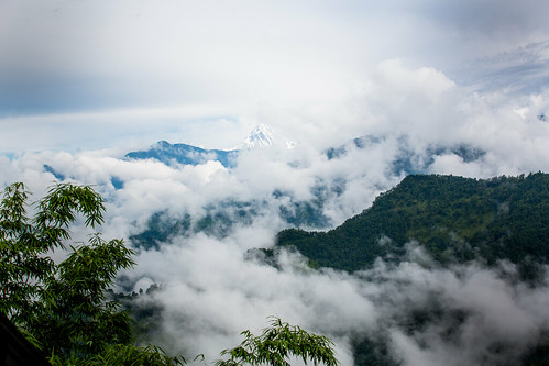
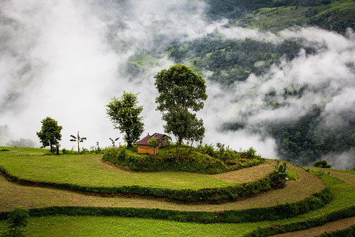
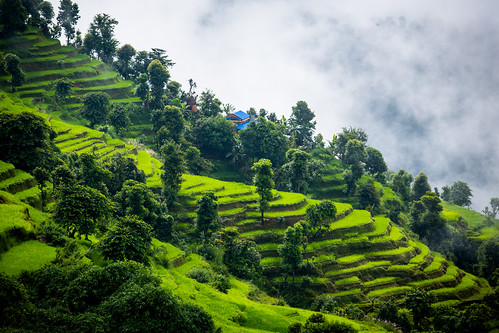
Fotos
Chisapani, Nepal Karte
Suchen Sie einen anderen Ort
Nahe Plätze
Bhirchok Kot Mandir भिरचोक कोट मन्दिर, Rupakot, Nepal
Rupakot Resort Pvt. Ltd., Pokhara, Rupakot, Kaski, Vhirchowk-Mohoriya Rd, Pokhara, Nepal
Rupakot, Nepal
Thumki, Nepal
Rupa Lake, Nepal
Lekhnath, Nepal
Thulakot ViewPoint (Kalika), Kalikasthan Pokhara, कालिका, Nepal
Talchowk, Lekhnath, Nepal
Kalika, Nepal
Kahundada Again Afro Farm, Unnamed Road, पोखरा, Nepal
Kaski, Nepal
Hotel Mesokanto, Pokhara, Nepal
Pokhara, Nepal
Flughafen Pokhara, Pokhara, Nepal
nayapool kirana pasal, Bhimsen Marga, Pokhara, Nepal
Milan Chowk, Pokhara, Nepal
Baidam, Pokhara, Nepal
Mount Kailash, AMMOT LAKESIDE-6, Pokhara, Nepal
Bhujung, Ghanpokhara, Nepal
Lakeside Rd, Pokhara, Nepal
Letzte Suche
- Red Dog Mine, AK, USA Sonnenaufgang Sonnenuntergang Zeiten
- Am Bahnhof, Am bhf, Borken, Germany Sonnenaufgang Sonnenuntergang Zeiten
- 4th St E, Sonoma, CA, USA Sonnenaufgang Sonnenuntergang Zeiten
- Oakland Ave, Williamsport, PA, USA Sonnenaufgang Sonnenuntergang Zeiten
- Via Roma, Pieranica CR, Italien Sonnenaufgang Sonnenuntergang Zeiten
- Glockenturm, Grad, Dubrovnik, Kroatien Sonnenaufgang Sonnenuntergang Zeiten
- Trelew, Chubut Province, Argentina Sonnenaufgang Sonnenuntergang Zeiten
- Hartfords Bluff Cir, Mt Pleasant, SC, USA Sonnenaufgang Sonnenuntergang Zeiten
- Kita-ku, Kumamoto, Präfektur Kumamoto, Japan Sonnenaufgang Sonnenuntergang Zeiten
- Pingtan Island, Pingtan County, Fuzhou, China Sonnenaufgang Sonnenuntergang Zeiten

