Cherry Creek Road, Cherry Creek Rd, Idaho, USA Sonnenaufgang Sonnenuntergang Zeiten
Location: USA > Idaho > Benewah County > Saint Maries >
Zeitzone:
America/Los_Angeles
Ortszeit:
2025-06-19 10:47:26
Länge:
-116.646576
Breite:
47.2808043
Sonnenaufgang Heute:
04:50:09 AM
Sonnenuntergang Heute:
08:46:32 PM
Tageslänge heute:
15h 56m 23s
Sonnenaufgang morgen:
04:50:23 AM
Sonnenuntergang Morgen:
08:46:44 PM
Tageslänge von morgen:
15h 56m 21s
Alle Termine anzeigen
| Datum | Sonnenaufgang | Sonnenuntergang | Tageslänge |
|---|---|---|---|
| 2025-01-01 | 07:33:18 AM | 04:08:19 PM | 8h 35m 1s |
| 2025-01-02 | 07:33:12 AM | 04:09:20 PM | 8h 36m 8s |
| 2025-01-03 | 07:33:03 AM | 04:10:23 PM | 8h 37m 20s |
| 2025-01-04 | 07:32:52 AM | 04:11:27 PM | 8h 38m 35s |
| 2025-01-05 | 07:32:38 AM | 04:12:34 PM | 8h 39m 56s |
| 2025-01-06 | 07:32:21 AM | 04:13:43 PM | 8h 41m 22s |
| 2025-01-07 | 07:32:01 AM | 04:14:53 PM | 8h 42m 52s |
| 2025-01-08 | 07:31:38 AM | 04:16:05 PM | 8h 44m 27s |
| 2025-01-09 | 07:31:13 AM | 04:17:19 PM | 8h 46m 6s |
| 2025-01-10 | 07:30:45 AM | 04:18:34 PM | 8h 47m 49s |
| 2025-01-11 | 07:30:14 AM | 04:19:51 PM | 8h 49m 37s |
| 2025-01-12 | 07:29:41 AM | 04:21:09 PM | 8h 51m 28s |
| 2025-01-13 | 07:29:05 AM | 04:22:29 PM | 8h 53m 24s |
| 2025-01-14 | 07:28:26 AM | 04:23:49 PM | 8h 55m 23s |
| 2025-01-15 | 07:27:45 AM | 04:25:11 PM | 8h 57m 26s |
| 2025-01-16 | 07:27:01 AM | 04:26:34 PM | 8h 59m 33s |
| 2025-01-17 | 07:26:15 AM | 04:27:59 PM | 9h 1m 44s |
| 2025-01-18 | 07:25:26 AM | 04:29:24 PM | 9h 3m 58s |
| 2025-01-19 | 07:24:35 AM | 04:30:50 PM | 9h 6m 15s |
| 2025-01-20 | 07:23:41 AM | 04:32:17 PM | 9h 8m 36s |
| 2025-01-21 | 07:22:46 AM | 04:33:45 PM | 9h 10m 59s |
| 2025-01-22 | 07:21:47 AM | 04:35:13 PM | 9h 13m 26s |
| 2025-01-23 | 07:20:47 AM | 04:36:42 PM | 9h 15m 55s |
| 2025-01-24 | 07:19:44 AM | 04:38:12 PM | 9h 18m 28s |
| 2025-01-25 | 07:18:40 AM | 04:39:43 PM | 9h 21m 3s |
| 2025-01-26 | 07:17:33 AM | 04:41:14 PM | 9h 23m 41s |
| 2025-01-27 | 07:16:24 AM | 04:42:45 PM | 9h 26m 21s |
| 2025-01-28 | 07:15:13 AM | 04:44:17 PM | 9h 29m 4s |
| 2025-01-29 | 07:14:00 AM | 04:45:49 PM | 9h 31m 49s |
| 2025-01-30 | 07:12:45 AM | 04:47:22 PM | 9h 34m 37s |
| 2025-01-31 | 07:11:28 AM | 04:48:54 PM | 9h 37m 26s |
| 2025-02-01 | 07:10:09 AM | 04:50:27 PM | 9h 40m 18s |
| 2025-02-02 | 07:08:49 AM | 04:52:01 PM | 9h 43m 12s |
| 2025-02-03 | 07:07:26 AM | 04:53:34 PM | 9h 46m 8s |
| 2025-02-04 | 07:06:02 AM | 04:55:07 PM | 9h 49m 5s |
| 2025-02-05 | 07:04:37 AM | 04:56:41 PM | 9h 52m 4s |
| 2025-02-06 | 07:03:09 AM | 04:58:14 PM | 9h 55m 5s |
| 2025-02-07 | 07:01:40 AM | 04:59:48 PM | 9h 58m 8s |
| 2025-02-08 | 07:00:10 AM | 05:01:21 PM | 10h 1m 11s |
| 2025-02-09 | 06:58:38 AM | 05:02:55 PM | 10h 4m 17s |
| 2025-02-10 | 06:57:05 AM | 05:04:28 PM | 10h 7m 23s |
| 2025-02-11 | 06:55:30 AM | 05:06:02 PM | 10h 10m 32s |
| 2025-02-12 | 06:53:54 AM | 05:07:35 PM | 10h 13m 41s |
| 2025-02-13 | 06:52:16 AM | 05:09:08 PM | 10h 16m 52s |
| 2025-02-14 | 06:50:37 AM | 05:10:41 PM | 10h 20m 4s |
| 2025-02-15 | 06:48:57 AM | 05:12:13 PM | 10h 23m 16s |
| 2025-02-16 | 06:47:16 AM | 05:13:46 PM | 10h 26m 30s |
| 2025-02-17 | 06:45:33 AM | 05:15:18 PM | 10h 29m 45s |
| 2025-02-18 | 06:43:50 AM | 05:16:50 PM | 10h 33m 0s |
| 2025-02-19 | 06:42:05 AM | 05:18:22 PM | 10h 36m 17s |
| 2025-02-20 | 06:40:20 AM | 05:19:53 PM | 10h 39m 33s |
| 2025-02-21 | 06:38:33 AM | 05:21:24 PM | 10h 42m 51s |
| 2025-02-22 | 06:36:45 AM | 05:22:55 PM | 10h 46m 10s |
| 2025-02-23 | 06:34:57 AM | 05:24:26 PM | 10h 49m 29s |
| 2025-02-24 | 06:33:07 AM | 05:25:57 PM | 10h 52m 50s |
| 2025-02-25 | 06:31:17 AM | 05:27:27 PM | 10h 56m 10s |
| 2025-02-26 | 06:29:26 AM | 05:28:57 PM | 10h 59m 31s |
| 2025-02-27 | 06:27:34 AM | 05:30:26 PM | 11h 2m 52s |
| 2025-02-28 | 06:25:41 AM | 05:31:56 PM | 11h 6m 15s |
| 2025-03-01 | 06:23:48 AM | 05:33:25 PM | 11h 9m 37s |
| 2025-03-02 | 06:21:54 AM | 05:34:54 PM | 11h 13m 0s |
| 2025-03-03 | 06:19:59 AM | 05:36:22 PM | 11h 16m 23s |
| 2025-03-04 | 06:18:03 AM | 05:37:51 PM | 11h 19m 48s |
| 2025-03-05 | 06:16:08 AM | 05:39:19 PM | 11h 23m 11s |
| 2025-03-06 | 06:14:11 AM | 05:40:46 PM | 11h 26m 35s |
| 2025-03-07 | 06:12:14 AM | 05:42:14 PM | 11h 30m 0s |
| 2025-03-08 | 06:10:17 AM | 05:43:41 PM | 11h 33m 24s |
| 2025-03-09 | 07:08:24 AM | 06:45:04 PM | 11h 36m 40s |
| 2025-03-10 | 07:06:26 AM | 06:46:31 PM | 11h 40m 5s |
| 2025-03-11 | 07:04:27 AM | 06:47:58 PM | 11h 43m 31s |
| 2025-03-12 | 07:02:28 AM | 06:49:24 PM | 11h 46m 56s |
| 2025-03-13 | 07:00:29 AM | 06:50:50 PM | 11h 50m 21s |
| 2025-03-14 | 06:58:29 AM | 06:52:16 PM | 11h 53m 47s |
| 2025-03-15 | 06:56:30 AM | 06:53:42 PM | 11h 57m 12s |
| 2025-03-16 | 06:54:30 AM | 06:55:07 PM | 12h 0m 37s |
| 2025-03-17 | 06:52:30 AM | 06:56:32 PM | 12h 4m 2s |
| 2025-03-18 | 06:50:29 AM | 06:57:58 PM | 12h 7m 29s |
| 2025-03-19 | 06:48:29 AM | 06:59:23 PM | 12h 10m 54s |
| 2025-03-20 | 06:46:28 AM | 07:00:48 PM | 12h 14m 20s |
| 2025-03-21 | 06:44:28 AM | 07:02:12 PM | 12h 17m 44s |
| 2025-03-22 | 06:42:27 AM | 07:03:37 PM | 12h 21m 10s |
| 2025-03-23 | 06:40:26 AM | 07:05:01 PM | 12h 24m 35s |
| 2025-03-24 | 06:38:26 AM | 07:06:26 PM | 12h 28m 0s |
| 2025-03-25 | 06:36:25 AM | 07:07:50 PM | 12h 31m 25s |
| 2025-03-26 | 06:34:25 AM | 07:09:14 PM | 12h 34m 49s |
| 2025-03-27 | 06:32:25 AM | 07:10:38 PM | 12h 38m 13s |
| 2025-03-28 | 06:30:25 AM | 07:12:02 PM | 12h 41m 37s |
| 2025-03-29 | 06:28:25 AM | 07:13:26 PM | 12h 45m 1s |
| 2025-03-30 | 06:26:25 AM | 07:14:50 PM | 12h 48m 25s |
| 2025-03-31 | 06:24:26 AM | 07:16:14 PM | 12h 51m 48s |
| 2025-04-01 | 06:22:26 AM | 07:17:38 PM | 12h 55m 12s |
| 2025-04-02 | 06:20:27 AM | 07:19:02 PM | 12h 58m 35s |
| 2025-04-03 | 06:18:29 AM | 07:20:25 PM | 13h 1m 56s |
| 2025-04-04 | 06:16:31 AM | 07:21:49 PM | 13h 5m 18s |
| 2025-04-05 | 06:14:33 AM | 07:23:13 PM | 13h 8m 40s |
| 2025-04-06 | 06:12:36 AM | 07:24:36 PM | 13h 12m 0s |
| 2025-04-07 | 06:10:39 AM | 07:26:00 PM | 13h 15m 21s |
| 2025-04-08 | 06:08:43 AM | 07:27:24 PM | 13h 18m 41s |
| 2025-04-09 | 06:06:47 AM | 07:28:47 PM | 13h 22m 0s |
| 2025-04-10 | 06:04:52 AM | 07:30:11 PM | 13h 25m 19s |
| 2025-04-11 | 06:02:57 AM | 07:31:35 PM | 13h 28m 38s |
| 2025-04-12 | 06:01:03 AM | 07:32:58 PM | 13h 31m 55s |
| 2025-04-13 | 05:59:10 AM | 07:34:22 PM | 13h 35m 12s |
| 2025-04-14 | 05:57:18 AM | 07:35:46 PM | 13h 38m 28s |
| 2025-04-15 | 05:55:26 AM | 07:37:09 PM | 13h 41m 43s |
| 2025-04-16 | 05:53:35 AM | 07:38:33 PM | 13h 44m 58s |
| 2025-04-17 | 05:51:45 AM | 07:39:56 PM | 13h 48m 11s |
| 2025-04-18 | 05:49:55 AM | 07:41:20 PM | 13h 51m 25s |
| 2025-04-19 | 05:48:07 AM | 07:42:43 PM | 13h 54m 36s |
| 2025-04-20 | 05:46:19 AM | 07:44:07 PM | 13h 57m 48s |
| 2025-04-21 | 05:44:33 AM | 07:45:30 PM | 14h 0m 57s |
| 2025-04-22 | 05:42:47 AM | 07:46:53 PM | 14h 4m 6s |
| 2025-04-23 | 05:41:03 AM | 07:48:16 PM | 14h 7m 13s |
| 2025-04-24 | 05:39:19 AM | 07:49:39 PM | 14h 10m 20s |
| 2025-04-25 | 05:37:37 AM | 07:51:02 PM | 14h 13m 25s |
| 2025-04-26 | 05:35:55 AM | 07:52:25 PM | 14h 16m 30s |
| 2025-04-27 | 05:34:15 AM | 07:53:48 PM | 14h 19m 33s |
| 2025-04-28 | 05:32:37 AM | 07:55:10 PM | 14h 22m 33s |
| 2025-04-29 | 05:30:59 AM | 07:56:32 PM | 14h 25m 33s |
| 2025-04-30 | 05:29:23 AM | 07:57:54 PM | 14h 28m 31s |
| 2025-05-01 | 05:27:48 AM | 07:59:16 PM | 14h 31m 28s |
| 2025-05-02 | 05:26:14 AM | 08:00:37 PM | 14h 34m 23s |
| 2025-05-03 | 05:24:42 AM | 08:01:59 PM | 14h 37m 17s |
| 2025-05-04 | 05:23:11 AM | 08:03:19 PM | 14h 40m 8s |
| 2025-05-05 | 05:21:42 AM | 08:04:40 PM | 14h 42m 58s |
| 2025-05-06 | 05:20:14 AM | 08:06:00 PM | 14h 45m 46s |
| 2025-05-07 | 05:18:48 AM | 08:07:20 PM | 14h 48m 32s |
| 2025-05-08 | 05:17:23 AM | 08:08:39 PM | 14h 51m 16s |
| 2025-05-09 | 05:16:01 AM | 08:09:57 PM | 14h 53m 56s |
| 2025-05-10 | 05:14:39 AM | 08:11:15 PM | 14h 56m 36s |
| 2025-05-11 | 05:13:20 AM | 08:12:33 PM | 14h 59m 13s |
| 2025-05-12 | 05:12:02 AM | 08:13:50 PM | 15h 1m 48s |
| 2025-05-13 | 05:10:46 AM | 08:15:06 PM | 15h 4m 20s |
| 2025-05-14 | 05:09:32 AM | 08:16:22 PM | 15h 6m 50s |
| 2025-05-15 | 05:08:20 AM | 08:17:36 PM | 15h 9m 16s |
| 2025-05-16 | 05:07:10 AM | 08:18:50 PM | 15h 11m 40s |
| 2025-05-17 | 05:06:02 AM | 08:20:03 PM | 15h 14m 1s |
| 2025-05-18 | 05:04:56 AM | 08:21:15 PM | 15h 16m 19s |
| 2025-05-19 | 05:03:51 AM | 08:22:27 PM | 15h 18m 36s |
| 2025-05-20 | 05:02:49 AM | 08:23:37 PM | 15h 20m 48s |
| 2025-05-21 | 05:01:49 AM | 08:24:46 PM | 15h 22m 57s |
| 2025-05-22 | 05:00:51 AM | 08:25:54 PM | 15h 25m 3s |
| 2025-05-23 | 04:59:56 AM | 08:27:01 PM | 15h 27m 5s |
| 2025-05-24 | 04:59:02 AM | 08:28:07 PM | 15h 29m 5s |
| 2025-05-25 | 04:58:11 AM | 08:29:11 PM | 15h 31m 0s |
| 2025-05-26 | 04:57:22 AM | 08:30:14 PM | 15h 32m 52s |
| 2025-05-27 | 04:56:35 AM | 08:31:16 PM | 15h 34m 41s |
| 2025-05-28 | 04:55:51 AM | 08:32:16 PM | 15h 36m 25s |
| 2025-05-29 | 04:55:09 AM | 08:33:14 PM | 15h 38m 5s |
| 2025-05-30 | 04:54:30 AM | 08:34:12 PM | 15h 39m 42s |
| 2025-05-31 | 04:53:53 AM | 08:35:07 PM | 15h 41m 14s |
| 2025-06-01 | 04:53:18 AM | 08:36:01 PM | 15h 42m 43s |
| 2025-06-02 | 04:52:46 AM | 08:36:53 PM | 15h 44m 7s |
| 2025-06-03 | 04:52:16 AM | 08:37:43 PM | 15h 45m 27s |
| 2025-06-04 | 04:51:49 AM | 08:38:32 PM | 15h 46m 43s |
| 2025-06-05 | 04:51:24 AM | 08:39:19 PM | 15h 47m 55s |
| 2025-06-06 | 04:51:02 AM | 08:40:03 PM | 15h 49m 1s |
| 2025-06-07 | 04:50:42 AM | 08:40:46 PM | 15h 50m 4s |
| 2025-06-08 | 04:50:25 AM | 08:41:27 PM | 15h 51m 2s |
| 2025-06-09 | 04:50:11 AM | 08:42:05 PM | 15h 51m 54s |
| 2025-06-10 | 04:49:59 AM | 08:42:42 PM | 15h 52m 43s |
| 2025-06-11 | 04:49:49 AM | 08:43:16 PM | 15h 53m 27s |
| 2025-06-12 | 04:49:42 AM | 08:43:48 PM | 15h 54m 6s |
| 2025-06-13 | 04:49:38 AM | 08:44:18 PM | 15h 54m 40s |
| 2025-06-14 | 04:49:36 AM | 08:44:45 PM | 15h 55m 9s |
| 2025-06-15 | 04:49:37 AM | 08:45:11 PM | 15h 55m 34s |
| 2025-06-16 | 04:49:40 AM | 08:45:33 PM | 15h 55m 53s |
| 2025-06-17 | 04:49:46 AM | 08:45:54 PM | 15h 56m 8s |
| 2025-06-18 | 04:49:54 AM | 08:46:12 PM | 15h 56m 18s |
| 2025-06-19 | 04:50:05 AM | 08:46:27 PM | 15h 56m 22s |
| 2025-06-20 | 04:50:18 AM | 08:46:40 PM | 15h 56m 22s |
| 2025-06-21 | 04:50:33 AM | 08:46:51 PM | 15h 56m 18s |
| 2025-06-22 | 04:50:51 AM | 08:46:59 PM | 15h 56m 8s |
| 2025-06-23 | 04:51:11 AM | 08:47:04 PM | 15h 55m 53s |
| 2025-06-24 | 04:51:34 AM | 08:47:07 PM | 15h 55m 33s |
| 2025-06-25 | 04:51:59 AM | 08:47:07 PM | 15h 55m 8s |
| 2025-06-26 | 04:52:26 AM | 08:47:05 PM | 15h 54m 39s |
| 2025-06-27 | 04:52:55 AM | 08:47:00 PM | 15h 54m 5s |
| 2025-06-28 | 04:53:27 AM | 08:46:53 PM | 15h 53m 26s |
| 2025-06-29 | 04:54:01 AM | 08:46:43 PM | 15h 52m 42s |
| 2025-06-30 | 04:54:36 AM | 08:46:30 PM | 15h 51m 54s |
| 2025-07-01 | 04:55:14 AM | 08:46:15 PM | 15h 51m 1s |
| 2025-07-02 | 04:55:54 AM | 08:45:57 PM | 15h 50m 3s |
| 2025-07-03 | 04:56:36 AM | 08:45:37 PM | 15h 49m 1s |
| 2025-07-04 | 04:57:20 AM | 08:45:14 PM | 15h 47m 54s |
| 2025-07-05 | 04:58:05 AM | 08:44:48 PM | 15h 46m 43s |
| 2025-07-06 | 04:58:52 AM | 08:44:20 PM | 15h 45m 28s |
| 2025-07-07 | 04:59:42 AM | 08:43:49 PM | 15h 44m 7s |
| 2025-07-08 | 05:00:32 AM | 08:43:16 PM | 15h 42m 44s |
| 2025-07-09 | 05:01:25 AM | 08:42:41 PM | 15h 41m 16s |
| 2025-07-10 | 05:02:19 AM | 08:42:03 PM | 15h 39m 44s |
| 2025-07-11 | 05:03:14 AM | 08:41:22 PM | 15h 38m 8s |
| 2025-07-12 | 05:04:11 AM | 08:40:39 PM | 15h 36m 28s |
| 2025-07-13 | 05:05:10 AM | 08:39:54 PM | 15h 34m 44s |
| 2025-07-14 | 05:06:09 AM | 08:39:06 PM | 15h 32m 57s |
| 2025-07-15 | 05:07:10 AM | 08:38:16 PM | 15h 31m 6s |
| 2025-07-16 | 05:08:13 AM | 08:37:24 PM | 15h 29m 11s |
| 2025-07-17 | 05:09:16 AM | 08:36:29 PM | 15h 27m 13s |
| 2025-07-18 | 05:10:21 AM | 08:35:33 PM | 15h 25m 12s |
| 2025-07-19 | 05:11:27 AM | 08:34:34 PM | 15h 23m 7s |
| 2025-07-20 | 05:12:33 AM | 08:33:32 PM | 15h 20m 59s |
| 2025-07-21 | 05:13:41 AM | 08:32:29 PM | 15h 18m 48s |
| 2025-07-22 | 05:14:50 AM | 08:31:24 PM | 15h 16m 34s |
| 2025-07-23 | 05:15:59 AM | 08:30:16 PM | 15h 14m 17s |
| 2025-07-24 | 05:17:10 AM | 08:29:07 PM | 15h 11m 57s |
| 2025-07-25 | 05:18:21 AM | 08:27:56 PM | 15h 9m 35s |
| 2025-07-26 | 05:19:33 AM | 08:26:42 PM | 15h 7m 9s |
| 2025-07-27 | 05:20:45 AM | 08:25:27 PM | 15h 4m 42s |
| 2025-07-28 | 05:21:59 AM | 08:24:10 PM | 15h 2m 11s |
| 2025-07-29 | 05:23:13 AM | 08:22:51 PM | 14h 59m 38s |
| 2025-07-30 | 05:24:27 AM | 08:21:30 PM | 14h 57m 3s |
| 2025-07-31 | 05:25:42 AM | 08:20:08 PM | 14h 54m 26s |
| 2025-08-01 | 05:26:57 AM | 08:18:44 PM | 14h 51m 47s |
| 2025-08-02 | 05:28:13 AM | 08:17:18 PM | 14h 49m 5s |
| 2025-08-03 | 05:29:29 AM | 08:15:51 PM | 14h 46m 22s |
| 2025-08-04 | 05:30:46 AM | 08:14:22 PM | 14h 43m 36s |
| 2025-08-05 | 05:32:03 AM | 08:12:51 PM | 14h 40m 48s |
| 2025-08-06 | 05:33:20 AM | 08:11:19 PM | 14h 37m 59s |
| 2025-08-07 | 05:34:38 AM | 08:09:46 PM | 14h 35m 8s |
| 2025-08-08 | 05:35:56 AM | 08:08:11 PM | 14h 32m 15s |
| 2025-08-09 | 05:37:14 AM | 08:06:35 PM | 14h 29m 21s |
| 2025-08-10 | 05:38:32 AM | 08:04:57 PM | 14h 26m 25s |
| 2025-08-11 | 05:39:50 AM | 08:03:18 PM | 14h 23m 28s |
| 2025-08-12 | 05:41:09 AM | 08:01:38 PM | 14h 20m 29s |
| 2025-08-13 | 05:42:27 AM | 07:59:57 PM | 14h 17m 30s |
| 2025-08-14 | 05:43:46 AM | 07:58:14 PM | 14h 14m 28s |
| 2025-08-15 | 05:45:05 AM | 07:56:31 PM | 14h 11m 26s |
| 2025-08-16 | 05:46:24 AM | 07:54:46 PM | 14h 8m 22s |
| 2025-08-17 | 05:47:43 AM | 07:53:00 PM | 14h 5m 17s |
| 2025-08-18 | 05:49:02 AM | 07:51:13 PM | 14h 2m 11s |
| 2025-08-19 | 05:50:21 AM | 07:49:25 PM | 13h 59m 4s |
| 2025-08-20 | 05:51:40 AM | 07:47:36 PM | 13h 55m 56s |
| 2025-08-21 | 05:53:00 AM | 07:45:47 PM | 13h 52m 47s |
| 2025-08-22 | 05:54:19 AM | 07:43:56 PM | 13h 49m 37s |
| 2025-08-23 | 05:55:38 AM | 07:42:04 PM | 13h 46m 26s |
| 2025-08-24 | 05:56:57 AM | 07:40:12 PM | 13h 43m 15s |
| 2025-08-25 | 05:58:16 AM | 07:38:19 PM | 13h 40m 3s |
| 2025-08-26 | 05:59:35 AM | 07:36:25 PM | 13h 36m 50s |
| 2025-08-27 | 06:00:55 AM | 07:34:30 PM | 13h 33m 35s |
| 2025-08-28 | 06:02:14 AM | 07:32:35 PM | 13h 30m 21s |
| 2025-08-29 | 06:03:33 AM | 07:30:39 PM | 13h 27m 6s |
| 2025-08-30 | 06:04:52 AM | 07:28:42 PM | 13h 23m 50s |
| 2025-08-31 | 06:06:11 AM | 07:26:45 PM | 13h 20m 34s |
| 2025-09-01 | 06:07:30 AM | 07:24:48 PM | 13h 17m 18s |
| 2025-09-02 | 06:08:49 AM | 07:22:49 PM | 13h 14m 0s |
| 2025-09-03 | 06:10:08 AM | 07:20:51 PM | 13h 10m 43s |
| 2025-09-04 | 06:11:27 AM | 07:18:51 PM | 13h 7m 24s |
| 2025-09-05 | 06:12:46 AM | 07:16:52 PM | 13h 4m 6s |
| 2025-09-06 | 06:14:05 AM | 07:14:52 PM | 13h 0m 47s |
| 2025-09-07 | 06:15:24 AM | 07:12:51 PM | 12h 57m 27s |
| 2025-09-08 | 06:16:43 AM | 07:10:51 PM | 12h 54m 8s |
| 2025-09-09 | 06:18:02 AM | 07:08:50 PM | 12h 50m 48s |
| 2025-09-10 | 06:19:21 AM | 07:06:48 PM | 12h 47m 27s |
| 2025-09-11 | 06:20:40 AM | 07:04:47 PM | 12h 44m 7s |
| 2025-09-12 | 06:21:59 AM | 07:02:45 PM | 12h 40m 46s |
| 2025-09-13 | 06:23:18 AM | 07:00:43 PM | 12h 37m 25s |
| 2025-09-14 | 06:24:37 AM | 06:58:41 PM | 12h 34m 4s |
| 2025-09-15 | 06:25:57 AM | 06:56:39 PM | 12h 30m 42s |
| 2025-09-16 | 06:27:16 AM | 06:54:37 PM | 12h 27m 21s |
| 2025-09-17 | 06:28:35 AM | 06:52:34 PM | 12h 23m 59s |
| 2025-09-18 | 06:29:55 AM | 06:50:32 PM | 12h 20m 37s |
| 2025-09-19 | 06:31:15 AM | 06:48:30 PM | 12h 17m 15s |
| 2025-09-20 | 06:32:35 AM | 06:46:27 PM | 12h 13m 52s |
| 2025-09-21 | 06:33:55 AM | 06:44:25 PM | 12h 10m 30s |
| 2025-09-22 | 06:35:15 AM | 06:42:23 PM | 12h 7m 8s |
| 2025-09-23 | 06:36:35 AM | 06:40:21 PM | 12h 3m 46s |
| 2025-09-24 | 06:37:55 AM | 06:38:19 PM | 12h 0m 24s |
| 2025-09-25 | 06:39:16 AM | 06:36:17 PM | 11h 57m 1s |
| 2025-09-26 | 06:40:37 AM | 06:34:15 PM | 11h 53m 38s |
| 2025-09-27 | 06:41:58 AM | 06:32:14 PM | 11h 50m 16s |
| 2025-09-28 | 06:43:19 AM | 06:30:13 PM | 11h 46m 54s |
| 2025-09-29 | 06:44:40 AM | 06:28:12 PM | 11h 43m 32s |
| 2025-09-30 | 06:46:02 AM | 06:26:12 PM | 11h 40m 10s |
| 2025-10-01 | 06:47:24 AM | 06:24:12 PM | 11h 36m 48s |
| 2025-10-02 | 06:48:46 AM | 06:22:12 PM | 11h 33m 26s |
| 2025-10-03 | 06:50:08 AM | 06:20:13 PM | 11h 30m 5s |
| 2025-10-04 | 06:51:31 AM | 06:18:14 PM | 11h 26m 43s |
| 2025-10-05 | 06:52:54 AM | 06:16:16 PM | 11h 23m 22s |
| 2025-10-06 | 06:54:17 AM | 06:14:18 PM | 11h 20m 1s |
| 2025-10-07 | 06:55:40 AM | 06:12:21 PM | 11h 16m 41s |
| 2025-10-08 | 06:57:04 AM | 06:10:25 PM | 11h 13m 21s |
| 2025-10-09 | 06:58:28 AM | 06:08:29 PM | 11h 10m 1s |
| 2025-10-10 | 06:59:52 AM | 06:06:33 PM | 11h 6m 41s |
| 2025-10-11 | 07:01:17 AM | 06:04:39 PM | 11h 3m 22s |
| 2025-10-12 | 07:02:42 AM | 06:02:45 PM | 11h 0m 3s |
| 2025-10-13 | 07:04:07 AM | 06:00:52 PM | 10h 56m 45s |
| 2025-10-14 | 07:05:33 AM | 05:59:00 PM | 10h 53m 27s |
| 2025-10-15 | 07:06:58 AM | 05:57:08 PM | 10h 50m 10s |
| 2025-10-16 | 07:08:25 AM | 05:55:18 PM | 10h 46m 53s |
| 2025-10-17 | 07:09:51 AM | 05:53:28 PM | 10h 43m 37s |
| 2025-10-18 | 07:11:18 AM | 05:51:39 PM | 10h 40m 21s |
| 2025-10-19 | 07:12:45 AM | 05:49:52 PM | 10h 37m 7s |
| 2025-10-20 | 07:14:12 AM | 05:48:05 PM | 10h 33m 53s |
| 2025-10-21 | 07:15:40 AM | 05:46:19 PM | 10h 30m 39s |
| 2025-10-22 | 07:17:07 AM | 05:44:35 PM | 10h 27m 28s |
| 2025-10-23 | 07:18:36 AM | 05:42:51 PM | 10h 24m 15s |
| 2025-10-24 | 07:20:04 AM | 05:41:09 PM | 10h 21m 5s |
| 2025-10-25 | 07:21:32 AM | 05:39:28 PM | 10h 17m 56s |
| 2025-10-26 | 07:23:01 AM | 05:37:48 PM | 10h 14m 47s |
| 2025-10-27 | 07:24:30 AM | 05:36:10 PM | 10h 11m 40s |
| 2025-10-28 | 07:25:59 AM | 05:34:33 PM | 10h 8m 34s |
| 2025-10-29 | 07:27:29 AM | 05:32:57 PM | 10h 5m 28s |
| 2025-10-30 | 07:28:58 AM | 05:31:23 PM | 10h 2m 25s |
| 2025-10-31 | 07:30:28 AM | 05:29:50 PM | 9h 59m 22s |
| 2025-11-01 | 07:31:57 AM | 05:28:19 PM | 9h 56m 22s |
| 2025-11-02 | 06:33:31 AM | 04:26:46 PM | 9h 53m 15s |
| 2025-11-03 | 06:35:01 AM | 04:25:17 PM | 9h 50m 16s |
| 2025-11-04 | 06:36:31 AM | 04:23:51 PM | 9h 47m 20s |
| 2025-11-05 | 06:38:00 AM | 04:22:26 PM | 9h 44m 26s |
| 2025-11-06 | 06:39:30 AM | 04:21:03 PM | 9h 41m 33s |
| 2025-11-07 | 06:41:00 AM | 04:19:42 PM | 9h 38m 42s |
| 2025-11-08 | 06:42:29 AM | 04:18:23 PM | 9h 35m 54s |
| 2025-11-09 | 06:43:58 AM | 04:17:05 PM | 9h 33m 7s |
| 2025-11-10 | 06:45:27 AM | 04:15:50 PM | 9h 30m 23s |
| 2025-11-11 | 06:46:56 AM | 04:14:36 PM | 9h 27m 40s |
| 2025-11-12 | 06:48:25 AM | 04:13:25 PM | 9h 25m 0s |
| 2025-11-13 | 06:49:53 AM | 04:12:15 PM | 9h 22m 22s |
| 2025-11-14 | 06:51:20 AM | 04:11:08 PM | 9h 19m 48s |
| 2025-11-15 | 06:52:48 AM | 04:10:02 PM | 9h 17m 14s |
| 2025-11-16 | 06:54:14 AM | 04:08:59 PM | 9h 14m 45s |
| 2025-11-17 | 06:55:41 AM | 04:07:58 PM | 9h 12m 17s |
| 2025-11-18 | 06:57:06 AM | 04:07:00 PM | 9h 9m 54s |
| 2025-11-19 | 06:58:31 AM | 04:06:04 PM | 9h 7m 33s |
| 2025-11-20 | 06:59:55 AM | 04:05:10 PM | 9h 5m 15s |
| 2025-11-21 | 07:01:18 AM | 04:04:18 PM | 9h 3m 0s |
| 2025-11-22 | 07:02:41 AM | 04:03:29 PM | 9h 0m 48s |
| 2025-11-23 | 07:04:02 AM | 04:02:43 PM | 8h 58m 41s |
| 2025-11-24 | 07:05:23 AM | 04:01:59 PM | 8h 56m 36s |
| 2025-11-25 | 07:06:42 AM | 04:01:17 PM | 8h 54m 35s |
| 2025-11-26 | 07:08:00 AM | 04:00:38 PM | 8h 52m 38s |
| 2025-11-27 | 07:09:17 AM | 04:00:02 PM | 8h 50m 45s |
| 2025-11-28 | 07:10:33 AM | 03:59:28 PM | 8h 48m 55s |
| 2025-11-29 | 07:11:47 AM | 03:58:58 PM | 8h 47m 11s |
| 2025-11-30 | 07:13:00 AM | 03:58:29 PM | 8h 45m 29s |
| 2025-12-01 | 07:14:12 AM | 03:58:04 PM | 8h 43m 52s |
| 2025-12-02 | 07:15:22 AM | 03:57:41 PM | 8h 42m 19s |
| 2025-12-03 | 07:16:30 AM | 03:57:22 PM | 8h 40m 52s |
| 2025-12-04 | 07:17:37 AM | 03:57:04 PM | 8h 39m 27s |
| 2025-12-05 | 07:18:42 AM | 03:56:50 PM | 8h 38m 8s |
| 2025-12-06 | 07:19:45 AM | 03:56:39 PM | 8h 36m 54s |
| 2025-12-07 | 07:20:46 AM | 03:56:31 PM | 8h 35m 45s |
| 2025-12-08 | 07:21:45 AM | 03:56:25 PM | 8h 34m 40s |
| 2025-12-09 | 07:22:42 AM | 03:56:22 PM | 8h 33m 40s |
| 2025-12-10 | 07:23:37 AM | 03:56:22 PM | 8h 32m 45s |
| 2025-12-11 | 07:24:30 AM | 03:56:25 PM | 8h 31m 55s |
| 2025-12-12 | 07:25:21 AM | 03:56:31 PM | 8h 31m 10s |
| 2025-12-13 | 07:26:09 AM | 03:56:40 PM | 8h 30m 31s |
| 2025-12-14 | 07:26:55 AM | 03:56:52 PM | 8h 29m 57s |
| 2025-12-15 | 07:27:39 AM | 03:57:07 PM | 8h 29m 28s |
| 2025-12-16 | 07:28:20 AM | 03:57:24 PM | 8h 29m 4s |
| 2025-12-17 | 07:28:59 AM | 03:57:44 PM | 8h 28m 45s |
| 2025-12-18 | 07:29:35 AM | 03:58:07 PM | 8h 28m 32s |
| 2025-12-19 | 07:30:09 AM | 03:58:33 PM | 8h 28m 24s |
| 2025-12-20 | 07:30:40 AM | 03:59:02 PM | 8h 28m 22s |
| 2025-12-21 | 07:31:08 AM | 03:59:33 PM | 8h 28m 25s |
| 2025-12-22 | 07:31:34 AM | 04:00:07 PM | 8h 28m 33s |
| 2025-12-23 | 07:31:57 AM | 04:00:43 PM | 8h 28m 46s |
| 2025-12-24 | 07:32:17 AM | 04:01:23 PM | 8h 29m 6s |
| 2025-12-25 | 07:32:35 AM | 04:02:04 PM | 8h 29m 29s |
| 2025-12-26 | 07:32:49 AM | 04:02:49 PM | 8h 30m 0s |
| 2025-12-27 | 07:33:01 AM | 04:03:35 PM | 8h 30m 34s |
| 2025-12-28 | 07:33:10 AM | 04:04:25 PM | 8h 31m 15s |
| 2025-12-29 | 07:33:17 AM | 04:05:16 PM | 8h 31m 59s |
| 2025-12-30 | 07:33:20 AM | 04:06:10 PM | 8h 32m 50s |
| 2025-12-31 | 07:33:21 AM | 04:07:06 PM | 8h 33m 45s |
Fotos

The river that flows thru a Lake

Benewah Lake

Hayburn St Park

Sunset Silhouette
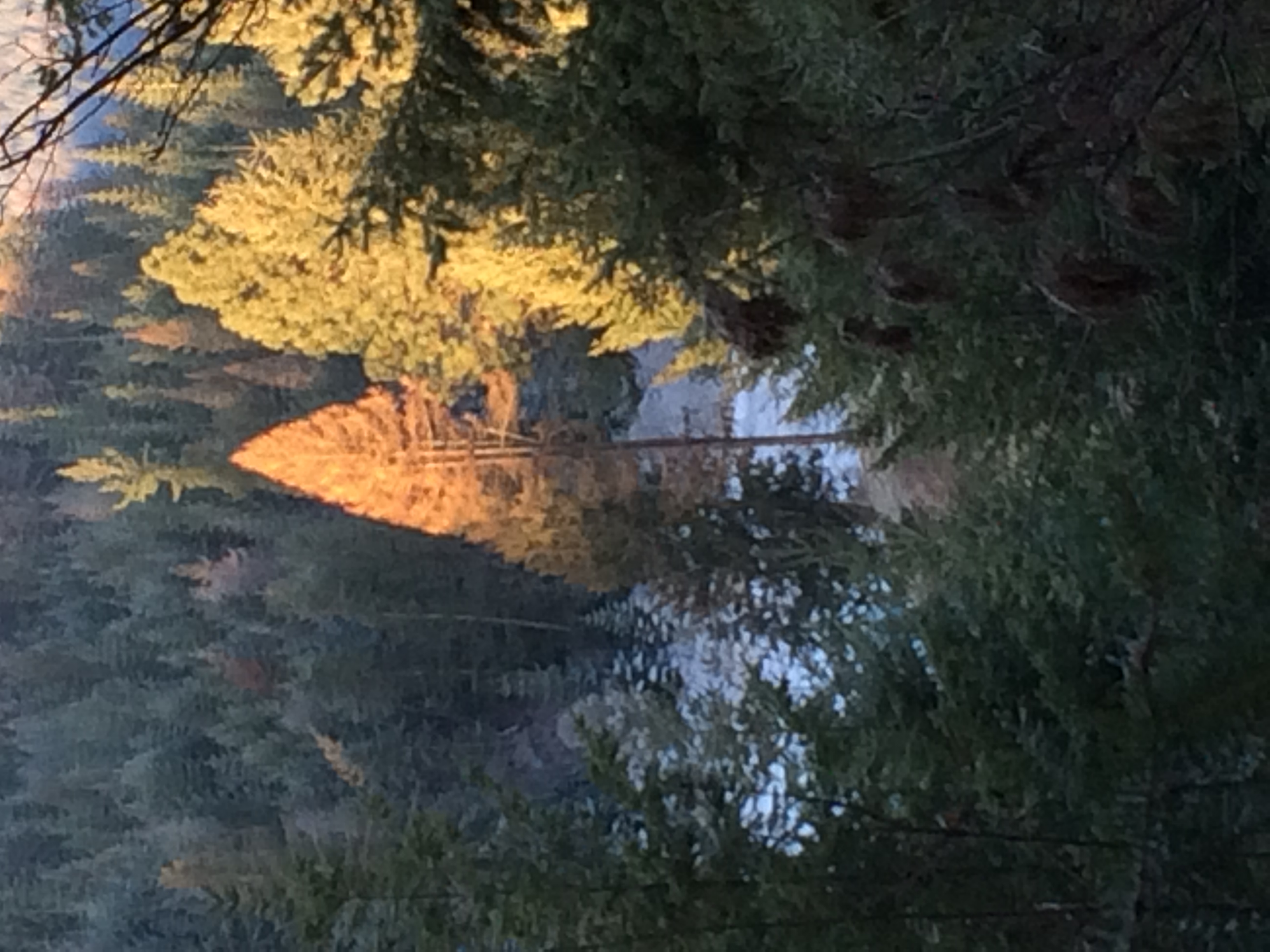
Sunrise Larch

Shadowy St. Joe River

LAKE CHATCOLET, RAMSDELL, IDAHO 2012

Shadowy St. Joe River

Picture from the Indian Cliffs Trail

Picture from the Indian Cliffs Trail

Picture from the Indian Cliffs Trail

Crossing Lake Benewah

Over Hwy 5

STMA Plummer Turn @ Peedee

Benewah Lake

the two week quarantine

STMA Plummer Turn @ St Maries

STMA Plummer Turn @ Peedee

STMA Plummer Turn @ Peedee

STMA Plummer Turn at Pedee, ID

STMA Plummer Turn @ St Maries

The River That Flows Thru a Lake

Lost and Found

MILW X900109

Picture from the Indian Cliffs Trail

Picture from the Indian Cliffs Trail

Picture from the Indian Cliffs Trail

Picture from the Indian Cliffs Trail

STMA Plummer Turn @ St Maries
Cherry Creek Road, Cherry Creek Rd, Idaho, USA Karte
Suchen Sie einen anderen Ort
Nahe Plätze
82 Patches Ln, St Maries, ID, USA
Benewah County, Idaho, USA
Highland Springs Road, Highland Springs Rd, St Maries, ID, USA
Parkline, ID, USA
Alder Creek Rd, St Maries, ID, USA
S 7th St, St Maries, ID, USA
Saint Maries, St Maries, ID, USA
Ridgeview Dr, St Maries, ID, USA
Jim's Auto & Tire Pros, 69 Milwaukee Road, St Maries, ID, USA
75 Ella Rd, St Maries, ID, USA
55 Christmas Hills Rd, St Maries, ID, USA
Abbey Rd, St Maries, ID, USA
E Rosewood Rd, St Maries, ID, USA
Flat Creek Rd, St Maries, ID, USA
S Lake Ridge Rd, St Maries, ID, USA
North Main Street, N Main St, St Maries, ID, USA
Emida, ID, USA
Santa, ID, USA
ID-3, St Maries, ID, USA
Ahrs Loop, St Maries, ID, USA
Letzte Suche
- Red Dog Mine, AK, USA Sonnenaufgang Sonnenuntergang Zeiten
- Am Bahnhof, Am bhf, Borken, Germany Sonnenaufgang Sonnenuntergang Zeiten
- 4th St E, Sonoma, CA, USA Sonnenaufgang Sonnenuntergang Zeiten
- Oakland Ave, Williamsport, PA, USA Sonnenaufgang Sonnenuntergang Zeiten
- Via Roma, Pieranica CR, Italien Sonnenaufgang Sonnenuntergang Zeiten
- Glockenturm, Grad, Dubrovnik, Kroatien Sonnenaufgang Sonnenuntergang Zeiten
- Trelew, Chubut Province, Argentina Sonnenaufgang Sonnenuntergang Zeiten
- Hartfords Bluff Cir, Mt Pleasant, SC, USA Sonnenaufgang Sonnenuntergang Zeiten
- Kita-ku, Kumamoto, Präfektur Kumamoto, Japan Sonnenaufgang Sonnenuntergang Zeiten
- Pingtan Island, Pingtan County, Fuzhou, China Sonnenaufgang Sonnenuntergang Zeiten