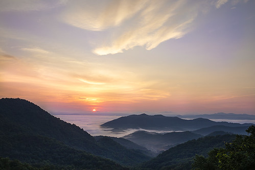
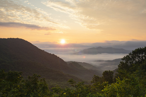
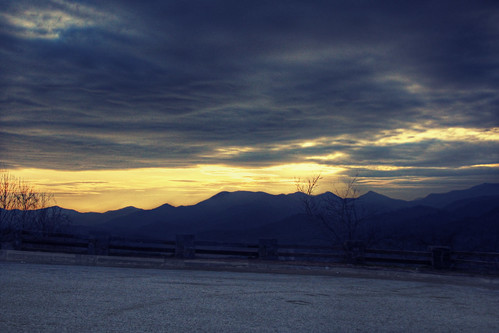
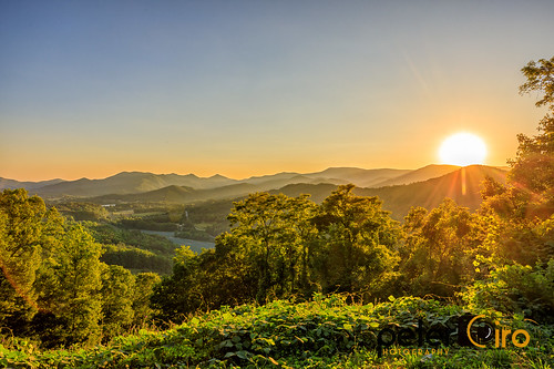
Cheek Rd, Franklin, NC, USA Sonnenaufgang Sonnenuntergang Zeiten
Location: USA > North Carolina > Macon County > Franklin > >
Zeitzone:
America/New_York
Ortszeit:
2025-07-08 21:06:22
Länge:
-83.3945668
Breite:
35.1166355
Sonnenaufgang Heute:
06:27:25 AM
Sonnenuntergang Heute:
08:50:27 PM
Tageslänge heute:
14h 23m 2s
Sonnenaufgang morgen:
06:28:01 AM
Sonnenuntergang Morgen:
08:50:08 PM
Tageslänge von morgen:
14h 22m 7s
Alle Termine anzeigen
| Datum | Sonnenaufgang | Sonnenuntergang | Tageslänge |
|---|---|---|---|
| 2025-01-01 | 07:41:59 AM | 05:33:25 PM | 9h 51m 26s |
| 2025-01-02 | 07:42:06 AM | 05:34:12 PM | 9h 52m 6s |
| 2025-01-03 | 07:42:12 AM | 05:35:01 PM | 9h 52m 49s |
| 2025-01-04 | 07:42:16 AM | 05:35:51 PM | 9h 53m 35s |
| 2025-01-05 | 07:42:18 AM | 05:36:41 PM | 9h 54m 23s |
| 2025-01-06 | 07:42:18 AM | 05:37:33 PM | 9h 55m 15s |
| 2025-01-07 | 07:42:16 AM | 05:38:26 PM | 9h 56m 10s |
| 2025-01-08 | 07:42:12 AM | 05:39:19 PM | 9h 57m 7s |
| 2025-01-09 | 07:42:07 AM | 05:40:14 PM | 9h 58m 7s |
| 2025-01-10 | 07:41:59 AM | 05:41:09 PM | 9h 59m 10s |
| 2025-01-11 | 07:41:49 AM | 05:42:05 PM | 10h 0m 16s |
| 2025-01-12 | 07:41:38 AM | 05:43:01 PM | 10h 1m 23s |
| 2025-01-13 | 07:41:25 AM | 05:43:58 PM | 10h 2m 33s |
| 2025-01-14 | 07:41:09 AM | 05:44:56 PM | 10h 3m 47s |
| 2025-01-15 | 07:40:52 AM | 05:45:54 PM | 10h 5m 2s |
| 2025-01-16 | 07:40:33 AM | 05:46:53 PM | 10h 6m 20s |
| 2025-01-17 | 07:40:12 AM | 05:47:52 PM | 10h 7m 40s |
| 2025-01-18 | 07:39:50 AM | 05:48:51 PM | 10h 9m 1s |
| 2025-01-19 | 07:39:25 AM | 05:49:51 PM | 10h 10m 26s |
| 2025-01-20 | 07:38:59 AM | 05:50:52 PM | 10h 11m 53s |
| 2025-01-21 | 07:38:30 AM | 05:51:52 PM | 10h 13m 22s |
| 2025-01-22 | 07:38:00 AM | 05:52:53 PM | 10h 14m 53s |
| 2025-01-23 | 07:37:29 AM | 05:53:54 PM | 10h 16m 25s |
| 2025-01-24 | 07:36:55 AM | 05:54:55 PM | 10h 18m 0s |
| 2025-01-25 | 07:36:20 AM | 05:55:56 PM | 10h 19m 36s |
| 2025-01-26 | 07:35:43 AM | 05:56:57 PM | 10h 21m 14s |
| 2025-01-27 | 07:35:04 AM | 05:57:59 PM | 10h 22m 55s |
| 2025-01-28 | 07:34:24 AM | 05:59:00 PM | 10h 24m 36s |
| 2025-01-29 | 07:33:42 AM | 06:00:02 PM | 10h 26m 20s |
| 2025-01-30 | 07:32:59 AM | 06:01:03 PM | 10h 28m 4s |
| 2025-01-31 | 07:32:14 AM | 06:02:04 PM | 10h 29m 50s |
| 2025-02-01 | 07:31:27 AM | 06:03:06 PM | 10h 31m 39s |
| 2025-02-02 | 07:30:39 AM | 06:04:07 PM | 10h 33m 28s |
| 2025-02-03 | 07:29:49 AM | 06:05:08 PM | 10h 35m 19s |
| 2025-02-04 | 07:28:58 AM | 06:06:08 PM | 10h 37m 10s |
| 2025-02-05 | 07:28:06 AM | 06:07:09 PM | 10h 39m 3s |
| 2025-02-06 | 07:27:12 AM | 06:08:09 PM | 10h 40m 57s |
| 2025-02-07 | 07:26:17 AM | 06:09:10 PM | 10h 42m 53s |
| 2025-02-08 | 07:25:20 AM | 06:10:10 PM | 10h 44m 50s |
| 2025-02-09 | 07:24:22 AM | 06:11:09 PM | 10h 46m 47s |
| 2025-02-10 | 07:23:23 AM | 06:12:09 PM | 10h 48m 46s |
| 2025-02-11 | 07:22:23 AM | 06:13:08 PM | 10h 50m 45s |
| 2025-02-12 | 07:21:21 AM | 06:14:07 PM | 10h 52m 46s |
| 2025-02-13 | 07:20:18 AM | 06:15:06 PM | 10h 54m 48s |
| 2025-02-14 | 07:19:14 AM | 06:16:04 PM | 10h 56m 50s |
| 2025-02-15 | 07:18:09 AM | 06:17:02 PM | 10h 58m 53s |
| 2025-02-16 | 07:17:03 AM | 06:18:00 PM | 11h 0m 57s |
| 2025-02-17 | 07:15:56 AM | 06:18:57 PM | 11h 3m 1s |
| 2025-02-18 | 07:14:48 AM | 06:19:54 PM | 11h 5m 6s |
| 2025-02-19 | 07:13:38 AM | 06:20:51 PM | 11h 7m 13s |
| 2025-02-20 | 07:12:28 AM | 06:21:47 PM | 11h 9m 19s |
| 2025-02-21 | 07:11:17 AM | 06:22:43 PM | 11h 11m 26s |
| 2025-02-22 | 07:10:05 AM | 06:23:39 PM | 11h 13m 34s |
| 2025-02-23 | 07:08:52 AM | 06:24:34 PM | 11h 15m 42s |
| 2025-02-24 | 07:07:38 AM | 06:25:29 PM | 11h 17m 51s |
| 2025-02-25 | 07:06:24 AM | 06:26:23 PM | 11h 19m 59s |
| 2025-02-26 | 07:05:08 AM | 06:27:18 PM | 11h 22m 10s |
| 2025-02-27 | 07:03:52 AM | 06:28:12 PM | 11h 24m 20s |
| 2025-02-28 | 07:02:36 AM | 06:29:05 PM | 11h 26m 29s |
| 2025-03-01 | 07:01:18 AM | 06:29:59 PM | 11h 28m 41s |
| 2025-03-02 | 07:00:00 AM | 06:30:52 PM | 11h 30m 52s |
| 2025-03-03 | 06:58:41 AM | 06:31:45 PM | 11h 33m 4s |
| 2025-03-04 | 06:57:22 AM | 06:32:37 PM | 11h 35m 15s |
| 2025-03-05 | 06:56:02 AM | 06:33:29 PM | 11h 37m 27s |
| 2025-03-06 | 06:54:42 AM | 06:34:21 PM | 11h 39m 39s |
| 2025-03-07 | 06:53:21 AM | 06:35:12 PM | 11h 41m 51s |
| 2025-03-08 | 06:52:00 AM | 06:36:04 PM | 11h 44m 4s |
| 2025-03-09 | 07:50:41 AM | 07:36:53 PM | 11h 46m 12s |
| 2025-03-10 | 07:49:19 AM | 07:37:43 PM | 11h 48m 24s |
| 2025-03-11 | 07:47:57 AM | 07:38:34 PM | 11h 50m 37s |
| 2025-03-12 | 07:46:34 AM | 07:39:24 PM | 11h 52m 50s |
| 2025-03-13 | 07:45:11 AM | 07:40:14 PM | 11h 55m 3s |
| 2025-03-14 | 07:43:47 AM | 07:41:04 PM | 11h 57m 17s |
| 2025-03-15 | 07:42:24 AM | 07:41:54 PM | 11h 59m 30s |
| 2025-03-16 | 07:41:00 AM | 07:42:44 PM | 12h 1m 44s |
| 2025-03-17 | 07:39:36 AM | 07:43:33 PM | 12h 3m 57s |
| 2025-03-18 | 07:38:11 AM | 07:44:22 PM | 12h 6m 11s |
| 2025-03-19 | 07:36:47 AM | 07:45:11 PM | 12h 8m 24s |
| 2025-03-20 | 07:35:23 AM | 07:46:00 PM | 12h 10m 37s |
| 2025-03-21 | 07:33:58 AM | 07:46:49 PM | 12h 12m 51s |
| 2025-03-22 | 07:32:33 AM | 07:47:37 PM | 12h 15m 4s |
| 2025-03-23 | 07:31:09 AM | 07:48:26 PM | 12h 17m 17s |
| 2025-03-24 | 07:29:44 AM | 07:49:14 PM | 12h 19m 30s |
| 2025-03-25 | 07:28:20 AM | 07:50:03 PM | 12h 21m 43s |
| 2025-03-26 | 07:26:55 AM | 07:50:51 PM | 12h 23m 56s |
| 2025-03-27 | 07:25:31 AM | 07:51:39 PM | 12h 26m 8s |
| 2025-03-28 | 07:24:07 AM | 07:52:27 PM | 12h 28m 20s |
| 2025-03-29 | 07:22:42 AM | 07:53:15 PM | 12h 30m 33s |
| 2025-03-30 | 07:21:19 AM | 07:54:03 PM | 12h 32m 44s |
| 2025-03-31 | 07:19:55 AM | 07:54:51 PM | 12h 34m 56s |
| 2025-04-01 | 07:18:31 AM | 07:55:39 PM | 12h 37m 8s |
| 2025-04-02 | 07:17:08 AM | 07:56:27 PM | 12h 39m 19s |
| 2025-04-03 | 07:15:46 AM | 07:57:15 PM | 12h 41m 29s |
| 2025-04-04 | 07:14:23 AM | 07:58:03 PM | 12h 43m 40s |
| 2025-04-05 | 07:13:01 AM | 07:58:51 PM | 12h 45m 50s |
| 2025-04-06 | 07:11:39 AM | 07:59:40 PM | 12h 48m 1s |
| 2025-04-07 | 07:10:18 AM | 08:00:28 PM | 12h 50m 10s |
| 2025-04-08 | 07:08:57 AM | 08:01:16 PM | 12h 52m 19s |
| 2025-04-09 | 07:07:37 AM | 08:02:04 PM | 12h 54m 27s |
| 2025-04-10 | 07:06:17 AM | 08:02:52 PM | 12h 56m 35s |
| 2025-04-11 | 07:04:57 AM | 08:03:40 PM | 12h 58m 43s |
| 2025-04-12 | 07:03:39 AM | 08:04:29 PM | 13h 0m 50s |
| 2025-04-13 | 07:02:20 AM | 08:05:17 PM | 13h 2m 57s |
| 2025-04-14 | 07:01:03 AM | 08:06:06 PM | 13h 5m 3s |
| 2025-04-15 | 06:59:46 AM | 08:06:54 PM | 13h 7m 8s |
| 2025-04-16 | 06:58:30 AM | 08:07:43 PM | 13h 9m 13s |
| 2025-04-17 | 06:57:14 AM | 08:08:31 PM | 13h 11m 17s |
| 2025-04-18 | 06:56:00 AM | 08:09:20 PM | 13h 13m 20s |
| 2025-04-19 | 06:54:46 AM | 08:10:09 PM | 13h 15m 23s |
| 2025-04-20 | 06:53:32 AM | 08:10:58 PM | 13h 17m 26s |
| 2025-04-21 | 06:52:20 AM | 08:11:47 PM | 13h 19m 27s |
| 2025-04-22 | 06:51:08 AM | 08:12:36 PM | 13h 21m 28s |
| 2025-04-23 | 06:49:58 AM | 08:13:25 PM | 13h 23m 27s |
| 2025-04-24 | 06:48:48 AM | 08:14:14 PM | 13h 25m 26s |
| 2025-04-25 | 06:47:39 AM | 08:15:03 PM | 13h 27m 24s |
| 2025-04-26 | 06:46:32 AM | 08:15:52 PM | 13h 29m 20s |
| 2025-04-27 | 06:45:25 AM | 08:16:41 PM | 13h 31m 16s |
| 2025-04-28 | 06:44:19 AM | 08:17:30 PM | 13h 33m 11s |
| 2025-04-29 | 06:43:14 AM | 08:18:19 PM | 13h 35m 5s |
| 2025-04-30 | 06:42:11 AM | 08:19:08 PM | 13h 36m 57s |
| 2025-05-01 | 06:41:08 AM | 08:19:57 PM | 13h 38m 49s |
| 2025-05-02 | 06:40:07 AM | 08:20:46 PM | 13h 40m 39s |
| 2025-05-03 | 06:39:06 AM | 08:21:35 PM | 13h 42m 29s |
| 2025-05-04 | 06:38:07 AM | 08:22:24 PM | 13h 44m 17s |
| 2025-05-05 | 06:37:10 AM | 08:23:13 PM | 13h 46m 3s |
| 2025-05-06 | 06:36:13 AM | 08:24:02 PM | 13h 47m 49s |
| 2025-05-07 | 06:35:18 AM | 08:24:50 PM | 13h 49m 32s |
| 2025-05-08 | 06:34:23 AM | 08:25:39 PM | 13h 51m 16s |
| 2025-05-09 | 06:33:31 AM | 08:26:27 PM | 13h 52m 56s |
| 2025-05-10 | 06:32:39 AM | 08:27:15 PM | 13h 54m 36s |
| 2025-05-11 | 06:31:49 AM | 08:28:03 PM | 13h 56m 14s |
| 2025-05-12 | 06:31:00 AM | 08:28:51 PM | 13h 57m 51s |
| 2025-05-13 | 06:30:13 AM | 08:29:38 PM | 13h 59m 25s |
| 2025-05-14 | 06:29:27 AM | 08:30:25 PM | 14h 0m 58s |
| 2025-05-15 | 06:28:43 AM | 08:31:12 PM | 14h 2m 29s |
| 2025-05-16 | 06:28:00 AM | 08:31:58 PM | 14h 3m 58s |
| 2025-05-17 | 06:27:18 AM | 08:32:44 PM | 14h 5m 26s |
| 2025-05-18 | 06:26:38 AM | 08:33:30 PM | 14h 6m 52s |
| 2025-05-19 | 06:26:00 AM | 08:34:15 PM | 14h 8m 15s |
| 2025-05-20 | 06:25:23 AM | 08:35:00 PM | 14h 9m 37s |
| 2025-05-21 | 06:24:48 AM | 08:35:44 PM | 14h 10m 56s |
| 2025-05-22 | 06:24:14 AM | 08:36:28 PM | 14h 12m 14s |
| 2025-05-23 | 06:23:42 AM | 08:37:11 PM | 14h 13m 29s |
| 2025-05-24 | 06:23:11 AM | 08:37:54 PM | 14h 14m 43s |
| 2025-05-25 | 06:22:42 AM | 08:38:36 PM | 14h 15m 54s |
| 2025-05-26 | 06:22:15 AM | 08:39:17 PM | 14h 17m 2s |
| 2025-05-27 | 06:21:49 AM | 08:39:58 PM | 14h 18m 9s |
| 2025-05-28 | 06:21:25 AM | 08:40:38 PM | 14h 19m 13s |
| 2025-05-29 | 06:21:02 AM | 08:41:17 PM | 14h 20m 15s |
| 2025-05-30 | 06:20:41 AM | 08:41:55 PM | 14h 21m 14s |
| 2025-05-31 | 06:20:22 AM | 08:42:32 PM | 14h 22m 10s |
| 2025-06-01 | 06:20:05 AM | 08:43:09 PM | 14h 23m 4s |
| 2025-06-02 | 06:19:49 AM | 08:43:45 PM | 14h 23m 56s |
| 2025-06-03 | 06:19:35 AM | 08:44:19 PM | 14h 24m 44s |
| 2025-06-04 | 06:19:22 AM | 08:44:53 PM | 14h 25m 31s |
| 2025-06-05 | 06:19:11 AM | 08:45:26 PM | 14h 26m 15s |
| 2025-06-06 | 06:19:02 AM | 08:45:57 PM | 14h 26m 55s |
| 2025-06-07 | 06:18:54 AM | 08:46:28 PM | 14h 27m 34s |
| 2025-06-08 | 06:18:48 AM | 08:46:57 PM | 14h 28m 9s |
| 2025-06-09 | 06:18:44 AM | 08:47:26 PM | 14h 28m 42s |
| 2025-06-10 | 06:18:41 AM | 08:47:53 PM | 14h 29m 12s |
| 2025-06-11 | 06:18:40 AM | 08:48:18 PM | 14h 29m 38s |
| 2025-06-12 | 06:18:41 AM | 08:48:43 PM | 14h 30m 2s |
| 2025-06-13 | 06:18:43 AM | 08:49:06 PM | 14h 30m 23s |
| 2025-06-14 | 06:18:47 AM | 08:49:28 PM | 14h 30m 41s |
| 2025-06-15 | 06:18:52 AM | 08:49:49 PM | 14h 30m 57s |
| 2025-06-16 | 06:18:59 AM | 08:50:08 PM | 14h 31m 9s |
| 2025-06-17 | 06:19:07 AM | 08:50:26 PM | 14h 31m 19s |
| 2025-06-18 | 06:19:17 AM | 08:50:42 PM | 14h 31m 25s |
| 2025-06-19 | 06:19:28 AM | 08:50:57 PM | 14h 31m 29s |
| 2025-06-20 | 06:19:41 AM | 08:51:10 PM | 14h 31m 29s |
| 2025-06-21 | 06:19:55 AM | 08:51:22 PM | 14h 31m 27s |
| 2025-06-22 | 06:20:11 AM | 08:51:32 PM | 14h 31m 21s |
| 2025-06-23 | 06:20:28 AM | 08:51:41 PM | 14h 31m 13s |
| 2025-06-24 | 06:20:46 AM | 08:51:48 PM | 14h 31m 2s |
| 2025-06-25 | 06:21:06 AM | 08:51:54 PM | 14h 30m 48s |
| 2025-06-26 | 06:21:27 AM | 08:51:58 PM | 14h 30m 31s |
| 2025-06-27 | 06:21:49 AM | 08:52:00 PM | 14h 30m 11s |
| 2025-06-28 | 06:22:13 AM | 08:52:01 PM | 14h 29m 48s |
| 2025-06-29 | 06:22:37 AM | 08:52:00 PM | 14h 29m 23s |
| 2025-06-30 | 06:23:03 AM | 08:51:57 PM | 14h 28m 54s |
| 2025-07-01 | 06:23:30 AM | 08:51:53 PM | 14h 28m 23s |
| 2025-07-02 | 06:23:58 AM | 08:51:47 PM | 14h 27m 49s |
| 2025-07-03 | 06:24:27 AM | 08:51:39 PM | 14h 27m 12s |
| 2025-07-04 | 06:24:58 AM | 08:51:30 PM | 14h 26m 32s |
| 2025-07-05 | 06:25:29 AM | 08:51:19 PM | 14h 25m 50s |
| 2025-07-06 | 06:26:01 AM | 08:51:06 PM | 14h 25m 5s |
| 2025-07-07 | 06:26:34 AM | 08:50:52 PM | 14h 24m 18s |
| 2025-07-08 | 06:27:08 AM | 08:50:36 PM | 14h 23m 28s |
| 2025-07-09 | 06:27:43 AM | 08:50:18 PM | 14h 22m 35s |
| 2025-07-10 | 06:28:19 AM | 08:49:58 PM | 14h 21m 39s |
| 2025-07-11 | 06:28:55 AM | 08:49:37 PM | 14h 20m 42s |
| 2025-07-12 | 06:29:32 AM | 08:49:14 PM | 14h 19m 42s |
| 2025-07-13 | 06:30:10 AM | 08:48:50 PM | 14h 18m 40s |
| 2025-07-14 | 06:30:49 AM | 08:48:23 PM | 14h 17m 34s |
| 2025-07-15 | 06:31:28 AM | 08:47:55 PM | 14h 16m 27s |
| 2025-07-16 | 06:32:08 AM | 08:47:26 PM | 14h 15m 18s |
| 2025-07-17 | 06:32:48 AM | 08:46:55 PM | 14h 14m 7s |
| 2025-07-18 | 06:33:29 AM | 08:46:22 PM | 14h 12m 53s |
| 2025-07-19 | 06:34:11 AM | 08:45:47 PM | 14h 11m 36s |
| 2025-07-20 | 06:34:53 AM | 08:45:11 PM | 14h 10m 18s |
| 2025-07-21 | 06:35:35 AM | 08:44:34 PM | 14h 8m 59s |
| 2025-07-22 | 06:36:18 AM | 08:43:54 PM | 14h 7m 36s |
| 2025-07-23 | 06:37:01 AM | 08:43:14 PM | 14h 6m 13s |
| 2025-07-24 | 06:37:44 AM | 08:42:31 PM | 14h 4m 47s |
| 2025-07-25 | 06:38:28 AM | 08:41:48 PM | 14h 3m 20s |
| 2025-07-26 | 06:39:12 AM | 08:41:02 PM | 14h 1m 50s |
| 2025-07-27 | 06:39:57 AM | 08:40:15 PM | 14h 0m 18s |
| 2025-07-28 | 06:40:41 AM | 08:39:27 PM | 13h 58m 46s |
| 2025-07-29 | 06:41:26 AM | 08:38:38 PM | 13h 57m 12s |
| 2025-07-30 | 06:42:11 AM | 08:37:47 PM | 13h 55m 36s |
| 2025-07-31 | 06:42:56 AM | 08:36:54 PM | 13h 53m 58s |
| 2025-08-01 | 06:43:42 AM | 08:36:00 PM | 13h 52m 18s |
| 2025-08-02 | 06:44:27 AM | 08:35:05 PM | 13h 50m 38s |
| 2025-08-03 | 06:45:13 AM | 08:34:09 PM | 13h 48m 56s |
| 2025-08-04 | 06:45:58 AM | 08:33:11 PM | 13h 47m 13s |
| 2025-08-05 | 06:46:44 AM | 08:32:12 PM | 13h 45m 28s |
| 2025-08-06 | 06:47:30 AM | 08:31:12 PM | 13h 43m 42s |
| 2025-08-07 | 06:48:16 AM | 08:30:11 PM | 13h 41m 55s |
| 2025-08-08 | 06:49:01 AM | 08:29:08 PM | 13h 40m 7s |
| 2025-08-09 | 06:49:47 AM | 08:28:04 PM | 13h 38m 17s |
| 2025-08-10 | 06:50:33 AM | 08:26:59 PM | 13h 36m 26s |
| 2025-08-11 | 06:51:19 AM | 08:25:53 PM | 13h 34m 34s |
| 2025-08-12 | 06:52:04 AM | 08:24:46 PM | 13h 32m 42s |
| 2025-08-13 | 06:52:50 AM | 08:23:38 PM | 13h 30m 48s |
| 2025-08-14 | 06:53:36 AM | 08:22:29 PM | 13h 28m 53s |
| 2025-08-15 | 06:54:21 AM | 08:21:19 PM | 13h 26m 58s |
| 2025-08-16 | 06:55:07 AM | 08:20:08 PM | 13h 25m 1s |
| 2025-08-17 | 06:55:52 AM | 08:18:56 PM | 13h 23m 4s |
| 2025-08-18 | 06:56:37 AM | 08:17:43 PM | 13h 21m 6s |
| 2025-08-19 | 06:57:23 AM | 08:16:29 PM | 13h 19m 6s |
| 2025-08-20 | 06:58:08 AM | 08:15:15 PM | 13h 17m 7s |
| 2025-08-21 | 06:58:53 AM | 08:13:59 PM | 13h 15m 6s |
| 2025-08-22 | 06:59:38 AM | 08:12:43 PM | 13h 13m 5s |
| 2025-08-23 | 07:00:23 AM | 08:11:26 PM | 13h 11m 3s |
| 2025-08-24 | 07:01:07 AM | 08:10:08 PM | 13h 9m 1s |
| 2025-08-25 | 07:01:52 AM | 08:08:50 PM | 13h 6m 58s |
| 2025-08-26 | 07:02:37 AM | 08:07:30 PM | 13h 4m 53s |
| 2025-08-27 | 07:03:21 AM | 08:06:11 PM | 13h 2m 50s |
| 2025-08-28 | 07:04:05 AM | 08:04:50 PM | 13h 0m 45s |
| 2025-08-29 | 07:04:50 AM | 08:03:29 PM | 12h 58m 39s |
| 2025-08-30 | 07:05:34 AM | 08:02:08 PM | 12h 56m 34s |
| 2025-08-31 | 07:06:18 AM | 08:00:45 PM | 12h 54m 27s |
| 2025-09-01 | 07:07:02 AM | 07:59:23 PM | 12h 52m 21s |
| 2025-09-02 | 07:07:46 AM | 07:58:00 PM | 12h 50m 14s |
| 2025-09-03 | 07:08:30 AM | 07:56:36 PM | 12h 48m 6s |
| 2025-09-04 | 07:09:14 AM | 07:55:12 PM | 12h 45m 58s |
| 2025-09-05 | 07:09:58 AM | 07:53:48 PM | 12h 43m 50s |
| 2025-09-06 | 07:10:42 AM | 07:52:23 PM | 12h 41m 41s |
| 2025-09-07 | 07:11:25 AM | 07:50:58 PM | 12h 39m 33s |
| 2025-09-08 | 07:12:09 AM | 07:49:32 PM | 12h 37m 23s |
| 2025-09-09 | 07:12:53 AM | 07:48:07 PM | 12h 35m 14s |
| 2025-09-10 | 07:13:37 AM | 07:46:41 PM | 12h 33m 4s |
| 2025-09-11 | 07:14:20 AM | 07:45:15 PM | 12h 30m 55s |
| 2025-09-12 | 07:15:04 AM | 07:43:48 PM | 12h 28m 44s |
| 2025-09-13 | 07:15:48 AM | 07:42:22 PM | 12h 26m 34s |
| 2025-09-14 | 07:16:32 AM | 07:40:55 PM | 12h 24m 23s |
| 2025-09-15 | 07:17:16 AM | 07:39:28 PM | 12h 22m 12s |
| 2025-09-16 | 07:18:00 AM | 07:38:01 PM | 12h 20m 1s |
| 2025-09-17 | 07:18:44 AM | 07:36:34 PM | 12h 17m 50s |
| 2025-09-18 | 07:19:28 AM | 07:35:08 PM | 12h 15m 40s |
| 2025-09-19 | 07:20:12 AM | 07:33:41 PM | 12h 13m 29s |
| 2025-09-20 | 07:20:56 AM | 07:32:14 PM | 12h 11m 18s |
| 2025-09-21 | 07:21:41 AM | 07:30:47 PM | 12h 9m 6s |
| 2025-09-22 | 07:22:25 AM | 07:29:20 PM | 12h 6m 55s |
| 2025-09-23 | 07:23:10 AM | 07:27:53 PM | 12h 4m 43s |
| 2025-09-24 | 07:23:55 AM | 07:26:27 PM | 12h 2m 32s |
| 2025-09-25 | 07:24:40 AM | 07:25:01 PM | 12h 0m 21s |
| 2025-09-26 | 07:25:25 AM | 07:23:35 PM | 11h 58m 10s |
| 2025-09-27 | 07:26:11 AM | 07:22:09 PM | 11h 55m 58s |
| 2025-09-28 | 07:26:56 AM | 07:20:43 PM | 11h 53m 47s |
| 2025-09-29 | 07:27:42 AM | 07:19:18 PM | 11h 51m 36s |
| 2025-09-30 | 07:28:28 AM | 07:17:53 PM | 11h 49m 25s |
| 2025-10-01 | 07:29:15 AM | 07:16:28 PM | 11h 47m 13s |
| 2025-10-02 | 07:30:01 AM | 07:15:04 PM | 11h 45m 3s |
| 2025-10-03 | 07:30:48 AM | 07:13:40 PM | 11h 42m 52s |
| 2025-10-04 | 07:31:35 AM | 07:12:17 PM | 11h 40m 42s |
| 2025-10-05 | 07:32:23 AM | 07:10:54 PM | 11h 38m 31s |
| 2025-10-06 | 07:33:10 AM | 07:09:31 PM | 11h 36m 21s |
| 2025-10-07 | 07:33:58 AM | 07:08:09 PM | 11h 34m 11s |
| 2025-10-08 | 07:34:47 AM | 07:06:48 PM | 11h 32m 1s |
| 2025-10-09 | 07:35:35 AM | 07:05:27 PM | 11h 29m 52s |
| 2025-10-10 | 07:36:24 AM | 07:04:07 PM | 11h 27m 43s |
| 2025-10-11 | 07:37:14 AM | 07:02:48 PM | 11h 25m 34s |
| 2025-10-12 | 07:38:03 AM | 07:01:29 PM | 11h 23m 26s |
| 2025-10-13 | 07:38:53 AM | 07:00:11 PM | 11h 21m 18s |
| 2025-10-14 | 07:39:43 AM | 06:58:54 PM | 11h 19m 11s |
| 2025-10-15 | 07:40:34 AM | 06:57:37 PM | 11h 17m 3s |
| 2025-10-16 | 07:41:25 AM | 06:56:21 PM | 11h 14m 56s |
| 2025-10-17 | 07:42:17 AM | 06:55:07 PM | 11h 12m 50s |
| 2025-10-18 | 07:43:08 AM | 06:53:53 PM | 11h 10m 45s |
| 2025-10-19 | 07:44:00 AM | 06:52:39 PM | 11h 8m 39s |
| 2025-10-20 | 07:44:53 AM | 06:51:27 PM | 11h 6m 34s |
| 2025-10-21 | 07:45:46 AM | 06:50:16 PM | 11h 4m 30s |
| 2025-10-22 | 07:46:39 AM | 06:49:06 PM | 11h 2m 27s |
| 2025-10-23 | 07:47:33 AM | 06:47:57 PM | 11h 0m 24s |
| 2025-10-24 | 07:48:26 AM | 06:46:49 PM | 10h 58m 23s |
| 2025-10-25 | 07:49:21 AM | 06:45:42 PM | 10h 56m 21s |
| 2025-10-26 | 07:50:15 AM | 06:44:36 PM | 10h 54m 21s |
| 2025-10-27 | 07:51:10 AM | 06:43:31 PM | 10h 52m 21s |
| 2025-10-28 | 07:52:06 AM | 06:42:27 PM | 10h 50m 21s |
| 2025-10-29 | 07:53:01 AM | 06:41:25 PM | 10h 48m 24s |
| 2025-10-30 | 07:53:57 AM | 06:40:24 PM | 10h 46m 27s |
| 2025-10-31 | 07:54:53 AM | 06:39:24 PM | 10h 44m 31s |
| 2025-11-01 | 07:55:50 AM | 06:38:26 PM | 10h 42m 36s |
| 2025-11-02 | 06:56:49 AM | 05:37:26 PM | 10h 40m 37s |
| 2025-11-03 | 06:57:46 AM | 05:36:30 PM | 10h 38m 44s |
| 2025-11-04 | 06:58:44 AM | 05:35:36 PM | 10h 36m 52s |
| 2025-11-05 | 06:59:41 AM | 05:34:43 PM | 10h 35m 2s |
| 2025-11-06 | 07:00:39 AM | 05:33:52 PM | 10h 33m 13s |
| 2025-11-07 | 07:01:37 AM | 05:33:02 PM | 10h 31m 25s |
| 2025-11-08 | 07:02:35 AM | 05:32:14 PM | 10h 29m 39s |
| 2025-11-09 | 07:03:33 AM | 05:31:27 PM | 10h 27m 54s |
| 2025-11-10 | 07:04:32 AM | 05:30:41 PM | 10h 26m 9s |
| 2025-11-11 | 07:05:30 AM | 05:29:58 PM | 10h 24m 28s |
| 2025-11-12 | 07:06:29 AM | 05:29:16 PM | 10h 22m 47s |
| 2025-11-13 | 07:07:27 AM | 05:28:35 PM | 10h 21m 8s |
| 2025-11-14 | 07:08:26 AM | 05:27:57 PM | 10h 19m 31s |
| 2025-11-15 | 07:09:24 AM | 05:27:20 PM | 10h 17m 56s |
| 2025-11-16 | 07:10:23 AM | 05:26:45 PM | 10h 16m 22s |
| 2025-11-17 | 07:11:21 AM | 05:26:11 PM | 10h 14m 50s |
| 2025-11-18 | 07:12:20 AM | 05:25:39 PM | 10h 13m 19s |
| 2025-11-19 | 07:13:18 AM | 05:25:10 PM | 10h 11m 52s |
| 2025-11-20 | 07:14:16 AM | 05:24:42 PM | 10h 10m 26s |
| 2025-11-21 | 07:15:13 AM | 05:24:15 PM | 10h 9m 2s |
| 2025-11-22 | 07:16:11 AM | 05:23:51 PM | 10h 7m 40s |
| 2025-11-23 | 07:17:08 AM | 05:23:29 PM | 10h 6m 21s |
| 2025-11-24 | 07:18:04 AM | 05:23:08 PM | 10h 5m 4s |
| 2025-11-25 | 07:19:01 AM | 05:22:49 PM | 10h 3m 48s |
| 2025-11-26 | 07:19:56 AM | 05:22:33 PM | 10h 2m 37s |
| 2025-11-27 | 07:20:52 AM | 05:22:18 PM | 10h 1m 26s |
| 2025-11-28 | 07:21:46 AM | 05:22:05 PM | 10h 0m 19s |
| 2025-11-29 | 07:22:41 AM | 05:21:54 PM | 9h 59m 13s |
| 2025-11-30 | 07:23:34 AM | 05:21:45 PM | 9h 58m 11s |
| 2025-12-01 | 07:24:27 AM | 05:21:38 PM | 9h 57m 11s |
| 2025-12-02 | 07:25:19 AM | 05:21:33 PM | 9h 56m 14s |
| 2025-12-03 | 07:26:10 AM | 05:21:30 PM | 9h 55m 20s |
| 2025-12-04 | 07:27:01 AM | 05:21:29 PM | 9h 54m 28s |
| 2025-12-05 | 07:27:51 AM | 05:21:29 PM | 9h 53m 38s |
| 2025-12-06 | 07:28:39 AM | 05:21:32 PM | 9h 52m 53s |
| 2025-12-07 | 07:29:27 AM | 05:21:37 PM | 9h 52m 10s |
| 2025-12-08 | 07:30:14 AM | 05:21:44 PM | 9h 51m 30s |
| 2025-12-09 | 07:30:59 AM | 05:21:52 PM | 9h 50m 53s |
| 2025-12-10 | 07:31:44 AM | 05:22:03 PM | 9h 50m 19s |
| 2025-12-11 | 07:32:27 AM | 05:22:15 PM | 9h 49m 48s |
| 2025-12-12 | 07:33:09 AM | 05:22:30 PM | 9h 49m 21s |
| 2025-12-13 | 07:33:50 AM | 05:22:46 PM | 9h 48m 56s |
| 2025-12-14 | 07:34:30 AM | 05:23:04 PM | 9h 48m 34s |
| 2025-12-15 | 07:35:08 AM | 05:23:24 PM | 9h 48m 16s |
| 2025-12-16 | 07:35:45 AM | 05:23:45 PM | 9h 48m 0s |
| 2025-12-17 | 07:36:20 AM | 05:24:09 PM | 9h 47m 49s |
| 2025-12-18 | 07:36:54 AM | 05:24:34 PM | 9h 47m 40s |
| 2025-12-19 | 07:37:27 AM | 05:25:01 PM | 9h 47m 34s |
| 2025-12-20 | 07:37:57 AM | 05:25:30 PM | 9h 47m 33s |
| 2025-12-21 | 07:38:27 AM | 05:26:00 PM | 9h 47m 33s |
| 2025-12-22 | 07:38:55 AM | 05:26:32 PM | 9h 47m 37s |
| 2025-12-23 | 07:39:21 AM | 05:27:06 PM | 9h 47m 45s |
| 2025-12-24 | 07:39:45 AM | 05:27:41 PM | 9h 47m 56s |
| 2025-12-25 | 07:40:08 AM | 05:28:18 PM | 9h 48m 10s |
| 2025-12-26 | 07:40:28 AM | 05:28:56 PM | 9h 48m 28s |
| 2025-12-27 | 07:40:48 AM | 05:29:35 PM | 9h 48m 47s |
| 2025-12-28 | 07:41:05 AM | 05:30:16 PM | 9h 49m 11s |
| 2025-12-29 | 07:41:21 AM | 05:30:59 PM | 9h 49m 38s |
| 2025-12-30 | 07:41:34 AM | 05:31:42 PM | 9h 50m 8s |
| 2025-12-31 | 07:41:46 AM | 05:32:27 PM | 9h 50m 41s |
Fotos
Cheek Rd, Franklin, NC, USA Karte
Suchen Sie einen anderen Ort
Nahe Plätze
Franklin RV Park & Campground, Addington Bridge Rd, Franklin, NC, USA
Cedar Estates Rd, Franklin, NC, USA
Middle Skeenah Rd, Franklin, NC, USA
Prentiss Bridge Road, Prentiss Bridge Rd, Franklin, NC, USA
Hootowl Hollow Rd, Franklin, NC, USA
Prentiss Bridge Rd, Franklin, NC, USA
15 Glory Rd, Franklin, NC, USA
15 Glory Rd, Franklin, NC, USA
11 Glory Rd, Franklin, NC, USA
60 Country Woods Dr, Franklin, NC, USA
99 Vista Cir, Franklin, NC, USA
Vista Cir, Franklin, NC, USA
60 Mitten Ln, Franklin, NC, USA
Wide Horizon Dr, Franklin, NC, USA
Clarks Chapel Rd, Franklin, NC, USA
58 Imperial Dr, Franklin, NC, USA
66 Fulcher Creek Rd, Franklin, NC, USA
Forest Cove Rd, Franklin, NC, USA
Wide Horizon Dr, Franklin, NC, USA
Mountain Pro Real Estate, Georgia Rd, Franklin, NC, USA
Letzte Suche
- Red Dog Mine, AK, USA Sonnenaufgang Sonnenuntergang Zeiten
- Am Bahnhof, Am bhf, Borken, Germany Sonnenaufgang Sonnenuntergang Zeiten
- 4th St E, Sonoma, CA, USA Sonnenaufgang Sonnenuntergang Zeiten
- Oakland Ave, Williamsport, PA, USA Sonnenaufgang Sonnenuntergang Zeiten
- Via Roma, Pieranica CR, Italien Sonnenaufgang Sonnenuntergang Zeiten
- Glockenturm, Grad, Dubrovnik, Kroatien Sonnenaufgang Sonnenuntergang Zeiten
- Trelew, Chubut Province, Argentina Sonnenaufgang Sonnenuntergang Zeiten
- Hartfords Bluff Cir, Mt Pleasant, SC, USA Sonnenaufgang Sonnenuntergang Zeiten
- Kita-ku, Kumamoto, Präfektur Kumamoto, Japan Sonnenaufgang Sonnenuntergang Zeiten
- Pingtan Island, Pingtan County, Fuzhou, China Sonnenaufgang Sonnenuntergang Zeiten
