CA-33, Maricopa, CA, USA Sonnenaufgang Sonnenuntergang Zeiten
Location: USA > Kalifornien > Santa Barbara County >
Zeitzone:
America/Los_Angeles
Ortszeit:
2025-06-17 21:13:32
Länge:
-119.476285
Breite:
34.8304199
Sonnenaufgang Heute:
05:44:20 AM
Sonnenuntergang Heute:
08:14:07 PM
Tageslänge heute:
14h 29m 47s
Sonnenaufgang morgen:
05:44:31 AM
Sonnenuntergang Morgen:
08:14:23 PM
Tageslänge von morgen:
14h 29m 52s
Alle Termine anzeigen
| Datum | Sonnenaufgang | Sonnenuntergang | Tageslänge |
|---|---|---|---|
| 2025-01-01 | 07:05:36 AM | 04:58:39 PM | 9h 53m 3s |
| 2025-01-02 | 07:05:44 AM | 04:59:26 PM | 9h 53m 42s |
| 2025-01-03 | 07:05:49 AM | 05:00:15 PM | 9h 54m 26s |
| 2025-01-04 | 07:05:53 AM | 05:01:05 PM | 9h 55m 12s |
| 2025-01-05 | 07:05:55 AM | 05:01:55 PM | 9h 56m 0s |
| 2025-01-06 | 07:05:55 AM | 05:02:47 PM | 9h 56m 52s |
| 2025-01-07 | 07:05:53 AM | 05:03:40 PM | 9h 57m 47s |
| 2025-01-08 | 07:05:49 AM | 05:04:33 PM | 9h 58m 44s |
| 2025-01-09 | 07:05:43 AM | 05:05:27 PM | 9h 59m 44s |
| 2025-01-10 | 07:05:36 AM | 05:06:22 PM | 10h 0m 46s |
| 2025-01-11 | 07:05:26 AM | 05:07:18 PM | 10h 1m 52s |
| 2025-01-12 | 07:05:14 AM | 05:08:14 PM | 10h 3m 0s |
| 2025-01-13 | 07:05:01 AM | 05:09:11 PM | 10h 4m 10s |
| 2025-01-14 | 07:04:46 AM | 05:10:08 PM | 10h 5m 22s |
| 2025-01-15 | 07:04:29 AM | 05:11:06 PM | 10h 6m 37s |
| 2025-01-16 | 07:04:10 AM | 05:12:04 PM | 10h 7m 54s |
| 2025-01-17 | 07:03:49 AM | 05:13:03 PM | 10h 9m 14s |
| 2025-01-18 | 07:03:26 AM | 05:14:02 PM | 10h 10m 36s |
| 2025-01-19 | 07:03:02 AM | 05:15:02 PM | 10h 12m 0s |
| 2025-01-20 | 07:02:35 AM | 05:16:02 PM | 10h 13m 27s |
| 2025-01-21 | 07:02:07 AM | 05:17:02 PM | 10h 14m 55s |
| 2025-01-22 | 07:01:37 AM | 05:18:02 PM | 10h 16m 25s |
| 2025-01-23 | 07:01:06 AM | 05:19:02 PM | 10h 17m 56s |
| 2025-01-24 | 07:00:32 AM | 05:20:03 PM | 10h 19m 31s |
| 2025-01-25 | 06:59:57 AM | 05:21:04 PM | 10h 21m 7s |
| 2025-01-26 | 06:59:20 AM | 05:22:05 PM | 10h 22m 45s |
| 2025-01-27 | 06:58:42 AM | 05:23:05 PM | 10h 24m 23s |
| 2025-01-28 | 06:58:02 AM | 05:24:06 PM | 10h 26m 4s |
| 2025-01-29 | 06:57:20 AM | 05:25:07 PM | 10h 27m 47s |
| 2025-01-30 | 06:56:37 AM | 05:26:08 PM | 10h 29m 31s |
| 2025-01-31 | 06:55:52 AM | 05:27:08 PM | 10h 31m 16s |
| 2025-02-01 | 06:55:06 AM | 05:28:09 PM | 10h 33m 3s |
| 2025-02-02 | 06:54:18 AM | 05:29:10 PM | 10h 34m 52s |
| 2025-02-03 | 06:53:29 AM | 05:30:10 PM | 10h 36m 41s |
| 2025-02-04 | 06:52:38 AM | 05:31:10 PM | 10h 38m 32s |
| 2025-02-05 | 06:51:46 AM | 05:32:10 PM | 10h 40m 24s |
| 2025-02-06 | 06:50:52 AM | 05:33:10 PM | 10h 42m 18s |
| 2025-02-07 | 06:49:57 AM | 05:34:09 PM | 10h 44m 12s |
| 2025-02-08 | 06:49:01 AM | 05:35:09 PM | 10h 46m 8s |
| 2025-02-09 | 06:48:04 AM | 05:36:08 PM | 10h 48m 4s |
| 2025-02-10 | 06:47:05 AM | 05:37:06 PM | 10h 50m 1s |
| 2025-02-11 | 06:46:05 AM | 05:38:05 PM | 10h 52m 0s |
| 2025-02-12 | 06:45:03 AM | 05:39:03 PM | 10h 54m 0s |
| 2025-02-13 | 06:44:01 AM | 05:40:01 PM | 10h 56m 0s |
| 2025-02-14 | 06:42:57 AM | 05:40:58 PM | 10h 58m 1s |
| 2025-02-15 | 06:41:53 AM | 05:41:56 PM | 11h 0m 3s |
| 2025-02-16 | 06:40:47 AM | 05:42:53 PM | 11h 2m 6s |
| 2025-02-17 | 06:39:40 AM | 05:43:49 PM | 11h 4m 9s |
| 2025-02-18 | 06:38:32 AM | 05:44:45 PM | 11h 6m 13s |
| 2025-02-19 | 06:37:24 AM | 05:45:41 PM | 11h 8m 17s |
| 2025-02-20 | 06:36:14 AM | 05:46:37 PM | 11h 10m 23s |
| 2025-02-21 | 06:35:03 AM | 05:47:32 PM | 11h 12m 29s |
| 2025-02-22 | 06:33:52 AM | 05:48:27 PM | 11h 14m 35s |
| 2025-02-23 | 06:32:39 AM | 05:49:22 PM | 11h 16m 43s |
| 2025-02-24 | 06:31:26 AM | 05:50:16 PM | 11h 18m 50s |
| 2025-02-25 | 06:30:12 AM | 05:51:10 PM | 11h 20m 58s |
| 2025-02-26 | 06:28:57 AM | 05:52:03 PM | 11h 23m 6s |
| 2025-02-27 | 06:27:42 AM | 05:52:56 PM | 11h 25m 14s |
| 2025-02-28 | 06:26:26 AM | 05:53:49 PM | 11h 27m 23s |
| 2025-03-01 | 06:25:09 AM | 05:54:42 PM | 11h 29m 33s |
| 2025-03-02 | 06:23:51 AM | 05:55:34 PM | 11h 31m 43s |
| 2025-03-03 | 06:22:33 AM | 05:56:26 PM | 11h 33m 53s |
| 2025-03-04 | 06:21:14 AM | 05:57:18 PM | 11h 36m 4s |
| 2025-03-05 | 06:19:55 AM | 05:58:09 PM | 11h 38m 14s |
| 2025-03-06 | 06:18:35 AM | 05:59:00 PM | 11h 40m 25s |
| 2025-03-07 | 06:17:15 AM | 05:59:51 PM | 11h 42m 36s |
| 2025-03-08 | 06:15:54 AM | 06:00:42 PM | 11h 44m 48s |
| 2025-03-09 | 07:14:37 AM | 07:01:30 PM | 11h 46m 53s |
| 2025-03-10 | 07:13:15 AM | 07:02:20 PM | 11h 49m 5s |
| 2025-03-11 | 07:11:53 AM | 07:03:10 PM | 11h 51m 17s |
| 2025-03-12 | 07:10:31 AM | 07:03:59 PM | 11h 53m 28s |
| 2025-03-13 | 07:09:08 AM | 07:04:48 PM | 11h 55m 40s |
| 2025-03-14 | 07:07:46 AM | 07:05:38 PM | 11h 57m 52s |
| 2025-03-15 | 07:06:23 AM | 07:06:27 PM | 12h 0m 4s |
| 2025-03-16 | 07:04:59 AM | 07:07:15 PM | 12h 2m 16s |
| 2025-03-17 | 07:03:36 AM | 07:08:04 PM | 12h 4m 28s |
| 2025-03-18 | 07:02:12 AM | 07:08:52 PM | 12h 6m 40s |
| 2025-03-19 | 07:00:49 AM | 07:09:41 PM | 12h 8m 52s |
| 2025-03-20 | 06:59:25 AM | 07:10:29 PM | 12h 11m 4s |
| 2025-03-21 | 06:58:01 AM | 07:11:17 PM | 12h 13m 16s |
| 2025-03-22 | 06:56:37 AM | 07:12:05 PM | 12h 15m 28s |
| 2025-03-23 | 06:55:13 AM | 07:12:53 PM | 12h 17m 40s |
| 2025-03-24 | 06:53:49 AM | 07:13:40 PM | 12h 19m 51s |
| 2025-03-25 | 06:52:26 AM | 07:14:28 PM | 12h 22m 2s |
| 2025-03-26 | 06:51:02 AM | 07:15:15 PM | 12h 24m 13s |
| 2025-03-27 | 06:49:38 AM | 07:16:03 PM | 12h 26m 25s |
| 2025-03-28 | 06:48:15 AM | 07:16:50 PM | 12h 28m 35s |
| 2025-03-29 | 06:46:51 AM | 07:17:38 PM | 12h 30m 47s |
| 2025-03-30 | 06:45:28 AM | 07:18:25 PM | 12h 32m 57s |
| 2025-03-31 | 06:44:05 AM | 07:19:12 PM | 12h 35m 7s |
| 2025-04-01 | 06:42:43 AM | 07:20:00 PM | 12h 37m 17s |
| 2025-04-02 | 06:41:20 AM | 07:20:47 PM | 12h 39m 27s |
| 2025-04-03 | 06:39:58 AM | 07:21:34 PM | 12h 41m 36s |
| 2025-04-04 | 06:38:36 AM | 07:22:22 PM | 12h 43m 46s |
| 2025-04-05 | 06:37:15 AM | 07:23:09 PM | 12h 45m 54s |
| 2025-04-06 | 06:35:54 AM | 07:23:56 PM | 12h 48m 2s |
| 2025-04-07 | 06:34:34 AM | 07:24:44 PM | 12h 50m 10s |
| 2025-04-08 | 06:33:13 AM | 07:25:31 PM | 12h 52m 18s |
| 2025-04-09 | 06:31:54 AM | 07:26:19 PM | 12h 54m 25s |
| 2025-04-10 | 06:30:35 AM | 07:27:06 PM | 12h 56m 31s |
| 2025-04-11 | 06:29:16 AM | 07:27:54 PM | 12h 58m 38s |
| 2025-04-12 | 06:27:58 AM | 07:28:42 PM | 13h 0m 44s |
| 2025-04-13 | 06:26:41 AM | 07:29:29 PM | 13h 2m 48s |
| 2025-04-14 | 06:25:24 AM | 07:30:17 PM | 13h 4m 53s |
| 2025-04-15 | 06:24:08 AM | 07:31:05 PM | 13h 6m 57s |
| 2025-04-16 | 06:22:53 AM | 07:31:53 PM | 13h 9m 0s |
| 2025-04-17 | 06:21:38 AM | 07:32:41 PM | 13h 11m 3s |
| 2025-04-18 | 06:20:24 AM | 07:33:29 PM | 13h 13m 5s |
| 2025-04-19 | 06:19:11 AM | 07:34:17 PM | 13h 15m 6s |
| 2025-04-20 | 06:17:59 AM | 07:35:05 PM | 13h 17m 6s |
| 2025-04-21 | 06:16:47 AM | 07:35:53 PM | 13h 19m 6s |
| 2025-04-22 | 06:15:37 AM | 07:36:42 PM | 13h 21m 5s |
| 2025-04-23 | 06:14:27 AM | 07:37:30 PM | 13h 23m 3s |
| 2025-04-24 | 06:13:18 AM | 07:38:19 PM | 13h 25m 1s |
| 2025-04-25 | 06:12:10 AM | 07:39:07 PM | 13h 26m 57s |
| 2025-04-26 | 06:11:03 AM | 07:39:55 PM | 13h 28m 52s |
| 2025-04-27 | 06:09:57 AM | 07:40:44 PM | 13h 30m 47s |
| 2025-04-28 | 06:08:52 AM | 07:41:32 PM | 13h 32m 40s |
| 2025-04-29 | 06:07:48 AM | 07:42:21 PM | 13h 34m 33s |
| 2025-04-30 | 06:06:46 AM | 07:43:09 PM | 13h 36m 23s |
| 2025-05-01 | 06:05:44 AM | 07:43:58 PM | 13h 38m 14s |
| 2025-05-02 | 06:04:43 AM | 07:44:46 PM | 13h 40m 3s |
| 2025-05-03 | 06:03:44 AM | 07:45:35 PM | 13h 41m 51s |
| 2025-05-04 | 06:02:46 AM | 07:46:23 PM | 13h 43m 37s |
| 2025-05-05 | 06:01:49 AM | 07:47:11 PM | 13h 45m 22s |
| 2025-05-06 | 06:00:53 AM | 07:47:59 PM | 13h 47m 6s |
| 2025-05-07 | 05:59:59 AM | 07:48:47 PM | 13h 48m 48s |
| 2025-05-08 | 05:59:05 AM | 07:49:35 PM | 13h 50m 30s |
| 2025-05-09 | 05:58:13 AM | 07:50:23 PM | 13h 52m 10s |
| 2025-05-10 | 05:57:23 AM | 07:51:10 PM | 13h 53m 47s |
| 2025-05-11 | 05:56:34 AM | 07:51:58 PM | 13h 55m 24s |
| 2025-05-12 | 05:55:46 AM | 07:52:45 PM | 13h 56m 59s |
| 2025-05-13 | 05:54:59 AM | 07:53:31 PM | 13h 58m 32s |
| 2025-05-14 | 05:54:14 AM | 07:54:18 PM | 14h 0m 4s |
| 2025-05-15 | 05:53:31 AM | 07:55:04 PM | 14h 1m 33s |
| 2025-05-16 | 05:52:49 AM | 07:55:50 PM | 14h 3m 1s |
| 2025-05-17 | 05:52:08 AM | 07:56:35 PM | 14h 4m 27s |
| 2025-05-18 | 05:51:29 AM | 07:57:21 PM | 14h 5m 52s |
| 2025-05-19 | 05:50:51 AM | 07:58:05 PM | 14h 7m 14s |
| 2025-05-20 | 05:50:15 AM | 07:58:49 PM | 14h 8m 34s |
| 2025-05-21 | 05:49:40 AM | 07:59:33 PM | 14h 9m 53s |
| 2025-05-22 | 05:49:07 AM | 08:00:16 PM | 14h 11m 9s |
| 2025-05-23 | 05:48:36 AM | 08:00:59 PM | 14h 12m 23s |
| 2025-05-24 | 05:48:06 AM | 08:01:41 PM | 14h 13m 35s |
| 2025-05-25 | 05:47:38 AM | 08:02:22 PM | 14h 14m 44s |
| 2025-05-26 | 05:47:11 AM | 08:03:03 PM | 14h 15m 52s |
| 2025-05-27 | 05:46:46 AM | 08:03:43 PM | 14h 16m 57s |
| 2025-05-28 | 05:46:23 AM | 08:04:22 PM | 14h 17m 59s |
| 2025-05-29 | 05:46:01 AM | 08:05:01 PM | 14h 19m 0s |
| 2025-05-30 | 05:45:41 AM | 08:05:39 PM | 14h 19m 58s |
| 2025-05-31 | 05:45:22 AM | 08:06:16 PM | 14h 20m 54s |
| 2025-06-01 | 05:45:06 AM | 08:06:52 PM | 14h 21m 46s |
| 2025-06-02 | 05:44:50 AM | 08:07:27 PM | 14h 22m 37s |
| 2025-06-03 | 05:44:37 AM | 08:08:01 PM | 14h 23m 24s |
| 2025-06-04 | 05:44:25 AM | 08:08:34 PM | 14h 24m 9s |
| 2025-06-05 | 05:44:15 AM | 08:09:07 PM | 14h 24m 52s |
| 2025-06-06 | 05:44:06 AM | 08:09:38 PM | 14h 25m 32s |
| 2025-06-07 | 05:43:59 AM | 08:10:08 PM | 14h 26m 9s |
| 2025-06-08 | 05:43:54 AM | 08:10:37 PM | 14h 26m 43s |
| 2025-06-09 | 05:43:50 AM | 08:11:04 PM | 14h 27m 14s |
| 2025-06-10 | 05:43:48 AM | 08:11:31 PM | 14h 27m 43s |
| 2025-06-11 | 05:43:47 AM | 08:11:56 PM | 14h 28m 9s |
| 2025-06-12 | 05:43:48 AM | 08:12:21 PM | 14h 28m 33s |
| 2025-06-13 | 05:43:51 AM | 08:12:43 PM | 14h 28m 52s |
| 2025-06-14 | 05:43:55 AM | 08:13:05 PM | 14h 29m 10s |
| 2025-06-15 | 05:44:01 AM | 08:13:25 PM | 14h 29m 24s |
| 2025-06-16 | 05:44:08 AM | 08:13:44 PM | 14h 29m 36s |
| 2025-06-17 | 05:44:17 AM | 08:14:01 PM | 14h 29m 44s |
| 2025-06-18 | 05:44:27 AM | 08:14:17 PM | 14h 29m 50s |
| 2025-06-19 | 05:44:38 AM | 08:14:32 PM | 14h 29m 54s |
| 2025-06-20 | 05:44:52 AM | 08:14:45 PM | 14h 29m 53s |
| 2025-06-21 | 05:45:06 AM | 08:14:56 PM | 14h 29m 50s |
| 2025-06-22 | 05:45:22 AM | 08:15:06 PM | 14h 29m 44s |
| 2025-06-23 | 05:45:39 AM | 08:15:15 PM | 14h 29m 36s |
| 2025-06-24 | 05:45:58 AM | 08:15:22 PM | 14h 29m 24s |
| 2025-06-25 | 05:46:18 AM | 08:15:27 PM | 14h 29m 9s |
| 2025-06-26 | 05:46:39 AM | 08:15:31 PM | 14h 28m 52s |
| 2025-06-27 | 05:47:01 AM | 08:15:33 PM | 14h 28m 32s |
| 2025-06-28 | 05:47:25 AM | 08:15:33 PM | 14h 28m 8s |
| 2025-06-29 | 05:47:50 AM | 08:15:32 PM | 14h 27m 42s |
| 2025-06-30 | 05:48:16 AM | 08:15:29 PM | 14h 27m 13s |
| 2025-07-01 | 05:48:43 AM | 08:15:25 PM | 14h 26m 42s |
| 2025-07-02 | 05:49:11 AM | 08:15:19 PM | 14h 26m 8s |
| 2025-07-03 | 05:49:40 AM | 08:15:11 PM | 14h 25m 31s |
| 2025-07-04 | 05:50:10 AM | 08:15:01 PM | 14h 24m 51s |
| 2025-07-05 | 05:50:41 AM | 08:14:50 PM | 14h 24m 9s |
| 2025-07-06 | 05:51:14 AM | 08:14:37 PM | 14h 23m 23s |
| 2025-07-07 | 05:51:47 AM | 08:14:23 PM | 14h 22m 36s |
| 2025-07-08 | 05:52:21 AM | 08:14:06 PM | 14h 21m 45s |
| 2025-07-09 | 05:52:55 AM | 08:13:49 PM | 14h 20m 54s |
| 2025-07-10 | 05:53:31 AM | 08:13:29 PM | 14h 19m 58s |
| 2025-07-11 | 05:54:07 AM | 08:13:08 PM | 14h 19m 1s |
| 2025-07-12 | 05:54:44 AM | 08:12:45 PM | 14h 18m 1s |
| 2025-07-13 | 05:55:22 AM | 08:12:20 PM | 14h 16m 58s |
| 2025-07-14 | 05:56:00 AM | 08:11:54 PM | 14h 15m 54s |
| 2025-07-15 | 05:56:39 AM | 08:11:26 PM | 14h 14m 47s |
| 2025-07-16 | 05:57:19 AM | 08:10:56 PM | 14h 13m 37s |
| 2025-07-17 | 05:57:59 AM | 08:10:25 PM | 14h 12m 26s |
| 2025-07-18 | 05:58:39 AM | 08:09:52 PM | 14h 11m 13s |
| 2025-07-19 | 05:59:21 AM | 08:09:18 PM | 14h 9m 57s |
| 2025-07-20 | 06:00:02 AM | 08:08:42 PM | 14h 8m 40s |
| 2025-07-21 | 06:00:44 AM | 08:08:05 PM | 14h 7m 21s |
| 2025-07-22 | 06:01:27 AM | 08:07:25 PM | 14h 5m 58s |
| 2025-07-23 | 06:02:09 AM | 08:06:45 PM | 14h 4m 36s |
| 2025-07-24 | 06:02:52 AM | 08:06:03 PM | 14h 3m 11s |
| 2025-07-25 | 06:03:36 AM | 08:05:19 PM | 14h 1m 43s |
| 2025-07-26 | 06:04:20 AM | 08:04:34 PM | 14h 0m 14s |
| 2025-07-27 | 06:05:03 AM | 08:03:47 PM | 13h 58m 44s |
| 2025-07-28 | 06:05:48 AM | 08:02:59 PM | 13h 57m 11s |
| 2025-07-29 | 06:06:32 AM | 08:02:10 PM | 13h 55m 38s |
| 2025-07-30 | 06:07:16 AM | 08:01:19 PM | 13h 54m 3s |
| 2025-07-31 | 06:08:01 AM | 08:00:27 PM | 13h 52m 26s |
| 2025-08-01 | 06:08:46 AM | 07:59:33 PM | 13h 50m 47s |
| 2025-08-02 | 06:09:31 AM | 07:58:39 PM | 13h 49m 8s |
| 2025-08-03 | 06:10:16 AM | 07:57:42 PM | 13h 47m 26s |
| 2025-08-04 | 06:11:01 AM | 07:56:45 PM | 13h 45m 44s |
| 2025-08-05 | 06:11:46 AM | 07:55:46 PM | 13h 44m 0s |
| 2025-08-06 | 06:12:31 AM | 07:54:46 PM | 13h 42m 15s |
| 2025-08-07 | 06:13:16 AM | 07:53:45 PM | 13h 40m 29s |
| 2025-08-08 | 06:14:02 AM | 07:52:43 PM | 13h 38m 41s |
| 2025-08-09 | 06:14:47 AM | 07:51:40 PM | 13h 36m 53s |
| 2025-08-10 | 06:15:32 AM | 07:50:35 PM | 13h 35m 3s |
| 2025-08-11 | 06:16:17 AM | 07:49:30 PM | 13h 33m 13s |
| 2025-08-12 | 06:17:02 AM | 07:48:23 PM | 13h 31m 21s |
| 2025-08-13 | 06:17:47 AM | 07:47:15 PM | 13h 29m 28s |
| 2025-08-14 | 06:18:32 AM | 07:46:06 PM | 13h 27m 34s |
| 2025-08-15 | 06:19:17 AM | 07:44:57 PM | 13h 25m 40s |
| 2025-08-16 | 06:20:02 AM | 07:43:46 PM | 13h 23m 44s |
| 2025-08-17 | 06:20:47 AM | 07:42:35 PM | 13h 21m 48s |
| 2025-08-18 | 06:21:31 AM | 07:41:22 PM | 13h 19m 51s |
| 2025-08-19 | 06:22:16 AM | 07:40:09 PM | 13h 17m 53s |
| 2025-08-20 | 06:23:00 AM | 07:38:54 PM | 13h 15m 54s |
| 2025-08-21 | 06:23:45 AM | 07:37:39 PM | 13h 13m 54s |
| 2025-08-22 | 06:24:29 AM | 07:36:24 PM | 13h 11m 55s |
| 2025-08-23 | 06:25:13 AM | 07:35:07 PM | 13h 9m 54s |
| 2025-08-24 | 06:25:57 AM | 07:33:50 PM | 13h 7m 53s |
| 2025-08-25 | 06:26:41 AM | 07:32:32 PM | 13h 5m 51s |
| 2025-08-26 | 06:27:25 AM | 07:31:13 PM | 13h 3m 48s |
| 2025-08-27 | 06:28:09 AM | 07:29:54 PM | 13h 1m 45s |
| 2025-08-28 | 06:28:53 AM | 07:28:34 PM | 12h 59m 41s |
| 2025-08-29 | 06:29:36 AM | 07:27:14 PM | 12h 57m 38s |
| 2025-08-30 | 06:30:20 AM | 07:25:53 PM | 12h 55m 33s |
| 2025-08-31 | 06:31:03 AM | 07:24:31 PM | 12h 53m 28s |
| 2025-09-01 | 06:31:46 AM | 07:23:09 PM | 12h 51m 23s |
| 2025-09-02 | 06:32:30 AM | 07:21:46 PM | 12h 49m 16s |
| 2025-09-03 | 06:33:13 AM | 07:20:23 PM | 12h 47m 10s |
| 2025-09-04 | 06:33:56 AM | 07:19:00 PM | 12h 45m 4s |
| 2025-09-05 | 06:34:39 AM | 07:17:36 PM | 12h 42m 57s |
| 2025-09-06 | 06:35:22 AM | 07:16:12 PM | 12h 40m 50s |
| 2025-09-07 | 06:36:06 AM | 07:14:48 PM | 12h 38m 42s |
| 2025-09-08 | 06:36:49 AM | 07:13:23 PM | 12h 36m 34s |
| 2025-09-09 | 06:37:32 AM | 07:11:58 PM | 12h 34m 26s |
| 2025-09-10 | 06:38:15 AM | 07:10:32 PM | 12h 32m 17s |
| 2025-09-11 | 06:38:58 AM | 07:09:07 PM | 12h 30m 9s |
| 2025-09-12 | 06:39:41 AM | 07:07:41 PM | 12h 28m 0s |
| 2025-09-13 | 06:40:24 AM | 07:06:15 PM | 12h 25m 51s |
| 2025-09-14 | 06:41:07 AM | 07:04:49 PM | 12h 23m 42s |
| 2025-09-15 | 06:41:50 AM | 07:03:23 PM | 12h 21m 33s |
| 2025-09-16 | 06:42:34 AM | 07:01:57 PM | 12h 19m 23s |
| 2025-09-17 | 06:43:17 AM | 07:00:31 PM | 12h 17m 14s |
| 2025-09-18 | 06:44:00 AM | 06:59:04 PM | 12h 15m 4s |
| 2025-09-19 | 06:44:44 AM | 06:57:38 PM | 12h 12m 54s |
| 2025-09-20 | 06:45:28 AM | 06:56:12 PM | 12h 10m 44s |
| 2025-09-21 | 06:46:11 AM | 06:54:46 PM | 12h 8m 35s |
| 2025-09-22 | 06:46:55 AM | 06:53:20 PM | 12h 6m 25s |
| 2025-09-23 | 06:47:39 AM | 06:51:54 PM | 12h 4m 15s |
| 2025-09-24 | 06:48:24 AM | 06:50:28 PM | 12h 2m 4s |
| 2025-09-25 | 06:49:08 AM | 06:49:03 PM | 11h 59m 55s |
| 2025-09-26 | 06:49:53 AM | 06:47:37 PM | 11h 57m 44s |
| 2025-09-27 | 06:50:37 AM | 06:46:12 PM | 11h 55m 35s |
| 2025-09-28 | 06:51:22 AM | 06:44:47 PM | 11h 53m 25s |
| 2025-09-29 | 06:52:08 AM | 06:43:23 PM | 11h 51m 15s |
| 2025-09-30 | 06:52:53 AM | 06:41:59 PM | 11h 49m 6s |
| 2025-10-01 | 06:53:39 AM | 06:40:35 PM | 11h 46m 56s |
| 2025-10-02 | 06:54:25 AM | 06:39:11 PM | 11h 44m 46s |
| 2025-10-03 | 06:55:11 AM | 06:37:48 PM | 11h 42m 37s |
| 2025-10-04 | 06:55:58 AM | 06:36:26 PM | 11h 40m 28s |
| 2025-10-05 | 06:56:44 AM | 06:35:03 PM | 11h 38m 19s |
| 2025-10-06 | 06:57:31 AM | 06:33:42 PM | 11h 36m 11s |
| 2025-10-07 | 06:58:19 AM | 06:32:21 PM | 11h 34m 2s |
| 2025-10-08 | 06:59:06 AM | 06:31:00 PM | 11h 31m 54s |
| 2025-10-09 | 06:59:54 AM | 06:29:40 PM | 11h 29m 46s |
| 2025-10-10 | 07:00:43 AM | 06:28:21 PM | 11h 27m 38s |
| 2025-10-11 | 07:01:31 AM | 06:27:02 PM | 11h 25m 31s |
| 2025-10-12 | 07:02:20 AM | 06:25:45 PM | 11h 23m 25s |
| 2025-10-13 | 07:03:10 AM | 06:24:27 PM | 11h 21m 17s |
| 2025-10-14 | 07:04:00 AM | 06:23:11 PM | 11h 19m 11s |
| 2025-10-15 | 07:04:50 AM | 06:21:55 PM | 11h 17m 5s |
| 2025-10-16 | 07:05:40 AM | 06:20:40 PM | 11h 15m 0s |
| 2025-10-17 | 07:06:31 AM | 06:19:26 PM | 11h 12m 55s |
| 2025-10-18 | 07:07:22 AM | 06:18:13 PM | 11h 10m 51s |
| 2025-10-19 | 07:08:14 AM | 06:17:01 PM | 11h 8m 47s |
| 2025-10-20 | 07:09:05 AM | 06:15:50 PM | 11h 6m 45s |
| 2025-10-21 | 07:09:58 AM | 06:14:39 PM | 11h 4m 41s |
| 2025-10-22 | 07:10:50 AM | 06:13:30 PM | 11h 2m 40s |
| 2025-10-23 | 07:11:43 AM | 06:12:22 PM | 11h 0m 39s |
| 2025-10-24 | 07:12:37 AM | 06:11:15 PM | 10h 58m 38s |
| 2025-10-25 | 07:13:30 AM | 06:10:09 PM | 10h 56m 39s |
| 2025-10-26 | 07:14:24 AM | 06:09:04 PM | 10h 54m 40s |
| 2025-10-27 | 07:15:19 AM | 06:08:00 PM | 10h 52m 41s |
| 2025-10-28 | 07:16:14 AM | 06:06:57 PM | 10h 50m 43s |
| 2025-10-29 | 07:17:09 AM | 06:05:56 PM | 10h 48m 47s |
| 2025-10-30 | 07:18:04 AM | 06:04:55 PM | 10h 46m 51s |
| 2025-10-31 | 07:19:00 AM | 06:03:57 PM | 10h 44m 57s |
| 2025-11-01 | 07:19:56 AM | 06:02:59 PM | 10h 43m 3s |
| 2025-11-02 | 06:20:54 AM | 05:02:01 PM | 10h 41m 7s |
| 2025-11-03 | 06:21:51 AM | 05:01:06 PM | 10h 39m 15s |
| 2025-11-04 | 06:22:48 AM | 05:00:12 PM | 10h 37m 24s |
| 2025-11-05 | 06:23:45 AM | 04:59:20 PM | 10h 35m 35s |
| 2025-11-06 | 06:24:42 AM | 04:58:30 PM | 10h 33m 48s |
| 2025-11-07 | 06:25:39 AM | 04:57:41 PM | 10h 32m 2s |
| 2025-11-08 | 06:26:37 AM | 04:56:54 PM | 10h 30m 17s |
| 2025-11-09 | 06:27:34 AM | 04:56:08 PM | 10h 28m 34s |
| 2025-11-10 | 06:28:32 AM | 04:55:23 PM | 10h 26m 51s |
| 2025-11-11 | 06:29:30 AM | 04:54:41 PM | 10h 25m 11s |
| 2025-11-12 | 06:30:28 AM | 04:54:00 PM | 10h 23m 32s |
| 2025-11-13 | 06:31:26 AM | 04:53:20 PM | 10h 21m 54s |
| 2025-11-14 | 06:32:24 AM | 04:52:42 PM | 10h 20m 18s |
| 2025-11-15 | 06:33:22 AM | 04:52:06 PM | 10h 18m 44s |
| 2025-11-16 | 06:34:20 AM | 04:51:32 PM | 10h 17m 12s |
| 2025-11-17 | 06:35:18 AM | 04:51:00 PM | 10h 15m 42s |
| 2025-11-18 | 06:36:16 AM | 04:50:29 PM | 10h 14m 13s |
| 2025-11-19 | 06:37:13 AM | 04:50:00 PM | 10h 12m 47s |
| 2025-11-20 | 06:38:11 AM | 04:49:33 PM | 10h 11m 22s |
| 2025-11-21 | 06:39:08 AM | 04:49:07 PM | 10h 9m 59s |
| 2025-11-22 | 06:40:05 AM | 04:48:44 PM | 10h 8m 39s |
| 2025-11-23 | 06:41:01 AM | 04:48:22 PM | 10h 7m 21s |
| 2025-11-24 | 06:41:57 AM | 04:48:03 PM | 10h 6m 6s |
| 2025-11-25 | 06:42:53 AM | 04:47:45 PM | 10h 4m 52s |
| 2025-11-26 | 06:43:48 AM | 04:47:29 PM | 10h 3m 41s |
| 2025-11-27 | 06:44:43 AM | 04:47:15 PM | 10h 2m 32s |
| 2025-11-28 | 06:45:37 AM | 04:47:03 PM | 10h 1m 26s |
| 2025-11-29 | 06:46:31 AM | 04:46:53 PM | 10h 0m 22s |
| 2025-11-30 | 06:47:24 AM | 04:46:44 PM | 9h 59m 20s |
| 2025-12-01 | 06:48:16 AM | 04:46:38 PM | 9h 58m 22s |
| 2025-12-02 | 06:49:08 AM | 04:46:34 PM | 9h 57m 26s |
| 2025-12-03 | 06:49:59 AM | 04:46:32 PM | 9h 56m 33s |
| 2025-12-04 | 06:50:49 AM | 04:46:31 PM | 9h 55m 42s |
| 2025-12-05 | 06:51:38 AM | 04:46:33 PM | 9h 54m 55s |
| 2025-12-06 | 06:52:26 AM | 04:46:36 PM | 9h 54m 10s |
| 2025-12-07 | 06:53:14 AM | 04:46:42 PM | 9h 53m 28s |
| 2025-12-08 | 06:54:00 AM | 04:46:49 PM | 9h 52m 49s |
| 2025-12-09 | 06:54:45 AM | 04:46:58 PM | 9h 52m 13s |
| 2025-12-10 | 06:55:29 AM | 04:47:09 PM | 9h 51m 40s |
| 2025-12-11 | 06:56:12 AM | 04:47:22 PM | 9h 51m 10s |
| 2025-12-12 | 06:56:54 AM | 04:47:37 PM | 9h 50m 43s |
| 2025-12-13 | 06:57:34 AM | 04:47:54 PM | 9h 50m 20s |
| 2025-12-14 | 06:58:13 AM | 04:48:13 PM | 9h 50m 0s |
| 2025-12-15 | 06:58:51 AM | 04:48:33 PM | 9h 49m 42s |
| 2025-12-16 | 06:59:27 AM | 04:48:55 PM | 9h 49m 28s |
| 2025-12-17 | 07:00:02 AM | 04:49:19 PM | 9h 49m 17s |
| 2025-12-18 | 07:00:36 AM | 04:49:45 PM | 9h 49m 9s |
| 2025-12-19 | 07:01:08 AM | 04:50:12 PM | 9h 49m 4s |
| 2025-12-20 | 07:01:39 AM | 04:50:41 PM | 9h 49m 2s |
| 2025-12-21 | 07:02:08 AM | 04:51:12 PM | 9h 49m 4s |
| 2025-12-22 | 07:02:35 AM | 04:51:45 PM | 9h 49m 10s |
| 2025-12-23 | 07:03:01 AM | 04:52:18 PM | 9h 49m 17s |
| 2025-12-24 | 07:03:25 AM | 04:52:54 PM | 9h 49m 29s |
| 2025-12-25 | 07:03:47 AM | 04:53:31 PM | 9h 49m 44s |
| 2025-12-26 | 07:04:08 AM | 04:54:09 PM | 9h 50m 1s |
| 2025-12-27 | 07:04:27 AM | 04:54:49 PM | 9h 50m 22s |
| 2025-12-28 | 07:04:44 AM | 04:55:30 PM | 9h 50m 46s |
| 2025-12-29 | 07:04:59 AM | 04:56:12 PM | 9h 51m 13s |
| 2025-12-30 | 07:05:12 AM | 04:56:56 PM | 9h 51m 44s |
| 2025-12-31 | 07:05:24 AM | 04:57:41 PM | 9h 52m 17s |
Fotos

Lonesome Highway

Dreaming of Carrizo

So long to 2014!
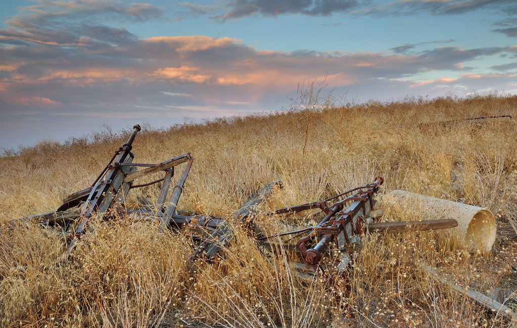
Abandoned in field

The Flower Pixies

valle vista sunrise

Me - at Bitter Creek National Wildlife Refuge
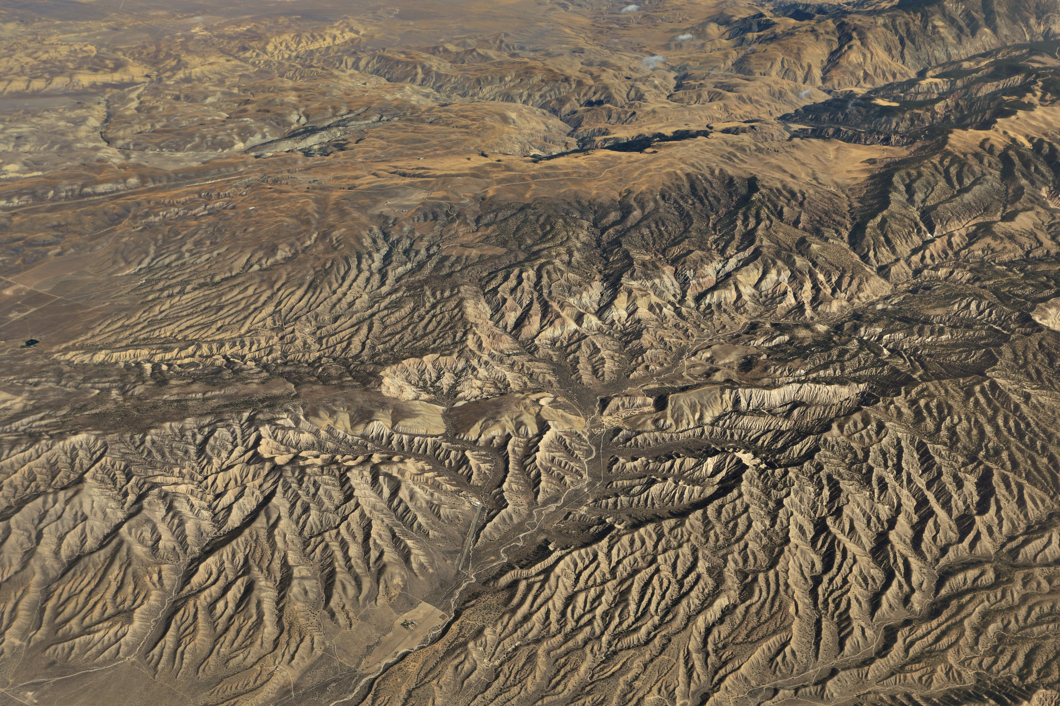
Air Travel- Ballinger Canyon

View of San Joaquin Valley from San Emigdio Mountains

Looking SSE from Cerro Noroests Rd.(2) - hdr hyper cross view 3d
CA-33, Maricopa, CA, USA Karte
Suchen Sie einen anderen Ort
Nahe Plätze
El Roblar St, Maricopa, CA, USA
Reyes Creek Campground, Maricopa, CA, Vereinigte Staaten
Western Minerals Rd, Maricopa, CA, USA
Maricopa, Kalifornien, USA
Brush Mountain, California, USA
Reyes Peak, California, USA
San Emigdio Mountain, California, USA
Arroyo Way, Taft, CA, USA
Philippine St, Taft, CA, USA
Pinewood Ct, Frazier Park, CA, USA
Sage St, Taft, CA, USA
Copus Rd, Bakersfield, CA, USA
Banff Dr, Pine Mountain Club, CA, USA
Pine Mountain Club Real Estate, Pine Valley Ln, Pine Mountain Club, CA, USA
Alpine St, Taft, CA, USA
Peak to Peak Realty, Pine Mountain Club Ca, Askin Dr unit d, Pine Mountain Club, CA, USA
Askin Dr, Frazier Park, CA, USA
Taft, Kalifornien, USA
Lucard St, Taft, CA, USA
Bernina Dr, Pine Mountain Club, CA, USA
Letzte Suche
- Red Dog Mine, AK, USA Sonnenaufgang Sonnenuntergang Zeiten
- Am Bahnhof, Am bhf, Borken, Germany Sonnenaufgang Sonnenuntergang Zeiten
- 4th St E, Sonoma, CA, USA Sonnenaufgang Sonnenuntergang Zeiten
- Oakland Ave, Williamsport, PA, USA Sonnenaufgang Sonnenuntergang Zeiten
- Via Roma, Pieranica CR, Italien Sonnenaufgang Sonnenuntergang Zeiten
- Glockenturm, Grad, Dubrovnik, Kroatien Sonnenaufgang Sonnenuntergang Zeiten
- Trelew, Chubut Province, Argentina Sonnenaufgang Sonnenuntergang Zeiten
- Hartfords Bluff Cir, Mt Pleasant, SC, USA Sonnenaufgang Sonnenuntergang Zeiten
- Kita-ku, Kumamoto, Präfektur Kumamoto, Japan Sonnenaufgang Sonnenuntergang Zeiten
- Pingtan Island, Pingtan County, Fuzhou, China Sonnenaufgang Sonnenuntergang Zeiten