Bunga, Negros Occidental, Philippinen Sonnenaufgang Sonnenuntergang Zeiten
Location: Philippinen > Western Visayas > Negros Occidental >
Zeitzone:
Asia/Manila
Ortszeit:
2025-06-22 05:20:31
Länge:
123.2644093
Breite:
10.5707697
Sonnenaufgang Heute:
05:26:40 AM
Sonnenuntergang Heute:
06:11:19 PM
Tageslänge heute:
12h 44m 39s
Sonnenaufgang morgen:
05:26:54 AM
Sonnenuntergang Morgen:
06:11:31 PM
Tageslänge von morgen:
12h 44m 37s
Alle Termine anzeigen
| Datum | Sonnenaufgang | Sonnenuntergang | Tageslänge |
|---|---|---|---|
| 2025-01-01 | 06:04:54 AM | 05:36:11 PM | 11h 31m 17s |
| 2025-01-02 | 06:05:17 AM | 05:36:43 PM | 11h 31m 26s |
| 2025-01-03 | 06:05:40 AM | 05:37:16 PM | 11h 31m 36s |
| 2025-01-04 | 06:06:02 AM | 05:37:48 PM | 11h 31m 46s |
| 2025-01-05 | 06:06:23 AM | 05:38:21 PM | 11h 31m 58s |
| 2025-01-06 | 06:06:44 AM | 05:38:54 PM | 11h 32m 10s |
| 2025-01-07 | 06:07:03 AM | 05:39:26 PM | 11h 32m 23s |
| 2025-01-08 | 06:07:22 AM | 05:39:58 PM | 11h 32m 36s |
| 2025-01-09 | 06:07:39 AM | 05:40:30 PM | 11h 32m 51s |
| 2025-01-10 | 06:07:56 AM | 05:41:02 PM | 11h 33m 6s |
| 2025-01-11 | 06:08:12 AM | 05:41:34 PM | 11h 33m 22s |
| 2025-01-12 | 06:08:27 AM | 05:42:05 PM | 11h 33m 38s |
| 2025-01-13 | 06:08:41 AM | 05:42:36 PM | 11h 33m 55s |
| 2025-01-14 | 06:08:55 AM | 05:43:07 PM | 11h 34m 12s |
| 2025-01-15 | 06:09:07 AM | 05:43:37 PM | 11h 34m 30s |
| 2025-01-16 | 06:09:18 AM | 05:44:07 PM | 11h 34m 49s |
| 2025-01-17 | 06:09:28 AM | 05:44:37 PM | 11h 35m 9s |
| 2025-01-18 | 06:09:37 AM | 05:45:06 PM | 11h 35m 29s |
| 2025-01-19 | 06:09:45 AM | 05:45:35 PM | 11h 35m 50s |
| 2025-01-20 | 06:09:52 AM | 05:46:04 PM | 11h 36m 12s |
| 2025-01-21 | 06:09:58 AM | 05:46:32 PM | 11h 36m 34s |
| 2025-01-22 | 06:10:03 AM | 05:46:59 PM | 11h 36m 56s |
| 2025-01-23 | 06:10:07 AM | 05:47:26 PM | 11h 37m 19s |
| 2025-01-24 | 06:10:10 AM | 05:47:52 PM | 11h 37m 42s |
| 2025-01-25 | 06:10:12 AM | 05:48:18 PM | 11h 38m 6s |
| 2025-01-26 | 06:10:13 AM | 05:48:44 PM | 11h 38m 31s |
| 2025-01-27 | 06:10:13 AM | 05:49:08 PM | 11h 38m 55s |
| 2025-01-28 | 06:10:12 AM | 05:49:33 PM | 11h 39m 21s |
| 2025-01-29 | 06:10:09 AM | 05:49:56 PM | 11h 39m 47s |
| 2025-01-30 | 06:10:06 AM | 05:50:19 PM | 11h 40m 13s |
| 2025-01-31 | 06:10:02 AM | 05:50:42 PM | 11h 40m 40s |
| 2025-02-01 | 06:09:56 AM | 05:51:04 PM | 11h 41m 8s |
| 2025-02-02 | 06:09:50 AM | 05:51:25 PM | 11h 41m 35s |
| 2025-02-03 | 06:09:43 AM | 05:51:45 PM | 11h 42m 2s |
| 2025-02-04 | 06:09:34 AM | 05:52:05 PM | 11h 42m 31s |
| 2025-02-05 | 06:09:25 AM | 05:52:25 PM | 11h 43m 0s |
| 2025-02-06 | 06:09:14 AM | 05:52:43 PM | 11h 43m 29s |
| 2025-02-07 | 06:09:03 AM | 05:53:01 PM | 11h 43m 58s |
| 2025-02-08 | 06:08:51 AM | 05:53:19 PM | 11h 44m 28s |
| 2025-02-09 | 06:08:38 AM | 05:53:36 PM | 11h 44m 58s |
| 2025-02-10 | 06:08:23 AM | 05:53:52 PM | 11h 45m 29s |
| 2025-02-11 | 06:08:08 AM | 05:54:07 PM | 11h 45m 59s |
| 2025-02-12 | 06:07:52 AM | 05:54:22 PM | 11h 46m 30s |
| 2025-02-13 | 06:07:36 AM | 05:54:37 PM | 11h 47m 1s |
| 2025-02-14 | 06:07:18 AM | 05:54:50 PM | 11h 47m 32s |
| 2025-02-15 | 06:06:59 AM | 05:55:03 PM | 11h 48m 4s |
| 2025-02-16 | 06:06:40 AM | 05:55:16 PM | 11h 48m 36s |
| 2025-02-17 | 06:06:19 AM | 05:55:28 PM | 11h 49m 9s |
| 2025-02-18 | 06:05:58 AM | 05:55:39 PM | 11h 49m 41s |
| 2025-02-19 | 06:05:37 AM | 05:55:50 PM | 11h 50m 13s |
| 2025-02-20 | 06:05:14 AM | 05:56:00 PM | 11h 50m 46s |
| 2025-02-21 | 06:04:51 AM | 05:56:10 PM | 11h 51m 19s |
| 2025-02-22 | 06:04:27 AM | 05:56:19 PM | 11h 51m 52s |
| 2025-02-23 | 06:04:02 AM | 05:56:27 PM | 11h 52m 25s |
| 2025-02-24 | 06:03:36 AM | 05:56:35 PM | 11h 52m 59s |
| 2025-02-25 | 06:03:10 AM | 05:56:43 PM | 11h 53m 33s |
| 2025-02-26 | 06:02:43 AM | 05:56:50 PM | 11h 54m 7s |
| 2025-02-27 | 06:02:16 AM | 05:56:56 PM | 11h 54m 40s |
| 2025-02-28 | 06:01:48 AM | 05:57:03 PM | 11h 55m 15s |
| 2025-03-01 | 06:01:19 AM | 05:57:08 PM | 11h 55m 49s |
| 2025-03-02 | 06:00:50 AM | 05:57:13 PM | 11h 56m 23s |
| 2025-03-03 | 06:00:20 AM | 05:57:18 PM | 11h 56m 58s |
| 2025-03-04 | 05:59:50 AM | 05:57:22 PM | 11h 57m 32s |
| 2025-03-05 | 05:59:19 AM | 05:57:26 PM | 11h 58m 7s |
| 2025-03-06 | 05:58:48 AM | 05:57:30 PM | 11h 58m 42s |
| 2025-03-07 | 05:58:17 AM | 05:57:33 PM | 11h 59m 16s |
| 2025-03-08 | 05:57:45 AM | 05:57:36 PM | 11h 59m 51s |
| 2025-03-09 | 05:57:12 AM | 05:57:39 PM | 12h 0m 27s |
| 2025-03-10 | 05:56:39 AM | 05:57:41 PM | 12h 1m 2s |
| 2025-03-11 | 05:56:06 AM | 05:57:43 PM | 12h 1m 37s |
| 2025-03-12 | 05:55:33 AM | 05:57:44 PM | 12h 2m 11s |
| 2025-03-13 | 05:54:59 AM | 05:57:46 PM | 12h 2m 47s |
| 2025-03-14 | 05:54:25 AM | 05:57:47 PM | 12h 3m 22s |
| 2025-03-15 | 05:53:50 AM | 05:57:48 PM | 12h 3m 58s |
| 2025-03-16 | 05:53:16 AM | 05:57:48 PM | 12h 4m 32s |
| 2025-03-17 | 05:52:41 AM | 05:57:49 PM | 12h 5m 8s |
| 2025-03-18 | 05:52:06 AM | 05:57:49 PM | 12h 5m 43s |
| 2025-03-19 | 05:51:31 AM | 05:57:49 PM | 12h 6m 18s |
| 2025-03-20 | 05:50:55 AM | 05:57:49 PM | 12h 6m 54s |
| 2025-03-21 | 05:50:20 AM | 05:57:49 PM | 12h 7m 29s |
| 2025-03-22 | 05:49:44 AM | 05:57:49 PM | 12h 8m 5s |
| 2025-03-23 | 05:49:08 AM | 05:57:49 PM | 12h 8m 41s |
| 2025-03-24 | 05:48:33 AM | 05:57:48 PM | 12h 9m 15s |
| 2025-03-25 | 05:47:57 AM | 05:57:48 PM | 12h 9m 51s |
| 2025-03-26 | 05:47:21 AM | 05:57:47 PM | 12h 10m 26s |
| 2025-03-27 | 05:46:45 AM | 05:57:47 PM | 12h 11m 2s |
| 2025-03-28 | 05:46:10 AM | 05:57:46 PM | 12h 11m 36s |
| 2025-03-29 | 05:45:34 AM | 05:57:46 PM | 12h 12m 12s |
| 2025-03-30 | 05:44:59 AM | 05:57:46 PM | 12h 12m 47s |
| 2025-03-31 | 05:44:23 AM | 05:57:45 PM | 12h 13m 22s |
| 2025-04-01 | 05:43:48 AM | 05:57:45 PM | 12h 13m 57s |
| 2025-04-02 | 05:43:13 AM | 05:57:45 PM | 12h 14m 32s |
| 2025-04-03 | 05:42:38 AM | 05:57:44 PM | 12h 15m 6s |
| 2025-04-04 | 05:42:03 AM | 05:57:44 PM | 12h 15m 41s |
| 2025-04-05 | 05:41:28 AM | 05:57:44 PM | 12h 16m 16s |
| 2025-04-06 | 05:40:54 AM | 05:57:45 PM | 12h 16m 51s |
| 2025-04-07 | 05:40:20 AM | 05:57:45 PM | 12h 17m 25s |
| 2025-04-08 | 05:39:46 AM | 05:57:46 PM | 12h 18m 0s |
| 2025-04-09 | 05:39:12 AM | 05:57:46 PM | 12h 18m 34s |
| 2025-04-10 | 05:38:39 AM | 05:57:47 PM | 12h 19m 8s |
| 2025-04-11 | 05:38:06 AM | 05:57:49 PM | 12h 19m 43s |
| 2025-04-12 | 05:37:34 AM | 05:57:50 PM | 12h 20m 16s |
| 2025-04-13 | 05:37:02 AM | 05:57:52 PM | 12h 20m 50s |
| 2025-04-14 | 05:36:30 AM | 05:57:53 PM | 12h 21m 23s |
| 2025-04-15 | 05:35:59 AM | 05:57:56 PM | 12h 21m 57s |
| 2025-04-16 | 05:35:28 AM | 05:57:58 PM | 12h 22m 30s |
| 2025-04-17 | 05:34:57 AM | 05:58:01 PM | 12h 23m 4s |
| 2025-04-18 | 05:34:28 AM | 05:58:04 PM | 12h 23m 36s |
| 2025-04-19 | 05:33:58 AM | 05:58:07 PM | 12h 24m 9s |
| 2025-04-20 | 05:33:29 AM | 05:58:11 PM | 12h 24m 42s |
| 2025-04-21 | 05:33:01 AM | 05:58:15 PM | 12h 25m 14s |
| 2025-04-22 | 05:32:33 AM | 05:58:19 PM | 12h 25m 46s |
| 2025-04-23 | 05:32:06 AM | 05:58:24 PM | 12h 26m 18s |
| 2025-04-24 | 05:31:39 AM | 05:58:29 PM | 12h 26m 50s |
| 2025-04-25 | 05:31:13 AM | 05:58:34 PM | 12h 27m 21s |
| 2025-04-26 | 05:30:48 AM | 05:58:40 PM | 12h 27m 52s |
| 2025-04-27 | 05:30:23 AM | 05:58:46 PM | 12h 28m 23s |
| 2025-04-28 | 05:29:59 AM | 05:58:52 PM | 12h 28m 53s |
| 2025-04-29 | 05:29:35 AM | 05:58:59 PM | 12h 29m 24s |
| 2025-04-30 | 05:29:12 AM | 05:59:06 PM | 12h 29m 54s |
| 2025-05-01 | 05:28:50 AM | 05:59:14 PM | 12h 30m 24s |
| 2025-05-02 | 05:28:28 AM | 05:59:22 PM | 12h 30m 54s |
| 2025-05-03 | 05:28:08 AM | 05:59:30 PM | 12h 31m 22s |
| 2025-05-04 | 05:27:48 AM | 05:59:39 PM | 12h 31m 51s |
| 2025-05-05 | 05:27:28 AM | 05:59:48 PM | 12h 32m 20s |
| 2025-05-06 | 05:27:10 AM | 05:59:57 PM | 12h 32m 47s |
| 2025-05-07 | 05:26:52 AM | 06:00:07 PM | 12h 33m 15s |
| 2025-05-08 | 05:26:35 AM | 06:00:17 PM | 12h 33m 42s |
| 2025-05-09 | 05:26:18 AM | 06:00:28 PM | 12h 34m 10s |
| 2025-05-10 | 05:26:03 AM | 06:00:39 PM | 12h 34m 36s |
| 2025-05-11 | 05:25:48 AM | 06:00:50 PM | 12h 35m 2s |
| 2025-05-12 | 05:25:34 AM | 06:01:02 PM | 12h 35m 28s |
| 2025-05-13 | 05:25:21 AM | 06:01:14 PM | 12h 35m 53s |
| 2025-05-14 | 05:25:09 AM | 06:01:26 PM | 12h 36m 17s |
| 2025-05-15 | 05:24:57 AM | 06:01:39 PM | 12h 36m 42s |
| 2025-05-16 | 05:24:46 AM | 06:01:52 PM | 12h 37m 6s |
| 2025-05-17 | 05:24:36 AM | 06:02:06 PM | 12h 37m 30s |
| 2025-05-18 | 05:24:27 AM | 06:02:19 PM | 12h 37m 52s |
| 2025-05-19 | 05:24:19 AM | 06:02:33 PM | 12h 38m 14s |
| 2025-05-20 | 05:24:11 AM | 06:02:48 PM | 12h 38m 37s |
| 2025-05-21 | 05:24:04 AM | 06:03:02 PM | 12h 38m 58s |
| 2025-05-22 | 05:23:58 AM | 06:03:17 PM | 12h 39m 19s |
| 2025-05-23 | 05:23:53 AM | 06:03:32 PM | 12h 39m 39s |
| 2025-05-24 | 05:23:49 AM | 06:03:47 PM | 12h 39m 58s |
| 2025-05-25 | 05:23:45 AM | 06:04:03 PM | 12h 40m 18s |
| 2025-05-26 | 05:23:42 AM | 06:04:18 PM | 12h 40m 36s |
| 2025-05-27 | 05:23:40 AM | 06:04:34 PM | 12h 40m 54s |
| 2025-05-28 | 05:23:39 AM | 06:04:50 PM | 12h 41m 11s |
| 2025-05-29 | 05:23:39 AM | 06:05:06 PM | 12h 41m 27s |
| 2025-05-30 | 05:23:39 AM | 06:05:23 PM | 12h 41m 44s |
| 2025-05-31 | 05:23:40 AM | 06:05:39 PM | 12h 41m 59s |
| 2025-06-01 | 05:23:42 AM | 06:05:55 PM | 12h 42m 13s |
| 2025-06-02 | 05:23:44 AM | 06:06:12 PM | 12h 42m 28s |
| 2025-06-03 | 05:23:47 AM | 06:06:28 PM | 12h 42m 41s |
| 2025-06-04 | 05:23:51 AM | 06:06:45 PM | 12h 42m 54s |
| 2025-06-05 | 05:23:56 AM | 06:07:02 PM | 12h 43m 6s |
| 2025-06-06 | 05:24:01 AM | 06:07:18 PM | 12h 43m 17s |
| 2025-06-07 | 05:24:07 AM | 06:07:35 PM | 12h 43m 28s |
| 2025-06-08 | 05:24:13 AM | 06:07:51 PM | 12h 43m 38s |
| 2025-06-09 | 05:24:20 AM | 06:08:07 PM | 12h 43m 47s |
| 2025-06-10 | 05:24:28 AM | 06:08:23 PM | 12h 43m 55s |
| 2025-06-11 | 05:24:36 AM | 06:08:39 PM | 12h 44m 3s |
| 2025-06-12 | 05:24:45 AM | 06:08:55 PM | 12h 44m 10s |
| 2025-06-13 | 05:24:55 AM | 06:09:11 PM | 12h 44m 16s |
| 2025-06-14 | 05:25:05 AM | 06:09:26 PM | 12h 44m 21s |
| 2025-06-15 | 05:25:15 AM | 06:09:42 PM | 12h 44m 27s |
| 2025-06-16 | 05:25:26 AM | 06:09:56 PM | 12h 44m 30s |
| 2025-06-17 | 05:25:37 AM | 06:10:11 PM | 12h 44m 34s |
| 2025-06-18 | 05:25:49 AM | 06:10:25 PM | 12h 44m 36s |
| 2025-06-19 | 05:26:01 AM | 06:10:39 PM | 12h 44m 38s |
| 2025-06-20 | 05:26:14 AM | 06:10:53 PM | 12h 44m 39s |
| 2025-06-21 | 05:26:27 AM | 06:11:06 PM | 12h 44m 39s |
| 2025-06-22 | 05:26:40 AM | 06:11:19 PM | 12h 44m 39s |
| 2025-06-23 | 05:26:54 AM | 06:11:31 PM | 12h 44m 37s |
| 2025-06-24 | 05:27:08 AM | 06:11:43 PM | 12h 44m 35s |
| 2025-06-25 | 05:27:22 AM | 06:11:54 PM | 12h 44m 32s |
| 2025-06-26 | 05:27:36 AM | 06:12:05 PM | 12h 44m 29s |
| 2025-06-27 | 05:27:51 AM | 06:12:15 PM | 12h 44m 24s |
| 2025-06-28 | 05:28:06 AM | 06:12:25 PM | 12h 44m 19s |
| 2025-06-29 | 05:28:21 AM | 06:12:34 PM | 12h 44m 13s |
| 2025-06-30 | 05:28:36 AM | 06:12:43 PM | 12h 44m 7s |
| 2025-07-01 | 05:28:51 AM | 06:12:51 PM | 12h 44m 0s |
| 2025-07-02 | 05:29:07 AM | 06:12:58 PM | 12h 43m 51s |
| 2025-07-03 | 05:29:22 AM | 06:13:05 PM | 12h 43m 43s |
| 2025-07-04 | 05:29:38 AM | 06:13:11 PM | 12h 43m 33s |
| 2025-07-05 | 05:29:53 AM | 06:13:17 PM | 12h 43m 24s |
| 2025-07-06 | 05:30:09 AM | 06:13:21 PM | 12h 43m 12s |
| 2025-07-07 | 05:30:24 AM | 06:13:25 PM | 12h 43m 1s |
| 2025-07-08 | 05:30:40 AM | 06:13:28 PM | 12h 42m 48s |
| 2025-07-09 | 05:30:55 AM | 06:13:31 PM | 12h 42m 36s |
| 2025-07-10 | 05:31:11 AM | 06:13:33 PM | 12h 42m 22s |
| 2025-07-11 | 05:31:26 AM | 06:13:34 PM | 12h 42m 8s |
| 2025-07-12 | 05:31:41 AM | 06:13:34 PM | 12h 41m 53s |
| 2025-07-13 | 05:31:56 AM | 06:13:33 PM | 12h 41m 37s |
| 2025-07-14 | 05:32:11 AM | 06:13:32 PM | 12h 41m 21s |
| 2025-07-15 | 05:32:25 AM | 06:13:30 PM | 12h 41m 5s |
| 2025-07-16 | 05:32:40 AM | 06:13:27 PM | 12h 40m 47s |
| 2025-07-17 | 05:32:54 AM | 06:13:23 PM | 12h 40m 29s |
| 2025-07-18 | 05:33:08 AM | 06:13:18 PM | 12h 40m 10s |
| 2025-07-19 | 05:33:21 AM | 06:13:13 PM | 12h 39m 52s |
| 2025-07-20 | 05:33:35 AM | 06:13:06 PM | 12h 39m 31s |
| 2025-07-21 | 05:33:48 AM | 06:12:59 PM | 12h 39m 11s |
| 2025-07-22 | 05:34:01 AM | 06:12:51 PM | 12h 38m 50s |
| 2025-07-23 | 05:34:13 AM | 06:12:42 PM | 12h 38m 29s |
| 2025-07-24 | 05:34:25 AM | 06:12:33 PM | 12h 38m 8s |
| 2025-07-25 | 05:34:37 AM | 06:12:22 PM | 12h 37m 45s |
| 2025-07-26 | 05:34:49 AM | 06:12:11 PM | 12h 37m 22s |
| 2025-07-27 | 05:35:00 AM | 06:11:59 PM | 12h 36m 59s |
| 2025-07-28 | 05:35:11 AM | 06:11:46 PM | 12h 36m 35s |
| 2025-07-29 | 05:35:21 AM | 06:11:32 PM | 12h 36m 11s |
| 2025-07-30 | 05:35:31 AM | 06:11:17 PM | 12h 35m 46s |
| 2025-07-31 | 05:35:41 AM | 06:11:02 PM | 12h 35m 21s |
| 2025-08-01 | 05:35:50 AM | 06:10:45 PM | 12h 34m 55s |
| 2025-08-02 | 05:35:59 AM | 06:10:28 PM | 12h 34m 29s |
| 2025-08-03 | 05:36:07 AM | 06:10:10 PM | 12h 34m 3s |
| 2025-08-04 | 05:36:15 AM | 06:09:51 PM | 12h 33m 36s |
| 2025-08-05 | 05:36:22 AM | 06:09:32 PM | 12h 33m 10s |
| 2025-08-06 | 05:36:30 AM | 06:09:11 PM | 12h 32m 41s |
| 2025-08-07 | 05:36:36 AM | 06:08:50 PM | 12h 32m 14s |
| 2025-08-08 | 05:36:43 AM | 06:08:28 PM | 12h 31m 45s |
| 2025-08-09 | 05:36:49 AM | 06:08:06 PM | 12h 31m 17s |
| 2025-08-10 | 05:36:54 AM | 06:07:42 PM | 12h 30m 48s |
| 2025-08-11 | 05:36:59 AM | 06:07:18 PM | 12h 30m 19s |
| 2025-08-12 | 05:37:04 AM | 06:06:54 PM | 12h 29m 50s |
| 2025-08-13 | 05:37:08 AM | 06:06:28 PM | 12h 29m 20s |
| 2025-08-14 | 05:37:12 AM | 06:06:02 PM | 12h 28m 50s |
| 2025-08-15 | 05:37:15 AM | 06:05:35 PM | 12h 28m 20s |
| 2025-08-16 | 05:37:18 AM | 06:05:08 PM | 12h 27m 50s |
| 2025-08-17 | 05:37:21 AM | 06:04:39 PM | 12h 27m 18s |
| 2025-08-18 | 05:37:23 AM | 06:04:11 PM | 12h 26m 48s |
| 2025-08-19 | 05:37:25 AM | 06:03:41 PM | 12h 26m 16s |
| 2025-08-20 | 05:37:27 AM | 06:03:11 PM | 12h 25m 44s |
| 2025-08-21 | 05:37:28 AM | 06:02:41 PM | 12h 25m 13s |
| 2025-08-22 | 05:37:28 AM | 06:02:09 PM | 12h 24m 41s |
| 2025-08-23 | 05:37:29 AM | 06:01:38 PM | 12h 24m 9s |
| 2025-08-24 | 05:37:29 AM | 06:01:06 PM | 12h 23m 37s |
| 2025-08-25 | 05:37:29 AM | 06:00:33 PM | 12h 23m 4s |
| 2025-08-26 | 05:37:28 AM | 06:00:00 PM | 12h 22m 32s |
| 2025-08-27 | 05:37:27 AM | 05:59:26 PM | 12h 21m 59s |
| 2025-08-28 | 05:37:26 AM | 05:58:52 PM | 12h 21m 26s |
| 2025-08-29 | 05:37:25 AM | 05:58:17 PM | 12h 20m 52s |
| 2025-08-30 | 05:37:23 AM | 05:57:42 PM | 12h 20m 19s |
| 2025-08-31 | 05:37:21 AM | 05:57:07 PM | 12h 19m 46s |
| 2025-09-01 | 05:37:19 AM | 05:56:31 PM | 12h 19m 12s |
| 2025-09-02 | 05:37:16 AM | 05:55:55 PM | 12h 18m 39s |
| 2025-09-03 | 05:37:14 AM | 05:55:19 PM | 12h 18m 5s |
| 2025-09-04 | 05:37:11 AM | 05:54:42 PM | 12h 17m 31s |
| 2025-09-05 | 05:37:08 AM | 05:54:05 PM | 12h 16m 57s |
| 2025-09-06 | 05:37:04 AM | 05:53:28 PM | 12h 16m 24s |
| 2025-09-07 | 05:37:01 AM | 05:52:50 PM | 12h 15m 49s |
| 2025-09-08 | 05:36:58 AM | 05:52:12 PM | 12h 15m 14s |
| 2025-09-09 | 05:36:54 AM | 05:51:34 PM | 12h 14m 40s |
| 2025-09-10 | 05:36:50 AM | 05:50:56 PM | 12h 14m 6s |
| 2025-09-11 | 05:36:46 AM | 05:50:18 PM | 12h 13m 32s |
| 2025-09-12 | 05:36:42 AM | 05:49:39 PM | 12h 12m 57s |
| 2025-09-13 | 05:36:38 AM | 05:49:01 PM | 12h 12m 23s |
| 2025-09-14 | 05:36:34 AM | 05:48:22 PM | 12h 11m 48s |
| 2025-09-15 | 05:36:30 AM | 05:47:43 PM | 12h 11m 13s |
| 2025-09-16 | 05:36:26 AM | 05:47:05 PM | 12h 10m 39s |
| 2025-09-17 | 05:36:22 AM | 05:46:26 PM | 12h 10m 4s |
| 2025-09-18 | 05:36:18 AM | 05:45:47 PM | 12h 9m 29s |
| 2025-09-19 | 05:36:14 AM | 05:45:08 PM | 12h 8m 54s |
| 2025-09-20 | 05:36:10 AM | 05:44:29 PM | 12h 8m 19s |
| 2025-09-21 | 05:36:06 AM | 05:43:51 PM | 12h 7m 45s |
| 2025-09-22 | 05:36:02 AM | 05:43:12 PM | 12h 7m 10s |
| 2025-09-23 | 05:35:59 AM | 05:42:34 PM | 12h 6m 35s |
| 2025-09-24 | 05:35:55 AM | 05:41:55 PM | 12h 6m 0s |
| 2025-09-25 | 05:35:52 AM | 05:41:17 PM | 12h 5m 25s |
| 2025-09-26 | 05:35:48 AM | 05:40:39 PM | 12h 4m 51s |
| 2025-09-27 | 05:35:45 AM | 05:40:01 PM | 12h 4m 16s |
| 2025-09-28 | 05:35:43 AM | 05:39:24 PM | 12h 3m 41s |
| 2025-09-29 | 05:35:40 AM | 05:38:46 PM | 12h 3m 6s |
| 2025-09-30 | 05:35:38 AM | 05:38:09 PM | 12h 2m 31s |
| 2025-10-01 | 05:35:35 AM | 05:37:32 PM | 12h 1m 57s |
| 2025-10-02 | 05:35:34 AM | 05:36:56 PM | 12h 1m 22s |
| 2025-10-03 | 05:35:32 AM | 05:36:20 PM | 12h 0m 48s |
| 2025-10-04 | 05:35:31 AM | 05:35:44 PM | 12h 0m 13s |
| 2025-10-05 | 05:35:30 AM | 05:35:09 PM | 11h 59m 39s |
| 2025-10-06 | 05:35:29 AM | 05:34:34 PM | 11h 59m 5s |
| 2025-10-07 | 05:35:29 AM | 05:33:59 PM | 11h 58m 30s |
| 2025-10-08 | 05:35:29 AM | 05:33:25 PM | 11h 57m 56s |
| 2025-10-09 | 05:35:30 AM | 05:32:51 PM | 11h 57m 21s |
| 2025-10-10 | 05:35:30 AM | 05:32:18 PM | 11h 56m 48s |
| 2025-10-11 | 05:35:32 AM | 05:31:46 PM | 11h 56m 14s |
| 2025-10-12 | 05:35:34 AM | 05:31:14 PM | 11h 55m 40s |
| 2025-10-13 | 05:35:36 AM | 05:30:42 PM | 11h 55m 6s |
| 2025-10-14 | 05:35:39 AM | 05:30:11 PM | 11h 54m 32s |
| 2025-10-15 | 05:35:42 AM | 05:29:41 PM | 11h 53m 59s |
| 2025-10-16 | 05:35:45 AM | 05:29:11 PM | 11h 53m 26s |
| 2025-10-17 | 05:35:50 AM | 05:28:42 PM | 11h 52m 52s |
| 2025-10-18 | 05:35:54 AM | 05:28:14 PM | 11h 52m 20s |
| 2025-10-19 | 05:36:00 AM | 05:27:47 PM | 11h 51m 47s |
| 2025-10-20 | 05:36:05 AM | 05:27:20 PM | 11h 51m 15s |
| 2025-10-21 | 05:36:12 AM | 05:26:54 PM | 11h 50m 42s |
| 2025-10-22 | 05:36:19 AM | 05:26:28 PM | 11h 50m 9s |
| 2025-10-23 | 05:36:26 AM | 05:26:04 PM | 11h 49m 38s |
| 2025-10-24 | 05:36:34 AM | 05:25:40 PM | 11h 49m 6s |
| 2025-10-25 | 05:36:43 AM | 05:25:17 PM | 11h 48m 34s |
| 2025-10-26 | 05:36:52 AM | 05:24:55 PM | 11h 48m 3s |
| 2025-10-27 | 05:37:02 AM | 05:24:33 PM | 11h 47m 31s |
| 2025-10-28 | 05:37:13 AM | 05:24:13 PM | 11h 47m 0s |
| 2025-10-29 | 05:37:24 AM | 05:23:53 PM | 11h 46m 29s |
| 2025-10-30 | 05:37:36 AM | 05:23:34 PM | 11h 45m 58s |
| 2025-10-31 | 05:37:48 AM | 05:23:17 PM | 11h 45m 29s |
| 2025-11-01 | 05:38:02 AM | 05:23:00 PM | 11h 44m 58s |
| 2025-11-02 | 05:38:15 AM | 05:22:44 PM | 11h 44m 29s |
| 2025-11-03 | 05:38:30 AM | 05:22:29 PM | 11h 43m 59s |
| 2025-11-04 | 05:38:45 AM | 05:22:15 PM | 11h 43m 30s |
| 2025-11-05 | 05:39:01 AM | 05:22:02 PM | 11h 43m 1s |
| 2025-11-06 | 05:39:17 AM | 05:21:50 PM | 11h 42m 33s |
| 2025-11-07 | 05:39:34 AM | 05:21:39 PM | 11h 42m 5s |
| 2025-11-08 | 05:39:52 AM | 05:21:29 PM | 11h 41m 37s |
| 2025-11-09 | 05:40:11 AM | 05:21:20 PM | 11h 41m 9s |
| 2025-11-10 | 05:40:30 AM | 05:21:13 PM | 11h 40m 43s |
| 2025-11-11 | 05:40:49 AM | 05:21:06 PM | 11h 40m 17s |
| 2025-11-12 | 05:41:10 AM | 05:21:00 PM | 11h 39m 50s |
| 2025-11-13 | 05:41:31 AM | 05:20:55 PM | 11h 39m 24s |
| 2025-11-14 | 05:41:52 AM | 05:20:52 PM | 11h 39m 0s |
| 2025-11-15 | 05:42:15 AM | 05:20:49 PM | 11h 38m 34s |
| 2025-11-16 | 05:42:38 AM | 05:20:48 PM | 11h 38m 10s |
| 2025-11-17 | 05:43:01 AM | 05:20:47 PM | 11h 37m 46s |
| 2025-11-18 | 05:43:25 AM | 05:20:48 PM | 11h 37m 23s |
| 2025-11-19 | 05:43:50 AM | 05:20:50 PM | 11h 37m 0s |
| 2025-11-20 | 05:44:15 AM | 05:20:53 PM | 11h 36m 38s |
| 2025-11-21 | 05:44:41 AM | 05:20:57 PM | 11h 36m 16s |
| 2025-11-22 | 05:45:07 AM | 05:21:02 PM | 11h 35m 55s |
| 2025-11-23 | 05:45:34 AM | 05:21:08 PM | 11h 35m 34s |
| 2025-11-24 | 05:46:01 AM | 05:21:15 PM | 11h 35m 14s |
| 2025-11-25 | 05:46:29 AM | 05:21:23 PM | 11h 34m 54s |
| 2025-11-26 | 05:46:57 AM | 05:21:32 PM | 11h 34m 35s |
| 2025-11-27 | 05:47:26 AM | 05:21:42 PM | 11h 34m 16s |
| 2025-11-28 | 05:47:55 AM | 05:21:54 PM | 11h 33m 59s |
| 2025-11-29 | 05:48:24 AM | 05:22:06 PM | 11h 33m 42s |
| 2025-11-30 | 05:48:54 AM | 05:22:19 PM | 11h 33m 25s |
| 2025-12-01 | 05:49:24 AM | 05:22:34 PM | 11h 33m 10s |
| 2025-12-02 | 05:49:54 AM | 05:22:49 PM | 11h 32m 55s |
| 2025-12-03 | 05:50:25 AM | 05:23:05 PM | 11h 32m 40s |
| 2025-12-04 | 05:50:56 AM | 05:23:22 PM | 11h 32m 26s |
| 2025-12-05 | 05:51:27 AM | 05:23:41 PM | 11h 32m 14s |
| 2025-12-06 | 05:51:58 AM | 05:24:00 PM | 11h 32m 2s |
| 2025-12-07 | 05:52:30 AM | 05:24:20 PM | 11h 31m 50s |
| 2025-12-08 | 05:53:01 AM | 05:24:40 PM | 11h 31m 39s |
| 2025-12-09 | 05:53:33 AM | 05:25:02 PM | 11h 31m 29s |
| 2025-12-10 | 05:54:05 AM | 05:25:24 PM | 11h 31m 19s |
| 2025-12-11 | 05:54:36 AM | 05:25:47 PM | 11h 31m 11s |
| 2025-12-12 | 05:55:08 AM | 05:26:11 PM | 11h 31m 3s |
| 2025-12-13 | 05:55:40 AM | 05:26:36 PM | 11h 30m 56s |
| 2025-12-14 | 05:56:12 AM | 05:27:02 PM | 11h 30m 50s |
| 2025-12-15 | 05:56:43 AM | 05:27:28 PM | 11h 30m 45s |
| 2025-12-16 | 05:57:14 AM | 05:27:54 PM | 11h 30m 40s |
| 2025-12-17 | 05:57:46 AM | 05:28:22 PM | 11h 30m 36s |
| 2025-12-18 | 05:58:17 AM | 05:28:50 PM | 11h 30m 33s |
| 2025-12-19 | 05:58:47 AM | 05:29:18 PM | 11h 30m 31s |
| 2025-12-20 | 05:59:18 AM | 05:29:47 PM | 11h 30m 29s |
| 2025-12-21 | 05:59:48 AM | 05:30:16 PM | 11h 30m 28s |
| 2025-12-22 | 06:00:18 AM | 05:30:46 PM | 11h 30m 28s |
| 2025-12-23 | 06:00:47 AM | 05:31:17 PM | 11h 30m 30s |
| 2025-12-24 | 06:01:16 AM | 05:31:47 PM | 11h 30m 31s |
| 2025-12-25 | 06:01:44 AM | 05:32:18 PM | 11h 30m 34s |
| 2025-12-26 | 06:02:12 AM | 05:32:50 PM | 11h 30m 38s |
| 2025-12-27 | 06:02:40 AM | 05:33:21 PM | 11h 30m 41s |
| 2025-12-28 | 06:03:07 AM | 05:33:53 PM | 11h 30m 46s |
| 2025-12-29 | 06:03:33 AM | 05:34:25 PM | 11h 30m 52s |
| 2025-12-30 | 06:03:59 AM | 05:34:58 PM | 11h 30m 59s |
| 2025-12-31 | 06:04:24 AM | 05:35:30 PM | 11h 31m 6s |
Fotos

Sunrise touching the fields of Don Salvador

Morning Light across the fields of Don Salvador

Another View of Salvador Benedicto
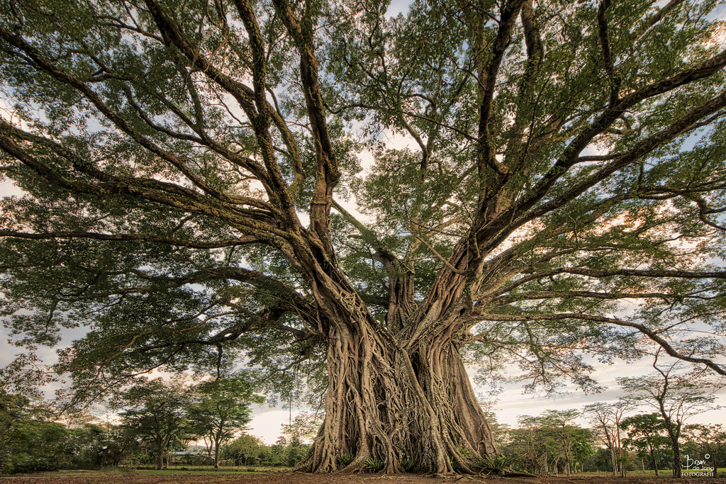
The Century Tree(s)

Road Development in Salvador Benedicto
Bunga, Negros Occidental, Philippinen Karte
Suchen Sie einen anderen Ort
Nahe Plätze
Don Salvador Benedicto, Negros Occidental, Philippinen
Highway 16 Cafe, Spur 16 Brgy, Don Salvador Benedicto, Negros Occidental, Philippinen
Lion's Park, Salvador Benedicto, Negros Occidental, Philippinen
Canlandog, Negros Occidental, Philippinen
Pandanon, Negros Occidental, Philippinen
Grassland, Murcia, Negros Occidental, Philippinen
Amayco, Murcia, Negros Occidental, Philippinen
Hicovill Highland Resort, Japanese Shrine in Barangay Patag, Silay City, Negros Occidental, Philippi
Cabatangan, Negros Occidental, Philippinen
Campuestohan Highland Resort Shark Wave, Unnamed Road, Talisay City, Negros Occidental, Philippinen
Campuestohan Highland Resort, Talisay City, Negros Occidental, Philippinen
Ilaya Highland Resort, Brgy Patag, Silay City, Negros Occidental, Philippinen
San Fernando, Negros Occidental, Philippinen
Patag Elementary School, Silay-Patag Rd, Silay City, Negros Occidental, Philippinen
Patag Highland Resort, Brgy, Silay City, Negros Occidental, Philippinen
Buenavista, Negros Occidental, Philippinen
Murcia, Negros Occidental, Philippinen
Lantawan View, Silay-Lantawan Road, Silay City, Negros Occidental, Philippinen
Santa Rosa, Murcia, Negros Occidental, Philippinen
Caliban, Murcia, Negros Occidental, Philippinen
Letzte Suche
- Red Dog Mine, AK, USA Sonnenaufgang Sonnenuntergang Zeiten
- Am Bahnhof, Am bhf, Borken, Germany Sonnenaufgang Sonnenuntergang Zeiten
- 4th St E, Sonoma, CA, USA Sonnenaufgang Sonnenuntergang Zeiten
- Oakland Ave, Williamsport, PA, USA Sonnenaufgang Sonnenuntergang Zeiten
- Via Roma, Pieranica CR, Italien Sonnenaufgang Sonnenuntergang Zeiten
- Glockenturm, Grad, Dubrovnik, Kroatien Sonnenaufgang Sonnenuntergang Zeiten
- Trelew, Chubut Province, Argentina Sonnenaufgang Sonnenuntergang Zeiten
- Hartfords Bluff Cir, Mt Pleasant, SC, USA Sonnenaufgang Sonnenuntergang Zeiten
- Kita-ku, Kumamoto, Präfektur Kumamoto, Japan Sonnenaufgang Sonnenuntergang Zeiten
- Pingtan Island, Pingtan County, Fuzhou, China Sonnenaufgang Sonnenuntergang Zeiten