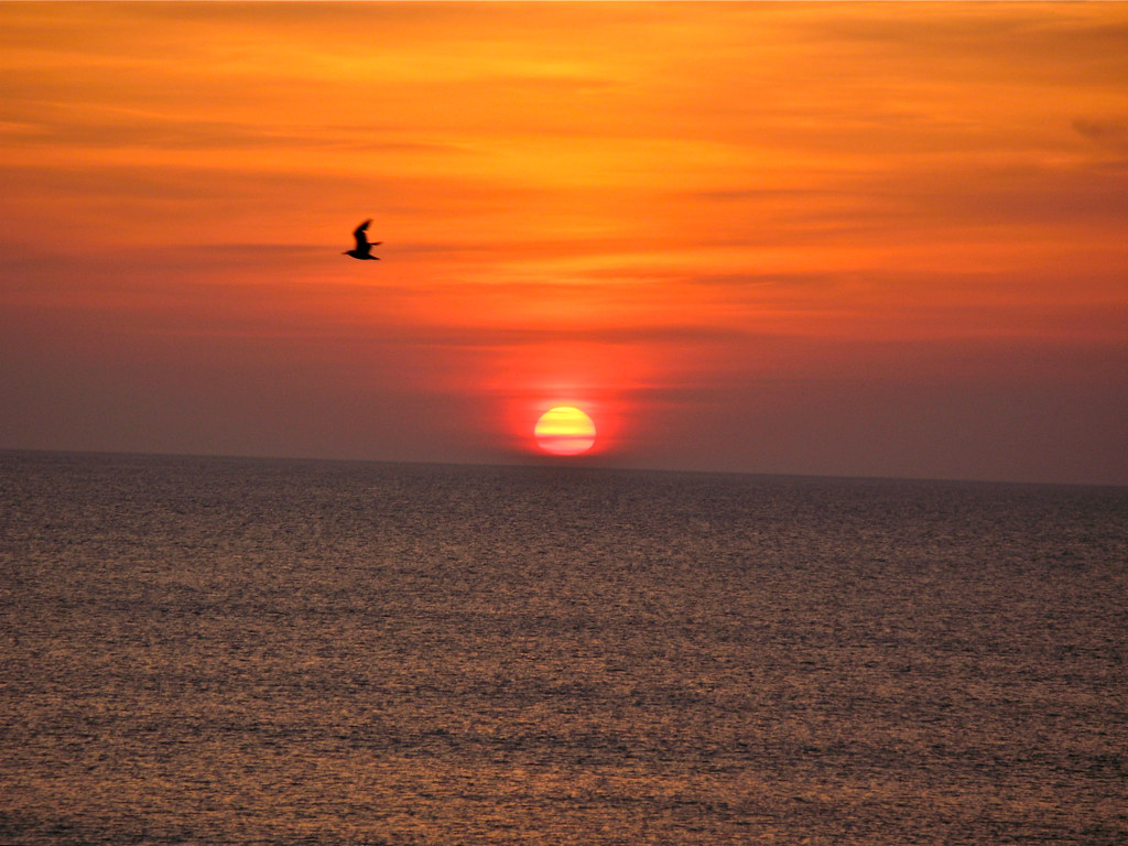
Bridle Ridge Ln, Wade, NC, USA Sonnenaufgang Sonnenuntergang Zeiten
Location: USA > North Carolina > Cumberland County > Cedar Creek > Cape Fear >
Zeitzone:
America/New_York
Ortszeit:
2025-06-25 23:07:09
Länge:
-78.694687
Breite:
35.113355
Sonnenaufgang Heute:
06:02:29 AM
Sonnenuntergang Heute:
08:33:08 PM
Tageslänge heute:
14h 30m 39s
Sonnenaufgang morgen:
06:02:50 AM
Sonnenuntergang Morgen:
08:33:11 PM
Tageslänge von morgen:
14h 30m 21s
Alle Termine anzeigen
| Datum | Sonnenaufgang | Sonnenuntergang | Tageslänge |
|---|---|---|---|
| 2025-01-01 | 07:23:10 AM | 05:14:37 PM | 9h 51m 27s |
| 2025-01-02 | 07:23:18 AM | 05:15:24 PM | 9h 52m 6s |
| 2025-01-03 | 07:23:24 AM | 05:16:13 PM | 9h 52m 49s |
| 2025-01-04 | 07:23:27 AM | 05:17:03 PM | 9h 53m 36s |
| 2025-01-05 | 07:23:29 AM | 05:17:53 PM | 9h 54m 24s |
| 2025-01-06 | 07:23:30 AM | 05:18:45 PM | 9h 55m 15s |
| 2025-01-07 | 07:23:28 AM | 05:19:38 PM | 9h 56m 10s |
| 2025-01-08 | 07:23:24 AM | 05:20:31 PM | 9h 57m 7s |
| 2025-01-09 | 07:23:18 AM | 05:21:25 PM | 9h 58m 7s |
| 2025-01-10 | 07:23:11 AM | 05:22:21 PM | 9h 59m 10s |
| 2025-01-11 | 07:23:01 AM | 05:23:16 PM | 10h 0m 15s |
| 2025-01-12 | 07:22:50 AM | 05:24:13 PM | 10h 1m 23s |
| 2025-01-13 | 07:22:36 AM | 05:25:10 PM | 10h 2m 34s |
| 2025-01-14 | 07:22:21 AM | 05:26:08 PM | 10h 3m 47s |
| 2025-01-15 | 07:22:04 AM | 05:27:06 PM | 10h 5m 2s |
| 2025-01-16 | 07:21:45 AM | 05:28:04 PM | 10h 6m 19s |
| 2025-01-17 | 07:21:24 AM | 05:29:04 PM | 10h 7m 40s |
| 2025-01-18 | 07:21:01 AM | 05:30:03 PM | 10h 9m 2s |
| 2025-01-19 | 07:20:37 AM | 05:31:03 PM | 10h 10m 26s |
| 2025-01-20 | 07:20:11 AM | 05:32:03 PM | 10h 11m 52s |
| 2025-01-21 | 07:19:42 AM | 05:33:04 PM | 10h 13m 22s |
| 2025-01-22 | 07:19:12 AM | 05:34:05 PM | 10h 14m 53s |
| 2025-01-23 | 07:18:41 AM | 05:35:05 PM | 10h 16m 24s |
| 2025-01-24 | 07:18:07 AM | 05:36:07 PM | 10h 18m 0s |
| 2025-01-25 | 07:17:32 AM | 05:37:08 PM | 10h 19m 36s |
| 2025-01-26 | 07:16:55 AM | 05:38:09 PM | 10h 21m 14s |
| 2025-01-27 | 07:16:16 AM | 05:39:10 PM | 10h 22m 54s |
| 2025-01-28 | 07:15:36 AM | 05:40:12 PM | 10h 24m 36s |
| 2025-01-29 | 07:14:54 AM | 05:41:13 PM | 10h 26m 19s |
| 2025-01-30 | 07:14:11 AM | 05:42:15 PM | 10h 28m 4s |
| 2025-01-31 | 07:13:26 AM | 05:43:16 PM | 10h 29m 50s |
| 2025-02-01 | 07:12:39 AM | 05:44:17 PM | 10h 31m 38s |
| 2025-02-02 | 07:11:51 AM | 05:45:18 PM | 10h 33m 27s |
| 2025-02-03 | 07:11:02 AM | 05:46:19 PM | 10h 35m 17s |
| 2025-02-04 | 07:10:11 AM | 05:47:20 PM | 10h 37m 9s |
| 2025-02-05 | 07:09:18 AM | 05:48:21 PM | 10h 39m 3s |
| 2025-02-06 | 07:08:24 AM | 05:49:21 PM | 10h 40m 57s |
| 2025-02-07 | 07:07:29 AM | 05:50:21 PM | 10h 42m 52s |
| 2025-02-08 | 07:06:33 AM | 05:51:21 PM | 10h 44m 48s |
| 2025-02-09 | 07:05:35 AM | 05:52:21 PM | 10h 46m 46s |
| 2025-02-10 | 07:04:36 AM | 05:53:20 PM | 10h 48m 44s |
| 2025-02-11 | 07:03:35 AM | 05:54:20 PM | 10h 50m 45s |
| 2025-02-12 | 07:02:34 AM | 05:55:18 PM | 10h 52m 44s |
| 2025-02-13 | 07:01:31 AM | 05:56:17 PM | 10h 54m 46s |
| 2025-02-14 | 07:00:27 AM | 05:57:15 PM | 10h 56m 48s |
| 2025-02-15 | 06:59:22 AM | 05:58:13 PM | 10h 58m 51s |
| 2025-02-16 | 06:58:16 AM | 05:59:11 PM | 11h 0m 55s |
| 2025-02-17 | 06:57:08 AM | 06:00:08 PM | 11h 3m 0s |
| 2025-02-18 | 06:56:00 AM | 06:01:05 PM | 11h 5m 5s |
| 2025-02-19 | 06:54:51 AM | 06:02:02 PM | 11h 7m 11s |
| 2025-02-20 | 06:53:41 AM | 06:02:58 PM | 11h 9m 17s |
| 2025-02-21 | 06:52:30 AM | 06:03:54 PM | 11h 11m 24s |
| 2025-02-22 | 06:51:18 AM | 06:04:50 PM | 11h 13m 32s |
| 2025-02-23 | 06:50:05 AM | 06:05:45 PM | 11h 15m 40s |
| 2025-02-24 | 06:48:51 AM | 06:06:40 PM | 11h 17m 49s |
| 2025-02-25 | 06:47:37 AM | 06:07:35 PM | 11h 19m 58s |
| 2025-02-26 | 06:46:21 AM | 06:08:29 PM | 11h 22m 8s |
| 2025-02-27 | 06:45:05 AM | 06:09:23 PM | 11h 24m 18s |
| 2025-02-28 | 06:43:48 AM | 06:10:17 PM | 11h 26m 29s |
| 2025-03-01 | 06:42:31 AM | 06:11:10 PM | 11h 28m 39s |
| 2025-03-02 | 06:41:13 AM | 06:12:03 PM | 11h 30m 50s |
| 2025-03-03 | 06:39:54 AM | 06:12:56 PM | 11h 33m 2s |
| 2025-03-04 | 06:38:35 AM | 06:13:48 PM | 11h 35m 13s |
| 2025-03-05 | 06:37:15 AM | 06:14:40 PM | 11h 37m 25s |
| 2025-03-06 | 06:35:55 AM | 06:15:32 PM | 11h 39m 37s |
| 2025-03-07 | 06:34:34 AM | 06:16:24 PM | 11h 41m 50s |
| 2025-03-08 | 06:33:13 AM | 06:17:15 PM | 11h 44m 2s |
| 2025-03-09 | 07:31:54 AM | 07:18:04 PM | 11h 46m 10s |
| 2025-03-10 | 07:30:32 AM | 07:18:55 PM | 11h 48m 23s |
| 2025-03-11 | 07:29:10 AM | 07:19:45 PM | 11h 50m 35s |
| 2025-03-12 | 07:27:47 AM | 07:20:36 PM | 11h 52m 49s |
| 2025-03-13 | 07:26:24 AM | 07:21:26 PM | 11h 55m 2s |
| 2025-03-14 | 07:25:00 AM | 07:22:16 PM | 11h 57m 16s |
| 2025-03-15 | 07:23:37 AM | 07:23:05 PM | 11h 59m 28s |
| 2025-03-16 | 07:22:13 AM | 07:23:55 PM | 12h 1m 42s |
| 2025-03-17 | 07:20:49 AM | 07:24:44 PM | 12h 3m 55s |
| 2025-03-18 | 07:19:25 AM | 07:25:33 PM | 12h 6m 8s |
| 2025-03-19 | 07:18:00 AM | 07:26:22 PM | 12h 8m 22s |
| 2025-03-20 | 07:16:36 AM | 07:27:11 PM | 12h 10m 35s |
| 2025-03-21 | 07:15:11 AM | 07:28:00 PM | 12h 12m 49s |
| 2025-03-22 | 07:13:47 AM | 07:28:49 PM | 12h 15m 2s |
| 2025-03-23 | 07:12:22 AM | 07:29:37 PM | 12h 17m 15s |
| 2025-03-24 | 07:10:57 AM | 07:30:26 PM | 12h 19m 29s |
| 2025-03-25 | 07:09:33 AM | 07:31:14 PM | 12h 21m 41s |
| 2025-03-26 | 07:08:08 AM | 07:32:02 PM | 12h 23m 54s |
| 2025-03-27 | 07:06:44 AM | 07:32:50 PM | 12h 26m 6s |
| 2025-03-28 | 07:05:20 AM | 07:33:39 PM | 12h 28m 19s |
| 2025-03-29 | 07:03:56 AM | 07:34:27 PM | 12h 30m 31s |
| 2025-03-30 | 07:02:32 AM | 07:35:15 PM | 12h 32m 43s |
| 2025-03-31 | 07:01:08 AM | 07:36:03 PM | 12h 34m 55s |
| 2025-04-01 | 06:59:45 AM | 07:36:51 PM | 12h 37m 6s |
| 2025-04-02 | 06:58:22 AM | 07:37:39 PM | 12h 39m 17s |
| 2025-04-03 | 06:56:59 AM | 07:38:27 PM | 12h 41m 28s |
| 2025-04-04 | 06:55:36 AM | 07:39:15 PM | 12h 43m 39s |
| 2025-04-05 | 06:54:14 AM | 07:40:03 PM | 12h 45m 49s |
| 2025-04-06 | 06:52:52 AM | 07:40:51 PM | 12h 47m 59s |
| 2025-04-07 | 06:51:31 AM | 07:41:39 PM | 12h 50m 8s |
| 2025-04-08 | 06:50:10 AM | 07:42:27 PM | 12h 52m 17s |
| 2025-04-09 | 06:48:50 AM | 07:43:15 PM | 12h 54m 25s |
| 2025-04-10 | 06:47:30 AM | 07:44:03 PM | 12h 56m 33s |
| 2025-04-11 | 06:46:11 AM | 07:44:52 PM | 12h 58m 41s |
| 2025-04-12 | 06:44:52 AM | 07:45:40 PM | 13h 0m 48s |
| 2025-04-13 | 06:43:34 AM | 07:46:28 PM | 13h 2m 54s |
| 2025-04-14 | 06:42:16 AM | 07:47:17 PM | 13h 5m 1s |
| 2025-04-15 | 06:40:59 AM | 07:48:05 PM | 13h 7m 6s |
| 2025-04-16 | 06:39:43 AM | 07:48:54 PM | 13h 9m 11s |
| 2025-04-17 | 06:38:28 AM | 07:49:43 PM | 13h 11m 15s |
| 2025-04-18 | 06:37:13 AM | 07:50:31 PM | 13h 13m 18s |
| 2025-04-19 | 06:35:59 AM | 07:51:20 PM | 13h 15m 21s |
| 2025-04-20 | 06:34:46 AM | 07:52:09 PM | 13h 17m 23s |
| 2025-04-21 | 06:33:33 AM | 07:52:58 PM | 13h 19m 25s |
| 2025-04-22 | 06:32:22 AM | 07:53:47 PM | 13h 21m 25s |
| 2025-04-23 | 06:31:11 AM | 07:54:36 PM | 13h 23m 25s |
| 2025-04-24 | 06:30:01 AM | 07:55:25 PM | 13h 25m 24s |
| 2025-04-25 | 06:28:53 AM | 07:56:14 PM | 13h 27m 21s |
| 2025-04-26 | 06:27:45 AM | 07:57:03 PM | 13h 29m 18s |
| 2025-04-27 | 06:26:38 AM | 07:57:52 PM | 13h 31m 14s |
| 2025-04-28 | 06:25:32 AM | 07:58:41 PM | 13h 33m 9s |
| 2025-04-29 | 06:24:27 AM | 07:59:30 PM | 13h 35m 3s |
| 2025-04-30 | 06:23:24 AM | 08:00:19 PM | 13h 36m 55s |
| 2025-05-01 | 06:22:21 AM | 08:01:08 PM | 13h 38m 47s |
| 2025-05-02 | 06:21:20 AM | 08:01:57 PM | 13h 40m 37s |
| 2025-05-03 | 06:20:20 AM | 08:02:46 PM | 13h 42m 26s |
| 2025-05-04 | 06:19:21 AM | 08:03:35 PM | 13h 44m 14s |
| 2025-05-05 | 06:18:23 AM | 08:04:24 PM | 13h 46m 1s |
| 2025-05-06 | 06:17:26 AM | 08:05:13 PM | 13h 47m 47s |
| 2025-05-07 | 06:16:31 AM | 08:06:01 PM | 13h 49m 30s |
| 2025-05-08 | 06:15:37 AM | 08:06:50 PM | 13h 51m 13s |
| 2025-05-09 | 06:14:44 AM | 08:07:38 PM | 13h 52m 54s |
| 2025-05-10 | 06:13:52 AM | 08:08:26 PM | 13h 54m 34s |
| 2025-05-11 | 06:13:02 AM | 08:09:14 PM | 13h 56m 12s |
| 2025-05-12 | 06:12:14 AM | 08:10:02 PM | 13h 57m 48s |
| 2025-05-13 | 06:11:26 AM | 08:10:49 PM | 13h 59m 23s |
| 2025-05-14 | 06:10:40 AM | 08:11:36 PM | 14h 0m 56s |
| 2025-05-15 | 06:09:56 AM | 08:12:23 PM | 14h 2m 27s |
| 2025-05-16 | 06:09:13 AM | 08:13:09 PM | 14h 3m 56s |
| 2025-05-17 | 06:08:31 AM | 08:13:55 PM | 14h 5m 24s |
| 2025-05-18 | 06:07:51 AM | 08:14:41 PM | 14h 6m 50s |
| 2025-05-19 | 06:07:13 AM | 08:15:26 PM | 14h 8m 13s |
| 2025-05-20 | 06:06:36 AM | 08:16:11 PM | 14h 9m 35s |
| 2025-05-21 | 06:06:01 AM | 08:16:55 PM | 14h 10m 54s |
| 2025-05-22 | 06:05:27 AM | 08:17:39 PM | 14h 12m 12s |
| 2025-05-23 | 06:04:55 AM | 08:18:22 PM | 14h 13m 27s |
| 2025-05-24 | 06:04:24 AM | 08:19:05 PM | 14h 14m 41s |
| 2025-05-25 | 06:03:55 AM | 08:19:47 PM | 14h 15m 52s |
| 2025-05-26 | 06:03:28 AM | 08:20:28 PM | 14h 17m 0s |
| 2025-05-27 | 06:03:02 AM | 08:21:09 PM | 14h 18m 7s |
| 2025-05-28 | 06:02:38 AM | 08:21:49 PM | 14h 19m 11s |
| 2025-05-29 | 06:02:15 AM | 08:22:28 PM | 14h 20m 13s |
| 2025-05-30 | 06:01:54 AM | 08:23:06 PM | 14h 21m 12s |
| 2025-05-31 | 06:01:35 AM | 08:23:44 PM | 14h 22m 9s |
| 2025-06-01 | 06:01:17 AM | 08:24:20 PM | 14h 23m 3s |
| 2025-06-02 | 06:01:02 AM | 08:24:56 PM | 14h 23m 54s |
| 2025-06-03 | 06:00:47 AM | 08:25:30 PM | 14h 24m 43s |
| 2025-06-04 | 06:00:35 AM | 08:26:04 PM | 14h 25m 29s |
| 2025-06-05 | 06:00:24 AM | 08:26:37 PM | 14h 26m 13s |
| 2025-06-06 | 06:00:15 AM | 08:27:09 PM | 14h 26m 54s |
| 2025-06-07 | 06:00:07 AM | 08:27:39 PM | 14h 27m 32s |
| 2025-06-08 | 06:00:01 AM | 08:28:08 PM | 14h 28m 7s |
| 2025-06-09 | 05:59:57 AM | 08:28:37 PM | 14h 28m 40s |
| 2025-06-10 | 05:59:54 AM | 08:29:04 PM | 14h 29m 10s |
| 2025-06-11 | 05:59:53 AM | 08:29:30 PM | 14h 29m 37s |
| 2025-06-12 | 05:59:53 AM | 08:29:54 PM | 14h 30m 1s |
| 2025-06-13 | 05:59:56 AM | 08:30:17 PM | 14h 30m 21s |
| 2025-06-14 | 05:59:59 AM | 08:30:39 PM | 14h 30m 40s |
| 2025-06-15 | 06:00:04 AM | 08:31:00 PM | 14h 30m 56s |
| 2025-06-16 | 06:00:11 AM | 08:31:19 PM | 14h 31m 8s |
| 2025-06-17 | 06:00:20 AM | 08:31:37 PM | 14h 31m 17s |
| 2025-06-18 | 06:00:29 AM | 08:31:53 PM | 14h 31m 24s |
| 2025-06-19 | 06:00:41 AM | 08:32:08 PM | 14h 31m 27s |
| 2025-06-20 | 06:00:53 AM | 08:32:21 PM | 14h 31m 28s |
| 2025-06-21 | 06:01:08 AM | 08:32:33 PM | 14h 31m 25s |
| 2025-06-22 | 06:01:23 AM | 08:32:44 PM | 14h 31m 21s |
| 2025-06-23 | 06:01:40 AM | 08:32:52 PM | 14h 31m 12s |
| 2025-06-24 | 06:01:59 AM | 08:33:00 PM | 14h 31m 1s |
| 2025-06-25 | 06:02:18 AM | 08:33:05 PM | 14h 30m 47s |
| 2025-06-26 | 06:02:39 AM | 08:33:09 PM | 14h 30m 30s |
| 2025-06-27 | 06:03:01 AM | 08:33:12 PM | 14h 30m 11s |
| 2025-06-28 | 06:03:25 AM | 08:33:12 PM | 14h 29m 47s |
| 2025-06-29 | 06:03:50 AM | 08:33:11 PM | 14h 29m 21s |
| 2025-06-30 | 06:04:15 AM | 08:33:09 PM | 14h 28m 54s |
| 2025-07-01 | 06:04:42 AM | 08:33:05 PM | 14h 28m 23s |
| 2025-07-02 | 06:05:10 AM | 08:32:59 PM | 14h 27m 49s |
| 2025-07-03 | 06:05:40 AM | 08:32:51 PM | 14h 27m 11s |
| 2025-07-04 | 06:06:10 AM | 08:32:42 PM | 14h 26m 32s |
| 2025-07-05 | 06:06:41 AM | 08:32:31 PM | 14h 25m 50s |
| 2025-07-06 | 06:07:13 AM | 08:32:18 PM | 14h 25m 5s |
| 2025-07-07 | 06:07:46 AM | 08:32:04 PM | 14h 24m 18s |
| 2025-07-08 | 06:08:20 AM | 08:31:47 PM | 14h 23m 27s |
| 2025-07-09 | 06:08:55 AM | 08:31:30 PM | 14h 22m 35s |
| 2025-07-10 | 06:09:31 AM | 08:31:10 PM | 14h 21m 39s |
| 2025-07-11 | 06:10:07 AM | 08:30:49 PM | 14h 20m 42s |
| 2025-07-12 | 06:10:44 AM | 08:30:26 PM | 14h 19m 42s |
| 2025-07-13 | 06:11:22 AM | 08:30:01 PM | 14h 18m 39s |
| 2025-07-14 | 06:12:01 AM | 08:29:35 PM | 14h 17m 34s |
| 2025-07-15 | 06:12:40 AM | 08:29:07 PM | 14h 16m 27s |
| 2025-07-16 | 06:13:20 AM | 08:28:38 PM | 14h 15m 18s |
| 2025-07-17 | 06:14:00 AM | 08:28:07 PM | 14h 14m 7s |
| 2025-07-18 | 06:14:41 AM | 08:27:34 PM | 14h 12m 53s |
| 2025-07-19 | 06:15:23 AM | 08:26:59 PM | 14h 11m 36s |
| 2025-07-20 | 06:16:05 AM | 08:26:23 PM | 14h 10m 18s |
| 2025-07-21 | 06:16:47 AM | 08:25:46 PM | 14h 8m 59s |
| 2025-07-22 | 06:17:30 AM | 08:25:06 PM | 14h 7m 36s |
| 2025-07-23 | 06:18:13 AM | 08:24:26 PM | 14h 6m 13s |
| 2025-07-24 | 06:18:56 AM | 08:23:43 PM | 14h 4m 47s |
| 2025-07-25 | 06:19:40 AM | 08:23:00 PM | 14h 3m 20s |
| 2025-07-26 | 06:20:24 AM | 08:22:14 PM | 14h 1m 50s |
| 2025-07-27 | 06:21:09 AM | 08:21:28 PM | 14h 0m 19s |
| 2025-07-28 | 06:21:53 AM | 08:20:40 PM | 13h 58m 47s |
| 2025-07-29 | 06:22:38 AM | 08:19:50 PM | 13h 57m 12s |
| 2025-07-30 | 06:23:23 AM | 08:18:59 PM | 13h 55m 36s |
| 2025-07-31 | 06:24:08 AM | 08:18:06 PM | 13h 53m 58s |
| 2025-08-01 | 06:24:54 AM | 08:17:13 PM | 13h 52m 19s |
| 2025-08-02 | 06:25:39 AM | 08:16:18 PM | 13h 50m 39s |
| 2025-08-03 | 06:26:25 AM | 08:15:21 PM | 13h 48m 56s |
| 2025-08-04 | 06:27:10 AM | 08:14:24 PM | 13h 47m 14s |
| 2025-08-05 | 06:27:56 AM | 08:13:25 PM | 13h 45m 29s |
| 2025-08-06 | 06:28:42 AM | 08:12:24 PM | 13h 43m 42s |
| 2025-08-07 | 06:29:27 AM | 08:11:23 PM | 13h 41m 56s |
| 2025-08-08 | 06:30:13 AM | 08:10:20 PM | 13h 40m 7s |
| 2025-08-09 | 06:30:59 AM | 08:09:17 PM | 13h 38m 18s |
| 2025-08-10 | 06:31:45 AM | 08:08:12 PM | 13h 36m 27s |
| 2025-08-11 | 06:32:30 AM | 08:07:06 PM | 13h 34m 36s |
| 2025-08-12 | 06:33:16 AM | 08:05:59 PM | 13h 32m 43s |
| 2025-08-13 | 06:34:02 AM | 08:04:51 PM | 13h 30m 49s |
| 2025-08-14 | 06:34:47 AM | 08:03:42 PM | 13h 28m 55s |
| 2025-08-15 | 06:35:33 AM | 08:02:32 PM | 13h 26m 59s |
| 2025-08-16 | 06:36:18 AM | 08:01:21 PM | 13h 25m 3s |
| 2025-08-17 | 06:37:04 AM | 08:00:09 PM | 13h 23m 5s |
| 2025-08-18 | 06:37:49 AM | 07:58:56 PM | 13h 21m 7s |
| 2025-08-19 | 06:38:34 AM | 07:57:42 PM | 13h 19m 8s |
| 2025-08-20 | 06:39:20 AM | 07:56:27 PM | 13h 17m 7s |
| 2025-08-21 | 06:40:05 AM | 07:55:12 PM | 13h 15m 7s |
| 2025-08-22 | 06:40:49 AM | 07:53:56 PM | 13h 13m 7s |
| 2025-08-23 | 06:41:34 AM | 07:52:39 PM | 13h 11m 5s |
| 2025-08-24 | 06:42:19 AM | 07:51:21 PM | 13h 9m 2s |
| 2025-08-25 | 06:43:04 AM | 07:50:02 PM | 13h 6m 58s |
| 2025-08-26 | 06:43:48 AM | 07:48:43 PM | 13h 4m 55s |
| 2025-08-27 | 06:44:33 AM | 07:47:23 PM | 13h 2m 50s |
| 2025-08-28 | 06:45:17 AM | 07:46:03 PM | 13h 0m 46s |
| 2025-08-29 | 06:46:01 AM | 07:44:42 PM | 12h 58m 41s |
| 2025-08-30 | 06:46:46 AM | 07:43:20 PM | 12h 56m 34s |
| 2025-08-31 | 06:47:30 AM | 07:41:58 PM | 12h 54m 28s |
| 2025-09-01 | 06:48:14 AM | 07:40:36 PM | 12h 52m 22s |
| 2025-09-02 | 06:48:58 AM | 07:39:13 PM | 12h 50m 15s |
| 2025-09-03 | 06:49:42 AM | 07:37:49 PM | 12h 48m 7s |
| 2025-09-04 | 06:50:26 AM | 07:36:25 PM | 12h 45m 59s |
| 2025-09-05 | 06:51:09 AM | 07:35:01 PM | 12h 43m 52s |
| 2025-09-06 | 06:51:53 AM | 07:33:36 PM | 12h 41m 43s |
| 2025-09-07 | 06:52:37 AM | 07:32:11 PM | 12h 39m 34s |
| 2025-09-08 | 06:53:21 AM | 07:30:45 PM | 12h 37m 24s |
| 2025-09-09 | 06:54:04 AM | 07:29:20 PM | 12h 35m 16s |
| 2025-09-10 | 06:54:48 AM | 07:27:54 PM | 12h 33m 6s |
| 2025-09-11 | 06:55:32 AM | 07:26:28 PM | 12h 30m 56s |
| 2025-09-12 | 06:56:16 AM | 07:25:01 PM | 12h 28m 45s |
| 2025-09-13 | 06:56:59 AM | 07:23:35 PM | 12h 26m 36s |
| 2025-09-14 | 06:57:43 AM | 07:22:08 PM | 12h 24m 25s |
| 2025-09-15 | 06:58:27 AM | 07:20:41 PM | 12h 22m 14s |
| 2025-09-16 | 06:59:11 AM | 07:19:14 PM | 12h 20m 3s |
| 2025-09-17 | 06:59:55 AM | 07:17:48 PM | 12h 17m 53s |
| 2025-09-18 | 07:00:39 AM | 07:16:21 PM | 12h 15m 42s |
| 2025-09-19 | 07:01:24 AM | 07:14:54 PM | 12h 13m 30s |
| 2025-09-20 | 07:02:08 AM | 07:13:27 PM | 12h 11m 19s |
| 2025-09-21 | 07:02:52 AM | 07:12:00 PM | 12h 9m 8s |
| 2025-09-22 | 07:03:37 AM | 07:10:33 PM | 12h 6m 56s |
| 2025-09-23 | 07:04:22 AM | 07:09:07 PM | 12h 4m 45s |
| 2025-09-24 | 07:05:06 AM | 07:07:40 PM | 12h 2m 34s |
| 2025-09-25 | 07:05:52 AM | 07:06:14 PM | 12h 0m 22s |
| 2025-09-26 | 07:06:37 AM | 07:04:48 PM | 11h 58m 11s |
| 2025-09-27 | 07:07:22 AM | 07:03:22 PM | 11h 56m 0s |
| 2025-09-28 | 07:08:08 AM | 07:01:56 PM | 11h 53m 48s |
| 2025-09-29 | 07:08:54 AM | 07:00:31 PM | 11h 51m 37s |
| 2025-09-30 | 07:09:40 AM | 06:59:06 PM | 11h 49m 26s |
| 2025-10-01 | 07:10:26 AM | 06:57:41 PM | 11h 47m 15s |
| 2025-10-02 | 07:11:13 AM | 06:56:17 PM | 11h 45m 4s |
| 2025-10-03 | 07:12:00 AM | 06:54:53 PM | 11h 42m 53s |
| 2025-10-04 | 07:12:47 AM | 06:53:30 PM | 11h 40m 43s |
| 2025-10-05 | 07:13:34 AM | 06:52:07 PM | 11h 38m 33s |
| 2025-10-06 | 07:14:22 AM | 06:50:45 PM | 11h 36m 23s |
| 2025-10-07 | 07:15:10 AM | 06:49:23 PM | 11h 34m 13s |
| 2025-10-08 | 07:15:58 AM | 06:48:01 PM | 11h 32m 3s |
| 2025-10-09 | 07:16:47 AM | 06:46:41 PM | 11h 29m 54s |
| 2025-10-10 | 07:17:36 AM | 06:45:20 PM | 11h 27m 44s |
| 2025-10-11 | 07:18:25 AM | 06:44:01 PM | 11h 25m 36s |
| 2025-10-12 | 07:19:14 AM | 06:42:42 PM | 11h 23m 28s |
| 2025-10-13 | 07:20:04 AM | 06:41:24 PM | 11h 21m 20s |
| 2025-10-14 | 07:20:55 AM | 06:40:07 PM | 11h 19m 12s |
| 2025-10-15 | 07:21:45 AM | 06:38:50 PM | 11h 17m 5s |
| 2025-10-16 | 07:22:36 AM | 06:37:35 PM | 11h 14m 59s |
| 2025-10-17 | 07:23:28 AM | 06:36:20 PM | 11h 12m 52s |
| 2025-10-18 | 07:24:19 AM | 06:35:06 PM | 11h 10m 47s |
| 2025-10-19 | 07:25:12 AM | 06:33:53 PM | 11h 8m 41s |
| 2025-10-20 | 07:26:04 AM | 06:32:40 PM | 11h 6m 36s |
| 2025-10-21 | 07:26:57 AM | 06:31:29 PM | 11h 4m 32s |
| 2025-10-22 | 07:27:50 AM | 06:30:19 PM | 11h 2m 29s |
| 2025-10-23 | 07:28:44 AM | 06:29:10 PM | 11h 0m 26s |
| 2025-10-24 | 07:29:38 AM | 06:28:02 PM | 10h 58m 24s |
| 2025-10-25 | 07:30:32 AM | 06:26:55 PM | 10h 56m 23s |
| 2025-10-26 | 07:31:26 AM | 06:25:49 PM | 10h 54m 23s |
| 2025-10-27 | 07:32:21 AM | 06:24:44 PM | 10h 52m 23s |
| 2025-10-28 | 07:33:17 AM | 06:23:40 PM | 10h 50m 23s |
| 2025-10-29 | 07:34:12 AM | 06:22:38 PM | 10h 48m 26s |
| 2025-10-30 | 07:35:08 AM | 06:21:37 PM | 10h 46m 29s |
| 2025-10-31 | 07:36:04 AM | 06:20:37 PM | 10h 44m 33s |
| 2025-11-01 | 07:37:01 AM | 06:19:39 PM | 10h 42m 38s |
| 2025-11-02 | 06:38:00 AM | 05:18:39 PM | 10h 40m 39s |
| 2025-11-03 | 06:38:57 AM | 05:17:43 PM | 10h 38m 46s |
| 2025-11-04 | 06:39:55 AM | 05:16:49 PM | 10h 36m 54s |
| 2025-11-05 | 06:40:52 AM | 05:15:56 PM | 10h 35m 4s |
| 2025-11-06 | 06:41:50 AM | 05:15:05 PM | 10h 33m 15s |
| 2025-11-07 | 06:42:48 AM | 05:14:15 PM | 10h 31m 27s |
| 2025-11-08 | 06:43:46 AM | 05:13:27 PM | 10h 29m 41s |
| 2025-11-09 | 06:44:44 AM | 05:12:40 PM | 10h 27m 56s |
| 2025-11-10 | 06:45:43 AM | 05:11:54 PM | 10h 26m 11s |
| 2025-11-11 | 06:46:41 AM | 05:11:11 PM | 10h 24m 30s |
| 2025-11-12 | 06:47:40 AM | 05:10:29 PM | 10h 22m 49s |
| 2025-11-13 | 06:48:38 AM | 05:09:48 PM | 10h 21m 10s |
| 2025-11-14 | 06:49:37 AM | 05:09:10 PM | 10h 19m 33s |
| 2025-11-15 | 06:50:35 AM | 05:08:33 PM | 10h 17m 58s |
| 2025-11-16 | 06:51:34 AM | 05:07:58 PM | 10h 16m 24s |
| 2025-11-17 | 06:52:32 AM | 05:07:24 PM | 10h 14m 52s |
| 2025-11-18 | 06:53:30 AM | 05:06:52 PM | 10h 13m 22s |
| 2025-11-19 | 06:54:29 AM | 05:06:22 PM | 10h 11m 53s |
| 2025-11-20 | 06:55:26 AM | 05:05:54 PM | 10h 10m 28s |
| 2025-11-21 | 06:56:24 AM | 05:05:28 PM | 10h 9m 4s |
| 2025-11-22 | 06:57:21 AM | 05:05:04 PM | 10h 7m 43s |
| 2025-11-23 | 06:58:18 AM | 05:04:41 PM | 10h 6m 23s |
| 2025-11-24 | 06:59:15 AM | 05:04:21 PM | 10h 5m 6s |
| 2025-11-25 | 07:00:11 AM | 05:04:02 PM | 10h 3m 51s |
| 2025-11-26 | 07:01:07 AM | 05:03:45 PM | 10h 2m 38s |
| 2025-11-27 | 07:02:03 AM | 05:03:30 PM | 10h 1m 27s |
| 2025-11-28 | 07:02:57 AM | 05:03:17 PM | 10h 0m 20s |
| 2025-11-29 | 07:03:51 AM | 05:03:07 PM | 9h 59m 16s |
| 2025-11-30 | 07:04:45 AM | 05:02:58 PM | 9h 58m 13s |
| 2025-12-01 | 07:05:38 AM | 05:02:50 PM | 9h 57m 12s |
| 2025-12-02 | 07:06:30 AM | 05:02:45 PM | 9h 56m 15s |
| 2025-12-03 | 07:07:21 AM | 05:02:42 PM | 9h 55m 21s |
| 2025-12-04 | 07:08:12 AM | 05:02:41 PM | 9h 54m 29s |
| 2025-12-05 | 07:09:01 AM | 05:02:42 PM | 9h 53m 41s |
| 2025-12-06 | 07:09:50 AM | 05:02:45 PM | 9h 52m 55s |
| 2025-12-07 | 07:10:38 AM | 05:02:49 PM | 9h 52m 11s |
| 2025-12-08 | 07:11:25 AM | 05:02:56 PM | 9h 51m 31s |
| 2025-12-09 | 07:12:10 AM | 05:03:05 PM | 9h 50m 55s |
| 2025-12-10 | 07:12:55 AM | 05:03:15 PM | 9h 50m 20s |
| 2025-12-11 | 07:13:38 AM | 05:03:28 PM | 9h 49m 50s |
| 2025-12-12 | 07:14:20 AM | 05:03:42 PM | 9h 49m 22s |
| 2025-12-13 | 07:15:01 AM | 05:03:58 PM | 9h 48m 57s |
| 2025-12-14 | 07:15:41 AM | 05:04:16 PM | 9h 48m 35s |
| 2025-12-15 | 07:16:19 AM | 05:04:36 PM | 9h 48m 17s |
| 2025-12-16 | 07:16:56 AM | 05:04:58 PM | 9h 48m 2s |
| 2025-12-17 | 07:17:31 AM | 05:05:21 PM | 9h 47m 50s |
| 2025-12-18 | 07:18:05 AM | 05:05:46 PM | 9h 47m 41s |
| 2025-12-19 | 07:18:38 AM | 05:06:13 PM | 9h 47m 35s |
| 2025-12-20 | 07:19:09 AM | 05:06:42 PM | 9h 47m 33s |
| 2025-12-21 | 07:19:38 AM | 05:07:12 PM | 9h 47m 34s |
| 2025-12-22 | 07:20:06 AM | 05:07:44 PM | 9h 47m 38s |
| 2025-12-23 | 07:20:32 AM | 05:08:18 PM | 9h 47m 46s |
| 2025-12-24 | 07:20:56 AM | 05:08:53 PM | 9h 47m 57s |
| 2025-12-25 | 07:21:19 AM | 05:09:30 PM | 9h 48m 11s |
| 2025-12-26 | 07:21:40 AM | 05:10:08 PM | 9h 48m 28s |
| 2025-12-27 | 07:21:59 AM | 05:10:47 PM | 9h 48m 48s |
| 2025-12-28 | 07:22:16 AM | 05:11:28 PM | 9h 49m 12s |
| 2025-12-29 | 07:22:32 AM | 05:12:11 PM | 9h 49m 39s |
| 2025-12-30 | 07:22:46 AM | 05:12:54 PM | 9h 50m 8s |
| 2025-12-31 | 07:22:58 AM | 05:13:39 PM | 9h 50m 41s |
Fotos
outer banks

A Little More Sunrise @ Black Ops

Cape Fear River Trail-May 10-2018-090
Leaving Kelly Springfield

20160110-DSC_0083

Interstate 95 northbound at exit 58 in North Carolina

Ready to do Battle

JDP-20110430-40.jpg

Octagon Tabernacle in Falcon, North Carolina

Stedman Soda Shop - 1

Carolina Cypress
Mark's ready
Cape Fear River Trail- leafy walkway
Cape Fear River Trail-
Cape Fear River Trail- cyclist
Cape Fear River Trail- early section
Cape Fear River Trail-Trestles

Cape Fear River Trail- Fall run
Cape Fear River Trail- milemarker

Cape Fear River Trail- Jogger

Cape Fear River Trail- Waterfall

Cape Fear River Trail- walking uphill

Cape Fear River Trail-May 10-2018-091
Bridle Ridge Ln, Wade, NC, USA Karte
Suchen Sie einen anderen Ort
Nahe Plätze
Smithfield Rd, Wade, NC, USA
Maxwell Rd, Autryville, NC, USA
Dismal, NC, USA
Cape Fear, Wade, NC, USA
Minnie Hall Rd, Autryville, NC, USA
Autryville, North Carolina, USA
E Williams St, Autryville, NC, USA
Beaver Dam Rd, Autryville, NC, USA
Cedar Creek, NC, USA
Fayetteville, North Carolina, USA
Stedman Cedar Creek Rd, Fayetteville, NC, USA
Minnie Hall Rd, Roseboro, NC, USA
Bogie Island Rd, Fayetteville, NC, USA
Cumberland County, North Carolina, USA
Fayetteville, North Carolina, USA
Little Coharie, NC, USA
Turnbull Road, Turnbull Rd, Cape Fear, NC, USA
Beaver Dam, NC, USA
Roseboro, North Carolina, USA
Turnbull Rd, Fayetteville, NC, USA
Letzte Suche
- Red Dog Mine, AK, USA Sonnenaufgang Sonnenuntergang Zeiten
- Am Bahnhof, Am bhf, Borken, Germany Sonnenaufgang Sonnenuntergang Zeiten
- 4th St E, Sonoma, CA, USA Sonnenaufgang Sonnenuntergang Zeiten
- Oakland Ave, Williamsport, PA, USA Sonnenaufgang Sonnenuntergang Zeiten
- Via Roma, Pieranica CR, Italien Sonnenaufgang Sonnenuntergang Zeiten
- Glockenturm, Grad, Dubrovnik, Kroatien Sonnenaufgang Sonnenuntergang Zeiten
- Trelew, Chubut Province, Argentina Sonnenaufgang Sonnenuntergang Zeiten
- Hartfords Bluff Cir, Mt Pleasant, SC, USA Sonnenaufgang Sonnenuntergang Zeiten
- Kita-ku, Kumamoto, Präfektur Kumamoto, Japan Sonnenaufgang Sonnenuntergang Zeiten
- Pingtan Island, Pingtan County, Fuzhou, China Sonnenaufgang Sonnenuntergang Zeiten