Birken, BC V0N, Kanada Sonnenaufgang Sonnenuntergang Zeiten
Location: Kanada > Britisch-Kolumbien > Squamish-Lillooet Regional District > Squamish-Lillooet C >
Zeitzone:
America/Vancouver
Ortszeit:
2025-06-28 07:05:27
Länge:
-122.622092
Breite:
50.479891
Sonnenaufgang Heute:
05:01:45 AM
Sonnenuntergang Heute:
09:26:08 PM
Tageslänge heute:
16h 24m 23s
Sonnenaufgang morgen:
05:02:21 AM
Sonnenuntergang Morgen:
09:25:56 PM
Tageslänge von morgen?>:
16h 23m 35s
Alle Termine anzeigen
| Datum | Sonnenaufgang | Sonnenuntergang | Tageslänge |
|---|---|---|---|
| 2025-01-01 | 08:10:50 AM | 04:18:35 PM | 8h 7m 45s |
| 2025-01-02 | 08:10:39 AM | 04:19:41 PM | 8h 9m 2s |
| 2025-01-03 | 08:10:25 AM | 04:20:50 PM | 8h 10m 25s |
| 2025-01-04 | 08:10:08 AM | 04:22:00 PM | 8h 11m 52s |
| 2025-01-05 | 08:09:47 AM | 04:23:13 PM | 8h 13m 26s |
| 2025-01-06 | 08:09:24 AM | 04:24:29 PM | 8h 15m 5s |
| 2025-01-07 | 08:08:57 AM | 04:25:46 PM | 8h 16m 49s |
| 2025-01-08 | 08:08:27 AM | 04:27:05 PM | 8h 18m 38s |
| 2025-01-09 | 08:07:54 AM | 04:28:26 PM | 8h 20m 32s |
| 2025-01-10 | 08:07:19 AM | 04:29:49 PM | 8h 22m 30s |
| 2025-01-11 | 08:06:40 AM | 04:31:14 PM | 8h 24m 34s |
| 2025-01-12 | 08:05:58 AM | 04:32:41 PM | 8h 26m 43s |
| 2025-01-13 | 08:05:13 AM | 04:34:09 PM | 8h 28m 56s |
| 2025-01-14 | 08:04:26 AM | 04:35:38 PM | 8h 31m 12s |
| 2025-01-15 | 08:03:36 AM | 04:37:09 PM | 8h 33m 33s |
| 2025-01-16 | 08:02:42 AM | 04:38:42 PM | 8h 36m 0s |
| 2025-01-17 | 08:01:47 AM | 04:40:15 PM | 8h 38m 28s |
| 2025-01-18 | 08:00:48 AM | 04:41:50 PM | 8h 41m 2s |
| 2025-01-19 | 07:59:47 AM | 04:43:26 PM | 8h 43m 39s |
| 2025-01-20 | 07:58:44 AM | 04:45:03 PM | 8h 46m 19s |
| 2025-01-21 | 07:57:38 AM | 04:46:41 PM | 8h 49m 3s |
| 2025-01-22 | 07:56:29 AM | 04:48:20 PM | 8h 51m 51s |
| 2025-01-23 | 07:55:18 AM | 04:50:00 PM | 8h 54m 42s |
| 2025-01-24 | 07:54:05 AM | 04:51:41 PM | 8h 57m 36s |
| 2025-01-25 | 07:52:49 AM | 04:53:22 PM | 9h 0m 33s |
| 2025-01-26 | 07:51:31 AM | 04:55:04 PM | 9h 3m 33s |
| 2025-01-27 | 07:50:11 AM | 04:56:47 PM | 9h 6m 36s |
| 2025-01-28 | 07:48:49 AM | 04:58:30 PM | 9h 9m 41s |
| 2025-01-29 | 07:47:24 AM | 05:00:13 PM | 9h 12m 49s |
| 2025-01-30 | 07:45:58 AM | 05:01:57 PM | 9h 15m 59s |
| 2025-01-31 | 07:44:30 AM | 05:03:41 PM | 9h 19m 11s |
| 2025-02-01 | 07:42:59 AM | 05:05:26 PM | 9h 22m 27s |
| 2025-02-02 | 07:41:27 AM | 05:07:11 PM | 9h 25m 44s |
| 2025-02-03 | 07:39:53 AM | 05:08:56 PM | 9h 29m 3s |
| 2025-02-04 | 07:38:17 AM | 05:10:41 PM | 9h 32m 24s |
| 2025-02-05 | 07:36:40 AM | 05:12:26 PM | 9h 35m 46s |
| 2025-02-06 | 07:35:00 AM | 05:14:12 PM | 9h 39m 12s |
| 2025-02-07 | 07:33:19 AM | 05:15:57 PM | 9h 42m 38s |
| 2025-02-08 | 07:31:37 AM | 05:17:43 PM | 9h 46m 6s |
| 2025-02-09 | 07:29:53 AM | 05:19:28 PM | 9h 49m 35s |
| 2025-02-10 | 07:28:07 AM | 05:21:14 PM | 9h 53m 7s |
| 2025-02-11 | 07:26:20 AM | 05:22:59 PM | 9h 56m 39s |
| 2025-02-12 | 07:24:32 AM | 05:24:44 PM | 10h 0m 12s |
| 2025-02-13 | 07:22:42 AM | 05:26:30 PM | 10h 3m 48s |
| 2025-02-14 | 07:20:51 AM | 05:28:15 PM | 10h 7m 24s |
| 2025-02-15 | 07:18:59 AM | 05:29:59 PM | 10h 11m 0s |
| 2025-02-16 | 07:17:05 AM | 05:31:44 PM | 10h 14m 39s |
| 2025-02-17 | 07:15:11 AM | 05:33:29 PM | 10h 18m 18s |
| 2025-02-18 | 07:13:15 AM | 05:35:13 PM | 10h 21m 58s |
| 2025-02-19 | 07:11:18 AM | 05:36:57 PM | 10h 25m 39s |
| 2025-02-20 | 07:09:20 AM | 05:38:41 PM | 10h 29m 21s |
| 2025-02-21 | 07:07:21 AM | 05:40:24 PM | 10h 33m 3s |
| 2025-02-22 | 07:05:21 AM | 05:42:08 PM | 10h 36m 47s |
| 2025-02-23 | 07:03:20 AM | 05:43:51 PM | 10h 40m 31s |
| 2025-02-24 | 07:01:18 AM | 05:45:33 PM | 10h 44m 15s |
| 2025-02-25 | 06:59:16 AM | 05:47:16 PM | 10h 48m 0s |
| 2025-02-26 | 06:57:12 AM | 05:48:58 PM | 10h 51m 46s |
| 2025-02-27 | 06:55:08 AM | 05:50:40 PM | 10h 55m 32s |
| 2025-02-28 | 06:53:03 AM | 05:52:22 PM | 10h 59m 19s |
| 2025-03-01 | 06:50:57 AM | 05:54:03 PM | 11h 3m 6s |
| 2025-03-02 | 06:48:51 AM | 05:55:44 PM | 11h 6m 53s |
| 2025-03-03 | 06:46:44 AM | 05:57:25 PM | 11h 10m 41s |
| 2025-03-04 | 06:44:36 AM | 05:59:06 PM | 11h 14m 30s |
| 2025-03-05 | 06:42:28 AM | 06:00:46 PM | 11h 18m 18s |
| 2025-03-06 | 06:40:19 AM | 06:02:26 PM | 11h 22m 7s |
| 2025-03-07 | 06:38:10 AM | 06:04:06 PM | 11h 25m 56s |
| 2025-03-08 | 06:36:00 AM | 06:05:45 PM | 11h 29m 45s |
| 2025-03-09 | 07:33:56 AM | 07:07:20 PM | 11h 33m 24s |
| 2025-03-10 | 07:31:45 AM | 07:08:59 PM | 11h 37m 14s |
| 2025-03-11 | 07:29:34 AM | 07:10:38 PM | 11h 41m 4s |
| 2025-03-12 | 07:27:23 AM | 07:12:17 PM | 11h 44m 54s |
| 2025-03-13 | 07:25:12 AM | 07:13:55 PM | 11h 48m 43s |
| 2025-03-14 | 07:23:00 AM | 07:15:33 PM | 11h 52m 33s |
| 2025-03-15 | 07:20:48 AM | 07:17:11 PM | 11h 56m 23s |
| 2025-03-16 | 07:18:35 AM | 07:18:49 PM | 12h 0m 14s |
| 2025-03-17 | 07:16:23 AM | 07:20:27 PM | 12h 4m 4s |
| 2025-03-18 | 07:14:10 AM | 07:22:04 PM | 12h 7m 54s |
| 2025-03-19 | 07:11:58 AM | 07:23:41 PM | 12h 11m 43s |
| 2025-03-20 | 07:09:45 AM | 07:25:19 PM | 12h 15m 34s |
| 2025-03-21 | 07:07:32 AM | 07:26:56 PM | 12h 19m 24s |
| 2025-03-22 | 07:05:19 AM | 07:28:32 PM | 12h 23m 13s |
| 2025-03-23 | 07:03:06 AM | 07:30:09 PM | 12h 27m 3s |
| 2025-03-24 | 07:00:53 AM | 07:31:46 PM | 12h 30m 53s |
| 2025-03-25 | 06:58:41 AM | 07:33:22 PM | 12h 34m 41s |
| 2025-03-26 | 06:56:28 AM | 07:34:59 PM | 12h 38m 31s |
| 2025-03-27 | 06:54:15 AM | 07:36:35 PM | 12h 42m 20s |
| 2025-03-28 | 06:52:03 AM | 07:38:11 PM | 12h 46m 8s |
| 2025-03-29 | 06:49:51 AM | 07:39:48 PM | 12h 49m 57s |
| 2025-03-30 | 06:47:39 AM | 07:41:24 PM | 12h 53m 45s |
| 2025-03-31 | 06:45:27 AM | 07:43:00 PM | 12h 57m 33s |
| 2025-04-01 | 06:43:16 AM | 07:44:36 PM | 13h 1m 20s |
| 2025-04-02 | 06:41:05 AM | 07:46:12 PM | 13h 5m 7s |
| 2025-04-03 | 06:38:54 AM | 07:47:48 PM | 13h 8m 54s |
| 2025-04-04 | 06:36:43 AM | 07:49:24 PM | 13h 12m 41s |
| 2025-04-05 | 06:34:33 AM | 07:51:00 PM | 13h 16m 27s |
| 2025-04-06 | 06:32:24 AM | 07:52:36 PM | 13h 20m 12s |
| 2025-04-07 | 06:30:15 AM | 07:54:12 PM | 13h 23m 57s |
| 2025-04-08 | 06:28:06 AM | 07:55:48 PM | 13h 27m 42s |
| 2025-04-09 | 06:25:58 AM | 07:57:24 PM | 13h 31m 26s |
| 2025-04-10 | 06:23:51 AM | 07:59:00 PM | 13h 35m 9s |
| 2025-04-11 | 06:21:44 AM | 08:00:36 PM | 13h 38m 52s |
| 2025-04-12 | 06:19:38 AM | 08:02:12 PM | 13h 42m 34s |
| 2025-04-13 | 06:17:32 AM | 08:03:48 PM | 13h 46m 16s |
| 2025-04-14 | 06:15:27 AM | 08:05:24 PM | 13h 49m 57s |
| 2025-04-15 | 06:13:23 AM | 08:07:00 PM | 13h 53m 37s |
| 2025-04-16 | 06:11:20 AM | 08:08:35 PM | 13h 57m 15s |
| 2025-04-17 | 06:09:17 AM | 08:10:11 PM | 14h 0m 54s |
| 2025-04-18 | 06:07:16 AM | 08:11:47 PM | 14h 4m 31s |
| 2025-04-19 | 06:05:15 AM | 08:13:23 PM | 14h 8m 8s |
| 2025-04-20 | 06:03:15 AM | 08:14:58 PM | 14h 11m 43s |
| 2025-04-21 | 06:01:17 AM | 08:16:34 PM | 14h 15m 17s |
| 2025-04-22 | 05:59:19 AM | 08:18:09 PM | 14h 18m 50s |
| 2025-04-23 | 05:57:22 AM | 08:19:45 PM | 14h 22m 23s |
| 2025-04-24 | 05:55:26 AM | 08:21:20 PM | 14h 25m 54s |
| 2025-04-25 | 05:53:32 AM | 08:22:55 PM | 14h 29m 23s |
| 2025-04-26 | 05:51:38 AM | 08:24:30 PM | 14h 32m 52s |
| 2025-04-27 | 05:49:46 AM | 08:26:05 PM | 14h 36m 19s |
| 2025-04-28 | 05:47:55 AM | 08:27:39 PM | 14h 39m 44s |
| 2025-04-29 | 05:46:06 AM | 08:29:13 PM | 14h 43m 7s |
| 2025-04-30 | 05:44:17 AM | 08:30:47 PM | 14h 46m 30s |
| 2025-05-01 | 05:42:31 AM | 08:32:21 PM | 14h 49m 50s |
| 2025-05-02 | 05:40:45 AM | 08:33:54 PM | 14h 53m 9s |
| 2025-05-03 | 05:39:01 AM | 08:35:27 PM | 14h 56m 26s |
| 2025-05-04 | 05:37:19 AM | 08:37:00 PM | 14h 59m 41s |
| 2025-05-05 | 05:35:38 AM | 08:38:32 PM | 15h 2m 54s |
| 2025-05-06 | 05:33:58 AM | 08:40:04 PM | 15h 6m 6s |
| 2025-05-07 | 05:32:21 AM | 08:41:35 PM | 15h 9m 14s |
| 2025-05-08 | 05:30:45 AM | 08:43:06 PM | 15h 12m 21s |
| 2025-05-09 | 05:29:10 AM | 08:44:36 PM | 15h 15m 26s |
| 2025-05-10 | 05:27:38 AM | 08:46:05 PM | 15h 18m 27s |
| 2025-05-11 | 05:26:07 AM | 08:47:34 PM | 15h 21m 27s |
| 2025-05-12 | 05:24:38 AM | 08:49:02 PM | 15h 24m 24s |
| 2025-05-13 | 05:23:12 AM | 08:50:29 PM | 15h 27m 17s |
| 2025-05-14 | 05:21:47 AM | 08:51:55 PM | 15h 30m 8s |
| 2025-05-15 | 05:20:24 AM | 08:53:21 PM | 15h 32m 57s |
| 2025-05-16 | 05:19:03 AM | 08:54:45 PM | 15h 35m 42s |
| 2025-05-17 | 05:17:45 AM | 08:56:09 PM | 15h 38m 24s |
| 2025-05-18 | 05:16:28 AM | 08:57:31 PM | 15h 41m 3s |
| 2025-05-19 | 05:15:14 AM | 08:58:53 PM | 15h 43m 39s |
| 2025-05-20 | 05:14:02 AM | 09:00:13 PM | 15h 46m 11s |
| 2025-05-21 | 05:12:52 AM | 09:01:31 PM | 15h 48m 39s |
| 2025-05-22 | 05:11:45 AM | 09:02:49 PM | 15h 51m 4s |
| 2025-05-23 | 05:10:40 AM | 09:04:05 PM | 15h 53m 25s |
| 2025-05-24 | 05:09:37 AM | 09:05:20 PM | 15h 55m 43s |
| 2025-05-25 | 05:08:37 AM | 09:06:33 PM | 15h 57m 56s |
| 2025-05-26 | 05:07:40 AM | 09:07:45 PM | 16h 0m 5s |
| 2025-05-27 | 05:06:45 AM | 09:08:55 PM | 16h 2m 10s |
| 2025-05-28 | 05:05:52 AM | 09:10:03 PM | 16h 4m 11s |
| 2025-05-29 | 05:05:02 AM | 09:11:10 PM | 16h 6m 8s |
| 2025-05-30 | 05:04:15 AM | 09:12:15 PM | 16h 8m 0s |
| 2025-05-31 | 05:03:31 AM | 09:13:17 PM | 16h 9m 46s |
| 2025-06-01 | 05:02:49 AM | 09:14:18 PM | 16h 11m 29s |
| 2025-06-02 | 05:02:10 AM | 09:15:17 PM | 16h 13m 7s |
| 2025-06-03 | 05:01:34 AM | 09:16:14 PM | 16h 14m 40s |
| 2025-06-04 | 05:01:01 AM | 09:17:08 PM | 16h 16m 7s |
| 2025-06-05 | 05:00:31 AM | 09:18:01 PM | 16h 17m 30s |
| 2025-06-06 | 05:00:03 AM | 09:18:51 PM | 16h 18m 48s |
| 2025-06-07 | 04:59:38 AM | 09:19:39 PM | 16h 20m 1s |
| 2025-06-08 | 04:59:17 AM | 09:20:24 PM | 16h 21m 7s |
| 2025-06-09 | 04:58:58 AM | 09:21:07 PM | 16h 22m 9s |
| 2025-06-10 | 04:58:42 AM | 09:21:47 PM | 16h 23m 5s |
| 2025-06-11 | 04:58:29 AM | 09:22:25 PM | 16h 23m 56s |
| 2025-06-12 | 04:58:19 AM | 09:23:00 PM | 16h 24m 41s |
| 2025-06-13 | 04:58:11 AM | 09:23:33 PM | 16h 25m 22s |
| 2025-06-14 | 04:58:07 AM | 09:24:03 PM | 16h 25m 56s |
| 2025-06-15 | 04:58:06 AM | 09:24:30 PM | 16h 26m 24s |
| 2025-06-16 | 04:58:08 AM | 09:24:54 PM | 16h 26m 46s |
| 2025-06-17 | 04:58:12 AM | 09:25:16 PM | 16h 27m 4s |
| 2025-06-18 | 04:58:20 AM | 09:25:35 PM | 16h 27m 15s |
| 2025-06-19 | 04:58:30 AM | 09:25:51 PM | 16h 27m 21s |
| 2025-06-20 | 04:58:43 AM | 09:26:03 PM | 16h 27m 20s |
| 2025-06-21 | 04:58:59 AM | 09:26:14 PM | 16h 27m 15s |
| 2025-06-22 | 04:59:18 AM | 09:26:21 PM | 16h 27m 3s |
| 2025-06-23 | 04:59:39 AM | 09:26:25 PM | 16h 26m 46s |
| 2025-06-24 | 05:00:04 AM | 09:26:26 PM | 16h 26m 22s |
| 2025-06-25 | 05:00:31 AM | 09:26:24 PM | 16h 25m 53s |
| 2025-06-26 | 05:01:00 AM | 09:26:19 PM | 16h 25m 19s |
| 2025-06-27 | 05:01:33 AM | 09:26:12 PM | 16h 24m 39s |
| 2025-06-28 | 05:02:07 AM | 09:26:01 PM | 16h 23m 54s |
| 2025-06-29 | 05:02:45 AM | 09:25:47 PM | 16h 23m 2s |
| 2025-06-30 | 05:03:24 AM | 09:25:31 PM | 16h 22m 7s |
| 2025-07-01 | 05:04:07 AM | 09:25:11 PM | 16h 21m 4s |
| 2025-07-02 | 05:04:51 AM | 09:24:48 PM | 16h 19m 57s |
| 2025-07-03 | 05:05:38 AM | 09:24:23 PM | 16h 18m 45s |
| 2025-07-04 | 05:06:27 AM | 09:23:54 PM | 16h 17m 27s |
| 2025-07-05 | 05:07:19 AM | 09:23:23 PM | 16h 16m 4s |
| 2025-07-06 | 05:08:12 AM | 09:22:49 PM | 16h 14m 37s |
| 2025-07-07 | 05:09:08 AM | 09:22:12 PM | 16h 13m 4s |
| 2025-07-08 | 05:10:05 AM | 09:21:32 PM | 16h 11m 27s |
| 2025-07-09 | 05:11:05 AM | 09:20:49 PM | 16h 9m 44s |
| 2025-07-10 | 05:12:06 AM | 09:20:04 PM | 16h 7m 58s |
| 2025-07-11 | 05:13:09 AM | 09:19:16 PM | 16h 6m 7s |
| 2025-07-12 | 05:14:14 AM | 09:18:25 PM | 16h 4m 11s |
| 2025-07-13 | 05:15:20 AM | 09:17:32 PM | 16h 2m 12s |
| 2025-07-14 | 05:16:29 AM | 09:16:35 PM | 16h 0m 6s |
| 2025-07-15 | 05:17:38 AM | 09:15:37 PM | 15h 57m 59s |
| 2025-07-16 | 05:18:50 AM | 09:14:36 PM | 15h 55m 46s |
| 2025-07-17 | 05:20:02 AM | 09:13:32 PM | 15h 53m 30s |
| 2025-07-18 | 05:21:16 AM | 09:12:26 PM | 15h 51m 10s |
| 2025-07-19 | 05:22:31 AM | 09:11:17 PM | 15h 48m 46s |
| 2025-07-20 | 05:23:48 AM | 09:10:07 PM | 15h 46m 19s |
| 2025-07-21 | 05:25:05 AM | 09:08:53 PM | 15h 43m 48s |
| 2025-07-22 | 05:26:24 AM | 09:07:38 PM | 15h 41m 14s |
| 2025-07-23 | 05:27:44 AM | 09:06:20 PM | 15h 38m 36s |
| 2025-07-24 | 05:29:04 AM | 09:05:01 PM | 15h 35m 57s |
| 2025-07-25 | 05:30:26 AM | 09:03:39 PM | 15h 33m 13s |
| 2025-07-26 | 05:31:49 AM | 09:02:15 PM | 15h 30m 26s |
| 2025-07-27 | 05:33:12 AM | 09:00:49 PM | 15h 27m 37s |
| 2025-07-28 | 05:34:36 AM | 08:59:21 PM | 15h 24m 45s |
| 2025-07-29 | 05:36:01 AM | 08:57:51 PM | 15h 21m 50s |
| 2025-07-30 | 05:37:26 AM | 08:56:19 PM | 15h 18m 53s |
| 2025-07-31 | 05:38:53 AM | 08:54:45 PM | 15h 15m 52s |
| 2025-08-01 | 05:40:19 AM | 08:53:10 PM | 15h 12m 51s |
| 2025-08-02 | 05:41:46 AM | 08:51:33 PM | 15h 9m 47s |
| 2025-08-03 | 05:43:14 AM | 08:49:54 PM | 15h 6m 40s |
| 2025-08-04 | 05:44:42 AM | 08:48:14 PM | 15h 3m 32s |
| 2025-08-05 | 05:46:11 AM | 08:46:31 PM | 15h 0m 20s |
| 2025-08-06 | 05:47:40 AM | 08:44:48 PM | 14h 57m 8s |
| 2025-08-07 | 05:49:09 AM | 08:43:03 PM | 14h 53m 54s |
| 2025-08-08 | 05:50:38 AM | 08:41:16 PM | 14h 50m 38s |
| 2025-08-09 | 05:52:08 AM | 08:39:28 PM | 14h 47m 20s |
| 2025-08-10 | 05:53:38 AM | 08:37:39 PM | 14h 44m 1s |
| 2025-08-11 | 05:55:09 AM | 08:35:48 PM | 14h 40m 39s |
| 2025-08-12 | 05:56:39 AM | 08:33:56 PM | 14h 37m 17s |
| 2025-08-13 | 05:58:10 AM | 08:32:02 PM | 14h 33m 52s |
| 2025-08-14 | 05:59:41 AM | 08:30:08 PM | 14h 30m 27s |
| 2025-08-15 | 06:01:11 AM | 08:28:12 PM | 14h 27m 1s |
| 2025-08-16 | 06:02:42 AM | 08:26:15 PM | 14h 23m 33s |
| 2025-08-17 | 06:04:13 AM | 08:24:17 PM | 14h 20m 4s |
| 2025-08-18 | 06:05:45 AM | 08:22:18 PM | 14h 16m 33s |
| 2025-08-19 | 06:07:16 AM | 08:20:18 PM | 14h 13m 2s |
| 2025-08-20 | 06:08:47 AM | 08:18:17 PM | 14h 9m 30s |
| 2025-08-21 | 06:10:18 AM | 08:16:16 PM | 14h 5m 58s |
| 2025-08-22 | 06:11:50 AM | 08:14:13 PM | 14h 2m 23s |
| 2025-08-23 | 06:13:21 AM | 08:12:09 PM | 13h 58m 48s |
| 2025-08-24 | 06:14:52 AM | 08:10:05 PM | 13h 55m 13s |
| 2025-08-25 | 06:16:23 AM | 08:07:59 PM | 13h 51m 36s |
| 2025-08-26 | 06:17:55 AM | 08:05:53 PM | 13h 47m 58s |
| 2025-08-27 | 06:19:26 AM | 08:03:47 PM | 13h 44m 21s |
| 2025-08-28 | 06:20:57 AM | 08:01:39 PM | 13h 40m 42s |
| 2025-08-29 | 06:22:28 AM | 07:59:31 PM | 13h 37m 3s |
| 2025-08-30 | 06:24:00 AM | 07:57:22 PM | 13h 33m 22s |
| 2025-08-31 | 06:25:31 AM | 07:55:13 PM | 13h 29m 42s |
| 2025-09-01 | 06:27:02 AM | 07:53:03 PM | 13h 26m 1s |
| 2025-09-02 | 06:28:33 AM | 07:50:53 PM | 13h 22m 20s |
| 2025-09-03 | 06:30:04 AM | 07:48:42 PM | 13h 18m 38s |
| 2025-09-04 | 06:31:35 AM | 07:46:31 PM | 13h 14m 56s |
| 2025-09-05 | 06:33:06 AM | 07:44:19 PM | 13h 11m 13s |
| 2025-09-06 | 06:34:37 AM | 07:42:07 PM | 13h 7m 30s |
| 2025-09-07 | 06:36:08 AM | 07:39:54 PM | 13h 3m 46s |
| 2025-09-08 | 06:37:40 AM | 07:37:41 PM | 13h 0m 1s |
| 2025-09-09 | 06:39:11 AM | 07:35:28 PM | 12h 56m 17s |
| 2025-09-10 | 06:40:42 AM | 07:33:15 PM | 12h 52m 33s |
| 2025-09-11 | 06:42:13 AM | 07:31:01 PM | 12h 48m 48s |
| 2025-09-12 | 06:43:44 AM | 07:28:47 PM | 12h 45m 3s |
| 2025-09-13 | 06:45:15 AM | 07:26:33 PM | 12h 41m 18s |
| 2025-09-14 | 06:46:47 AM | 07:24:19 PM | 12h 37m 32s |
| 2025-09-15 | 06:48:18 AM | 07:22:05 PM | 12h 33m 47s |
| 2025-09-16 | 06:49:50 AM | 07:19:51 PM | 12h 30m 1s |
| 2025-09-17 | 06:51:21 AM | 07:17:36 PM | 12h 26m 15s |
| 2025-09-18 | 06:52:53 AM | 07:15:22 PM | 12h 22m 29s |
| 2025-09-19 | 06:54:25 AM | 07:13:07 PM | 12h 18m 42s |
| 2025-09-20 | 06:55:57 AM | 07:10:53 PM | 12h 14m 56s |
| 2025-09-21 | 06:57:29 AM | 07:08:38 PM | 12h 11m 9s |
| 2025-09-22 | 06:59:01 AM | 07:06:24 PM | 12h 7m 23s |
| 2025-09-23 | 07:00:33 AM | 07:04:10 PM | 12h 3m 37s |
| 2025-09-24 | 07:02:06 AM | 07:01:56 PM | 11h 59m 50s |
| 2025-09-25 | 07:03:38 AM | 06:59:42 PM | 11h 56m 4s |
| 2025-09-26 | 07:05:11 AM | 06:57:28 PM | 11h 52m 17s |
| 2025-09-27 | 07:06:44 AM | 06:55:15 PM | 11h 48m 31s |
| 2025-09-28 | 07:08:17 AM | 06:53:02 PM | 11h 44m 45s |
| 2025-09-29 | 07:09:51 AM | 06:50:49 PM | 11h 40m 58s |
| 2025-09-30 | 07:11:25 AM | 06:48:37 PM | 11h 37m 12s |
| 2025-10-01 | 07:12:59 AM | 06:46:25 PM | 11h 33m 26s |
| 2025-10-02 | 07:14:33 AM | 06:44:13 PM | 11h 29m 40s |
| 2025-10-03 | 07:16:07 AM | 06:42:02 PM | 11h 25m 55s |
| 2025-10-04 | 07:17:42 AM | 06:39:51 PM | 11h 22m 9s |
| 2025-10-05 | 07:19:17 AM | 06:37:40 PM | 11h 18m 23s |
| 2025-10-06 | 07:20:52 AM | 06:35:31 PM | 11h 14m 39s |
| 2025-10-07 | 07:22:28 AM | 06:33:21 PM | 11h 10m 53s |
| 2025-10-08 | 07:24:04 AM | 06:31:13 PM | 11h 7m 9s |
| 2025-10-09 | 07:25:40 AM | 06:29:05 PM | 11h 3m 25s |
| 2025-10-10 | 07:27:16 AM | 06:26:57 PM | 10h 59m 41s |
| 2025-10-11 | 07:28:53 AM | 06:24:51 PM | 10h 55m 58s |
| 2025-10-12 | 07:30:30 AM | 06:22:45 PM | 10h 52m 15s |
| 2025-10-13 | 07:32:08 AM | 06:20:39 PM | 10h 48m 31s |
| 2025-10-14 | 07:33:45 AM | 06:18:35 PM | 10h 44m 50s |
| 2025-10-15 | 07:35:23 AM | 06:16:31 PM | 10h 41m 8s |
| 2025-10-16 | 07:37:01 AM | 06:14:29 PM | 10h 37m 28s |
| 2025-10-17 | 07:38:40 AM | 06:12:27 PM | 10h 33m 47s |
| 2025-10-18 | 07:40:19 AM | 06:10:26 PM | 10h 30m 7s |
| 2025-10-19 | 07:41:58 AM | 06:08:26 PM | 10h 26m 28s |
| 2025-10-20 | 07:43:37 AM | 06:06:28 PM | 10h 22m 51s |
| 2025-10-21 | 07:45:17 AM | 06:04:30 PM | 10h 19m 13s |
| 2025-10-22 | 07:46:57 AM | 06:02:33 PM | 10h 15m 36s |
| 2025-10-23 | 07:48:37 AM | 06:00:38 PM | 10h 12m 1s |
| 2025-10-24 | 07:50:17 AM | 05:58:44 PM | 10h 8m 27s |
| 2025-10-25 | 07:51:58 AM | 05:56:51 PM | 10h 4m 53s |
| 2025-10-26 | 07:53:39 AM | 05:54:59 PM | 10h 1m 20s |
| 2025-10-27 | 07:55:20 AM | 05:53:09 PM | 9h 57m 49s |
| 2025-10-28 | 07:57:01 AM | 05:51:19 PM | 9h 54m 18s |
| 2025-10-29 | 07:58:42 AM | 05:49:32 PM | 9h 50m 50s |
| 2025-10-30 | 08:00:24 AM | 05:47:46 PM | 9h 47m 22s |
| 2025-10-31 | 08:02:05 AM | 05:46:01 PM | 9h 43m 56s |
| 2025-11-01 | 08:03:47 AM | 05:44:18 PM | 9h 40m 31s |
| 2025-11-02 | 07:05:32 AM | 04:42:32 PM | 9h 37m 0s |
| 2025-11-03 | 07:07:14 AM | 04:40:53 PM | 9h 33m 39s |
| 2025-11-04 | 07:08:55 AM | 04:39:14 PM | 9h 30m 19s |
| 2025-11-05 | 07:10:37 AM | 04:37:38 PM | 9h 27m 1s |
| 2025-11-06 | 07:12:18 AM | 04:36:04 PM | 9h 23m 46s |
| 2025-11-07 | 07:13:59 AM | 04:34:31 PM | 9h 20m 32s |
| 2025-11-08 | 07:15:40 AM | 04:33:00 PM | 9h 17m 20s |
| 2025-11-09 | 07:17:21 AM | 04:31:32 PM | 9h 14m 11s |
| 2025-11-10 | 07:19:01 AM | 04:30:05 PM | 9h 11m 4s |
| 2025-11-11 | 07:20:41 AM | 04:28:40 PM | 9h 7m 59s |
| 2025-11-12 | 07:22:20 AM | 04:27:17 PM | 9h 4m 57s |
| 2025-11-13 | 07:23:59 AM | 04:25:57 PM | 9h 1m 58s |
| 2025-11-14 | 07:25:38 AM | 04:24:39 PM | 8h 59m 1s |
| 2025-11-15 | 07:27:16 AM | 04:23:23 PM | 8h 56m 7s |
| 2025-11-16 | 07:28:53 AM | 04:22:09 PM | 8h 53m 16s |
| 2025-11-17 | 07:30:30 AM | 04:20:58 PM | 8h 50m 28s |
| 2025-11-18 | 07:32:05 AM | 04:19:49 PM | 8h 47m 44s |
| 2025-11-19 | 07:33:40 AM | 04:18:43 PM | 8h 45m 3s |
| 2025-11-20 | 07:35:14 AM | 04:17:39 PM | 8h 42m 25s |
| 2025-11-21 | 07:36:47 AM | 04:16:38 PM | 8h 39m 51s |
| 2025-11-22 | 07:38:19 AM | 04:15:40 PM | 8h 37m 21s |
| 2025-11-23 | 07:39:50 AM | 04:14:44 PM | 8h 34m 54s |
| 2025-11-24 | 07:41:19 AM | 04:13:51 PM | 8h 32m 32s |
| 2025-11-25 | 07:42:48 AM | 04:13:00 PM | 8h 30m 12s |
| 2025-11-26 | 07:44:15 AM | 04:12:13 PM | 8h 27m 58s |
| 2025-11-27 | 07:45:40 AM | 04:11:28 PM | 8h 25m 48s |
| 2025-11-28 | 07:47:04 AM | 04:10:47 PM | 8h 23m 43s |
| 2025-11-29 | 07:48:26 AM | 04:10:08 PM | 8h 21m 42s |
| 2025-11-30 | 07:49:47 AM | 04:09:32 PM | 8h 19m 45s |
| 2025-12-01 | 07:51:06 AM | 04:08:59 PM | 8h 17m 53s |
| 2025-12-02 | 07:52:22 AM | 04:08:30 PM | 8h 16m 8s |
| 2025-12-03 | 07:53:37 AM | 04:08:03 PM | 8h 14m 26s |
| 2025-12-04 | 07:54:50 AM | 04:07:40 PM | 8h 12m 50s |
| 2025-12-05 | 07:56:01 AM | 04:07:20 PM | 8h 11m 19s |
| 2025-12-06 | 07:57:10 AM | 04:07:03 PM | 8h 9m 53s |
| 2025-12-07 | 07:58:17 AM | 04:06:49 PM | 8h 8m 32s |
| 2025-12-08 | 07:59:21 AM | 04:06:38 PM | 8h 7m 17s |
| 2025-12-09 | 08:00:22 AM | 04:06:31 PM | 8h 6m 9s |
| 2025-12-10 | 08:01:22 AM | 04:06:27 PM | 8h 5m 5s |
| 2025-12-11 | 08:02:18 AM | 04:06:26 PM | 8h 4m 8s |
| 2025-12-12 | 08:03:12 AM | 04:06:29 PM | 8h 3m 17s |
| 2025-12-13 | 08:04:04 AM | 04:06:35 PM | 8h 2m 31s |
| 2025-12-14 | 08:04:53 AM | 04:06:44 PM | 8h 1m 51s |
| 2025-12-15 | 08:05:39 AM | 04:06:56 PM | 8h 1m 17s |
| 2025-12-16 | 08:06:22 AM | 04:07:12 PM | 8h 0m 50s |
| 2025-12-17 | 08:07:02 AM | 04:07:30 PM | 8h 0m 28s |
| 2025-12-18 | 08:07:39 AM | 04:07:53 PM | 8h 0m 14s |
| 2025-12-19 | 08:08:13 AM | 04:08:18 PM | 8h 0m 5s |
| 2025-12-20 | 08:08:44 AM | 04:08:46 PM | 8h 0m 2s |
| 2025-12-21 | 08:09:13 AM | 04:09:18 PM | 8h 0m 5s |
| 2025-12-22 | 08:09:38 AM | 04:09:52 PM | 8h 0m 14s |
| 2025-12-23 | 08:09:59 AM | 04:10:30 PM | 8h 0m 31s |
| 2025-12-24 | 08:10:18 AM | 04:11:11 PM | 8h 0m 53s |
| 2025-12-25 | 08:10:34 AM | 04:11:55 PM | 8h 1m 21s |
| 2025-12-26 | 08:10:46 AM | 04:12:41 PM | 8h 1m 55s |
| 2025-12-27 | 08:10:55 AM | 04:13:31 PM | 8h 2m 36s |
| 2025-12-28 | 08:11:01 AM | 04:14:23 PM | 8h 3m 22s |
| 2025-12-29 | 08:11:04 AM | 04:15:18 PM | 8h 4m 14s |
| 2025-12-30 | 08:11:03 AM | 04:16:16 PM | 8h 5m 13s |
| 2025-12-31 | 08:10:59 AM | 04:17:16 PM | 8h 6m 17s |
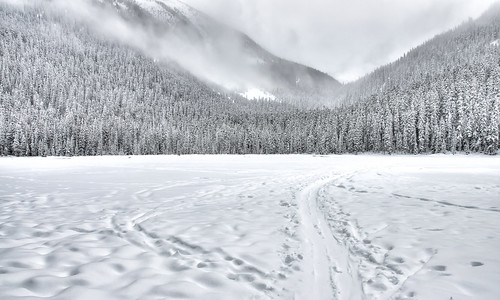
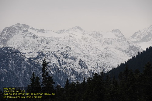
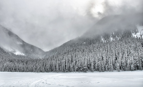
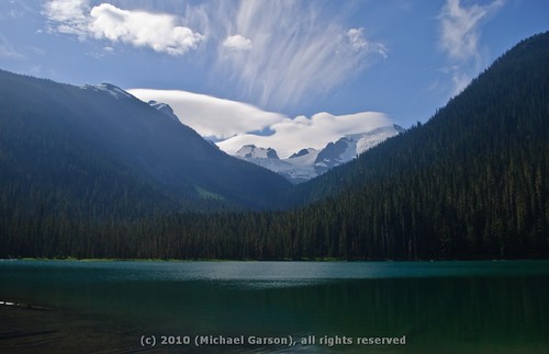
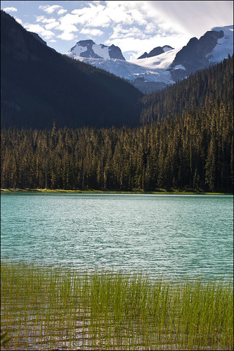
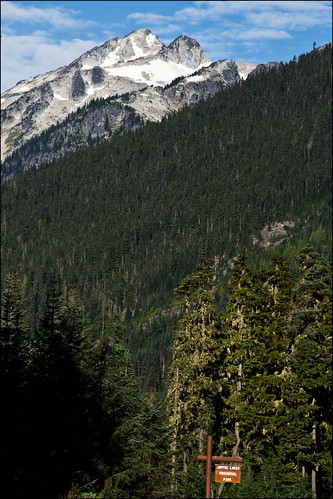
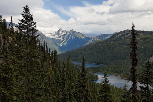
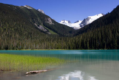
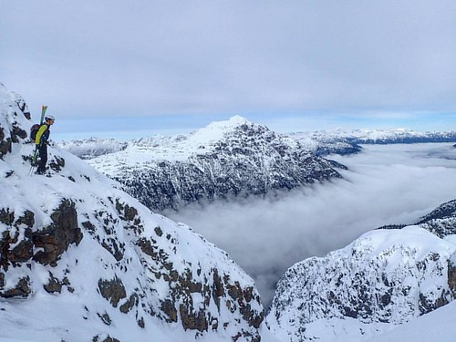
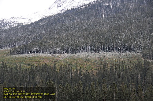
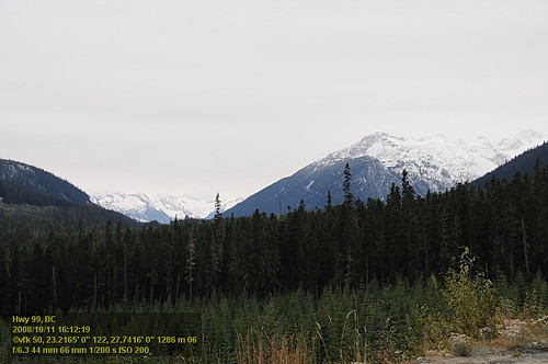
Fotos
Birken, BC V0N, Kanada Karte
Suchen Sie einen anderen Ort
Nahe Plätze
Birkenhead Peak, Squamish-Lillooet C, BC V0N, Kanada
Poole Creek Road, Poole Creek Rd, D'Arcy, BC V0N 1L0, Kanada
Birkenhead Lake Campground, Squamish-Lillooet C, BC V0N 1L0, Kanada
Squamish-Lillooet Regional District, Britisch-Kolumbien, Kanada
Devine Street, Devine St, D'Arcy, BC V0N 1L0, Kanada
D'Arcy, BC V0N, Kanada
Sweetwater Ln, Mount Currie, BC V0N 2K0, Kanada
Mt Currie Indian Band, Main St, Mount Currie, BC V0N 2K0, Kanada
Mount Currie, BC V0N, Kanada
Joffre Lakes Provincial Park, Duffey Lake Rd, Mount Currie, BC V0N 2K0, Kanada
Whistler, Britisch-Kolumbien V0N 1B4, Kanada
Mount Matier, Squamish-Lillooet C, BC V0N, Kanada
Mount Currie Coffee Company, Arbutus St #2, Pemberton, BC V0N 2L0, Kanada
Pemberton, Britisch-Kolumbien V0N, Kanada
Cedar Grove Ln, Pemberton, BC V0N 2L2, Kanada
Green Road, Green Rd, Pemberton Meadows, BC V0N, Kanada
Mount Currie, Squamish-Lillooet C, BC V0N, Kanada
Squamish-Lillooet C, BC, Kanada
Sea-to-Sky Hwy, Pemberton, BC V0N 2L0, Kanada
Garibaldi Ranges, Squamish-Lillooet C, BC V0N, Kanada
Letzte Suche
- Red Dog Mine, AK, USA Sonnenaufgang Sonnenuntergang Zeiten
- Am Bahnhof, Am bhf, Borken, Germany Sonnenaufgang Sonnenuntergang Zeiten
- 4th St E, Sonoma, CA, USA Sonnenaufgang Sonnenuntergang Zeiten
- Oakland Ave, Williamsport, PA, USA Sonnenaufgang Sonnenuntergang Zeiten
- Via Roma, Pieranica CR, Italien Sonnenaufgang Sonnenuntergang Zeiten
- Glockenturm, Grad, Dubrovnik, Kroatien Sonnenaufgang Sonnenuntergang Zeiten
- Trelew, Chubut Province, Argentina Sonnenaufgang Sonnenuntergang Zeiten
- Hartfords Bluff Cir, Mt Pleasant, SC, USA Sonnenaufgang Sonnenuntergang Zeiten
- Kita-ku, Kumamoto, Präfektur Kumamoto, Japan Sonnenaufgang Sonnenuntergang Zeiten
- Pingtan Island, Pingtan County, Fuzhou, China Sonnenaufgang Sonnenuntergang Zeiten
