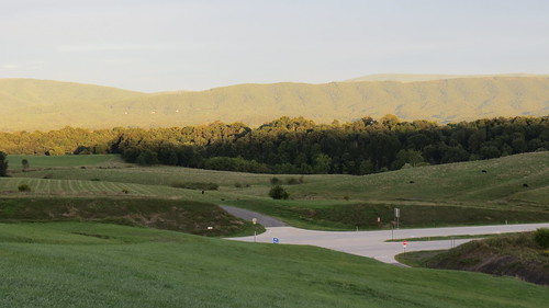
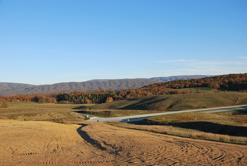
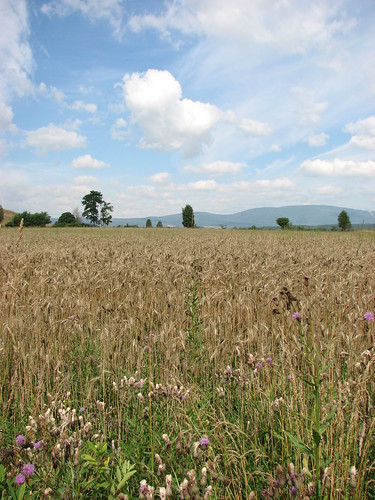
Ashton Woods Drive, Ashton Woods Dr, Old Fields, WV, USA Sonnenaufgang Sonnenuntergang Zeiten
Location: USA > West Virginia > Hardy County > Moorefield >
Zeitzone:
America/New_York
Ortszeit:
2025-07-13 12:24:46
Länge:
-78.891598
Breite:
39.1290808
Sonnenaufgang Heute:
06:01:42 AM
Sonnenuntergang Heute:
08:41:23 PM
Tageslänge heute:
14h 39m 41s
Sonnenaufgang morgen:
06:02:26 AM
Sonnenuntergang Morgen:
08:40:50 PM
Tageslänge von morgen:
14h 38m 24s
Alle Termine anzeigen
| Datum | Sonnenaufgang | Sonnenuntergang | Tageslänge |
|---|---|---|---|
| 2025-01-01 | 07:34:53 AM | 05:04:29 PM | 9h 29m 36s |
| 2025-01-02 | 07:34:57 AM | 05:05:20 PM | 9h 30m 23s |
| 2025-01-03 | 07:34:59 AM | 05:06:12 PM | 9h 31m 13s |
| 2025-01-04 | 07:34:59 AM | 05:07:06 PM | 9h 32m 7s |
| 2025-01-05 | 07:34:57 AM | 05:08:01 PM | 9h 33m 4s |
| 2025-01-06 | 07:34:52 AM | 05:08:57 PM | 9h 34m 5s |
| 2025-01-07 | 07:34:46 AM | 05:09:54 PM | 9h 35m 8s |
| 2025-01-08 | 07:34:37 AM | 05:10:53 PM | 9h 36m 16s |
| 2025-01-09 | 07:34:26 AM | 05:11:52 PM | 9h 37m 26s |
| 2025-01-10 | 07:34:13 AM | 05:12:53 PM | 9h 38m 40s |
| 2025-01-11 | 07:33:58 AM | 05:13:54 PM | 9h 39m 56s |
| 2025-01-12 | 07:33:41 AM | 05:14:57 PM | 9h 41m 16s |
| 2025-01-13 | 07:33:21 AM | 05:16:00 PM | 9h 42m 39s |
| 2025-01-14 | 07:33:00 AM | 05:17:04 PM | 9h 44m 4s |
| 2025-01-15 | 07:32:36 AM | 05:18:08 PM | 9h 45m 32s |
| 2025-01-16 | 07:32:10 AM | 05:19:14 PM | 9h 47m 4s |
| 2025-01-17 | 07:31:43 AM | 05:20:20 PM | 9h 48m 37s |
| 2025-01-18 | 07:31:13 AM | 05:21:26 PM | 9h 50m 13s |
| 2025-01-19 | 07:30:41 AM | 05:22:33 PM | 9h 51m 52s |
| 2025-01-20 | 07:30:07 AM | 05:23:41 PM | 9h 53m 34s |
| 2025-01-21 | 07:29:32 AM | 05:24:49 PM | 9h 55m 17s |
| 2025-01-22 | 07:28:54 AM | 05:25:57 PM | 9h 57m 3s |
| 2025-01-23 | 07:28:14 AM | 05:27:06 PM | 9h 58m 52s |
| 2025-01-24 | 07:27:33 AM | 05:28:15 PM | 10h 0m 42s |
| 2025-01-25 | 07:26:50 AM | 05:29:25 PM | 10h 2m 35s |
| 2025-01-26 | 07:26:04 AM | 05:30:34 PM | 10h 4m 30s |
| 2025-01-27 | 07:25:18 AM | 05:31:44 PM | 10h 6m 26s |
| 2025-01-28 | 07:24:29 AM | 05:32:54 PM | 10h 8m 25s |
| 2025-01-29 | 07:23:38 AM | 05:34:04 PM | 10h 10m 26s |
| 2025-01-30 | 07:22:46 AM | 05:35:14 PM | 10h 12m 28s |
| 2025-01-31 | 07:21:52 AM | 05:36:24 PM | 10h 14m 32s |
| 2025-02-01 | 07:20:57 AM | 05:37:34 PM | 10h 16m 37s |
| 2025-02-02 | 07:20:00 AM | 05:38:44 PM | 10h 18m 44s |
| 2025-02-03 | 07:19:01 AM | 05:39:55 PM | 10h 20m 54s |
| 2025-02-04 | 07:18:01 AM | 05:41:05 PM | 10h 23m 4s |
| 2025-02-05 | 07:16:59 AM | 05:42:14 PM | 10h 25m 15s |
| 2025-02-06 | 07:15:56 AM | 05:43:24 PM | 10h 27m 28s |
| 2025-02-07 | 07:14:51 AM | 05:44:34 PM | 10h 29m 43s |
| 2025-02-08 | 07:13:45 AM | 05:45:43 PM | 10h 31m 58s |
| 2025-02-09 | 07:12:37 AM | 05:46:53 PM | 10h 34m 16s |
| 2025-02-10 | 07:11:29 AM | 05:48:02 PM | 10h 36m 33s |
| 2025-02-11 | 07:10:19 AM | 05:49:11 PM | 10h 38m 52s |
| 2025-02-12 | 07:09:07 AM | 05:50:20 PM | 10h 41m 13s |
| 2025-02-13 | 07:07:54 AM | 05:51:28 PM | 10h 43m 34s |
| 2025-02-14 | 07:06:41 AM | 05:52:36 PM | 10h 45m 55s |
| 2025-02-15 | 07:05:26 AM | 05:53:44 PM | 10h 48m 18s |
| 2025-02-16 | 07:04:10 AM | 05:54:52 PM | 10h 50m 42s |
| 2025-02-17 | 07:02:52 AM | 05:55:59 PM | 10h 53m 7s |
| 2025-02-18 | 07:01:34 AM | 05:57:06 PM | 10h 55m 32s |
| 2025-02-19 | 07:00:15 AM | 05:58:13 PM | 10h 57m 58s |
| 2025-02-20 | 06:58:54 AM | 05:59:19 PM | 11h 0m 25s |
| 2025-02-21 | 06:57:33 AM | 06:00:26 PM | 11h 2m 53s |
| 2025-02-22 | 06:56:11 AM | 06:01:31 PM | 11h 5m 20s |
| 2025-02-23 | 06:54:48 AM | 06:02:37 PM | 11h 7m 49s |
| 2025-02-24 | 06:53:24 AM | 06:03:42 PM | 11h 10m 18s |
| 2025-02-25 | 06:51:59 AM | 06:04:47 PM | 11h 12m 48s |
| 2025-02-26 | 06:50:33 AM | 06:05:52 PM | 11h 15m 19s |
| 2025-02-27 | 06:49:07 AM | 06:06:56 PM | 11h 17m 49s |
| 2025-02-28 | 06:47:40 AM | 06:08:00 PM | 11h 20m 20s |
| 2025-03-01 | 06:46:12 AM | 06:09:04 PM | 11h 22m 52s |
| 2025-03-02 | 06:44:44 AM | 06:10:07 PM | 11h 25m 23s |
| 2025-03-03 | 06:43:15 AM | 06:11:10 PM | 11h 27m 55s |
| 2025-03-04 | 06:41:45 AM | 06:12:13 PM | 11h 30m 28s |
| 2025-03-05 | 06:40:15 AM | 06:13:16 PM | 11h 33m 1s |
| 2025-03-06 | 06:38:44 AM | 06:14:18 PM | 11h 35m 34s |
| 2025-03-07 | 06:37:13 AM | 06:15:20 PM | 11h 38m 7s |
| 2025-03-08 | 06:35:41 AM | 06:16:22 PM | 11h 40m 41s |
| 2025-03-09 | 07:34:13 AM | 07:17:21 PM | 11h 43m 8s |
| 2025-03-10 | 07:32:40 AM | 07:18:22 PM | 11h 45m 42s |
| 2025-03-11 | 07:31:07 AM | 07:19:23 PM | 11h 48m 16s |
| 2025-03-12 | 07:29:34 AM | 07:20:24 PM | 11h 50m 50s |
| 2025-03-13 | 07:28:00 AM | 07:21:24 PM | 11h 53m 24s |
| 2025-03-14 | 07:26:26 AM | 07:22:25 PM | 11h 55m 59s |
| 2025-03-15 | 07:24:52 AM | 07:23:25 PM | 11h 58m 33s |
| 2025-03-16 | 07:23:18 AM | 07:24:25 PM | 12h 1m 7s |
| 2025-03-17 | 07:21:43 AM | 07:25:24 PM | 12h 3m 41s |
| 2025-03-18 | 07:20:08 AM | 07:26:24 PM | 12h 6m 16s |
| 2025-03-19 | 07:18:34 AM | 07:27:24 PM | 12h 8m 50s |
| 2025-03-20 | 07:16:59 AM | 07:28:23 PM | 12h 11m 24s |
| 2025-03-21 | 07:15:24 AM | 07:29:22 PM | 12h 13m 58s |
| 2025-03-22 | 07:13:49 AM | 07:30:21 PM | 12h 16m 32s |
| 2025-03-23 | 07:12:14 AM | 07:31:20 PM | 12h 19m 6s |
| 2025-03-24 | 07:10:38 AM | 07:32:19 PM | 12h 21m 41s |
| 2025-03-25 | 07:09:03 AM | 07:33:18 PM | 12h 24m 15s |
| 2025-03-26 | 07:07:29 AM | 07:34:16 PM | 12h 26m 47s |
| 2025-03-27 | 07:05:54 AM | 07:35:15 PM | 12h 29m 21s |
| 2025-03-28 | 07:04:19 AM | 07:36:14 PM | 12h 31m 55s |
| 2025-03-29 | 07:02:45 AM | 07:37:12 PM | 12h 34m 27s |
| 2025-03-30 | 07:01:10 AM | 07:38:11 PM | 12h 37m 1s |
| 2025-03-31 | 06:59:36 AM | 07:39:09 PM | 12h 39m 33s |
| 2025-04-01 | 06:58:03 AM | 07:40:07 PM | 12h 42m 4s |
| 2025-04-02 | 06:56:29 AM | 07:41:06 PM | 12h 44m 37s |
| 2025-04-03 | 06:54:56 AM | 07:42:04 PM | 12h 47m 8s |
| 2025-04-04 | 06:53:23 AM | 07:43:02 PM | 12h 49m 39s |
| 2025-04-05 | 06:51:51 AM | 07:44:01 PM | 12h 52m 10s |
| 2025-04-06 | 06:50:19 AM | 07:44:59 PM | 12h 54m 40s |
| 2025-04-07 | 06:48:47 AM | 07:45:57 PM | 12h 57m 10s |
| 2025-04-08 | 06:47:16 AM | 07:46:56 PM | 12h 59m 40s |
| 2025-04-09 | 06:45:45 AM | 07:47:54 PM | 13h 2m 9s |
| 2025-04-10 | 06:44:15 AM | 07:48:53 PM | 13h 4m 38s |
| 2025-04-11 | 06:42:46 AM | 07:49:51 PM | 13h 7m 5s |
| 2025-04-12 | 06:41:17 AM | 07:50:50 PM | 13h 9m 33s |
| 2025-04-13 | 06:39:49 AM | 07:51:48 PM | 13h 11m 59s |
| 2025-04-14 | 06:38:21 AM | 07:52:47 PM | 13h 14m 26s |
| 2025-04-15 | 06:36:54 AM | 07:53:45 PM | 13h 16m 51s |
| 2025-04-16 | 06:35:28 AM | 07:54:44 PM | 13h 19m 16s |
| 2025-04-17 | 06:34:02 AM | 07:55:42 PM | 13h 21m 40s |
| 2025-04-18 | 06:32:38 AM | 07:56:41 PM | 13h 24m 3s |
| 2025-04-19 | 06:31:14 AM | 07:57:40 PM | 13h 26m 26s |
| 2025-04-20 | 06:29:51 AM | 07:58:38 PM | 13h 28m 47s |
| 2025-04-21 | 06:28:28 AM | 07:59:37 PM | 13h 31m 9s |
| 2025-04-22 | 06:27:07 AM | 08:00:36 PM | 13h 33m 29s |
| 2025-04-23 | 06:25:47 AM | 08:01:34 PM | 13h 35m 47s |
| 2025-04-24 | 06:24:27 AM | 08:02:33 PM | 13h 38m 6s |
| 2025-04-25 | 06:23:09 AM | 08:03:32 PM | 13h 40m 23s |
| 2025-04-26 | 06:21:52 AM | 08:04:30 PM | 13h 42m 38s |
| 2025-04-27 | 06:20:35 AM | 08:05:29 PM | 13h 44m 54s |
| 2025-04-28 | 06:19:20 AM | 08:06:28 PM | 13h 47m 8s |
| 2025-04-29 | 06:18:06 AM | 08:07:26 PM | 13h 49m 20s |
| 2025-04-30 | 06:16:53 AM | 08:08:24 PM | 13h 51m 31s |
| 2025-05-01 | 06:15:41 AM | 08:09:23 PM | 13h 53m 42s |
| 2025-05-02 | 06:14:31 AM | 08:10:21 PM | 13h 55m 50s |
| 2025-05-03 | 06:13:22 AM | 08:11:19 PM | 13h 57m 57s |
| 2025-05-04 | 06:12:14 AM | 08:12:17 PM | 14h 0m 3s |
| 2025-05-05 | 06:11:07 AM | 08:13:14 PM | 14h 2m 7s |
| 2025-05-06 | 06:10:01 AM | 08:14:12 PM | 14h 4m 11s |
| 2025-05-07 | 06:08:57 AM | 08:15:09 PM | 14h 6m 12s |
| 2025-05-08 | 06:07:55 AM | 08:16:06 PM | 14h 8m 11s |
| 2025-05-09 | 06:06:53 AM | 08:17:03 PM | 14h 10m 10s |
| 2025-05-10 | 06:05:54 AM | 08:18:00 PM | 14h 12m 6s |
| 2025-05-11 | 06:04:55 AM | 08:18:56 PM | 14h 14m 1s |
| 2025-05-12 | 06:03:58 AM | 08:19:51 PM | 14h 15m 53s |
| 2025-05-13 | 06:03:03 AM | 08:20:47 PM | 14h 17m 44s |
| 2025-05-14 | 06:02:09 AM | 08:21:42 PM | 14h 19m 33s |
| 2025-05-15 | 06:01:17 AM | 08:22:36 PM | 14h 21m 19s |
| 2025-05-16 | 06:00:26 AM | 08:23:30 PM | 14h 23m 4s |
| 2025-05-17 | 05:59:38 AM | 08:24:24 PM | 14h 24m 46s |
| 2025-05-18 | 05:58:50 AM | 08:25:17 PM | 14h 26m 27s |
| 2025-05-19 | 05:58:05 AM | 08:26:09 PM | 14h 28m 4s |
| 2025-05-20 | 05:57:21 AM | 08:27:01 PM | 14h 29m 40s |
| 2025-05-21 | 05:56:38 AM | 08:27:52 PM | 14h 31m 14s |
| 2025-05-22 | 05:55:58 AM | 08:28:43 PM | 14h 32m 45s |
| 2025-05-23 | 05:55:19 AM | 08:29:32 PM | 14h 34m 13s |
| 2025-05-24 | 05:54:42 AM | 08:30:21 PM | 14h 35m 39s |
| 2025-05-25 | 05:54:07 AM | 08:31:10 PM | 14h 37m 3s |
| 2025-05-26 | 05:53:34 AM | 08:31:57 PM | 14h 38m 23s |
| 2025-05-27 | 05:53:02 AM | 08:32:43 PM | 14h 39m 41s |
| 2025-05-28 | 05:52:32 AM | 08:33:29 PM | 14h 40m 57s |
| 2025-05-29 | 05:52:04 AM | 08:34:13 PM | 14h 42m 9s |
| 2025-05-30 | 05:51:38 AM | 08:34:57 PM | 14h 43m 19s |
| 2025-05-31 | 05:51:14 AM | 08:35:39 PM | 14h 44m 25s |
| 2025-06-01 | 05:50:52 AM | 08:36:20 PM | 14h 45m 28s |
| 2025-06-02 | 05:50:31 AM | 08:37:01 PM | 14h 46m 30s |
| 2025-06-03 | 05:50:13 AM | 08:37:40 PM | 14h 47m 27s |
| 2025-06-04 | 05:49:56 AM | 08:38:17 PM | 14h 48m 21s |
| 2025-06-05 | 05:49:41 AM | 08:38:54 PM | 14h 49m 13s |
| 2025-06-06 | 05:49:28 AM | 08:39:29 PM | 14h 50m 1s |
| 2025-06-07 | 05:49:17 AM | 08:40:03 PM | 14h 50m 46s |
| 2025-06-08 | 05:49:08 AM | 08:40:36 PM | 14h 51m 28s |
| 2025-06-09 | 05:49:01 AM | 08:41:07 PM | 14h 52m 6s |
| 2025-06-10 | 05:48:56 AM | 08:41:36 PM | 14h 52m 40s |
| 2025-06-11 | 05:48:52 AM | 08:42:05 PM | 14h 53m 13s |
| 2025-06-12 | 05:48:51 AM | 08:42:31 PM | 14h 53m 40s |
| 2025-06-13 | 05:48:51 AM | 08:42:57 PM | 14h 54m 6s |
| 2025-06-14 | 05:48:53 AM | 08:43:20 PM | 14h 54m 27s |
| 2025-06-15 | 05:48:57 AM | 08:43:42 PM | 14h 54m 45s |
| 2025-06-16 | 05:49:03 AM | 08:44:02 PM | 14h 54m 59s |
| 2025-06-17 | 05:49:10 AM | 08:44:21 PM | 14h 55m 11s |
| 2025-06-18 | 05:49:19 AM | 08:44:38 PM | 14h 55m 19s |
| 2025-06-19 | 05:49:30 AM | 08:44:53 PM | 14h 55m 23s |
| 2025-06-20 | 05:49:43 AM | 08:45:07 PM | 14h 55m 24s |
| 2025-06-21 | 05:49:57 AM | 08:45:18 PM | 14h 55m 21s |
| 2025-06-22 | 05:50:13 AM | 08:45:28 PM | 14h 55m 15s |
| 2025-06-23 | 05:50:31 AM | 08:45:36 PM | 14h 55m 5s |
| 2025-06-24 | 05:50:50 AM | 08:45:42 PM | 14h 54m 52s |
| 2025-06-25 | 05:51:11 AM | 08:45:47 PM | 14h 54m 36s |
| 2025-06-26 | 05:51:34 AM | 08:45:49 PM | 14h 54m 15s |
| 2025-06-27 | 05:51:58 AM | 08:45:50 PM | 14h 53m 52s |
| 2025-06-28 | 05:52:23 AM | 08:45:48 PM | 14h 53m 25s |
| 2025-06-29 | 05:52:50 AM | 08:45:45 PM | 14h 52m 55s |
| 2025-06-30 | 05:53:19 AM | 08:45:40 PM | 14h 52m 21s |
| 2025-07-01 | 05:53:48 AM | 08:45:33 PM | 14h 51m 45s |
| 2025-07-02 | 05:54:20 AM | 08:45:24 PM | 14h 51m 4s |
| 2025-07-03 | 05:54:52 AM | 08:45:13 PM | 14h 50m 21s |
| 2025-07-04 | 05:55:26 AM | 08:45:00 PM | 14h 49m 34s |
| 2025-07-05 | 05:56:01 AM | 08:44:46 PM | 14h 48m 45s |
| 2025-07-06 | 05:56:37 AM | 08:44:29 PM | 14h 47m 52s |
| 2025-07-07 | 05:57:14 AM | 08:44:10 PM | 14h 46m 56s |
| 2025-07-08 | 05:57:52 AM | 08:43:50 PM | 14h 45m 58s |
| 2025-07-09 | 05:58:32 AM | 08:43:27 PM | 14h 44m 55s |
| 2025-07-10 | 05:59:12 AM | 08:43:03 PM | 14h 43m 51s |
| 2025-07-11 | 05:59:54 AM | 08:42:37 PM | 14h 42m 43s |
| 2025-07-12 | 06:00:36 AM | 08:42:09 PM | 14h 41m 33s |
| 2025-07-13 | 06:01:20 AM | 08:41:39 PM | 14h 40m 19s |
| 2025-07-14 | 06:02:04 AM | 08:41:07 PM | 14h 39m 3s |
| 2025-07-15 | 06:02:49 AM | 08:40:33 PM | 14h 37m 44s |
| 2025-07-16 | 06:03:35 AM | 08:39:57 PM | 14h 36m 22s |
| 2025-07-17 | 06:04:21 AM | 08:39:20 PM | 14h 34m 59s |
| 2025-07-18 | 06:05:09 AM | 08:38:41 PM | 14h 33m 32s |
| 2025-07-19 | 06:05:57 AM | 08:38:00 PM | 14h 32m 3s |
| 2025-07-20 | 06:06:45 AM | 08:37:17 PM | 14h 30m 32s |
| 2025-07-21 | 06:07:35 AM | 08:36:32 PM | 14h 28m 57s |
| 2025-07-22 | 06:08:24 AM | 08:35:46 PM | 14h 27m 22s |
| 2025-07-23 | 06:09:15 AM | 08:34:58 PM | 14h 25m 43s |
| 2025-07-24 | 06:10:06 AM | 08:34:09 PM | 14h 24m 3s |
| 2025-07-25 | 06:10:57 AM | 08:33:18 PM | 14h 22m 21s |
| 2025-07-26 | 06:11:49 AM | 08:32:25 PM | 14h 20m 36s |
| 2025-07-27 | 06:12:41 AM | 08:31:30 PM | 14h 18m 49s |
| 2025-07-28 | 06:13:33 AM | 08:30:34 PM | 14h 17m 1s |
| 2025-07-29 | 06:14:26 AM | 08:29:37 PM | 14h 15m 11s |
| 2025-07-30 | 06:15:19 AM | 08:28:37 PM | 14h 13m 18s |
| 2025-07-31 | 06:16:13 AM | 08:27:37 PM | 14h 11m 24s |
| 2025-08-01 | 06:17:06 AM | 08:26:35 PM | 14h 9m 29s |
| 2025-08-02 | 06:18:00 AM | 08:25:31 PM | 14h 7m 31s |
| 2025-08-03 | 06:18:54 AM | 08:24:26 PM | 14h 5m 32s |
| 2025-08-04 | 06:19:48 AM | 08:23:20 PM | 14h 3m 32s |
| 2025-08-05 | 06:20:43 AM | 08:22:12 PM | 14h 1m 29s |
| 2025-08-06 | 06:21:37 AM | 08:21:03 PM | 13h 59m 26s |
| 2025-08-07 | 06:22:32 AM | 08:19:53 PM | 13h 57m 21s |
| 2025-08-08 | 06:23:27 AM | 08:18:41 PM | 13h 55m 14s |
| 2025-08-09 | 06:24:22 AM | 08:17:29 PM | 13h 53m 7s |
| 2025-08-10 | 06:25:16 AM | 08:16:15 PM | 13h 50m 59s |
| 2025-08-11 | 06:26:11 AM | 08:15:00 PM | 13h 48m 49s |
| 2025-08-12 | 06:27:06 AM | 08:13:43 PM | 13h 46m 37s |
| 2025-08-13 | 06:28:01 AM | 08:12:26 PM | 13h 44m 25s |
| 2025-08-14 | 06:28:56 AM | 08:11:07 PM | 13h 42m 11s |
| 2025-08-15 | 06:29:51 AM | 08:09:48 PM | 13h 39m 57s |
| 2025-08-16 | 06:30:46 AM | 08:08:27 PM | 13h 37m 41s |
| 2025-08-17 | 06:31:41 AM | 08:07:06 PM | 13h 35m 25s |
| 2025-08-18 | 06:32:36 AM | 08:05:43 PM | 13h 33m 7s |
| 2025-08-19 | 06:33:31 AM | 08:04:20 PM | 13h 30m 49s |
| 2025-08-20 | 06:34:26 AM | 08:02:55 PM | 13h 28m 29s |
| 2025-08-21 | 06:35:21 AM | 08:01:30 PM | 13h 26m 9s |
| 2025-08-22 | 06:36:15 AM | 08:00:04 PM | 13h 23m 49s |
| 2025-08-23 | 06:37:10 AM | 07:58:37 PM | 13h 21m 27s |
| 2025-08-24 | 06:38:05 AM | 07:57:10 PM | 13h 19m 5s |
| 2025-08-25 | 06:38:59 AM | 07:55:42 PM | 13h 16m 43s |
| 2025-08-26 | 06:39:54 AM | 07:54:12 PM | 13h 14m 18s |
| 2025-08-27 | 06:40:48 AM | 07:52:43 PM | 13h 11m 55s |
| 2025-08-28 | 06:41:42 AM | 07:51:12 PM | 13h 9m 30s |
| 2025-08-29 | 06:42:37 AM | 07:49:41 PM | 13h 7m 4s |
| 2025-08-30 | 06:43:31 AM | 07:48:10 PM | 13h 4m 39s |
| 2025-08-31 | 06:44:25 AM | 07:46:38 PM | 13h 2m 13s |
| 2025-09-01 | 06:45:19 AM | 07:45:05 PM | 12h 59m 46s |
| 2025-09-02 | 06:46:13 AM | 07:43:32 PM | 12h 57m 19s |
| 2025-09-03 | 06:47:07 AM | 07:41:58 PM | 12h 54m 51s |
| 2025-09-04 | 06:48:01 AM | 07:40:24 PM | 12h 52m 23s |
| 2025-09-05 | 06:48:55 AM | 07:38:49 PM | 12h 49m 54s |
| 2025-09-06 | 06:49:49 AM | 07:37:14 PM | 12h 47m 25s |
| 2025-09-07 | 06:50:43 AM | 07:35:39 PM | 12h 44m 56s |
| 2025-09-08 | 06:51:37 AM | 07:34:04 PM | 12h 42m 27s |
| 2025-09-09 | 06:52:31 AM | 07:32:28 PM | 12h 39m 57s |
| 2025-09-10 | 06:53:25 AM | 07:30:52 PM | 12h 37m 27s |
| 2025-09-11 | 06:54:19 AM | 07:29:15 PM | 12h 34m 56s |
| 2025-09-12 | 06:55:13 AM | 07:27:39 PM | 12h 32m 26s |
| 2025-09-13 | 06:56:07 AM | 07:26:02 PM | 12h 29m 55s |
| 2025-09-14 | 06:57:01 AM | 07:24:25 PM | 12h 27m 24s |
| 2025-09-15 | 06:57:55 AM | 07:22:48 PM | 12h 24m 53s |
| 2025-09-16 | 06:58:49 AM | 07:21:11 PM | 12h 22m 22s |
| 2025-09-17 | 06:59:44 AM | 07:19:33 PM | 12h 19m 49s |
| 2025-09-18 | 07:00:38 AM | 07:17:56 PM | 12h 17m 18s |
| 2025-09-19 | 07:01:33 AM | 07:16:19 PM | 12h 14m 46s |
| 2025-09-20 | 07:02:27 AM | 07:14:42 PM | 12h 12m 15s |
| 2025-09-21 | 07:03:22 AM | 07:13:05 PM | 12h 9m 43s |
| 2025-09-22 | 07:04:17 AM | 07:11:28 PM | 12h 7m 11s |
| 2025-09-23 | 07:05:12 AM | 07:09:51 PM | 12h 4m 39s |
| 2025-09-24 | 07:06:07 AM | 07:08:14 PM | 12h 2m 7s |
| 2025-09-25 | 07:07:03 AM | 07:06:37 PM | 11h 59m 34s |
| 2025-09-26 | 07:07:58 AM | 07:05:01 PM | 11h 57m 3s |
| 2025-09-27 | 07:08:54 AM | 07:03:25 PM | 11h 54m 31s |
| 2025-09-28 | 07:09:50 AM | 07:01:49 PM | 11h 51m 59s |
| 2025-09-29 | 07:10:46 AM | 07:00:13 PM | 11h 49m 27s |
| 2025-09-30 | 07:11:42 AM | 06:58:38 PM | 11h 46m 56s |
| 2025-10-01 | 07:12:39 AM | 06:57:03 PM | 11h 44m 24s |
| 2025-10-02 | 07:13:36 AM | 06:55:28 PM | 11h 41m 52s |
| 2025-10-03 | 07:14:33 AM | 06:53:54 PM | 11h 39m 21s |
| 2025-10-04 | 07:15:30 AM | 06:52:21 PM | 11h 36m 51s |
| 2025-10-05 | 07:16:28 AM | 06:50:47 PM | 11h 34m 19s |
| 2025-10-06 | 07:17:26 AM | 06:49:15 PM | 11h 31m 49s |
| 2025-10-07 | 07:18:24 AM | 06:47:43 PM | 11h 29m 19s |
| 2025-10-08 | 07:19:23 AM | 06:46:11 PM | 11h 26m 48s |
| 2025-10-09 | 07:20:22 AM | 06:44:40 PM | 11h 24m 18s |
| 2025-10-10 | 07:21:21 AM | 06:43:10 PM | 11h 21m 49s |
| 2025-10-11 | 07:22:20 AM | 06:41:40 PM | 11h 19m 20s |
| 2025-10-12 | 07:23:20 AM | 06:40:11 PM | 11h 16m 51s |
| 2025-10-13 | 07:24:20 AM | 06:38:43 PM | 11h 14m 23s |
| 2025-10-14 | 07:25:21 AM | 06:37:15 PM | 11h 11m 54s |
| 2025-10-15 | 07:26:22 AM | 06:35:49 PM | 11h 9m 27s |
| 2025-10-16 | 07:27:23 AM | 06:34:23 PM | 11h 7m 0s |
| 2025-10-17 | 07:28:24 AM | 06:32:58 PM | 11h 4m 34s |
| 2025-10-18 | 07:29:26 AM | 06:31:34 PM | 11h 2m 8s |
| 2025-10-19 | 07:30:28 AM | 06:30:11 PM | 10h 59m 43s |
| 2025-10-20 | 07:31:30 AM | 06:28:49 PM | 10h 57m 19s |
| 2025-10-21 | 07:32:33 AM | 06:27:27 PM | 10h 54m 54s |
| 2025-10-22 | 07:33:36 AM | 06:26:07 PM | 10h 52m 31s |
| 2025-10-23 | 07:34:40 AM | 06:24:48 PM | 10h 50m 8s |
| 2025-10-24 | 07:35:44 AM | 06:23:30 PM | 10h 47m 46s |
| 2025-10-25 | 07:36:48 AM | 06:22:13 PM | 10h 45m 25s |
| 2025-10-26 | 07:37:52 AM | 06:20:58 PM | 10h 43m 6s |
| 2025-10-27 | 07:38:57 AM | 06:19:43 PM | 10h 40m 46s |
| 2025-10-28 | 07:40:02 AM | 06:18:30 PM | 10h 38m 28s |
| 2025-10-29 | 07:41:07 AM | 06:17:18 PM | 10h 36m 11s |
| 2025-10-30 | 07:42:12 AM | 06:16:07 PM | 10h 33m 55s |
| 2025-10-31 | 07:43:18 AM | 06:14:58 PM | 10h 31m 40s |
| 2025-11-01 | 07:44:24 AM | 06:13:50 PM | 10h 29m 26s |
| 2025-11-02 | 06:45:33 AM | 05:12:41 PM | 10h 27m 8s |
| 2025-11-03 | 06:46:39 AM | 05:11:36 PM | 10h 24m 57s |
| 2025-11-04 | 06:47:46 AM | 05:10:32 PM | 10h 22m 46s |
| 2025-11-05 | 06:48:52 AM | 05:09:31 PM | 10h 20m 39s |
| 2025-11-06 | 06:49:59 AM | 05:08:30 PM | 10h 18m 31s |
| 2025-11-07 | 06:51:06 AM | 05:07:31 PM | 10h 16m 25s |
| 2025-11-08 | 06:52:13 AM | 05:06:34 PM | 10h 14m 21s |
| 2025-11-09 | 06:53:20 AM | 05:05:38 PM | 10h 12m 18s |
| 2025-11-10 | 06:54:27 AM | 05:04:44 PM | 10h 10m 17s |
| 2025-11-11 | 06:55:34 AM | 05:03:52 PM | 10h 8m 18s |
| 2025-11-12 | 06:56:41 AM | 05:03:02 PM | 10h 6m 21s |
| 2025-11-13 | 06:57:48 AM | 05:02:13 PM | 10h 4m 25s |
| 2025-11-14 | 06:58:55 AM | 05:01:26 PM | 10h 2m 31s |
| 2025-11-15 | 07:00:01 AM | 05:00:41 PM | 10h 0m 40s |
| 2025-11-16 | 07:01:08 AM | 04:59:58 PM | 9h 58m 50s |
| 2025-11-17 | 07:02:14 AM | 04:59:17 PM | 9h 57m 3s |
| 2025-11-18 | 07:03:20 AM | 04:58:38 PM | 9h 55m 18s |
| 2025-11-19 | 07:04:25 AM | 04:58:00 PM | 9h 53m 35s |
| 2025-11-20 | 07:05:30 AM | 04:57:25 PM | 9h 51m 55s |
| 2025-11-21 | 07:06:35 AM | 04:56:51 PM | 9h 50m 16s |
| 2025-11-22 | 07:07:40 AM | 04:56:20 PM | 9h 48m 40s |
| 2025-11-23 | 07:08:43 AM | 04:55:51 PM | 9h 47m 8s |
| 2025-11-24 | 07:09:47 AM | 04:55:24 PM | 9h 45m 37s |
| 2025-11-25 | 07:10:49 AM | 04:54:58 PM | 9h 44m 9s |
| 2025-11-26 | 07:11:52 AM | 04:54:35 PM | 9h 42m 43s |
| 2025-11-27 | 07:12:53 AM | 04:54:15 PM | 9h 41m 22s |
| 2025-11-28 | 07:13:54 AM | 04:53:56 PM | 9h 40m 2s |
| 2025-11-29 | 07:14:53 AM | 04:53:39 PM | 9h 38m 46s |
| 2025-11-30 | 07:15:52 AM | 04:53:25 PM | 9h 37m 33s |
| 2025-12-01 | 07:16:50 AM | 04:53:13 PM | 9h 36m 23s |
| 2025-12-02 | 07:17:47 AM | 04:53:02 PM | 9h 35m 15s |
| 2025-12-03 | 07:18:44 AM | 04:52:55 PM | 9h 34m 11s |
| 2025-12-04 | 07:19:39 AM | 04:52:49 PM | 9h 33m 10s |
| 2025-12-05 | 07:20:32 AM | 04:52:45 PM | 9h 32m 13s |
| 2025-12-06 | 07:21:25 AM | 04:52:44 PM | 9h 31m 19s |
| 2025-12-07 | 07:22:17 AM | 04:52:45 PM | 9h 30m 28s |
| 2025-12-08 | 07:23:07 AM | 04:52:48 PM | 9h 29m 41s |
| 2025-12-09 | 07:23:56 AM | 04:52:54 PM | 9h 28m 58s |
| 2025-12-10 | 07:24:43 AM | 04:53:01 PM | 9h 28m 18s |
| 2025-12-11 | 07:25:29 AM | 04:53:11 PM | 9h 27m 42s |
| 2025-12-12 | 07:26:14 AM | 04:53:23 PM | 9h 27m 9s |
| 2025-12-13 | 07:26:57 AM | 04:53:37 PM | 9h 26m 40s |
| 2025-12-14 | 07:27:39 AM | 04:53:53 PM | 9h 26m 14s |
| 2025-12-15 | 07:28:18 AM | 04:54:11 PM | 9h 25m 53s |
| 2025-12-16 | 07:28:57 AM | 04:54:32 PM | 9h 25m 35s |
| 2025-12-17 | 07:29:33 AM | 04:54:54 PM | 9h 25m 21s |
| 2025-12-18 | 07:30:08 AM | 04:55:18 PM | 9h 25m 10s |
| 2025-12-19 | 07:30:41 AM | 04:55:45 PM | 9h 25m 4s |
| 2025-12-20 | 07:31:12 AM | 04:56:13 PM | 9h 25m 1s |
| 2025-12-21 | 07:31:41 AM | 04:56:44 PM | 9h 25m 3s |
| 2025-12-22 | 07:32:08 AM | 04:57:16 PM | 9h 25m 8s |
| 2025-12-23 | 07:32:34 AM | 04:57:50 PM | 9h 25m 16s |
| 2025-12-24 | 07:32:57 AM | 04:58:26 PM | 9h 25m 29s |
| 2025-12-25 | 07:33:19 AM | 04:59:04 PM | 9h 25m 45s |
| 2025-12-26 | 07:33:38 AM | 04:59:44 PM | 9h 26m 6s |
| 2025-12-27 | 07:33:56 AM | 05:00:25 PM | 9h 26m 29s |
| 2025-12-28 | 07:34:11 AM | 05:01:08 PM | 9h 26m 57s |
| 2025-12-29 | 07:34:24 AM | 05:01:53 PM | 9h 27m 29s |
| 2025-12-30 | 07:34:35 AM | 05:02:39 PM | 9h 28m 4s |
| 2025-12-31 | 07:34:44 AM | 05:03:27 PM | 9h 28m 43s |
Fotos
Ashton Woods Drive, Ashton Woods Dr, Old Fields, WV, USA Karte
Suchen Sie einen anderen Ort
Nahe Plätze
Ridge View Road, Ridge View Rd, Old Fields, WV, USA
Old Fields, WV, USA
High Knob Rd, Old Fields, WV, USA
Old Fields, WV, USA
Mt Oliver Rd, Rio, WV, USA
96 River View Ln, Moorefield, WV, USA
High Knob, Romney, WV, USA
Dover Hollow Rd, Moorefield, WV, USA
Co Rte 23/3, Baker, WV, USA
Moorefield, WV, USA
Hardy County, West Virginia, USA
Moorefield, WV, USA
Powder Spring Knob, Moorefield, WV, USA
Co Rd 23/4, Baker, WV, USA
Lower Pine Grove Road, Lower Pine Grove Rd, Baker, WV, USA
N River Rd, Baker, WV, USA
Nathaniel Mountain, Romney, WV, USA
Fisher, WV, USA
White Oak Pass, Lost River, WV, USA
Terra Alta School Road, Terra Alta School Rd, Lost River, WV, USA
Letzte Suche
- Red Dog Mine, AK, USA Sonnenaufgang Sonnenuntergang Zeiten
- Am Bahnhof, Am bhf, Borken, Germany Sonnenaufgang Sonnenuntergang Zeiten
- 4th St E, Sonoma, CA, USA Sonnenaufgang Sonnenuntergang Zeiten
- Oakland Ave, Williamsport, PA, USA Sonnenaufgang Sonnenuntergang Zeiten
- Via Roma, Pieranica CR, Italien Sonnenaufgang Sonnenuntergang Zeiten
- Glockenturm, Grad, Dubrovnik, Kroatien Sonnenaufgang Sonnenuntergang Zeiten
- Trelew, Chubut Province, Argentina Sonnenaufgang Sonnenuntergang Zeiten
- Hartfords Bluff Cir, Mt Pleasant, SC, USA Sonnenaufgang Sonnenuntergang Zeiten
- Kita-ku, Kumamoto, Präfektur Kumamoto, Japan Sonnenaufgang Sonnenuntergang Zeiten
- Pingtan Island, Pingtan County, Fuzhou, China Sonnenaufgang Sonnenuntergang Zeiten


