Timezone:Nepal Time
Current Time:Thursday, November 19, 2026 4:36 PM
Longitude:80.7937158648594
Latitude:29.912733250000002
Sunrise Time Today:6:51:05 AM
Sunset Time Today:5:26:02 PM
Daylength Today:10h 34m 57s
Sunrise Time Tomorrow:6:51:55 AM
Sunset Time Tomorrow:5:25:40 PM
Daylength Tomorrow:10h 33m 45s

: Show All Dates

Date Sunrise Time Sunset Time Daylength
Jan 1, 2026 7:18:24 AM 5:33:19 PM 10h 14m 55s
Feb 1, 2026 7:14:06 AM 5:58:45 PM 10h 44m 39s
Mar 1, 2026 6:50:50 AM 6:21:01 PM 11h 30m 11s
Apr 1, 2026 6:14:11 AM 6:40:23 PM 12h 26m 12s
May 1, 2026 5:41:39 AM 6:58:56 PM 13h 17m 16s
Jun 1, 2026 5:23:15 AM 7:18:33 PM 13h 55m 17s
Jul 1, 2026 5:25:08 AM 7:27:57 PM 14h 2m 49s
Aug 1, 2026 5:41:16 AM 7:17:36 PM 13h 36m 19s
Sep 1, 2026 5:59:31 AM 6:48:07 PM 12h 48m 35s
Oct 1, 2026 6:15:28 AM 6:10:58 PM 11h 55m 30s
Nov 1, 2026 6:35:37 AM 5:37:44 PM 11h 2m 7s
Nov 19, 2026 6:50:14 AM 5:26:26 PM 10h 36m 12s
Nov 20, 2026 6:51:05 AM 5:26:02 PM 10h 34m 57s
Dec 1, 2026 7:00:11 AM 5:23:27 PM 10h 23m 15s

Sunrise & Sunset Photos

Nepal | India by Saumil U. Shah, First the descent to Jipti post. Then a long distance to cover through Malpa and then an ascent to B
Nepal | India by Saumil U. Shah
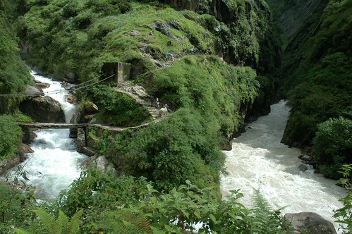
Waterfalls and the Kali Ganga River by Saumil U. Shah, The monsoon has replenished many mountain streams and there are numerous waterfalls along our way. W
Waterfalls and the Kali Ganga River by Saumil U. Shah
The women of Garbayang by Saumil U. Shah, The women of the Himalayas. These ladies toil up and down the slopes daily, without any fancy amenit
The women of Garbayang by Saumil U. Shah
Trekking to Kalapani by Saumil U. Shah, The road to Kalapani. Most people know of Kalapani (black waters) as the prison in the Andaman and N
Trekking to Kalapani by Saumil U. Shah
Walking towards Malpa by Saumil U. Shah, The Indian Himalayas are not only very beautiful but extremely spiritual as well. It is a different
Walking towards Malpa by Saumil U. Shah
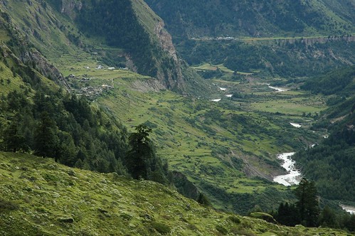
The valley and Garbayang village by Saumil U. Shah, Garbayang village is at a height of 3400 metres (11200 feet). It is one of the last villages before
The valley and Garbayang village by Saumil U. Shah
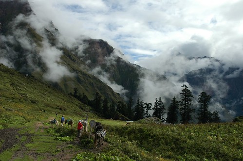
Misty Mountains by Saumil U. Shah, As we approach 3600 metres (11900 feet) the vegetation starts thinning out. A few trees remain. The
Misty Mountains by Saumil U. Shah
The fog clears over Chhiyalekh by Saumil U. Shah, In the distance you can see the ITBP checkpost.

Trekking through the Chhiyalekh meadow was an amazi
The fog clears over Chhiyalekh by Saumil U. Shah
Monsoon Waterfalls by Saumil U. Shah, We made a yatra (pilgrimage) to the holy land of Mt. Kailash and Manassarovar Lake in Tibet in Septe
Monsoon Waterfalls by Saumil U. Shah
Mt Api peeking through the clouds by Saumil U. Shah, A glimpse of the peak of <a href="http://en.wikipedia.org/wiki/Api_(mountain)" rel="nofollow">Mt Api
Mt Api peeking through the clouds by Saumil U. Shah
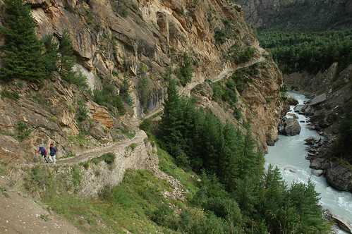
The Road from Gunji by Saumil U. Shah, Our return journey from Gunji to Budhi takes us through Garbayang village once again. This is the sa
The Road from Gunji by Saumil U. Shah
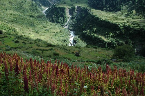
Harvest at Budhi by Saumil U. Shah, The monsoon has brought a good harvest in the fields around Budhi. Red stalks of grain can be seen d
Harvest at Budhi by Saumil U. Shah
Watch your step! by Saumil U. Shah, Crossing a waterfall is a tricky affair! This one was particularly challenging as we returned from B
Watch your step! by Saumil U. Shah
Entry Point Of Darma Valley by AmitabhaGupta, The entry point to The Darma Valley in Uttarakhand is through a ravine which has a one way road. Thi
Entry Point Of Darma Valley by AmitabhaGupta
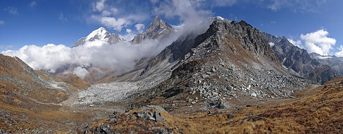
W_Nepal_2329 Pathar Rashi Bhanjyang by Roger Nix's Travel Collection, A view from just above the pass (the Pathar Rashi Bhanjyang, 4677 m) which is marked by two large ca
W_Nepal_2329 Pathar Rashi Bhanjyang by Roger Nix's Travel Collection
W_Nepal_1020-022 Khandeshwari & Nampa Himal by Roger Nix's Travel Collection, A view up the valley of the Chamalya Nadi, with the terraced fields surrounding Khandeshwari village
W_Nepal_1020-022 Khandeshwari & Nampa Himal by Roger Nix's Travel Collection
W_Nepal_2170 Bobaye Chuli (6808 m), in Nampa Himal by Roger Nix's Travel Collection,                                nepal himalaya darchula
W_Nepal_2170 Bobaye Chuli (6808 m), in Nampa Himal by Roger Nix's Travel Collection
W_Nepal_2169 Pk 6729 in Nampa Himal by Roger Nix's Travel Collection, Despite being marked on most maps as being of 6929 m elevation, I believe this peak is "only&qu
W_Nepal_2169 Pk 6729 in Nampa Himal by Roger Nix's Travel Collection
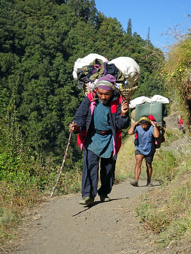
W_Nepal_2207 Porters on the Trail by Roger Nix's Travel Collection, At the beginning of the trek the porters are heavily loaded as they need to carry the food for more
W_Nepal_2207 Porters on the Trail by Roger Nix's Travel Collection
W_Nepal_1011 Nampa Himal (from Makarkot) by Roger Nix's Travel Collection, The peak on the far-left is Pk 6729 (this summit is incorrectly labelled on most maps as Pk 6929 but
W_Nepal_1011 Nampa Himal (from Makarkot) by Roger Nix's Travel Collection
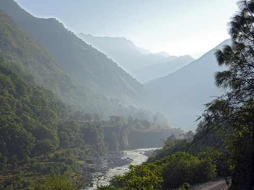
W_Nepal_2111 Chamalya Nadi Valley by Roger Nix's Travel Collection, Early morning mist (haze) in the valley ...nepal himalaya darchula
W_Nepal_2111 Chamalya Nadi Valley by Roger Nix's Travel Collection
W_Nepal_1019 Khandeshwari (from Makarkot) by Roger Nix's Travel Collection, Khandeshwari, and some neighbouring villages, are located amongst the terraces on the right-of-pictu
W_Nepal_1019 Khandeshwari (from Makarkot) by Roger Nix's Travel Collection
W_Nepal_2103 Chamalya Nadi by Roger Nix's Travel Collection,                                nepal himalaya darchula
W_Nepal_2103 Chamalya Nadi by Roger Nix's Travel Collection
W_Nepal_2143 Chamalya Nadi Valley by Roger Nix's Travel Collection,                                nepal himalaya darchula
W_Nepal_2143 Chamalya Nadi Valley by Roger Nix's Travel Collection
W_Nepal_2197 Chettiganga Gad Valley (near Sabbad) by Roger Nix's Travel Collection, Looking up the valley from the hill beside the trail, above Khandeshwarinepal himalaya darchula
W_Nepal_2197 Chettiganga Gad Valley (near Sabbad) by Roger Nix's Travel Collection
W_Nepal_2194 School Class, Khandeshwari by Roger Nix's Travel Collection, As we passed the whole School came to a halt ... we were then invited to meet this class of pupils b
W_Nepal_2194 School Class, Khandeshwari by Roger Nix's Travel Collection
W_Nepal_1030 Dudhisain Lek by Roger Nix's Travel Collection, The more distant peak on the right is Pk 6395 of the Namlung Lek (just south-west of Api)nepal himal
W_Nepal_1030 Dudhisain Lek by Roger Nix's Travel Collection
W_Nepal_2146 Chamalya Nadi Valley by Roger Nix's Travel Collection,                                nepal himalaya darchula
W_Nepal_2146 Chamalya Nadi Valley by Roger Nix's Travel Collection
W_Nepal_1027 Dudhisain Lek by Roger Nix's Travel Collection, The more distant peak on the far-right is Pk 6395 of the Namlung Lek (just south-west of Api)nepal h
W_Nepal_1027 Dudhisain Lek by Roger Nix's Travel Collection
W_Nepal_1018 Hindu Shrine at Makarkot by Roger Nix's Travel Collection, On the hilltop, a short climb up from the main trail,nepal himalaya darchula
W_Nepal_1018 Hindu Shrine at Makarkot by Roger Nix's Travel Collection
W_Nepal_1020 Khandeshwari (from Makarkot) by Roger Nix's Travel Collection, Khandeshwari is just left-of-centre in this photograph, partially hidden by the folds in then terrai
W_Nepal_1020 Khandeshwari (from Makarkot) by Roger Nix's Travel Collection
W_Nepal_2199 Chamalya Nadi Valley (above Khandeshwari) by Roger Nix's Travel Collection, A view up towards the Api Himal (all obscured in afternoon cloud)nepal himalaya darchula
W_Nepal_2199 Chamalya Nadi Valley (above Khandeshwari) by Roger Nix's Travel Collection
W_Nepal_2155 Chamalyi Nadi (Okhal, Chauki Bagar) by Roger Nix's Travel Collection,                                nepal himalaya darchula
W_Nepal_2155 Chamalyi Nadi (Okhal, Chauki Bagar) by Roger Nix's Travel Collection
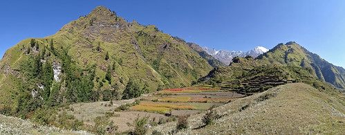
W_Nepal_2223 Ghatte Gad & Kap Chuli by Roger Nix's Travel Collection, A view up the Ghatte Gad (a tributary of the Chhetiganga Gad) to Kap Chuli (6468 m), from just below
W_Nepal_2223 Ghatte Gad & Kap Chuli by Roger Nix's Travel Collection
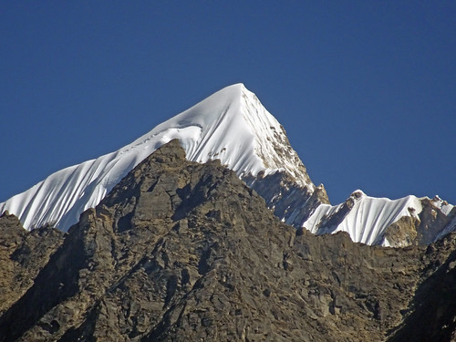
W_Nepal_2225 Jethi Bahurani Chuli by Roger Nix's Travel Collection, This peak reveals its impressive summit (6850 m) from Patha village nepal himalaya darchula
W_Nepal_2225 Jethi Bahurani Chuli by Roger Nix's Travel Collection
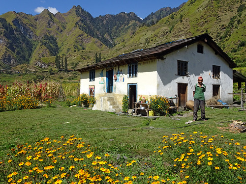
W_Nepal_2245 House, Kasauti by Roger Nix's Travel Collection, .. it could easily be the Alps (if you ignore the paintings)nepal himalaya darchula
W_Nepal_2245 House, Kasauti by Roger Nix's Travel Collection
W_Nepal_1035 Ghatte Gad and Kap Chuli by Roger Nix's Travel Collection, A view up the Ghatte Gad (a tributary of the Chhetiganga Gad) to Kap Chuli (6468 m, on the right), f
W_Nepal_1035 Ghatte Gad and Kap Chuli by Roger Nix's Travel Collection
W_Nepal_1031 Kap Chuli by Roger Nix's Travel Collection, A first "close-up" of this impressive peaknepal himalaya darchula
W_Nepal_1031 Kap Chuli by Roger Nix's Travel Collection
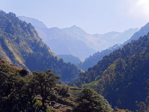
W_Nepal_1032 Chettiganga Gad Valley by Roger Nix's Travel Collection, A view up the valley, towards the ridge we expected to be crossing (but ultimately didn't as the loc
W_Nepal_1032 Chettiganga Gad Valley by Roger Nix's Travel Collection
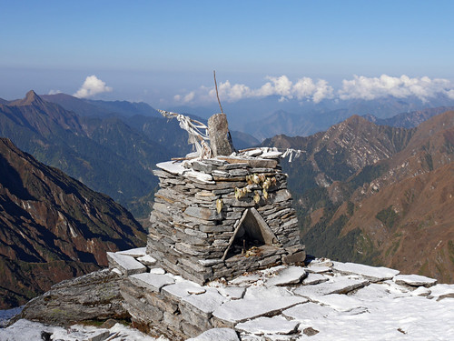
W_Nepal_1108 Shrine below the Pathar Rashi Bhanjyang by Roger Nix's Travel Collection, The same shrine as <a href="https://www.flickr.com/photos/rogernix/23220696193/in/album-721576623650
W_Nepal_1108 Shrine below the Pathar Rashi Bhanjyang by Roger Nix's Travel Collection