Timezone:Pacific Standard Time
Current Time:Wednesday, November 18, 2026 7:31 PM
Longitude:-122.863013
Latitude:47.761625
Sunrise Time Today:7:22:59 AM
Sunset Time Today:4:33:11 PM
Daylength Today:9h 10m 12s
Sunrise Time Tomorrow:7:24:27 AM
Sunset Time Tomorrow:4:32:11 PM
Daylength Tomorrow:9h 7m 43s

: Show All Dates

Date Sunrise Time Sunset Time Daylength
Jan 1, 2026 8:01:34 AM 4:29:56 PM 8h 28m 22s
Feb 1, 2026 7:41:02 AM 5:11:16 PM 9h 30m 14s
Mar 1, 2026 6:55:31 AM 5:55:23 PM 10h 59m 51s
Apr 1, 2026 6:53:04 AM 7:40:24 PM 12h 47m 20s
May 1, 2026 5:56:39 AM 8:23:03 PM 14h 26m 23s
Jun 1, 2026 5:19:15 AM 9:01:58 PM 15h 42m 42s
Jul 1, 2026 5:17:41 AM 9:14:52 PM 15h 57m 10s
Aug 1, 2026 5:48:23 AM 8:49:42 PM 15h 1m 18s
Sep 1, 2026 6:29:56 AM 7:56:36 PM 13h 26m 40s
Oct 1, 2026 7:10:20 AM 6:54:58 PM 11h 44m 38s
Nov 1, 2026 7:55:32 AM 5:57:03 PM 10h 1m 30s
Nov 19, 2026 7:22:59 AM 4:33:11 PM 9h 10m 12s
Nov 20, 2026 7:24:27 AM 4:32:11 PM 9h 7m 43s
Dec 1, 2026 7:39:34 AM 4:23:44 PM 8h 44m 10s

Sunrise & Sunset Photos

DABOB BAY SUNSET-1 by Oly-Pentax, dabobbay jeffersoncounty washingtonstate sunset
DABOB BAY SUNSET-1 by Oly-Pentax
The Hood Canal by rve13, Just off of the Seabeck Highway.seabeckhighway hoodcanal galaxys24 sunset cloudsstormssunsetssunrise
The Hood Canal by rve13
_DSC0314 by Jeff Liska, Sunrise on Mt. Constance and Hood Canal; Seabeck, Wahington.sunrise mtconstance olympicmts hoodcanal
_DSC0314 by Jeff Liska
JL10370 by Jeff Liska, Poulsbo harbor sunrise, with Mt Rainier in background;
Poulsbo, WAsunrise harbor washington mtrainie
JL10370 by Jeff Liska
SUNSET ON THE DABOB by Oly-Pentax, sunset washington olympicpeninsula olympics washingtonstate olympicmountains dabobbay olympicmountai
SUNSET ON THE DABOB by Oly-Pentax
SUNSET ON DABOB-2 by Oly-Pentax, sunset washington olympicpeninsula olympics washingtonstate olympicmountains dabobbay olympicmountai
SUNSET ON DABOB-2 by Oly-Pentax
Pleasant Harbor Sunrise by George Stenberg Photography, washingtonstate pacificnorthwest hoodcanal sunrise reflections water
Pleasant Harbor Sunrise by George Stenberg Photography
Smoke Sunset by Umnak,
Smoke Sunset by Umnak
Natural Light Wedding Sunset by Harth Photography, Thinking it's about time that use my yearly subscription to upload some wedding images (and images i
Natural Light Wedding Sunset by Harth Photography
_DSC0756 by Jeff Liska, Sunset on the Hood Canal. Wahington State.sunset hoodcanal olympicmountains washingtonstate
_DSC0756 by Jeff Liska
Charlie by scott0284, Enjoying the sunset at Scenic Beach State Parkpark sunset dog beach water puppy bay canal washington
Charlie by scott0284
Pleasant Harbor Sunrise by George Stenberg Photography, washingtonstate pacificnorthwest hoodcanal pleasantharbormarina marina boats sunrise calmwater
Pleasant Harbor Sunrise by George Stenberg Photography
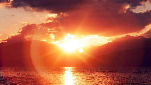
Sunset at Scenic Beach by scott0284, One of my favorite spots to watch a sunset. park mountains beach canal washington nikon state pacifi
Sunset at Scenic Beach by scott0284
Hood Canal 2017 01 06 16 by davidseibold, Scenic Beach State Park, Washington 2017america olympicmountainrange olympicmountains pnw pacificnor
Hood Canal 2017 01 06 16 by davidseibold
JL10396 by Jeff Liska, Poulsbo harbor sunrise, with Mt Rainier in background
Poulsbo, WAsunrise harbor washington mtrainier
JL10396 by Jeff Liska
Mt Rainier by redfishsuefish, Taken from Mt Walkersunset usa washington rainier mtrainier d810
Mt Rainier by redfishsuefish
Sunset on the Day by scott0284, park sunset mountains beach washington nikon state pacific northwest scenic national olympic 18200
Sunset on the Day by scott0284
Memories Never Forgotten by Theodore A. Stark, <a href="http://www.tstark.com/" rel="nofollow">Website</a> | <a href="http://www.twitter.com/theodo
Memories Never Forgotten by Theodore A. Stark
Where One World Ends... by Theodore A. Stark, <a href="http://www.tstark.com/" rel="nofollow">Website</a> | <a href="http://www.twitter.com/theodo
Where One World Ends... by Theodore A. Stark
_DSC0320 by Jeff Liska, Sunrise on Mt. Constance and Hood Canal; Seabeck, Wahington.
sunrise mtconstance olympicmts hoodcana
_DSC0320 by Jeff Liska
The Hood Canal by rve13, And the Olympic Mountains,
We had a little rain  on the Kitsap peninsula side of the canal.
It looks
The Hood Canal by rve13
Night Approach (p) by davidseibold, Scenic Beach State Park, Seabeck, Washington 2017sunset sky usa plant tree america painting washingt
Night Approach (p) by davidseibold
Almost Touch It (p) by davidseibold, Scenic Beach State Park, Washington 2017camera america usa snow plant tree painting washington unite
Almost Touch It (p) by davidseibold
Hood Canal Sunset by rve13, Storm clouds over the Olympics.cloudsstormssunsetssunrises galaxys24 hoodcanal lowtide sunset olympi
Hood Canal Sunset by rve13
Poulsbo Sunset by rve13, On the road.kitsappeninsula poulsbo street sunset galaxys9 powerlines
Poulsbo Sunset by rve13
Poulsbo Sunset by rve13, Another view. cloudsstormssunsetssunrises galaxys9 poulsbowashington
Poulsbo Sunset by rve13
_DSC0308 by Jeff Liska, Sunrise Hood Canal; Seabeck, Wahington.sunrise hoodcanal seabeck washington usa
_DSC0308 by Jeff Liska
The Hood Canal by rve13, From the Seabeck Highway. Sunset.galaxys24 kitsappeninsula hoodcanal olympicpeninsula sunset olympic
The Hood Canal by rve13
Hood Canal sunset in May by LarrynJill, sunset
Hood Canal sunset in May by LarrynJill
Sunset on the Hood Canal by rve13, A viewpoint on the Seabeck Highway. washingtonstate hoodcanal sunset boats galaxys24 cloudsstormssun
Sunset on the Hood Canal by rve13
Low Tide on the Hood Canal by rve13, On the Road to Seabeck.hoodcanal lowtide sunset kitsappeninsula olympicpeninsula olympicmountains ga
Low Tide on the Hood Canal by rve13
Poulsbo Sunset by rve13, Just off of the Liberty Bay, the Puget Sound.poulsbowashington galaxys9
Poulsbo Sunset by rve13
Hood Canal 2017 01 06 10 by davidseibold, Scenic Beach State Park, Seabeck, Washington 2017usa mountain plant tree america washington unitedst
Hood Canal 2017 01 06 10 by davidseibold
Pastel Poulsbo Sunset by rve13, On a supply run from the shelter at home plan, The streets were empty, the grocery stores were busy.
Pastel Poulsbo Sunset by rve13
Hood Canal Sunset by rve13, Looking north toward the Strait of Juan de Fuca.

kitsappeninsula hoodcanal sunset galaxys21 cloudss
Hood Canal Sunset by rve13
Seabeck Highway Sunset by rve13, Along the Hood Canal.galaxys24 sunset kitsappeninsula hoodcanal olympicpeninsula seabeckhighway seab
Seabeck Highway Sunset by rve13
The last of the Sunset on the Road by rve13, Approaching Silverdale Washington.kitsappeninsula route3 sunset twilight galaxys9
The last of the Sunset on the Road by rve13
Poulsbo Sunset by rve13, Gassing up at the feed store.kitsappeninsula poulsbo sunset mostlycloudy galaxys21
Poulsbo Sunset by rve13
Potential by davidseibold, View of what I think is Mount Constance in the Olympic mountain range.

Scenic Beach State Park, Was
Potential by davidseibold
Sunset on Dog Fish Creek by rve13, Dog Fish Creek feeds the Liberty Inlet, and high tide brings saltwater up Dog Fish Creek. Poulsbo Wa
Sunset on Dog Fish Creek by rve13
Seabeck Highway Sunset by rve13, The Hood Canal is on the right side of the highway. The road is no doubt cutting through a tidal wet
Seabeck Highway Sunset by rve13
Hood Canal Sunset by rve13, On the Kitsap Peninsula, you can see a few peaks of the Olympic  mountains on the right side.hoodcan
Hood Canal Sunset by rve13
Hood Canal Sunset by rve13, Shot just above the water. The tide was coming in, nipping at my shoes.kitsappeninsula hoodcanal oly
Hood Canal Sunset by rve13
Dogfish Creek by rve13, This area floods with the tide from Liberty Bay in the Puget Sound.poulsbo libertybay pugetsound gal
Dogfish Creek by rve13
Nearing Dusk by davidseibold, Scenic Beach State Park, Washington 2017america pnw hoodcanal usa water washington unitedstates paci
Nearing Dusk by davidseibold
The Road To Bangor by rve13, Seeing some nice clouds on Interstate 3.sinclairinlet galaxys21 highway3 kitsappeninsula clouds blue
The Road To Bangor by rve13
Hood Canal Sunset by rve13, On the Seabeck Highway.cloudsstormssunsetssunrises hoodcanal seabeckhighway
Hood Canal Sunset by rve13
#sunset #perfect #day by Dalmatica, square squareformat rise iphoneography instagramapp uploaded:by=instagram
#sunset #perfect #day by Dalmatica
The Hood Canal by rve13, galaxys24 kitsappeninsula hoodcanal sunset hightide
The Hood Canal by rve13
Seabeck Highway by rve13, High Tide. Sunset...hightide sunset kitsappeninsula galaxys24 seabeckhighway cloudsstormssunsetssunr
Seabeck Highway by rve13
Seattle sunrise by t_ravtyler, Crossing the Puget Sound from Bainbridge Island to Seattle, WA.clouds city pnw sunrise seattle
Seattle sunrise by t_ravtyler
Poulsbo Sunset by rve13, Looking across Dogfish Creek and high tide Liberty Bay. poulsbowashington poulsbosunset dogfishcreek
Poulsbo Sunset by rve13
Sunset on the Road by rve13, highway305 theroad sunset traffic galaxys21
Sunset on the Road by rve13
Slumber by davidseibold, Scenic Beach State Park, Washington 2017usa cloud beach america washington unitedstates pacificocean
Slumber by davidseibold
Sunrise Halo over Rainier by ScottElliottSmithson, brinnon olympicpeninsula hood canal landscape nature washingtonstate washington pacificnorthwest nor
Sunrise Halo over Rainier by ScottElliottSmithson
Poulsbo Sunset by rve13, Looking for the Sun.sunset poulsbo galaxys9 kitsappeninsula civilization
Poulsbo Sunset by rve13
Almost Touch It by davidseibold, Scenic Beach State Park, Washington 2017america hoodcanal olympicmountainrange olympicmountains pnw
Almost Touch It by davidseibold
Hood Canal 2017 01 06 19 by davidseibold, Scenic Beach State Park, Washington 2017america hoodcanal olympicmountainrange olympicmountains pnw
Hood Canal 2017 01 06 19 by davidseibold
Low tide on the Hood Canal by rve13, olympicpeninsula galaxy lowtide washingtonstate s6 hoodcanal kitsappeninsula cloudsstormssunsetssunr
Low tide on the Hood Canal by rve13
Hood Canal 1 by ScottElliottSmithson, olympicpeninsula hood canal landscape nature washingtonstate washington pacificnorthwest northwest c
Hood Canal 1 by ScottElliottSmithson