Sunrise Sunset Times of Black Chasm Cavern National Natural Landmark, Pioneer Volcano Rd, Volcano, CA, USA
Location: United States > California > Amador County > Volcano >
Timezone:
America/Los_Angeles
Current Time:
2025-07-01 15:05:23
Longitude:
-120.626471
Latitude:
38.434278
Sunrise Today:
05:43:11 AM
Sunset Today:
08:30:17 PM
Daylength Today:
14h 47m 6s
Sunrise Tomorrow:
05:43:43 AM
Sunset Tomorrow:
08:30:07 PM
Daylength Tomorrow:
14h 46m 24s
Year Show All Dates
| Date | Sunrise | Sunset | Daylength |
|---|---|---|---|
| 01/01/2025 | 07:19:51 AM | 04:53:36 PM | 9h 33m 45s |
| 01/02/2025 | 07:19:56 AM | 04:54:27 PM | 9h 34m 31s |
| 01/03/2025 | 07:19:58 AM | 04:55:19 PM | 9h 35m 21s |
| 01/04/2025 | 07:19:58 AM | 04:56:12 PM | 9h 36m 14s |
| 01/05/2025 | 07:19:56 AM | 04:57:07 PM | 9h 37m 11s |
| 01/06/2025 | 07:19:52 AM | 04:58:02 PM | 9h 38m 10s |
| 01/07/2025 | 07:19:46 AM | 04:58:59 PM | 9h 39m 13s |
| 01/08/2025 | 07:19:37 AM | 04:59:57 PM | 9h 40m 20s |
| 01/09/2025 | 07:19:27 AM | 05:00:56 PM | 9h 41m 29s |
| 01/10/2025 | 07:19:14 AM | 05:01:55 PM | 9h 42m 41s |
| 01/11/2025 | 07:19:00 AM | 05:02:56 PM | 9h 43m 56s |
| 01/12/2025 | 07:18:43 AM | 05:03:57 PM | 9h 45m 14s |
| 01/13/2025 | 07:18:24 AM | 05:05:00 PM | 9h 46m 36s |
| 01/14/2025 | 07:18:03 AM | 05:06:03 PM | 9h 48m 0s |
| 01/15/2025 | 07:17:41 AM | 05:07:06 PM | 9h 49m 25s |
| 01/16/2025 | 07:17:16 AM | 05:08:11 PM | 9h 50m 55s |
| 01/17/2025 | 07:16:49 AM | 05:09:15 PM | 9h 52m 26s |
| 01/18/2025 | 07:16:20 AM | 05:10:21 PM | 9h 54m 1s |
| 01/19/2025 | 07:15:49 AM | 05:11:27 PM | 9h 55m 38s |
| 01/20/2025 | 07:15:16 AM | 05:12:33 PM | 9h 57m 17s |
| 01/21/2025 | 07:14:41 AM | 05:13:40 PM | 9h 58m 59s |
| 01/22/2025 | 07:14:04 AM | 05:14:47 PM | 10h 0m 43s |
| 01/23/2025 | 07:13:26 AM | 05:15:54 PM | 10h 2m 28s |
| 01/24/2025 | 07:12:45 AM | 05:17:02 PM | 10h 4m 17s |
| 01/25/2025 | 07:12:03 AM | 05:18:10 PM | 10h 6m 7s |
| 01/26/2025 | 07:11:19 AM | 05:19:18 PM | 10h 7m 59s |
| 01/27/2025 | 07:10:33 AM | 05:20:26 PM | 10h 9m 53s |
| 01/28/2025 | 07:09:46 AM | 05:21:35 PM | 10h 11m 49s |
| 01/29/2025 | 07:08:56 AM | 05:22:43 PM | 10h 13m 47s |
| 01/30/2025 | 07:08:05 AM | 05:23:52 PM | 10h 15m 47s |
| 01/31/2025 | 07:07:13 AM | 05:25:00 PM | 10h 17m 47s |
| 02/01/2025 | 07:06:18 AM | 05:26:09 PM | 10h 19m 51s |
| 02/02/2025 | 07:05:23 AM | 05:27:17 PM | 10h 21m 54s |
| 02/03/2025 | 07:04:25 AM | 05:28:26 PM | 10h 24m 1s |
| 02/04/2025 | 07:03:26 AM | 05:29:34 PM | 10h 26m 8s |
| 02/05/2025 | 07:02:26 AM | 05:30:42 PM | 10h 28m 16s |
| 02/06/2025 | 07:01:24 AM | 05:31:50 PM | 10h 30m 26s |
| 02/07/2025 | 07:00:21 AM | 05:32:58 PM | 10h 32m 37s |
| 02/08/2025 | 06:59:16 AM | 05:34:06 PM | 10h 34m 50s |
| 02/09/2025 | 06:58:10 AM | 05:35:13 PM | 10h 37m 3s |
| 02/10/2025 | 06:57:02 AM | 05:36:21 PM | 10h 39m 19s |
| 02/11/2025 | 06:55:54 AM | 05:37:28 PM | 10h 41m 34s |
| 02/12/2025 | 06:54:44 AM | 05:38:35 PM | 10h 43m 51s |
| 02/13/2025 | 06:53:33 AM | 05:39:41 PM | 10h 46m 8s |
| 02/14/2025 | 06:52:20 AM | 05:40:48 PM | 10h 48m 28s |
| 02/15/2025 | 06:51:07 AM | 05:41:54 PM | 10h 50m 47s |
| 02/16/2025 | 06:49:52 AM | 05:42:59 PM | 10h 53m 7s |
| 02/17/2025 | 06:48:37 AM | 05:44:05 PM | 10h 55m 28s |
| 02/18/2025 | 06:47:20 AM | 05:45:10 PM | 10h 57m 50s |
| 02/19/2025 | 06:46:02 AM | 05:46:15 PM | 11h 0m 13s |
| 02/20/2025 | 06:44:44 AM | 05:47:19 PM | 11h 2m 35s |
| 02/21/2025 | 06:43:24 AM | 05:48:24 PM | 11h 5m 0s |
| 02/22/2025 | 06:42:03 AM | 05:49:28 PM | 11h 7m 25s |
| 02/23/2025 | 06:40:42 AM | 05:50:31 PM | 11h 9m 49s |
| 02/24/2025 | 06:39:19 AM | 05:51:34 PM | 11h 12m 15s |
| 02/25/2025 | 06:37:56 AM | 05:52:37 PM | 11h 14m 41s |
| 02/26/2025 | 06:36:32 AM | 05:53:40 PM | 11h 17m 8s |
| 02/27/2025 | 06:35:08 AM | 05:54:42 PM | 11h 19m 34s |
| 02/28/2025 | 06:33:42 AM | 05:55:45 PM | 11h 22m 3s |
| 03/01/2025 | 06:32:16 AM | 05:56:46 PM | 11h 24m 30s |
| 03/02/2025 | 06:30:50 AM | 05:57:48 PM | 11h 26m 58s |
| 03/03/2025 | 06:29:22 AM | 05:58:49 PM | 11h 29m 27s |
| 03/04/2025 | 06:27:54 AM | 05:59:50 PM | 11h 31m 56s |
| 03/05/2025 | 06:26:26 AM | 06:00:50 PM | 11h 34m 24s |
| 03/06/2025 | 06:24:57 AM | 06:01:51 PM | 11h 36m 54s |
| 03/07/2025 | 06:23:27 AM | 06:02:51 PM | 11h 39m 24s |
| 03/08/2025 | 06:21:57 AM | 06:03:50 PM | 11h 41m 53s |
| 03/09/2025 | 07:20:31 AM | 07:04:48 PM | 11h 44m 17s |
| 03/10/2025 | 07:19:00 AM | 07:05:47 PM | 11h 46m 47s |
| 03/11/2025 | 07:17:29 AM | 07:06:46 PM | 11h 49m 17s |
| 03/12/2025 | 07:15:57 AM | 07:07:45 PM | 11h 51m 48s |
| 03/13/2025 | 07:14:26 AM | 07:08:43 PM | 11h 54m 17s |
| 03/14/2025 | 07:12:54 AM | 07:09:42 PM | 11h 56m 48s |
| 03/15/2025 | 07:11:21 AM | 07:10:40 PM | 11h 59m 19s |
| 03/16/2025 | 07:09:49 AM | 07:11:38 PM | 12h 1m 49s |
| 03/17/2025 | 07:08:16 AM | 07:12:36 PM | 12h 4m 20s |
| 03/18/2025 | 07:06:43 AM | 07:13:34 PM | 12h 6m 51s |
| 03/19/2025 | 07:05:10 AM | 07:14:31 PM | 12h 9m 21s |
| 03/20/2025 | 07:03:37 AM | 07:15:29 PM | 12h 11m 52s |
| 03/21/2025 | 07:02:04 AM | 07:16:26 PM | 12h 14m 22s |
| 03/22/2025 | 07:00:31 AM | 07:17:23 PM | 12h 16m 52s |
| 03/23/2025 | 06:58:58 AM | 07:18:20 PM | 12h 19m 22s |
| 03/24/2025 | 06:57:24 AM | 07:19:17 PM | 12h 21m 53s |
| 03/25/2025 | 06:55:51 AM | 07:20:14 PM | 12h 24m 23s |
| 03/26/2025 | 06:54:18 AM | 07:21:11 PM | 12h 26m 53s |
| 03/27/2025 | 06:52:46 AM | 07:22:07 PM | 12h 29m 21s |
| 03/28/2025 | 06:51:13 AM | 07:23:04 PM | 12h 31m 51s |
| 03/29/2025 | 06:49:40 AM | 07:24:01 PM | 12h 34m 21s |
| 03/30/2025 | 06:48:08 AM | 07:24:57 PM | 12h 36m 49s |
| 03/31/2025 | 06:46:36 AM | 07:25:54 PM | 12h 39m 18s |
| 04/01/2025 | 06:45:04 AM | 07:26:50 PM | 12h 41m 46s |
| 04/02/2025 | 06:43:32 AM | 07:27:47 PM | 12h 44m 15s |
| 04/03/2025 | 06:42:01 AM | 07:28:43 PM | 12h 46m 42s |
| 04/04/2025 | 06:40:30 AM | 07:29:40 PM | 12h 49m 10s |
| 04/05/2025 | 06:39:00 AM | 07:30:36 PM | 12h 51m 36s |
| 04/06/2025 | 06:37:30 AM | 07:31:33 PM | 12h 54m 3s |
| 04/07/2025 | 06:36:00 AM | 07:32:29 PM | 12h 56m 29s |
| 04/08/2025 | 06:34:31 AM | 07:33:26 PM | 12h 58m 55s |
| 04/09/2025 | 06:33:02 AM | 07:34:22 PM | 13h 1m 20s |
| 04/10/2025 | 06:31:34 AM | 07:35:19 PM | 13h 3m 45s |
| 04/11/2025 | 06:30:07 AM | 07:36:15 PM | 13h 6m 8s |
| 04/12/2025 | 06:28:40 AM | 07:37:12 PM | 13h 8m 32s |
| 04/13/2025 | 06:27:14 AM | 07:38:09 PM | 13h 10m 55s |
| 04/14/2025 | 06:25:48 AM | 07:39:05 PM | 13h 13m 17s |
| 04/15/2025 | 06:24:23 AM | 07:40:02 PM | 13h 15m 39s |
| 04/16/2025 | 06:22:59 AM | 07:40:59 PM | 13h 18m 0s |
| 04/17/2025 | 06:21:35 AM | 07:41:56 PM | 13h 20m 21s |
| 04/18/2025 | 06:20:13 AM | 07:42:53 PM | 13h 22m 40s |
| 04/19/2025 | 06:18:51 AM | 07:43:49 PM | 13h 24m 58s |
| 04/20/2025 | 06:17:30 AM | 07:44:46 PM | 13h 27m 16s |
| 04/21/2025 | 06:16:09 AM | 07:45:43 PM | 13h 29m 34s |
| 04/22/2025 | 06:14:50 AM | 07:46:40 PM | 13h 31m 50s |
| 04/23/2025 | 06:13:32 AM | 07:47:37 PM | 13h 34m 5s |
| 04/24/2025 | 06:12:14 AM | 07:48:34 PM | 13h 36m 20s |
| 04/25/2025 | 06:10:58 AM | 07:49:31 PM | 13h 38m 33s |
| 04/26/2025 | 06:09:43 AM | 07:50:28 PM | 13h 40m 45s |
| 04/27/2025 | 06:08:28 AM | 07:51:25 PM | 13h 42m 57s |
| 04/28/2025 | 06:07:15 AM | 07:52:22 PM | 13h 45m 7s |
| 04/29/2025 | 06:06:03 AM | 07:53:18 PM | 13h 47m 15s |
| 04/30/2025 | 06:04:52 AM | 07:54:15 PM | 13h 49m 23s |
| 05/01/2025 | 06:03:42 AM | 07:55:12 PM | 13h 51m 30s |
| 05/02/2025 | 06:02:34 AM | 07:56:08 PM | 13h 53m 34s |
| 05/03/2025 | 06:01:26 AM | 07:57:04 PM | 13h 55m 38s |
| 05/04/2025 | 06:00:20 AM | 07:58:01 PM | 13h 57m 41s |
| 05/05/2025 | 05:59:15 AM | 07:58:57 PM | 13h 59m 42s |
| 05/06/2025 | 05:58:12 AM | 07:59:52 PM | 14h 1m 40s |
| 05/07/2025 | 05:57:10 AM | 08:00:48 PM | 14h 3m 38s |
| 05/08/2025 | 05:56:09 AM | 08:01:43 PM | 14h 5m 34s |
| 05/09/2025 | 05:55:10 AM | 08:02:39 PM | 14h 7m 29s |
| 05/10/2025 | 05:54:12 AM | 08:03:33 PM | 14h 9m 21s |
| 05/11/2025 | 05:53:15 AM | 08:04:28 PM | 14h 11m 13s |
| 05/12/2025 | 05:52:20 AM | 08:05:22 PM | 14h 13m 2s |
| 05/13/2025 | 05:51:27 AM | 08:06:16 PM | 14h 14m 49s |
| 05/14/2025 | 05:50:35 AM | 08:07:09 PM | 14h 16m 34s |
| 05/15/2025 | 05:49:44 AM | 08:08:02 PM | 14h 18m 18s |
| 05/16/2025 | 05:48:56 AM | 08:08:55 PM | 14h 19m 59s |
| 05/17/2025 | 05:48:08 AM | 08:09:47 PM | 14h 21m 39s |
| 05/18/2025 | 05:47:23 AM | 08:10:39 PM | 14h 23m 16s |
| 05/19/2025 | 05:46:39 AM | 08:11:30 PM | 14h 24m 51s |
| 05/20/2025 | 05:45:57 AM | 08:12:20 PM | 14h 26m 23s |
| 05/21/2025 | 05:45:16 AM | 08:13:10 PM | 14h 27m 54s |
| 05/22/2025 | 05:44:37 AM | 08:13:59 PM | 14h 29m 22s |
| 05/23/2025 | 05:44:00 AM | 08:14:47 PM | 14h 30m 47s |
| 05/24/2025 | 05:43:25 AM | 08:15:35 PM | 14h 32m 10s |
| 05/25/2025 | 05:42:51 AM | 08:16:21 PM | 14h 33m 30s |
| 05/26/2025 | 05:42:19 AM | 08:17:07 PM | 14h 34m 48s |
| 05/27/2025 | 05:41:49 AM | 08:17:52 PM | 14h 36m 3s |
| 05/28/2025 | 05:41:21 AM | 08:18:37 PM | 14h 37m 16s |
| 05/29/2025 | 05:40:54 AM | 08:19:20 PM | 14h 38m 26s |
| 05/30/2025 | 05:40:30 AM | 08:20:02 PM | 14h 39m 32s |
| 05/31/2025 | 05:40:07 AM | 08:20:43 PM | 14h 40m 36s |
| 06/01/2025 | 05:39:46 AM | 08:21:24 PM | 14h 41m 38s |
| 06/02/2025 | 05:39:27 AM | 08:22:03 PM | 14h 42m 36s |
| 06/03/2025 | 05:39:09 AM | 08:22:41 PM | 14h 43m 32s |
| 06/04/2025 | 05:38:54 AM | 08:23:17 PM | 14h 44m 23s |
| 06/05/2025 | 05:38:40 AM | 08:23:53 PM | 14h 45m 13s |
| 06/06/2025 | 05:38:29 AM | 08:24:27 PM | 14h 45m 58s |
| 06/07/2025 | 05:38:19 AM | 08:25:00 PM | 14h 46m 41s |
| 06/08/2025 | 05:38:11 AM | 08:25:32 PM | 14h 47m 21s |
| 06/09/2025 | 05:38:04 AM | 08:26:02 PM | 14h 47m 58s |
| 06/10/2025 | 05:38:00 AM | 08:26:31 PM | 14h 48m 31s |
| 06/11/2025 | 05:37:57 AM | 08:26:58 PM | 14h 49m 1s |
| 06/12/2025 | 05:37:57 AM | 08:27:24 PM | 14h 49m 27s |
| 06/13/2025 | 05:37:58 AM | 08:27:49 PM | 14h 49m 51s |
| 06/14/2025 | 05:38:00 AM | 08:28:12 PM | 14h 50m 12s |
| 06/15/2025 | 05:38:05 AM | 08:28:33 PM | 14h 50m 28s |
| 06/16/2025 | 05:38:11 AM | 08:28:53 PM | 14h 50m 42s |
| 06/17/2025 | 05:38:19 AM | 08:29:11 PM | 14h 50m 52s |
| 06/18/2025 | 05:38:29 AM | 08:29:27 PM | 14h 50m 58s |
| 06/19/2025 | 05:38:40 AM | 08:29:42 PM | 14h 51m 2s |
| 06/20/2025 | 05:38:54 AM | 08:29:55 PM | 14h 51m 1s |
| 06/21/2025 | 05:39:08 AM | 08:30:06 PM | 14h 50m 58s |
| 06/22/2025 | 05:39:25 AM | 08:30:16 PM | 14h 50m 51s |
| 06/23/2025 | 05:39:43 AM | 08:30:24 PM | 14h 50m 41s |
| 06/24/2025 | 05:40:02 AM | 08:30:29 PM | 14h 50m 27s |
| 06/25/2025 | 05:40:23 AM | 08:30:34 PM | 14h 50m 11s |
| 06/26/2025 | 05:40:46 AM | 08:30:36 PM | 14h 49m 50s |
| 06/27/2025 | 05:41:10 AM | 08:30:36 PM | 14h 49m 26s |
| 06/28/2025 | 05:41:35 AM | 08:30:35 PM | 14h 49m 0s |
| 06/29/2025 | 05:42:02 AM | 08:30:32 PM | 14h 48m 30s |
| 06/30/2025 | 05:42:30 AM | 08:30:27 PM | 14h 47m 57s |
| 07/01/2025 | 05:43:00 AM | 08:30:20 PM | 14h 47m 20s |
| 07/02/2025 | 05:43:31 AM | 08:30:11 PM | 14h 46m 40s |
| 07/03/2025 | 05:44:03 AM | 08:30:00 PM | 14h 45m 57s |
| 07/04/2025 | 05:44:36 AM | 08:29:48 PM | 14h 45m 12s |
| 07/05/2025 | 05:45:11 AM | 08:29:33 PM | 14h 44m 22s |
| 07/06/2025 | 05:45:46 AM | 08:29:17 PM | 14h 43m 31s |
| 07/07/2025 | 05:46:23 AM | 08:28:58 PM | 14h 42m 35s |
| 07/08/2025 | 05:47:01 AM | 08:28:38 PM | 14h 41m 37s |
| 07/09/2025 | 05:47:40 AM | 08:28:16 PM | 14h 40m 36s |
| 07/10/2025 | 05:48:20 AM | 08:27:52 PM | 14h 39m 32s |
| 07/11/2025 | 05:49:01 AM | 08:27:26 PM | 14h 38m 25s |
| 07/12/2025 | 05:49:42 AM | 08:26:59 PM | 14h 37m 17s |
| 07/13/2025 | 05:50:25 AM | 08:26:29 PM | 14h 36m 4s |
| 07/14/2025 | 05:51:08 AM | 08:25:58 PM | 14h 34m 50s |
| 07/15/2025 | 05:51:52 AM | 08:25:25 PM | 14h 33m 33s |
| 07/16/2025 | 05:52:37 AM | 08:24:50 PM | 14h 32m 13s |
| 07/17/2025 | 05:53:23 AM | 08:24:13 PM | 14h 30m 50s |
| 07/18/2025 | 05:54:09 AM | 08:23:35 PM | 14h 29m 26s |
| 07/19/2025 | 05:54:56 AM | 08:22:55 PM | 14h 27m 59s |
| 07/20/2025 | 05:55:44 AM | 08:22:13 PM | 14h 26m 29s |
| 07/21/2025 | 05:56:32 AM | 08:21:29 PM | 14h 24m 57s |
| 07/22/2025 | 05:57:20 AM | 08:20:44 PM | 14h 23m 24s |
| 07/23/2025 | 05:58:10 AM | 08:19:57 PM | 14h 21m 47s |
| 07/24/2025 | 05:58:59 AM | 08:19:08 PM | 14h 20m 9s |
| 07/25/2025 | 05:59:49 AM | 08:18:18 PM | 14h 18m 29s |
| 07/26/2025 | 06:00:40 AM | 08:17:26 PM | 14h 16m 46s |
| 07/27/2025 | 06:01:30 AM | 08:16:33 PM | 14h 15m 3s |
| 07/28/2025 | 06:02:21 AM | 08:15:38 PM | 14h 13m 17s |
| 07/29/2025 | 06:03:13 AM | 08:14:41 PM | 14h 11m 28s |
| 07/30/2025 | 06:04:05 AM | 08:13:43 PM | 14h 9m 38s |
| 07/31/2025 | 06:04:57 AM | 08:12:44 PM | 14h 7m 47s |
| 08/01/2025 | 06:05:49 AM | 08:11:43 PM | 14h 5m 54s |
| 08/02/2025 | 06:06:41 AM | 08:10:40 PM | 14h 3m 59s |
| 08/03/2025 | 06:07:34 AM | 08:09:37 PM | 14h 2m 3s |
| 08/04/2025 | 06:08:26 AM | 08:08:32 PM | 14h 0m 6s |
| 08/05/2025 | 06:09:19 AM | 08:07:25 PM | 13h 58m 6s |
| 08/06/2025 | 06:10:12 AM | 08:06:18 PM | 13h 56m 6s |
| 08/07/2025 | 06:11:05 AM | 08:05:09 PM | 13h 54m 4s |
| 08/08/2025 | 06:11:58 AM | 08:03:58 PM | 13h 52m 0s |
| 08/09/2025 | 06:12:52 AM | 08:02:47 PM | 13h 49m 55s |
| 08/10/2025 | 06:13:45 AM | 08:01:34 PM | 13h 47m 49s |
| 08/11/2025 | 06:14:38 AM | 08:00:21 PM | 13h 45m 43s |
| 08/12/2025 | 06:15:31 AM | 07:59:06 PM | 13h 43m 35s |
| 08/13/2025 | 06:16:25 AM | 07:57:50 PM | 13h 41m 25s |
| 08/14/2025 | 06:17:18 AM | 07:56:33 PM | 13h 39m 15s |
| 08/15/2025 | 06:18:11 AM | 07:55:15 PM | 13h 37m 4s |
| 08/16/2025 | 06:19:04 AM | 07:53:56 PM | 13h 34m 52s |
| 08/17/2025 | 06:19:58 AM | 07:52:36 PM | 13h 32m 38s |
| 08/18/2025 | 06:20:51 AM | 07:51:15 PM | 13h 30m 24s |
| 08/19/2025 | 06:21:44 AM | 07:49:53 PM | 13h 28m 9s |
| 08/20/2025 | 06:22:37 AM | 07:48:30 PM | 13h 25m 53s |
| 08/21/2025 | 06:23:30 AM | 07:47:06 PM | 13h 23m 36s |
| 08/22/2025 | 06:24:23 AM | 07:45:42 PM | 13h 21m 19s |
| 08/23/2025 | 06:25:16 AM | 07:44:17 PM | 13h 19m 1s |
| 08/24/2025 | 06:26:08 AM | 07:42:51 PM | 13h 16m 43s |
| 08/25/2025 | 06:27:01 AM | 07:41:24 PM | 13h 14m 23s |
| 08/26/2025 | 06:27:54 AM | 07:39:57 PM | 13h 12m 3s |
| 08/27/2025 | 06:28:46 AM | 07:38:28 PM | 13h 9m 42s |
| 08/28/2025 | 06:29:39 AM | 07:37:00 PM | 13h 7m 21s |
| 08/29/2025 | 06:30:31 AM | 07:35:30 PM | 13h 4m 59s |
| 08/30/2025 | 06:31:24 AM | 07:34:00 PM | 13h 2m 36s |
| 08/31/2025 | 06:32:16 AM | 07:32:30 PM | 13h 0m 14s |
| 09/01/2025 | 06:33:08 AM | 07:30:59 PM | 12h 57m 51s |
| 09/02/2025 | 06:34:01 AM | 07:29:28 PM | 12h 55m 27s |
| 09/03/2025 | 06:34:53 AM | 07:27:56 PM | 12h 53m 3s |
| 09/04/2025 | 06:35:45 AM | 07:26:23 PM | 12h 50m 38s |
| 09/05/2025 | 06:36:37 AM | 07:24:50 PM | 12h 48m 13s |
| 09/06/2025 | 06:37:29 AM | 07:23:17 PM | 12h 45m 48s |
| 09/07/2025 | 06:38:21 AM | 07:21:44 PM | 12h 43m 23s |
| 09/08/2025 | 06:39:13 AM | 07:20:10 PM | 12h 40m 57s |
| 09/09/2025 | 06:40:05 AM | 07:18:36 PM | 12h 38m 31s |
| 09/10/2025 | 06:40:58 AM | 07:17:01 PM | 12h 36m 3s |
| 09/11/2025 | 06:41:50 AM | 07:15:27 PM | 12h 33m 37s |
| 09/12/2025 | 06:42:42 AM | 07:13:52 PM | 12h 31m 10s |
| 09/13/2025 | 06:43:34 AM | 07:12:17 PM | 12h 28m 43s |
| 09/14/2025 | 06:44:26 AM | 07:10:42 PM | 12h 26m 16s |
| 09/15/2025 | 06:45:19 AM | 07:09:07 PM | 12h 23m 48s |
| 09/16/2025 | 06:46:11 AM | 07:07:31 PM | 12h 21m 20s |
| 09/17/2025 | 06:47:04 AM | 07:05:56 PM | 12h 18m 52s |
| 09/18/2025 | 06:47:56 AM | 07:04:21 PM | 12h 16m 25s |
| 09/19/2025 | 06:48:49 AM | 07:02:45 PM | 12h 13m 56s |
| 09/20/2025 | 06:49:42 AM | 07:01:10 PM | 12h 11m 28s |
| 09/21/2025 | 06:50:34 AM | 06:59:35 PM | 12h 9m 1s |
| 09/22/2025 | 06:51:28 AM | 06:58:00 PM | 12h 6m 32s |
| 09/23/2025 | 06:52:21 AM | 06:56:25 PM | 12h 4m 4s |
| 09/24/2025 | 06:53:14 AM | 06:54:50 PM | 12h 1m 36s |
| 09/25/2025 | 06:54:08 AM | 06:53:15 PM | 11h 59m 7s |
| 09/26/2025 | 06:55:01 AM | 06:51:41 PM | 11h 56m 40s |
| 09/27/2025 | 06:55:55 AM | 06:50:06 PM | 11h 54m 11s |
| 09/28/2025 | 06:56:49 AM | 06:48:32 PM | 11h 51m 43s |
| 09/29/2025 | 06:57:44 AM | 06:46:59 PM | 11h 49m 15s |
| 09/30/2025 | 06:58:38 AM | 06:45:25 PM | 11h 46m 47s |
| 10/01/2025 | 06:59:33 AM | 06:43:52 PM | 11h 44m 19s |
| 10/02/2025 | 07:00:28 AM | 06:42:20 PM | 11h 41m 52s |
| 10/03/2025 | 07:01:24 AM | 06:40:48 PM | 11h 39m 24s |
| 10/04/2025 | 07:02:19 AM | 06:39:16 PM | 11h 36m 57s |
| 10/05/2025 | 07:03:15 AM | 06:37:45 PM | 11h 34m 30s |
| 10/06/2025 | 07:04:11 AM | 06:36:14 PM | 11h 32m 3s |
| 10/07/2025 | 07:05:08 AM | 06:34:44 PM | 11h 29m 36s |
| 10/08/2025 | 07:06:05 AM | 06:33:14 PM | 11h 27m 9s |
| 10/09/2025 | 07:07:02 AM | 06:31:45 PM | 11h 24m 43s |
| 10/10/2025 | 07:07:59 AM | 06:30:17 PM | 11h 22m 18s |
| 10/11/2025 | 07:08:57 AM | 06:28:49 PM | 11h 19m 52s |
| 10/12/2025 | 07:09:55 AM | 06:27:22 PM | 11h 17m 27s |
| 10/13/2025 | 07:10:53 AM | 06:25:56 PM | 11h 15m 3s |
| 10/14/2025 | 07:11:52 AM | 06:24:31 PM | 11h 12m 39s |
| 10/15/2025 | 07:12:51 AM | 06:23:06 PM | 11h 10m 15s |
| 10/16/2025 | 07:13:50 AM | 06:21:42 PM | 11h 7m 52s |
| 10/17/2025 | 07:14:50 AM | 06:20:19 PM | 11h 5m 29s |
| 10/18/2025 | 07:15:50 AM | 06:18:57 PM | 11h 3m 7s |
| 10/19/2025 | 07:16:50 AM | 06:17:36 PM | 11h 0m 46s |
| 10/20/2025 | 07:17:51 AM | 06:16:16 PM | 10h 58m 25s |
| 10/21/2025 | 07:18:52 AM | 06:14:57 PM | 10h 56m 5s |
| 10/22/2025 | 07:19:54 AM | 06:13:39 PM | 10h 53m 45s |
| 10/23/2025 | 07:20:55 AM | 06:12:22 PM | 10h 51m 27s |
| 10/24/2025 | 07:21:57 AM | 06:11:06 PM | 10h 49m 9s |
| 10/25/2025 | 07:23:00 AM | 06:09:51 PM | 10h 46m 51s |
| 10/26/2025 | 07:24:02 AM | 06:08:38 PM | 10h 44m 36s |
| 10/27/2025 | 07:25:05 AM | 06:07:25 PM | 10h 42m 20s |
| 10/28/2025 | 07:26:09 AM | 06:06:14 PM | 10h 40m 5s |
| 10/29/2025 | 07:27:12 AM | 06:05:04 PM | 10h 37m 52s |
| 10/30/2025 | 07:28:16 AM | 06:03:56 PM | 10h 35m 40s |
| 10/31/2025 | 07:29:20 AM | 06:02:48 PM | 10h 33m 28s |
| 11/01/2025 | 07:30:24 AM | 06:01:42 PM | 10h 31m 18s |
| 11/02/2025 | 06:31:31 AM | 05:00:35 PM | 10h 29m 4s |
| 11/03/2025 | 06:32:36 AM | 04:59:32 PM | 10h 26m 56s |
| 11/04/2025 | 06:33:41 AM | 04:58:31 PM | 10h 24m 50s |
| 11/05/2025 | 06:34:46 AM | 04:57:31 PM | 10h 22m 45s |
| 11/06/2025 | 06:35:51 AM | 04:56:33 PM | 10h 20m 42s |
| 11/07/2025 | 06:36:57 AM | 04:55:36 PM | 10h 18m 39s |
| 11/08/2025 | 06:38:02 AM | 04:54:40 PM | 10h 16m 38s |
| 11/09/2025 | 06:39:07 AM | 04:53:47 PM | 10h 14m 40s |
| 11/10/2025 | 06:40:13 AM | 04:52:55 PM | 10h 12m 42s |
| 11/11/2025 | 06:41:18 AM | 04:52:05 PM | 10h 10m 47s |
| 11/12/2025 | 06:42:24 AM | 04:51:16 PM | 10h 8m 52s |
| 11/13/2025 | 06:43:29 AM | 04:50:30 PM | 10h 7m 1s |
| 11/14/2025 | 06:44:34 AM | 04:49:45 PM | 10h 5m 11s |
| 11/15/2025 | 06:45:39 AM | 04:49:02 PM | 10h 3m 23s |
| 11/16/2025 | 06:46:44 AM | 04:48:20 PM | 10h 1m 36s |
| 11/17/2025 | 06:47:49 AM | 04:47:41 PM | 9h 59m 52s |
| 11/18/2025 | 06:48:53 AM | 04:47:03 PM | 9h 58m 10s |
| 11/19/2025 | 06:49:57 AM | 04:46:28 PM | 9h 56m 31s |
| 11/20/2025 | 06:51:01 AM | 04:45:54 PM | 9h 54m 53s |
| 11/21/2025 | 06:52:05 AM | 04:45:23 PM | 9h 53m 18s |
| 11/22/2025 | 06:53:07 AM | 04:44:53 PM | 9h 51m 46s |
| 11/23/2025 | 06:54:10 AM | 04:44:26 PM | 9h 50m 16s |
| 11/24/2025 | 06:55:12 AM | 04:44:00 PM | 9h 48m 48s |
| 11/25/2025 | 06:56:13 AM | 04:43:37 PM | 9h 47m 24s |
| 11/26/2025 | 06:57:14 AM | 04:43:15 PM | 9h 46m 1s |
| 11/27/2025 | 06:58:14 AM | 04:42:56 PM | 9h 44m 42s |
| 11/28/2025 | 06:59:14 AM | 04:42:39 PM | 9h 43m 25s |
| 11/29/2025 | 07:00:12 AM | 04:42:24 PM | 9h 42m 12s |
| 11/30/2025 | 07:01:10 AM | 04:42:11 PM | 9h 41m 1s |
| 12/01/2025 | 07:02:07 AM | 04:42:00 PM | 9h 39m 53s |
| 12/02/2025 | 07:03:03 AM | 04:41:51 PM | 9h 38m 48s |
| 12/03/2025 | 07:03:58 AM | 04:41:45 PM | 9h 37m 47s |
| 12/04/2025 | 07:04:52 AM | 04:41:41 PM | 9h 36m 49s |
| 12/05/2025 | 07:05:44 AM | 04:41:39 PM | 9h 35m 55s |
| 12/06/2025 | 07:06:36 AM | 04:41:39 PM | 9h 35m 3s |
| 12/07/2025 | 07:07:27 AM | 04:41:41 PM | 9h 34m 14s |
| 12/08/2025 | 07:08:16 AM | 04:41:45 PM | 9h 33m 29s |
| 12/09/2025 | 07:09:04 AM | 04:41:51 PM | 9h 32m 47s |
| 12/10/2025 | 07:09:51 AM | 04:42:00 PM | 9h 32m 9s |
| 12/11/2025 | 07:10:36 AM | 04:42:11 PM | 9h 31m 35s |
| 12/12/2025 | 07:11:20 AM | 04:42:24 PM | 9h 31m 4s |
| 12/13/2025 | 07:12:02 AM | 04:42:39 PM | 9h 30m 37s |
| 12/14/2025 | 07:12:43 AM | 04:42:56 PM | 9h 30m 13s |
| 12/15/2025 | 07:13:22 AM | 04:43:15 PM | 9h 29m 53s |
| 12/16/2025 | 07:13:59 AM | 04:43:36 PM | 9h 29m 37s |
| 12/17/2025 | 07:14:35 AM | 04:43:59 PM | 9h 29m 24s |
| 12/18/2025 | 07:15:09 AM | 04:44:24 PM | 9h 29m 15s |
| 12/19/2025 | 07:15:42 AM | 04:44:51 PM | 9h 29m 9s |
| 12/20/2025 | 07:16:12 AM | 04:45:20 PM | 9h 29m 8s |
| 12/21/2025 | 07:16:41 AM | 04:45:51 PM | 9h 29m 10s |
| 12/22/2025 | 07:17:08 AM | 04:46:23 PM | 9h 29m 15s |
| 12/23/2025 | 07:17:33 AM | 04:46:58 PM | 9h 29m 25s |
| 12/24/2025 | 07:17:56 AM | 04:47:34 PM | 9h 29m 38s |
| 12/25/2025 | 07:18:18 AM | 04:48:12 PM | 9h 29m 54s |
| 12/26/2025 | 07:18:37 AM | 04:48:52 PM | 9h 30m 15s |
| 12/27/2025 | 07:18:54 AM | 04:49:34 PM | 9h 30m 40s |
| 12/28/2025 | 07:19:09 AM | 04:50:17 PM | 9h 31m 8s |
| 12/29/2025 | 07:19:23 AM | 04:51:01 PM | 9h 31m 38s |
| 12/30/2025 | 07:19:34 AM | 04:51:47 PM | 9h 32m 13s |
| 12/31/2025 | 07:19:43 AM | 04:52:35 PM | 9h 32m 52s |
Sunrise & Sunset Photos

The Veins of an Oak at Sunset - Sutter Creek, CA

Dave Stamey sings western and cowboy songs at Bella Grace Tasting Room, sunset

sunset, hilltop, Red Mule Ranch, Fiddletown,

sunset, "Cowboy Campfire", cowboy, Fiddletown, Red Mule Ranch, Ron Scofield

Butte Fire heads south around Jackson Peak

sunset skies, Red Mule Ranch, Fiddletown,
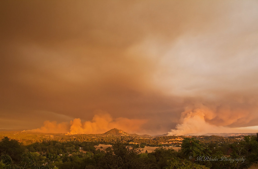
Butte Fire, Amador and Calaveras Counties

Cowboy Campfire, Dave Stamey, Hopkins, torch, sunset, Red Mule Ranch, Fiddletown,
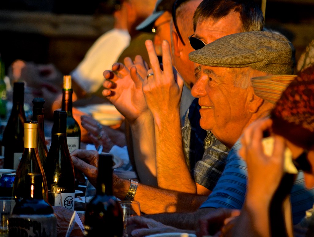
sunset, men,

Sacramento deluge

Sunset Window

Sunset in Jackson

Sunset Over Sutter Creek

Flying towards the sunset

#sunset #nature #mountains #pioneer

Jackson Sunset

Amador winetasting Nov 2012 145

Rise and Shine

Painted Sky

Question Mark

Sunset Ahead

Sunrise through the trees in Amador County

Sunrise through the trees in Amador County

Sunrise through the trees in Amador County

Sunrise through the trees in Amador County

Sunrise through the trees in Amador County

Sunrise through the trees in Amador County

Sunrise through the trees in Amador County

Sunrise through the trees in Amador County

Sunrise through the trees in Amador County

Sunrise through the trees in Amador County

Sunrise through the trees in Amador County

Sunrise through the trees in Amador County

Sunrise Behind the Trees Amador County
Black Chasm Cavern National Natural Landmark, Pioneer Volcano Rd, Volcano, CA, USA Map
Search another place
Near Places
Pioneer Volcano Rd, Pine Grove, CA, USA
Quartz Rd, Pioneer, CA, USA
Consolation St, Volcano, CA, USA
Pioneer Volcano Rd, Pine Grove, CA, USA
Diamond View Dr, Pine Grove, CA, USA
Volcano Hills Rd, Pioneer, CA, USA
Madrone Dr, Pioneer, CA, USA
Red Corral Mini Mart, CA-88, Pioneer, CA, USA
Sierra Yard Supply & Equipment, CA-88, Pioneer, CA, USA
Church At The Cross, Alpine State Hwy, Pine Grove, CA, USA
Rolling Hills Ct, Pine Grove, CA, USA
Van De Hei Ranch Rd, Pioneer, CA, USA
Van De Hei Ranch Rd, Pioneer, CA, USA
Red Corral Rd, Pioneer, CA, USA
CA-88, Pioneer, CA, USA
Robin Rd, Pioneer, CA, USA
Raven Rd, Pioneer, CA, USA
Roden Ln, Pioneer, CA, USA
Meadow Pines Estates, Carson Dr UNIT 21, Pioneer, CA, USA
Lodestar Way, Pioneer, CA, USA
Recent Searches
- Sunrise Sunset Times of Red Dog Mine, AK, USA
- Sunrise Sunset Times of Am Bahnhof, Am bhf, Borken, Germany
- Sunrise Sunset Times of 4th St E, Sonoma, CA, USA
- Sunrise Sunset Times of Oakland Ave, Williamsport, PA, USA
- Sunrise Sunset Times of Via Roma, Pieranica CR, Italy
- Sunrise Sunset Times of Clock Tower of Dubrovnik, Grad, Dubrovnik, Croatia
- Sunrise Sunset Times of Trelew, Chubut Province, Argentina
- Sunrise Sunset Times of Hartfords Bluff Cir, Mt Pleasant, SC, USA
- Sunrise Sunset Times of Kita Ward, Kumamoto, Japan
- Sunrise Sunset Times of Pingtan Island, Pingtan County, Fuzhou, China