Timezone:Eastern Standard Time
Current Time:Tuesday, November 10, 2026 5:09 PM
Longitude:-84.7216924
Latitude:46.452491
Sunrise Time Today:7:34:39 AM
Sunset Time Today:5:13:39 PM
Daylength Today:9h 39m 0s
Sunrise Time Tomorrow:7:36:07 AM
Sunset Time Tomorrow:5:12:26 PM
Daylength Tomorrow:9h 36m 19s

: Show All Dates

Date Sunrise Time Sunset Time Daylength
Jan 1, 2026 8:23:47 AM 5:02:28 PM 8h 38m 41s
Feb 1, 2026 8:05:00 AM 5:42:08 PM 9h 37m 7s
Mar 1, 2026 7:21:42 AM 6:24:07 PM 11h 2m 25s
Apr 1, 2026 7:21:40 AM 8:06:44 PM 12h 45m 4s
May 1, 2026 6:27:31 AM 8:47:04 PM 14h 19m 32s
Jun 1, 2026 5:52:01 AM 9:24:02 PM 15h 32m 0s
Jul 1, 2026 5:50:44 AM 9:36:39 PM 15h 45m 54s
Aug 1, 2026 6:19:51 AM 9:13:06 PM 14h 53m 15s
Sep 1, 2026 6:59:06 AM 8:22:23 PM 13h 23m 17s
Oct 1, 2026 7:37:11 AM 7:23:03 PM 11h 45m 52s
Nov 1, 2026 8:20:00 AM 6:27:27 PM 10h 7m 27s
Nov 11, 2026 7:34:39 AM 5:13:39 PM 9h 39m 0s
Nov 12, 2026 7:36:07 AM 5:12:26 PM 9h 36m 19s
Dec 1, 2026 8:02:06 AM 4:55:59 PM 8h 53m 53s

Sunrise & Sunset Photos

sunset, whitefish bay by twurdemann, <i><u>EXPLORE January 5, 2018</u></i>


Sunset
-20°C
Ice
Encrusted
Winter
Gros Cap, Prince Township
sunset, whitefish bay by twurdemann
sunset, whitefish island by twurdemann, <b><u><i>EXPLORE February 2, 2017</i></u></b>

Sunset, Whitefish Island / Whitefish Channel, Sault C
sunset, whitefish island by twurdemann
gros cap crib lightstation, ontario by twurdemann, 

<b>EXPLORE March 5, 2016, Highest #74</b>

The Gros Cap Reef Lighthouse (officially, the Canadian
gros cap crib lightstation, ontario by twurdemann
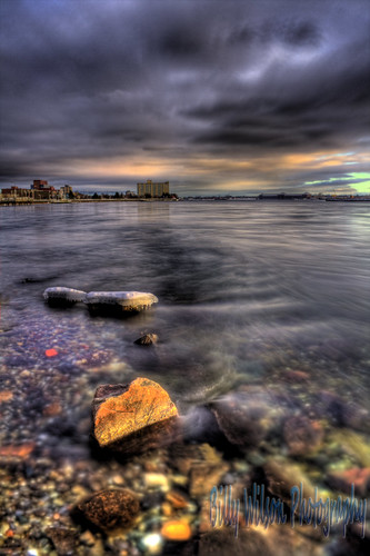
Sault Waterfront by Billy Wilson Photography, This is the waterfront viewed from upstream in Sault Ste. Marie. I'm excited because I just got a bu
Sault Waterfront by Billy Wilson Photography
All I See is Gold by Billy Wilson Photography, I took this evening, the windchill was unbelievable. This is the edge of the ice at the end of a pie
All I See is Gold by Billy Wilson Photography
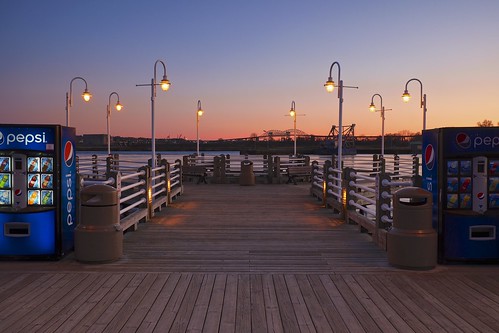
sunset, st. marys river by twurdemann, 
<b>EXPLORE May 11, 2016, Highest rank 97</b>

Sunset from the St. Marys River boardwalk / John Rows
sunset, st. marys river by twurdemann
st. marys rapids winter sunset by twurdemann, <b><u><i>EXPLORE February 2, 2017</i></u></b>

The St. Marys Rapids are part of the 120 kilometer /
st. marys rapids winter sunset by twurdemann
Beneath Superior's Surface by Bryan O'Toole, To complete the trio, here is another shot from Gros Cap.  This time I moved in close and low to the
Beneath Superior's Surface by Bryan O'Toole
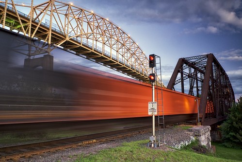
railroad swing bridge, sault ste. marie by twurdemann, International Railroad Swing bridge, Sault Canal National Historic Site.

A passing Canadian Nationa
railroad swing bridge, sault ste. marie by twurdemann
Superior Stones by Bryan O'Toole, It's about time!  It feels like it's been forever getting out and photographing a sunset.  Although
Superior Stones by Bryan O'Toole
WhitefishBay by HansWobbe, (WikiPedia)<a href="http://en.wikipedia.org/wiki/Lake_Superior" rel="nofollow">Lake Superior</a>'s W
WhitefishBay by HansWobbe
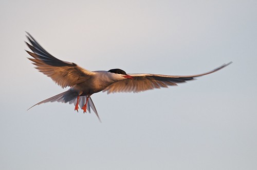
common tern by twurdemann, <i>sterna hirundo</i>

Sunset
St. Marys River, Sault Ste. Marie

AF-S VR Nikkor 500mm f/4G ED + Niko
common tern by twurdemann
attikamek trail, sault canal national historic site by twurdemann, <b>EXPLORE, November 14,  2015, #46</b>

The 2.5 km Attikamek Trail, in the Sault Ste. Marie Canal N
attikamek trail, sault canal national historic site by twurdemann
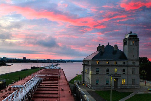
Spectacular Sunrise at the Soo by knutsonrick, The Poe Lock gates have opened and on the downbound MV American Spirit loaded with taconite pellets
Spectacular Sunrise at the Soo by knutsonrick
gros cap crib lightstation, ontario by twurdemann, The Gros Cap Reef Lighthouse (officially, the Canadian Coast Guard Gros Cap Crib Lightstation) at th
gros cap crib lightstation, ontario by twurdemann
gros cap / frozen waterfall by twurdemann, Sunset
Winter
Waterfall
Gros Cap Bluffs
Prince Township

The 2.5 billion year old Archean granite Gr
gros cap / frozen waterfall by twurdemann
bridges, st. marys river by twurdemann, Sunset / twilight.

On the left, the Sault Ste. Marie International Bridge is a 4.5 kilometer / 2.8
bridges, st. marys river by twurdemann
international railway bridge by twurdemann, Sunset
St. Mary's River
International Railroad Bridge
Sault Ste. Marie

The International Railroad h
international railway bridge by twurdemann
sunset, algoma steelworks (algoma steel) by twurdemann, Cold
Winter
Sunset


Algoma's Number Seven blast furnace, one of the largest in North America, has a
sunset, algoma steelworks (algoma steel) by twurdemann
gros cap / ice cave by twurdemann, Sunset
Winter
Ice cave
Whitefish Bay
Lake Superior

Gros Cap, Prince Township, is a small hamlet of
gros cap / ice cave by twurdemann
attikamek trail, sault canal national historic site by twurdemann, Dawn warms part of the 2.5 km Attikamek Trail, in the Sault Ste. Marie Canal National Historic Site:
attikamek trail, sault canal national historic site by twurdemann
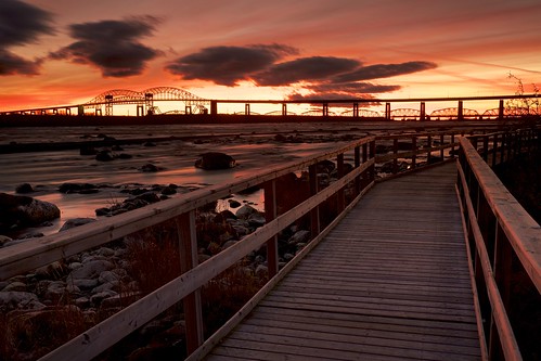
st. marys rapids sunset by twurdemann, The St. Marys Rapids are part of the 120 kilometer / 75 mile St. Marys River which drains Lake Super
st. marys rapids sunset by twurdemann
international railroad bridge by twurdemann, Cold
Winter
Sunset
St. Mary's Island

The International Railroad had Bridge was built in 1887 by the
international railroad bridge by twurdemann
sunset, algoma steelworks (algoma steel) by twurdemann, Number Seven blast furnace, one of the largest in North America, has a capacity of 2.9 million nTPA,
sunset, algoma steelworks (algoma steel) by twurdemann
sunset, whitefish bay by twurdemann, Sunset
-20°C
Winter
Gros Cap, Prince Township
Whitefish Bay
Lake Superior
encrusted fujixt1 groscap
sunset, whitefish bay by twurdemann
lake superior sunset by twurdemann, Fire and ice.
Gros Cap, Ontario, a small hamlet of 250, along Ontario Highway 550.  The 2.5 billion
lake superior sunset by twurdemann
Shoreline Sky by Bryan O'Toole, A little different view from the other evening while out at Gros Cap.  It was a very peaceful and ca
Shoreline Sky by Bryan O'Toole
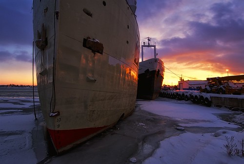
e. m. ford and yankcanuck by twurdemann, The cement carrier E. M. Ford at Purvis Marine awaiting its eventual scrapping. The boat was built i
e. m. ford and yankcanuck by twurdemann
international railroad bridge / st. marys river by twurdemann, Sunset.

The International Railroad Bridge was built in 1887 by the Dominion Bridge Company- -Lachin
international railroad bridge / st. marys river by twurdemann
sunset by twurdemann, Spring
Sault Canal
Sault Ste. Marie International Bridge
Sault Canal National Historic Site

The Sau
sunset by twurdemann
sunset, gros cap by twurdemann, Sunset
Five seconds
Archean granite
St. Marys River / Whitefish Bay
Gros Cap, Prince Township, Ontar
sunset, gros cap by twurdemann
sunset, sault canal national historic site by twurdemann, Sunset.
The Sault Canal opened in 1895- - it was the world’s first electrically operated lock and th
sunset, sault canal national historic site by twurdemann
Paradise Sunrise by pabs35, Paradise, Michigan. Early morning light illuminates the sky over Whitefish Bay, Lake Superior

Mamiy
Paradise Sunrise by pabs35
sinking like a sunset by twurdemann, Sunset
St. Marys River
International Railroad Bridge
Sault Ste. Marie
Ontario06ndsoftgrad bridge cam
sinking like a sunset by twurdemann
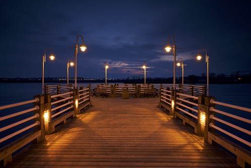
night, st. marys river by twurdemann, Night from the St. Marys River Boardwalk.
The boardwalk is part of the John Rowswell Hub Trail- - a
night, st. marys river by twurdemann
gros cap sunset by twurdemann, Fire and Ice.
Sunset  at Gros Cap, Prince Township, Ontario.
In the distance is the old abandoned do
gros cap sunset by twurdemann
gros cap bluffs by twurdemann, -24ºC / -30ºC windchill
Sunset
Prince Township
Whitefish Bay
Lake Superior03ndsoftgrad bluffs cold f
gros cap bluffs by twurdemann
sun pillar, sault ste. marie, ontario by twurdemann, The winter setting sun creates a sun pillar along the Sault Ste. Marie waterfront. A Singh-Ray two s
sun pillar, sault ste. marie, ontario by twurdemann
sunset and passing train by twurdemann, Sunset
Railway Swing Bridge (1896)
Emergency Swing Dam (1896)
Sault Ste. Marie International Bridge
sunset and passing train by twurdemann
sunset, st. marys river by twurdemann, Fog
Sunset
Summer
St. Marys River
Sault Ste. Mariecanada cloud dock fog fujixt1 generalhospital hubt
sunset, st. marys river by twurdemann
sunset, cloud, st. marys river by twurdemann, A passing rainstorm at sunset over the St. Marys River,  as seen from the waterfront at the old Gene
sunset, cloud, st. marys river by twurdemann
sunset by twurdemann, Ombre
Attikamek Trail
Sault Ste. Marie International Bridge
St. Mary's Island
Sault Canal National H
sunset by twurdemann
the last sunset... by BillsExplorations, The final days of the Sunset Inn just south of Sault Ste. Marie,MI. The old hotel is in full collaps
the last sunset... by BillsExplorations
two minute sunset, sault ste. marie by twurdemann, A two minute sunset and the St. Marys River, as seen from the Roberta Bonder Marina / Pavilion- -in
two minute sunset, sault ste. marie by twurdemann
sunset, fort creek by twurdemann, Sunset on the last day of 2016 at the Fort Creek Conservation Area.
The 135m (445 feet) footbridge c
sunset, fort creek by twurdemann
attikamek trail, sault canal national historic site by twurdemann, The 2.5 km Attikamek Trail, in the Sault Ste. Marie Canal National Historic Site, allows access to t
attikamek trail, sault canal national historic site by twurdemann
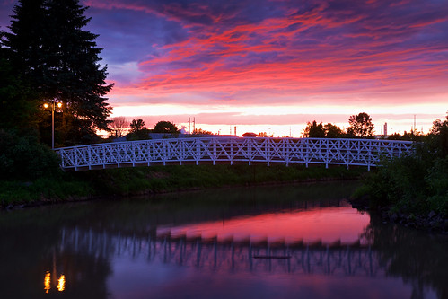
sunset, fort creek by twurdemann, Footbridge across Fort Creek at the mouth of the St. Marys River.
Algoma Steel settling ponds.
John
sunset, fort creek by twurdemann
golden hour by twurdemann, Golden hour on the last day of 2016 at the Fort Creek Conservation Area.
The 135m (445 feet) footbri
golden hour by twurdemann
common tern by twurdemann, <i>sterna hirundo</i>

Sunset
St. Marys River, Sault Ste. Marie

AF-S VR Nikkor 500mm f/4G ED + Niko
common tern by twurdemann
essar steel algoma (algoma steel), sault ste. marie, ontario by twurdemann, Essar Steel Algoma is currently, again, under the Companies' Creditors Arrangement Act: A Canadian l
essar steel algoma (algoma steel), sault ste. marie, ontario by twurdemann
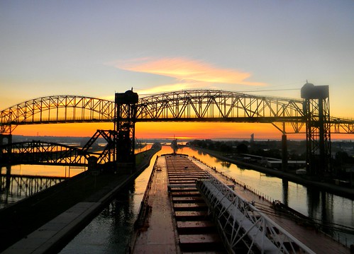
Sunrise over the Soo by knutsonrick, It's about 6:45 local time at Sault St. Marie, MI on a wonderfully calm morning in September on the
Sunrise over the Soo by knutsonrick
attikamek trail, sault canal national historic site by twurdemann, The 2.5 km Attikamek Trail, in the Sault Ste. Marie Canal National Historic Site, allows access to t
attikamek trail, sault canal national historic site by twurdemann
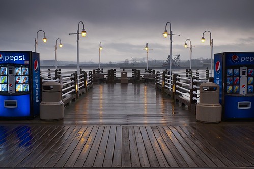
storm / st. marys river by twurdemann, Passing rain storm over the St. Marys River boardwalk / John Rowswell Hub Trail- - a 22.5 km non-mot
storm / st. marys river by twurdemann
sunset, st. marys river by twurdemann, Sunset from the St. Marys River Boardwalk.
The boardwalk is part of the John Rowswell Hub Trail- - a
sunset, st. marys river by twurdemann
The day begins by pabs35, Paradise, MI

Mamiya M645 1000s
Fuji Velvia 50120 mamiya film sunrise mediumformat paradise fuji mic
The day begins by pabs35
level crossing, sault ste. marie by twurdemann, CN locomotive 2342 idling, at sunset, at a level crossing in Parks Canada's Sault Canal National His
level crossing, sault ste. marie by twurdemann
Admiring a sunrise by pabs35, Paradise, Michigan

Mamiya M645 1000s
Fuji Velvia 50120 mamiya film silhouette sunrise mediumformat
Admiring a sunrise by pabs35
Marks Bay by Bryan O'Toole, Before hitting the sunset at Gros Cap the other night, I was first over in the Marks Bay Conservatio
Marks Bay by Bryan O'Toole
Layers by rexp2, This is the sunrise over Whitefish Bay at Parasdise, Mi.  The Prince Wind Energy Project is shown in
Layers by rexp2
Sunrise at Point Iroquois by John Mickevich, Point Iroquois Lighthouse near Brimley Michigan at sunriselighthouse lake sunrise point nikon lighth
Sunrise at Point Iroquois by John Mickevich