Sunrise Sunset Times of -80 Stones Rd, Susanville, CA, USA
Location: United States > California > Susanville >
Timezone:
America/Los_Angeles
Current Time:
2025-06-23 02:25:55
Longitude:
-120.723528
Latitude:
40.712568
Sunrise Today:
05:32:34 AM
Sunset Today:
08:38:03 PM
Daylength Today:
15h 5m 29s
Sunrise Tomorrow:
05:32:53 AM
Sunset Tomorrow:
08:38:10 PM
Daylength Tomorrow:
15h 5m 17s
Year Show All Dates
| Date | Sunrise | Sunset | Daylength |
|---|---|---|---|
| 01/01/2025 | 07:26:55 AM | 04:47:19 PM | 9h 20m 24s |
| 01/02/2025 | 07:26:57 AM | 04:48:12 PM | 9h 21m 15s |
| 01/03/2025 | 07:26:57 AM | 04:49:06 PM | 9h 22m 9s |
| 01/04/2025 | 07:26:55 AM | 04:50:02 PM | 9h 23m 7s |
| 01/05/2025 | 07:26:50 AM | 04:50:59 PM | 9h 24m 9s |
| 01/06/2025 | 07:26:43 AM | 04:51:58 PM | 9h 25m 15s |
| 01/07/2025 | 07:26:34 AM | 04:52:57 PM | 9h 26m 23s |
| 01/08/2025 | 07:26:22 AM | 04:53:58 PM | 9h 27m 36s |
| 01/09/2025 | 07:26:09 AM | 04:55:00 PM | 9h 28m 51s |
| 01/10/2025 | 07:25:53 AM | 04:56:04 PM | 9h 30m 11s |
| 01/11/2025 | 07:25:35 AM | 04:57:08 PM | 9h 31m 33s |
| 01/12/2025 | 07:25:14 AM | 04:58:13 PM | 9h 32m 59s |
| 01/13/2025 | 07:24:52 AM | 04:59:19 PM | 9h 34m 27s |
| 01/14/2025 | 07:24:27 AM | 05:00:26 PM | 9h 35m 59s |
| 01/15/2025 | 07:24:00 AM | 05:01:34 PM | 9h 37m 34s |
| 01/16/2025 | 07:23:31 AM | 05:02:42 PM | 9h 39m 11s |
| 01/17/2025 | 07:22:59 AM | 05:03:51 PM | 9h 40m 52s |
| 01/18/2025 | 07:22:26 AM | 05:05:01 PM | 9h 42m 35s |
| 01/19/2025 | 07:21:51 AM | 05:06:11 PM | 9h 44m 20s |
| 01/20/2025 | 07:21:13 AM | 05:07:22 PM | 9h 46m 9s |
| 01/21/2025 | 07:20:34 AM | 05:08:34 PM | 9h 48m 0s |
| 01/22/2025 | 07:19:52 AM | 05:09:46 PM | 9h 49m 54s |
| 01/23/2025 | 07:19:09 AM | 05:10:58 PM | 9h 51m 49s |
| 01/24/2025 | 07:18:23 AM | 05:12:11 PM | 9h 53m 48s |
| 01/25/2025 | 07:17:36 AM | 05:13:23 PM | 9h 55m 47s |
| 01/26/2025 | 07:16:47 AM | 05:14:37 PM | 9h 57m 50s |
| 01/27/2025 | 07:15:56 AM | 05:15:50 PM | 9h 59m 54s |
| 01/28/2025 | 07:15:03 AM | 05:17:04 PM | 10h 2m 1s |
| 01/29/2025 | 07:14:08 AM | 05:18:18 PM | 10h 4m 10s |
| 01/30/2025 | 07:13:12 AM | 05:19:31 PM | 10h 6m 19s |
| 01/31/2025 | 07:12:14 AM | 05:20:45 PM | 10h 8m 31s |
| 02/01/2025 | 07:11:14 AM | 05:21:59 PM | 10h 10m 45s |
| 02/02/2025 | 07:10:13 AM | 05:23:14 PM | 10h 13m 1s |
| 02/03/2025 | 07:09:10 AM | 05:24:28 PM | 10h 15m 18s |
| 02/04/2025 | 07:08:05 AM | 05:25:42 PM | 10h 17m 37s |
| 02/05/2025 | 07:06:59 AM | 05:26:56 PM | 10h 19m 57s |
| 02/06/2025 | 07:05:51 AM | 05:28:09 PM | 10h 22m 18s |
| 02/07/2025 | 07:04:42 AM | 05:29:23 PM | 10h 24m 41s |
| 02/08/2025 | 07:03:32 AM | 05:30:37 PM | 10h 27m 5s |
| 02/09/2025 | 07:02:20 AM | 05:31:50 PM | 10h 29m 30s |
| 02/10/2025 | 07:01:06 AM | 05:33:03 PM | 10h 31m 57s |
| 02/11/2025 | 06:59:52 AM | 05:34:16 PM | 10h 34m 24s |
| 02/12/2025 | 06:58:36 AM | 05:35:29 PM | 10h 36m 53s |
| 02/13/2025 | 06:57:19 AM | 05:36:42 PM | 10h 39m 23s |
| 02/14/2025 | 06:56:00 AM | 05:37:54 PM | 10h 41m 54s |
| 02/15/2025 | 06:54:41 AM | 05:39:06 PM | 10h 44m 25s |
| 02/16/2025 | 06:53:20 AM | 05:40:18 PM | 10h 46m 58s |
| 02/17/2025 | 06:51:58 AM | 05:41:30 PM | 10h 49m 32s |
| 02/18/2025 | 06:50:35 AM | 05:42:41 PM | 10h 52m 6s |
| 02/19/2025 | 06:49:12 AM | 05:43:52 PM | 10h 54m 40s |
| 02/20/2025 | 06:47:47 AM | 05:45:03 PM | 10h 57m 16s |
| 02/21/2025 | 06:46:21 AM | 05:46:13 PM | 10h 59m 52s |
| 02/22/2025 | 06:44:54 AM | 05:47:23 PM | 11h 2m 29s |
| 02/23/2025 | 06:43:26 AM | 05:48:33 PM | 11h 5m 7s |
| 02/24/2025 | 06:41:58 AM | 05:49:43 PM | 11h 7m 45s |
| 02/25/2025 | 06:40:28 AM | 05:50:52 PM | 11h 10m 24s |
| 02/26/2025 | 06:38:58 AM | 05:52:01 PM | 11h 13m 3s |
| 02/27/2025 | 06:37:27 AM | 05:53:10 PM | 11h 15m 43s |
| 02/28/2025 | 06:35:55 AM | 05:54:18 PM | 11h 18m 23s |
| 03/01/2025 | 06:34:23 AM | 05:55:26 PM | 11h 21m 3s |
| 03/02/2025 | 06:32:50 AM | 05:56:34 PM | 11h 23m 44s |
| 03/03/2025 | 06:31:16 AM | 05:57:41 PM | 11h 26m 25s |
| 03/04/2025 | 06:29:42 AM | 05:58:49 PM | 11h 29m 7s |
| 03/05/2025 | 06:28:07 AM | 05:59:55 PM | 11h 31m 48s |
| 03/06/2025 | 06:26:32 AM | 06:01:02 PM | 11h 34m 30s |
| 03/07/2025 | 06:24:56 AM | 06:02:08 PM | 11h 37m 12s |
| 03/08/2025 | 06:23:20 AM | 06:03:15 PM | 11h 39m 55s |
| 03/09/2025 | 07:21:47 AM | 07:04:18 PM | 11h 42m 31s |
| 03/10/2025 | 07:20:10 AM | 07:05:23 PM | 11h 45m 13s |
| 03/11/2025 | 07:18:33 AM | 07:06:29 PM | 11h 47m 56s |
| 03/12/2025 | 07:16:55 AM | 07:07:34 PM | 11h 50m 39s |
| 03/13/2025 | 07:15:17 AM | 07:08:39 PM | 11h 53m 22s |
| 03/14/2025 | 07:13:38 AM | 07:09:44 PM | 11h 56m 6s |
| 03/15/2025 | 07:11:59 AM | 07:10:48 PM | 11h 58m 49s |
| 03/16/2025 | 07:10:21 AM | 07:11:53 PM | 12h 1m 32s |
| 03/17/2025 | 07:08:42 AM | 07:12:57 PM | 12h 4m 15s |
| 03/18/2025 | 07:07:02 AM | 07:14:01 PM | 12h 6m 59s |
| 03/19/2025 | 07:05:23 AM | 07:15:05 PM | 12h 9m 42s |
| 03/20/2025 | 07:03:44 AM | 07:16:09 PM | 12h 12m 25s |
| 03/21/2025 | 07:02:04 AM | 07:17:12 PM | 12h 15m 8s |
| 03/22/2025 | 07:00:25 AM | 07:18:16 PM | 12h 17m 51s |
| 03/23/2025 | 06:58:45 AM | 07:19:19 PM | 12h 20m 34s |
| 03/24/2025 | 06:57:06 AM | 07:20:22 PM | 12h 23m 16s |
| 03/25/2025 | 06:55:26 AM | 07:21:26 PM | 12h 26m 0s |
| 03/26/2025 | 06:53:47 AM | 07:22:29 PM | 12h 28m 42s |
| 03/27/2025 | 06:52:08 AM | 07:23:32 PM | 12h 31m 24s |
| 03/28/2025 | 06:50:29 AM | 07:24:35 PM | 12h 34m 6s |
| 03/29/2025 | 06:48:50 AM | 07:25:38 PM | 12h 36m 48s |
| 03/30/2025 | 06:47:11 AM | 07:26:41 PM | 12h 39m 30s |
| 03/31/2025 | 06:45:33 AM | 07:27:43 PM | 12h 42m 10s |
| 04/01/2025 | 06:43:55 AM | 07:28:46 PM | 12h 44m 51s |
| 04/02/2025 | 06:42:17 AM | 07:29:49 PM | 12h 47m 32s |
| 04/03/2025 | 06:40:39 AM | 07:30:52 PM | 12h 50m 13s |
| 04/04/2025 | 06:39:02 AM | 07:31:54 PM | 12h 52m 52s |
| 04/05/2025 | 06:37:25 AM | 07:32:57 PM | 12h 55m 32s |
| 04/06/2025 | 06:35:49 AM | 07:34:00 PM | 12h 58m 11s |
| 04/07/2025 | 06:34:13 AM | 07:35:03 PM | 13h 0m 50s |
| 04/08/2025 | 06:32:38 AM | 07:36:05 PM | 13h 3m 27s |
| 04/09/2025 | 06:31:03 AM | 07:37:08 PM | 13h 6m 5s |
| 04/10/2025 | 06:29:29 AM | 07:38:11 PM | 13h 8m 42s |
| 04/11/2025 | 06:27:55 AM | 07:39:14 PM | 13h 11m 19s |
| 04/12/2025 | 06:26:22 AM | 07:40:17 PM | 13h 13m 55s |
| 04/13/2025 | 06:24:49 AM | 07:41:19 PM | 13h 16m 30s |
| 04/14/2025 | 06:23:18 AM | 07:42:22 PM | 13h 19m 4s |
| 04/15/2025 | 06:21:46 AM | 07:43:25 PM | 13h 21m 39s |
| 04/16/2025 | 06:20:16 AM | 07:44:28 PM | 13h 24m 12s |
| 04/17/2025 | 06:18:47 AM | 07:45:31 PM | 13h 26m 44s |
| 04/18/2025 | 06:17:18 AM | 07:46:34 PM | 13h 29m 16s |
| 04/19/2025 | 06:15:50 AM | 07:47:37 PM | 13h 31m 47s |
| 04/20/2025 | 06:14:23 AM | 07:48:40 PM | 13h 34m 17s |
| 04/21/2025 | 06:12:57 AM | 07:49:43 PM | 13h 36m 46s |
| 04/22/2025 | 06:11:31 AM | 07:50:46 PM | 13h 39m 15s |
| 04/23/2025 | 06:10:07 AM | 07:51:48 PM | 13h 41m 41s |
| 04/24/2025 | 06:08:44 AM | 07:52:51 PM | 13h 44m 7s |
| 04/25/2025 | 06:07:21 AM | 07:53:54 PM | 13h 46m 33s |
| 04/26/2025 | 06:06:00 AM | 07:54:57 PM | 13h 48m 57s |
| 04/27/2025 | 06:04:40 AM | 07:56:00 PM | 13h 51m 20s |
| 04/28/2025 | 06:03:21 AM | 07:57:02 PM | 13h 53m 41s |
| 04/29/2025 | 06:02:03 AM | 07:58:05 PM | 13h 56m 2s |
| 04/30/2025 | 06:00:47 AM | 07:59:07 PM | 13h 58m 20s |
| 05/01/2025 | 05:59:31 AM | 08:00:09 PM | 14h 0m 38s |
| 05/02/2025 | 05:58:17 AM | 08:01:11 PM | 14h 2m 54s |
| 05/03/2025 | 05:57:04 AM | 08:02:13 PM | 14h 5m 9s |
| 05/04/2025 | 05:55:52 AM | 08:03:15 PM | 14h 7m 23s |
| 05/05/2025 | 05:54:42 AM | 08:04:16 PM | 14h 9m 34s |
| 05/06/2025 | 05:53:33 AM | 08:05:18 PM | 14h 11m 45s |
| 05/07/2025 | 05:52:26 AM | 08:06:19 PM | 14h 13m 53s |
| 05/08/2025 | 05:51:20 AM | 08:07:19 PM | 14h 15m 59s |
| 05/09/2025 | 05:50:15 AM | 08:08:20 PM | 14h 18m 5s |
| 05/10/2025 | 05:49:12 AM | 08:09:20 PM | 14h 20m 8s |
| 05/11/2025 | 05:48:10 AM | 08:10:19 PM | 14h 22m 9s |
| 05/12/2025 | 05:47:10 AM | 08:11:19 PM | 14h 24m 9s |
| 05/13/2025 | 05:46:12 AM | 08:12:17 PM | 14h 26m 5s |
| 05/14/2025 | 05:45:15 AM | 08:13:16 PM | 14h 28m 1s |
| 05/15/2025 | 05:44:20 AM | 08:14:14 PM | 14h 29m 54s |
| 05/16/2025 | 05:43:26 AM | 08:15:11 PM | 14h 31m 45s |
| 05/17/2025 | 05:42:35 AM | 08:16:08 PM | 14h 33m 33s |
| 05/18/2025 | 05:41:44 AM | 08:17:04 PM | 14h 35m 20s |
| 05/19/2025 | 05:40:56 AM | 08:17:59 PM | 14h 37m 3s |
| 05/20/2025 | 05:40:09 AM | 08:18:54 PM | 14h 38m 45s |
| 05/21/2025 | 05:39:25 AM | 08:19:48 PM | 14h 40m 23s |
| 05/22/2025 | 05:38:42 AM | 08:20:41 PM | 14h 41m 59s |
| 05/23/2025 | 05:38:00 AM | 08:21:33 PM | 14h 43m 33s |
| 05/24/2025 | 05:37:21 AM | 08:22:25 PM | 14h 45m 4s |
| 05/25/2025 | 05:36:44 AM | 08:23:15 PM | 14h 46m 31s |
| 05/26/2025 | 05:36:08 AM | 08:24:05 PM | 14h 47m 57s |
| 05/27/2025 | 05:35:34 AM | 08:24:54 PM | 14h 49m 20s |
| 05/28/2025 | 05:35:03 AM | 08:25:41 PM | 14h 50m 38s |
| 05/29/2025 | 05:34:33 AM | 08:26:28 PM | 14h 51m 55s |
| 05/30/2025 | 05:34:05 AM | 08:27:14 PM | 14h 53m 9s |
| 05/31/2025 | 05:33:39 AM | 08:27:58 PM | 14h 54m 19s |
| 06/01/2025 | 05:33:15 AM | 08:28:41 PM | 14h 55m 26s |
| 06/02/2025 | 05:32:53 AM | 08:29:23 PM | 14h 56m 30s |
| 06/03/2025 | 05:32:33 AM | 08:30:04 PM | 14h 57m 31s |
| 06/04/2025 | 05:32:15 AM | 08:30:43 PM | 14h 58m 28s |
| 06/05/2025 | 05:31:59 AM | 08:31:21 PM | 14h 59m 22s |
| 06/06/2025 | 05:31:45 AM | 08:31:57 PM | 15h 0m 12s |
| 06/07/2025 | 05:31:33 AM | 08:32:32 PM | 15h 0m 59s |
| 06/08/2025 | 05:31:23 AM | 08:33:06 PM | 15h 1m 43s |
| 06/09/2025 | 05:31:15 AM | 08:33:38 PM | 15h 2m 23s |
| 06/10/2025 | 05:31:09 AM | 08:34:08 PM | 15h 2m 59s |
| 06/11/2025 | 05:31:05 AM | 08:34:37 PM | 15h 3m 32s |
| 06/12/2025 | 05:31:03 AM | 08:35:05 PM | 15h 4m 2s |
| 06/13/2025 | 05:31:03 AM | 08:35:30 PM | 15h 4m 27s |
| 06/14/2025 | 05:31:05 AM | 08:35:54 PM | 15h 4m 49s |
| 06/15/2025 | 05:31:08 AM | 08:36:16 PM | 15h 5m 8s |
| 06/16/2025 | 05:31:14 AM | 08:36:37 PM | 15h 5m 23s |
| 06/17/2025 | 05:31:21 AM | 08:36:55 PM | 15h 5m 34s |
| 06/18/2025 | 05:31:31 AM | 08:37:12 PM | 15h 5m 41s |
| 06/19/2025 | 05:31:42 AM | 08:37:27 PM | 15h 5m 45s |
| 06/20/2025 | 05:31:55 AM | 08:37:40 PM | 15h 5m 45s |
| 06/21/2025 | 05:32:10 AM | 08:37:51 PM | 15h 5m 41s |
| 06/22/2025 | 05:32:27 AM | 08:38:00 PM | 15h 5m 33s |
| 06/23/2025 | 05:32:45 AM | 08:38:07 PM | 15h 5m 22s |
| 06/24/2025 | 05:33:06 AM | 08:38:13 PM | 15h 5m 7s |
| 06/25/2025 | 05:33:27 AM | 08:38:16 PM | 15h 4m 49s |
| 06/26/2025 | 05:33:51 AM | 08:38:17 PM | 15h 4m 26s |
| 06/27/2025 | 05:34:16 AM | 08:38:17 PM | 15h 4m 1s |
| 06/28/2025 | 05:34:43 AM | 08:38:14 PM | 15h 3m 31s |
| 06/29/2025 | 05:35:11 AM | 08:38:09 PM | 15h 2m 58s |
| 06/30/2025 | 05:35:41 AM | 08:38:03 PM | 15h 2m 22s |
| 07/01/2025 | 05:36:13 AM | 08:37:54 PM | 15h 1m 41s |
| 07/02/2025 | 05:36:45 AM | 08:37:43 PM | 15h 0m 58s |
| 07/03/2025 | 05:37:20 AM | 08:37:30 PM | 15h 0m 10s |
| 07/04/2025 | 05:37:55 AM | 08:37:15 PM | 14h 59m 20s |
| 07/05/2025 | 05:38:32 AM | 08:36:58 PM | 14h 58m 26s |
| 07/06/2025 | 05:39:10 AM | 08:36:39 PM | 14h 57m 29s |
| 07/07/2025 | 05:39:50 AM | 08:36:18 PM | 14h 56m 28s |
| 07/08/2025 | 05:40:30 AM | 08:35:55 PM | 14h 55m 25s |
| 07/09/2025 | 05:41:12 AM | 08:35:31 PM | 14h 54m 19s |
| 07/10/2025 | 05:41:55 AM | 08:35:04 PM | 14h 53m 9s |
| 07/11/2025 | 05:42:39 AM | 08:34:35 PM | 14h 51m 56s |
| 07/12/2025 | 05:43:24 AM | 08:34:04 PM | 14h 50m 40s |
| 07/13/2025 | 05:44:10 AM | 08:33:31 PM | 14h 49m 21s |
| 07/14/2025 | 05:44:57 AM | 08:32:56 PM | 14h 47m 59s |
| 07/15/2025 | 05:45:45 AM | 08:32:19 PM | 14h 46m 34s |
| 07/16/2025 | 05:46:34 AM | 08:31:40 PM | 14h 45m 6s |
| 07/17/2025 | 05:47:23 AM | 08:31:00 PM | 14h 43m 37s |
| 07/18/2025 | 05:48:13 AM | 08:30:17 PM | 14h 42m 4s |
| 07/19/2025 | 05:49:04 AM | 08:29:33 PM | 14h 40m 29s |
| 07/20/2025 | 05:49:56 AM | 08:28:47 PM | 14h 38m 51s |
| 07/21/2025 | 05:50:49 AM | 08:27:59 PM | 14h 37m 10s |
| 07/22/2025 | 05:51:42 AM | 08:27:09 PM | 14h 35m 27s |
| 07/23/2025 | 05:52:35 AM | 08:26:18 PM | 14h 33m 43s |
| 07/24/2025 | 05:53:29 AM | 08:25:24 PM | 14h 31m 55s |
| 07/25/2025 | 05:54:24 AM | 08:24:29 PM | 14h 30m 5s |
| 07/26/2025 | 05:55:19 AM | 08:23:33 PM | 14h 28m 14s |
| 07/27/2025 | 05:56:15 AM | 08:22:35 PM | 14h 26m 20s |
| 07/28/2025 | 05:57:11 AM | 08:21:35 PM | 14h 24m 24s |
| 07/29/2025 | 05:58:07 AM | 08:20:33 PM | 14h 22m 26s |
| 07/30/2025 | 05:59:04 AM | 08:19:30 PM | 14h 20m 26s |
| 07/31/2025 | 06:00:01 AM | 08:18:26 PM | 14h 18m 25s |
| 08/01/2025 | 06:00:58 AM | 08:17:20 PM | 14h 16m 22s |
| 08/02/2025 | 06:01:56 AM | 08:16:12 PM | 14h 14m 16s |
| 08/03/2025 | 06:02:54 AM | 08:15:03 PM | 14h 12m 9s |
| 08/04/2025 | 06:03:52 AM | 08:13:53 PM | 14h 10m 1s |
| 08/05/2025 | 06:04:50 AM | 08:12:41 PM | 14h 7m 51s |
| 08/06/2025 | 06:05:49 AM | 08:11:28 PM | 14h 5m 39s |
| 08/07/2025 | 06:06:47 AM | 08:10:13 PM | 14h 3m 26s |
| 08/08/2025 | 06:07:46 AM | 08:08:57 PM | 14h 1m 11s |
| 08/09/2025 | 06:08:45 AM | 08:07:40 PM | 13h 58m 55s |
| 08/10/2025 | 06:09:43 AM | 08:06:22 PM | 13h 56m 39s |
| 08/11/2025 | 06:10:42 AM | 08:05:03 PM | 13h 54m 21s |
| 08/12/2025 | 06:11:41 AM | 08:03:42 PM | 13h 52m 1s |
| 08/13/2025 | 06:12:40 AM | 08:02:21 PM | 13h 49m 41s |
| 08/14/2025 | 06:13:39 AM | 08:00:58 PM | 13h 47m 19s |
| 08/15/2025 | 06:14:38 AM | 07:59:34 PM | 13h 44m 56s |
| 08/16/2025 | 06:15:38 AM | 07:58:09 PM | 13h 42m 31s |
| 08/17/2025 | 06:16:37 AM | 07:56:43 PM | 13h 40m 6s |
| 08/18/2025 | 06:17:36 AM | 07:55:16 PM | 13h 37m 40s |
| 08/19/2025 | 06:18:35 AM | 07:53:48 PM | 13h 35m 13s |
| 08/20/2025 | 06:19:34 AM | 07:52:20 PM | 13h 32m 46s |
| 08/21/2025 | 06:20:33 AM | 07:50:50 PM | 13h 30m 17s |
| 08/22/2025 | 06:21:31 AM | 07:49:20 PM | 13h 27m 49s |
| 08/23/2025 | 06:22:30 AM | 07:47:49 PM | 13h 25m 19s |
| 08/24/2025 | 06:23:29 AM | 07:46:17 PM | 13h 22m 48s |
| 08/25/2025 | 06:24:28 AM | 07:44:44 PM | 13h 20m 16s |
| 08/26/2025 | 06:25:27 AM | 07:43:10 PM | 13h 17m 43s |
| 08/27/2025 | 06:26:25 AM | 07:41:36 PM | 13h 15m 11s |
| 08/28/2025 | 06:27:24 AM | 07:40:01 PM | 13h 12m 37s |
| 08/29/2025 | 06:28:22 AM | 07:38:26 PM | 13h 10m 4s |
| 08/30/2025 | 06:29:21 AM | 07:36:50 PM | 13h 7m 29s |
| 08/31/2025 | 06:30:19 AM | 07:35:13 PM | 13h 4m 54s |
| 09/01/2025 | 06:31:18 AM | 07:33:36 PM | 13h 2m 18s |
| 09/02/2025 | 06:32:16 AM | 07:31:58 PM | 12h 59m 42s |
| 09/03/2025 | 06:33:15 AM | 07:30:20 PM | 12h 57m 5s |
| 09/04/2025 | 06:34:13 AM | 07:28:42 PM | 12h 54m 29s |
| 09/05/2025 | 06:35:11 AM | 07:27:03 PM | 12h 51m 52s |
| 09/06/2025 | 06:36:10 AM | 07:25:23 PM | 12h 49m 13s |
| 09/07/2025 | 06:37:08 AM | 07:23:44 PM | 12h 46m 36s |
| 09/08/2025 | 06:38:06 AM | 07:22:04 PM | 12h 43m 58s |
| 09/09/2025 | 06:39:04 AM | 07:20:23 PM | 12h 41m 19s |
| 09/10/2025 | 06:40:03 AM | 07:18:43 PM | 12h 38m 40s |
| 09/11/2025 | 06:41:01 AM | 07:17:02 PM | 12h 36m 1s |
| 09/12/2025 | 06:41:59 AM | 07:15:21 PM | 12h 33m 22s |
| 09/13/2025 | 06:42:58 AM | 07:13:40 PM | 12h 30m 42s |
| 09/14/2025 | 06:43:56 AM | 07:11:59 PM | 12h 28m 3s |
| 09/15/2025 | 06:44:55 AM | 07:10:17 PM | 12h 25m 22s |
| 09/16/2025 | 06:45:54 AM | 07:08:36 PM | 12h 22m 42s |
| 09/17/2025 | 06:46:52 AM | 07:06:54 PM | 12h 20m 2s |
| 09/18/2025 | 06:47:51 AM | 07:05:12 PM | 12h 17m 21s |
| 09/19/2025 | 06:48:50 AM | 07:03:31 PM | 12h 14m 41s |
| 09/20/2025 | 06:49:49 AM | 07:01:49 PM | 12h 12m 0s |
| 09/21/2025 | 06:50:48 AM | 07:00:08 PM | 12h 9m 20s |
| 09/22/2025 | 06:51:48 AM | 06:58:26 PM | 12h 6m 38s |
| 09/23/2025 | 06:52:47 AM | 06:56:45 PM | 12h 3m 58s |
| 09/24/2025 | 06:53:47 AM | 06:55:04 PM | 12h 1m 17s |
| 09/25/2025 | 06:54:46 AM | 06:53:23 PM | 11h 58m 37s |
| 09/26/2025 | 06:55:46 AM | 06:51:42 PM | 11h 55m 56s |
| 09/27/2025 | 06:56:47 AM | 06:50:02 PM | 11h 53m 15s |
| 09/28/2025 | 06:57:47 AM | 06:48:21 PM | 11h 50m 34s |
| 09/29/2025 | 06:58:48 AM | 06:46:41 PM | 11h 47m 53s |
| 09/30/2025 | 06:59:48 AM | 06:45:02 PM | 11h 45m 14s |
| 10/01/2025 | 07:00:50 AM | 06:43:23 PM | 11h 42m 33s |
| 10/02/2025 | 07:01:51 AM | 06:41:44 PM | 11h 39m 53s |
| 10/03/2025 | 07:02:52 AM | 06:40:05 PM | 11h 37m 13s |
| 10/04/2025 | 07:03:54 AM | 06:38:27 PM | 11h 34m 33s |
| 10/05/2025 | 07:04:56 AM | 06:36:50 PM | 11h 31m 54s |
| 10/06/2025 | 07:05:59 AM | 06:35:13 PM | 11h 29m 14s |
| 10/07/2025 | 07:07:02 AM | 06:33:37 PM | 11h 26m 35s |
| 10/08/2025 | 07:08:05 AM | 06:32:01 PM | 11h 23m 56s |
| 10/09/2025 | 07:09:08 AM | 06:30:26 PM | 11h 21m 18s |
| 10/10/2025 | 07:10:11 AM | 06:28:51 PM | 11h 18m 40s |
| 10/11/2025 | 07:11:15 AM | 06:27:17 PM | 11h 16m 2s |
| 10/12/2025 | 07:12:20 AM | 06:25:44 PM | 11h 13m 24s |
| 10/13/2025 | 07:13:24 AM | 06:24:12 PM | 11h 10m 48s |
| 10/14/2025 | 07:14:29 AM | 06:22:40 PM | 11h 8m 11s |
| 10/15/2025 | 07:15:34 AM | 06:21:09 PM | 11h 5m 35s |
| 10/16/2025 | 07:16:40 AM | 06:19:39 PM | 11h 2m 59s |
| 10/17/2025 | 07:17:46 AM | 06:18:10 PM | 11h 0m 24s |
| 10/18/2025 | 07:18:52 AM | 06:16:42 PM | 10h 57m 50s |
| 10/19/2025 | 07:19:58 AM | 06:15:15 PM | 10h 55m 17s |
| 10/20/2025 | 07:21:05 AM | 06:13:49 PM | 10h 52m 44s |
| 10/21/2025 | 07:22:12 AM | 06:12:24 PM | 10h 50m 12s |
| 10/22/2025 | 07:23:20 AM | 06:10:59 PM | 10h 47m 39s |
| 10/23/2025 | 07:24:27 AM | 06:09:36 PM | 10h 45m 9s |
| 10/24/2025 | 07:25:35 AM | 06:08:14 PM | 10h 42m 39s |
| 10/25/2025 | 07:26:44 AM | 06:06:54 PM | 10h 40m 10s |
| 10/26/2025 | 07:27:52 AM | 06:05:34 PM | 10h 37m 42s |
| 10/27/2025 | 07:29:01 AM | 06:04:16 PM | 10h 35m 15s |
| 10/28/2025 | 07:30:10 AM | 06:02:59 PM | 10h 32m 49s |
| 10/29/2025 | 07:31:20 AM | 06:01:43 PM | 10h 30m 23s |
| 10/30/2025 | 07:32:29 AM | 06:00:29 PM | 10h 28m 0s |
| 10/31/2025 | 07:33:39 AM | 05:59:16 PM | 10h 25m 37s |
| 11/01/2025 | 07:34:49 AM | 05:58:04 PM | 10h 23m 15s |
| 11/02/2025 | 06:36:03 AM | 04:56:51 PM | 10h 20m 48s |
| 11/03/2025 | 06:37:13 AM | 04:55:42 PM | 10h 18m 29s |
| 11/04/2025 | 06:38:23 AM | 04:54:35 PM | 10h 16m 12s |
| 11/05/2025 | 06:39:34 AM | 04:53:30 PM | 10h 13m 56s |
| 11/06/2025 | 06:40:45 AM | 04:52:26 PM | 10h 11m 41s |
| 11/07/2025 | 06:41:56 AM | 04:51:23 PM | 10h 9m 27s |
| 11/08/2025 | 06:43:06 AM | 04:50:23 PM | 10h 7m 17s |
| 11/09/2025 | 06:44:17 AM | 04:49:24 PM | 10h 5m 7s |
| 11/10/2025 | 06:45:28 AM | 04:48:26 PM | 10h 2m 58s |
| 11/11/2025 | 06:46:39 AM | 04:47:31 PM | 10h 0m 52s |
| 11/12/2025 | 06:47:49 AM | 04:46:37 PM | 9h 58m 48s |
| 11/13/2025 | 06:49:00 AM | 04:45:46 PM | 9h 56m 46s |
| 11/14/2025 | 06:50:10 AM | 04:44:56 PM | 9h 54m 46s |
| 11/15/2025 | 06:51:20 AM | 04:44:08 PM | 9h 52m 48s |
| 11/16/2025 | 06:52:30 AM | 04:43:21 PM | 9h 50m 51s |
| 11/17/2025 | 06:53:39 AM | 04:42:37 PM | 9h 48m 58s |
| 11/18/2025 | 06:54:48 AM | 04:41:55 PM | 9h 47m 7s |
| 11/19/2025 | 06:55:57 AM | 04:41:15 PM | 9h 45m 18s |
| 11/20/2025 | 06:57:05 AM | 04:40:37 PM | 9h 43m 32s |
| 11/21/2025 | 06:58:13 AM | 04:40:01 PM | 9h 41m 48s |
| 11/22/2025 | 06:59:20 AM | 04:39:27 PM | 9h 40m 7s |
| 11/23/2025 | 07:00:27 AM | 04:38:55 PM | 9h 38m 28s |
| 11/24/2025 | 07:01:33 AM | 04:38:26 PM | 9h 36m 53s |
| 11/25/2025 | 07:02:38 AM | 04:37:58 PM | 9h 35m 20s |
| 11/26/2025 | 07:03:43 AM | 04:37:33 PM | 9h 33m 50s |
| 11/27/2025 | 07:04:47 AM | 04:37:10 PM | 9h 32m 23s |
| 11/28/2025 | 07:05:50 AM | 04:36:49 PM | 9h 30m 59s |
| 11/29/2025 | 07:06:52 AM | 04:36:31 PM | 9h 29m 39s |
| 11/30/2025 | 07:07:53 AM | 04:36:14 PM | 9h 28m 21s |
| 12/01/2025 | 07:08:53 AM | 04:36:00 PM | 9h 27m 7s |
| 12/02/2025 | 07:09:52 AM | 04:35:49 PM | 9h 25m 57s |
| 12/03/2025 | 07:10:50 AM | 04:35:39 PM | 9h 24m 49s |
| 12/04/2025 | 07:11:47 AM | 04:35:32 PM | 9h 23m 45s |
| 12/05/2025 | 07:12:42 AM | 04:35:28 PM | 9h 22m 46s |
| 12/06/2025 | 07:13:36 AM | 04:35:25 PM | 9h 21m 49s |
| 12/07/2025 | 07:14:29 AM | 04:35:25 PM | 9h 20m 56s |
| 12/08/2025 | 07:15:20 AM | 04:35:27 PM | 9h 20m 7s |
| 12/09/2025 | 07:16:10 AM | 04:35:32 PM | 9h 19m 22s |
| 12/10/2025 | 07:16:59 AM | 04:35:38 PM | 9h 18m 39s |
| 12/11/2025 | 07:17:46 AM | 04:35:47 PM | 9h 18m 1s |
| 12/12/2025 | 07:18:31 AM | 04:35:59 PM | 9h 17m 28s |
| 12/13/2025 | 07:19:15 AM | 04:36:12 PM | 9h 16m 57s |
| 12/14/2025 | 07:19:57 AM | 04:36:28 PM | 9h 16m 31s |
| 12/15/2025 | 07:20:37 AM | 04:36:46 PM | 9h 16m 9s |
| 12/16/2025 | 07:21:15 AM | 04:37:07 PM | 9h 15m 52s |
| 12/17/2025 | 07:21:52 AM | 04:37:29 PM | 9h 15m 37s |
| 12/18/2025 | 07:22:26 AM | 04:37:54 PM | 9h 15m 28s |
| 12/19/2025 | 07:22:59 AM | 04:38:20 PM | 9h 15m 21s |
| 12/20/2025 | 07:23:30 AM | 04:38:49 PM | 9h 15m 19s |
| 12/21/2025 | 07:23:58 AM | 04:39:20 PM | 9h 15m 22s |
| 12/22/2025 | 07:24:25 AM | 04:39:53 PM | 9h 15m 28s |
| 12/23/2025 | 07:24:50 AM | 04:40:28 PM | 9h 15m 38s |
| 12/24/2025 | 07:25:12 AM | 04:41:05 PM | 9h 15m 53s |
| 12/25/2025 | 07:25:33 AM | 04:41:44 PM | 9h 16m 11s |
| 12/26/2025 | 07:25:51 AM | 04:42:25 PM | 9h 16m 34s |
| 12/27/2025 | 07:26:07 AM | 04:43:07 PM | 9h 17m 0s |
| 12/28/2025 | 07:26:21 AM | 04:43:52 PM | 9h 17m 31s |
| 12/29/2025 | 07:26:32 AM | 04:44:38 PM | 9h 18m 6s |
| 12/30/2025 | 07:26:42 AM | 04:45:26 PM | 9h 18m 44s |
| 12/31/2025 | 07:26:49 AM | 04:46:15 PM | 9h 19m 26s |
Sunrise & Sunset Photos
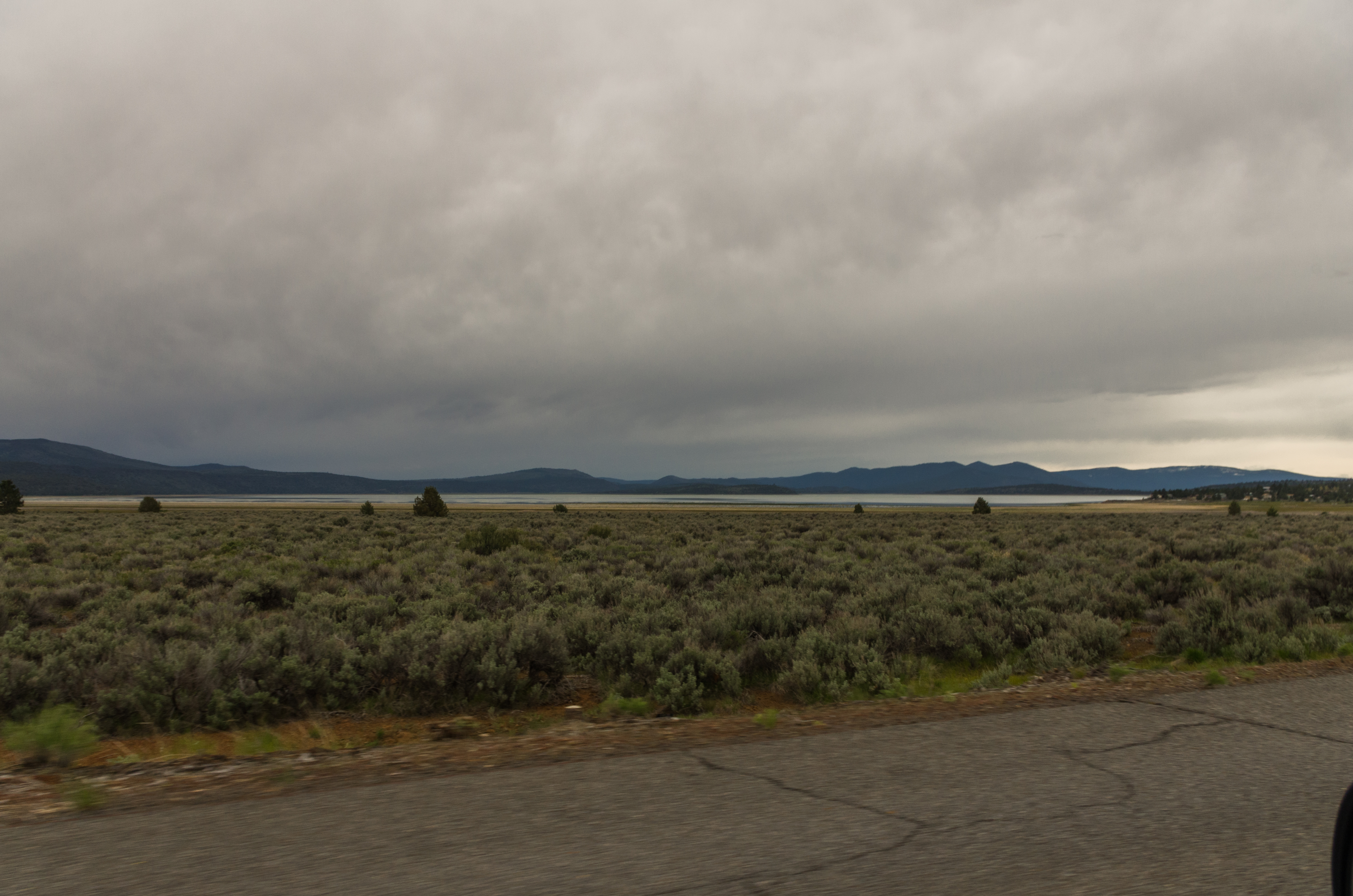
_IGP9715.PEF Eagle Lake from North Shore Lassen County California
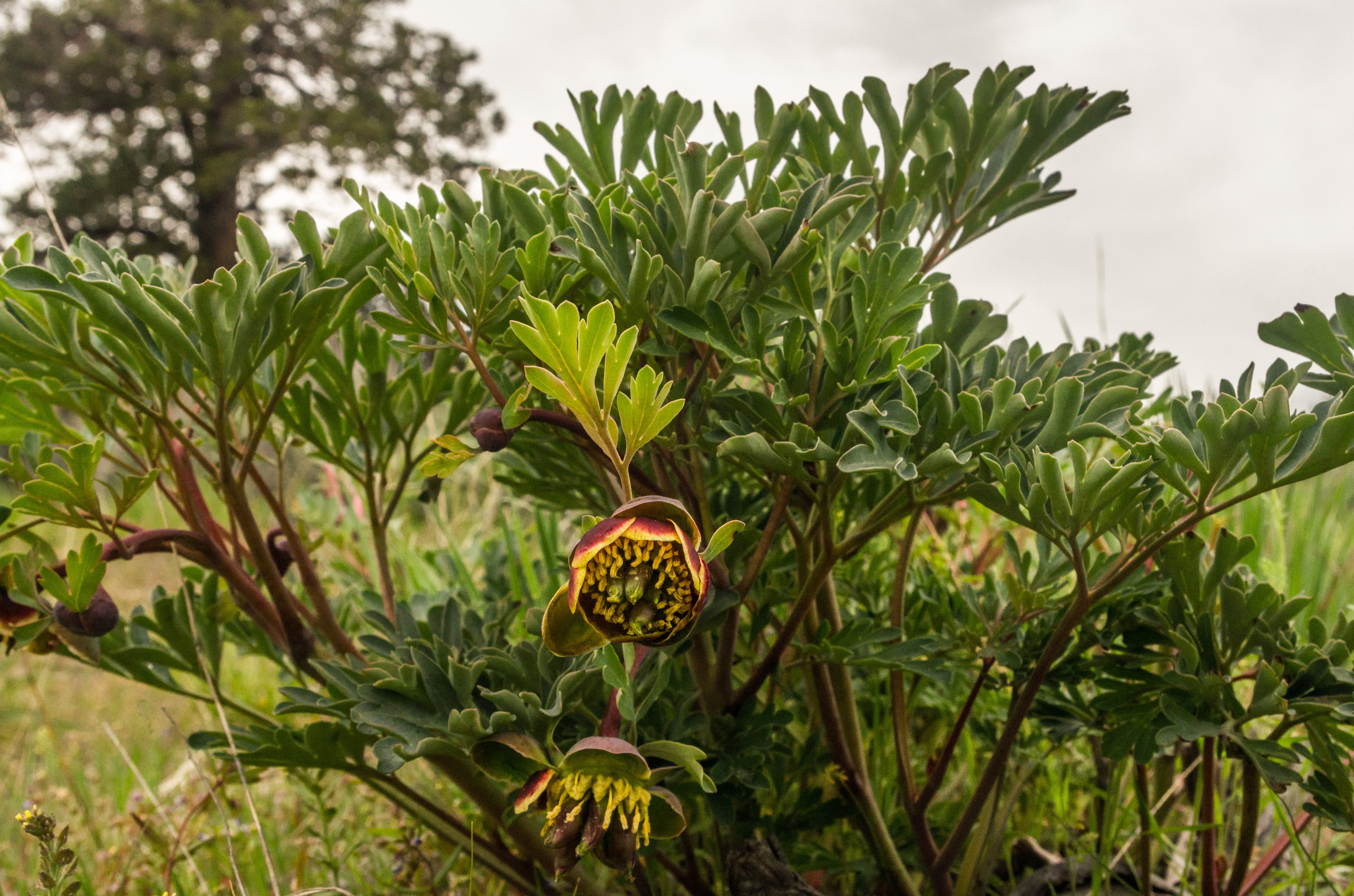
_IGP9707.PEF Multiple Lobed Leaf Wildflower, Like Poppy

805_1247.NEF

805_1248.NEF

805_1249.NEF
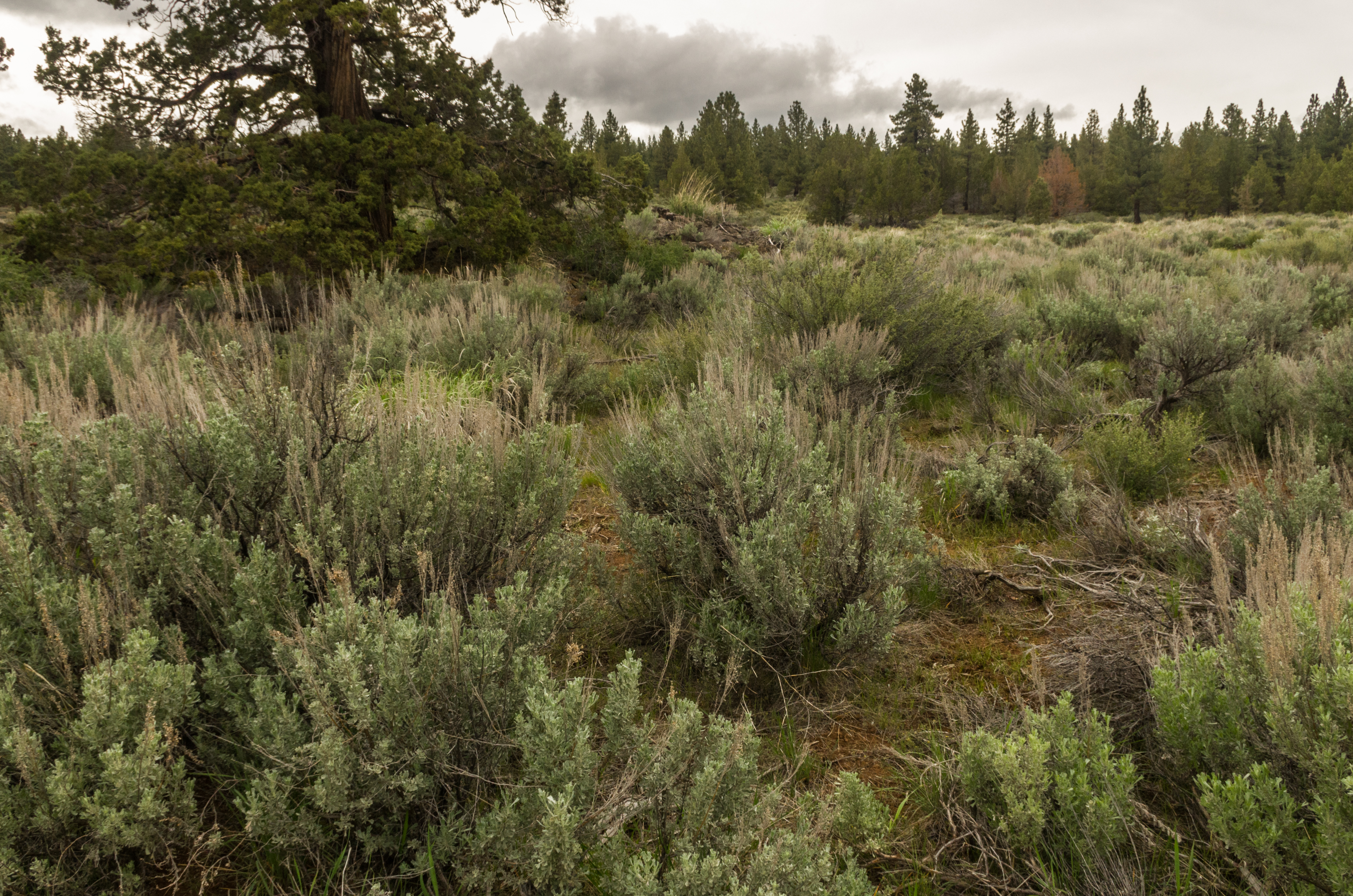
_IGP9711.PEF Sagebrush pine and juniper along Eagle Lake Lassen County California
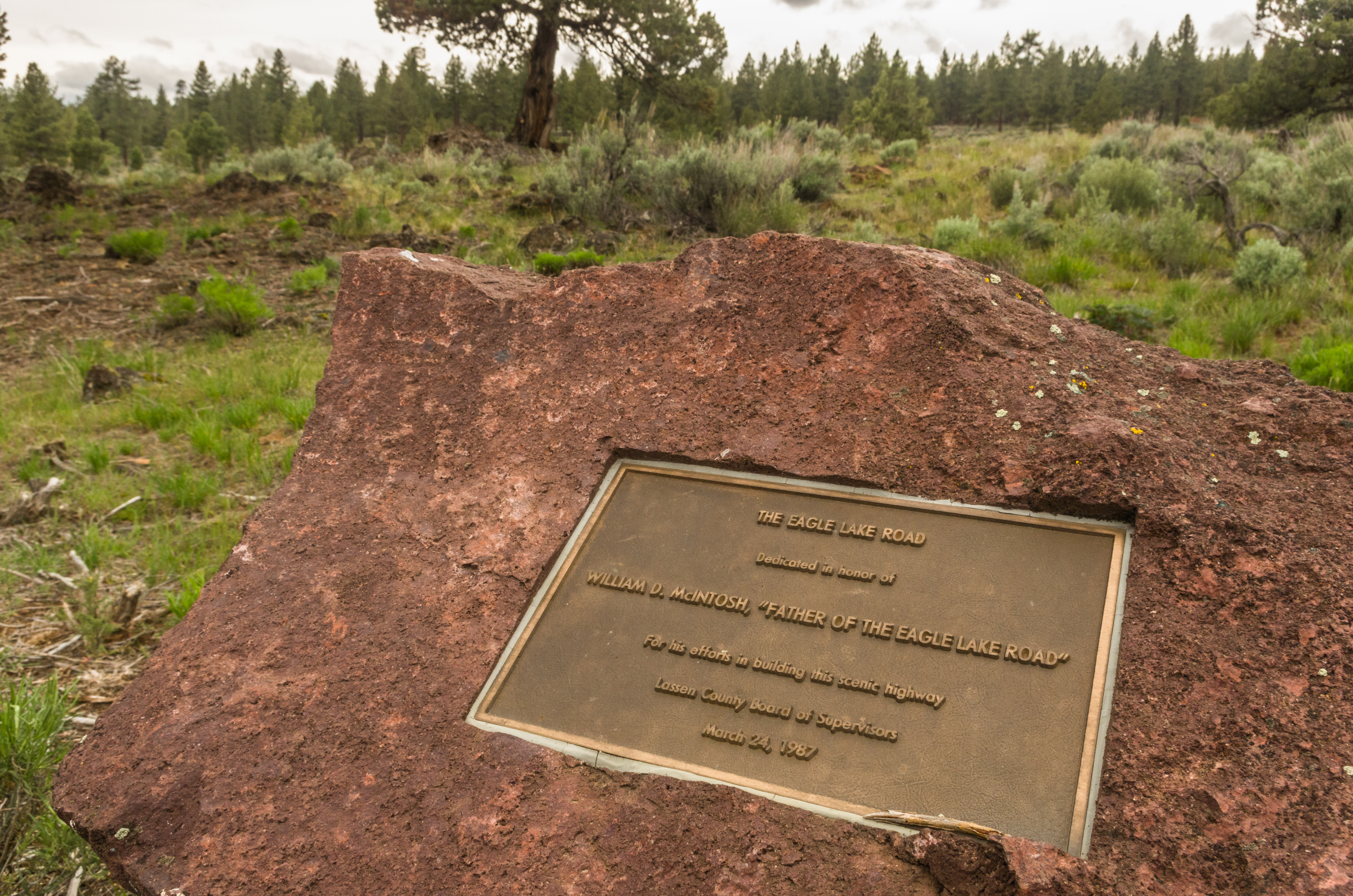
_IGP9696.PEF Lassen County Route A-1 Eagle Lake Road
_IGP9693.PEF Eagle Lake Hwy
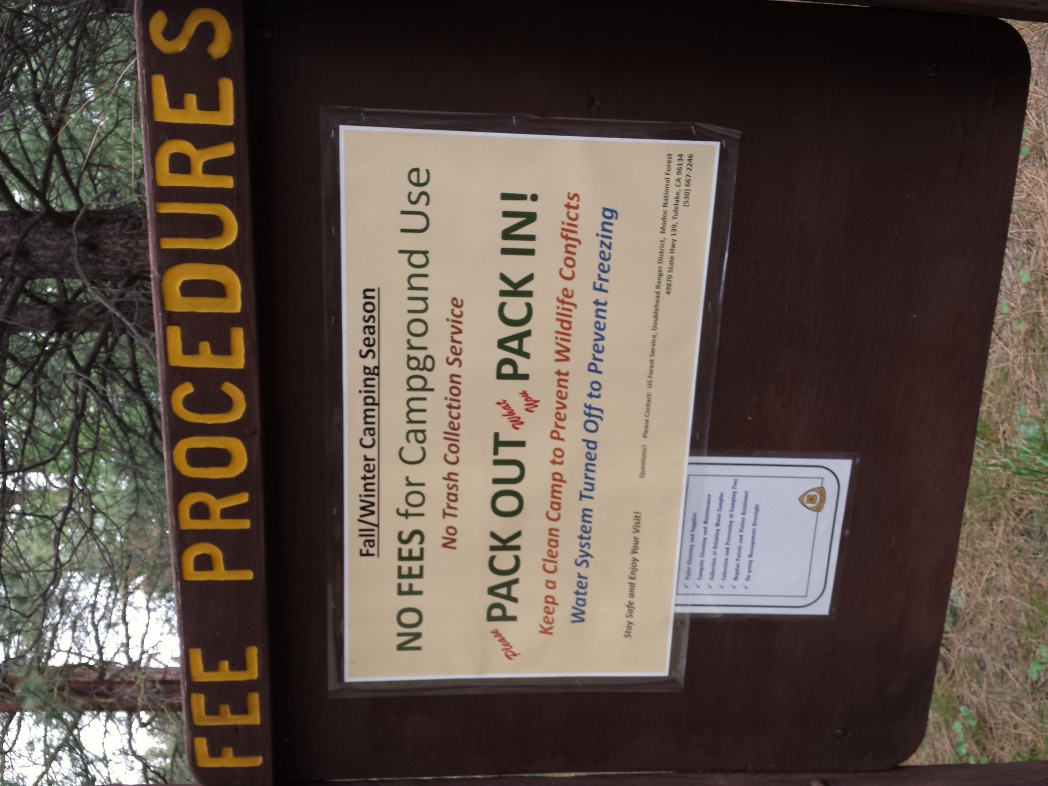
Way Northern California (State of Jefferson) has a nice fee schedule for camping in early May.
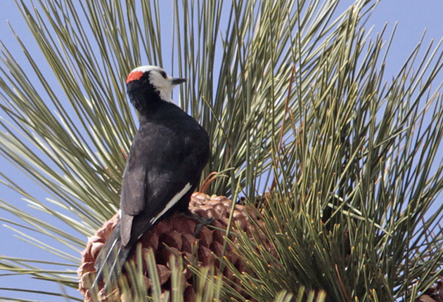
White-headed Woodpecker, male
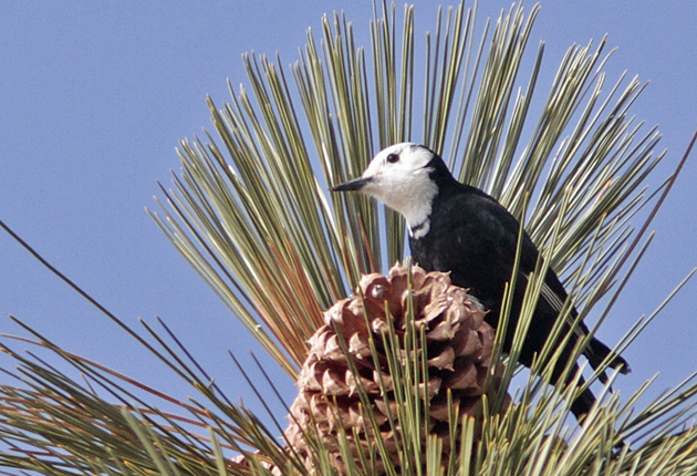
White-headed Woodpecker, male
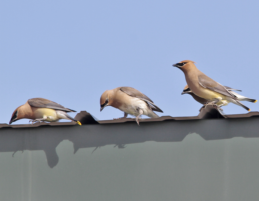
Cedar Waxwing drinking morning dew

Cowboys at work

Herd those cows

_2240022.NEF

DSC_0045.jpg
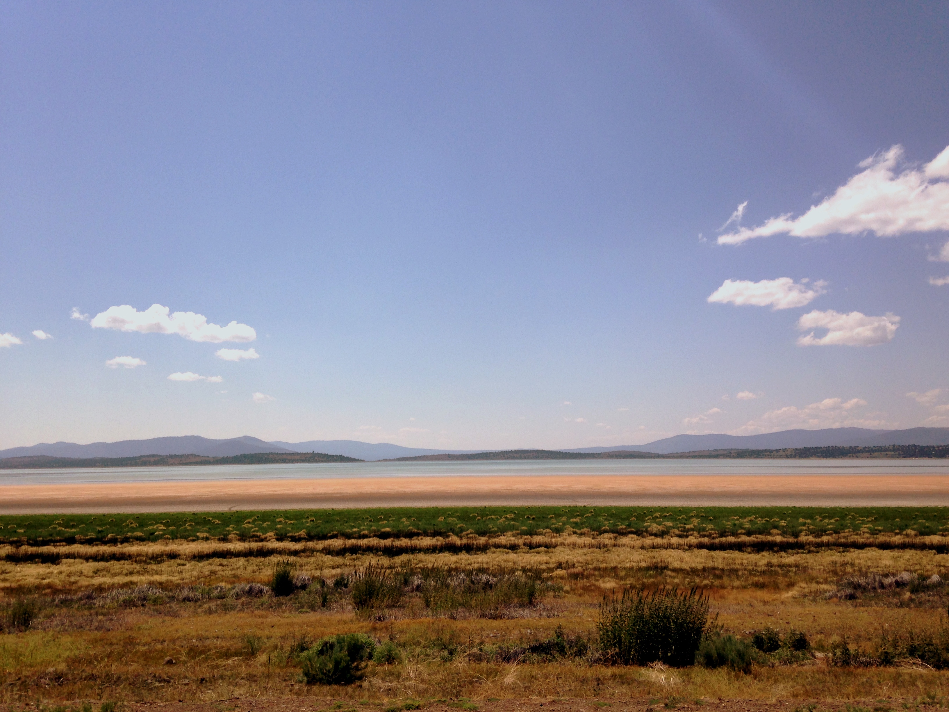
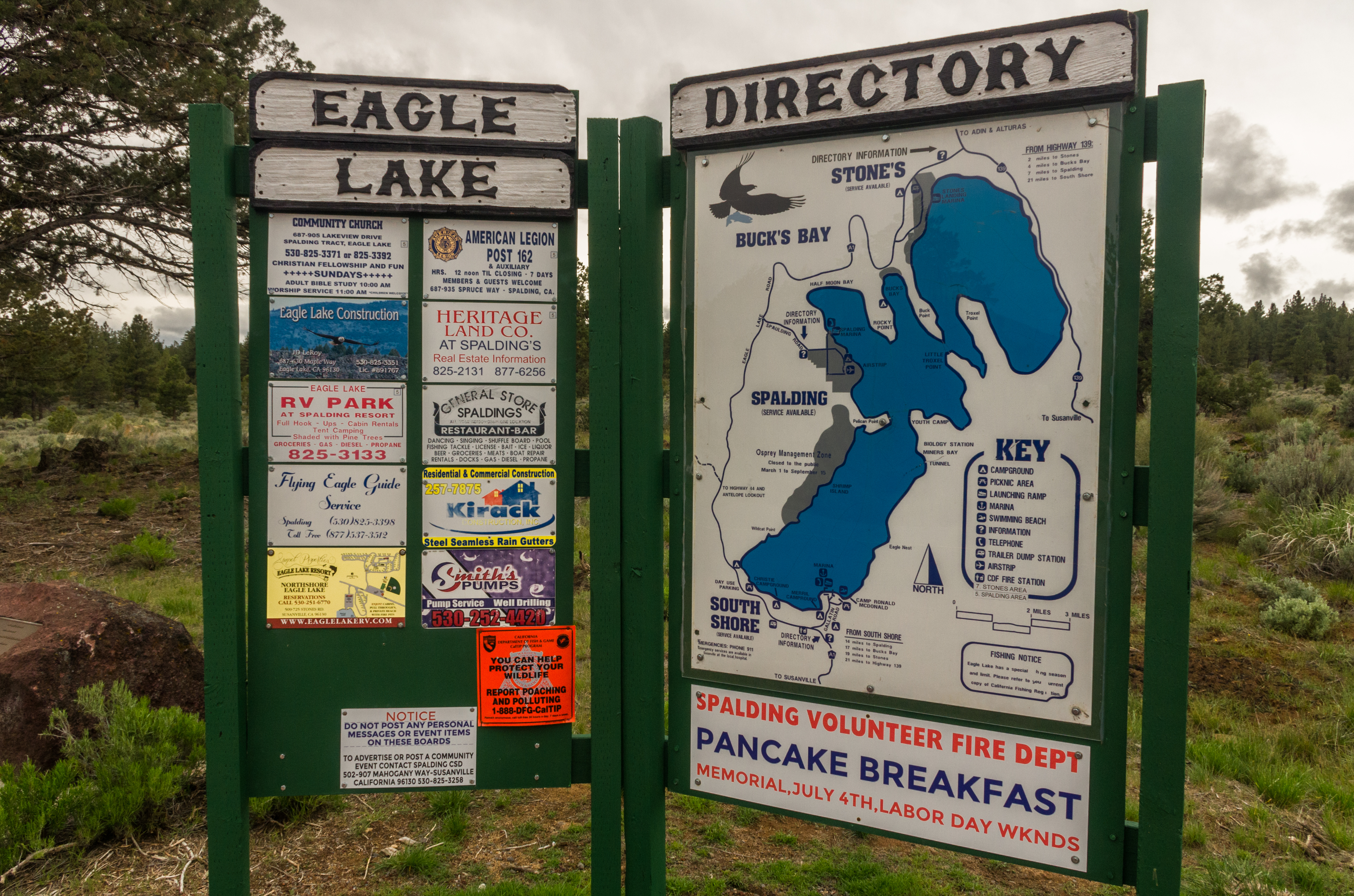
eagle lake, california
Eagle Lake June 2013

Eagle Lake June 2013

Eagle Lake June 2013
Eagle Lake June 2013
-80 Stones Rd, Susanville, CA, USA Map
Search another place
Near Places
- Lahonton Heights Dr, Susanville, CA, USA
- Juniper Ln, Susanville, CA, USA
Eagle Lake, California, USA
Fredonyer Peak, California, USA
Susanville, USA
Lassen County, CA, USA
Roop Mountain, California, USA
Peak Rd, Susanville, CA, USA
- Las Plumas Way, Susanville, CA, USA
Lassen Way, California, USA
- Lake Forest Dr, Susanville, CA, USA
Susanville, CA, USA
Main St, Susanville, CA, USA
- Johnstonville Rd, Susanville, CA, USA
- Oak Mountain Dr, Susanville, CA, USA
- Old Archery Rd, Susanville, CA, USA
- Center Rd, Susanville, CA, USA
- Indale Dr, Susanville, CA, USA
- Belfast Rd, Litchfield, CA, USA
Diamond Mountain, California, USA
Recent Searches
- Sunrise Sunset Times of Red Dog Mine, AK, USA
- Sunrise Sunset Times of Am Bahnhof, Am bhf, Borken, Germany
- Sunrise Sunset Times of 4th St E, Sonoma, CA, USA
- Sunrise Sunset Times of Oakland Ave, Williamsport, PA, USA
- Sunrise Sunset Times of Via Roma, Pieranica CR, Italy
- Sunrise Sunset Times of Clock Tower of Dubrovnik, Grad, Dubrovnik, Croatia
- Sunrise Sunset Times of Trelew, Chubut Province, Argentina
- Sunrise Sunset Times of Hartfords Bluff Cir, Mt Pleasant, SC, USA
- Sunrise Sunset Times of Kita Ward, Kumamoto, Japan
- Sunrise Sunset Times of Pingtan Island, Pingtan County, Fuzhou, China