W Mitchell Mine Rd, Pine Grove, CA 美國的日出日落時間表
Location: 美國 > 加利福尼亞州 > 阿馬多爾縣 > 美國 >
時區:
America/Los_Angeles
當地時間:
2024-04-27 07:56:48
經度:
-120.661783
緯度:
38.429976
今天日出時間:
06:09:06 AM
今天日落時間:
07:51:11 PM
今天日照時長:
13h 42m 5s
明天日出時間:
06:07:52 AM
明天日落時間:
07:52:08 PM
明天日照時長:
13h 44m 16s
顯示所有日期
| 日期 | 日出 | 日落 | 日照時長 |
|---|---|---|---|
| 2024年01月01日 | 07:19:54 AM | 04:53:08 PM | 9h 33m 14s |
| 2024年01月02日 | 07:20:00 AM | 04:53:58 PM | 9h 33m 58s |
| 2024年01月03日 | 07:20:04 AM | 04:54:49 PM | 9h 34m 45s |
| 2024年01月04日 | 07:20:06 AM | 04:55:41 PM | 9h 35m 35s |
| 2024年01月05日 | 07:20:06 AM | 04:56:35 PM | 9h 36m 29s |
| 2024年01月06日 | 07:20:03 AM | 04:57:29 PM | 9h 37m 26s |
| 2024年01月07日 | 07:19:59 AM | 04:58:25 PM | 9h 38m 26s |
| 2024年01月08日 | 07:19:52 AM | 04:59:22 PM | 9h 39m 30s |
| 2024年01月09日 | 07:19:43 AM | 05:00:20 PM | 9h 40m 37s |
| 2024年01月10日 | 07:19:32 AM | 05:01:19 PM | 9h 41m 47s |
| 2024年01月11日 | 07:19:19 AM | 05:02:19 PM | 9h 43m 0s |
| 2024年01月12日 | 07:19:04 AM | 05:03:20 PM | 9h 44m 16s |
| 2024年01月13日 | 07:18:47 AM | 05:04:22 PM | 9h 45m 35s |
| 2024年01月14日 | 07:18:27 AM | 05:05:24 PM | 9h 46m 57s |
| 2024年01月15日 | 07:18:06 AM | 05:06:27 PM | 9h 48m 21s |
| 2024年01月16日 | 07:17:43 AM | 05:07:31 PM | 9h 49m 48s |
| 2024年01月17日 | 07:17:17 AM | 05:08:35 PM | 9h 51m 18s |
| 2024年01月18日 | 07:16:50 AM | 05:09:40 PM | 9h 52m 50s |
| 2024年01月19日 | 07:16:20 AM | 05:10:46 PM | 9h 54m 26s |
| 2024年01月20日 | 07:15:49 AM | 05:11:52 PM | 9h 56m 3s |
| 2024年01月21日 | 07:15:16 AM | 05:12:58 PM | 9h 57m 42s |
| 2024年01月22日 | 07:14:40 AM | 05:14:05 PM | 9h 59m 25s |
| 2024年01月23日 | 07:14:03 AM | 05:15:12 PM | 10h 1m 9s |
| 2024年01月24日 | 07:13:24 AM | 05:16:20 PM | 10h 2m 56s |
| 2024年01月25日 | 07:12:43 AM | 05:17:28 PM | 10h 4m 45s |
| 2024年01月26日 | 07:12:01 AM | 05:18:36 PM | 10h 6m 35s |
| 2024年01月27日 | 07:11:16 AM | 05:19:44 PM | 10h 8m 28s |
| 2024年01月28日 | 07:10:30 AM | 05:20:52 PM | 10h 10m 22s |
| 2024年01月29日 | 07:09:42 AM | 05:22:00 PM | 10h 12m 18s |
| 2024年01月30日 | 07:08:52 AM | 05:23:09 PM | 10h 14m 17s |
| 2024年01月31日 | 07:08:01 AM | 05:24:17 PM | 10h 16m 16s |
| 2024年02月01日 | 07:07:08 AM | 05:25:26 PM | 10h 18m 18s |
| 2024年02月02日 | 07:06:13 AM | 05:26:34 PM | 10h 20m 21s |
| 2024年02月03日 | 07:05:17 AM | 05:27:43 PM | 10h 22m 26s |
| 2024年02月04日 | 07:04:19 AM | 05:28:51 PM | 10h 24m 32s |
| 2024年02月05日 | 07:03:20 AM | 05:30:00 PM | 10h 26m 40s |
| 2024年02月06日 | 07:02:19 AM | 05:31:08 PM | 10h 28m 49s |
| 2024年02月07日 | 07:01:17 AM | 05:32:16 PM | 10h 30m 59s |
| 2024年02月08日 | 07:00:13 AM | 05:33:24 PM | 10h 33m 11s |
| 2024年02月09日 | 06:59:08 AM | 05:34:31 PM | 10h 35m 23s |
| 2024年02月10日 | 06:58:02 AM | 05:35:39 PM | 10h 37m 37s |
| 2024年02月11日 | 06:56:54 AM | 05:36:46 PM | 10h 39m 52s |
| 2024年02月12日 | 06:55:45 AM | 05:37:53 PM | 10h 42m 8s |
| 2024年02月13日 | 06:54:35 AM | 05:39:00 PM | 10h 44m 25s |
| 2024年02月14日 | 06:53:24 AM | 05:40:06 PM | 10h 46m 42s |
| 2024年02月15日 | 06:52:11 AM | 05:41:12 PM | 10h 49m 1s |
| 2024年02月16日 | 06:50:57 AM | 05:42:18 PM | 10h 51m 21s |
| 2024年02月17日 | 06:49:42 AM | 05:43:24 PM | 10h 53m 42s |
| 2024年02月18日 | 06:48:26 AM | 05:44:30 PM | 10h 56m 4s |
| 2024年02月19日 | 06:47:10 AM | 05:45:35 PM | 10h 58m 25s |
| 2024年02月20日 | 06:45:52 AM | 05:46:39 PM | 11h 0m 47s |
| 2024年02月21日 | 06:44:33 AM | 05:47:44 PM | 11h 3m 11s |
| 2024年02月22日 | 06:43:13 AM | 05:48:48 PM | 11h 5m 35s |
| 2024年02月23日 | 06:41:52 AM | 05:49:52 PM | 11h 8m 0s |
| 2024年02月24日 | 06:40:30 AM | 05:50:55 PM | 11h 10m 25s |
| 2024年02月25日 | 06:39:08 AM | 05:51:59 PM | 11h 12m 51s |
| 2024年02月26日 | 06:37:44 AM | 05:53:01 PM | 11h 15m 17s |
| 2024年02月27日 | 06:36:20 AM | 05:54:04 PM | 11h 17m 44s |
| 2024年02月28日 | 06:34:55 AM | 05:55:06 PM | 11h 20m 11s |
| 2024年02月29日 | 06:33:30 AM | 05:56:08 PM | 11h 22m 38s |
| 2024年03月01日 | 06:32:04 AM | 05:57:10 PM | 11h 25m 6s |
| 2024年03月02日 | 06:30:37 AM | 05:58:11 PM | 11h 27m 34s |
| 2024年03月03日 | 06:29:09 AM | 05:59:12 PM | 11h 30m 3s |
| 2024年03月04日 | 06:27:41 AM | 06:00:13 PM | 11h 32m 32s |
| 2024年03月05日 | 06:26:13 AM | 06:01:14 PM | 11h 35m 1s |
| 2024年03月06日 | 06:24:44 AM | 06:02:14 PM | 11h 37m 30s |
| 2024年03月07日 | 06:23:14 AM | 06:03:14 PM | 11h 40m 0s |
| 2024年03月08日 | 06:21:44 AM | 06:04:14 PM | 11h 42m 30s |
| 2024年03月09日 | 06:20:13 AM | 06:05:13 PM | 11h 45m 0s |
| 2024年03月10日 | 07:18:46 AM | 07:06:10 PM | 11h 47m 24s |
| 2024年03月11日 | 07:17:15 AM | 07:07:09 PM | 11h 49m 54s |
| 2024年03月12日 | 07:15:44 AM | 07:08:08 PM | 11h 52m 24s |
| 2024年03月13日 | 07:14:12 AM | 07:09:06 PM | 11h 54m 54s |
| 2024年03月14日 | 07:12:40 AM | 07:10:05 PM | 11h 57m 25s |
| 2024年03月15日 | 07:11:07 AM | 07:11:03 PM | 11h 59m 56s |
| 2024年03月16日 | 07:09:35 AM | 07:12:01 PM | 12h 2m 26s |
| 2024年03月17日 | 07:08:02 AM | 07:12:58 PM | 12h 4m 56s |
| 2024年03月18日 | 07:06:29 AM | 07:13:56 PM | 12h 7m 27s |
| 2024年03月19日 | 07:04:56 AM | 07:14:54 PM | 12h 9m 58s |
| 2024年03月20日 | 07:03:23 AM | 07:15:51 PM | 12h 12m 28s |
| 2024年03月21日 | 07:01:50 AM | 07:16:48 PM | 12h 14m 58s |
| 2024年03月22日 | 07:00:17 AM | 07:17:45 PM | 12h 17m 28s |
| 2024年03月23日 | 06:58:44 AM | 07:18:42 PM | 12h 19m 58s |
| 2024年03月24日 | 06:57:10 AM | 07:19:39 PM | 12h 22m 29s |
| 2024年03月25日 | 06:55:37 AM | 07:20:36 PM | 12h 24m 59s |
| 2024年03月26日 | 06:54:04 AM | 07:21:33 PM | 12h 27m 29s |
| 2024年03月27日 | 06:52:32 AM | 07:22:30 PM | 12h 29m 58s |
| 2024年03月28日 | 06:50:59 AM | 07:23:26 PM | 12h 32m 27s |
| 2024年03月29日 | 06:49:26 AM | 07:24:23 PM | 12h 34m 57s |
| 2024年03月30日 | 06:47:54 AM | 07:25:19 PM | 12h 37m 25s |
| 2024年03月31日 | 06:46:22 AM | 07:26:16 PM | 12h 39m 54s |
| 2024年04月01日 | 06:44:50 AM | 07:27:12 PM | 12h 42m 22s |
| 2024年04月02日 | 06:43:19 AM | 07:28:09 PM | 12h 44m 50s |
| 2024年04月03日 | 06:41:48 AM | 07:29:05 PM | 12h 47m 17s |
| 2024年04月04日 | 06:40:17 AM | 07:30:02 PM | 12h 49m 45s |
| 2024年04月05日 | 06:38:47 AM | 07:30:58 PM | 12h 52m 11s |
| 2024年04月06日 | 06:37:17 AM | 07:31:55 PM | 12h 54m 38s |
| 2024年04月07日 | 06:35:47 AM | 07:32:51 PM | 12h 57m 4s |
| 2024年04月08日 | 06:34:18 AM | 07:33:48 PM | 12h 59m 30s |
| 2024年04月09日 | 06:32:50 AM | 07:34:44 PM | 13h 1m 54s |
| 2024年04月10日 | 06:31:22 AM | 07:35:41 PM | 13h 4m 19s |
| 2024年04月11日 | 06:29:54 AM | 07:36:37 PM | 13h 6m 43s |
| 2024年04月12日 | 06:28:28 AM | 07:37:34 PM | 13h 9m 6s |
| 2024年04月13日 | 06:27:02 AM | 07:38:31 PM | 13h 11m 29s |
| 2024年04月14日 | 06:25:36 AM | 07:39:27 PM | 13h 13m 51s |
| 2024年04月15日 | 06:24:11 AM | 07:40:24 PM | 13h 16m 13s |
| 2024年04月16日 | 06:22:47 AM | 07:41:21 PM | 13h 18m 34s |
| 2024年04月17日 | 06:21:24 AM | 07:42:18 PM | 13h 20m 54s |
| 2024年04月18日 | 06:20:01 AM | 07:43:14 PM | 13h 23m 13s |
| 2024年04月19日 | 06:18:40 AM | 07:44:11 PM | 13h 25m 31s |
| 2024年04月20日 | 06:17:19 AM | 07:45:08 PM | 13h 27m 49s |
| 2024年04月21日 | 06:15:59 AM | 07:46:05 PM | 13h 30m 6s |
| 2024年04月22日 | 06:14:40 AM | 07:47:02 PM | 13h 32m 22s |
| 2024年04月23日 | 06:13:22 AM | 07:47:59 PM | 13h 34m 37s |
| 2024年04月24日 | 06:12:05 AM | 07:48:56 PM | 13h 36m 51s |
| 2024年04月25日 | 06:10:49 AM | 07:49:53 PM | 13h 39m 4s |
| 2024年04月26日 | 06:09:33 AM | 07:50:50 PM | 13h 41m 17s |
| 2024年04月27日 | 06:08:19 AM | 07:51:46 PM | 13h 43m 27s |
| 2024年04月28日 | 06:07:06 AM | 07:52:43 PM | 13h 45m 37s |
| 2024年04月29日 | 06:05:55 AM | 07:53:40 PM | 13h 47m 45s |
| 2024年04月30日 | 06:04:44 AM | 07:54:37 PM | 13h 49m 53s |
| 2024年05月01日 | 06:03:34 AM | 07:55:33 PM | 13h 51m 59s |
| 2024年05月02日 | 06:02:26 AM | 07:56:30 PM | 13h 54m 4s |
| 2024年05月03日 | 06:01:19 AM | 07:57:26 PM | 13h 56m 7s |
| 2024年05月04日 | 06:00:13 AM | 07:58:22 PM | 13h 58m 9s |
| 2024年05月05日 | 05:59:09 AM | 07:59:18 PM | 14h 0m 9s |
| 2024年05月06日 | 05:58:06 AM | 08:00:14 PM | 14h 2m 8s |
| 2024年05月07日 | 05:57:04 AM | 08:01:09 PM | 14h 4m 5s |
| 2024年05月08日 | 05:56:03 AM | 08:02:05 PM | 14h 6m 2s |
| 2024年05月09日 | 05:55:04 AM | 08:03:00 PM | 14h 7m 56s |
| 2024年05月10日 | 05:54:07 AM | 08:03:54 PM | 14h 9m 47s |
| 2024年05月11日 | 05:53:11 AM | 08:04:49 PM | 14h 11m 38s |
| 2024年05月12日 | 05:52:16 AM | 08:05:43 PM | 14h 13m 27s |
| 2024年05月13日 | 05:51:23 AM | 08:06:37 PM | 14h 15m 14s |
| 2024年05月14日 | 05:50:31 AM | 08:07:30 PM | 14h 16m 59s |
| 2024年05月15日 | 05:49:41 AM | 08:08:23 PM | 14h 18m 42s |
| 2024年05月16日 | 05:48:53 AM | 08:09:15 PM | 14h 20m 22s |
| 2024年05月17日 | 05:48:06 AM | 08:10:07 PM | 14h 22m 1s |
| 2024年05月18日 | 05:47:21 AM | 08:10:59 PM | 14h 23m 38s |
| 2024年05月19日 | 05:46:38 AM | 08:11:49 PM | 14h 25m 11s |
| 2024年05月20日 | 05:45:56 AM | 08:12:40 PM | 14h 26m 44s |
| 2024年05月21日 | 05:45:16 AM | 08:13:29 PM | 14h 28m 13s |
| 2024年05月22日 | 05:44:37 AM | 08:14:18 PM | 14h 29m 41s |
| 2024年05月23日 | 05:44:00 AM | 08:15:06 PM | 14h 31m 6s |
| 2024年05月24日 | 05:43:25 AM | 08:15:54 PM | 14h 32m 29s |
| 2024年05月25日 | 05:42:52 AM | 08:16:40 PM | 14h 33m 48s |
| 2024年05月26日 | 05:42:21 AM | 08:17:26 PM | 14h 35m 5s |
| 2024年05月27日 | 05:41:51 AM | 08:18:11 PM | 14h 36m 20s |
| 2024年05月28日 | 05:41:23 AM | 08:18:55 PM | 14h 37m 32s |
| 2024年05月29日 | 05:40:57 AM | 08:19:38 PM | 14h 38m 41s |
| 2024年05月30日 | 05:40:33 AM | 08:20:20 PM | 14h 39m 47s |
| 2024年05月31日 | 05:40:11 AM | 08:21:01 PM | 14h 40m 50s |
| 2024年06月01日 | 05:39:50 AM | 08:21:41 PM | 14h 41m 51s |
| 2024年06月02日 | 05:39:31 AM | 08:22:20 PM | 14h 42m 49s |
| 2024年06月03日 | 05:39:15 AM | 08:22:57 PM | 14h 43m 42s |
| 2024年06月04日 | 05:39:00 AM | 08:23:34 PM | 14h 44m 34s |
| 2024年06月05日 | 05:38:46 AM | 08:24:09 PM | 14h 45m 23s |
| 2024年06月06日 | 05:38:35 AM | 08:24:43 PM | 14h 46m 8s |
| 2024年06月07日 | 05:38:26 AM | 08:25:16 PM | 14h 46m 50s |
| 2024年06月08日 | 05:38:18 AM | 08:25:47 PM | 14h 47m 29s |
| 2024年06月09日 | 05:38:12 AM | 08:26:17 PM | 14h 48m 5s |
| 2024年06月10日 | 05:38:08 AM | 08:26:45 PM | 14h 48m 37s |
| 2024年06月11日 | 05:38:06 AM | 08:27:12 PM | 14h 49m 6s |
| 2024年06月12日 | 05:38:06 AM | 08:27:38 PM | 14h 49m 32s |
| 2024年06月13日 | 05:38:07 AM | 08:28:02 PM | 14h 49m 55s |
| 2024年06月14日 | 05:38:10 AM | 08:28:25 PM | 14h 50m 15s |
| 2024年06月15日 | 05:38:15 AM | 08:28:45 PM | 14h 50m 30s |
| 2024年06月16日 | 05:38:22 AM | 08:29:05 PM | 14h 50m 43s |
| 2024年06月17日 | 05:38:31 AM | 08:29:22 PM | 14h 50m 51s |
| 2024年06月18日 | 05:38:41 AM | 08:29:38 PM | 14h 50m 57s |
| 2024年06月19日 | 05:38:53 AM | 08:29:53 PM | 14h 51m 0s |
| 2024年06月20日 | 05:39:06 AM | 08:30:05 PM | 14h 50m 59s |
| 2024年06月21日 | 05:39:21 AM | 08:30:16 PM | 14h 50m 55s |
| 2024年06月22日 | 05:39:38 AM | 08:30:25 PM | 14h 50m 47s |
| 2024年06月23日 | 05:39:56 AM | 08:30:33 PM | 14h 50m 37s |
| 2024年06月24日 | 05:40:16 AM | 08:30:38 PM | 14h 50m 22s |
| 2024年06月25日 | 05:40:38 AM | 08:30:42 PM | 14h 50m 4s |
| 2024年06月26日 | 05:41:01 AM | 08:30:44 PM | 14h 49m 43s |
| 2024年06月27日 | 05:41:25 AM | 08:30:44 PM | 14h 49m 19s |
| 2024年06月28日 | 05:41:51 AM | 08:30:42 PM | 14h 48m 51s |
| 2024年06月29日 | 05:42:18 AM | 08:30:38 PM | 14h 48m 20s |
| 2024年06月30日 | 05:42:46 AM | 08:30:33 PM | 14h 47m 47s |
| 2024年07月01日 | 05:43:16 AM | 08:30:25 PM | 14h 47m 9s |
| 2024年07月02日 | 05:43:48 AM | 08:30:16 PM | 14h 46m 28s |
| 2024年07月03日 | 05:44:20 AM | 08:30:05 PM | 14h 45m 45s |
| 2024年07月04日 | 05:44:54 AM | 08:29:52 PM | 14h 44m 58s |
| 2024年07月05日 | 05:45:28 AM | 08:29:37 PM | 14h 44m 9s |
| 2024年07月06日 | 05:46:04 AM | 08:29:20 PM | 14h 43m 16s |
| 2024年07月07日 | 05:46:41 AM | 08:29:01 PM | 14h 42m 20s |
| 2024年07月08日 | 05:47:19 AM | 08:28:41 PM | 14h 41m 22s |
| 2024年07月09日 | 05:47:58 AM | 08:28:18 PM | 14h 40m 20s |
| 2024年07月10日 | 05:48:39 AM | 08:27:54 PM | 14h 39m 15s |
| 2024年07月11日 | 05:49:20 AM | 08:27:28 PM | 14h 38m 8s |
| 2024年07月12日 | 05:50:01 AM | 08:26:59 PM | 14h 36m 58s |
| 2024年07月13日 | 05:50:44 AM | 08:26:30 PM | 14h 35m 46s |
| 2024年07月14日 | 05:51:28 AM | 08:25:58 PM | 14h 34m 30s |
| 2024年07月15日 | 05:52:12 AM | 08:25:24 PM | 14h 33m 12s |
| 2024年07月16日 | 05:52:57 AM | 08:24:49 PM | 14h 31m 52s |
| 2024年07月17日 | 05:53:43 AM | 08:24:12 PM | 14h 30m 29s |
| 2024年07月18日 | 05:54:29 AM | 08:23:33 PM | 14h 29m 4s |
| 2024年07月19日 | 05:55:17 AM | 08:22:52 PM | 14h 27m 35s |
| 2024年07月20日 | 05:56:04 AM | 08:22:10 PM | 14h 26m 6s |
| 2024年07月21日 | 05:56:52 AM | 08:21:26 PM | 14h 24m 34s |
| 2024年07月22日 | 05:57:41 AM | 08:20:40 PM | 14h 22m 59s |
| 2024年07月23日 | 05:58:30 AM | 08:19:53 PM | 14h 21m 23s |
| 2024年07月24日 | 05:59:20 AM | 08:19:04 PM | 14h 19m 44s |
| 2024年07月25日 | 06:00:10 AM | 08:18:13 PM | 14h 18m 3s |
| 2024年07月26日 | 06:01:01 AM | 08:17:21 PM | 14h 16m 20s |
| 2024年07月27日 | 06:01:52 AM | 08:16:27 PM | 14h 14m 35s |
| 2024年07月28日 | 06:02:43 AM | 08:15:32 PM | 14h 12m 49s |
| 2024年07月29日 | 06:03:34 AM | 08:14:35 PM | 14h 11m 1s |
| 2024年07月30日 | 06:04:26 AM | 08:13:37 PM | 14h 9m 11s |
| 2024年07月31日 | 06:05:18 AM | 08:12:37 PM | 14h 7m 19s |
| 2024年08月01日 | 06:06:10 AM | 08:11:36 PM | 14h 5m 26s |
| 2024年08月02日 | 06:07:03 AM | 08:10:33 PM | 14h 3m 30s |
| 2024年08月03日 | 06:07:55 AM | 08:09:29 PM | 14h 1m 34s |
| 2024年08月04日 | 06:08:48 AM | 08:08:24 PM | 13h 59m 36s |
| 2024年08月05日 | 06:09:41 AM | 08:07:17 PM | 13h 57m 36s |
| 2024年08月06日 | 06:10:34 AM | 08:06:09 PM | 13h 55m 35s |
| 2024年08月07日 | 06:11:27 AM | 08:05:00 PM | 13h 53m 33s |
| 2024年08月08日 | 06:12:20 AM | 08:03:49 PM | 13h 51m 29s |
| 2024年08月09日 | 06:13:13 AM | 08:02:37 PM | 13h 49m 24s |
| 2024年08月10日 | 06:14:06 AM | 08:01:25 PM | 13h 47m 19s |
| 2024年08月11日 | 06:15:00 AM | 08:00:11 PM | 13h 45m 11s |
| 2024年08月12日 | 06:15:53 AM | 07:58:55 PM | 13h 43m 2s |
| 2024年08月13日 | 06:16:46 AM | 07:57:39 PM | 13h 40m 53s |
| 2024年08月14日 | 06:17:40 AM | 07:56:22 PM | 13h 38m 42s |
| 2024年08月15日 | 06:18:33 AM | 07:55:04 PM | 13h 36m 31s |
| 2024年08月16日 | 06:19:26 AM | 07:53:44 PM | 13h 34m 18s |
| 2024年08月17日 | 06:20:19 AM | 07:52:24 PM | 13h 32m 5s |
| 2024年08月18日 | 06:21:12 AM | 07:51:03 PM | 13h 29m 51s |
| 2024年08月19日 | 06:22:05 AM | 07:49:41 PM | 13h 27m 36s |
| 2024年08月20日 | 06:22:58 AM | 07:48:18 PM | 13h 25m 20s |
| 2024年08月21日 | 06:23:51 AM | 07:46:54 PM | 13h 23m 3s |
| 2024年08月22日 | 06:24:44 AM | 07:45:29 PM | 13h 20m 45s |
| 2024年08月23日 | 06:25:37 AM | 07:44:04 PM | 13h 18m 27s |
| 2024年08月24日 | 06:26:30 AM | 07:42:38 PM | 13h 16m 8s |
| 2024年08月25日 | 06:27:23 AM | 07:41:11 PM | 13h 13m 48s |
| 2024年08月26日 | 06:28:15 AM | 07:39:43 PM | 13h 11m 28s |
| 2024年08月27日 | 06:29:08 AM | 07:38:15 PM | 13h 9m 7s |
| 2024年08月28日 | 06:30:00 AM | 07:36:46 PM | 13h 6m 46s |
| 2024年08月29日 | 06:30:53 AM | 07:35:17 PM | 13h 4m 24s |
| 2024年08月30日 | 06:31:45 AM | 07:33:47 PM | 13h 2m 2s |
| 2024年08月31日 | 06:32:37 AM | 07:32:16 PM | 12h 59m 39s |
| 2024年09月01日 | 06:33:30 AM | 07:30:45 PM | 12h 57m 15s |
| 2024年09月02日 | 06:34:22 AM | 07:29:13 PM | 12h 54m 51s |
| 2024年09月03日 | 06:35:14 AM | 07:27:41 PM | 12h 52m 27s |
| 2024年09月04日 | 06:36:06 AM | 07:26:09 PM | 12h 50m 3s |
| 2024年09月05日 | 06:36:58 AM | 07:24:36 PM | 12h 47m 38s |
| 2024年09月06日 | 06:37:50 AM | 07:23:03 PM | 12h 45m 13s |
| 2024年09月07日 | 06:38:42 AM | 07:21:29 PM | 12h 42m 47s |
| 2024年09月08日 | 06:39:35 AM | 07:19:55 PM | 12h 40m 20s |
| 2024年09月09日 | 06:40:27 AM | 07:18:21 PM | 12h 37m 54s |
| 2024年09月10日 | 06:41:19 AM | 07:16:47 PM | 12h 35m 28s |
| 2024年09月11日 | 06:42:11 AM | 07:15:12 PM | 12h 33m 1s |
| 2024年09月12日 | 06:43:03 AM | 07:13:37 PM | 12h 30m 34s |
| 2024年09月13日 | 06:43:55 AM | 07:12:02 PM | 12h 28m 7s |
| 2024年09月14日 | 06:44:48 AM | 07:10:27 PM | 12h 25m 39s |
| 2024年09月15日 | 06:45:40 AM | 07:08:52 PM | 12h 23m 12s |
| 2024年09月16日 | 06:46:32 AM | 07:07:17 PM | 12h 20m 45s |
| 2024年09月17日 | 06:47:25 AM | 07:05:41 PM | 12h 18m 16s |
| 2024年09月18日 | 06:48:17 AM | 07:04:06 PM | 12h 15m 49s |
| 2024年09月19日 | 06:49:10 AM | 07:02:31 PM | 12h 13m 21s |
| 2024年09月20日 | 06:50:03 AM | 07:00:55 PM | 12h 10m 52s |
| 2024年09月21日 | 06:50:56 AM | 06:59:20 PM | 12h 8m 24s |
| 2024年09月22日 | 06:51:49 AM | 06:57:45 PM | 12h 5m 56s |
| 2024年09月23日 | 06:52:42 AM | 06:56:10 PM | 12h 3m 28s |
| 2024年09月24日 | 06:53:35 AM | 06:54:35 PM | 12h 1m 0s |
| 2024年09月25日 | 06:54:29 AM | 06:53:01 PM | 11h 58m 32s |
| 2024年09月26日 | 06:55:23 AM | 06:51:26 PM | 11h 56m 3s |
| 2024年09月27日 | 06:56:17 AM | 06:49:52 PM | 11h 53m 35s |
| 2024年09月28日 | 06:57:11 AM | 06:48:18 PM | 11h 51m 7s |
| 2024年09月29日 | 06:58:05 AM | 06:46:44 PM | 11h 48m 39s |
| 2024年09月30日 | 06:59:00 AM | 06:45:11 PM | 11h 46m 11s |
| 2024年10月01日 | 06:59:55 AM | 06:43:38 PM | 11h 43m 43s |
| 2024年10月02日 | 07:00:50 AM | 06:42:06 PM | 11h 41m 16s |
| 2024年10月03日 | 07:01:45 AM | 06:40:34 PM | 11h 38m 49s |
| 2024年10月04日 | 07:02:41 AM | 06:39:02 PM | 11h 36m 21s |
| 2024年10月05日 | 07:03:37 AM | 06:37:31 PM | 11h 33m 54s |
| 2024年10月06日 | 07:04:33 AM | 06:36:01 PM | 11h 31m 28s |
| 2024年10月07日 | 07:05:30 AM | 06:34:31 PM | 11h 29m 1s |
| 2024年10月08日 | 07:06:27 AM | 06:33:01 PM | 11h 26m 34s |
| 2024年10月09日 | 07:07:24 AM | 06:31:32 PM | 11h 24m 8s |
| 2024年10月10日 | 07:08:21 AM | 06:30:04 PM | 11h 21m 43s |
| 2024年10月11日 | 07:09:19 AM | 06:28:37 PM | 11h 19m 18s |
| 2024年10月12日 | 07:10:17 AM | 06:27:10 PM | 11h 16m 53s |
| 2024年10月13日 | 07:11:16 AM | 06:25:44 PM | 11h 14m 28s |
| 2024年10月14日 | 07:12:14 AM | 06:24:19 PM | 11h 12m 5s |
| 2024年10月15日 | 07:13:13 AM | 06:22:54 PM | 11h 9m 41s |
| 2024年10月16日 | 07:14:13 AM | 06:21:31 PM | 11h 7m 18s |
| 2024年10月17日 | 07:15:13 AM | 06:20:08 PM | 11h 4m 55s |
| 2024年10月18日 | 07:16:13 AM | 06:18:46 PM | 11h 2m 33s |
| 2024年10月19日 | 07:17:13 AM | 06:17:26 PM | 11h 0m 13s |
| 2024年10月20日 | 07:18:14 AM | 06:16:06 PM | 10h 57m 52s |
| 2024年10月21日 | 07:19:15 AM | 06:14:47 PM | 10h 55m 32s |
| 2024年10月22日 | 07:20:17 AM | 06:13:29 PM | 10h 53m 12s |
| 2024年10月23日 | 07:21:18 AM | 06:12:12 PM | 10h 50m 54s |
| 2024年10月24日 | 07:22:21 AM | 06:10:57 PM | 10h 48m 36s |
| 2024年10月25日 | 07:23:23 AM | 06:09:42 PM | 10h 46m 19s |
| 2024年10月26日 | 07:24:26 AM | 06:08:29 PM | 10h 44m 3s |
| 2024年10月27日 | 07:25:29 AM | 06:07:17 PM | 10h 41m 48s |
| 2024年10月28日 | 07:26:32 AM | 06:06:06 PM | 10h 39m 34s |
| 2024年10月29日 | 07:27:36 AM | 06:04:56 PM | 10h 37m 20s |
| 2024年10月30日 | 07:28:40 AM | 06:03:48 PM | 10h 35m 8s |
| 2024年10月31日 | 07:29:44 AM | 06:02:41 PM | 10h 32m 57s |
| 2024年11月01日 | 07:30:48 AM | 06:01:36 PM | 10h 30m 48s |
| 2024年11月02日 | 07:31:53 AM | 06:00:32 PM | 10h 28m 39s |
| 2024年11月03日 | 06:33:00 AM | 04:59:26 PM | 10h 26m 26s |
| 2024年11月04日 | 06:34:05 AM | 04:58:25 PM | 10h 24m 20s |
| 2024年11月05日 | 06:35:10 AM | 04:57:26 PM | 10h 22m 16s |
| 2024年11月06日 | 06:36:15 AM | 04:56:28 PM | 10h 20m 13s |
| 2024年11月07日 | 06:37:20 AM | 04:55:31 PM | 10h 18m 11s |
| 2024年11月08日 | 06:38:26 AM | 04:54:36 PM | 10h 16m 10s |
| 2024年11月09日 | 06:39:31 AM | 04:53:43 PM | 10h 14m 12s |
| 2024年11月10日 | 06:40:37 AM | 04:52:52 PM | 10h 12m 15s |
| 2024年11月11日 | 06:41:42 AM | 04:52:02 PM | 10h 10m 20s |
| 2024年11月12日 | 06:42:47 AM | 04:51:14 PM | 10h 8m 27s |
| 2024年11月13日 | 06:43:53 AM | 04:50:28 PM | 10h 6m 35s |
| 2024年11月14日 | 06:44:58 AM | 04:49:43 PM | 10h 4m 45s |
| 2024年11月15日 | 06:46:03 AM | 04:49:00 PM | 10h 2m 57s |
| 2024年11月16日 | 06:47:08 AM | 04:48:20 PM | 10h 1m 12s |
| 2024年11月17日 | 06:48:12 AM | 04:47:41 PM | 9h 59m 29s |
| 2024年11月18日 | 06:49:17 AM | 04:47:04 PM | 9h 57m 47s |
| 2024年11月19日 | 06:50:21 AM | 04:46:29 PM | 9h 56m 8s |
| 2024年11月20日 | 06:51:25 AM | 04:45:56 PM | 9h 54m 31s |
| 2024年11月21日 | 06:52:28 AM | 04:45:25 PM | 9h 52m 57s |
| 2024年11月22日 | 06:53:31 AM | 04:44:55 PM | 9h 51m 24s |
| 2024年11月23日 | 06:54:33 AM | 04:44:28 PM | 9h 49m 55s |
| 2024年11月24日 | 06:55:35 AM | 04:44:03 PM | 9h 48m 28s |
| 2024年11月25日 | 06:56:36 AM | 04:43:40 PM | 9h 47m 4s |
| 2024年11月26日 | 06:57:37 AM | 04:43:20 PM | 9h 45m 43s |
| 2024年11月27日 | 06:58:37 AM | 04:43:01 PM | 9h 44m 24s |
| 2024年11月28日 | 06:59:36 AM | 04:42:44 PM | 9h 43m 8s |
| 2024年11月29日 | 07:00:34 AM | 04:42:30 PM | 9h 41m 56s |
| 2024年11月30日 | 07:01:32 AM | 04:42:17 PM | 9h 40m 45s |
| 2024年12月01日 | 07:02:28 AM | 04:42:07 PM | 9h 39m 39s |
| 2024年12月02日 | 07:03:24 AM | 04:41:59 PM | 9h 38m 35s |
| 2024年12月03日 | 07:04:19 AM | 04:41:53 PM | 9h 37m 34s |
| 2024年12月04日 | 07:05:12 AM | 04:41:49 PM | 9h 36m 37s |
| 2024年12月05日 | 07:06:05 AM | 04:41:48 PM | 9h 35m 43s |
| 2024年12月06日 | 07:06:56 AM | 04:41:48 PM | 9h 34m 52s |
| 2024年12月07日 | 07:07:47 AM | 04:41:51 PM | 9h 34m 4s |
| 2024年12月08日 | 07:08:36 AM | 04:41:56 PM | 9h 33m 20s |
| 2024年12月09日 | 07:09:23 AM | 04:42:03 PM | 9h 32m 40s |
| 2024年12月10日 | 07:10:10 AM | 04:42:12 PM | 9h 32m 2s |
| 2024年12月11日 | 07:10:54 AM | 04:42:23 PM | 9h 31m 29s |
| 2024年12月12日 | 07:11:38 AM | 04:42:36 PM | 9h 30m 58s |
| 2024年12月13日 | 07:12:20 AM | 04:42:52 PM | 9h 30m 32s |
| 2024年12月14日 | 07:13:00 AM | 04:43:09 PM | 9h 30m 9s |
| 2024年12月15日 | 07:13:39 AM | 04:43:29 PM | 9h 29m 50s |
| 2024年12月16日 | 07:14:16 AM | 04:43:50 PM | 9h 29m 34s |
| 2024年12月17日 | 07:14:52 AM | 04:44:14 PM | 9h 29m 22s |
| 2024年12月18日 | 07:15:25 AM | 04:44:40 PM | 9h 29m 15s |
| 2024年12月19日 | 07:15:57 AM | 04:45:07 PM | 9h 29m 10s |
| 2024年12月20日 | 07:16:28 AM | 04:45:37 PM | 9h 29m 9s |
| 2024年12月21日 | 07:16:56 AM | 04:46:08 PM | 9h 29m 12s |
| 2024年12月22日 | 07:17:22 AM | 04:46:41 PM | 9h 29m 19s |
| 2024年12月23日 | 07:17:47 AM | 04:47:16 PM | 9h 29m 29s |
| 2024年12月24日 | 07:18:10 AM | 04:47:53 PM | 9h 29m 43s |
| 2024年12月25日 | 07:18:30 AM | 04:48:31 PM | 9h 30m 1s |
| 2024年12月26日 | 07:18:49 AM | 04:49:11 PM | 9h 30m 22s |
| 2024年12月27日 | 07:19:06 AM | 04:49:53 PM | 9h 30m 47s |
| 2024年12月28日 | 07:19:21 AM | 04:50:37 PM | 9h 31m 16s |
| 2024年12月29日 | 07:19:33 AM | 04:51:22 PM | 9h 31m 49s |
| 2024年12月30日 | 07:19:44 AM | 04:52:08 PM | 9h 32m 24s |
日出日落照片

El Campo Casa

The Veins of an Oak at Sunset - Sutter Creek, CA

Sunset in Jackson

Butte Fire heads south around Jackson Peak

Sunset Window

Rise and Shine

Sunset Ahead
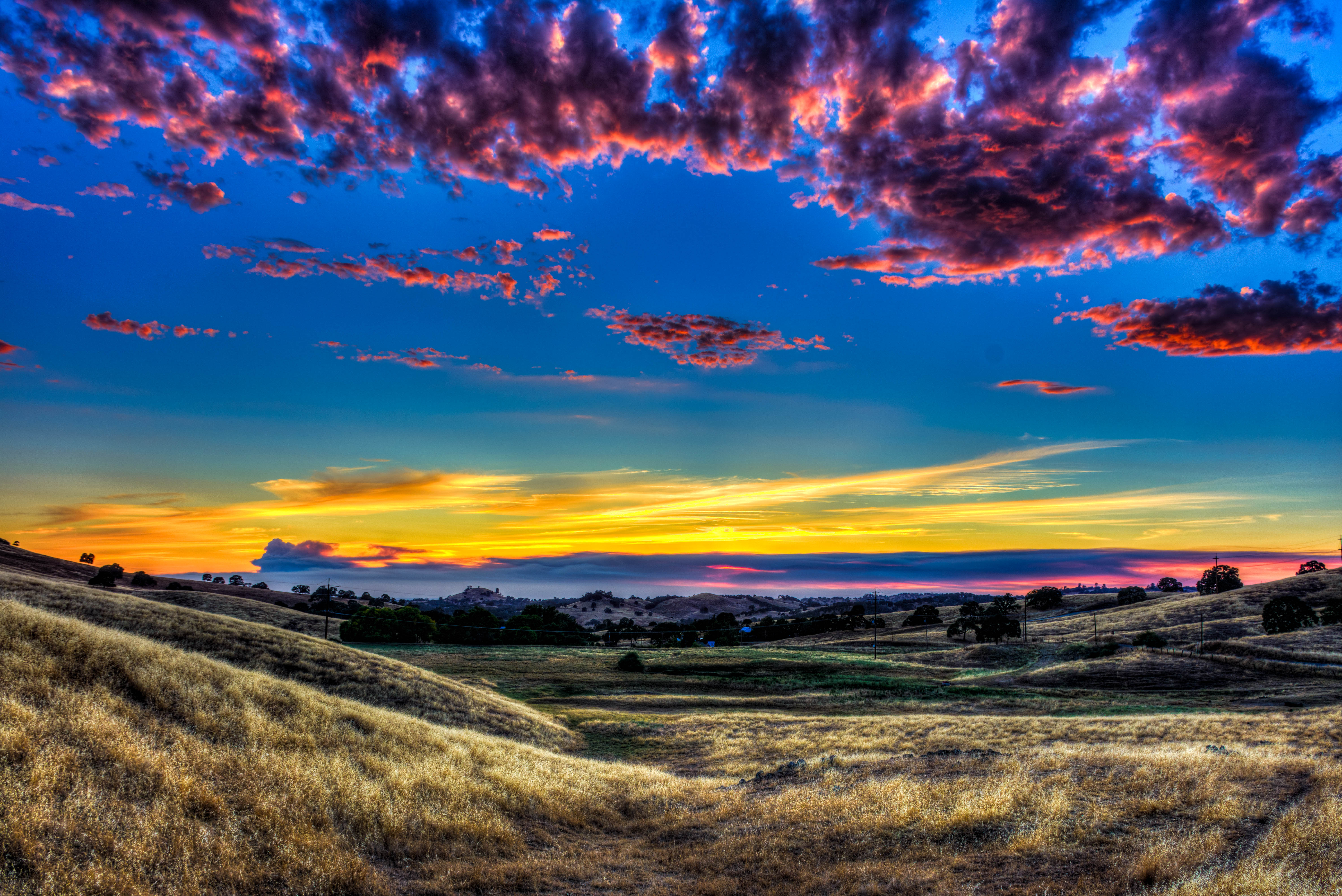
Amador Sunset
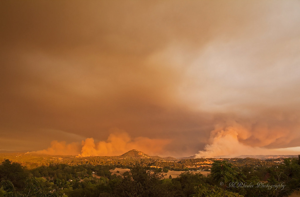
Butte Fire, Amador and Calaveras Counties

Sacramento deluge

Sunset Over Sutter Creek

Flying towards the sunset

#sunset #nature #mountains #pioneer

Amador winetasting Nov 2012 145

Jackson Sunset

Painted Sky

Question Mark

Clouds at Sunset

Another Sunset at the Fence

Red Sun

First Sunset

Sunrise through the trees in Amador County

Sunrise through the trees in Amador County

Sunrise through the trees in Amador County

Sunrise through the trees in Amador County

Sunrise through the trees in Amador County

Sunrise through the trees in Amador County

Sunrise through the trees in Amador County

Sunrise through the trees in Amador County

Sunrise through the trees in Amador County

Sunrise through the trees in Amador County

Sunrise Behind the Trees Amador County

Sunrise through the trees in Amador County

Sunrise through the trees in Amador County
W Mitchell Mine Rd, Pine Grove, CA 美國的地圖
搜索其他地方的日出日落時間
附近地點
Laurel Canyon Rd, Sutter Creek, CA 美國
Mitchell Mine Rd, Pine Grove, CA 美國
Berry St, Pine Grove, CA 美國
Berry St, Pine Grove, CA 美國
Knoll Ct, Pine Grove, CA 美國
美國加利福尼亞派恩格羅夫Aces Transfer Station
Knoll Ct, Pine Grove, CA 美國
CA-88, Pine Grove, CA 美國Brent & Jeff's Upcountry Hardware
CA-88, Pine Grove, CA 美國
CA-88, Pine Grove, CA 美國Pine Cone Drug
CA-88, Pine Grove, CA 美國ATM (Pine Grove Stage Stop)
Pine Grove, CA, 美國
CA-88, Pine Grove, CA 美國
Church St, Pine Grove, CA 美國Pine Grove Community Park
Ridge Rd, Pine Grove, CA 美國
CA-88, Pine Grove, CA 美國Bank of Stockton (Pine Grove)
CA-88, Pine Grove, CA 美國Pine Grove Market
Ridge Rd, Pine Grove, CA 美國Dollar General
CA-88, Pine Grove, CA 美國Pine Grove Elementary School
Ridge Rd, Pine Grove, CA 美國
最近搜索
- 阿根廷布宜諾斯艾利斯聖特爾莫區的日出日落時間表
- Congressional Dr, Stevensville, MD, USA的日出日落時間表
- Papingo 04希臘的日出日落時間表
- Kranto 7-oji g. 8"N, Kaunas, 立陶宛Pagonija rock的日出日落時間表
- Co Rd 87, Jamestown, CO, USA的日出日落時間表
- 哥倫比亞昆迪納馬卡省滕霍的日出日落時間表
- -1 Gosho, Ichihara, Chiba -, Japan的日出日落時間表
- -日本的日出日落時間表
- Co Rd A, Truth or Consequences, NM 美國美國太空港的日出日落時間表
- 美國羅德島州沃威克的日出日落時間表