O'Rourke W3, East Kootenay A, BC V0B加拿大的日出日落時間表
Location: 加拿大 > 英屬哥倫比亞 > 加拿大 > 加拿大 >
時區:
America/Edmonton
當地時間:
2024-05-10 14:14:17
經度:
-114.7683333
緯度:
50.1613888
今天日出時間:
05:56:29 AM
今天日落時間:
09:14:23 PM
今天日照時長:
15h 17m 54s
明天日出時間:
05:55:01 AM
明天日落時間:
09:15:50 PM
明天日照時長:
15h 20m 49s
顯示所有日期
| 日期 | 日出 | 日落 | 日照時長 |
|---|---|---|---|
| 2024年01月01日 | 08:38:04 AM | 04:47:46 PM | 8h 9m 42s |
| 2024年01月02日 | 08:37:57 AM | 04:48:49 PM | 8h 10m 52s |
| 2024年01月03日 | 08:37:46 AM | 04:49:55 PM | 8h 12m 9s |
| 2024年01月04日 | 08:37:31 AM | 04:51:04 PM | 8h 13m 33s |
| 2024年01月05日 | 08:37:14 AM | 04:52:14 PM | 8h 15m 0s |
| 2024年01月06日 | 08:36:54 AM | 04:53:27 PM | 8h 16m 33s |
| 2024年01月07日 | 08:36:30 AM | 04:54:42 PM | 8h 18m 12s |
| 2024年01月08日 | 08:36:04 AM | 04:55:59 PM | 8h 19m 55s |
| 2024年01月09日 | 08:35:34 AM | 04:57:17 PM | 8h 21m 43s |
| 2024年01月10日 | 08:35:02 AM | 04:58:38 PM | 8h 23m 36s |
| 2024年01月11日 | 08:34:26 AM | 05:00:01 PM | 8h 25m 35s |
| 2024年01月12日 | 08:33:48 AM | 05:01:25 PM | 8h 27m 37s |
| 2024年01月13日 | 08:33:06 AM | 05:02:51 PM | 8h 29m 45s |
| 2024年01月14日 | 08:32:22 AM | 05:04:18 PM | 8h 31m 56s |
| 2024年01月15日 | 08:31:35 AM | 05:05:47 PM | 8h 34m 12s |
| 2024年01月16日 | 08:30:45 AM | 05:07:17 PM | 8h 36m 32s |
| 2024年01月17日 | 08:29:53 AM | 05:08:49 PM | 8h 38m 56s |
| 2024年01月18日 | 08:28:57 AM | 05:10:22 PM | 8h 41m 25s |
| 2024年01月19日 | 08:28:00 AM | 05:11:56 PM | 8h 43m 56s |
| 2024年01月20日 | 08:26:59 AM | 05:13:31 PM | 8h 46m 32s |
| 2024年01月21日 | 08:25:56 AM | 05:15:07 PM | 8h 49m 11s |
| 2024年01月22日 | 08:24:51 AM | 05:16:44 PM | 8h 51m 53s |
| 2024年01月23日 | 08:23:43 AM | 05:18:22 PM | 8h 54m 39s |
| 2024年01月24日 | 08:22:33 AM | 05:20:01 PM | 8h 57m 28s |
| 2024年01月25日 | 08:21:20 AM | 05:21:41 PM | 9h 0m 21s |
| 2024年01月26日 | 08:20:05 AM | 05:23:21 PM | 9h 3m 16s |
| 2024年01月27日 | 08:18:48 AM | 05:25:02 PM | 9h 6m 14s |
| 2024年01月28日 | 08:17:29 AM | 05:26:43 PM | 9h 9m 14s |
| 2024年01月29日 | 08:16:07 AM | 05:28:25 PM | 9h 12m 18s |
| 2024年01月30日 | 08:14:44 AM | 05:30:07 PM | 9h 15m 23s |
| 2024年01月31日 | 08:13:18 AM | 05:31:50 PM | 9h 18m 32s |
| 2024年02月01日 | 08:11:51 AM | 05:33:33 PM | 9h 21m 42s |
| 2024年02月02日 | 08:10:21 AM | 05:35:17 PM | 9h 24m 56s |
| 2024年02月03日 | 08:08:50 AM | 05:37:00 PM | 9h 28m 10s |
| 2024年02月04日 | 08:07:17 AM | 05:38:44 PM | 9h 31m 27s |
| 2024年02月05日 | 08:05:42 AM | 05:40:28 PM | 9h 34m 46s |
| 2024年02月06日 | 08:04:05 AM | 05:42:12 PM | 9h 38m 7s |
| 2024年02月07日 | 08:02:27 AM | 05:43:56 PM | 9h 41m 29s |
| 2024年02月08日 | 08:00:47 AM | 05:45:40 PM | 9h 44m 53s |
| 2024年02月09日 | 07:59:06 AM | 05:47:25 PM | 9h 48m 19s |
| 2024年02月10日 | 07:57:23 AM | 05:49:09 PM | 9h 51m 46s |
| 2024年02月11日 | 07:55:38 AM | 05:50:53 PM | 9h 55m 15s |
| 2024年02月12日 | 07:53:52 AM | 05:52:37 PM | 9h 58m 45s |
| 2024年02月13日 | 07:52:05 AM | 05:54:21 PM | 10h 2m 16s |
| 2024年02月14日 | 07:50:16 AM | 05:56:05 PM | 10h 5m 49s |
| 2024年02月15日 | 07:48:26 AM | 05:57:49 PM | 10h 9m 23s |
| 2024年02月16日 | 07:46:35 AM | 05:59:32 PM | 10h 12m 57s |
| 2024年02月17日 | 07:44:43 AM | 06:01:16 PM | 10h 16m 33s |
| 2024年02月18日 | 07:42:49 AM | 06:02:59 PM | 10h 20m 10s |
| 2024年02月19日 | 07:40:54 AM | 06:04:42 PM | 10h 23m 48s |
| 2024年02月20日 | 07:38:59 AM | 06:06:24 PM | 10h 27m 25s |
| 2024年02月21日 | 07:37:02 AM | 06:08:07 PM | 10h 31m 5s |
| 2024年02月22日 | 07:35:04 AM | 06:09:49 PM | 10h 34m 45s |
| 2024年02月23日 | 07:33:05 AM | 06:11:31 PM | 10h 38m 26s |
| 2024年02月24日 | 07:31:05 AM | 06:13:13 PM | 10h 42m 8s |
| 2024年02月25日 | 07:29:05 AM | 06:14:54 PM | 10h 45m 49s |
| 2024年02月26日 | 07:27:03 AM | 06:16:35 PM | 10h 49m 32s |
| 2024年02月27日 | 07:25:01 AM | 06:18:16 PM | 10h 53m 15s |
| 2024年02月28日 | 07:22:58 AM | 06:19:57 PM | 10h 56m 59s |
| 2024年02月29日 | 07:20:54 AM | 06:21:37 PM | 11h 0m 43s |
| 2024年03月01日 | 07:18:49 AM | 06:23:17 PM | 11h 4m 28s |
| 2024年03月02日 | 07:16:44 AM | 06:24:57 PM | 11h 8m 13s |
| 2024年03月03日 | 07:14:38 AM | 06:26:36 PM | 11h 11m 58s |
| 2024年03月04日 | 07:12:32 AM | 06:28:15 PM | 11h 15m 43s |
| 2024年03月05日 | 07:10:25 AM | 06:29:54 PM | 11h 19m 29s |
| 2024年03月06日 | 07:08:17 AM | 06:31:33 PM | 11h 23m 16s |
| 2024年03月07日 | 07:06:09 AM | 06:33:11 PM | 11h 27m 2s |
| 2024年03月08日 | 07:04:01 AM | 06:34:50 PM | 11h 30m 49s |
| 2024年03月09日 | 07:01:52 AM | 06:36:28 PM | 11h 34m 36s |
| 2024年03月10日 | 07:59:48 AM | 07:38:01 PM | 11h 38m 13s |
| 2024年03月11日 | 07:57:38 AM | 07:39:39 PM | 11h 42m 1s |
| 2024年03月12日 | 07:55:28 AM | 07:41:16 PM | 11h 45m 48s |
| 2024年03月13日 | 07:53:18 AM | 07:42:53 PM | 11h 49m 35s |
| 2024年03月14日 | 07:51:07 AM | 07:44:30 PM | 11h 53m 23s |
| 2024年03月15日 | 07:48:57 AM | 07:46:06 PM | 11h 57m 9s |
| 2024年03月16日 | 07:46:46 AM | 07:47:43 PM | 12h 0m 57s |
| 2024年03月17日 | 07:44:35 AM | 07:49:19 PM | 12h 4m 44s |
| 2024年03月18日 | 07:42:23 AM | 07:50:55 PM | 12h 8m 32s |
| 2024年03月19日 | 07:40:12 AM | 07:52:31 PM | 12h 12m 19s |
| 2024年03月20日 | 07:38:00 AM | 07:54:07 PM | 12h 16m 7s |
| 2024年03月21日 | 07:35:49 AM | 07:55:43 PM | 12h 19m 54s |
| 2024年03月22日 | 07:33:37 AM | 07:57:18 PM | 12h 23m 41s |
| 2024年03月23日 | 07:31:26 AM | 07:58:54 PM | 12h 27m 28s |
| 2024年03月24日 | 07:29:14 AM | 08:00:29 PM | 12h 31m 15s |
| 2024年03月25日 | 07:27:03 AM | 08:02:04 PM | 12h 35m 1s |
| 2024年03月26日 | 07:24:51 AM | 08:03:39 PM | 12h 38m 48s |
| 2024年03月27日 | 07:22:40 AM | 08:05:14 PM | 12h 42m 34s |
| 2024年03月28日 | 07:20:29 AM | 08:06:49 PM | 12h 46m 20s |
| 2024年03月29日 | 07:18:18 AM | 08:08:24 PM | 12h 50m 6s |
| 2024年03月30日 | 07:16:07 AM | 08:09:59 PM | 12h 53m 52s |
| 2024年03月31日 | 07:13:57 AM | 08:11:34 PM | 12h 57m 37s |
| 2024年04月01日 | 07:11:47 AM | 08:13:09 PM | 13h 1m 22s |
| 2024年04月02日 | 07:09:37 AM | 08:14:44 PM | 13h 5m 7s |
| 2024年04月03日 | 07:07:28 AM | 08:16:18 PM | 13h 8m 50s |
| 2024年04月04日 | 07:05:19 AM | 08:17:53 PM | 13h 12m 34s |
| 2024年04月05日 | 07:03:10 AM | 08:19:28 PM | 13h 16m 18s |
| 2024年04月06日 | 07:01:02 AM | 08:21:02 PM | 13h 20m 0s |
| 2024年04月07日 | 06:58:54 AM | 08:22:37 PM | 13h 23m 43s |
| 2024年04月08日 | 06:56:47 AM | 08:24:12 PM | 13h 27m 25s |
| 2024年04月09日 | 06:54:40 AM | 08:25:46 PM | 13h 31m 6s |
| 2024年04月10日 | 06:52:34 AM | 08:27:21 PM | 13h 34m 47s |
| 2024年04月11日 | 06:50:29 AM | 08:28:56 PM | 13h 38m 27s |
| 2024年04月12日 | 06:48:24 AM | 08:30:30 PM | 13h 42m 6s |
| 2024年04月13日 | 06:46:20 AM | 08:32:05 PM | 13h 45m 45s |
| 2024年04月14日 | 06:44:17 AM | 08:33:39 PM | 13h 49m 22s |
| 2024年04月15日 | 06:42:14 AM | 08:35:14 PM | 13h 53m 0s |
| 2024年04月16日 | 06:40:12 AM | 08:36:49 PM | 13h 56m 37s |
| 2024年04月17日 | 06:38:11 AM | 08:38:23 PM | 14h 0m 12s |
| 2024年04月18日 | 06:36:11 AM | 08:39:57 PM | 14h 3m 46s |
| 2024年04月19日 | 06:34:12 AM | 08:41:32 PM | 14h 7m 20s |
| 2024年04月20日 | 06:32:14 AM | 08:43:06 PM | 14h 10m 52s |
| 2024年04月21日 | 06:30:16 AM | 08:44:40 PM | 14h 14m 24s |
| 2024年04月22日 | 06:28:20 AM | 08:46:15 PM | 14h 17m 55s |
| 2024年04月23日 | 06:26:25 AM | 08:47:49 PM | 14h 21m 24s |
| 2024年04月24日 | 06:24:30 AM | 08:49:22 PM | 14h 24m 52s |
| 2024年04月25日 | 06:22:37 AM | 08:50:56 PM | 14h 28m 19s |
| 2024年04月26日 | 06:20:46 AM | 08:52:30 PM | 14h 31m 44s |
| 2024年04月27日 | 06:18:55 AM | 08:54:03 PM | 14h 35m 8s |
| 2024年04月28日 | 06:17:05 AM | 08:55:36 PM | 14h 38m 31s |
| 2024年04月29日 | 06:15:17 AM | 08:57:09 PM | 14h 41m 52s |
| 2024年04月30日 | 06:13:31 AM | 08:58:42 PM | 14h 45m 11s |
| 2024年05月01日 | 06:11:45 AM | 09:00:14 PM | 14h 48m 29s |
| 2024年05月02日 | 06:10:01 AM | 09:01:46 PM | 14h 51m 45s |
| 2024年05月03日 | 06:08:19 AM | 09:03:18 PM | 14h 54m 59s |
| 2024年05月04日 | 06:06:38 AM | 09:04:49 PM | 14h 58m 11s |
| 2024年05月05日 | 06:04:59 AM | 09:06:20 PM | 15h 1m 21s |
| 2024年05月06日 | 06:03:21 AM | 09:07:50 PM | 15h 4m 29s |
| 2024年05月07日 | 06:01:45 AM | 09:09:20 PM | 15h 7m 35s |
| 2024年05月08日 | 06:00:10 AM | 09:10:49 PM | 15h 10m 39s |
| 2024年05月09日 | 05:58:37 AM | 09:12:18 PM | 15h 13m 41s |
| 2024年05月10日 | 05:57:07 AM | 09:13:46 PM | 15h 16m 39s |
| 2024年05月11日 | 05:55:37 AM | 09:15:14 PM | 15h 19m 37s |
| 2024年05月12日 | 05:54:10 AM | 09:16:40 PM | 15h 22m 30s |
| 2024年05月13日 | 05:52:45 AM | 09:18:06 PM | 15h 25m 21s |
| 2024年05月14日 | 05:51:22 AM | 09:19:31 PM | 15h 28m 9s |
| 2024年05月15日 | 05:50:00 AM | 09:20:55 PM | 15h 30m 55s |
| 2024年05月16日 | 05:48:41 AM | 09:22:18 PM | 15h 33m 37s |
| 2024年05月17日 | 05:47:24 AM | 09:23:40 PM | 15h 36m 16s |
| 2024年05月18日 | 05:46:09 AM | 09:25:02 PM | 15h 38m 53s |
| 2024年05月19日 | 05:44:56 AM | 09:26:22 PM | 15h 41m 26s |
| 2024年05月20日 | 05:43:46 AM | 09:27:40 PM | 15h 43m 54s |
| 2024年05月21日 | 05:42:37 AM | 09:28:58 PM | 15h 46m 21s |
| 2024年05月22日 | 05:41:32 AM | 09:30:14 PM | 15h 48m 42s |
| 2024年05月23日 | 05:40:28 AM | 09:31:29 PM | 15h 51m 1s |
| 2024年05月24日 | 05:39:27 AM | 09:32:43 PM | 15h 53m 16s |
| 2024年05月25日 | 05:38:28 AM | 09:33:55 PM | 15h 55m 27s |
| 2024年05月26日 | 05:37:32 AM | 09:35:05 PM | 15h 57m 33s |
| 2024年05月27日 | 05:36:39 AM | 09:36:14 PM | 15h 59m 35s |
| 2024年05月28日 | 05:35:47 AM | 09:37:21 PM | 16h 1m 34s |
| 2024年05月29日 | 05:34:59 AM | 09:38:26 PM | 16h 3m 27s |
| 2024年05月30日 | 05:34:13 AM | 09:39:30 PM | 16h 5m 17s |
| 2024年05月31日 | 05:33:30 AM | 09:40:32 PM | 16h 7m 2s |
| 2024年06月01日 | 05:32:50 AM | 09:41:31 PM | 16h 8m 41s |
| 2024年06月02日 | 05:32:12 AM | 09:42:29 PM | 16h 10m 17s |
| 2024年06月03日 | 05:31:37 AM | 09:43:25 PM | 16h 11m 48s |
| 2024年06月04日 | 05:31:05 AM | 09:44:18 PM | 16h 13m 13s |
| 2024年06月05日 | 05:30:36 AM | 09:45:09 PM | 16h 14m 33s |
| 2024年06月06日 | 05:30:09 AM | 09:45:59 PM | 16h 15m 50s |
| 2024年06月07日 | 05:29:46 AM | 09:46:45 PM | 16h 16m 59s |
| 2024年06月08日 | 05:29:25 AM | 09:47:30 PM | 16h 18m 5s |
| 2024年06月09日 | 05:29:07 AM | 09:48:12 PM | 16h 19m 5s |
| 2024年06月10日 | 05:28:52 AM | 09:48:51 PM | 16h 19m 59s |
| 2024年06月11日 | 05:28:40 AM | 09:49:28 PM | 16h 20m 48s |
| 2024年06月12日 | 05:28:31 AM | 09:50:03 PM | 16h 21m 32s |
| 2024年06月13日 | 05:28:24 AM | 09:50:34 PM | 16h 22m 10s |
| 2024年06月14日 | 05:28:21 AM | 09:51:04 PM | 16h 22m 43s |
| 2024年06月15日 | 05:28:20 AM | 09:51:30 PM | 16h 23m 10s |
| 2024年06月16日 | 05:28:23 AM | 09:51:54 PM | 16h 23m 31s |
| 2024年06月17日 | 05:28:28 AM | 09:52:15 PM | 16h 23m 47s |
| 2024年06月18日 | 05:28:36 AM | 09:52:33 PM | 16h 23m 57s |
| 2024年06月19日 | 05:28:47 AM | 09:52:48 PM | 16h 24m 1s |
| 2024年06月20日 | 05:29:01 AM | 09:53:01 PM | 16h 24m 0s |
| 2024年06月21日 | 05:29:17 AM | 09:53:10 PM | 16h 23m 53s |
| 2024年06月22日 | 05:29:36 AM | 09:53:17 PM | 16h 23m 41s |
| 2024年06月23日 | 05:29:58 AM | 09:53:21 PM | 16h 23m 23s |
| 2024年06月24日 | 05:30:23 AM | 09:53:22 PM | 16h 22m 59s |
| 2024年06月25日 | 05:30:50 AM | 09:53:19 PM | 16h 22m 29s |
| 2024年06月26日 | 05:31:20 AM | 09:53:14 PM | 16h 21m 54s |
| 2024年06月27日 | 05:31:52 AM | 09:53:06 PM | 16h 21m 14s |
| 2024年06月28日 | 05:32:27 AM | 09:52:56 PM | 16h 20m 29s |
| 2024年06月29日 | 05:33:04 AM | 09:52:42 PM | 16h 19m 38s |
| 2024年06月30日 | 05:33:44 AM | 09:52:25 PM | 16h 18m 41s |
| 2024年07月01日 | 05:34:26 AM | 09:52:05 PM | 16h 17m 39s |
| 2024年07月02日 | 05:35:11 AM | 09:51:43 PM | 16h 16m 32s |
| 2024年07月03日 | 05:35:57 AM | 09:51:17 PM | 16h 15m 20s |
| 2024年07月04日 | 05:36:46 AM | 09:50:49 PM | 16h 14m 3s |
| 2024年07月05日 | 05:37:37 AM | 09:50:18 PM | 16h 12m 41s |
| 2024年07月06日 | 05:38:31 AM | 09:49:44 PM | 16h 11m 13s |
| 2024年07月07日 | 05:39:26 AM | 09:49:07 PM | 16h 9m 41s |
| 2024年07月08日 | 05:40:23 AM | 09:48:27 PM | 16h 8m 4s |
| 2024年07月09日 | 05:41:22 AM | 09:47:45 PM | 16h 6m 23s |
| 2024年07月10日 | 05:42:23 AM | 09:47:00 PM | 16h 4m 37s |
| 2024年07月11日 | 05:43:25 AM | 09:46:12 PM | 16h 2m 47s |
| 2024年07月12日 | 05:44:30 AM | 09:45:22 PM | 16h 0m 52s |
| 2024年07月13日 | 05:45:36 AM | 09:44:29 PM | 15h 58m 53s |
| 2024年07月14日 | 05:46:43 AM | 09:43:33 PM | 15h 56m 50s |
| 2024年07月15日 | 05:47:52 AM | 09:42:35 PM | 15h 54m 43s |
| 2024年07月16日 | 05:49:03 AM | 09:41:34 PM | 15h 52m 31s |
| 2024年07月17日 | 05:50:14 AM | 09:40:31 PM | 15h 50m 17s |
| 2024年07月18日 | 05:51:28 AM | 09:39:26 PM | 15h 47m 58s |
| 2024年07月19日 | 05:52:42 AM | 09:38:18 PM | 15h 45m 36s |
| 2024年07月20日 | 05:53:58 AM | 09:37:08 PM | 15h 43m 10s |
| 2024年07月21日 | 05:55:14 AM | 09:35:55 PM | 15h 40m 41s |
| 2024年07月22日 | 05:56:32 AM | 09:34:40 PM | 15h 38m 8s |
| 2024年07月23日 | 05:57:51 AM | 09:33:23 PM | 15h 35m 32s |
| 2024年07月24日 | 05:59:11 AM | 09:32:04 PM | 15h 32m 53s |
| 2024年07月25日 | 06:00:31 AM | 09:30:43 PM | 15h 30m 12s |
| 2024年07月26日 | 06:01:53 AM | 09:29:20 PM | 15h 27m 27s |
| 2024年07月27日 | 06:03:15 AM | 09:27:55 PM | 15h 24m 40s |
| 2024年07月28日 | 06:04:38 AM | 09:26:28 PM | 15h 21m 50s |
| 2024年07月29日 | 06:06:02 AM | 09:24:59 PM | 15h 18m 57s |
| 2024年07月30日 | 06:07:26 AM | 09:23:28 PM | 15h 16m 2s |
| 2024年07月31日 | 06:08:51 AM | 09:21:55 PM | 15h 13m 4s |
| 2024年08月01日 | 06:10:17 AM | 09:20:21 PM | 15h 10m 4s |
| 2024年08月02日 | 06:11:43 AM | 09:18:44 PM | 15h 7m 1s |
| 2024年08月03日 | 06:13:09 AM | 09:17:07 PM | 15h 3m 58s |
| 2024年08月04日 | 06:14:36 AM | 09:15:27 PM | 15h 0m 51s |
| 2024年08月05日 | 06:16:04 AM | 09:13:46 PM | 14h 57m 42s |
| 2024年08月06日 | 06:17:32 AM | 09:12:03 PM | 14h 54m 31s |
| 2024年08月07日 | 06:19:00 AM | 09:10:19 PM | 14h 51m 19s |
| 2024年08月08日 | 06:20:28 AM | 09:08:33 PM | 14h 48m 5s |
| 2024年08月09日 | 06:21:57 AM | 09:06:46 PM | 14h 44m 49s |
| 2024年08月10日 | 06:23:25 AM | 09:04:58 PM | 14h 41m 33s |
| 2024年08月11日 | 06:24:54 AM | 09:03:08 PM | 14h 38m 14s |
| 2024年08月12日 | 06:26:24 AM | 09:01:17 PM | 14h 34m 53s |
| 2024年08月13日 | 06:27:53 AM | 08:59:25 PM | 14h 31m 32s |
| 2024年08月14日 | 06:29:23 AM | 08:57:31 PM | 14h 28m 8s |
| 2024年08月15日 | 06:30:52 AM | 08:55:37 PM | 14h 24m 45s |
| 2024年08月16日 | 06:32:22 AM | 08:53:41 PM | 14h 21m 19s |
| 2024年08月17日 | 06:33:52 AM | 08:51:44 PM | 14h 17m 52s |
| 2024年08月18日 | 06:35:22 AM | 08:49:46 PM | 14h 14m 24s |
| 2024年08月19日 | 06:36:51 AM | 08:47:48 PM | 14h 10m 57s |
| 2024年08月20日 | 06:38:21 AM | 08:45:48 PM | 14h 7m 27s |
| 2024年08月21日 | 06:39:51 AM | 08:43:47 PM | 14h 3m 56s |
| 2024年08月22日 | 06:41:21 AM | 08:41:45 PM | 14h 0m 24s |
| 2024年08月23日 | 06:42:51 AM | 08:39:43 PM | 13h 56m 52s |
| 2024年08月24日 | 06:44:21 AM | 08:37:39 PM | 13h 53m 18s |
| 2024年08月25日 | 06:45:51 AM | 08:35:35 PM | 13h 49m 44s |
| 2024年08月26日 | 06:47:21 AM | 08:33:30 PM | 13h 46m 9s |
| 2024年08月27日 | 06:48:51 AM | 08:31:25 PM | 13h 42m 34s |
| 2024年08月28日 | 06:50:21 AM | 08:29:19 PM | 13h 38m 58s |
| 2024年08月29日 | 06:51:51 AM | 08:27:12 PM | 13h 35m 21s |
| 2024年08月30日 | 06:53:21 AM | 08:25:04 PM | 13h 31m 43s |
| 2024年08月31日 | 06:54:51 AM | 08:22:56 PM | 13h 28m 5s |
| 2024年09月01日 | 06:56:21 AM | 08:20:47 PM | 13h 24m 26s |
| 2024年09月02日 | 06:57:51 AM | 08:18:38 PM | 13h 20m 47s |
| 2024年09月03日 | 06:59:20 AM | 08:16:28 PM | 13h 17m 8s |
| 2024年09月04日 | 07:00:50 AM | 08:14:18 PM | 13h 13m 28s |
| 2024年09月05日 | 07:02:20 AM | 08:12:08 PM | 13h 9m 48s |
| 2024年09月06日 | 07:03:50 AM | 08:09:57 PM | 13h 6m 7s |
| 2024年09月07日 | 07:05:20 AM | 08:07:46 PM | 13h 2m 26s |
| 2024年09月08日 | 07:06:49 AM | 08:05:34 PM | 12h 58m 45s |
| 2024年09月09日 | 07:08:19 AM | 08:03:22 PM | 12h 55m 3s |
| 2024年09月10日 | 07:09:49 AM | 08:01:10 PM | 12h 51m 21s |
| 2024年09月11日 | 07:11:19 AM | 07:58:58 PM | 12h 47m 39s |
| 2024年09月12日 | 07:12:49 AM | 07:56:45 PM | 12h 43m 56s |
| 2024年09月13日 | 07:14:19 AM | 07:54:32 PM | 12h 40m 13s |
| 2024年09月14日 | 07:15:49 AM | 07:52:19 PM | 12h 36m 30s |
| 2024年09月15日 | 07:17:19 AM | 07:50:06 PM | 12h 32m 47s |
| 2024年09月16日 | 07:18:49 AM | 07:47:53 PM | 12h 29m 4s |
| 2024年09月17日 | 07:20:20 AM | 07:45:40 PM | 12h 25m 20s |
| 2024年09月18日 | 07:21:50 AM | 07:43:27 PM | 12h 21m 37s |
| 2024年09月19日 | 07:23:21 AM | 07:41:14 PM | 12h 17m 53s |
| 2024年09月20日 | 07:24:51 AM | 07:39:00 PM | 12h 14m 9s |
| 2024年09月21日 | 07:26:22 AM | 07:36:47 PM | 12h 10m 25s |
| 2024年09月22日 | 07:27:53 AM | 07:34:34 PM | 12h 6m 41s |
| 2024年09月23日 | 07:29:24 AM | 07:32:22 PM | 12h 2m 58s |
| 2024年09月24日 | 07:30:55 AM | 07:30:09 PM | 11h 59m 14s |
| 2024年09月25日 | 07:32:27 AM | 07:27:56 PM | 11h 55m 29s |
| 2024年09月26日 | 07:33:58 AM | 07:25:44 PM | 11h 51m 46s |
| 2024年09月27日 | 07:35:30 AM | 07:23:32 PM | 11h 48m 2s |
| 2024年09月28日 | 07:37:02 AM | 07:21:20 PM | 11h 44m 18s |
| 2024年09月29日 | 07:38:35 AM | 07:19:09 PM | 11h 40m 34s |
| 2024年09月30日 | 07:40:07 AM | 07:16:58 PM | 11h 36m 51s |
| 2024年10月01日 | 07:41:40 AM | 07:14:47 PM | 11h 33m 7s |
| 2024年10月02日 | 07:43:13 AM | 07:12:36 PM | 11h 29m 23s |
| 2024年10月03日 | 07:44:46 AM | 07:10:26 PM | 11h 25m 40s |
| 2024年10月04日 | 07:46:20 AM | 07:08:17 PM | 11h 21m 57s |
| 2024年10月05日 | 07:47:53 AM | 07:06:08 PM | 11h 18m 15s |
| 2024年10月06日 | 07:49:27 AM | 07:04:00 PM | 11h 14m 33s |
| 2024年10月07日 | 07:51:02 AM | 07:01:52 PM | 11h 10m 50s |
| 2024年10月08日 | 07:52:36 AM | 06:59:44 PM | 11h 7m 8s |
| 2024年10月09日 | 07:54:11 AM | 06:57:38 PM | 11h 3m 27s |
| 2024年10月10日 | 07:55:47 AM | 06:55:32 PM | 10h 59m 45s |
| 2024年10月11日 | 07:57:22 AM | 06:53:27 PM | 10h 56m 5s |
| 2024年10月12日 | 07:58:58 AM | 06:51:22 PM | 10h 52m 24s |
| 2024年10月13日 | 08:00:34 AM | 06:49:18 PM | 10h 48m 44s |
| 2024年10月14日 | 08:02:10 AM | 06:47:15 PM | 10h 45m 5s |
| 2024年10月15日 | 08:03:47 AM | 06:45:13 PM | 10h 41m 26s |
| 2024年10月16日 | 08:05:24 AM | 06:43:12 PM | 10h 37m 48s |
| 2024年10月17日 | 08:07:02 AM | 06:41:12 PM | 10h 34m 10s |
| 2024年10月18日 | 08:08:39 AM | 06:39:12 PM | 10h 30m 33s |
| 2024年10月19日 | 08:10:17 AM | 06:37:14 PM | 10h 26m 57s |
| 2024年10月20日 | 08:11:55 AM | 06:35:17 PM | 10h 23m 22s |
| 2024年10月21日 | 08:13:34 AM | 06:33:20 PM | 10h 19m 46s |
| 2024年10月22日 | 08:15:12 AM | 06:31:25 PM | 10h 16m 13s |
| 2024年10月23日 | 08:16:51 AM | 06:29:31 PM | 10h 12m 40s |
| 2024年10月24日 | 08:18:30 AM | 06:27:39 PM | 10h 9m 9s |
| 2024年10月25日 | 08:20:10 AM | 06:25:47 PM | 10h 5m 37s |
| 2024年10月26日 | 08:21:49 AM | 06:23:57 PM | 10h 2m 8s |
| 2024年10月27日 | 08:23:29 AM | 06:22:08 PM | 9h 58m 39s |
| 2024年10月28日 | 08:25:09 AM | 06:20:21 PM | 9h 55m 12s |
| 2024年10月29日 | 08:26:49 AM | 06:18:34 PM | 9h 51m 45s |
| 2024年10月30日 | 08:28:29 AM | 06:16:50 PM | 9h 48m 21s |
| 2024年10月31日 | 08:30:09 AM | 06:15:07 PM | 9h 44m 58s |
| 2024年11月01日 | 08:31:50 AM | 06:13:25 PM | 9h 41m 35s |
| 2024年11月02日 | 08:33:30 AM | 06:11:45 PM | 9h 38m 15s |
| 2024年11月03日 | 07:35:14 AM | 05:10:03 PM | 9h 34m 49s |
| 2024年11月04日 | 07:36:55 AM | 05:08:26 PM | 9h 31m 31s |
| 2024年11月05日 | 07:38:35 AM | 05:06:52 PM | 9h 28m 17s |
| 2024年11月06日 | 07:40:15 AM | 05:05:19 PM | 9h 25m 4s |
| 2024年11月07日 | 07:41:55 AM | 05:03:48 PM | 9h 21m 53s |
| 2024年11月08日 | 07:43:34 AM | 05:02:19 PM | 9h 18m 45s |
| 2024年11月09日 | 07:45:13 AM | 05:00:51 PM | 9h 15m 38s |
| 2024年11月10日 | 07:46:52 AM | 04:59:26 PM | 9h 12m 34s |
| 2024年11月11日 | 07:48:31 AM | 04:58:03 PM | 9h 9m 32s |
| 2024年11月12日 | 07:50:09 AM | 04:56:42 PM | 9h 6m 33s |
| 2024年11月13日 | 07:51:47 AM | 04:55:23 PM | 9h 3m 36s |
| 2024年11月14日 | 07:53:24 AM | 04:54:07 PM | 9h 0m 43s |
| 2024年11月15日 | 07:55:01 AM | 04:52:52 PM | 8h 57m 51s |
| 2024年11月16日 | 07:56:37 AM | 04:51:40 PM | 8h 55m 3s |
| 2024年11月17日 | 07:58:12 AM | 04:50:30 PM | 8h 52m 18s |
| 2024年11月18日 | 07:59:47 AM | 04:49:23 PM | 8h 49m 36s |
| 2024年11月19日 | 08:01:20 AM | 04:48:19 PM | 8h 46m 59s |
| 2024年11月20日 | 08:02:53 AM | 04:47:16 PM | 8h 44m 23s |
| 2024年11月21日 | 08:04:25 AM | 04:46:17 PM | 8h 41m 52s |
| 2024年11月22日 | 08:05:56 AM | 04:45:20 PM | 8h 39m 24s |
| 2024年11月23日 | 08:07:25 AM | 04:44:25 PM | 8h 37m 0s |
| 2024年11月24日 | 08:08:54 AM | 04:43:34 PM | 8h 34m 40s |
| 2024年11月25日 | 08:10:21 AM | 04:42:45 PM | 8h 32m 24s |
| 2024年11月26日 | 08:11:46 AM | 04:41:59 PM | 8h 30m 13s |
| 2024年11月27日 | 08:13:11 AM | 04:41:16 PM | 8h 28m 5s |
| 2024年11月28日 | 08:14:33 AM | 04:40:35 PM | 8h 26m 2s |
| 2024年11月29日 | 08:15:54 AM | 04:39:58 PM | 8h 24m 4s |
| 2024年11月30日 | 08:17:14 AM | 04:39:24 PM | 8h 22m 10s |
| 2024年12月01日 | 08:18:31 AM | 04:38:52 PM | 8h 20m 21s |
| 2024年12月02日 | 08:19:47 AM | 04:38:24 PM | 8h 18m 37s |
| 2024年12月03日 | 08:21:01 AM | 04:37:59 PM | 8h 16m 58s |
| 2024年12月04日 | 08:22:13 AM | 04:37:37 PM | 8h 15m 24s |
| 2024年12月05日 | 08:23:23 AM | 04:37:18 PM | 8h 13m 55s |
| 2024年12月06日 | 08:24:31 AM | 04:37:02 PM | 8h 12m 31s |
| 2024年12月07日 | 08:25:36 AM | 04:36:49 PM | 8h 11m 13s |
| 2024年12月08日 | 08:26:39 AM | 04:36:40 PM | 8h 10m 1s |
| 2024年12月09日 | 08:27:40 AM | 04:36:34 PM | 8h 8m 54s |
| 2024年12月10日 | 08:28:38 AM | 04:36:31 PM | 8h 7m 53s |
| 2024年12月11日 | 08:29:34 AM | 04:36:31 PM | 8h 6m 57s |
| 2024年12月12日 | 08:30:28 AM | 04:36:34 PM | 8h 6m 6s |
| 2024年12月13日 | 08:31:18 AM | 04:36:41 PM | 8h 5m 23s |
| 2024年12月14日 | 08:32:06 AM | 04:36:51 PM | 8h 4m 45s |
| 2024年12月15日 | 08:32:51 AM | 04:37:04 PM | 8h 4m 13s |
| 2024年12月16日 | 08:33:34 AM | 04:37:21 PM | 8h 3m 47s |
| 2024年12月17日 | 08:34:13 AM | 04:37:40 PM | 8h 3m 27s |
| 2024年12月18日 | 08:34:50 AM | 04:38:03 PM | 8h 3m 13s |
| 2024年12月19日 | 08:35:23 AM | 04:38:29 PM | 8h 3m 6s |
| 2024年12月20日 | 08:35:54 AM | 04:38:58 PM | 8h 3m 4s |
| 2024年12月21日 | 08:36:22 AM | 04:39:30 PM | 8h 3m 8s |
| 2024年12月22日 | 08:36:46 AM | 04:40:05 PM | 8h 3m 19s |
| 2024年12月23日 | 08:37:08 AM | 04:40:43 PM | 8h 3m 35s |
| 2024年12月24日 | 08:37:26 AM | 04:41:24 PM | 8h 3m 58s |
| 2024年12月25日 | 08:37:41 AM | 04:42:08 PM | 8h 4m 27s |
| 2024年12月26日 | 08:37:53 AM | 04:42:55 PM | 8h 5m 2s |
| 2024年12月27日 | 08:38:02 AM | 04:43:45 PM | 8h 5m 43s |
| 2024年12月28日 | 08:38:08 AM | 04:44:37 PM | 8h 6m 29s |
| 2024年12月29日 | 08:38:10 AM | 04:45:33 PM | 8h 7m 23s |
| 2024年12月30日 | 08:38:09 AM | 04:46:30 PM | 8h 8m 21s |
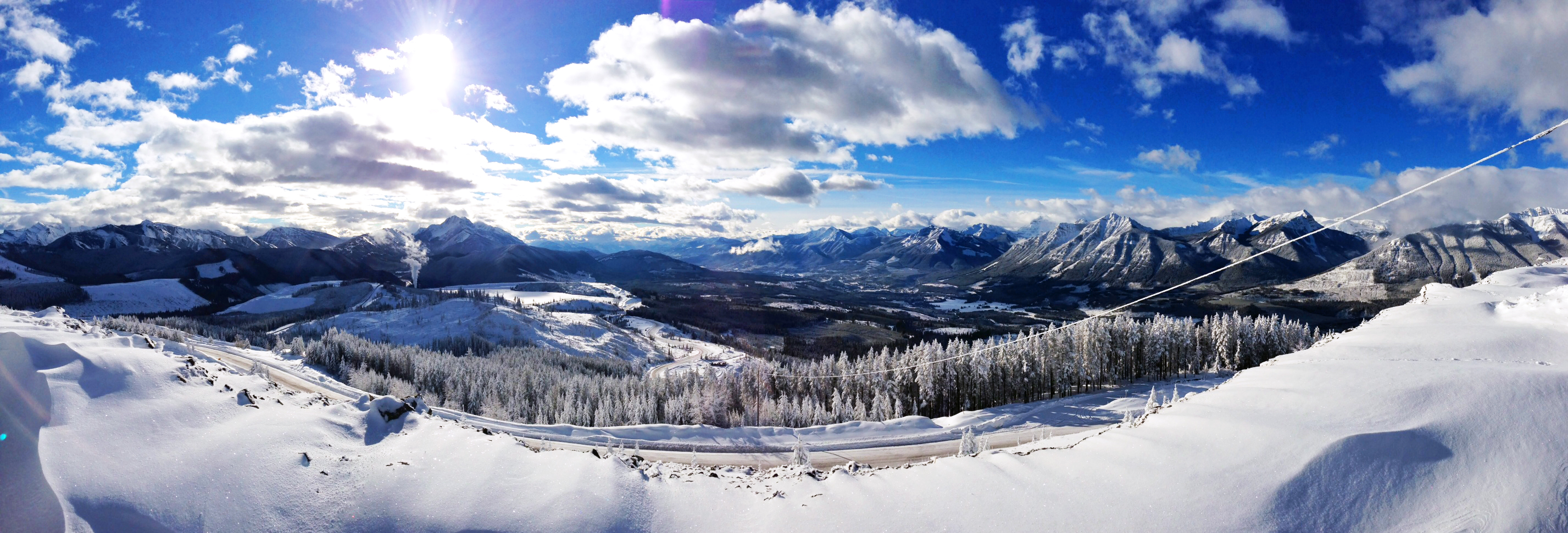
日出日落照片
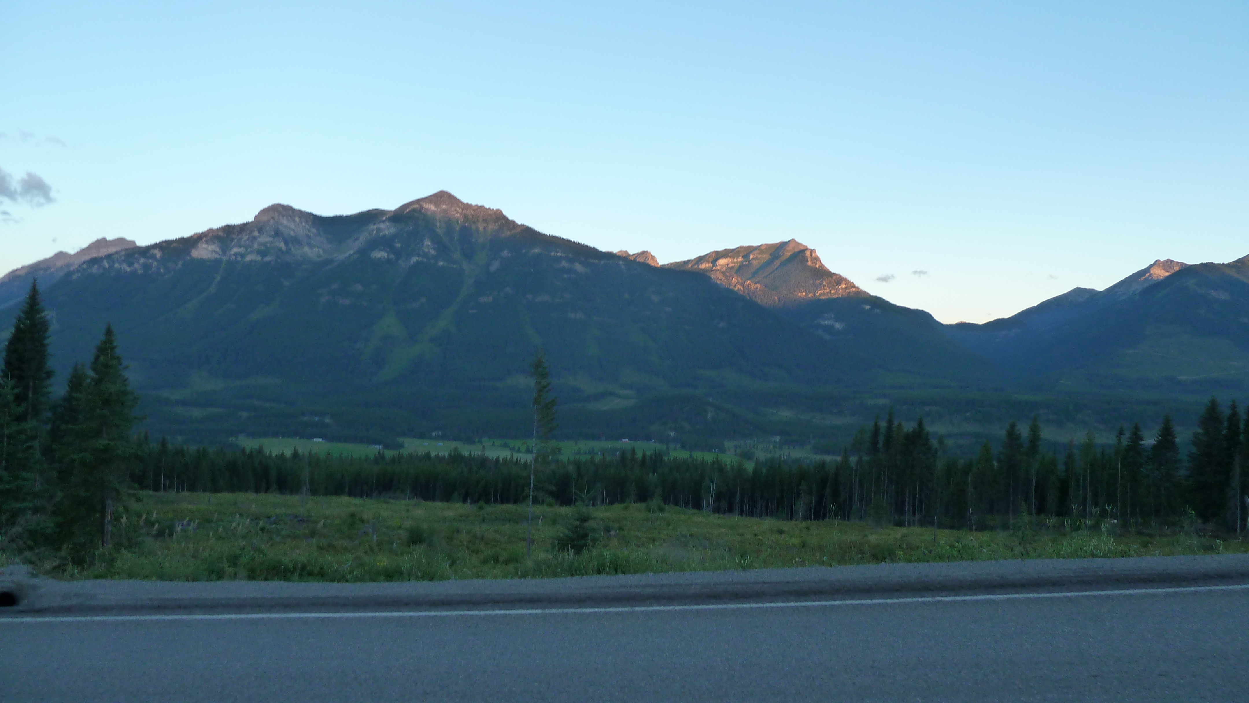
Sunrise on road out of Elkford

Sunrise on road out of Elkford
View from the 2nd floor roof @ greenhills. Looking west
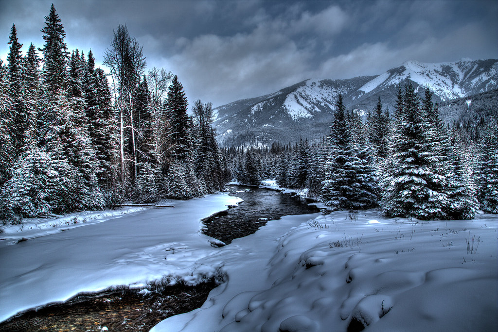
Winter River
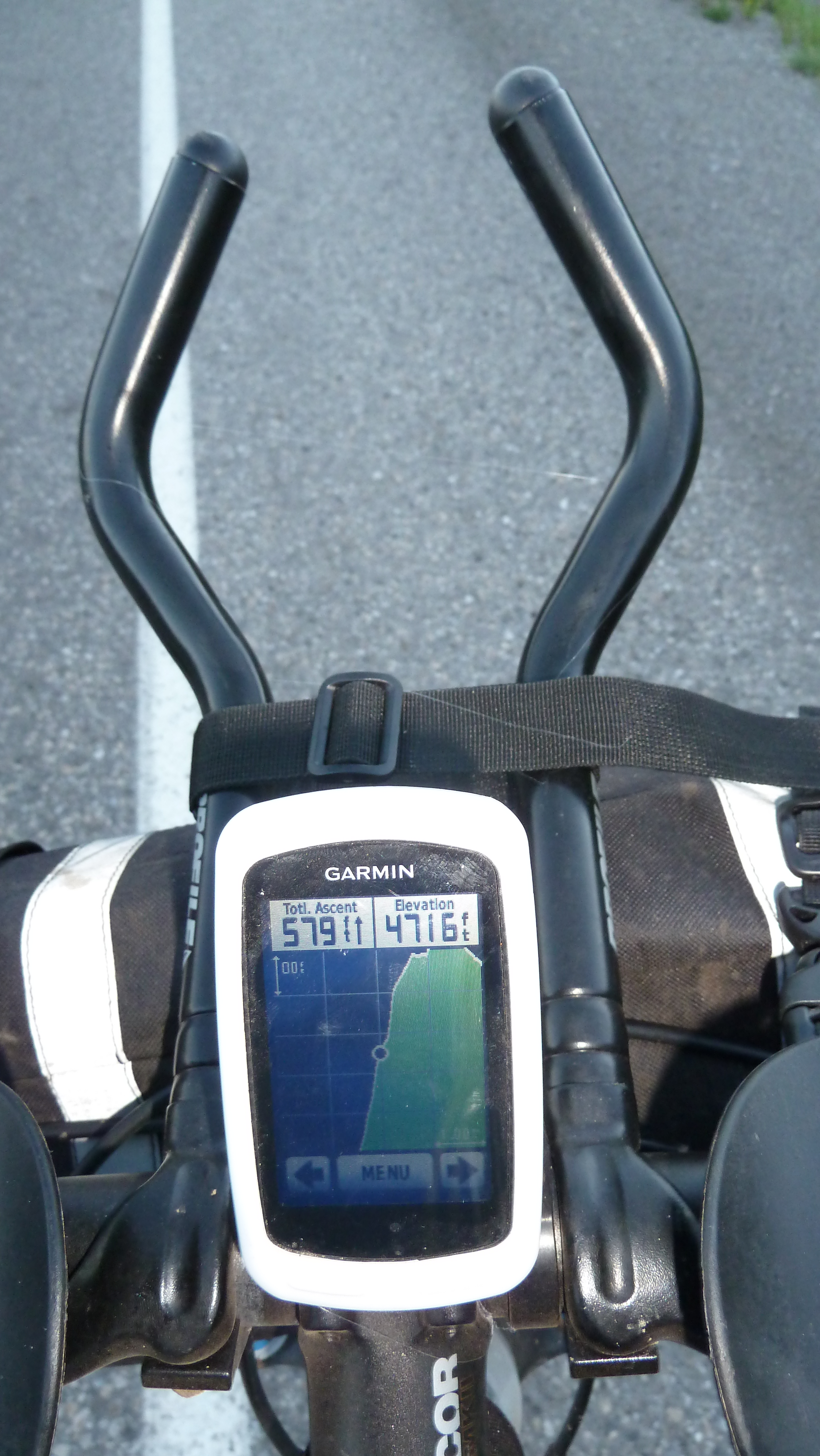
Navigation Center on Bike...
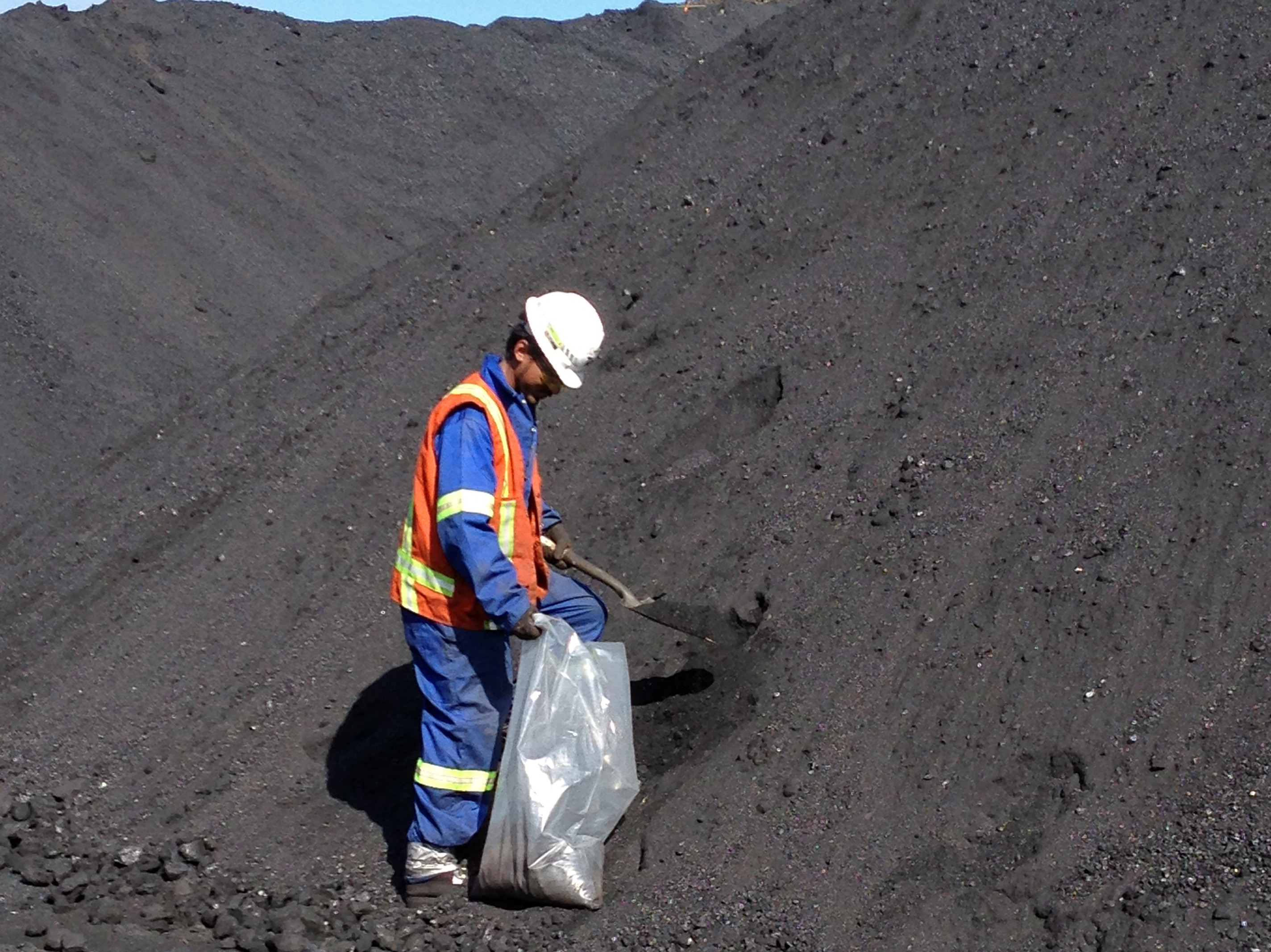
Sampling coal from coal pile; Photo: Saleh Ewan
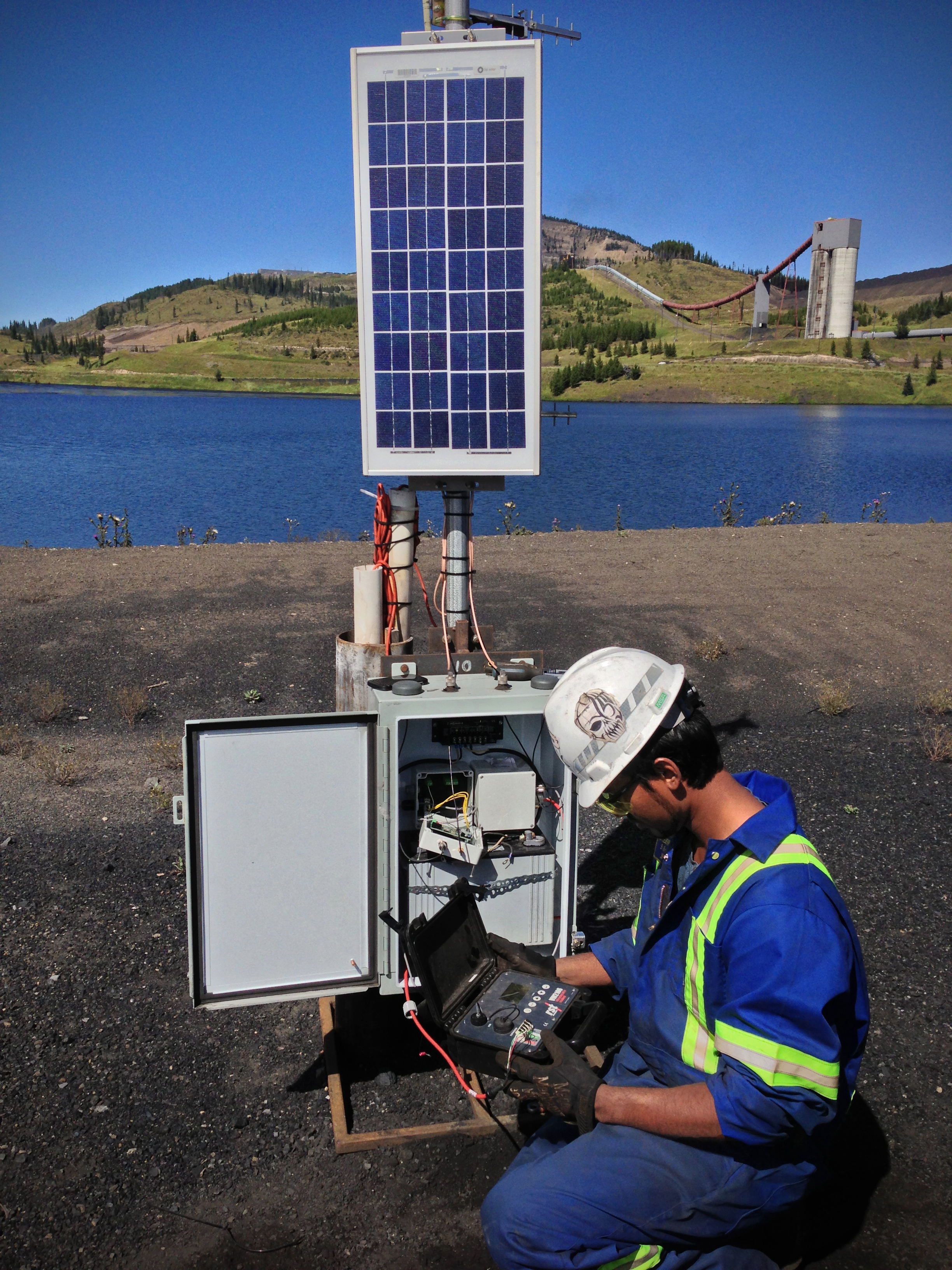
Taking reading from piezometer for "Slug test"; Photo: Saleh Ewan
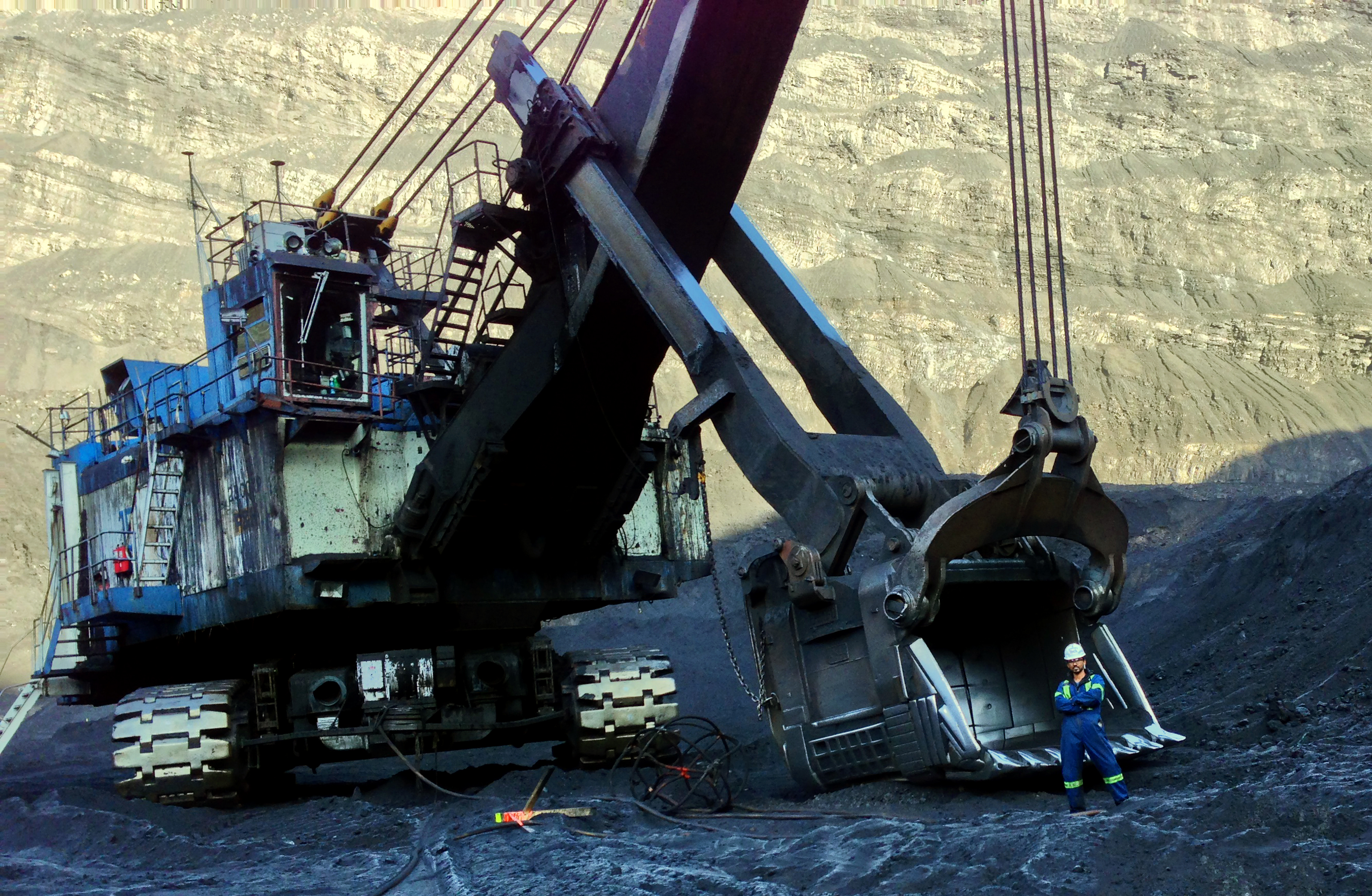
Size comparison: Man and Machine; Photo: Saleh Ewan
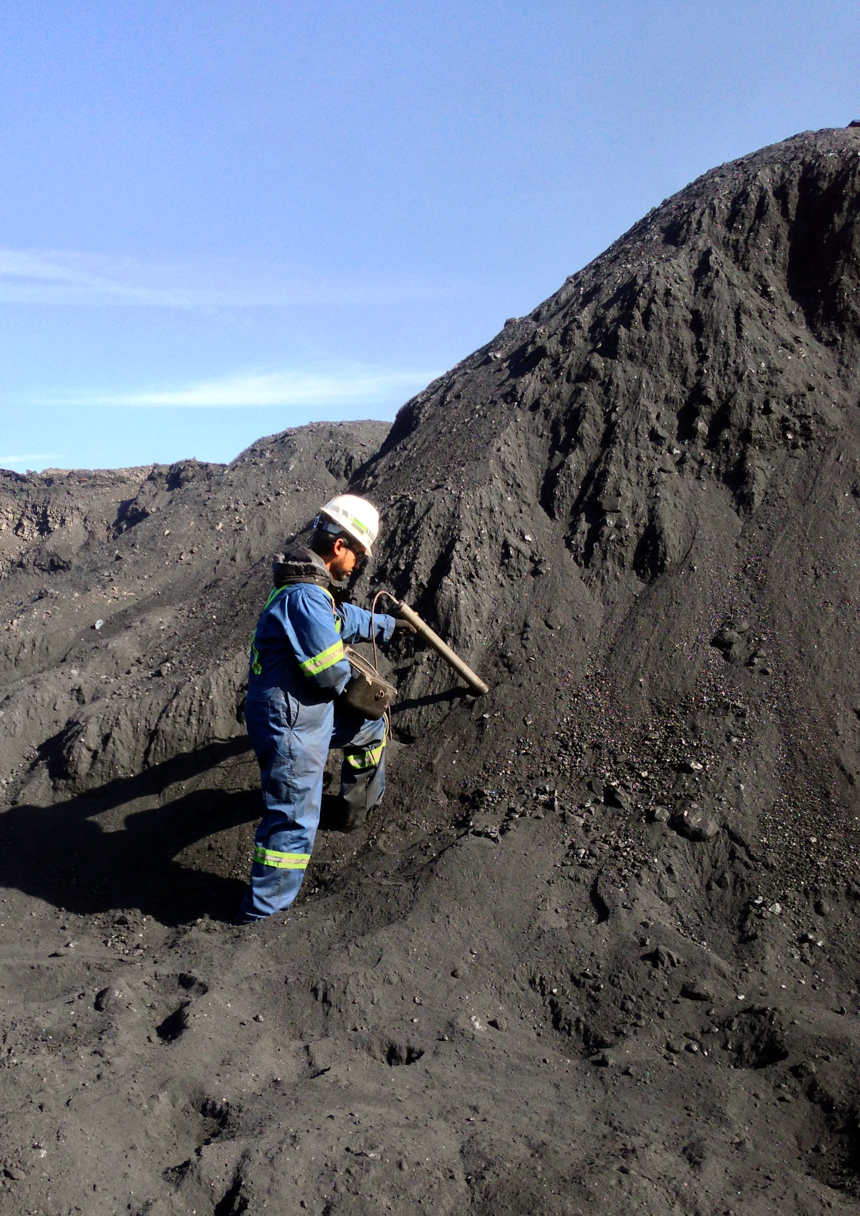
Checking ash percentage in coal pile using ash probe; Photo: Saleh Ewan
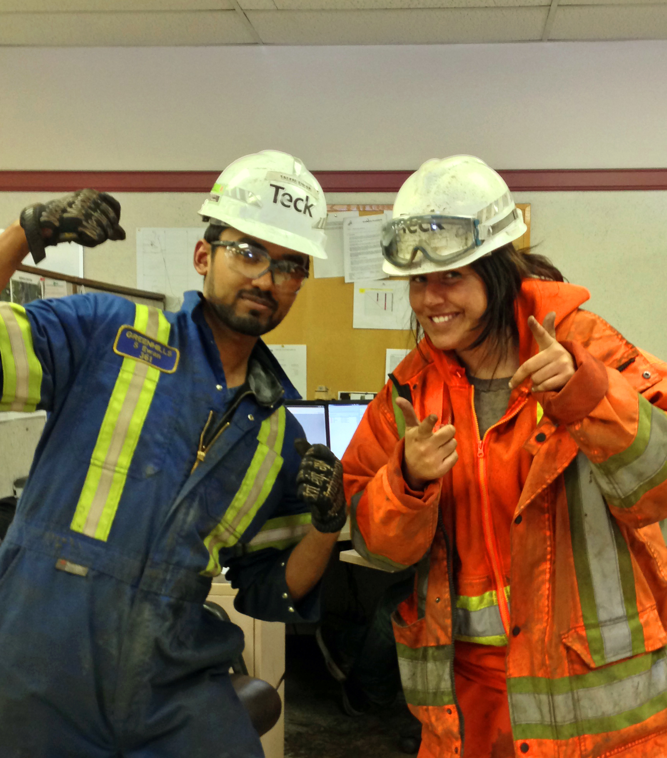
Fellow McGillian at Teck; Photo: Saleh Ewan
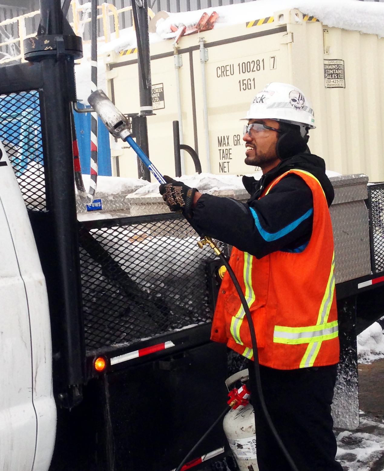
Melting ice from logging truck using a tiger torch; Photo: Saleh Ewan
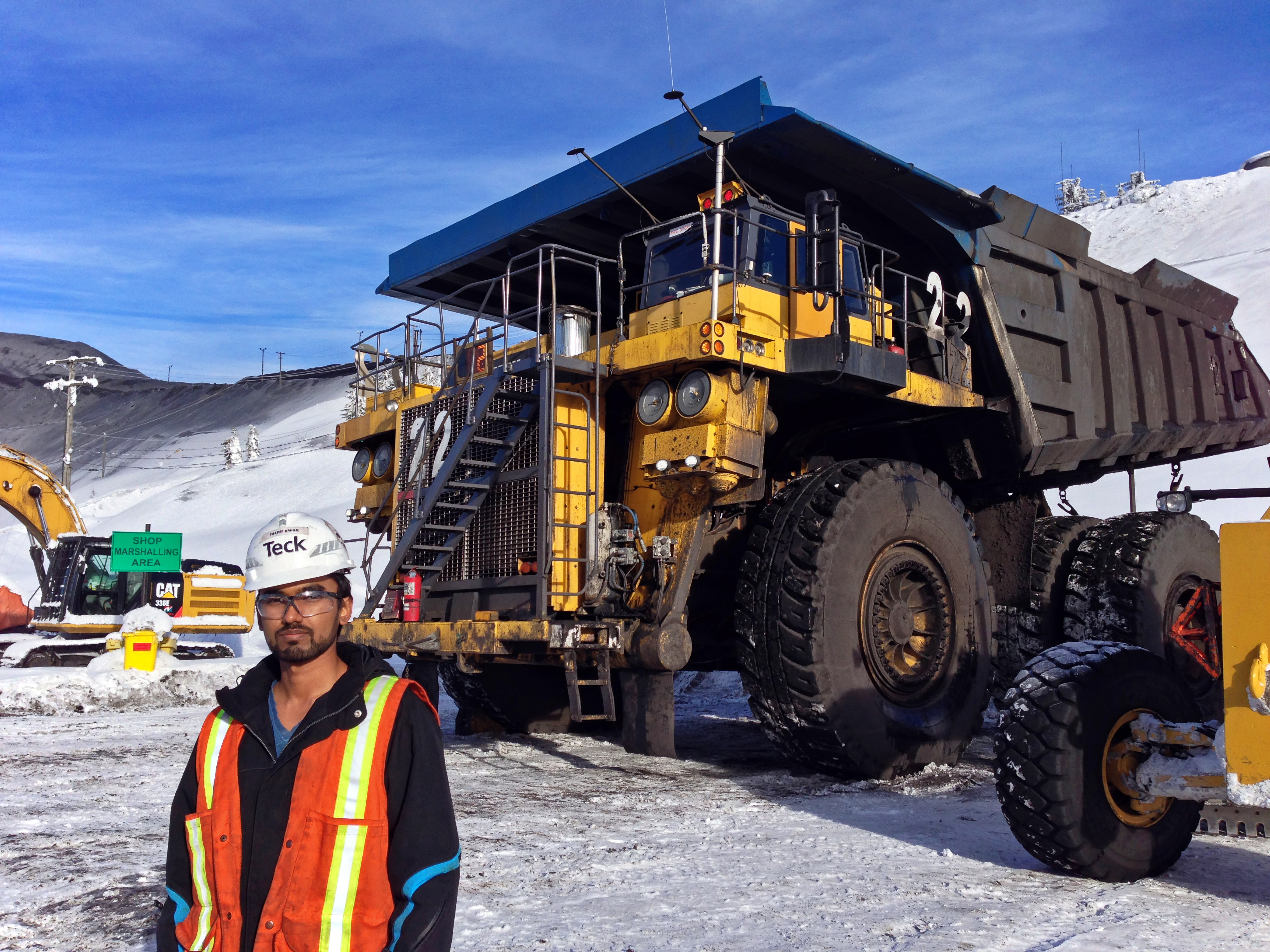
Komatsu 830E Haul Truck; Photo: Saleh Ewan

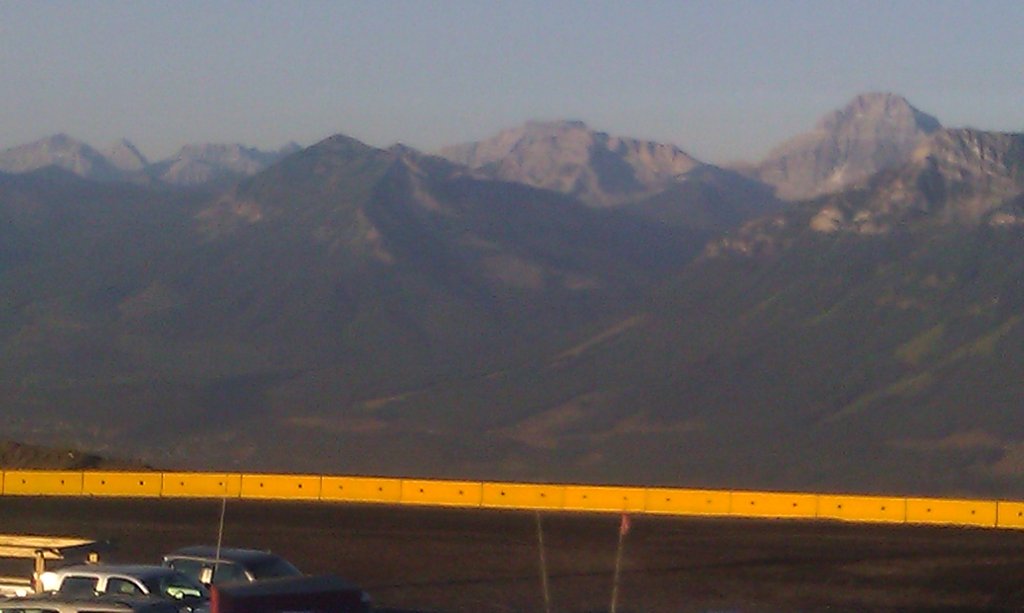
View of Rocky Mountain from Teck's Greenhills Operation; Photo: Saleh Ewan
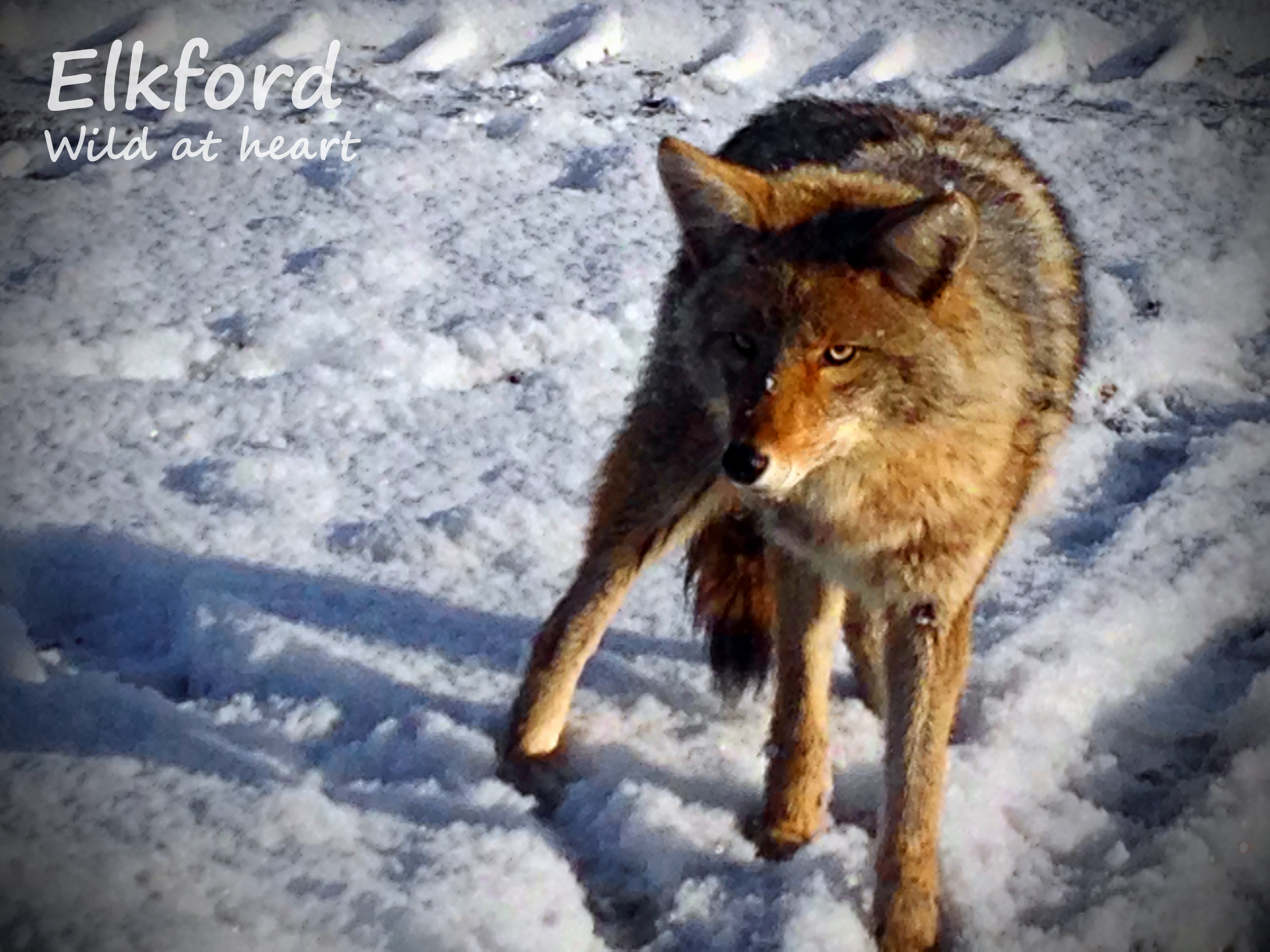
Elkford: Wild at heart
Mountain Range, Elkford

Forestry Trunk Road
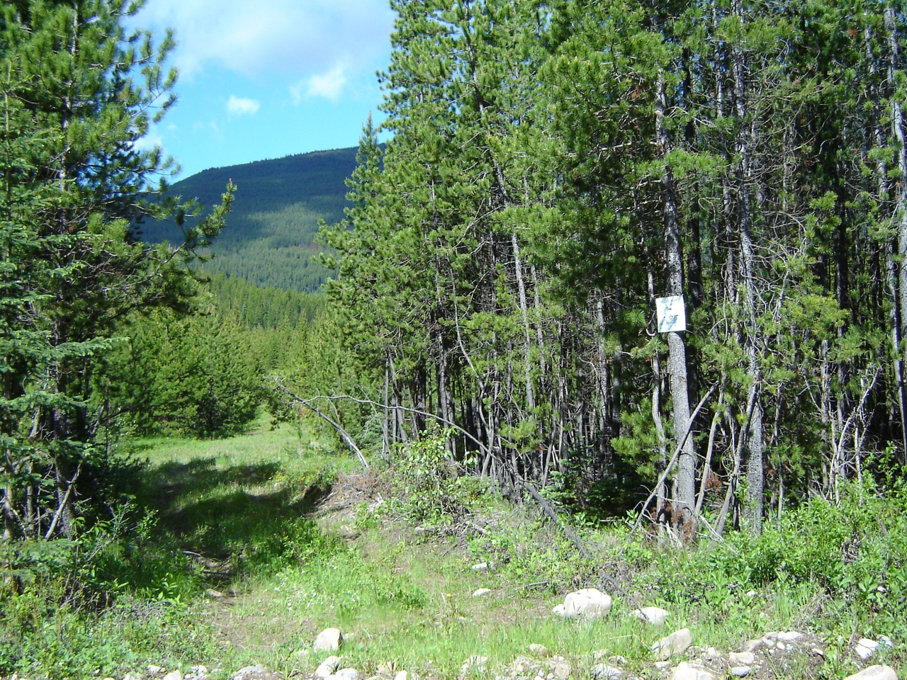
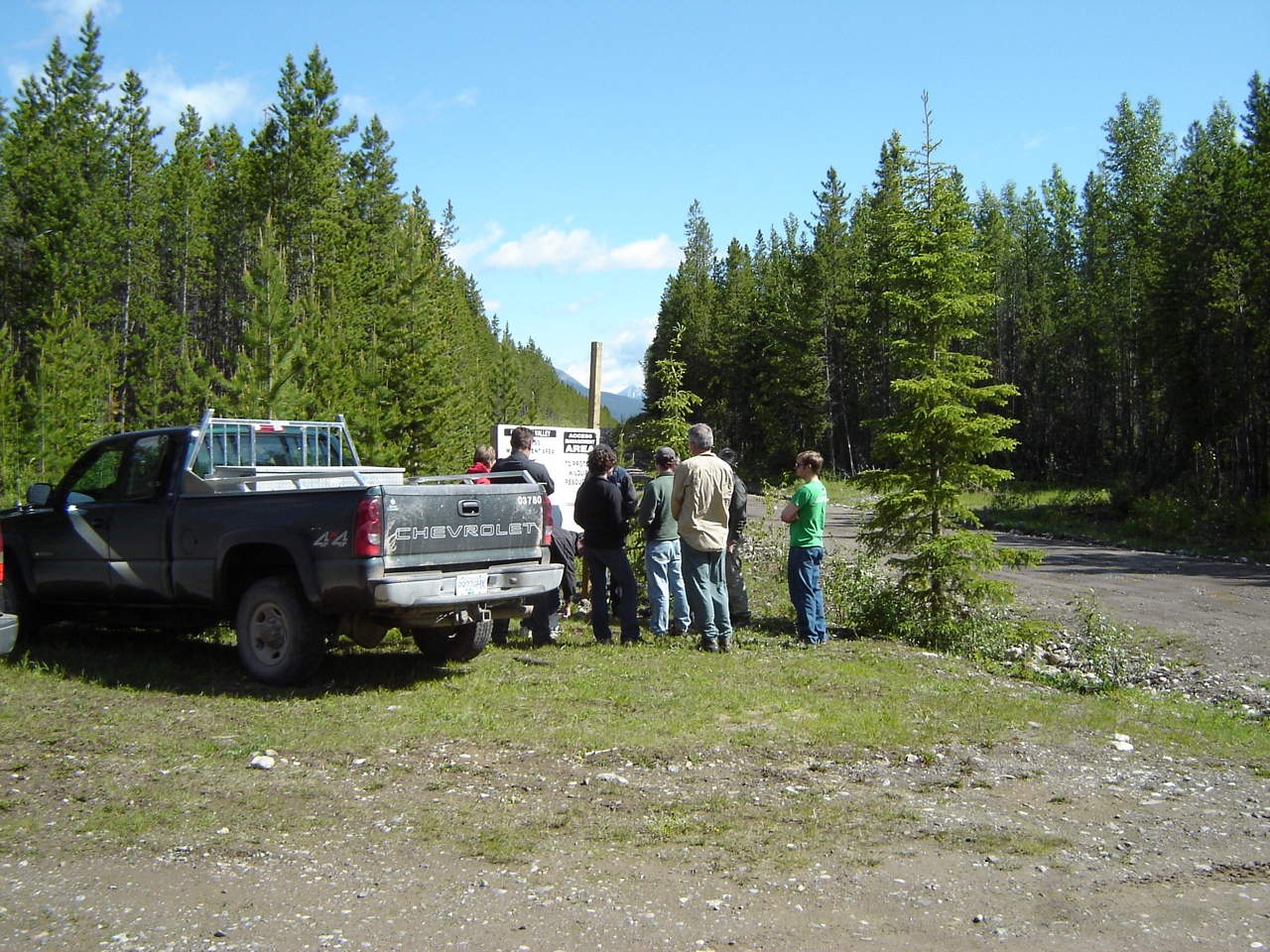
A sign at the next entrance to the north
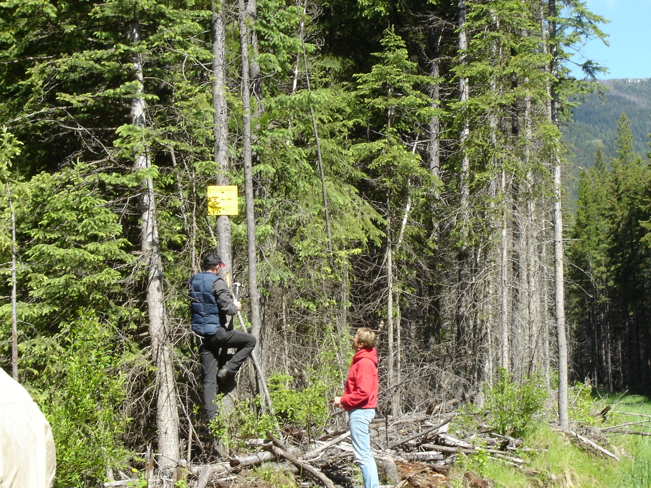
Replacing the MoE sign
Signs of illegal access by truck and ATV
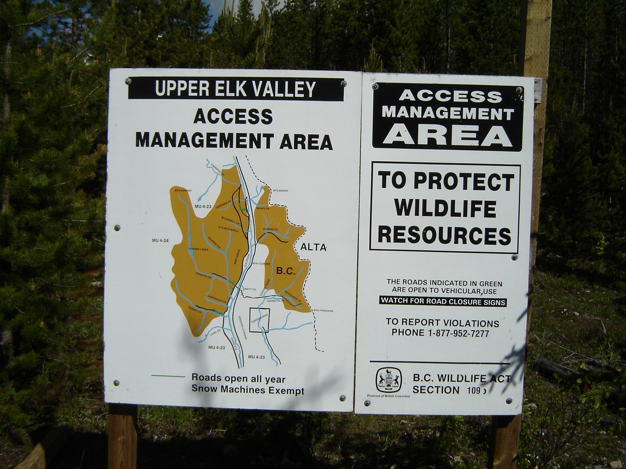
Upper Elk AMA sign
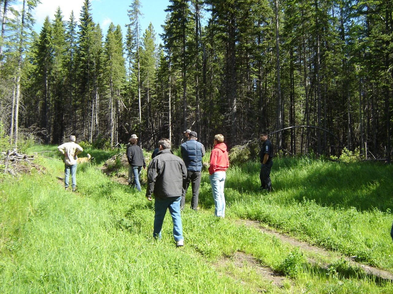
Orientation at Bleasdel Creek
O'Rourke W3, East Kootenay A, BC V0B加拿大的地圖
搜索其他地方的日出日落時間
附近地點
Gass N3, East Kootenay A, BC V0B加拿大
Peak 09-48, East Kootenay A, BC V0B加拿大
Mount Pierce, East Kootenay A, BC V0B加拿大
Mount Gass, East Kootenay A, BC V0B加拿大
Gass SW3, East Kootenay A, BC V0B加拿大
Mount Farquhar, East Kootenay A, BC V0B加拿大
Mount Scrimger, East Kootenay A, BC V0B加拿大
Mount Etherington, East Kootenay A, BC V0B加拿大
Gill Peak, East Kootenay A, BC V0B加拿大
Courcelette Peak, East Kootenay A, BC V0B加拿大
Baril Peak, Kananaskis, AB T0L加拿大
Mount Cornwell, East Kootenay A, BC V0B加拿大
Elkford, BC V0B加拿大
Courcelette NW2, East Kootenay A, BC V0B加拿大
High Rock Range, East Kootenay A, BC V0B加拿大
Courcelette NW3, East Kootenay A, BC V0B加拿大
Mount Tuxford, East Kootenay A, BC V0B加拿大
Mount Armstrong, East Kootenay A, BC V0B加拿大
Mount Veits, East Kootenay A, BC V0B加拿大
Mount Shankland, East Kootenay A, BC V0B加拿大
最近搜索
- Hickory St, Greenville, NC 美國的日出日落時間表
- V0T加拿大英屬哥倫比亞 North Coast, 莫爾斯比島的日出日落時間表
- Aliağa, Samurlu, Aliağa/İzmir, Türkiye的日出日落時間表
- 台灣台南市安南區幸福里的日出日落時間表
- 台灣台南市安南區國安街55巷 & 國安街的日出日落時間表
- 南非埃滕哈赫的日出日落時間表
- Brooks Lp, Spearfish, SD 美國的日出日落時間表
- Via Buonarroti, 26, Roma RM, 義大利的日出日落時間表
- Jais St - Wadi Shehah - Ras al Khaimah - 阿拉伯聯合大公國的日出日落時間表
- Benagil, Carvoeiro, 葡萄牙的日出日落時間表