Cotalo, 厄瓜多的日出日落時間表
Location: 厄瓜多爾 > 通古拉瓦 > 厄瓜多佩利萊奧縣 >
時區:
America/Guayaquil
當地時間:
2024-04-27 02:42:18
經度:
-78.509288
緯度:
-1.4240225
今天日出時間:
06:09:29 AM
今天日落時間:
06:13:36 PM
今天日照時長:
12h 4m 7s
明天日出時間:
06:09:22 AM
明天日落時間:
06:13:26 PM
明天日照時長:
12h 4m 4s
顯示所有日期
| 日期 | 日出 | 日落 | 日照時長 |
|---|---|---|---|
| 2024年01月01日 | 06:11:40 AM | 06:23:55 PM | 12h 12m 15s |
| 2024年01月02日 | 06:12:09 AM | 06:24:22 PM | 12h 12m 13s |
| 2024年01月03日 | 06:12:37 AM | 06:24:49 PM | 12h 12m 12s |
| 2024年01月04日 | 06:13:06 AM | 06:25:15 PM | 12h 12m 9s |
| 2024年01月05日 | 06:13:33 AM | 06:25:41 PM | 12h 12m 8s |
| 2024年01月06日 | 06:14:01 AM | 06:26:06 PM | 12h 12m 5s |
| 2024年01月07日 | 06:14:27 AM | 06:26:31 PM | 12h 12m 4s |
| 2024年01月08日 | 06:14:54 AM | 06:26:55 PM | 12h 12m 1s |
| 2024年01月09日 | 06:15:20 AM | 06:27:18 PM | 12h 11m 58s |
| 2024年01月10日 | 06:15:45 AM | 06:27:41 PM | 12h 11m 56s |
| 2024年01月11日 | 06:16:10 AM | 06:28:04 PM | 12h 11m 54s |
| 2024年01月12日 | 06:16:35 AM | 06:28:25 PM | 12h 11m 50s |
| 2024年01月13日 | 06:16:58 AM | 06:28:46 PM | 12h 11m 48s |
| 2024年01月14日 | 06:17:22 AM | 06:29:06 PM | 12h 11m 44s |
| 2024年01月15日 | 06:17:44 AM | 06:29:26 PM | 12h 11m 42s |
| 2024年01月16日 | 06:18:06 AM | 06:29:45 PM | 12h 11m 39s |
| 2024年01月17日 | 06:18:27 AM | 06:30:03 PM | 12h 11m 36s |
| 2024年01月18日 | 06:18:48 AM | 06:30:20 PM | 12h 11m 32s |
| 2024年01月19日 | 06:19:08 AM | 06:30:36 PM | 12h 11m 28s |
| 2024年01月20日 | 06:19:27 AM | 06:30:52 PM | 12h 11m 25s |
| 2024年01月21日 | 06:19:46 AM | 06:31:07 PM | 12h 11m 21s |
| 2024年01月22日 | 06:20:04 AM | 06:31:21 PM | 12h 11m 17s |
| 2024年01月23日 | 06:20:21 AM | 06:31:34 PM | 12h 11m 13s |
| 2024年01月24日 | 06:20:37 AM | 06:31:47 PM | 12h 11m 10s |
| 2024年01月25日 | 06:20:53 AM | 06:31:59 PM | 12h 11m 6s |
| 2024年01月26日 | 06:21:08 AM | 06:32:09 PM | 12h 11m 1s |
| 2024年01月27日 | 06:21:22 AM | 06:32:19 PM | 12h 10m 57s |
| 2024年01月28日 | 06:21:35 AM | 06:32:28 PM | 12h 10m 53s |
| 2024年01月29日 | 06:21:48 AM | 06:32:37 PM | 12h 10m 49s |
| 2024年01月30日 | 06:21:59 AM | 06:32:44 PM | 12h 10m 45s |
| 2024年01月31日 | 06:22:10 AM | 06:32:51 PM | 12h 10m 41s |
| 2024年02月01日 | 06:22:20 AM | 06:32:56 PM | 12h 10m 36s |
| 2024年02月02日 | 06:22:30 AM | 06:33:01 PM | 12h 10m 31s |
| 2024年02月03日 | 06:22:38 AM | 06:33:05 PM | 12h 10m 27s |
| 2024年02月04日 | 06:22:46 AM | 06:33:09 PM | 12h 10m 23s |
| 2024年02月05日 | 06:22:53 AM | 06:33:11 PM | 12h 10m 18s |
| 2024年02月06日 | 06:22:59 AM | 06:33:13 PM | 12h 10m 14s |
| 2024年02月07日 | 06:23:05 AM | 06:33:13 PM | 12h 10m 8s |
| 2024年02月08日 | 06:23:09 AM | 06:33:13 PM | 12h 10m 4s |
| 2024年02月09日 | 06:23:13 AM | 06:33:13 PM | 12h 10m 0s |
| 2024年02月10日 | 06:23:16 AM | 06:33:11 PM | 12h 9m 55s |
| 2024年02月11日 | 06:23:19 AM | 06:33:08 PM | 12h 9m 49s |
| 2024年02月12日 | 06:23:20 AM | 06:33:05 PM | 12h 9m 45s |
| 2024年02月13日 | 06:23:21 AM | 06:33:01 PM | 12h 9m 40s |
| 2024年02月14日 | 06:23:21 AM | 06:32:57 PM | 12h 9m 36s |
| 2024年02月15日 | 06:23:21 AM | 06:32:51 PM | 12h 9m 30s |
| 2024年02月16日 | 06:23:20 AM | 06:32:45 PM | 12h 9m 25s |
| 2024年02月17日 | 06:23:18 AM | 06:32:38 PM | 12h 9m 20s |
| 2024年02月18日 | 06:23:15 AM | 06:32:30 PM | 12h 9m 15s |
| 2024年02月19日 | 06:23:12 AM | 06:32:22 PM | 12h 9m 10s |
| 2024年02月20日 | 06:23:08 AM | 06:32:13 PM | 12h 9m 5s |
| 2024年02月21日 | 06:23:03 AM | 06:32:04 PM | 12h 9m 1s |
| 2024年02月22日 | 06:22:58 AM | 06:31:53 PM | 12h 8m 55s |
| 2024年02月23日 | 06:22:52 AM | 06:31:43 PM | 12h 8m 51s |
| 2024年02月24日 | 06:22:46 AM | 06:31:31 PM | 12h 8m 45s |
| 2024年02月25日 | 06:22:39 AM | 06:31:19 PM | 12h 8m 40s |
| 2024年02月26日 | 06:22:31 AM | 06:31:07 PM | 12h 8m 36s |
| 2024年02月27日 | 06:22:23 AM | 06:30:53 PM | 12h 8m 30s |
| 2024年02月28日 | 06:22:14 AM | 06:30:40 PM | 12h 8m 26s |
| 2024年02月29日 | 06:22:05 AM | 06:30:26 PM | 12h 8m 21s |
| 2024年03月01日 | 06:21:56 AM | 06:30:11 PM | 12h 8m 15s |
| 2024年03月02日 | 06:21:45 AM | 06:29:56 PM | 12h 8m 11s |
| 2024年03月03日 | 06:21:35 AM | 06:29:40 PM | 12h 8m 5s |
| 2024年03月04日 | 06:21:24 AM | 06:29:24 PM | 12h 8m 0s |
| 2024年03月05日 | 06:21:12 AM | 06:29:08 PM | 12h 7m 56s |
| 2024年03月06日 | 06:21:00 AM | 06:28:51 PM | 12h 7m 51s |
| 2024年03月07日 | 06:20:48 AM | 06:28:34 PM | 12h 7m 46s |
| 2024年03月08日 | 06:20:36 AM | 06:28:16 PM | 12h 7m 40s |
| 2024年03月09日 | 06:20:23 AM | 06:27:58 PM | 12h 7m 35s |
| 2024年03月10日 | 06:20:09 AM | 06:27:40 PM | 12h 7m 31s |
| 2024年03月11日 | 06:19:56 AM | 06:27:22 PM | 12h 7m 26s |
| 2024年03月12日 | 06:19:42 AM | 06:27:03 PM | 12h 7m 21s |
| 2024年03月13日 | 06:19:28 AM | 06:26:44 PM | 12h 7m 16s |
| 2024年03月14日 | 06:19:13 AM | 06:26:24 PM | 12h 7m 11s |
| 2024年03月15日 | 06:18:59 AM | 06:26:05 PM | 12h 7m 6s |
| 2024年03月16日 | 06:18:44 AM | 06:25:45 PM | 12h 7m 1s |
| 2024年03月17日 | 06:18:29 AM | 06:25:26 PM | 12h 6m 57s |
| 2024年03月18日 | 06:18:14 AM | 06:25:06 PM | 12h 6m 52s |
| 2024年03月19日 | 06:17:58 AM | 06:24:45 PM | 12h 6m 47s |
| 2024年03月20日 | 06:17:43 AM | 06:24:25 PM | 12h 6m 42s |
| 2024年03月21日 | 06:17:27 AM | 06:24:05 PM | 12h 6m 38s |
| 2024年03月22日 | 06:17:12 AM | 06:23:45 PM | 12h 6m 33s |
| 2024年03月23日 | 06:16:56 AM | 06:23:24 PM | 12h 6m 28s |
| 2024年03月24日 | 06:16:40 AM | 06:23:04 PM | 12h 6m 24s |
| 2024年03月25日 | 06:16:24 AM | 06:22:43 PM | 12h 6m 19s |
| 2024年03月26日 | 06:16:08 AM | 06:22:23 PM | 12h 6m 15s |
| 2024年03月27日 | 06:15:53 AM | 06:22:03 PM | 12h 6m 10s |
| 2024年03月28日 | 06:15:37 AM | 06:21:42 PM | 12h 6m 5s |
| 2024年03月29日 | 06:15:21 AM | 06:21:22 PM | 12h 6m 1s |
| 2024年03月30日 | 06:15:05 AM | 06:21:02 PM | 12h 5m 57s |
| 2024年03月31日 | 06:14:50 AM | 06:20:42 PM | 12h 5m 52s |
| 2024年04月01日 | 06:14:34 AM | 06:20:22 PM | 12h 5m 48s |
| 2024年04月02日 | 06:14:19 AM | 06:20:02 PM | 12h 5m 43s |
| 2024年04月03日 | 06:14:04 AM | 06:19:43 PM | 12h 5m 39s |
| 2024年04月04日 | 06:13:49 AM | 06:19:23 PM | 12h 5m 34s |
| 2024年04月05日 | 06:13:34 AM | 06:19:04 PM | 12h 5m 30s |
| 2024年04月06日 | 06:13:19 AM | 06:18:45 PM | 12h 5m 26s |
| 2024年04月07日 | 06:13:05 AM | 06:18:27 PM | 12h 5m 22s |
| 2024年04月08日 | 06:12:51 AM | 06:18:08 PM | 12h 5m 17s |
| 2024年04月09日 | 06:12:37 AM | 06:17:50 PM | 12h 5m 13s |
| 2024年04月10日 | 06:12:23 AM | 06:17:32 PM | 12h 5m 9s |
| 2024年04月11日 | 06:12:10 AM | 06:17:15 PM | 12h 5m 5s |
| 2024年04月12日 | 06:11:57 AM | 06:16:58 PM | 12h 5m 1s |
| 2024年04月13日 | 06:11:44 AM | 06:16:41 PM | 12h 4m 57s |
| 2024年04月14日 | 06:11:31 AM | 06:16:24 PM | 12h 4m 53s |
| 2024年04月15日 | 06:11:19 AM | 06:16:08 PM | 12h 4m 49s |
| 2024年04月16日 | 06:11:07 AM | 06:15:53 PM | 12h 4m 46s |
| 2024年04月17日 | 06:10:56 AM | 06:15:38 PM | 12h 4m 42s |
| 2024年04月18日 | 06:10:45 AM | 06:15:23 PM | 12h 4m 38s |
| 2024年04月19日 | 06:10:34 AM | 06:15:08 PM | 12h 4m 34s |
| 2024年04月20日 | 06:10:24 AM | 06:14:54 PM | 12h 4m 30s |
| 2024年04月21日 | 06:10:15 AM | 06:14:41 PM | 12h 4m 26s |
| 2024年04月22日 | 06:10:05 AM | 06:14:28 PM | 12h 4m 23s |
| 2024年04月23日 | 06:09:56 AM | 06:14:15 PM | 12h 4m 19s |
| 2024年04月24日 | 06:09:48 AM | 06:14:03 PM | 12h 4m 15s |
| 2024年04月25日 | 06:09:40 AM | 06:13:52 PM | 12h 4m 12s |
| 2024年04月26日 | 06:09:32 AM | 06:13:41 PM | 12h 4m 9s |
| 2024年04月27日 | 06:09:25 AM | 06:13:31 PM | 12h 4m 6s |
| 2024年04月28日 | 06:09:19 AM | 06:13:21 PM | 12h 4m 2s |
| 2024年04月29日 | 06:09:13 AM | 06:13:11 PM | 12h 3m 58s |
| 2024年04月30日 | 06:09:07 AM | 06:13:03 PM | 12h 3m 56s |
| 2024年05月01日 | 06:09:03 AM | 06:12:54 PM | 12h 3m 51s |
| 2024年05月02日 | 06:08:58 AM | 06:12:47 PM | 12h 3m 49s |
| 2024年05月03日 | 06:08:54 AM | 06:12:40 PM | 12h 3m 46s |
| 2024年05月04日 | 06:08:51 AM | 06:12:33 PM | 12h 3m 42s |
| 2024年05月05日 | 06:08:48 AM | 06:12:27 PM | 12h 3m 39s |
| 2024年05月06日 | 06:08:46 AM | 06:12:22 PM | 12h 3m 36s |
| 2024年05月07日 | 06:08:44 AM | 06:12:17 PM | 12h 3m 33s |
| 2024年05月08日 | 06:08:43 AM | 06:12:13 PM | 12h 3m 30s |
| 2024年05月09日 | 06:08:42 AM | 06:12:10 PM | 12h 3m 28s |
| 2024年05月10日 | 06:08:42 AM | 06:12:07 PM | 12h 3m 25s |
| 2024年05月11日 | 06:08:42 AM | 06:12:04 PM | 12h 3m 22s |
| 2024年05月12日 | 06:08:43 AM | 06:12:03 PM | 12h 3m 20s |
| 2024年05月13日 | 06:08:45 AM | 06:12:02 PM | 12h 3m 17s |
| 2024年05月14日 | 06:08:47 AM | 06:12:01 PM | 12h 3m 14s |
| 2024年05月15日 | 06:08:49 AM | 06:12:01 PM | 12h 3m 12s |
| 2024年05月16日 | 06:08:52 AM | 06:12:02 PM | 12h 3m 10s |
| 2024年05月17日 | 06:08:56 AM | 06:12:03 PM | 12h 3m 7s |
| 2024年05月18日 | 06:09:00 AM | 06:12:05 PM | 12h 3m 5s |
| 2024年05月19日 | 06:09:05 AM | 06:12:07 PM | 12h 3m 2s |
| 2024年05月20日 | 06:09:10 AM | 06:12:10 PM | 12h 3m 0s |
| 2024年05月21日 | 06:09:16 AM | 06:12:14 PM | 12h 2m 58s |
| 2024年05月22日 | 06:09:22 AM | 06:12:18 PM | 12h 2m 56s |
| 2024年05月23日 | 06:09:29 AM | 06:12:23 PM | 12h 2m 54s |
| 2024年05月24日 | 06:09:36 AM | 06:12:28 PM | 12h 2m 52s |
| 2024年05月25日 | 06:09:43 AM | 06:12:33 PM | 12h 2m 50s |
| 2024年05月26日 | 06:09:51 AM | 06:12:40 PM | 12h 2m 49s |
| 2024年05月27日 | 06:10:00 AM | 06:12:46 PM | 12h 2m 46s |
| 2024年05月28日 | 06:10:08 AM | 06:12:53 PM | 12h 2m 45s |
| 2024年05月29日 | 06:10:18 AM | 06:13:01 PM | 12h 2m 43s |
| 2024年05月30日 | 06:10:27 AM | 06:13:09 PM | 12h 2m 42s |
| 2024年05月31日 | 06:10:37 AM | 06:13:18 PM | 12h 2m 41s |
| 2024年06月01日 | 06:10:47 AM | 06:13:26 PM | 12h 2m 39s |
| 2024年06月02日 | 06:10:58 AM | 06:13:36 PM | 12h 2m 38s |
| 2024年06月03日 | 06:11:09 AM | 06:13:45 PM | 12h 2m 36s |
| 2024年06月04日 | 06:11:20 AM | 06:13:56 PM | 12h 2m 36s |
| 2024年06月05日 | 06:11:32 AM | 06:14:06 PM | 12h 2m 34s |
| 2024年06月06日 | 06:11:44 AM | 06:14:17 PM | 12h 2m 33s |
| 2024年06月07日 | 06:11:56 AM | 06:14:28 PM | 12h 2m 32s |
| 2024年06月08日 | 06:12:08 AM | 06:14:39 PM | 12h 2m 31s |
| 2024年06月09日 | 06:12:20 AM | 06:14:51 PM | 12h 2m 31s |
| 2024年06月10日 | 06:12:33 AM | 06:15:03 PM | 12h 2m 30s |
| 2024年06月11日 | 06:12:46 AM | 06:15:15 PM | 12h 2m 29s |
| 2024年06月12日 | 06:12:59 AM | 06:15:27 PM | 12h 2m 28s |
| 2024年06月13日 | 06:13:12 AM | 06:15:39 PM | 12h 2m 27s |
| 2024年06月14日 | 06:13:25 AM | 06:15:52 PM | 12h 2m 27s |
| 2024年06月15日 | 06:13:38 AM | 06:16:05 PM | 12h 2m 27s |
| 2024年06月16日 | 06:13:51 AM | 06:16:18 PM | 12h 2m 27s |
| 2024年06月17日 | 06:14:04 AM | 06:16:31 PM | 12h 2m 27s |
| 2024年06月18日 | 06:14:17 AM | 06:16:44 PM | 12h 2m 27s |
| 2024年06月19日 | 06:14:30 AM | 06:16:57 PM | 12h 2m 27s |
| 2024年06月20日 | 06:14:43 AM | 06:17:10 PM | 12h 2m 27s |
| 2024年06月21日 | 06:14:56 AM | 06:17:23 PM | 12h 2m 27s |
| 2024年06月22日 | 06:15:09 AM | 06:17:36 PM | 12h 2m 27s |
| 2024年06月23日 | 06:15:22 AM | 06:17:49 PM | 12h 2m 27s |
| 2024年06月24日 | 06:15:35 AM | 06:18:02 PM | 12h 2m 27s |
| 2024年06月25日 | 06:15:47 AM | 06:18:14 PM | 12h 2m 27s |
| 2024年06月26日 | 06:15:59 AM | 06:18:27 PM | 12h 2m 28s |
| 2024年06月27日 | 06:16:11 AM | 06:18:39 PM | 12h 2m 28s |
| 2024年06月28日 | 06:16:23 AM | 06:18:52 PM | 12h 2m 29s |
| 2024年06月29日 | 06:16:34 AM | 06:19:04 PM | 12h 2m 30s |
| 2024年06月30日 | 06:16:46 AM | 06:19:16 PM | 12h 2m 30s |
| 2024年07月01日 | 06:16:57 AM | 06:19:28 PM | 12h 2m 31s |
| 2024年07月02日 | 06:17:07 AM | 06:19:39 PM | 12h 2m 32s |
| 2024年07月03日 | 06:17:17 AM | 06:19:50 PM | 12h 2m 33s |
| 2024年07月04日 | 06:17:27 AM | 06:20:01 PM | 12h 2m 34s |
| 2024年07月05日 | 06:17:37 AM | 06:20:12 PM | 12h 2m 35s |
| 2024年07月06日 | 06:17:46 AM | 06:20:22 PM | 12h 2m 36s |
| 2024年07月07日 | 06:17:54 AM | 06:20:32 PM | 12h 2m 38s |
| 2024年07月08日 | 06:18:02 AM | 06:20:41 PM | 12h 2m 39s |
| 2024年07月09日 | 06:18:10 AM | 06:20:50 PM | 12h 2m 40s |
| 2024年07月10日 | 06:18:17 AM | 06:20:59 PM | 12h 2m 42s |
| 2024年07月11日 | 06:18:24 AM | 06:21:07 PM | 12h 2m 43s |
| 2024年07月12日 | 06:18:30 AM | 06:21:15 PM | 12h 2m 45s |
| 2024年07月13日 | 06:18:36 AM | 06:21:22 PM | 12h 2m 46s |
| 2024年07月14日 | 06:18:41 AM | 06:21:29 PM | 12h 2m 48s |
| 2024年07月15日 | 06:18:46 AM | 06:21:36 PM | 12h 2m 50s |
| 2024年07月16日 | 06:18:50 AM | 06:21:41 PM | 12h 2m 51s |
| 2024年07月17日 | 06:18:53 AM | 06:21:47 PM | 12h 2m 54s |
| 2024年07月18日 | 06:18:56 AM | 06:21:52 PM | 12h 2m 56s |
| 2024年07月19日 | 06:18:58 AM | 06:21:56 PM | 12h 2m 58s |
| 2024年07月20日 | 06:19:00 AM | 06:22:00 PM | 12h 3m 0s |
| 2024年07月21日 | 06:19:01 AM | 06:22:03 PM | 12h 3m 2s |
| 2024年07月22日 | 06:19:02 AM | 06:22:06 PM | 12h 3m 4s |
| 2024年07月23日 | 06:19:02 AM | 06:22:08 PM | 12h 3m 6s |
| 2024年07月24日 | 06:19:01 AM | 06:22:10 PM | 12h 3m 9s |
| 2024年07月25日 | 06:19:00 AM | 06:22:11 PM | 12h 3m 11s |
| 2024年07月26日 | 06:18:58 AM | 06:22:11 PM | 12h 3m 13s |
| 2024年07月27日 | 06:18:55 AM | 06:22:11 PM | 12h 3m 16s |
| 2024年07月28日 | 06:18:52 AM | 06:22:11 PM | 12h 3m 19s |
| 2024年07月29日 | 06:18:48 AM | 06:22:09 PM | 12h 3m 21s |
| 2024年07月30日 | 06:18:43 AM | 06:22:07 PM | 12h 3m 24s |
| 2024年07月31日 | 06:18:38 AM | 06:22:05 PM | 12h 3m 27s |
| 2024年08月01日 | 06:18:32 AM | 06:22:02 PM | 12h 3m 30s |
| 2024年08月02日 | 06:18:26 AM | 06:21:58 PM | 12h 3m 32s |
| 2024年08月03日 | 06:18:19 AM | 06:21:54 PM | 12h 3m 35s |
| 2024年08月04日 | 06:18:11 AM | 06:21:50 PM | 12h 3m 39s |
| 2024年08月05日 | 06:18:03 AM | 06:21:44 PM | 12h 3m 41s |
| 2024年08月06日 | 06:17:54 AM | 06:21:38 PM | 12h 3m 44s |
| 2024年08月07日 | 06:17:45 AM | 06:21:32 PM | 12h 3m 47s |
| 2024年08月08日 | 06:17:34 AM | 06:21:25 PM | 12h 3m 51s |
| 2024年08月09日 | 06:17:24 AM | 06:21:17 PM | 12h 3m 53s |
| 2024年08月10日 | 06:17:12 AM | 06:21:09 PM | 12h 3m 57s |
| 2024年08月11日 | 06:17:01 AM | 06:21:01 PM | 12h 4m 0s |
| 2024年08月12日 | 06:16:48 AM | 06:20:52 PM | 12h 4m 4s |
| 2024年08月13日 | 06:16:35 AM | 06:20:42 PM | 12h 4m 7s |
| 2024年08月14日 | 06:16:21 AM | 06:20:32 PM | 12h 4m 11s |
| 2024年08月15日 | 06:16:07 AM | 06:20:21 PM | 12h 4m 14s |
| 2024年08月16日 | 06:15:53 AM | 06:20:10 PM | 12h 4m 17s |
| 2024年08月17日 | 06:15:37 AM | 06:19:58 PM | 12h 4m 21s |
| 2024年08月18日 | 06:15:22 AM | 06:19:46 PM | 12h 4m 24s |
| 2024年08月19日 | 06:15:05 AM | 06:19:33 PM | 12h 4m 28s |
| 2024年08月20日 | 06:14:49 AM | 06:19:20 PM | 12h 4m 31s |
| 2024年08月21日 | 06:14:31 AM | 06:19:07 PM | 12h 4m 36s |
| 2024年08月22日 | 06:14:14 AM | 06:18:53 PM | 12h 4m 39s |
| 2024年08月23日 | 06:13:56 AM | 06:18:39 PM | 12h 4m 43s |
| 2024年08月24日 | 06:13:37 AM | 06:18:24 PM | 12h 4m 47s |
| 2024年08月25日 | 06:13:18 AM | 06:18:09 PM | 12h 4m 51s |
| 2024年08月26日 | 06:12:59 AM | 06:17:54 PM | 12h 4m 55s |
| 2024年08月27日 | 06:12:39 AM | 06:17:38 PM | 12h 4m 59s |
| 2024年08月28日 | 06:12:19 AM | 06:17:22 PM | 12h 5m 3s |
| 2024年08月29日 | 06:11:59 AM | 06:17:05 PM | 12h 5m 6s |
| 2024年08月30日 | 06:11:38 AM | 06:16:48 PM | 12h 5m 10s |
| 2024年08月31日 | 06:11:17 AM | 06:16:31 PM | 12h 5m 14s |
| 2024年09月01日 | 06:10:55 AM | 06:16:14 PM | 12h 5m 19s |
| 2024年09月02日 | 06:10:34 AM | 06:15:56 PM | 12h 5m 22s |
| 2024年09月03日 | 06:10:12 AM | 06:15:39 PM | 12h 5m 27s |
| 2024年09月04日 | 06:09:49 AM | 06:15:21 PM | 12h 5m 32s |
| 2024年09月05日 | 06:09:27 AM | 06:15:02 PM | 12h 5m 35s |
| 2024年09月06日 | 06:09:04 AM | 06:14:44 PM | 12h 5m 40s |
| 2024年09月07日 | 06:08:41 AM | 06:14:26 PM | 12h 5m 45s |
| 2024年09月08日 | 06:08:18 AM | 06:14:07 PM | 12h 5m 49s |
| 2024年09月09日 | 06:07:55 AM | 06:13:48 PM | 12h 5m 53s |
| 2024年09月10日 | 06:07:32 AM | 06:13:29 PM | 12h 5m 57s |
| 2024年09月11日 | 06:07:08 AM | 06:13:10 PM | 12h 6m 2s |
| 2024年09月12日 | 06:06:45 AM | 06:12:51 PM | 12h 6m 6s |
| 2024年09月13日 | 06:06:21 AM | 06:12:32 PM | 12h 6m 11s |
| 2024年09月14日 | 06:05:58 AM | 06:12:13 PM | 12h 6m 15s |
| 2024年09月15日 | 06:05:34 AM | 06:11:53 PM | 12h 6m 19s |
| 2024年09月16日 | 06:05:10 AM | 06:11:34 PM | 12h 6m 24s |
| 2024年09月17日 | 06:04:46 AM | 06:11:15 PM | 12h 6m 29s |
| 2024年09月18日 | 06:04:23 AM | 06:10:56 PM | 12h 6m 33s |
| 2024年09月19日 | 06:03:59 AM | 06:10:37 PM | 12h 6m 38s |
| 2024年09月20日 | 06:03:36 AM | 06:10:18 PM | 12h 6m 42s |
| 2024年09月21日 | 06:03:12 AM | 06:09:59 PM | 12h 6m 47s |
| 2024年09月22日 | 06:02:49 AM | 06:09:40 PM | 12h 6m 51s |
| 2024年09月23日 | 06:02:25 AM | 06:09:22 PM | 12h 6m 57s |
| 2024年09月24日 | 06:02:02 AM | 06:09:04 PM | 12h 7m 2s |
| 2024年09月25日 | 06:01:39 AM | 06:08:45 PM | 12h 7m 6s |
| 2024年09月26日 | 06:01:17 AM | 06:08:27 PM | 12h 7m 10s |
| 2024年09月27日 | 06:00:54 AM | 06:08:10 PM | 12h 7m 16s |
| 2024年09月28日 | 06:00:32 AM | 06:07:52 PM | 12h 7m 20s |
| 2024年09月29日 | 06:00:10 AM | 06:07:35 PM | 12h 7m 25s |
| 2024年09月30日 | 05:59:48 AM | 06:07:18 PM | 12h 7m 30s |
| 2024年10月01日 | 05:59:26 AM | 06:07:01 PM | 12h 7m 35s |
| 2024年10月02日 | 05:59:05 AM | 06:06:45 PM | 12h 7m 40s |
| 2024年10月03日 | 05:58:44 AM | 06:06:29 PM | 12h 7m 45s |
| 2024年10月04日 | 05:58:24 AM | 06:06:13 PM | 12h 7m 49s |
| 2024年10月05日 | 05:58:04 AM | 06:05:58 PM | 12h 7m 54s |
| 2024年10月06日 | 05:57:44 AM | 06:05:43 PM | 12h 7m 59s |
| 2024年10月07日 | 05:57:25 AM | 06:05:29 PM | 12h 8m 4s |
| 2024年10月08日 | 05:57:06 AM | 06:05:15 PM | 12h 8m 9s |
| 2024年10月09日 | 05:56:48 AM | 06:05:02 PM | 12h 8m 14s |
| 2024年10月10日 | 05:56:30 AM | 06:04:49 PM | 12h 8m 19s |
| 2024年10月11日 | 05:56:12 AM | 06:04:36 PM | 12h 8m 24s |
| 2024年10月12日 | 05:55:55 AM | 06:04:24 PM | 12h 8m 29s |
| 2024年10月13日 | 05:55:39 AM | 06:04:13 PM | 12h 8m 34s |
| 2024年10月14日 | 05:55:23 AM | 06:04:02 PM | 12h 8m 39s |
| 2024年10月15日 | 05:55:08 AM | 06:03:52 PM | 12h 8m 44s |
| 2024年10月16日 | 05:54:53 AM | 06:03:42 PM | 12h 8m 49s |
| 2024年10月17日 | 05:54:39 AM | 06:03:33 PM | 12h 8m 54s |
| 2024年10月18日 | 05:54:26 AM | 06:03:24 PM | 12h 8m 58s |
| 2024年10月19日 | 05:54:13 AM | 06:03:17 PM | 12h 9m 4s |
| 2024年10月20日 | 05:54:01 AM | 06:03:09 PM | 12h 9m 8s |
| 2024年10月21日 | 05:53:49 AM | 06:03:03 PM | 12h 9m 14s |
| 2024年10月22日 | 05:53:39 AM | 06:02:57 PM | 12h 9m 18s |
| 2024年10月23日 | 05:53:29 AM | 06:02:52 PM | 12h 9m 23s |
| 2024年10月24日 | 05:53:19 AM | 06:02:47 PM | 12h 9m 28s |
| 2024年10月25日 | 05:53:11 AM | 06:02:44 PM | 12h 9m 33s |
| 2024年10月26日 | 05:53:03 AM | 06:02:41 PM | 12h 9m 38s |
| 2024年10月27日 | 05:52:56 AM | 06:02:38 PM | 12h 9m 42s |
| 2024年10月28日 | 05:52:49 AM | 06:02:37 PM | 12h 9m 48s |
| 2024年10月29日 | 05:52:44 AM | 06:02:36 PM | 12h 9m 52s |
| 2024年10月30日 | 05:52:39 AM | 06:02:36 PM | 12h 9m 57s |
| 2024年10月31日 | 05:52:35 AM | 06:02:37 PM | 12h 10m 2s |
| 2024年11月01日 | 05:52:32 AM | 06:02:38 PM | 12h 10m 6s |
| 2024年11月02日 | 05:52:30 AM | 06:02:41 PM | 12h 10m 11s |
| 2024年11月03日 | 05:52:28 AM | 06:02:44 PM | 12h 10m 16s |
| 2024年11月04日 | 05:52:28 AM | 06:02:48 PM | 12h 10m 20s |
| 2024年11月05日 | 05:52:28 AM | 06:02:53 PM | 12h 10m 25s |
| 2024年11月06日 | 05:52:29 AM | 06:02:58 PM | 12h 10m 29s |
| 2024年11月07日 | 05:52:31 AM | 06:03:05 PM | 12h 10m 34s |
| 2024年11月08日 | 05:52:34 AM | 06:03:12 PM | 12h 10m 38s |
| 2024年11月09日 | 05:52:38 AM | 06:03:20 PM | 12h 10m 42s |
| 2024年11月10日 | 05:52:43 AM | 06:03:29 PM | 12h 10m 46s |
| 2024年11月11日 | 05:52:48 AM | 06:03:39 PM | 12h 10m 51s |
| 2024年11月12日 | 05:52:54 AM | 06:03:49 PM | 12h 10m 55s |
| 2024年11月13日 | 05:53:02 AM | 06:04:01 PM | 12h 10m 59s |
| 2024年11月14日 | 05:53:10 AM | 06:04:13 PM | 12h 11m 3s |
| 2024年11月15日 | 05:53:19 AM | 06:04:26 PM | 12h 11m 7s |
| 2024年11月16日 | 05:53:29 AM | 06:04:40 PM | 12h 11m 11s |
| 2024年11月17日 | 05:53:39 AM | 06:04:54 PM | 12h 11m 15s |
| 2024年11月18日 | 05:53:51 AM | 06:05:10 PM | 12h 11m 19s |
| 2024年11月19日 | 05:54:03 AM | 06:05:26 PM | 12h 11m 23s |
| 2024年11月20日 | 05:54:17 AM | 06:05:43 PM | 12h 11m 26s |
| 2024年11月21日 | 05:54:31 AM | 06:06:00 PM | 12h 11m 29s |
| 2024年11月22日 | 05:54:46 AM | 06:06:19 PM | 12h 11m 33s |
| 2024年11月23日 | 05:55:02 AM | 06:06:38 PM | 12h 11m 36s |
| 2024年11月24日 | 05:55:18 AM | 06:06:58 PM | 12h 11m 40s |
| 2024年11月25日 | 05:55:36 AM | 06:07:18 PM | 12h 11m 42s |
| 2024年11月26日 | 05:55:54 AM | 06:07:39 PM | 12h 11m 45s |
| 2024年11月27日 | 05:56:13 AM | 06:08:01 PM | 12h 11m 48s |
| 2024年11月28日 | 05:56:32 AM | 06:08:24 PM | 12h 11m 52s |
| 2024年11月29日 | 05:56:53 AM | 06:08:47 PM | 12h 11m 54s |
| 2024年11月30日 | 05:57:14 AM | 06:09:11 PM | 12h 11m 57s |
| 2024年12月01日 | 05:57:36 AM | 06:09:35 PM | 12h 11m 59s |
| 2024年12月02日 | 05:57:58 AM | 06:10:00 PM | 12h 12m 2s |
| 2024年12月03日 | 05:58:21 AM | 06:10:25 PM | 12h 12m 4s |
| 2024年12月04日 | 05:58:45 AM | 06:10:51 PM | 12h 12m 6s |
| 2024年12月05日 | 05:59:09 AM | 06:11:18 PM | 12h 12m 9s |
| 2024年12月06日 | 05:59:34 AM | 06:11:44 PM | 12h 12m 10s |
| 2024年12月07日 | 06:00:00 AM | 06:12:12 PM | 12h 12m 12s |
| 2024年12月08日 | 06:00:26 AM | 06:12:39 PM | 12h 12m 13s |
| 2024年12月09日 | 06:00:52 AM | 06:13:07 PM | 12h 12m 15s |
| 2024年12月10日 | 06:01:19 AM | 06:13:36 PM | 12h 12m 17s |
| 2024年12月11日 | 06:01:46 AM | 06:14:04 PM | 12h 12m 18s |
| 2024年12月12日 | 06:02:14 AM | 06:14:33 PM | 12h 12m 19s |
| 2024年12月13日 | 06:02:42 AM | 06:15:02 PM | 12h 12m 20s |
| 2024年12月14日 | 06:03:11 AM | 06:15:32 PM | 12h 12m 21s |
| 2024年12月15日 | 06:03:39 AM | 06:16:01 PM | 12h 12m 22s |
| 2024年12月16日 | 06:04:08 AM | 06:16:31 PM | 12h 12m 23s |
| 2024年12月17日 | 06:04:38 AM | 06:17:00 PM | 12h 12m 22s |
| 2024年12月18日 | 06:05:07 AM | 06:17:30 PM | 12h 12m 23s |
| 2024年12月19日 | 06:05:37 AM | 06:18:00 PM | 12h 12m 23s |
| 2024年12月20日 | 06:06:06 AM | 06:18:30 PM | 12h 12m 24s |
| 2024年12月21日 | 06:06:36 AM | 06:19:00 PM | 12h 12m 24s |
| 2024年12月22日 | 06:07:06 AM | 06:19:30 PM | 12h 12m 24s |
| 2024年12月23日 | 06:07:36 AM | 06:19:59 PM | 12h 12m 23s |
| 2024年12月24日 | 06:08:06 AM | 06:20:29 PM | 12h 12m 23s |
| 2024年12月25日 | 06:08:36 AM | 06:20:58 PM | 12h 12m 22s |
| 2024年12月26日 | 06:09:06 AM | 06:21:27 PM | 12h 12m 21s |
| 2024年12月27日 | 06:09:36 AM | 06:21:56 PM | 12h 12m 20s |
| 2024年12月28日 | 06:10:05 AM | 06:22:25 PM | 12h 12m 20s |
| 2024年12月29日 | 06:10:35 AM | 06:22:53 PM | 12h 12m 18s |
| 2024年12月30日 | 06:11:04 AM | 06:23:21 PM | 12h 12m 17s |
日出日落照片

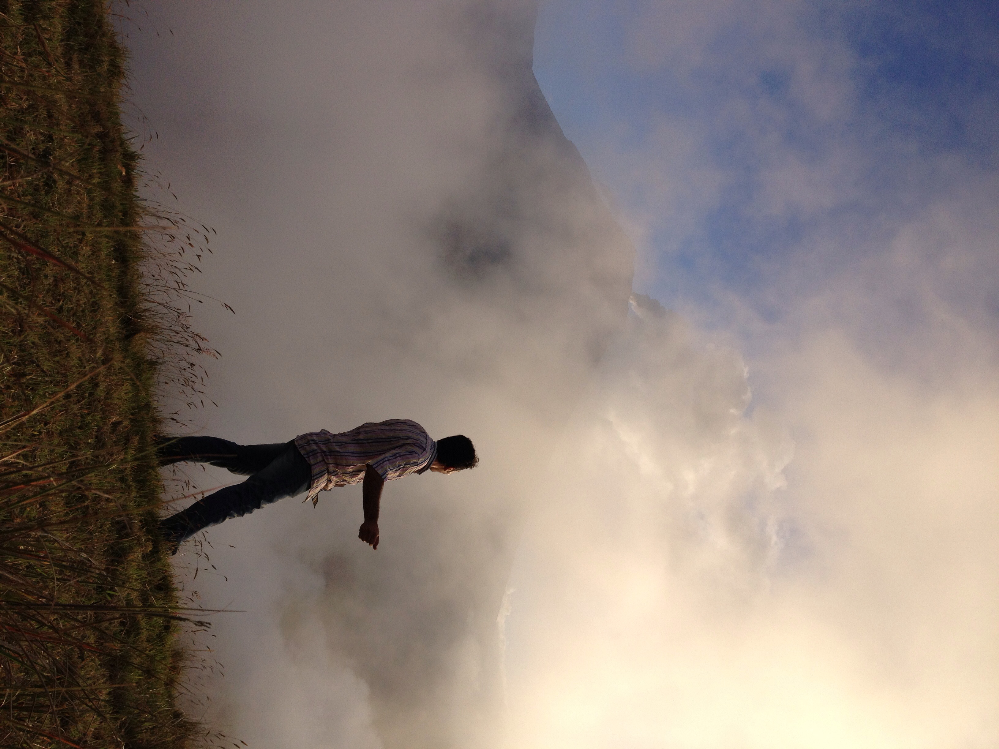
El Refugio del Volcán at 3,830 meters (12,565 feet) above sea level, Climbing the Summit of the Active and Mighty Stratovolcano 'Tungurahua' ('Throat of Fire' volcano) at 5,023 meters (16,479 feet) above sea level, Baños, the Central Highlands, Ecuador.

El Refugio del Volcán at 3,830 meters (12,565 feet) above sea level, Climbing the Summit of the Active and Mighty Stratovolcano 'Tungurahua' ('Throat of Fire' volcano) at 5,023 meters (16,479 feet) above sea level, Baños, the Central Highlands, Ecuador.

El Refugio del Volcán at 3,830 meters (12,565 feet) above sea level, Climbing the Summit of the Active and Mighty Stratovolcano 'Tungurahua' ('Throat of Fire' volcano) at 5,023 meters (16,479 feet) above sea level, Baños, the Central Highlands, Ecuador.

Parque Aventura San Martin at 1,800 meters (5,905 ft) above sea level, Baños, Ecuador.

Ecuador, Feb 2017, Cantón Baños

Ecuador, Feb 2017, Cantón Baños

Ecuador, Feb 2017, Cantón Baños

Ecuador, Feb 2017, Cantón Baños

Ecuador, Feb 2017, Cantón Baños

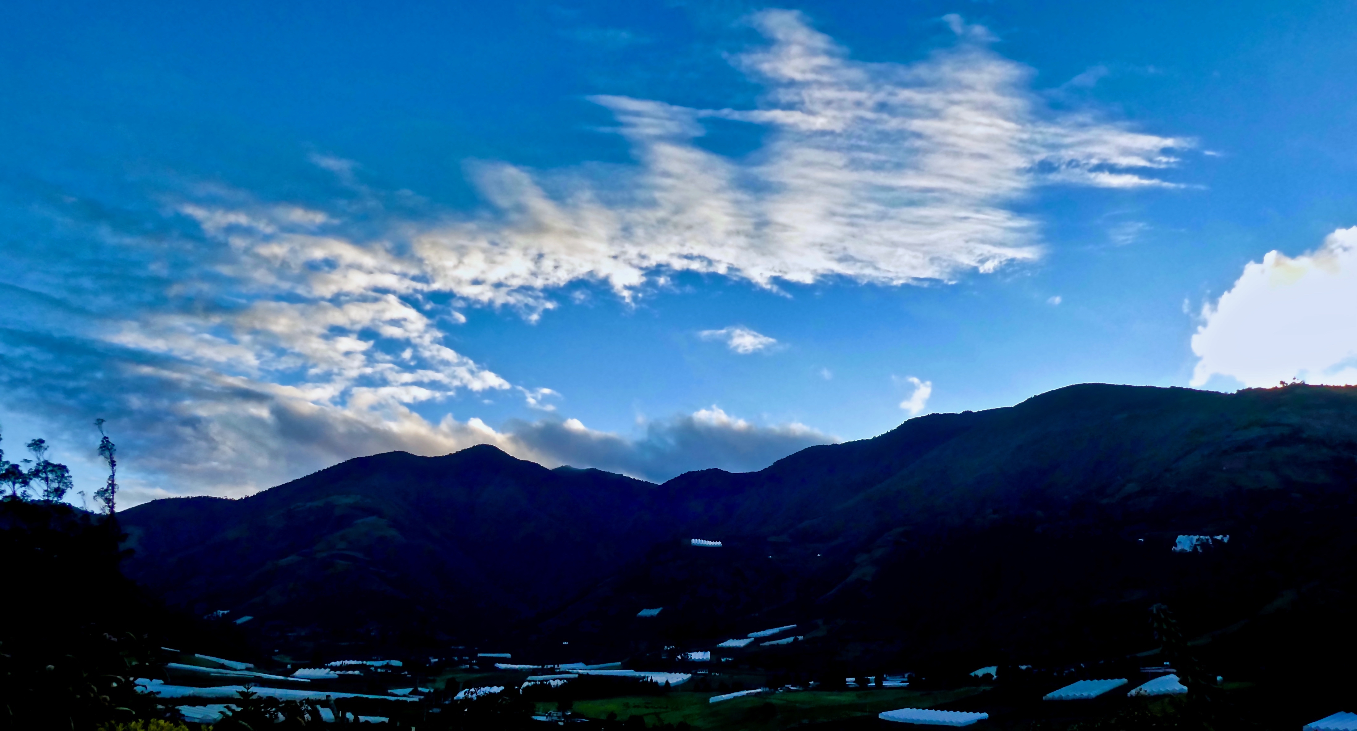
Baños sunset

Ecuador, Feb 2017, Baños de Agua Santa

Ecuador, Feb 2017, Baños de Agua Santa

Ecuador, Feb 2017, Cantón Baños
White haze!

Ecuador, Feb 2017, Baños de Agua Santa

Ecuador, Feb 2017, Baños de Agua Santa

Ecuador, Feb 2017, Baños de Agua Santa

Sunset over Baños

Ecuador, Feb 2017, Baños de Agua Santa

The sunset, looking almost straight up at the huge mountain next door

Sunrise, Climbing the Summit of the Active and Mighty Stratovolcano 'Tungurahua' ('Throat of Fire' volcano) at 5,023 meters (16,479 feet) above sea level, Baños, the Central Highlands, Ecuador.

Climbing the Summit of the Active and Mighty Stratovolcano 'Tungurahua' ('Throat of Fire' volcano) at 5,023 meters (16,479 feet) above sea level, Baños, the Central Highlands, Ecuador.
Sunrise at Hacienda Leito

Valley Sunrise

The Crater, Climbing the Summit of the Active and Mighty Stratovolcano 'Tungurahua' ('Throat of Fire' volcano) at 5,023 meters (16,479 feet) above sea level, Baños, the Central Highlands, Ecuador.

19981204-002
Cotalo, 厄瓜多的地圖
搜索其他地方的日出日落時間
附近地點
厄瓜多通古拉瓦火山
Banos, 厄瓜多爾La Casa del Arbol
厄瓜多爾乌尔维纳
Riobamba, 厄瓜多爾
Natale Torment, Riobamba, 厄瓜多
Chambo, 厄瓜多
厄瓜多爾錢博縣
厄瓜多里奥班巴
Topo, 厄瓜多爾
Pablo Sexto, 厄瓜多
Pablo Sexto, 厄瓜多
厄瓜多爾Guargualla Sangay Lodge
厄瓜多爾帕斯塔薩省
厄瓜多爾普約
厄瓜多爾Banco Pichincha
厄瓜多爾
Calle Vargas Y Torres, Guamote, 厄瓜多爾Inti Sisa
Vargas Torres y Garcia Moreno, Guamote, 厄瓜多爾Inti Sisa Art Guesthouse
厄瓜多爾瓜莫特縣
Unnamed Road, 厄瓜多爾
最近搜索
- Pagonija rock, Kranto 7-oji g. 8"N, Kaunas, Lithuania的日出日落時間表
- Co Rd 87, Jamestown, CO, USA的日出日落時間表
- 哥倫比亞昆迪納馬卡省滕霍的日出日落時間表
- -1 Gosho, Ichihara, Chiba -, Japan的日出日落時間表
- -日本的日出日落時間表
- Co Rd A, Truth or Consequences, NM 美國美國太空港的日出日落時間表
- 美國羅德島州沃威克的日出日落時間表
- 3-chōme-21-21 Nishikamata, Ota City, Tokyo -日本Moriyama House的日出日落時間表
- Sawasaki, Sado, Niigata -日本Manjojiki的日出日落時間表
- W Granada St, Tampa, FL 美國的日出日落時間表