-80 Stones Rd, Susanville, CA 美國的日出日落時間表
Location: 美國 > 加利福尼亞州 > 蘇珊維爾 >
時區:
America/Los_Angeles
當地時間:
2024-05-03 15:13:07
經度:
-120.723528
緯度:
40.712568
今天日出時間:
05:56:20 AM
今天日落時間:
08:02:51 PM
今天日照時長:
14h 6m 31s
明天日出時間:
05:55:09 AM
明天日落時間:
08:03:53 PM
明天日照時長:
14h 8m 44s
顯示所有日期
| 日期 | 日出 | 日落 | 日照時長 |
|---|---|---|---|
| 2024年01月01日 | 07:26:52 AM | 04:46:40 PM | 9h 19m 48s |
| 2024年01月02日 | 07:26:56 AM | 04:47:32 PM | 9h 20m 36s |
| 2024年01月03日 | 07:26:58 AM | 04:48:25 PM | 9h 21m 27s |
| 2024年01月04日 | 07:26:57 AM | 04:49:20 PM | 9h 22m 23s |
| 2024年01月05日 | 07:26:54 AM | 04:50:16 PM | 9h 23m 22s |
| 2024年01月06日 | 07:26:49 AM | 04:51:13 PM | 9h 24m 24s |
| 2024年01月07日 | 07:26:41 AM | 04:52:12 PM | 9h 25m 31s |
| 2024年01月08日 | 07:26:31 AM | 04:53:12 PM | 9h 26m 41s |
| 2024年01月09日 | 07:26:19 AM | 04:54:13 PM | 9h 27m 54s |
| 2024年01月10日 | 07:26:05 AM | 04:55:16 PM | 9h 29m 11s |
| 2024年01月11日 | 07:25:49 AM | 04:56:19 PM | 9h 30m 30s |
| 2024年01月12日 | 07:25:30 AM | 04:57:24 PM | 9h 31m 54s |
| 2024年01月13日 | 07:25:09 AM | 04:58:29 PM | 9h 33m 20s |
| 2024年01月14日 | 07:24:46 AM | 04:59:35 PM | 9h 34m 49s |
| 2024年01月15日 | 07:24:21 AM | 05:00:42 PM | 9h 36m 21s |
| 2024年01月16日 | 07:23:53 AM | 05:01:50 PM | 9h 37m 57s |
| 2024年01月17日 | 07:23:23 AM | 05:02:59 PM | 9h 39m 36s |
| 2024年01月18日 | 07:22:52 AM | 05:04:08 PM | 9h 41m 16s |
| 2024年01月19日 | 07:22:18 AM | 05:05:18 PM | 9h 43m 0s |
| 2024年01月20日 | 07:21:42 AM | 05:06:29 PM | 9h 44m 47s |
| 2024年01月21日 | 07:21:04 AM | 05:07:40 PM | 9h 46m 36s |
| 2024年01月22日 | 07:20:24 AM | 05:08:51 PM | 9h 48m 27s |
| 2024年01月23日 | 07:19:42 AM | 05:10:03 PM | 9h 50m 21s |
| 2024年01月24日 | 07:18:58 AM | 05:11:16 PM | 9h 52m 18s |
| 2024年01月25日 | 07:18:12 AM | 05:12:28 PM | 9h 54m 16s |
| 2024年01月26日 | 07:17:25 AM | 05:13:41 PM | 9h 56m 16s |
| 2024年01月27日 | 07:16:35 AM | 05:14:55 PM | 9h 58m 20s |
| 2024年01月28日 | 07:15:43 AM | 05:16:08 PM | 10h 0m 25s |
| 2024年01月29日 | 07:14:50 AM | 05:17:22 PM | 10h 2m 32s |
| 2024年01月30日 | 07:13:55 AM | 05:18:36 PM | 10h 4m 41s |
| 2024年01月31日 | 07:12:58 AM | 05:19:50 PM | 10h 6m 52s |
| 2024年02月01日 | 07:12:00 AM | 05:21:04 PM | 10h 9m 4s |
| 2024年02月02日 | 07:11:00 AM | 05:22:18 PM | 10h 11m 18s |
| 2024年02月03日 | 07:09:58 AM | 05:23:32 PM | 10h 13m 34s |
| 2024年02月04日 | 07:08:54 AM | 05:24:46 PM | 10h 15m 52s |
| 2024年02月05日 | 07:07:49 AM | 05:26:00 PM | 10h 18m 11s |
| 2024年02月06日 | 07:06:43 AM | 05:27:14 PM | 10h 20m 31s |
| 2024年02月07日 | 07:05:35 AM | 05:28:27 PM | 10h 22m 52s |
| 2024年02月08日 | 07:04:25 AM | 05:29:41 PM | 10h 25m 16s |
| 2024年02月09日 | 07:03:14 AM | 05:30:55 PM | 10h 27m 41s |
| 2024年02月10日 | 07:02:02 AM | 05:32:08 PM | 10h 30m 6s |
| 2024年02月11日 | 07:00:49 AM | 05:33:21 PM | 10h 32m 32s |
| 2024年02月12日 | 06:59:34 AM | 05:34:34 PM | 10h 35m 0s |
| 2024年02月13日 | 06:58:17 AM | 05:35:47 PM | 10h 37m 30s |
| 2024年02月14日 | 06:57:00 AM | 05:37:00 PM | 10h 40m 0s |
| 2024年02月15日 | 06:55:41 AM | 05:38:12 PM | 10h 42m 31s |
| 2024年02月16日 | 06:54:21 AM | 05:39:24 PM | 10h 45m 3s |
| 2024年02月17日 | 06:53:00 AM | 05:40:36 PM | 10h 47m 36s |
| 2024年02月18日 | 06:51:38 AM | 05:41:47 PM | 10h 50m 9s |
| 2024年02月19日 | 06:50:15 AM | 05:42:58 PM | 10h 52m 43s |
| 2024年02月20日 | 06:48:51 AM | 05:44:09 PM | 10h 55m 18s |
| 2024年02月21日 | 06:47:26 AM | 05:45:20 PM | 10h 57m 54s |
| 2024年02月22日 | 06:46:00 AM | 05:46:30 PM | 11h 0m 30s |
| 2024年02月23日 | 06:44:33 AM | 05:47:41 PM | 11h 3m 8s |
| 2024年02月24日 | 06:43:05 AM | 05:48:50 PM | 11h 5m 45s |
| 2024年02月25日 | 06:41:36 AM | 05:50:00 PM | 11h 8m 24s |
| 2024年02月26日 | 06:40:07 AM | 05:51:09 PM | 11h 11m 2s |
| 2024年02月27日 | 06:38:36 AM | 05:52:18 PM | 11h 13m 42s |
| 2024年02月28日 | 06:37:05 AM | 05:53:26 PM | 11h 16m 21s |
| 2024年02月29日 | 06:35:33 AM | 05:54:35 PM | 11h 19m 2s |
| 2024年03月01日 | 06:34:01 AM | 05:55:43 PM | 11h 21m 42s |
| 2024年03月02日 | 06:32:27 AM | 05:56:50 PM | 11h 24m 23s |
| 2024年03月03日 | 06:30:54 AM | 05:57:58 PM | 11h 27m 4s |
| 2024年03月04日 | 06:29:19 AM | 05:59:05 PM | 11h 29m 46s |
| 2024年03月05日 | 06:27:44 AM | 06:00:12 PM | 11h 32m 28s |
| 2024年03月06日 | 06:26:09 AM | 06:01:18 PM | 11h 35m 9s |
| 2024年03月07日 | 06:24:33 AM | 06:02:25 PM | 11h 37m 52s |
| 2024年03月08日 | 06:22:56 AM | 06:03:31 PM | 11h 40m 35s |
| 2024年03月09日 | 06:21:20 AM | 06:04:36 PM | 11h 43m 16s |
| 2024年03月10日 | 07:19:46 AM | 07:05:39 PM | 11h 45m 53s |
| 2024年03月11日 | 07:18:09 AM | 07:06:45 PM | 11h 48m 36s |
| 2024年03月12日 | 07:16:31 AM | 07:07:50 PM | 11h 51m 19s |
| 2024年03月13日 | 07:14:53 AM | 07:08:55 PM | 11h 54m 2s |
| 2024年03月14日 | 07:13:14 AM | 07:09:59 PM | 11h 56m 45s |
| 2024年03月15日 | 07:11:36 AM | 07:11:04 PM | 11h 59m 28s |
| 2024年03月16日 | 07:09:57 AM | 07:12:08 PM | 12h 2m 11s |
| 2024年03月17日 | 07:08:18 AM | 07:13:13 PM | 12h 4m 55s |
| 2024年03月18日 | 07:06:38 AM | 07:14:17 PM | 12h 7m 39s |
| 2024年03月19日 | 07:04:59 AM | 07:15:20 PM | 12h 10m 21s |
| 2024年03月20日 | 07:03:20 AM | 07:16:24 PM | 12h 13m 4s |
| 2024年03月21日 | 07:01:40 AM | 07:17:28 PM | 12h 15m 48s |
| 2024年03月22日 | 07:00:01 AM | 07:18:31 PM | 12h 18m 30s |
| 2024年03月23日 | 06:58:21 AM | 07:19:35 PM | 12h 21m 14s |
| 2024年03月24日 | 06:56:42 AM | 07:20:38 PM | 12h 23m 56s |
| 2024年03月25日 | 06:55:02 AM | 07:21:41 PM | 12h 26m 39s |
| 2024年03月26日 | 06:53:23 AM | 07:22:44 PM | 12h 29m 21s |
| 2024年03月27日 | 06:51:44 AM | 07:23:47 PM | 12h 32m 3s |
| 2024年03月28日 | 06:50:05 AM | 07:24:50 PM | 12h 34m 45s |
| 2024年03月29日 | 06:48:26 AM | 07:25:53 PM | 12h 37m 27s |
| 2024年03月30日 | 06:46:47 AM | 07:26:56 PM | 12h 40m 9s |
| 2024年03月31日 | 06:45:09 AM | 07:27:59 PM | 12h 42m 50s |
| 2024年04月01日 | 06:43:31 AM | 07:29:01 PM | 12h 45m 30s |
| 2024年04月02日 | 06:41:53 AM | 07:30:04 PM | 12h 48m 11s |
| 2024年04月03日 | 06:40:16 AM | 07:31:07 PM | 12h 50m 51s |
| 2024年04月04日 | 06:38:39 AM | 07:32:10 PM | 12h 53m 31s |
| 2024年04月05日 | 06:37:02 AM | 07:33:12 PM | 12h 56m 10s |
| 2024年04月06日 | 06:35:26 AM | 07:34:15 PM | 12h 58m 49s |
| 2024年04月07日 | 06:33:50 AM | 07:35:18 PM | 13h 1m 28s |
| 2024年04月08日 | 06:32:15 AM | 07:36:21 PM | 13h 4m 6s |
| 2024年04月09日 | 06:30:40 AM | 07:37:23 PM | 13h 6m 43s |
| 2024年04月10日 | 06:29:06 AM | 07:38:26 PM | 13h 9m 20s |
| 2024年04月11日 | 06:27:32 AM | 07:39:29 PM | 13h 11m 57s |
| 2024年04月12日 | 06:25:59 AM | 07:40:32 PM | 13h 14m 33s |
| 2024年04月13日 | 06:24:27 AM | 07:41:35 PM | 13h 17m 8s |
| 2024年04月14日 | 06:22:55 AM | 07:42:38 PM | 13h 19m 43s |
| 2024年04月15日 | 06:21:24 AM | 07:43:40 PM | 13h 22m 16s |
| 2024年04月16日 | 06:19:54 AM | 07:44:43 PM | 13h 24m 49s |
| 2024年04月17日 | 06:18:25 AM | 07:45:46 PM | 13h 27m 21s |
| 2024年04月18日 | 06:16:56 AM | 07:46:49 PM | 13h 29m 53s |
| 2024年04月19日 | 06:15:29 AM | 07:47:52 PM | 13h 32m 23s |
| 2024年04月20日 | 06:14:02 AM | 07:48:55 PM | 13h 34m 53s |
| 2024年04月21日 | 06:12:36 AM | 07:49:58 PM | 13h 37m 22s |
| 2024年04月22日 | 06:11:11 AM | 07:51:01 PM | 13h 39m 50s |
| 2024年04月23日 | 06:09:47 AM | 07:52:04 PM | 13h 42m 17s |
| 2024年04月24日 | 06:08:24 AM | 07:53:07 PM | 13h 44m 43s |
| 2024年04月25日 | 06:07:02 AM | 07:54:09 PM | 13h 47m 7s |
| 2024年04月26日 | 06:05:41 AM | 07:55:12 PM | 13h 49m 31s |
| 2024年04月27日 | 06:04:21 AM | 07:56:15 PM | 13h 51m 54s |
| 2024年04月28日 | 06:03:02 AM | 07:57:17 PM | 13h 54m 15s |
| 2024年04月29日 | 06:01:45 AM | 07:58:20 PM | 13h 56m 35s |
| 2024年04月30日 | 06:00:28 AM | 07:59:22 PM | 13h 58m 54s |
| 2024年05月01日 | 05:59:13 AM | 08:00:24 PM | 14h 1m 11s |
| 2024年05月02日 | 05:57:59 AM | 08:01:26 PM | 14h 3m 27s |
| 2024年05月03日 | 05:56:46 AM | 08:02:28 PM | 14h 5m 42s |
| 2024年05月04日 | 05:55:35 AM | 08:03:30 PM | 14h 7m 55s |
| 2024年05月05日 | 05:54:25 AM | 08:04:31 PM | 14h 10m 6s |
| 2024年05月06日 | 05:53:17 AM | 08:05:32 PM | 14h 12m 15s |
| 2024年05月07日 | 05:52:10 AM | 08:06:33 PM | 14h 14m 23s |
| 2024年05月08日 | 05:51:04 AM | 08:07:34 PM | 14h 16m 30s |
| 2024年05月09日 | 05:50:00 AM | 08:08:34 PM | 14h 18m 34s |
| 2024年05月10日 | 05:48:57 AM | 08:09:34 PM | 14h 20m 37s |
| 2024年05月11日 | 05:47:56 AM | 08:10:34 PM | 14h 22m 38s |
| 2024年05月12日 | 05:46:56 AM | 08:11:33 PM | 14h 24m 37s |
| 2024年05月13日 | 05:45:58 AM | 08:12:32 PM | 14h 26m 34s |
| 2024年05月14日 | 05:45:01 AM | 08:13:30 PM | 14h 28m 29s |
| 2024年05月15日 | 05:44:07 AM | 08:14:27 PM | 14h 30m 20s |
| 2024年05月16日 | 05:43:14 AM | 08:15:25 PM | 14h 32m 11s |
| 2024年05月17日 | 05:42:22 AM | 08:16:21 PM | 14h 33m 59s |
| 2024年05月18日 | 05:41:32 AM | 08:17:17 PM | 14h 35m 45s |
| 2024年05月19日 | 05:40:44 AM | 08:18:12 PM | 14h 37m 28s |
| 2024年05月20日 | 05:39:58 AM | 08:19:07 PM | 14h 39m 9s |
| 2024年05月21日 | 05:39:14 AM | 08:20:01 PM | 14h 40m 47s |
| 2024年05月22日 | 05:38:31 AM | 08:20:54 PM | 14h 42m 23s |
| 2024年05月23日 | 05:37:51 AM | 08:21:46 PM | 14h 43m 55s |
| 2024年05月24日 | 05:37:12 AM | 08:22:37 PM | 14h 45m 25s |
| 2024年05月25日 | 05:36:35 AM | 08:23:27 PM | 14h 46m 52s |
| 2024年05月26日 | 05:36:00 AM | 08:24:17 PM | 14h 48m 17s |
| 2024年05月27日 | 05:35:26 AM | 08:25:05 PM | 14h 49m 39s |
| 2024年05月28日 | 05:34:55 AM | 08:25:53 PM | 14h 50m 58s |
| 2024年05月29日 | 05:34:26 AM | 08:26:39 PM | 14h 52m 13s |
| 2024年05月30日 | 05:33:58 AM | 08:27:24 PM | 14h 53m 26s |
| 2024年05月31日 | 05:33:33 AM | 08:28:08 PM | 14h 54m 35s |
| 2024年06月01日 | 05:33:09 AM | 08:28:51 PM | 14h 55m 42s |
| 2024年06月02日 | 05:32:48 AM | 08:29:33 PM | 14h 56m 45s |
| 2024年06月03日 | 05:32:28 AM | 08:30:13 PM | 14h 57m 45s |
| 2024年06月04日 | 05:32:11 AM | 08:30:52 PM | 14h 58m 41s |
| 2024年06月05日 | 05:31:55 AM | 08:31:30 PM | 14h 59m 35s |
| 2024年06月06日 | 05:31:42 AM | 08:32:06 PM | 15h 0m 24s |
| 2024年06月07日 | 05:31:30 AM | 08:32:41 PM | 15h 1m 11s |
| 2024年06月08日 | 05:31:21 AM | 08:33:14 PM | 15h 1m 53s |
| 2024年06月09日 | 05:31:13 AM | 08:33:45 PM | 15h 2m 32s |
| 2024年06月10日 | 05:31:08 AM | 08:34:16 PM | 15h 3m 8s |
| 2024年06月11日 | 05:31:04 AM | 08:34:44 PM | 15h 3m 40s |
| 2024年06月12日 | 05:31:03 AM | 08:35:11 PM | 15h 4m 8s |
| 2024年06月13日 | 05:31:03 AM | 08:35:36 PM | 15h 4m 33s |
| 2024年06月14日 | 05:31:05 AM | 08:35:59 PM | 15h 4m 54s |
| 2024年06月15日 | 05:31:09 AM | 08:36:21 PM | 15h 5m 12s |
| 2024年06月16日 | 05:31:15 AM | 08:36:41 PM | 15h 5m 26s |
| 2024年06月17日 | 05:31:23 AM | 08:36:59 PM | 15h 5m 36s |
| 2024年06月18日 | 05:31:33 AM | 08:37:16 PM | 15h 5m 43s |
| 2024年06月19日 | 05:31:45 AM | 08:37:30 PM | 15h 5m 45s |
| 2024年06月20日 | 05:31:59 AM | 08:37:43 PM | 15h 5m 44s |
| 2024年06月21日 | 05:32:14 AM | 08:37:53 PM | 15h 5m 39s |
| 2024年06月22日 | 05:32:31 AM | 08:38:02 PM | 15h 5m 31s |
| 2024年06月23日 | 05:32:50 AM | 08:38:09 PM | 15h 5m 19s |
| 2024年06月24日 | 05:33:11 AM | 08:38:14 PM | 15h 5m 3s |
| 2024年06月25日 | 05:33:33 AM | 08:38:16 PM | 15h 4m 43s |
| 2024年06月26日 | 05:33:57 AM | 08:38:17 PM | 15h 4m 20s |
| 2024年06月27日 | 05:34:22 AM | 08:38:16 PM | 15h 3m 54s |
| 2024年06月28日 | 05:34:50 AM | 08:38:13 PM | 15h 3m 23s |
| 2024年06月29日 | 05:35:18 AM | 08:38:08 PM | 15h 2m 50s |
| 2024年06月30日 | 05:35:48 AM | 08:38:00 PM | 15h 2m 12s |
| 2024年07月01日 | 05:36:20 AM | 08:37:51 PM | 15h 1m 31s |
| 2024年07月02日 | 05:36:53 AM | 08:37:40 PM | 15h 0m 47s |
| 2024年07月03日 | 05:37:28 AM | 08:37:27 PM | 14h 59m 59s |
| 2024年07月04日 | 05:38:04 AM | 08:37:11 PM | 14h 59m 7s |
| 2024年07月05日 | 05:38:41 AM | 08:36:54 PM | 14h 58m 13s |
| 2024年07月06日 | 05:39:19 AM | 08:36:34 PM | 14h 57m 15s |
| 2024年07月07日 | 05:39:59 AM | 08:36:13 PM | 14h 56m 14s |
| 2024年07月08日 | 05:40:40 AM | 08:35:50 PM | 14h 55m 10s |
| 2024年07月09日 | 05:41:22 AM | 08:35:24 PM | 14h 54m 2s |
| 2024年07月10日 | 05:42:05 AM | 08:34:57 PM | 14h 52m 52s |
| 2024年07月11日 | 05:42:50 AM | 08:34:27 PM | 14h 51m 37s |
| 2024年07月12日 | 05:43:35 AM | 08:33:56 PM | 14h 50m 21s |
| 2024年07月13日 | 05:44:21 AM | 08:33:22 PM | 14h 49m 1s |
| 2024年07月14日 | 05:45:08 AM | 08:32:47 PM | 14h 47m 39s |
| 2024年07月15日 | 05:45:56 AM | 08:32:10 PM | 14h 46m 14s |
| 2024年07月16日 | 05:46:45 AM | 08:31:31 PM | 14h 44m 46s |
| 2024年07月17日 | 05:47:35 AM | 08:30:50 PM | 14h 43m 15s |
| 2024年07月18日 | 05:48:25 AM | 08:30:07 PM | 14h 41m 42s |
| 2024年07月19日 | 05:49:17 AM | 08:29:22 PM | 14h 40m 5s |
| 2024年07月20日 | 05:50:09 AM | 08:28:35 PM | 14h 38m 26s |
| 2024年07月21日 | 05:51:01 AM | 08:27:47 PM | 14h 36m 46s |
| 2024年07月22日 | 05:51:54 AM | 08:26:57 PM | 14h 35m 3s |
| 2024年07月23日 | 05:52:48 AM | 08:26:05 PM | 14h 33m 17s |
| 2024年07月24日 | 05:53:42 AM | 08:25:11 PM | 14h 31m 29s |
| 2024年07月25日 | 05:54:37 AM | 08:24:16 PM | 14h 29m 39s |
| 2024年07月26日 | 05:55:33 AM | 08:23:19 PM | 14h 27m 46s |
| 2024年07月27日 | 05:56:28 AM | 08:22:20 PM | 14h 25m 52s |
| 2024年07月28日 | 05:57:24 AM | 08:21:20 PM | 14h 23m 56s |
| 2024年07月29日 | 05:58:21 AM | 08:20:18 PM | 14h 21m 57s |
| 2024年07月30日 | 05:59:18 AM | 08:19:15 PM | 14h 19m 57s |
| 2024年07月31日 | 06:00:15 AM | 08:18:10 PM | 14h 17m 55s |
| 2024年08月01日 | 06:01:12 AM | 08:17:03 PM | 14h 15m 51s |
| 2024年08月02日 | 06:02:10 AM | 08:15:55 PM | 14h 13m 45s |
| 2024年08月03日 | 06:03:08 AM | 08:14:46 PM | 14h 11m 38s |
| 2024年08月04日 | 06:04:06 AM | 08:13:35 PM | 14h 9m 29s |
| 2024年08月05日 | 06:05:04 AM | 08:12:23 PM | 14h 7m 19s |
| 2024年08月06日 | 06:06:03 AM | 08:11:10 PM | 14h 5m 7s |
| 2024年08月07日 | 06:07:01 AM | 08:09:55 PM | 14h 2m 54s |
| 2024年08月08日 | 06:08:00 AM | 08:08:39 PM | 14h 0m 39s |
| 2024年08月09日 | 06:08:59 AM | 08:07:22 PM | 13h 58m 23s |
| 2024年08月10日 | 06:09:58 AM | 08:06:03 PM | 13h 56m 5s |
| 2024年08月11日 | 06:10:57 AM | 08:04:43 PM | 13h 53m 46s |
| 2024年08月12日 | 06:11:55 AM | 08:03:23 PM | 13h 51m 28s |
| 2024年08月13日 | 06:12:55 AM | 08:02:01 PM | 13h 49m 6s |
| 2024年08月14日 | 06:13:54 AM | 08:00:38 PM | 13h 46m 44s |
| 2024年08月15日 | 06:14:53 AM | 07:59:13 PM | 13h 44m 20s |
| 2024年08月16日 | 06:15:52 AM | 07:57:48 PM | 13h 41m 56s |
| 2024年08月17日 | 06:16:51 AM | 07:56:22 PM | 13h 39m 31s |
| 2024年08月18日 | 06:17:50 AM | 07:54:55 PM | 13h 37m 5s |
| 2024年08月19日 | 06:18:49 AM | 07:53:27 PM | 13h 34m 38s |
| 2024年08月20日 | 06:19:48 AM | 07:51:58 PM | 13h 32m 10s |
| 2024年08月21日 | 06:20:47 AM | 07:50:28 PM | 13h 29m 41s |
| 2024年08月22日 | 06:21:46 AM | 07:48:58 PM | 13h 27m 12s |
| 2024年08月23日 | 06:22:44 AM | 07:47:26 PM | 13h 24m 42s |
| 2024年08月24日 | 06:23:43 AM | 07:45:54 PM | 13h 22m 11s |
| 2024年08月25日 | 06:24:42 AM | 07:44:21 PM | 13h 19m 39s |
| 2024年08月26日 | 06:25:41 AM | 07:42:48 PM | 13h 17m 7s |
| 2024年08月27日 | 06:26:39 AM | 07:41:13 PM | 13h 14m 34s |
| 2024年08月28日 | 06:27:38 AM | 07:39:38 PM | 13h 12m 0s |
| 2024年08月29日 | 06:28:36 AM | 07:38:03 PM | 13h 9m 27s |
| 2024年08月30日 | 06:29:35 AM | 07:36:26 PM | 13h 6m 51s |
| 2024年08月31日 | 06:30:33 AM | 07:34:50 PM | 13h 4m 17s |
| 2024年09月01日 | 06:31:32 AM | 07:33:12 PM | 13h 1m 40s |
| 2024年09月02日 | 06:32:30 AM | 07:31:35 PM | 12h 59m 5s |
| 2024年09月03日 | 06:33:29 AM | 07:29:56 PM | 12h 56m 27s |
| 2024年09月04日 | 06:34:27 AM | 07:28:18 PM | 12h 53m 51s |
| 2024年09月05日 | 06:35:25 AM | 07:26:39 PM | 12h 51m 14s |
| 2024年09月06日 | 06:36:24 AM | 07:24:59 PM | 12h 48m 35s |
| 2024年09月07日 | 06:37:22 AM | 07:23:20 PM | 12h 45m 58s |
| 2024年09月08日 | 06:38:20 AM | 07:21:39 PM | 12h 43m 19s |
| 2024年09月09日 | 06:39:18 AM | 07:19:59 PM | 12h 40m 41s |
| 2024年09月10日 | 06:40:17 AM | 07:18:18 PM | 12h 38m 1s |
| 2024年09月11日 | 06:41:15 AM | 07:16:38 PM | 12h 35m 23s |
| 2024年09月12日 | 06:42:14 AM | 07:14:57 PM | 12h 32m 43s |
| 2024年09月13日 | 06:43:12 AM | 07:13:15 PM | 12h 30m 3s |
| 2024年09月14日 | 06:44:10 AM | 07:11:34 PM | 12h 27m 24s |
| 2024年09月15日 | 06:45:09 AM | 07:09:52 PM | 12h 24m 43s |
| 2024年09月16日 | 06:46:08 AM | 07:08:11 PM | 12h 22m 3s |
| 2024年09月17日 | 06:47:06 AM | 07:06:29 PM | 12h 19m 23s |
| 2024年09月18日 | 06:48:05 AM | 07:04:48 PM | 12h 16m 43s |
| 2024年09月19日 | 06:49:04 AM | 07:03:06 PM | 12h 14m 2s |
| 2024年09月20日 | 06:50:03 AM | 07:01:25 PM | 12h 11m 22s |
| 2024年09月21日 | 06:51:03 AM | 06:59:43 PM | 12h 8m 40s |
| 2024年09月22日 | 06:52:02 AM | 06:58:02 PM | 12h 6m 0s |
| 2024年09月23日 | 06:53:01 AM | 06:56:20 PM | 12h 3m 19s |
| 2024年09月24日 | 06:54:01 AM | 06:54:39 PM | 12h 0m 38s |
| 2024年09月25日 | 06:55:01 AM | 06:52:58 PM | 11h 57m 57s |
| 2024年09月26日 | 06:56:01 AM | 06:51:18 PM | 11h 55m 17s |
| 2024年09月27日 | 06:57:01 AM | 06:49:37 PM | 11h 52m 36s |
| 2024年09月28日 | 06:58:02 AM | 06:47:57 PM | 11h 49m 55s |
| 2024年09月29日 | 06:59:02 AM | 06:46:17 PM | 11h 47m 15s |
| 2024年09月30日 | 07:00:03 AM | 06:44:38 PM | 11h 44m 35s |
| 2024年10月01日 | 07:01:04 AM | 06:42:59 PM | 11h 41m 55s |
| 2024年10月02日 | 07:02:06 AM | 06:41:20 PM | 11h 39m 14s |
| 2024年10月03日 | 07:03:07 AM | 06:39:42 PM | 11h 36m 35s |
| 2024年10月04日 | 07:04:09 AM | 06:38:04 PM | 11h 33m 55s |
| 2024年10月05日 | 07:05:12 AM | 06:36:26 PM | 11h 31m 14s |
| 2024年10月06日 | 07:06:14 AM | 06:34:50 PM | 11h 28m 36s |
| 2024年10月07日 | 07:07:17 AM | 06:33:13 PM | 11h 25m 56s |
| 2024年10月08日 | 07:08:20 AM | 06:31:38 PM | 11h 23m 18s |
| 2024年10月09日 | 07:09:23 AM | 06:30:03 PM | 11h 20m 40s |
| 2024年10月10日 | 07:10:27 AM | 06:28:28 PM | 11h 18m 1s |
| 2024年10月11日 | 07:11:31 AM | 06:26:55 PM | 11h 15m 24s |
| 2024年10月12日 | 07:12:35 AM | 06:25:22 PM | 11h 12m 47s |
| 2024年10月13日 | 07:13:40 AM | 06:23:49 PM | 11h 10m 9s |
| 2024年10月14日 | 07:14:45 AM | 06:22:18 PM | 11h 7m 33s |
| 2024年10月15日 | 07:15:50 AM | 06:20:47 PM | 11h 4m 57s |
| 2024年10月16日 | 07:16:56 AM | 06:19:18 PM | 11h 2m 22s |
| 2024年10月17日 | 07:18:02 AM | 06:17:49 PM | 10h 59m 47s |
| 2024年10月18日 | 07:19:08 AM | 06:16:21 PM | 10h 57m 13s |
| 2024年10月19日 | 07:20:14 AM | 06:14:54 PM | 10h 54m 40s |
| 2024年10月20日 | 07:21:21 AM | 06:13:28 PM | 10h 52m 7s |
| 2024年10月21日 | 07:22:28 AM | 06:12:03 PM | 10h 49m 35s |
| 2024年10月22日 | 07:23:36 AM | 06:10:39 PM | 10h 47m 3s |
| 2024年10月23日 | 07:24:44 AM | 06:09:16 PM | 10h 44m 32s |
| 2024年10月24日 | 07:25:52 AM | 06:07:55 PM | 10h 42m 3s |
| 2024年10月25日 | 07:27:00 AM | 06:06:34 PM | 10h 39m 34s |
| 2024年10月26日 | 07:28:09 AM | 06:05:15 PM | 10h 37m 6s |
| 2024年10月27日 | 07:29:18 AM | 06:03:57 PM | 10h 34m 39s |
| 2024年10月28日 | 07:30:27 AM | 06:02:40 PM | 10h 32m 13s |
| 2024年10月29日 | 07:31:37 AM | 06:01:25 PM | 10h 29m 48s |
| 2024年10月30日 | 07:32:46 AM | 06:00:11 PM | 10h 27m 25s |
| 2024年10月31日 | 07:33:56 AM | 05:58:58 PM | 10h 25m 2s |
| 2024年11月01日 | 07:35:06 AM | 05:57:47 PM | 10h 22m 41s |
| 2024年11月02日 | 07:36:17 AM | 05:56:37 PM | 10h 20m 20s |
| 2024年11月03日 | 06:37:30 AM | 04:55:26 PM | 10h 17m 56s |
| 2024年11月04日 | 06:38:41 AM | 04:54:19 PM | 10h 15m 38s |
| 2024年11月05日 | 06:39:51 AM | 04:53:14 PM | 10h 13m 23s |
| 2024年11月06日 | 06:41:02 AM | 04:52:10 PM | 10h 11m 8s |
| 2024年11月07日 | 06:42:13 AM | 04:51:08 PM | 10h 8m 55s |
| 2024年11月08日 | 06:43:24 AM | 04:50:08 PM | 10h 6m 44s |
| 2024年11月09日 | 06:44:34 AM | 04:49:10 PM | 10h 4m 36s |
| 2024年11月10日 | 06:45:45 AM | 04:48:13 PM | 10h 2m 28s |
| 2024年11月11日 | 06:46:56 AM | 04:47:18 PM | 10h 0m 22s |
| 2024年11月12日 | 06:48:06 AM | 04:46:25 PM | 9h 58m 19s |
| 2024年11月13日 | 06:49:17 AM | 04:45:33 PM | 9h 56m 16s |
| 2024年11月14日 | 06:50:27 AM | 04:44:44 PM | 9h 54m 17s |
| 2024年11月15日 | 06:51:37 AM | 04:43:56 PM | 9h 52m 19s |
| 2024年11月16日 | 06:52:47 AM | 04:43:11 PM | 9h 50m 24s |
| 2024年11月17日 | 06:53:56 AM | 04:42:27 PM | 9h 48m 31s |
| 2024年11月18日 | 06:55:05 AM | 04:41:45 PM | 9h 46m 40s |
| 2024年11月19日 | 06:56:14 AM | 04:41:06 PM | 9h 44m 52s |
| 2024年11月20日 | 06:57:22 AM | 04:40:28 PM | 9h 43m 6s |
| 2024年11月21日 | 06:58:29 AM | 04:39:53 PM | 9h 41m 24s |
| 2024年11月22日 | 06:59:37 AM | 04:39:19 PM | 9h 39m 42s |
| 2024年11月23日 | 07:00:43 AM | 04:38:48 PM | 9h 38m 5s |
| 2024年11月24日 | 07:01:49 AM | 04:38:19 PM | 9h 36m 30s |
| 2024年11月25日 | 07:02:54 AM | 04:37:52 PM | 9h 34m 58s |
| 2024年11月26日 | 07:03:59 AM | 04:37:27 PM | 9h 33m 28s |
| 2024年11月27日 | 07:05:02 AM | 04:37:05 PM | 9h 32m 3s |
| 2024年11月28日 | 07:06:05 AM | 04:36:45 PM | 9h 30m 40s |
| 2024年11月29日 | 07:07:07 AM | 04:36:27 PM | 9h 29m 20s |
| 2024年11月30日 | 07:08:08 AM | 04:36:11 PM | 9h 28m 3s |
| 2024年12月01日 | 07:09:08 AM | 04:35:57 PM | 9h 26m 49s |
| 2024年12月02日 | 07:10:06 AM | 04:35:46 PM | 9h 25m 40s |
| 2024年12月03日 | 07:11:04 AM | 04:35:38 PM | 9h 24m 34s |
| 2024年12月04日 | 07:12:00 AM | 04:35:31 PM | 9h 23m 31s |
| 2024年12月05日 | 07:12:55 AM | 04:35:27 PM | 9h 22m 32s |
| 2024年12月06日 | 07:13:49 AM | 04:35:25 PM | 9h 21m 36s |
| 2024年12月07日 | 07:14:42 AM | 04:35:25 PM | 9h 20m 43s |
| 2024年12月08日 | 07:15:33 AM | 04:35:28 PM | 9h 19m 55s |
| 2024年12月09日 | 07:16:23 AM | 04:35:33 PM | 9h 19m 10s |
| 2024年12月10日 | 07:17:11 AM | 04:35:40 PM | 9h 18m 29s |
| 2024年12月11日 | 07:17:57 AM | 04:35:50 PM | 9h 17m 53s |
| 2024年12月12日 | 07:18:42 AM | 04:36:02 PM | 9h 17m 20s |
| 2024年12月13日 | 07:19:25 AM | 04:36:16 PM | 9h 16m 51s |
| 2024年12月14日 | 07:20:07 AM | 04:36:32 PM | 9h 16m 25s |
| 2024年12月15日 | 07:20:46 AM | 04:36:51 PM | 9h 16m 5s |
| 2024年12月16日 | 07:21:24 AM | 04:37:12 PM | 9h 15m 48s |
| 2024年12月17日 | 07:22:00 AM | 04:37:35 PM | 9h 15m 35s |
| 2024年12月18日 | 07:22:35 AM | 04:38:00 PM | 9h 15m 25s |
| 2024年12月19日 | 07:23:07 AM | 04:38:27 PM | 9h 15m 20s |
| 2024年12月20日 | 07:23:37 AM | 04:38:57 PM | 9h 15m 20s |
| 2024年12月21日 | 07:24:05 AM | 04:39:28 PM | 9h 15m 23s |
| 2024年12月22日 | 07:24:31 AM | 04:40:02 PM | 9h 15m 31s |
| 2024年12月23日 | 07:24:55 AM | 04:40:37 PM | 9h 15m 42s |
| 2024年12月24日 | 07:25:17 AM | 04:41:15 PM | 9h 15m 58s |
| 2024年12月25日 | 07:25:37 AM | 04:41:54 PM | 9h 16m 17s |
| 2024年12月26日 | 07:25:55 AM | 04:42:35 PM | 9h 16m 40s |
| 2024年12月27日 | 07:26:11 AM | 04:43:18 PM | 9h 17m 7s |
| 2024年12月28日 | 07:26:24 AM | 04:44:03 PM | 9h 17m 39s |
| 2024年12月29日 | 07:26:35 AM | 04:44:49 PM | 9h 18m 14s |
| 2024年12月30日 | 07:26:44 AM | 04:45:38 PM | 9h 18m 54s |
日出日落照片
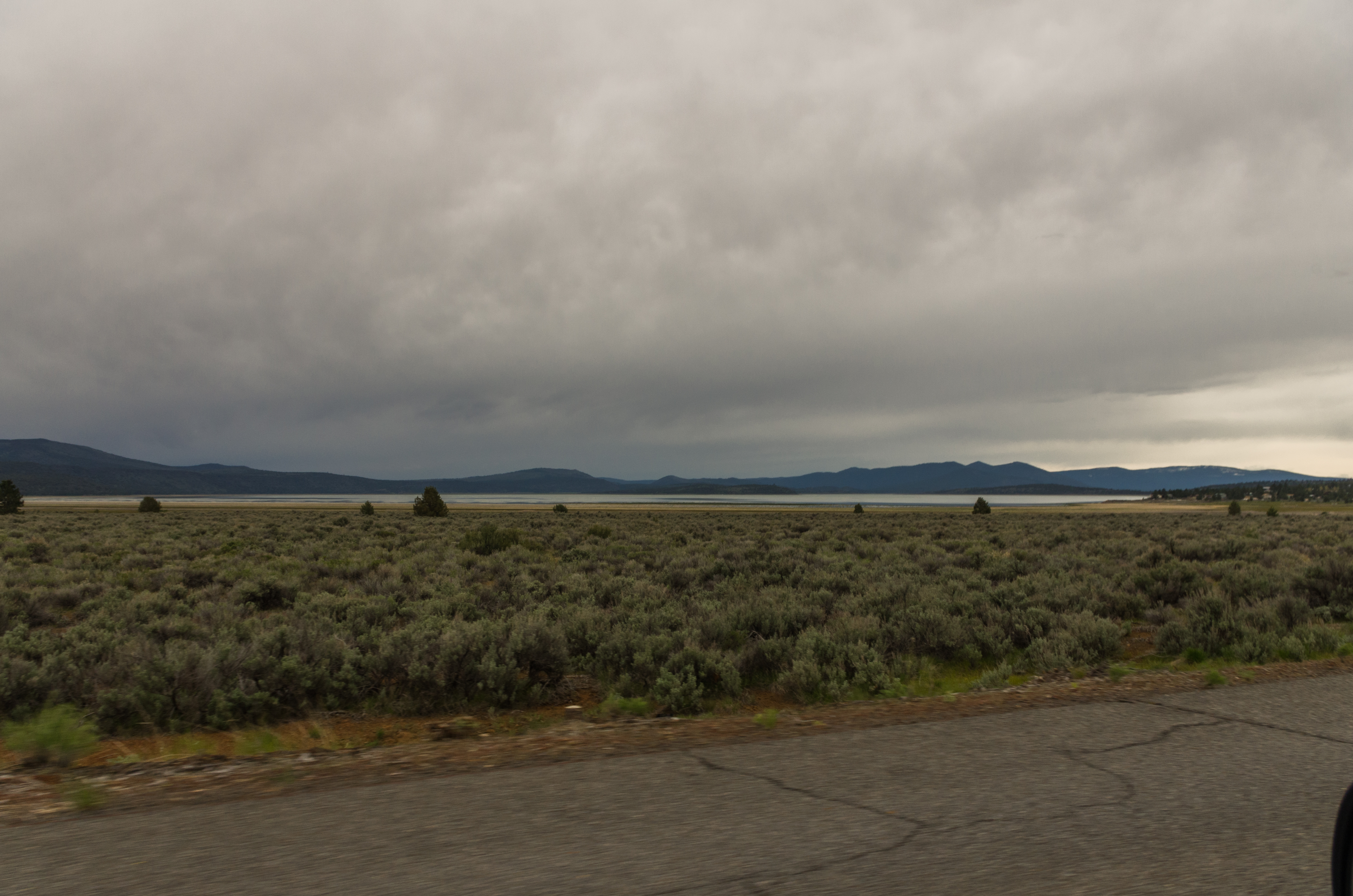
_IGP9715.PEF Eagle Lake from North Shore Lassen County California
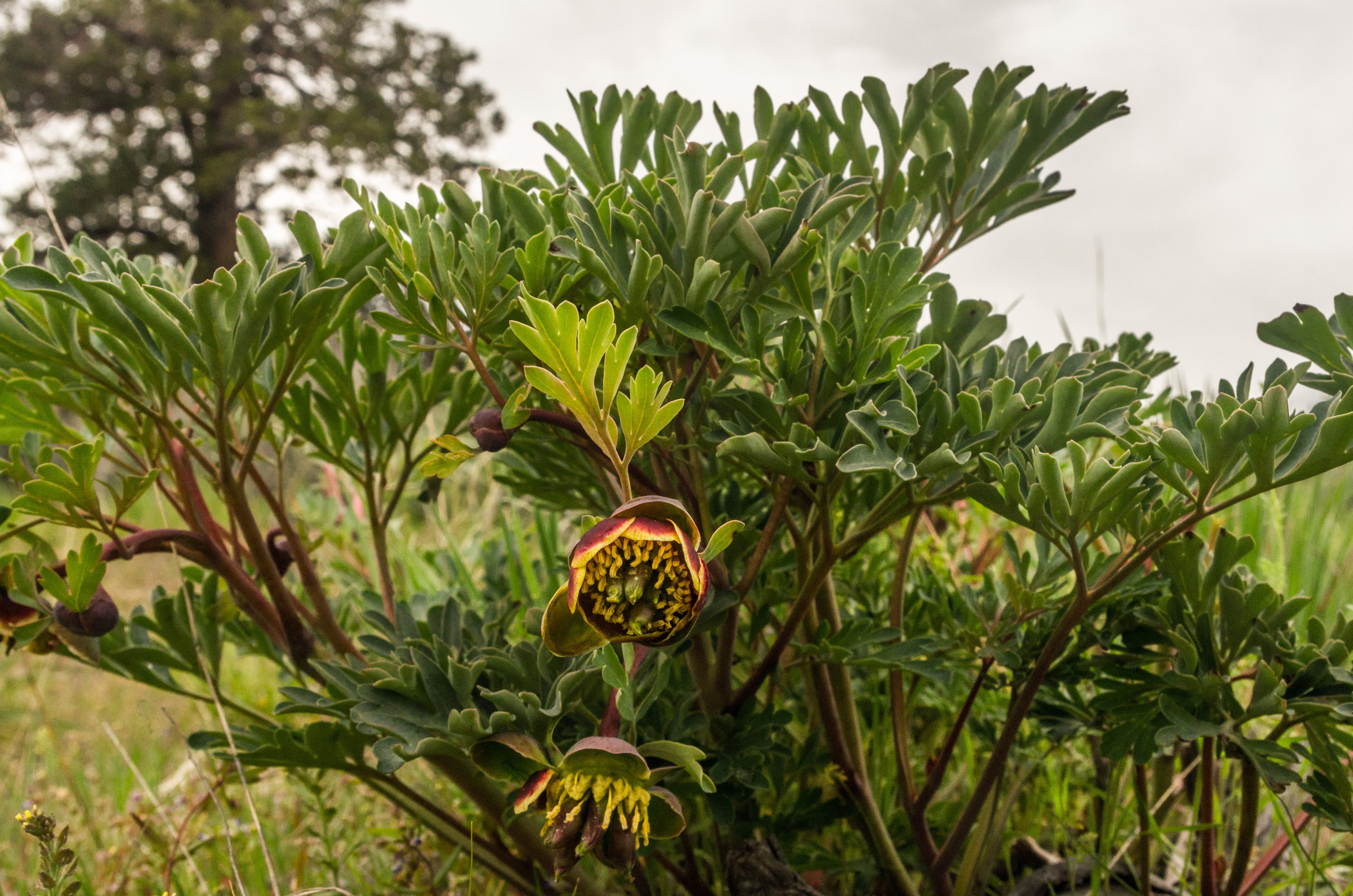
_IGP9707.PEF Multiple Lobed Leaf Wildflower, Like Poppy

805_1247.NEF

805_1248.NEF

805_1249.NEF
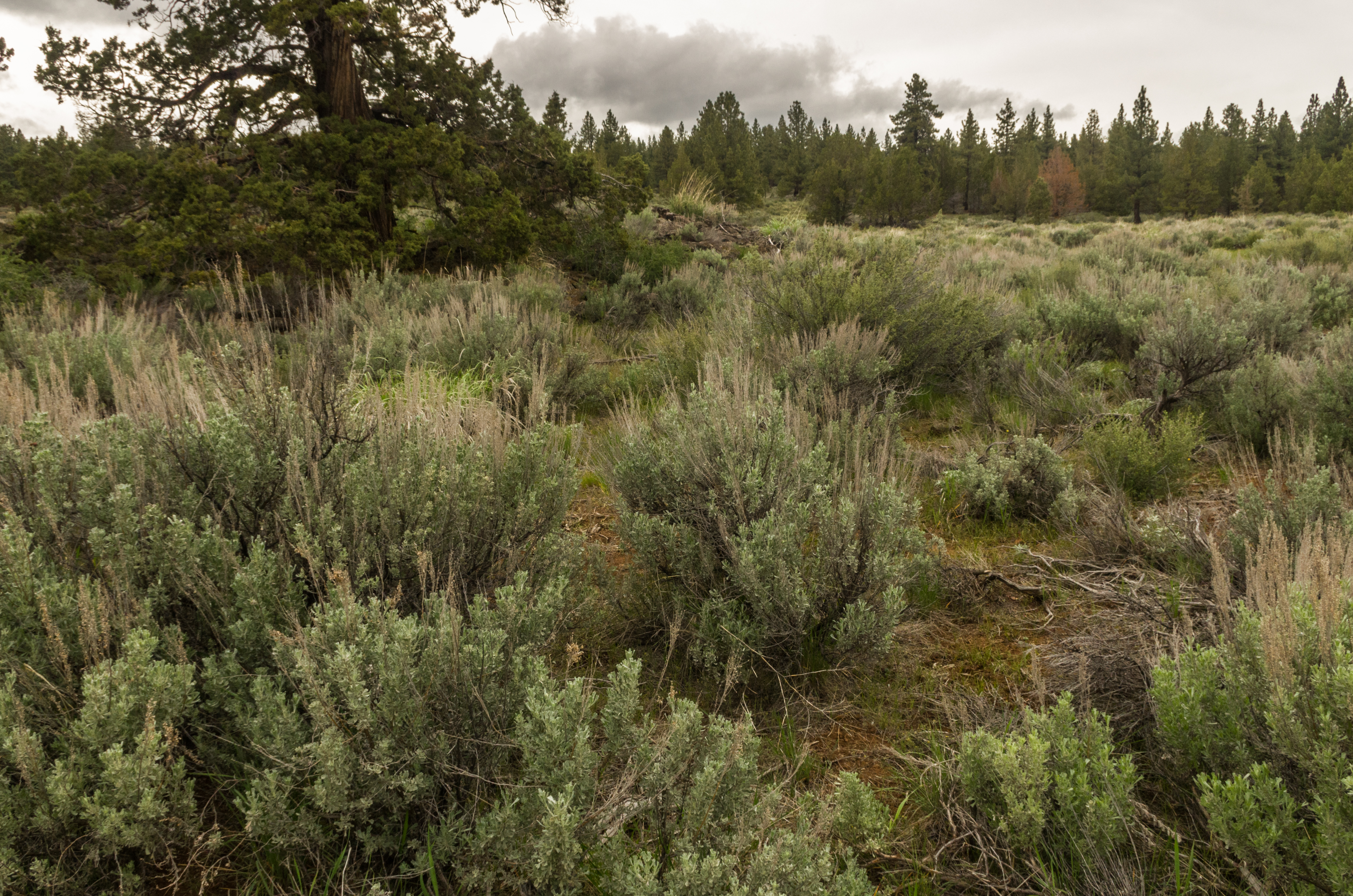
_IGP9711.PEF Sagebrush pine and juniper along Eagle Lake Lassen County California
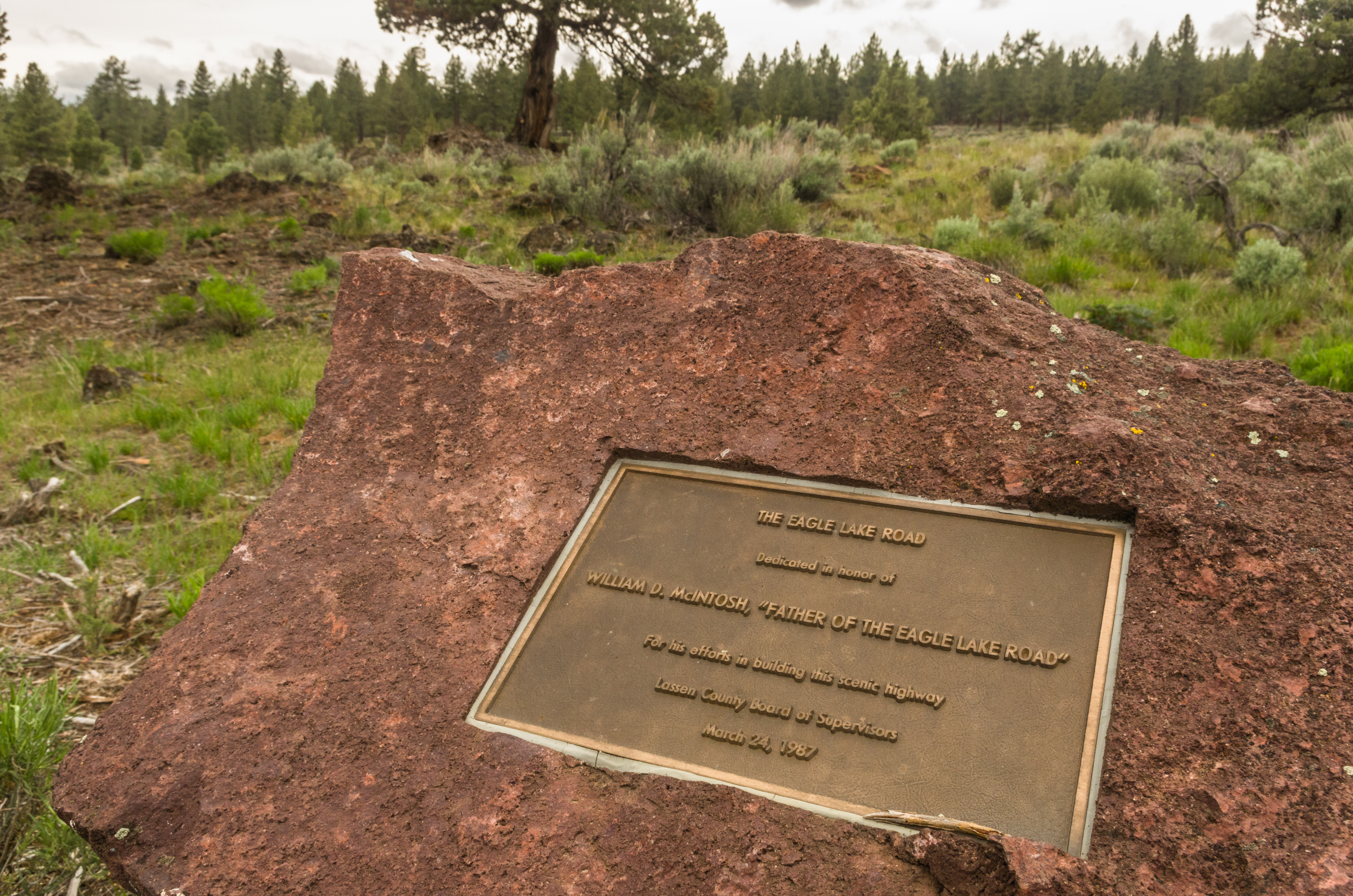
_IGP9696.PEF Lassen County Route A-1 Eagle Lake Road
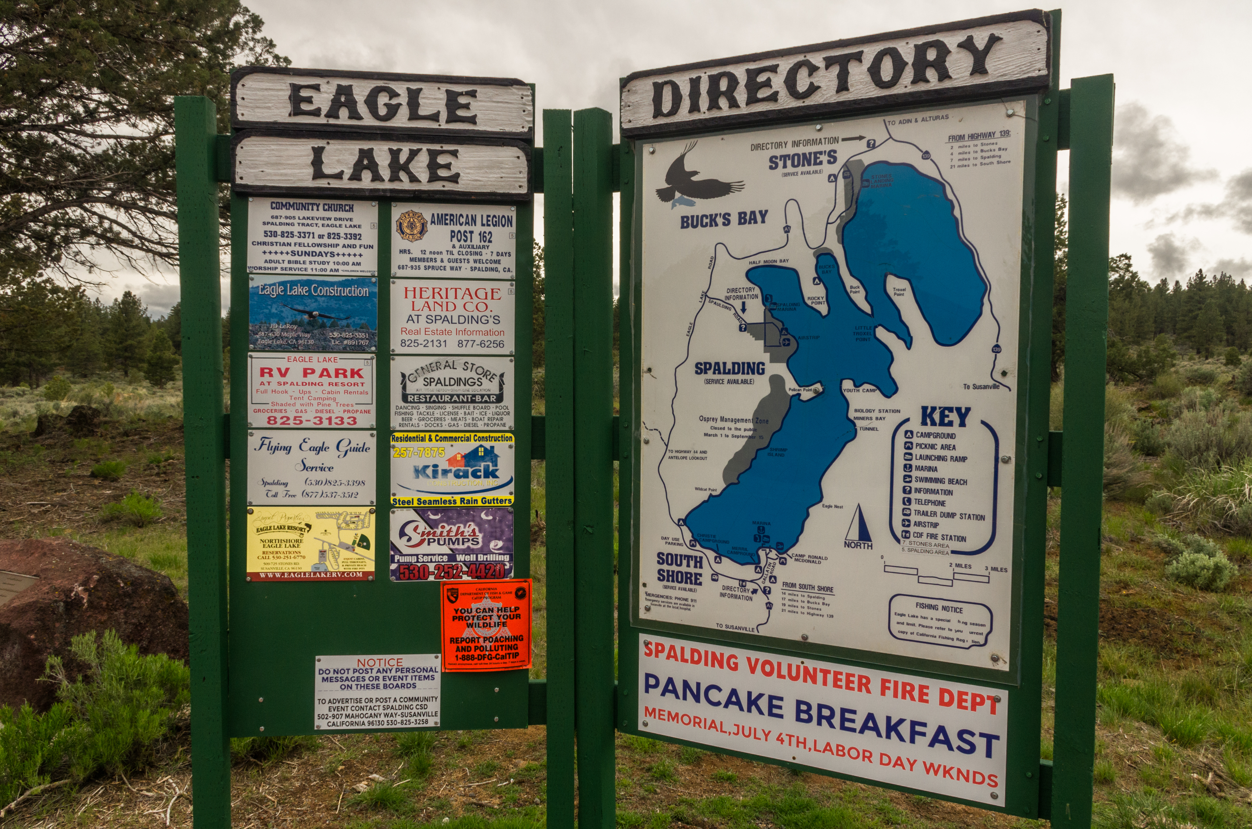
_IGP9693.PEF Eagle Lake Hwy
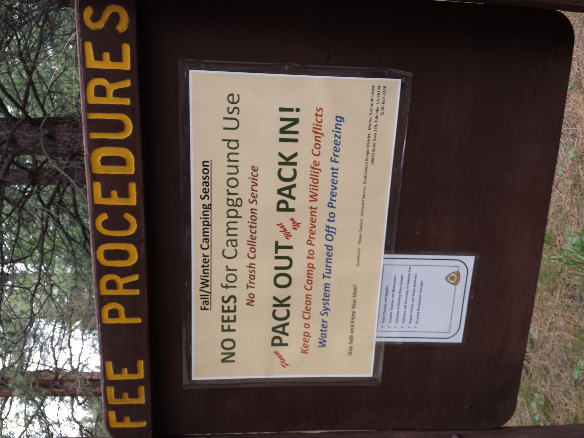
Way Northern California (State of Jefferson) has a nice fee schedule for camping in early May.
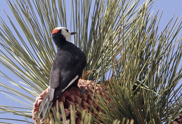
White-headed Woodpecker, male
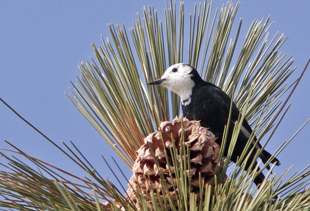
White-headed Woodpecker, male
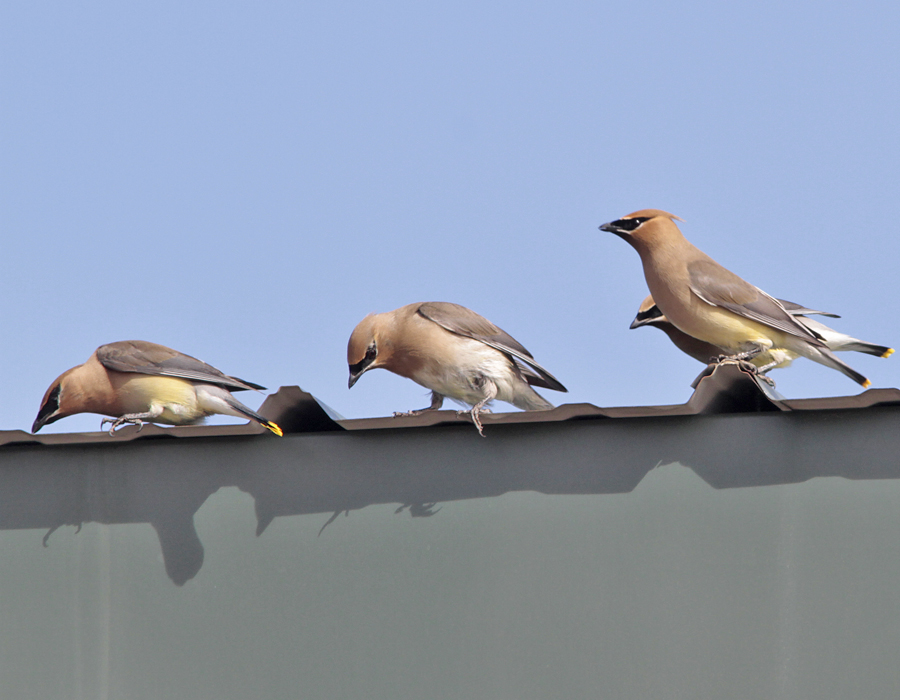
Cedar Waxwing drinking morning dew

Cowboys at work

Herd those cows

_2240022.NEF

DSC_0045.jpg
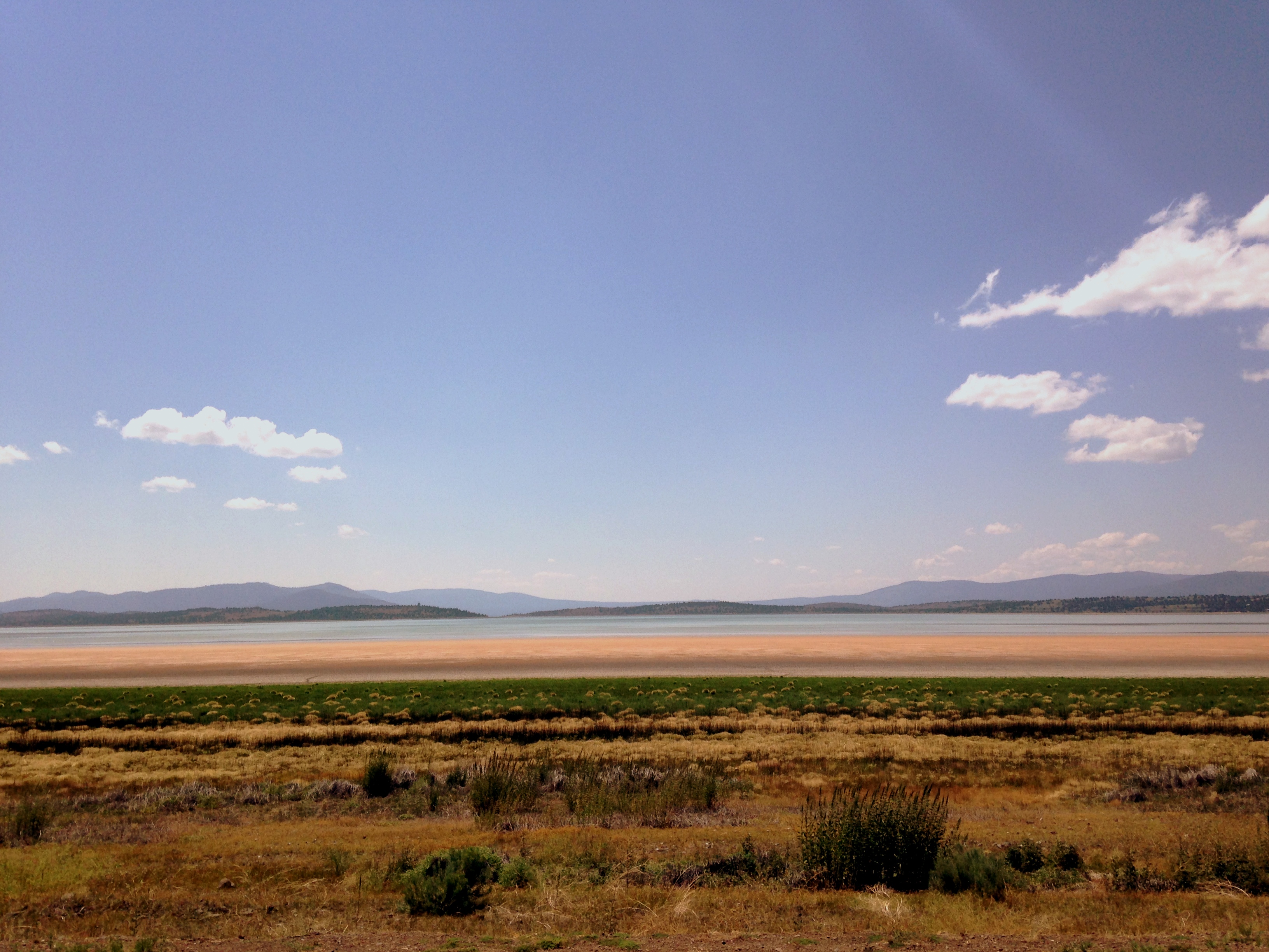
eagle lake, california
Eagle Lake June 2013

Eagle Lake June 2013

Eagle Lake June 2013

Eagle Lake June 2013
-80 Stones Rd, Susanville, CA 美國的地圖
搜索其他地方的日出日落時間
附近地點
- Lahonton Heights Dr, Susanville, CA 美國
- Juniper Ln, Susanville, CA 美國
美國加利福尼亚州伊格尔湖
Fredonyer Peak, California 美國
Susanville, 美國
美國加利福尼亞州拉森縣
Roop Mountain, California, 美國
Peak Rd, Susanville, CA 美國
- Las Plumas Way, Susanville, CA 美國
Lassen Way, California 美國
- Lake Forest Dr, Susanville, CA 美國
美國加利福尼亞州蘇珊維爾
Main St, Susanville, CA 美國
- Johnstonville Rd, Susanville, CA 美國
- Oak Mountain Dr, Susanville, CA 美國
- Old Archery Rd, Susanville, CA 美國
- Center Rd, Susanville, CA 美國
- Indale Dr, Susanville, CA 美國
- Belfast Rd, Litchfield, CA 美國
Diamond Mountain, California 美國
最近搜索
- Woodland Oak Pl, Thousand Oaks, CA, USA的日出日落時間表
- Sarangdanda 尼泊爾的日出日落時間表
- Nakanoshima, Shiogama, Miyagi -日本的日出日落時間表
- bp - 63 Rte de l'Observatoire, Bouzareah, 阿爾及利亞阿爾及爾天文台的日出日落時間表
- Crocker Dr, Vacaville, CA 美國的日出日落時間表
- 柬埔寨森莫諾隆HWHM+3X7Pu Ngaol Community Meeting Hall的日出日落時間表
- batu 10, Jalan Pantai, Port Dickson, Melaka, 馬來西亞Pantai Cermin的日出日落時間表
- 南非格魯伯斯普的日出日落時間表
- Petriti, 希臘的日出日落時間表
- Chesaw Rd, Oroville, WA 美國的日出日落時間表