Tokeland, WA 美国的日出日落时间表
Location: 美国 > 华盛顿 > 太平洋城 >
时区:
America/Los_Angeles
当地时间:
2024-05-07 12:20:19
经度:
-123.9818347
纬度:
46.7064856
今天日出时间:
05:48:58 AM
今天日落时间:
08:35:47 PM
今天日照时常:
14h 46m 49s
明天日出时间:
05:47:36 AM
明天日落时间:
08:37:04 PM
明天日照时常:
14h 49m 28s
显示所有日期
| 日期 | 日出 | 日落 | 日照时常 |
|---|---|---|---|
| 2024年01月01日 | 08:00:26 AM | 04:39:11 PM | 8h 38m 45s |
| 2024年01月02日 | 08:00:23 AM | 04:40:09 PM | 8h 39m 46s |
| 2024年01月03日 | 08:00:17 AM | 04:41:10 PM | 8h 40m 53s |
| 2024年01月04日 | 08:00:09 AM | 04:42:12 PM | 8h 42m 3s |
| 2024年01月05日 | 07:59:58 AM | 04:43:17 PM | 8h 43m 19s |
| 2024年01月06日 | 07:59:44 AM | 04:44:23 PM | 8h 44m 39s |
| 2024年01月07日 | 07:59:27 AM | 04:45:31 PM | 8h 46m 4s |
| 2024年01月08日 | 07:59:07 AM | 04:46:41 PM | 8h 47m 34s |
| 2024年01月09日 | 07:58:45 AM | 04:47:52 PM | 8h 49m 7s |
| 2024年01月10日 | 07:58:20 AM | 04:49:05 PM | 8h 50m 45s |
| 2024年01月11日 | 07:57:53 AM | 04:50:19 PM | 8h 52m 26s |
| 2024年01月12日 | 07:57:23 AM | 04:51:35 PM | 8h 54m 12s |
| 2024年01月13日 | 07:56:50 AM | 04:52:52 PM | 8h 56m 2s |
| 2024年01月14日 | 07:56:15 AM | 04:54:11 PM | 8h 57m 56s |
| 2024年01月15日 | 07:55:37 AM | 04:55:31 PM | 8h 59m 54s |
| 2024年01月16日 | 07:54:56 AM | 04:56:51 PM | 9h 1m 55s |
| 2024年01月17日 | 07:54:13 AM | 04:58:13 PM | 9h 4m 0s |
| 2024年01月18日 | 07:53:28 AM | 04:59:36 PM | 9h 6m 8s |
| 2024年01月19日 | 07:52:40 AM | 05:01:00 PM | 9h 8m 20s |
| 2024年01月20日 | 07:51:50 AM | 05:02:25 PM | 9h 10m 35s |
| 2024年01月21日 | 07:50:58 AM | 05:03:50 PM | 9h 12m 52s |
| 2024年01月22日 | 07:50:03 AM | 05:05:17 PM | 9h 15m 14s |
| 2024年01月23日 | 07:49:06 AM | 05:06:44 PM | 9h 17m 38s |
| 2024年01月24日 | 07:48:07 AM | 05:08:11 PM | 9h 20m 4s |
| 2024年01月25日 | 07:47:05 AM | 05:09:40 PM | 9h 22m 35s |
| 2024年01月26日 | 07:46:02 AM | 05:11:09 PM | 9h 25m 7s |
| 2024年01月27日 | 07:44:56 AM | 05:12:38 PM | 9h 27m 42s |
| 2024年01月28日 | 07:43:48 AM | 05:14:08 PM | 9h 30m 20s |
| 2024年01月29日 | 07:42:38 AM | 05:15:38 PM | 9h 33m 0s |
| 2024年01月30日 | 07:41:27 AM | 05:17:08 PM | 9h 35m 41s |
| 2024年01月31日 | 07:40:13 AM | 05:18:39 PM | 9h 38m 26s |
| 2024年02月01日 | 07:38:58 AM | 05:20:10 PM | 9h 41m 12s |
| 2024年02月02日 | 07:37:40 AM | 05:21:41 PM | 9h 44m 1s |
| 2024年02月03日 | 07:36:21 AM | 05:23:12 PM | 9h 46m 51s |
| 2024年02月04日 | 07:35:00 AM | 05:24:44 PM | 9h 49m 44s |
| 2024年02月05日 | 07:33:38 AM | 05:26:15 PM | 9h 52m 37s |
| 2024年02月06日 | 07:32:14 AM | 05:27:47 PM | 9h 55m 33s |
| 2024年02月07日 | 07:30:48 AM | 05:29:18 PM | 9h 58m 30s |
| 2024年02月08日 | 07:29:20 AM | 05:30:50 PM | 10h 1m 30s |
| 2024年02月09日 | 07:27:52 AM | 05:32:21 PM | 10h 4m 29s |
| 2024年02月10日 | 07:26:21 AM | 05:33:53 PM | 10h 7m 32s |
| 2024年02月11日 | 07:24:49 AM | 05:35:24 PM | 10h 10m 35s |
| 2024年02月12日 | 07:23:16 AM | 05:36:56 PM | 10h 13m 40s |
| 2024年02月13日 | 07:21:42 AM | 05:38:27 PM | 10h 16m 45s |
| 2024年02月14日 | 07:20:06 AM | 05:39:58 PM | 10h 19m 52s |
| 2024年02月15日 | 07:18:29 AM | 05:41:28 PM | 10h 22m 59s |
| 2024年02月16日 | 07:16:50 AM | 05:42:59 PM | 10h 26m 9s |
| 2024年02月17日 | 07:15:11 AM | 05:44:29 PM | 10h 29m 18s |
| 2024年02月18日 | 07:13:30 AM | 05:46:00 PM | 10h 32m 30s |
| 2024年02月19日 | 07:11:48 AM | 05:47:29 PM | 10h 35m 41s |
| 2024年02月20日 | 07:10:05 AM | 05:48:59 PM | 10h 38m 54s |
| 2024年02月21日 | 07:08:21 AM | 05:50:29 PM | 10h 42m 8s |
| 2024年02月22日 | 07:06:36 AM | 05:51:58 PM | 10h 45m 22s |
| 2024年02月23日 | 07:04:51 AM | 05:53:27 PM | 10h 48m 36s |
| 2024年02月24日 | 07:03:04 AM | 05:54:55 PM | 10h 51m 51s |
| 2024年02月25日 | 07:01:16 AM | 05:56:24 PM | 10h 55m 8s |
| 2024年02月26日 | 06:59:28 AM | 05:57:52 PM | 10h 58m 24s |
| 2024年02月27日 | 06:57:38 AM | 05:59:20 PM | 11h 1m 42s |
| 2024年02月28日 | 06:55:48 AM | 06:00:47 PM | 11h 4m 59s |
| 2024年02月29日 | 06:53:57 AM | 06:02:14 PM | 11h 8m 17s |
| 2024年03月01日 | 06:52:06 AM | 06:03:41 PM | 11h 11m 35s |
| 2024年03月02日 | 06:50:14 AM | 06:05:08 PM | 11h 14m 54s |
| 2024年03月03日 | 06:48:21 AM | 06:06:34 PM | 11h 18m 13s |
| 2024年03月04日 | 06:46:27 AM | 06:08:01 PM | 11h 21m 34s |
| 2024年03月05日 | 06:44:33 AM | 06:09:26 PM | 11h 24m 53s |
| 2024年03月06日 | 06:42:39 AM | 06:10:52 PM | 11h 28m 13s |
| 2024年03月07日 | 06:40:44 AM | 06:12:17 PM | 11h 31m 33s |
| 2024年03月08日 | 06:38:48 AM | 06:13:43 PM | 11h 34m 55s |
| 2024年03月09日 | 06:36:52 AM | 06:15:07 PM | 11h 38m 15s |
| 2024年03月10日 | 07:35:01 AM | 07:16:29 PM | 11h 41m 28s |
| 2024年03月11日 | 07:33:04 AM | 07:17:53 PM | 11h 44m 49s |
| 2024年03月12日 | 07:31:07 AM | 07:19:17 PM | 11h 48m 10s |
| 2024年03月13日 | 07:29:10 AM | 07:20:41 PM | 11h 51m 31s |
| 2024年03月14日 | 07:27:13 AM | 07:22:05 PM | 11h 54m 52s |
| 2024年03月15日 | 07:25:15 AM | 07:23:29 PM | 11h 58m 14s |
| 2024年03月16日 | 07:23:17 AM | 07:24:52 PM | 12h 1m 35s |
| 2024年03月17日 | 07:21:19 AM | 07:26:15 PM | 12h 4m 56s |
| 2024年03月18日 | 07:19:20 AM | 07:27:38 PM | 12h 8m 18s |
| 2024年03月19日 | 07:17:22 AM | 07:29:01 PM | 12h 11m 39s |
| 2024年03月20日 | 07:15:23 AM | 07:30:24 PM | 12h 15m 1s |
| 2024年03月21日 | 07:13:25 AM | 07:31:47 PM | 12h 18m 22s |
| 2024年03月22日 | 07:11:26 AM | 07:33:09 PM | 12h 21m 43s |
| 2024年03月23日 | 07:09:28 AM | 07:34:32 PM | 12h 25m 4s |
| 2024年03月24日 | 07:07:29 AM | 07:35:54 PM | 12h 28m 25s |
| 2024年03月25日 | 07:05:31 AM | 07:37:16 PM | 12h 31m 45s |
| 2024年03月26日 | 07:03:32 AM | 07:38:38 PM | 12h 35m 6s |
| 2024年03月27日 | 07:01:34 AM | 07:40:00 PM | 12h 38m 26s |
| 2024年03月28日 | 06:59:36 AM | 07:41:22 PM | 12h 41m 46s |
| 2024年03月29日 | 06:57:38 AM | 07:42:44 PM | 12h 45m 6s |
| 2024年03月30日 | 06:55:41 AM | 07:44:06 PM | 12h 48m 25s |
| 2024年03月31日 | 06:53:43 AM | 07:45:28 PM | 12h 51m 45s |
| 2024年04月01日 | 06:51:46 AM | 07:46:50 PM | 12h 55m 4s |
| 2024年04月02日 | 06:49:50 AM | 07:48:11 PM | 12h 58m 21s |
| 2024年04月03日 | 06:47:53 AM | 07:49:33 PM | 13h 1m 40s |
| 2024年04月04日 | 06:45:57 AM | 07:50:55 PM | 13h 4m 58s |
| 2024年04月05日 | 06:44:02 AM | 07:52:16 PM | 13h 8m 14s |
| 2024年04月06日 | 06:42:07 AM | 07:53:38 PM | 13h 11m 31s |
| 2024年04月07日 | 06:40:12 AM | 07:55:00 PM | 13h 14m 48s |
| 2024年04月08日 | 06:38:18 AM | 07:56:21 PM | 13h 18m 3s |
| 2024年04月09日 | 06:36:24 AM | 07:57:43 PM | 13h 21m 19s |
| 2024年04月10日 | 06:34:31 AM | 07:59:04 PM | 13h 24m 33s |
| 2024年04月11日 | 06:32:39 AM | 08:00:26 PM | 13h 27m 47s |
| 2024年04月12日 | 06:30:47 AM | 08:01:48 PM | 13h 31m 1s |
| 2024年04月13日 | 06:28:56 AM | 08:03:09 PM | 13h 34m 13s |
| 2024年04月14日 | 06:27:06 AM | 08:04:31 PM | 13h 37m 25s |
| 2024年04月15日 | 06:25:16 AM | 08:05:52 PM | 13h 40m 36s |
| 2024年04月16日 | 06:23:28 AM | 08:07:14 PM | 13h 43m 46s |
| 2024年04月17日 | 06:21:40 AM | 08:08:35 PM | 13h 46m 55s |
| 2024年04月18日 | 06:19:53 AM | 08:09:57 PM | 13h 50m 4s |
| 2024年04月19日 | 06:18:06 AM | 08:11:18 PM | 13h 53m 12s |
| 2024年04月20日 | 06:16:21 AM | 08:12:39 PM | 13h 56m 18s |
| 2024年04月21日 | 06:14:37 AM | 08:14:01 PM | 13h 59m 24s |
| 2024年04月22日 | 06:12:54 AM | 08:15:22 PM | 14h 2m 28s |
| 2024年04月23日 | 06:11:11 AM | 08:16:43 PM | 14h 5m 32s |
| 2024年04月24日 | 06:09:30 AM | 08:18:04 PM | 14h 8m 34s |
| 2024年04月25日 | 06:07:50 AM | 08:19:25 PM | 14h 11m 35s |
| 2024年04月26日 | 06:06:11 AM | 08:20:46 PM | 14h 14m 35s |
| 2024年04月27日 | 06:04:33 AM | 08:22:06 PM | 14h 17m 33s |
| 2024年04月28日 | 06:02:57 AM | 08:23:27 PM | 14h 20m 30s |
| 2024年04月29日 | 06:01:21 AM | 08:24:47 PM | 14h 23m 26s |
| 2024年04月30日 | 05:59:47 AM | 08:26:07 PM | 14h 26m 20s |
| 2024年05月01日 | 05:58:15 AM | 08:27:27 PM | 14h 29m 12s |
| 2024年05月02日 | 05:56:43 AM | 08:28:46 PM | 14h 32m 3s |
| 2024年05月03日 | 05:55:13 AM | 08:30:05 PM | 14h 34m 52s |
| 2024年05月04日 | 05:53:45 AM | 08:31:24 PM | 14h 37m 39s |
| 2024年05月05日 | 05:52:18 AM | 08:32:42 PM | 14h 40m 24s |
| 2024年05月06日 | 05:50:53 AM | 08:34:01 PM | 14h 43m 8s |
| 2024年05月07日 | 05:49:29 AM | 08:35:18 PM | 14h 45m 49s |
| 2024年05月08日 | 05:48:06 AM | 08:36:35 PM | 14h 48m 29s |
| 2024年05月09日 | 05:46:46 AM | 08:37:52 PM | 14h 51m 6s |
| 2024年05月10日 | 05:45:27 AM | 08:39:08 PM | 14h 53m 41s |
| 2024年05月11日 | 05:44:10 AM | 08:40:24 PM | 14h 56m 14s |
| 2024年05月12日 | 05:42:54 AM | 08:41:39 PM | 14h 58m 45s |
| 2024年05月13日 | 05:41:41 AM | 08:42:53 PM | 15h 1m 12s |
| 2024年05月14日 | 05:40:29 AM | 08:44:06 PM | 15h 3m 37s |
| 2024年05月15日 | 05:39:19 AM | 08:45:19 PM | 15h 6m 0s |
| 2024年05月16日 | 05:38:11 AM | 08:46:31 PM | 15h 8m 20s |
| 2024年05月17日 | 05:37:05 AM | 08:47:42 PM | 15h 10m 37s |
| 2024年05月18日 | 05:36:01 AM | 08:48:53 PM | 15h 12m 52s |
| 2024年05月19日 | 05:34:59 AM | 08:50:02 PM | 15h 15m 3s |
| 2024年05月20日 | 05:33:59 AM | 08:51:10 PM | 15h 17m 11s |
| 2024年05月21日 | 05:33:01 AM | 08:52:18 PM | 15h 19m 17s |
| 2024年05月22日 | 05:32:05 AM | 08:53:24 PM | 15h 21m 19s |
| 2024年05月23日 | 05:31:11 AM | 08:54:29 PM | 15h 23m 18s |
| 2024年05月24日 | 05:30:20 AM | 08:55:33 PM | 15h 25m 13s |
| 2024年05月25日 | 05:29:31 AM | 08:56:36 PM | 15h 27m 5s |
| 2024年05月26日 | 05:28:44 AM | 08:57:37 PM | 15h 28m 53s |
| 2024年05月27日 | 05:27:59 AM | 08:58:37 PM | 15h 30m 38s |
| 2024年05月28日 | 05:27:17 AM | 08:59:35 PM | 15h 32m 18s |
| 2024年05月29日 | 05:26:37 AM | 09:00:32 PM | 15h 33m 55s |
| 2024年05月30日 | 05:25:59 AM | 09:01:28 PM | 15h 35m 29s |
| 2024年05月31日 | 05:25:24 AM | 09:02:22 PM | 15h 36m 58s |
| 2024年06月01日 | 05:24:51 AM | 09:03:14 PM | 15h 38m 23s |
| 2024年06月02日 | 05:24:20 AM | 09:04:05 PM | 15h 39m 45s |
| 2024年06月03日 | 05:23:52 AM | 09:04:54 PM | 15h 41m 2s |
| 2024年06月04日 | 05:23:27 AM | 09:05:41 PM | 15h 42m 14s |
| 2024年06月05日 | 05:23:03 AM | 09:06:26 PM | 15h 43m 23s |
| 2024年06月06日 | 05:22:43 AM | 09:07:09 PM | 15h 44m 26s |
| 2024年06月07日 | 05:22:24 AM | 09:07:51 PM | 15h 45m 27s |
| 2024年06月08日 | 05:22:09 AM | 09:08:30 PM | 15h 46m 21s |
| 2024年06月09日 | 05:21:55 AM | 09:09:07 PM | 15h 47m 12s |
| 2024年06月10日 | 05:21:45 AM | 09:09:43 PM | 15h 47m 58s |
| 2024年06月11日 | 05:21:36 AM | 09:10:16 PM | 15h 48m 40s |
| 2024年06月12日 | 05:21:31 AM | 09:10:47 PM | 15h 49m 16s |
| 2024年06月13日 | 05:21:27 AM | 09:11:16 PM | 15h 49m 49s |
| 2024年06月14日 | 05:21:27 AM | 09:11:42 PM | 15h 50m 15s |
| 2024年06月15日 | 05:21:28 AM | 09:12:06 PM | 15h 50m 38s |
| 2024年06月16日 | 05:21:32 AM | 09:12:28 PM | 15h 50m 56s |
| 2024年06月17日 | 05:21:39 AM | 09:12:48 PM | 15h 51m 9s |
| 2024年06月18日 | 05:21:48 AM | 09:13:05 PM | 15h 51m 17s |
| 2024年06月19日 | 05:21:59 AM | 09:13:20 PM | 15h 51m 21s |
| 2024年06月20日 | 05:22:13 AM | 09:13:32 PM | 15h 51m 19s |
| 2024年06月21日 | 05:22:29 AM | 09:13:42 PM | 15h 51m 13s |
| 2024年06月22日 | 05:22:47 AM | 09:13:50 PM | 15h 51m 3s |
| 2024年06月23日 | 05:23:08 AM | 09:13:55 PM | 15h 50m 47s |
| 2024年06月24日 | 05:23:31 AM | 09:13:57 PM | 15h 50m 26s |
| 2024年06月25日 | 05:23:56 AM | 09:13:57 PM | 15h 50m 1s |
| 2024年06月26日 | 05:24:23 AM | 09:13:55 PM | 15h 49m 32s |
| 2024年06月27日 | 05:24:53 AM | 09:13:50 PM | 15h 48m 57s |
| 2024年06月28日 | 05:25:25 AM | 09:13:42 PM | 15h 48m 17s |
| 2024年06月29日 | 05:25:58 AM | 09:13:32 PM | 15h 47m 34s |
| 2024年06月30日 | 05:26:34 AM | 09:13:19 PM | 15h 46m 45s |
| 2024年07月01日 | 05:27:12 AM | 09:13:04 PM | 15h 45m 52s |
| 2024年07月02日 | 05:27:51 AM | 09:12:46 PM | 15h 44m 55s |
| 2024年07月03日 | 05:28:33 AM | 09:12:26 PM | 15h 43m 53s |
| 2024年07月04日 | 05:29:16 AM | 09:12:03 PM | 15h 42m 47s |
| 2024年07月05日 | 05:30:01 AM | 09:11:38 PM | 15h 41m 37s |
| 2024年07月06日 | 05:30:48 AM | 09:11:10 PM | 15h 40m 22s |
| 2024年07月07日 | 05:31:37 AM | 09:10:40 PM | 15h 39m 3s |
| 2024年07月08日 | 05:32:27 AM | 09:10:07 PM | 15h 37m 40s |
| 2024年07月09日 | 05:33:18 AM | 09:09:32 PM | 15h 36m 14s |
| 2024年07月10日 | 05:34:12 AM | 09:08:54 PM | 15h 34m 42s |
| 2024年07月11日 | 05:35:06 AM | 09:08:14 PM | 15h 33m 8s |
| 2024年07月12日 | 05:36:02 AM | 09:07:32 PM | 15h 31m 30s |
| 2024年07月13日 | 05:37:00 AM | 09:06:48 PM | 15h 29m 48s |
| 2024年07月14日 | 05:37:59 AM | 09:06:01 PM | 15h 28m 2s |
| 2024年07月15日 | 05:38:59 AM | 09:05:11 PM | 15h 26m 12s |
| 2024年07月16日 | 05:40:00 AM | 09:04:20 PM | 15h 24m 20s |
| 2024年07月17日 | 05:41:02 AM | 09:03:26 PM | 15h 22m 24s |
| 2024年07月18日 | 05:42:06 AM | 09:02:30 PM | 15h 20m 24s |
| 2024年07月19日 | 05:43:10 AM | 09:01:32 PM | 15h 18m 22s |
| 2024年07月20日 | 05:44:16 AM | 09:00:32 PM | 15h 16m 16s |
| 2024年07月21日 | 05:45:22 AM | 08:59:30 PM | 15h 14m 8s |
| 2024年07月22日 | 05:46:30 AM | 08:58:26 PM | 15h 11m 56s |
| 2024年07月23日 | 05:47:38 AM | 08:57:19 PM | 15h 9m 41s |
| 2024年07月24日 | 05:48:47 AM | 08:56:11 PM | 15h 7m 24s |
| 2024年07月25日 | 05:49:56 AM | 08:55:01 PM | 15h 5m 5s |
| 2024年07月26日 | 05:51:07 AM | 08:53:49 PM | 15h 2m 42s |
| 2024年07月27日 | 05:52:18 AM | 08:52:35 PM | 15h 0m 17s |
| 2024年07月28日 | 05:53:29 AM | 08:51:19 PM | 14h 57m 50s |
| 2024年07月29日 | 05:54:42 AM | 08:50:01 PM | 14h 55m 19s |
| 2024年07月30日 | 05:55:54 AM | 08:48:42 PM | 14h 52m 48s |
| 2024年07月31日 | 05:57:08 AM | 08:47:21 PM | 14h 50m 13s |
| 2024年08月01日 | 05:58:21 AM | 08:45:58 PM | 14h 47m 37s |
| 2024年08月02日 | 05:59:35 AM | 08:44:34 PM | 14h 44m 59s |
| 2024年08月03日 | 06:00:50 AM | 08:43:08 PM | 14h 42m 18s |
| 2024年08月04日 | 06:02:05 AM | 08:41:40 PM | 14h 39m 35s |
| 2024年08月05日 | 06:03:20 AM | 08:40:11 PM | 14h 36m 51s |
| 2024年08月06日 | 06:04:35 AM | 08:38:41 PM | 14h 34m 6s |
| 2024年08月07日 | 06:05:51 AM | 08:37:09 PM | 14h 31m 18s |
| 2024年08月08日 | 06:07:07 AM | 08:35:36 PM | 14h 28m 29s |
| 2024年08月09日 | 06:08:23 AM | 08:34:01 PM | 14h 25m 38s |
| 2024年08月10日 | 06:09:40 AM | 08:32:25 PM | 14h 22m 45s |
| 2024年08月11日 | 06:10:56 AM | 08:30:48 PM | 14h 19m 52s |
| 2024年08月12日 | 06:12:13 AM | 08:29:09 PM | 14h 16m 56s |
| 2024年08月13日 | 06:13:29 AM | 08:27:29 PM | 14h 14m 0s |
| 2024年08月14日 | 06:14:46 AM | 08:25:49 PM | 14h 11m 3s |
| 2024年08月15日 | 06:16:03 AM | 08:24:07 PM | 14h 8m 4s |
| 2024年08月16日 | 06:17:20 AM | 08:22:23 PM | 14h 5m 3s |
| 2024年08月17日 | 06:18:37 AM | 08:20:39 PM | 14h 2m 2s |
| 2024年08月18日 | 06:19:54 AM | 08:18:54 PM | 13h 59m 0s |
| 2024年08月19日 | 06:21:12 AM | 08:17:08 PM | 13h 55m 56s |
| 2024年08月20日 | 06:22:29 AM | 08:15:21 PM | 13h 52m 52s |
| 2024年08月21日 | 06:23:46 AM | 08:13:33 PM | 13h 49m 47s |
| 2024年08月22日 | 06:25:03 AM | 08:11:44 PM | 13h 46m 41s |
| 2024年08月23日 | 06:26:20 AM | 08:09:54 PM | 13h 43m 34s |
| 2024年08月24日 | 06:27:37 AM | 08:08:04 PM | 13h 40m 27s |
| 2024年08月25日 | 06:28:55 AM | 08:06:12 PM | 13h 37m 17s |
| 2024年08月26日 | 06:30:12 AM | 08:04:20 PM | 13h 34m 8s |
| 2024年08月27日 | 06:31:29 AM | 08:02:27 PM | 13h 30m 58s |
| 2024年08月28日 | 06:32:46 AM | 08:00:34 PM | 13h 27m 48s |
| 2024年08月29日 | 06:34:03 AM | 07:58:40 PM | 13h 24m 37s |
| 2024年08月30日 | 06:35:20 AM | 07:56:45 PM | 13h 21m 25s |
| 2024年08月31日 | 06:36:37 AM | 07:54:50 PM | 13h 18m 13s |
| 2024年09月01日 | 06:37:54 AM | 07:52:54 PM | 13h 15m 0s |
| 2024年09月02日 | 06:39:11 AM | 07:50:57 PM | 13h 11m 46s |
| 2024年09月03日 | 06:40:28 AM | 07:49:01 PM | 13h 8m 33s |
| 2024年09月04日 | 06:41:45 AM | 07:47:03 PM | 13h 5m 18s |
| 2024年09月05日 | 06:43:02 AM | 07:45:06 PM | 13h 2m 4s |
| 2024年09月06日 | 06:44:19 AM | 07:43:08 PM | 12h 58m 49s |
| 2024年09月07日 | 06:45:36 AM | 07:41:09 PM | 12h 55m 33s |
| 2024年09月08日 | 06:46:53 AM | 07:39:10 PM | 12h 52m 17s |
| 2024年09月09日 | 06:48:10 AM | 07:37:11 PM | 12h 49m 1s |
| 2024年09月10日 | 06:49:27 AM | 07:35:12 PM | 12h 45m 45s |
| 2024年09月11日 | 06:50:44 AM | 07:33:12 PM | 12h 42m 28s |
| 2024年09月12日 | 06:52:01 AM | 07:31:13 PM | 12h 39m 12s |
| 2024年09月13日 | 06:53:18 AM | 07:29:13 PM | 12h 35m 55s |
| 2024年09月14日 | 06:54:36 AM | 07:27:12 PM | 12h 32m 36s |
| 2024年09月15日 | 06:55:53 AM | 07:25:12 PM | 12h 29m 19s |
| 2024年09月16日 | 06:57:10 AM | 07:23:12 PM | 12h 26m 2s |
| 2024年09月17日 | 06:58:28 AM | 07:21:12 PM | 12h 22m 44s |
| 2024年09月18日 | 06:59:45 AM | 07:19:11 PM | 12h 19m 26s |
| 2024年09月19日 | 07:01:03 AM | 07:17:11 PM | 12h 16m 8s |
| 2024年09月20日 | 07:02:21 AM | 07:15:11 PM | 12h 12m 50s |
| 2024年09月21日 | 07:03:39 AM | 07:13:10 PM | 12h 9m 31s |
| 2024年09月22日 | 07:04:57 AM | 07:11:10 PM | 12h 6m 13s |
| 2024年09月23日 | 07:06:15 AM | 07:09:10 PM | 12h 2m 55s |
| 2024年09月24日 | 07:07:34 AM | 07:07:10 PM | 11h 59m 36s |
| 2024年09月25日 | 07:08:52 AM | 07:05:10 PM | 11h 56m 18s |
| 2024年09月26日 | 07:10:11 AM | 07:03:11 PM | 11h 53m 0s |
| 2024年09月27日 | 07:11:30 AM | 07:01:12 PM | 11h 49m 42s |
| 2024年09月28日 | 07:12:49 AM | 06:59:13 PM | 11h 46m 24s |
| 2024年09月29日 | 07:14:09 AM | 06:57:14 PM | 11h 43m 5s |
| 2024年09月30日 | 07:15:29 AM | 06:55:16 PM | 11h 39m 47s |
| 2024年10月01日 | 07:16:49 AM | 06:53:18 PM | 11h 36m 29s |
| 2024年10月02日 | 07:18:09 AM | 06:51:21 PM | 11h 33m 12s |
| 2024年10月03日 | 07:19:29 AM | 06:49:23 PM | 11h 29m 54s |
| 2024年10月04日 | 07:20:50 AM | 06:47:27 PM | 11h 26m 37s |
| 2024年10月05日 | 07:22:11 AM | 06:45:31 PM | 11h 23m 20s |
| 2024年10月06日 | 07:23:32 AM | 06:43:35 PM | 11h 20m 3s |
| 2024年10月07日 | 07:24:53 AM | 06:41:40 PM | 11h 16m 47s |
| 2024年10月08日 | 07:26:15 AM | 06:39:46 PM | 11h 13m 31s |
| 2024年10月09日 | 07:27:37 AM | 06:37:52 PM | 11h 10m 15s |
| 2024年10月10日 | 07:29:00 AM | 06:35:59 PM | 11h 6m 59s |
| 2024年10月11日 | 07:30:22 AM | 06:34:07 PM | 11h 3m 45s |
| 2024年10月12日 | 07:31:45 AM | 06:32:15 PM | 11h 0m 30s |
| 2024年10月13日 | 07:33:09 AM | 06:30:24 PM | 10h 57m 15s |
| 2024年10月14日 | 07:34:32 AM | 06:28:34 PM | 10h 54m 2s |
| 2024年10月15日 | 07:35:56 AM | 06:26:45 PM | 10h 50m 49s |
| 2024年10月16日 | 07:37:20 AM | 06:24:57 PM | 10h 47m 37s |
| 2024年10月17日 | 07:38:45 AM | 06:23:09 PM | 10h 44m 24s |
| 2024年10月18日 | 07:40:10 AM | 06:21:23 PM | 10h 41m 13s |
| 2024年10月19日 | 07:41:35 AM | 06:19:37 PM | 10h 38m 2s |
| 2024年10月20日 | 07:43:00 AM | 06:17:53 PM | 10h 34m 53s |
| 2024年10月21日 | 07:44:26 AM | 06:16:10 PM | 10h 31m 44s |
| 2024年10月22日 | 07:45:52 AM | 06:14:27 PM | 10h 28m 35s |
| 2024年10月23日 | 07:47:18 AM | 06:12:46 PM | 10h 25m 28s |
| 2024年10月24日 | 07:48:44 AM | 06:11:06 PM | 10h 22m 22s |
| 2024年10月25日 | 07:50:11 AM | 06:09:28 PM | 10h 19m 17s |
| 2024年10月26日 | 07:51:38 AM | 06:07:50 PM | 10h 16m 12s |
| 2024年10月27日 | 07:53:05 AM | 06:06:14 PM | 10h 13m 9s |
| 2024年10月28日 | 07:54:32 AM | 06:04:39 PM | 10h 10m 7s |
| 2024年10月29日 | 07:56:00 AM | 06:03:06 PM | 10h 7m 6s |
| 2024年10月30日 | 07:57:27 AM | 06:01:34 PM | 10h 4m 7s |
| 2024年10月31日 | 07:58:55 AM | 06:00:04 PM | 10h 1m 9s |
| 2024年11月01日 | 08:00:23 AM | 05:58:35 PM | 9h 58m 12s |
| 2024年11月02日 | 08:01:50 AM | 05:57:07 PM | 9h 55m 17s |
| 2024年11月03日 | 07:03:22 AM | 04:55:38 PM | 9h 52m 16s |
| 2024年11月04日 | 07:04:50 AM | 04:54:14 PM | 9h 49m 24s |
| 2024年11月05日 | 07:06:18 AM | 04:52:52 PM | 9h 46m 34s |
| 2024年11月06日 | 07:07:45 AM | 04:51:31 PM | 9h 43m 46s |
| 2024年11月07日 | 07:09:13 AM | 04:50:12 PM | 9h 40m 59s |
| 2024年11月08日 | 07:10:41 AM | 04:48:55 PM | 9h 38m 14s |
| 2024年11月09日 | 07:12:08 AM | 04:47:40 PM | 9h 35m 32s |
| 2024年11月10日 | 07:13:35 AM | 04:46:27 PM | 9h 32m 52s |
| 2024年11月11日 | 07:15:02 AM | 04:45:16 PM | 9h 30m 14s |
| 2024年11月12日 | 07:16:29 AM | 04:44:06 PM | 9h 27m 37s |
| 2024年11月13日 | 07:17:55 AM | 04:42:59 PM | 9h 25m 4s |
| 2024年11月14日 | 07:19:21 AM | 04:41:54 PM | 9h 22m 33s |
| 2024年11月15日 | 07:20:46 AM | 04:40:51 PM | 9h 20m 5s |
| 2024年11月16日 | 07:22:11 AM | 04:39:50 PM | 9h 17m 39s |
| 2024年11月17日 | 07:23:35 AM | 04:38:52 PM | 9h 15m 17s |
| 2024年11月18日 | 07:24:59 AM | 04:37:55 PM | 9h 12m 56s |
| 2024年11月19日 | 07:26:22 AM | 04:37:01 PM | 9h 10m 39s |
| 2024年11月20日 | 07:27:45 AM | 04:36:10 PM | 9h 8m 25s |
| 2024年11月21日 | 07:29:06 AM | 04:35:20 PM | 9h 6m 14s |
| 2024年11月22日 | 07:30:27 AM | 04:34:33 PM | 9h 4m 6s |
| 2024年11月23日 | 07:31:46 AM | 04:33:49 PM | 9h 2m 3s |
| 2024年11月24日 | 07:33:05 AM | 04:33:07 PM | 9h 0m 2s |
| 2024年11月25日 | 07:34:23 AM | 04:32:28 PM | 8h 58m 5s |
| 2024年11月26日 | 07:35:39 AM | 04:31:51 PM | 8h 56m 12s |
| 2024年11月27日 | 07:36:55 AM | 04:31:17 PM | 8h 54m 22s |
| 2024年11月28日 | 07:38:09 AM | 04:30:45 PM | 8h 52m 36s |
| 2024年11月29日 | 07:39:22 AM | 04:30:16 PM | 8h 50m 54s |
| 2024年11月30日 | 07:40:33 AM | 04:29:50 PM | 8h 49m 17s |
| 2024年12月01日 | 07:41:43 AM | 04:29:26 PM | 8h 47m 43s |
| 2024年12月02日 | 07:42:51 AM | 04:29:06 PM | 8h 46m 15s |
| 2024年12月03日 | 07:43:58 AM | 04:28:48 PM | 8h 44m 50s |
| 2024年12月04日 | 07:45:03 AM | 04:28:32 PM | 8h 43m 29s |
| 2024年12月05日 | 07:46:07 AM | 04:28:20 PM | 8h 42m 13s |
| 2024年12月06日 | 07:47:09 AM | 04:28:10 PM | 8h 41m 1s |
| 2024年12月07日 | 07:48:08 AM | 04:28:03 PM | 8h 39m 55s |
| 2024年12月08日 | 07:49:06 AM | 04:27:59 PM | 8h 38m 53s |
| 2024年12月09日 | 07:50:02 AM | 04:27:58 PM | 8h 37m 56s |
| 2024年12月10日 | 07:50:56 AM | 04:28:00 PM | 8h 37m 4s |
| 2024年12月11日 | 07:51:48 AM | 04:28:04 PM | 8h 36m 16s |
| 2024年12月12日 | 07:52:37 AM | 04:28:11 PM | 8h 35m 34s |
| 2024年12月13日 | 07:53:24 AM | 04:28:21 PM | 8h 34m 57s |
| 2024年12月14日 | 07:54:09 AM | 04:28:34 PM | 8h 34m 25s |
| 2024年12月15日 | 07:54:52 AM | 04:28:50 PM | 8h 33m 58s |
| 2024年12月16日 | 07:55:32 AM | 04:29:08 PM | 8h 33m 36s |
| 2024年12月17日 | 07:56:10 AM | 04:29:29 PM | 8h 33m 19s |
| 2024年12月18日 | 07:56:46 AM | 04:29:53 PM | 8h 33m 7s |
| 2024年12月19日 | 07:57:19 AM | 04:30:20 PM | 8h 33m 1s |
| 2024年12月20日 | 07:57:49 AM | 04:30:49 PM | 8h 33m 0s |
| 2024年12月21日 | 07:58:17 AM | 04:31:21 PM | 8h 33m 4s |
| 2024年12月22日 | 07:58:42 AM | 04:31:56 PM | 8h 33m 14s |
| 2024年12月23日 | 07:59:04 AM | 04:32:33 PM | 8h 33m 29s |
| 2024年12月24日 | 07:59:24 AM | 04:33:12 PM | 8h 33m 48s |
| 2024年12月25日 | 07:59:41 AM | 04:33:55 PM | 8h 34m 14s |
| 2024年12月26日 | 07:59:56 AM | 04:34:39 PM | 8h 34m 43s |
| 2024年12月27日 | 08:00:07 AM | 04:35:26 PM | 8h 35m 19s |
| 2024年12月28日 | 08:00:16 AM | 04:36:15 PM | 8h 35m 59s |
| 2024年12月29日 | 08:00:22 AM | 04:37:07 PM | 8h 36m 45s |
| 2024年12月30日 | 08:00:25 AM | 04:38:01 PM | 8h 37m 36s |
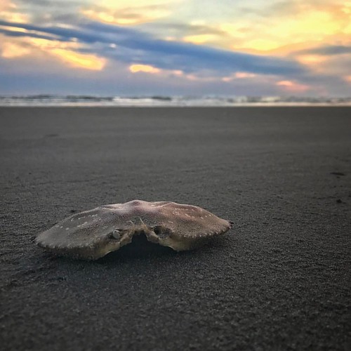
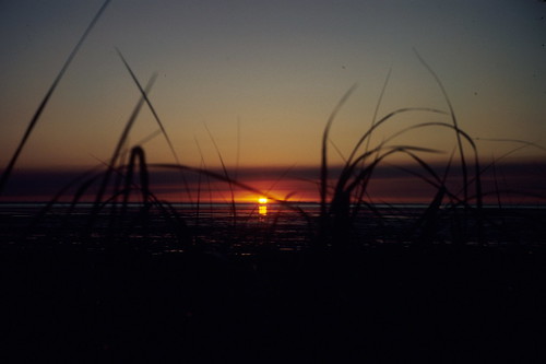
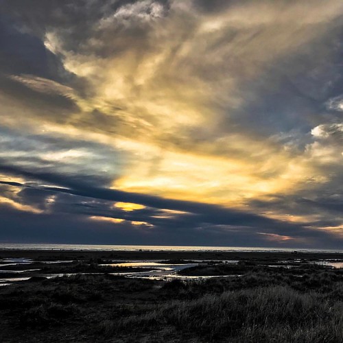
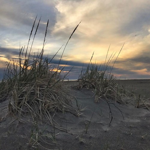
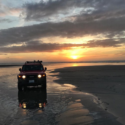
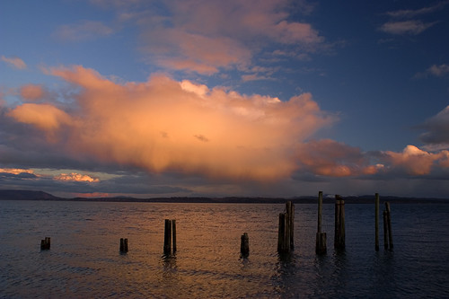
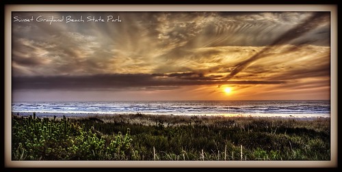
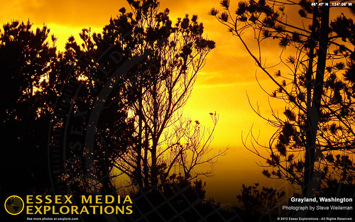
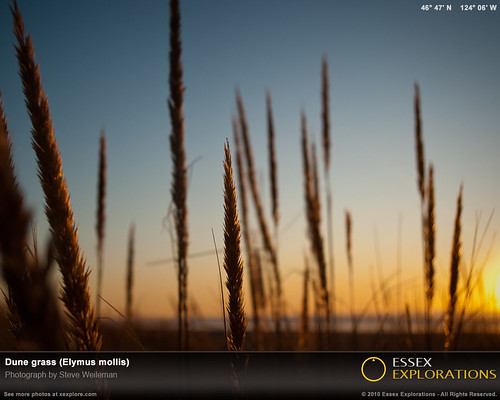
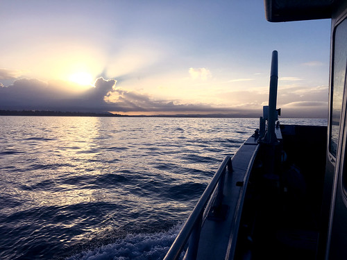
日出日落照片
Tokeland, WA 美国的地图
查询其他地方的日出日落时间
Tokeland, WA 美国的其他地方
附近地点
Toke Point, Tokeland, WA 美国
US-, South Bend, WA 美国
18 Wilson Ln, South Bend, WA 美国
Juniper St, Grayland, WA 美国
16 Bay Center Rd, South Bend, WA 美国
30 Willapa Sands Lane, South Bend, WA 美国
Stackpole Rd, Oysterville, WA 美国
WA-, Grayland, WA 美国
美国华盛顿格雷兰
WA-, Raymond, WA 美国Royal Heights Transfer Station
Johns River Rd, Aberdeen, WA 美国
美国华盛顿奥伊斯特维尔
West Ln, Ocean Park, WA 美国
Vista Ridge Dr, Grayland, WA 美国
Oysterville Rd, Ocean Park, WA 美国
J Pl, Ocean Park, WA 美国
J Pl, Ocean Park, WA 美国
J Pl, Ocean Park, WA 美国
Territory Rd, Oysterville, WA 美国
G St, Ocean Park, WA 美国
最近搜索
- Cabo de Cruz, Boiro, A Coruña, Spain的日出日落时间表
- Japan, 山形県 置賜地方的日出日落时间表
- 中国山西省晋中市榆次区的日出日落时间表
- 4 Vale Rd, Sheffield S3 9QX, UK的日出日落时间表
- State St, Zanesville, OH 美国的日出日落时间表
- 1-chome Tsukaguchicho, Amagasaki, Hyogo -日本的日出日落时间表
- 日本〒- 静冈县骏东郡小山町 SubashiriKusushi Shrine的日出日落时间表
- Sinai St 16, Be'er Sheva, 以色列的日出日落时间表
- Presidente Quintana & Emilio Mitre, Carlos Keen, Provincia de Buenos Aires, 阿根廷的日出日落时间表
- Deep Gap Farm Rd E, Mill Spring, NC 美国的日出日落时间表


