Rd M, Emporia, KS 美国的日出日落时间表
Location: 美国 > 堪萨斯 > 莱昂县 > 美国堪萨斯恩波里亚 >
时区:
America/Chicago
当地时间:
2024-05-11 16:02:43
经度:
-96.1525319
纬度:
38.45669
今天日出时间:
06:14:48 AM
今天日落时间:
08:27:07 PM
今天日照时常:
14h 12m 19s
明天日出时间:
06:13:54 AM
明天日落时间:
08:28:01 PM
明天日照时常:
14h 14m 7s
显示所有日期
| 日期 | 日出 | 日落 | 日照时常 |
|---|---|---|---|
| 2024年01月01日 | 07:41:56 AM | 05:14:54 PM | 9h 32m 58s |
| 2024年01月02日 | 07:42:02 AM | 05:15:43 PM | 9h 33m 41s |
| 2024年01月03日 | 07:42:06 AM | 05:16:34 PM | 9h 34m 28s |
| 2024年01月04日 | 07:42:08 AM | 05:17:26 PM | 9h 35m 18s |
| 2024年01月05日 | 07:42:08 AM | 05:18:20 PM | 9h 36m 12s |
| 2024年01月06日 | 07:42:06 AM | 05:19:14 PM | 9h 37m 8s |
| 2024年01月07日 | 07:42:02 AM | 05:20:10 PM | 9h 38m 8s |
| 2024年01月08日 | 07:41:55 AM | 05:21:07 PM | 9h 39m 12s |
| 2024年01月09日 | 07:41:47 AM | 05:22:05 PM | 9h 40m 18s |
| 2024年01月10日 | 07:41:36 AM | 05:23:04 PM | 9h 41m 28s |
| 2024年01月11日 | 07:41:23 AM | 05:24:04 PM | 9h 42m 41s |
| 2024年01月12日 | 07:41:08 AM | 05:25:04 PM | 9h 43m 56s |
| 2024年01月13日 | 07:40:51 AM | 05:26:06 PM | 9h 45m 15s |
| 2024年01月14日 | 07:40:32 AM | 05:27:08 PM | 9h 46m 36s |
| 2024年01月15日 | 07:40:11 AM | 05:28:11 PM | 9h 48m 0s |
| 2024年01月16日 | 07:39:48 AM | 05:29:15 PM | 9h 49m 27s |
| 2024年01月17日 | 07:39:23 AM | 05:30:19 PM | 9h 50m 56s |
| 2024年01月18日 | 07:38:56 AM | 05:31:24 PM | 9h 52m 28s |
| 2024年01月19日 | 07:38:27 AM | 05:32:30 PM | 9h 54m 3s |
| 2024年01月20日 | 07:37:55 AM | 05:33:36 PM | 9h 55m 41s |
| 2024年01月21日 | 07:37:22 AM | 05:34:42 PM | 9h 57m 20s |
| 2024年01月22日 | 07:36:47 AM | 05:35:49 PM | 9h 59m 2s |
| 2024年01月23日 | 07:36:10 AM | 05:36:56 PM | 10h 0m 46s |
| 2024年01月24日 | 07:35:32 AM | 05:38:04 PM | 10h 2m 32s |
| 2024年01月25日 | 07:34:51 AM | 05:39:12 PM | 10h 4m 21s |
| 2024年01月26日 | 07:34:08 AM | 05:40:20 PM | 10h 6m 12s |
| 2024年01月27日 | 07:33:24 AM | 05:41:28 PM | 10h 8m 4s |
| 2024年01月28日 | 07:32:38 AM | 05:42:36 PM | 10h 9m 58s |
| 2024年01月29日 | 07:31:50 AM | 05:43:44 PM | 10h 11m 54s |
| 2024年01月30日 | 07:31:01 AM | 05:44:53 PM | 10h 13m 52s |
| 2024年01月31日 | 07:30:10 AM | 05:46:02 PM | 10h 15m 52s |
| 2024年02月01日 | 07:29:17 AM | 05:47:10 PM | 10h 17m 53s |
| 2024年02月02日 | 07:28:22 AM | 05:48:19 PM | 10h 19m 57s |
| 2024年02月03日 | 07:27:26 AM | 05:49:27 PM | 10h 22m 1s |
| 2024年02月04日 | 07:26:29 AM | 05:50:36 PM | 10h 24m 7s |
| 2024年02月05日 | 07:25:30 AM | 05:51:44 PM | 10h 26m 14s |
| 2024年02月06日 | 07:24:29 AM | 05:52:52 PM | 10h 28m 23s |
| 2024年02月07日 | 07:23:27 AM | 05:54:00 PM | 10h 30m 33s |
| 2024年02月08日 | 07:22:23 AM | 05:55:08 PM | 10h 32m 45s |
| 2024年02月09日 | 07:21:19 AM | 05:56:16 PM | 10h 34m 57s |
| 2024年02月10日 | 07:20:12 AM | 05:57:24 PM | 10h 37m 12s |
| 2024年02月11日 | 07:19:05 AM | 05:58:31 PM | 10h 39m 26s |
| 2024年02月12日 | 07:17:56 AM | 05:59:38 PM | 10h 41m 42s |
| 2024年02月13日 | 07:16:46 AM | 06:00:45 PM | 10h 43m 59s |
| 2024年02月14日 | 07:15:35 AM | 06:01:52 PM | 10h 46m 17s |
| 2024年02月15日 | 07:14:22 AM | 06:02:58 PM | 10h 48m 36s |
| 2024年02月16日 | 07:13:08 AM | 06:04:04 PM | 10h 50m 56s |
| 2024年02月17日 | 07:11:54 AM | 06:05:10 PM | 10h 53m 16s |
| 2024年02月18日 | 07:10:38 AM | 06:06:15 PM | 10h 55m 37s |
| 2024年02月19日 | 07:09:21 AM | 06:07:21 PM | 10h 58m 0s |
| 2024年02月20日 | 07:08:03 AM | 06:08:26 PM | 11h 0m 23s |
| 2024年02月21日 | 07:06:44 AM | 06:09:30 PM | 11h 2m 46s |
| 2024年02月22日 | 07:05:24 AM | 06:10:34 PM | 11h 5m 10s |
| 2024年02月23日 | 07:04:04 AM | 06:11:38 PM | 11h 7m 34s |
| 2024年02月24日 | 07:02:42 AM | 06:12:42 PM | 11h 10m 0s |
| 2024年02月25日 | 07:01:20 AM | 06:13:45 PM | 11h 12m 25s |
| 2024年02月26日 | 06:59:56 AM | 06:14:48 PM | 11h 14m 52s |
| 2024年02月27日 | 06:58:32 AM | 06:15:51 PM | 11h 17m 19s |
| 2024年02月28日 | 06:57:07 AM | 06:16:53 PM | 11h 19m 46s |
| 2024年02月29日 | 06:55:42 AM | 06:17:55 PM | 11h 22m 13s |
| 2024年03月01日 | 06:54:16 AM | 06:18:57 PM | 11h 24m 41s |
| 2024年03月02日 | 06:52:49 AM | 06:19:59 PM | 11h 27m 10s |
| 2024年03月03日 | 06:51:21 AM | 06:21:00 PM | 11h 29m 39s |
| 2024年03月04日 | 06:49:53 AM | 06:22:01 PM | 11h 32m 8s |
| 2024年03月05日 | 06:48:25 AM | 06:23:01 PM | 11h 34m 36s |
| 2024年03月06日 | 06:46:56 AM | 06:24:02 PM | 11h 37m 6s |
| 2024年03月07日 | 06:45:26 AM | 06:25:02 PM | 11h 39m 36s |
| 2024年03月08日 | 06:43:56 AM | 06:26:02 PM | 11h 42m 6s |
| 2024年03月09日 | 06:42:26 AM | 06:27:01 PM | 11h 44m 35s |
| 2024年03月10日 | 07:40:58 AM | 07:27:58 PM | 11h 47m 0s |
| 2024年03月11日 | 07:39:27 AM | 07:28:57 PM | 11h 49m 30s |
| 2024年03月12日 | 07:37:56 AM | 07:29:56 PM | 11h 52m 0s |
| 2024年03月13日 | 07:36:24 AM | 07:30:55 PM | 11h 54m 31s |
| 2024年03月14日 | 07:34:52 AM | 07:31:53 PM | 11h 57m 1s |
| 2024年03月15日 | 07:33:19 AM | 07:32:52 PM | 11h 59m 33s |
| 2024年03月16日 | 07:31:47 AM | 07:33:50 PM | 12h 2m 3s |
| 2024年03月17日 | 07:30:14 AM | 07:34:48 PM | 12h 4m 34s |
| 2024年03月18日 | 07:28:41 AM | 07:35:45 PM | 12h 7m 4s |
| 2024年03月19日 | 07:27:08 AM | 07:36:43 PM | 12h 9m 35s |
| 2024年03月20日 | 07:25:35 AM | 07:37:40 PM | 12h 12m 5s |
| 2024年03月21日 | 07:24:02 AM | 07:38:38 PM | 12h 14m 36s |
| 2024年03月22日 | 07:22:28 AM | 07:39:35 PM | 12h 17m 7s |
| 2024年03月23日 | 07:20:55 AM | 07:40:32 PM | 12h 19m 37s |
| 2024年03月24日 | 07:19:22 AM | 07:41:29 PM | 12h 22m 7s |
| 2024年03月25日 | 07:17:49 AM | 07:42:26 PM | 12h 24m 37s |
| 2024年03月26日 | 07:16:16 AM | 07:43:23 PM | 12h 27m 7s |
| 2024年03月27日 | 07:14:43 AM | 07:44:19 PM | 12h 29m 36s |
| 2024年03月28日 | 07:13:10 AM | 07:45:16 PM | 12h 32m 6s |
| 2024年03月29日 | 07:11:37 AM | 07:46:13 PM | 12h 34m 36s |
| 2024年03月30日 | 07:10:05 AM | 07:47:09 PM | 12h 37m 4s |
| 2024年03月31日 | 07:08:33 AM | 07:48:06 PM | 12h 39m 33s |
| 2024年04月01日 | 07:07:01 AM | 07:49:03 PM | 12h 42m 2s |
| 2024年04月02日 | 07:05:29 AM | 07:49:59 PM | 12h 44m 30s |
| 2024年04月03日 | 07:03:58 AM | 07:50:56 PM | 12h 46m 58s |
| 2024年04月04日 | 07:02:27 AM | 07:51:52 PM | 12h 49m 25s |
| 2024年04月05日 | 07:00:57 AM | 07:52:49 PM | 12h 51m 52s |
| 2024年04月06日 | 06:59:27 AM | 07:53:45 PM | 12h 54m 18s |
| 2024年04月07日 | 06:57:57 AM | 07:54:42 PM | 12h 56m 45s |
| 2024年04月08日 | 06:56:28 AM | 07:55:38 PM | 12h 59m 10s |
| 2024年04月09日 | 06:54:59 AM | 07:56:35 PM | 13h 1m 36s |
| 2024年04月10日 | 06:53:31 AM | 07:57:32 PM | 13h 4m 1s |
| 2024年04月11日 | 06:52:04 AM | 07:58:28 PM | 13h 6m 24s |
| 2024年04月12日 | 06:50:37 AM | 07:59:25 PM | 13h 8m 48s |
| 2024年04月13日 | 06:49:10 AM | 08:00:22 PM | 13h 11m 12s |
| 2024年04月14日 | 06:47:45 AM | 08:01:18 PM | 13h 13m 33s |
| 2024年04月15日 | 06:46:20 AM | 08:02:15 PM | 13h 15m 55s |
| 2024年04月16日 | 06:44:56 AM | 08:03:12 PM | 13h 18m 16s |
| 2024年04月17日 | 06:43:32 AM | 08:04:09 PM | 13h 20m 37s |
| 2024年04月18日 | 06:42:09 AM | 08:05:06 PM | 13h 22m 57s |
| 2024年04月19日 | 06:40:48 AM | 08:06:03 PM | 13h 25m 15s |
| 2024年04月20日 | 06:39:27 AM | 08:07:00 PM | 13h 27m 33s |
| 2024年04月21日 | 06:38:06 AM | 08:07:57 PM | 13h 29m 51s |
| 2024年04月22日 | 06:36:47 AM | 08:08:54 PM | 13h 32m 7s |
| 2024年04月23日 | 06:35:29 AM | 08:09:51 PM | 13h 34m 22s |
| 2024年04月24日 | 06:34:11 AM | 08:10:48 PM | 13h 36m 37s |
| 2024年04月25日 | 06:32:55 AM | 08:11:45 PM | 13h 38m 50s |
| 2024年04月26日 | 06:31:40 AM | 08:12:42 PM | 13h 41m 2s |
| 2024年04月27日 | 06:30:25 AM | 08:13:38 PM | 13h 43m 13s |
| 2024年04月28日 | 06:29:12 AM | 08:14:35 PM | 13h 45m 23s |
| 2024年04月29日 | 06:28:00 AM | 08:15:32 PM | 13h 47m 32s |
| 2024年04月30日 | 06:26:49 AM | 08:16:29 PM | 13h 49m 40s |
| 2024年05月01日 | 06:25:40 AM | 08:17:25 PM | 13h 51m 45s |
| 2024年05月02日 | 06:24:31 AM | 08:18:22 PM | 13h 53m 51s |
| 2024年05月03日 | 06:23:24 AM | 08:19:18 PM | 13h 55m 54s |
| 2024年05月04日 | 06:22:18 AM | 08:20:15 PM | 13h 57m 57s |
| 2024年05月05日 | 06:21:13 AM | 08:21:11 PM | 13h 59m 58s |
| 2024年05月06日 | 06:20:10 AM | 08:22:07 PM | 14h 1m 57s |
| 2024年05月07日 | 06:19:07 AM | 08:23:02 PM | 14h 3m 55s |
| 2024年05月08日 | 06:18:07 AM | 08:23:58 PM | 14h 5m 51s |
| 2024年05月09日 | 06:17:08 AM | 08:24:53 PM | 14h 7m 45s |
| 2024年05月10日 | 06:16:10 AM | 08:25:48 PM | 14h 9m 38s |
| 2024年05月11日 | 06:15:13 AM | 08:26:42 PM | 14h 11m 29s |
| 2024年05月12日 | 06:14:18 AM | 08:27:36 PM | 14h 13m 18s |
| 2024年05月13日 | 06:13:25 AM | 08:28:30 PM | 14h 15m 5s |
| 2024年05月14日 | 06:12:33 AM | 08:29:24 PM | 14h 16m 51s |
| 2024年05月15日 | 06:11:43 AM | 08:30:17 PM | 14h 18m 34s |
| 2024年05月16日 | 06:10:54 AM | 08:31:09 PM | 14h 20m 15s |
| 2024年05月17日 | 06:10:07 AM | 08:32:01 PM | 14h 21m 54s |
| 2024年05月18日 | 06:09:22 AM | 08:32:53 PM | 14h 23m 31s |
| 2024年05月19日 | 06:08:38 AM | 08:33:44 PM | 14h 25m 6s |
| 2024年05月20日 | 06:07:56 AM | 08:34:34 PM | 14h 26m 38s |
| 2024年05月21日 | 06:07:15 AM | 08:35:24 PM | 14h 28m 9s |
| 2024年05月22日 | 06:06:36 AM | 08:36:13 PM | 14h 29m 37s |
| 2024年05月23日 | 06:05:59 AM | 08:37:01 PM | 14h 31m 2s |
| 2024年05月24日 | 06:05:24 AM | 08:37:49 PM | 14h 32m 25s |
| 2024年05月25日 | 06:04:51 AM | 08:38:35 PM | 14h 33m 44s |
| 2024年05月26日 | 06:04:19 AM | 08:39:21 PM | 14h 35m 2s |
| 2024年05月27日 | 06:03:49 AM | 08:40:06 PM | 14h 36m 17s |
| 2024年05月28日 | 06:03:21 AM | 08:40:51 PM | 14h 37m 30s |
| 2024年05月29日 | 06:02:54 AM | 08:41:34 PM | 14h 38m 40s |
| 2024年05月30日 | 06:02:30 AM | 08:42:16 PM | 14h 39m 46s |
| 2024年05月31日 | 06:02:07 AM | 08:42:57 PM | 14h 40m 50s |
| 2024年06月01日 | 06:01:46 AM | 08:43:37 PM | 14h 41m 51s |
| 2024年06月02日 | 06:01:27 AM | 08:44:16 PM | 14h 42m 49s |
| 2024年06月03日 | 06:01:10 AM | 08:44:54 PM | 14h 43m 44s |
| 2024年06月04日 | 06:00:55 AM | 08:45:31 PM | 14h 44m 36s |
| 2024年06月05日 | 06:00:41 AM | 08:46:06 PM | 14h 45m 25s |
| 2024年06月06日 | 06:00:30 AM | 08:46:40 PM | 14h 46m 10s |
| 2024年06月07日 | 06:00:20 AM | 08:47:13 PM | 14h 46m 53s |
| 2024年06月08日 | 06:00:12 AM | 08:47:45 PM | 14h 47m 33s |
| 2024年06月09日 | 06:00:06 AM | 08:48:15 PM | 14h 48m 9s |
| 2024年06月10日 | 06:00:02 AM | 08:48:44 PM | 14h 48m 42s |
| 2024年06月11日 | 05:59:59 AM | 08:49:11 PM | 14h 49m 12s |
| 2024年06月12日 | 05:59:59 AM | 08:49:37 PM | 14h 49m 38s |
| 2024年06月13日 | 06:00:00 AM | 08:50:01 PM | 14h 50m 1s |
| 2024年06月14日 | 06:00:03 AM | 08:50:24 PM | 14h 50m 21s |
| 2024年06月15日 | 06:00:07 AM | 08:50:45 PM | 14h 50m 38s |
| 2024年06月16日 | 06:00:14 AM | 08:51:05 PM | 14h 50m 51s |
| 2024年06月17日 | 06:00:22 AM | 08:51:23 PM | 14h 51m 1s |
| 2024年06月18日 | 06:00:32 AM | 08:51:39 PM | 14h 51m 7s |
| 2024年06月19日 | 06:00:43 AM | 08:51:54 PM | 14h 51m 11s |
| 2024年06月20日 | 06:00:57 AM | 08:52:06 PM | 14h 51m 9s |
| 2024年06月21日 | 06:01:12 AM | 08:52:17 PM | 14h 51m 5s |
| 2024年06月22日 | 06:01:28 AM | 08:52:27 PM | 14h 50m 59s |
| 2024年06月23日 | 06:01:46 AM | 08:52:34 PM | 14h 50m 48s |
| 2024年06月24日 | 06:02:06 AM | 08:52:40 PM | 14h 50m 34s |
| 2024年06月25日 | 06:02:27 AM | 08:52:44 PM | 14h 50m 17s |
| 2024年06月26日 | 06:02:50 AM | 08:52:46 PM | 14h 49m 56s |
| 2024年06月27日 | 06:03:14 AM | 08:52:47 PM | 14h 49m 33s |
| 2024年06月28日 | 06:03:40 AM | 08:52:45 PM | 14h 49m 5s |
| 2024年06月29日 | 06:04:07 AM | 08:52:42 PM | 14h 48m 35s |
| 2024年06月30日 | 06:04:35 AM | 08:52:36 PM | 14h 48m 1s |
| 2024年07月01日 | 06:05:05 AM | 08:52:29 PM | 14h 47m 24s |
| 2024年07月02日 | 06:05:36 AM | 08:52:20 PM | 14h 46m 44s |
| 2024年07月03日 | 06:06:08 AM | 08:52:09 PM | 14h 46m 1s |
| 2024年07月04日 | 06:06:41 AM | 08:51:56 PM | 14h 45m 15s |
| 2024年07月05日 | 06:07:16 AM | 08:51:42 PM | 14h 44m 26s |
| 2024年07月06日 | 06:07:52 AM | 08:51:25 PM | 14h 43m 33s |
| 2024年07月07日 | 06:08:29 AM | 08:51:07 PM | 14h 42m 38s |
| 2024年07月08日 | 06:09:07 AM | 08:50:46 PM | 14h 41m 39s |
| 2024年07月09日 | 06:09:46 AM | 08:50:24 PM | 14h 40m 38s |
| 2024年07月10日 | 06:10:26 AM | 08:50:00 PM | 14h 39m 34s |
| 2024年07月11日 | 06:11:07 AM | 08:49:34 PM | 14h 38m 27s |
| 2024年07月12日 | 06:11:48 AM | 08:49:06 PM | 14h 37m 18s |
| 2024年07月13日 | 06:12:31 AM | 08:48:36 PM | 14h 36m 5s |
| 2024年07月14日 | 06:13:14 AM | 08:48:05 PM | 14h 34m 51s |
| 2024年07月15日 | 06:13:59 AM | 08:47:32 PM | 14h 33m 33s |
| 2024年07月16日 | 06:14:44 AM | 08:46:57 PM | 14h 32m 13s |
| 2024年07月17日 | 06:15:29 AM | 08:46:20 PM | 14h 30m 51s |
| 2024年07月18日 | 06:16:16 AM | 08:45:41 PM | 14h 29m 25s |
| 2024年07月19日 | 06:17:03 AM | 08:45:01 PM | 14h 27m 58s |
| 2024年07月20日 | 06:17:51 AM | 08:44:18 PM | 14h 26m 27s |
| 2024年07月21日 | 06:18:39 AM | 08:43:35 PM | 14h 24m 56s |
| 2024年07月22日 | 06:19:27 AM | 08:42:49 PM | 14h 23m 22s |
| 2024年07月23日 | 06:20:17 AM | 08:42:02 PM | 14h 21m 45s |
| 2024年07月24日 | 06:21:06 AM | 08:41:13 PM | 14h 20m 7s |
| 2024年07月25日 | 06:21:56 AM | 08:40:23 PM | 14h 18m 27s |
| 2024年07月26日 | 06:22:47 AM | 08:39:31 PM | 14h 16m 44s |
| 2024年07月27日 | 06:23:38 AM | 08:38:37 PM | 14h 14m 59s |
| 2024年07月28日 | 06:24:29 AM | 08:37:42 PM | 14h 13m 13s |
| 2024年07月29日 | 06:25:21 AM | 08:36:45 PM | 14h 11m 24s |
| 2024年07月30日 | 06:26:12 AM | 08:35:47 PM | 14h 9m 35s |
| 2024年07月31日 | 06:27:04 AM | 08:34:47 PM | 14h 7m 43s |
| 2024年08月01日 | 06:27:57 AM | 08:33:46 PM | 14h 5m 49s |
| 2024年08月02日 | 06:28:49 AM | 08:32:44 PM | 14h 3m 55s |
| 2024年08月03日 | 06:29:42 AM | 08:31:40 PM | 14h 1m 58s |
| 2024年08月04日 | 06:30:34 AM | 08:30:35 PM | 14h 0m 1s |
| 2024年08月05日 | 06:31:27 AM | 08:29:28 PM | 13h 58m 1s |
| 2024年08月06日 | 06:32:20 AM | 08:28:20 PM | 13h 56m 0s |
| 2024年08月07日 | 06:33:13 AM | 08:27:11 PM | 13h 53m 58s |
| 2024年08月08日 | 06:34:07 AM | 08:26:01 PM | 13h 51m 54s |
| 2024年08月09日 | 06:35:00 AM | 08:24:49 PM | 13h 49m 49s |
| 2024年08月10日 | 06:35:53 AM | 08:23:36 PM | 13h 47m 43s |
| 2024年08月11日 | 06:36:47 AM | 08:22:23 PM | 13h 45m 36s |
| 2024年08月12日 | 06:37:40 AM | 08:21:07 PM | 13h 43m 27s |
| 2024年08月13日 | 06:38:33 AM | 08:19:51 PM | 13h 41m 18s |
| 2024年08月14日 | 06:39:27 AM | 08:18:34 PM | 13h 39m 7s |
| 2024年08月15日 | 06:40:20 AM | 08:17:16 PM | 13h 36m 56s |
| 2024年08月16日 | 06:41:13 AM | 08:15:57 PM | 13h 34m 44s |
| 2024年08月17日 | 06:42:06 AM | 08:14:37 PM | 13h 32m 31s |
| 2024年08月18日 | 06:43:00 AM | 08:13:15 PM | 13h 30m 15s |
| 2024年08月19日 | 06:43:53 AM | 08:11:53 PM | 13h 28m 0s |
| 2024年08月20日 | 06:44:46 AM | 08:10:31 PM | 13h 25m 45s |
| 2024年08月21日 | 06:45:39 AM | 08:09:07 PM | 13h 23m 28s |
| 2024年08月22日 | 06:46:32 AM | 08:07:42 PM | 13h 21m 10s |
| 2024年08月23日 | 06:47:25 AM | 08:06:17 PM | 13h 18m 52s |
| 2024年08月24日 | 06:48:18 AM | 08:04:51 PM | 13h 16m 33s |
| 2024年08月25日 | 06:49:10 AM | 08:03:24 PM | 13h 14m 14s |
| 2024年08月26日 | 06:50:03 AM | 08:01:56 PM | 13h 11m 53s |
| 2024年08月27日 | 06:50:56 AM | 08:00:28 PM | 13h 9m 32s |
| 2024年08月28日 | 06:51:48 AM | 07:58:59 PM | 13h 7m 11s |
| 2024年08月29日 | 06:52:41 AM | 07:57:30 PM | 13h 4m 49s |
| 2024年08月30日 | 06:53:33 AM | 07:56:00 PM | 13h 2m 27s |
| 2024年08月31日 | 06:54:26 AM | 07:54:29 PM | 13h 0m 3s |
| 2024年09月01日 | 06:55:18 AM | 07:52:58 PM | 12h 57m 40s |
| 2024年09月02日 | 06:56:10 AM | 07:51:27 PM | 12h 55m 17s |
| 2024年09月03日 | 06:57:03 AM | 07:49:55 PM | 12h 52m 52s |
| 2024年09月04日 | 06:57:55 AM | 07:48:22 PM | 12h 50m 27s |
| 2024年09月05日 | 06:58:47 AM | 07:46:49 PM | 12h 48m 2s |
| 2024年09月06日 | 06:59:39 AM | 07:45:16 PM | 12h 45m 37s |
| 2024年09月07日 | 07:00:31 AM | 07:43:42 PM | 12h 43m 11s |
| 2024年09月08日 | 07:01:23 AM | 07:42:08 PM | 12h 40m 45s |
| 2024年09月09日 | 07:02:16 AM | 07:40:34 PM | 12h 38m 18s |
| 2024年09月10日 | 07:03:08 AM | 07:39:00 PM | 12h 35m 52s |
| 2024年09月11日 | 07:04:00 AM | 07:37:25 PM | 12h 33m 25s |
| 2024年09月12日 | 07:04:52 AM | 07:35:50 PM | 12h 30m 58s |
| 2024年09月13日 | 07:05:44 AM | 07:34:15 PM | 12h 28m 31s |
| 2024年09月14日 | 07:06:37 AM | 07:32:40 PM | 12h 26m 3s |
| 2024年09月15日 | 07:07:29 AM | 07:31:05 PM | 12h 23m 36s |
| 2024年09月16日 | 07:08:22 AM | 07:29:29 PM | 12h 21m 7s |
| 2024年09月17日 | 07:09:14 AM | 07:27:54 PM | 12h 18m 40s |
| 2024年09月18日 | 07:10:07 AM | 07:26:19 PM | 12h 16m 12s |
| 2024年09月19日 | 07:11:00 AM | 07:24:43 PM | 12h 13m 43s |
| 2024年09月20日 | 07:11:52 AM | 07:23:08 PM | 12h 11m 16s |
| 2024年09月21日 | 07:12:45 AM | 07:21:32 PM | 12h 8m 47s |
| 2024年09月22日 | 07:13:39 AM | 07:19:57 PM | 12h 6m 18s |
| 2024年09月23日 | 07:14:32 AM | 07:18:22 PM | 12h 3m 50s |
| 2024年09月24日 | 07:15:25 AM | 07:16:47 PM | 12h 1m 22s |
| 2024年09月25日 | 07:16:19 AM | 07:15:12 PM | 11h 58m 53s |
| 2024年09月26日 | 07:17:13 AM | 07:13:38 PM | 11h 56m 25s |
| 2024年09月27日 | 07:18:07 AM | 07:12:04 PM | 11h 53m 57s |
| 2024年09月28日 | 07:19:01 AM | 07:10:30 PM | 11h 51m 29s |
| 2024年09月29日 | 07:19:55 AM | 07:08:56 PM | 11h 49m 1s |
| 2024年09月30日 | 07:20:50 AM | 07:07:23 PM | 11h 46m 33s |
| 2024年10月01日 | 07:21:45 AM | 07:05:50 PM | 11h 44m 5s |
| 2024年10月02日 | 07:22:40 AM | 07:04:17 PM | 11h 41m 37s |
| 2024年10月03日 | 07:23:36 AM | 07:02:45 PM | 11h 39m 9s |
| 2024年10月04日 | 07:24:31 AM | 07:01:13 PM | 11h 36m 42s |
| 2024年10月05日 | 07:25:27 AM | 06:59:42 PM | 11h 34m 15s |
| 2024年10月06日 | 07:26:23 AM | 06:58:11 PM | 11h 31m 48s |
| 2024年10月07日 | 07:27:20 AM | 06:56:41 PM | 11h 29m 21s |
| 2024年10月08日 | 07:28:17 AM | 06:55:11 PM | 11h 26m 54s |
| 2024年10月09日 | 07:29:14 AM | 06:53:42 PM | 11h 24m 28s |
| 2024年10月10日 | 07:30:12 AM | 06:52:14 PM | 11h 22m 2s |
| 2024年10月11日 | 07:31:09 AM | 06:50:46 PM | 11h 19m 37s |
| 2024年10月12日 | 07:32:07 AM | 06:49:20 PM | 11h 17m 13s |
| 2024年10月13日 | 07:33:06 AM | 06:47:53 PM | 11h 14m 47s |
| 2024年10月14日 | 07:34:05 AM | 06:46:28 PM | 11h 12m 23s |
| 2024年10月15日 | 07:35:04 AM | 06:45:03 PM | 11h 9m 59s |
| 2024年10月16日 | 07:36:03 AM | 06:43:40 PM | 11h 7m 37s |
| 2024年10月17日 | 07:37:03 AM | 06:42:17 PM | 11h 5m 14s |
| 2024年10月18日 | 07:38:03 AM | 06:40:55 PM | 11h 2m 52s |
| 2024年10月19日 | 07:39:04 AM | 06:39:34 PM | 11h 0m 30s |
| 2024年10月20日 | 07:40:05 AM | 06:38:14 PM | 10h 58m 9s |
| 2024年10月21日 | 07:41:06 AM | 06:36:54 PM | 10h 55m 48s |
| 2024年10月22日 | 07:42:07 AM | 06:35:36 PM | 10h 53m 29s |
| 2024年10月23日 | 07:43:09 AM | 06:34:19 PM | 10h 51m 10s |
| 2024年10月24日 | 07:44:11 AM | 06:33:04 PM | 10h 48m 53s |
| 2024年10月25日 | 07:45:14 AM | 06:31:49 PM | 10h 46m 35s |
| 2024年10月26日 | 07:46:16 AM | 06:30:35 PM | 10h 44m 19s |
| 2024年10月27日 | 07:47:19 AM | 06:29:23 PM | 10h 42m 4s |
| 2024年10月28日 | 07:48:23 AM | 06:28:12 PM | 10h 39m 49s |
| 2024年10月29日 | 07:49:26 AM | 06:27:02 PM | 10h 37m 36s |
| 2024年10月30日 | 07:50:30 AM | 06:25:53 PM | 10h 35m 23s |
| 2024年10月31日 | 07:51:34 AM | 06:24:46 PM | 10h 33m 12s |
| 2024年11月01日 | 07:52:39 AM | 06:23:41 PM | 10h 31m 2s |
| 2024年11月02日 | 07:53:43 AM | 06:22:36 PM | 10h 28m 53s |
| 2024年11月03日 | 06:54:51 AM | 05:21:31 PM | 10h 26m 40s |
| 2024年11月04日 | 06:55:56 AM | 05:20:29 PM | 10h 24m 33s |
| 2024年11月05日 | 06:57:01 AM | 05:19:29 PM | 10h 22m 28s |
| 2024年11月06日 | 06:58:06 AM | 05:18:31 PM | 10h 20m 25s |
| 2024年11月07日 | 06:59:11 AM | 05:17:34 PM | 10h 18m 23s |
| 2024年11月08日 | 07:00:17 AM | 05:16:39 PM | 10h 16m 22s |
| 2024年11月09日 | 07:01:22 AM | 05:15:46 PM | 10h 14m 24s |
| 2024年11月10日 | 07:02:28 AM | 05:14:54 PM | 10h 12m 26s |
| 2024年11月11日 | 07:03:33 AM | 05:14:04 PM | 10h 10m 31s |
| 2024年11月12日 | 07:04:39 AM | 05:13:15 PM | 10h 8m 36s |
| 2024年11月13日 | 07:05:44 AM | 05:12:29 PM | 10h 6m 45s |
| 2024年11月14日 | 07:06:49 AM | 05:11:44 PM | 10h 4m 55s |
| 2024年11月15日 | 07:07:55 AM | 05:11:01 PM | 10h 3m 6s |
| 2024年11月16日 | 07:08:59 AM | 05:10:20 PM | 10h 1m 21s |
| 2024年11月17日 | 07:10:04 AM | 05:09:41 PM | 9h 59m 37s |
| 2024年11月18日 | 07:11:09 AM | 05:09:03 PM | 9h 57m 54s |
| 2024年11月19日 | 07:12:13 AM | 05:08:28 PM | 9h 56m 15s |
| 2024年11月20日 | 07:13:17 AM | 05:07:54 PM | 9h 54m 37s |
| 2024年11月21日 | 07:14:20 AM | 05:07:23 PM | 9h 53m 3s |
| 2024年11月22日 | 07:15:23 AM | 05:06:54 PM | 9h 51m 31s |
| 2024年11月23日 | 07:16:25 AM | 05:06:26 PM | 9h 50m 1s |
| 2024年11月24日 | 07:17:27 AM | 05:06:01 PM | 9h 48m 34s |
| 2024年11月25日 | 07:18:29 AM | 05:05:37 PM | 9h 47m 8s |
| 2024年11月26日 | 07:19:29 AM | 05:05:16 PM | 9h 45m 47s |
| 2024年11月27日 | 07:20:29 AM | 05:04:57 PM | 9h 44m 28s |
| 2024年11月28日 | 07:21:29 AM | 05:04:40 PM | 9h 43m 11s |
| 2024年11月29日 | 07:22:27 AM | 05:04:25 PM | 9h 41m 58s |
| 2024年11月30日 | 07:23:25 AM | 05:04:13 PM | 9h 40m 48s |
| 2024年12月01日 | 07:24:22 AM | 05:04:02 PM | 9h 39m 40s |
| 2024年12月02日 | 07:25:18 AM | 05:03:53 PM | 9h 38m 35s |
| 2024年12月03日 | 07:26:13 AM | 05:03:47 PM | 9h 37m 34s |
| 2024年12月04日 | 07:27:07 AM | 05:03:43 PM | 9h 36m 36s |
| 2024年12月05日 | 07:27:59 AM | 05:03:41 PM | 9h 35m 42s |
| 2024年12月06日 | 07:28:51 AM | 05:03:41 PM | 9h 34m 50s |
| 2024年12月07日 | 07:29:41 AM | 05:03:44 PM | 9h 34m 3s |
| 2024年12月08日 | 07:30:31 AM | 05:03:48 PM | 9h 33m 17s |
| 2024年12月09日 | 07:31:18 AM | 05:03:55 PM | 9h 32m 37s |
| 2024年12月10日 | 07:32:05 AM | 05:04:03 PM | 9h 31m 58s |
| 2024年12月11日 | 07:32:50 AM | 05:04:14 PM | 9h 31m 24s |
| 2024年12月12日 | 07:33:34 AM | 05:04:27 PM | 9h 30m 53s |
| 2024年12月13日 | 07:34:16 AM | 05:04:42 PM | 9h 30m 26s |
| 2024年12月14日 | 07:34:57 AM | 05:05:00 PM | 9h 30m 3s |
| 2024年12月15日 | 07:35:36 AM | 05:05:19 PM | 9h 29m 43s |
| 2024年12月16日 | 07:36:13 AM | 05:05:40 PM | 9h 29m 27s |
| 2024年12月17日 | 07:36:49 AM | 05:06:03 PM | 9h 29m 14s |
| 2024年12月18日 | 07:37:23 AM | 05:06:29 PM | 9h 29m 6s |
| 2024年12月19日 | 07:37:55 AM | 05:06:56 PM | 9h 29m 1s |
| 2024年12月20日 | 07:38:26 AM | 05:07:25 PM | 9h 28m 59s |
| 2024年12月21日 | 07:38:54 AM | 05:07:56 PM | 9h 29m 2s |
| 2024年12月22日 | 07:39:21 AM | 05:08:29 PM | 9h 29m 8s |
| 2024年12月23日 | 07:39:46 AM | 05:09:04 PM | 9h 29m 18s |
| 2024年12月24日 | 07:40:09 AM | 05:09:40 PM | 9h 29m 31s |
| 2024年12月25日 | 07:40:30 AM | 05:10:18 PM | 9h 29m 48s |
| 2024年12月26日 | 07:40:49 AM | 05:10:58 PM | 9h 30m 9s |
| 2024年12月27日 | 07:41:06 AM | 05:11:40 PM | 9h 30m 34s |
| 2024年12月28日 | 07:41:21 AM | 05:12:23 PM | 9h 31m 2s |
| 2024年12月29日 | 07:41:34 AM | 05:13:08 PM | 9h 31m 34s |
| 2024年12月30日 | 07:41:45 AM | 05:13:54 PM | 9h 32m 9s |
日出日落照片
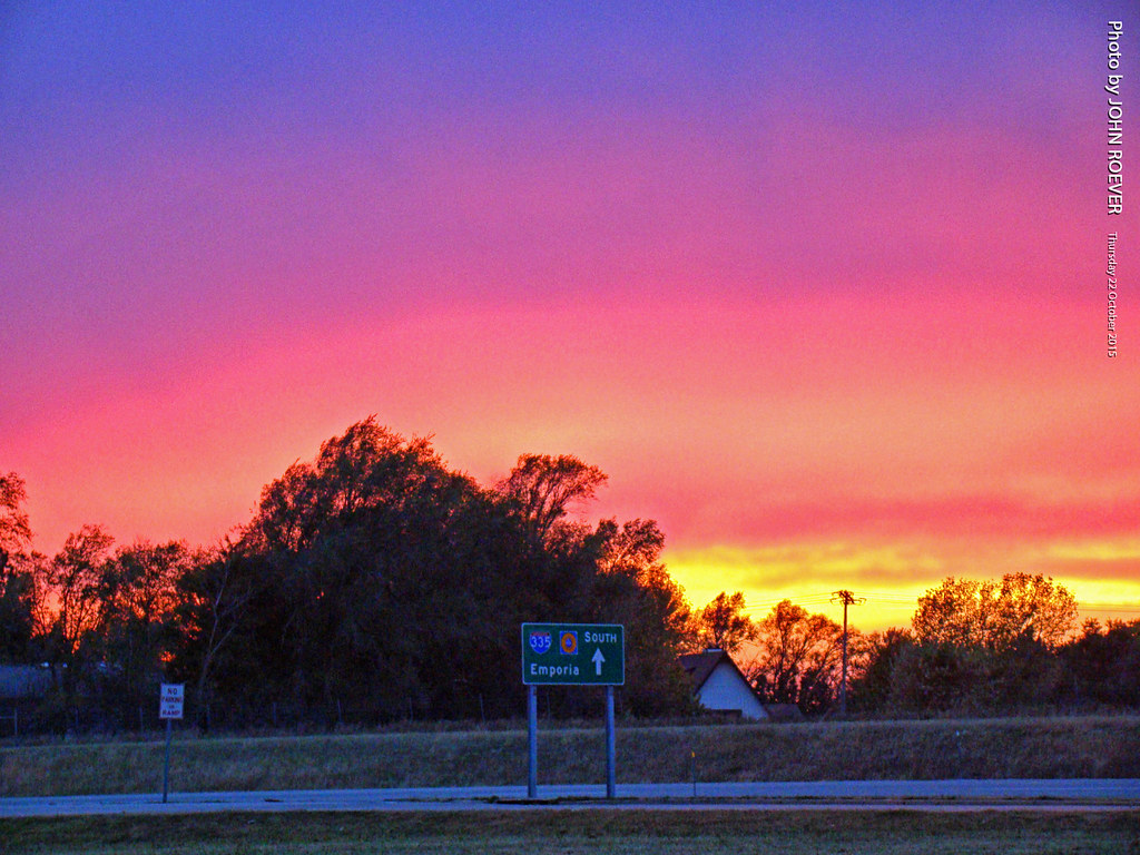
Color after sunset along I-335, 22 Oct 2015
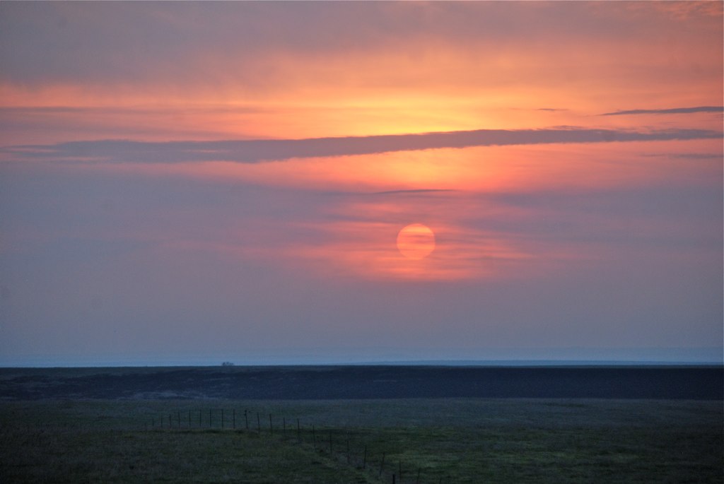
Days End by The Keeper of Lights
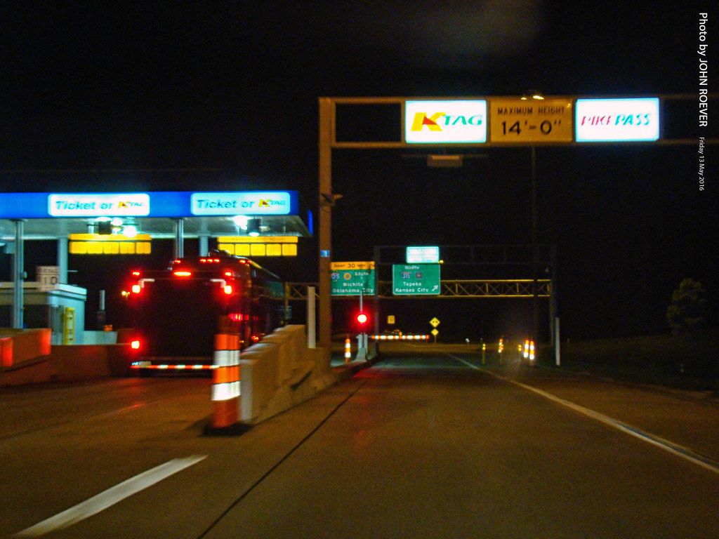
K-Tag Lane at Emporia Toll Plaza, 13 May 2016

KTA Toll Plaza in Emporia, 22 April 2009

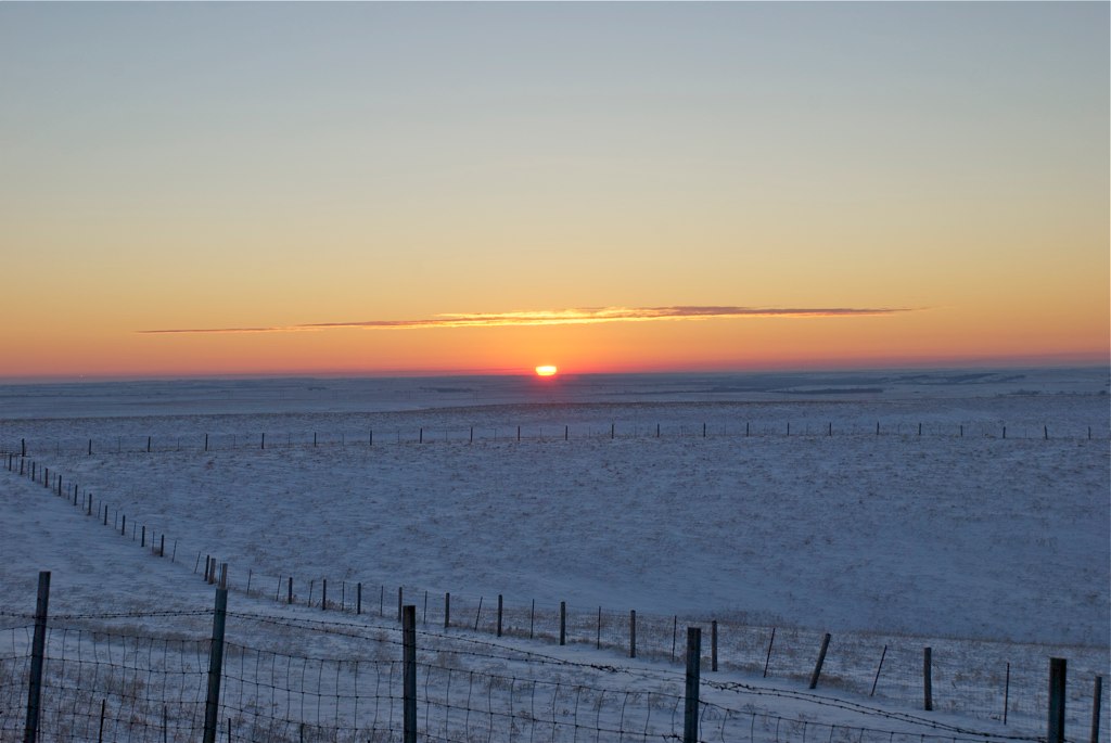
Cattle Pens cast their shadow

Starbucks in Emporia, 22 April 2009
Sunrise at 7:19 AM

Aerial view of NR Junction

Aerial view of NR Junction
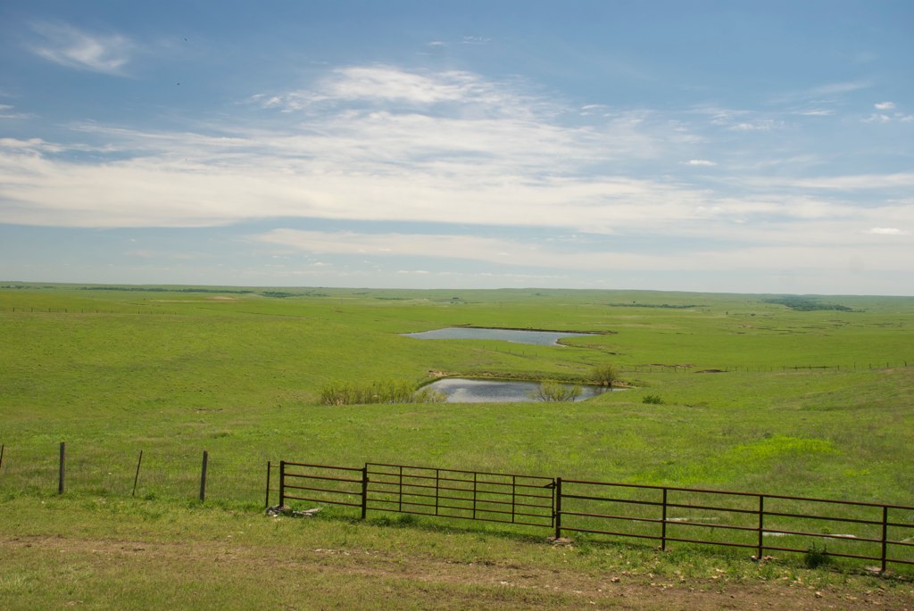
Flint Hills at Cattle Pen
Rd M, Emporia, KS 美国的地图
查询其他地方的日出日落时间
附近地点
美国堪萨斯莱昂县
Commercial St, Emporia, KS 美国Red Rocks State Historic Site
Carter St, Emporia, KS 美国
E 6th Ave, Emporia, KS 美国Tortas El Toro
Commercial St, Emporia, KS 美国Jimmy John's
美国堪萨斯恩波里亚
Commercial St, Emporia, KS 美国
W 6th Ave, Emporia, KS 美国Flint Hills Lanes
W 7th Ave, Emporia, KS 美国7th Avenue Storage
Janice St, Emporia, KS 美国
Graphic Arts Rd, Emporia, KS 美国VFW Post
Rd L, Emporia, KS 美国
美国堪萨斯阿德迈尔
美国堪萨斯艾伦
美国堪萨斯艾伦
Agnes City, KS, 美国
美国堪萨斯滑铁卢
美国堪萨斯林肯
美国堪萨斯巴克利
美国堪萨斯麦迪逊U Road
最近搜索
- Village Point Dr, Daphne, AL, USA的日出日落时间表
- 俄罗斯卡巴尔达-巴尔卡尔共和国特尔内奥兹的日出日落时间表
- 新西兰 Tasman, 罗托罗阿湖的日出日落时间表
- Cove Rd, Jasper, GA 美国的日出日落时间表
- Ushio, Fujieda, Shizuoka -日本的日出日落时间表
- Forest Road, Paragonah, UT 美国South Yankee Meadow Road的日出日落时间表
- Hickory St, Greenville, NC 美国的日出日落时间表
- 加拿大不列颠哥伦比亚省 North Coast, 莫尔兹比岛V0T的日出日落时间表
- 土耳其伊兹密尔省阿利阿 Samurlu, 阿利阿的日出日落时间表
- 台湾台南市安南區幸福里的日出日落时间表