越南河内彰美县的日出日落时间表
Location: 越南 > 河内 >
时区:
Asia/Saigon
当地时间:
2024-05-22 03:53:01
经度:
105.6712465
纬度:
20.8746466
今天日出时间:
05:17:18 AM
今天日落时间:
06:30:45 PM
今天日照时常:
13h 13m 27s
明天日出时间:
05:17:02 AM
明天日落时间:
06:31:10 PM
明天日照时常:
13h 14m 8s
显示所有日期
| 日期 | 日出 | 日落 | 日照时常 |
|---|---|---|---|
| 2024年01月01日 | 06:33:53 AM | 05:27:19 PM | 10h 53m 26s |
| 2024年01月02日 | 06:34:12 AM | 05:27:56 PM | 10h 53m 44s |
| 2024年01月03日 | 06:34:30 AM | 05:28:34 PM | 10h 54m 4s |
| 2024年01月04日 | 06:34:47 AM | 05:29:12 PM | 10h 54m 25s |
| 2024年01月05日 | 06:35:03 AM | 05:29:51 PM | 10h 54m 48s |
| 2024年01月06日 | 06:35:17 AM | 05:30:29 PM | 10h 55m 12s |
| 2024年01月07日 | 06:35:31 AM | 05:31:09 PM | 10h 55m 38s |
| 2024年01月08日 | 06:35:43 AM | 05:31:48 PM | 10h 56m 5s |
| 2024年01月09日 | 06:35:54 AM | 05:32:28 PM | 10h 56m 34s |
| 2024年01月10日 | 06:36:03 AM | 05:33:08 PM | 10h 57m 5s |
| 2024年01月11日 | 06:36:12 AM | 05:33:48 PM | 10h 57m 36s |
| 2024年01月12日 | 06:36:19 AM | 05:34:28 PM | 10h 58m 9s |
| 2024年01月13日 | 06:36:24 AM | 05:35:08 PM | 10h 58m 44s |
| 2024年01月14日 | 06:36:29 AM | 05:35:49 PM | 10h 59m 20s |
| 2024年01月15日 | 06:36:32 AM | 05:36:29 PM | 10h 59m 57s |
| 2024年01月16日 | 06:36:33 AM | 05:37:10 PM | 11h 0m 37s |
| 2024年01月17日 | 06:36:34 AM | 05:37:50 PM | 11h 1m 16s |
| 2024年01月18日 | 06:36:33 AM | 05:38:30 PM | 11h 1m 57s |
| 2024年01月19日 | 06:36:31 AM | 05:39:10 PM | 11h 2m 39s |
| 2024年01月20日 | 06:36:27 AM | 05:39:51 PM | 11h 3m 24s |
| 2024年01月21日 | 06:36:22 AM | 05:40:30 PM | 11h 4m 8s |
| 2024年01月22日 | 06:36:16 AM | 05:41:10 PM | 11h 4m 54s |
| 2024年01月23日 | 06:36:08 AM | 05:41:50 PM | 11h 5m 42s |
| 2024年01月24日 | 06:35:59 AM | 05:42:29 PM | 11h 6m 30s |
| 2024年01月25日 | 06:35:49 AM | 05:43:08 PM | 11h 7m 19s |
| 2024年01月26日 | 06:35:38 AM | 05:43:47 PM | 11h 8m 9s |
| 2024年01月27日 | 06:35:25 AM | 05:44:25 PM | 11h 9m 0s |
| 2024年01月28日 | 06:35:11 AM | 05:45:03 PM | 11h 9m 52s |
| 2024年01月29日 | 06:34:55 AM | 05:45:41 PM | 11h 10m 46s |
| 2024年01月30日 | 06:34:39 AM | 05:46:19 PM | 11h 11m 40s |
| 2024年01月31日 | 06:34:21 AM | 05:46:56 PM | 11h 12m 35s |
| 2024年02月01日 | 06:34:01 AM | 05:47:33 PM | 11h 13m 32s |
| 2024年02月02日 | 06:33:41 AM | 05:48:09 PM | 11h 14m 28s |
| 2024年02月03日 | 06:33:19 AM | 05:48:45 PM | 11h 15m 26s |
| 2024年02月04日 | 06:32:57 AM | 05:49:20 PM | 11h 16m 23s |
| 2024年02月05日 | 06:32:33 AM | 05:49:55 PM | 11h 17m 22s |
| 2024年02月06日 | 06:32:07 AM | 05:50:30 PM | 11h 18m 23s |
| 2024年02月07日 | 06:31:41 AM | 05:51:04 PM | 11h 19m 23s |
| 2024年02月08日 | 06:31:14 AM | 05:51:38 PM | 11h 20m 24s |
| 2024年02月09日 | 06:30:45 AM | 05:52:11 PM | 11h 21m 26s |
| 2024年02月10日 | 06:30:15 AM | 05:52:44 PM | 11h 22m 29s |
| 2024年02月11日 | 06:29:45 AM | 05:53:16 PM | 11h 23m 31s |
| 2024年02月12日 | 06:29:13 AM | 05:53:48 PM | 11h 24m 35s |
| 2024年02月13日 | 06:28:40 AM | 05:54:19 PM | 11h 25m 39s |
| 2024年02月14日 | 06:28:06 AM | 05:54:50 PM | 11h 26m 44s |
| 2024年02月15日 | 06:27:31 AM | 05:55:20 PM | 11h 27m 49s |
| 2024年02月16日 | 06:26:55 AM | 05:55:50 PM | 11h 28m 55s |
| 2024年02月17日 | 06:26:19 AM | 05:56:19 PM | 11h 30m 0s |
| 2024年02月18日 | 06:25:41 AM | 05:56:48 PM | 11h 31m 7s |
| 2024年02月19日 | 06:25:02 AM | 05:57:17 PM | 11h 32m 15s |
| 2024年02月20日 | 06:24:23 AM | 05:57:45 PM | 11h 33m 22s |
| 2024年02月21日 | 06:23:42 AM | 05:58:12 PM | 11h 34m 30s |
| 2024年02月22日 | 06:23:01 AM | 05:58:39 PM | 11h 35m 38s |
| 2024年02月23日 | 06:22:19 AM | 05:59:06 PM | 11h 36m 47s |
| 2024年02月24日 | 06:21:37 AM | 05:59:32 PM | 11h 37m 55s |
| 2024年02月25日 | 06:20:53 AM | 05:59:57 PM | 11h 39m 4s |
| 2024年02月26日 | 06:20:09 AM | 06:00:23 PM | 11h 40m 14s |
| 2024年02月27日 | 06:19:24 AM | 06:00:47 PM | 11h 41m 23s |
| 2024年02月28日 | 06:18:38 AM | 06:01:12 PM | 11h 42m 34s |
| 2024年02月29日 | 06:17:52 AM | 06:01:36 PM | 11h 43m 44s |
| 2024年03月01日 | 06:17:05 AM | 06:01:59 PM | 11h 44m 54s |
| 2024年03月02日 | 06:16:18 AM | 06:02:22 PM | 11h 46m 4s |
| 2024年03月03日 | 06:15:30 AM | 06:02:45 PM | 11h 47m 15s |
| 2024年03月04日 | 06:14:41 AM | 06:03:08 PM | 11h 48m 27s |
| 2024年03月05日 | 06:13:52 AM | 06:03:30 PM | 11h 49m 38s |
| 2024年03月06日 | 06:13:02 AM | 06:03:52 PM | 11h 50m 50s |
| 2024年03月07日 | 06:12:12 AM | 06:04:13 PM | 11h 52m 1s |
| 2024年03月08日 | 06:11:22 AM | 06:04:34 PM | 11h 53m 12s |
| 2024年03月09日 | 06:10:31 AM | 06:04:55 PM | 11h 54m 24s |
| 2024年03月10日 | 06:09:39 AM | 06:05:15 PM | 11h 55m 36s |
| 2024年03月11日 | 06:08:47 AM | 06:05:36 PM | 11h 56m 49s |
| 2024年03月12日 | 06:07:55 AM | 06:05:56 PM | 11h 58m 1s |
| 2024年03月13日 | 06:07:03 AM | 06:06:15 PM | 11h 59m 12s |
| 2024年03月14日 | 06:06:10 AM | 06:06:35 PM | 12h 0m 25s |
| 2024年03月15日 | 06:05:17 AM | 06:06:54 PM | 12h 1m 37s |
| 2024年03月16日 | 06:04:24 AM | 06:07:13 PM | 12h 2m 49s |
| 2024年03月17日 | 06:03:31 AM | 06:07:32 PM | 12h 4m 1s |
| 2024年03月18日 | 06:02:37 AM | 06:07:51 PM | 12h 5m 14s |
| 2024年03月19日 | 06:01:43 AM | 06:08:09 PM | 12h 6m 26s |
| 2024年03月20日 | 06:00:50 AM | 06:08:28 PM | 12h 7m 38s |
| 2024年03月21日 | 05:59:56 AM | 06:08:46 PM | 12h 8m 50s |
| 2024年03月22日 | 05:59:01 AM | 06:09:04 PM | 12h 10m 3s |
| 2024年03月23日 | 05:58:07 AM | 06:09:23 PM | 12h 11m 16s |
| 2024年03月24日 | 05:57:13 AM | 06:09:41 PM | 12h 12m 28s |
| 2024年03月25日 | 05:56:19 AM | 06:09:59 PM | 12h 13m 40s |
| 2024年03月26日 | 05:55:25 AM | 06:10:16 PM | 12h 14m 51s |
| 2024年03月27日 | 05:54:31 AM | 06:10:34 PM | 12h 16m 3s |
| 2024年03月28日 | 05:53:37 AM | 06:10:52 PM | 12h 17m 15s |
| 2024年03月29日 | 05:52:43 AM | 06:11:10 PM | 12h 18m 27s |
| 2024年03月30日 | 05:51:49 AM | 06:11:28 PM | 12h 19m 39s |
| 2024年03月31日 | 05:50:56 AM | 06:11:46 PM | 12h 20m 50s |
| 2024年04月01日 | 05:50:02 AM | 06:12:04 PM | 12h 22m 2s |
| 2024年04月02日 | 05:49:09 AM | 06:12:21 PM | 12h 23m 12s |
| 2024年04月03日 | 05:48:16 AM | 06:12:39 PM | 12h 24m 23s |
| 2024年04月04日 | 05:47:23 AM | 06:12:57 PM | 12h 25m 34s |
| 2024年04月05日 | 05:46:30 AM | 06:13:16 PM | 12h 26m 46s |
| 2024年04月06日 | 05:45:38 AM | 06:13:34 PM | 12h 27m 56s |
| 2024年04月07日 | 05:44:46 AM | 06:13:52 PM | 12h 29m 6s |
| 2024年04月08日 | 05:43:55 AM | 06:14:11 PM | 12h 30m 16s |
| 2024年04月09日 | 05:43:04 AM | 06:14:29 PM | 12h 31m 25s |
| 2024年04月10日 | 05:42:13 AM | 06:14:48 PM | 12h 32m 35s |
| 2024年04月11日 | 05:41:22 AM | 06:15:07 PM | 12h 33m 45s |
| 2024年04月12日 | 05:40:33 AM | 06:15:26 PM | 12h 34m 53s |
| 2024年04月13日 | 05:39:43 AM | 06:15:45 PM | 12h 36m 2s |
| 2024年04月14日 | 05:38:54 AM | 06:16:04 PM | 12h 37m 10s |
| 2024年04月15日 | 05:38:06 AM | 06:16:24 PM | 12h 38m 18s |
| 2024年04月16日 | 05:37:18 AM | 06:16:43 PM | 12h 39m 25s |
| 2024年04月17日 | 05:36:31 AM | 06:17:03 PM | 12h 40m 32s |
| 2024年04月18日 | 05:35:44 AM | 06:17:23 PM | 12h 41m 39s |
| 2024年04月19日 | 05:34:58 AM | 06:17:44 PM | 12h 42m 46s |
| 2024年04月20日 | 05:34:12 AM | 06:18:04 PM | 12h 43m 52s |
| 2024年04月21日 | 05:33:27 AM | 06:18:25 PM | 12h 44m 58s |
| 2024年04月22日 | 05:32:43 AM | 06:18:46 PM | 12h 46m 3s |
| 2024年04月23日 | 05:31:59 AM | 06:19:07 PM | 12h 47m 8s |
| 2024年04月24日 | 05:31:17 AM | 06:19:29 PM | 12h 48m 12s |
| 2024年04月25日 | 05:30:35 AM | 06:19:50 PM | 12h 49m 15s |
| 2024年04月26日 | 05:29:53 AM | 06:20:12 PM | 12h 50m 19s |
| 2024年04月27日 | 05:29:13 AM | 06:20:34 PM | 12h 51m 21s |
| 2024年04月28日 | 05:28:33 AM | 06:20:57 PM | 12h 52m 24s |
| 2024年04月29日 | 05:27:54 AM | 06:21:19 PM | 12h 53m 25s |
| 2024年04月30日 | 05:27:16 AM | 06:21:42 PM | 12h 54m 26s |
| 2024年05月01日 | 05:26:38 AM | 06:22:05 PM | 12h 55m 27s |
| 2024年05月02日 | 05:26:02 AM | 06:22:28 PM | 12h 56m 26s |
| 2024年05月03日 | 05:25:27 AM | 06:22:52 PM | 12h 57m 25s |
| 2024年05月04日 | 05:24:52 AM | 06:23:15 PM | 12h 58m 23s |
| 2024年05月05日 | 05:24:18 AM | 06:23:39 PM | 12h 59m 21s |
| 2024年05月06日 | 05:23:45 AM | 06:24:03 PM | 13h 0m 18s |
| 2024年05月07日 | 05:23:13 AM | 06:24:28 PM | 13h 1m 15s |
| 2024年05月08日 | 05:22:43 AM | 06:24:52 PM | 13h 2m 9s |
| 2024年05月09日 | 05:22:13 AM | 06:25:17 PM | 13h 3m 4s |
| 2024年05月10日 | 05:21:44 AM | 06:25:41 PM | 13h 3m 57s |
| 2024年05月11日 | 05:21:16 AM | 06:26:06 PM | 13h 4m 50s |
| 2024年05月12日 | 05:20:49 AM | 06:26:31 PM | 13h 5m 42s |
| 2024年05月13日 | 05:20:23 AM | 06:26:56 PM | 13h 6m 33s |
| 2024年05月14日 | 05:19:58 AM | 06:27:22 PM | 13h 7m 24s |
| 2024年05月15日 | 05:19:34 AM | 06:27:47 PM | 13h 8m 13s |
| 2024年05月16日 | 05:19:11 AM | 06:28:13 PM | 13h 9m 2s |
| 2024年05月17日 | 05:18:50 AM | 06:28:38 PM | 13h 9m 48s |
| 2024年05月18日 | 05:18:29 AM | 06:29:04 PM | 13h 10m 35s |
| 2024年05月19日 | 05:18:09 AM | 06:29:29 PM | 13h 11m 20s |
| 2024年05月20日 | 05:17:51 AM | 06:29:55 PM | 13h 12m 4s |
| 2024年05月21日 | 05:17:33 AM | 06:30:20 PM | 13h 12m 47s |
| 2024年05月22日 | 05:17:17 AM | 06:30:46 PM | 13h 13m 29s |
| 2024年05月23日 | 05:17:02 AM | 06:31:11 PM | 13h 14m 9s |
| 2024年05月24日 | 05:16:47 AM | 06:31:37 PM | 13h 14m 50s |
| 2024年05月25日 | 05:16:34 AM | 06:32:02 PM | 13h 15m 28s |
| 2024年05月26日 | 05:16:22 AM | 06:32:27 PM | 13h 16m 5s |
| 2024年05月27日 | 05:16:11 AM | 06:32:52 PM | 13h 16m 41s |
| 2024年05月28日 | 05:16:02 AM | 06:33:17 PM | 13h 17m 15s |
| 2024年05月29日 | 05:15:53 AM | 06:33:42 PM | 13h 17m 49s |
| 2024年05月30日 | 05:15:45 AM | 06:34:06 PM | 13h 18m 21s |
| 2024年05月31日 | 05:15:39 AM | 06:34:31 PM | 13h 18m 52s |
| 2024年06月01日 | 05:15:33 AM | 06:34:55 PM | 13h 19m 22s |
| 2024年06月02日 | 05:15:29 AM | 06:35:18 PM | 13h 19m 49s |
| 2024年06月03日 | 05:15:25 AM | 06:35:42 PM | 13h 20m 17s |
| 2024年06月04日 | 05:15:23 AM | 06:36:05 PM | 13h 20m 42s |
| 2024年06月05日 | 05:15:21 AM | 06:36:27 PM | 13h 21m 6s |
| 2024年06月06日 | 05:15:21 AM | 06:36:50 PM | 13h 21m 29s |
| 2024年06月07日 | 05:15:22 AM | 06:37:12 PM | 13h 21m 50s |
| 2024年06月08日 | 05:15:24 AM | 06:37:33 PM | 13h 22m 9s |
| 2024年06月09日 | 05:15:26 AM | 06:37:54 PM | 13h 22m 28s |
| 2024年06月10日 | 05:15:30 AM | 06:38:14 PM | 13h 22m 44s |
| 2024年06月11日 | 05:15:34 AM | 06:38:34 PM | 13h 23m 0s |
| 2024年06月12日 | 05:15:40 AM | 06:38:53 PM | 13h 23m 13s |
| 2024年06月13日 | 05:15:47 AM | 06:39:12 PM | 13h 23m 25s |
| 2024年06月14日 | 05:15:54 AM | 06:39:30 PM | 13h 23m 36s |
| 2024年06月15日 | 05:16:02 AM | 06:39:47 PM | 13h 23m 45s |
| 2024年06月16日 | 05:16:11 AM | 06:40:04 PM | 13h 23m 53s |
| 2024年06月17日 | 05:16:21 AM | 06:40:20 PM | 13h 23m 59s |
| 2024年06月18日 | 05:16:32 AM | 06:40:36 PM | 13h 24m 4s |
| 2024年06月19日 | 05:16:44 AM | 06:40:50 PM | 13h 24m 6s |
| 2024年06月20日 | 05:16:56 AM | 06:41:04 PM | 13h 24m 8s |
| 2024年06月21日 | 05:17:09 AM | 06:41:17 PM | 13h 24m 8s |
| 2024年06月22日 | 05:17:23 AM | 06:41:29 PM | 13h 24m 6s |
| 2024年06月23日 | 05:17:37 AM | 06:41:41 PM | 13h 24m 4s |
| 2024年06月24日 | 05:17:53 AM | 06:41:51 PM | 13h 23m 58s |
| 2024年06月25日 | 05:18:09 AM | 06:42:01 PM | 13h 23m 52s |
| 2024年06月26日 | 05:18:25 AM | 06:42:09 PM | 13h 23m 44s |
| 2024年06月27日 | 05:18:42 AM | 06:42:17 PM | 13h 23m 35s |
| 2024年06月28日 | 05:19:00 AM | 06:42:24 PM | 13h 23m 24s |
| 2024年06月29日 | 05:19:18 AM | 06:42:30 PM | 13h 23m 12s |
| 2024年06月30日 | 05:19:37 AM | 06:42:35 PM | 13h 22m 58s |
| 2024年07月01日 | 05:19:56 AM | 06:42:39 PM | 13h 22m 43s |
| 2024年07月02日 | 05:20:16 AM | 06:42:41 PM | 13h 22m 25s |
| 2024年07月03日 | 05:20:36 AM | 06:42:43 PM | 13h 22m 7s |
| 2024年07月04日 | 05:20:56 AM | 06:42:44 PM | 13h 21m 48s |
| 2024年07月05日 | 05:21:17 AM | 06:42:44 PM | 13h 21m 27s |
| 2024年07月06日 | 05:21:39 AM | 06:42:43 PM | 13h 21m 4s |
| 2024年07月07日 | 05:22:00 AM | 06:42:40 PM | 13h 20m 40s |
| 2024年07月08日 | 05:22:22 AM | 06:42:37 PM | 13h 20m 15s |
| 2024年07月09日 | 05:22:44 AM | 06:42:32 PM | 13h 19m 48s |
| 2024年07月10日 | 05:23:07 AM | 06:42:26 PM | 13h 19m 19s |
| 2024年07月11日 | 05:23:29 AM | 06:42:20 PM | 13h 18m 51s |
| 2024年07月12日 | 05:23:52 AM | 06:42:12 PM | 13h 18m 20s |
| 2024年07月13日 | 05:24:15 AM | 06:42:03 PM | 13h 17m 48s |
| 2024年07月14日 | 05:24:39 AM | 06:41:53 PM | 13h 17m 14s |
| 2024年07月15日 | 05:25:02 AM | 06:41:41 PM | 13h 16m 39s |
| 2024年07月16日 | 05:25:25 AM | 06:41:29 PM | 13h 16m 4s |
| 2024年07月17日 | 05:25:49 AM | 06:41:15 PM | 13h 15m 26s |
| 2024年07月18日 | 05:26:12 AM | 06:41:01 PM | 13h 14m 49s |
| 2024年07月19日 | 05:26:36 AM | 06:40:45 PM | 13h 14m 9s |
| 2024年07月20日 | 05:27:00 AM | 06:40:28 PM | 13h 13m 28s |
| 2024年07月21日 | 05:27:23 AM | 06:40:10 PM | 13h 12m 47s |
| 2024年07月22日 | 05:27:47 AM | 06:39:51 PM | 13h 12m 4s |
| 2024年07月23日 | 05:28:10 AM | 06:39:31 PM | 13h 11m 21s |
| 2024年07月24日 | 05:28:34 AM | 06:39:09 PM | 13h 10m 35s |
| 2024年07月25日 | 05:28:57 AM | 06:38:47 PM | 13h 9m 50s |
| 2024年07月26日 | 05:29:20 AM | 06:38:23 PM | 13h 9m 3s |
| 2024年07月27日 | 05:29:43 AM | 06:37:59 PM | 13h 8m 16s |
| 2024年07月28日 | 05:30:07 AM | 06:37:33 PM | 13h 7m 26s |
| 2024年07月29日 | 05:30:29 AM | 06:37:06 PM | 13h 6m 37s |
| 2024年07月30日 | 05:30:52 AM | 06:36:39 PM | 13h 5m 47s |
| 2024年07月31日 | 05:31:15 AM | 06:36:10 PM | 13h 4m 55s |
| 2024年08月01日 | 05:31:37 AM | 06:35:40 PM | 13h 4m 3s |
| 2024年08月02日 | 05:31:59 AM | 06:35:09 PM | 13h 3m 10s |
| 2024年08月03日 | 05:32:21 AM | 06:34:37 PM | 13h 2m 16s |
| 2024年08月04日 | 05:32:43 AM | 06:34:04 PM | 13h 1m 21s |
| 2024年08月05日 | 05:33:04 AM | 06:33:30 PM | 13h 0m 26s |
| 2024年08月06日 | 05:33:26 AM | 06:32:55 PM | 12h 59m 29s |
| 2024年08月07日 | 05:33:47 AM | 06:32:19 PM | 12h 58m 32s |
| 2024年08月08日 | 05:34:07 AM | 06:31:43 PM | 12h 57m 36s |
| 2024年08月09日 | 05:34:28 AM | 06:31:05 PM | 12h 56m 37s |
| 2024年08月10日 | 05:34:48 AM | 06:30:26 PM | 12h 55m 38s |
| 2024年08月11日 | 05:35:08 AM | 06:29:47 PM | 12h 54m 39s |
| 2024年08月12日 | 05:35:28 AM | 06:29:07 PM | 12h 53m 39s |
| 2024年08月13日 | 05:35:48 AM | 06:28:26 PM | 12h 52m 38s |
| 2024年08月14日 | 05:36:07 AM | 06:27:44 PM | 12h 51m 37s |
| 2024年08月15日 | 05:36:26 AM | 06:27:01 PM | 12h 50m 35s |
| 2024年08月16日 | 05:36:45 AM | 06:26:17 PM | 12h 49m 32s |
| 2024年08月17日 | 05:37:03 AM | 06:25:33 PM | 12h 48m 30s |
| 2024年08月18日 | 05:37:21 AM | 06:24:48 PM | 12h 47m 27s |
| 2024年08月19日 | 05:37:39 AM | 06:24:02 PM | 12h 46m 23s |
| 2024年08月20日 | 05:37:57 AM | 06:23:16 PM | 12h 45m 19s |
| 2024年08月21日 | 05:38:14 AM | 06:22:28 PM | 12h 44m 14s |
| 2024年08月22日 | 05:38:32 AM | 06:21:40 PM | 12h 43m 8s |
| 2024年08月23日 | 05:38:49 AM | 06:20:52 PM | 12h 42m 3s |
| 2024年08月24日 | 05:39:05 AM | 06:20:03 PM | 12h 40m 58s |
| 2024年08月25日 | 05:39:22 AM | 06:19:13 PM | 12h 39m 51s |
| 2024年08月26日 | 05:39:38 AM | 06:18:23 PM | 12h 38m 45s |
| 2024年08月27日 | 05:39:54 AM | 06:17:32 PM | 12h 37m 38s |
| 2024年08月28日 | 05:40:10 AM | 06:16:41 PM | 12h 36m 31s |
| 2024年08月29日 | 05:40:26 AM | 06:15:49 PM | 12h 35m 23s |
| 2024年08月30日 | 05:40:41 AM | 06:14:56 PM | 12h 34m 15s |
| 2024年08月31日 | 05:40:56 AM | 06:14:04 PM | 12h 33m 8s |
| 2024年09月01日 | 05:41:11 AM | 06:13:10 PM | 12h 31m 59s |
| 2024年09月02日 | 05:41:26 AM | 06:12:17 PM | 12h 30m 51s |
| 2024年09月03日 | 05:41:41 AM | 06:11:23 PM | 12h 29m 42s |
| 2024年09月04日 | 05:41:56 AM | 06:10:28 PM | 12h 28m 32s |
| 2024年09月05日 | 05:42:10 AM | 06:09:33 PM | 12h 27m 23s |
| 2024年09月06日 | 05:42:25 AM | 06:08:38 PM | 12h 26m 13s |
| 2024年09月07日 | 05:42:39 AM | 06:07:43 PM | 12h 25m 4s |
| 2024年09月08日 | 05:42:53 AM | 06:06:47 PM | 12h 23m 54s |
| 2024年09月09日 | 05:43:07 AM | 06:05:52 PM | 12h 22m 45s |
| 2024年09月10日 | 05:43:22 AM | 06:04:55 PM | 12h 21m 33s |
| 2024年09月11日 | 05:43:36 AM | 06:03:59 PM | 12h 20m 23s |
| 2024年09月12日 | 05:43:50 AM | 06:03:03 PM | 12h 19m 13s |
| 2024年09月13日 | 05:44:04 AM | 06:02:06 PM | 12h 18m 2s |
| 2024年09月14日 | 05:44:18 AM | 06:01:09 PM | 12h 16m 51s |
| 2024年09月15日 | 05:44:31 AM | 06:00:13 PM | 12h 15m 42s |
| 2024年09月16日 | 05:44:45 AM | 05:59:16 PM | 12h 14m 31s |
| 2024年09月17日 | 05:44:59 AM | 05:58:19 PM | 12h 13m 20s |
| 2024年09月18日 | 05:45:14 AM | 05:57:22 PM | 12h 12m 8s |
| 2024年09月19日 | 05:45:28 AM | 05:56:25 PM | 12h 10m 57s |
| 2024年09月20日 | 05:45:42 AM | 05:55:28 PM | 12h 9m 46s |
| 2024年09月21日 | 05:45:56 AM | 05:54:31 PM | 12h 8m 35s |
| 2024年09月22日 | 05:46:11 AM | 05:53:34 PM | 12h 7m 23s |
| 2024年09月23日 | 05:46:25 AM | 05:52:38 PM | 12h 6m 13s |
| 2024年09月24日 | 05:46:40 AM | 05:51:41 PM | 12h 5m 1s |
| 2024年09月25日 | 05:46:55 AM | 05:50:45 PM | 12h 3m 50s |
| 2024年09月26日 | 05:47:10 AM | 05:49:49 PM | 12h 2m 39s |
| 2024年09月27日 | 05:47:25 AM | 05:48:53 PM | 12h 1m 28s |
| 2024年09月28日 | 05:47:40 AM | 05:47:57 PM | 12h 0m 17s |
| 2024年09月29日 | 05:47:56 AM | 05:47:01 PM | 11h 59m 5s |
| 2024年09月30日 | 05:48:12 AM | 05:46:06 PM | 11h 57m 54s |
| 2024年10月01日 | 05:48:28 AM | 05:45:11 PM | 11h 56m 43s |
| 2024年10月02日 | 05:48:44 AM | 05:44:17 PM | 11h 55m 33s |
| 2024年10月03日 | 05:49:01 AM | 05:43:23 PM | 11h 54m 22s |
| 2024年10月04日 | 05:49:18 AM | 05:42:29 PM | 11h 53m 11s |
| 2024年10月05日 | 05:49:35 AM | 05:41:36 PM | 11h 52m 1s |
| 2024年10月06日 | 05:49:53 AM | 05:40:43 PM | 11h 50m 50s |
| 2024年10月07日 | 05:50:11 AM | 05:39:50 PM | 11h 49m 39s |
| 2024年10月08日 | 05:50:29 AM | 05:38:58 PM | 11h 48m 29s |
| 2024年10月09日 | 05:50:48 AM | 05:38:07 PM | 11h 47m 19s |
| 2024年10月10日 | 05:51:07 AM | 05:37:16 PM | 11h 46m 9s |
| 2024年10月11日 | 05:51:26 AM | 05:36:26 PM | 11h 45m 0s |
| 2024年10月12日 | 05:51:46 AM | 05:35:36 PM | 11h 43m 50s |
| 2024年10月13日 | 05:52:06 AM | 05:34:47 PM | 11h 42m 41s |
| 2024年10月14日 | 05:52:27 AM | 05:33:59 PM | 11h 41m 32s |
| 2024年10月15日 | 05:52:48 AM | 05:33:11 PM | 11h 40m 23s |
| 2024年10月16日 | 05:53:09 AM | 05:32:24 PM | 11h 39m 15s |
| 2024年10月17日 | 05:53:31 AM | 05:31:38 PM | 11h 38m 7s |
| 2024年10月18日 | 05:53:53 AM | 05:30:52 PM | 11h 36m 59s |
| 2024年10月19日 | 05:54:16 AM | 05:30:07 PM | 11h 35m 51s |
| 2024年10月20日 | 05:54:40 AM | 05:29:23 PM | 11h 34m 43s |
| 2024年10月21日 | 05:55:03 AM | 05:28:40 PM | 11h 33m 37s |
| 2024年10月22日 | 05:55:28 AM | 05:27:58 PM | 11h 32m 30s |
| 2024年10月23日 | 05:55:53 AM | 05:27:17 PM | 11h 31m 24s |
| 2024年10月24日 | 05:56:18 AM | 05:26:36 PM | 11h 30m 18s |
| 2024年10月25日 | 05:56:44 AM | 05:25:56 PM | 11h 29m 12s |
| 2024年10月26日 | 05:57:10 AM | 05:25:18 PM | 11h 28m 8s |
| 2024年10月27日 | 05:57:37 AM | 05:24:40 PM | 11h 27m 3s |
| 2024年10月28日 | 05:58:04 AM | 05:24:03 PM | 11h 25m 59s |
| 2024年10月29日 | 05:58:32 AM | 05:23:28 PM | 11h 24m 56s |
| 2024年10月30日 | 05:59:00 AM | 05:22:53 PM | 11h 23m 53s |
| 2024年10月31日 | 05:59:29 AM | 05:22:19 PM | 11h 22m 50s |
| 2024年11月01日 | 05:59:59 AM | 05:21:47 PM | 11h 21m 48s |
| 2024年11月02日 | 06:00:28 AM | 05:21:16 PM | 11h 20m 48s |
| 2024年11月03日 | 06:00:59 AM | 05:20:45 PM | 11h 19m 46s |
| 2024年11月04日 | 06:01:30 AM | 05:20:16 PM | 11h 18m 46s |
| 2024年11月05日 | 06:02:01 AM | 05:19:48 PM | 11h 17m 47s |
| 2024年11月06日 | 06:02:33 AM | 05:19:21 PM | 11h 16m 48s |
| 2024年11月07日 | 06:03:05 AM | 05:18:56 PM | 11h 15m 51s |
| 2024年11月08日 | 06:03:38 AM | 05:18:31 PM | 11h 14m 53s |
| 2024年11月09日 | 06:04:11 AM | 05:18:08 PM | 11h 13m 57s |
| 2024年11月10日 | 06:04:45 AM | 05:17:46 PM | 11h 13m 1s |
| 2024年11月11日 | 06:05:19 AM | 05:17:25 PM | 11h 12m 6s |
| 2024年11月12日 | 06:05:54 AM | 05:17:06 PM | 11h 11m 12s |
| 2024年11月13日 | 06:06:29 AM | 05:16:48 PM | 11h 10m 19s |
| 2024年11月14日 | 06:07:05 AM | 05:16:31 PM | 11h 9m 26s |
| 2024年11月15日 | 06:07:40 AM | 05:16:15 PM | 11h 8m 35s |
| 2024年11月16日 | 06:08:16 AM | 05:16:01 PM | 11h 7m 45s |
| 2024年11月17日 | 06:08:53 AM | 05:15:48 PM | 11h 6m 55s |
| 2024年11月18日 | 06:09:30 AM | 05:15:37 PM | 11h 6m 7s |
| 2024年11月19日 | 06:10:07 AM | 05:15:27 PM | 11h 5m 20s |
| 2024年11月20日 | 06:10:44 AM | 05:15:18 PM | 11h 4m 34s |
| 2024年11月21日 | 06:11:22 AM | 05:15:10 PM | 11h 3m 48s |
| 2024年11月22日 | 06:12:00 AM | 05:15:04 PM | 11h 3m 4s |
| 2024年11月23日 | 06:12:38 AM | 05:15:00 PM | 11h 2m 22s |
| 2024年11月24日 | 06:13:16 AM | 05:14:56 PM | 11h 1m 40s |
| 2024年11月25日 | 06:13:55 AM | 05:14:54 PM | 11h 0m 59s |
| 2024年11月26日 | 06:14:33 AM | 05:14:54 PM | 11h 0m 21s |
| 2024年11月27日 | 06:15:12 AM | 05:14:54 PM | 10h 59m 42s |
| 2024年11月28日 | 06:15:51 AM | 05:14:56 PM | 10h 59m 5s |
| 2024年11月29日 | 06:16:29 AM | 05:15:00 PM | 10h 58m 31s |
| 2024年11月30日 | 06:17:08 AM | 05:15:05 PM | 10h 57m 57s |
| 2024年12月01日 | 06:17:47 AM | 05:15:11 PM | 10h 57m 24s |
| 2024年12月02日 | 06:18:25 AM | 05:15:18 PM | 10h 56m 53s |
| 2024年12月03日 | 06:19:04 AM | 05:15:27 PM | 10h 56m 23s |
| 2024年12月04日 | 06:19:42 AM | 05:15:37 PM | 10h 55m 55s |
| 2024年12月05日 | 06:20:20 AM | 05:15:49 PM | 10h 55m 29s |
| 2024年12月06日 | 06:20:58 AM | 05:16:01 PM | 10h 55m 3s |
| 2024年12月07日 | 06:21:36 AM | 05:16:15 PM | 10h 54m 39s |
| 2024年12月08日 | 06:22:13 AM | 05:16:31 PM | 10h 54m 18s |
| 2024年12月09日 | 06:22:50 AM | 05:16:47 PM | 10h 53m 57s |
| 2024年12月10日 | 06:23:27 AM | 05:17:05 PM | 10h 53m 38s |
| 2024年12月11日 | 06:24:04 AM | 05:17:24 PM | 10h 53m 20s |
| 2024年12月12日 | 06:24:39 AM | 05:17:44 PM | 10h 53m 5s |
| 2024年12月13日 | 06:25:15 AM | 05:18:05 PM | 10h 52m 50s |
| 2024年12月14日 | 06:25:50 AM | 05:18:27 PM | 10h 52m 37s |
| 2024年12月15日 | 06:26:24 AM | 05:18:51 PM | 10h 52m 27s |
| 2024年12月16日 | 06:26:58 AM | 05:19:15 PM | 10h 52m 17s |
| 2024年12月17日 | 06:27:31 AM | 05:19:41 PM | 10h 52m 10s |
| 2024年12月18日 | 06:28:03 AM | 05:20:08 PM | 10h 52m 5s |
| 2024年12月19日 | 06:28:35 AM | 05:20:35 PM | 10h 52m 0s |
| 2024年12月20日 | 06:29:06 AM | 05:21:04 PM | 10h 51m 58s |
| 2024年12月21日 | 06:29:36 AM | 05:21:33 PM | 10h 51m 57s |
| 2024年12月22日 | 06:30:05 AM | 05:22:03 PM | 10h 51m 58s |
| 2024年12月23日 | 06:30:34 AM | 05:22:34 PM | 10h 52m 0s |
| 2024年12月24日 | 06:31:02 AM | 05:23:06 PM | 10h 52m 4s |
| 2024年12月25日 | 06:31:28 AM | 05:23:39 PM | 10h 52m 11s |
| 2024年12月26日 | 06:31:54 AM | 05:24:13 PM | 10h 52m 19s |
| 2024年12月27日 | 06:32:19 AM | 05:24:47 PM | 10h 52m 28s |
| 2024年12月28日 | 06:32:43 AM | 05:25:22 PM | 10h 52m 39s |
| 2024年12月29日 | 06:33:06 AM | 05:25:57 PM | 10h 52m 51s |
| 2024年12月30日 | 06:33:27 AM | 05:26:33 PM | 10h 53m 6s |
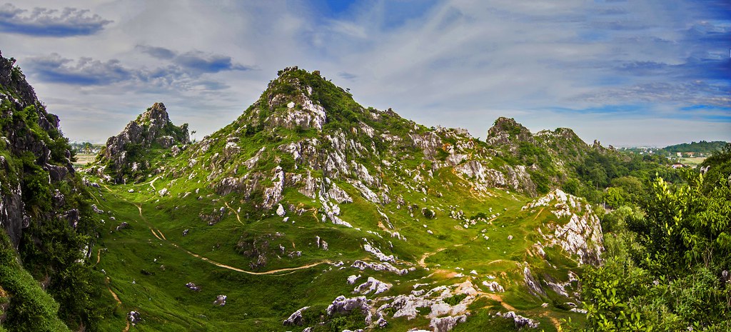
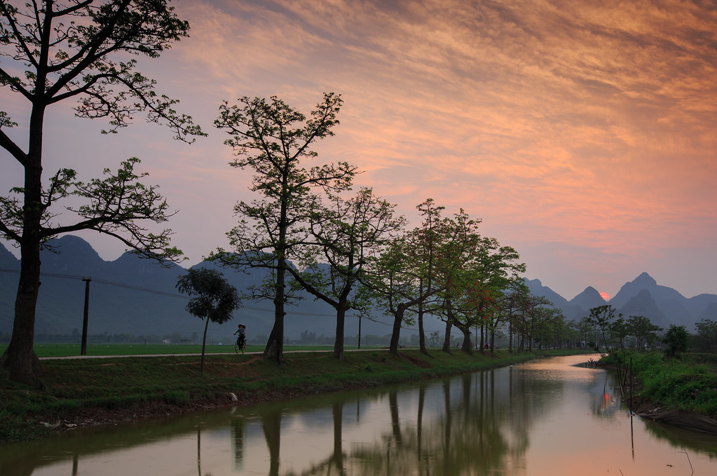
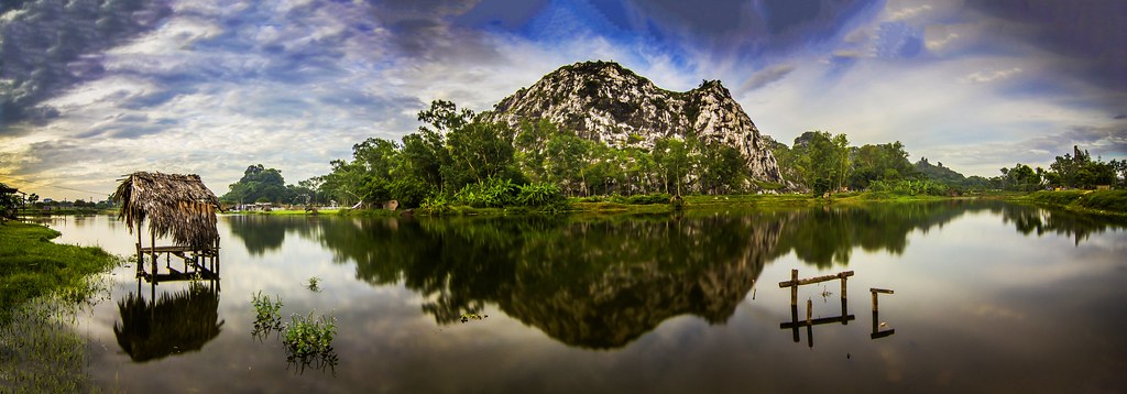
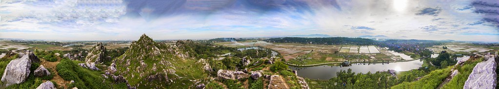
日出日落照片

Doi Bu mountain in sunset
_MG_0261-Edit
Hoa gạo - Bombax

Hanoi sunset

Sunset at 833
_MG_0314-Edit

32/365

34/365
_MG_0287-Edit
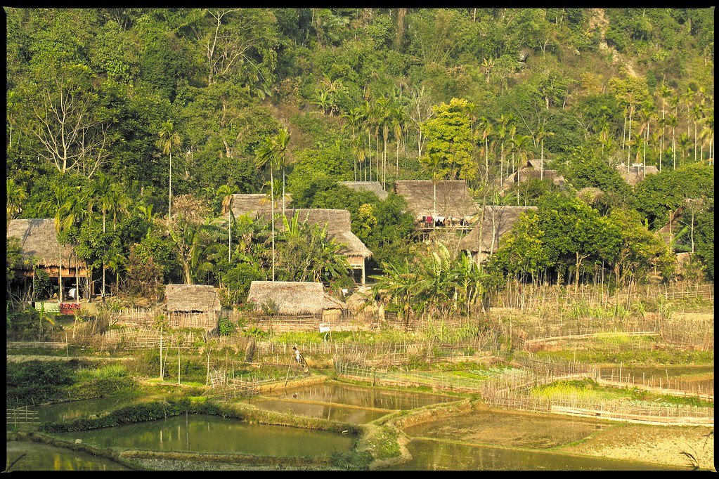
Village / Pù Luông National Reserve

boy walking in the ricefield
越南河内彰美县的地图
查询其他地方的日出日落时间
越南河内彰美县的其他地方
附近地点
Hoàng Văn Thụ, Chương Mỹ, Hà Nội, 越南
Khu vực hồ Văn Sơn, Hoàng Văn Thụ, Chương Mỹ, Hà Nội 越南Sky Lake Resort & Golf Club
越南河内河东郡
Khu đô thị Nam An Khánh, An Khánh, Hoài Đức, Hà Nội, 越南
Khu đô thị Nam An Khánh, Hoài Đức, Hà Nội, 越南Vinhomes Thăng Long
越南河内怀德县
Mộ Lao, Hà Đông, Hà Nội, 越南
越南河内南慈廉郡
Ngõ P2 Lê Quang Đạo, Mễ Trì, Từ Liêm, Hà Nội, 越南Hanoi Street Circuit
1 Hoàng Minh Giám, Trung Hoà, Cầu Giấy, Hà Nội, 越南Sân bóng Sơn Trang 2
Keangnam, Mễ Trì, Từ Liêm, Hanoi, 越南
Trung Hoà, Cầu Giấy, Hanoi, 越南
越南河内石室
15 Ngõ - Yên Hòa, Yên Hoà, Cầu Giấy, Hà Nội, 越南
Đường Hồ Tùng Mậu, Goldmark City, Từ Liêm, Hà Nội 越南Goldmark City Hồ Tùng Mậu
Goldmark City, Phú Diễn, Từ Liêm, Hanoi, 越南
越南河内
越南河内纸桥郡
V3 Kim Mã, Ngọc Khánh, Ba Đình, Hà Nội, 越南
Đường La Thành, Hà Nội, 越南
最近搜索
- Chester St, Columbia, SC 美国的日出日落时间表
- 59-38 Linden St, Flushing, NY 美国的日出日落时间表
- N Main St, Boaz, AL, USA的日出日落时间表
- LEHIGHTON BOROUGH, PA 美国的日出日落时间表
- Anza Ave, Vista, CA 美国的日出日落时间表
- Surcuolm, 瑞士的日出日落时间表
- 66 Howmart Rd, Quezon City, Metro Manila, 菲律宾的日出日落时间表
- Azabu, Minato City, Tokyo, 日本的日出日落时间表
- 8 Rue Raoul Dufy, Collioure, France的日出日落时间表
- 西班牙巴塞罗那赫罗那布拉瓦海岸的日出日落时间表