Beach Rd, Wikwemikong, ON P0P 2J0加拿大Bebamikawe Memorial Trail Head的日出日落时间表
Location: 加拿大 > 安大略省 > 马尼图林区 > 加拿大安大略省威奎米孔P0P >
时区:
America/Toronto
当地时间:
2024-05-28 16:05:45
经度:
-81.6718956
纬度:
45.8278267
今天日出时间:
05:41:14 AM
今天日落时间:
09:07:13 PM
今天日照时常:
15h 25m 59s
明天日出时间:
05:40:36 AM
明天日落时间:
09:08:08 PM
明天日照时常:
15h 27m 32s
显示所有日期
| 日期 | 日出 | 日落 | 日照时常 |
|---|---|---|---|
| 2024年01月01日 | 08:07:52 AM | 04:53:02 PM | 8h 45m 10s |
| 2024年01月02日 | 08:07:51 AM | 04:53:59 PM | 8h 46m 8s |
| 2024年01月03日 | 08:07:47 AM | 04:54:58 PM | 8h 47m 11s |
| 2024年01月04日 | 08:07:40 AM | 04:55:59 PM | 8h 48m 19s |
| 2024年01月05日 | 08:07:31 AM | 04:57:02 PM | 8h 49m 31s |
| 2024年01月06日 | 08:07:19 AM | 04:58:06 PM | 8h 50m 47s |
| 2024年01月07日 | 08:07:05 AM | 04:59:12 PM | 8h 52m 7s |
| 2024年01月08日 | 08:06:48 AM | 05:00:20 PM | 8h 53m 32s |
| 2024年01月09日 | 08:06:28 AM | 05:01:29 PM | 8h 55m 1s |
| 2024年01月10日 | 08:06:05 AM | 05:02:40 PM | 8h 56m 35s |
| 2024年01月11日 | 08:05:40 AM | 05:03:52 PM | 8h 58m 12s |
| 2024年01月12日 | 08:05:13 AM | 05:05:06 PM | 8h 59m 53s |
| 2024年01月13日 | 08:04:42 AM | 05:06:21 PM | 9h 1m 39s |
| 2024年01月14日 | 08:04:10 AM | 05:07:37 PM | 9h 3m 27s |
| 2024年01月15日 | 08:03:34 AM | 05:08:54 PM | 9h 5m 20s |
| 2024年01月16日 | 08:02:57 AM | 05:10:12 PM | 9h 7m 15s |
| 2024年01月17日 | 08:02:17 AM | 05:11:32 PM | 9h 9m 15s |
| 2024年01月18日 | 08:01:34 AM | 05:12:52 PM | 9h 11m 18s |
| 2024年01月19日 | 08:00:49 AM | 05:14:14 PM | 9h 13m 25s |
| 2024年01月20日 | 08:00:02 AM | 05:15:36 PM | 9h 15m 34s |
| 2024年01月21日 | 07:59:12 AM | 05:16:59 PM | 9h 17m 47s |
| 2024年01月22日 | 07:58:21 AM | 05:18:23 PM | 9h 20m 2s |
| 2024年01月23日 | 07:57:27 AM | 05:19:47 PM | 9h 22m 20s |
| 2024年01月24日 | 07:56:30 AM | 05:21:12 PM | 9h 24m 42s |
| 2024年01月25日 | 07:55:32 AM | 05:22:38 PM | 9h 27m 6s |
| 2024年01月26日 | 07:54:32 AM | 05:24:04 PM | 9h 29m 32s |
| 2024年01月27日 | 07:53:29 AM | 05:25:30 PM | 9h 32m 1s |
| 2024年01月28日 | 07:52:24 AM | 05:26:57 PM | 9h 34m 33s |
| 2024年01月29日 | 07:51:18 AM | 05:28:25 PM | 9h 37m 7s |
| 2024年01月30日 | 07:50:09 AM | 05:29:52 PM | 9h 39m 43s |
| 2024年01月31日 | 07:48:59 AM | 05:31:20 PM | 9h 42m 21s |
| 2024年02月01日 | 07:47:47 AM | 05:32:48 PM | 9h 45m 1s |
| 2024年02月02日 | 07:46:33 AM | 05:34:17 PM | 9h 47m 44s |
| 2024年02月03日 | 07:45:17 AM | 05:35:45 PM | 9h 50m 28s |
| 2024年02月04日 | 07:43:59 AM | 05:37:14 PM | 9h 53m 15s |
| 2024年02月05日 | 07:42:40 AM | 05:38:42 PM | 9h 56m 2s |
| 2024年02月06日 | 07:41:19 AM | 05:40:11 PM | 9h 58m 52s |
| 2024年02月07日 | 07:39:56 AM | 05:41:40 PM | 10h 1m 44s |
| 2024年02月08日 | 07:38:32 AM | 05:43:08 PM | 10h 4m 36s |
| 2024年02月09日 | 07:37:07 AM | 05:44:37 PM | 10h 7m 30s |
| 2024年02月10日 | 07:35:40 AM | 05:46:06 PM | 10h 10m 26s |
| 2024年02月11日 | 07:34:11 AM | 05:47:34 PM | 10h 13m 23s |
| 2024年02月12日 | 07:32:41 AM | 05:49:02 PM | 10h 16m 21s |
| 2024年02月13日 | 07:31:10 AM | 05:50:31 PM | 10h 19m 21s |
| 2024年02月14日 | 07:29:37 AM | 05:51:59 PM | 10h 22m 22s |
| 2024年02月15日 | 07:28:03 AM | 05:53:27 PM | 10h 25m 24s |
| 2024年02月16日 | 07:26:28 AM | 05:54:54 PM | 10h 28m 26s |
| 2024年02月17日 | 07:24:52 AM | 05:56:22 PM | 10h 31m 30s |
| 2024年02月18日 | 07:23:15 AM | 05:57:49 PM | 10h 34m 34s |
| 2024年02月19日 | 07:21:36 AM | 05:59:16 PM | 10h 37m 40s |
| 2024年02月20日 | 07:19:56 AM | 06:00:43 PM | 10h 40m 47s |
| 2024年02月21日 | 07:18:16 AM | 06:02:09 PM | 10h 43m 53s |
| 2024年02月22日 | 07:16:34 AM | 06:03:35 PM | 10h 47m 1s |
| 2024年02月23日 | 07:14:52 AM | 06:05:01 PM | 10h 50m 9s |
| 2024年02月24日 | 07:13:08 AM | 06:06:27 PM | 10h 53m 19s |
| 2024年02月25日 | 07:11:24 AM | 06:07:52 PM | 10h 56m 28s |
| 2024年02月26日 | 07:09:38 AM | 06:09:17 PM | 10h 59m 39s |
| 2024年02月27日 | 07:07:52 AM | 06:10:42 PM | 11h 2m 50s |
| 2024年02月28日 | 07:06:05 AM | 06:12:07 PM | 11h 6m 2s |
| 2024年02月29日 | 07:04:18 AM | 06:13:31 PM | 11h 9m 13s |
| 2024年03月01日 | 07:02:29 AM | 06:14:55 PM | 11h 12m 26s |
| 2024年03月02日 | 07:00:40 AM | 06:16:19 PM | 11h 15m 39s |
| 2024年03月03日 | 06:58:51 AM | 06:17:42 PM | 11h 18m 51s |
| 2024年03月04日 | 06:57:00 AM | 06:19:05 PM | 11h 22m 5s |
| 2024年03月05日 | 06:55:10 AM | 06:20:28 PM | 11h 25m 18s |
| 2024年03月06日 | 06:53:18 AM | 06:21:51 PM | 11h 28m 33s |
| 2024年03月07日 | 06:51:26 AM | 06:23:13 PM | 11h 31m 47s |
| 2024年03月08日 | 06:49:34 AM | 06:24:35 PM | 11h 35m 1s |
| 2024年03月09日 | 06:47:41 AM | 06:25:57 PM | 11h 38m 16s |
| 2024年03月10日 | 07:45:53 AM | 07:27:15 PM | 11h 41m 22s |
| 2024年03月11日 | 07:43:59 AM | 07:28:37 PM | 11h 44m 38s |
| 2024年03月12日 | 07:42:06 AM | 07:29:58 PM | 11h 47m 52s |
| 2024年03月13日 | 07:40:11 AM | 07:31:19 PM | 11h 51m 8s |
| 2024年03月14日 | 07:38:17 AM | 07:32:40 PM | 11h 54m 23s |
| 2024年03月15日 | 07:36:22 AM | 07:34:01 PM | 11h 57m 39s |
| 2024年03月16日 | 07:34:27 AM | 07:35:21 PM | 12h 0m 54s |
| 2024年03月17日 | 07:32:32 AM | 07:36:41 PM | 12h 4m 9s |
| 2024年03月18日 | 07:30:37 AM | 07:38:01 PM | 12h 7m 24s |
| 2024年03月19日 | 07:28:42 AM | 07:39:21 PM | 12h 10m 39s |
| 2024年03月20日 | 07:26:46 AM | 07:40:41 PM | 12h 13m 55s |
| 2024年03月21日 | 07:24:51 AM | 07:42:01 PM | 12h 17m 10s |
| 2024年03月22日 | 07:22:55 AM | 07:43:20 PM | 12h 20m 25s |
| 2024年03月23日 | 07:21:00 AM | 07:44:39 PM | 12h 23m 39s |
| 2024年03月24日 | 07:19:04 AM | 07:45:59 PM | 12h 26m 55s |
| 2024年03月25日 | 07:17:09 AM | 07:47:18 PM | 12h 30m 9s |
| 2024年03月26日 | 07:15:14 AM | 07:48:37 PM | 12h 33m 23s |
| 2024年03月27日 | 07:13:18 AM | 07:49:56 PM | 12h 36m 38s |
| 2024年03月28日 | 07:11:23 AM | 07:51:15 PM | 12h 39m 52s |
| 2024年03月29日 | 07:09:29 AM | 07:52:34 PM | 12h 43m 5s |
| 2024年03月30日 | 07:07:34 AM | 07:53:53 PM | 12h 46m 19s |
| 2024年03月31日 | 07:05:40 AM | 07:55:11 PM | 12h 49m 31s |
| 2024年04月01日 | 07:03:45 AM | 07:56:30 PM | 12h 52m 45s |
| 2024年04月02日 | 07:01:52 AM | 07:57:49 PM | 12h 55m 57s |
| 2024年04月03日 | 06:59:58 AM | 07:59:08 PM | 12h 59m 10s |
| 2024年04月04日 | 06:58:05 AM | 08:00:26 PM | 13h 2m 21s |
| 2024年04月05日 | 06:56:13 AM | 08:01:45 PM | 13h 5m 32s |
| 2024年04月06日 | 06:54:20 AM | 08:03:03 PM | 13h 8m 43s |
| 2024年04月07日 | 06:52:29 AM | 08:04:22 PM | 13h 11m 53s |
| 2024年04月08日 | 06:50:38 AM | 08:05:41 PM | 13h 15m 3s |
| 2024年04月09日 | 06:48:47 AM | 08:06:59 PM | 13h 18m 12s |
| 2024年04月10日 | 06:46:57 AM | 08:08:18 PM | 13h 21m 21s |
| 2024年04月11日 | 06:45:07 AM | 08:09:36 PM | 13h 24m 29s |
| 2024年04月12日 | 06:43:18 AM | 08:10:55 PM | 13h 27m 37s |
| 2024年04月13日 | 06:41:30 AM | 08:12:13 PM | 13h 30m 43s |
| 2024年04月14日 | 06:39:43 AM | 08:13:32 PM | 13h 33m 49s |
| 2024年04月15日 | 06:37:56 AM | 08:14:50 PM | 13h 36m 54s |
| 2024年04月16日 | 06:36:10 AM | 08:16:09 PM | 13h 39m 59s |
| 2024年04月17日 | 06:34:25 AM | 08:17:28 PM | 13h 43m 3s |
| 2024年04月18日 | 06:32:41 AM | 08:18:46 PM | 13h 46m 5s |
| 2024年04月19日 | 06:30:57 AM | 08:20:04 PM | 13h 49m 7s |
| 2024年04月20日 | 06:29:15 AM | 08:21:23 PM | 13h 52m 8s |
| 2024年04月21日 | 06:27:33 AM | 08:22:41 PM | 13h 55m 8s |
| 2024年04月22日 | 06:25:53 AM | 08:23:59 PM | 13h 58m 6s |
| 2024年04月23日 | 06:24:13 AM | 08:25:18 PM | 14h 1m 5s |
| 2024年04月24日 | 06:22:34 AM | 08:26:36 PM | 14h 4m 2s |
| 2024年04月25日 | 06:20:57 AM | 08:27:54 PM | 14h 6m 57s |
| 2024年04月26日 | 06:19:21 AM | 08:29:11 PM | 14h 9m 50s |
| 2024年04月27日 | 06:17:46 AM | 08:30:29 PM | 14h 12m 43s |
| 2024年04月28日 | 06:16:12 AM | 08:31:47 PM | 14h 15m 35s |
| 2024年04月29日 | 06:14:39 AM | 08:33:04 PM | 14h 18m 25s |
| 2024年04月30日 | 06:13:07 AM | 08:34:21 PM | 14h 21m 14s |
| 2024年05月01日 | 06:11:37 AM | 08:35:38 PM | 14h 24m 1s |
| 2024年05月02日 | 06:10:08 AM | 08:36:55 PM | 14h 26m 47s |
| 2024年05月03日 | 06:08:41 AM | 08:38:11 PM | 14h 29m 30s |
| 2024年05月04日 | 06:07:15 AM | 08:39:27 PM | 14h 32m 12s |
| 2024年05月05日 | 06:05:51 AM | 08:40:43 PM | 14h 34m 52s |
| 2024年05月06日 | 06:04:28 AM | 08:41:58 PM | 14h 37m 30s |
| 2024年05月07日 | 06:03:06 AM | 08:43:13 PM | 14h 40m 7s |
| 2024年05月08日 | 06:01:46 AM | 08:44:28 PM | 14h 42m 42s |
| 2024年05月09日 | 06:00:28 AM | 08:45:42 PM | 14h 45m 14s |
| 2024年05月10日 | 05:59:11 AM | 08:46:56 PM | 14h 47m 45s |
| 2024年05月11日 | 05:57:56 AM | 08:48:09 PM | 14h 50m 13s |
| 2024年05月12日 | 05:56:43 AM | 08:49:21 PM | 14h 52m 38s |
| 2024年05月13日 | 05:55:31 AM | 08:50:33 PM | 14h 55m 2s |
| 2024年05月14日 | 05:54:22 AM | 08:51:44 PM | 14h 57m 22s |
| 2024年05月15日 | 05:53:14 AM | 08:52:55 PM | 14h 59m 41s |
| 2024年05月16日 | 05:52:08 AM | 08:54:04 PM | 15h 1m 56s |
| 2024年05月17日 | 05:51:04 AM | 08:55:13 PM | 15h 4m 9s |
| 2024年05月18日 | 05:50:02 AM | 08:56:21 PM | 15h 6m 19s |
| 2024年05月19日 | 05:49:01 AM | 08:57:29 PM | 15h 8m 28s |
| 2024年05月20日 | 05:48:03 AM | 08:58:35 PM | 15h 10m 32s |
| 2024年05月21日 | 05:47:07 AM | 08:59:40 PM | 15h 12m 33s |
| 2024年05月22日 | 05:46:13 AM | 09:00:44 PM | 15h 14m 31s |
| 2024年05月23日 | 05:45:21 AM | 09:01:48 PM | 15h 16m 27s |
| 2024年05月24日 | 05:44:31 AM | 09:02:50 PM | 15h 18m 19s |
| 2024年05月25日 | 05:43:44 AM | 09:03:51 PM | 15h 20m 7s |
| 2024年05月26日 | 05:42:58 AM | 09:04:50 PM | 15h 21m 52s |
| 2024年05月27日 | 05:42:15 AM | 09:05:48 PM | 15h 23m 33s |
| 2024年05月28日 | 05:41:34 AM | 09:06:45 PM | 15h 25m 11s |
| 2024年05月29日 | 05:40:55 AM | 09:07:41 PM | 15h 26m 46s |
| 2024年05月30日 | 05:40:18 AM | 09:08:35 PM | 15h 28m 17s |
| 2024年05月31日 | 05:39:44 AM | 09:09:28 PM | 15h 29m 44s |
| 2024年06月01日 | 05:39:12 AM | 09:10:19 PM | 15h 31m 7s |
| 2024年06月02日 | 05:38:43 AM | 09:11:08 PM | 15h 32m 25s |
| 2024年06月03日 | 05:38:16 AM | 09:11:56 PM | 15h 33m 40s |
| 2024年06月04日 | 05:37:51 AM | 09:12:42 PM | 15h 34m 51s |
| 2024年06月05日 | 05:37:28 AM | 09:13:27 PM | 15h 35m 59s |
| 2024年06月06日 | 05:37:08 AM | 09:14:09 PM | 15h 37m 1s |
| 2024年06月07日 | 05:36:51 AM | 09:14:50 PM | 15h 37m 59s |
| 2024年06月08日 | 05:36:35 AM | 09:15:29 PM | 15h 38m 54s |
| 2024年06月09日 | 05:36:22 AM | 09:16:06 PM | 15h 39m 44s |
| 2024年06月10日 | 05:36:12 AM | 09:16:41 PM | 15h 40m 29s |
| 2024年06月11日 | 05:36:04 AM | 09:17:14 PM | 15h 41m 10s |
| 2024年06月12日 | 05:35:58 AM | 09:17:44 PM | 15h 41m 46s |
| 2024年06月13日 | 05:35:55 AM | 09:18:13 PM | 15h 42m 18s |
| 2024年06月14日 | 05:35:54 AM | 09:18:40 PM | 15h 42m 46s |
| 2024年06月15日 | 05:35:56 AM | 09:19:04 PM | 15h 43m 8s |
| 2024年06月16日 | 05:36:00 AM | 09:19:26 PM | 15h 43m 26s |
| 2024年06月17日 | 05:36:06 AM | 09:19:46 PM | 15h 43m 40s |
| 2024年06月18日 | 05:36:14 AM | 09:20:04 PM | 15h 43m 50s |
| 2024年06月19日 | 05:36:25 AM | 09:20:19 PM | 15h 43m 54s |
| 2024年06月20日 | 05:36:38 AM | 09:20:32 PM | 15h 43m 54s |
| 2024年06月21日 | 05:36:54 AM | 09:20:42 PM | 15h 43m 48s |
| 2024年06月22日 | 05:37:11 AM | 09:20:51 PM | 15h 43m 40s |
| 2024年06月23日 | 05:37:31 AM | 09:20:57 PM | 15h 43m 26s |
| 2024年06月24日 | 05:37:53 AM | 09:21:00 PM | 15h 43m 7s |
| 2024年06月25日 | 05:38:17 AM | 09:21:01 PM | 15h 42m 44s |
| 2024年06月26日 | 05:38:44 AM | 09:21:00 PM | 15h 42m 16s |
| 2024年06月27日 | 05:39:12 AM | 09:20:56 PM | 15h 41m 44s |
| 2024年06月28日 | 05:39:42 AM | 09:20:50 PM | 15h 41m 8s |
| 2024年06月29日 | 05:40:15 AM | 09:20:41 PM | 15h 40m 26s |
| 2024年06月30日 | 05:40:49 AM | 09:20:30 PM | 15h 39m 41s |
| 2024年07月01日 | 05:41:25 AM | 09:20:16 PM | 15h 38m 51s |
| 2024年07月02日 | 05:42:03 AM | 09:20:00 PM | 15h 37m 57s |
| 2024年07月03日 | 05:42:43 AM | 09:19:42 PM | 15h 36m 59s |
| 2024年07月04日 | 05:43:25 AM | 09:19:21 PM | 15h 35m 56s |
| 2024年07月05日 | 05:44:08 AM | 09:18:57 PM | 15h 34m 49s |
| 2024年07月06日 | 05:44:53 AM | 09:18:31 PM | 15h 33m 38s |
| 2024年07月07日 | 05:45:40 AM | 09:18:03 PM | 15h 32m 23s |
| 2024年07月08日 | 05:46:28 AM | 09:17:33 PM | 15h 31m 5s |
| 2024年07月09日 | 05:47:18 AM | 09:17:00 PM | 15h 29m 42s |
| 2024年07月10日 | 05:48:09 AM | 09:16:24 PM | 15h 28m 15s |
| 2024年07月11日 | 05:49:02 AM | 09:15:47 PM | 15h 26m 45s |
| 2024年07月12日 | 05:49:56 AM | 09:15:07 PM | 15h 25m 11s |
| 2024年07月13日 | 05:50:51 AM | 09:14:25 PM | 15h 23m 34s |
| 2024年07月14日 | 05:51:48 AM | 09:13:40 PM | 15h 21m 52s |
| 2024年07月15日 | 05:52:45 AM | 09:12:54 PM | 15h 20m 9s |
| 2024年07月16日 | 05:53:44 AM | 09:12:05 PM | 15h 18m 21s |
| 2024年07月17日 | 05:54:44 AM | 09:11:14 PM | 15h 16m 30s |
| 2024年07月18日 | 05:55:45 AM | 09:10:20 PM | 15h 14m 35s |
| 2024年07月19日 | 05:56:47 AM | 09:09:25 PM | 15h 12m 38s |
| 2024年07月20日 | 05:57:50 AM | 09:08:28 PM | 15h 10m 38s |
| 2024年07月21日 | 05:58:54 AM | 09:07:28 PM | 15h 8m 34s |
| 2024年07月22日 | 05:59:59 AM | 09:06:27 PM | 15h 6m 28s |
| 2024年07月23日 | 06:01:04 AM | 09:05:23 PM | 15h 4m 19s |
| 2024年07月24日 | 06:02:11 AM | 09:04:18 PM | 15h 2m 7s |
| 2024年07月25日 | 06:03:18 AM | 09:03:11 PM | 14h 59m 53s |
| 2024年07月26日 | 06:04:26 AM | 09:02:01 PM | 14h 57m 35s |
| 2024年07月27日 | 06:05:34 AM | 09:00:50 PM | 14h 55m 16s |
| 2024年07月28日 | 06:06:43 AM | 08:59:38 PM | 14h 52m 55s |
| 2024年07月29日 | 06:07:52 AM | 08:58:23 PM | 14h 50m 31s |
| 2024年07月30日 | 06:09:02 AM | 08:57:07 PM | 14h 48m 5s |
| 2024年07月31日 | 06:10:13 AM | 08:55:49 PM | 14h 45m 36s |
| 2024年08月01日 | 06:11:24 AM | 08:54:29 PM | 14h 43m 5s |
| 2024年08月02日 | 06:12:35 AM | 08:53:08 PM | 14h 40m 33s |
| 2024年08月03日 | 06:13:47 AM | 08:51:45 PM | 14h 37m 58s |
| 2024年08月04日 | 06:14:59 AM | 08:50:21 PM | 14h 35m 22s |
| 2024年08月05日 | 06:16:11 AM | 08:48:55 PM | 14h 32m 44s |
| 2024年08月06日 | 06:17:24 AM | 08:47:27 PM | 14h 30m 3s |
| 2024年08月07日 | 06:18:37 AM | 08:45:59 PM | 14h 27m 22s |
| 2024年08月08日 | 06:19:50 AM | 08:44:29 PM | 14h 24m 39s |
| 2024年08月09日 | 06:21:03 AM | 08:42:57 PM | 14h 21m 54s |
| 2024年08月10日 | 06:22:16 AM | 08:41:24 PM | 14h 19m 8s |
| 2024年08月11日 | 06:23:30 AM | 08:39:50 PM | 14h 16m 20s |
| 2024年08月12日 | 06:24:44 AM | 08:38:15 PM | 14h 13m 31s |
| 2024年08月13日 | 06:25:58 AM | 08:36:38 PM | 14h 10m 40s |
| 2024年08月14日 | 06:27:11 AM | 08:35:01 PM | 14h 7m 50s |
| 2024年08月15日 | 06:28:26 AM | 08:33:22 PM | 14h 4m 56s |
| 2024年08月16日 | 06:29:40 AM | 08:31:42 PM | 14h 2m 2s |
| 2024年08月17日 | 06:30:54 AM | 08:30:01 PM | 13h 59m 7s |
| 2024年08月18日 | 06:32:08 AM | 08:28:19 PM | 13h 56m 11s |
| 2024年08月19日 | 06:33:22 AM | 08:26:36 PM | 13h 53m 14s |
| 2024年08月20日 | 06:34:36 AM | 08:24:52 PM | 13h 50m 16s |
| 2024年08月21日 | 06:35:51 AM | 08:23:07 PM | 13h 47m 16s |
| 2024年08月22日 | 06:37:05 AM | 08:21:21 PM | 13h 44m 16s |
| 2024年08月23日 | 06:38:19 AM | 08:19:35 PM | 13h 41m 16s |
| 2024年08月24日 | 06:39:33 AM | 08:17:47 PM | 13h 38m 14s |
| 2024年08月25日 | 06:40:47 AM | 08:15:59 PM | 13h 35m 12s |
| 2024年08月26日 | 06:42:02 AM | 08:14:10 PM | 13h 32m 8s |
| 2024年08月27日 | 06:43:16 AM | 08:12:20 PM | 13h 29m 4s |
| 2024年08月28日 | 06:44:30 AM | 08:10:30 PM | 13h 26m 0s |
| 2024年08月29日 | 06:45:44 AM | 08:08:39 PM | 13h 22m 55s |
| 2024年08月30日 | 06:46:58 AM | 08:06:48 PM | 13h 19m 50s |
| 2024年08月31日 | 06:48:12 AM | 08:04:55 PM | 13h 16m 43s |
| 2024年09月01日 | 06:49:26 AM | 08:03:03 PM | 13h 13m 37s |
| 2024年09月02日 | 06:50:40 AM | 08:01:09 PM | 13h 10m 29s |
| 2024年09月03日 | 06:51:54 AM | 07:59:16 PM | 13h 7m 22s |
| 2024年09月04日 | 06:53:08 AM | 07:57:21 PM | 13h 4m 13s |
| 2024年09月05日 | 06:54:22 AM | 07:55:27 PM | 13h 1m 5s |
| 2024年09月06日 | 06:55:36 AM | 07:53:32 PM | 12h 57m 56s |
| 2024年09月07日 | 06:56:50 AM | 07:51:36 PM | 12h 54m 46s |
| 2024年09月08日 | 06:58:04 AM | 07:49:41 PM | 12h 51m 37s |
| 2024年09月09日 | 06:59:18 AM | 07:47:45 PM | 12h 48m 27s |
| 2024年09月10日 | 07:00:32 AM | 07:45:48 PM | 12h 45m 16s |
| 2024年09月11日 | 07:01:46 AM | 07:43:52 PM | 12h 42m 6s |
| 2024年09月12日 | 07:03:00 AM | 07:41:55 PM | 12h 38m 55s |
| 2024年09月13日 | 07:04:14 AM | 07:39:58 PM | 12h 35m 44s |
| 2024年09月14日 | 07:05:29 AM | 07:38:01 PM | 12h 32m 32s |
| 2024年09月15日 | 07:06:43 AM | 07:36:04 PM | 12h 29m 21s |
| 2024年09月16日 | 07:07:57 AM | 07:34:07 PM | 12h 26m 10s |
| 2024年09月17日 | 07:09:12 AM | 07:32:09 PM | 12h 22m 57s |
| 2024年09月18日 | 07:10:26 AM | 07:30:12 PM | 12h 19m 46s |
| 2024年09月19日 | 07:11:41 AM | 07:28:15 PM | 12h 16m 34s |
| 2024年09月20日 | 07:12:56 AM | 07:26:17 PM | 12h 13m 21s |
| 2024年09月21日 | 07:14:11 AM | 07:24:20 PM | 12h 10m 9s |
| 2024年09月22日 | 07:15:26 AM | 07:22:23 PM | 12h 6m 57s |
| 2024年09月23日 | 07:16:41 AM | 07:20:26 PM | 12h 3m 45s |
| 2024年09月24日 | 07:17:56 AM | 07:18:29 PM | 12h 0m 33s |
| 2024年09月25日 | 07:19:12 AM | 07:16:32 PM | 11h 57m 20s |
| 2024年09月26日 | 07:20:28 AM | 07:14:35 PM | 11h 54m 7s |
| 2024年09月27日 | 07:21:44 AM | 07:12:39 PM | 11h 50m 55s |
| 2024年09月28日 | 07:23:00 AM | 07:10:43 PM | 11h 47m 43s |
| 2024年09月29日 | 07:24:16 AM | 07:08:47 PM | 11h 44m 31s |
| 2024年09月30日 | 07:25:33 AM | 07:06:52 PM | 11h 41m 19s |
| 2024年10月01日 | 07:26:50 AM | 07:04:57 PM | 11h 38m 7s |
| 2024年10月02日 | 07:28:07 AM | 07:03:03 PM | 11h 34m 56s |
| 2024年10月03日 | 07:29:24 AM | 07:01:08 PM | 11h 31m 44s |
| 2024年10月04日 | 07:30:42 AM | 06:59:15 PM | 11h 28m 33s |
| 2024年10月05日 | 07:32:00 AM | 06:57:21 PM | 11h 25m 21s |
| 2024年10月06日 | 07:33:18 AM | 06:55:29 PM | 11h 22m 11s |
| 2024年10月07日 | 07:34:36 AM | 06:53:37 PM | 11h 19m 1s |
| 2024年10月08日 | 07:35:55 AM | 06:51:45 PM | 11h 15m 50s |
| 2024年10月09日 | 07:37:14 AM | 06:49:54 PM | 11h 12m 40s |
| 2024年10月10日 | 07:38:33 AM | 06:48:04 PM | 11h 9m 31s |
| 2024年10月11日 | 07:39:53 AM | 06:46:14 PM | 11h 6m 21s |
| 2024年10月12日 | 07:41:13 AM | 06:44:26 PM | 11h 3m 13s |
| 2024年10月13日 | 07:42:33 AM | 06:42:38 PM | 11h 0m 5s |
| 2024年10月14日 | 07:43:54 AM | 06:40:50 PM | 10h 56m 56s |
| 2024年10月15日 | 07:45:15 AM | 06:39:04 PM | 10h 53m 49s |
| 2024年10月16日 | 07:46:36 AM | 06:37:18 PM | 10h 50m 42s |
| 2024年10月17日 | 07:47:57 AM | 06:35:34 PM | 10h 47m 37s |
| 2024年10月18日 | 07:49:19 AM | 06:33:50 PM | 10h 44m 31s |
| 2024年10月19日 | 07:50:41 AM | 06:32:07 PM | 10h 41m 26s |
| 2024年10月20日 | 07:52:03 AM | 06:30:26 PM | 10h 38m 23s |
| 2024年10月21日 | 07:53:26 AM | 06:28:45 PM | 10h 35m 19s |
| 2024年10月22日 | 07:54:49 AM | 06:27:05 PM | 10h 32m 16s |
| 2024年10月23日 | 07:56:12 AM | 06:25:27 PM | 10h 29m 15s |
| 2024年10月24日 | 07:57:35 AM | 06:23:50 PM | 10h 26m 15s |
| 2024年10月25日 | 07:58:59 AM | 06:22:14 PM | 10h 23m 15s |
| 2024年10月26日 | 08:00:23 AM | 06:20:39 PM | 10h 20m 16s |
| 2024年10月27日 | 08:01:47 AM | 06:19:05 PM | 10h 17m 18s |
| 2024年10月28日 | 08:03:11 AM | 06:17:33 PM | 10h 14m 22s |
| 2024年10月29日 | 08:04:36 AM | 06:16:02 PM | 10h 11m 26s |
| 2024年10月30日 | 08:06:00 AM | 06:14:33 PM | 10h 8m 33s |
| 2024年10月31日 | 08:07:25 AM | 06:13:05 PM | 10h 5m 40s |
| 2024年11月01日 | 08:08:50 AM | 06:11:39 PM | 10h 2m 49s |
| 2024年11月02日 | 08:10:15 AM | 06:10:14 PM | 9h 59m 59s |
| 2024年11月03日 | 07:11:43 AM | 05:08:47 PM | 9h 57m 4s |
| 2024年11月04日 | 07:13:08 AM | 05:07:25 PM | 9h 54m 17s |
| 2024年11月05日 | 07:14:34 AM | 05:06:05 PM | 9h 51m 31s |
| 2024年11月06日 | 07:15:59 AM | 05:04:47 PM | 9h 48m 48s |
| 2024年11月07日 | 07:17:24 AM | 05:03:31 PM | 9h 46m 7s |
| 2024年11月08日 | 07:18:48 AM | 05:02:16 PM | 9h 43m 28s |
| 2024年11月09日 | 07:20:13 AM | 05:01:03 PM | 9h 40m 50s |
| 2024年11月10日 | 07:21:38 AM | 04:59:52 PM | 9h 38m 14s |
| 2024年11月11日 | 07:23:02 AM | 04:58:43 PM | 9h 35m 41s |
| 2024年11月12日 | 07:24:26 AM | 04:57:36 PM | 9h 33m 10s |
| 2024年11月13日 | 07:25:50 AM | 04:56:31 PM | 9h 30m 41s |
| 2024年11月14日 | 07:27:13 AM | 04:55:28 PM | 9h 28m 15s |
| 2024年11月15日 | 07:28:36 AM | 04:54:27 PM | 9h 25m 51s |
| 2024年11月16日 | 07:29:59 AM | 04:53:28 PM | 9h 23m 29s |
| 2024年11月17日 | 07:31:21 AM | 04:52:31 PM | 9h 21m 10s |
| 2024年11月18日 | 07:32:42 AM | 04:51:37 PM | 9h 18m 55s |
| 2024年11月19日 | 07:34:03 AM | 04:50:45 PM | 9h 16m 42s |
| 2024年11月20日 | 07:35:23 AM | 04:49:55 PM | 9h 14m 32s |
| 2024年11月21日 | 07:36:42 AM | 04:49:07 PM | 9h 12m 25s |
| 2024年11月22日 | 07:38:01 AM | 04:48:22 PM | 9h 10m 21s |
| 2024年11月23日 | 07:39:19 AM | 04:47:39 PM | 9h 8m 20s |
| 2024年11月24日 | 07:40:36 AM | 04:46:59 PM | 9h 6m 23s |
| 2024年11月25日 | 07:41:51 AM | 04:46:21 PM | 9h 4m 30s |
| 2024年11月26日 | 07:43:06 AM | 04:45:45 PM | 9h 2m 39s |
| 2024年11月27日 | 07:44:20 AM | 04:45:13 PM | 9h 0m 53s |
| 2024年11月28日 | 07:45:32 AM | 04:44:42 PM | 8h 59m 10s |
| 2024年11月29日 | 07:46:44 AM | 04:44:15 PM | 8h 57m 31s |
| 2024年11月30日 | 07:47:54 AM | 04:43:49 PM | 8h 55m 55s |
| 2024年12月01日 | 07:49:02 AM | 04:43:27 PM | 8h 54m 25s |
| 2024年12月02日 | 07:50:10 AM | 04:43:07 PM | 8h 52m 57s |
| 2024年12月03日 | 07:51:15 AM | 04:42:50 PM | 8h 51m 35s |
| 2024年12月04日 | 07:52:19 AM | 04:42:36 PM | 8h 50m 17s |
| 2024年12月05日 | 07:53:22 AM | 04:42:24 PM | 8h 49m 2s |
| 2024年12月06日 | 07:54:23 AM | 04:42:15 PM | 8h 47m 52s |
| 2024年12月07日 | 07:55:22 AM | 04:42:08 PM | 8h 46m 46s |
| 2024年12月08日 | 07:56:19 AM | 04:42:05 PM | 8h 45m 46s |
| 2024年12月09日 | 07:57:14 AM | 04:42:04 PM | 8h 44m 50s |
| 2024年12月10日 | 07:58:07 AM | 04:42:06 PM | 8h 43m 59s |
| 2024年12月11日 | 07:58:59 AM | 04:42:11 PM | 8h 43m 12s |
| 2024年12月12日 | 07:59:48 AM | 04:42:18 PM | 8h 42m 30s |
| 2024年12月13日 | 08:00:35 AM | 04:42:28 PM | 8h 41m 53s |
| 2024年12月14日 | 08:01:20 AM | 04:42:41 PM | 8h 41m 21s |
| 2024年12月15日 | 08:02:03 AM | 04:42:56 PM | 8h 40m 53s |
| 2024年12月16日 | 08:02:43 AM | 04:43:14 PM | 8h 40m 31s |
| 2024年12月17日 | 08:03:21 AM | 04:43:35 PM | 8h 40m 14s |
| 2024年12月18日 | 08:03:57 AM | 04:43:59 PM | 8h 40m 2s |
| 2024年12月19日 | 08:04:30 AM | 04:44:25 PM | 8h 39m 55s |
| 2024年12月20日 | 08:05:01 AM | 04:44:54 PM | 8h 39m 53s |
| 2024年12月21日 | 08:05:30 AM | 04:45:25 PM | 8h 39m 55s |
| 2024年12月22日 | 08:05:56 AM | 04:45:59 PM | 8h 40m 3s |
| 2024年12月23日 | 08:06:19 AM | 04:46:35 PM | 8h 40m 16s |
| 2024年12月24日 | 08:06:40 AM | 04:47:14 PM | 8h 40m 34s |
| 2024年12月25日 | 08:06:58 AM | 04:47:55 PM | 8h 40m 57s |
| 2024年12月26日 | 08:07:14 AM | 04:48:38 PM | 8h 41m 24s |
| 2024年12月27日 | 08:07:27 AM | 04:49:24 PM | 8h 41m 57s |
| 2024年12月28日 | 08:07:37 AM | 04:50:12 PM | 8h 42m 35s |
| 2024年12月29日 | 08:07:44 AM | 04:51:02 PM | 8h 43m 18s |
| 2024年12月30日 | 08:07:49 AM | 04:51:54 PM | 8h 44m 5s |
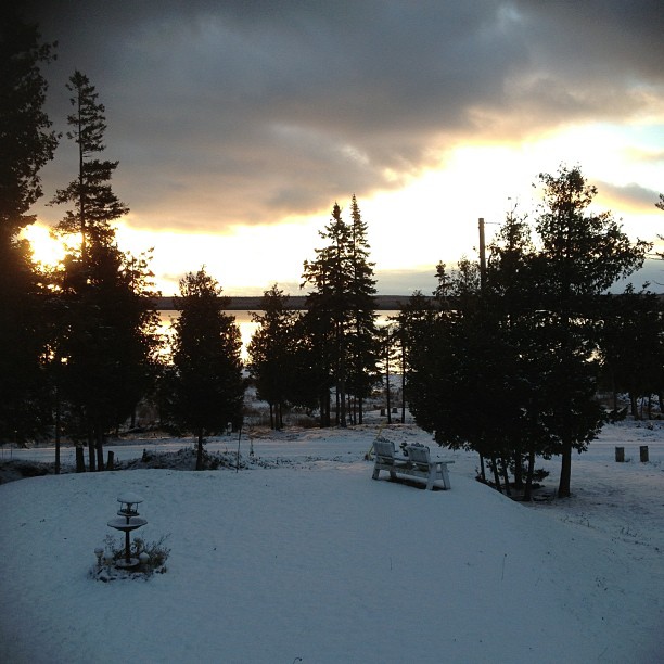
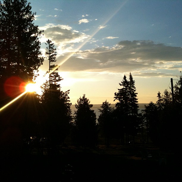
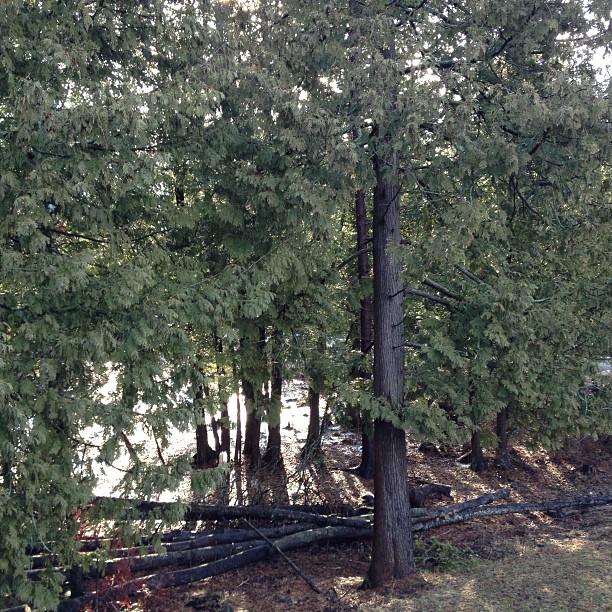
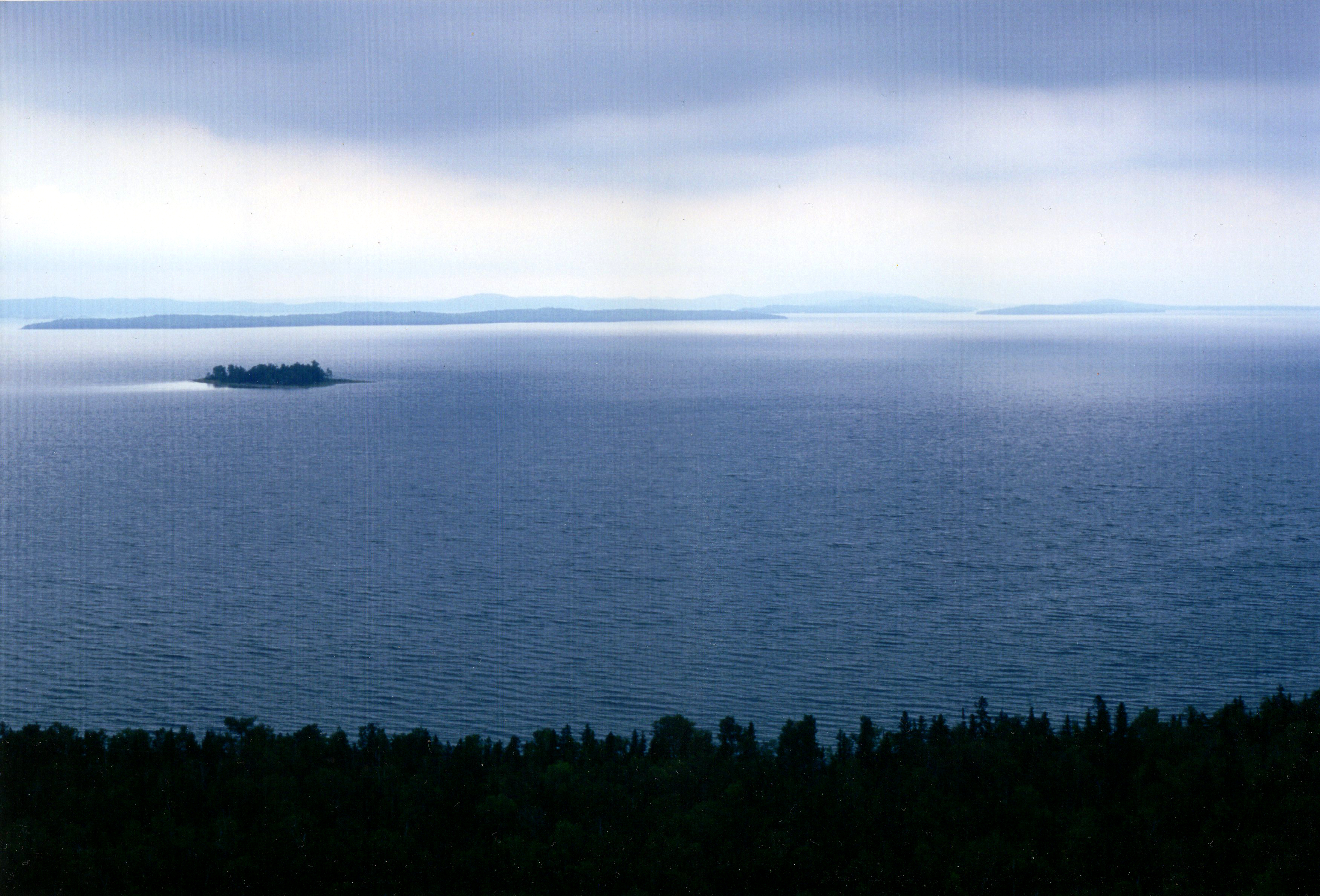
日出日落照片

Bemamikawe Memorial Trail

GB_2016_01450_Heywood-Is-achorage-sunset
November 26, 2012
November 11, 2012

GB_2016_01470_Heywood-Is-achorage-sunset

GB_2016_01460_Heywood-Is-achorage-sunset

GB_2016_01480_Heywood-Is-achorage-sunset
Sunrise through the trees.
Manitoulin Island
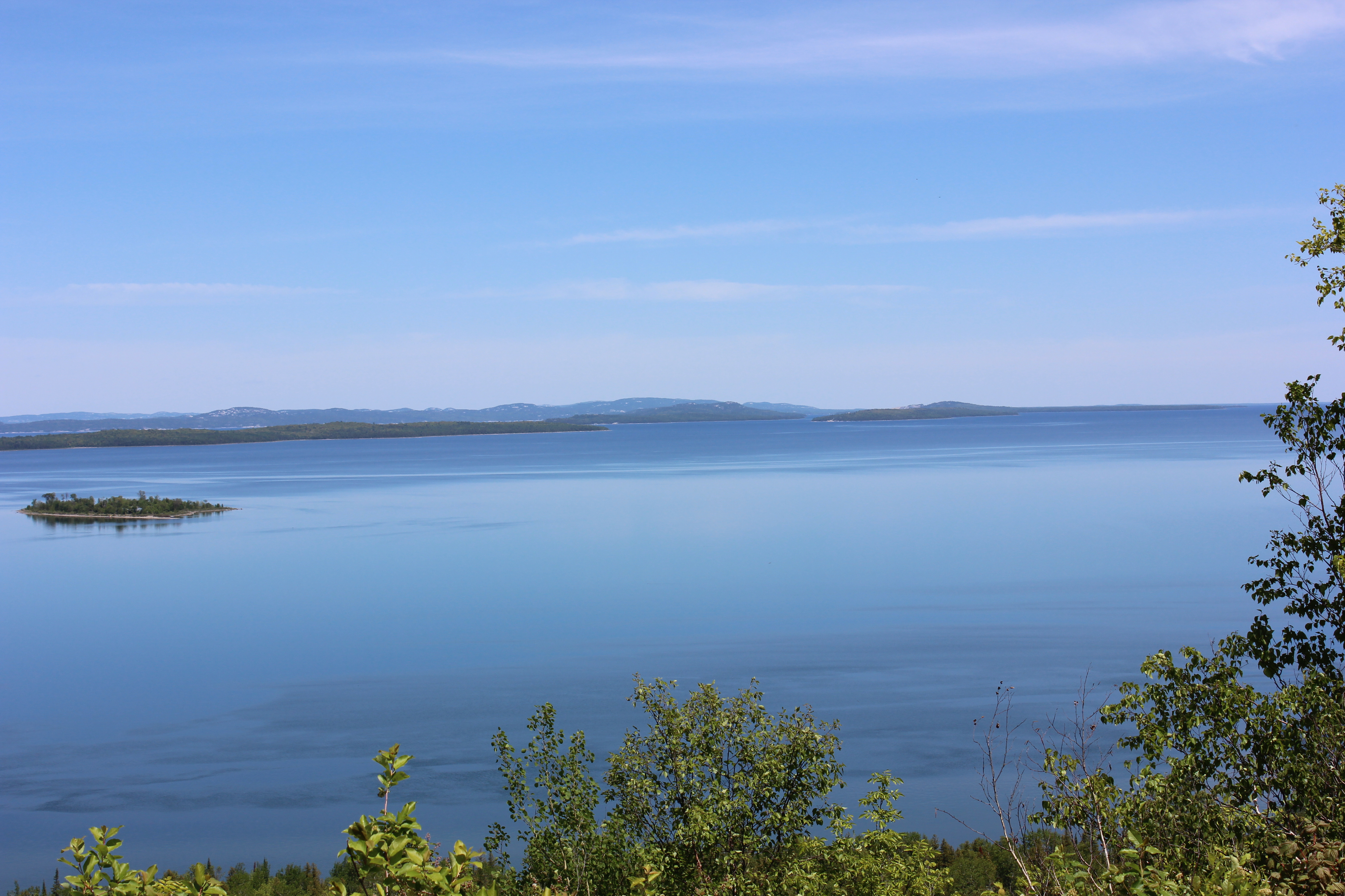
View from Ten-mile Point, Manitoulin Island
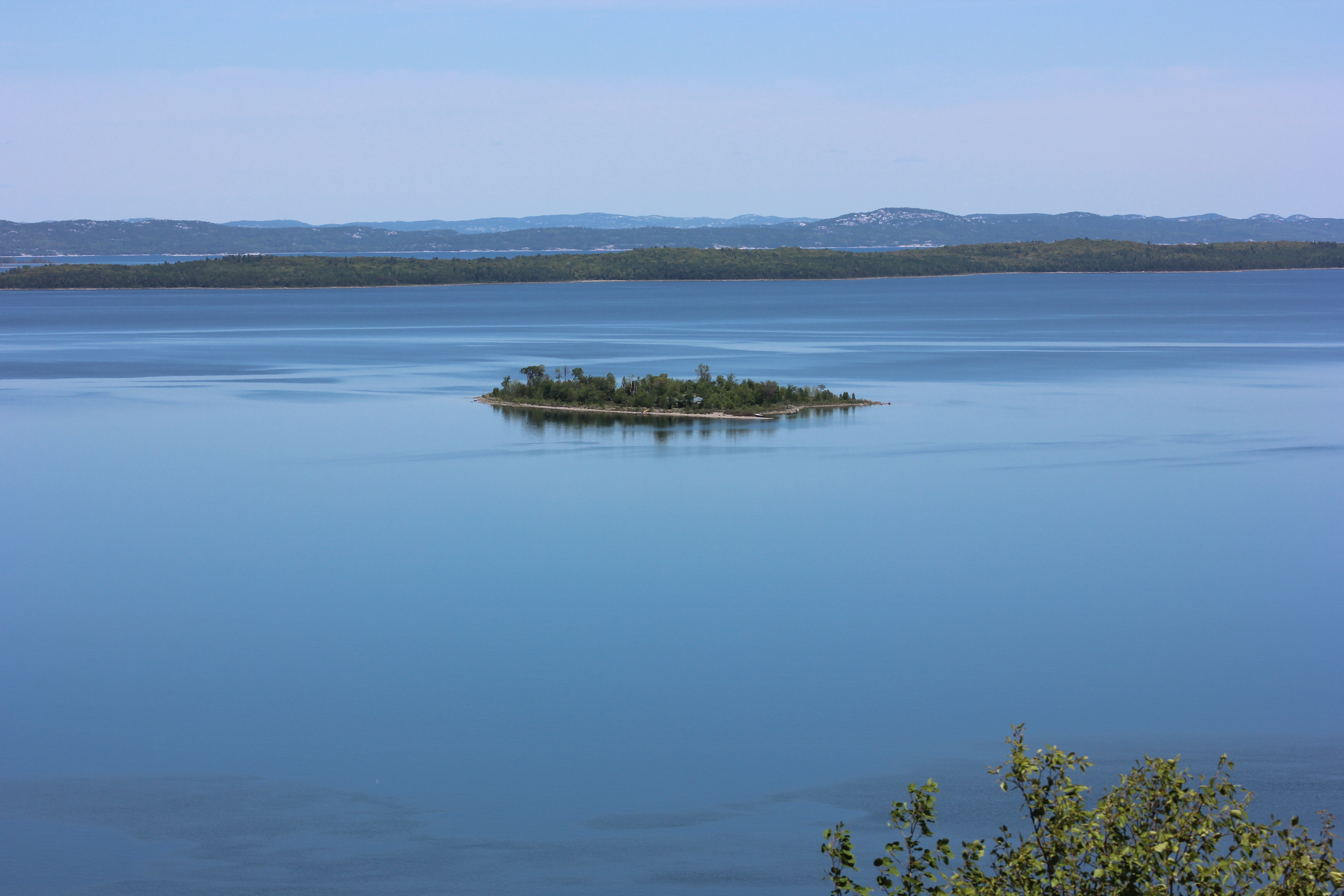
View from Ten-mile Point, Manitoulin Island
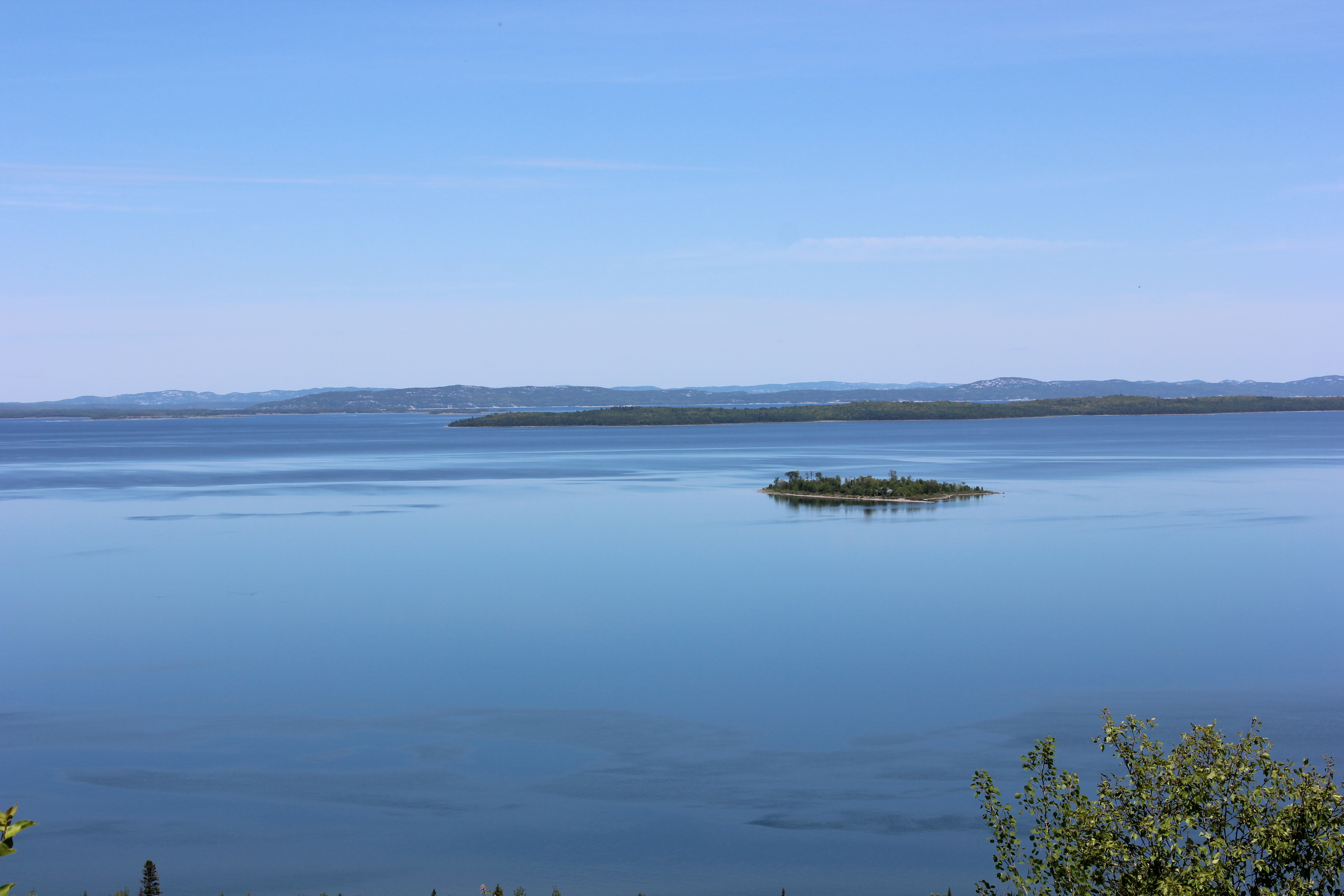
View from Ten-mile Point, Manitoulin Island
Beach Rd, Wikwemikong, ON P0P 2J0加拿大Bebamikawe Memorial Trail Head的地图
查询其他地方的日出日落时间
附近地点
A Rabbit Island Rd, Wikwemikong, ON P0P 2J0加拿大
Rabbit Island Rd, Wikwemikong, ON P0P 2J0加拿大
加拿大安大略省威奎米孔P0P
加拿大安大略省詹姆斯湾
Northeastern Manitoulin and the Islands, ON, 加拿大
Cardwell St, Manitowaning, ON P0P 1N0加拿大
加拿大安大略省马尼托瓦宁P0P
Assiginack, ON, 加拿大
New England Rd, Manitowaning, ON P0P 1N0加拿大
18 ON-6, Northeastern Manitoulin and the Islands, ON P0P加拿大
加拿大安大略省小柯伦特P0P 1K0
Morphets Side Rd, Little Current, ON P0P 1K0加拿大Morphets Side Road
Bidwell Rd, Manitowaning, ON P0P 1N0加拿大
Oakcliff Dr N, Mindemoya, ON P0P 1S0加拿大
Lakeshore Rd, Wikwemikong, ON P0P 2J0加拿大
2nd Concession Rd, Gore Bay, ON P0P 1H0加拿大
Tehkummah, ON P0P加拿大
ON-, Little Current, ON P0P 1K0加拿大
Tehkummah, ON, 加拿大
South Baymouth, ON P0P 1Z0加拿大