Sunrise Sunset Times of Village Creek Road, Village Creek Rd, South Carolina, USA
Location: United States > South Carolina > Oconee County > Mountain Rest >
Timezone:
America/New_York
Current Time:
2024-05-09 18:09:42
Longitude:
-83.1198471
Latitude:
34.886552
Sunrise Today:
06:32:15 AM
Sunset Today:
08:25:29 PM
Daylength Today:
13h 53m 14s
Sunrise Tomorrow:
06:31:25 AM
Sunset Tomorrow:
08:26:16 PM
Daylength Tomorrow:
13h 54m 51s
Year Show All Dates
| Date | Sunrise | Sunset | Daylength |
|---|---|---|---|
| 01/01/2024 | 07:40:10 AM | 05:32:19 PM | 9h 52m 9s |
| 01/02/2024 | 07:40:20 AM | 05:33:06 PM | 9h 52m 46s |
| 01/03/2024 | 07:40:27 AM | 05:33:53 PM | 9h 53m 26s |
| 01/04/2024 | 07:40:33 AM | 05:34:42 PM | 9h 54m 9s |
| 01/05/2024 | 07:40:36 AM | 05:35:32 PM | 9h 54m 56s |
| 01/06/2024 | 07:40:38 AM | 05:36:23 PM | 9h 55m 45s |
| 01/07/2024 | 07:40:38 AM | 05:37:14 PM | 9h 56m 36s |
| 01/08/2024 | 07:40:36 AM | 05:38:07 PM | 9h 57m 31s |
| 01/09/2024 | 07:40:32 AM | 05:39:00 PM | 9h 58m 28s |
| 01/10/2024 | 07:40:26 AM | 05:39:54 PM | 9h 59m 28s |
| 01/11/2024 | 07:40:18 AM | 05:40:49 PM | 10h 0m 31s |
| 01/12/2024 | 07:40:08 AM | 05:41:45 PM | 10h 1m 37s |
| 01/13/2024 | 07:39:57 AM | 05:42:41 PM | 10h 2m 44s |
| 01/14/2024 | 07:39:43 AM | 05:43:38 PM | 10h 3m 55s |
| 01/15/2024 | 07:39:28 AM | 05:44:36 PM | 10h 5m 8s |
| 01/16/2024 | 07:39:11 AM | 05:45:34 PM | 10h 6m 23s |
| 01/17/2024 | 07:38:51 AM | 05:46:32 PM | 10h 7m 41s |
| 01/18/2024 | 07:38:30 AM | 05:47:31 PM | 10h 9m 1s |
| 01/19/2024 | 07:38:08 AM | 05:48:30 PM | 10h 10m 22s |
| 01/20/2024 | 07:37:43 AM | 05:49:30 PM | 10h 11m 47s |
| 01/21/2024 | 07:37:17 AM | 05:50:30 PM | 10h 13m 13s |
| 01/22/2024 | 07:36:48 AM | 05:51:30 PM | 10h 14m 42s |
| 01/23/2024 | 07:36:18 AM | 05:52:31 PM | 10h 16m 13s |
| 01/24/2024 | 07:35:47 AM | 05:53:31 PM | 10h 17m 44s |
| 01/25/2024 | 07:35:13 AM | 05:54:32 PM | 10h 19m 19s |
| 01/26/2024 | 07:34:38 AM | 05:55:33 PM | 10h 20m 55s |
| 01/27/2024 | 07:34:01 AM | 05:56:34 PM | 10h 22m 33s |
| 01/28/2024 | 07:33:22 AM | 05:57:34 PM | 10h 24m 12s |
| 01/29/2024 | 07:32:42 AM | 05:58:35 PM | 10h 25m 53s |
| 01/30/2024 | 07:32:00 AM | 05:59:36 PM | 10h 27m 36s |
| 01/31/2024 | 07:31:17 AM | 06:00:37 PM | 10h 29m 20s |
| 02/01/2024 | 07:30:32 AM | 06:01:38 PM | 10h 31m 6s |
| 02/02/2024 | 07:29:46 AM | 06:02:39 PM | 10h 32m 53s |
| 02/03/2024 | 07:28:58 AM | 06:03:39 PM | 10h 34m 41s |
| 02/04/2024 | 07:28:08 AM | 06:04:40 PM | 10h 36m 32s |
| 02/05/2024 | 07:27:17 AM | 06:05:40 PM | 10h 38m 23s |
| 02/06/2024 | 07:26:25 AM | 06:06:40 PM | 10h 40m 15s |
| 02/07/2024 | 07:25:31 AM | 06:07:40 PM | 10h 42m 9s |
| 02/08/2024 | 07:24:36 AM | 06:08:40 PM | 10h 44m 4s |
| 02/09/2024 | 07:23:40 AM | 06:09:39 PM | 10h 45m 59s |
| 02/10/2024 | 07:22:42 AM | 06:10:38 PM | 10h 47m 56s |
| 02/11/2024 | 07:21:43 AM | 06:11:37 PM | 10h 49m 54s |
| 02/12/2024 | 07:20:43 AM | 06:12:36 PM | 10h 51m 53s |
| 02/13/2024 | 07:19:42 AM | 06:13:34 PM | 10h 53m 52s |
| 02/14/2024 | 07:18:39 AM | 06:14:32 PM | 10h 55m 53s |
| 02/15/2024 | 07:17:35 AM | 06:15:30 PM | 10h 57m 55s |
| 02/16/2024 | 07:16:30 AM | 06:16:27 PM | 10h 59m 57s |
| 02/17/2024 | 07:15:25 AM | 06:17:24 PM | 11h 1m 59s |
| 02/18/2024 | 07:14:18 AM | 06:18:21 PM | 11h 4m 3s |
| 02/19/2024 | 07:13:10 AM | 06:19:17 PM | 11h 6m 7s |
| 02/20/2024 | 07:12:01 AM | 06:20:13 PM | 11h 8m 12s |
| 02/21/2024 | 07:10:51 AM | 06:21:09 PM | 11h 10m 18s |
| 02/22/2024 | 07:09:40 AM | 06:22:04 PM | 11h 12m 24s |
| 02/23/2024 | 07:08:28 AM | 06:22:59 PM | 11h 14m 31s |
| 02/24/2024 | 07:07:16 AM | 06:23:54 PM | 11h 16m 38s |
| 02/25/2024 | 07:06:02 AM | 06:24:48 PM | 11h 18m 46s |
| 02/26/2024 | 07:04:48 AM | 06:25:42 PM | 11h 20m 54s |
| 02/27/2024 | 07:03:33 AM | 06:26:36 PM | 11h 23m 3s |
| 02/28/2024 | 07:02:18 AM | 06:27:29 PM | 11h 25m 11s |
| 02/29/2024 | 07:01:01 AM | 06:28:22 PM | 11h 27m 21s |
| 03/01/2024 | 06:59:44 AM | 06:29:15 PM | 11h 29m 31s |
| 03/02/2024 | 06:58:27 AM | 06:30:07 PM | 11h 31m 40s |
| 03/03/2024 | 06:57:08 AM | 06:31:00 PM | 11h 33m 52s |
| 03/04/2024 | 06:55:49 AM | 06:31:51 PM | 11h 36m 2s |
| 03/05/2024 | 06:54:30 AM | 06:32:43 PM | 11h 38m 13s |
| 03/06/2024 | 06:53:10 AM | 06:33:34 PM | 11h 40m 24s |
| 03/07/2024 | 06:51:50 AM | 06:34:25 PM | 11h 42m 35s |
| 03/08/2024 | 06:50:29 AM | 06:35:16 PM | 11h 44m 47s |
| 03/09/2024 | 06:49:08 AM | 06:36:06 PM | 11h 46m 58s |
| 03/10/2024 | 07:47:49 AM | 07:36:54 PM | 11h 49m 5s |
| 03/11/2024 | 07:46:27 AM | 07:37:44 PM | 11h 51m 17s |
| 03/12/2024 | 07:45:05 AM | 07:38:34 PM | 11h 53m 29s |
| 03/13/2024 | 07:43:42 AM | 07:39:23 PM | 11h 55m 41s |
| 03/14/2024 | 07:42:19 AM | 07:40:12 PM | 11h 57m 53s |
| 03/15/2024 | 07:40:56 AM | 07:41:02 PM | 12h 0m 6s |
| 03/16/2024 | 07:39:33 AM | 07:41:50 PM | 12h 2m 17s |
| 03/17/2024 | 07:38:09 AM | 07:42:39 PM | 12h 4m 30s |
| 03/18/2024 | 07:36:45 AM | 07:43:28 PM | 12h 6m 43s |
| 03/19/2024 | 07:35:22 AM | 07:44:16 PM | 12h 8m 54s |
| 03/20/2024 | 07:33:58 AM | 07:45:04 PM | 12h 11m 6s |
| 03/21/2024 | 07:32:34 AM | 07:45:53 PM | 12h 13m 19s |
| 03/22/2024 | 07:31:10 AM | 07:46:41 PM | 12h 15m 31s |
| 03/23/2024 | 07:29:46 AM | 07:47:29 PM | 12h 17m 43s |
| 03/24/2024 | 07:28:22 AM | 07:48:16 PM | 12h 19m 54s |
| 03/25/2024 | 07:26:58 AM | 07:49:04 PM | 12h 22m 6s |
| 03/26/2024 | 07:25:34 AM | 07:49:52 PM | 12h 24m 18s |
| 03/27/2024 | 07:24:10 AM | 07:50:39 PM | 12h 26m 29s |
| 03/28/2024 | 07:22:46 AM | 07:51:27 PM | 12h 28m 41s |
| 03/29/2024 | 07:21:23 AM | 07:52:14 PM | 12h 30m 51s |
| 03/30/2024 | 07:20:00 AM | 07:53:02 PM | 12h 33m 2s |
| 03/31/2024 | 07:18:36 AM | 07:53:49 PM | 12h 35m 13s |
| 04/01/2024 | 07:17:14 AM | 07:54:37 PM | 12h 37m 23s |
| 04/02/2024 | 07:15:51 AM | 07:55:24 PM | 12h 39m 33s |
| 04/03/2024 | 07:14:29 AM | 07:56:12 PM | 12h 41m 43s |
| 04/04/2024 | 07:13:07 AM | 07:56:59 PM | 12h 43m 52s |
| 04/05/2024 | 07:11:46 AM | 07:57:47 PM | 12h 46m 1s |
| 04/06/2024 | 07:10:25 AM | 07:58:34 PM | 12h 48m 9s |
| 04/07/2024 | 07:09:04 AM | 07:59:22 PM | 12h 50m 18s |
| 04/08/2024 | 07:07:44 AM | 08:00:09 PM | 12h 52m 25s |
| 04/09/2024 | 07:06:24 AM | 08:00:57 PM | 12h 54m 33s |
| 04/10/2024 | 07:05:05 AM | 08:01:45 PM | 12h 56m 40s |
| 04/11/2024 | 07:03:46 AM | 08:02:32 PM | 12h 58m 46s |
| 04/12/2024 | 07:02:28 AM | 08:03:20 PM | 13h 0m 52s |
| 04/13/2024 | 07:01:11 AM | 08:04:08 PM | 13h 2m 57s |
| 04/14/2024 | 06:59:54 AM | 08:04:56 PM | 13h 5m 2s |
| 04/15/2024 | 06:58:37 AM | 08:05:44 PM | 13h 7m 7s |
| 04/16/2024 | 06:57:22 AM | 08:06:32 PM | 13h 9m 10s |
| 04/17/2024 | 06:56:07 AM | 08:07:20 PM | 13h 11m 13s |
| 04/18/2024 | 06:54:53 AM | 08:08:08 PM | 13h 13m 15s |
| 04/19/2024 | 06:53:40 AM | 08:08:57 PM | 13h 15m 17s |
| 04/20/2024 | 06:52:27 AM | 08:09:45 PM | 13h 17m 18s |
| 04/21/2024 | 06:51:16 AM | 08:10:33 PM | 13h 19m 17s |
| 04/22/2024 | 06:50:05 AM | 08:11:22 PM | 13h 21m 17s |
| 04/23/2024 | 06:48:55 AM | 08:12:10 PM | 13h 23m 15s |
| 04/24/2024 | 06:47:46 AM | 08:12:59 PM | 13h 25m 13s |
| 04/25/2024 | 06:46:38 AM | 08:13:47 PM | 13h 27m 9s |
| 04/26/2024 | 06:45:31 AM | 08:14:36 PM | 13h 29m 5s |
| 04/27/2024 | 06:44:25 AM | 08:15:25 PM | 13h 31m 0s |
| 04/28/2024 | 06:43:20 AM | 08:16:13 PM | 13h 32m 53s |
| 04/29/2024 | 06:42:16 AM | 08:17:02 PM | 13h 34m 46s |
| 04/30/2024 | 06:41:13 AM | 08:17:50 PM | 13h 36m 37s |
| 05/01/2024 | 06:40:11 AM | 08:18:39 PM | 13h 38m 28s |
| 05/02/2024 | 06:39:11 AM | 08:19:27 PM | 13h 40m 16s |
| 05/03/2024 | 06:38:11 AM | 08:20:16 PM | 13h 42m 5s |
| 05/04/2024 | 06:37:13 AM | 08:21:04 PM | 13h 43m 51s |
| 05/05/2024 | 06:36:16 AM | 08:21:53 PM | 13h 45m 37s |
| 05/06/2024 | 06:35:20 AM | 08:22:41 PM | 13h 47m 21s |
| 05/07/2024 | 06:34:25 AM | 08:23:29 PM | 13h 49m 4s |
| 05/08/2024 | 06:33:32 AM | 08:24:17 PM | 13h 50m 45s |
| 05/09/2024 | 06:32:40 AM | 08:25:05 PM | 13h 52m 25s |
| 05/10/2024 | 06:31:49 AM | 08:25:52 PM | 13h 54m 3s |
| 05/11/2024 | 06:31:00 AM | 08:26:40 PM | 13h 55m 40s |
| 05/12/2024 | 06:30:12 AM | 08:27:27 PM | 13h 57m 15s |
| 05/13/2024 | 06:29:26 AM | 08:28:14 PM | 13h 58m 48s |
| 05/14/2024 | 06:28:41 AM | 08:29:00 PM | 14h 0m 19s |
| 05/15/2024 | 06:27:57 AM | 08:29:47 PM | 14h 1m 50s |
| 05/16/2024 | 06:27:15 AM | 08:30:33 PM | 14h 3m 18s |
| 05/17/2024 | 06:26:34 AM | 08:31:18 PM | 14h 4m 44s |
| 05/18/2024 | 06:25:55 AM | 08:32:03 PM | 14h 6m 8s |
| 05/19/2024 | 06:25:17 AM | 08:32:48 PM | 14h 7m 31s |
| 05/20/2024 | 06:24:41 AM | 08:33:32 PM | 14h 8m 51s |
| 05/21/2024 | 06:24:06 AM | 08:34:16 PM | 14h 10m 10s |
| 05/22/2024 | 06:23:33 AM | 08:34:59 PM | 14h 11m 26s |
| 05/23/2024 | 06:23:02 AM | 08:35:42 PM | 14h 12m 40s |
| 05/24/2024 | 06:22:32 AM | 08:36:24 PM | 14h 13m 52s |
| 05/25/2024 | 06:22:04 AM | 08:37:06 PM | 14h 15m 2s |
| 05/26/2024 | 06:21:37 AM | 08:37:46 PM | 14h 16m 9s |
| 05/27/2024 | 06:21:12 AM | 08:38:27 PM | 14h 17m 15s |
| 05/28/2024 | 06:20:48 AM | 08:39:06 PM | 14h 18m 18s |
| 05/29/2024 | 06:20:26 AM | 08:39:45 PM | 14h 19m 19s |
| 05/30/2024 | 06:20:06 AM | 08:40:22 PM | 14h 20m 16s |
| 05/31/2024 | 06:19:48 AM | 08:40:59 PM | 14h 21m 11s |
| 06/01/2024 | 06:19:31 AM | 08:41:36 PM | 14h 22m 5s |
| 06/02/2024 | 06:19:16 AM | 08:42:11 PM | 14h 22m 55s |
| 06/03/2024 | 06:19:02 AM | 08:42:45 PM | 14h 23m 43s |
| 06/04/2024 | 06:18:50 AM | 08:43:18 PM | 14h 24m 28s |
| 06/05/2024 | 06:18:40 AM | 08:43:50 PM | 14h 25m 10s |
| 06/06/2024 | 06:18:31 AM | 08:44:22 PM | 14h 25m 51s |
| 06/07/2024 | 06:18:24 AM | 08:44:52 PM | 14h 26m 28s |
| 06/08/2024 | 06:18:19 AM | 08:45:21 PM | 14h 27m 2s |
| 06/09/2024 | 06:18:15 AM | 08:45:48 PM | 14h 27m 33s |
| 06/10/2024 | 06:18:13 AM | 08:46:15 PM | 14h 28m 2s |
| 06/11/2024 | 06:18:12 AM | 08:46:40 PM | 14h 28m 28s |
| 06/12/2024 | 06:18:13 AM | 08:47:05 PM | 14h 28m 52s |
| 06/13/2024 | 06:18:16 AM | 08:47:27 PM | 14h 29m 11s |
| 06/14/2024 | 06:18:20 AM | 08:47:49 PM | 14h 29m 29s |
| 06/15/2024 | 06:18:26 AM | 08:48:09 PM | 14h 29m 43s |
| 06/16/2024 | 06:18:33 AM | 08:48:28 PM | 14h 29m 55s |
| 06/17/2024 | 06:18:42 AM | 08:48:45 PM | 14h 30m 3s |
| 06/18/2024 | 06:18:52 AM | 08:49:01 PM | 14h 30m 9s |
| 06/19/2024 | 06:19:04 AM | 08:49:16 PM | 14h 30m 12s |
| 06/20/2024 | 06:19:17 AM | 08:49:29 PM | 14h 30m 12s |
| 06/21/2024 | 06:19:31 AM | 08:49:40 PM | 14h 30m 9s |
| 06/22/2024 | 06:19:47 AM | 08:49:50 PM | 14h 30m 3s |
| 06/23/2024 | 06:20:04 AM | 08:49:59 PM | 14h 29m 55s |
| 06/24/2024 | 06:20:23 AM | 08:50:05 PM | 14h 29m 42s |
| 06/25/2024 | 06:20:43 AM | 08:50:11 PM | 14h 29m 28s |
| 06/26/2024 | 06:21:04 AM | 08:50:14 PM | 14h 29m 10s |
| 06/27/2024 | 06:21:27 AM | 08:50:16 PM | 14h 28m 49s |
| 06/28/2024 | 06:21:50 AM | 08:50:17 PM | 14h 28m 27s |
| 06/29/2024 | 06:22:15 AM | 08:50:16 PM | 14h 28m 1s |
| 06/30/2024 | 06:22:41 AM | 08:50:13 PM | 14h 27m 32s |
| 07/01/2024 | 06:23:08 AM | 08:50:08 PM | 14h 27m 0s |
| 07/02/2024 | 06:23:37 AM | 08:50:02 PM | 14h 26m 25s |
| 07/03/2024 | 06:24:06 AM | 08:49:54 PM | 14h 25m 48s |
| 07/04/2024 | 06:24:36 AM | 08:49:45 PM | 14h 25m 9s |
| 07/05/2024 | 06:25:07 AM | 08:49:33 PM | 14h 24m 26s |
| 07/06/2024 | 06:25:40 AM | 08:49:20 PM | 14h 23m 40s |
| 07/07/2024 | 06:26:13 AM | 08:49:06 PM | 14h 22m 53s |
| 07/08/2024 | 06:26:47 AM | 08:48:49 PM | 14h 22m 2s |
| 07/09/2024 | 06:27:21 AM | 08:48:31 PM | 14h 21m 10s |
| 07/10/2024 | 06:27:57 AM | 08:48:12 PM | 14h 20m 15s |
| 07/11/2024 | 06:28:33 AM | 08:47:50 PM | 14h 19m 17s |
| 07/12/2024 | 06:29:10 AM | 08:47:27 PM | 14h 18m 17s |
| 07/13/2024 | 06:29:48 AM | 08:47:03 PM | 14h 17m 15s |
| 07/14/2024 | 06:30:27 AM | 08:46:36 PM | 14h 16m 9s |
| 07/15/2024 | 06:31:06 AM | 08:46:08 PM | 14h 15m 2s |
| 07/16/2024 | 06:31:45 AM | 08:45:38 PM | 14h 13m 53s |
| 07/17/2024 | 06:32:26 AM | 08:45:07 PM | 14h 12m 41s |
| 07/18/2024 | 06:33:06 AM | 08:44:34 PM | 14h 11m 28s |
| 07/19/2024 | 06:33:48 AM | 08:44:00 PM | 14h 10m 12s |
| 07/20/2024 | 06:34:29 AM | 08:43:24 PM | 14h 8m 55s |
| 07/21/2024 | 06:35:11 AM | 08:42:46 PM | 14h 7m 35s |
| 07/22/2024 | 06:35:54 AM | 08:42:07 PM | 14h 6m 13s |
| 07/23/2024 | 06:36:37 AM | 08:41:26 PM | 14h 4m 49s |
| 07/24/2024 | 06:37:20 AM | 08:40:44 PM | 14h 3m 24s |
| 07/25/2024 | 06:38:03 AM | 08:40:00 PM | 14h 1m 57s |
| 07/26/2024 | 06:38:47 AM | 08:39:15 PM | 14h 0m 28s |
| 07/27/2024 | 06:39:31 AM | 08:38:28 PM | 13h 58m 57s |
| 07/28/2024 | 06:40:15 AM | 08:37:40 PM | 13h 57m 25s |
| 07/29/2024 | 06:41:00 AM | 08:36:50 PM | 13h 55m 50s |
| 07/30/2024 | 06:41:45 AM | 08:36:00 PM | 13h 54m 15s |
| 07/31/2024 | 06:42:29 AM | 08:35:07 PM | 13h 52m 38s |
| 08/01/2024 | 06:43:14 AM | 08:34:14 PM | 13h 51m 0s |
| 08/02/2024 | 06:43:59 AM | 08:33:19 PM | 13h 49m 20s |
| 08/03/2024 | 06:44:44 AM | 08:32:22 PM | 13h 47m 38s |
| 08/04/2024 | 06:45:30 AM | 08:31:25 PM | 13h 45m 55s |
| 08/05/2024 | 06:46:15 AM | 08:30:26 PM | 13h 44m 11s |
| 08/06/2024 | 06:47:00 AM | 08:29:26 PM | 13h 42m 26s |
| 08/07/2024 | 06:47:45 AM | 08:28:25 PM | 13h 40m 40s |
| 08/08/2024 | 06:48:31 AM | 08:27:22 PM | 13h 38m 51s |
| 08/09/2024 | 06:49:16 AM | 08:26:19 PM | 13h 37m 3s |
| 08/10/2024 | 06:50:01 AM | 08:25:14 PM | 13h 35m 13s |
| 08/11/2024 | 06:50:47 AM | 08:24:08 PM | 13h 33m 21s |
| 08/12/2024 | 06:51:32 AM | 08:23:02 PM | 13h 31m 30s |
| 08/13/2024 | 06:52:17 AM | 08:21:54 PM | 13h 29m 37s |
| 08/14/2024 | 06:53:02 AM | 08:20:45 PM | 13h 27m 43s |
| 08/15/2024 | 06:53:47 AM | 08:19:35 PM | 13h 25m 48s |
| 08/16/2024 | 06:54:32 AM | 08:18:24 PM | 13h 23m 52s |
| 08/17/2024 | 06:55:17 AM | 08:17:13 PM | 13h 21m 56s |
| 08/18/2024 | 06:56:02 AM | 08:16:00 PM | 13h 19m 58s |
| 08/19/2024 | 06:56:46 AM | 08:14:46 PM | 13h 18m 0s |
| 08/20/2024 | 06:57:31 AM | 08:13:32 PM | 13h 16m 1s |
| 08/21/2024 | 06:58:15 AM | 08:12:17 PM | 13h 14m 2s |
| 08/22/2024 | 06:59:00 AM | 08:11:01 PM | 13h 12m 1s |
| 08/23/2024 | 06:59:44 AM | 08:09:44 PM | 13h 10m 0s |
| 08/24/2024 | 07:00:28 AM | 08:08:27 PM | 13h 7m 59s |
| 08/25/2024 | 07:01:12 AM | 08:07:09 PM | 13h 5m 57s |
| 08/26/2024 | 07:01:56 AM | 08:05:50 PM | 13h 3m 54s |
| 08/27/2024 | 07:02:40 AM | 08:04:31 PM | 13h 1m 51s |
| 08/28/2024 | 07:03:24 AM | 08:03:11 PM | 12h 59m 47s |
| 08/29/2024 | 07:04:08 AM | 08:01:50 PM | 12h 57m 42s |
| 08/30/2024 | 07:04:52 AM | 08:00:29 PM | 12h 55m 37s |
| 08/31/2024 | 07:05:35 AM | 07:59:07 PM | 12h 53m 32s |
| 09/01/2024 | 07:06:19 AM | 07:57:45 PM | 12h 51m 26s |
| 09/02/2024 | 07:07:02 AM | 07:56:22 PM | 12h 49m 20s |
| 09/03/2024 | 07:07:45 AM | 07:54:59 PM | 12h 47m 14s |
| 09/04/2024 | 07:08:29 AM | 07:53:36 PM | 12h 45m 7s |
| 09/05/2024 | 07:09:12 AM | 07:52:12 PM | 12h 43m 0s |
| 09/06/2024 | 07:09:55 AM | 07:50:47 PM | 12h 40m 52s |
| 09/07/2024 | 07:10:38 AM | 07:49:23 PM | 12h 38m 45s |
| 09/08/2024 | 07:11:22 AM | 07:47:58 PM | 12h 36m 36s |
| 09/09/2024 | 07:12:05 AM | 07:46:33 PM | 12h 34m 28s |
| 09/10/2024 | 07:12:48 AM | 07:45:07 PM | 12h 32m 19s |
| 09/11/2024 | 07:13:31 AM | 07:43:41 PM | 12h 30m 10s |
| 09/12/2024 | 07:14:15 AM | 07:42:16 PM | 12h 28m 1s |
| 09/13/2024 | 07:14:58 AM | 07:40:50 PM | 12h 25m 52s |
| 09/14/2024 | 07:15:41 AM | 07:39:23 PM | 12h 23m 42s |
| 09/15/2024 | 07:16:24 AM | 07:37:57 PM | 12h 21m 33s |
| 09/16/2024 | 07:17:08 AM | 07:36:31 PM | 12h 19m 23s |
| 09/17/2024 | 07:17:51 AM | 07:35:04 PM | 12h 17m 13s |
| 09/18/2024 | 07:18:35 AM | 07:33:38 PM | 12h 15m 3s |
| 09/19/2024 | 07:19:19 AM | 07:32:12 PM | 12h 12m 53s |
| 09/20/2024 | 07:20:02 AM | 07:30:45 PM | 12h 10m 43s |
| 09/21/2024 | 07:20:46 AM | 07:29:19 PM | 12h 8m 33s |
| 09/22/2024 | 07:21:30 AM | 07:27:53 PM | 12h 6m 23s |
| 09/23/2024 | 07:22:15 AM | 07:26:27 PM | 12h 4m 12s |
| 09/24/2024 | 07:22:59 AM | 07:25:01 PM | 12h 2m 2s |
| 09/25/2024 | 07:23:44 AM | 07:23:35 PM | 11h 59m 51s |
| 09/26/2024 | 07:24:28 AM | 07:22:10 PM | 11h 57m 42s |
| 09/27/2024 | 07:25:13 AM | 07:20:45 PM | 11h 55m 32s |
| 09/28/2024 | 07:25:58 AM | 07:19:20 PM | 11h 53m 22s |
| 09/29/2024 | 07:26:44 AM | 07:17:55 PM | 11h 51m 11s |
| 09/30/2024 | 07:27:29 AM | 07:16:31 PM | 11h 49m 2s |
| 10/01/2024 | 07:28:15 AM | 07:15:07 PM | 11h 46m 52s |
| 10/02/2024 | 07:29:01 AM | 07:13:43 PM | 11h 44m 42s |
| 10/03/2024 | 07:29:48 AM | 07:12:20 PM | 11h 42m 32s |
| 10/04/2024 | 07:30:34 AM | 07:10:57 PM | 11h 40m 23s |
| 10/05/2024 | 07:31:21 AM | 07:09:35 PM | 11h 38m 14s |
| 10/06/2024 | 07:32:08 AM | 07:08:13 PM | 11h 36m 5s |
| 10/07/2024 | 07:32:56 AM | 07:06:52 PM | 11h 33m 56s |
| 10/08/2024 | 07:33:44 AM | 07:05:31 PM | 11h 31m 47s |
| 10/09/2024 | 07:34:32 AM | 07:04:11 PM | 11h 29m 39s |
| 10/10/2024 | 07:35:20 AM | 07:02:52 PM | 11h 27m 32s |
| 10/11/2024 | 07:36:09 AM | 07:01:33 PM | 11h 25m 24s |
| 10/12/2024 | 07:36:58 AM | 07:00:15 PM | 11h 23m 17s |
| 10/13/2024 | 07:37:48 AM | 06:58:58 PM | 11h 21m 10s |
| 10/14/2024 | 07:38:38 AM | 06:57:41 PM | 11h 19m 3s |
| 10/15/2024 | 07:39:28 AM | 06:56:25 PM | 11h 16m 57s |
| 10/16/2024 | 07:40:19 AM | 06:55:10 PM | 11h 14m 51s |
| 10/17/2024 | 07:41:09 AM | 06:53:56 PM | 11h 12m 47s |
| 10/18/2024 | 07:42:01 AM | 06:52:43 PM | 11h 10m 42s |
| 10/19/2024 | 07:42:52 AM | 06:51:31 PM | 11h 8m 39s |
| 10/20/2024 | 07:43:44 AM | 06:50:19 PM | 11h 6m 35s |
| 10/21/2024 | 07:44:37 AM | 06:49:09 PM | 11h 4m 32s |
| 10/22/2024 | 07:45:30 AM | 06:47:59 PM | 11h 2m 29s |
| 10/23/2024 | 07:46:23 AM | 06:46:51 PM | 11h 0m 28s |
| 10/24/2024 | 07:47:16 AM | 06:45:44 PM | 10h 58m 28s |
| 10/25/2024 | 07:48:10 AM | 06:44:38 PM | 10h 56m 28s |
| 10/26/2024 | 07:49:04 AM | 06:43:32 PM | 10h 54m 28s |
| 10/27/2024 | 07:49:59 AM | 06:42:29 PM | 10h 52m 30s |
| 10/28/2024 | 07:50:54 AM | 06:41:26 PM | 10h 50m 32s |
| 10/29/2024 | 07:51:49 AM | 06:40:24 PM | 10h 48m 35s |
| 10/30/2024 | 07:52:44 AM | 06:39:24 PM | 10h 46m 40s |
| 10/31/2024 | 07:53:40 AM | 06:38:25 PM | 10h 44m 45s |
| 11/01/2024 | 07:54:36 AM | 06:37:27 PM | 10h 42m 51s |
| 11/02/2024 | 07:55:33 AM | 06:36:31 PM | 10h 40m 58s |
| 11/03/2024 | 06:56:32 AM | 05:35:34 PM | 10h 39m 2s |
| 11/04/2024 | 06:57:29 AM | 05:34:40 PM | 10h 37m 11s |
| 11/05/2024 | 06:58:26 AM | 05:33:48 PM | 10h 35m 22s |
| 11/06/2024 | 06:59:23 AM | 05:32:58 PM | 10h 33m 35s |
| 11/07/2024 | 07:00:21 AM | 05:32:09 PM | 10h 31m 48s |
| 11/08/2024 | 07:01:18 AM | 05:31:21 PM | 10h 30m 3s |
| 11/09/2024 | 07:02:16 AM | 05:30:35 PM | 10h 28m 19s |
| 11/10/2024 | 07:03:14 AM | 05:29:51 PM | 10h 26m 37s |
| 11/11/2024 | 07:04:12 AM | 05:29:08 PM | 10h 24m 56s |
| 11/12/2024 | 07:05:10 AM | 05:28:27 PM | 10h 23m 17s |
| 11/13/2024 | 07:06:08 AM | 05:27:47 PM | 10h 21m 39s |
| 11/14/2024 | 07:07:06 AM | 05:27:10 PM | 10h 20m 4s |
| 11/15/2024 | 07:08:05 AM | 05:26:33 PM | 10h 18m 28s |
| 11/16/2024 | 07:09:03 AM | 05:25:59 PM | 10h 16m 56s |
| 11/17/2024 | 07:10:01 AM | 05:25:26 PM | 10h 15m 25s |
| 11/18/2024 | 07:10:58 AM | 05:24:56 PM | 10h 13m 58s |
| 11/19/2024 | 07:11:56 AM | 05:24:27 PM | 10h 12m 31s |
| 11/20/2024 | 07:12:54 AM | 05:23:59 PM | 10h 11m 5s |
| 11/21/2024 | 07:13:51 AM | 05:23:34 PM | 10h 9m 43s |
| 11/22/2024 | 07:14:48 AM | 05:23:10 PM | 10h 8m 22s |
| 11/23/2024 | 07:15:44 AM | 05:22:49 PM | 10h 7m 5s |
| 11/24/2024 | 07:16:40 AM | 05:22:29 PM | 10h 5m 49s |
| 11/25/2024 | 07:17:36 AM | 05:22:11 PM | 10h 4m 35s |
| 11/26/2024 | 07:18:32 AM | 05:21:55 PM | 10h 3m 23s |
| 11/27/2024 | 07:19:27 AM | 05:21:41 PM | 10h 2m 14s |
| 11/28/2024 | 07:20:21 AM | 05:21:29 PM | 10h 1m 8s |
| 11/29/2024 | 07:21:15 AM | 05:21:19 PM | 10h 0m 4s |
| 11/30/2024 | 07:22:08 AM | 05:21:11 PM | 9h 59m 3s |
| 12/01/2024 | 07:23:00 AM | 05:21:04 PM | 9h 58m 4s |
| 12/02/2024 | 07:23:52 AM | 05:21:00 PM | 9h 57m 8s |
| 12/03/2024 | 07:24:43 AM | 05:20:58 PM | 9h 56m 15s |
| 12/04/2024 | 07:25:33 AM | 05:20:57 PM | 9h 55m 24s |
| 12/05/2024 | 07:26:22 AM | 05:20:59 PM | 9h 54m 37s |
| 12/06/2024 | 07:27:10 AM | 05:21:02 PM | 9h 53m 52s |
| 12/07/2024 | 07:27:57 AM | 05:21:08 PM | 9h 53m 11s |
| 12/08/2024 | 07:28:44 AM | 05:21:15 PM | 9h 52m 31s |
| 12/09/2024 | 07:29:29 AM | 05:21:24 PM | 9h 51m 55s |
| 12/10/2024 | 07:30:13 AM | 05:21:35 PM | 9h 51m 22s |
| 12/11/2024 | 07:30:56 AM | 05:21:49 PM | 9h 50m 53s |
| 12/12/2024 | 07:31:38 AM | 05:22:03 PM | 9h 50m 25s |
| 12/13/2024 | 07:32:18 AM | 05:22:20 PM | 9h 50m 2s |
| 12/14/2024 | 07:32:57 AM | 05:22:39 PM | 9h 49m 42s |
| 12/15/2024 | 07:33:35 AM | 05:22:59 PM | 9h 49m 24s |
| 12/16/2024 | 07:34:11 AM | 05:23:21 PM | 9h 49m 10s |
| 12/17/2024 | 07:34:46 AM | 05:23:45 PM | 9h 48m 59s |
| 12/18/2024 | 07:35:20 AM | 05:24:11 PM | 9h 48m 51s |
| 12/19/2024 | 07:35:52 AM | 05:24:39 PM | 9h 48m 47s |
| 12/20/2024 | 07:36:23 AM | 05:25:08 PM | 9h 48m 45s |
| 12/21/2024 | 07:36:51 AM | 05:25:38 PM | 9h 48m 47s |
| 12/22/2024 | 07:37:19 AM | 05:26:11 PM | 9h 48m 52s |
| 12/23/2024 | 07:37:44 AM | 05:26:45 PM | 9h 49m 1s |
| 12/24/2024 | 07:38:09 AM | 05:27:20 PM | 9h 49m 11s |
| 12/25/2024 | 07:38:31 AM | 05:27:57 PM | 9h 49m 26s |
| 12/26/2024 | 07:38:51 AM | 05:28:36 PM | 9h 49m 45s |
| 12/27/2024 | 07:39:10 AM | 05:29:15 PM | 9h 50m 5s |
| 12/28/2024 | 07:39:27 AM | 05:29:57 PM | 9h 50m 30s |
| 12/29/2024 | 07:39:43 AM | 05:30:39 PM | 9h 50m 56s |
| 12/30/2024 | 07:39:56 AM | 05:31:23 PM | 9h 51m 27s |
Sunrise & Sunset Photos

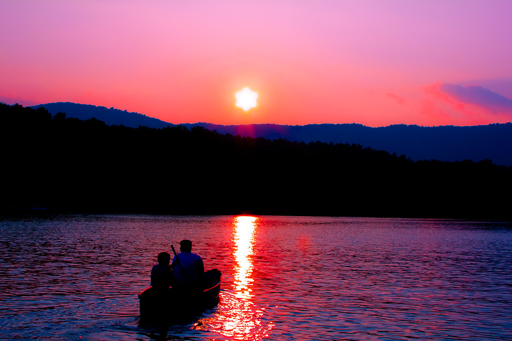
Gentle Light
Travel into the night

docked for the night

Sweet Dreams

Miss Sunshine

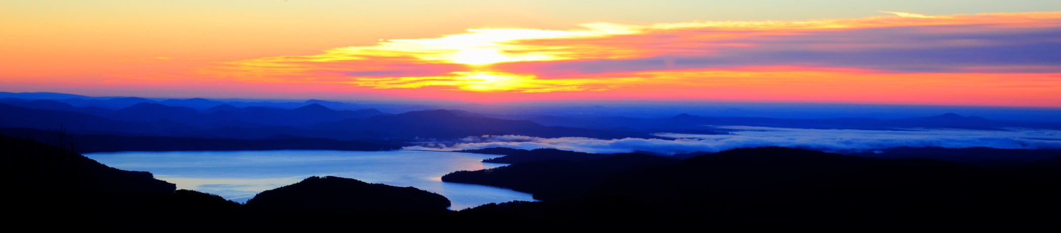
Tamassee Knob
Sunrise on the way to W4G/NG-025 - Glade Mtn

Sunrise on the way to W4G/NG-025 - Glade Mtn

Sunrise on the way to W4G/NG-025 - Glade Mtn

West Fork of the Chattooga River

Chattooga River Potholes Highlands NC - The Artist's Hand

Issaqueena Falls

Secret Falls

Chattooga River at Burrells Ford

Lake Jocassee

Mountain View

Lake Jocassee

Behind the falls

Chattooga river, north view from burrells ford

Chattooga river, south view from burrells ford

View from Boone's Creek Baptist Church

DSC_6132-2.jpg

DSC_6131-2.jpg

DSC_6129-2.jpg
Village Creek Road, Village Creek Rd, South Carolina, USA Map
Search another place
Near Places
Lenore B Ln, Mountain Rest, SC, USA
Old Turnpike Rd, Mountain Rest, SC, USA
Bauknight Rd, Mountain Rest, SC, USA
Lakeside Dr, Mountain Rest, SC, USA
Lakeside Dr, Mountain Rest, SC, USA
Nature Ln, Mountain Rest, SC, USA
Chattooga Lake Rd, Mountain Rest, SC, USA
Mountain Rest, SC, USA
Lake Becky Rd, Mountain Rest, SC, USA
South Carolina, SC-, South Carolina, USA
Winding River Rd, Mountain Rest, SC, USA
W Village Creek Rd, Mountain Rest, SC, USA
Land Bridge Rd, Mountain Rest, SC, USA
Whites Way, Mountain Rest, SC, USA
Cherry Hill Recreation Area, SC-, Walhalla, SC, USA
Crystal Lake Rd, Mountain Rest, SC, USA
Lake Cheohee Rd, Tamassee, SC, USA
The Bear Blvd, Tamassee, SC, USA
Cassidy Bridge Rd, Mountain Rest, SC, USA
Issaqueena Falls, South Carolina, USA
Recent Searches
- Sunrise Sunset Times of Brooks Lp, Spearfish, SD, USA
- Sunrise Sunset Times of Via Buonarroti, 26, Roma RM, Italy
- Sunrise Sunset Times of Jais St - Wadi Shehah - Ras al Khaimah - United Arab Emirates
- Sunrise Sunset Times of Benagil, Carvoeiro, Portugal
- Sunrise Sunset Times of W Prive Cir, Delray Beach, FL, USA
- Sunrise Sunset Times of S Layton Cir W, Layton, UT, USA
- Sunrise Sunset Times of Fairland Ave, Fairhope, AL, USA
- Sunrise Sunset Times of Sunset Dr, Richmond, VA, USA
- Sunrise Sunset Times of View Villa Apartments Hurghada, Al Ahyaa, Mubarak 7, Villa nr 2 Hurghada, قسم ثان الغردقة، محافظة ال
- Sunrise Sunset Times of Grodna District, Hrodna Region, Belarus