Windmill Point Rd, White Stone, VA アメリカ合衆国日の出日の入り時間
Location: アメリカ合衆国 > バージニア州 > ランカスター > アメリカ合衆国 バージニア州 3 > アメリカ合衆国 〒 バージニア州 ホワイト・ストーン >
時間帯:
America/New_York
現地時間:
2024-05-14 13:34:44
経度:
-76.2912871
緯度:
37.628285
今日の日の出時刻:
05:54:45 AM
今日の日の入時刻:
08:08:19 PM
今日の日長:
14h 13m 34s
明日の日の出時刻:
05:53:57 AM
明日の日の入時刻:
08:09:10 PM
明日の日長:
14h 15m 13s
すべて表示する
| 日付 | 日出 | 日没 | 日長 |
|---|---|---|---|
| 2024年01月01日 | 07:20:09 AM | 04:57:42 PM | 9h 37m 33s |
| 2024年01月02日 | 07:20:16 AM | 04:58:30 PM | 9h 38m 14s |
| 2024年01月03日 | 07:20:21 AM | 04:59:20 PM | 9h 38m 59s |
| 2024年01月04日 | 07:20:24 AM | 05:00:12 PM | 9h 39m 48s |
| 2024年01月05日 | 07:20:25 AM | 05:01:04 PM | 9h 40m 39s |
| 2024年01月06日 | 07:20:24 AM | 05:01:58 PM | 9h 41m 34s |
| 2024年01月07日 | 07:20:21 AM | 05:02:52 PM | 9h 42m 31s |
| 2024年01月08日 | 07:20:16 AM | 05:03:48 PM | 9h 43m 32s |
| 2024年01月09日 | 07:20:09 AM | 05:04:45 PM | 9h 44m 36s |
| 2024年01月10日 | 07:19:59 AM | 05:05:42 PM | 9h 45m 43s |
| 2024年01月11日 | 07:19:48 AM | 05:06:41 PM | 9h 46m 53s |
| 2024年01月12日 | 07:19:34 AM | 05:07:40 PM | 9h 48m 6s |
| 2024年01月13日 | 07:19:19 AM | 05:08:41 PM | 9h 49m 22s |
| 2024年01月14日 | 07:19:01 AM | 05:09:42 PM | 9h 50m 41s |
| 2024年01月15日 | 07:18:42 AM | 05:10:43 PM | 9h 52m 1s |
| 2024年01月16日 | 07:18:20 AM | 05:11:46 PM | 9h 53m 26s |
| 2024年01月17日 | 07:17:57 AM | 05:12:49 PM | 9h 54m 52s |
| 2024年01月18日 | 07:17:31 AM | 05:13:52 PM | 9h 56m 21s |
| 2024年01月19日 | 07:17:04 AM | 05:14:56 PM | 9h 57m 52s |
| 2024年01月20日 | 07:16:34 AM | 05:16:00 PM | 9h 59m 26s |
| 2024年01月21日 | 07:16:03 AM | 05:17:05 PM | 10h 1m 2s |
| 2024年01月22日 | 07:15:30 AM | 05:18:10 PM | 10h 2m 40s |
| 2024年01月23日 | 07:14:55 AM | 05:19:16 PM | 10h 4m 21s |
| 2024年01月24日 | 07:14:18 AM | 05:20:22 PM | 10h 6m 4s |
| 2024年01月25日 | 07:13:39 AM | 05:21:28 PM | 10h 7m 49s |
| 2024年01月26日 | 07:12:58 AM | 05:22:34 PM | 10h 9m 36s |
| 2024年01月27日 | 07:12:16 AM | 05:23:40 PM | 10h 11m 24s |
| 2024年01月28日 | 07:11:32 AM | 05:24:47 PM | 10h 13m 15s |
| 2024年01月29日 | 07:10:46 AM | 05:25:53 PM | 10h 15m 7s |
| 2024年01月30日 | 07:09:59 AM | 05:27:00 PM | 10h 17m 1s |
| 2024年01月31日 | 07:09:09 AM | 05:28:07 PM | 10h 18m 58s |
| 2024年02月01日 | 07:08:19 AM | 05:29:13 PM | 10h 20m 54s |
| 2024年02月02日 | 07:07:26 AM | 05:30:20 PM | 10h 22m 54s |
| 2024年02月03日 | 07:06:32 AM | 05:31:27 PM | 10h 24m 55s |
| 2024年02月04日 | 07:05:37 AM | 05:32:33 PM | 10h 26m 56s |
| 2024年02月05日 | 07:04:40 AM | 05:33:40 PM | 10h 29m 0s |
| 2024年02月06日 | 07:03:41 AM | 05:34:46 PM | 10h 31m 5s |
| 2024年02月07日 | 07:02:41 AM | 05:35:52 PM | 10h 33m 11s |
| 2024年02月08日 | 07:01:40 AM | 05:36:58 PM | 10h 35m 18s |
| 2024年02月09日 | 07:00:37 AM | 05:38:04 PM | 10h 37m 27s |
| 2024年02月10日 | 06:59:33 AM | 05:39:09 PM | 10h 39m 36s |
| 2024年02月11日 | 06:58:28 AM | 05:40:15 PM | 10h 41m 47s |
| 2024年02月12日 | 06:57:21 AM | 05:41:20 PM | 10h 43m 59s |
| 2024年02月13日 | 06:56:13 AM | 05:42:25 PM | 10h 46m 12s |
| 2024年02月14日 | 06:55:04 AM | 05:43:29 PM | 10h 48m 25s |
| 2024年02月15日 | 06:53:54 AM | 05:44:33 PM | 10h 50m 39s |
| 2024年02月16日 | 06:52:43 AM | 05:45:37 PM | 10h 52m 54s |
| 2024年02月17日 | 06:51:30 AM | 05:46:41 PM | 10h 55m 11s |
| 2024年02月18日 | 06:50:16 AM | 05:47:45 PM | 10h 57m 29s |
| 2024年02月19日 | 06:49:02 AM | 05:48:48 PM | 10h 59m 46s |
| 2024年02月20日 | 06:47:46 AM | 05:49:50 PM | 11h 2m 4s |
| 2024年02月21日 | 06:46:29 AM | 05:50:53 PM | 11h 4m 24s |
| 2024年02月22日 | 06:45:12 AM | 05:51:55 PM | 11h 6m 43s |
| 2024年02月23日 | 06:43:53 AM | 05:52:57 PM | 11h 9m 4s |
| 2024年02月24日 | 06:42:34 AM | 05:53:58 PM | 11h 11m 24s |
| 2024年02月25日 | 06:41:14 AM | 05:55:00 PM | 11h 13m 46s |
| 2024年02月26日 | 06:39:53 AM | 05:56:00 PM | 11h 16m 7s |
| 2024年02月27日 | 06:38:31 AM | 05:57:01 PM | 11h 18m 30s |
| 2024年02月28日 | 06:37:08 AM | 05:58:01 PM | 11h 20m 53s |
| 2024年02月29日 | 06:35:45 AM | 05:59:01 PM | 11h 23m 16s |
| 2024年03月01日 | 06:34:21 AM | 06:00:01 PM | 11h 25m 40s |
| 2024年03月02日 | 06:32:57 AM | 06:01:00 PM | 11h 28m 3s |
| 2024年03月03日 | 06:31:31 AM | 06:01:59 PM | 11h 30m 28s |
| 2024年03月04日 | 06:30:06 AM | 06:02:58 PM | 11h 32m 52s |
| 2024年03月05日 | 06:28:39 AM | 06:03:56 PM | 11h 35m 17s |
| 2024年03月06日 | 06:27:12 AM | 06:04:54 PM | 11h 37m 42s |
| 2024年03月07日 | 06:25:45 AM | 06:05:52 PM | 11h 40m 7s |
| 2024年03月08日 | 06:24:17 AM | 06:06:50 PM | 11h 42m 33s |
| 2024年03月09日 | 06:22:49 AM | 06:07:47 PM | 11h 44m 58s |
| 2024年03月10日 | 07:21:24 AM | 07:08:42 PM | 11h 47m 18s |
| 2024年03月11日 | 07:19:55 AM | 07:09:39 PM | 11h 49m 44s |
| 2024年03月12日 | 07:18:26 AM | 07:10:36 PM | 11h 52m 10s |
| 2024年03月13日 | 07:16:56 AM | 07:11:32 PM | 11h 54m 36s |
| 2024年03月14日 | 07:15:26 AM | 07:12:28 PM | 11h 57m 2s |
| 2024年03月15日 | 07:13:56 AM | 07:13:25 PM | 11h 59m 29s |
| 2024年03月16日 | 07:12:26 AM | 07:14:20 PM | 12h 1m 54s |
| 2024年03月17日 | 07:10:55 AM | 07:15:16 PM | 12h 4m 21s |
| 2024年03月18日 | 07:09:25 AM | 07:16:12 PM | 12h 6m 47s |
| 2024年03月19日 | 07:07:54 AM | 07:17:07 PM | 12h 9m 13s |
| 2024年03月20日 | 07:06:23 AM | 07:18:02 PM | 12h 11m 39s |
| 2024年03月21日 | 07:04:52 AM | 07:18:57 PM | 12h 14m 5s |
| 2024年03月22日 | 07:03:21 AM | 07:19:52 PM | 12h 16m 31s |
| 2024年03月23日 | 07:01:50 AM | 07:20:47 PM | 12h 18m 57s |
| 2024年03月24日 | 07:00:19 AM | 07:21:42 PM | 12h 21m 23s |
| 2024年03月25日 | 06:58:48 AM | 07:22:37 PM | 12h 23m 49s |
| 2024年03月26日 | 06:57:17 AM | 07:23:32 PM | 12h 26m 15s |
| 2024年03月27日 | 06:55:46 AM | 07:24:26 PM | 12h 28m 40s |
| 2024年03月28日 | 06:54:16 AM | 07:25:21 PM | 12h 31m 5s |
| 2024年03月29日 | 06:52:45 AM | 07:26:15 PM | 12h 33m 30s |
| 2024年03月30日 | 06:51:15 AM | 07:27:09 PM | 12h 35m 54s |
| 2024年03月31日 | 06:49:45 AM | 07:28:04 PM | 12h 38m 19s |
| 2024年04月01日 | 06:48:15 AM | 07:28:58 PM | 12h 40m 43s |
| 2024年04月02日 | 06:46:46 AM | 07:29:53 PM | 12h 43m 7s |
| 2024年04月03日 | 06:45:17 AM | 07:30:47 PM | 12h 45m 30s |
| 2024年04月04日 | 06:43:48 AM | 07:31:41 PM | 12h 47m 53s |
| 2024年04月05日 | 06:42:20 AM | 07:32:36 PM | 12h 50m 16s |
| 2024年04月06日 | 06:40:52 AM | 07:33:30 PM | 12h 52m 38s |
| 2024年04月07日 | 06:39:24 AM | 07:34:24 PM | 12h 55m 0s |
| 2024年04月08日 | 06:37:57 AM | 07:35:19 PM | 12h 57m 22s |
| 2024年04月09日 | 06:36:31 AM | 07:36:13 PM | 12h 59m 42s |
| 2024年04月10日 | 06:35:05 AM | 07:37:08 PM | 13h 2m 3s |
| 2024年04月11日 | 06:33:39 AM | 07:38:02 PM | 13h 4m 23s |
| 2024年04月12日 | 06:32:14 AM | 07:38:57 PM | 13h 6m 43s |
| 2024年04月13日 | 06:30:50 AM | 07:39:51 PM | 13h 9m 1s |
| 2024年04月14日 | 06:29:27 AM | 07:40:46 PM | 13h 11m 19s |
| 2024年04月15日 | 06:28:04 AM | 07:41:41 PM | 13h 13m 37s |
| 2024年04月16日 | 06:26:42 AM | 07:42:35 PM | 13h 15m 53s |
| 2024年04月17日 | 06:25:20 AM | 07:43:30 PM | 13h 18m 10s |
| 2024年04月18日 | 06:23:59 AM | 07:44:25 PM | 13h 20m 26s |
| 2024年04月19日 | 06:22:40 AM | 07:45:20 PM | 13h 22m 40s |
| 2024年04月20日 | 06:21:21 AM | 07:46:15 PM | 13h 24m 54s |
| 2024年04月21日 | 06:20:02 AM | 07:47:10 PM | 13h 27m 8s |
| 2024年04月22日 | 06:18:45 AM | 07:48:04 PM | 13h 29m 19s |
| 2024年04月23日 | 06:17:29 AM | 07:48:59 PM | 13h 31m 30s |
| 2024年04月24日 | 06:16:13 AM | 07:49:54 PM | 13h 33m 41s |
| 2024年04月25日 | 06:14:59 AM | 07:50:49 PM | 13h 35m 50s |
| 2024年04月26日 | 06:13:46 AM | 07:51:44 PM | 13h 37m 58s |
| 2024年04月27日 | 06:12:33 AM | 07:52:39 PM | 13h 40m 6s |
| 2024年04月28日 | 06:11:22 AM | 07:53:34 PM | 13h 42m 12s |
| 2024年04月29日 | 06:10:12 AM | 07:54:29 PM | 13h 44m 17s |
| 2024年04月30日 | 06:09:03 AM | 07:55:23 PM | 13h 46m 20s |
| 2024年05月01日 | 06:07:55 AM | 07:56:18 PM | 13h 48m 23s |
| 2024年05月02日 | 06:06:48 AM | 07:57:13 PM | 13h 50m 25s |
| 2024年05月03日 | 06:05:42 AM | 07:58:07 PM | 13h 52m 25s |
| 2024年05月04日 | 06:04:38 AM | 07:59:02 PM | 13h 54m 24s |
| 2024年05月05日 | 06:03:35 AM | 07:59:56 PM | 13h 56m 21s |
| 2024年05月06日 | 06:02:34 AM | 08:00:50 PM | 13h 58m 16s |
| 2024年05月07日 | 06:01:33 AM | 08:01:44 PM | 14h 0m 11s |
| 2024年05月08日 | 06:00:34 AM | 08:02:37 PM | 14h 2m 3s |
| 2024年05月09日 | 05:59:37 AM | 08:03:31 PM | 14h 3m 54s |
| 2024年05月10日 | 05:58:40 AM | 08:04:24 PM | 14h 5m 44s |
| 2024年05月11日 | 05:57:46 AM | 08:05:17 PM | 14h 7m 31s |
| 2024年05月12日 | 05:56:52 AM | 08:06:09 PM | 14h 9m 17s |
| 2024年05月13日 | 05:56:00 AM | 08:07:01 PM | 14h 11m 1s |
| 2024年05月14日 | 05:55:10 AM | 08:07:53 PM | 14h 12m 43s |
| 2024年05月15日 | 05:54:21 AM | 08:08:45 PM | 14h 14m 24s |
| 2024年05月16日 | 05:53:34 AM | 08:09:36 PM | 14h 16m 2s |
| 2024年05月17日 | 05:52:48 AM | 08:10:26 PM | 14h 17m 38s |
| 2024年05月18日 | 05:52:04 AM | 08:11:16 PM | 14h 19m 12s |
| 2024年05月19日 | 05:51:22 AM | 08:12:06 PM | 14h 20m 44s |
| 2024年05月20日 | 05:50:41 AM | 08:12:54 PM | 14h 22m 13s |
| 2024年05月21日 | 05:50:02 AM | 08:13:43 PM | 14h 23m 41s |
| 2024年05月22日 | 05:49:24 AM | 08:14:30 PM | 14h 25m 6s |
| 2024年05月23日 | 05:48:48 AM | 08:15:17 PM | 14h 26m 29s |
| 2024年05月24日 | 05:48:14 AM | 08:16:04 PM | 14h 27m 50s |
| 2024年05月25日 | 05:47:42 AM | 08:16:49 PM | 14h 29m 7s |
| 2024年05月26日 | 05:47:11 AM | 08:17:34 PM | 14h 30m 23s |
| 2024年05月27日 | 05:46:42 AM | 08:18:18 PM | 14h 31m 36s |
| 2024年05月28日 | 05:46:15 AM | 08:19:01 PM | 14h 32m 46s |
| 2024年05月29日 | 05:45:50 AM | 08:19:43 PM | 14h 33m 53s |
| 2024年05月30日 | 05:45:26 AM | 08:20:24 PM | 14h 34m 58s |
| 2024年05月31日 | 05:45:05 AM | 08:21:05 PM | 14h 36m 0s |
| 2024年06月01日 | 05:44:44 AM | 08:21:44 PM | 14h 37m 0s |
| 2024年06月02日 | 05:44:26 AM | 08:22:22 PM | 14h 37m 56s |
| 2024年06月03日 | 05:44:10 AM | 08:22:59 PM | 14h 38m 49s |
| 2024年06月04日 | 05:43:55 AM | 08:23:35 PM | 14h 39m 40s |
| 2024年06月05日 | 05:43:42 AM | 08:24:10 PM | 14h 40m 28s |
| 2024年06月06日 | 05:43:31 AM | 08:24:43 PM | 14h 41m 12s |
| 2024年06月07日 | 05:43:22 AM | 08:25:16 PM | 14h 41m 54s |
| 2024年06月08日 | 05:43:15 AM | 08:25:47 PM | 14h 42m 32s |
| 2024年06月09日 | 05:43:09 AM | 08:26:16 PM | 14h 43m 7s |
| 2024年06月10日 | 05:43:05 AM | 08:26:45 PM | 14h 43m 40s |
| 2024年06月11日 | 05:43:03 AM | 08:27:12 PM | 14h 44m 9s |
| 2024年06月12日 | 05:43:03 AM | 08:27:37 PM | 14h 44m 34s |
| 2024年06月13日 | 05:43:04 AM | 08:28:01 PM | 14h 44m 57s |
| 2024年06月14日 | 05:43:07 AM | 08:28:24 PM | 14h 45m 17s |
| 2024年06月15日 | 05:43:12 AM | 08:28:45 PM | 14h 45m 33s |
| 2024年06月16日 | 05:43:18 AM | 08:29:04 PM | 14h 45m 46s |
| 2024年06月17日 | 05:43:27 AM | 08:29:22 PM | 14h 45m 55s |
| 2024年06月18日 | 05:43:36 AM | 08:29:38 PM | 14h 46m 2s |
| 2024年06月19日 | 05:43:48 AM | 08:29:53 PM | 14h 46m 5s |
| 2024年06月20日 | 05:44:01 AM | 08:30:06 PM | 14h 46m 5s |
| 2024年06月21日 | 05:44:16 AM | 08:30:18 PM | 14h 46m 2s |
| 2024年06月22日 | 05:44:32 AM | 08:30:27 PM | 14h 45m 55s |
| 2024年06月23日 | 05:44:50 AM | 08:30:35 PM | 14h 45m 45s |
| 2024年06月24日 | 05:45:09 AM | 08:30:41 PM | 14h 45m 32s |
| 2024年06月25日 | 05:45:30 AM | 08:30:46 PM | 14h 45m 16s |
| 2024年06月26日 | 05:45:52 AM | 08:30:48 PM | 14h 44m 56s |
| 2024年06月27日 | 05:46:16 AM | 08:30:49 PM | 14h 44m 33s |
| 2024年06月28日 | 05:46:41 AM | 08:30:48 PM | 14h 44m 7s |
| 2024年06月29日 | 05:47:07 AM | 08:30:46 PM | 14h 43m 39s |
| 2024年06月30日 | 05:47:35 AM | 08:30:41 PM | 14h 43m 6s |
| 2024年07月01日 | 05:48:04 AM | 08:30:35 PM | 14h 42m 31s |
| 2024年07月02日 | 05:48:34 AM | 08:30:26 PM | 14h 41m 52s |
| 2024年07月03日 | 05:49:05 AM | 08:30:16 PM | 14h 41m 11s |
| 2024年07月04日 | 05:49:38 AM | 08:30:05 PM | 14h 40m 27s |
| 2024年07月05日 | 05:50:12 AM | 08:29:51 PM | 14h 39m 39s |
| 2024年07月06日 | 05:50:46 AM | 08:29:35 PM | 14h 38m 49s |
| 2024年07月07日 | 05:51:22 AM | 08:29:18 PM | 14h 37m 56s |
| 2024年07月08日 | 05:51:59 AM | 08:28:59 PM | 14h 37m 0s |
| 2024年07月09日 | 05:52:37 AM | 08:28:38 PM | 14h 36m 1s |
| 2024年07月10日 | 05:53:16 AM | 08:28:15 PM | 14h 34m 59s |
| 2024年07月11日 | 05:53:56 AM | 08:27:50 PM | 14h 33m 54s |
| 2024年07月12日 | 05:54:36 AM | 08:27:23 PM | 14h 32m 47s |
| 2024年07月13日 | 05:55:18 AM | 08:26:55 PM | 14h 31m 37s |
| 2024年07月14日 | 05:56:00 AM | 08:26:25 PM | 14h 30m 25s |
| 2024年07月15日 | 05:56:43 AM | 08:25:53 PM | 14h 29m 10s |
| 2024年07月16日 | 05:57:26 AM | 08:25:20 PM | 14h 27m 54s |
| 2024年07月17日 | 05:58:11 AM | 08:24:44 PM | 14h 26m 33s |
| 2024年07月18日 | 05:58:56 AM | 08:24:07 PM | 14h 25m 11s |
| 2024年07月19日 | 05:59:41 AM | 08:23:28 PM | 14h 23m 47s |
| 2024年07月20日 | 06:00:27 AM | 08:22:48 PM | 14h 22m 21s |
| 2024年07月21日 | 06:01:14 AM | 08:22:06 PM | 14h 20m 52s |
| 2024年07月22日 | 06:02:01 AM | 08:21:22 PM | 14h 19m 21s |
| 2024年07月23日 | 06:02:49 AM | 08:20:36 PM | 14h 17m 47s |
| 2024年07月24日 | 06:03:37 AM | 08:19:49 PM | 14h 16m 12s |
| 2024年07月25日 | 06:04:25 AM | 08:19:00 PM | 14h 14m 35s |
| 2024年07月26日 | 06:05:14 AM | 08:18:10 PM | 14h 12m 56s |
| 2024年07月27日 | 06:06:03 AM | 08:17:18 PM | 14h 11m 15s |
| 2024年07月28日 | 06:06:53 AM | 08:16:25 PM | 14h 9m 32s |
| 2024年07月29日 | 06:07:43 AM | 08:15:30 PM | 14h 7m 47s |
| 2024年07月30日 | 06:08:33 AM | 08:14:34 PM | 14h 6m 1s |
| 2024年07月31日 | 06:09:23 AM | 08:13:36 PM | 14h 4m 13s |
| 2024年08月01日 | 06:10:13 AM | 08:12:37 PM | 14h 2m 24s |
| 2024年08月02日 | 06:11:04 AM | 08:11:36 PM | 14h 0m 32s |
| 2024年08月03日 | 06:11:55 AM | 08:10:34 PM | 13h 58m 39s |
| 2024年08月04日 | 06:12:46 AM | 08:09:31 PM | 13h 56m 45s |
| 2024年08月05日 | 06:13:37 AM | 08:08:27 PM | 13h 54m 50s |
| 2024年08月06日 | 06:14:28 AM | 08:07:21 PM | 13h 52m 53s |
| 2024年08月07日 | 06:15:19 AM | 08:06:14 PM | 13h 50m 55s |
| 2024年08月08日 | 06:16:10 AM | 08:05:05 PM | 13h 48m 55s |
| 2024年08月09日 | 06:17:02 AM | 08:03:56 PM | 13h 46m 54s |
| 2024年08月10日 | 06:17:53 AM | 08:02:45 PM | 13h 44m 52s |
| 2024年08月11日 | 06:18:44 AM | 08:01:33 PM | 13h 42m 49s |
| 2024年08月12日 | 06:19:36 AM | 08:00:20 PM | 13h 40m 44s |
| 2024年08月13日 | 06:20:27 AM | 07:59:06 PM | 13h 38m 39s |
| 2024年08月14日 | 06:21:19 AM | 07:57:51 PM | 13h 36m 32s |
| 2024年08月15日 | 06:22:10 AM | 07:56:35 PM | 13h 34m 25s |
| 2024年08月16日 | 06:23:01 AM | 07:55:18 PM | 13h 32m 17s |
| 2024年08月17日 | 06:23:52 AM | 07:54:00 PM | 13h 30m 8s |
| 2024年08月18日 | 06:24:43 AM | 07:52:41 PM | 13h 27m 58s |
| 2024年08月19日 | 06:25:35 AM | 07:51:21 PM | 13h 25m 46s |
| 2024年08月20日 | 06:26:26 AM | 07:50:00 PM | 13h 23m 34s |
| 2024年08月21日 | 06:27:17 AM | 07:48:39 PM | 13h 21m 22s |
| 2024年08月22日 | 06:28:08 AM | 07:47:16 PM | 13h 19m 8s |
| 2024年08月23日 | 06:28:58 AM | 07:45:53 PM | 13h 16m 55s |
| 2024年08月24日 | 06:29:49 AM | 07:44:29 PM | 13h 14m 40s |
| 2024年08月25日 | 06:30:40 AM | 07:43:04 PM | 13h 12m 24s |
| 2024年08月26日 | 06:31:30 AM | 07:41:39 PM | 13h 10m 9s |
| 2024年08月27日 | 06:32:21 AM | 07:40:13 PM | 13h 7m 52s |
| 2024年08月28日 | 06:33:11 AM | 07:38:46 PM | 13h 5m 35s |
| 2024年08月29日 | 06:34:02 AM | 07:37:19 PM | 13h 3m 17s |
| 2024年08月30日 | 06:34:52 AM | 07:35:51 PM | 13h 0m 59s |
| 2024年08月31日 | 06:35:42 AM | 07:34:23 PM | 12h 58m 41s |
| 2024年09月01日 | 06:36:33 AM | 07:32:54 PM | 12h 56m 21s |
| 2024年09月02日 | 06:37:23 AM | 07:31:24 PM | 12h 54m 1s |
| 2024年09月03日 | 06:38:13 AM | 07:29:55 PM | 12h 51m 42s |
| 2024年09月04日 | 06:39:03 AM | 07:28:24 PM | 12h 49m 21s |
| 2024年09月05日 | 06:39:53 AM | 07:26:54 PM | 12h 47m 1s |
| 2024年09月06日 | 06:40:43 AM | 07:25:23 PM | 12h 44m 40s |
| 2024年09月07日 | 06:41:33 AM | 07:23:51 PM | 12h 42m 18s |
| 2024年09月08日 | 06:42:23 AM | 07:22:19 PM | 12h 39m 56s |
| 2024年09月09日 | 06:43:13 AM | 07:20:47 PM | 12h 37m 34s |
| 2024年09月10日 | 06:44:03 AM | 07:19:15 PM | 12h 35m 12s |
| 2024年09月11日 | 06:44:53 AM | 07:17:43 PM | 12h 32m 50s |
| 2024年09月12日 | 06:45:43 AM | 07:16:10 PM | 12h 30m 27s |
| 2024年09月13日 | 06:46:33 AM | 07:14:37 PM | 12h 28m 4s |
| 2024年09月14日 | 06:47:23 AM | 07:13:04 PM | 12h 25m 41s |
| 2024年09月15日 | 06:48:14 AM | 07:11:31 PM | 12h 23m 17s |
| 2024年09月16日 | 06:49:04 AM | 07:09:58 PM | 12h 20m 54s |
| 2024年09月17日 | 06:49:54 AM | 07:08:25 PM | 12h 18m 31s |
| 2024年09月18日 | 06:50:45 AM | 07:06:51 PM | 12h 16m 6s |
| 2024年09月19日 | 06:51:35 AM | 07:05:18 PM | 12h 13m 43s |
| 2024年09月20日 | 06:52:26 AM | 07:03:45 PM | 12h 11m 19s |
| 2024年09月21日 | 06:53:17 AM | 07:02:12 PM | 12h 8m 55s |
| 2024年09月22日 | 06:54:08 AM | 07:00:39 PM | 12h 6m 31s |
| 2024年09月23日 | 06:54:59 AM | 06:59:06 PM | 12h 4m 7s |
| 2024年09月24日 | 06:55:50 AM | 06:57:33 PM | 12h 1m 43s |
| 2024年09月25日 | 06:56:42 AM | 06:56:00 PM | 11h 59m 18s |
| 2024年09月26日 | 06:57:33 AM | 06:54:28 PM | 11h 56m 55s |
| 2024年09月27日 | 06:58:25 AM | 06:52:56 PM | 11h 54m 31s |
| 2024年09月28日 | 06:59:17 AM | 06:51:24 PM | 11h 52m 7s |
| 2024年09月29日 | 07:00:09 AM | 06:49:53 PM | 11h 49m 44s |
| 2024年09月30日 | 07:01:02 AM | 06:48:21 PM | 11h 47m 19s |
| 2024年10月01日 | 07:01:54 AM | 06:46:50 PM | 11h 44m 56s |
| 2024年10月02日 | 07:02:47 AM | 06:45:20 PM | 11h 42m 33s |
| 2024年10月03日 | 07:03:41 AM | 06:43:50 PM | 11h 40m 9s |
| 2024年10月04日 | 07:04:34 AM | 06:42:20 PM | 11h 37m 46s |
| 2024年10月05日 | 07:05:28 AM | 06:40:51 PM | 11h 35m 23s |
| 2024年10月06日 | 07:06:22 AM | 06:39:23 PM | 11h 33m 1s |
| 2024年10月07日 | 07:07:16 AM | 06:37:55 PM | 11h 30m 39s |
| 2024年10月08日 | 07:08:11 AM | 06:36:27 PM | 11h 28m 16s |
| 2024年10月09日 | 07:09:06 AM | 06:35:00 PM | 11h 25m 54s |
| 2024年10月10日 | 07:10:01 AM | 06:33:34 PM | 11h 23m 33s |
| 2024年10月11日 | 07:10:57 AM | 06:32:08 PM | 11h 21m 11s |
| 2024年10月12日 | 07:11:53 AM | 06:30:44 PM | 11h 18m 51s |
| 2024年10月13日 | 07:12:49 AM | 06:29:19 PM | 11h 16m 30s |
| 2024年10月14日 | 07:13:46 AM | 06:27:56 PM | 11h 14m 10s |
| 2024年10月15日 | 07:14:43 AM | 06:26:34 PM | 11h 11m 51s |
| 2024年10月16日 | 07:15:40 AM | 06:25:12 PM | 11h 9m 32s |
| 2024年10月17日 | 07:16:37 AM | 06:23:51 PM | 11h 7m 14s |
| 2024年10月18日 | 07:17:35 AM | 06:22:31 PM | 11h 4m 56s |
| 2024年10月19日 | 07:18:34 AM | 06:21:12 PM | 11h 2m 38s |
| 2024年10月20日 | 07:19:32 AM | 06:19:54 PM | 11h 0m 22s |
| 2024年10月21日 | 07:20:32 AM | 06:18:37 PM | 10h 58m 5s |
| 2024年10月22日 | 07:21:31 AM | 06:17:21 PM | 10h 55m 50s |
| 2024年10月23日 | 07:22:31 AM | 06:16:06 PM | 10h 53m 35s |
| 2024年10月24日 | 07:23:31 AM | 06:14:52 PM | 10h 51m 21s |
| 2024年10月25日 | 07:24:31 AM | 06:13:39 PM | 10h 49m 8s |
| 2024年10月26日 | 07:25:32 AM | 06:12:28 PM | 10h 46m 56s |
| 2024年10月27日 | 07:26:33 AM | 06:11:17 PM | 10h 44m 44s |
| 2024年10月28日 | 07:27:34 AM | 06:10:08 PM | 10h 42m 34s |
| 2024年10月29日 | 07:28:35 AM | 06:09:00 PM | 10h 40m 25s |
| 2024年10月30日 | 07:29:37 AM | 06:07:53 PM | 10h 38m 16s |
| 2024年10月31日 | 07:30:39 AM | 06:06:48 PM | 10h 36m 9s |
| 2024年11月01日 | 07:31:42 AM | 06:05:44 PM | 10h 34m 2s |
| 2024年11月02日 | 07:32:44 AM | 06:04:42 PM | 10h 31m 58s |
| 2024年11月03日 | 06:33:50 AM | 05:03:38 PM | 10h 29m 48s |
| 2024年11月04日 | 06:34:53 AM | 05:02:38 PM | 10h 27m 45s |
| 2024年11月05日 | 06:35:56 AM | 05:01:40 PM | 10h 25m 44s |
| 2024年11月06日 | 06:36:59 AM | 05:00:44 PM | 10h 23m 45s |
| 2024年11月07日 | 06:38:03 AM | 04:59:49 PM | 10h 21m 46s |
| 2024年11月08日 | 06:39:06 AM | 04:58:55 PM | 10h 19m 49s |
| 2024年11月09日 | 06:40:10 AM | 04:58:04 PM | 10h 17m 54s |
| 2024年11月10日 | 06:41:13 AM | 04:57:13 PM | 10h 16m 0s |
| 2024年11月11日 | 06:42:17 AM | 04:56:25 PM | 10h 14m 8s |
| 2024年11月12日 | 06:43:21 AM | 04:55:38 PM | 10h 12m 17s |
| 2024年11月13日 | 06:44:24 AM | 04:54:53 PM | 10h 10m 29s |
| 2024年11月14日 | 06:45:28 AM | 04:54:10 PM | 10h 8m 42s |
| 2024年11月15日 | 06:46:31 AM | 04:53:28 PM | 10h 6m 57s |
| 2024年11月16日 | 06:47:35 AM | 04:52:49 PM | 10h 5m 14s |
| 2024年11月17日 | 06:48:38 AM | 04:52:11 PM | 10h 3m 33s |
| 2024年11月18日 | 06:49:41 AM | 04:51:35 PM | 10h 1m 54s |
| 2024年11月19日 | 06:50:43 AM | 04:51:01 PM | 10h 0m 18s |
| 2024年11月20日 | 06:51:45 AM | 04:50:29 PM | 9h 58m 44s |
| 2024年11月21日 | 06:52:47 AM | 04:49:59 PM | 9h 57m 12s |
| 2024年11月22日 | 06:53:49 AM | 04:49:31 PM | 9h 55m 42s |
| 2024年11月23日 | 06:54:50 AM | 04:49:05 PM | 9h 54m 15s |
| 2024年11月24日 | 06:55:51 AM | 04:48:40 PM | 9h 52m 49s |
| 2024年11月25日 | 06:56:51 AM | 04:48:18 PM | 9h 51m 27s |
| 2024年11月26日 | 06:57:50 AM | 04:47:58 PM | 9h 50m 8s |
| 2024年11月27日 | 06:58:49 AM | 04:47:40 PM | 9h 48m 51s |
| 2024年11月28日 | 06:59:47 AM | 04:47:24 PM | 9h 47m 37s |
| 2024年11月29日 | 07:00:45 AM | 04:47:10 PM | 9h 46m 25s |
| 2024年11月30日 | 07:01:41 AM | 04:46:58 PM | 9h 45m 17s |
| 2024年12月01日 | 07:02:37 AM | 04:46:49 PM | 9h 44m 12s |
| 2024年12月02日 | 07:03:32 AM | 04:46:41 PM | 9h 43m 9s |
| 2024年12月03日 | 07:04:26 AM | 04:46:36 PM | 9h 42m 10s |
| 2024年12月04日 | 07:05:19 AM | 04:46:32 PM | 9h 41m 13s |
| 2024年12月05日 | 07:06:11 AM | 04:46:31 PM | 9h 40m 20s |
| 2024年12月06日 | 07:07:02 AM | 04:46:32 PM | 9h 39m 30s |
| 2024年12月07日 | 07:07:52 AM | 04:46:35 PM | 9h 38m 43s |
| 2024年12月08日 | 07:08:40 AM | 04:46:40 PM | 9h 38m 0s |
| 2024年12月09日 | 07:09:28 AM | 04:46:47 PM | 9h 37m 19s |
| 2024年12月10日 | 07:10:14 AM | 04:46:56 PM | 9h 36m 42s |
| 2024年12月11日 | 07:10:58 AM | 04:47:07 PM | 9h 36m 9s |
| 2024年12月12日 | 07:11:42 AM | 04:47:21 PM | 9h 35m 39s |
| 2024年12月13日 | 07:12:23 AM | 04:47:36 PM | 9h 35m 13s |
| 2024年12月14日 | 07:13:04 AM | 04:47:53 PM | 9h 34m 49s |
| 2024年12月15日 | 07:13:43 AM | 04:48:13 PM | 9h 34m 30s |
| 2024年12月16日 | 07:14:20 AM | 04:48:34 PM | 9h 34m 14s |
| 2024年12月17日 | 07:14:56 AM | 04:48:57 PM | 9h 34m 1s |
| 2024年12月18日 | 07:15:30 AM | 04:49:23 PM | 9h 33m 53s |
| 2024年12月19日 | 07:16:02 AM | 04:49:50 PM | 9h 33m 48s |
| 2024年12月20日 | 07:16:33 AM | 04:50:19 PM | 9h 33m 46s |
| 2024年12月21日 | 07:17:02 AM | 04:50:49 PM | 9h 33m 47s |
| 2024年12月22日 | 07:17:29 AM | 04:51:22 PM | 9h 33m 53s |
| 2024年12月23日 | 07:17:54 AM | 04:51:56 PM | 9h 34m 2s |
| 2024年12月24日 | 07:18:17 AM | 04:52:33 PM | 9h 34m 16s |
| 2024年12月25日 | 07:18:39 AM | 04:53:10 PM | 9h 34m 31s |
| 2024年12月26日 | 07:18:58 AM | 04:53:50 PM | 9h 34m 52s |
| 2024年12月27日 | 07:19:16 AM | 04:54:31 PM | 9h 35m 15s |
| 2024年12月28日 | 07:19:32 AM | 04:55:13 PM | 9h 35m 41s |
| 2024年12月29日 | 07:19:45 AM | 04:55:57 PM | 9h 36m 12s |
| 2024年12月30日 | 07:19:57 AM | 04:56:43 PM | 9h 36m 46s |
写真

Evening Reflections

Late Afternoon on the River

Quiet Time

Finally [Explored!]

Godfrey Bay at Misti Cove, Mathews County Virginia 6:53 a.m. 11/28/15

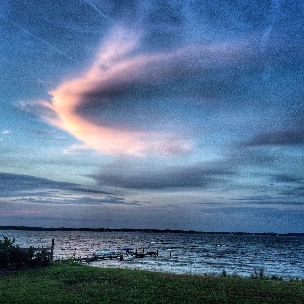
Sunset and Clouds Over Rappahanock River, VA

Beautiful Day on the Piankatank River Virginia 6:07 a.m. 4/17/16

Time to Head Home

This Morning. Godfrey Bay, Mathews County Virginia 5:40 a.m. 7/10/16
Godfrey Bay, Mathews County Virginia 7:33 p.m. 9/5/15

#Easter Sunrise

Gwynn's Island and Milford Haven, Mathews County Virginia 7:21 a.m. 9/6/15

After the Monsoon

Sturgeon Creek
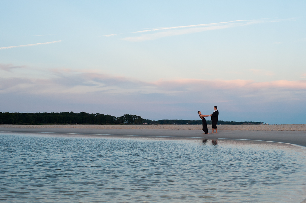
Marston Engagement Shoot

Sunset on Sturgeon Creek - Deltaville, VA

Dawn on Godfrey Bay

Sunday Sunrise

Storm Off Stingray Point

This Morning. Sunrise over Chesapeake Bay. Cobbs Creek Virginia 6:05 a.m. 7/23/16 #roadtrip

1986.12.15 Linda

Sunrise on the Bay

Private Beach, Sunrise at Westland Beach on the Rappahannock River in White Stone VA, a Digital Painting

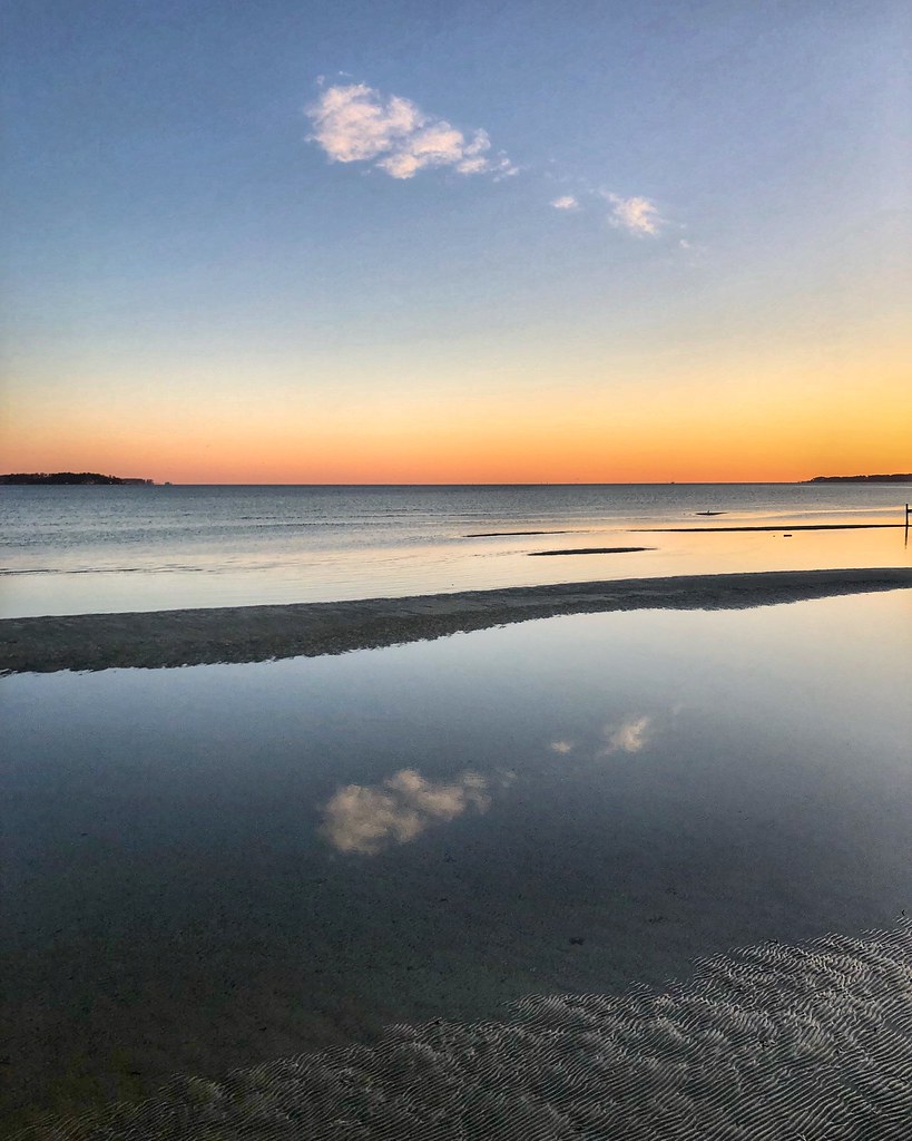
Sunrise Low Tide
Low Tide on the Piankatank River on the Western Edge of the Chesapeake Bay, Mathews County Virginia 7:04 a.m. Nov. 20, 2017

Sunrise from Crossrip, Deltaville, VA

Road ends at the Chesapeake

Rappahannock River Oyster Company in Middlesex County, Va.

Rappahannock River Oyster Company in Middlesex County, Va.

Rappahannock River Oyster Company in Middlesex County, Va.

Rappahannock River Oyster Company in Middlesex County, Va.
Windmill Point Rd, White Stone, VA アメリカ合衆国の地図
別の場所を検索
近所の場所
アメリカ合衆国 バージニア州 3
Windmill Point Rd, White Stone, VA アメリカ合衆国
Windmill Point Rd, White Stone, VA アメリカ合衆国
Windmill Point Rd, White Stone, VA アメリカ合衆国
Windmill Point Rd, White Stone, VA アメリカ合衆国
Windmill Point Rd, 3, VA アメリカ合衆国ウィンミル・ポイント・ロード
Windmill Point Rd, White Stone, VA アメリカ合衆国
Dameron Dr, White Stone, VA アメリカ合衆国Dameron Drive
27 Bay Dr, White Stone, VA アメリカ合衆国
アメリカ合衆国 〒 バージニア州 ホワイト・ストーン
Rappahannock Dr, White Stone, VA アメリカ合衆国
43 River Bluff Rd, White Stone, VA アメリカ合衆国
4, VA, アメリカ合衆国
アメリカ合衆国 〒 バージニア州 キルマーノック
93 Dividing Cove Ln, Kilmarnock, VA アメリカ合衆国
Broadway, Irvington, VA アメリカ合衆国
4, VA, アメリカ合衆国
アメリカ合衆国 〒 バージニア州 アービントン
Steamboat Rd, Irvington, VA アメリカ合衆国
33 Reynolds Landing, Irvington, VA アメリカ合衆国
最近の検索
- スイス 〒 メッツォヴィコ=ヴィラ日の出日の入り時間
- Dawa Gengzha, PPF6+WGM, Baoxing County, Yaan, Sichuan, China日の出日の入り時間
- Hickory Blvd, Bonita Springs, FL, USA日の出日の入り時間
- ナイジェリア 〒 ララグベン 2WWJ+4PJOgbosuware Health Centre日の出日の入り時間
- No. 6號, Kending Rd, Hengchun Township, Pingtung County, 台湾 墾丁凱撒大飯店(シーザーパークホテル墾丁)日の出日の入り時間
- エチオピア ハディヤ州日の出日の入り時間
- エチオピア ホサイナ日の出日の入り時間
- アルゼンチン ブエノスアイレス州 ネコチェア日の出日の入り時間
- Maxine St NE, Albuquerque, NM アメリカ合衆国日の出日の入り時間
- カンボジア Krong Bavet, CityManhattan Special Economic Zone日の出日の入り時間