US-89, Thayne, WY アメリカ合衆国日の出日の入り時間
Location: アメリカ合衆国 > ワイオミング州 > リンカーン > アメリカ合衆国 〒 ワイオミング州 テイン >
時間帯:
America/Denver
現地時間:
2024-05-05 12:17:42
経度:
-111.012691
緯度:
42.9522941
今日の日の出時刻:
06:09:53 AM
今日の日の入時刻:
08:31:20 PM
今日の日長:
14h 21m 27s
明日の日の出時刻:
06:08:39 AM
明日の日の入時刻:
08:32:27 PM
明日の日長:
14h 23m 48s
すべて表示する
| 日付 | 日出 | 日没 | 日長 |
|---|---|---|---|
| 2024年01月01日 | 07:55:08 AM | 05:00:38 PM | 9h 5m 30s |
| 2024年01月02日 | 07:55:10 AM | 05:01:32 PM | 9h 6m 22s |
| 2024年01月03日 | 07:55:10 AM | 05:02:28 PM | 9h 7m 18s |
| 2024年01月04日 | 07:55:06 AM | 05:03:25 PM | 9h 8m 19s |
| 2024年01月05日 | 07:55:01 AM | 05:04:24 PM | 9h 9m 23s |
| 2024年01月06日 | 07:54:53 AM | 05:05:25 PM | 9h 10m 32s |
| 2024年01月07日 | 07:54:42 AM | 05:06:26 PM | 9h 11m 44s |
| 2024年01月08日 | 07:54:29 AM | 05:07:30 PM | 9h 13m 1s |
| 2024年01月09日 | 07:54:14 AM | 05:08:34 PM | 9h 14m 20s |
| 2024年01月10日 | 07:53:57 AM | 05:09:40 PM | 9h 15m 43s |
| 2024年01月11日 | 07:53:36 AM | 05:10:47 PM | 9h 17m 11s |
| 2024年01月12日 | 07:53:14 AM | 05:11:55 PM | 9h 18m 41s |
| 2024年01月13日 | 07:52:49 AM | 05:13:05 PM | 9h 20m 16s |
| 2024年01月14日 | 07:52:22 AM | 05:14:15 PM | 9h 21m 53s |
| 2024年01月15日 | 07:51:53 AM | 05:15:26 PM | 9h 23m 33s |
| 2024年01月16日 | 07:51:21 AM | 05:16:38 PM | 9h 25m 17s |
| 2024年01月17日 | 07:50:47 AM | 05:17:52 PM | 9h 27m 5s |
| 2024年01月18日 | 07:50:11 AM | 05:19:05 PM | 9h 28m 54s |
| 2024年01月19日 | 07:49:32 AM | 05:20:20 PM | 9h 30m 48s |
| 2024年01月20日 | 07:48:52 AM | 05:21:35 PM | 9h 32m 43s |
| 2024年01月21日 | 07:48:09 AM | 05:22:51 PM | 9h 34m 42s |
| 2024年01月22日 | 07:47:24 AM | 05:24:08 PM | 9h 36m 44s |
| 2024年01月23日 | 07:46:37 AM | 05:25:25 PM | 9h 38m 48s |
| 2024年01月24日 | 07:45:48 AM | 05:26:43 PM | 9h 40m 55s |
| 2024年01月25日 | 07:44:57 AM | 05:28:01 PM | 9h 43m 4s |
| 2024年01月26日 | 07:44:04 AM | 05:29:19 PM | 9h 45m 15s |
| 2024年01月27日 | 07:43:09 AM | 05:30:38 PM | 9h 47m 29s |
| 2024年01月28日 | 07:42:12 AM | 05:31:57 PM | 9h 49m 45s |
| 2024年01月29日 | 07:41:13 AM | 05:33:16 PM | 9h 52m 3s |
| 2024年01月30日 | 07:40:12 AM | 05:34:36 PM | 9h 54m 24s |
| 2024年01月31日 | 07:39:10 AM | 05:35:55 PM | 9h 56m 45s |
| 2024年02月01日 | 07:38:06 AM | 05:37:15 PM | 9h 59m 9s |
| 2024年02月02日 | 07:37:00 AM | 05:38:35 PM | 10h 1m 35s |
| 2024年02月03日 | 07:35:52 AM | 05:39:55 PM | 10h 4m 3s |
| 2024年02月04日 | 07:34:43 AM | 05:41:15 PM | 10h 6m 32s |
| 2024年02月05日 | 07:33:32 AM | 05:42:35 PM | 10h 9m 3s |
| 2024年02月06日 | 07:32:19 AM | 05:43:55 PM | 10h 11m 36s |
| 2024年02月07日 | 07:31:05 AM | 05:45:15 PM | 10h 14m 10s |
| 2024年02月08日 | 07:29:50 AM | 05:46:35 PM | 10h 16m 45s |
| 2024年02月09日 | 07:28:33 AM | 05:47:55 PM | 10h 19m 22s |
| 2024年02月10日 | 07:27:14 AM | 05:49:15 PM | 10h 22m 1s |
| 2024年02月11日 | 07:25:54 AM | 05:50:34 PM | 10h 24m 40s |
| 2024年02月12日 | 07:24:33 AM | 05:51:54 PM | 10h 27m 21s |
| 2024年02月13日 | 07:23:11 AM | 05:53:13 PM | 10h 30m 2s |
| 2024年02月14日 | 07:21:47 AM | 05:54:32 PM | 10h 32m 45s |
| 2024年02月15日 | 07:20:22 AM | 05:55:50 PM | 10h 35m 28s |
| 2024年02月16日 | 07:18:56 AM | 05:57:09 PM | 10h 38m 13s |
| 2024年02月17日 | 07:17:28 AM | 05:58:27 PM | 10h 40m 59s |
| 2024年02月18日 | 07:16:00 AM | 05:59:45 PM | 10h 43m 45s |
| 2024年02月19日 | 07:14:30 AM | 06:01:03 PM | 10h 46m 33s |
| 2024年02月20日 | 07:13:00 AM | 06:02:21 PM | 10h 49m 21s |
| 2024年02月21日 | 07:11:28 AM | 06:03:38 PM | 10h 52m 10s |
| 2024年02月22日 | 07:09:55 AM | 06:04:55 PM | 10h 55m 0s |
| 2024年02月23日 | 07:08:22 AM | 06:06:11 PM | 10h 57m 49s |
| 2024年02月24日 | 07:06:48 AM | 06:07:28 PM | 11h 0m 40s |
| 2024年02月25日 | 07:05:12 AM | 06:08:44 PM | 11h 3m 32s |
| 2024年02月26日 | 07:03:36 AM | 06:10:00 PM | 11h 6m 24s |
| 2024年02月27日 | 07:01:59 AM | 06:11:15 PM | 11h 9m 16s |
| 2024年02月28日 | 07:00:21 AM | 06:12:30 PM | 11h 12m 9s |
| 2024年02月29日 | 06:58:43 AM | 06:13:45 PM | 11h 15m 2s |
| 2024年03月01日 | 06:57:04 AM | 06:15:00 PM | 11h 17m 56s |
| 2024年03月02日 | 06:55:24 AM | 06:16:14 PM | 11h 20m 50s |
| 2024年03月03日 | 06:53:44 AM | 06:17:28 PM | 11h 23m 44s |
| 2024年03月04日 | 06:52:03 AM | 06:18:42 PM | 11h 26m 39s |
| 2024年03月05日 | 06:50:21 AM | 06:19:56 PM | 11h 29m 35s |
| 2024年03月06日 | 06:48:39 AM | 06:21:09 PM | 11h 32m 30s |
| 2024年03月07日 | 06:46:56 AM | 06:22:22 PM | 11h 35m 26s |
| 2024年03月08日 | 06:45:13 AM | 06:23:35 PM | 11h 38m 22s |
| 2024年03月09日 | 06:43:30 AM | 06:24:47 PM | 11h 41m 17s |
| 2024年03月10日 | 07:41:50 AM | 07:25:57 PM | 11h 44m 7s |
| 2024年03月11日 | 07:40:06 AM | 07:27:09 PM | 11h 47m 3s |
| 2024年03月12日 | 07:38:21 AM | 07:28:20 PM | 11h 49m 59s |
| 2024年03月13日 | 07:36:37 AM | 07:29:32 PM | 11h 52m 55s |
| 2024年03月14日 | 07:34:51 AM | 07:30:44 PM | 11h 55m 53s |
| 2024年03月15日 | 07:33:06 AM | 07:31:55 PM | 11h 58m 49s |
| 2024年03月16日 | 07:31:20 AM | 07:33:06 PM | 12h 1m 46s |
| 2024年03月17日 | 07:29:35 AM | 07:34:17 PM | 12h 4m 42s |
| 2024年03月18日 | 07:27:49 AM | 07:35:27 PM | 12h 7m 38s |
| 2024年03月19日 | 07:26:03 AM | 07:36:38 PM | 12h 10m 35s |
| 2024年03月20日 | 07:24:17 AM | 07:37:48 PM | 12h 13m 31s |
| 2024年03月21日 | 07:22:30 AM | 07:38:59 PM | 12h 16m 29s |
| 2024年03月22日 | 07:20:44 AM | 07:40:09 PM | 12h 19m 25s |
| 2024年03月23日 | 07:18:58 AM | 07:41:19 PM | 12h 22m 21s |
| 2024年03月24日 | 07:17:12 AM | 07:42:29 PM | 12h 25m 17s |
| 2024年03月25日 | 07:15:26 AM | 07:43:39 PM | 12h 28m 13s |
| 2024年03月26日 | 07:13:40 AM | 07:44:48 PM | 12h 31m 8s |
| 2024年03月27日 | 07:11:54 AM | 07:45:58 PM | 12h 34m 4s |
| 2024年03月28日 | 07:10:08 AM | 07:47:08 PM | 12h 37m 0s |
| 2024年03月29日 | 07:08:23 AM | 07:48:17 PM | 12h 39m 54s |
| 2024年03月30日 | 07:06:38 AM | 07:49:27 PM | 12h 42m 49s |
| 2024年03月31日 | 07:04:52 AM | 07:50:36 PM | 12h 45m 44s |
| 2024年04月01日 | 07:03:08 AM | 07:51:46 PM | 12h 48m 38s |
| 2024年04月02日 | 07:01:23 AM | 07:52:55 PM | 12h 51m 32s |
| 2024年04月03日 | 06:59:39 AM | 07:54:04 PM | 12h 54m 25s |
| 2024年04月04日 | 06:57:56 AM | 07:55:14 PM | 12h 57m 18s |
| 2024年04月05日 | 06:56:12 AM | 07:56:23 PM | 13h 0m 11s |
| 2024年04月06日 | 06:54:29 AM | 07:57:33 PM | 13h 3m 4s |
| 2024年04月07日 | 06:52:47 AM | 07:58:42 PM | 13h 5m 55s |
| 2024年04月08日 | 06:51:05 AM | 07:59:51 PM | 13h 8m 46s |
| 2024年04月09日 | 06:49:24 AM | 08:01:01 PM | 13h 11m 37s |
| 2024年04月10日 | 06:47:43 AM | 08:02:10 PM | 13h 14m 27s |
| 2024年04月11日 | 06:46:03 AM | 08:03:19 PM | 13h 17m 16s |
| 2024年04月12日 | 06:44:23 AM | 08:04:29 PM | 13h 20m 6s |
| 2024年04月13日 | 06:42:45 AM | 08:05:38 PM | 13h 22m 53s |
| 2024年04月14日 | 06:41:06 AM | 08:06:47 PM | 13h 25m 41s |
| 2024年04月15日 | 06:39:29 AM | 08:07:57 PM | 13h 28m 28s |
| 2024年04月16日 | 06:37:52 AM | 08:09:06 PM | 13h 31m 14s |
| 2024年04月17日 | 06:36:16 AM | 08:10:15 PM | 13h 33m 59s |
| 2024年04月18日 | 06:34:41 AM | 08:11:25 PM | 13h 36m 44s |
| 2024年04月19日 | 06:33:07 AM | 08:12:34 PM | 13h 39m 27s |
| 2024年04月20日 | 06:31:34 AM | 08:13:43 PM | 13h 42m 9s |
| 2024年04月21日 | 06:30:01 AM | 08:14:53 PM | 13h 44m 52s |
| 2024年04月22日 | 06:28:30 AM | 08:16:02 PM | 13h 47m 32s |
| 2024年04月23日 | 06:26:59 AM | 08:17:11 PM | 13h 50m 12s |
| 2024年04月24日 | 06:25:30 AM | 08:18:20 PM | 13h 52m 50s |
| 2024年04月25日 | 06:24:02 AM | 08:19:29 PM | 13h 55m 27s |
| 2024年04月26日 | 06:22:34 AM | 08:20:38 PM | 13h 58m 4s |
| 2024年04月27日 | 06:21:08 AM | 08:21:47 PM | 14h 0m 39s |
| 2024年04月28日 | 06:19:43 AM | 08:22:56 PM | 14h 3m 13s |
| 2024年04月29日 | 06:18:19 AM | 08:24:05 PM | 14h 5m 46s |
| 2024年04月30日 | 06:16:57 AM | 08:25:13 PM | 14h 8m 16s |
| 2024年05月01日 | 06:15:36 AM | 08:26:21 PM | 14h 10m 45s |
| 2024年05月02日 | 06:14:16 AM | 08:27:29 PM | 14h 13m 13s |
| 2024年05月03日 | 06:12:57 AM | 08:28:37 PM | 14h 15m 40s |
| 2024年05月04日 | 06:11:40 AM | 08:29:45 PM | 14h 18m 5s |
| 2024年05月05日 | 06:10:24 AM | 08:30:52 PM | 14h 20m 28s |
| 2024年05月06日 | 06:09:09 AM | 08:31:59 PM | 14h 22m 50s |
| 2024年05月07日 | 06:07:56 AM | 08:33:06 PM | 14h 25m 10s |
| 2024年05月08日 | 06:06:45 AM | 08:34:12 PM | 14h 27m 27s |
| 2024年05月09日 | 06:05:35 AM | 08:35:18 PM | 14h 29m 43s |
| 2024年05月10日 | 06:04:27 AM | 08:36:23 PM | 14h 31m 56s |
| 2024年05月11日 | 06:03:20 AM | 08:37:28 PM | 14h 34m 8s |
| 2024年05月12日 | 06:02:15 AM | 08:38:33 PM | 14h 36m 18s |
| 2024年05月13日 | 06:01:11 AM | 08:39:37 PM | 14h 38m 26s |
| 2024年05月14日 | 06:00:09 AM | 08:40:41 PM | 14h 40m 32s |
| 2024年05月15日 | 05:59:09 AM | 08:41:43 PM | 14h 42m 34s |
| 2024年05月16日 | 05:58:11 AM | 08:42:46 PM | 14h 44m 35s |
| 2024年05月17日 | 05:57:14 AM | 08:43:47 PM | 14h 46m 33s |
| 2024年05月18日 | 05:56:20 AM | 08:44:48 PM | 14h 48m 28s |
| 2024年05月19日 | 05:55:27 AM | 08:45:48 PM | 14h 50m 21s |
| 2024年05月20日 | 05:54:36 AM | 08:46:47 PM | 14h 52m 11s |
| 2024年05月21日 | 05:53:47 AM | 08:47:46 PM | 14h 53m 59s |
| 2024年05月22日 | 05:52:59 AM | 08:48:43 PM | 14h 55m 44s |
| 2024年05月23日 | 05:52:14 AM | 08:49:40 PM | 14h 57m 26s |
| 2024年05月24日 | 05:51:31 AM | 08:50:36 PM | 14h 59m 5s |
| 2024年05月25日 | 05:50:50 AM | 08:51:30 PM | 15h 0m 40s |
| 2024年05月26日 | 05:50:10 AM | 08:52:24 PM | 15h 2m 14s |
| 2024年05月27日 | 05:49:33 AM | 08:53:16 PM | 15h 3m 43s |
| 2024年05月28日 | 05:48:58 AM | 08:54:07 PM | 15h 5m 9s |
| 2024年05月29日 | 05:48:25 AM | 08:54:58 PM | 15h 6m 33s |
| 2024年05月30日 | 05:47:54 AM | 08:55:46 PM | 15h 7m 52s |
| 2024年05月31日 | 05:47:25 AM | 08:56:34 PM | 15h 9m 9s |
| 2024年06月01日 | 05:46:58 AM | 08:57:20 PM | 15h 10m 22s |
| 2024年06月02日 | 05:46:34 AM | 08:58:05 PM | 15h 11m 31s |
| 2024年06月03日 | 05:46:11 AM | 08:58:48 PM | 15h 12m 37s |
| 2024年06月04日 | 05:45:51 AM | 08:59:30 PM | 15h 13m 39s |
| 2024年06月05日 | 05:45:32 AM | 09:00:10 PM | 15h 14m 38s |
| 2024年06月06日 | 05:45:16 AM | 09:00:49 PM | 15h 15m 33s |
| 2024年06月07日 | 05:45:02 AM | 09:01:26 PM | 15h 16m 24s |
| 2024年06月08日 | 05:44:51 AM | 09:02:01 PM | 15h 17m 10s |
| 2024年06月09日 | 05:44:41 AM | 09:02:35 PM | 15h 17m 54s |
| 2024年06月10日 | 05:44:33 AM | 09:03:07 PM | 15h 18m 34s |
| 2024年06月11日 | 05:44:28 AM | 09:03:37 PM | 15h 19m 9s |
| 2024年06月12日 | 05:44:25 AM | 09:04:05 PM | 15h 19m 40s |
| 2024年06月13日 | 05:44:24 AM | 09:04:32 PM | 15h 20m 8s |
| 2024年06月14日 | 05:44:25 AM | 09:04:57 PM | 15h 20m 32s |
| 2024年06月15日 | 05:44:28 AM | 09:05:19 PM | 15h 20m 51s |
| 2024年06月16日 | 05:44:34 AM | 09:05:40 PM | 15h 21m 6s |
| 2024年06月17日 | 05:44:41 AM | 09:05:59 PM | 15h 21m 18s |
| 2024年06月18日 | 05:44:50 AM | 09:06:16 PM | 15h 21m 26s |
| 2024年06月19日 | 05:45:02 AM | 09:06:30 PM | 15h 21m 28s |
| 2024年06月20日 | 05:45:15 AM | 09:06:43 PM | 15h 21m 28s |
| 2024年06月21日 | 05:45:31 AM | 09:06:53 PM | 15h 21m 22s |
| 2024年06月22日 | 05:45:48 AM | 09:07:02 PM | 15h 21m 14s |
| 2024年06月23日 | 05:46:07 AM | 09:07:08 PM | 15h 21m 1s |
| 2024年06月24日 | 05:46:29 AM | 09:07:12 PM | 15h 20m 43s |
| 2024年06月25日 | 05:46:52 AM | 09:07:14 PM | 15h 20m 22s |
| 2024年06月26日 | 05:47:17 AM | 09:07:14 PM | 15h 19m 57s |
| 2024年06月27日 | 05:47:44 AM | 09:07:12 PM | 15h 19m 28s |
| 2024年06月28日 | 05:48:12 AM | 09:07:08 PM | 15h 18m 56s |
| 2024年06月29日 | 05:48:42 AM | 09:07:01 PM | 15h 18m 19s |
| 2024年06月30日 | 05:49:14 AM | 09:06:52 PM | 15h 17m 38s |
| 2024年07月01日 | 05:49:48 AM | 09:06:41 PM | 15h 16m 53s |
| 2024年07月02日 | 05:50:23 AM | 09:06:28 PM | 15h 16m 5s |
| 2024年07月03日 | 05:51:00 AM | 09:06:12 PM | 15h 15m 12s |
| 2024年07月04日 | 05:51:38 AM | 09:05:54 PM | 15h 14m 16s |
| 2024年07月05日 | 05:52:18 AM | 09:05:34 PM | 15h 13m 16s |
| 2024年07月06日 | 05:52:59 AM | 09:05:12 PM | 15h 12m 13s |
| 2024年07月07日 | 05:53:42 AM | 09:04:48 PM | 15h 11m 6s |
| 2024年07月08日 | 05:54:26 AM | 09:04:22 PM | 15h 9m 56s |
| 2024年07月09日 | 05:55:11 AM | 09:03:53 PM | 15h 8m 42s |
| 2024年07月10日 | 05:55:57 AM | 09:03:22 PM | 15h 7m 25s |
| 2024年07月11日 | 05:56:45 AM | 09:02:50 PM | 15h 6m 5s |
| 2024年07月12日 | 05:57:34 AM | 09:02:15 PM | 15h 4m 41s |
| 2024年07月13日 | 05:58:24 AM | 09:01:38 PM | 15h 3m 14s |
| 2024年07月14日 | 05:59:15 AM | 09:00:59 PM | 15h 1m 44s |
| 2024年07月15日 | 06:00:07 AM | 09:00:17 PM | 15h 0m 10s |
| 2024年07月16日 | 06:01:00 AM | 08:59:34 PM | 14h 58m 34s |
| 2024年07月17日 | 06:01:54 AM | 08:58:49 PM | 14h 56m 55s |
| 2024年07月18日 | 06:02:49 AM | 08:58:02 PM | 14h 55m 13s |
| 2024年07月19日 | 06:03:44 AM | 08:57:13 PM | 14h 53m 29s |
| 2024年07月20日 | 06:04:41 AM | 08:56:22 PM | 14h 51m 41s |
| 2024年07月21日 | 06:05:38 AM | 08:55:29 PM | 14h 49m 51s |
| 2024年07月22日 | 06:06:36 AM | 08:54:34 PM | 14h 47m 58s |
| 2024年07月23日 | 06:07:34 AM | 08:53:37 PM | 14h 46m 3s |
| 2024年07月24日 | 06:08:34 AM | 08:52:39 PM | 14h 44m 5s |
| 2024年07月25日 | 06:09:34 AM | 08:51:38 PM | 14h 42m 4s |
| 2024年07月26日 | 06:10:34 AM | 08:50:36 PM | 14h 40m 2s |
| 2024年07月27日 | 06:11:35 AM | 08:49:33 PM | 14h 37m 58s |
| 2024年07月28日 | 06:12:36 AM | 08:48:27 PM | 14h 35m 51s |
| 2024年07月29日 | 06:13:38 AM | 08:47:20 PM | 14h 33m 42s |
| 2024年07月30日 | 06:14:40 AM | 08:46:11 PM | 14h 31m 31s |
| 2024年07月31日 | 06:15:43 AM | 08:45:01 PM | 14h 29m 18s |
| 2024年08月01日 | 06:16:46 AM | 08:43:49 PM | 14h 27m 3s |
| 2024年08月02日 | 06:17:49 AM | 08:42:36 PM | 14h 24m 47s |
| 2024年08月03日 | 06:18:53 AM | 08:41:21 PM | 14h 22m 28s |
| 2024年08月04日 | 06:19:57 AM | 08:40:04 PM | 14h 20m 7s |
| 2024年08月05日 | 06:21:01 AM | 08:38:46 PM | 14h 17m 45s |
| 2024年08月06日 | 06:22:05 AM | 08:37:27 PM | 14h 15m 22s |
| 2024年08月07日 | 06:23:09 AM | 08:36:07 PM | 14h 12m 58s |
| 2024年08月08日 | 06:24:14 AM | 08:34:45 PM | 14h 10m 31s |
| 2024年08月09日 | 06:25:19 AM | 08:33:22 PM | 14h 8m 3s |
| 2024年08月10日 | 06:26:24 AM | 08:31:57 PM | 14h 5m 33s |
| 2024年08月11日 | 06:27:29 AM | 08:30:31 PM | 14h 3m 2s |
| 2024年08月12日 | 06:28:34 AM | 08:29:05 PM | 14h 0m 31s |
| 2024年08月13日 | 06:29:39 AM | 08:27:37 PM | 13h 57m 58s |
| 2024年08月14日 | 06:30:44 AM | 08:26:07 PM | 13h 55m 23s |
| 2024年08月15日 | 06:31:49 AM | 08:24:37 PM | 13h 52m 48s |
| 2024年08月16日 | 06:32:55 AM | 08:23:06 PM | 13h 50m 11s |
| 2024年08月17日 | 06:34:00 AM | 08:21:34 PM | 13h 47m 34s |
| 2024年08月18日 | 06:35:05 AM | 08:20:00 PM | 13h 44m 55s |
| 2024年08月19日 | 06:36:10 AM | 08:18:26 PM | 13h 42m 16s |
| 2024年08月20日 | 06:37:16 AM | 08:16:51 PM | 13h 39m 35s |
| 2024年08月21日 | 06:38:21 AM | 08:15:15 PM | 13h 36m 54s |
| 2024年08月22日 | 06:39:26 AM | 08:13:38 PM | 13h 34m 12s |
| 2024年08月23日 | 06:40:32 AM | 08:12:00 PM | 13h 31m 28s |
| 2024年08月24日 | 06:41:37 AM | 08:10:22 PM | 13h 28m 45s |
| 2024年08月25日 | 06:42:42 AM | 08:08:42 PM | 13h 26m 0s |
| 2024年08月26日 | 06:43:47 AM | 08:07:02 PM | 13h 23m 15s |
| 2024年08月27日 | 06:44:52 AM | 08:05:22 PM | 13h 20m 30s |
| 2024年08月28日 | 06:45:57 AM | 08:03:40 PM | 13h 17m 43s |
| 2024年08月29日 | 06:47:02 AM | 08:01:58 PM | 13h 14m 56s |
| 2024年08月30日 | 06:48:07 AM | 08:00:16 PM | 13h 12m 9s |
| 2024年08月31日 | 06:49:12 AM | 07:58:33 PM | 13h 9m 21s |
| 2024年09月01日 | 06:50:17 AM | 07:56:49 PM | 13h 6m 32s |
| 2024年09月02日 | 06:51:22 AM | 07:55:05 PM | 13h 3m 43s |
| 2024年09月03日 | 06:52:27 AM | 07:53:20 PM | 13h 0m 53s |
| 2024年09月04日 | 06:53:32 AM | 07:51:35 PM | 12h 58m 3s |
| 2024年09月05日 | 06:54:36 AM | 07:49:49 PM | 12h 55m 13s |
| 2024年09月06日 | 06:55:41 AM | 07:48:03 PM | 12h 52m 22s |
| 2024年09月07日 | 06:56:46 AM | 07:46:17 PM | 12h 49m 31s |
| 2024年09月08日 | 06:57:51 AM | 07:44:30 PM | 12h 46m 39s |
| 2024年09月09日 | 06:58:56 AM | 07:42:44 PM | 12h 43m 48s |
| 2024年09月10日 | 07:00:01 AM | 07:40:56 PM | 12h 40m 55s |
| 2024年09月11日 | 07:01:06 AM | 07:39:09 PM | 12h 38m 3s |
| 2024年09月12日 | 07:02:10 AM | 07:37:21 PM | 12h 35m 11s |
| 2024年09月13日 | 07:03:15 AM | 07:35:34 PM | 12h 32m 19s |
| 2024年09月14日 | 07:04:21 AM | 07:33:46 PM | 12h 29m 25s |
| 2024年09月15日 | 07:05:26 AM | 07:31:58 PM | 12h 26m 32s |
| 2024年09月16日 | 07:06:31 AM | 07:30:09 PM | 12h 23m 38s |
| 2024年09月17日 | 07:07:36 AM | 07:28:21 PM | 12h 20m 45s |
| 2024年09月18日 | 07:08:42 AM | 07:26:33 PM | 12h 17m 51s |
| 2024年09月19日 | 07:09:47 AM | 07:24:45 PM | 12h 14m 58s |
| 2024年09月20日 | 07:10:53 AM | 07:22:57 PM | 12h 12m 4s |
| 2024年09月21日 | 07:11:59 AM | 07:21:09 PM | 12h 9m 10s |
| 2024年09月22日 | 07:13:04 AM | 07:19:21 PM | 12h 6m 17s |
| 2024年09月23日 | 07:14:11 AM | 07:17:33 PM | 12h 3m 22s |
| 2024年09月24日 | 07:15:17 AM | 07:15:45 PM | 12h 0m 28s |
| 2024年09月25日 | 07:16:23 AM | 07:13:58 PM | 11h 57m 35s |
| 2024年09月26日 | 07:17:30 AM | 07:12:10 PM | 11h 54m 40s |
| 2024年09月27日 | 07:18:37 AM | 07:10:23 PM | 11h 51m 46s |
| 2024年09月28日 | 07:19:44 AM | 07:08:37 PM | 11h 48m 53s |
| 2024年09月29日 | 07:20:51 AM | 07:06:50 PM | 11h 45m 59s |
| 2024年09月30日 | 07:21:58 AM | 07:05:04 PM | 11h 43m 6s |
| 2024年10月01日 | 07:23:06 AM | 07:03:18 PM | 11h 40m 12s |
| 2024年10月02日 | 07:24:14 AM | 07:01:33 PM | 11h 37m 19s |
| 2024年10月03日 | 07:25:22 AM | 06:59:48 PM | 11h 34m 26s |
| 2024年10月04日 | 07:26:31 AM | 06:58:04 PM | 11h 31m 33s |
| 2024年10月05日 | 07:27:39 AM | 06:56:20 PM | 11h 28m 41s |
| 2024年10月06日 | 07:28:48 AM | 06:54:36 PM | 11h 25m 48s |
| 2024年10月07日 | 07:29:58 AM | 06:52:53 PM | 11h 22m 55s |
| 2024年10月08日 | 07:31:07 AM | 06:51:11 PM | 11h 20m 4s |
| 2024年10月09日 | 07:32:17 AM | 06:49:29 PM | 11h 17m 12s |
| 2024年10月10日 | 07:33:27 AM | 06:47:49 PM | 11h 14m 22s |
| 2024年10月11日 | 07:34:38 AM | 06:46:08 PM | 11h 11m 30s |
| 2024年10月12日 | 07:35:49 AM | 06:44:29 PM | 11h 8m 40s |
| 2024年10月13日 | 07:37:00 AM | 06:42:50 PM | 11h 5m 50s |
| 2024年10月14日 | 07:38:11 AM | 06:41:12 PM | 11h 3m 1s |
| 2024年10月15日 | 07:39:23 AM | 06:39:35 PM | 11h 0m 12s |
| 2024年10月16日 | 07:40:35 AM | 06:37:59 PM | 10h 57m 24s |
| 2024年10月17日 | 07:41:48 AM | 06:36:23 PM | 10h 54m 35s |
| 2024年10月18日 | 07:43:00 AM | 06:34:49 PM | 10h 51m 49s |
| 2024年10月19日 | 07:44:13 AM | 06:33:15 PM | 10h 49m 2s |
| 2024年10月20日 | 07:45:27 AM | 06:31:43 PM | 10h 46m 16s |
| 2024年10月21日 | 07:46:40 AM | 06:30:11 PM | 10h 43m 31s |
| 2024年10月22日 | 07:47:54 AM | 06:28:41 PM | 10h 40m 47s |
| 2024年10月23日 | 07:49:08 AM | 06:27:12 PM | 10h 38m 4s |
| 2024年10月24日 | 07:50:23 AM | 06:25:44 PM | 10h 35m 21s |
| 2024年10月25日 | 07:51:38 AM | 06:24:17 PM | 10h 32m 39s |
| 2024年10月26日 | 07:52:53 AM | 06:22:51 PM | 10h 29m 58s |
| 2024年10月27日 | 07:54:08 AM | 06:21:27 PM | 10h 27m 19s |
| 2024年10月28日 | 07:55:23 AM | 06:20:04 PM | 10h 24m 41s |
| 2024年10月29日 | 07:56:39 AM | 06:18:42 PM | 10h 22m 3s |
| 2024年10月30日 | 07:57:55 AM | 06:17:22 PM | 10h 19m 27s |
| 2024年10月31日 | 07:59:11 AM | 06:16:03 PM | 10h 16m 52s |
| 2024年11月01日 | 08:00:27 AM | 06:14:45 PM | 10h 14m 18s |
| 2024年11月02日 | 08:01:43 AM | 06:13:29 PM | 10h 11m 46s |
| 2024年11月03日 | 07:03:03 AM | 05:12:12 PM | 10h 9m 9s |
| 2024年11月04日 | 07:04:20 AM | 05:10:59 PM | 10h 6m 39s |
| 2024年11月05日 | 07:05:36 AM | 05:09:47 PM | 10h 4m 11s |
| 2024年11月06日 | 07:06:53 AM | 05:08:38 PM | 10h 1m 45s |
| 2024年11月07日 | 07:08:09 AM | 05:07:30 PM | 9h 59m 21s |
| 2024年11月08日 | 07:09:26 AM | 05:06:24 PM | 9h 56m 58s |
| 2024年11月09日 | 07:10:42 AM | 05:05:19 PM | 9h 54m 37s |
| 2024年11月10日 | 07:11:59 AM | 05:04:17 PM | 9h 52m 18s |
| 2024年11月11日 | 07:13:15 AM | 05:03:16 PM | 9h 50m 1s |
| 2024年11月12日 | 07:14:31 AM | 05:02:17 PM | 9h 47m 46s |
| 2024年11月13日 | 07:15:47 AM | 05:01:20 PM | 9h 45m 33s |
| 2024年11月14日 | 07:17:03 AM | 05:00:25 PM | 9h 43m 22s |
| 2024年11月15日 | 07:18:18 AM | 04:59:32 PM | 9h 41m 14s |
| 2024年11月16日 | 07:19:33 AM | 04:58:41 PM | 9h 39m 8s |
| 2024年11月17日 | 07:20:47 AM | 04:57:52 PM | 9h 37m 5s |
| 2024年11月18日 | 07:22:02 AM | 04:57:06 PM | 9h 35m 4s |
| 2024年11月19日 | 07:23:15 AM | 04:56:21 PM | 9h 33m 6s |
| 2024年11月20日 | 07:24:28 AM | 04:55:38 PM | 9h 31m 10s |
| 2024年11月21日 | 07:25:41 AM | 04:54:58 PM | 9h 29m 17s |
| 2024年11月22日 | 07:26:52 AM | 04:54:20 PM | 9h 27m 28s |
| 2024年11月23日 | 07:28:03 AM | 04:53:44 PM | 9h 25m 41s |
| 2024年11月24日 | 07:29:14 AM | 04:53:10 PM | 9h 23m 56s |
| 2024年11月25日 | 07:30:23 AM | 04:52:39 PM | 9h 22m 16s |
| 2024年11月26日 | 07:31:32 AM | 04:52:10 PM | 9h 20m 38s |
| 2024年11月27日 | 07:32:40 AM | 04:51:43 PM | 9h 19m 3s |
| 2024年11月28日 | 07:33:46 AM | 04:51:19 PM | 9h 17m 33s |
| 2024年11月29日 | 07:34:52 AM | 04:50:57 PM | 9h 16m 5s |
| 2024年11月30日 | 07:35:57 AM | 04:50:38 PM | 9h 14m 41s |
| 2024年12月01日 | 07:37:00 AM | 04:50:21 PM | 9h 13m 21s |
| 2024年12月02日 | 07:38:02 AM | 04:50:06 PM | 9h 12m 4s |
| 2024年12月03日 | 07:39:03 AM | 04:49:54 PM | 9h 10m 51s |
| 2024年12月04日 | 07:40:02 AM | 04:49:44 PM | 9h 9m 42s |
| 2024年12月05日 | 07:41:00 AM | 04:49:37 PM | 9h 8m 37s |
| 2024年12月06日 | 07:41:57 AM | 04:49:32 PM | 9h 7m 35s |
| 2024年12月07日 | 07:42:52 AM | 04:49:30 PM | 9h 6m 38s |
| 2024年12月08日 | 07:43:46 AM | 04:49:30 PM | 9h 5m 44s |
| 2024年12月09日 | 07:44:37 AM | 04:49:33 PM | 9h 4m 56s |
| 2024年12月10日 | 07:45:28 AM | 04:49:38 PM | 9h 4m 10s |
| 2024年12月11日 | 07:46:16 AM | 04:49:46 PM | 9h 3m 30s |
| 2024年12月12日 | 07:47:03 AM | 04:49:56 PM | 9h 2m 53s |
| 2024年12月13日 | 07:47:47 AM | 04:50:09 PM | 9h 2m 22s |
| 2024年12月14日 | 07:48:30 AM | 04:50:24 PM | 9h 1m 54s |
| 2024年12月15日 | 07:49:11 AM | 04:50:41 PM | 9h 1m 30s |
| 2024年12月16日 | 07:49:50 AM | 04:51:01 PM | 9h 1m 11s |
| 2024年12月17日 | 07:50:27 AM | 04:51:23 PM | 9h 0m 56s |
| 2024年12月18日 | 07:51:01 AM | 04:51:48 PM | 9h 0m 47s |
| 2024年12月19日 | 07:51:34 AM | 04:52:15 PM | 9h 0m 41s |
| 2024年12月20日 | 07:52:04 AM | 04:52:44 PM | 9h 0m 40s |
| 2024年12月21日 | 07:52:33 AM | 04:53:15 PM | 9h 0m 42s |
| 2024年12月22日 | 07:52:59 AM | 04:53:49 PM | 9h 0m 50s |
| 2024年12月23日 | 07:53:22 AM | 04:54:25 PM | 9h 1m 3s |
| 2024年12月24日 | 07:53:44 AM | 04:55:03 PM | 9h 1m 19s |
| 2024年12月25日 | 07:54:03 AM | 04:55:43 PM | 9h 1m 40s |
| 2024年12月26日 | 07:54:20 AM | 04:56:25 PM | 9h 2m 5s |
| 2024年12月27日 | 07:54:34 AM | 04:57:10 PM | 9h 2m 36s |
| 2024年12月28日 | 07:54:46 AM | 04:57:56 PM | 9h 3m 10s |
| 2024年12月29日 | 07:54:56 AM | 04:58:44 PM | 9h 3m 48s |
| 2024年12月30日 | 07:55:03 AM | 04:59:34 PM | 9h 4m 31s |
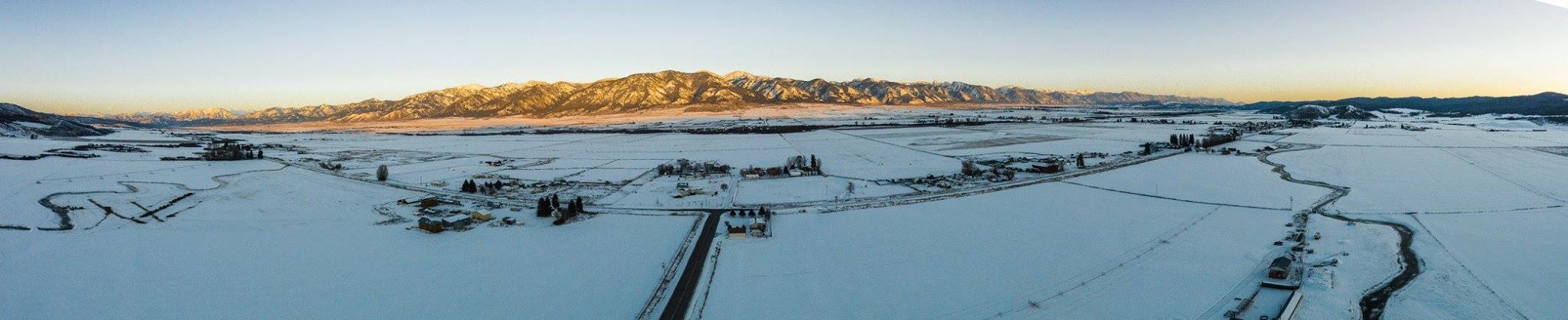
写真

Sunset Over The Caribou Range

Wyoming winter sunset

Wyoming winter sunset

Sunset purple
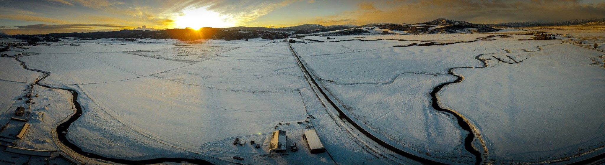
Panorama sunset

Sunset photo of the farm in winter.
The Salt River Range at Sunset

Sun setting over #flatcreek #Wyoming gorgeous and beautiful, feeling blessed at our #familyreunion
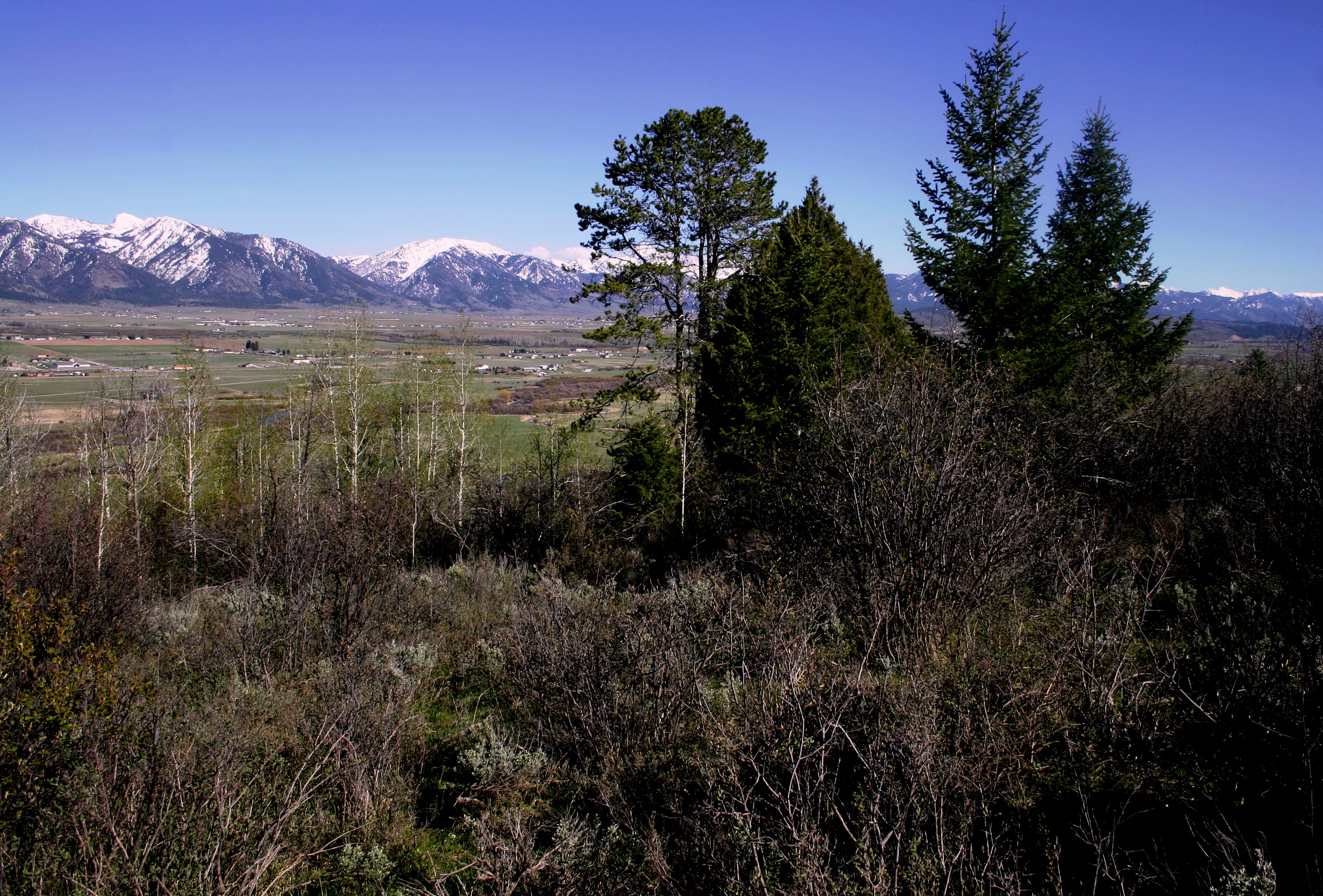
Above Star Valley

The Star Valley
US-89, Thayne, WY アメリカ合衆国の地図
別の場所を検索
近所の場所
Brambleberry Dr, Star Valley Ranch, WY アメリカ合衆国
Tumbleweed Ln, Thayne, WY アメリカ合衆国
アメリカ合衆国 〒 ワイオミング州 テイン
Weber Ln, Freedom, ID アメリカ合衆国
アメリカ合衆国 〒 ワイオミング州 スター・バレー・ランチ
47 Last Chance Cir, Star Valley Ranch, WY アメリカ合衆国
アメリカ合衆国 ワイオミング州 エトナ
Turnerville Rd, Bedford, WY アメリカ合衆国
County Rd, Thayne, WY アメリカ合衆国カウンティー・ロード
Swiming Pool Rd., Freedom, WY アメリカ合衆国Double L Ranch
アメリカ合衆国 ワイオミング州 グローバー
アメリカ合衆国 〒 ワイオミング州 アルパインブリッジ・キャンプグランド
アメリカ合衆国 〒 ワイオミング州 アルパイン
Bridger Teton National Forest, Forest Rd, Alpine, WY アメリカ合衆国マーフィー・クリーク・キャンプグランド
アメリカ合衆国 〒 ワイオミング州 グレイズ川
W Hills Dr, Afton, WY アメリカ合衆国
アメリカ合衆国 ワイオミング州 アルパイン・ノースウェスト
アメリカ合衆国 〒 ワイオミング州 アフトン
アメリカ合衆国 〒 ワイオミング州 アルパイン・ノースイースト
Bridger Teton National Forest, Forest Rd, Alpine, WY アメリカ合衆国ムース・フラット・キャンプグランド
最近の検索
- Presidente Quintana & Emilio Mitre, Carlos Keen, Provincia de Buenos Aires, Argentina日の出日の入り時間
- Deep Gap Farm Rd E, Mill Spring, NC, USA日の出日の入り時間
- 中華人民共和国 広東省 仏山市 南海区 九江鎮日の出日の入り時間
- アメリカ合衆国 〒 カリフォルニア州 マウンテンビュー日の出日の入り時間
- 日本、〒- 北海道斜里郡斜里町朱円東天に続く道展望台日の出日の入り時間
- 海岸咖啡, No. 31號, Chaishan Ave, Gushan District, Kaohsiung City, Taiwan日の出日の入り時間
- Estates Loop, Priest River, ID アメリカ合衆国日の出日の入り時間
- Woodland Oak Pl, Thousand Oaks, CA アメリカ合衆国日の出日の入り時間
- Sarangdanda ネパール日の出日の入り時間
- 日本、〒- 宮城県塩竈市中の島日の出日の入り時間