Teas Rd, Sugar Grove, VA アメリカ合衆国日の出日の入り時間
Location: アメリカ合衆国 > バージニア州 > スミス > アメリカ合衆国 バージニア州 ライ・バレー > アメリカ合衆国 〒 バージニア州 シュガー・グローブ >
時間帯:
America/New_York
現地時間:
2024-05-01 17:08:40
経度:
-81.4763643
緯度:
36.7719928
今日の日の出時刻:
06:29:42 AM
今日の日の入時刻:
08:15:54 PM
今日の日長:
13h 46m 12s
明日の日の出時刻:
06:28:37 AM
明日の日の入時刻:
08:16:46 PM
明日の日長:
13h 48m 9s
すべて表示する
| 日付 | 日出 | 日没 | 日長 |
|---|---|---|---|
| 2024年01月01日 | 07:38:33 AM | 05:20:47 PM | 9h 42m 14s |
| 2024年01月02日 | 07:38:41 AM | 05:21:35 PM | 9h 42m 54s |
| 2024年01月03日 | 07:38:47 AM | 05:22:24 PM | 9h 43m 37s |
| 2024年01月04日 | 07:38:51 AM | 05:23:15 PM | 9h 44m 24s |
| 2024年01月05日 | 07:38:52 AM | 05:24:06 PM | 9h 45m 14s |
| 2024年01月06日 | 07:38:52 AM | 05:24:59 PM | 9h 46m 7s |
| 2024年01月07日 | 07:38:50 AM | 05:25:53 PM | 9h 47m 3s |
| 2024年01月08日 | 07:38:46 AM | 05:26:48 PM | 9h 48m 2s |
| 2024年01月09日 | 07:38:40 AM | 05:27:43 PM | 9h 49m 3s |
| 2024年01月10日 | 07:38:31 AM | 05:28:40 PM | 9h 50m 9s |
| 2024年01月11日 | 07:38:21 AM | 05:29:37 PM | 9h 51m 16s |
| 2024年01月12日 | 07:38:09 AM | 05:30:36 PM | 9h 52m 27s |
| 2024年01月13日 | 07:37:55 AM | 05:31:34 PM | 9h 53m 39s |
| 2024年01月14日 | 07:37:38 AM | 05:32:34 PM | 9h 54m 56s |
| 2024年01月15日 | 07:37:20 AM | 05:33:34 PM | 9h 56m 14s |
| 2024年01月16日 | 07:37:00 AM | 05:34:35 PM | 9h 57m 35s |
| 2024年01月17日 | 07:36:38 AM | 05:35:37 PM | 9h 58m 59s |
| 2024年01月18日 | 07:36:14 AM | 05:36:39 PM | 10h 0m 25s |
| 2024年01月19日 | 07:35:48 AM | 05:37:41 PM | 10h 1m 53s |
| 2024年01月20日 | 07:35:20 AM | 05:38:44 PM | 10h 3m 24s |
| 2024年01月21日 | 07:34:50 AM | 05:39:47 PM | 10h 4m 57s |
| 2024年01月22日 | 07:34:18 AM | 05:40:51 PM | 10h 6m 33s |
| 2024年01月23日 | 07:33:45 AM | 05:41:55 PM | 10h 8m 10s |
| 2024年01月24日 | 07:33:10 AM | 05:42:59 PM | 10h 9m 49s |
| 2024年01月25日 | 07:32:33 AM | 05:44:03 PM | 10h 11m 30s |
| 2024年01月26日 | 07:31:54 AM | 05:45:08 PM | 10h 13m 14s |
| 2024年01月27日 | 07:31:13 AM | 05:46:12 PM | 10h 14m 59s |
| 2024年01月28日 | 07:30:31 AM | 05:47:17 PM | 10h 16m 46s |
| 2024年01月29日 | 07:29:47 AM | 05:48:22 PM | 10h 18m 35s |
| 2024年01月30日 | 07:29:01 AM | 05:49:27 PM | 10h 20m 26s |
| 2024年01月31日 | 07:28:14 AM | 05:50:32 PM | 10h 22m 18s |
| 2024年02月01日 | 07:27:25 AM | 05:51:36 PM | 10h 24m 11s |
| 2024年02月02日 | 07:26:34 AM | 05:52:41 PM | 10h 26m 7s |
| 2024年02月03日 | 07:25:42 AM | 05:53:46 PM | 10h 28m 4s |
| 2024年02月04日 | 07:24:49 AM | 05:54:50 PM | 10h 30m 1s |
| 2024年02月05日 | 07:23:54 AM | 05:55:55 PM | 10h 32m 1s |
| 2024年02月06日 | 07:22:57 AM | 05:56:59 PM | 10h 34m 2s |
| 2024年02月07日 | 07:21:59 AM | 05:58:03 PM | 10h 36m 4s |
| 2024年02月08日 | 07:21:00 AM | 05:59:07 PM | 10h 38m 7s |
| 2024年02月09日 | 07:19:59 AM | 06:00:11 PM | 10h 40m 12s |
| 2024年02月10日 | 07:18:57 AM | 06:01:14 PM | 10h 42m 17s |
| 2024年02月11日 | 07:17:54 AM | 06:02:18 PM | 10h 44m 24s |
| 2024年02月12日 | 07:16:49 AM | 06:03:21 PM | 10h 46m 32s |
| 2024年02月13日 | 07:15:43 AM | 06:04:23 PM | 10h 48m 40s |
| 2024年02月14日 | 07:14:36 AM | 06:05:26 PM | 10h 50m 50s |
| 2024年02月15日 | 07:13:28 AM | 06:06:28 PM | 10h 53m 0s |
| 2024年02月16日 | 07:12:19 AM | 06:07:30 PM | 10h 55m 11s |
| 2024年02月17日 | 07:11:08 AM | 06:08:31 PM | 10h 57m 23s |
| 2024年02月18日 | 07:09:57 AM | 06:09:33 PM | 10h 59m 36s |
| 2024年02月19日 | 07:08:44 AM | 06:10:34 PM | 11h 1m 50s |
| 2024年02月20日 | 07:07:31 AM | 06:11:34 PM | 11h 4m 3s |
| 2024年02月21日 | 07:06:16 AM | 06:12:34 PM | 11h 6m 18s |
| 2024年02月22日 | 07:05:01 AM | 06:13:34 PM | 11h 8m 33s |
| 2024年02月23日 | 07:03:45 AM | 06:14:34 PM | 11h 10m 49s |
| 2024年02月24日 | 07:02:28 AM | 06:15:33 PM | 11h 13m 5s |
| 2024年02月25日 | 07:01:10 AM | 06:16:32 PM | 11h 15m 22s |
| 2024年02月26日 | 06:59:51 AM | 06:17:31 PM | 11h 17m 40s |
| 2024年02月27日 | 06:58:31 AM | 06:18:29 PM | 11h 19m 58s |
| 2024年02月28日 | 06:57:11 AM | 06:19:27 PM | 11h 22m 16s |
| 2024年02月29日 | 06:55:50 AM | 06:20:25 PM | 11h 24m 35s |
| 2024年03月01日 | 06:54:28 AM | 06:21:23 PM | 11h 26m 55s |
| 2024年03月02日 | 06:53:06 AM | 06:22:20 PM | 11h 29m 14s |
| 2024年03月03日 | 06:51:43 AM | 06:23:16 PM | 11h 31m 33s |
| 2024年03月04日 | 06:50:19 AM | 06:24:13 PM | 11h 33m 54s |
| 2024年03月05日 | 06:48:55 AM | 06:25:09 PM | 11h 36m 14s |
| 2024年03月06日 | 06:47:30 AM | 06:26:05 PM | 11h 38m 35s |
| 2024年03月07日 | 06:46:05 AM | 06:27:01 PM | 11h 40m 56s |
| 2024年03月08日 | 06:44:40 AM | 06:27:56 PM | 11h 43m 16s |
| 2024年03月09日 | 06:43:13 AM | 06:28:51 PM | 11h 45m 38s |
| 2024年03月10日 | 07:41:51 AM | 07:29:44 PM | 11h 47m 53s |
| 2024年03月11日 | 07:40:24 AM | 07:30:39 PM | 11h 50m 15s |
| 2024年03月12日 | 07:38:57 AM | 07:31:33 PM | 11h 52m 36s |
| 2024年03月13日 | 07:37:29 AM | 07:32:27 PM | 11h 54m 58s |
| 2024年03月14日 | 07:36:02 AM | 07:33:21 PM | 11h 57m 19s |
| 2024年03月15日 | 07:34:34 AM | 07:34:15 PM | 11h 59m 41s |
| 2024年03月16日 | 07:33:06 AM | 07:35:09 PM | 12h 2m 3s |
| 2024年03月17日 | 07:31:37 AM | 07:36:02 PM | 12h 4m 25s |
| 2024年03月18日 | 07:30:09 AM | 07:36:56 PM | 12h 6m 47s |
| 2024年03月19日 | 07:28:40 AM | 07:37:49 PM | 12h 9m 9s |
| 2024年03月20日 | 07:27:12 AM | 07:38:42 PM | 12h 11m 30s |
| 2024年03月21日 | 07:25:43 AM | 07:39:35 PM | 12h 13m 52s |
| 2024年03月22日 | 07:24:14 AM | 07:40:27 PM | 12h 16m 13s |
| 2024年03月23日 | 07:22:45 AM | 07:41:20 PM | 12h 18m 35s |
| 2024年03月24日 | 07:21:17 AM | 07:42:13 PM | 12h 20m 56s |
| 2024年03月25日 | 07:19:48 AM | 07:43:05 PM | 12h 23m 17s |
| 2024年03月26日 | 07:18:19 AM | 07:43:58 PM | 12h 25m 39s |
| 2024年03月27日 | 07:16:51 AM | 07:44:50 PM | 12h 27m 59s |
| 2024年03月28日 | 07:15:22 AM | 07:45:42 PM | 12h 30m 20s |
| 2024年03月29日 | 07:13:54 AM | 07:46:34 PM | 12h 32m 40s |
| 2024年03月30日 | 07:12:26 AM | 07:47:27 PM | 12h 35m 1s |
| 2024年03月31日 | 07:10:58 AM | 07:48:19 PM | 12h 37m 21s |
| 2024年04月01日 | 07:09:31 AM | 07:49:11 PM | 12h 39m 40s |
| 2024年04月02日 | 07:08:04 AM | 07:50:03 PM | 12h 41m 59s |
| 2024年04月03日 | 07:06:37 AM | 07:50:55 PM | 12h 44m 18s |
| 2024年04月04日 | 07:05:10 AM | 07:51:47 PM | 12h 46m 37s |
| 2024年04月05日 | 07:03:44 AM | 07:52:40 PM | 12h 48m 56s |
| 2024年04月06日 | 07:02:18 AM | 07:53:32 PM | 12h 51m 14s |
| 2024年04月07日 | 07:00:53 AM | 07:54:24 PM | 12h 53m 31s |
| 2024年04月08日 | 06:59:28 AM | 07:55:16 PM | 12h 55m 48s |
| 2024年04月09日 | 06:58:04 AM | 07:56:08 PM | 12h 58m 4s |
| 2024年04月10日 | 06:56:40 AM | 07:57:01 PM | 13h 0m 21s |
| 2024年04月11日 | 06:55:17 AM | 07:57:53 PM | 13h 2m 36s |
| 2024年04月12日 | 06:53:54 AM | 07:58:45 PM | 13h 4m 51s |
| 2024年04月13日 | 06:52:32 AM | 07:59:38 PM | 13h 7m 6s |
| 2024年04月14日 | 06:51:11 AM | 08:00:30 PM | 13h 9m 19s |
| 2024年04月15日 | 06:49:50 AM | 08:01:23 PM | 13h 11m 33s |
| 2024年04月16日 | 06:48:30 AM | 08:02:15 PM | 13h 13m 45s |
| 2024年04月17日 | 06:47:11 AM | 08:03:08 PM | 13h 15m 57s |
| 2024年04月18日 | 06:45:52 AM | 08:04:01 PM | 13h 18m 9s |
| 2024年04月19日 | 06:44:34 AM | 08:04:53 PM | 13h 20m 19s |
| 2024年04月20日 | 06:43:17 AM | 08:05:46 PM | 13h 22m 29s |
| 2024年04月21日 | 06:42:01 AM | 08:06:39 PM | 13h 24m 38s |
| 2024年04月22日 | 06:40:46 AM | 08:07:32 PM | 13h 26m 46s |
| 2024年04月23日 | 06:39:32 AM | 08:08:25 PM | 13h 28m 53s |
| 2024年04月24日 | 06:38:19 AM | 08:09:18 PM | 13h 30m 59s |
| 2024年04月25日 | 06:37:06 AM | 08:10:11 PM | 13h 33m 5s |
| 2024年04月26日 | 06:35:55 AM | 08:11:03 PM | 13h 35m 8s |
| 2024年04月27日 | 06:34:45 AM | 08:11:56 PM | 13h 37m 11s |
| 2024年04月28日 | 06:33:35 AM | 08:12:49 PM | 13h 39m 14s |
| 2024年04月29日 | 06:32:27 AM | 08:13:42 PM | 13h 41m 15s |
| 2024年04月30日 | 06:31:20 AM | 08:14:35 PM | 13h 43m 15s |
| 2024年05月01日 | 06:30:14 AM | 08:15:27 PM | 13h 45m 13s |
| 2024年05月02日 | 06:29:09 AM | 08:16:20 PM | 13h 47m 11s |
| 2024年05月03日 | 06:28:06 AM | 08:17:13 PM | 13h 49m 7s |
| 2024年05月04日 | 06:27:03 AM | 08:18:05 PM | 13h 51m 2s |
| 2024年05月05日 | 06:26:02 AM | 08:18:57 PM | 13h 52m 55s |
| 2024年05月06日 | 06:25:03 AM | 08:19:50 PM | 13h 54m 47s |
| 2024年05月07日 | 06:24:04 AM | 08:20:42 PM | 13h 56m 38s |
| 2024年05月08日 | 06:23:07 AM | 08:21:33 PM | 13h 58m 26s |
| 2024年05月09日 | 06:22:11 AM | 08:22:25 PM | 14h 0m 14s |
| 2024年05月10日 | 06:21:17 AM | 08:23:16 PM | 14h 1m 59s |
| 2024年05月11日 | 06:20:24 AM | 08:24:07 PM | 14h 3m 43s |
| 2024年05月12日 | 06:19:32 AM | 08:24:58 PM | 14h 5m 26s |
| 2024年05月13日 | 06:18:42 AM | 08:25:49 PM | 14h 7m 7s |
| 2024年05月14日 | 06:17:53 AM | 08:26:39 PM | 14h 8m 46s |
| 2024年05月15日 | 06:17:06 AM | 08:27:28 PM | 14h 10m 22s |
| 2024年05月16日 | 06:16:21 AM | 08:28:18 PM | 14h 11m 57s |
| 2024年05月17日 | 06:15:37 AM | 08:29:07 PM | 14h 13m 30s |
| 2024年05月18日 | 06:14:54 AM | 08:29:55 PM | 14h 15m 1s |
| 2024年05月19日 | 06:14:13 AM | 08:30:43 PM | 14h 16m 30s |
| 2024年05月20日 | 06:13:34 AM | 08:31:31 PM | 14h 17m 57s |
| 2024年05月21日 | 06:12:56 AM | 08:32:17 PM | 14h 19m 21s |
| 2024年05月22日 | 06:12:20 AM | 08:33:04 PM | 14h 20m 44s |
| 2024年05月23日 | 06:11:46 AM | 08:33:49 PM | 14h 22m 3s |
| 2024年05月24日 | 06:11:13 AM | 08:34:34 PM | 14h 23m 21s |
| 2024年05月25日 | 06:10:42 AM | 08:35:18 PM | 14h 24m 36s |
| 2024年05月26日 | 06:10:13 AM | 08:36:02 PM | 14h 25m 49s |
| 2024年05月27日 | 06:09:45 AM | 08:36:45 PM | 14h 27m 0s |
| 2024年05月28日 | 06:09:19 AM | 08:37:26 PM | 14h 28m 7s |
| 2024年05月29日 | 06:08:55 AM | 08:38:07 PM | 14h 29m 12s |
| 2024年05月30日 | 06:08:32 AM | 08:38:47 PM | 14h 30m 15s |
| 2024年05月31日 | 06:08:12 AM | 08:39:27 PM | 14h 31m 15s |
| 2024年06月01日 | 06:07:53 AM | 08:40:05 PM | 14h 32m 12s |
| 2024年06月02日 | 06:07:35 AM | 08:40:42 PM | 14h 33m 7s |
| 2024年06月03日 | 06:07:20 AM | 08:41:18 PM | 14h 33m 58s |
| 2024年06月04日 | 06:07:06 AM | 08:41:53 PM | 14h 34m 47s |
| 2024年06月05日 | 06:06:54 AM | 08:42:27 PM | 14h 35m 33s |
| 2024年06月06日 | 06:06:44 AM | 08:43:00 PM | 14h 36m 16s |
| 2024年06月07日 | 06:06:35 AM | 08:43:32 PM | 14h 36m 57s |
| 2024年06月08日 | 06:06:29 AM | 08:44:02 PM | 14h 37m 33s |
| 2024年06月09日 | 06:06:23 AM | 08:44:31 PM | 14h 38m 8s |
| 2024年06月10日 | 06:06:20 AM | 08:44:59 PM | 14h 38m 39s |
| 2024年06月11日 | 06:06:19 AM | 08:45:25 PM | 14h 39m 6s |
| 2024年06月12日 | 06:06:19 AM | 08:45:50 PM | 14h 39m 31s |
| 2024年06月13日 | 06:06:20 AM | 08:46:14 PM | 14h 39m 54s |
| 2024年06月14日 | 06:06:24 AM | 08:46:36 PM | 14h 40m 12s |
| 2024年06月15日 | 06:06:29 AM | 08:46:57 PM | 14h 40m 28s |
| 2024年06月16日 | 06:06:36 AM | 08:47:16 PM | 14h 40m 40s |
| 2024年06月17日 | 06:06:44 AM | 08:47:34 PM | 14h 40m 50s |
| 2024年06月18日 | 06:06:54 AM | 08:47:50 PM | 14h 40m 56s |
| 2024年06月19日 | 06:07:06 AM | 08:48:05 PM | 14h 40m 59s |
| 2024年06月20日 | 06:07:19 AM | 08:48:18 PM | 14h 40m 59s |
| 2024年06月21日 | 06:07:33 AM | 08:48:29 PM | 14h 40m 56s |
| 2024年06月22日 | 06:07:50 AM | 08:48:39 PM | 14h 40m 49s |
| 2024年06月23日 | 06:08:07 AM | 08:48:47 PM | 14h 40m 40s |
| 2024年06月24日 | 06:08:26 AM | 08:48:53 PM | 14h 40m 27s |
| 2024年06月25日 | 06:08:47 AM | 08:48:58 PM | 14h 40m 11s |
| 2024年06月26日 | 06:09:09 AM | 08:49:01 PM | 14h 39m 52s |
| 2024年06月27日 | 06:09:32 AM | 08:49:02 PM | 14h 39m 30s |
| 2024年06月28日 | 06:09:57 AM | 08:49:02 PM | 14h 39m 5s |
| 2024年06月29日 | 06:10:23 AM | 08:48:59 PM | 14h 38m 36s |
| 2024年06月30日 | 06:10:50 AM | 08:48:55 PM | 14h 38m 5s |
| 2024年07月01日 | 06:11:18 AM | 08:48:49 PM | 14h 37m 31s |
| 2024年07月02日 | 06:11:48 AM | 08:48:42 PM | 14h 36m 54s |
| 2024年07月03日 | 06:12:18 AM | 08:48:33 PM | 14h 36m 15s |
| 2024年07月04日 | 06:12:50 AM | 08:48:21 PM | 14h 35m 31s |
| 2024年07月05日 | 06:13:23 AM | 08:48:08 PM | 14h 34m 45s |
| 2024年07月06日 | 06:13:57 AM | 08:47:54 PM | 14h 33m 57s |
| 2024年07月07日 | 06:14:32 AM | 08:47:37 PM | 14h 33m 5s |
| 2024年07月08日 | 06:15:08 AM | 08:47:19 PM | 14h 32m 11s |
| 2024年07月09日 | 06:15:45 AM | 08:46:59 PM | 14h 31m 14s |
| 2024年07月10日 | 06:16:23 AM | 08:46:37 PM | 14h 30m 14s |
| 2024年07月11日 | 06:17:01 AM | 08:46:13 PM | 14h 29m 12s |
| 2024年07月12日 | 06:17:41 AM | 08:45:48 PM | 14h 28m 7s |
| 2024年07月13日 | 06:18:21 AM | 08:45:21 PM | 14h 27m 0s |
| 2024年07月14日 | 06:19:02 AM | 08:44:52 PM | 14h 25m 50s |
| 2024年07月15日 | 06:19:44 AM | 08:44:21 PM | 14h 24m 37s |
| 2024年07月16日 | 06:20:26 AM | 08:43:49 PM | 14h 23m 23s |
| 2024年07月17日 | 06:21:09 AM | 08:43:15 PM | 14h 22m 6s |
| 2024年07月18日 | 06:21:53 AM | 08:42:39 PM | 14h 20m 46s |
| 2024年07月19日 | 06:22:37 AM | 08:42:02 PM | 14h 19m 25s |
| 2024年07月20日 | 06:23:22 AM | 08:41:22 PM | 14h 18m 0s |
| 2024年07月21日 | 06:24:07 AM | 08:40:42 PM | 14h 16m 35s |
| 2024年07月22日 | 06:24:53 AM | 08:39:59 PM | 14h 15m 6s |
| 2024年07月23日 | 06:25:39 AM | 08:39:15 PM | 14h 13m 36s |
| 2024年07月24日 | 06:26:25 AM | 08:38:30 PM | 14h 12m 5s |
| 2024年07月25日 | 06:27:12 AM | 08:37:43 PM | 14h 10m 31s |
| 2024年07月26日 | 06:27:59 AM | 08:36:54 PM | 14h 8m 55s |
| 2024年07月27日 | 06:28:47 AM | 08:36:04 PM | 14h 7m 17s |
| 2024年07月28日 | 06:29:34 AM | 08:35:12 PM | 14h 5m 38s |
| 2024年07月29日 | 06:30:23 AM | 08:34:19 PM | 14h 3m 56s |
| 2024年07月30日 | 06:31:11 AM | 08:33:24 PM | 14h 2m 13s |
| 2024年07月31日 | 06:31:59 AM | 08:32:28 PM | 14h 0m 29s |
| 2024年08月01日 | 06:32:48 AM | 08:31:31 PM | 13h 58m 43s |
| 2024年08月02日 | 06:33:37 AM | 08:30:32 PM | 13h 56m 55s |
| 2024年08月03日 | 06:34:26 AM | 08:29:32 PM | 13h 55m 6s |
| 2024年08月04日 | 06:35:15 AM | 08:28:31 PM | 13h 53m 16s |
| 2024年08月05日 | 06:36:04 AM | 08:27:28 PM | 13h 51m 24s |
| 2024年08月06日 | 06:36:53 AM | 08:26:24 PM | 13h 49m 31s |
| 2024年08月07日 | 06:37:43 AM | 08:25:19 PM | 13h 47m 36s |
| 2024年08月08日 | 06:38:32 AM | 08:24:12 PM | 13h 45m 40s |
| 2024年08月09日 | 06:39:21 AM | 08:23:05 PM | 13h 43m 44s |
| 2024年08月10日 | 06:40:11 AM | 08:21:56 PM | 13h 41m 45s |
| 2024年08月11日 | 06:41:00 AM | 08:20:46 PM | 13h 39m 46s |
| 2024年08月12日 | 06:41:50 AM | 08:19:35 PM | 13h 37m 45s |
| 2024年08月13日 | 06:42:39 AM | 08:18:23 PM | 13h 35m 44s |
| 2024年08月14日 | 06:43:28 AM | 08:17:10 PM | 13h 33m 42s |
| 2024年08月15日 | 06:44:18 AM | 08:15:56 PM | 13h 31m 38s |
| 2024年08月16日 | 06:45:07 AM | 08:14:41 PM | 13h 29m 34s |
| 2024年08月17日 | 06:45:56 AM | 08:13:25 PM | 13h 27m 29s |
| 2024年08月18日 | 06:46:45 AM | 08:12:08 PM | 13h 25m 23s |
| 2024年08月19日 | 06:47:34 AM | 08:10:50 PM | 13h 23m 16s |
| 2024年08月20日 | 06:48:23 AM | 08:09:31 PM | 13h 21m 8s |
| 2024年08月21日 | 06:49:12 AM | 08:08:12 PM | 13h 19m 0s |
| 2024年08月22日 | 06:50:01 AM | 08:06:51 PM | 13h 16m 50s |
| 2024年08月23日 | 06:50:50 AM | 08:05:30 PM | 13h 14m 40s |
| 2024年08月24日 | 06:51:38 AM | 08:04:08 PM | 13h 12m 30s |
| 2024年08月25日 | 06:52:27 AM | 08:02:46 PM | 13h 10m 19s |
| 2024年08月26日 | 06:53:15 AM | 08:01:23 PM | 13h 8m 8s |
| 2024年08月27日 | 06:54:04 AM | 07:59:59 PM | 13h 5m 55s |
| 2024年08月28日 | 06:54:52 AM | 07:58:34 PM | 13h 3m 42s |
| 2024年08月29日 | 06:55:40 AM | 07:57:09 PM | 13h 1m 29s |
| 2024年08月30日 | 06:56:28 AM | 07:55:43 PM | 12h 59m 15s |
| 2024年08月31日 | 06:57:17 AM | 07:54:17 PM | 12h 57m 0s |
| 2024年09月01日 | 06:58:05 AM | 07:52:50 PM | 12h 54m 45s |
| 2024年09月02日 | 06:58:53 AM | 07:51:23 PM | 12h 52m 30s |
| 2024年09月03日 | 06:59:41 AM | 07:49:55 PM | 12h 50m 14s |
| 2024年09月04日 | 07:00:29 AM | 07:48:27 PM | 12h 47m 58s |
| 2024年09月05日 | 07:01:16 AM | 07:46:59 PM | 12h 45m 43s |
| 2024年09月06日 | 07:02:04 AM | 07:45:30 PM | 12h 43m 26s |
| 2024年09月07日 | 07:02:52 AM | 07:44:00 PM | 12h 41m 8s |
| 2024年09月08日 | 07:03:40 AM | 07:42:31 PM | 12h 38m 51s |
| 2024年09月09日 | 07:04:28 AM | 07:41:01 PM | 12h 36m 33s |
| 2024年09月10日 | 07:05:16 AM | 07:39:31 PM | 12h 34m 15s |
| 2024年09月11日 | 07:06:03 AM | 07:38:01 PM | 12h 31m 58s |
| 2024年09月12日 | 07:06:51 AM | 07:36:30 PM | 12h 29m 39s |
| 2024年09月13日 | 07:07:39 AM | 07:34:59 PM | 12h 27m 20s |
| 2024年09月14日 | 07:08:27 AM | 07:33:29 PM | 12h 25m 2s |
| 2024年09月15日 | 07:09:15 AM | 07:31:58 PM | 12h 22m 43s |
| 2024年09月16日 | 07:10:03 AM | 07:30:27 PM | 12h 20m 24s |
| 2024年09月17日 | 07:10:51 AM | 07:28:56 PM | 12h 18m 5s |
| 2024年09月18日 | 07:11:40 AM | 07:27:25 PM | 12h 15m 45s |
| 2024年09月19日 | 07:12:28 AM | 07:25:54 PM | 12h 13m 26s |
| 2024年09月20日 | 07:13:17 AM | 07:24:23 PM | 12h 11m 6s |
| 2024年09月21日 | 07:14:05 AM | 07:22:52 PM | 12h 8m 47s |
| 2024年09月22日 | 07:14:54 AM | 07:21:21 PM | 12h 6m 27s |
| 2024年09月23日 | 07:15:43 AM | 07:19:50 PM | 12h 4m 7s |
| 2024年09月24日 | 07:16:32 AM | 07:18:20 PM | 12h 1m 48s |
| 2024年09月25日 | 07:17:21 AM | 07:16:49 PM | 11h 59m 28s |
| 2024年09月26日 | 07:18:10 AM | 07:15:19 PM | 11h 57m 9s |
| 2024年09月27日 | 07:19:00 AM | 07:13:49 PM | 11h 54m 49s |
| 2024年09月28日 | 07:19:50 AM | 07:12:19 PM | 11h 52m 29s |
| 2024年09月29日 | 07:20:40 AM | 07:10:50 PM | 11h 50m 10s |
| 2024年09月30日 | 07:21:30 AM | 07:09:21 PM | 11h 47m 51s |
| 2024年10月01日 | 07:22:21 AM | 07:07:52 PM | 11h 45m 31s |
| 2024年10月02日 | 07:23:12 AM | 07:06:24 PM | 11h 43m 12s |
| 2024年10月03日 | 07:24:03 AM | 07:04:56 PM | 11h 40m 53s |
| 2024年10月04日 | 07:24:54 AM | 07:03:29 PM | 11h 38m 35s |
| 2024年10月05日 | 07:25:45 AM | 07:02:02 PM | 11h 36m 17s |
| 2024年10月06日 | 07:26:37 AM | 07:00:36 PM | 11h 33m 59s |
| 2024年10月07日 | 07:27:29 AM | 06:59:10 PM | 11h 31m 41s |
| 2024年10月08日 | 07:28:22 AM | 06:57:44 PM | 11h 29m 22s |
| 2024年10月09日 | 07:29:15 AM | 06:56:20 PM | 11h 27m 5s |
| 2024年10月10日 | 07:30:08 AM | 06:54:56 PM | 11h 24m 48s |
| 2024年10月11日 | 07:31:01 AM | 06:53:32 PM | 11h 22m 31s |
| 2024年10月12日 | 07:31:55 AM | 06:52:10 PM | 11h 20m 15s |
| 2024年10月13日 | 07:32:49 AM | 06:50:48 PM | 11h 17m 59s |
| 2024年10月14日 | 07:33:44 AM | 06:49:27 PM | 11h 15m 43s |
| 2024年10月15日 | 07:34:38 AM | 06:48:06 PM | 11h 13m 28s |
| 2024年10月16日 | 07:35:34 AM | 06:46:47 PM | 11h 11m 13s |
| 2024年10月17日 | 07:36:29 AM | 06:45:28 PM | 11h 8m 59s |
| 2024年10月18日 | 07:37:25 AM | 06:44:10 PM | 11h 6m 45s |
| 2024年10月19日 | 07:38:21 AM | 06:42:53 PM | 11h 4m 32s |
| 2024年10月20日 | 07:39:18 AM | 06:41:37 PM | 11h 2m 19s |
| 2024年10月21日 | 07:40:15 AM | 06:40:22 PM | 11h 0m 7s |
| 2024年10月22日 | 07:41:12 AM | 06:39:09 PM | 10h 57m 57s |
| 2024年10月23日 | 07:42:09 AM | 06:37:56 PM | 10h 55m 47s |
| 2024年10月24日 | 07:43:07 AM | 06:36:44 PM | 10h 53m 37s |
| 2024年10月25日 | 07:44:06 AM | 06:35:33 PM | 10h 51m 27s |
| 2024年10月26日 | 07:45:04 AM | 06:34:24 PM | 10h 49m 20s |
| 2024年10月27日 | 07:46:03 AM | 06:33:15 PM | 10h 47m 12s |
| 2024年10月28日 | 07:47:02 AM | 06:32:08 PM | 10h 45m 6s |
| 2024年10月29日 | 07:48:02 AM | 06:31:02 PM | 10h 43m 0s |
| 2024年10月30日 | 07:49:02 AM | 06:29:58 PM | 10h 40m 56s |
| 2024年10月31日 | 07:50:02 AM | 06:28:55 PM | 10h 38m 53s |
| 2024年11月01日 | 07:51:02 AM | 06:27:53 PM | 10h 36m 51s |
| 2024年11月02日 | 07:52:03 AM | 06:26:52 PM | 10h 34m 49s |
| 2024年11月03日 | 06:53:06 AM | 05:25:51 PM | 10h 32m 45s |
| 2024年11月04日 | 06:54:07 AM | 05:24:53 PM | 10h 30m 46s |
| 2024年11月05日 | 06:55:08 AM | 05:23:57 PM | 10h 28m 49s |
| 2024年11月06日 | 06:56:10 AM | 05:23:02 PM | 10h 26m 52s |
| 2024年11月07日 | 06:57:11 AM | 05:22:09 PM | 10h 24m 58s |
| 2024年11月08日 | 06:58:13 AM | 05:21:18 PM | 10h 23m 5s |
| 2024年11月09日 | 06:59:15 AM | 05:20:28 PM | 10h 21m 13s |
| 2024年11月10日 | 07:00:16 AM | 05:19:39 PM | 10h 19m 23s |
| 2024年11月11日 | 07:01:18 AM | 05:18:53 PM | 10h 17m 35s |
| 2024年11月12日 | 07:02:20 AM | 05:18:08 PM | 10h 15m 48s |
| 2024年11月13日 | 07:03:22 AM | 05:17:25 PM | 10h 14m 3s |
| 2024年11月14日 | 07:04:24 AM | 05:16:43 PM | 10h 12m 19s |
| 2024年11月15日 | 07:05:26 AM | 05:16:03 PM | 10h 10m 37s |
| 2024年11月16日 | 07:06:27 AM | 05:15:26 PM | 10h 8m 59s |
| 2024年11月17日 | 07:07:29 AM | 05:14:49 PM | 10h 7m 20s |
| 2024年11月18日 | 07:08:30 AM | 05:14:15 PM | 10h 5m 45s |
| 2024年11月19日 | 07:09:31 AM | 05:13:43 PM | 10h 4m 12s |
| 2024年11月20日 | 07:10:32 AM | 05:13:12 PM | 10h 2m 40s |
| 2024年11月21日 | 07:11:32 AM | 05:12:44 PM | 10h 1m 12s |
| 2024年11月22日 | 07:12:32 AM | 05:12:17 PM | 9h 59m 45s |
| 2024年11月23日 | 07:13:32 AM | 05:11:52 PM | 9h 58m 20s |
| 2024年11月24日 | 07:14:31 AM | 05:11:30 PM | 9h 56m 59s |
| 2024年11月25日 | 07:15:30 AM | 05:11:09 PM | 9h 55m 39s |
| 2024年11月26日 | 07:16:28 AM | 05:10:50 PM | 9h 54m 22s |
| 2024年11月27日 | 07:17:25 AM | 05:10:33 PM | 9h 53m 8s |
| 2024年11月28日 | 07:18:22 AM | 05:10:19 PM | 9h 51m 57s |
| 2024年11月29日 | 07:19:18 AM | 05:10:06 PM | 9h 50m 48s |
| 2024年11月30日 | 07:20:14 AM | 05:09:55 PM | 9h 49m 41s |
| 2024年12月01日 | 07:21:09 AM | 05:09:47 PM | 9h 48m 38s |
| 2024年12月02日 | 07:22:02 AM | 05:09:40 PM | 9h 47m 38s |
| 2024年12月03日 | 07:22:55 AM | 05:09:36 PM | 9h 46m 41s |
| 2024年12月04日 | 07:23:48 AM | 05:09:33 PM | 9h 45m 45s |
| 2024年12月05日 | 07:24:39 AM | 05:09:33 PM | 9h 44m 54s |
| 2024年12月06日 | 07:25:29 AM | 05:09:35 PM | 9h 44m 6s |
| 2024年12月07日 | 07:26:18 AM | 05:09:38 PM | 9h 43m 20s |
| 2024年12月08日 | 07:27:05 AM | 05:09:44 PM | 9h 42m 39s |
| 2024年12月09日 | 07:27:52 AM | 05:09:52 PM | 9h 42m 0s |
| 2024年12月10日 | 07:28:37 AM | 05:10:02 PM | 9h 41m 25s |
| 2024年12月11日 | 07:29:22 AM | 05:10:14 PM | 9h 40m 52s |
| 2024年12月12日 | 07:30:04 AM | 05:10:28 PM | 9h 40m 24s |
| 2024年12月13日 | 07:30:46 AM | 05:10:43 PM | 9h 39m 57s |
| 2024年12月14日 | 07:31:26 AM | 05:11:01 PM | 9h 39m 35s |
| 2024年12月15日 | 07:32:04 AM | 05:11:21 PM | 9h 39m 17s |
| 2024年12月16日 | 07:32:41 AM | 05:11:43 PM | 9h 39m 2s |
| 2024年12月17日 | 07:33:17 AM | 05:12:06 PM | 9h 38m 49s |
| 2024年12月18日 | 07:33:51 AM | 05:12:32 PM | 9h 38m 41s |
| 2024年12月19日 | 07:34:23 AM | 05:12:59 PM | 9h 38m 36s |
| 2024年12月20日 | 07:34:53 AM | 05:13:28 PM | 9h 38m 35s |
| 2024年12月21日 | 07:35:22 AM | 05:13:59 PM | 9h 38m 37s |
| 2024年12月22日 | 07:35:49 AM | 05:14:31 PM | 9h 38m 42s |
| 2024年12月23日 | 07:36:15 AM | 05:15:05 PM | 9h 38m 50s |
| 2024年12月24日 | 07:36:38 AM | 05:15:41 PM | 9h 39m 3s |
| 2024年12月25日 | 07:37:00 AM | 05:16:19 PM | 9h 39m 19s |
| 2024年12月26日 | 07:37:20 AM | 05:16:58 PM | 9h 39m 38s |
| 2024年12月27日 | 07:37:38 AM | 05:17:39 PM | 9h 40m 1s |
| 2024年12月28日 | 07:37:54 AM | 05:18:21 PM | 9h 40m 27s |
| 2024年12月29日 | 07:38:08 AM | 05:19:04 PM | 9h 40m 56s |
| 2024年12月30日 | 07:38:20 AM | 05:19:49 PM | 9h 41m 29s |
写真

Wilburn Ridge Sunset

Wilburn Ridge Sunrise

Tough Times

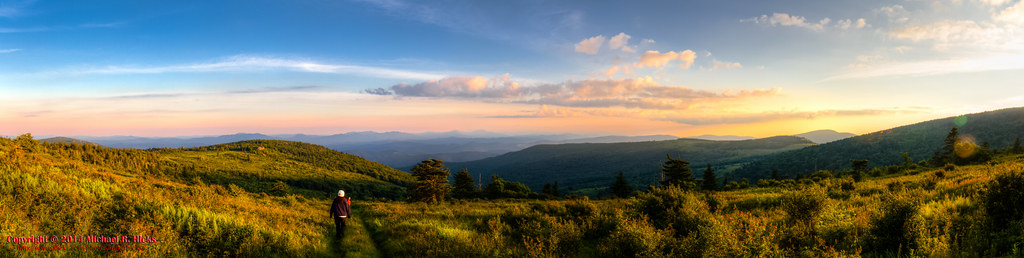
Wilburn Ridge Pano

Grayson Highlands Sunset
Mt Rogers Backpack - On the AT - Golden Hour at Thomas Knob - July 5, 2014

Wilburn Ridge Sunset

Nuclear Blast

Sunset from Pine Mountain

Starry Starry Evening

Mt Rogers Sunset

Sunset Over Mt Rogers

An Evening at Hungry Mother

Lincoln Theater- Marion VA

Mountain pony

Lookg for food

Highland Pony

The end of the day

Skulls Gap Overlook

grayson hiker sunset

First day of Spring

Wilburn Ridge Trail

Morning on Wilburn Ridge

Mt Rogers Backpack - Sunrise on Thomas Knob - July 6, 2014

Mount Rogers Sunrise 1

Fabio and the sunrise

Wilburn Ridge

Harvest Moon

Mt Rogers Backpack Day 3 - Sunrise on Rhododendron Gap

Mt Rogers Backpack Day 3 - Sunrise on Rhododendron Gap

Mt Rogers Backpack Day 3 - Sunrise on Rhododendron Gap
Mount Rogers Sunrise 3

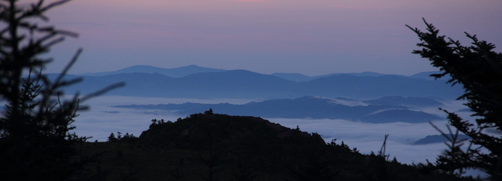
Mount Rogers Summit through sunrise fog

sunrise pony foal

sunrise over Wilburn Ridge

Mount Rogers Sunrise 4

Havin' trouble waking up...

Sunrise, Thomas Knob

Mt Rogers Backpack Day 3 - Sunrise on Rhododendron Gap
Teas Rd, Sugar Grove, VA アメリカ合衆国の地図
別の場所を検索
近所の場所
Slab Town Rd, Sugar Grove, VA アメリカ合衆国
アメリカ合衆国 バージニア州 ライ・バレー
Sand Mines Rd, Sugar Grove, VA アメリカ合衆国
アメリカ合衆国 バージニア州 ロイヤル・オーク
Solar Ln, Marion, VA アメリカ合衆国
S Fork Rd, Marion, VA アメリカ合衆国
Dry Run, Marion, VA アメリカ合衆国
Sugar Grove Hwy, Sugar Grove, VA アメリカ合衆国ラクーン・ブランチ・キャンプグランド
Pleasant Valley Rd, Marion, VA アメリカ合衆国Pleasant Valley Road
アメリカ合衆国 〒 バージニア州 シュガー・グローブ
Spruce St, Marion, VA アメリカ合衆国Spruce Street
Henderson St, Marion, VA アメリカ合衆国
Scratch Gravel Rd, Virginia アメリカ合衆国スクラッチ・グラベル・ロード
E Main St, Marion, VA アメリカ合衆国
S Fork Rd, Marion, VA アメリカ合衆国South Fork Road
アメリカ合衆国 〒 バージニア州 マリオン
Flat Ridge Rd, Sugar Grove, VA アメリカ合衆国
N Main St, Marion, VA アメリカ合衆国
Sage Dr, Marion, VA アメリカ合衆国
Chatham Hill Rd, Marion, VA アメリカ合衆国
最近の検索
- 6 Rue Jules Ferry, Beausoleil, France日の出日の入り時間
- スペイン 〒 ビスカヤ オチャンディオ日の出日の入り時間
- Sattva Horizon, 4JC6+G9P, Vinayak Nagar, Kattigenahalli, Bengaluru, Karnataka, India日の出日の入り時間
- 日本、〒- 静岡県富士宮市北山富士山日の出日の入り時間
- Laurel Rd, Townsend, TN アメリカ合衆国日の出日の入り時間
- 中華人民共和国 Guang Dong Sheng, Shen Zhen Shi, Long Gang Qu, 海滨南路GFPQ+R9Q 海浜南路日の出日の入り時間
- Redondo Ave, Long Beach, CA アメリカ合衆国日の出日の入り時間
- Ulitsa Kalinina, 79, Rezh, Sverdlovskaya oblast', ロシア日の出日の入り時間
- Leguwa ネパール日の出日の入り時間
- Shustino, Vladimir Oblast, ロシア日の出日の入り時間