アメリカ合衆国 ユタ州 セント・ジョージ, UT日の出日の入り時間
Location: アメリカ合衆国 > ユタ州 > ワシントン >
時間帯:
America/Denver
現地時間:
2024-04-26 03:39:27
経度:
-113.4776098
緯度:
37.3224877
今日の日の出時刻:
06:43:30 AM
今日の日の入時刻:
08:19:36 PM
今日の日長:
13h 36m 6s
明日の日の出時刻:
06:42:18 AM
明日の日の入時刻:
08:20:31 PM
明日の日長:
13h 38m 13s
すべて表示する
| 日付 | 日出 | 日没 | 日長 |
|---|---|---|---|
| 2024年01月01日 | 07:48:05 AM | 05:27:26 PM | 9h 39m 21s |
| 2024年01月02日 | 07:48:12 AM | 05:28:15 PM | 9h 40m 3s |
| 2024年01月03日 | 07:48:17 AM | 05:29:05 PM | 9h 40m 48s |
| 2024年01月04日 | 07:48:20 AM | 05:29:56 PM | 9h 41m 36s |
| 2024年01月05日 | 07:48:21 AM | 05:30:48 PM | 9h 42m 27s |
| 2024年01月06日 | 07:48:19 AM | 05:31:41 PM | 9h 43m 22s |
| 2024年01月07日 | 07:48:16 AM | 05:32:36 PM | 9h 44m 20s |
| 2024年01月08日 | 07:48:11 AM | 05:33:32 PM | 9h 45m 21s |
| 2024年01月09日 | 07:48:04 AM | 05:34:28 PM | 9h 46m 24s |
| 2024年01月10日 | 07:47:54 AM | 05:35:26 PM | 9h 47m 32s |
| 2024年01月11日 | 07:47:43 AM | 05:36:24 PM | 9h 48m 41s |
| 2024年01月12日 | 07:47:30 AM | 05:37:23 PM | 9h 49m 53s |
| 2024年01月13日 | 07:47:14 AM | 05:38:23 PM | 9h 51m 9s |
| 2024年01月14日 | 07:46:57 AM | 05:39:24 PM | 9h 52m 27s |
| 2024年01月15日 | 07:46:38 AM | 05:40:25 PM | 9h 53m 47s |
| 2024年01月16日 | 07:46:16 AM | 05:41:27 PM | 9h 55m 11s |
| 2024年01月17日 | 07:45:53 AM | 05:42:29 PM | 9h 56m 36s |
| 2024年01月18日 | 07:45:27 AM | 05:43:32 PM | 9h 58m 5s |
| 2024年01月19日 | 07:45:00 AM | 05:44:36 PM | 9h 59m 36s |
| 2024年01月20日 | 07:44:31 AM | 05:45:40 PM | 10h 1m 9s |
| 2024年01月21日 | 07:44:00 AM | 05:46:44 PM | 10h 2m 44s |
| 2024年01月22日 | 07:43:27 AM | 05:47:49 PM | 10h 4m 22s |
| 2024年01月23日 | 07:42:52 AM | 05:48:54 PM | 10h 6m 2s |
| 2024年01月24日 | 07:42:15 AM | 05:49:59 PM | 10h 7m 44s |
| 2024年01月25日 | 07:41:37 AM | 05:51:04 PM | 10h 9m 27s |
| 2024年01月26日 | 07:40:56 AM | 05:52:10 PM | 10h 11m 14s |
| 2024年01月27日 | 07:40:14 AM | 05:53:16 PM | 10h 13m 2s |
| 2024年01月28日 | 07:39:31 AM | 05:54:22 PM | 10h 14m 51s |
| 2024年01月29日 | 07:38:45 AM | 05:55:28 PM | 10h 16m 43s |
| 2024年01月30日 | 07:37:58 AM | 05:56:34 PM | 10h 18m 36s |
| 2024年01月31日 | 07:37:09 AM | 05:57:40 PM | 10h 20m 31s |
| 2024年02月01日 | 07:36:19 AM | 05:58:46 PM | 10h 22m 27s |
| 2024年02月02日 | 07:35:27 AM | 05:59:52 PM | 10h 24m 25s |
| 2024年02月03日 | 07:34:33 AM | 06:00:57 PM | 10h 26m 24s |
| 2024年02月04日 | 07:33:38 AM | 06:02:03 PM | 10h 28m 25s |
| 2024年02月05日 | 07:32:42 AM | 06:03:09 PM | 10h 30m 27s |
| 2024年02月06日 | 07:31:43 AM | 06:04:14 PM | 10h 32m 31s |
| 2024年02月07日 | 07:30:44 AM | 06:05:20 PM | 10h 34m 36s |
| 2024年02月08日 | 07:29:43 AM | 06:06:25 PM | 10h 36m 42s |
| 2024年02月09日 | 07:28:41 AM | 06:07:30 PM | 10h 38m 49s |
| 2024年02月10日 | 07:27:37 AM | 06:08:35 PM | 10h 40m 58s |
| 2024年02月11日 | 07:26:32 AM | 06:09:39 PM | 10h 43m 7s |
| 2024年02月12日 | 07:25:26 AM | 06:10:44 PM | 10h 45m 18s |
| 2024年02月13日 | 07:24:19 AM | 06:11:48 PM | 10h 47m 29s |
| 2024年02月14日 | 07:23:10 AM | 06:12:51 PM | 10h 49m 41s |
| 2024年02月15日 | 07:22:01 AM | 06:13:55 PM | 10h 51m 54s |
| 2024年02月16日 | 07:20:50 AM | 06:14:58 PM | 10h 54m 8s |
| 2024年02月17日 | 07:19:38 AM | 06:16:01 PM | 10h 56m 23s |
| 2024年02月18日 | 07:18:25 AM | 06:17:03 PM | 10h 58m 38s |
| 2024年02月19日 | 07:17:11 AM | 06:18:06 PM | 11h 0m 55s |
| 2024年02月20日 | 07:15:56 AM | 06:19:08 PM | 11h 3m 12s |
| 2024年02月21日 | 07:14:40 AM | 06:20:09 PM | 11h 5m 29s |
| 2024年02月22日 | 07:13:23 AM | 06:21:11 PM | 11h 7m 48s |
| 2024年02月23日 | 07:12:05 AM | 06:22:12 PM | 11h 10m 7s |
| 2024年02月24日 | 07:10:46 AM | 06:23:12 PM | 11h 12m 26s |
| 2024年02月25日 | 07:09:27 AM | 06:24:13 PM | 11h 14m 46s |
| 2024年02月26日 | 07:08:06 AM | 06:25:13 PM | 11h 17m 7s |
| 2024年02月27日 | 07:06:45 AM | 06:26:12 PM | 11h 19m 27s |
| 2024年02月28日 | 07:05:23 AM | 06:27:12 PM | 11h 21m 49s |
| 2024年02月29日 | 07:04:01 AM | 06:28:11 PM | 11h 24m 10s |
| 2024年03月01日 | 07:02:37 AM | 06:29:10 PM | 11h 26m 33s |
| 2024年03月02日 | 07:01:13 AM | 06:30:08 PM | 11h 28m 55s |
| 2024年03月03日 | 06:59:49 AM | 06:31:06 PM | 11h 31m 17s |
| 2024年03月04日 | 06:58:24 AM | 06:32:04 PM | 11h 33m 40s |
| 2024年03月05日 | 06:56:58 AM | 06:33:02 PM | 11h 36m 4s |
| 2024年03月06日 | 06:55:32 AM | 06:33:59 PM | 11h 38m 27s |
| 2024年03月07日 | 06:54:05 AM | 06:34:56 PM | 11h 40m 51s |
| 2024年03月08日 | 06:52:38 AM | 06:35:53 PM | 11h 43m 15s |
| 2024年03月09日 | 06:51:11 AM | 06:36:49 PM | 11h 45m 38s |
| 2024年03月10日 | 07:49:46 AM | 07:37:43 PM | 11h 47m 57s |
| 2024年03月11日 | 07:48:18 AM | 07:38:39 PM | 11h 50m 21s |
| 2024年03月12日 | 07:46:50 AM | 07:39:35 PM | 11h 52m 45s |
| 2024年03月13日 | 07:45:21 AM | 07:40:31 PM | 11h 55m 10s |
| 2024年03月14日 | 07:43:52 AM | 07:41:26 PM | 11h 57m 34s |
| 2024年03月15日 | 07:42:22 AM | 07:42:21 PM | 11h 59m 59s |
| 2024年03月16日 | 07:40:53 AM | 07:43:17 PM | 12h 2m 24s |
| 2024年03月17日 | 07:39:23 AM | 07:44:11 PM | 12h 4m 48s |
| 2024年03月18日 | 07:37:53 AM | 07:45:06 PM | 12h 7m 13s |
| 2024年03月19日 | 07:36:23 AM | 07:46:01 PM | 12h 9m 38s |
| 2024年03月20日 | 07:34:53 AM | 07:46:55 PM | 12h 12m 2s |
| 2024年03月21日 | 07:33:23 AM | 07:47:49 PM | 12h 14m 26s |
| 2024年03月22日 | 07:31:52 AM | 07:48:44 PM | 12h 16m 52s |
| 2024年03月23日 | 07:30:22 AM | 07:49:38 PM | 12h 19m 16s |
| 2024年03月24日 | 07:28:52 AM | 07:50:32 PM | 12h 21m 40s |
| 2024年03月25日 | 07:27:22 AM | 07:51:26 PM | 12h 24m 4s |
| 2024年03月26日 | 07:25:52 AM | 07:52:19 PM | 12h 26m 27s |
| 2024年03月27日 | 07:24:22 AM | 07:53:13 PM | 12h 28m 51s |
| 2024年03月28日 | 07:22:52 AM | 07:54:07 PM | 12h 31m 15s |
| 2024年03月29日 | 07:21:22 AM | 07:55:01 PM | 12h 33m 39s |
| 2024年03月30日 | 07:19:53 AM | 07:55:54 PM | 12h 36m 1s |
| 2024年03月31日 | 07:18:24 AM | 07:56:48 PM | 12h 38m 24s |
| 2024年04月01日 | 07:16:55 AM | 07:57:41 PM | 12h 40m 46s |
| 2024年04月02日 | 07:15:27 AM | 07:58:35 PM | 12h 43m 8s |
| 2024年04月03日 | 07:13:58 AM | 07:59:28 PM | 12h 45m 30s |
| 2024年04月04日 | 07:12:30 AM | 08:00:22 PM | 12h 47m 52s |
| 2024年04月05日 | 07:11:03 AM | 08:01:15 PM | 12h 50m 12s |
| 2024年04月06日 | 07:09:36 AM | 08:02:09 PM | 12h 52m 33s |
| 2024年04月07日 | 07:08:09 AM | 08:03:03 PM | 12h 54m 54s |
| 2024年04月08日 | 07:06:43 AM | 08:03:56 PM | 12h 57m 13s |
| 2024年04月09日 | 07:05:17 AM | 08:04:50 PM | 12h 59m 33s |
| 2024年04月10日 | 07:03:52 AM | 08:05:44 PM | 13h 1m 52s |
| 2024年04月11日 | 07:02:28 AM | 08:06:37 PM | 13h 4m 9s |
| 2024年04月12日 | 07:01:04 AM | 08:07:31 PM | 13h 6m 27s |
| 2024年04月13日 | 06:59:40 AM | 08:08:25 PM | 13h 8m 45s |
| 2024年04月14日 | 06:58:18 AM | 08:09:19 PM | 13h 11m 1s |
| 2024年04月15日 | 06:56:56 AM | 08:10:13 PM | 13h 13m 17s |
| 2024年04月16日 | 06:55:35 AM | 08:11:07 PM | 13h 15m 32s |
| 2024年04月17日 | 06:54:14 AM | 08:12:01 PM | 13h 17m 47s |
| 2024年04月18日 | 06:52:54 AM | 08:12:55 PM | 13h 20m 1s |
| 2024年04月19日 | 06:51:35 AM | 08:13:49 PM | 13h 22m 14s |
| 2024年04月20日 | 06:50:17 AM | 08:14:43 PM | 13h 24m 26s |
| 2024年04月21日 | 06:49:00 AM | 08:15:37 PM | 13h 26m 37s |
| 2024年04月22日 | 06:47:44 AM | 08:16:31 PM | 13h 28m 47s |
| 2024年04月23日 | 06:46:28 AM | 08:17:25 PM | 13h 30m 57s |
| 2024年04月24日 | 06:45:14 AM | 08:18:20 PM | 13h 33m 6s |
| 2024年04月25日 | 06:44:00 AM | 08:19:14 PM | 13h 35m 14s |
| 2024年04月26日 | 06:42:48 AM | 08:20:08 PM | 13h 37m 20s |
| 2024年04月27日 | 06:41:36 AM | 08:21:02 PM | 13h 39m 26s |
| 2024年04月28日 | 06:40:26 AM | 08:21:56 PM | 13h 41m 30s |
| 2024年04月29日 | 06:39:17 AM | 08:22:50 PM | 13h 43m 33s |
| 2024年04月30日 | 06:38:09 AM | 08:23:44 PM | 13h 45m 35s |
| 2024年05月01日 | 06:37:02 AM | 08:24:38 PM | 13h 47m 36s |
| 2024年05月02日 | 06:35:56 AM | 08:25:32 PM | 13h 49m 36s |
| 2024年05月03日 | 06:34:51 AM | 08:26:26 PM | 13h 51m 35s |
| 2024年05月04日 | 06:33:48 AM | 08:27:20 PM | 13h 53m 32s |
| 2024年05月05日 | 06:32:46 AM | 08:28:13 PM | 13h 55m 27s |
| 2024年05月06日 | 06:31:45 AM | 08:29:07 PM | 13h 57m 22s |
| 2024年05月07日 | 06:30:46 AM | 08:30:00 PM | 13h 59m 14s |
| 2024年05月08日 | 06:29:47 AM | 08:30:53 PM | 14h 1m 6s |
| 2024年05月09日 | 06:28:51 AM | 08:31:45 PM | 14h 2m 54s |
| 2024年05月10日 | 06:27:55 AM | 08:32:38 PM | 14h 4m 43s |
| 2024年05月11日 | 06:27:02 AM | 08:33:30 PM | 14h 6m 28s |
| 2024年05月12日 | 06:26:09 AM | 08:34:22 PM | 14h 8m 13s |
| 2024年05月13日 | 06:25:18 AM | 08:35:13 PM | 14h 9m 55s |
| 2024年05月14日 | 06:24:29 AM | 08:36:04 PM | 14h 11m 35s |
| 2024年05月15日 | 06:23:41 AM | 08:36:55 PM | 14h 13m 14s |
| 2024年05月16日 | 06:22:54 AM | 08:37:45 PM | 14h 14m 51s |
| 2024年05月17日 | 06:22:10 AM | 08:38:35 PM | 14h 16m 25s |
| 2024年05月18日 | 06:21:26 AM | 08:39:25 PM | 14h 17m 59s |
| 2024年05月19日 | 06:20:45 AM | 08:40:13 PM | 14h 19m 28s |
| 2024年05月20日 | 06:20:05 AM | 08:41:02 PM | 14h 20m 57s |
| 2024年05月21日 | 06:19:26 AM | 08:41:49 PM | 14h 22m 23s |
| 2024年05月22日 | 06:18:50 AM | 08:42:36 PM | 14h 23m 46s |
| 2024年05月23日 | 06:18:15 AM | 08:43:23 PM | 14h 25m 8s |
| 2024年05月24日 | 06:17:41 AM | 08:44:08 PM | 14h 26m 27s |
| 2024年05月25日 | 06:17:10 AM | 08:44:53 PM | 14h 27m 43s |
| 2024年05月26日 | 06:16:40 AM | 08:45:37 PM | 14h 28m 57s |
| 2024年05月27日 | 06:16:12 AM | 08:46:21 PM | 14h 30m 9s |
| 2024年05月28日 | 06:15:46 AM | 08:47:03 PM | 14h 31m 17s |
| 2024年05月29日 | 06:15:21 AM | 08:47:45 PM | 14h 32m 24s |
| 2024年05月30日 | 06:14:58 AM | 08:48:25 PM | 14h 33m 27s |
| 2024年05月31日 | 06:14:37 AM | 08:49:05 PM | 14h 34m 28s |
| 2024年06月01日 | 06:14:18 AM | 08:49:44 PM | 14h 35m 26s |
| 2024年06月02日 | 06:14:00 AM | 08:50:21 PM | 14h 36m 21s |
| 2024年06月03日 | 06:13:44 AM | 08:50:58 PM | 14h 37m 14s |
| 2024年06月04日 | 06:13:30 AM | 08:51:33 PM | 14h 38m 3s |
| 2024年06月05日 | 06:13:18 AM | 08:52:08 PM | 14h 38m 50s |
| 2024年06月06日 | 06:13:08 AM | 08:52:41 PM | 14h 39m 33s |
| 2024年06月07日 | 06:12:59 AM | 08:53:12 PM | 14h 40m 13s |
| 2024年06月08日 | 06:12:52 AM | 08:53:43 PM | 14h 40m 51s |
| 2024年06月09日 | 06:12:47 AM | 08:54:12 PM | 14h 41m 25s |
| 2024年06月10日 | 06:12:44 AM | 08:54:40 PM | 14h 41m 56s |
| 2024年06月11日 | 06:12:42 AM | 08:55:07 PM | 14h 42m 25s |
| 2024年06月12日 | 06:12:42 AM | 08:55:32 PM | 14h 42m 50s |
| 2024年06月13日 | 06:12:44 AM | 08:55:55 PM | 14h 43m 11s |
| 2024年06月14日 | 06:12:47 AM | 08:56:18 PM | 14h 43m 31s |
| 2024年06月15日 | 06:12:53 AM | 08:56:38 PM | 14h 43m 45s |
| 2024年06月16日 | 06:13:00 AM | 08:56:57 PM | 14h 43m 57s |
| 2024年06月17日 | 06:13:08 AM | 08:57:15 PM | 14h 44m 7s |
| 2024年06月18日 | 06:13:18 AM | 08:57:31 PM | 14h 44m 13s |
| 2024年06月19日 | 06:13:30 AM | 08:57:45 PM | 14h 44m 15s |
| 2024年06月20日 | 06:13:44 AM | 08:57:58 PM | 14h 44m 14s |
| 2024年06月21日 | 06:13:58 AM | 08:58:09 PM | 14h 44m 11s |
| 2024年06月22日 | 06:14:15 AM | 08:58:18 PM | 14h 44m 3s |
| 2024年06月23日 | 06:14:33 AM | 08:58:26 PM | 14h 43m 53s |
| 2024年06月24日 | 06:14:52 AM | 08:58:32 PM | 14h 43m 40s |
| 2024年06月25日 | 06:15:13 AM | 08:58:36 PM | 14h 43m 23s |
| 2024年06月26日 | 06:15:36 AM | 08:58:39 PM | 14h 43m 3s |
| 2024年06月27日 | 06:16:00 AM | 08:58:39 PM | 14h 42m 39s |
| 2024年06月28日 | 06:16:25 AM | 08:58:38 PM | 14h 42m 13s |
| 2024年06月29日 | 06:16:51 AM | 08:58:35 PM | 14h 41m 44s |
| 2024年06月30日 | 06:17:19 AM | 08:58:31 PM | 14h 41m 12s |
| 2024年07月01日 | 06:17:48 AM | 08:58:24 PM | 14h 40m 36s |
| 2024年07月02日 | 06:18:18 AM | 08:58:16 PM | 14h 39m 58s |
| 2024年07月03日 | 06:18:49 AM | 08:58:06 PM | 14h 39m 17s |
| 2024年07月04日 | 06:19:22 AM | 08:57:54 PM | 14h 38m 32s |
| 2024年07月05日 | 06:19:56 AM | 08:57:40 PM | 14h 37m 44s |
| 2024年07月06日 | 06:20:30 AM | 08:57:24 PM | 14h 36m 54s |
| 2024年07月07日 | 06:21:06 AM | 08:57:07 PM | 14h 36m 1s |
| 2024年07月08日 | 06:21:43 AM | 08:56:48 PM | 14h 35m 5s |
| 2024年07月09日 | 06:22:20 AM | 08:56:27 PM | 14h 34m 7s |
| 2024年07月10日 | 06:22:59 AM | 08:56:04 PM | 14h 33m 5s |
| 2024年07月11日 | 06:23:39 AM | 08:55:39 PM | 14h 32m 0s |
| 2024年07月12日 | 06:24:19 AM | 08:55:13 PM | 14h 30m 54s |
| 2024年07月13日 | 06:25:00 AM | 08:54:45 PM | 14h 29m 45s |
| 2024年07月14日 | 06:25:42 AM | 08:54:15 PM | 14h 28m 33s |
| 2024年07月15日 | 06:26:24 AM | 08:53:43 PM | 14h 27m 19s |
| 2024年07月16日 | 06:27:08 AM | 08:53:09 PM | 14h 26m 1s |
| 2024年07月17日 | 06:27:52 AM | 08:52:34 PM | 14h 24m 42s |
| 2024年07月18日 | 06:28:36 AM | 08:51:57 PM | 14h 23m 21s |
| 2024年07月19日 | 06:29:22 AM | 08:51:19 PM | 14h 21m 57s |
| 2024年07月20日 | 06:30:07 AM | 08:50:38 PM | 14h 20m 31s |
| 2024年07月21日 | 06:30:53 AM | 08:49:56 PM | 14h 19m 3s |
| 2024年07月22日 | 06:31:40 AM | 08:49:13 PM | 14h 17m 33s |
| 2024年07月23日 | 06:32:27 AM | 08:48:27 PM | 14h 16m 0s |
| 2024年07月24日 | 06:33:15 AM | 08:47:41 PM | 14h 14m 26s |
| 2024年07月25日 | 06:34:03 AM | 08:46:52 PM | 14h 12m 49s |
| 2024年07月26日 | 06:34:51 AM | 08:46:02 PM | 14h 11m 11s |
| 2024年07月27日 | 06:35:40 AM | 08:45:11 PM | 14h 9m 31s |
| 2024年07月28日 | 06:36:29 AM | 08:44:18 PM | 14h 7m 49s |
| 2024年07月29日 | 06:37:18 AM | 08:43:23 PM | 14h 6m 5s |
| 2024年07月30日 | 06:38:07 AM | 08:42:27 PM | 14h 4m 20s |
| 2024年07月31日 | 06:38:57 AM | 08:41:30 PM | 14h 2m 33s |
| 2024年08月01日 | 06:39:47 AM | 08:40:31 PM | 14h 0m 44s |
| 2024年08月02日 | 06:40:37 AM | 08:39:31 PM | 13h 58m 54s |
| 2024年08月03日 | 06:41:27 AM | 08:38:29 PM | 13h 57m 2s |
| 2024年08月04日 | 06:42:17 AM | 08:37:27 PM | 13h 55m 10s |
| 2024年08月05日 | 06:43:08 AM | 08:36:22 PM | 13h 53m 14s |
| 2024年08月06日 | 06:43:58 AM | 08:35:17 PM | 13h 51m 19s |
| 2024年08月07日 | 06:44:49 AM | 08:34:10 PM | 13h 49m 21s |
| 2024年08月08日 | 06:45:39 AM | 08:33:03 PM | 13h 47m 24s |
| 2024年08月09日 | 06:46:30 AM | 08:31:53 PM | 13h 45m 23s |
| 2024年08月10日 | 06:47:21 AM | 08:30:43 PM | 13h 43m 22s |
| 2024年08月11日 | 06:48:11 AM | 08:29:32 PM | 13h 41m 21s |
| 2024年08月12日 | 06:49:02 AM | 08:28:19 PM | 13h 39m 17s |
| 2024年08月13日 | 06:49:53 AM | 08:27:06 PM | 13h 37m 13s |
| 2024年08月14日 | 06:50:43 AM | 08:25:51 PM | 13h 35m 8s |
| 2024年08月15日 | 06:51:34 AM | 08:24:36 PM | 13h 33m 2s |
| 2024年08月16日 | 06:52:24 AM | 08:23:19 PM | 13h 30m 55s |
| 2024年08月17日 | 06:53:15 AM | 08:22:02 PM | 13h 28m 47s |
| 2024年08月18日 | 06:54:05 AM | 08:20:43 PM | 13h 26m 38s |
| 2024年08月19日 | 06:54:55 AM | 08:19:24 PM | 13h 24m 29s |
| 2024年08月20日 | 06:55:46 AM | 08:18:04 PM | 13h 22m 18s |
| 2024年08月21日 | 06:56:36 AM | 08:16:43 PM | 13h 20m 7s |
| 2024年08月22日 | 06:57:26 AM | 08:15:21 PM | 13h 17m 55s |
| 2024年08月23日 | 06:58:16 AM | 08:13:59 PM | 13h 15m 43s |
| 2024年08月24日 | 06:59:06 AM | 08:12:35 PM | 13h 13m 29s |
| 2024年08月25日 | 06:59:56 AM | 08:11:11 PM | 13h 11m 15s |
| 2024年08月26日 | 07:00:46 AM | 08:09:46 PM | 13h 9m 0s |
| 2024年08月27日 | 07:01:36 AM | 08:08:21 PM | 13h 6m 45s |
| 2024年08月28日 | 07:02:25 AM | 08:06:55 PM | 13h 4m 30s |
| 2024年08月29日 | 07:03:15 AM | 08:05:28 PM | 13h 2m 13s |
| 2024年08月30日 | 07:04:05 AM | 08:04:01 PM | 12h 59m 56s |
| 2024年08月31日 | 07:04:54 AM | 08:02:33 PM | 12h 57m 39s |
| 2024年09月01日 | 07:05:43 AM | 08:01:05 PM | 12h 55m 22s |
| 2024年09月02日 | 07:06:33 AM | 07:59:36 PM | 12h 53m 3s |
| 2024年09月03日 | 07:07:22 AM | 07:58:07 PM | 12h 50m 45s |
| 2024年09月04日 | 07:08:11 AM | 07:56:38 PM | 12h 48m 27s |
| 2024年09月05日 | 07:09:01 AM | 07:55:08 PM | 12h 46m 7s |
| 2024年09月06日 | 07:09:50 AM | 07:53:37 PM | 12h 43m 47s |
| 2024年09月07日 | 07:10:39 AM | 07:52:07 PM | 12h 41m 28s |
| 2024年09月08日 | 07:11:28 AM | 07:50:36 PM | 12h 39m 8s |
| 2024年09月09日 | 07:12:18 AM | 07:49:04 PM | 12h 36m 46s |
| 2024年09月10日 | 07:13:07 AM | 07:47:33 PM | 12h 34m 26s |
| 2024年09月11日 | 07:13:56 AM | 07:46:01 PM | 12h 32m 5s |
| 2024年09月12日 | 07:14:45 AM | 07:44:29 PM | 12h 29m 44s |
| 2024年09月13日 | 07:15:35 AM | 07:42:57 PM | 12h 27m 22s |
| 2024年09月14日 | 07:16:24 AM | 07:41:25 PM | 12h 25m 1s |
| 2024年09月15日 | 07:17:14 AM | 07:39:53 PM | 12h 22m 39s |
| 2024年09月16日 | 07:18:03 AM | 07:38:20 PM | 12h 20m 17s |
| 2024年09月17日 | 07:18:53 AM | 07:36:48 PM | 12h 17m 55s |
| 2024年09月18日 | 07:19:42 AM | 07:35:15 PM | 12h 15m 33s |
| 2024年09月19日 | 07:20:32 AM | 07:33:43 PM | 12h 13m 11s |
| 2024年09月20日 | 07:21:22 AM | 07:32:10 PM | 12h 10m 48s |
| 2024年09月21日 | 07:22:12 AM | 07:30:38 PM | 12h 8m 26s |
| 2024年09月22日 | 07:23:02 AM | 07:29:06 PM | 12h 6m 4s |
| 2024年09月23日 | 07:23:53 AM | 07:27:34 PM | 12h 3m 41s |
| 2024年09月24日 | 07:24:43 AM | 07:26:02 PM | 12h 1m 19s |
| 2024年09月25日 | 07:25:34 AM | 07:24:30 PM | 11h 58m 56s |
| 2024年09月26日 | 07:26:25 AM | 07:22:59 PM | 11h 56m 34s |
| 2024年09月27日 | 07:27:16 AM | 07:21:27 PM | 11h 54m 11s |
| 2024年09月28日 | 07:28:07 AM | 07:19:56 PM | 11h 51m 49s |
| 2024年09月29日 | 07:28:58 AM | 07:18:25 PM | 11h 49m 27s |
| 2024年09月30日 | 07:29:50 AM | 07:16:55 PM | 11h 47m 5s |
| 2024年10月01日 | 07:30:42 AM | 07:15:25 PM | 11h 44m 43s |
| 2024年10月02日 | 07:31:34 AM | 07:13:56 PM | 11h 42m 22s |
| 2024年10月03日 | 07:32:27 AM | 07:12:26 PM | 11h 39m 59s |
| 2024年10月04日 | 07:33:20 AM | 07:10:58 PM | 11h 37m 38s |
| 2024年10月05日 | 07:34:13 AM | 07:09:29 PM | 11h 35m 16s |
| 2024年10月06日 | 07:35:06 AM | 07:08:02 PM | 11h 32m 56s |
| 2024年10月07日 | 07:36:00 AM | 07:06:35 PM | 11h 30m 35s |
| 2024年10月08日 | 07:36:53 AM | 07:05:08 PM | 11h 28m 15s |
| 2024年10月09日 | 07:37:48 AM | 07:03:42 PM | 11h 25m 54s |
| 2024年10月10日 | 07:38:42 AM | 07:02:17 PM | 11h 23m 35s |
| 2024年10月11日 | 07:39:37 AM | 07:00:52 PM | 11h 21m 15s |
| 2024年10月12日 | 07:40:32 AM | 06:59:28 PM | 11h 18m 56s |
| 2024年10月13日 | 07:41:28 AM | 06:58:05 PM | 11h 16m 37s |
| 2024年10月14日 | 07:42:24 AM | 06:56:42 PM | 11h 14m 18s |
| 2024年10月15日 | 07:43:20 AM | 06:55:21 PM | 11h 12m 1s |
| 2024年10月16日 | 07:44:17 AM | 06:54:00 PM | 11h 9m 43s |
| 2024年10月17日 | 07:45:14 AM | 06:52:40 PM | 11h 7m 26s |
| 2024年10月18日 | 07:46:11 AM | 06:51:21 PM | 11h 5m 10s |
| 2024年10月19日 | 07:47:08 AM | 06:50:03 PM | 11h 2m 55s |
| 2024年10月20日 | 07:48:06 AM | 06:48:46 PM | 11h 0m 40s |
| 2024年10月21日 | 07:49:05 AM | 06:47:30 PM | 10h 58m 25s |
| 2024年10月22日 | 07:50:03 AM | 06:46:15 PM | 10h 56m 12s |
| 2024年10月23日 | 07:51:02 AM | 06:45:01 PM | 10h 53m 59s |
| 2024年10月24日 | 07:52:02 AM | 06:43:48 PM | 10h 51m 46s |
| 2024年10月25日 | 07:53:01 AM | 06:42:36 PM | 10h 49m 35s |
| 2024年10月26日 | 07:54:01 AM | 06:41:25 PM | 10h 47m 24s |
| 2024年10月27日 | 07:55:02 AM | 06:40:16 PM | 10h 45m 14s |
| 2024年10月28日 | 07:56:02 AM | 06:39:08 PM | 10h 43m 6s |
| 2024年10月29日 | 07:57:03 AM | 06:38:01 PM | 10h 40m 58s |
| 2024年10月30日 | 07:58:04 AM | 06:36:55 PM | 10h 38m 51s |
| 2024年10月31日 | 07:59:06 AM | 06:35:51 PM | 10h 36m 45s |
| 2024年11月01日 | 08:00:07 AM | 06:34:48 PM | 10h 34m 41s |
| 2024年11月02日 | 08:01:09 AM | 06:33:46 PM | 10h 32m 37s |
| 2024年11月03日 | 07:02:14 AM | 05:32:44 PM | 10h 30m 30s |
| 2024年11月04日 | 07:03:16 AM | 05:31:45 PM | 10h 28m 29s |
| 2024年11月05日 | 07:04:19 AM | 05:30:48 PM | 10h 26m 29s |
| 2024年11月06日 | 07:05:22 AM | 05:29:52 PM | 10h 24m 30s |
| 2024年11月07日 | 07:06:24 AM | 05:28:58 PM | 10h 22m 34s |
| 2024年11月08日 | 07:07:27 AM | 05:28:06 PM | 10h 20m 39s |
| 2024年11月09日 | 07:08:30 AM | 05:27:15 PM | 10h 18m 45s |
| 2024年11月10日 | 07:09:33 AM | 05:26:26 PM | 10h 16m 53s |
| 2024年11月11日 | 07:10:36 AM | 05:25:38 PM | 10h 15m 2s |
| 2024年11月12日 | 07:11:39 AM | 05:24:53 PM | 10h 13m 14s |
| 2024年11月13日 | 07:12:42 AM | 05:24:09 PM | 10h 11m 27s |
| 2024年11月14日 | 07:13:45 AM | 05:23:26 PM | 10h 9m 41s |
| 2024年11月15日 | 07:14:48 AM | 05:22:46 PM | 10h 7m 58s |
| 2024年11月16日 | 07:15:50 AM | 05:22:07 PM | 10h 6m 17s |
| 2024年11月17日 | 07:16:53 AM | 05:21:30 PM | 10h 4m 37s |
| 2024年11月18日 | 07:17:55 AM | 05:20:55 PM | 10h 3m 0s |
| 2024年11月19日 | 07:18:57 AM | 05:20:22 PM | 10h 1m 25s |
| 2024年11月20日 | 07:19:59 AM | 05:19:51 PM | 9h 59m 52s |
| 2024年11月21日 | 07:21:00 AM | 05:19:22 PM | 9h 58m 22s |
| 2024年11月22日 | 07:22:01 AM | 05:18:55 PM | 9h 56m 54s |
| 2024年11月23日 | 07:23:02 AM | 05:18:29 PM | 9h 55m 27s |
| 2024年11月24日 | 07:24:02 AM | 05:18:06 PM | 9h 54m 4s |
| 2024年11月25日 | 07:25:01 AM | 05:17:45 PM | 9h 52m 44s |
| 2024年11月26日 | 07:26:00 AM | 05:17:26 PM | 9h 51m 26s |
| 2024年11月27日 | 07:26:58 AM | 05:17:08 PM | 9h 50m 10s |
| 2024年11月28日 | 07:27:56 AM | 05:16:53 PM | 9h 48m 57s |
| 2024年11月29日 | 07:28:53 AM | 05:16:40 PM | 9h 47m 47s |
| 2024年11月30日 | 07:29:49 AM | 05:16:29 PM | 9h 46m 40s |
| 2024年12月01日 | 07:30:44 AM | 05:16:20 PM | 9h 45m 36s |
| 2024年12月02日 | 07:31:38 AM | 05:16:13 PM | 9h 44m 35s |
| 2024年12月03日 | 07:32:32 AM | 05:16:09 PM | 9h 43m 37s |
| 2024年12月04日 | 07:33:24 AM | 05:16:06 PM | 9h 42m 42s |
| 2024年12月05日 | 07:34:16 AM | 05:16:05 PM | 9h 41m 49s |
| 2024年12月06日 | 07:35:06 AM | 05:16:07 PM | 9h 41m 1s |
| 2024年12月07日 | 07:35:55 AM | 05:16:10 PM | 9h 40m 15s |
| 2024年12月08日 | 07:36:43 AM | 05:16:16 PM | 9h 39m 33s |
| 2024年12月09日 | 07:37:30 AM | 05:16:24 PM | 9h 38m 54s |
| 2024年12月10日 | 07:38:16 AM | 05:16:34 PM | 9h 38m 18s |
| 2024年12月11日 | 07:39:00 AM | 05:16:45 PM | 9h 37m 45s |
| 2024年12月12日 | 07:39:43 AM | 05:16:59 PM | 9h 37m 16s |
| 2024年12月13日 | 07:40:24 AM | 05:17:15 PM | 9h 36m 51s |
| 2024年12月14日 | 07:41:04 AM | 05:17:33 PM | 9h 36m 29s |
| 2024年12月15日 | 07:41:43 AM | 05:17:53 PM | 9h 36m 10s |
| 2024年12月16日 | 07:42:20 AM | 05:18:15 PM | 9h 35m 55s |
| 2024年12月17日 | 07:42:55 AM | 05:18:38 PM | 9h 35m 43s |
| 2024年12月18日 | 07:43:29 AM | 05:19:04 PM | 9h 35m 35s |
| 2024年12月19日 | 07:44:01 AM | 05:19:32 PM | 9h 35m 31s |
| 2024年12月20日 | 07:44:31 AM | 05:20:01 PM | 9h 35m 30s |
| 2024年12月21日 | 07:45:00 AM | 05:20:32 PM | 9h 35m 32s |
| 2024年12月22日 | 07:45:26 AM | 05:21:05 PM | 9h 35m 39s |
| 2024年12月23日 | 07:45:51 AM | 05:21:40 PM | 9h 35m 49s |
| 2024年12月24日 | 07:46:14 AM | 05:22:16 PM | 9h 36m 2s |
| 2024年12月25日 | 07:46:36 AM | 05:22:54 PM | 9h 36m 18s |
| 2024年12月26日 | 07:46:55 AM | 05:23:34 PM | 9h 36m 39s |
| 2024年12月27日 | 07:47:12 AM | 05:24:15 PM | 9h 37m 3s |
| 2024年12月28日 | 07:47:28 AM | 05:24:57 PM | 9h 37m 29s |
| 2024年12月29日 | 07:47:41 AM | 05:25:42 PM | 9h 38m 1s |
| 2024年12月30日 | 07:47:53 AM | 05:26:27 PM | 9h 38m 34s |
写真
Brian Head Ski Trip, Mark, Chuck,

Thunderclouds over Red Cliffs

Baker Reservoir

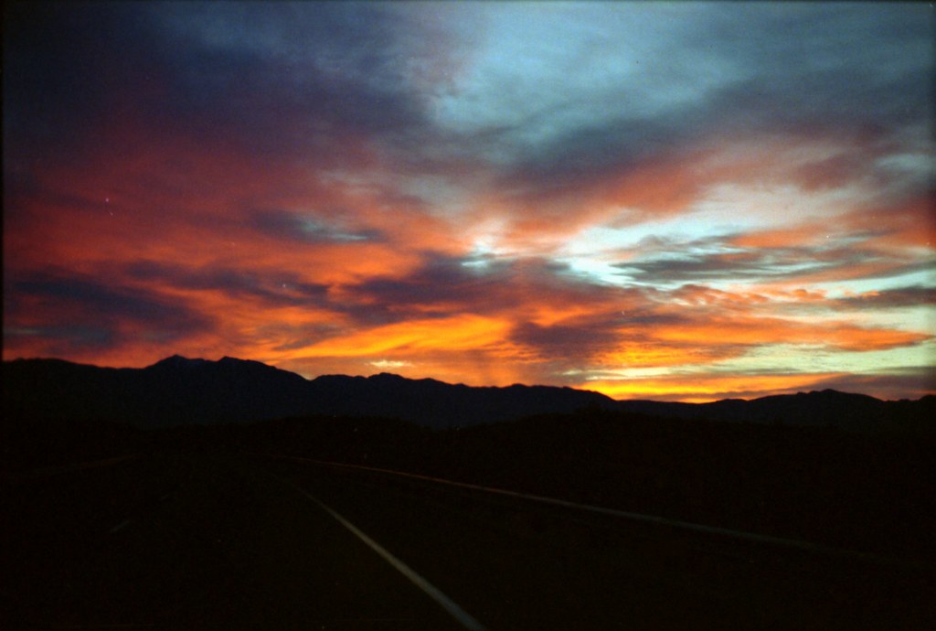
Desert sunrise along Interstate 15

Freaking good day! 269
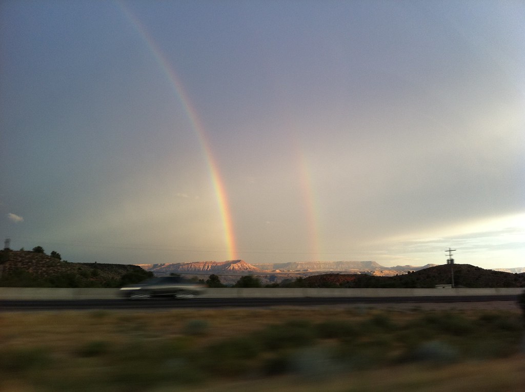
Double Rainbow near Hurricane, Utah
Sunset and clouds
a place to get lost
Brian Head Ski Trip, Mark, Chuck,
morning view
Looking Up a Slot | 1011-1-5770
016-01 Utah, I15 Jct23, Silver Reef, View to SouthWest
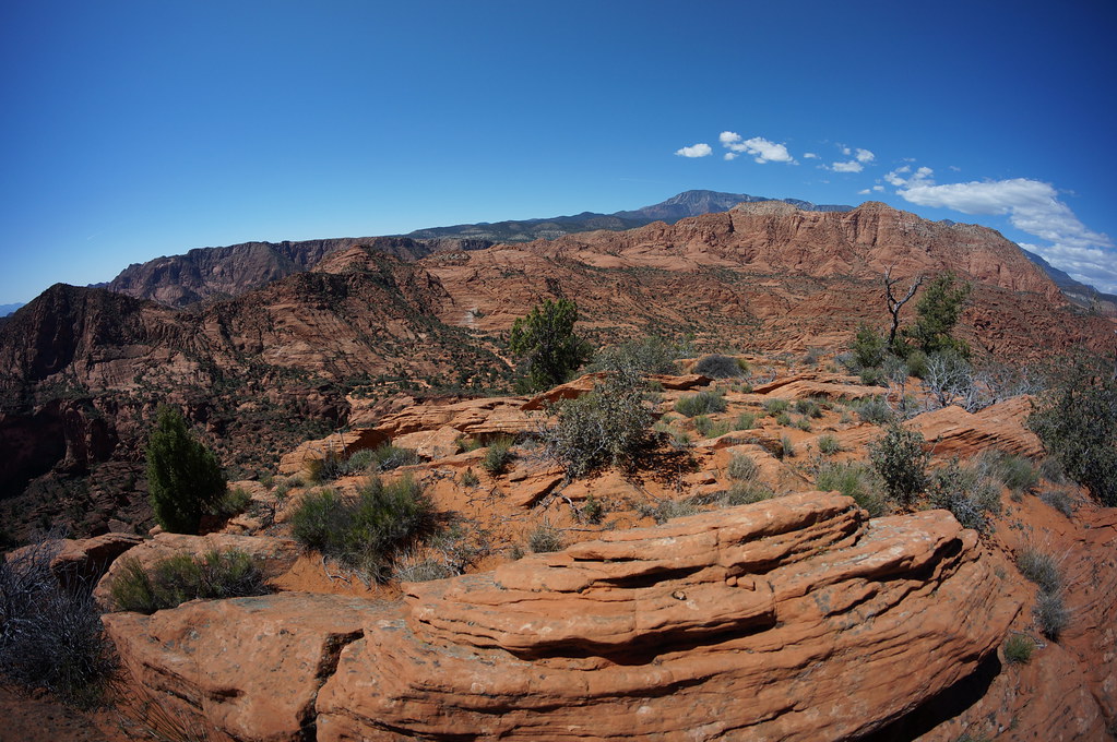
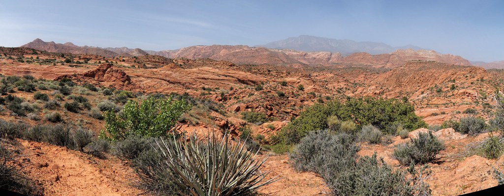
redrock country

Pine Valley View
アメリカ合衆国 ユタ州 セント・ジョージ, UTの地図
別の場所を検索
近所の場所
アメリカ合衆国 ユタ州 ワシントン
アメリカ合衆国 〒 ユタ州 シグナル・ピーク
E S, Pine Valley, UT アメリカ合衆国
アメリカ合衆国 〒 ユタ州 パイン・バレー
アメリカ合衆国 〒 ユタ州 パイン・バレー
Old Hwy 91, Hurricane, UT アメリカ合衆国
N W, St George, UT アメリカ合衆国
アメリカ合衆国 〒 ユタ州 セントジョージ
アメリカ合衆国 〒 ユタ州 セントラル
N W, Washington, UT アメリカ合衆国
Catalpa Drive, Washington, UT アメリカ合衆国
N W, Hurricane, UT アメリカ合衆国
W N, Hurricane, UT アメリカ合衆国
Shinnecock Dr, St. George, UT アメリカ合衆国
Snow Canyon Dr, St. George, UT アメリカ合衆国Whiterocks
W Ledges Parkway, St George, UT アメリカ合衆国The Ledges Golf Club
White Rocks Dr, St. George, UT アメリカ合衆国
W Bluff Hill Dr, Washington, UT アメリカ合衆国
E Telegraph St, Washington, UT アメリカ合衆国
アメリカ合衆国 ユタ州 ワシントン
最近の検索
- Co Rd A, Truth or Consequences, NM アメリカ合衆国スペースポート・アメリカ日の出日の入り時間
- Warwick, RI, USA日の出日の入り時間
- 日本、〒- 東京都大田区西蒲田3丁目21−21Moriyama House日の出日の入り時間
- 日本、〒- 新潟県佐渡市沢崎万畳敷日の出日の入り時間
- W Granada St, Tampa, FL アメリカ合衆国日の出日の入り時間
- メキシコ 〒 オアハカ サンタ・マリア・ハラパ・デル・マルケス日の出日の入り時間
- Pykes Down, Ivybridge PL21 0BY イギリス日の出日の入り時間
- Wuzhi Mountain, Wuzhishan City, 中華人民共和国日の出日の入り時間
- オーストリア 〒 エーエンビヒル日の出日の入り時間
- ベロゴルスク日の出日の入り時間