アメリカ合衆国 〒 ワシントン州 ソープ・レイク日の出日の入り時間
Location: アメリカ合衆国 > ワシントン州 > グラント >
時間帯:
America/Los_Angeles
現地時間:
2024-05-14 00:33:18
経度:
-119.490591
緯度:
47.389307
今日の日の出時刻:
05:21:00 AM
今日の日の入時刻:
08:27:38 PM
今日の日長:
15h 6m 38s
明日の日の出時刻:
05:19:47 AM
明日の日の入時刻:
08:28:53 PM
明日の日長:
15h 9m 6s
すべて表示する
| 日付 | 日出 | 日没 | 日長 |
|---|---|---|---|
| 2024年01月01日 | 07:45:09 AM | 04:18:31 PM | 8h 33m 22s |
| 2024年01月02日 | 07:45:05 AM | 04:19:31 PM | 8h 34m 26s |
| 2024年01月03日 | 07:44:58 AM | 04:20:32 PM | 8h 35m 34s |
| 2024年01月04日 | 07:44:49 AM | 04:21:36 PM | 8h 36m 47s |
| 2024年01月05日 | 07:44:36 AM | 04:22:41 PM | 8h 38m 5s |
| 2024年01月06日 | 07:44:21 AM | 04:23:49 PM | 8h 39m 28s |
| 2024年01月07日 | 07:44:03 AM | 04:24:58 PM | 8h 40m 55s |
| 2024年01月08日 | 07:43:43 AM | 04:26:09 PM | 8h 42m 26s |
| 2024年01月09日 | 07:43:19 AM | 04:27:22 PM | 8h 44m 3s |
| 2024年01月10日 | 07:42:53 AM | 04:28:36 PM | 8h 45m 43s |
| 2024年01月11日 | 07:42:24 AM | 04:29:52 PM | 8h 47m 28s |
| 2024年01月12日 | 07:41:52 AM | 04:31:09 PM | 8h 49m 17s |
| 2024年01月13日 | 07:41:18 AM | 04:32:28 PM | 8h 51m 10s |
| 2024年01月14日 | 07:40:41 AM | 04:33:48 PM | 8h 53m 7s |
| 2024年01月15日 | 07:40:01 AM | 04:35:10 PM | 8h 55m 9s |
| 2024年01月16日 | 07:39:19 AM | 04:36:32 PM | 8h 57m 13s |
| 2024年01月17日 | 07:38:35 AM | 04:37:56 PM | 8h 59m 21s |
| 2024年01月18日 | 07:37:48 AM | 04:39:20 PM | 9h 1m 32s |
| 2024年01月19日 | 07:36:58 AM | 04:40:46 PM | 9h 3m 48s |
| 2024年01月20日 | 07:36:06 AM | 04:42:13 PM | 9h 6m 7s |
| 2024年01月21日 | 07:35:11 AM | 04:43:40 PM | 9h 8m 29s |
| 2024年01月22日 | 07:34:15 AM | 04:45:09 PM | 9h 10m 54s |
| 2024年01月23日 | 07:33:16 AM | 04:46:38 PM | 9h 13m 22s |
| 2024年01月24日 | 07:32:14 AM | 04:48:07 PM | 9h 15m 53s |
| 2024年01月25日 | 07:31:11 AM | 04:49:38 PM | 9h 18m 27s |
| 2024年01月26日 | 07:30:05 AM | 04:51:09 PM | 9h 21m 4s |
| 2024年01月27日 | 07:28:57 AM | 04:52:40 PM | 9h 23m 43s |
| 2024年01月28日 | 07:27:48 AM | 04:54:12 PM | 9h 26m 24s |
| 2024年01月29日 | 07:26:36 AM | 04:55:44 PM | 9h 29m 8s |
| 2024年01月30日 | 07:25:22 AM | 04:57:17 PM | 9h 31m 55s |
| 2024年01月31日 | 07:24:06 AM | 04:58:50 PM | 9h 34m 44s |
| 2024年02月01日 | 07:22:48 AM | 05:00:23 PM | 9h 37m 35s |
| 2024年02月02日 | 07:21:29 AM | 05:01:56 PM | 9h 40m 27s |
| 2024年02月03日 | 07:20:08 AM | 05:03:30 PM | 9h 43m 22s |
| 2024年02月04日 | 07:18:44 AM | 05:05:04 PM | 9h 46m 20s |
| 2024年02月05日 | 07:17:20 AM | 05:06:38 PM | 9h 49m 18s |
| 2024年02月06日 | 07:15:53 AM | 05:08:11 PM | 9h 52m 18s |
| 2024年02月07日 | 07:14:25 AM | 05:09:45 PM | 9h 55m 20s |
| 2024年02月08日 | 07:12:55 AM | 05:11:19 PM | 9h 58m 24s |
| 2024年02月09日 | 07:11:24 AM | 05:12:53 PM | 10h 1m 29s |
| 2024年02月10日 | 07:09:51 AM | 05:14:27 PM | 10h 4m 36s |
| 2024年02月11日 | 07:08:17 AM | 05:16:01 PM | 10h 7m 44s |
| 2024年02月12日 | 07:06:42 AM | 05:17:34 PM | 10h 10m 52s |
| 2024年02月13日 | 07:05:05 AM | 05:19:08 PM | 10h 14m 3s |
| 2024年02月14日 | 07:03:27 AM | 05:20:41 PM | 10h 17m 14s |
| 2024年02月15日 | 07:01:47 AM | 05:22:14 PM | 10h 20m 27s |
| 2024年02月16日 | 07:00:06 AM | 05:23:47 PM | 10h 23m 41s |
| 2024年02月17日 | 06:58:24 AM | 05:25:20 PM | 10h 26m 56s |
| 2024年02月18日 | 06:56:41 AM | 05:26:53 PM | 10h 30m 12s |
| 2024年02月19日 | 06:54:57 AM | 05:28:25 PM | 10h 33m 28s |
| 2024年02月20日 | 06:53:12 AM | 05:29:57 PM | 10h 36m 45s |
| 2024年02月21日 | 06:51:25 AM | 05:31:29 PM | 10h 40m 4s |
| 2024年02月22日 | 06:49:38 AM | 05:33:01 PM | 10h 43m 23s |
| 2024年02月23日 | 06:47:50 AM | 05:34:32 PM | 10h 46m 42s |
| 2024年02月24日 | 06:46:00 AM | 05:36:03 PM | 10h 50m 3s |
| 2024年02月25日 | 06:44:10 AM | 05:37:34 PM | 10h 53m 24s |
| 2024年02月26日 | 06:42:19 AM | 05:39:04 PM | 10h 56m 45s |
| 2024年02月27日 | 06:40:28 AM | 05:40:35 PM | 11h 0m 7s |
| 2024年02月28日 | 06:38:35 AM | 05:42:05 PM | 11h 3m 30s |
| 2024年02月29日 | 06:36:42 AM | 05:43:34 PM | 11h 6m 52s |
| 2024年03月01日 | 06:34:48 AM | 05:45:04 PM | 11h 10m 16s |
| 2024年03月02日 | 06:32:53 AM | 05:46:33 PM | 11h 13m 40s |
| 2024年03月03日 | 06:30:58 AM | 05:48:02 PM | 11h 17m 4s |
| 2024年03月04日 | 06:29:02 AM | 05:49:30 PM | 11h 20m 28s |
| 2024年03月05日 | 06:27:06 AM | 05:50:59 PM | 11h 23m 53s |
| 2024年03月06日 | 06:25:09 AM | 05:52:27 PM | 11h 27m 18s |
| 2024年03月07日 | 06:23:11 AM | 05:53:54 PM | 11h 30m 43s |
| 2024年03月08日 | 06:21:14 AM | 05:55:22 PM | 11h 34m 8s |
| 2024年03月09日 | 06:19:15 AM | 05:56:49 PM | 11h 37m 34s |
| 2024年03月10日 | 07:17:21 AM | 06:58:13 PM | 11h 40m 52s |
| 2024年03月11日 | 07:15:22 AM | 06:59:40 PM | 11h 44m 18s |
| 2024年03月12日 | 07:13:23 AM | 07:01:06 PM | 11h 47m 43s |
| 2024年03月13日 | 07:11:23 AM | 07:02:33 PM | 11h 51m 10s |
| 2024年03月14日 | 07:09:23 AM | 07:03:59 PM | 11h 54m 36s |
| 2024年03月15日 | 07:07:23 AM | 07:05:25 PM | 11h 58m 2s |
| 2024年03月16日 | 07:05:23 AM | 07:06:51 PM | 12h 1m 28s |
| 2024年03月17日 | 07:03:22 AM | 07:08:16 PM | 12h 4m 54s |
| 2024年03月18日 | 07:01:21 AM | 07:09:42 PM | 12h 8m 21s |
| 2024年03月19日 | 06:59:20 AM | 07:11:07 PM | 12h 11m 47s |
| 2024年03月20日 | 06:57:19 AM | 07:12:33 PM | 12h 15m 14s |
| 2024年03月21日 | 06:55:18 AM | 07:13:58 PM | 12h 18m 40s |
| 2024年03月22日 | 06:53:17 AM | 07:15:23 PM | 12h 22m 6s |
| 2024年03月23日 | 06:51:16 AM | 07:16:47 PM | 12h 25m 31s |
| 2024年03月24日 | 06:49:16 AM | 07:18:12 PM | 12h 28m 56s |
| 2024年03月25日 | 06:47:15 AM | 07:19:37 PM | 12h 32m 22s |
| 2024年03月26日 | 06:45:14 AM | 07:21:01 PM | 12h 35m 47s |
| 2024年03月27日 | 06:43:13 AM | 07:22:26 PM | 12h 39m 13s |
| 2024年03月28日 | 06:41:13 AM | 07:23:50 PM | 12h 42m 37s |
| 2024年03月29日 | 06:39:13 AM | 07:25:15 PM | 12h 46m 2s |
| 2024年03月30日 | 06:37:12 AM | 07:26:39 PM | 12h 49m 27s |
| 2024年03月31日 | 06:35:13 AM | 07:28:03 PM | 12h 52m 50s |
| 2024年04月01日 | 06:33:13 AM | 07:29:27 PM | 12h 56m 14s |
| 2024年04月02日 | 06:31:14 AM | 07:30:51 PM | 12h 59m 37s |
| 2024年04月03日 | 06:29:15 AM | 07:32:16 PM | 13h 3m 1s |
| 2024年04月04日 | 06:27:17 AM | 07:33:40 PM | 13h 6m 23s |
| 2024年04月05日 | 06:25:19 AM | 07:35:04 PM | 13h 9m 45s |
| 2024年04月06日 | 06:23:21 AM | 07:36:28 PM | 13h 13m 7s |
| 2024年04月07日 | 06:21:24 AM | 07:37:52 PM | 13h 16m 28s |
| 2024年04月08日 | 06:19:28 AM | 07:39:16 PM | 13h 19m 48s |
| 2024年04月09日 | 06:17:32 AM | 07:40:40 PM | 13h 23m 8s |
| 2024年04月10日 | 06:15:36 AM | 07:42:04 PM | 13h 26m 28s |
| 2024年04月11日 | 06:13:42 AM | 07:43:28 PM | 13h 29m 46s |
| 2024年04月12日 | 06:11:47 AM | 07:44:52 PM | 13h 33m 5s |
| 2024年04月13日 | 06:09:54 AM | 07:46:16 PM | 13h 36m 22s |
| 2024年04月14日 | 06:08:01 AM | 07:47:40 PM | 13h 39m 39s |
| 2024年04月15日 | 06:06:09 AM | 07:49:04 PM | 13h 42m 55s |
| 2024年04月16日 | 06:04:18 AM | 07:50:28 PM | 13h 46m 10s |
| 2024年04月17日 | 06:02:28 AM | 07:51:52 PM | 13h 49m 24s |
| 2024年04月18日 | 06:00:38 AM | 07:53:16 PM | 13h 52m 38s |
| 2024年04月19日 | 05:58:50 AM | 07:54:39 PM | 13h 55m 49s |
| 2024年04月20日 | 05:57:02 AM | 07:56:03 PM | 13h 59m 1s |
| 2024年04月21日 | 05:55:15 AM | 07:57:27 PM | 14h 2m 12s |
| 2024年04月22日 | 05:53:29 AM | 07:58:50 PM | 14h 5m 21s |
| 2024年04月23日 | 05:51:45 AM | 08:00:14 PM | 14h 8m 29s |
| 2024年04月24日 | 05:50:01 AM | 08:01:37 PM | 14h 11m 36s |
| 2024年04月25日 | 05:48:19 AM | 08:03:01 PM | 14h 14m 42s |
| 2024年04月26日 | 05:46:37 AM | 08:04:24 PM | 14h 17m 47s |
| 2024年04月27日 | 05:44:57 AM | 08:05:47 PM | 14h 20m 50s |
| 2024年04月28日 | 05:43:18 AM | 08:07:09 PM | 14h 23m 51s |
| 2024年04月29日 | 05:41:40 AM | 08:08:32 PM | 14h 26m 52s |
| 2024年04月30日 | 05:40:04 AM | 08:09:54 PM | 14h 29m 50s |
| 2024年05月01日 | 05:38:29 AM | 08:11:16 PM | 14h 32m 47s |
| 2024年05月02日 | 05:36:55 AM | 08:12:38 PM | 14h 35m 43s |
| 2024年05月03日 | 05:35:23 AM | 08:14:00 PM | 14h 38m 37s |
| 2024年05月04日 | 05:33:53 AM | 08:15:21 PM | 14h 41m 28s |
| 2024年05月05日 | 05:32:23 AM | 08:16:41 PM | 14h 44m 18s |
| 2024年05月06日 | 05:30:56 AM | 08:18:02 PM | 14h 47m 6s |
| 2024年05月07日 | 05:29:30 AM | 08:19:22 PM | 14h 49m 52s |
| 2024年05月08日 | 05:28:05 AM | 08:20:41 PM | 14h 52m 36s |
| 2024年05月09日 | 05:26:42 AM | 08:22:00 PM | 14h 55m 18s |
| 2024年05月10日 | 05:25:21 AM | 08:23:18 PM | 14h 57m 57s |
| 2024年05月11日 | 05:24:02 AM | 08:24:36 PM | 15h 0m 34s |
| 2024年05月12日 | 05:22:44 AM | 08:25:53 PM | 15h 3m 9s |
| 2024年05月13日 | 05:21:28 AM | 08:27:09 PM | 15h 5m 41s |
| 2024年05月14日 | 05:20:14 AM | 08:28:25 PM | 15h 8m 11s |
| 2024年05月15日 | 05:19:02 AM | 08:29:40 PM | 15h 10m 38s |
| 2024年05月16日 | 05:17:52 AM | 08:30:54 PM | 15h 13m 2s |
| 2024年05月17日 | 05:16:44 AM | 08:32:07 PM | 15h 15m 23s |
| 2024年05月18日 | 05:15:38 AM | 08:33:19 PM | 15h 17m 41s |
| 2024年05月19日 | 05:14:34 AM | 08:34:31 PM | 15h 19m 57s |
| 2024年05月20日 | 05:13:32 AM | 08:35:41 PM | 15h 22m 9s |
| 2024年05月21日 | 05:12:33 AM | 08:36:50 PM | 15h 24m 17s |
| 2024年05月22日 | 05:11:35 AM | 08:37:58 PM | 15h 26m 23s |
| 2024年05月23日 | 05:10:40 AM | 08:39:05 PM | 15h 28m 25s |
| 2024年05月24日 | 05:09:46 AM | 08:40:10 PM | 15h 30m 24s |
| 2024年05月25日 | 05:08:56 AM | 08:41:15 PM | 15h 32m 19s |
| 2024年05月26日 | 05:08:07 AM | 08:42:18 PM | 15h 34m 11s |
| 2024年05月27日 | 05:07:21 AM | 08:43:19 PM | 15h 35m 58s |
| 2024年05月28日 | 05:06:37 AM | 08:44:19 PM | 15h 37m 42s |
| 2024年05月29日 | 05:05:55 AM | 08:45:18 PM | 15h 39m 23s |
| 2024年05月30日 | 05:05:16 AM | 08:46:15 PM | 15h 40m 59s |
| 2024年05月31日 | 05:04:39 AM | 08:47:10 PM | 15h 42m 31s |
| 2024年06月01日 | 05:04:05 AM | 08:48:04 PM | 15h 43m 59s |
| 2024年06月02日 | 05:03:33 AM | 08:48:56 PM | 15h 45m 23s |
| 2024年06月03日 | 05:03:04 AM | 08:49:46 PM | 15h 46m 42s |
| 2024年06月04日 | 05:02:37 AM | 08:50:34 PM | 15h 47m 57s |
| 2024年06月05日 | 05:02:13 AM | 08:51:20 PM | 15h 49m 7s |
| 2024年06月06日 | 05:01:51 AM | 08:52:05 PM | 15h 50m 14s |
| 2024年06月07日 | 05:01:32 AM | 08:52:47 PM | 15h 51m 15s |
| 2024年06月08日 | 05:01:16 AM | 08:53:27 PM | 15h 52m 11s |
| 2024年06月09日 | 05:01:01 AM | 08:54:05 PM | 15h 53m 4s |
| 2024年06月10日 | 05:00:50 AM | 08:54:41 PM | 15h 53m 51s |
| 2024年06月11日 | 05:00:41 AM | 08:55:15 PM | 15h 54m 34s |
| 2024年06月12日 | 05:00:35 AM | 08:55:47 PM | 15h 55m 12s |
| 2024年06月13日 | 05:00:31 AM | 08:56:16 PM | 15h 55m 45s |
| 2024年06月14日 | 05:00:30 AM | 08:56:43 PM | 15h 56m 13s |
| 2024年06月15日 | 05:00:31 AM | 08:57:08 PM | 15h 56m 37s |
| 2024年06月16日 | 05:00:35 AM | 08:57:30 PM | 15h 56m 55s |
| 2024年06月17日 | 05:00:41 AM | 08:57:50 PM | 15h 57m 9s |
| 2024年06月18日 | 05:00:50 AM | 08:58:07 PM | 15h 57m 17s |
| 2024年06月19日 | 05:01:01 AM | 08:58:22 PM | 15h 57m 21s |
| 2024年06月20日 | 05:01:15 AM | 08:58:35 PM | 15h 57m 20s |
| 2024年06月21日 | 05:01:31 AM | 08:58:44 PM | 15h 57m 13s |
| 2024年06月22日 | 05:01:49 AM | 08:58:52 PM | 15h 57m 3s |
| 2024年06月23日 | 05:02:10 AM | 08:58:57 PM | 15h 56m 47s |
| 2024年06月24日 | 05:02:33 AM | 08:58:59 PM | 15h 56m 26s |
| 2024年06月25日 | 05:02:59 AM | 08:58:58 PM | 15h 55m 59s |
| 2024年06月26日 | 05:03:27 AM | 08:58:55 PM | 15h 55m 28s |
| 2024年06月27日 | 05:03:57 AM | 08:58:50 PM | 15h 54m 53s |
| 2024年06月28日 | 05:04:29 AM | 08:58:42 PM | 15h 54m 13s |
| 2024年06月29日 | 05:05:03 AM | 08:58:31 PM | 15h 53m 28s |
| 2024年06月30日 | 05:05:40 AM | 08:58:17 PM | 15h 52m 37s |
| 2024年07月01日 | 05:06:18 AM | 08:58:01 PM | 15h 51m 43s |
| 2024年07月02日 | 05:06:59 AM | 08:57:43 PM | 15h 50m 44s |
| 2024年07月03日 | 05:07:41 AM | 08:57:21 PM | 15h 49m 40s |
| 2024年07月04日 | 05:08:25 AM | 08:56:58 PM | 15h 48m 33s |
| 2024年07月05日 | 05:09:12 AM | 08:56:31 PM | 15h 47m 19s |
| 2024年07月06日 | 05:10:00 AM | 08:56:02 PM | 15h 46m 2s |
| 2024年07月07日 | 05:10:49 AM | 08:55:31 PM | 15h 44m 42s |
| 2024年07月08日 | 05:11:41 AM | 08:54:57 PM | 15h 43m 16s |
| 2024年07月09日 | 05:12:34 AM | 08:54:21 PM | 15h 41m 47s |
| 2024年07月10日 | 05:13:28 AM | 08:53:42 PM | 15h 40m 14s |
| 2024年07月11日 | 05:14:24 AM | 08:53:00 PM | 15h 38m 36s |
| 2024年07月12日 | 05:15:22 AM | 08:52:17 PM | 15h 36m 55s |
| 2024年07月13日 | 05:16:21 AM | 08:51:31 PM | 15h 35m 10s |
| 2024年07月14日 | 05:17:21 AM | 08:50:42 PM | 15h 33m 21s |
| 2024年07月15日 | 05:18:23 AM | 08:49:51 PM | 15h 31m 28s |
| 2024年07月16日 | 05:19:26 AM | 08:48:58 PM | 15h 29m 32s |
| 2024年07月17日 | 05:20:30 AM | 08:48:03 PM | 15h 27m 33s |
| 2024年07月18日 | 05:21:35 AM | 08:47:05 PM | 15h 25m 30s |
| 2024年07月19日 | 05:22:41 AM | 08:46:05 PM | 15h 23m 24s |
| 2024年07月20日 | 05:23:49 AM | 08:45:03 PM | 15h 21m 14s |
| 2024年07月21日 | 05:24:57 AM | 08:43:59 PM | 15h 19m 2s |
| 2024年07月22日 | 05:26:06 AM | 08:42:53 PM | 15h 16m 47s |
| 2024年07月23日 | 05:27:16 AM | 08:41:45 PM | 15h 14m 29s |
| 2024年07月24日 | 05:28:27 AM | 08:40:34 PM | 15h 12m 7s |
| 2024年07月25日 | 05:29:39 AM | 08:39:22 PM | 15h 9m 43s |
| 2024年07月26日 | 05:30:51 AM | 08:38:08 PM | 15h 7m 17s |
| 2024年07月27日 | 05:32:04 AM | 08:36:52 PM | 15h 4m 48s |
| 2024年07月28日 | 05:33:18 AM | 08:35:34 PM | 15h 2m 16s |
| 2024年07月29日 | 05:34:33 AM | 08:34:15 PM | 14h 59m 42s |
| 2024年07月30日 | 05:35:47 AM | 08:32:53 PM | 14h 57m 6s |
| 2024年07月31日 | 05:37:03 AM | 08:31:30 PM | 14h 54m 27s |
| 2024年08月01日 | 05:38:19 AM | 08:30:05 PM | 14h 51m 46s |
| 2024年08月02日 | 05:39:35 AM | 08:28:39 PM | 14h 49m 4s |
| 2024年08月03日 | 05:40:52 AM | 08:27:10 PM | 14h 46m 18s |
| 2024年08月04日 | 05:42:09 AM | 08:25:41 PM | 14h 43m 32s |
| 2024年08月05日 | 05:43:26 AM | 08:24:09 PM | 14h 40m 43s |
| 2024年08月06日 | 05:44:44 AM | 08:22:37 PM | 14h 37m 53s |
| 2024年08月07日 | 05:46:02 AM | 08:21:03 PM | 14h 35m 1s |
| 2024年08月08日 | 05:47:20 AM | 08:19:27 PM | 14h 32m 7s |
| 2024年08月09日 | 05:48:38 AM | 08:17:50 PM | 14h 29m 12s |
| 2024年08月10日 | 05:49:57 AM | 08:16:12 PM | 14h 26m 15s |
| 2024年08月11日 | 05:51:16 AM | 08:14:32 PM | 14h 23m 16s |
| 2024年08月12日 | 05:52:35 AM | 08:12:51 PM | 14h 20m 16s |
| 2024年08月13日 | 05:53:54 AM | 08:11:09 PM | 14h 17m 15s |
| 2024年08月14日 | 05:55:13 AM | 08:09:26 PM | 14h 14m 13s |
| 2024年08月15日 | 05:56:32 AM | 08:07:42 PM | 14h 11m 10s |
| 2024年08月16日 | 05:57:52 AM | 08:05:56 PM | 14h 8m 4s |
| 2024年08月17日 | 05:59:11 AM | 08:04:10 PM | 14h 4m 59s |
| 2024年08月18日 | 06:00:31 AM | 08:02:22 PM | 14h 1m 51s |
| 2024年08月19日 | 06:01:50 AM | 08:00:34 PM | 13h 58m 44s |
| 2024年08月20日 | 06:03:10 AM | 07:58:44 PM | 13h 55m 34s |
| 2024年08月21日 | 06:04:29 AM | 07:56:54 PM | 13h 52m 25s |
| 2024年08月22日 | 06:05:49 AM | 07:55:03 PM | 13h 49m 14s |
| 2024年08月23日 | 06:07:08 AM | 07:53:11 PM | 13h 46m 3s |
| 2024年08月24日 | 06:08:28 AM | 07:51:18 PM | 13h 42m 50s |
| 2024年08月25日 | 06:09:48 AM | 07:49:24 PM | 13h 39m 36s |
| 2024年08月26日 | 06:11:07 AM | 07:47:29 PM | 13h 36m 22s |
| 2024年08月27日 | 06:12:27 AM | 07:45:34 PM | 13h 33m 7s |
| 2024年08月28日 | 06:13:46 AM | 07:43:38 PM | 13h 29m 52s |
| 2024年08月29日 | 06:15:05 AM | 07:41:42 PM | 13h 26m 37s |
| 2024年08月30日 | 06:16:25 AM | 07:39:45 PM | 13h 23m 20s |
| 2024年08月31日 | 06:17:44 AM | 07:37:47 PM | 13h 20m 3s |
| 2024年09月01日 | 06:19:04 AM | 07:35:49 PM | 13h 16m 45s |
| 2024年09月02日 | 06:20:23 AM | 07:33:50 PM | 13h 13m 27s |
| 2024年09月03日 | 06:21:42 AM | 07:31:51 PM | 13h 10m 9s |
| 2024年09月04日 | 06:23:02 AM | 07:29:51 PM | 13h 6m 49s |
| 2024年09月05日 | 06:24:21 AM | 07:27:51 PM | 13h 3m 30s |
| 2024年09月06日 | 06:25:41 AM | 07:25:51 PM | 13h 0m 10s |
| 2024年09月07日 | 06:27:00 AM | 07:23:50 PM | 12h 56m 50s |
| 2024年09月08日 | 06:28:19 AM | 07:21:49 PM | 12h 53m 30s |
| 2024年09月09日 | 06:29:39 AM | 07:19:47 PM | 12h 50m 8s |
| 2024年09月10日 | 06:30:58 AM | 07:17:45 PM | 12h 46m 47s |
| 2024年09月11日 | 06:32:18 AM | 07:15:43 PM | 12h 43m 25s |
| 2024年09月12日 | 06:33:37 AM | 07:13:41 PM | 12h 40m 4s |
| 2024年09月13日 | 06:34:57 AM | 07:11:39 PM | 12h 36m 42s |
| 2024年09月14日 | 06:36:16 AM | 07:09:36 PM | 12h 33m 20s |
| 2024年09月15日 | 06:37:36 AM | 07:07:34 PM | 12h 29m 58s |
| 2024年09月16日 | 06:38:56 AM | 07:05:31 PM | 12h 26m 35s |
| 2024年09月17日 | 06:40:16 AM | 07:03:28 PM | 12h 23m 12s |
| 2024年09月18日 | 06:41:36 AM | 07:01:26 PM | 12h 19m 50s |
| 2024年09月19日 | 06:42:56 AM | 06:59:23 PM | 12h 16m 27s |
| 2024年09月20日 | 06:44:16 AM | 06:57:20 PM | 12h 13m 4s |
| 2024年09月21日 | 06:45:36 AM | 06:55:17 PM | 12h 9m 41s |
| 2024年09月22日 | 06:46:57 AM | 06:53:15 PM | 12h 6m 18s |
| 2024年09月23日 | 06:48:18 AM | 06:51:12 PM | 12h 2m 54s |
| 2024年09月24日 | 06:49:39 AM | 06:49:10 PM | 11h 59m 31s |
| 2024年09月25日 | 06:51:00 AM | 06:47:08 PM | 11h 56m 8s |
| 2024年09月26日 | 06:52:21 AM | 06:45:06 PM | 11h 52m 45s |
| 2024年09月27日 | 06:53:42 AM | 06:43:05 PM | 11h 49m 23s |
| 2024年09月28日 | 06:55:04 AM | 06:41:03 PM | 11h 45m 59s |
| 2024年09月29日 | 06:56:26 AM | 06:39:02 PM | 11h 42m 36s |
| 2024年09月30日 | 06:57:48 AM | 06:37:02 PM | 11h 39m 14s |
| 2024年10月01日 | 06:59:10 AM | 06:35:01 PM | 11h 35m 51s |
| 2024年10月02日 | 07:00:33 AM | 06:33:01 PM | 11h 32m 28s |
| 2024年10月03日 | 07:01:55 AM | 06:31:02 PM | 11h 29m 7s |
| 2024年10月04日 | 07:03:18 AM | 06:29:03 PM | 11h 25m 45s |
| 2024年10月05日 | 07:04:42 AM | 06:27:04 PM | 11h 22m 22s |
| 2024年10月06日 | 07:06:05 AM | 06:25:06 PM | 11h 19m 1s |
| 2024年10月07日 | 07:07:29 AM | 06:23:09 PM | 11h 15m 40s |
| 2024年10月08日 | 07:08:54 AM | 06:21:12 PM | 11h 12m 18s |
| 2024年10月09日 | 07:10:18 AM | 06:19:16 PM | 11h 8m 58s |
| 2024年10月10日 | 07:11:43 AM | 06:17:21 PM | 11h 5m 38s |
| 2024年10月11日 | 07:13:08 AM | 06:15:26 PM | 11h 2m 18s |
| 2024年10月12日 | 07:14:33 AM | 06:13:32 PM | 10h 58m 59s |
| 2024年10月13日 | 07:15:59 AM | 06:11:39 PM | 10h 55m 40s |
| 2024年10月14日 | 07:17:25 AM | 06:09:46 PM | 10h 52m 21s |
| 2024年10月15日 | 07:18:51 AM | 06:07:54 PM | 10h 49m 3s |
| 2024年10月16日 | 07:20:18 AM | 06:06:04 PM | 10h 45m 46s |
| 2024年10月17日 | 07:21:45 AM | 06:04:14 PM | 10h 42m 29s |
| 2024年10月18日 | 07:23:12 AM | 06:02:25 PM | 10h 39m 13s |
| 2024年10月19日 | 07:24:39 AM | 06:00:37 PM | 10h 35m 58s |
| 2024年10月20日 | 07:26:07 AM | 05:58:50 PM | 10h 32m 43s |
| 2024年10月21日 | 07:27:35 AM | 05:57:05 PM | 10h 29m 30s |
| 2024年10月22日 | 07:29:03 AM | 05:55:20 PM | 10h 26m 17s |
| 2024年10月23日 | 07:30:32 AM | 05:53:37 PM | 10h 23m 5s |
| 2024年10月24日 | 07:32:01 AM | 05:51:54 PM | 10h 19m 53s |
| 2024年10月25日 | 07:33:30 AM | 05:50:13 PM | 10h 16m 43s |
| 2024年10月26日 | 07:34:59 AM | 05:48:33 PM | 10h 13m 34s |
| 2024年10月27日 | 07:36:28 AM | 05:46:55 PM | 10h 10m 27s |
| 2024年10月28日 | 07:37:58 AM | 05:45:18 PM | 10h 7m 20s |
| 2024年10月29日 | 07:39:28 AM | 05:43:42 PM | 10h 4m 14s |
| 2024年10月30日 | 07:40:58 AM | 05:42:08 PM | 10h 1m 10s |
| 2024年10月31日 | 07:42:28 AM | 05:40:35 PM | 9h 58m 7s |
| 2024年11月01日 | 07:43:58 AM | 05:39:04 PM | 9h 55m 6s |
| 2024年11月02日 | 07:45:28 AM | 05:37:34 PM | 9h 52m 6s |
| 2024年11月03日 | 06:47:02 AM | 04:36:02 PM | 9h 49m 0s |
| 2024年11月04日 | 06:48:32 AM | 04:34:36 PM | 9h 46m 4s |
| 2024年11月05日 | 06:50:02 AM | 04:33:11 PM | 9h 43m 9s |
| 2024年11月06日 | 06:51:32 AM | 04:31:49 PM | 9h 40m 17s |
| 2024年11月07日 | 06:53:02 AM | 04:30:27 PM | 9h 37m 25s |
| 2024年11月08日 | 06:54:32 AM | 04:29:08 PM | 9h 34m 36s |
| 2024年11月09日 | 06:56:01 AM | 04:27:51 PM | 9h 31m 50s |
| 2024年11月10日 | 06:57:31 AM | 04:26:35 PM | 9h 29m 4s |
| 2024年11月11日 | 06:59:00 AM | 04:25:22 PM | 9h 26m 22s |
| 2024年11月12日 | 07:00:28 AM | 04:24:11 PM | 9h 23m 43s |
| 2024年11月13日 | 07:01:57 AM | 04:23:01 PM | 9h 21m 4s |
| 2024年11月14日 | 07:03:25 AM | 04:21:54 PM | 9h 18m 29s |
| 2024年11月15日 | 07:04:52 AM | 04:20:49 PM | 9h 15m 57s |
| 2024年11月16日 | 07:06:19 AM | 04:19:46 PM | 9h 13m 27s |
| 2024年11月17日 | 07:07:45 AM | 04:18:45 PM | 9h 11m 0s |
| 2024年11月18日 | 07:09:11 AM | 04:17:47 PM | 9h 8m 36s |
| 2024年11月19日 | 07:10:36 AM | 04:16:51 PM | 9h 6m 15s |
| 2024年11月20日 | 07:12:00 AM | 04:15:58 PM | 9h 3m 58s |
| 2024年11月21日 | 07:13:24 AM | 04:15:06 PM | 9h 1m 42s |
| 2024年11月22日 | 07:14:46 AM | 04:14:18 PM | 8h 59m 32s |
| 2024年11月23日 | 07:16:08 AM | 04:13:31 PM | 8h 57m 23s |
| 2024年11月24日 | 07:17:28 AM | 04:12:48 PM | 8h 55m 20s |
| 2024年11月25日 | 07:18:48 AM | 04:12:07 PM | 8h 53m 19s |
| 2024年11月26日 | 07:20:06 AM | 04:11:28 PM | 8h 51m 22s |
| 2024年11月27日 | 07:21:23 AM | 04:10:52 PM | 8h 49m 29s |
| 2024年11月28日 | 07:22:38 AM | 04:10:19 PM | 8h 47m 41s |
| 2024年11月29日 | 07:23:53 AM | 04:09:49 PM | 8h 45m 56s |
| 2024年11月30日 | 07:25:06 AM | 04:09:21 PM | 8h 44m 15s |
| 2024年12月01日 | 07:26:17 AM | 04:08:56 PM | 8h 42m 39s |
| 2024年12月02日 | 07:27:27 AM | 04:08:34 PM | 8h 41m 7s |
| 2024年12月03日 | 07:28:35 AM | 04:08:15 PM | 8h 39m 40s |
| 2024年12月04日 | 07:29:41 AM | 04:07:58 PM | 8h 38m 17s |
| 2024年12月05日 | 07:30:46 AM | 04:07:44 PM | 8h 36m 58s |
| 2024年12月06日 | 07:31:49 AM | 04:07:34 PM | 8h 35m 45s |
| 2024年12月07日 | 07:32:49 AM | 04:07:26 PM | 8h 34m 37s |
| 2024年12月08日 | 07:33:48 AM | 04:07:21 PM | 8h 33m 33s |
| 2024年12月09日 | 07:34:45 AM | 04:07:19 PM | 8h 32m 34s |
| 2024年12月10日 | 07:35:40 AM | 04:07:19 PM | 8h 31m 39s |
| 2024年12月11日 | 07:36:32 AM | 04:07:23 PM | 8h 30m 51s |
| 2024年12月12日 | 07:37:22 AM | 04:07:30 PM | 8h 30m 8s |
| 2024年12月13日 | 07:38:10 AM | 04:07:39 PM | 8h 29m 29s |
| 2024年12月14日 | 07:38:56 AM | 04:07:51 PM | 8h 28m 55s |
| 2024年12月15日 | 07:39:39 AM | 04:08:07 PM | 8h 28m 28s |
| 2024年12月16日 | 07:40:19 AM | 04:08:25 PM | 8h 28m 6s |
| 2024年12月17日 | 07:40:58 AM | 04:08:46 PM | 8h 27m 48s |
| 2024年12月18日 | 07:41:33 AM | 04:09:09 PM | 8h 27m 36s |
| 2024年12月19日 | 07:42:06 AM | 04:09:36 PM | 8h 27m 30s |
| 2024年12月20日 | 07:42:37 AM | 04:10:05 PM | 8h 27m 28s |
| 2024年12月21日 | 07:43:04 AM | 04:10:37 PM | 8h 27m 33s |
| 2024年12月22日 | 07:43:29 AM | 04:11:12 PM | 8h 27m 43s |
| 2024年12月23日 | 07:43:52 AM | 04:11:49 PM | 8h 27m 57s |
| 2024年12月24日 | 07:44:11 AM | 04:12:29 PM | 8h 28m 18s |
| 2024年12月25日 | 07:44:28 AM | 04:13:11 PM | 8h 28m 43s |
| 2024年12月26日 | 07:44:42 AM | 04:13:56 PM | 8h 29m 14s |
| 2024年12月27日 | 07:44:53 AM | 04:14:44 PM | 8h 29m 51s |
| 2024年12月28日 | 07:45:01 AM | 04:15:34 PM | 8h 30m 33s |
| 2024年12月29日 | 07:45:07 AM | 04:16:26 PM | 8h 31m 19s |
| 2024年12月30日 | 07:45:09 AM | 04:17:20 PM | 8h 32m 11s |
写真

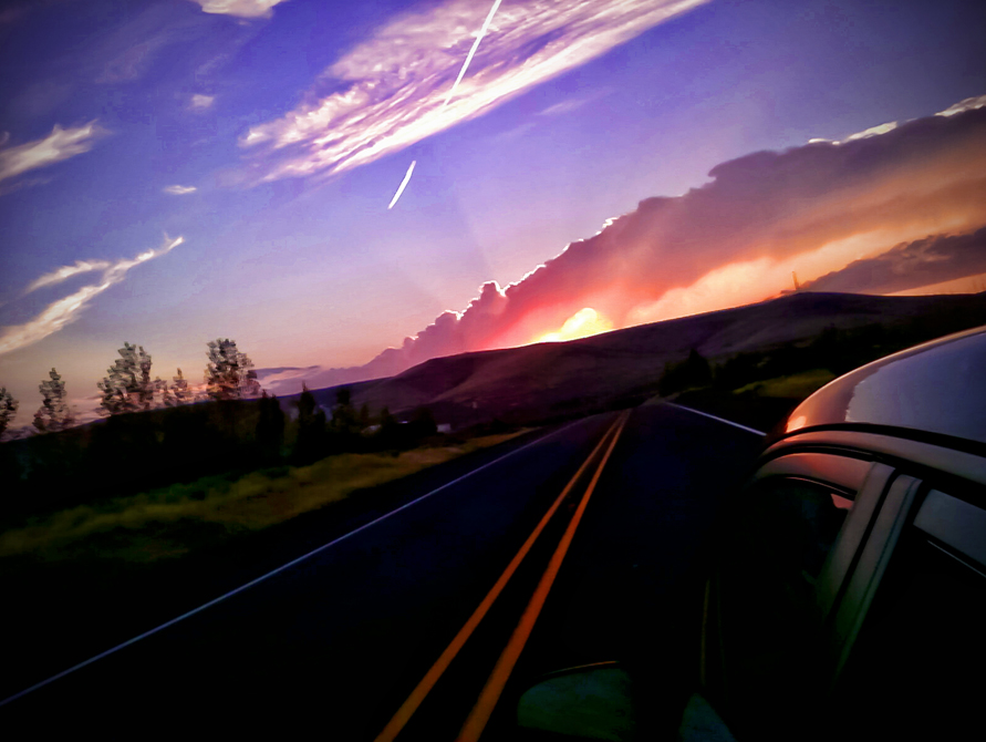
A Pacific Northwest Crush: A Dramatic Sunset (Part 6): Healing & Soothing Away One's Pain (In Technicolor)
Road Trip

Winter Lake
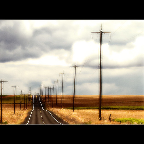
Stratford Road
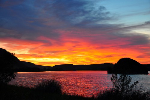
Lake Sunrise

Soap Lake 1

Sunrise Behind Emily

Marinating Upon the Great Northwest Country: East of the Cascades (Part 27): Calming Approach

Marinating Upon the Great Northwest Country: East of the Cascades (Part 32): Grand and Commanding

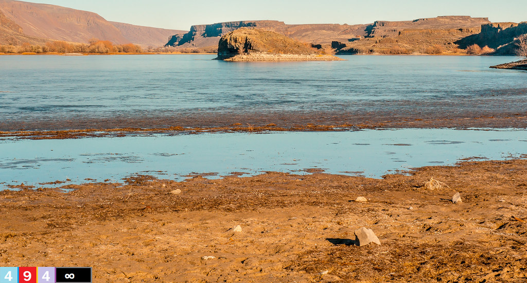
Lake Lenore Caves Park in the Lower Grand Coulee, Washington
Marinating Upon the Great Northwest Country: East of the Cascades (Part 28): First Contact

Marinating Upon the Great Northwest Country: East of the Cascades (Part 22): Silent Moments

Marinating Upon the Great Northwest Country: East of the Cascades (Part 30): Classically Frozen (Black n White Edition)
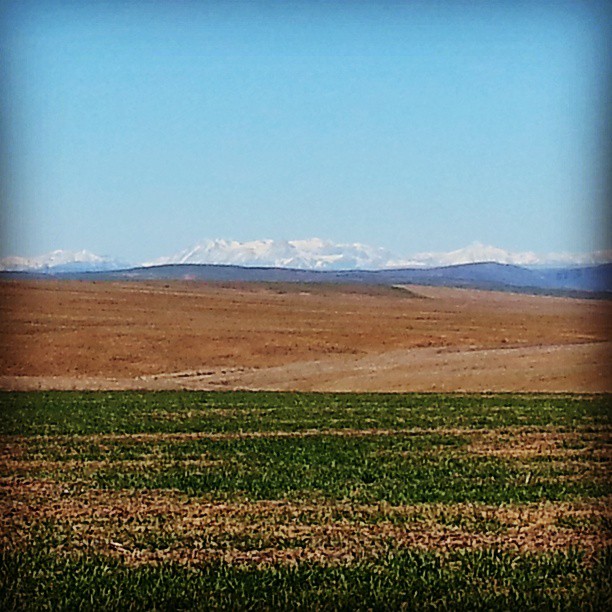
It' s a scenic view driving out to the farm from town. #NorthCascades #Cascades #Easter #GoingHome #KickBackRelax #Wheat #SpringWheat
Behind the Ridge at Lake Lenore Caves
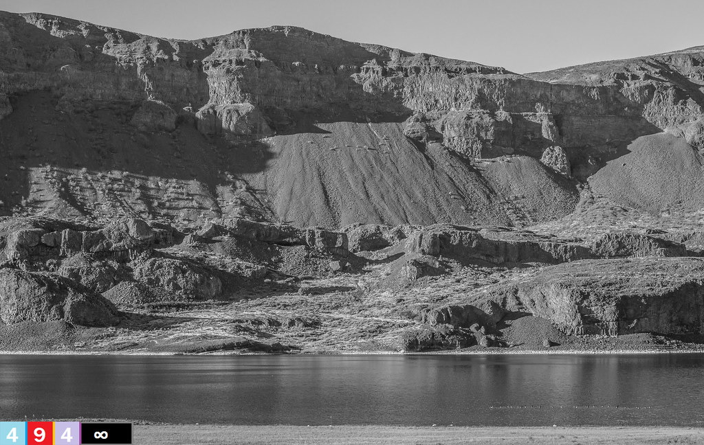
Marinating Upon the Great Northwest Country: East of the Cascades (Part 24): Classically Presentable (Black n' White Edition)

Marinating Upon the Great Northwest Country: East of the Cascades (Part 52): Ready for Recreation!!

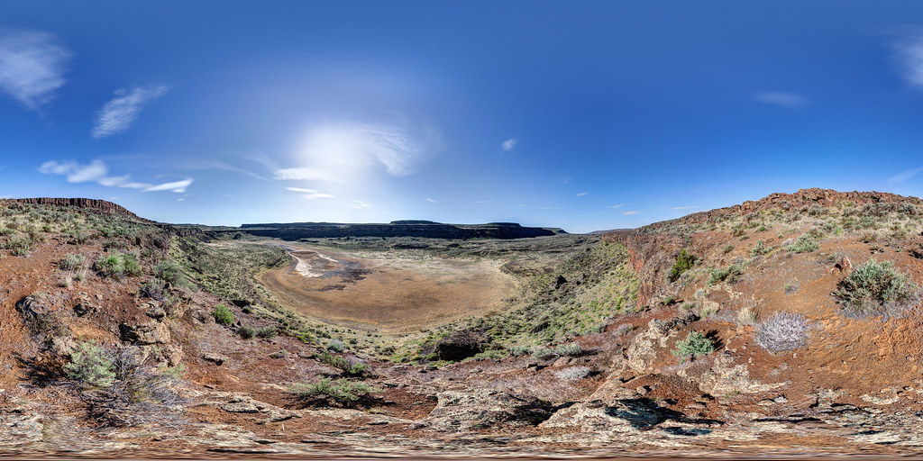
Lenore Lake Basin

Lenore Lake Basin

Lenore Lake Basin

Lenore Lake Basin

Lenore Lake Basin

Lenore Lake Basin

Lenore Lake Basin

Lenore Lake Basin

Lenore Lake Basin
アメリカ合衆国 〒 ワシントン州 ソープ・レイクの地図
別の場所を検索
近所の場所
6th Ave SE, Soap Lake, WA アメリカ合衆国
Grant St NW, Soap Lake, WA アメリカ合衆国
アメリカ合衆国 〒 ワシントン州 レイクビュー
Rd B NE, Soap Lake, WA アメリカ合衆国
アメリカ合衆国 ワシントン州 グラント
Lakeshore Dr NE, Coulee City, WA アメリカ合衆国
Andrews St NE, Moses Lake, WA アメリカ合衆国グラント・インターナショナル・エアポート-MWH
アメリカ合衆国 〒 ワシントン州 モーゼスレイク
アメリカ合衆国 〒 ワシントン州 クーリー・シティ
Rd 36 NE, Soap Lake, WA アメリカ合衆国
アメリカ合衆国 〒 ワシントン州 モーゼスレイク
S Beaumont Dr, Moses Lake, WA アメリカ合衆国
アメリカ合衆国 ワシントン州 ウィルソン・クリーク
Rd N NE, Moses Lake, WA アメリカ合衆国
アメリカ合衆国 〒 ワシントン州 ウィーラー
2nd St NE, Moses Lake, WA アメリカ合衆国
High St, Marlin, WA アメリカ合衆国
アメリカ合衆国 〒 ワシントン州 クルップ
アメリカ合衆国 〒 ワシントン州 クルップ マーリン
Braeburn Pl NW, Soap Lake, WA アメリカ合衆国
最近の検索
- ナイジェリア 〒 ララグベン 2WWJ+4PJOgbosuware Health Centre日の出日の入り時間
- No. 6號, Kending Rd, Hengchun Township, Pingtung County, 台湾 墾丁凱撒大飯店(シーザーパークホテル墾丁)日の出日の入り時間
- エチオピア ハディヤ州日の出日の入り時間
- エチオピア ホサイナ日の出日の入り時間
- アルゼンチン ブエノスアイレス州 ネコチェア日の出日の入り時間
- Maxine St NE, Albuquerque, NM アメリカ合衆国日の出日の入り時間
- カンボジア Krong Bavet, CityManhattan Special Economic Zone日の出日の入り時間
- 日本、〒- 茨城県東茨城郡大洗町磯浜町大洗神社東日の出日の入り時間
- Polzela, スロベニア日の出日の入り時間
- Douro River日の出日の入り時間