アメリカ合衆国 ミズーリ州 パイン・クリーク・タウンシップ日の出日の入り時間
Location: アメリカ合衆国 > ミズーリ州 > オザーク >
時間帯:
America/Chicago
現地時間:
2024-05-03 13:41:43
経度:
-92.3320235
緯度:
36.6837603
今日の日の出時刻:
06:11:08 AM
今日の日の入時刻:
08:00:56 PM
今日の日長:
13h 49m 48s
明日の日の出時刻:
06:10:07 AM
明日の日の入時刻:
08:01:48 PM
明日の日長:
13h 51m 41s
すべて表示する
| 日付 | 日出 | 日没 | 日長 |
|---|---|---|---|
| 2024年01月01日 | 07:21:45 AM | 05:04:30 PM | 9h 42m 45s |
| 2024年01月02日 | 07:21:53 AM | 05:05:18 PM | 9h 43m 25s |
| 2024年01月03日 | 07:21:58 AM | 05:06:08 PM | 9h 44m 10s |
| 2024年01月04日 | 07:22:02 AM | 05:06:58 PM | 9h 44m 56s |
| 2024年01月05日 | 07:22:04 AM | 05:07:50 PM | 9h 45m 46s |
| 2024年01月06日 | 07:22:04 AM | 05:08:42 PM | 9h 46m 38s |
| 2024年01月07日 | 07:22:01 AM | 05:09:36 PM | 9h 47m 35s |
| 2024年01月08日 | 07:21:57 AM | 05:10:31 PM | 9h 48m 34s |
| 2024年01月09日 | 07:21:51 AM | 05:11:26 PM | 9h 49m 35s |
| 2024年01月10日 | 07:21:43 AM | 05:12:23 PM | 9h 50m 40s |
| 2024年01月11日 | 07:21:32 AM | 05:13:20 PM | 9h 51m 48s |
| 2024年01月12日 | 07:21:20 AM | 05:14:18 PM | 9h 52m 58s |
| 2024年01月13日 | 07:21:06 AM | 05:15:17 PM | 9h 54m 11s |
| 2024年01月14日 | 07:20:50 AM | 05:16:17 PM | 9h 55m 27s |
| 2024年01月15日 | 07:20:31 AM | 05:17:17 PM | 9h 56m 46s |
| 2024年01月16日 | 07:20:11 AM | 05:18:18 PM | 9h 58m 7s |
| 2024年01月17日 | 07:19:49 AM | 05:19:19 PM | 9h 59m 30s |
| 2024年01月18日 | 07:19:25 AM | 05:20:21 PM | 10h 0m 56s |
| 2024年01月19日 | 07:18:59 AM | 05:21:23 PM | 10h 2m 24s |
| 2024年01月20日 | 07:18:31 AM | 05:22:26 PM | 10h 3m 55s |
| 2024年01月21日 | 07:18:01 AM | 05:23:29 PM | 10h 5m 28s |
| 2024年01月22日 | 07:17:30 AM | 05:24:33 PM | 10h 7m 3s |
| 2024年01月23日 | 07:16:56 AM | 05:25:36 PM | 10h 8m 40s |
| 2024年01月24日 | 07:16:21 AM | 05:26:40 PM | 10h 10m 19s |
| 2024年01月25日 | 07:15:44 AM | 05:27:44 PM | 10h 12m 0s |
| 2024年01月26日 | 07:15:05 AM | 05:28:49 PM | 10h 13m 44s |
| 2024年01月27日 | 07:14:25 AM | 05:29:53 PM | 10h 15m 28s |
| 2024年01月28日 | 07:13:42 AM | 05:30:58 PM | 10h 17m 16s |
| 2024年01月29日 | 07:12:58 AM | 05:32:02 PM | 10h 19m 4s |
| 2024年01月30日 | 07:12:13 AM | 05:33:07 PM | 10h 20m 54s |
| 2024年01月31日 | 07:11:26 AM | 05:34:12 PM | 10h 22m 46s |
| 2024年02月01日 | 07:10:37 AM | 05:35:16 PM | 10h 24m 39s |
| 2024年02月02日 | 07:09:46 AM | 05:36:21 PM | 10h 26m 35s |
| 2024年02月03日 | 07:08:54 AM | 05:37:25 PM | 10h 28m 31s |
| 2024年02月04日 | 07:08:01 AM | 05:38:30 PM | 10h 30m 29s |
| 2024年02月05日 | 07:07:06 AM | 05:39:34 PM | 10h 32m 28s |
| 2024年02月06日 | 07:06:09 AM | 05:40:38 PM | 10h 34m 29s |
| 2024年02月07日 | 07:05:12 AM | 05:41:42 PM | 10h 36m 30s |
| 2024年02月08日 | 07:04:12 AM | 05:42:46 PM | 10h 38m 34s |
| 2024年02月09日 | 07:03:12 AM | 05:43:49 PM | 10h 40m 37s |
| 2024年02月10日 | 07:02:10 AM | 05:44:52 PM | 10h 42m 42s |
| 2024年02月11日 | 07:01:07 AM | 05:45:55 PM | 10h 44m 48s |
| 2024年02月12日 | 07:00:02 AM | 05:46:58 PM | 10h 46m 56s |
| 2024年02月13日 | 06:58:57 AM | 05:48:01 PM | 10h 49m 4s |
| 2024年02月14日 | 06:57:50 AM | 05:49:03 PM | 10h 51m 13s |
| 2024年02月15日 | 06:56:42 AM | 05:50:05 PM | 10h 53m 23s |
| 2024年02月16日 | 06:55:32 AM | 05:51:06 PM | 10h 55m 34s |
| 2024年02月17日 | 06:54:22 AM | 05:52:08 PM | 10h 57m 46s |
| 2024年02月18日 | 06:53:11 AM | 05:53:09 PM | 10h 59m 58s |
| 2024年02月19日 | 06:51:58 AM | 05:54:09 PM | 11h 2m 11s |
| 2024年02月20日 | 06:50:45 AM | 05:55:10 PM | 11h 4m 25s |
| 2024年02月21日 | 06:49:31 AM | 05:56:10 PM | 11h 6m 39s |
| 2024年02月22日 | 06:48:15 AM | 05:57:10 PM | 11h 8m 55s |
| 2024年02月23日 | 06:46:59 AM | 05:58:09 PM | 11h 11m 10s |
| 2024年02月24日 | 06:45:42 AM | 05:59:08 PM | 11h 13m 26s |
| 2024年02月25日 | 06:44:24 AM | 06:00:07 PM | 11h 15m 43s |
| 2024年02月26日 | 06:43:06 AM | 06:01:05 PM | 11h 17m 59s |
| 2024年02月27日 | 06:41:46 AM | 06:02:03 PM | 11h 20m 17s |
| 2024年02月28日 | 06:40:26 AM | 06:03:01 PM | 11h 22m 35s |
| 2024年02月29日 | 06:39:05 AM | 06:03:59 PM | 11h 24m 54s |
| 2024年03月01日 | 06:37:44 AM | 06:04:56 PM | 11h 27m 12s |
| 2024年03月02日 | 06:36:22 AM | 06:05:53 PM | 11h 29m 31s |
| 2024年03月03日 | 06:34:59 AM | 06:06:49 PM | 11h 31m 50s |
| 2024年03月04日 | 06:33:35 AM | 06:07:45 PM | 11h 34m 10s |
| 2024年03月05日 | 06:32:11 AM | 06:08:41 PM | 11h 36m 30s |
| 2024年03月06日 | 06:30:47 AM | 06:09:37 PM | 11h 38m 50s |
| 2024年03月07日 | 06:29:22 AM | 06:10:32 PM | 11h 41m 10s |
| 2024年03月08日 | 06:27:57 AM | 06:11:28 PM | 11h 43m 31s |
| 2024年03月09日 | 06:26:31 AM | 06:12:23 PM | 11h 45m 52s |
| 2024年03月10日 | 07:25:08 AM | 07:13:15 PM | 11h 48m 7s |
| 2024年03月11日 | 07:23:42 AM | 07:14:09 PM | 11h 50m 27s |
| 2024年03月12日 | 07:22:15 AM | 07:15:04 PM | 11h 52m 49s |
| 2024年03月13日 | 07:20:48 AM | 07:15:58 PM | 11h 55m 10s |
| 2024年03月14日 | 07:19:20 AM | 07:16:51 PM | 11h 57m 31s |
| 2024年03月15日 | 07:17:52 AM | 07:17:45 PM | 11h 59m 53s |
| 2024年03月16日 | 07:16:24 AM | 07:18:38 PM | 12h 2m 14s |
| 2024年03月17日 | 07:14:56 AM | 07:19:32 PM | 12h 4m 36s |
| 2024年03月18日 | 07:13:28 AM | 07:20:25 PM | 12h 6m 57s |
| 2024年03月19日 | 07:12:00 AM | 07:21:18 PM | 12h 9m 18s |
| 2024年03月20日 | 07:10:31 AM | 07:22:10 PM | 12h 11m 39s |
| 2024年03月21日 | 07:09:03 AM | 07:23:03 PM | 12h 14m 0s |
| 2024年03月22日 | 07:07:34 AM | 07:23:56 PM | 12h 16m 22s |
| 2024年03月23日 | 07:06:06 AM | 07:24:48 PM | 12h 18m 42s |
| 2024年03月24日 | 07:04:37 AM | 07:25:40 PM | 12h 21m 3s |
| 2024年03月25日 | 07:03:09 AM | 07:26:33 PM | 12h 23m 24s |
| 2024年03月26日 | 07:01:40 AM | 07:27:25 PM | 12h 25m 45s |
| 2024年03月27日 | 07:00:12 AM | 07:28:17 PM | 12h 28m 5s |
| 2024年03月28日 | 06:58:44 AM | 07:29:09 PM | 12h 30m 25s |
| 2024年03月29日 | 06:57:16 AM | 07:30:01 PM | 12h 32m 45s |
| 2024年03月30日 | 06:55:48 AM | 07:30:53 PM | 12h 35m 5s |
| 2024年03月31日 | 06:54:21 AM | 07:31:45 PM | 12h 37m 24s |
| 2024年04月01日 | 06:52:53 AM | 07:32:37 PM | 12h 39m 44s |
| 2024年04月02日 | 06:51:26 AM | 07:33:29 PM | 12h 42m 3s |
| 2024年04月03日 | 06:50:00 AM | 07:34:21 PM | 12h 44m 21s |
| 2024年04月04日 | 06:48:33 AM | 07:35:13 PM | 12h 46m 40s |
| 2024年04月05日 | 06:47:07 AM | 07:36:04 PM | 12h 48m 57s |
| 2024年04月06日 | 06:45:42 AM | 07:36:56 PM | 12h 51m 14s |
| 2024年04月07日 | 06:44:17 AM | 07:37:48 PM | 12h 53m 31s |
| 2024年04月08日 | 06:42:52 AM | 07:38:40 PM | 12h 55m 48s |
| 2024年04月09日 | 06:41:28 AM | 07:39:32 PM | 12h 58m 4s |
| 2024年04月10日 | 06:40:05 AM | 07:40:24 PM | 13h 0m 19s |
| 2024年04月11日 | 06:38:42 AM | 07:41:17 PM | 13h 2m 35s |
| 2024年04月12日 | 06:37:19 AM | 07:42:09 PM | 13h 4m 50s |
| 2024年04月13日 | 06:35:58 AM | 07:43:01 PM | 13h 7m 3s |
| 2024年04月14日 | 06:34:36 AM | 07:43:53 PM | 13h 9m 17s |
| 2024年04月15日 | 06:33:16 AM | 07:44:46 PM | 13h 11m 30s |
| 2024年04月16日 | 06:31:56 AM | 07:45:38 PM | 13h 13m 42s |
| 2024年04月17日 | 06:30:37 AM | 07:46:30 PM | 13h 15m 53s |
| 2024年04月18日 | 06:29:19 AM | 07:47:23 PM | 13h 18m 4s |
| 2024年04月19日 | 06:28:01 AM | 07:48:15 PM | 13h 20m 14s |
| 2024年04月20日 | 06:26:45 AM | 07:49:08 PM | 13h 22m 23s |
| 2024年04月21日 | 06:25:29 AM | 07:50:01 PM | 13h 24m 32s |
| 2024年04月22日 | 06:24:14 AM | 07:50:53 PM | 13h 26m 39s |
| 2024年04月23日 | 06:23:00 AM | 07:51:46 PM | 13h 28m 46s |
| 2024年04月24日 | 06:21:47 AM | 07:52:38 PM | 13h 30m 51s |
| 2024年04月25日 | 06:20:35 AM | 07:53:31 PM | 13h 32m 56s |
| 2024年04月26日 | 06:19:24 AM | 07:54:24 PM | 13h 35m 0s |
| 2024年04月27日 | 06:18:14 AM | 07:55:16 PM | 13h 37m 2s |
| 2024年04月28日 | 06:17:05 AM | 07:56:09 PM | 13h 39m 4s |
| 2024年04月29日 | 06:15:57 AM | 07:57:02 PM | 13h 41m 5s |
| 2024年04月30日 | 06:14:50 AM | 07:57:54 PM | 13h 43m 4s |
| 2024年05月01日 | 06:13:45 AM | 07:58:47 PM | 13h 45m 2s |
| 2024年05月02日 | 06:12:40 AM | 07:59:39 PM | 13h 46m 59s |
| 2024年05月03日 | 06:11:37 AM | 08:00:32 PM | 13h 48m 55s |
| 2024年05月04日 | 06:10:35 AM | 08:01:24 PM | 13h 50m 49s |
| 2024年05月05日 | 06:09:34 AM | 08:02:16 PM | 13h 52m 42s |
| 2024年05月06日 | 06:08:34 AM | 08:03:08 PM | 13h 54m 34s |
| 2024年05月07日 | 06:07:36 AM | 08:04:00 PM | 13h 56m 24s |
| 2024年05月08日 | 06:06:39 AM | 08:04:51 PM | 13h 58m 12s |
| 2024年05月09日 | 06:05:44 AM | 08:05:43 PM | 13h 59m 59s |
| 2024年05月10日 | 06:04:50 AM | 08:06:34 PM | 14h 1m 44s |
| 2024年05月11日 | 06:03:57 AM | 08:07:25 PM | 14h 3m 28s |
| 2024年05月12日 | 06:03:06 AM | 08:08:15 PM | 14h 5m 9s |
| 2024年05月13日 | 06:02:16 AM | 08:09:06 PM | 14h 6m 50s |
| 2024年05月14日 | 06:01:27 AM | 08:09:56 PM | 14h 8m 29s |
| 2024年05月15日 | 06:00:41 AM | 08:10:45 PM | 14h 10m 4s |
| 2024年05月16日 | 05:59:55 AM | 08:11:34 PM | 14h 11m 39s |
| 2024年05月17日 | 05:59:11 AM | 08:12:23 PM | 14h 13m 12s |
| 2024年05月18日 | 05:58:29 AM | 08:13:11 PM | 14h 14m 42s |
| 2024年05月19日 | 05:57:49 AM | 08:13:59 PM | 14h 16m 10s |
| 2024年05月20日 | 05:57:10 AM | 08:14:46 PM | 14h 17m 36s |
| 2024年05月21日 | 05:56:32 AM | 08:15:33 PM | 14h 19m 1s |
| 2024年05月22日 | 05:55:56 AM | 08:16:19 PM | 14h 20m 23s |
| 2024年05月23日 | 05:55:22 AM | 08:17:04 PM | 14h 21m 42s |
| 2024年05月24日 | 05:54:50 AM | 08:17:49 PM | 14h 22m 59s |
| 2024年05月25日 | 05:54:19 AM | 08:18:33 PM | 14h 24m 14s |
| 2024年05月26日 | 05:53:50 AM | 08:19:16 PM | 14h 25m 26s |
| 2024年05月27日 | 05:53:22 AM | 08:19:59 PM | 14h 26m 37s |
| 2024年05月28日 | 05:52:57 AM | 08:20:41 PM | 14h 27m 44s |
| 2024年05月29日 | 05:52:33 AM | 08:21:21 PM | 14h 28m 48s |
| 2024年05月30日 | 05:52:10 AM | 08:22:01 PM | 14h 29m 51s |
| 2024年05月31日 | 05:51:50 AM | 08:22:40 PM | 14h 30m 50s |
| 2024年06月01日 | 05:51:31 AM | 08:23:18 PM | 14h 31m 47s |
| 2024年06月02日 | 05:51:14 AM | 08:23:55 PM | 14h 32m 41s |
| 2024年06月03日 | 05:50:59 AM | 08:24:31 PM | 14h 33m 32s |
| 2024年06月04日 | 05:50:45 AM | 08:25:06 PM | 14h 34m 21s |
| 2024年06月05日 | 05:50:34 AM | 08:25:40 PM | 14h 35m 6s |
| 2024年06月06日 | 05:50:24 AM | 08:26:13 PM | 14h 35m 49s |
| 2024年06月07日 | 05:50:15 AM | 08:26:44 PM | 14h 36m 29s |
| 2024年06月08日 | 05:50:09 AM | 08:27:14 PM | 14h 37m 5s |
| 2024年06月09日 | 05:50:04 AM | 08:27:43 PM | 14h 37m 39s |
| 2024年06月10日 | 05:50:01 AM | 08:28:11 PM | 14h 38m 10s |
| 2024年06月11日 | 05:49:59 AM | 08:28:37 PM | 14h 38m 38s |
| 2024年06月12日 | 05:49:59 AM | 08:29:02 PM | 14h 39m 3s |
| 2024年06月13日 | 05:50:01 AM | 08:29:25 PM | 14h 39m 24s |
| 2024年06月14日 | 05:50:05 AM | 08:29:47 PM | 14h 39m 42s |
| 2024年06月15日 | 05:50:10 AM | 08:30:08 PM | 14h 39m 58s |
| 2024年06月16日 | 05:50:17 AM | 08:30:27 PM | 14h 40m 10s |
| 2024年06月17日 | 05:50:26 AM | 08:30:45 PM | 14h 40m 19s |
| 2024年06月18日 | 05:50:36 AM | 08:31:01 PM | 14h 40m 25s |
| 2024年06月19日 | 05:50:48 AM | 08:31:15 PM | 14h 40m 27s |
| 2024年06月20日 | 05:51:01 AM | 08:31:28 PM | 14h 40m 27s |
| 2024年06月21日 | 05:51:15 AM | 08:31:40 PM | 14h 40m 25s |
| 2024年06月22日 | 05:51:32 AM | 08:31:49 PM | 14h 40m 17s |
| 2024年06月23日 | 05:51:49 AM | 08:31:57 PM | 14h 40m 8s |
| 2024年06月24日 | 05:52:09 AM | 08:32:03 PM | 14h 39m 54s |
| 2024年06月25日 | 05:52:29 AM | 08:32:08 PM | 14h 39m 39s |
| 2024年06月26日 | 05:52:51 AM | 08:32:11 PM | 14h 39m 20s |
| 2024年06月27日 | 05:53:15 AM | 08:32:12 PM | 14h 38m 57s |
| 2024年06月28日 | 05:53:39 AM | 08:32:11 PM | 14h 38m 32s |
| 2024年06月29日 | 05:54:05 AM | 08:32:09 PM | 14h 38m 4s |
| 2024年06月30日 | 05:54:32 AM | 08:32:05 PM | 14h 37m 33s |
| 2024年07月01日 | 05:55:01 AM | 08:31:59 PM | 14h 36m 58s |
| 2024年07月02日 | 05:55:30 AM | 08:31:52 PM | 14h 36m 22s |
| 2024年07月03日 | 05:56:01 AM | 08:31:42 PM | 14h 35m 41s |
| 2024年07月04日 | 05:56:33 AM | 08:31:31 PM | 14h 34m 58s |
| 2024年07月05日 | 05:57:06 AM | 08:31:18 PM | 14h 34m 12s |
| 2024年07月06日 | 05:57:40 AM | 08:31:03 PM | 14h 33m 23s |
| 2024年07月07日 | 05:58:15 AM | 08:30:47 PM | 14h 32m 32s |
| 2024年07月08日 | 05:58:51 AM | 08:30:28 PM | 14h 31m 37s |
| 2024年07月09日 | 05:59:28 AM | 08:30:08 PM | 14h 30m 40s |
| 2024年07月10日 | 06:00:05 AM | 08:29:46 PM | 14h 29m 41s |
| 2024年07月11日 | 06:00:44 AM | 08:29:23 PM | 14h 28m 39s |
| 2024年07月12日 | 06:01:23 AM | 08:28:57 PM | 14h 27m 34s |
| 2024年07月13日 | 06:02:03 AM | 08:28:30 PM | 14h 26m 27s |
| 2024年07月14日 | 06:02:44 AM | 08:28:01 PM | 14h 25m 17s |
| 2024年07月15日 | 06:03:26 AM | 08:27:30 PM | 14h 24m 4s |
| 2024年07月16日 | 06:04:08 AM | 08:26:58 PM | 14h 22m 50s |
| 2024年07月17日 | 06:04:51 AM | 08:26:24 PM | 14h 21m 33s |
| 2024年07月18日 | 06:05:35 AM | 08:25:48 PM | 14h 20m 13s |
| 2024年07月19日 | 06:06:19 AM | 08:25:11 PM | 14h 18m 52s |
| 2024年07月20日 | 06:07:03 AM | 08:24:32 PM | 14h 17m 29s |
| 2024年07月21日 | 06:07:48 AM | 08:23:51 PM | 14h 16m 3s |
| 2024年07月22日 | 06:08:34 AM | 08:23:09 PM | 14h 14m 35s |
| 2024年07月23日 | 06:09:20 AM | 08:22:25 PM | 14h 13m 5s |
| 2024年07月24日 | 06:10:06 AM | 08:21:39 PM | 14h 11m 33s |
| 2024年07月25日 | 06:10:53 AM | 08:20:52 PM | 14h 9m 59s |
| 2024年07月26日 | 06:11:40 AM | 08:20:04 PM | 14h 8m 24s |
| 2024年07月27日 | 06:12:27 AM | 08:19:14 PM | 14h 6m 47s |
| 2024年07月28日 | 06:13:15 AM | 08:18:22 PM | 14h 5m 7s |
| 2024年07月29日 | 06:14:03 AM | 08:17:29 PM | 14h 3m 26s |
| 2024年07月30日 | 06:14:51 AM | 08:16:34 PM | 14h 1m 43s |
| 2024年07月31日 | 06:15:39 AM | 08:15:38 PM | 13h 59m 59s |
| 2024年08月01日 | 06:16:28 AM | 08:14:41 PM | 13h 58m 13s |
| 2024年08月02日 | 06:17:17 AM | 08:13:42 PM | 13h 56m 25s |
| 2024年08月03日 | 06:18:05 AM | 08:12:42 PM | 13h 54m 37s |
| 2024年08月04日 | 06:18:54 AM | 08:11:41 PM | 13h 52m 47s |
| 2024年08月05日 | 06:19:43 AM | 08:10:38 PM | 13h 50m 55s |
| 2024年08月06日 | 06:20:32 AM | 08:09:35 PM | 13h 49m 3s |
| 2024年08月07日 | 06:21:21 AM | 08:08:29 PM | 13h 47m 8s |
| 2024年08月08日 | 06:22:11 AM | 08:07:23 PM | 13h 45m 12s |
| 2024年08月09日 | 06:23:00 AM | 08:06:16 PM | 13h 43m 16s |
| 2024年08月10日 | 06:23:49 AM | 08:05:07 PM | 13h 41m 18s |
| 2024年08月11日 | 06:24:38 AM | 08:03:57 PM | 13h 39m 19s |
| 2024年08月12日 | 06:25:27 AM | 08:02:46 PM | 13h 37m 19s |
| 2024年08月13日 | 06:26:17 AM | 08:01:34 PM | 13h 35m 17s |
| 2024年08月14日 | 06:27:06 AM | 08:00:21 PM | 13h 33m 15s |
| 2024年08月15日 | 06:27:55 AM | 07:59:07 PM | 13h 31m 12s |
| 2024年08月16日 | 06:28:44 AM | 07:57:53 PM | 13h 29m 9s |
| 2024年08月17日 | 06:29:33 AM | 07:56:37 PM | 13h 27m 4s |
| 2024年08月18日 | 06:30:22 AM | 07:55:20 PM | 13h 24m 58s |
| 2024年08月19日 | 06:31:11 AM | 07:54:02 PM | 13h 22m 51s |
| 2024年08月20日 | 06:31:59 AM | 07:52:44 PM | 13h 20m 45s |
| 2024年08月21日 | 06:32:48 AM | 07:51:24 PM | 13h 18m 36s |
| 2024年08月22日 | 06:33:37 AM | 07:50:04 PM | 13h 16m 27s |
| 2024年08月23日 | 06:34:25 AM | 07:48:43 PM | 13h 14m 18s |
| 2024年08月24日 | 06:35:14 AM | 07:47:21 PM | 13h 12m 7s |
| 2024年08月25日 | 06:36:02 AM | 07:45:59 PM | 13h 9m 57s |
| 2024年08月26日 | 06:36:50 AM | 07:44:36 PM | 13h 7m 46s |
| 2024年08月27日 | 06:37:38 AM | 07:43:12 PM | 13h 5m 34s |
| 2024年08月28日 | 06:38:26 AM | 07:41:48 PM | 13h 3m 22s |
| 2024年08月29日 | 06:39:14 AM | 07:40:23 PM | 13h 1m 9s |
| 2024年08月30日 | 06:40:02 AM | 07:38:57 PM | 12h 58m 55s |
| 2024年08月31日 | 06:40:50 AM | 07:37:31 PM | 12h 56m 41s |
| 2024年09月01日 | 06:41:38 AM | 07:36:05 PM | 12h 54m 27s |
| 2024年09月02日 | 06:42:26 AM | 07:34:37 PM | 12h 52m 11s |
| 2024年09月03日 | 06:43:14 AM | 07:33:10 PM | 12h 49m 56s |
| 2024年09月04日 | 06:44:01 AM | 07:31:42 PM | 12h 47m 41s |
| 2024年09月05日 | 06:44:49 AM | 07:30:14 PM | 12h 45m 25s |
| 2024年09月06日 | 06:45:37 AM | 07:28:45 PM | 12h 43m 8s |
| 2024年09月07日 | 06:46:24 AM | 07:27:16 PM | 12h 40m 52s |
| 2024年09月08日 | 06:47:12 AM | 07:25:47 PM | 12h 38m 35s |
| 2024年09月09日 | 06:48:00 AM | 07:24:17 PM | 12h 36m 17s |
| 2024年09月10日 | 06:48:47 AM | 07:22:47 PM | 12h 34m 0s |
| 2024年09月11日 | 06:49:35 AM | 07:21:17 PM | 12h 31m 42s |
| 2024年09月12日 | 06:50:22 AM | 07:19:47 PM | 12h 29m 25s |
| 2024年09月13日 | 06:51:10 AM | 07:18:16 PM | 12h 27m 6s |
| 2024年09月14日 | 06:51:58 AM | 07:16:46 PM | 12h 24m 48s |
| 2024年09月15日 | 06:52:46 AM | 07:15:15 PM | 12h 22m 29s |
| 2024年09月16日 | 06:53:34 AM | 07:13:44 PM | 12h 20m 10s |
| 2024年09月17日 | 06:54:21 AM | 07:12:13 PM | 12h 17m 52s |
| 2024年09月18日 | 06:55:10 AM | 07:10:43 PM | 12h 15m 33s |
| 2024年09月19日 | 06:55:58 AM | 07:09:12 PM | 12h 13m 14s |
| 2024年09月20日 | 06:56:46 AM | 07:07:41 PM | 12h 10m 55s |
| 2024年09月21日 | 06:57:34 AM | 07:06:10 PM | 12h 8m 36s |
| 2024年09月22日 | 06:58:23 AM | 07:04:40 PM | 12h 6m 17s |
| 2024年09月23日 | 06:59:12 AM | 07:03:09 PM | 12h 3m 57s |
| 2024年09月24日 | 07:00:00 AM | 07:01:39 PM | 12h 1m 39s |
| 2024年09月25日 | 07:00:49 AM | 07:00:09 PM | 11h 59m 20s |
| 2024年09月26日 | 07:01:39 AM | 06:58:39 PM | 11h 57m 0s |
| 2024年09月27日 | 07:02:28 AM | 06:57:09 PM | 11h 54m 41s |
| 2024年09月28日 | 07:03:18 AM | 06:55:40 PM | 11h 52m 22s |
| 2024年09月29日 | 07:04:07 AM | 06:54:10 PM | 11h 50m 3s |
| 2024年09月30日 | 07:04:58 AM | 06:52:42 PM | 11h 47m 44s |
| 2024年10月01日 | 07:05:48 AM | 06:51:13 PM | 11h 45m 25s |
| 2024年10月02日 | 07:06:38 AM | 06:49:45 PM | 11h 43m 7s |
| 2024年10月03日 | 07:07:29 AM | 06:48:18 PM | 11h 40m 49s |
| 2024年10月04日 | 07:08:20 AM | 06:46:51 PM | 11h 38m 31s |
| 2024年10月05日 | 07:09:12 AM | 06:45:24 PM | 11h 36m 12s |
| 2024年10月06日 | 07:10:03 AM | 06:43:58 PM | 11h 33m 55s |
| 2024年10月07日 | 07:10:55 AM | 06:42:32 PM | 11h 31m 37s |
| 2024年10月08日 | 07:11:48 AM | 06:41:07 PM | 11h 29m 19s |
| 2024年10月09日 | 07:12:40 AM | 06:39:43 PM | 11h 27m 3s |
| 2024年10月10日 | 07:13:33 AM | 06:38:19 PM | 11h 24m 46s |
| 2024年10月11日 | 07:14:26 AM | 06:36:56 PM | 11h 22m 30s |
| 2024年10月12日 | 07:15:20 AM | 06:35:34 PM | 11h 20m 14s |
| 2024年10月13日 | 07:16:14 AM | 06:34:12 PM | 11h 17m 58s |
| 2024年10月14日 | 07:17:08 AM | 06:32:51 PM | 11h 15m 43s |
| 2024年10月15日 | 07:18:03 AM | 06:31:31 PM | 11h 13m 28s |
| 2024年10月16日 | 07:18:58 AM | 06:30:12 PM | 11h 11m 14s |
| 2024年10月17日 | 07:19:53 AM | 06:28:53 PM | 11h 9m 0s |
| 2024年10月18日 | 07:20:49 AM | 06:27:36 PM | 11h 6m 47s |
| 2024年10月19日 | 07:21:45 AM | 06:26:19 PM | 11h 4m 34s |
| 2024年10月20日 | 07:22:41 AM | 06:25:03 PM | 11h 2m 22s |
| 2024年10月21日 | 07:23:38 AM | 06:23:49 PM | 11h 0m 11s |
| 2024年10月22日 | 07:24:35 AM | 06:22:35 PM | 10h 58m 0s |
| 2024年10月23日 | 07:25:32 AM | 06:21:23 PM | 10h 55m 51s |
| 2024年10月24日 | 07:26:30 AM | 06:20:11 PM | 10h 53m 41s |
| 2024年10月25日 | 07:27:28 AM | 06:19:01 PM | 10h 51m 33s |
| 2024年10月26日 | 07:28:26 AM | 06:17:52 PM | 10h 49m 26s |
| 2024年10月27日 | 07:29:25 AM | 06:16:44 PM | 10h 47m 19s |
| 2024年10月28日 | 07:30:24 AM | 06:15:37 PM | 10h 45m 13s |
| 2024年10月29日 | 07:31:23 AM | 06:14:31 PM | 10h 43m 8s |
| 2024年10月30日 | 07:32:23 AM | 06:13:27 PM | 10h 41m 4s |
| 2024年10月31日 | 07:33:23 AM | 06:12:24 PM | 10h 39m 1s |
| 2024年11月01日 | 07:34:23 AM | 06:11:22 PM | 10h 36m 59s |
| 2024年11月02日 | 07:35:24 AM | 06:10:22 PM | 10h 34m 58s |
| 2024年11月03日 | 06:36:27 AM | 05:09:21 PM | 10h 32m 54s |
| 2024年11月04日 | 06:37:28 AM | 05:08:24 PM | 10h 30m 56s |
| 2024年11月05日 | 06:38:29 AM | 05:07:28 PM | 10h 28m 59s |
| 2024年11月06日 | 06:39:30 AM | 05:06:33 PM | 10h 27m 3s |
| 2024年11月07日 | 06:40:31 AM | 05:05:41 PM | 10h 25m 10s |
| 2024年11月08日 | 06:41:33 AM | 05:04:49 PM | 10h 23m 16s |
| 2024年11月09日 | 06:42:34 AM | 05:04:00 PM | 10h 21m 26s |
| 2024年11月10日 | 06:43:36 AM | 05:03:12 PM | 10h 19m 36s |
| 2024年11月11日 | 06:44:38 AM | 05:02:25 PM | 10h 17m 47s |
| 2024年11月12日 | 06:45:39 AM | 05:01:41 PM | 10h 16m 2s |
| 2024年11月13日 | 06:46:41 AM | 05:00:58 PM | 10h 14m 17s |
| 2024年11月14日 | 06:47:43 AM | 05:00:17 PM | 10h 12m 34s |
| 2024年11月15日 | 06:48:44 AM | 04:59:37 PM | 10h 10m 53s |
| 2024年11月16日 | 06:49:45 AM | 04:59:00 PM | 10h 9m 15s |
| 2024年11月17日 | 06:50:47 AM | 04:58:24 PM | 10h 7m 37s |
| 2024年11月18日 | 06:51:48 AM | 04:57:50 PM | 10h 6m 2s |
| 2024年11月19日 | 06:52:49 AM | 04:57:18 PM | 10h 4m 29s |
| 2024年11月20日 | 06:53:49 AM | 04:56:48 PM | 10h 2m 59s |
| 2024年11月21日 | 06:54:49 AM | 04:56:19 PM | 10h 1m 30s |
| 2024年11月22日 | 06:55:49 AM | 04:55:53 PM | 10h 0m 4s |
| 2024年11月23日 | 06:56:49 AM | 04:55:29 PM | 9h 58m 40s |
| 2024年11月24日 | 06:57:48 AM | 04:55:06 PM | 9h 57m 18s |
| 2024年11月25日 | 06:58:46 AM | 04:54:46 PM | 9h 56m 0s |
| 2024年11月26日 | 06:59:44 AM | 04:54:27 PM | 9h 54m 43s |
| 2024年11月27日 | 07:00:42 AM | 04:54:11 PM | 9h 53m 29s |
| 2024年11月28日 | 07:01:38 AM | 04:53:56 PM | 9h 52m 18s |
| 2024年11月29日 | 07:02:34 AM | 04:53:44 PM | 9h 51m 10s |
| 2024年11月30日 | 07:03:30 AM | 04:53:34 PM | 9h 50m 4s |
| 2024年12月01日 | 07:04:24 AM | 04:53:25 PM | 9h 49m 1s |
| 2024年12月02日 | 07:05:18 AM | 04:53:19 PM | 9h 48m 1s |
| 2024年12月03日 | 07:06:11 AM | 04:53:15 PM | 9h 47m 4s |
| 2024年12月04日 | 07:07:03 AM | 04:53:13 PM | 9h 46m 10s |
| 2024年12月05日 | 07:07:54 AM | 04:53:12 PM | 9h 45m 18s |
| 2024年12月06日 | 07:08:43 AM | 04:53:14 PM | 9h 44m 31s |
| 2024年12月07日 | 07:09:32 AM | 04:53:18 PM | 9h 43m 46s |
| 2024年12月08日 | 07:10:20 AM | 04:53:24 PM | 9h 43m 4s |
| 2024年12月09日 | 07:11:06 AM | 04:53:32 PM | 9h 42m 26s |
| 2024年12月10日 | 07:11:52 AM | 04:53:42 PM | 9h 41m 50s |
| 2024年12月11日 | 07:12:36 AM | 04:53:54 PM | 9h 41m 18s |
| 2024年12月12日 | 07:13:18 AM | 04:54:08 PM | 9h 40m 50s |
| 2024年12月13日 | 07:13:59 AM | 04:54:25 PM | 9h 40m 26s |
| 2024年12月14日 | 07:14:39 AM | 04:54:42 PM | 9h 40m 3s |
| 2024年12月15日 | 07:15:18 AM | 04:55:02 PM | 9h 39m 44s |
| 2024年12月16日 | 07:15:55 AM | 04:55:24 PM | 9h 39m 29s |
| 2024年12月17日 | 07:16:30 AM | 04:55:48 PM | 9h 39m 18s |
| 2024年12月18日 | 07:17:04 AM | 04:56:13 PM | 9h 39m 9s |
| 2024年12月19日 | 07:17:36 AM | 04:56:41 PM | 9h 39m 5s |
| 2024年12月20日 | 07:18:06 AM | 04:57:10 PM | 9h 39m 4s |
| 2024年12月21日 | 07:18:35 AM | 04:57:41 PM | 9h 39m 6s |
| 2024年12月22日 | 07:19:02 AM | 04:58:14 PM | 9h 39m 12s |
| 2024年12月23日 | 07:19:27 AM | 04:58:48 PM | 9h 39m 21s |
| 2024年12月24日 | 07:19:51 AM | 04:59:24 PM | 9h 39m 33s |
| 2024年12月25日 | 07:20:12 AM | 05:00:02 PM | 9h 39m 50s |
| 2024年12月26日 | 07:20:32 AM | 05:00:41 PM | 9h 40m 9s |
| 2024年12月27日 | 07:20:50 AM | 05:01:21 PM | 9h 40m 31s |
| 2024年12月28日 | 07:21:06 AM | 05:02:04 PM | 9h 40m 58s |
| 2024年12月29日 | 07:21:20 AM | 05:02:47 PM | 9h 41m 27s |
| 2024年12月30日 | 07:21:32 AM | 05:03:32 PM | 9h 42m 0s |
写真
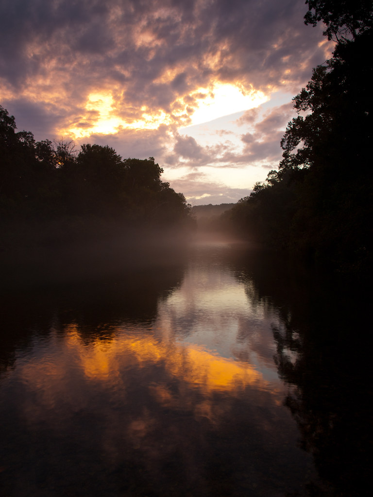
White River
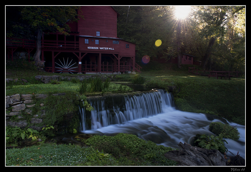
Hodgson Water Mill - Sunburst through the Trees

Camping by the North Fork River - Devils Backbone Wilderness
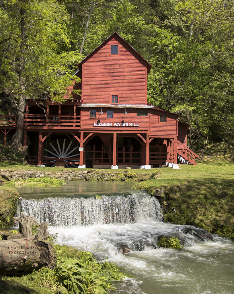
Hodgson Water Mill

At the landing (finally)

What the heck izzit?
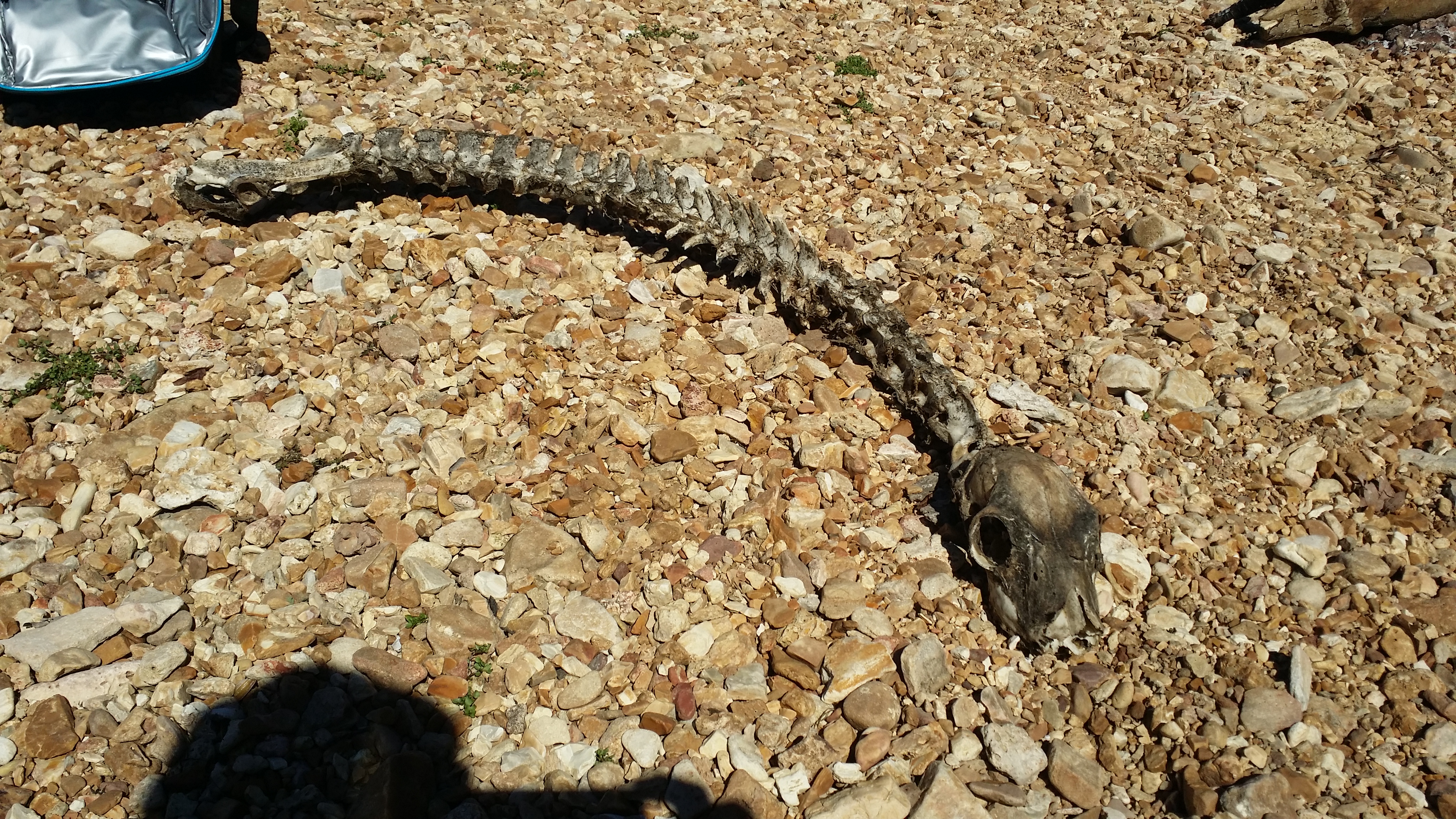
What the heck izzit?

Hodgson Water Mill
Alley Spring Mill
Rockbridge Mill
アメリカ合衆国 ミズーリ州 パイン・クリーク・タウンシップの地図
別の場所を検索
アメリカ合衆国 ミズーリ州 パイン・クリーク・タウンシップでの場所
近所の場所
45 Trigger Ln, Tecumseh, MO アメリカ合衆国
アメリカ合衆国 ミズーリ州 オザーク
Co Rd, Tecumseh, MO アメリカ合衆国County Road
State Hwy H, Caulfield, MO アメリカ合衆国
アメリカ合衆国 〒 ミズーリ州 ハーデンビル
アメリカ合衆国 ミズーリ州 ドー・タウンシップ
アメリカ合衆国 ミズーリ州 リッチランド・タウンシップ
アメリカ合衆国 〒 ミズーリ州 テカムセ
Hansen Ln, Gainesville, MO アメリカ合衆国
アメリカ合衆国 〒 ミズーリ州 ゲインズビル
Co Rd, Caulfield, MO アメリカ合衆国
アメリカ合衆国 〒 ミズーリ州 ブリッジズ・タウンシップ
アメリカ合衆国 ミズーリ州 ジャクソン
アメリカ合衆国 ミズーリ州 ドラ
Co Rd, Caulfield, MO アメリカ合衆国
Stone Mountain Dr, Wasola, MO アメリカ合衆国
アメリカ合衆国 ミズーリ州 バイユー II タウンシップ
アメリカ合衆国 ミズーリ州 チャンピオン・タウンシップ
アメリカ合衆国 ミズーリ州 ノッティングヒル・タウンシップ
アメリカ合衆国 〒 ミズーリ州 コールフィールド
最近の検索
- Woodland Oak Pl, Thousand Oaks, CA, USA日の出日の入り時間
- Sarangdanda, Nepal日の出日の入り時間
- 日本、〒- 宮城県塩竈市中の島日の出日の入り時間
- bp - 63 Rte de l'Observatoire, Bouzareah, アルジェリアアルジェ天文台日の出日の入り時間
- Crocker Dr, Vacaville, CA アメリカ合衆国日の出日の入り時間
- Pu Ngaol Community Meeting Hall, HWHM+3X7, Krong Saen Monourom, Cambodia日の出日の入り時間
- batu 10, Jalan Pantai, Port Dickson, Melaka, マレーシアPantai Cermin日の出日の入り時間
- Groblershoop, 南アフリカ日の出日の入り時間
- Petriti, Greece日の出日の入り時間
- Chesaw Rd, Oroville, WA アメリカ合衆国日の出日の入り時間