N Bear Creek Dr, Merced, CA アメリカ合衆国日の出日の入り時間
Location: アメリカ合衆国 > カリフォルニア州 > マーセド > >
時間帯:
America/Los_Angeles
現地時間:
2024-05-15 21:27:51
経度:
-120.4992784
緯度:
37.3129421
今日の日の出時刻:
05:51:27 AM
今日の日の入時刻:
08:05:21 PM
今日の日長:
14h 13m 54s
明日の日の出時刻:
05:50:41 AM
明日の日の入時刻:
08:06:11 PM
明日の日長:
14h 15m 30s
すべて表示する
| 日付 | 日出 | 日没 | 日長 |
|---|---|---|---|
| 2024年01月01日 | 07:16:09 AM | 04:55:36 PM | 9h 39m 27s |
| 2024年01月02日 | 07:16:16 AM | 04:56:24 PM | 9h 40m 8s |
| 2024年01月03日 | 07:16:21 AM | 04:57:14 PM | 9h 40m 53s |
| 2024年01月04日 | 07:16:23 AM | 04:58:06 PM | 9h 41m 43s |
| 2024年01月05日 | 07:16:24 AM | 04:58:58 PM | 9h 42m 34s |
| 2024年01月06日 | 07:16:23 AM | 04:59:51 PM | 9h 43m 28s |
| 2024年01月07日 | 07:16:20 AM | 05:00:46 PM | 9h 44m 26s |
| 2024年01月08日 | 07:16:14 AM | 05:01:42 PM | 9h 45m 28s |
| 2024年01月09日 | 07:16:07 AM | 05:02:38 PM | 9h 46m 31s |
| 2024年01月10日 | 07:15:58 AM | 05:03:36 PM | 9h 47m 38s |
| 2024年01月11日 | 07:15:46 AM | 05:04:34 PM | 9h 48m 48s |
| 2024年01月12日 | 07:15:33 AM | 05:05:33 PM | 9h 50m 0s |
| 2024年01月13日 | 07:15:17 AM | 05:06:33 PM | 9h 51m 16s |
| 2024年01月14日 | 07:15:00 AM | 05:07:34 PM | 9h 52m 34s |
| 2024年01月15日 | 07:14:40 AM | 05:08:35 PM | 9h 53m 55s |
| 2024年01月16日 | 07:14:19 AM | 05:09:37 PM | 9h 55m 18s |
| 2024年01月17日 | 07:13:55 AM | 05:10:40 PM | 9h 56m 45s |
| 2024年01月18日 | 07:13:30 AM | 05:11:43 PM | 9h 58m 13s |
| 2024年01月19日 | 07:13:02 AM | 05:12:46 PM | 9h 59m 44s |
| 2024年01月20日 | 07:12:33 AM | 05:13:50 PM | 10h 1m 17s |
| 2024年01月21日 | 07:12:02 AM | 05:14:54 PM | 10h 2m 52s |
| 2024年01月22日 | 07:11:29 AM | 05:15:59 PM | 10h 4m 30s |
| 2024年01月23日 | 07:10:54 AM | 05:17:04 PM | 10h 6m 10s |
| 2024年01月24日 | 07:10:17 AM | 05:18:09 PM | 10h 7m 52s |
| 2024年01月25日 | 07:09:38 AM | 05:19:15 PM | 10h 9m 37s |
| 2024年01月26日 | 07:08:58 AM | 05:20:20 PM | 10h 11m 22s |
| 2024年01月27日 | 07:08:16 AM | 05:21:26 PM | 10h 13m 10s |
| 2024年01月28日 | 07:07:32 AM | 05:22:32 PM | 10h 15m 0s |
| 2024年01月29日 | 07:06:46 AM | 05:23:38 PM | 10h 16m 52s |
| 2024年01月30日 | 07:05:59 AM | 05:24:44 PM | 10h 18m 45s |
| 2024年01月31日 | 07:05:10 AM | 05:25:50 PM | 10h 20m 40s |
| 2024年02月01日 | 07:04:20 AM | 05:26:56 PM | 10h 22m 36s |
| 2024年02月02日 | 07:03:28 AM | 05:28:02 PM | 10h 24m 34s |
| 2024年02月03日 | 07:02:34 AM | 05:29:08 PM | 10h 26m 34s |
| 2024年02月04日 | 07:01:39 AM | 05:30:13 PM | 10h 28m 34s |
| 2024年02月05日 | 07:00:42 AM | 05:31:19 PM | 10h 30m 37s |
| 2024年02月06日 | 06:59:44 AM | 05:32:25 PM | 10h 32m 41s |
| 2024年02月07日 | 06:58:45 AM | 05:33:30 PM | 10h 34m 45s |
| 2024年02月08日 | 06:57:44 AM | 05:34:35 PM | 10h 36m 51s |
| 2024年02月09日 | 06:56:41 AM | 05:35:40 PM | 10h 38m 59s |
| 2024年02月10日 | 06:55:38 AM | 05:36:45 PM | 10h 41m 7s |
| 2024年02月11日 | 06:54:33 AM | 05:37:49 PM | 10h 43m 16s |
| 2024年02月12日 | 06:53:27 AM | 05:38:54 PM | 10h 45m 27s |
| 2024年02月13日 | 06:52:19 AM | 05:39:58 PM | 10h 47m 39s |
| 2024年02月14日 | 06:51:11 AM | 05:41:01 PM | 10h 49m 50s |
| 2024年02月15日 | 06:50:01 AM | 05:42:05 PM | 10h 52m 4s |
| 2024年02月16日 | 06:48:50 AM | 05:43:08 PM | 10h 54m 18s |
| 2024年02月17日 | 06:47:38 AM | 05:44:11 PM | 10h 56m 33s |
| 2024年02月18日 | 06:46:25 AM | 05:45:13 PM | 10h 58m 48s |
| 2024年02月19日 | 06:45:11 AM | 05:46:15 PM | 11h 1m 4s |
| 2024年02月20日 | 06:43:56 AM | 05:47:17 PM | 11h 3m 21s |
| 2024年02月21日 | 06:42:40 AM | 05:48:19 PM | 11h 5m 39s |
| 2024年02月22日 | 06:41:23 AM | 05:49:20 PM | 11h 7m 57s |
| 2024年02月23日 | 06:40:05 AM | 05:50:21 PM | 11h 10m 16s |
| 2024年02月24日 | 06:38:46 AM | 05:51:22 PM | 11h 12m 36s |
| 2024年02月25日 | 06:37:26 AM | 05:52:22 PM | 11h 14m 56s |
| 2024年02月26日 | 06:36:06 AM | 05:53:22 PM | 11h 17m 16s |
| 2024年02月27日 | 06:34:45 AM | 05:54:22 PM | 11h 19m 37s |
| 2024年02月28日 | 06:33:23 AM | 05:55:21 PM | 11h 21m 58s |
| 2024年02月29日 | 06:32:00 AM | 05:56:20 PM | 11h 24m 20s |
| 2024年03月01日 | 06:30:37 AM | 05:57:19 PM | 11h 26m 42s |
| 2024年03月02日 | 06:29:13 AM | 05:58:17 PM | 11h 29m 4s |
| 2024年03月03日 | 06:27:48 AM | 05:59:15 PM | 11h 31m 27s |
| 2024年03月04日 | 06:26:23 AM | 06:00:13 PM | 11h 33m 50s |
| 2024年03月05日 | 06:24:58 AM | 06:01:11 PM | 11h 36m 13s |
| 2024年03月06日 | 06:23:32 AM | 06:02:08 PM | 11h 38m 36s |
| 2024年03月07日 | 06:22:05 AM | 06:03:05 PM | 11h 41m 0s |
| 2024年03月08日 | 06:20:38 AM | 06:04:02 PM | 11h 43m 24s |
| 2024年03月09日 | 06:19:10 AM | 06:04:58 PM | 11h 45m 48s |
| 2024年03月10日 | 07:17:46 AM | 07:05:52 PM | 11h 48m 6s |
| 2024年03月11日 | 07:16:18 AM | 07:06:48 PM | 11h 50m 30s |
| 2024年03月12日 | 07:14:49 AM | 07:07:44 PM | 11h 52m 55s |
| 2024年03月13日 | 07:13:20 AM | 07:08:40 PM | 11h 55m 20s |
| 2024年03月14日 | 07:11:51 AM | 07:09:35 PM | 11h 57m 44s |
| 2024年03月15日 | 07:10:22 AM | 07:10:30 PM | 12h 0m 8s |
| 2024年03月16日 | 07:08:52 AM | 07:11:25 PM | 12h 2m 33s |
| 2024年03月17日 | 07:07:23 AM | 07:12:20 PM | 12h 4m 57s |
| 2024年03月18日 | 07:05:53 AM | 07:13:15 PM | 12h 7m 22s |
| 2024年03月19日 | 07:04:23 AM | 07:14:09 PM | 12h 9m 46s |
| 2024年03月20日 | 07:02:52 AM | 07:15:04 PM | 12h 12m 12s |
| 2024年03月21日 | 07:01:22 AM | 07:15:58 PM | 12h 14m 36s |
| 2024年03月22日 | 06:59:52 AM | 07:16:52 PM | 12h 17m 0s |
| 2024年03月23日 | 06:58:22 AM | 07:17:46 PM | 12h 19m 24s |
| 2024年03月24日 | 06:56:52 AM | 07:18:40 PM | 12h 21m 48s |
| 2024年03月25日 | 06:55:22 AM | 07:19:34 PM | 12h 24m 12s |
| 2024年03月26日 | 06:53:52 AM | 07:20:28 PM | 12h 26m 36s |
| 2024年03月27日 | 06:52:22 AM | 07:21:21 PM | 12h 28m 59s |
| 2024年03月28日 | 06:50:52 AM | 07:22:15 PM | 12h 31m 23s |
| 2024年03月29日 | 06:49:23 AM | 07:23:09 PM | 12h 33m 46s |
| 2024年03月30日 | 06:47:53 AM | 07:24:02 PM | 12h 36m 9s |
| 2024年03月31日 | 06:46:24 AM | 07:24:56 PM | 12h 38m 32s |
| 2024年04月01日 | 06:44:55 AM | 07:25:49 PM | 12h 40m 54s |
| 2024年04月02日 | 06:43:27 AM | 07:26:43 PM | 12h 43m 16s |
| 2024年04月03日 | 06:41:59 AM | 07:27:36 PM | 12h 45m 37s |
| 2024年04月04日 | 06:40:31 AM | 07:28:30 PM | 12h 47m 59s |
| 2024年04月05日 | 06:39:03 AM | 07:29:23 PM | 12h 50m 20s |
| 2024年04月06日 | 06:37:36 AM | 07:30:17 PM | 12h 52m 41s |
| 2024年04月07日 | 06:36:10 AM | 07:31:11 PM | 12h 55m 1s |
| 2024年04月08日 | 06:34:44 AM | 07:32:04 PM | 12h 57m 20s |
| 2024年04月09日 | 06:33:18 AM | 07:32:58 PM | 12h 59m 40s |
| 2024年04月10日 | 06:31:53 AM | 07:33:52 PM | 13h 1m 59s |
| 2024年04月11日 | 06:30:28 AM | 07:34:45 PM | 13h 4m 17s |
| 2024年04月12日 | 06:29:05 AM | 07:35:39 PM | 13h 6m 34s |
| 2024年04月13日 | 06:27:41 AM | 07:36:33 PM | 13h 8m 52s |
| 2024年04月14日 | 06:26:19 AM | 07:37:27 PM | 13h 11m 8s |
| 2024年04月15日 | 06:24:57 AM | 07:38:21 PM | 13h 13m 24s |
| 2024年04月16日 | 06:23:36 AM | 07:39:14 PM | 13h 15m 38s |
| 2024年04月17日 | 06:22:15 AM | 07:40:08 PM | 13h 17m 53s |
| 2024年04月18日 | 06:20:55 AM | 07:41:03 PM | 13h 20m 8s |
| 2024年04月19日 | 06:19:37 AM | 07:41:57 PM | 13h 22m 20s |
| 2024年04月20日 | 06:18:18 AM | 07:42:51 PM | 13h 24m 33s |
| 2024年04月21日 | 06:17:01 AM | 07:43:45 PM | 13h 26m 44s |
| 2024年04月22日 | 06:15:45 AM | 07:44:39 PM | 13h 28m 54s |
| 2024年04月23日 | 06:14:30 AM | 07:45:33 PM | 13h 31m 3s |
| 2024年04月24日 | 06:13:15 AM | 07:46:27 PM | 13h 33m 12s |
| 2024年04月25日 | 06:12:02 AM | 07:47:21 PM | 13h 35m 19s |
| 2024年04月26日 | 06:10:49 AM | 07:48:16 PM | 13h 37m 27s |
| 2024年04月27日 | 06:09:38 AM | 07:49:10 PM | 13h 39m 32s |
| 2024年04月28日 | 06:08:28 AM | 07:50:04 PM | 13h 41m 36s |
| 2024年04月29日 | 06:07:19 AM | 07:50:58 PM | 13h 43m 39s |
| 2024年04月30日 | 06:06:11 AM | 07:51:52 PM | 13h 45m 41s |
| 2024年05月01日 | 06:05:04 AM | 07:52:46 PM | 13h 47m 42s |
| 2024年05月02日 | 06:03:58 AM | 07:53:40 PM | 13h 49m 42s |
| 2024年05月03日 | 06:02:54 AM | 07:54:33 PM | 13h 51m 39s |
| 2024年05月04日 | 06:01:50 AM | 07:55:27 PM | 13h 53m 37s |
| 2024年05月05日 | 06:00:48 AM | 07:56:20 PM | 13h 55m 32s |
| 2024年05月06日 | 05:59:48 AM | 07:57:14 PM | 13h 57m 26s |
| 2024年05月07日 | 05:58:48 AM | 07:58:07 PM | 13h 59m 19s |
| 2024年05月08日 | 05:57:50 AM | 07:59:00 PM | 14h 1m 10s |
| 2024年05月09日 | 05:56:54 AM | 07:59:52 PM | 14h 2m 58s |
| 2024年05月10日 | 05:55:59 AM | 08:00:45 PM | 14h 4m 46s |
| 2024年05月11日 | 05:55:05 AM | 08:01:37 PM | 14h 6m 32s |
| 2024年05月12日 | 05:54:12 AM | 08:02:29 PM | 14h 8m 17s |
| 2024年05月13日 | 05:53:22 AM | 08:03:20 PM | 14h 9m 58s |
| 2024年05月14日 | 05:52:32 AM | 08:04:11 PM | 14h 11m 39s |
| 2024年05月15日 | 05:51:44 AM | 08:05:02 PM | 14h 13m 18s |
| 2024年05月16日 | 05:50:58 AM | 08:05:52 PM | 14h 14m 54s |
| 2024年05月17日 | 05:50:14 AM | 08:06:42 PM | 14h 16m 28s |
| 2024年05月18日 | 05:49:30 AM | 08:07:31 PM | 14h 18m 1s |
| 2024年05月19日 | 05:48:49 AM | 08:08:20 PM | 14h 19m 31s |
| 2024年05月20日 | 05:48:09 AM | 08:09:08 PM | 14h 20m 59s |
| 2024年05月21日 | 05:47:31 AM | 08:09:56 PM | 14h 22m 25s |
| 2024年05月22日 | 05:46:54 AM | 08:10:43 PM | 14h 23m 49s |
| 2024年05月23日 | 05:46:19 AM | 08:11:29 PM | 14h 25m 10s |
| 2024年05月24日 | 05:45:46 AM | 08:12:15 PM | 14h 26m 29s |
| 2024年05月25日 | 05:45:15 AM | 08:13:00 PM | 14h 27m 45s |
| 2024年05月26日 | 05:44:45 AM | 08:13:44 PM | 14h 28m 59s |
| 2024年05月27日 | 05:44:17 AM | 08:14:27 PM | 14h 30m 10s |
| 2024年05月28日 | 05:43:51 AM | 08:15:09 PM | 14h 31m 18s |
| 2024年05月29日 | 05:43:26 AM | 08:15:51 PM | 14h 32m 25s |
| 2024年05月30日 | 05:43:03 AM | 08:16:32 PM | 14h 33m 29s |
| 2024年05月31日 | 05:42:42 AM | 08:17:11 PM | 14h 34m 29s |
| 2024年06月01日 | 05:42:23 AM | 08:17:50 PM | 14h 35m 27s |
| 2024年06月02日 | 05:42:06 AM | 08:18:27 PM | 14h 36m 21s |
| 2024年06月03日 | 05:41:50 AM | 08:19:04 PM | 14h 37m 14s |
| 2024年06月04日 | 05:41:36 AM | 08:19:39 PM | 14h 38m 3s |
| 2024年06月05日 | 05:41:24 AM | 08:20:13 PM | 14h 38m 49s |
| 2024年06月06日 | 05:41:14 AM | 08:20:46 PM | 14h 39m 32s |
| 2024年06月07日 | 05:41:05 AM | 08:21:18 PM | 14h 40m 13s |
| 2024年06月08日 | 05:40:59 AM | 08:21:48 PM | 14h 40m 49s |
| 2024年06月09日 | 05:40:54 AM | 08:22:17 PM | 14h 41m 23s |
| 2024年06月10日 | 05:40:50 AM | 08:22:45 PM | 14h 41m 55s |
| 2024年06月11日 | 05:40:49 AM | 08:23:12 PM | 14h 42m 23s |
| 2024年06月12日 | 05:40:49 AM | 08:23:37 PM | 14h 42m 48s |
| 2024年06月13日 | 05:40:51 AM | 08:24:00 PM | 14h 43m 9s |
| 2024年06月14日 | 05:40:55 AM | 08:24:22 PM | 14h 43m 27s |
| 2024年06月15日 | 05:41:00 AM | 08:24:43 PM | 14h 43m 43s |
| 2024年06月16日 | 05:41:07 AM | 08:25:02 PM | 14h 43m 55s |
| 2024年06月17日 | 05:41:16 AM | 08:25:19 PM | 14h 44m 3s |
| 2024年06月18日 | 05:41:26 AM | 08:25:35 PM | 14h 44m 9s |
| 2024年06月19日 | 05:41:38 AM | 08:25:50 PM | 14h 44m 12s |
| 2024年06月20日 | 05:41:51 AM | 08:26:02 PM | 14h 44m 11s |
| 2024年06月21日 | 05:42:06 AM | 08:26:13 PM | 14h 44m 7s |
| 2024年06月22日 | 05:42:23 AM | 08:26:22 PM | 14h 43m 59s |
| 2024年06月23日 | 05:42:41 AM | 08:26:30 PM | 14h 43m 49s |
| 2024年06月24日 | 05:43:01 AM | 08:26:36 PM | 14h 43m 35s |
| 2024年06月25日 | 05:43:22 AM | 08:26:40 PM | 14h 43m 18s |
| 2024年06月26日 | 05:43:44 AM | 08:26:42 PM | 14h 42m 58s |
| 2024年06月27日 | 05:44:08 AM | 08:26:43 PM | 14h 42m 35s |
| 2024年06月28日 | 05:44:33 AM | 08:26:42 PM | 14h 42m 9s |
| 2024年06月29日 | 05:45:00 AM | 08:26:39 PM | 14h 41m 39s |
| 2024年06月30日 | 05:45:27 AM | 08:26:34 PM | 14h 41m 7s |
| 2024年07月01日 | 05:45:56 AM | 08:26:27 PM | 14h 40m 31s |
| 2024年07月02日 | 05:46:27 AM | 08:26:19 PM | 14h 39m 52s |
| 2024年07月03日 | 05:46:58 AM | 08:26:09 PM | 14h 39m 11s |
| 2024年07月04日 | 05:47:31 AM | 08:25:57 PM | 14h 38m 26s |
| 2024年07月05日 | 05:48:04 AM | 08:25:43 PM | 14h 37m 39s |
| 2024年07月06日 | 05:48:39 AM | 08:25:27 PM | 14h 36m 48s |
| 2024年07月07日 | 05:49:15 AM | 08:25:10 PM | 14h 35m 55s |
| 2024年07月08日 | 05:49:52 AM | 08:24:50 PM | 14h 34m 58s |
| 2024年07月09日 | 05:50:30 AM | 08:24:29 PM | 14h 33m 59s |
| 2024年07月10日 | 05:51:08 AM | 08:24:06 PM | 14h 32m 58s |
| 2024年07月11日 | 05:51:48 AM | 08:23:41 PM | 14h 31m 53s |
| 2024年07月12日 | 05:52:28 AM | 08:23:15 PM | 14h 30m 47s |
| 2024年07月13日 | 05:53:09 AM | 08:22:46 PM | 14h 29m 37s |
| 2024年07月14日 | 05:53:51 AM | 08:22:16 PM | 14h 28m 25s |
| 2024年07月15日 | 05:54:34 AM | 08:21:45 PM | 14h 27m 11s |
| 2024年07月16日 | 05:55:17 AM | 08:21:11 PM | 14h 25m 54s |
| 2024年07月17日 | 05:56:01 AM | 08:20:36 PM | 14h 24m 35s |
| 2024年07月18日 | 05:56:46 AM | 08:19:59 PM | 14h 23m 13s |
| 2024年07月19日 | 05:57:31 AM | 08:19:20 PM | 14h 21m 49s |
| 2024年07月20日 | 05:58:17 AM | 08:18:40 PM | 14h 20m 23s |
| 2024年07月21日 | 05:59:03 AM | 08:17:57 PM | 14h 18m 54s |
| 2024年07月22日 | 05:59:50 AM | 08:17:14 PM | 14h 17m 24s |
| 2024年07月23日 | 06:00:37 AM | 08:16:28 PM | 14h 15m 51s |
| 2024年07月24日 | 06:01:24 AM | 08:15:42 PM | 14h 14m 18s |
| 2024年07月25日 | 06:02:12 AM | 08:14:53 PM | 14h 12m 41s |
| 2024年07月26日 | 06:03:01 AM | 08:14:03 PM | 14h 11m 2s |
| 2024年07月27日 | 06:03:49 AM | 08:13:11 PM | 14h 9m 22s |
| 2024年07月28日 | 06:04:38 AM | 08:12:18 PM | 14h 7m 40s |
| 2024年07月29日 | 06:05:27 AM | 08:11:24 PM | 14h 5m 57s |
| 2024年07月30日 | 06:06:17 AM | 08:10:28 PM | 14h 4m 11s |
| 2024年07月31日 | 06:07:06 AM | 08:09:30 PM | 14h 2m 24s |
| 2024年08月01日 | 06:07:56 AM | 08:08:31 PM | 14h 0m 35s |
| 2024年08月02日 | 06:08:46 AM | 08:07:31 PM | 13h 58m 45s |
| 2024年08月03日 | 06:09:36 AM | 08:06:30 PM | 13h 56m 54s |
| 2024年08月04日 | 06:10:27 AM | 08:05:27 PM | 13h 55m 0s |
| 2024年08月05日 | 06:11:17 AM | 08:04:23 PM | 13h 53m 6s |
| 2024年08月06日 | 06:12:08 AM | 08:03:17 PM | 13h 51m 9s |
| 2024年08月07日 | 06:12:58 AM | 08:02:10 PM | 13h 49m 12s |
| 2024年08月08日 | 06:13:49 AM | 08:01:02 PM | 13h 47m 13s |
| 2024年08月09日 | 06:14:39 AM | 07:59:53 PM | 13h 45m 14s |
| 2024年08月10日 | 06:15:30 AM | 07:58:43 PM | 13h 43m 13s |
| 2024年08月11日 | 06:16:21 AM | 07:57:32 PM | 13h 41m 11s |
| 2024年08月12日 | 06:17:11 AM | 07:56:19 PM | 13h 39m 8s |
| 2024年08月13日 | 06:18:02 AM | 07:55:06 PM | 13h 37m 4s |
| 2024年08月14日 | 06:18:52 AM | 07:53:51 PM | 13h 34m 59s |
| 2024年08月15日 | 06:19:43 AM | 07:52:35 PM | 13h 32m 52s |
| 2024年08月16日 | 06:20:33 AM | 07:51:19 PM | 13h 30m 46s |
| 2024年08月17日 | 06:21:24 AM | 07:50:01 PM | 13h 28m 37s |
| 2024年08月18日 | 06:22:14 AM | 07:48:43 PM | 13h 26m 29s |
| 2024年08月19日 | 06:23:05 AM | 07:47:24 PM | 13h 24m 19s |
| 2024年08月20日 | 06:23:55 AM | 07:46:03 PM | 13h 22m 8s |
| 2024年08月21日 | 06:24:45 AM | 07:44:42 PM | 13h 19m 57s |
| 2024年08月22日 | 06:25:35 AM | 07:43:21 PM | 13h 17m 46s |
| 2024年08月23日 | 06:26:25 AM | 07:41:58 PM | 13h 15m 33s |
| 2024年08月24日 | 06:27:15 AM | 07:40:35 PM | 13h 13m 20s |
| 2024年08月25日 | 06:28:05 AM | 07:39:10 PM | 13h 11m 5s |
| 2024年08月26日 | 06:28:55 AM | 07:37:46 PM | 13h 8m 51s |
| 2024年08月27日 | 06:29:45 AM | 07:36:20 PM | 13h 6m 35s |
| 2024年08月28日 | 06:30:34 AM | 07:34:54 PM | 13h 4m 20s |
| 2024年08月29日 | 06:31:24 AM | 07:33:28 PM | 13h 2m 4s |
| 2024年08月30日 | 06:32:13 AM | 07:32:00 PM | 12h 59m 47s |
| 2024年08月31日 | 06:33:03 AM | 07:30:33 PM | 12h 57m 30s |
| 2024年09月01日 | 06:33:52 AM | 07:29:04 PM | 12h 55m 12s |
| 2024年09月02日 | 06:34:42 AM | 07:27:36 PM | 12h 52m 54s |
| 2024年09月03日 | 06:35:31 AM | 07:26:07 PM | 12h 50m 36s |
| 2024年09月04日 | 06:36:20 AM | 07:24:37 PM | 12h 48m 17s |
| 2024年09月05日 | 06:37:09 AM | 07:23:07 PM | 12h 45m 58s |
| 2024年09月06日 | 06:37:59 AM | 07:21:37 PM | 12h 43m 38s |
| 2024年09月07日 | 06:38:48 AM | 07:20:06 PM | 12h 41m 18s |
| 2024年09月08日 | 06:39:37 AM | 07:18:35 PM | 12h 38m 58s |
| 2024年09月09日 | 06:40:26 AM | 07:17:04 PM | 12h 36m 38s |
| 2024年09月10日 | 06:41:15 AM | 07:15:32 PM | 12h 34m 17s |
| 2024年09月11日 | 06:42:05 AM | 07:14:00 PM | 12h 31m 55s |
| 2024年09月12日 | 06:42:54 AM | 07:12:29 PM | 12h 29m 35s |
| 2024年09月13日 | 06:43:43 AM | 07:10:56 PM | 12h 27m 13s |
| 2024年09月14日 | 06:44:33 AM | 07:09:24 PM | 12h 24m 51s |
| 2024年09月15日 | 06:45:22 AM | 07:07:52 PM | 12h 22m 30s |
| 2024年09月16日 | 06:46:11 AM | 07:06:20 PM | 12h 20m 9s |
| 2024年09月17日 | 06:47:01 AM | 07:04:47 PM | 12h 17m 46s |
| 2024年09月18日 | 06:47:51 AM | 07:03:15 PM | 12h 15m 24s |
| 2024年09月19日 | 06:48:40 AM | 07:01:42 PM | 12h 13m 2s |
| 2024年09月20日 | 06:49:30 AM | 07:00:10 PM | 12h 10m 40s |
| 2024年09月21日 | 06:50:20 AM | 06:58:38 PM | 12h 8m 18s |
| 2024年09月22日 | 06:51:11 AM | 06:57:05 PM | 12h 5m 54s |
| 2024年09月23日 | 06:52:01 AM | 06:55:33 PM | 12h 3m 32s |
| 2024年09月24日 | 06:52:51 AM | 06:54:01 PM | 12h 1m 10s |
| 2024年09月25日 | 06:53:42 AM | 06:52:30 PM | 11h 58m 48s |
| 2024年09月26日 | 06:54:33 AM | 06:50:58 PM | 11h 56m 25s |
| 2024年09月27日 | 06:55:24 AM | 06:49:27 PM | 11h 54m 3s |
| 2024年09月28日 | 06:56:15 AM | 06:47:56 PM | 11h 51m 41s |
| 2024年09月29日 | 06:57:07 AM | 06:46:25 PM | 11h 49m 18s |
| 2024年09月30日 | 06:57:58 AM | 06:44:55 PM | 11h 46m 57s |
| 2024年10月01日 | 06:58:50 AM | 06:43:25 PM | 11h 44m 35s |
| 2024年10月02日 | 06:59:42 AM | 06:41:55 PM | 11h 42m 13s |
| 2024年10月03日 | 07:00:35 AM | 06:40:26 PM | 11h 39m 51s |
| 2024年10月04日 | 07:01:28 AM | 06:38:58 PM | 11h 37m 30s |
| 2024年10月05日 | 07:02:21 AM | 06:37:30 PM | 11h 35m 9s |
| 2024年10月06日 | 07:03:14 AM | 06:36:02 PM | 11h 32m 48s |
| 2024年10月07日 | 07:04:08 AM | 06:34:35 PM | 11h 30m 27s |
| 2024年10月08日 | 07:05:02 AM | 06:33:08 PM | 11h 28m 6s |
| 2024年10月09日 | 07:05:56 AM | 06:31:42 PM | 11h 25m 46s |
| 2024年10月10日 | 07:06:50 AM | 06:30:17 PM | 11h 23m 27s |
| 2024年10月11日 | 07:07:45 AM | 06:28:53 PM | 11h 21m 8s |
| 2024年10月12日 | 07:08:40 AM | 06:27:29 PM | 11h 18m 49s |
| 2024年10月13日 | 07:09:36 AM | 06:26:06 PM | 11h 16m 30s |
| 2024年10月14日 | 07:10:32 AM | 06:24:43 PM | 11h 14m 11s |
| 2024年10月15日 | 07:11:28 AM | 06:23:22 PM | 11h 11m 54s |
| 2024年10月16日 | 07:12:25 AM | 06:22:01 PM | 11h 9m 36s |
| 2024年10月17日 | 07:13:22 AM | 06:20:41 PM | 11h 7m 19s |
| 2024年10月18日 | 07:14:19 AM | 06:19:22 PM | 11h 5m 3s |
| 2024年10月19日 | 07:15:17 AM | 06:18:04 PM | 11h 2m 47s |
| 2024年10月20日 | 07:16:15 AM | 06:16:47 PM | 11h 0m 32s |
| 2024年10月21日 | 07:17:13 AM | 06:15:31 PM | 10h 58m 18s |
| 2024年10月22日 | 07:18:12 AM | 06:14:16 PM | 10h 56m 4s |
| 2024年10月23日 | 07:19:11 AM | 06:13:02 PM | 10h 53m 51s |
| 2024年10月24日 | 07:20:10 AM | 06:11:49 PM | 10h 51m 39s |
| 2024年10月25日 | 07:21:09 AM | 06:10:38 PM | 10h 49m 29s |
| 2024年10月26日 | 07:22:09 AM | 06:09:27 PM | 10h 47m 18s |
| 2024年10月27日 | 07:23:10 AM | 06:08:18 PM | 10h 45m 8s |
| 2024年10月28日 | 07:24:10 AM | 06:07:10 PM | 10h 43m 0s |
| 2024年10月29日 | 07:25:11 AM | 06:06:03 PM | 10h 40m 52s |
| 2024年10月30日 | 07:26:12 AM | 06:04:57 PM | 10h 38m 45s |
| 2024年10月31日 | 07:27:14 AM | 06:03:53 PM | 10h 36m 39s |
| 2024年11月01日 | 07:28:15 AM | 06:02:50 PM | 10h 34m 35s |
| 2024年11月02日 | 07:29:17 AM | 06:01:49 PM | 10h 32m 32s |
| 2024年11月03日 | 06:30:22 AM | 05:00:46 PM | 10h 30m 24s |
| 2024年11月04日 | 06:31:24 AM | 04:59:48 PM | 10h 28m 24s |
| 2024年11月05日 | 06:32:27 AM | 04:58:51 PM | 10h 26m 24s |
| 2024年11月06日 | 06:33:29 AM | 04:57:55 PM | 10h 24m 26s |
| 2024年11月07日 | 06:34:32 AM | 04:57:01 PM | 10h 22m 29s |
| 2024年11月08日 | 06:35:35 AM | 04:56:09 PM | 10h 20m 34s |
| 2024年11月09日 | 06:36:38 AM | 04:55:18 PM | 10h 18m 40s |
| 2024年11月10日 | 06:37:41 AM | 04:54:29 PM | 10h 16m 48s |
| 2024年11月11日 | 06:38:44 AM | 04:53:42 PM | 10h 14m 58s |
| 2024年11月12日 | 06:39:47 AM | 04:52:56 PM | 10h 13m 9s |
| 2024年11月13日 | 06:40:50 AM | 04:52:12 PM | 10h 11m 22s |
| 2024年11月14日 | 06:41:53 AM | 04:51:30 PM | 10h 9m 37s |
| 2024年11月15日 | 06:42:56 AM | 04:50:50 PM | 10h 7m 54s |
| 2024年11月16日 | 06:43:58 AM | 04:50:11 PM | 10h 6m 13s |
| 2024年11月17日 | 06:45:01 AM | 04:49:35 PM | 10h 4m 34s |
| 2024年11月18日 | 06:46:03 AM | 04:49:00 PM | 10h 2m 57s |
| 2024年11月19日 | 06:47:05 AM | 04:48:27 PM | 10h 1m 22s |
| 2024年11月20日 | 06:48:06 AM | 04:47:56 PM | 9h 59m 50s |
| 2024年11月21日 | 06:49:08 AM | 04:47:27 PM | 9h 58m 19s |
| 2024年11月22日 | 06:50:09 AM | 04:47:00 PM | 9h 56m 51s |
| 2024年11月23日 | 06:51:09 AM | 04:46:34 PM | 9h 55m 25s |
| 2024年11月24日 | 06:52:09 AM | 04:46:11 PM | 9h 54m 2s |
| 2024年11月25日 | 06:53:08 AM | 04:45:50 PM | 9h 52m 42s |
| 2024年11月26日 | 06:54:07 AM | 04:45:31 PM | 9h 51m 24s |
| 2024年11月27日 | 06:55:05 AM | 04:45:14 PM | 9h 50m 9s |
| 2024年11月28日 | 06:56:03 AM | 04:44:59 PM | 9h 48m 56s |
| 2024年11月29日 | 06:57:00 AM | 04:44:46 PM | 9h 47m 46s |
| 2024年11月30日 | 06:57:56 AM | 04:44:35 PM | 9h 46m 39s |
| 2024年12月01日 | 06:58:51 AM | 04:44:26 PM | 9h 45m 35s |
| 2024年12月02日 | 06:59:45 AM | 04:44:20 PM | 9h 44m 35s |
| 2024年12月03日 | 07:00:39 AM | 04:44:15 PM | 9h 43m 36s |
| 2024年12月04日 | 07:01:31 AM | 04:44:12 PM | 9h 42m 41s |
| 2024年12月05日 | 07:02:23 AM | 04:44:12 PM | 9h 41m 49s |
| 2024年12月06日 | 07:03:13 AM | 04:44:14 PM | 9h 41m 1s |
| 2024年12月07日 | 07:04:02 AM | 04:44:17 PM | 9h 40m 15s |
| 2024年12月08日 | 07:04:50 AM | 04:44:23 PM | 9h 39m 33s |
| 2024年12月09日 | 07:05:37 AM | 04:44:31 PM | 9h 38m 54s |
| 2024年12月10日 | 07:06:22 AM | 04:44:41 PM | 9h 38m 19s |
| 2024年12月11日 | 07:07:06 AM | 04:44:53 PM | 9h 37m 47s |
| 2024年12月12日 | 07:07:49 AM | 04:45:07 PM | 9h 37m 18s |
| 2024年12月13日 | 07:08:31 AM | 04:45:23 PM | 9h 36m 52s |
| 2024年12月14日 | 07:09:10 AM | 04:45:41 PM | 9h 36m 31s |
| 2024年12月15日 | 07:09:49 AM | 04:46:01 PM | 9h 36m 12s |
| 2024年12月16日 | 07:10:26 AM | 04:46:23 PM | 9h 35m 57s |
| 2024年12月17日 | 07:11:01 AM | 04:46:47 PM | 9h 35m 46s |
| 2024年12月18日 | 07:11:34 AM | 04:47:13 PM | 9h 35m 39s |
| 2024年12月19日 | 07:12:06 AM | 04:47:40 PM | 9h 35m 34s |
| 2024年12月20日 | 07:12:36 AM | 04:48:10 PM | 9h 35m 34s |
| 2024年12月21日 | 07:13:05 AM | 04:48:41 PM | 9h 35m 36s |
| 2024年12月22日 | 07:13:32 AM | 04:49:14 PM | 9h 35m 42s |
| 2024年12月23日 | 07:13:56 AM | 04:49:49 PM | 9h 35m 53s |
| 2024年12月24日 | 07:14:19 AM | 04:50:25 PM | 9h 36m 6s |
| 2024年12月25日 | 07:14:40 AM | 04:51:03 PM | 9h 36m 23s |
| 2024年12月26日 | 07:15:00 AM | 04:51:43 PM | 9h 36m 43s |
| 2024年12月27日 | 07:15:17 AM | 04:52:24 PM | 9h 37m 7s |
| 2024年12月28日 | 07:15:32 AM | 04:53:07 PM | 9h 37m 35s |
| 2024年12月29日 | 07:15:46 AM | 04:53:51 PM | 9h 38m 5s |
| 2024年12月30日 | 07:15:57 AM | 04:54:37 PM | 9h 38m 40s |
写真

Off into the sunset

Belt of Venus, Earth Shadow, Sierra Foothills, Wheat Field (wheatfield study 2)

Lake Pier
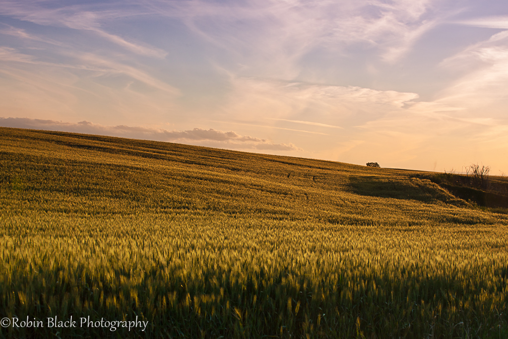
Evening Light on Ripened Wheat, Sierra Foothills

Obelisk on Highway 140

"G Street"

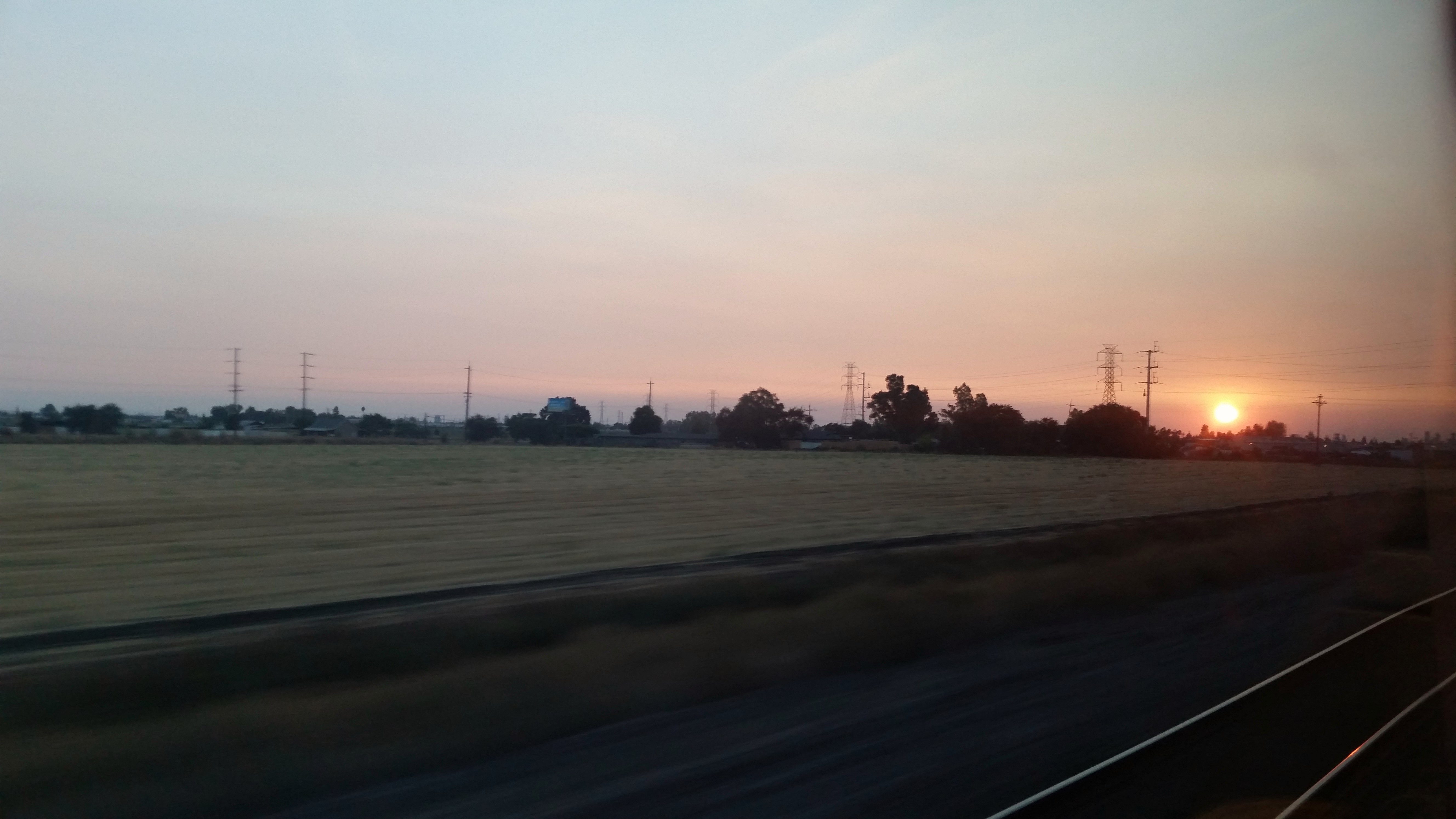
The sunset Merced 6-22-12

Sunset | Atwater

Sunrise #2, Robinson Ranch

Drive-thru, Merced

Barbed wire at sunset, Merced

Sunset-red, Merced

Gradually the flocks dispersed again.

Gradually the flocks dispersed again.

Gradually the flocks dispersed again

Flocks of birds heading for the fields of cut corn near sunset.

Last Sunset of 2011

2013-10-09 18.11.46 HDR

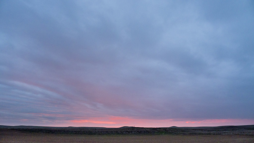
Winter Sunset

My landscape photos
Riding off into the sunset...

Polluted Sunrise

Skulls in hoarfrost #1 (1 of 1)

Sunrise Merced 6-23-12 2
#2 Sunrise at Robinson Ranch

Sunrise Merced 6-23-12 1

Sunrise Mer 7-23-12 1

Sunrise Mer 7-23-12 2

Sunrise, Robinson Ranch, looking SE

Sunrise on the 99
N Bear Creek Dr, Merced, CA アメリカ合衆国の地図
別の場所を検索
近所の場所
W Main St, Merced, CA アメリカ合衆国
Demoss Ct, Merced, CA アメリカ合衆国
アメリカ合衆国 カリフォルニア州 マーセド
Toulon Ct, Merced, CA アメリカ合衆国
Sonora Ave, Merced, CA アメリカ合衆国
N State Hwy 59, Merced, CA アメリカ合衆国
Nellie St, Merced, CA アメリカ合衆国
N Buhach Rd, Atwater, CA アメリカ合衆国
Third St, Atwater, CA アメリカ合衆国
アメリカ合衆国 〒 カリフォルニア州 アトウォーター
Spruce Ave, Atwater, CA アメリカ合衆国
アメリカ合衆国 〒 カリフォルニア州 ウィントン
アメリカ合衆国 〒 カリフォルニア州 アムステルダム
アメリカ合衆国 カリフォルニア州 サン・ウォーキン川
Eucalyptus Ave, Winton, CA アメリカ合衆国
アメリカ合衆国 〒 カリフォルニア州 ウィントン
Steinberg Rd, Atwater, CA アメリカ合衆国
58 E El Nido Rd, El Nido, CA アメリカ合衆国
アメリカ合衆国 〒 カリフォルニア州 エル・ニード
アメリカ合衆国 カリフォルニア州 プラナダ
最近の検索
- Somanouchicho, Tenri, Nara -, Japan日の出日の入り時間
- Kota Ternate Utara, Ternate City, North Maluku, Indonesia日の出日の入り時間
- Zhongzheng S Rd, Sanchong District, New Taipei City, 台湾 Zhongzheng South Road日の出日の入り時間
- コンゴ民主共和国 リュアラバ日の出日の入り時間
- スペイン オーレンセ ア・ポブラ・デ・トリーベス日の出日の入り時間
- Šodolovci, Croatia日の出日の入り時間
- ドイツ 〒 ピュンデリッヒ日の出日の入り時間
- Steamboat Island Road Northwest, Olympia, WA アメリカ合衆国日の出日の入り時間
- Kootenai Trail Rd, Bonners Ferry, ID アメリカ合衆国日の出日の入り時間
- スイス 〒 メッツォヴィコ=ヴィラ日の出日の入り時間