Mulligan Ln, Laytonville, CA アメリカ合衆国日の出日の入り時間
Location: アメリカ合衆国 > カリフォルニア州 > メンドシーノ > アメリカ合衆国 カリフォルニア州 レイトンビル >
時間帯:
America/Los_Angeles
現地時間:
2024-05-01 09:42:47
経度:
-123.486705
緯度:
39.670459
今日の日の出時刻:
06:11:57 AM
今日の日の入時刻:
08:09:42 PM
今日の日長:
13h 57m 45s
明日の日の出時刻:
06:10:47 AM
明日の日の入時刻:
08:10:41 PM
明日の日長:
13h 59m 54s
すべて表示する
| 日付 | 日出 | 日没 | 日長 |
|---|---|---|---|
| 2024年01月01日 | 07:34:48 AM | 05:00:51 PM | 9h 26m 3s |
| 2024年01月02日 | 07:34:52 AM | 05:01:42 PM | 9h 26m 50s |
| 2024年01月03日 | 07:34:55 AM | 05:02:34 PM | 9h 27m 39s |
| 2024年01月04日 | 07:34:56 AM | 05:03:28 PM | 9h 28m 32s |
| 2024年01月05日 | 07:34:54 AM | 05:04:23 PM | 9h 29m 29s |
| 2024年01月06日 | 07:34:50 AM | 05:05:19 PM | 9h 30m 29s |
| 2024年01月07日 | 07:34:44 AM | 05:06:16 PM | 9h 31m 32s |
| 2024年01月08日 | 07:34:35 AM | 05:07:15 PM | 9h 32m 40s |
| 2024年01月09日 | 07:34:25 AM | 05:08:15 PM | 9h 33m 50s |
| 2024年01月10日 | 07:34:12 AM | 05:09:16 PM | 9h 35m 4s |
| 2024年01月11日 | 07:33:57 AM | 05:10:17 PM | 9h 36m 20s |
| 2024年01月12日 | 07:33:40 AM | 05:11:20 PM | 9h 37m 40s |
| 2024年01月13日 | 07:33:21 AM | 05:12:24 PM | 9h 39m 3s |
| 2024年01月14日 | 07:33:00 AM | 05:13:28 PM | 9h 40m 28s |
| 2024年01月15日 | 07:32:36 AM | 05:14:33 PM | 9h 41m 57s |
| 2024年01月16日 | 07:32:10 AM | 05:15:39 PM | 9h 43m 29s |
| 2024年01月17日 | 07:31:43 AM | 05:16:46 PM | 9h 45m 3s |
| 2024年01月18日 | 07:31:13 AM | 05:17:53 PM | 9h 46m 40s |
| 2024年01月19日 | 07:30:41 AM | 05:19:01 PM | 9h 48m 20s |
| 2024年01月20日 | 07:30:07 AM | 05:20:10 PM | 9h 50m 3s |
| 2024年01月21日 | 07:29:32 AM | 05:21:19 PM | 9h 51m 47s |
| 2024年01月22日 | 07:28:54 AM | 05:22:28 PM | 9h 53m 34s |
| 2024年01月23日 | 07:28:14 AM | 05:23:38 PM | 9h 55m 24s |
| 2024年01月24日 | 07:27:32 AM | 05:24:48 PM | 9h 57m 16s |
| 2024年01月25日 | 07:26:49 AM | 05:25:58 PM | 9h 59m 9s |
| 2024年01月26日 | 07:26:04 AM | 05:27:09 PM | 10h 1m 5s |
| 2024年01月27日 | 07:25:16 AM | 05:28:20 PM | 10h 3m 4s |
| 2024年01月28日 | 07:24:27 AM | 05:29:31 PM | 10h 5m 4s |
| 2024年01月29日 | 07:23:36 AM | 05:30:42 PM | 10h 7m 6s |
| 2024年01月30日 | 07:22:44 AM | 05:31:53 PM | 10h 9m 9s |
| 2024年01月31日 | 07:21:49 AM | 05:33:05 PM | 10h 11m 16s |
| 2024年02月01日 | 07:20:54 AM | 05:34:16 PM | 10h 13m 22s |
| 2024年02月02日 | 07:19:56 AM | 05:35:28 PM | 10h 15m 32s |
| 2024年02月03日 | 07:18:57 AM | 05:36:39 PM | 10h 17m 42s |
| 2024年02月04日 | 07:17:56 AM | 05:37:50 PM | 10h 19m 54s |
| 2024年02月05日 | 07:16:54 AM | 05:39:02 PM | 10h 22m 8s |
| 2024年02月06日 | 07:15:50 AM | 05:40:13 PM | 10h 24m 23s |
| 2024年02月07日 | 07:14:44 AM | 05:41:24 PM | 10h 26m 40s |
| 2024年02月08日 | 07:13:38 AM | 05:42:35 PM | 10h 28m 57s |
| 2024年02月09日 | 07:12:29 AM | 05:43:46 PM | 10h 31m 17s |
| 2024年02月10日 | 07:11:20 AM | 05:44:57 PM | 10h 33m 37s |
| 2024年02月11日 | 07:10:09 AM | 05:46:07 PM | 10h 35m 58s |
| 2024年02月12日 | 07:08:57 AM | 05:47:17 PM | 10h 38m 20s |
| 2024年02月13日 | 07:07:44 AM | 05:48:27 PM | 10h 40m 43s |
| 2024年02月14日 | 07:06:29 AM | 05:49:37 PM | 10h 43m 8s |
| 2024年02月15日 | 07:05:13 AM | 05:50:46 PM | 10h 45m 33s |
| 2024年02月16日 | 07:03:56 AM | 05:51:56 PM | 10h 48m 0s |
| 2024年02月17日 | 07:02:38 AM | 05:53:05 PM | 10h 50m 27s |
| 2024年02月18日 | 07:01:19 AM | 05:54:13 PM | 10h 52m 54s |
| 2024年02月19日 | 06:59:58 AM | 05:55:22 PM | 10h 55m 24s |
| 2024年02月20日 | 06:58:37 AM | 05:56:30 PM | 10h 57m 53s |
| 2024年02月21日 | 06:57:15 AM | 05:57:37 PM | 11h 0m 22s |
| 2024年02月22日 | 06:55:52 AM | 05:58:45 PM | 11h 2m 53s |
| 2024年02月23日 | 06:54:27 AM | 05:59:52 PM | 11h 5m 25s |
| 2024年02月24日 | 06:53:02 AM | 06:00:59 PM | 11h 7m 57s |
| 2024年02月25日 | 06:51:37 AM | 06:02:06 PM | 11h 10m 29s |
| 2024年02月26日 | 06:50:10 AM | 06:03:12 PM | 11h 13m 2s |
| 2024年02月27日 | 06:48:42 AM | 06:04:18 PM | 11h 15m 36s |
| 2024年02月28日 | 06:47:14 AM | 06:05:23 PM | 11h 18m 9s |
| 2024年02月29日 | 06:45:45 AM | 06:06:29 PM | 11h 20m 44s |
| 2024年03月01日 | 06:44:16 AM | 06:07:34 PM | 11h 23m 18s |
| 2024年03月02日 | 06:42:45 AM | 06:08:38 PM | 11h 25m 53s |
| 2024年03月03日 | 06:41:15 AM | 06:09:43 PM | 11h 28m 28s |
| 2024年03月04日 | 06:39:43 AM | 06:10:47 PM | 11h 31m 4s |
| 2024年03月05日 | 06:38:11 AM | 06:11:51 PM | 11h 33m 40s |
| 2024年03月06日 | 06:36:39 AM | 06:12:55 PM | 11h 36m 16s |
| 2024年03月07日 | 06:35:06 AM | 06:13:58 PM | 11h 38m 52s |
| 2024年03月08日 | 06:33:32 AM | 06:15:01 PM | 11h 41m 29s |
| 2024年03月09日 | 06:31:58 AM | 06:16:04 PM | 11h 44m 6s |
| 2024年03月10日 | 07:30:28 AM | 07:17:04 PM | 11h 46m 36s |
| 2024年03月11日 | 07:28:53 AM | 07:18:06 PM | 11h 49m 13s |
| 2024年03月12日 | 07:27:18 AM | 07:19:09 PM | 11h 51m 51s |
| 2024年03月13日 | 07:25:43 AM | 07:20:11 PM | 11h 54m 28s |
| 2024年03月14日 | 07:24:08 AM | 07:21:12 PM | 11h 57m 4s |
| 2024年03月15日 | 07:22:32 AM | 07:22:14 PM | 11h 59m 42s |
| 2024年03月16日 | 07:20:56 AM | 07:23:15 PM | 12h 2m 19s |
| 2024年03月17日 | 07:19:20 AM | 07:24:16 PM | 12h 4m 56s |
| 2024年03月18日 | 07:17:43 AM | 07:25:18 PM | 12h 7m 35s |
| 2024年03月19日 | 07:16:07 AM | 07:26:18 PM | 12h 10m 11s |
| 2024年03月20日 | 07:14:31 AM | 07:27:19 PM | 12h 12m 48s |
| 2024年03月21日 | 07:12:54 AM | 07:28:20 PM | 12h 15m 26s |
| 2024年03月22日 | 07:11:17 AM | 07:29:20 PM | 12h 18m 3s |
| 2024年03月23日 | 07:09:41 AM | 07:30:21 PM | 12h 20m 40s |
| 2024年03月24日 | 07:08:04 AM | 07:31:21 PM | 12h 23m 17s |
| 2024年03月25日 | 07:06:28 AM | 07:32:21 PM | 12h 25m 53s |
| 2024年03月26日 | 07:04:52 AM | 07:33:21 PM | 12h 28m 29s |
| 2024年03月27日 | 07:03:15 AM | 07:34:22 PM | 12h 31m 7s |
| 2024年03月28日 | 07:01:39 AM | 07:35:22 PM | 12h 33m 43s |
| 2024年03月29日 | 07:00:03 AM | 07:36:22 PM | 12h 36m 19s |
| 2024年03月30日 | 06:58:28 AM | 07:37:21 PM | 12h 38m 53s |
| 2024年03月31日 | 06:56:52 AM | 07:38:21 PM | 12h 41m 29s |
| 2024年04月01日 | 06:55:17 AM | 07:39:21 PM | 12h 44m 4s |
| 2024年04月02日 | 06:53:42 AM | 07:40:21 PM | 12h 46m 39s |
| 2024年04月03日 | 06:52:08 AM | 07:41:21 PM | 12h 49m 13s |
| 2024年04月04日 | 06:50:34 AM | 07:42:21 PM | 12h 51m 47s |
| 2024年04月05日 | 06:49:00 AM | 07:43:20 PM | 12h 54m 20s |
| 2024年04月06日 | 06:47:27 AM | 07:44:20 PM | 12h 56m 53s |
| 2024年04月07日 | 06:45:54 AM | 07:45:20 PM | 12h 59m 26s |
| 2024年04月08日 | 06:44:22 AM | 07:46:20 PM | 13h 1m 58s |
| 2024年04月09日 | 06:42:50 AM | 07:47:20 PM | 13h 4m 30s |
| 2024年04月10日 | 06:41:18 AM | 07:48:20 PM | 13h 7m 2s |
| 2024年04月11日 | 06:39:48 AM | 07:49:20 PM | 13h 9m 32s |
| 2024年04月12日 | 06:38:18 AM | 07:50:20 PM | 13h 12m 2s |
| 2024年04月13日 | 06:36:48 AM | 07:51:20 PM | 13h 14m 32s |
| 2024年04月14日 | 06:35:20 AM | 07:52:20 PM | 13h 17m 0s |
| 2024年04月15日 | 06:33:51 AM | 07:53:20 PM | 13h 19m 29s |
| 2024年04月16日 | 06:32:24 AM | 07:54:20 PM | 13h 21m 56s |
| 2024年04月17日 | 06:30:58 AM | 07:55:20 PM | 13h 24m 22s |
| 2024年04月18日 | 06:29:32 AM | 07:56:20 PM | 13h 26m 48s |
| 2024年04月19日 | 06:28:07 AM | 07:57:20 PM | 13h 29m 13s |
| 2024年04月20日 | 06:26:43 AM | 07:58:20 PM | 13h 31m 37s |
| 2024年04月21日 | 06:25:20 AM | 07:59:20 PM | 13h 34m 0s |
| 2024年04月22日 | 06:23:58 AM | 08:00:20 PM | 13h 36m 22s |
| 2024年04月23日 | 06:22:36 AM | 08:01:20 PM | 13h 38m 44s |
| 2024年04月24日 | 06:21:16 AM | 08:02:20 PM | 13h 41m 4s |
| 2024年04月25日 | 06:19:57 AM | 08:03:20 PM | 13h 43m 23s |
| 2024年04月26日 | 06:18:39 AM | 08:04:20 PM | 13h 45m 41s |
| 2024年04月27日 | 06:17:21 AM | 08:05:20 PM | 13h 47m 59s |
| 2024年04月28日 | 06:16:05 AM | 08:06:20 PM | 13h 50m 15s |
| 2024年04月29日 | 06:14:50 AM | 08:07:20 PM | 13h 52m 30s |
| 2024年04月30日 | 06:13:37 AM | 08:08:20 PM | 13h 54m 43s |
| 2024年05月01日 | 06:12:24 AM | 08:09:19 PM | 13h 56m 55s |
| 2024年05月02日 | 06:11:13 AM | 08:10:19 PM | 13h 59m 6s |
| 2024年05月03日 | 06:10:03 AM | 08:11:18 PM | 14h 1m 15s |
| 2024年05月04日 | 06:08:54 AM | 08:12:17 PM | 14h 3m 23s |
| 2024年05月05日 | 06:07:47 AM | 08:13:16 PM | 14h 5m 29s |
| 2024年05月06日 | 06:06:41 AM | 08:14:15 PM | 14h 7m 34s |
| 2024年05月07日 | 06:05:36 AM | 08:15:13 PM | 14h 9m 37s |
| 2024年05月08日 | 06:04:33 AM | 08:16:11 PM | 14h 11m 38s |
| 2024年05月09日 | 06:03:31 AM | 08:17:09 PM | 14h 13m 38s |
| 2024年05月10日 | 06:02:31 AM | 08:18:06 PM | 14h 15m 35s |
| 2024年05月11日 | 06:01:32 AM | 08:19:04 PM | 14h 17m 32s |
| 2024年05月12日 | 06:00:35 AM | 08:20:00 PM | 14h 19m 25s |
| 2024年05月13日 | 05:59:39 AM | 08:20:57 PM | 14h 21m 18s |
| 2024年05月14日 | 05:58:45 AM | 08:21:53 PM | 14h 23m 8s |
| 2024年05月15日 | 05:57:52 AM | 08:22:48 PM | 14h 24m 56s |
| 2024年05月16日 | 05:57:01 AM | 08:23:43 PM | 14h 26m 42s |
| 2024年05月17日 | 05:56:12 AM | 08:24:37 PM | 14h 28m 25s |
| 2024年05月18日 | 05:55:25 AM | 08:25:31 PM | 14h 30m 6s |
| 2024年05月19日 | 05:54:39 AM | 08:26:24 PM | 14h 31m 45s |
| 2024年05月20日 | 05:53:55 AM | 08:27:17 PM | 14h 33m 22s |
| 2024年05月21日 | 05:53:12 AM | 08:28:09 PM | 14h 34m 57s |
| 2024年05月22日 | 05:52:32 AM | 08:29:00 PM | 14h 36m 28s |
| 2024年05月23日 | 05:51:53 AM | 08:29:50 PM | 14h 37m 57s |
| 2024年05月24日 | 05:51:16 AM | 08:30:39 PM | 14h 39m 23s |
| 2024年05月25日 | 05:50:41 AM | 08:31:28 PM | 14h 40m 47s |
| 2024年05月26日 | 05:50:07 AM | 08:32:16 PM | 14h 42m 9s |
| 2024年05月27日 | 05:49:36 AM | 08:33:03 PM | 14h 43m 27s |
| 2024年05月28日 | 05:49:06 AM | 08:33:48 PM | 14h 44m 42s |
| 2024年05月29日 | 05:48:38 AM | 08:34:33 PM | 14h 45m 55s |
| 2024年05月30日 | 05:48:12 AM | 08:35:17 PM | 14h 47m 5s |
| 2024年05月31日 | 05:47:48 AM | 08:35:59 PM | 14h 48m 11s |
| 2024年06月01日 | 05:47:26 AM | 08:36:41 PM | 14h 49m 15s |
| 2024年06月02日 | 05:47:06 AM | 08:37:21 PM | 14h 50m 15s |
| 2024年06月03日 | 05:46:48 AM | 08:38:00 PM | 14h 51m 12s |
| 2024年06月04日 | 05:46:32 AM | 08:38:38 PM | 14h 52m 6s |
| 2024年06月05日 | 05:46:17 AM | 08:39:14 PM | 14h 52m 57s |
| 2024年06月06日 | 05:46:05 AM | 08:39:50 PM | 14h 53m 45s |
| 2024年06月07日 | 05:45:54 AM | 08:40:23 PM | 14h 54m 29s |
| 2024年06月08日 | 05:45:45 AM | 08:40:56 PM | 14h 55m 11s |
| 2024年06月09日 | 05:45:39 AM | 08:41:26 PM | 14h 55m 47s |
| 2024年06月10日 | 05:45:34 AM | 08:41:56 PM | 14h 56m 22s |
| 2024年06月11日 | 05:45:31 AM | 08:42:24 PM | 14h 56m 53s |
| 2024年06月12日 | 05:45:30 AM | 08:42:50 PM | 14h 57m 20s |
| 2024年06月13日 | 05:45:31 AM | 08:43:15 PM | 14h 57m 44s |
| 2024年06月14日 | 05:45:34 AM | 08:43:38 PM | 14h 58m 4s |
| 2024年06月15日 | 05:45:38 AM | 08:43:59 PM | 14h 58m 21s |
| 2024年06月16日 | 05:45:45 AM | 08:44:18 PM | 14h 58m 33s |
| 2024年06月17日 | 05:45:53 AM | 08:44:36 PM | 14h 58m 43s |
| 2024年06月18日 | 05:46:03 AM | 08:44:53 PM | 14h 58m 50s |
| 2024年06月19日 | 05:46:15 AM | 08:45:07 PM | 14h 58m 52s |
| 2024年06月20日 | 05:46:28 AM | 08:45:19 PM | 14h 58m 51s |
| 2024年06月21日 | 05:46:43 AM | 08:45:30 PM | 14h 58m 47s |
| 2024年06月22日 | 05:47:00 AM | 08:45:39 PM | 14h 58m 39s |
| 2024年06月23日 | 05:47:19 AM | 08:45:46 PM | 14h 58m 27s |
| 2024年06月24日 | 05:47:39 AM | 08:45:51 PM | 14h 58m 12s |
| 2024年06月25日 | 05:48:01 AM | 08:45:54 PM | 14h 57m 53s |
| 2024年06月26日 | 05:48:25 AM | 08:45:56 PM | 14h 57m 31s |
| 2024年06月27日 | 05:48:50 AM | 08:45:55 PM | 14h 57m 5s |
| 2024年06月28日 | 05:49:16 AM | 08:45:53 PM | 14h 56m 37s |
| 2024年06月29日 | 05:49:44 AM | 08:45:48 PM | 14h 56m 4s |
| 2024年06月30日 | 05:50:14 AM | 08:45:42 PM | 14h 55m 28s |
| 2024年07月01日 | 05:50:45 AM | 08:45:33 PM | 14h 54m 48s |
| 2024年07月02日 | 05:51:17 AM | 08:45:23 PM | 14h 54m 6s |
| 2024年07月03日 | 05:51:50 AM | 08:45:11 PM | 14h 53m 21s |
| 2024年07月04日 | 05:52:25 AM | 08:44:56 PM | 14h 52m 31s |
| 2024年07月05日 | 05:53:01 AM | 08:44:40 PM | 14h 51m 39s |
| 2024年07月06日 | 05:53:39 AM | 08:44:22 PM | 14h 50m 43s |
| 2024年07月07日 | 05:54:17 AM | 08:44:02 PM | 14h 49m 45s |
| 2024年07月08日 | 05:54:57 AM | 08:43:39 PM | 14h 48m 42s |
| 2024年07月09日 | 05:55:37 AM | 08:43:15 PM | 14h 47m 38s |
| 2024年07月10日 | 05:56:19 AM | 08:42:49 PM | 14h 46m 30s |
| 2024年07月11日 | 05:57:02 AM | 08:42:21 PM | 14h 45m 19s |
| 2024年07月12日 | 05:57:46 AM | 08:41:51 PM | 14h 44m 5s |
| 2024年07月13日 | 05:58:30 AM | 08:41:20 PM | 14h 42m 50s |
| 2024年07月14日 | 05:59:16 AM | 08:40:46 PM | 14h 41m 30s |
| 2024年07月15日 | 06:00:02 AM | 08:40:11 PM | 14h 40m 9s |
| 2024年07月16日 | 06:00:49 AM | 08:39:33 PM | 14h 38m 44s |
| 2024年07月17日 | 06:01:37 AM | 08:38:54 PM | 14h 37m 17s |
| 2024年07月18日 | 06:02:26 AM | 08:38:13 PM | 14h 35m 47s |
| 2024年07月19日 | 06:03:15 AM | 08:37:30 PM | 14h 34m 15s |
| 2024年07月20日 | 06:04:05 AM | 08:36:45 PM | 14h 32m 40s |
| 2024年07月21日 | 06:04:55 AM | 08:35:59 PM | 14h 31m 4s |
| 2024年07月22日 | 06:05:46 AM | 08:35:11 PM | 14h 29m 25s |
| 2024年07月23日 | 06:06:38 AM | 08:34:21 PM | 14h 27m 43s |
| 2024年07月24日 | 06:07:30 AM | 08:33:30 PM | 14h 26m 0s |
| 2024年07月25日 | 06:08:23 AM | 08:32:36 PM | 14h 24m 13s |
| 2024年07月26日 | 06:09:16 AM | 08:31:42 PM | 14h 22m 26s |
| 2024年07月27日 | 06:10:09 AM | 08:30:45 PM | 14h 20m 36s |
| 2024年07月28日 | 06:11:03 AM | 08:29:47 PM | 14h 18m 44s |
| 2024年07月29日 | 06:11:57 AM | 08:28:48 PM | 14h 16m 51s |
| 2024年07月30日 | 06:12:52 AM | 08:27:47 PM | 14h 14m 55s |
| 2024年07月31日 | 06:13:47 AM | 08:26:44 PM | 14h 12m 57s |
| 2024年08月01日 | 06:14:42 AM | 08:25:40 PM | 14h 10m 58s |
| 2024年08月02日 | 06:15:37 AM | 08:24:35 PM | 14h 8m 58s |
| 2024年08月03日 | 06:16:32 AM | 08:23:28 PM | 14h 6m 56s |
| 2024年08月04日 | 06:17:28 AM | 08:22:20 PM | 14h 4m 52s |
| 2024年08月05日 | 06:18:24 AM | 08:21:10 PM | 14h 2m 46s |
| 2024年08月06日 | 06:19:19 AM | 08:19:59 PM | 14h 0m 40s |
| 2024年08月07日 | 06:20:15 AM | 08:18:47 PM | 13h 58m 32s |
| 2024年08月08日 | 06:21:12 AM | 08:17:33 PM | 13h 56m 21s |
| 2024年08月09日 | 06:22:08 AM | 08:16:19 PM | 13h 54m 11s |
| 2024年08月10日 | 06:23:04 AM | 08:15:03 PM | 13h 51m 59s |
| 2024年08月11日 | 06:24:00 AM | 08:13:46 PM | 13h 49m 46s |
| 2024年08月12日 | 06:24:57 AM | 08:12:28 PM | 13h 47m 31s |
| 2024年08月13日 | 06:25:53 AM | 08:11:08 PM | 13h 45m 15s |
| 2024年08月14日 | 06:26:49 AM | 08:09:48 PM | 13h 42m 59s |
| 2024年08月15日 | 06:27:46 AM | 08:08:27 PM | 13h 40m 41s |
| 2024年08月16日 | 06:28:42 AM | 08:07:04 PM | 13h 38m 22s |
| 2024年08月17日 | 06:29:38 AM | 08:05:41 PM | 13h 36m 3s |
| 2024年08月18日 | 06:30:35 AM | 08:04:16 PM | 13h 33m 41s |
| 2024年08月19日 | 06:31:31 AM | 08:02:51 PM | 13h 31m 20s |
| 2024年08月20日 | 06:32:27 AM | 08:01:25 PM | 13h 28m 58s |
| 2024年08月21日 | 06:33:23 AM | 07:59:58 PM | 13h 26m 35s |
| 2024年08月22日 | 06:34:19 AM | 07:58:30 PM | 13h 24m 11s |
| 2024年08月23日 | 06:35:15 AM | 07:57:02 PM | 13h 21m 47s |
| 2024年08月24日 | 06:36:11 AM | 07:55:32 PM | 13h 19m 21s |
| 2024年08月25日 | 06:37:07 AM | 07:54:02 PM | 13h 16m 55s |
| 2024年08月26日 | 06:38:03 AM | 07:52:31 PM | 13h 14m 28s |
| 2024年08月27日 | 06:38:59 AM | 07:51:00 PM | 13h 12m 1s |
| 2024年08月28日 | 06:39:55 AM | 07:49:28 PM | 13h 9m 33s |
| 2024年08月29日 | 06:40:50 AM | 07:47:55 PM | 13h 7m 5s |
| 2024年08月30日 | 06:41:46 AM | 07:46:21 PM | 13h 4m 35s |
| 2024年08月31日 | 06:42:42 AM | 07:44:48 PM | 13h 2m 6s |
| 2024年09月01日 | 06:43:37 AM | 07:43:13 PM | 12h 59m 36s |
| 2024年09月02日 | 06:44:33 AM | 07:41:38 PM | 12h 57m 5s |
| 2024年09月03日 | 06:45:28 AM | 07:40:03 PM | 12h 54m 35s |
| 2024年09月04日 | 06:46:24 AM | 07:38:27 PM | 12h 52m 3s |
| 2024年09月05日 | 06:47:19 AM | 07:36:51 PM | 12h 49m 32s |
| 2024年09月06日 | 06:48:14 AM | 07:35:14 PM | 12h 47m 0s |
| 2024年09月07日 | 06:49:10 AM | 07:33:38 PM | 12h 44m 28s |
| 2024年09月08日 | 06:50:05 AM | 07:32:00 PM | 12h 41m 55s |
| 2024年09月09日 | 06:51:01 AM | 07:30:23 PM | 12h 39m 22s |
| 2024年09月10日 | 06:51:56 AM | 07:28:45 PM | 12h 36m 49s |
| 2024年09月11日 | 06:52:52 AM | 07:27:07 PM | 12h 34m 15s |
| 2024年09月12日 | 06:53:47 AM | 07:25:29 PM | 12h 31m 42s |
| 2024年09月13日 | 06:54:43 AM | 07:23:51 PM | 12h 29m 8s |
| 2024年09月14日 | 06:55:38 AM | 07:22:12 PM | 12h 26m 34s |
| 2024年09月15日 | 06:56:34 AM | 07:20:34 PM | 12h 24m 0s |
| 2024年09月16日 | 06:57:30 AM | 07:18:55 PM | 12h 21m 25s |
| 2024年09月17日 | 06:58:25 AM | 07:17:16 PM | 12h 18m 51s |
| 2024年09月18日 | 06:59:21 AM | 07:15:38 PM | 12h 16m 17s |
| 2024年09月19日 | 07:00:17 AM | 07:13:59 PM | 12h 13m 42s |
| 2024年09月20日 | 07:01:14 AM | 07:12:20 PM | 12h 11m 6s |
| 2024年09月21日 | 07:02:10 AM | 07:10:42 PM | 12h 8m 32s |
| 2024年09月22日 | 07:03:06 AM | 07:09:03 PM | 12h 5m 57s |
| 2024年09月23日 | 07:04:03 AM | 07:07:25 PM | 12h 3m 22s |
| 2024年09月24日 | 07:05:00 AM | 07:05:47 PM | 12h 0m 47s |
| 2024年09月25日 | 07:05:57 AM | 07:04:09 PM | 11h 58m 12s |
| 2024年09月26日 | 07:06:54 AM | 07:02:31 PM | 11h 55m 37s |
| 2024年09月27日 | 07:07:51 AM | 07:00:53 PM | 11h 53m 2s |
| 2024年09月28日 | 07:08:49 AM | 06:59:16 PM | 11h 50m 27s |
| 2024年09月29日 | 07:09:46 AM | 06:57:39 PM | 11h 47m 53s |
| 2024年09月30日 | 07:10:44 AM | 06:56:03 PM | 11h 45m 19s |
| 2024年10月01日 | 07:11:43 AM | 06:54:26 PM | 11h 42m 43s |
| 2024年10月02日 | 07:12:41 AM | 06:52:50 PM | 11h 40m 9s |
| 2024年10月03日 | 07:13:40 AM | 06:51:15 PM | 11h 37m 35s |
| 2024年10月04日 | 07:14:39 AM | 06:49:40 PM | 11h 35m 1s |
| 2024年10月05日 | 07:15:38 AM | 06:48:06 PM | 11h 32m 28s |
| 2024年10月06日 | 07:16:38 AM | 06:46:32 PM | 11h 29m 54s |
| 2024年10月07日 | 07:17:38 AM | 06:44:59 PM | 11h 27m 21s |
| 2024年10月08日 | 07:18:38 AM | 06:43:26 PM | 11h 24m 48s |
| 2024年10月09日 | 07:19:38 AM | 06:41:54 PM | 11h 22m 16s |
| 2024年10月10日 | 07:20:39 AM | 06:40:22 PM | 11h 19m 43s |
| 2024年10月11日 | 07:21:40 AM | 06:38:51 PM | 11h 17m 11s |
| 2024年10月12日 | 07:22:42 AM | 06:37:21 PM | 11h 14m 39s |
| 2024年10月13日 | 07:23:43 AM | 06:35:52 PM | 11h 12m 9s |
| 2024年10月14日 | 07:24:45 AM | 06:34:23 PM | 11h 9m 38s |
| 2024年10月15日 | 07:25:48 AM | 06:32:56 PM | 11h 7m 8s |
| 2024年10月16日 | 07:26:51 AM | 06:31:29 PM | 11h 4m 38s |
| 2024年10月17日 | 07:27:54 AM | 06:30:03 PM | 11h 2m 9s |
| 2024年10月18日 | 07:28:57 AM | 06:28:38 PM | 10h 59m 41s |
| 2024年10月19日 | 07:30:01 AM | 06:27:14 PM | 10h 57m 13s |
| 2024年10月20日 | 07:31:05 AM | 06:25:51 PM | 10h 54m 46s |
| 2024年10月21日 | 07:32:09 AM | 06:24:29 PM | 10h 52m 20s |
| 2024年10月22日 | 07:33:14 AM | 06:23:08 PM | 10h 49m 54s |
| 2024年10月23日 | 07:34:19 AM | 06:21:48 PM | 10h 47m 29s |
| 2024年10月24日 | 07:35:24 AM | 06:20:29 PM | 10h 45m 5s |
| 2024年10月25日 | 07:36:30 AM | 06:19:11 PM | 10h 42m 41s |
| 2024年10月26日 | 07:37:36 AM | 06:17:55 PM | 10h 40m 19s |
| 2024年10月27日 | 07:38:42 AM | 06:16:39 PM | 10h 37m 57s |
| 2024年10月28日 | 07:39:49 AM | 06:15:25 PM | 10h 35m 36s |
| 2024年10月29日 | 07:40:55 AM | 06:14:13 PM | 10h 33m 18s |
| 2024年10月30日 | 07:42:02 AM | 06:13:01 PM | 10h 30m 59s |
| 2024年10月31日 | 07:43:09 AM | 06:11:51 PM | 10h 28m 42s |
| 2024年11月01日 | 07:44:17 AM | 06:10:43 PM | 10h 26m 26s |
| 2024年11月02日 | 07:45:24 AM | 06:09:36 PM | 10h 24m 12s |
| 2024年11月03日 | 06:46:35 AM | 05:08:27 PM | 10h 21m 52s |
| 2024年11月04日 | 06:47:43 AM | 05:07:23 PM | 10h 19m 40s |
| 2024年11月05日 | 06:48:51 AM | 05:06:21 PM | 10h 17m 30s |
| 2024年11月06日 | 06:49:59 AM | 05:05:20 PM | 10h 15m 21s |
| 2024年11月07日 | 06:51:07 AM | 05:04:20 PM | 10h 13m 13s |
| 2024年11月08日 | 06:52:16 AM | 05:03:23 PM | 10h 11m 7s |
| 2024年11月09日 | 06:53:24 AM | 05:02:27 PM | 10h 9m 3s |
| 2024年11月10日 | 06:54:32 AM | 05:01:32 PM | 10h 7m 0s |
| 2024年11月11日 | 06:55:40 AM | 05:00:40 PM | 10h 5m 0s |
| 2024年11月12日 | 06:56:49 AM | 04:59:49 PM | 10h 3m 0s |
| 2024年11月13日 | 06:57:57 AM | 04:59:00 PM | 10h 1m 3s |
| 2024年11月14日 | 06:59:04 AM | 04:58:13 PM | 9h 59m 9s |
| 2024年11月15日 | 07:00:12 AM | 04:57:28 PM | 9h 57m 16s |
| 2024年11月16日 | 07:01:19 AM | 04:56:44 PM | 9h 55m 25s |
| 2024年11月17日 | 07:02:27 AM | 04:56:03 PM | 9h 53m 36s |
| 2024年11月18日 | 07:03:33 AM | 04:55:23 PM | 9h 51m 50s |
| 2024年11月19日 | 07:04:40 AM | 04:54:46 PM | 9h 50m 6s |
| 2024年11月20日 | 07:05:46 AM | 04:54:10 PM | 9h 48m 24s |
| 2024年11月21日 | 07:06:52 AM | 04:53:37 PM | 9h 46m 45s |
| 2024年11月22日 | 07:07:57 AM | 04:53:06 PM | 9h 45m 9s |
| 2024年11月23日 | 07:09:01 AM | 04:52:36 PM | 9h 43m 35s |
| 2024年11月24日 | 07:10:05 AM | 04:52:09 PM | 9h 42m 4s |
| 2024年11月25日 | 07:11:09 AM | 04:51:44 PM | 9h 40m 35s |
| 2024年11月26日 | 07:12:11 AM | 04:51:21 PM | 9h 39m 10s |
| 2024年11月27日 | 07:13:13 AM | 04:51:01 PM | 9h 37m 48s |
| 2024年11月28日 | 07:14:14 AM | 04:50:42 PM | 9h 36m 28s |
| 2024年11月29日 | 07:15:14 AM | 04:50:26 PM | 9h 35m 12s |
| 2024年11月30日 | 07:16:14 AM | 04:50:11 PM | 9h 33m 57s |
| 2024年12月01日 | 07:17:12 AM | 04:50:00 PM | 9h 32m 48s |
| 2024年12月02日 | 07:18:09 AM | 04:49:50 PM | 9h 31m 41s |
| 2024年12月03日 | 07:19:06 AM | 04:49:42 PM | 9h 30m 36s |
| 2024年12月04日 | 07:20:01 AM | 04:49:37 PM | 9h 29m 36s |
| 2024年12月05日 | 07:20:55 AM | 04:49:34 PM | 9h 28m 39s |
| 2024年12月06日 | 07:21:47 AM | 04:49:33 PM | 9h 27m 46s |
| 2024年12月07日 | 07:22:39 AM | 04:49:35 PM | 9h 26m 56s |
| 2024年12月08日 | 07:23:29 AM | 04:49:39 PM | 9h 26m 10s |
| 2024年12月09日 | 07:24:18 AM | 04:49:45 PM | 9h 25m 27s |
| 2024年12月10日 | 07:25:05 AM | 04:49:53 PM | 9h 24m 48s |
| 2024年12月11日 | 07:25:51 AM | 04:50:03 PM | 9h 24m 12s |
| 2024年12月12日 | 07:26:35 AM | 04:50:16 PM | 9h 23m 41s |
| 2024年12月13日 | 07:27:17 AM | 04:50:31 PM | 9h 23m 14s |
| 2024年12月14日 | 07:27:58 AM | 04:50:48 PM | 9h 22m 50s |
| 2024年12月15日 | 07:28:38 AM | 04:51:07 PM | 9h 22m 29s |
| 2024年12月16日 | 07:29:15 AM | 04:51:28 PM | 9h 22m 13s |
| 2024年12月17日 | 07:29:51 AM | 04:51:51 PM | 9h 22m 0s |
| 2024年12月18日 | 07:30:25 AM | 04:52:16 PM | 9h 21m 51s |
| 2024年12月19日 | 07:30:57 AM | 04:52:44 PM | 9h 21m 47s |
| 2024年12月20日 | 07:31:27 AM | 04:53:13 PM | 9h 21m 46s |
| 2024年12月21日 | 07:31:55 AM | 04:53:45 PM | 9h 21m 50s |
| 2024年12月22日 | 07:32:22 AM | 04:54:18 PM | 9h 21m 56s |
| 2024年12月23日 | 07:32:46 AM | 04:54:53 PM | 9h 22m 7s |
| 2024年12月24日 | 07:33:08 AM | 04:55:30 PM | 9h 22m 22s |
| 2024年12月25日 | 07:33:29 AM | 04:56:09 PM | 9h 22m 40s |
| 2024年12月26日 | 07:33:47 AM | 04:56:50 PM | 9h 23m 3s |
| 2024年12月27日 | 07:34:03 AM | 04:57:33 PM | 9h 23m 30s |
| 2024年12月28日 | 07:34:17 AM | 04:58:17 PM | 9h 24m 0s |
| 2024年12月29日 | 07:34:29 AM | 04:59:03 PM | 9h 24m 34s |
| 2024年12月30日 | 07:34:38 AM | 04:59:50 PM | 9h 25m 12s |
写真
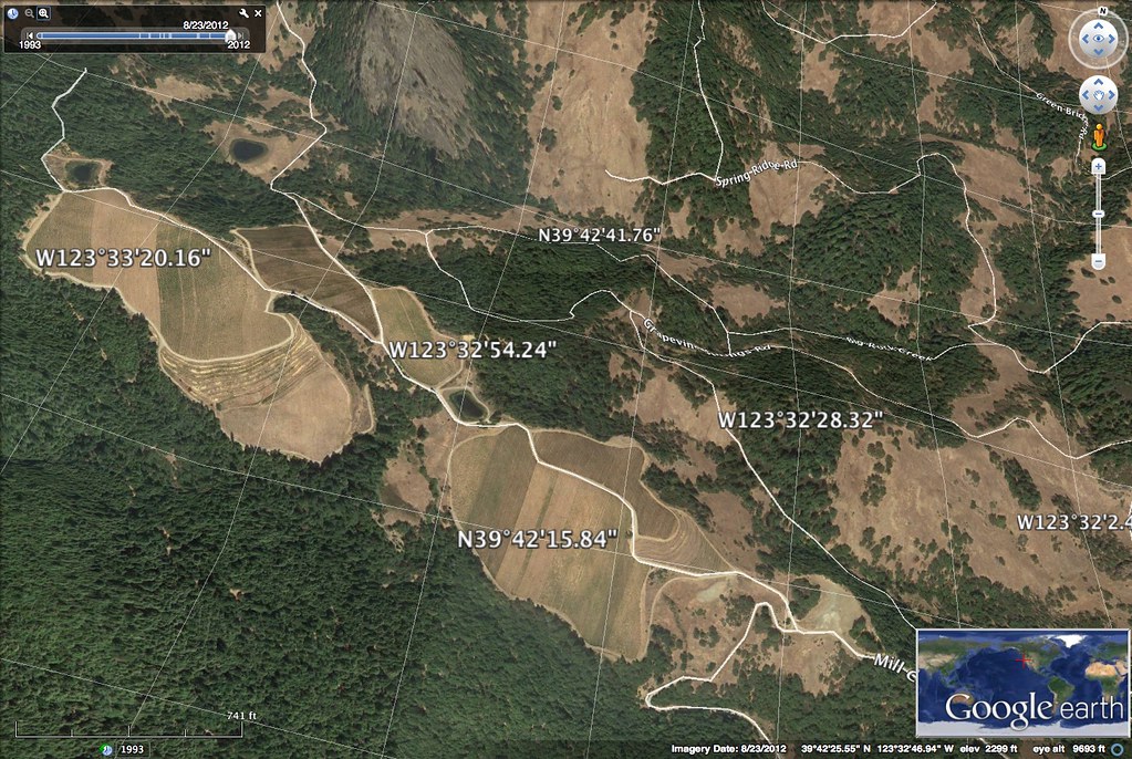
Mendocino Terraced Farm - h

Driving northbound on 101
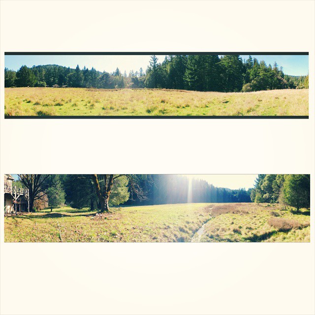
#angelo is like #paradise #nature #vscocam

IMG_3764 DESCANSO BILL

Earthdance 2009 058

Earthdance 2009 048

Opening parade

Historic dome and bus

Earthdance 2008 020

Driving northbound on 101
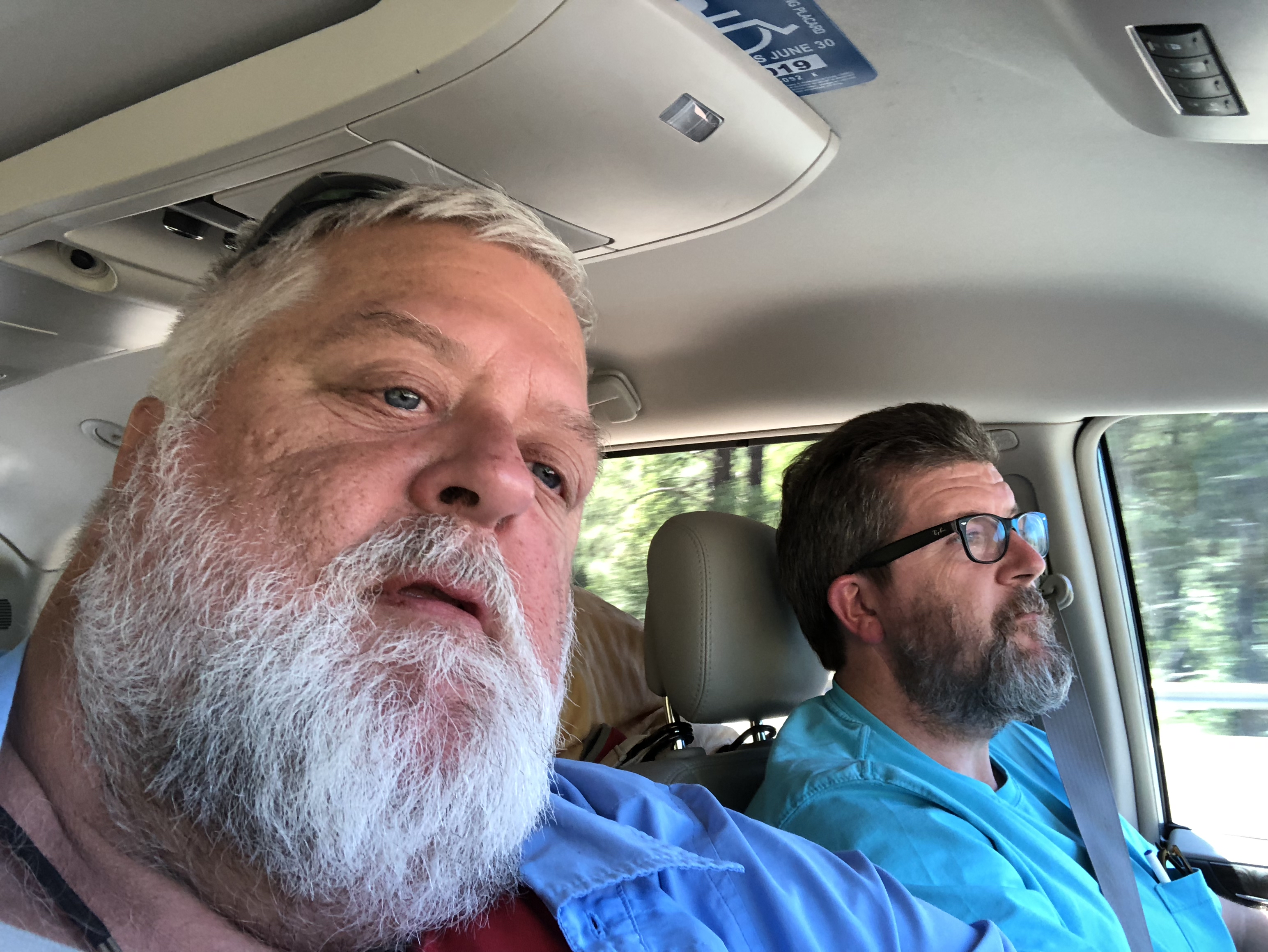
Driving northbound on 101
Mulligan Ln, Laytonville, CA アメリカ合衆国の地図
別の場所を検索
近所の場所
US-, Laytonville, CA アメリカ合衆国
アメリカ合衆国 カリフォルニア州 レイトンビル
Ten Mile Creek Rd, Laytonville, CA アメリカ合衆国
Simmerly Rd, Covelo, CA アメリカ合衆国
アメリカ合衆国 カリフォルニア州 メンドシーノ
Covelo Rd, Willits, CA アメリカ合衆国
Woodman Creek Rd, Covelo, CA アメリカ合衆国
アメリカ合衆国 〒 カリフォルニア州 ブランズクーム
N Hwy, Laytonville, CA アメリカ合衆国
Covelo Rd, Willits, CA アメリカ合衆国
Sherwood Rd, Willits, CA アメリカ合衆国Sherwood School
Simmerly Rd, Covelo, CA アメリカ合衆国
US-, Laytonville, CA アメリカ合衆国
Simmerly Ranch Rd, Laytonville, CA アメリカ合衆国
US-, Leggett, CA アメリカ合衆国
Timberline Rd, California アメリカ合衆国ティンバーライン・ロード
Covelo Rdfuse Rd, Covelo, CA アメリカ合衆国
Blue Lake Rd, Willits, CA アメリカ合衆国
CA-, Leggett, CA アメリカ合衆国
Ridge Rd, Willits, CA アメリカ合衆国
最近の検索
- 6 Rue Jules Ferry, Beausoleil, France日の出日の入り時間
- スペイン 〒 ビスカヤ オチャンディオ日の出日の入り時間
- Sattva Horizon, 4JC6+G9P, Vinayak Nagar, Kattigenahalli, Bengaluru, Karnataka, India日の出日の入り時間
- 日本、〒- 静岡県富士宮市北山富士山日の出日の入り時間
- Laurel Rd, Townsend, TN アメリカ合衆国日の出日の入り時間
- 中華人民共和国 Guang Dong Sheng, Shen Zhen Shi, Long Gang Qu, 海滨南路GFPQ+R9Q 海浜南路日の出日の入り時間
- Redondo Ave, Long Beach, CA アメリカ合衆国日の出日の入り時間
- Ulitsa Kalinina, 79, Rezh, Sverdlovskaya oblast', ロシア日の出日の入り時間
- Leguwa ネパール日の出日の入り時間
- Shustino, Vladimir Oblast, ロシア日の出日の入り時間