アメリカ合衆国 アーカンソー州 リーズ・クリーク・タウンシップ日の出日の入り時間
Location: アメリカ合衆国 > アーカンソー州 > ワシントン >
時間帯:
America/Chicago
現地時間:
2024-05-01 23:06:14
経度:
-94.2025859
緯度:
35.8310643
今日の日の出時刻:
06:22:17 AM
今日の日の入時刻:
08:05:06 PM
今日の日長:
13h 42m 49s
明日の日の出時刻:
06:21:15 AM
明日の日の入時刻:
08:05:57 PM
明日の日長:
13h 44m 42s
すべて表示する
| 日付 | 日出 | 日没 | 日長 |
|---|---|---|---|
| 2024年01月01日 | 07:26:58 AM | 05:14:15 PM | 9h 47m 17s |
| 2024年01月02日 | 07:27:06 AM | 05:15:03 PM | 9h 47m 57s |
| 2024年01月03日 | 07:27:13 AM | 05:15:51 PM | 9h 48m 38s |
| 2024年01月04日 | 07:27:17 AM | 05:16:41 PM | 9h 49m 24s |
| 2024年01月05日 | 07:27:20 AM | 05:17:32 PM | 9h 50m 12s |
| 2024年01月06日 | 07:27:20 AM | 05:18:23 PM | 9h 51m 3s |
| 2024年01月07日 | 07:27:19 AM | 05:19:16 PM | 9h 51m 57s |
| 2024年01月08日 | 07:27:16 AM | 05:20:10 PM | 9h 52m 54s |
| 2024年01月09日 | 07:27:11 AM | 05:21:05 PM | 9h 53m 54s |
| 2024年01月10日 | 07:27:03 AM | 05:22:00 PM | 9h 54m 57s |
| 2024年01月11日 | 07:26:54 AM | 05:22:56 PM | 9h 56m 2s |
| 2024年01月12日 | 07:26:43 AM | 05:23:53 PM | 9h 57m 10s |
| 2024年01月13日 | 07:26:30 AM | 05:24:51 PM | 9h 58m 21s |
| 2024年01月14日 | 07:26:15 AM | 05:25:49 PM | 9h 59m 34s |
| 2024年01月15日 | 07:25:58 AM | 05:26:48 PM | 10h 0m 50s |
| 2024年01月16日 | 07:25:39 AM | 05:27:48 PM | 10h 2m 9s |
| 2024年01月17日 | 07:25:19 AM | 05:28:48 PM | 10h 3m 29s |
| 2024年01月18日 | 07:24:56 AM | 05:29:48 PM | 10h 4m 52s |
| 2024年01月19日 | 07:24:32 AM | 05:30:49 PM | 10h 6m 17s |
| 2024年01月20日 | 07:24:05 AM | 05:31:50 PM | 10h 7m 45s |
| 2024年01月21日 | 07:23:37 AM | 05:32:52 PM | 10h 9m 15s |
| 2024年01月22日 | 07:23:07 AM | 05:33:54 PM | 10h 10m 47s |
| 2024年01月23日 | 07:22:35 AM | 05:34:56 PM | 10h 12m 21s |
| 2024年01月24日 | 07:22:01 AM | 05:35:58 PM | 10h 13m 57s |
| 2024年01月25日 | 07:21:26 AM | 05:37:01 PM | 10h 15m 35s |
| 2024年01月26日 | 07:20:49 AM | 05:38:03 PM | 10h 17m 14s |
| 2024年01月27日 | 07:20:10 AM | 05:39:06 PM | 10h 18m 56s |
| 2024年01月28日 | 07:19:29 AM | 05:40:09 PM | 10h 20m 40s |
| 2024年01月29日 | 07:18:47 AM | 05:41:12 PM | 10h 22m 25s |
| 2024年01月30日 | 07:18:03 AM | 05:42:14 PM | 10h 24m 11s |
| 2024年01月31日 | 07:17:18 AM | 05:43:17 PM | 10h 25m 59s |
| 2024年02月01日 | 07:16:31 AM | 05:44:20 PM | 10h 27m 49s |
| 2024年02月02日 | 07:15:42 AM | 05:45:23 PM | 10h 29m 41s |
| 2024年02月03日 | 07:14:52 AM | 05:46:25 PM | 10h 31m 33s |
| 2024年02月04日 | 07:14:01 AM | 05:47:28 PM | 10h 33m 27s |
| 2024年02月05日 | 07:13:08 AM | 05:48:30 PM | 10h 35m 22s |
| 2024年02月06日 | 07:12:13 AM | 05:49:32 PM | 10h 37m 19s |
| 2024年02月07日 | 07:11:17 AM | 05:50:34 PM | 10h 39m 17s |
| 2024年02月08日 | 07:10:20 AM | 05:51:36 PM | 10h 41m 16s |
| 2024年02月09日 | 07:09:21 AM | 05:52:37 PM | 10h 43m 16s |
| 2024年02月10日 | 07:08:21 AM | 05:53:39 PM | 10h 45m 18s |
| 2024年02月11日 | 07:07:20 AM | 05:54:40 PM | 10h 47m 20s |
| 2024年02月12日 | 07:06:18 AM | 05:55:41 PM | 10h 49m 23s |
| 2024年02月13日 | 07:05:14 AM | 05:56:41 PM | 10h 51m 27s |
| 2024年02月14日 | 07:04:09 AM | 05:57:41 PM | 10h 53m 32s |
| 2024年02月15日 | 07:03:03 AM | 05:58:41 PM | 10h 55m 38s |
| 2024年02月16日 | 07:01:56 AM | 05:59:41 PM | 10h 57m 45s |
| 2024年02月17日 | 07:00:48 AM | 06:00:40 PM | 10h 59m 52s |
| 2024年02月18日 | 06:59:39 AM | 06:01:39 PM | 11h 2m 0s |
| 2024年02月19日 | 06:58:28 AM | 06:02:37 PM | 11h 4m 9s |
| 2024年02月20日 | 06:57:17 AM | 06:03:36 PM | 11h 6m 19s |
| 2024年02月21日 | 06:56:05 AM | 06:04:34 PM | 11h 8m 29s |
| 2024年02月22日 | 06:54:52 AM | 06:05:31 PM | 11h 10m 39s |
| 2024年02月23日 | 06:53:38 AM | 06:06:29 PM | 11h 12m 51s |
| 2024年02月24日 | 06:52:23 AM | 06:07:26 PM | 11h 15m 3s |
| 2024年02月25日 | 06:51:07 AM | 06:08:22 PM | 11h 17m 15s |
| 2024年02月26日 | 06:49:50 AM | 06:09:18 PM | 11h 19m 28s |
| 2024年02月27日 | 06:48:33 AM | 06:10:14 PM | 11h 21m 41s |
| 2024年02月28日 | 06:47:15 AM | 06:11:10 PM | 11h 23m 55s |
| 2024年02月29日 | 06:45:56 AM | 06:12:05 PM | 11h 26m 9s |
| 2024年03月01日 | 06:44:37 AM | 06:13:00 PM | 11h 28m 23s |
| 2024年03月02日 | 06:43:17 AM | 06:13:55 PM | 11h 30m 38s |
| 2024年03月03日 | 06:41:56 AM | 06:14:49 PM | 11h 32m 53s |
| 2024年03月04日 | 06:40:35 AM | 06:15:44 PM | 11h 35m 9s |
| 2024年03月05日 | 06:39:13 AM | 06:16:37 PM | 11h 37m 24s |
| 2024年03月06日 | 06:37:51 AM | 06:17:31 PM | 11h 39m 40s |
| 2024年03月07日 | 06:36:28 AM | 06:18:24 PM | 11h 41m 56s |
| 2024年03月08日 | 06:35:05 AM | 06:19:17 PM | 11h 44m 12s |
| 2024年03月09日 | 06:33:41 AM | 06:20:10 PM | 11h 46m 29s |
| 2024年03月10日 | 07:32:21 AM | 07:21:00 PM | 11h 48m 39s |
| 2024年03月11日 | 07:30:56 AM | 07:21:52 PM | 11h 50m 56s |
| 2024年03月12日 | 07:29:31 AM | 07:22:44 PM | 11h 53m 13s |
| 2024年03月13日 | 07:28:06 AM | 07:23:36 PM | 11h 55m 30s |
| 2024年03月14日 | 07:26:41 AM | 07:24:28 PM | 11h 57m 47s |
| 2024年03月15日 | 07:25:16 AM | 07:25:19 PM | 12h 0m 3s |
| 2024年03月16日 | 07:23:50 AM | 07:26:11 PM | 12h 2m 21s |
| 2024年03月17日 | 07:22:24 AM | 07:27:02 PM | 12h 4m 38s |
| 2024年03月18日 | 07:20:58 AM | 07:27:53 PM | 12h 6m 55s |
| 2024年03月19日 | 07:19:32 AM | 07:28:43 PM | 12h 9m 11s |
| 2024年03月20日 | 07:18:05 AM | 07:29:34 PM | 12h 11m 29s |
| 2024年03月21日 | 07:16:39 AM | 07:30:24 PM | 12h 13m 45s |
| 2024年03月22日 | 07:15:13 AM | 07:31:15 PM | 12h 16m 2s |
| 2024年03月23日 | 07:13:46 AM | 07:32:05 PM | 12h 18m 19s |
| 2024年03月24日 | 07:12:20 AM | 07:32:55 PM | 12h 20m 35s |
| 2024年03月25日 | 07:10:54 AM | 07:33:45 PM | 12h 22m 51s |
| 2024年03月26日 | 07:09:27 AM | 07:34:35 PM | 12h 25m 8s |
| 2024年03月27日 | 07:08:01 AM | 07:35:25 PM | 12h 27m 24s |
| 2024年03月28日 | 07:06:35 AM | 07:36:15 PM | 12h 29m 40s |
| 2024年03月29日 | 07:05:09 AM | 07:37:05 PM | 12h 31m 56s |
| 2024年03月30日 | 07:03:44 AM | 07:37:55 PM | 12h 34m 11s |
| 2024年03月31日 | 07:02:18 AM | 07:38:45 PM | 12h 36m 27s |
| 2024年04月01日 | 07:00:53 AM | 07:39:34 PM | 12h 38m 41s |
| 2024年04月02日 | 06:59:29 AM | 07:40:24 PM | 12h 40m 55s |
| 2024年04月03日 | 06:58:04 AM | 07:41:14 PM | 12h 43m 10s |
| 2024年04月04日 | 06:56:40 AM | 07:42:04 PM | 12h 45m 24s |
| 2024年04月05日 | 06:55:16 AM | 07:42:53 PM | 12h 47m 37s |
| 2024年04月06日 | 06:53:53 AM | 07:43:43 PM | 12h 49m 50s |
| 2024年04月07日 | 06:52:30 AM | 07:44:33 PM | 12h 52m 3s |
| 2024年04月08日 | 06:51:07 AM | 07:45:23 PM | 12h 54m 16s |
| 2024年04月09日 | 06:49:45 AM | 07:46:13 PM | 12h 56m 28s |
| 2024年04月10日 | 06:48:24 AM | 07:47:03 PM | 12h 58m 39s |
| 2024年04月11日 | 06:47:03 AM | 07:47:53 PM | 13h 0m 50s |
| 2024年04月12日 | 06:45:43 AM | 07:48:43 PM | 13h 3m 0s |
| 2024年04月13日 | 06:44:23 AM | 07:49:33 PM | 13h 5m 10s |
| 2024年04月14日 | 06:43:04 AM | 07:50:23 PM | 13h 7m 19s |
| 2024年04月15日 | 06:41:46 AM | 07:51:14 PM | 13h 9m 28s |
| 2024年04月16日 | 06:40:28 AM | 07:52:04 PM | 13h 11m 36s |
| 2024年04月17日 | 06:39:11 AM | 07:52:54 PM | 13h 13m 43s |
| 2024年04月18日 | 06:37:55 AM | 07:53:45 PM | 13h 15m 50s |
| 2024年04月19日 | 06:36:39 AM | 07:54:35 PM | 13h 17m 56s |
| 2024年04月20日 | 06:35:25 AM | 07:55:26 PM | 13h 20m 1s |
| 2024年04月21日 | 06:34:11 AM | 07:56:16 PM | 13h 22m 5s |
| 2024年04月22日 | 06:32:58 AM | 07:57:07 PM | 13h 24m 9s |
| 2024年04月23日 | 06:31:46 AM | 07:57:57 PM | 13h 26m 11s |
| 2024年04月24日 | 06:30:35 AM | 07:58:48 PM | 13h 28m 13s |
| 2024年04月25日 | 06:29:25 AM | 07:59:39 PM | 13h 30m 14s |
| 2024年04月26日 | 06:28:16 AM | 08:00:30 PM | 13h 32m 14s |
| 2024年04月27日 | 06:27:08 AM | 08:01:20 PM | 13h 34m 12s |
| 2024年04月28日 | 06:26:01 AM | 08:02:11 PM | 13h 36m 10s |
| 2024年04月29日 | 06:24:55 AM | 08:03:02 PM | 13h 38m 7s |
| 2024年04月30日 | 06:23:50 AM | 08:03:52 PM | 13h 40m 2s |
| 2024年05月01日 | 06:22:46 AM | 08:04:43 PM | 13h 41m 57s |
| 2024年05月02日 | 06:21:44 AM | 08:05:33 PM | 13h 43m 49s |
| 2024年05月03日 | 06:20:42 AM | 08:06:24 PM | 13h 45m 42s |
| 2024年05月04日 | 06:19:42 AM | 08:07:14 PM | 13h 47m 32s |
| 2024年05月05日 | 06:18:43 AM | 08:08:05 PM | 13h 49m 22s |
| 2024年05月06日 | 06:17:45 AM | 08:08:55 PM | 13h 51m 10s |
| 2024年05月07日 | 06:16:49 AM | 08:09:45 PM | 13h 52m 56s |
| 2024年05月08日 | 06:15:54 AM | 08:10:35 PM | 13h 54m 41s |
| 2024年05月09日 | 06:15:00 AM | 08:11:24 PM | 13h 56m 24s |
| 2024年05月10日 | 06:14:08 AM | 08:12:14 PM | 13h 58m 6s |
| 2024年05月11日 | 06:13:17 AM | 08:13:03 PM | 13h 59m 46s |
| 2024年05月12日 | 06:12:27 AM | 08:13:52 PM | 14h 1m 25s |
| 2024年05月13日 | 06:11:39 AM | 08:14:40 PM | 14h 3m 1s |
| 2024年05月14日 | 06:10:52 AM | 08:15:29 PM | 14h 4m 37s |
| 2024年05月15日 | 06:10:07 AM | 08:16:17 PM | 14h 6m 10s |
| 2024年05月16日 | 06:09:23 AM | 08:17:04 PM | 14h 7m 41s |
| 2024年05月17日 | 06:08:41 AM | 08:17:52 PM | 14h 9m 11s |
| 2024年05月18日 | 06:08:00 AM | 08:18:38 PM | 14h 10m 38s |
| 2024年05月19日 | 06:07:21 AM | 08:19:25 PM | 14h 12m 4s |
| 2024年05月20日 | 06:06:43 AM | 08:20:10 PM | 14h 13m 27s |
| 2024年05月21日 | 06:06:07 AM | 08:20:56 PM | 14h 14m 49s |
| 2024年05月22日 | 06:05:33 AM | 08:21:40 PM | 14h 16m 7s |
| 2024年05月23日 | 06:05:00 AM | 08:22:24 PM | 14h 17m 24s |
| 2024年05月24日 | 06:04:29 AM | 08:23:08 PM | 14h 18m 39s |
| 2024年05月25日 | 06:03:59 AM | 08:23:51 PM | 14h 19m 52s |
| 2024年05月26日 | 06:03:31 AM | 08:24:33 PM | 14h 21m 2s |
| 2024年05月27日 | 06:03:05 AM | 08:25:14 PM | 14h 22m 9s |
| 2024年05月28日 | 06:02:41 AM | 08:25:55 PM | 14h 23m 14s |
| 2024年05月29日 | 06:02:18 AM | 08:26:34 PM | 14h 24m 16s |
| 2024年05月30日 | 06:01:57 AM | 08:27:13 PM | 14h 25m 16s |
| 2024年05月31日 | 06:01:37 AM | 08:27:51 PM | 14h 26m 14s |
| 2024年06月01日 | 06:01:19 AM | 08:28:28 PM | 14h 27m 9s |
| 2024年06月02日 | 06:01:03 AM | 08:29:04 PM | 14h 28m 1s |
| 2024年06月03日 | 06:00:49 AM | 08:29:39 PM | 14h 28m 50s |
| 2024年06月04日 | 06:00:36 AM | 08:30:13 PM | 14h 29m 37s |
| 2024年06月05日 | 06:00:25 AM | 08:30:46 PM | 14h 30m 21s |
| 2024年06月06日 | 06:00:16 AM | 08:31:18 PM | 14h 31m 2s |
| 2024年06月07日 | 06:00:08 AM | 08:31:49 PM | 14h 31m 41s |
| 2024年06月08日 | 06:00:02 AM | 08:32:19 PM | 14h 32m 17s |
| 2024年06月09日 | 05:59:58 AM | 08:32:47 PM | 14h 32m 49s |
| 2024年06月10日 | 05:59:55 AM | 08:33:14 PM | 14h 33m 19s |
| 2024年06月11日 | 05:59:54 AM | 08:33:40 PM | 14h 33m 46s |
| 2024年06月12日 | 05:59:55 AM | 08:34:04 PM | 14h 34m 9s |
| 2024年06月13日 | 05:59:57 AM | 08:34:27 PM | 14h 34m 30s |
| 2024年06月14日 | 06:00:01 AM | 08:34:49 PM | 14h 34m 48s |
| 2024年06月15日 | 06:00:07 AM | 08:35:09 PM | 14h 35m 2s |
| 2024年06月16日 | 06:00:14 AM | 08:35:28 PM | 14h 35m 14s |
| 2024年06月17日 | 06:00:23 AM | 08:35:46 PM | 14h 35m 23s |
| 2024年06月18日 | 06:00:33 AM | 08:36:02 PM | 14h 35m 29s |
| 2024年06月19日 | 06:00:45 AM | 08:36:16 PM | 14h 35m 31s |
| 2024年06月20日 | 06:00:58 AM | 08:36:29 PM | 14h 35m 31s |
| 2024年06月21日 | 06:01:13 AM | 08:36:40 PM | 14h 35m 27s |
| 2024年06月22日 | 06:01:29 AM | 08:36:50 PM | 14h 35m 21s |
| 2024年06月23日 | 06:01:46 AM | 08:36:58 PM | 14h 35m 12s |
| 2024年06月24日 | 06:02:05 AM | 08:37:05 PM | 14h 35m 0s |
| 2024年06月25日 | 06:02:26 AM | 08:37:10 PM | 14h 34m 44s |
| 2024年06月26日 | 06:02:47 AM | 08:37:13 PM | 14h 34m 26s |
| 2024年06月27日 | 06:03:10 AM | 08:37:14 PM | 14h 34m 4s |
| 2024年06月28日 | 06:03:34 AM | 08:37:14 PM | 14h 33m 40s |
| 2024年06月29日 | 06:04:00 AM | 08:37:12 PM | 14h 33m 12s |
| 2024年06月30日 | 06:04:27 AM | 08:37:09 PM | 14h 32m 42s |
| 2024年07月01日 | 06:04:54 AM | 08:37:04 PM | 14h 32m 10s |
| 2024年07月02日 | 06:05:23 AM | 08:36:57 PM | 14h 31m 34s |
| 2024年07月03日 | 06:05:53 AM | 08:36:48 PM | 14h 30m 55s |
| 2024年07月04日 | 06:06:24 AM | 08:36:37 PM | 14h 30m 13s |
| 2024年07月05日 | 06:06:57 AM | 08:36:25 PM | 14h 29m 28s |
| 2024年07月06日 | 06:07:30 AM | 08:36:11 PM | 14h 28m 41s |
| 2024年07月07日 | 06:08:04 AM | 08:35:55 PM | 14h 27m 51s |
| 2024年07月08日 | 06:08:39 AM | 08:35:38 PM | 14h 26m 59s |
| 2024年07月09日 | 06:09:15 AM | 08:35:19 PM | 14h 26m 4s |
| 2024年07月10日 | 06:09:52 AM | 08:34:58 PM | 14h 25m 6s |
| 2024年07月11日 | 06:10:29 AM | 08:34:35 PM | 14h 24m 6s |
| 2024年07月12日 | 06:11:07 AM | 08:34:11 PM | 14h 23m 4s |
| 2024年07月13日 | 06:11:46 AM | 08:33:45 PM | 14h 21m 59s |
| 2024年07月14日 | 06:12:26 AM | 08:33:17 PM | 14h 20m 51s |
| 2024年07月15日 | 06:13:07 AM | 08:32:48 PM | 14h 19m 41s |
| 2024年07月16日 | 06:13:48 AM | 08:32:17 PM | 14h 18m 29s |
| 2024年07月17日 | 06:14:29 AM | 08:31:44 PM | 14h 17m 15s |
| 2024年07月18日 | 06:15:11 AM | 08:31:09 PM | 14h 15m 58s |
| 2024年07月19日 | 06:15:54 AM | 08:30:33 PM | 14h 14m 39s |
| 2024年07月20日 | 06:16:37 AM | 08:29:56 PM | 14h 13m 19s |
| 2024年07月21日 | 06:17:21 AM | 08:29:16 PM | 14h 11m 55s |
| 2024年07月22日 | 06:18:05 AM | 08:28:35 PM | 14h 10m 30s |
| 2024年07月23日 | 06:18:50 AM | 08:27:53 PM | 14h 9m 3s |
| 2024年07月24日 | 06:19:34 AM | 08:27:09 PM | 14h 7m 35s |
| 2024年07月25日 | 06:20:20 AM | 08:26:24 PM | 14h 6m 4s |
| 2024年07月26日 | 06:21:05 AM | 08:25:36 PM | 14h 4m 31s |
| 2024年07月27日 | 06:21:51 AM | 08:24:48 PM | 14h 2m 57s |
| 2024年07月28日 | 06:22:37 AM | 08:23:58 PM | 14h 1m 21s |
| 2024年07月29日 | 06:23:23 AM | 08:23:07 PM | 13h 59m 44s |
| 2024年07月30日 | 06:24:10 AM | 08:22:14 PM | 13h 58m 4s |
| 2024年07月31日 | 06:24:56 AM | 08:21:19 PM | 13h 56m 23s |
| 2024年08月01日 | 06:25:43 AM | 08:20:24 PM | 13h 54m 41s |
| 2024年08月02日 | 06:26:30 AM | 08:19:27 PM | 13h 52m 57s |
| 2024年08月03日 | 06:27:17 AM | 08:18:29 PM | 13h 51m 12s |
| 2024年08月04日 | 06:28:04 AM | 08:17:29 PM | 13h 49m 25s |
| 2024年08月05日 | 06:28:51 AM | 08:16:28 PM | 13h 47m 37s |
| 2024年08月06日 | 06:29:39 AM | 08:15:26 PM | 13h 45m 47s |
| 2024年08月07日 | 06:30:26 AM | 08:14:23 PM | 13h 43m 57s |
| 2024年08月08日 | 06:31:13 AM | 08:13:18 PM | 13h 42m 5s |
| 2024年08月09日 | 06:32:00 AM | 08:12:13 PM | 13h 40m 13s |
| 2024年08月10日 | 06:32:48 AM | 08:11:06 PM | 13h 38m 18s |
| 2024年08月11日 | 06:33:35 AM | 08:09:58 PM | 13h 36m 23s |
| 2024年08月12日 | 06:34:22 AM | 08:08:49 PM | 13h 34m 27s |
| 2024年08月13日 | 06:35:10 AM | 08:07:39 PM | 13h 32m 29s |
| 2024年08月14日 | 06:35:57 AM | 08:06:28 PM | 13h 30m 31s |
| 2024年08月15日 | 06:36:44 AM | 08:05:16 PM | 13h 28m 32s |
| 2024年08月16日 | 06:37:31 AM | 08:04:03 PM | 13h 26m 32s |
| 2024年08月17日 | 06:38:18 AM | 08:02:49 PM | 13h 24m 31s |
| 2024年08月18日 | 06:39:05 AM | 08:01:34 PM | 13h 22m 29s |
| 2024年08月19日 | 06:39:52 AM | 08:00:19 PM | 13h 20m 27s |
| 2024年08月20日 | 06:40:38 AM | 07:59:02 PM | 13h 18m 24s |
| 2024年08月21日 | 06:41:25 AM | 07:57:45 PM | 13h 16m 20s |
| 2024年08月22日 | 06:42:12 AM | 07:56:27 PM | 13h 14m 15s |
| 2024年08月23日 | 06:42:58 AM | 07:55:08 PM | 13h 12m 10s |
| 2024年08月24日 | 06:43:45 AM | 07:53:48 PM | 13h 10m 3s |
| 2024年08月25日 | 06:44:31 AM | 07:52:28 PM | 13h 7m 57s |
| 2024年08月26日 | 06:45:17 AM | 07:51:07 PM | 13h 5m 50s |
| 2024年08月27日 | 06:46:03 AM | 07:49:45 PM | 13h 3m 42s |
| 2024年08月28日 | 06:46:49 AM | 07:48:23 PM | 13h 1m 34s |
| 2024年08月29日 | 06:47:35 AM | 07:47:00 PM | 12h 59m 25s |
| 2024年08月30日 | 06:48:21 AM | 07:45:36 PM | 12h 57m 15s |
| 2024年08月31日 | 06:49:07 AM | 07:44:12 PM | 12h 55m 5s |
| 2024年09月01日 | 06:49:53 AM | 07:42:48 PM | 12h 52m 55s |
| 2024年09月02日 | 06:50:38 AM | 07:41:23 PM | 12h 50m 45s |
| 2024年09月03日 | 06:51:24 AM | 07:39:57 PM | 12h 48m 33s |
| 2024年09月04日 | 06:52:10 AM | 07:38:31 PM | 12h 46m 21s |
| 2024年09月05日 | 06:52:55 AM | 07:37:05 PM | 12h 44m 10s |
| 2024年09月06日 | 06:53:41 AM | 07:35:39 PM | 12h 41m 58s |
| 2024年09月07日 | 06:54:26 AM | 07:34:12 PM | 12h 39m 46s |
| 2024年09月08日 | 06:55:12 AM | 07:32:44 PM | 12h 37m 32s |
| 2024年09月09日 | 06:55:57 AM | 07:31:17 PM | 12h 35m 20s |
| 2024年09月10日 | 06:56:43 AM | 07:29:49 PM | 12h 33m 6s |
| 2024年09月11日 | 06:57:28 AM | 07:28:21 PM | 12h 30m 53s |
| 2024年09月12日 | 06:58:14 AM | 07:26:53 PM | 12h 28m 39s |
| 2024年09月13日 | 06:58:59 AM | 07:25:25 PM | 12h 26m 26s |
| 2024年09月14日 | 06:59:45 AM | 07:23:56 PM | 12h 24m 11s |
| 2024年09月15日 | 07:00:31 AM | 07:22:28 PM | 12h 21m 57s |
| 2024年09月16日 | 07:01:16 AM | 07:20:59 PM | 12h 19m 43s |
| 2024年09月17日 | 07:02:02 AM | 07:19:30 PM | 12h 17m 28s |
| 2024年09月18日 | 07:02:48 AM | 07:18:02 PM | 12h 15m 14s |
| 2024年09月19日 | 07:03:34 AM | 07:16:33 PM | 12h 12m 59s |
| 2024年09月20日 | 07:04:20 AM | 07:15:04 PM | 12h 10m 44s |
| 2024年09月21日 | 07:05:06 AM | 07:13:36 PM | 12h 8m 30s |
| 2024年09月22日 | 07:05:53 AM | 07:12:07 PM | 12h 6m 14s |
| 2024年09月23日 | 07:06:39 AM | 07:10:39 PM | 12h 4m 0s |
| 2024年09月24日 | 07:07:26 AM | 07:09:11 PM | 12h 1m 45s |
| 2024年09月25日 | 07:08:13 AM | 07:07:43 PM | 11h 59m 30s |
| 2024年09月26日 | 07:09:00 AM | 07:06:15 PM | 11h 57m 15s |
| 2024年09月27日 | 07:09:47 AM | 07:04:47 PM | 11h 55m 0s |
| 2024年09月28日 | 07:10:35 AM | 07:03:20 PM | 11h 52m 45s |
| 2024年09月29日 | 07:11:22 AM | 07:01:53 PM | 11h 50m 31s |
| 2024年09月30日 | 07:12:10 AM | 07:00:27 PM | 11h 48m 17s |
| 2024年10月01日 | 07:12:59 AM | 06:59:00 PM | 11h 46m 1s |
| 2024年10月02日 | 07:13:47 AM | 06:57:34 PM | 11h 43m 47s |
| 2024年10月03日 | 07:14:36 AM | 06:56:09 PM | 11h 41m 33s |
| 2024年10月04日 | 07:15:25 AM | 06:54:44 PM | 11h 39m 19s |
| 2024年10月05日 | 07:16:14 AM | 06:53:19 PM | 11h 37m 5s |
| 2024年10月06日 | 07:17:03 AM | 06:51:55 PM | 11h 34m 52s |
| 2024年10月07日 | 07:17:53 AM | 06:50:32 PM | 11h 32m 39s |
| 2024年10月08日 | 07:18:43 AM | 06:49:09 PM | 11h 30m 26s |
| 2024年10月09日 | 07:19:34 AM | 06:47:47 PM | 11h 28m 13s |
| 2024年10月10日 | 07:20:25 AM | 06:46:25 PM | 11h 26m 0s |
| 2024年10月11日 | 07:21:16 AM | 06:45:04 PM | 11h 23m 48s |
| 2024年10月12日 | 07:22:07 AM | 06:43:44 PM | 11h 21m 37s |
| 2024年10月13日 | 07:22:59 AM | 06:42:24 PM | 11h 19m 25s |
| 2024年10月14日 | 07:23:51 AM | 06:41:06 PM | 11h 17m 15s |
| 2024年10月15日 | 07:24:44 AM | 06:39:48 PM | 11h 15m 4s |
| 2024年10月16日 | 07:25:37 AM | 06:38:30 PM | 11h 12m 53s |
| 2024年10月17日 | 07:26:30 AM | 06:37:14 PM | 11h 10m 44s |
| 2024年10月18日 | 07:27:23 AM | 06:35:59 PM | 11h 8m 36s |
| 2024年10月19日 | 07:28:17 AM | 06:34:44 PM | 11h 6m 27s |
| 2024年10月20日 | 07:29:12 AM | 06:33:31 PM | 11h 4m 19s |
| 2024年10月21日 | 07:30:06 AM | 06:32:18 PM | 11h 2m 12s |
| 2024年10月22日 | 07:31:01 AM | 06:31:06 PM | 11h 0m 5s |
| 2024年10月23日 | 07:31:57 AM | 06:29:56 PM | 10h 57m 59s |
| 2024年10月24日 | 07:32:52 AM | 06:28:46 PM | 10h 55m 54s |
| 2024年10月25日 | 07:33:48 AM | 06:27:38 PM | 10h 53m 50s |
| 2024年10月26日 | 07:34:45 AM | 06:26:31 PM | 10h 51m 46s |
| 2024年10月27日 | 07:35:41 AM | 06:25:25 PM | 10h 49m 44s |
| 2024年10月28日 | 07:36:39 AM | 06:24:20 PM | 10h 47m 41s |
| 2024年10月29日 | 07:37:36 AM | 06:23:17 PM | 10h 45m 41s |
| 2024年10月30日 | 07:38:34 AM | 06:22:14 PM | 10h 43m 40s |
| 2024年10月31日 | 07:39:31 AM | 06:21:13 PM | 10h 41m 42s |
| 2024年11月01日 | 07:40:30 AM | 06:20:14 PM | 10h 39m 44s |
| 2024年11月02日 | 07:41:28 AM | 06:19:15 PM | 10h 37m 47s |
| 2024年11月03日 | 06:42:29 AM | 05:18:16 PM | 10h 35m 47s |
| 2024年11月04日 | 06:43:28 AM | 05:17:21 PM | 10h 33m 53s |
| 2024年11月05日 | 06:44:28 AM | 05:16:27 PM | 10h 31m 59s |
| 2024年11月06日 | 06:45:27 AM | 05:15:34 PM | 10h 30m 7s |
| 2024年11月07日 | 06:46:26 AM | 05:14:43 PM | 10h 28m 17s |
| 2024年11月08日 | 06:47:26 AM | 05:13:54 PM | 10h 26m 28s |
| 2024年11月09日 | 06:48:26 AM | 05:13:06 PM | 10h 24m 40s |
| 2024年11月10日 | 06:49:26 AM | 05:12:20 PM | 10h 22m 54s |
| 2024年11月11日 | 06:50:26 AM | 05:11:35 PM | 10h 21m 9s |
| 2024年11月12日 | 06:51:26 AM | 05:10:52 PM | 10h 19m 26s |
| 2024年11月13日 | 06:52:26 AM | 05:10:11 PM | 10h 17m 45s |
| 2024年11月14日 | 06:53:25 AM | 05:09:32 PM | 10h 16m 7s |
| 2024年11月15日 | 06:54:25 AM | 05:08:54 PM | 10h 14m 29s |
| 2024年11月16日 | 06:55:25 AM | 05:08:18 PM | 10h 12m 53s |
| 2024年11月17日 | 06:56:25 AM | 05:07:44 PM | 10h 11m 19s |
| 2024年11月18日 | 06:57:24 AM | 05:07:11 PM | 10h 9m 47s |
| 2024年11月19日 | 06:58:24 AM | 05:06:41 PM | 10h 8m 17s |
| 2024年11月20日 | 06:59:23 AM | 05:06:12 PM | 10h 6m 49s |
| 2024年11月21日 | 07:00:21 AM | 05:05:45 PM | 10h 5m 24s |
| 2024年11月22日 | 07:01:20 AM | 05:05:20 PM | 10h 4m 0s |
| 2024年11月23日 | 07:02:18 AM | 05:04:57 PM | 10h 2m 39s |
| 2024年11月24日 | 07:03:16 AM | 05:04:36 PM | 10h 1m 20s |
| 2024年11月25日 | 07:04:13 AM | 05:04:17 PM | 10h 0m 4s |
| 2024年11月26日 | 07:05:09 AM | 05:04:00 PM | 9h 58m 51s |
| 2024年11月27日 | 07:06:06 AM | 05:03:45 PM | 9h 57m 39s |
| 2024年11月28日 | 07:07:01 AM | 05:03:32 PM | 9h 56m 31s |
| 2024年11月29日 | 07:07:56 AM | 05:03:20 PM | 9h 55m 24s |
| 2024年11月30日 | 07:08:50 AM | 05:03:11 PM | 9h 54m 21s |
| 2024年12月01日 | 07:09:44 AM | 05:03:04 PM | 9h 53m 20s |
| 2024年12月02日 | 07:10:37 AM | 05:02:59 PM | 9h 52m 22s |
| 2024年12月03日 | 07:11:28 AM | 05:02:55 PM | 9h 51m 27s |
| 2024年12月04日 | 07:12:19 AM | 05:02:54 PM | 9h 50m 35s |
| 2024年12月05日 | 07:13:09 AM | 05:02:55 PM | 9h 49m 46s |
| 2024年12月06日 | 07:13:58 AM | 05:02:57 PM | 9h 48m 59s |
| 2024年12月07日 | 07:14:46 AM | 05:03:02 PM | 9h 48m 16s |
| 2024年12月08日 | 07:15:33 AM | 05:03:09 PM | 9h 47m 36s |
| 2024年12月09日 | 07:16:19 AM | 05:03:18 PM | 9h 46m 59s |
| 2024年12月10日 | 07:17:04 AM | 05:03:28 PM | 9h 46m 24s |
| 2024年12月11日 | 07:17:47 AM | 05:03:41 PM | 9h 45m 54s |
| 2024年12月12日 | 07:18:29 AM | 05:03:55 PM | 9h 45m 26s |
| 2024年12月13日 | 07:19:10 AM | 05:04:12 PM | 9h 45m 2s |
| 2024年12月14日 | 07:19:50 AM | 05:04:30 PM | 9h 44m 40s |
| 2024年12月15日 | 07:20:28 AM | 05:04:50 PM | 9h 44m 22s |
| 2024年12月16日 | 07:21:04 AM | 05:05:13 PM | 9h 44m 9s |
| 2024年12月17日 | 07:21:39 AM | 05:05:36 PM | 9h 43m 57s |
| 2024年12月18日 | 07:22:13 AM | 05:06:02 PM | 9h 43m 49s |
| 2024年12月19日 | 07:22:45 AM | 05:06:30 PM | 9h 43m 45s |
| 2024年12月20日 | 07:23:15 AM | 05:06:59 PM | 9h 43m 44s |
| 2024年12月21日 | 07:23:44 AM | 05:07:30 PM | 9h 43m 46s |
| 2024年12月22日 | 07:24:11 AM | 05:08:02 PM | 9h 43m 51s |
| 2024年12月23日 | 07:24:37 AM | 05:08:36 PM | 9h 43m 59s |
| 2024年12月24日 | 07:25:00 AM | 05:09:12 PM | 9h 44m 12s |
| 2024年12月25日 | 07:25:22 AM | 05:09:50 PM | 9h 44m 28s |
| 2024年12月26日 | 07:25:42 AM | 05:10:28 PM | 9h 44m 46s |
| 2024年12月27日 | 07:26:01 AM | 05:11:09 PM | 9h 45m 8s |
| 2024年12月28日 | 07:26:17 AM | 05:11:51 PM | 9h 45m 34s |
| 2024年12月29日 | 07:26:32 AM | 05:12:34 PM | 9h 46m 2s |
| 2024年12月30日 | 07:26:44 AM | 05:13:18 PM | 9h 46m 34s |
写真

cars in the woods

Red Barn

Ozark Sunset

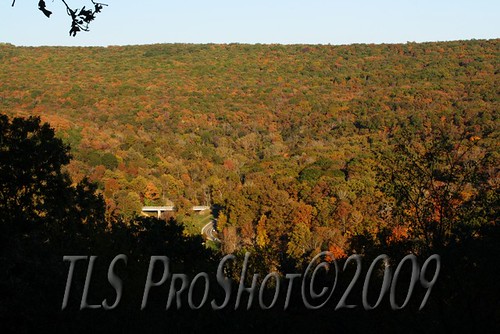
Fall colors along a winding road

Red Barn (Orton)
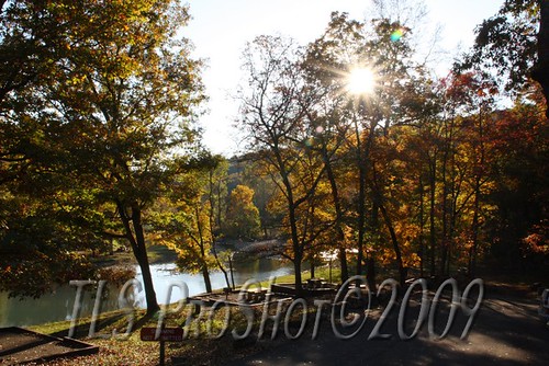
Sunset along river bank
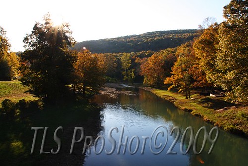
Sunset along river bank
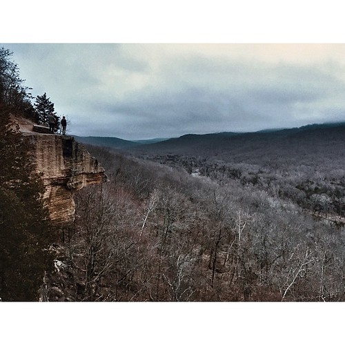
Devil den Natioanl Park Look Out Point

Sunrise at Artist Point on the Boston Mountains Scenic Highway

Devil's Den State Park
Bookin' it North
We got up for sunrise, but "the day just woke up on the wrong side of the bed and was just 'meh. '" - @kylesteed

7 a.m. hike at Devil's Den state park
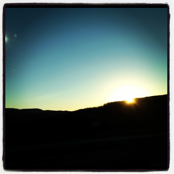
Ozark Mountain sunrise

Lee Creek Dam at sunrise
アメリカ合衆国 アーカンソー州 リーズ・クリーク・タウンシップの地図
別の場所を検索
近所の場所
Wc, Winslow, AR アメリカ合衆国
Center Rd, Winslow Township, AR アメリカ合衆国センター・ロード
Carpenter Rd, Winslow, AR アメリカ合衆国
Bunyard Rd, Winslow, AR アメリカ合衆国Bobby Hopper Tunnel
Bunyard Rd, Winslow, AR アメリカ合衆国
Bunyard Rd, Winslow, AR アメリカ合衆国
W Van Buren Ave, Winslow, AR アメリカ合衆国
アメリカ合衆国 〒 アーカンソー州 ウィンズロウ
W Van Buren Ave, Winslow, AR アメリカ合衆国
Bunyard Rd, Winslow, AR アメリカ合衆国
アメリカ合衆国 〒 アーカンソー州 ウィンズロウ
Koyle Cemetery Rd, Winslow, AR アメリカ合衆国
アメリカ合衆国 アーカンソー州 ポーター
US-71, Mountainburg, AR アメリカ合衆国
Winfrey Valley Rd, Winslow, AR アメリカ合衆国
Bidville Rd, Winslow, AR アメリカ合衆国
アメリカ合衆国 アーカンソー州 ウィンフリー
Shackelford Rd, Fayetteville, AR アメリカ合衆国
アメリカ合衆国 アーカンソー州 リード
アメリカ合衆国 〒 アーカンソー州 ビドビル
最近の検索
- N, Mt Pleasant, UT アメリカ合衆国日の出日の入り時間
- Kawanecho Sasamado, Shimada, Shizuoka -, Japan日の出日の入り時間
- 6 Rue Jules Ferry, Beausoleil, France日の出日の入り時間
- スペイン 〒 ビスカヤ オチャンディオ日の出日の入り時間
- Sattva Horizon, 4JC6+G9P, Vinayak Nagar, Kattigenahalli, Bengaluru, Karnataka, India日の出日の入り時間
- 日本、〒- 静岡県富士宮市北山富士山日の出日の入り時間
- Laurel Rd, Townsend, TN アメリカ合衆国日の出日の入り時間
- 中華人民共和国 Guang Dong Sheng, Shen Zhen Shi, Long Gang Qu, 海滨南路GFPQ+R9Q 海浜南路日の出日の入り時間
- Redondo Ave, Long Beach, CA アメリカ合衆国日の出日の入り時間
- Ulitsa Kalinina, 79, Rezh, Sverdlovskaya oblast', ロシア日の出日の入り時間