アメリカ合衆国 〒 オレゴン州 リーバーグ日の出日の入り時間
Location: アメリカ合衆国 > オレゴン州 > レーン >
時間帯:
America/Los_Angeles
現地時間:
2024-04-27 11:24:46
経度:
-122.6770174
緯度:
44.1073492
今日の日の出時刻:
06:04:41 AM
今日の日の入時刻:
08:11:25 PM
今日の日長:
14h 6m 44s
明日の日の出時刻:
06:03:14 AM
明日の日の入時刻:
08:12:37 PM
明日の日長:
14h 9m 23s
すべて表示する
| 日付 | 日出 | 日没 | 日長 |
|---|---|---|---|
| 2024年01月01日 | 07:45:43 AM | 04:43:27 PM | 8h 57m 44s |
| 2024年01月02日 | 07:45:43 AM | 04:44:23 PM | 8h 58m 40s |
| 2024年01月03日 | 07:45:41 AM | 04:45:20 PM | 8h 59m 39s |
| 2024年01月04日 | 07:45:36 AM | 04:46:19 PM | 9h 0m 43s |
| 2024年01月05日 | 07:45:29 AM | 04:47:19 PM | 9h 1m 50s |
| 2024年01月06日 | 07:45:19 AM | 04:48:21 PM | 9h 3m 2s |
| 2024年01月07日 | 07:45:06 AM | 04:49:25 PM | 9h 4m 19s |
| 2024年01月08日 | 07:44:52 AM | 04:50:30 PM | 9h 5m 38s |
| 2024年01月09日 | 07:44:34 AM | 04:51:37 PM | 9h 7m 3s |
| 2024年01月10日 | 07:44:14 AM | 04:52:45 PM | 9h 8m 31s |
| 2024年01月11日 | 07:43:52 AM | 04:53:54 PM | 9h 10m 2s |
| 2024年01月12日 | 07:43:27 AM | 04:55:04 PM | 9h 11m 37s |
| 2024年01月13日 | 07:43:00 AM | 04:56:16 PM | 9h 13m 16s |
| 2024年01月14日 | 07:42:30 AM | 04:57:29 PM | 9h 14m 59s |
| 2024年01月15日 | 07:41:58 AM | 04:58:42 PM | 9h 16m 44s |
| 2024年01月16日 | 07:41:24 AM | 04:59:57 PM | 9h 18m 33s |
| 2024年01月17日 | 07:40:47 AM | 05:01:13 PM | 9h 20m 26s |
| 2024年01月18日 | 07:40:08 AM | 05:02:29 PM | 9h 22m 21s |
| 2024年01月19日 | 07:39:27 AM | 05:03:47 PM | 9h 24m 20s |
| 2024年01月20日 | 07:38:44 AM | 05:05:05 PM | 9h 26m 21s |
| 2024年01月21日 | 07:37:58 AM | 05:06:24 PM | 9h 28m 26s |
| 2024年01月22日 | 07:37:10 AM | 05:07:43 PM | 9h 30m 33s |
| 2024年01月23日 | 07:36:20 AM | 05:09:03 PM | 9h 32m 43s |
| 2024年01月24日 | 07:35:28 AM | 05:10:24 PM | 9h 34m 56s |
| 2024年01月25日 | 07:34:34 AM | 05:11:45 PM | 9h 37m 11s |
| 2024年01月26日 | 07:33:38 AM | 05:13:06 PM | 9h 39m 28s |
| 2024年01月27日 | 07:32:39 AM | 05:14:28 PM | 9h 41m 49s |
| 2024年01月28日 | 07:31:39 AM | 05:15:50 PM | 9h 44m 11s |
| 2024年01月29日 | 07:30:37 AM | 05:17:12 PM | 9h 46m 35s |
| 2024年01月30日 | 07:29:33 AM | 05:18:35 PM | 9h 49m 2s |
| 2024年01月31日 | 07:28:27 AM | 05:19:58 PM | 9h 51m 31s |
| 2024年02月01日 | 07:27:20 AM | 05:21:21 PM | 9h 54m 1s |
| 2024年02月02日 | 07:26:11 AM | 05:22:44 PM | 9h 56m 33s |
| 2024年02月03日 | 07:24:59 AM | 05:24:08 PM | 9h 59m 9s |
| 2024年02月04日 | 07:23:47 AM | 05:25:31 PM | 10h 1m 44s |
| 2024年02月05日 | 07:22:32 AM | 05:26:54 PM | 10h 4m 22s |
| 2024年02月06日 | 07:21:16 AM | 05:28:18 PM | 10h 7m 2s |
| 2024年02月07日 | 07:19:59 AM | 05:29:41 PM | 10h 9m 42s |
| 2024年02月08日 | 07:18:40 AM | 05:31:04 PM | 10h 12m 24s |
| 2024年02月09日 | 07:17:19 AM | 05:32:28 PM | 10h 15m 9s |
| 2024年02月10日 | 07:15:57 AM | 05:33:51 PM | 10h 17m 54s |
| 2024年02月11日 | 07:14:34 AM | 05:35:14 PM | 10h 20m 40s |
| 2024年02月12日 | 07:13:09 AM | 05:36:36 PM | 10h 23m 27s |
| 2024年02月13日 | 07:11:43 AM | 05:37:59 PM | 10h 26m 16s |
| 2024年02月14日 | 07:10:16 AM | 05:39:22 PM | 10h 29m 6s |
| 2024年02月15日 | 07:08:47 AM | 05:40:44 PM | 10h 31m 57s |
| 2024年02月16日 | 07:07:17 AM | 05:42:06 PM | 10h 34m 49s |
| 2024年02月17日 | 07:05:46 AM | 05:43:28 PM | 10h 37m 42s |
| 2024年02月18日 | 07:04:14 AM | 05:44:49 PM | 10h 40m 35s |
| 2024年02月19日 | 07:02:41 AM | 05:46:11 PM | 10h 43m 30s |
| 2024年02月20日 | 07:01:07 AM | 05:47:32 PM | 10h 46m 25s |
| 2024年02月21日 | 06:59:31 AM | 05:48:52 PM | 10h 49m 21s |
| 2024年02月22日 | 06:57:55 AM | 05:50:13 PM | 10h 52m 18s |
| 2024年02月23日 | 06:56:18 AM | 05:51:33 PM | 10h 55m 15s |
| 2024年02月24日 | 06:54:40 AM | 05:52:53 PM | 10h 58m 13s |
| 2024年02月25日 | 06:53:01 AM | 05:54:13 PM | 11h 1m 12s |
| 2024年02月26日 | 06:51:21 AM | 05:55:32 PM | 11h 4m 11s |
| 2024年02月27日 | 06:49:40 AM | 05:56:51 PM | 11h 7m 11s |
| 2024年02月28日 | 06:47:59 AM | 05:58:10 PM | 11h 10m 11s |
| 2024年02月29日 | 06:46:17 AM | 05:59:29 PM | 11h 13m 12s |
| 2024年03月01日 | 06:44:34 AM | 06:00:47 PM | 11h 16m 13s |
| 2024年03月02日 | 06:42:50 AM | 06:02:05 PM | 11h 19m 15s |
| 2024年03月03日 | 06:41:06 AM | 06:03:23 PM | 11h 22m 17s |
| 2024年03月04日 | 06:39:22 AM | 06:04:40 PM | 11h 25m 18s |
| 2024年03月05日 | 06:37:36 AM | 06:05:57 PM | 11h 28m 21s |
| 2024年03月06日 | 06:35:51 AM | 06:07:14 PM | 11h 31m 23s |
| 2024年03月07日 | 06:34:04 AM | 06:08:31 PM | 11h 34m 27s |
| 2024年03月08日 | 06:32:18 AM | 06:09:47 PM | 11h 37m 29s |
| 2024年03月09日 | 06:30:31 AM | 06:11:03 PM | 11h 40m 32s |
| 2024年03月10日 | 07:28:47 AM | 07:12:16 PM | 11h 43m 29s |
| 2024年03月11日 | 07:27:00 AM | 07:13:32 PM | 11h 46m 32s |
| 2024年03月12日 | 07:25:11 AM | 07:14:47 PM | 11h 49m 36s |
| 2024年03月13日 | 07:23:23 AM | 07:16:02 PM | 11h 52m 39s |
| 2024年03月14日 | 07:21:34 AM | 07:17:17 PM | 11h 55m 43s |
| 2024年03月15日 | 07:19:45 AM | 07:18:32 PM | 11h 58m 47s |
| 2024年03月16日 | 07:17:56 AM | 07:19:47 PM | 12h 1m 51s |
| 2024年03月17日 | 07:16:06 AM | 07:21:01 PM | 12h 4m 55s |
| 2024年03月18日 | 07:14:17 AM | 07:22:16 PM | 12h 7m 59s |
| 2024年03月19日 | 07:12:27 AM | 07:23:30 PM | 12h 11m 3s |
| 2024年03月20日 | 07:10:37 AM | 07:24:44 PM | 12h 14m 7s |
| 2024年03月21日 | 07:08:47 AM | 07:25:58 PM | 12h 17m 11s |
| 2024年03月22日 | 07:06:58 AM | 07:27:12 PM | 12h 20m 14s |
| 2024年03月23日 | 07:05:08 AM | 07:28:25 PM | 12h 23m 17s |
| 2024年03月24日 | 07:03:18 AM | 07:29:39 PM | 12h 26m 21s |
| 2024年03月25日 | 07:01:28 AM | 07:30:52 PM | 12h 29m 24s |
| 2024年03月26日 | 06:59:39 AM | 07:32:06 PM | 12h 32m 27s |
| 2024年03月27日 | 06:57:49 AM | 07:33:19 PM | 12h 35m 30s |
| 2024年03月28日 | 06:56:00 AM | 07:34:32 PM | 12h 38m 32s |
| 2024年03月29日 | 06:54:11 AM | 07:35:45 PM | 12h 41m 34s |
| 2024年03月30日 | 06:52:22 AM | 07:36:59 PM | 12h 44m 37s |
| 2024年03月31日 | 06:50:33 AM | 07:38:12 PM | 12h 47m 39s |
| 2024年04月01日 | 06:48:45 AM | 07:39:25 PM | 12h 50m 40s |
| 2024年04月02日 | 06:46:57 AM | 07:40:38 PM | 12h 53m 41s |
| 2024年04月03日 | 06:45:09 AM | 07:41:51 PM | 12h 56m 42s |
| 2024年04月04日 | 06:43:22 AM | 07:43:04 PM | 12h 59m 42s |
| 2024年04月05日 | 06:41:35 AM | 07:44:17 PM | 13h 2m 42s |
| 2024年04月06日 | 06:39:49 AM | 07:45:30 PM | 13h 5m 41s |
| 2024年04月07日 | 06:38:03 AM | 07:46:43 PM | 13h 8m 40s |
| 2024年04月08日 | 06:36:17 AM | 07:47:55 PM | 13h 11m 38s |
| 2024年04月09日 | 06:34:33 AM | 07:49:08 PM | 13h 14m 35s |
| 2024年04月10日 | 06:32:48 AM | 07:50:21 PM | 13h 17m 33s |
| 2024年04月11日 | 06:31:05 AM | 07:51:34 PM | 13h 20m 29s |
| 2024年04月12日 | 06:29:21 AM | 07:52:47 PM | 13h 23m 26s |
| 2024年04月13日 | 06:27:39 AM | 07:54:00 PM | 13h 26m 21s |
| 2024年04月14日 | 06:25:57 AM | 07:55:13 PM | 13h 29m 16s |
| 2024年04月15日 | 06:24:16 AM | 07:56:26 PM | 13h 32m 10s |
| 2024年04月16日 | 06:22:36 AM | 07:57:39 PM | 13h 35m 3s |
| 2024年04月17日 | 06:20:57 AM | 07:58:52 PM | 13h 37m 55s |
| 2024年04月18日 | 06:19:18 AM | 08:00:05 PM | 13h 40m 47s |
| 2024年04月19日 | 06:17:41 AM | 08:01:18 PM | 13h 43m 37s |
| 2024年04月20日 | 06:16:04 AM | 08:02:30 PM | 13h 46m 26s |
| 2024年04月21日 | 06:14:28 AM | 08:03:43 PM | 13h 49m 15s |
| 2024年04月22日 | 06:12:53 AM | 08:04:56 PM | 13h 52m 3s |
| 2024年04月23日 | 06:11:19 AM | 08:06:09 PM | 13h 54m 50s |
| 2024年04月24日 | 06:09:47 AM | 08:07:21 PM | 13h 57m 34s |
| 2024年04月25日 | 06:08:15 AM | 08:08:34 PM | 14h 0m 19s |
| 2024年04月26日 | 06:06:44 AM | 08:09:46 PM | 14h 3m 2s |
| 2024年04月27日 | 06:05:15 AM | 08:10:58 PM | 14h 5m 43s |
| 2024年04月28日 | 06:03:46 AM | 08:12:10 PM | 14h 8m 24s |
| 2024年04月29日 | 06:02:19 AM | 08:13:22 PM | 14h 11m 3s |
| 2024年04月30日 | 06:00:54 AM | 08:14:34 PM | 14h 13m 40s |
| 2024年05月01日 | 05:59:29 AM | 08:15:46 PM | 14h 16m 17s |
| 2024年05月02日 | 05:58:06 AM | 08:16:57 PM | 14h 18m 51s |
| 2024年05月03日 | 05:56:44 AM | 08:18:08 PM | 14h 21m 24s |
| 2024年05月04日 | 05:55:24 AM | 08:19:19 PM | 14h 23m 55s |
| 2024年05月05日 | 05:54:05 AM | 08:20:30 PM | 14h 26m 25s |
| 2024年05月06日 | 05:52:47 AM | 08:21:40 PM | 14h 28m 53s |
| 2024年05月07日 | 05:51:31 AM | 08:22:50 PM | 14h 31m 19s |
| 2024年05月08日 | 05:50:16 AM | 08:23:59 PM | 14h 33m 43s |
| 2024年05月09日 | 05:49:03 AM | 08:25:08 PM | 14h 36m 5s |
| 2024年05月10日 | 05:47:52 AM | 08:26:17 PM | 14h 38m 25s |
| 2024年05月11日 | 05:46:42 AM | 08:27:25 PM | 14h 40m 43s |
| 2024年05月12日 | 05:45:34 AM | 08:28:32 PM | 14h 42m 58s |
| 2024年05月13日 | 05:44:28 AM | 08:29:39 PM | 14h 45m 11s |
| 2024年05月14日 | 05:43:23 AM | 08:30:46 PM | 14h 47m 23s |
| 2024年05月15日 | 05:42:21 AM | 08:31:51 PM | 14h 49m 30s |
| 2024年05月16日 | 05:41:20 AM | 08:32:56 PM | 14h 51m 36s |
| 2024年05月17日 | 05:40:20 AM | 08:34:01 PM | 14h 53m 41s |
| 2024年05月18日 | 05:39:23 AM | 08:35:04 PM | 14h 55m 41s |
| 2024年05月19日 | 05:38:28 AM | 08:36:07 PM | 14h 57m 39s |
| 2024年05月20日 | 05:37:34 AM | 08:37:09 PM | 14h 59m 35s |
| 2024年05月21日 | 05:36:43 AM | 08:38:10 PM | 15h 1m 27s |
| 2024年05月22日 | 05:35:53 AM | 08:39:10 PM | 15h 3m 17s |
| 2024年05月23日 | 05:35:06 AM | 08:40:09 PM | 15h 5m 3s |
| 2024年05月24日 | 05:34:20 AM | 08:41:06 PM | 15h 6m 46s |
| 2024年05月25日 | 05:33:37 AM | 08:42:03 PM | 15h 8m 26s |
| 2024年05月26日 | 05:32:55 AM | 08:42:59 PM | 15h 10m 4s |
| 2024年05月27日 | 05:32:16 AM | 08:43:54 PM | 15h 11m 38s |
| 2024年05月28日 | 05:31:39 AM | 08:44:47 PM | 15h 13m 8s |
| 2024年05月29日 | 05:31:04 AM | 08:45:39 PM | 15h 14m 35s |
| 2024年05月30日 | 05:30:31 AM | 08:46:29 PM | 15h 15m 58s |
| 2024年05月31日 | 05:30:00 AM | 08:47:19 PM | 15h 17m 19s |
| 2024年06月01日 | 05:29:32 AM | 08:48:06 PM | 15h 18m 34s |
| 2024年06月02日 | 05:29:06 AM | 08:48:53 PM | 15h 19m 47s |
| 2024年06月03日 | 05:28:42 AM | 08:49:38 PM | 15h 20m 56s |
| 2024年06月04日 | 05:28:20 AM | 08:50:21 PM | 15h 22m 1s |
| 2024年06月05日 | 05:28:00 AM | 08:51:02 PM | 15h 23m 2s |
| 2024年06月06日 | 05:27:43 AM | 08:51:42 PM | 15h 23m 59s |
| 2024年06月07日 | 05:27:28 AM | 08:52:21 PM | 15h 24m 53s |
| 2024年06月08日 | 05:27:15 AM | 08:52:57 PM | 15h 25m 42s |
| 2024年06月09日 | 05:27:05 AM | 08:53:32 PM | 15h 26m 27s |
| 2024年06月10日 | 05:26:57 AM | 08:54:05 PM | 15h 27m 8s |
| 2024年06月11日 | 05:26:50 AM | 08:54:35 PM | 15h 27m 45s |
| 2024年06月12日 | 05:26:47 AM | 08:55:04 PM | 15h 28m 17s |
| 2024年06月13日 | 05:26:45 AM | 08:55:32 PM | 15h 28m 47s |
| 2024年06月14日 | 05:26:46 AM | 08:55:57 PM | 15h 29m 11s |
| 2024年06月15日 | 05:26:49 AM | 08:56:20 PM | 15h 29m 31s |
| 2024年06月16日 | 05:26:54 AM | 08:56:41 PM | 15h 29m 47s |
| 2024年06月17日 | 05:27:01 AM | 08:57:00 PM | 15h 29m 59s |
| 2024年06月18日 | 05:27:10 AM | 08:57:16 PM | 15h 30m 6s |
| 2024年06月19日 | 05:27:22 AM | 08:57:31 PM | 15h 30m 9s |
| 2024年06月20日 | 05:27:36 AM | 08:57:43 PM | 15h 30m 7s |
| 2024年06月21日 | 05:27:51 AM | 08:57:54 PM | 15h 30m 3s |
| 2024年06月22日 | 05:28:09 AM | 08:58:02 PM | 15h 29m 53s |
| 2024年06月23日 | 05:28:29 AM | 08:58:08 PM | 15h 29m 39s |
| 2024年06月24日 | 05:28:51 AM | 08:58:11 PM | 15h 29m 20s |
| 2024年06月25日 | 05:29:14 AM | 08:58:13 PM | 15h 28m 59s |
| 2024年06月26日 | 05:29:40 AM | 08:58:12 PM | 15h 28m 32s |
| 2024年06月27日 | 05:30:08 AM | 08:58:08 PM | 15h 28m 0s |
| 2024年06月28日 | 05:30:37 AM | 08:58:03 PM | 15h 27m 26s |
| 2024年06月29日 | 05:31:09 AM | 08:57:55 PM | 15h 26m 46s |
| 2024年06月30日 | 05:31:42 AM | 08:57:45 PM | 15h 26m 3s |
| 2024年07月01日 | 05:32:17 AM | 08:57:33 PM | 15h 25m 16s |
| 2024年07月02日 | 05:32:53 AM | 08:57:18 PM | 15h 24m 25s |
| 2024年07月03日 | 05:33:31 AM | 08:57:01 PM | 15h 23m 30s |
| 2024年07月04日 | 05:34:11 AM | 08:56:42 PM | 15h 22m 31s |
| 2024年07月05日 | 05:34:52 AM | 08:56:20 PM | 15h 21m 28s |
| 2024年07月06日 | 05:35:35 AM | 08:55:56 PM | 15h 20m 21s |
| 2024年07月07日 | 05:36:20 AM | 08:55:30 PM | 15h 19m 10s |
| 2024年07月08日 | 05:37:05 AM | 08:55:02 PM | 15h 17m 57s |
| 2024年07月09日 | 05:37:53 AM | 08:54:31 PM | 15h 16m 38s |
| 2024年07月10日 | 05:38:41 AM | 08:53:59 PM | 15h 15m 18s |
| 2024年07月11日 | 05:39:31 AM | 08:53:24 PM | 15h 13m 53s |
| 2024年07月12日 | 05:40:22 AM | 08:52:47 PM | 15h 12m 25s |
| 2024年07月13日 | 05:41:14 AM | 08:52:07 PM | 15h 10m 53s |
| 2024年07月14日 | 05:42:07 AM | 08:51:26 PM | 15h 9m 19s |
| 2024年07月15日 | 05:43:02 AM | 08:50:42 PM | 15h 7m 40s |
| 2024年07月16日 | 05:43:57 AM | 08:49:57 PM | 15h 6m 0s |
| 2024年07月17日 | 05:44:53 AM | 08:49:09 PM | 15h 4m 16s |
| 2024年07月18日 | 05:45:51 AM | 08:48:19 PM | 15h 2m 28s |
| 2024年07月19日 | 05:46:49 AM | 08:47:27 PM | 15h 0m 38s |
| 2024年07月20日 | 05:47:48 AM | 08:46:33 PM | 14h 58m 45s |
| 2024年07月21日 | 05:48:48 AM | 08:45:38 PM | 14h 56m 50s |
| 2024年07月22日 | 05:49:49 AM | 08:44:40 PM | 14h 54m 51s |
| 2024年07月23日 | 05:50:50 AM | 08:43:41 PM | 14h 52m 51s |
| 2024年07月24日 | 05:51:52 AM | 08:42:39 PM | 14h 50m 47s |
| 2024年07月25日 | 05:52:55 AM | 08:41:36 PM | 14h 48m 41s |
| 2024年07月26日 | 05:53:58 AM | 08:40:31 PM | 14h 46m 33s |
| 2024年07月27日 | 05:55:02 AM | 08:39:24 PM | 14h 44m 22s |
| 2024年07月28日 | 05:56:06 AM | 08:38:16 PM | 14h 42m 10s |
| 2024年07月29日 | 05:57:11 AM | 08:37:05 PM | 14h 39m 54s |
| 2024年07月30日 | 05:58:16 AM | 08:35:53 PM | 14h 37m 37s |
| 2024年07月31日 | 05:59:22 AM | 08:34:40 PM | 14h 35m 18s |
| 2024年08月01日 | 06:00:28 AM | 08:33:25 PM | 14h 32m 57s |
| 2024年08月02日 | 06:01:35 AM | 08:32:08 PM | 14h 30m 33s |
| 2024年08月03日 | 06:02:41 AM | 08:30:50 PM | 14h 28m 9s |
| 2024年08月04日 | 06:03:48 AM | 08:29:30 PM | 14h 25m 42s |
| 2024年08月05日 | 06:04:56 AM | 08:28:09 PM | 14h 23m 13s |
| 2024年08月06日 | 06:06:03 AM | 08:26:47 PM | 14h 20m 44s |
| 2024年08月07日 | 06:07:11 AM | 08:25:23 PM | 14h 18m 12s |
| 2024年08月08日 | 06:08:19 AM | 08:23:57 PM | 14h 15m 38s |
| 2024年08月09日 | 06:09:27 AM | 08:22:31 PM | 14h 13m 4s |
| 2024年08月10日 | 06:10:35 AM | 08:21:03 PM | 14h 10m 28s |
| 2024年08月11日 | 06:11:44 AM | 08:19:34 PM | 14h 7m 50s |
| 2024年08月12日 | 06:12:52 AM | 08:18:04 PM | 14h 5m 12s |
| 2024年08月13日 | 06:14:01 AM | 08:16:32 PM | 14h 2m 31s |
| 2024年08月14日 | 06:15:09 AM | 08:14:59 PM | 13h 59m 50s |
| 2024年08月15日 | 06:16:18 AM | 08:13:26 PM | 13h 57m 8s |
| 2024年08月16日 | 06:17:27 AM | 08:11:51 PM | 13h 54m 24s |
| 2024年08月17日 | 06:18:35 AM | 08:10:15 PM | 13h 51m 40s |
| 2024年08月18日 | 06:19:44 AM | 08:08:38 PM | 13h 48m 54s |
| 2024年08月19日 | 06:20:53 AM | 08:07:01 PM | 13h 46m 8s |
| 2024年08月20日 | 06:22:01 AM | 08:05:22 PM | 13h 43m 21s |
| 2024年08月21日 | 06:23:10 AM | 08:03:42 PM | 13h 40m 32s |
| 2024年08月22日 | 06:24:19 AM | 08:02:02 PM | 13h 37m 43s |
| 2024年08月23日 | 06:25:28 AM | 08:00:21 PM | 13h 34m 53s |
| 2024年08月24日 | 06:26:36 AM | 07:58:38 PM | 13h 32m 2s |
| 2024年08月25日 | 06:27:45 AM | 07:56:56 PM | 13h 29m 11s |
| 2024年08月26日 | 06:28:54 AM | 07:55:12 PM | 13h 26m 18s |
| 2024年08月27日 | 06:30:02 AM | 07:53:28 PM | 13h 23m 26s |
| 2024年08月28日 | 06:31:11 AM | 07:51:43 PM | 13h 20m 32s |
| 2024年08月29日 | 06:32:19 AM | 07:49:57 PM | 13h 17m 38s |
| 2024年08月30日 | 06:33:28 AM | 07:48:11 PM | 13h 14m 43s |
| 2024年08月31日 | 06:34:36 AM | 07:46:24 PM | 13h 11m 48s |
| 2024年09月01日 | 06:35:45 AM | 07:44:37 PM | 13h 8m 52s |
| 2024年09月02日 | 06:36:53 AM | 07:42:49 PM | 13h 5m 56s |
| 2024年09月03日 | 06:38:02 AM | 07:41:01 PM | 13h 2m 59s |
| 2024年09月04日 | 06:39:10 AM | 07:39:12 PM | 13h 0m 2s |
| 2024年09月05日 | 06:40:18 AM | 07:37:23 PM | 12h 57m 5s |
| 2024年09月06日 | 06:41:27 AM | 07:35:33 PM | 12h 54m 6s |
| 2024年09月07日 | 06:42:35 AM | 07:33:44 PM | 12h 51m 9s |
| 2024年09月08日 | 06:43:44 AM | 07:31:53 PM | 12h 48m 9s |
| 2024年09月09日 | 06:44:52 AM | 07:30:03 PM | 12h 45m 11s |
| 2024年09月10日 | 06:46:00 AM | 07:28:12 PM | 12h 42m 12s |
| 2024年09月11日 | 06:47:09 AM | 07:26:21 PM | 12h 39m 12s |
| 2024年09月12日 | 06:48:18 AM | 07:24:30 PM | 12h 36m 12s |
| 2024年09月13日 | 06:49:26 AM | 07:22:39 PM | 12h 33m 13s |
| 2024年09月14日 | 06:50:35 AM | 07:20:47 PM | 12h 30m 12s |
| 2024年09月15日 | 06:51:43 AM | 07:18:56 PM | 12h 27m 13s |
| 2024年09月16日 | 06:52:52 AM | 07:17:04 PM | 12h 24m 12s |
| 2024年09月17日 | 06:54:01 AM | 07:15:12 PM | 12h 21m 11s |
| 2024年09月18日 | 06:55:10 AM | 07:13:20 PM | 12h 18m 10s |
| 2024年09月19日 | 06:56:19 AM | 07:11:29 PM | 12h 15m 10s |
| 2024年09月20日 | 06:57:29 AM | 07:09:37 PM | 12h 12m 8s |
| 2024年09月21日 | 06:58:38 AM | 07:07:45 PM | 12h 9m 7s |
| 2024年09月22日 | 06:59:47 AM | 07:05:54 PM | 12h 6m 7s |
| 2024年09月23日 | 07:00:57 AM | 07:04:02 PM | 12h 3m 5s |
| 2024年09月24日 | 07:02:07 AM | 07:02:11 PM | 12h 0m 4s |
| 2024年09月25日 | 07:03:17 AM | 07:00:20 PM | 11h 57m 3s |
| 2024年09月26日 | 07:04:27 AM | 06:58:29 PM | 11h 54m 2s |
| 2024年09月27日 | 07:05:38 AM | 06:56:38 PM | 11h 51m 0s |
| 2024年09月28日 | 07:06:48 AM | 06:54:48 PM | 11h 48m 0s |
| 2024年09月29日 | 07:07:59 AM | 06:52:58 PM | 11h 44m 59s |
| 2024年09月30日 | 07:09:10 AM | 06:51:08 PM | 11h 41m 58s |
| 2024年10月01日 | 07:10:21 AM | 06:49:19 PM | 11h 38m 58s |
| 2024年10月02日 | 07:11:33 AM | 06:47:30 PM | 11h 35m 57s |
| 2024年10月03日 | 07:12:45 AM | 06:45:42 PM | 11h 32m 57s |
| 2024年10月04日 | 07:13:57 AM | 06:43:54 PM | 11h 29m 57s |
| 2024年10月05日 | 07:15:09 AM | 06:42:06 PM | 11h 26m 57s |
| 2024年10月06日 | 07:16:22 AM | 06:40:19 PM | 11h 23m 57s |
| 2024年10月07日 | 07:17:35 AM | 06:38:33 PM | 11h 20m 58s |
| 2024年10月08日 | 07:18:48 AM | 06:36:47 PM | 11h 17m 59s |
| 2024年10月09日 | 07:20:01 AM | 06:35:02 PM | 11h 15m 1s |
| 2024年10月10日 | 07:21:15 AM | 06:33:17 PM | 11h 12m 2s |
| 2024年10月11日 | 07:22:29 AM | 06:31:34 PM | 11h 9m 5s |
| 2024年10月12日 | 07:23:44 AM | 06:29:51 PM | 11h 6m 7s |
| 2024年10月13日 | 07:24:58 AM | 06:28:08 PM | 11h 3m 10s |
| 2024年10月14日 | 07:26:13 AM | 06:26:27 PM | 11h 0m 14s |
| 2024年10月15日 | 07:27:29 AM | 06:24:46 PM | 10h 57m 17s |
| 2024年10月16日 | 07:28:44 AM | 06:23:06 PM | 10h 54m 22s |
| 2024年10月17日 | 07:30:00 AM | 06:21:28 PM | 10h 51m 28s |
| 2024年10月18日 | 07:31:17 AM | 06:19:50 PM | 10h 48m 33s |
| 2024年10月19日 | 07:32:33 AM | 06:18:13 PM | 10h 45m 40s |
| 2024年10月20日 | 07:33:50 AM | 06:16:37 PM | 10h 42m 47s |
| 2024年10月21日 | 07:35:07 AM | 06:15:02 PM | 10h 39m 55s |
| 2024年10月22日 | 07:36:25 AM | 06:13:28 PM | 10h 37m 3s |
| 2024年10月23日 | 07:37:42 AM | 06:11:56 PM | 10h 34m 14s |
| 2024年10月24日 | 07:39:00 AM | 06:10:24 PM | 10h 31m 24s |
| 2024年10月25日 | 07:40:19 AM | 06:08:54 PM | 10h 28m 35s |
| 2024年10月26日 | 07:41:37 AM | 06:07:25 PM | 10h 25m 48s |
| 2024年10月27日 | 07:42:56 AM | 06:05:57 PM | 10h 23m 1s |
| 2024年10月28日 | 07:44:15 AM | 06:04:31 PM | 10h 20m 16s |
| 2024年10月29日 | 07:45:34 AM | 06:03:06 PM | 10h 17m 32s |
| 2024年10月30日 | 07:46:53 AM | 06:01:42 PM | 10h 14m 49s |
| 2024年10月31日 | 07:48:12 AM | 06:00:20 PM | 10h 12m 8s |
| 2024年11月01日 | 07:49:32 AM | 05:58:59 PM | 10h 9m 27s |
| 2024年11月02日 | 07:50:52 AM | 05:57:40 PM | 10h 6m 48s |
| 2024年11月03日 | 06:52:15 AM | 04:56:19 PM | 10h 4m 4s |
| 2024年11月04日 | 06:53:35 AM | 04:55:03 PM | 10h 1m 28s |
| 2024年11月05日 | 06:54:55 AM | 04:53:48 PM | 9h 58m 53s |
| 2024年11月06日 | 06:56:14 AM | 04:52:36 PM | 9h 56m 22s |
| 2024年11月07日 | 06:57:34 AM | 04:51:25 PM | 9h 53m 51s |
| 2024年11月08日 | 06:58:54 AM | 04:50:16 PM | 9h 51m 22s |
| 2024年11月09日 | 07:00:14 AM | 04:49:08 PM | 9h 48m 54s |
| 2024年11月10日 | 07:01:33 AM | 04:48:03 PM | 9h 46m 30s |
| 2024年11月11日 | 07:02:53 AM | 04:46:59 PM | 9h 44m 6s |
| 2024年11月12日 | 07:04:12 AM | 04:45:57 PM | 9h 41m 45s |
| 2024年11月13日 | 07:05:31 AM | 04:44:57 PM | 9h 39m 26s |
| 2024年11月14日 | 07:06:49 AM | 04:43:59 PM | 9h 37m 10s |
| 2024年11月15日 | 07:08:07 AM | 04:43:04 PM | 9h 34m 57s |
| 2024年11月16日 | 07:09:25 AM | 04:42:10 PM | 9h 32m 45s |
| 2024年11月17日 | 07:10:42 AM | 04:41:18 PM | 9h 30m 36s |
| 2024年11月18日 | 07:11:59 AM | 04:40:29 PM | 9h 28m 30s |
| 2024年11月19日 | 07:13:16 AM | 04:39:41 PM | 9h 26m 25s |
| 2024年11月20日 | 07:14:31 AM | 04:38:56 PM | 9h 24m 25s |
| 2024年11月21日 | 07:15:46 AM | 04:38:14 PM | 9h 22m 28s |
| 2024年11月22日 | 07:17:01 AM | 04:37:33 PM | 9h 20m 32s |
| 2024年11月23日 | 07:18:14 AM | 04:36:55 PM | 9h 18m 41s |
| 2024年11月24日 | 07:19:27 AM | 04:36:19 PM | 9h 16m 52s |
| 2024年11月25日 | 07:20:39 AM | 04:35:45 PM | 9h 15m 6s |
| 2024年11月26日 | 07:21:50 AM | 04:35:14 PM | 9h 13m 24s |
| 2024年11月27日 | 07:22:59 AM | 04:34:46 PM | 9h 11m 47s |
| 2024年11月28日 | 07:24:08 AM | 04:34:19 PM | 9h 10m 11s |
| 2024年11月29日 | 07:25:16 AM | 04:33:56 PM | 9h 8m 40s |
| 2024年11月30日 | 07:26:22 AM | 04:33:34 PM | 9h 7m 12s |
| 2024年12月01日 | 07:27:27 AM | 04:33:16 PM | 9h 5m 49s |
| 2024年12月02日 | 07:28:31 AM | 04:32:59 PM | 9h 4m 28s |
| 2024年12月03日 | 07:29:34 AM | 04:32:46 PM | 9h 3m 12s |
| 2024年12月04日 | 07:30:35 AM | 04:32:34 PM | 9h 1m 59s |
| 2024年12月05日 | 07:31:34 AM | 04:32:26 PM | 9h 0m 52s |
| 2024年12月06日 | 07:32:32 AM | 04:32:20 PM | 8h 59m 48s |
| 2024年12月07日 | 07:33:29 AM | 04:32:16 PM | 8h 58m 47s |
| 2024年12月08日 | 07:34:23 AM | 04:32:16 PM | 8h 57m 53s |
| 2024年12月09日 | 07:35:16 AM | 04:32:17 PM | 8h 57m 1s |
| 2024年12月10日 | 07:36:07 AM | 04:32:22 PM | 8h 56m 15s |
| 2024年12月11日 | 07:36:57 AM | 04:32:28 PM | 8h 55m 31s |
| 2024年12月12日 | 07:37:44 AM | 04:32:38 PM | 8h 54m 54s |
| 2024年12月13日 | 07:38:29 AM | 04:32:50 PM | 8h 54m 21s |
| 2024年12月14日 | 07:39:13 AM | 04:33:04 PM | 8h 53m 51s |
| 2024年12月15日 | 07:39:54 AM | 04:33:21 PM | 8h 53m 27s |
| 2024年12月16日 | 07:40:33 AM | 04:33:41 PM | 8h 53m 8s |
| 2024年12月17日 | 07:41:10 AM | 04:34:03 PM | 8h 52m 53s |
| 2024年12月18日 | 07:41:45 AM | 04:34:28 PM | 8h 52m 43s |
| 2024年12月19日 | 07:42:18 AM | 04:34:55 PM | 8h 52m 37s |
| 2024年12月20日 | 07:42:48 AM | 04:35:24 PM | 8h 52m 36s |
| 2024年12月21日 | 07:43:16 AM | 04:35:56 PM | 8h 52m 40s |
| 2024年12月22日 | 07:43:41 AM | 04:36:30 PM | 8h 52m 49s |
| 2024年12月23日 | 07:44:05 AM | 04:37:06 PM | 8h 53m 1s |
| 2024年12月24日 | 07:44:25 AM | 04:37:45 PM | 8h 53m 20s |
| 2024年12月25日 | 07:44:44 AM | 04:38:25 PM | 8h 53m 41s |
| 2024年12月26日 | 07:45:00 AM | 04:39:08 PM | 8h 54m 8s |
| 2024年12月27日 | 07:45:13 AM | 04:39:53 PM | 8h 54m 40s |
| 2024年12月28日 | 07:45:24 AM | 04:40:41 PM | 8h 55m 17s |
| 2024年12月29日 | 07:45:33 AM | 04:41:30 PM | 8h 55m 57s |
| 2024年12月30日 | 07:45:39 AM | 04:42:21 PM | 8h 56m 42s |
写真
Sunset arriving on the river

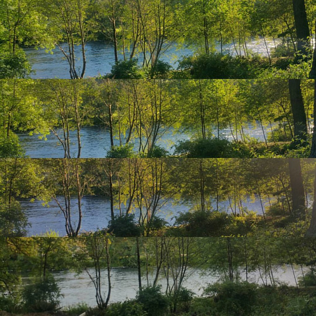
Walterville reflections
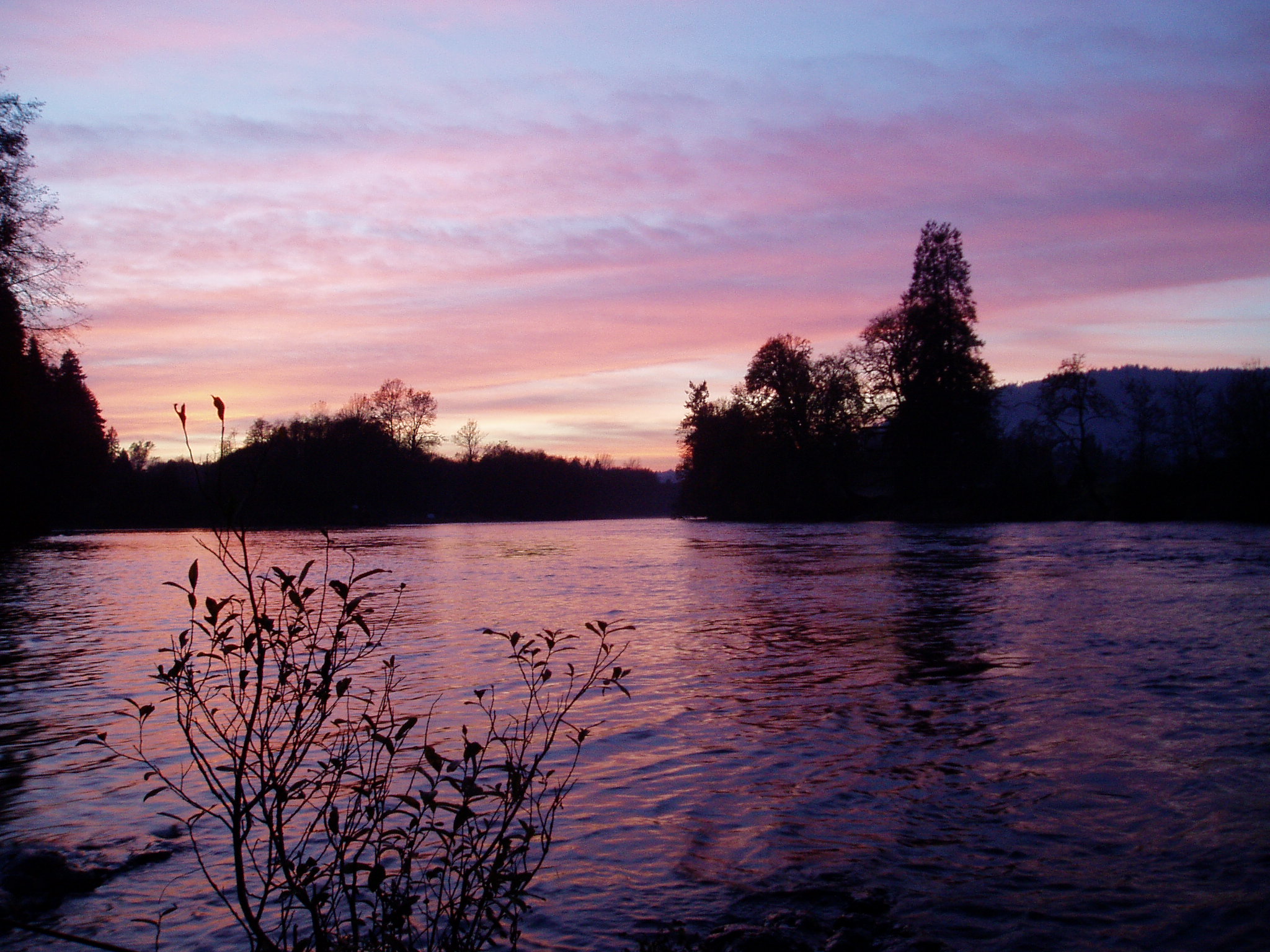
mckenzie river sunset
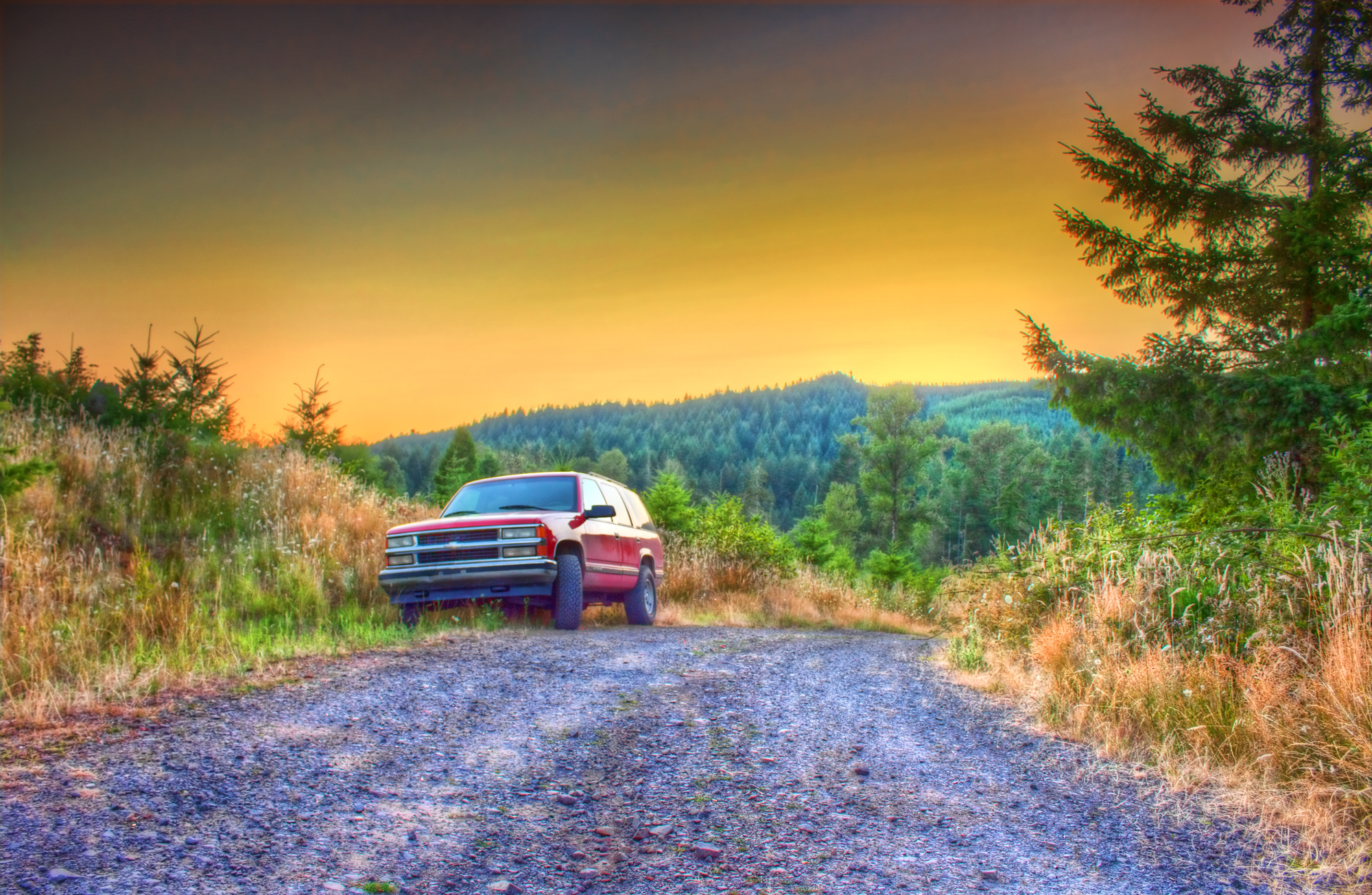
Sunset with Tahoe

Campsite Sunrise, Fall Creek Reservoir Lane County Oregon

Jun 10th - Partial - partial view of Lower Proxy Falls #fmsphotoaday #oregonexplored

View from Little Cownhorn Lookout

View from lookout
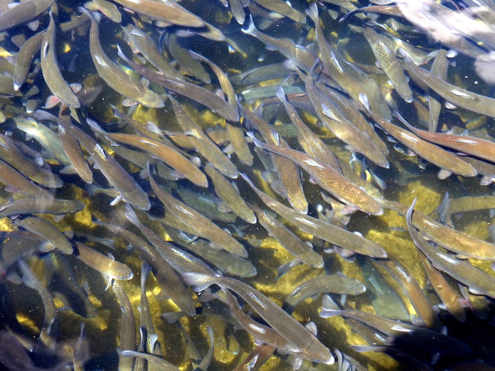
Trout over population

North and South Sister, Broken Top and Mt. Bachelor, Oregon
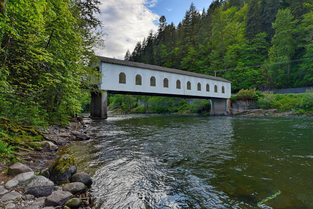
Goodpasture Bridge

We didn't get here till 2:30am, but the view we woke up to, wow!

Upper Proxy Falls #oregonexplored #pnwonderland #pnw

Getting as close as I can :-) #oregonexplored #pnwonderland #pnw
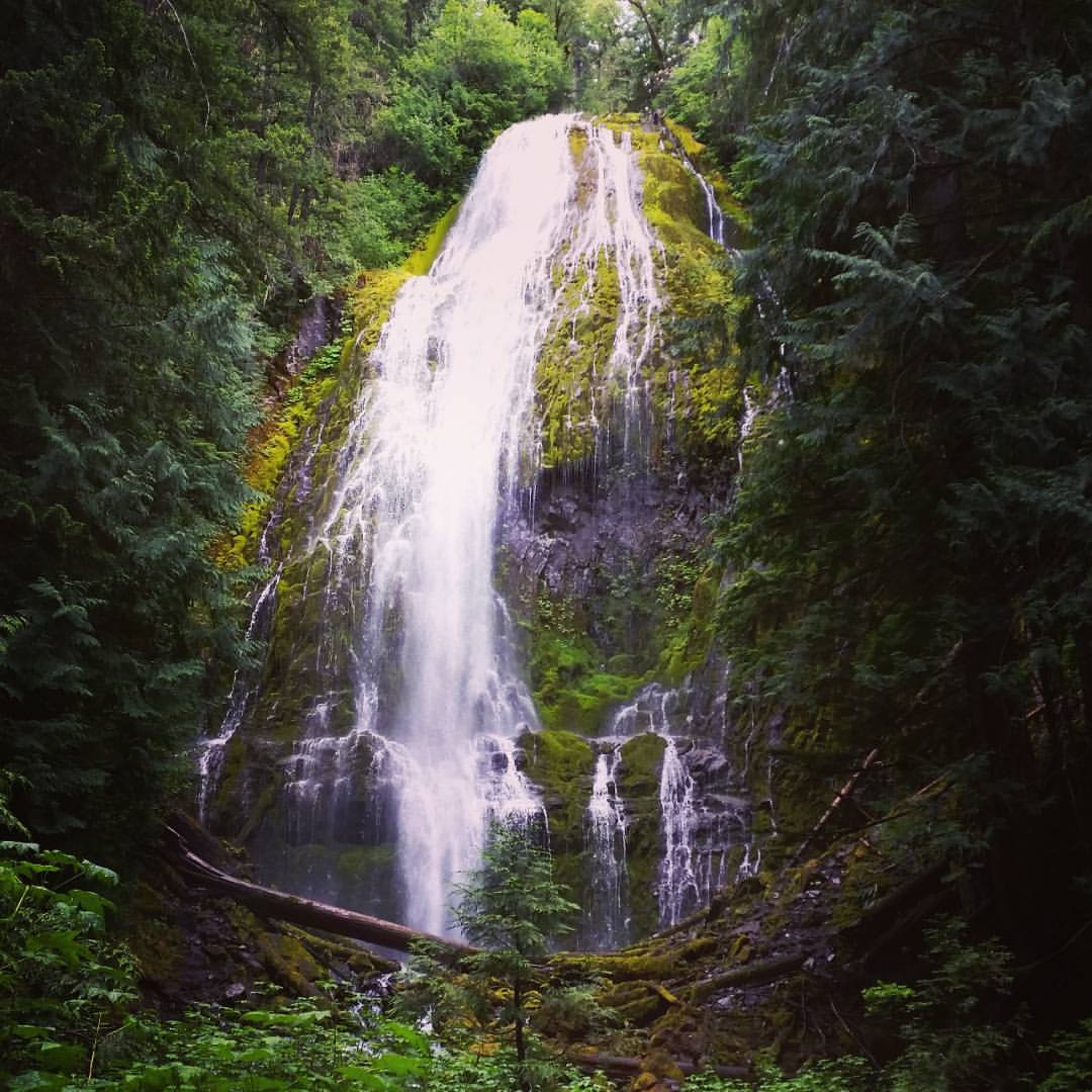
Lower Proxy Falls #oregonexplored #pnw #pnwonderland
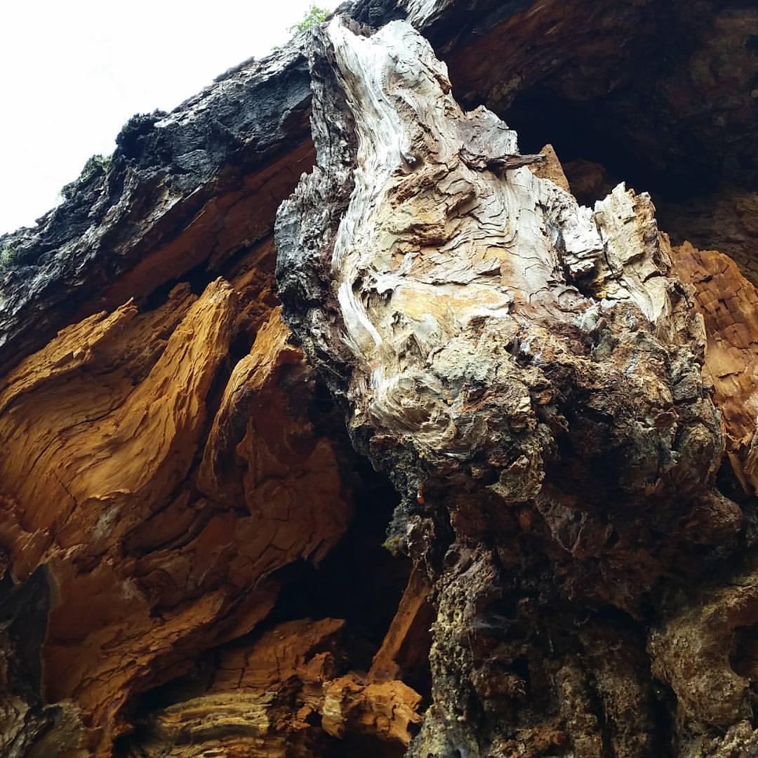
I see a demon face in the lighter wood. Is that just me? :-P #oregonexplored #pnw
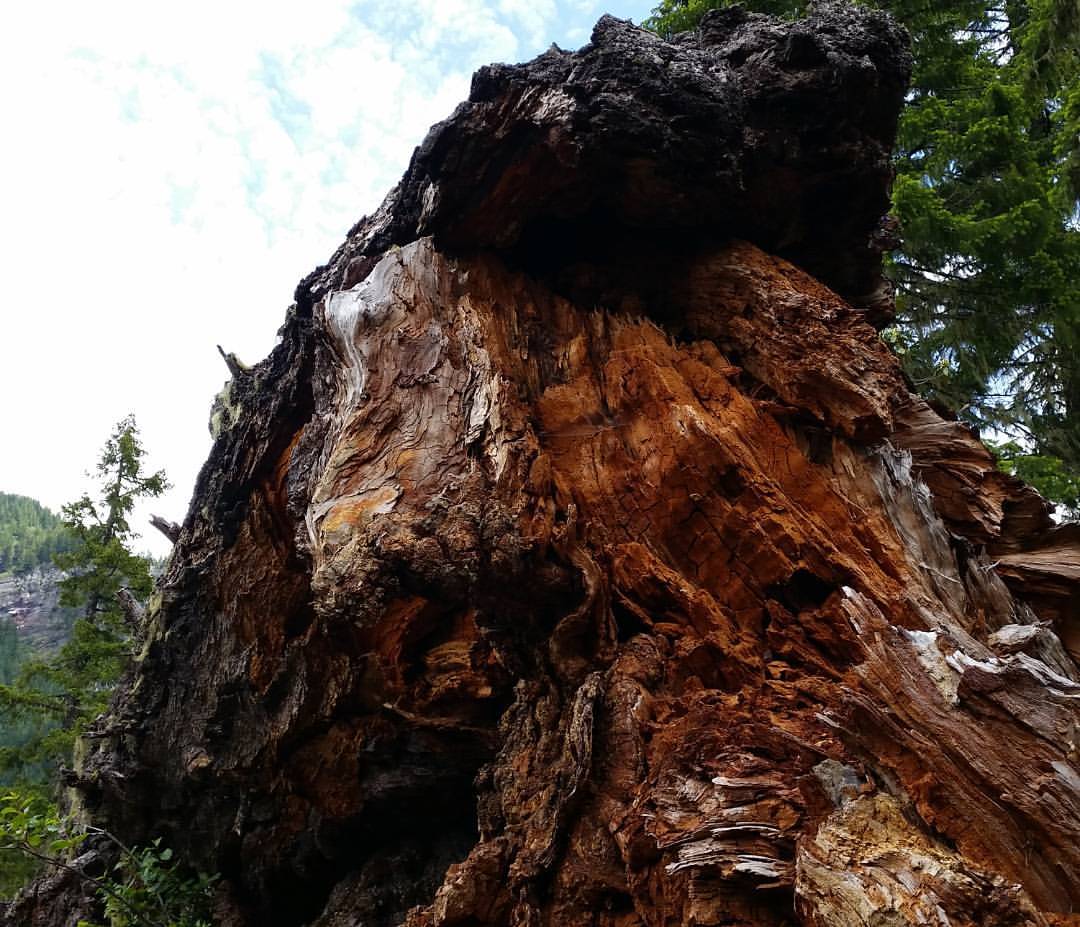
Huge fallen tree on the trail #oregonexplored #pnw #pnwonderland
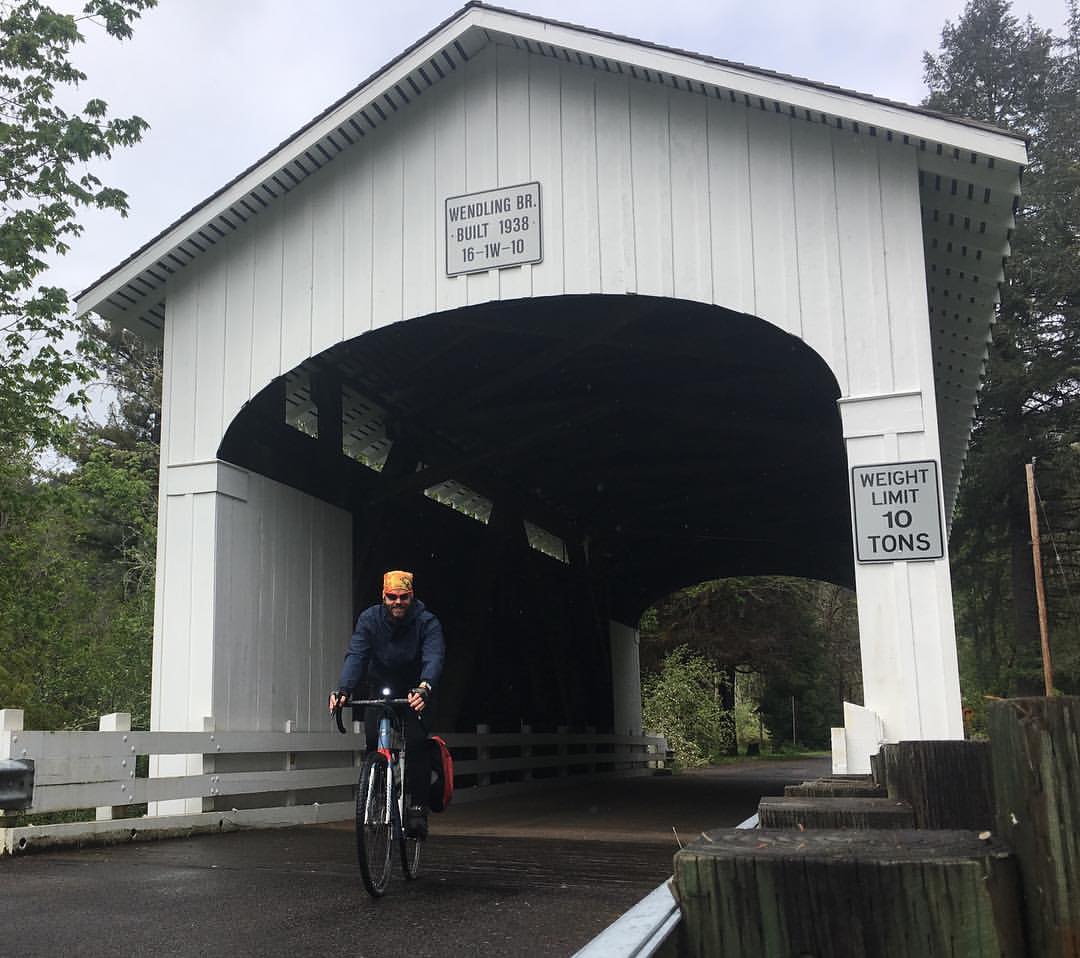
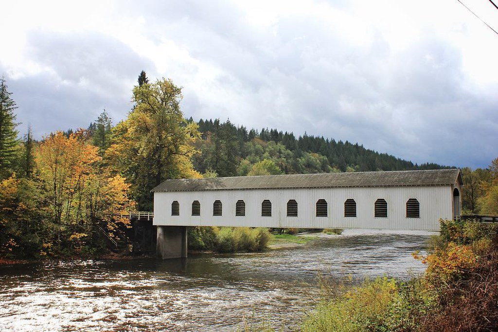
Wound up missing the ride I'd planned and pedaling out to Wendling, about 40 miles round trip. Not as fun as the day I had planned, but not terrible either. I love the covered bridges in Oregon.
Wayfarer, Vida OR
McKenzie River, OR
waiting for summer

McKenzie River, Oregon
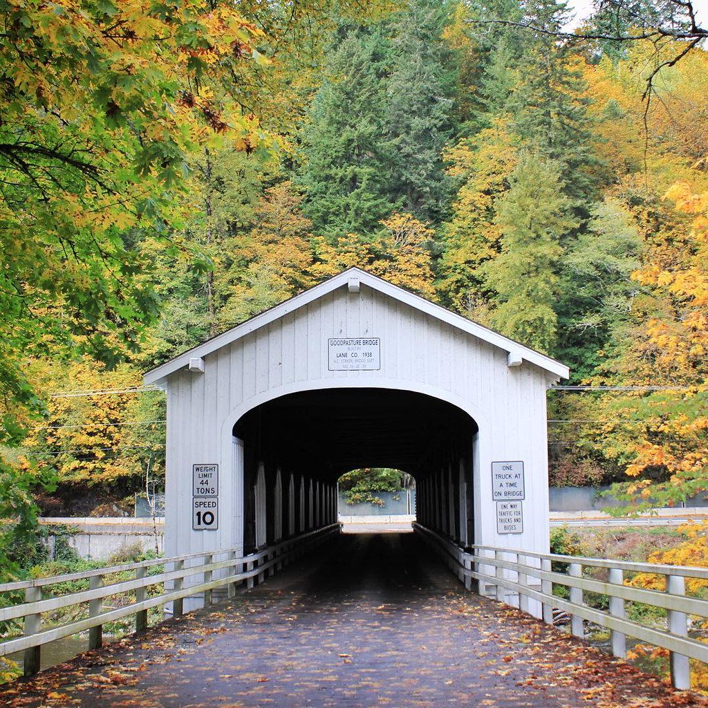
Goodpasture Covered Bridge. #oregon #vida #lanecounty #pnw #mackenzieriver #autumn #fall #october #fallcolors #coveredbridge #rural
Goodpasture Bridge. #oregon #pnw #lanecounty #coveredbridge #autumn #fall #october #rural #vida #mackenzieriver #river #fallcolors
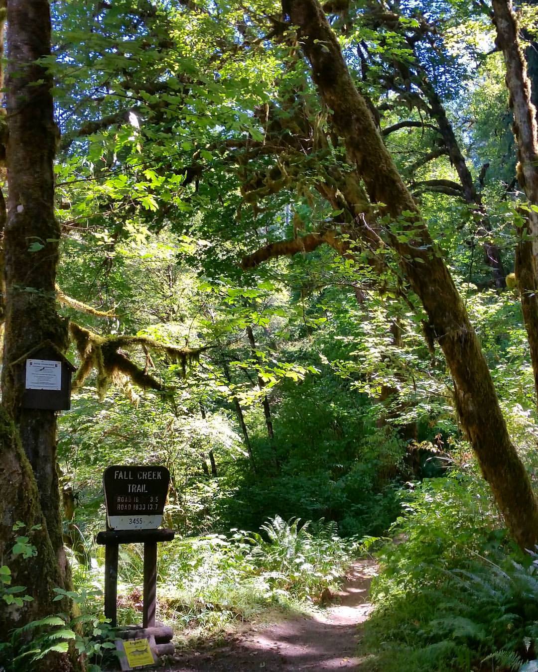
Fall Creek Trail ♧ One beautiful trail to explore????????

Can't sleep, so here's baby Keith.
Baby's first hike with Grandma!
アメリカ合衆国 〒 オレゴン州 リーバーグの地図
別の場所を検索
近所の場所
Greenwood Dr, Walterville, OR アメリカ合衆国
アメリカ合衆国 〒 オレゴン州 ディアホーン
アメリカ合衆国 オレゴン州 ビーダ
Page Ln, Springfield, OR アメリカ合衆国
アメリカ合衆国 〒 オレゴン州 ウォルタービル
アメリカ合衆国 オレゴン州 レーン
Upper Camp Creek Rd, Springfield, OR アメリカ合衆国
Big Fall Creek Rd, Fall Creek, OR アメリカ合衆国フォール・クリーク・トレイルヘッド #1
Upper Camp Creek Rd, Springfield, OR アメリカ合衆国
アメリカ合衆国 〒 オレゴン州 シダー・フラット
アメリカ合衆国 〒 オレゴン州 シダー・フラット
Mohawk River Rd, Marcola, OR アメリカ合衆国
Mohawk River Rd, Marcola, OR アメリカ合衆国
Marcola Rd, Marcola, OR アメリカ合衆国
Marcola Rd, Marcola, OR アメリカ合衆国
Paschelke Rd, Marcola, OR アメリカ合衆国Earnest Bridge
McKenzie Hwy, Springfield, OR アメリカ合衆国
Upper Camp Creek Rd, Springfield, OR アメリカ合衆国
Shotgun Creek Rd, Marcola, OR アメリカ合衆国
Shenandoah Loop, Springfield, OR アメリカ合衆国
最近の検索
- San Telmo, Buenos Aires, Argentina日の出日の入り時間
- Congressional Dr, Stevensville, MD, USA日の出日の入り時間
- ギリシャ 〒 04 パピンゴ日の出日の入り時間
- Kranto 7-oji g. 8"N, Kaunas, リトアニアPagonija rock日の出日の入り時間
- Co Rd 87, Jamestown, CO, USA日の出日の入り時間
- コロンビア クンディナマルカ テンホ日の出日の入り時間
- 日本、〒- 千葉県市原市五所1966−1日の出日の入り時間
- 日本 〒-日の出日の入り時間
- Co Rd A, Truth or Consequences, NM アメリカ合衆国スペースポート・アメリカ日の出日の入り時間
- アメリカ合衆国 〒 ロード・アイランド州 ウォーウィック日の出日の入り時間