アメリカ合衆国 コロラド州 ホースフライ川日の出日の入り時間
Location: アメリカ合衆国 > コロラド州 > モントローズ > >
時間帯:
America/Denver
現地時間:
2024-05-08 06:10:57
経度:
-108.1324874
緯度:
38.2198586
今日の日の出時刻:
06:07:04 AM
今日の日の入時刻:
08:10:54 PM
今日の日長:
14h 3m 50s
明日の日の出時刻:
06:06:04 AM
明日の日の入時刻:
08:11:48 PM
明日の日長:
14h 5m 44s
すべて表示する
| 日付 | 日出 | 日没 | 日長 |
|---|---|---|---|
| 2024年01月01日 | 07:29:11 AM | 05:03:33 PM | 9h 34m 22s |
| 2024年01月02日 | 07:29:18 AM | 05:04:22 PM | 9h 35m 4s |
| 2024年01月03日 | 07:29:22 AM | 05:05:13 PM | 9h 35m 51s |
| 2024年01月04日 | 07:29:24 AM | 05:06:05 PM | 9h 36m 41s |
| 2024年01月05日 | 07:29:24 AM | 05:06:58 PM | 9h 37m 34s |
| 2024年01月06日 | 07:29:22 AM | 05:07:53 PM | 9h 38m 31s |
| 2024年01月07日 | 07:29:18 AM | 05:08:48 PM | 9h 39m 30s |
| 2024年01月08日 | 07:29:11 AM | 05:09:45 PM | 9h 40m 34s |
| 2024年01月09日 | 07:29:03 AM | 05:10:43 PM | 9h 41m 40s |
| 2024年01月10日 | 07:28:52 AM | 05:11:41 PM | 9h 42m 49s |
| 2024年01月11日 | 07:28:40 AM | 05:12:41 PM | 9h 44m 1s |
| 2024年01月12日 | 07:28:25 AM | 05:13:41 PM | 9h 45m 16s |
| 2024年01月13日 | 07:28:08 AM | 05:14:42 PM | 9h 46m 34s |
| 2024年01月14日 | 07:27:50 AM | 05:15:44 PM | 9h 47m 54s |
| 2024年01月15日 | 07:27:29 AM | 05:16:47 PM | 9h 49m 18s |
| 2024年01月16日 | 07:27:06 AM | 05:17:51 PM | 9h 50m 45s |
| 2024年01月17日 | 07:26:41 AM | 05:18:55 PM | 9h 52m 14s |
| 2024年01月18日 | 07:26:14 AM | 05:19:59 PM | 9h 53m 45s |
| 2024年01月19日 | 07:25:45 AM | 05:21:04 PM | 9h 55m 19s |
| 2024年01月20日 | 07:25:14 AM | 05:22:10 PM | 9h 56m 56s |
| 2024年01月21日 | 07:24:42 AM | 05:23:16 PM | 9h 58m 34s |
| 2024年01月22日 | 07:24:07 AM | 05:24:22 PM | 10h 0m 15s |
| 2024年01月23日 | 07:23:30 AM | 05:25:29 PM | 10h 1m 59s |
| 2024年01月24日 | 07:22:52 AM | 05:26:36 PM | 10h 3m 44s |
| 2024年01月25日 | 07:22:12 AM | 05:27:43 PM | 10h 5m 31s |
| 2024年01月26日 | 07:21:29 AM | 05:28:51 PM | 10h 7m 22s |
| 2024年01月27日 | 07:20:46 AM | 05:29:58 PM | 10h 9m 12s |
| 2024年01月28日 | 07:20:00 AM | 05:31:06 PM | 10h 11m 6s |
| 2024年01月29日 | 07:19:12 AM | 05:32:14 PM | 10h 13m 2s |
| 2024年01月30日 | 07:18:23 AM | 05:33:22 PM | 10h 14m 59s |
| 2024年01月31日 | 07:17:33 AM | 05:34:30 PM | 10h 16m 57s |
| 2024年02月01日 | 07:16:40 AM | 05:35:38 PM | 10h 18m 58s |
| 2024年02月02日 | 07:15:46 AM | 05:36:46 PM | 10h 21m 0s |
| 2024年02月03日 | 07:14:51 AM | 05:37:54 PM | 10h 23m 3s |
| 2024年02月04日 | 07:13:53 AM | 05:39:02 PM | 10h 25m 9s |
| 2024年02月05日 | 07:12:55 AM | 05:40:10 PM | 10h 27m 15s |
| 2024年02月06日 | 07:11:55 AM | 05:41:18 PM | 10h 29m 23s |
| 2024年02月07日 | 07:10:53 AM | 05:42:25 PM | 10h 31m 32s |
| 2024年02月08日 | 07:09:50 AM | 05:43:32 PM | 10h 33m 42s |
| 2024年02月09日 | 07:08:46 AM | 05:44:40 PM | 10h 35m 54s |
| 2024年02月10日 | 07:07:40 AM | 05:45:47 PM | 10h 38m 7s |
| 2024年02月11日 | 07:06:33 AM | 05:46:53 PM | 10h 40m 20s |
| 2024年02月12日 | 07:05:24 AM | 05:48:00 PM | 10h 42m 36s |
| 2024年02月13日 | 07:04:15 AM | 05:49:06 PM | 10h 44m 51s |
| 2024年02月14日 | 07:03:04 AM | 05:50:12 PM | 10h 47m 8s |
| 2024年02月15日 | 07:01:52 AM | 05:51:18 PM | 10h 49m 26s |
| 2024年02月16日 | 07:00:39 AM | 05:52:23 PM | 10h 51m 44s |
| 2024年02月17日 | 06:59:25 AM | 05:53:28 PM | 10h 54m 3s |
| 2024年02月18日 | 06:58:09 AM | 05:54:33 PM | 10h 56m 24s |
| 2024年02月19日 | 06:56:53 AM | 05:55:38 PM | 10h 58m 45s |
| 2024年02月20日 | 06:55:36 AM | 05:56:42 PM | 11h 1m 6s |
| 2024年02月21日 | 06:54:17 AM | 05:57:46 PM | 11h 3m 29s |
| 2024年02月22日 | 06:52:58 AM | 05:58:50 PM | 11h 5m 52s |
| 2024年02月23日 | 06:51:38 AM | 05:59:53 PM | 11h 8m 15s |
| 2024年02月24日 | 06:50:17 AM | 06:00:56 PM | 11h 10m 39s |
| 2024年02月25日 | 06:48:55 AM | 06:01:59 PM | 11h 13m 4s |
| 2024年02月26日 | 06:47:32 AM | 06:03:01 PM | 11h 15m 29s |
| 2024年02月27日 | 06:46:09 AM | 06:04:03 PM | 11h 17m 54s |
| 2024年02月28日 | 06:44:45 AM | 06:05:05 PM | 11h 20m 20s |
| 2024年02月29日 | 06:43:20 AM | 06:06:06 PM | 11h 22m 46s |
| 2024年03月01日 | 06:41:54 AM | 06:07:07 PM | 11h 25m 13s |
| 2024年03月02日 | 06:40:28 AM | 06:08:08 PM | 11h 27m 40s |
| 2024年03月03日 | 06:39:01 AM | 06:09:09 PM | 11h 30m 8s |
| 2024年03月04日 | 06:37:34 AM | 06:10:09 PM | 11h 32m 35s |
| 2024年03月05日 | 06:36:06 AM | 06:11:09 PM | 11h 35m 3s |
| 2024年03月06日 | 06:34:37 AM | 06:12:09 PM | 11h 37m 32s |
| 2024年03月07日 | 06:33:08 AM | 06:13:08 PM | 11h 40m 0s |
| 2024年03月08日 | 06:31:39 AM | 06:14:07 PM | 11h 42m 28s |
| 2024年03月09日 | 06:30:09 AM | 06:15:06 PM | 11h 44m 57s |
| 2024年03月10日 | 07:28:42 AM | 07:16:02 PM | 11h 47m 20s |
| 2024年03月11日 | 07:27:12 AM | 07:17:01 PM | 11h 49m 49s |
| 2024年03月12日 | 07:25:41 AM | 07:17:59 PM | 11h 52m 18s |
| 2024年03月13日 | 07:24:09 AM | 07:18:57 PM | 11h 54m 48s |
| 2024年03月14日 | 07:22:38 AM | 07:19:55 PM | 11h 57m 17s |
| 2024年03月15日 | 07:21:06 AM | 07:20:52 PM | 11h 59m 46s |
| 2024年03月16日 | 07:19:34 AM | 07:21:50 PM | 12h 2m 16s |
| 2024年03月17日 | 07:18:02 AM | 07:22:47 PM | 12h 4m 45s |
| 2024年03月18日 | 07:16:30 AM | 07:23:44 PM | 12h 7m 14s |
| 2024年03月19日 | 07:14:57 AM | 07:24:41 PM | 12h 9m 44s |
| 2024年03月20日 | 07:13:25 AM | 07:25:38 PM | 12h 12m 13s |
| 2024年03月21日 | 07:11:52 AM | 07:26:35 PM | 12h 14m 43s |
| 2024年03月22日 | 07:10:20 AM | 07:27:31 PM | 12h 17m 11s |
| 2024年03月23日 | 07:08:47 AM | 07:28:28 PM | 12h 19m 41s |
| 2024年03月24日 | 07:07:14 AM | 07:29:24 PM | 12h 22m 10s |
| 2024年03月25日 | 07:05:42 AM | 07:30:20 PM | 12h 24m 38s |
| 2024年03月26日 | 07:04:09 AM | 07:31:17 PM | 12h 27m 8s |
| 2024年03月27日 | 07:02:37 AM | 07:32:13 PM | 12h 29m 36s |
| 2024年03月28日 | 07:01:05 AM | 07:33:09 PM | 12h 32m 4s |
| 2024年03月29日 | 06:59:33 AM | 07:34:05 PM | 12h 34m 32s |
| 2024年03月30日 | 06:58:01 AM | 07:35:01 PM | 12h 37m 0s |
| 2024年03月31日 | 06:56:30 AM | 07:35:57 PM | 12h 39m 27s |
| 2024年04月01日 | 06:54:59 AM | 07:36:53 PM | 12h 41m 54s |
| 2024年04月02日 | 06:53:28 AM | 07:37:48 PM | 12h 44m 20s |
| 2024年04月03日 | 06:51:57 AM | 07:38:44 PM | 12h 46m 47s |
| 2024年04月04日 | 06:50:27 AM | 07:39:40 PM | 12h 49m 13s |
| 2024年04月05日 | 06:48:57 AM | 07:40:36 PM | 12h 51m 39s |
| 2024年04月06日 | 06:47:28 AM | 07:41:32 PM | 12h 54m 4s |
| 2024年04月07日 | 06:45:59 AM | 07:42:28 PM | 12h 56m 29s |
| 2024年04月08日 | 06:44:30 AM | 07:43:24 PM | 12h 58m 54s |
| 2024年04月09日 | 06:43:02 AM | 07:44:20 PM | 13h 1m 18s |
| 2024年04月10日 | 06:41:35 AM | 07:45:16 PM | 13h 3m 41s |
| 2024年04月11日 | 06:40:08 AM | 07:46:12 PM | 13h 6m 4s |
| 2024年04月12日 | 06:38:42 AM | 07:47:08 PM | 13h 8m 26s |
| 2024年04月13日 | 06:37:16 AM | 07:48:04 PM | 13h 10m 48s |
| 2024年04月14日 | 06:35:51 AM | 07:49:00 PM | 13h 13m 9s |
| 2024年04月15日 | 06:34:27 AM | 07:49:57 PM | 13h 15m 30s |
| 2024年04月16日 | 06:33:03 AM | 07:50:53 PM | 13h 17m 50s |
| 2024年04月17日 | 06:31:40 AM | 07:51:49 PM | 13h 20m 9s |
| 2024年04月18日 | 06:30:18 AM | 07:52:45 PM | 13h 22m 27s |
| 2024年04月19日 | 06:28:57 AM | 07:53:42 PM | 13h 24m 45s |
| 2024年04月20日 | 06:27:37 AM | 07:54:38 PM | 13h 27m 1s |
| 2024年04月21日 | 06:26:17 AM | 07:55:34 PM | 13h 29m 17s |
| 2024年04月22日 | 06:24:59 AM | 07:56:31 PM | 13h 31m 32s |
| 2024年04月23日 | 06:23:41 AM | 07:57:27 PM | 13h 33m 46s |
| 2024年04月24日 | 06:22:24 AM | 07:58:24 PM | 13h 36m 0s |
| 2024年04月25日 | 06:21:09 AM | 07:59:20 PM | 13h 38m 11s |
| 2024年04月26日 | 06:19:54 AM | 08:00:16 PM | 13h 40m 22s |
| 2024年04月27日 | 06:18:40 AM | 08:01:13 PM | 13h 42m 33s |
| 2024年04月28日 | 06:17:28 AM | 08:02:09 PM | 13h 44m 41s |
| 2024年04月29日 | 06:16:16 AM | 08:03:05 PM | 13h 46m 49s |
| 2024年04月30日 | 06:15:06 AM | 08:04:01 PM | 13h 48m 55s |
| 2024年05月01日 | 06:13:57 AM | 08:04:57 PM | 13h 51m 0s |
| 2024年05月02日 | 06:12:49 AM | 08:05:53 PM | 13h 53m 4s |
| 2024年05月03日 | 06:11:43 AM | 08:06:49 PM | 13h 55m 6s |
| 2024年05月04日 | 06:10:37 AM | 08:07:45 PM | 13h 57m 8s |
| 2024年05月05日 | 06:09:33 AM | 08:08:40 PM | 13h 59m 7s |
| 2024年05月06日 | 06:08:30 AM | 08:09:36 PM | 14h 1m 6s |
| 2024年05月07日 | 06:07:29 AM | 08:10:31 PM | 14h 3m 2s |
| 2024年05月08日 | 06:06:29 AM | 08:11:26 PM | 14h 4m 57s |
| 2024年05月09日 | 06:05:30 AM | 08:12:20 PM | 14h 6m 50s |
| 2024年05月10日 | 06:04:33 AM | 08:13:15 PM | 14h 8m 42s |
| 2024年05月11日 | 06:03:37 AM | 08:14:09 PM | 14h 10m 32s |
| 2024年05月12日 | 06:02:43 AM | 08:15:02 PM | 14h 12m 19s |
| 2024年05月13日 | 06:01:50 AM | 08:15:56 PM | 14h 14m 6s |
| 2024年05月14日 | 06:00:59 AM | 08:16:49 PM | 14h 15m 50s |
| 2024年05月15日 | 06:00:09 AM | 08:17:41 PM | 14h 17m 32s |
| 2024年05月16日 | 05:59:21 AM | 08:18:33 PM | 14h 19m 12s |
| 2024年05月17日 | 05:58:34 AM | 08:19:25 PM | 14h 20m 51s |
| 2024年05月18日 | 05:57:50 AM | 08:20:16 PM | 14h 22m 26s |
| 2024年05月19日 | 05:57:06 AM | 08:21:06 PM | 14h 24m 0s |
| 2024年05月20日 | 05:56:25 AM | 08:21:56 PM | 14h 25m 31s |
| 2024年05月21日 | 05:55:45 AM | 08:22:45 PM | 14h 27m 0s |
| 2024年05月22日 | 05:55:07 AM | 08:23:34 PM | 14h 28m 27s |
| 2024年05月23日 | 05:54:30 AM | 08:24:22 PM | 14h 29m 52s |
| 2024年05月24日 | 05:53:55 AM | 08:25:09 PM | 14h 31m 14s |
| 2024年05月25日 | 05:53:22 AM | 08:25:55 PM | 14h 32m 33s |
| 2024年05月26日 | 05:52:51 AM | 08:26:41 PM | 14h 33m 50s |
| 2024年05月27日 | 05:52:22 AM | 08:27:25 PM | 14h 35m 3s |
| 2024年05月28日 | 05:51:54 AM | 08:28:09 PM | 14h 36m 15s |
| 2024年05月29日 | 05:51:28 AM | 08:28:52 PM | 14h 37m 24s |
| 2024年05月30日 | 05:51:04 AM | 08:29:34 PM | 14h 38m 30s |
| 2024年05月31日 | 05:50:42 AM | 08:30:14 PM | 14h 39m 32s |
| 2024年06月01日 | 05:50:21 AM | 08:30:54 PM | 14h 40m 33s |
| 2024年06月02日 | 05:50:03 AM | 08:31:33 PM | 14h 41m 30s |
| 2024年06月03日 | 05:49:46 AM | 08:32:10 PM | 14h 42m 24s |
| 2024年06月04日 | 05:49:31 AM | 08:32:47 PM | 14h 43m 16s |
| 2024年06月05日 | 05:49:18 AM | 08:33:22 PM | 14h 44m 4s |
| 2024年06月06日 | 05:49:07 AM | 08:33:56 PM | 14h 44m 49s |
| 2024年06月07日 | 05:48:57 AM | 08:34:28 PM | 14h 45m 31s |
| 2024年06月08日 | 05:48:50 AM | 08:34:59 PM | 14h 46m 9s |
| 2024年06月09日 | 05:48:44 AM | 08:35:29 PM | 14h 46m 45s |
| 2024年06月10日 | 05:48:40 AM | 08:35:58 PM | 14h 47m 18s |
| 2024年06月11日 | 05:48:38 AM | 08:36:25 PM | 14h 47m 47s |
| 2024年06月12日 | 05:48:37 AM | 08:36:50 PM | 14h 48m 13s |
| 2024年06月13日 | 05:48:39 AM | 08:37:15 PM | 14h 48m 36s |
| 2024年06月14日 | 05:48:42 AM | 08:37:37 PM | 14h 48m 55s |
| 2024年06月15日 | 05:48:47 AM | 08:37:58 PM | 14h 49m 11s |
| 2024年06月16日 | 05:48:53 AM | 08:38:17 PM | 14h 49m 24s |
| 2024年06月17日 | 05:49:02 AM | 08:38:35 PM | 14h 49m 33s |
| 2024年06月18日 | 05:49:12 AM | 08:38:51 PM | 14h 49m 39s |
| 2024年06月19日 | 05:49:24 AM | 08:39:06 PM | 14h 49m 42s |
| 2024年06月20日 | 05:49:37 AM | 08:39:18 PM | 14h 49m 41s |
| 2024年06月21日 | 05:49:52 AM | 08:39:29 PM | 14h 49m 37s |
| 2024年06月22日 | 05:50:09 AM | 08:39:39 PM | 14h 49m 30s |
| 2024年06月23日 | 05:50:27 AM | 08:39:46 PM | 14h 49m 19s |
| 2024年06月24日 | 05:50:46 AM | 08:39:52 PM | 14h 49m 6s |
| 2024年06月25日 | 05:51:08 AM | 08:39:56 PM | 14h 48m 48s |
| 2024年06月26日 | 05:51:30 AM | 08:39:58 PM | 14h 48m 28s |
| 2024年06月27日 | 05:51:55 AM | 08:39:58 PM | 14h 48m 3s |
| 2024年06月28日 | 05:52:20 AM | 08:39:57 PM | 14h 47m 37s |
| 2024年06月29日 | 05:52:47 AM | 08:39:53 PM | 14h 47m 6s |
| 2024年06月30日 | 05:53:15 AM | 08:39:48 PM | 14h 46m 33s |
| 2024年07月01日 | 05:53:45 AM | 08:39:41 PM | 14h 45m 56s |
| 2024年07月02日 | 05:54:16 AM | 08:39:32 PM | 14h 45m 16s |
| 2024年07月03日 | 05:54:48 AM | 08:39:21 PM | 14h 44m 33s |
| 2024年07月04日 | 05:55:21 AM | 08:39:08 PM | 14h 43m 47s |
| 2024年07月05日 | 05:55:56 AM | 08:38:54 PM | 14h 42m 58s |
| 2024年07月06日 | 05:56:32 AM | 08:38:37 PM | 14h 42m 5s |
| 2024年07月07日 | 05:57:08 AM | 08:38:19 PM | 14h 41m 11s |
| 2024年07月08日 | 05:57:46 AM | 08:37:59 PM | 14h 40m 13s |
| 2024年07月09日 | 05:58:25 AM | 08:37:37 PM | 14h 39m 12s |
| 2024年07月10日 | 05:59:04 AM | 08:37:13 PM | 14h 38m 9s |
| 2024年07月11日 | 05:59:45 AM | 08:36:47 PM | 14h 37m 2s |
| 2024年07月12日 | 06:00:27 AM | 08:36:19 PM | 14h 35m 52s |
| 2024年07月13日 | 06:01:09 AM | 08:35:50 PM | 14h 34m 41s |
| 2024年07月14日 | 06:01:52 AM | 08:35:18 PM | 14h 33m 26s |
| 2024年07月15日 | 06:02:36 AM | 08:34:45 PM | 14h 32m 9s |
| 2024年07月16日 | 06:03:21 AM | 08:34:10 PM | 14h 30m 49s |
| 2024年07月17日 | 06:04:06 AM | 08:33:34 PM | 14h 29m 28s |
| 2024年07月18日 | 06:04:52 AM | 08:32:55 PM | 14h 28m 3s |
| 2024年07月19日 | 06:05:39 AM | 08:32:15 PM | 14h 26m 36s |
| 2024年07月20日 | 06:06:26 AM | 08:31:34 PM | 14h 25m 8s |
| 2024年07月21日 | 06:07:14 AM | 08:30:50 PM | 14h 23m 36s |
| 2024年07月22日 | 06:08:02 AM | 08:30:05 PM | 14h 22m 3s |
| 2024年07月23日 | 06:08:51 AM | 08:29:18 PM | 14h 20m 27s |
| 2024年07月24日 | 06:09:40 AM | 08:28:29 PM | 14h 18m 49s |
| 2024年07月25日 | 06:10:30 AM | 08:27:39 PM | 14h 17m 9s |
| 2024年07月26日 | 06:11:20 AM | 08:26:48 PM | 14h 15m 28s |
| 2024年07月27日 | 06:12:11 AM | 08:25:54 PM | 14h 13m 43s |
| 2024年07月28日 | 06:13:01 AM | 08:25:00 PM | 14h 11m 59s |
| 2024年07月29日 | 06:13:52 AM | 08:24:03 PM | 14h 10m 11s |
| 2024年07月30日 | 06:14:44 AM | 08:23:05 PM | 14h 8m 21s |
| 2024年07月31日 | 06:15:35 AM | 08:22:06 PM | 14h 6m 31s |
| 2024年08月01日 | 06:16:27 AM | 08:21:06 PM | 14h 4m 39s |
| 2024年08月02日 | 06:17:19 AM | 08:20:03 PM | 14h 2m 44s |
| 2024年08月03日 | 06:18:11 AM | 08:19:00 PM | 14h 0m 49s |
| 2024年08月04日 | 06:19:03 AM | 08:17:55 PM | 13h 58m 52s |
| 2024年08月05日 | 06:19:56 AM | 08:16:49 PM | 13h 56m 53s |
| 2024年08月06日 | 06:20:48 AM | 08:15:42 PM | 13h 54m 54s |
| 2024年08月07日 | 06:21:41 AM | 08:14:33 PM | 13h 52m 52s |
| 2024年08月08日 | 06:22:33 AM | 08:13:23 PM | 13h 50m 50s |
| 2024年08月09日 | 06:23:26 AM | 08:12:12 PM | 13h 48m 46s |
| 2024年08月10日 | 06:24:19 AM | 08:11:00 PM | 13h 46m 41s |
| 2024年08月11日 | 06:25:12 AM | 08:09:46 PM | 13h 44m 34s |
| 2024年08月12日 | 06:26:04 AM | 08:08:32 PM | 13h 42m 28s |
| 2024年08月13日 | 06:26:57 AM | 08:07:16 PM | 13h 40m 19s |
| 2024年08月14日 | 06:27:50 AM | 08:05:59 PM | 13h 38m 9s |
| 2024年08月15日 | 06:28:43 AM | 08:04:42 PM | 13h 35m 59s |
| 2024年08月16日 | 06:29:35 AM | 08:03:23 PM | 13h 33m 48s |
| 2024年08月17日 | 06:30:28 AM | 08:02:03 PM | 13h 31m 35s |
| 2024年08月18日 | 06:31:20 AM | 08:00:43 PM | 13h 29m 23s |
| 2024年08月19日 | 06:32:13 AM | 07:59:21 PM | 13h 27m 8s |
| 2024年08月20日 | 06:33:06 AM | 07:57:59 PM | 13h 24m 53s |
| 2024年08月21日 | 06:33:58 AM | 07:56:36 PM | 13h 22m 38s |
| 2024年08月22日 | 06:34:50 AM | 07:55:12 PM | 13h 20m 22s |
| 2024年08月23日 | 06:35:43 AM | 07:53:47 PM | 13h 18m 4s |
| 2024年08月24日 | 06:36:35 AM | 07:52:21 PM | 13h 15m 46s |
| 2024年08月25日 | 06:37:27 AM | 07:50:55 PM | 13h 13m 28s |
| 2024年08月26日 | 06:38:19 AM | 07:49:28 PM | 13h 11m 9s |
| 2024年08月27日 | 06:39:11 AM | 07:48:00 PM | 13h 8m 49s |
| 2024年08月28日 | 06:40:03 AM | 07:46:32 PM | 13h 6m 29s |
| 2024年08月29日 | 06:40:55 AM | 07:45:03 PM | 13h 4m 8s |
| 2024年08月30日 | 06:41:47 AM | 07:43:34 PM | 13h 1m 47s |
| 2024年08月31日 | 06:42:39 AM | 07:42:04 PM | 12h 59m 25s |
| 2024年09月01日 | 06:43:30 AM | 07:40:33 PM | 12h 57m 3s |
| 2024年09月02日 | 06:44:22 AM | 07:39:02 PM | 12h 54m 40s |
| 2024年09月03日 | 06:45:14 AM | 07:37:31 PM | 12h 52m 17s |
| 2024年09月04日 | 06:46:05 AM | 07:35:59 PM | 12h 49m 54s |
| 2024年09月05日 | 06:46:57 AM | 07:34:27 PM | 12h 47m 30s |
| 2024年09月06日 | 06:47:48 AM | 07:32:54 PM | 12h 45m 6s |
| 2024年09月07日 | 06:48:40 AM | 07:31:21 PM | 12h 42m 41s |
| 2024年09月08日 | 06:49:31 AM | 07:29:48 PM | 12h 40m 17s |
| 2024年09月09日 | 06:50:23 AM | 07:28:14 PM | 12h 37m 51s |
| 2024年09月10日 | 06:51:15 AM | 07:26:40 PM | 12h 35m 25s |
| 2024年09月11日 | 06:52:06 AM | 07:25:06 PM | 12h 33m 0s |
| 2024年09月12日 | 06:52:58 AM | 07:23:32 PM | 12h 30m 34s |
| 2024年09月13日 | 06:53:49 AM | 07:21:57 PM | 12h 28m 8s |
| 2024年09月14日 | 06:54:41 AM | 07:20:23 PM | 12h 25m 42s |
| 2024年09月15日 | 06:55:33 AM | 07:18:48 PM | 12h 23m 15s |
| 2024年09月16日 | 06:56:25 AM | 07:17:13 PM | 12h 20m 48s |
| 2024年09月17日 | 06:57:17 AM | 07:15:39 PM | 12h 18m 22s |
| 2024年09月18日 | 06:58:09 AM | 07:14:04 PM | 12h 15m 55s |
| 2024年09月19日 | 06:59:01 AM | 07:12:29 PM | 12h 13m 28s |
| 2024年09月20日 | 06:59:53 AM | 07:10:54 PM | 12h 11m 1s |
| 2024年09月21日 | 07:00:45 AM | 07:09:20 PM | 12h 8m 35s |
| 2024年09月22日 | 07:01:38 AM | 07:07:45 PM | 12h 6m 7s |
| 2024年09月23日 | 07:02:31 AM | 07:06:11 PM | 12h 3m 40s |
| 2024年09月24日 | 07:03:23 AM | 07:04:36 PM | 12h 1m 13s |
| 2024年09月25日 | 07:04:16 AM | 07:03:02 PM | 11h 58m 46s |
| 2024年09月26日 | 07:05:10 AM | 07:01:28 PM | 11h 56m 18s |
| 2024年09月27日 | 07:06:03 AM | 06:59:55 PM | 11h 53m 52s |
| 2024年09月28日 | 07:06:57 AM | 06:58:21 PM | 11h 51m 24s |
| 2024年09月29日 | 07:07:50 AM | 06:56:48 PM | 11h 48m 58s |
| 2024年09月30日 | 07:08:45 AM | 06:55:16 PM | 11h 46m 31s |
| 2024年10月01日 | 07:09:39 AM | 06:53:43 PM | 11h 44m 4s |
| 2024年10月02日 | 07:10:33 AM | 06:52:11 PM | 11h 41m 38s |
| 2024年10月03日 | 07:11:28 AM | 06:50:40 PM | 11h 39m 12s |
| 2024年10月04日 | 07:12:23 AM | 06:49:09 PM | 11h 36m 46s |
| 2024年10月05日 | 07:13:19 AM | 06:47:38 PM | 11h 34m 19s |
| 2024年10月06日 | 07:14:14 AM | 06:46:08 PM | 11h 31m 54s |
| 2024年10月07日 | 07:15:10 AM | 06:44:39 PM | 11h 29m 29s |
| 2024年10月08日 | 07:16:07 AM | 06:43:10 PM | 11h 27m 3s |
| 2024年10月09日 | 07:17:03 AM | 06:41:41 PM | 11h 24m 38s |
| 2024年10月10日 | 07:18:00 AM | 06:40:14 PM | 11h 22m 14s |
| 2024年10月11日 | 07:18:57 AM | 06:38:47 PM | 11h 19m 50s |
| 2024年10月12日 | 07:19:55 AM | 06:37:21 PM | 11h 17m 26s |
| 2024年10月13日 | 07:20:53 AM | 06:35:55 PM | 11h 15m 2s |
| 2024年10月14日 | 07:21:51 AM | 06:34:30 PM | 11h 12m 39s |
| 2024年10月15日 | 07:22:49 AM | 06:33:06 PM | 11h 10m 17s |
| 2024年10月16日 | 07:23:48 AM | 06:31:43 PM | 11h 7m 55s |
| 2024年10月17日 | 07:24:47 AM | 06:30:21 PM | 11h 5m 34s |
| 2024年10月18日 | 07:25:47 AM | 06:29:00 PM | 11h 3m 13s |
| 2024年10月19日 | 07:26:47 AM | 06:27:39 PM | 11h 0m 52s |
| 2024年10月20日 | 07:27:47 AM | 06:26:20 PM | 10h 58m 33s |
| 2024年10月21日 | 07:28:48 AM | 06:25:02 PM | 10h 56m 14s |
| 2024年10月22日 | 07:29:49 AM | 06:23:44 PM | 10h 53m 55s |
| 2024年10月23日 | 07:30:50 AM | 06:22:28 PM | 10h 51m 38s |
| 2024年10月24日 | 07:31:51 AM | 06:21:13 PM | 10h 49m 22s |
| 2024年10月25日 | 07:32:53 AM | 06:19:59 PM | 10h 47m 6s |
| 2024年10月26日 | 07:33:55 AM | 06:18:46 PM | 10h 44m 51s |
| 2024年10月27日 | 07:34:58 AM | 06:17:34 PM | 10h 42m 36s |
| 2024年10月28日 | 07:36:01 AM | 06:16:24 PM | 10h 40m 23s |
| 2024年10月29日 | 07:37:04 AM | 06:15:15 PM | 10h 38m 11s |
| 2024年10月30日 | 07:38:07 AM | 06:14:07 PM | 10h 36m 0s |
| 2024年10月31日 | 07:39:11 AM | 06:13:00 PM | 10h 33m 49s |
| 2024年11月01日 | 07:40:14 AM | 06:11:55 PM | 10h 31m 41s |
| 2024年11月02日 | 07:41:18 AM | 06:10:51 PM | 10h 29m 33s |
| 2024年11月03日 | 06:42:25 AM | 05:09:47 PM | 10h 27m 22s |
| 2024年11月04日 | 06:43:30 AM | 05:08:46 PM | 10h 25m 16s |
| 2024年11月05日 | 06:44:34 AM | 05:07:47 PM | 10h 23m 13s |
| 2024年11月06日 | 06:45:39 AM | 05:06:49 PM | 10h 21m 10s |
| 2024年11月07日 | 06:46:44 AM | 05:05:53 PM | 10h 19m 9s |
| 2024年11月08日 | 06:47:49 AM | 05:04:59 PM | 10h 17m 10s |
| 2024年11月09日 | 06:48:54 AM | 05:04:06 PM | 10h 15m 12s |
| 2024年11月10日 | 06:49:59 AM | 05:03:15 PM | 10h 13m 16s |
| 2024年11月11日 | 06:51:04 AM | 05:02:25 PM | 10h 11m 21s |
| 2024年11月12日 | 06:52:09 AM | 05:01:37 PM | 10h 9m 28s |
| 2024年11月13日 | 06:53:13 AM | 05:00:51 PM | 10h 7m 38s |
| 2024年11月14日 | 06:54:18 AM | 05:00:07 PM | 10h 5m 49s |
| 2024年11月15日 | 06:55:23 AM | 04:59:25 PM | 10h 4m 2s |
| 2024年11月16日 | 06:56:27 AM | 04:58:44 PM | 10h 2m 17s |
| 2024年11月17日 | 06:57:31 AM | 04:58:06 PM | 10h 0m 35s |
| 2024年11月18日 | 06:58:35 AM | 04:57:29 PM | 9h 58m 54s |
| 2024年11月19日 | 06:59:39 AM | 04:56:54 PM | 9h 57m 15s |
| 2024年11月20日 | 07:00:42 AM | 04:56:21 PM | 9h 55m 39s |
| 2024年11月21日 | 07:01:45 AM | 04:55:51 PM | 9h 54m 6s |
| 2024年11月22日 | 07:02:48 AM | 04:55:22 PM | 9h 52m 34s |
| 2024年11月23日 | 07:03:50 AM | 04:54:55 PM | 9h 51m 5s |
| 2024年11月24日 | 07:04:51 AM | 04:54:30 PM | 9h 49m 39s |
| 2024年11月25日 | 07:05:52 AM | 04:54:07 PM | 9h 48m 15s |
| 2024年11月26日 | 07:06:53 AM | 04:53:47 PM | 9h 46m 54s |
| 2024年11月27日 | 07:07:52 AM | 04:53:28 PM | 9h 45m 36s |
| 2024年11月28日 | 07:08:51 AM | 04:53:11 PM | 9h 44m 20s |
| 2024年11月29日 | 07:09:49 AM | 04:52:57 PM | 9h 43m 8s |
| 2024年11月30日 | 07:10:47 AM | 04:52:45 PM | 9h 41m 58s |
| 2024年12月01日 | 07:11:43 AM | 04:52:35 PM | 9h 40m 52s |
| 2024年12月02日 | 07:12:39 AM | 04:52:27 PM | 9h 39m 48s |
| 2024年12月03日 | 07:13:33 AM | 04:52:21 PM | 9h 38m 48s |
| 2024年12月04日 | 07:14:27 AM | 04:52:17 PM | 9h 37m 50s |
| 2024年12月05日 | 07:15:19 AM | 04:52:16 PM | 9h 36m 57s |
| 2024年12月06日 | 07:16:10 AM | 04:52:16 PM | 9h 36m 6s |
| 2024年12月07日 | 07:17:00 AM | 04:52:19 PM | 9h 35m 19s |
| 2024年12月08日 | 07:17:49 AM | 04:52:24 PM | 9h 34m 35s |
| 2024年12月09日 | 07:18:37 AM | 04:52:31 PM | 9h 33m 54s |
| 2024年12月10日 | 07:19:23 AM | 04:52:40 PM | 9h 33m 17s |
| 2024年12月11日 | 07:20:08 AM | 04:52:51 PM | 9h 32m 43s |
| 2024年12月12日 | 07:20:51 AM | 04:53:04 PM | 9h 32m 13s |
| 2024年12月13日 | 07:21:33 AM | 04:53:20 PM | 9h 31m 47s |
| 2024年12月14日 | 07:22:14 AM | 04:53:37 PM | 9h 31m 23s |
| 2024年12月15日 | 07:22:53 AM | 04:53:57 PM | 9h 31m 4s |
| 2024年12月16日 | 07:23:30 AM | 04:54:18 PM | 9h 30m 48s |
| 2024年12月17日 | 07:24:05 AM | 04:54:42 PM | 9h 30m 37s |
| 2024年12月18日 | 07:24:39 AM | 04:55:07 PM | 9h 30m 28s |
| 2024年12月19日 | 07:25:11 AM | 04:55:35 PM | 9h 30m 24s |
| 2024年12月20日 | 07:25:42 AM | 04:56:04 PM | 9h 30m 22s |
| 2024年12月21日 | 07:26:10 AM | 04:56:35 PM | 9h 30m 25s |
| 2024年12月22日 | 07:26:37 AM | 04:57:08 PM | 9h 30m 31s |
| 2024年12月23日 | 07:27:02 AM | 04:57:43 PM | 9h 30m 41s |
| 2024年12月24日 | 07:27:25 AM | 04:58:19 PM | 9h 30m 54s |
| 2024年12月25日 | 07:27:45 AM | 04:58:58 PM | 9h 31m 13s |
| 2024年12月26日 | 07:28:04 AM | 04:59:38 PM | 9h 31m 34s |
| 2024年12月27日 | 07:28:21 AM | 05:00:19 PM | 9h 31m 58s |
| 2024年12月28日 | 07:28:36 AM | 05:01:02 PM | 9h 32m 26s |
| 2024年12月29日 | 07:28:49 AM | 05:01:47 PM | 9h 32m 58s |
| 2024年12月30日 | 07:29:00 AM | 05:02:33 PM | 9h 33m 33s |
写真

Colorado sunset #home

Near Norwood, CO
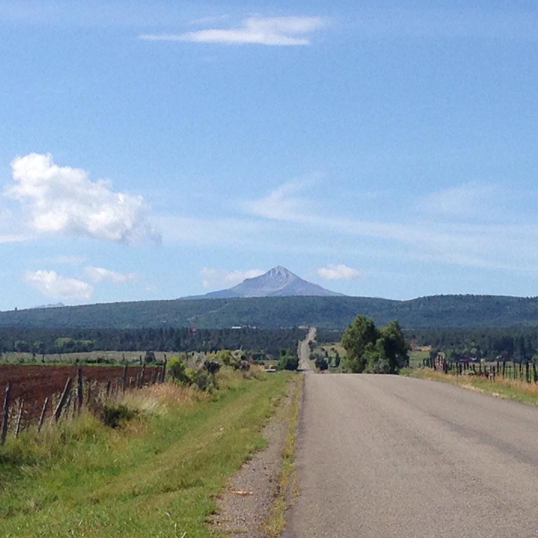
View of Lone Cone from home. I've missed that little mountain and all the wide open lush green spaces. A nice change from city life.

Colorado, San Miguel River near Norwood IMG_0147

Autumn's Fire

Colorado Wildfire Smoke_6725

San Miguel, Canyon, Colorado.

DSC06170.JPG

DSC06163.JPG

Looking towards Lone Cone #home

Golden meadow

W Colorado 050 - Happy Belly Deli, Norwood

SPRING IN THE HIGH COUNTRY

DON'T FALL ...

At The End Of The Fence

A drive on the Uncompahgre Plateau

Uncompahgre National Forest, 05/1972

Alpine meadow, 05/1972.

Colorado--Uncompahgre National Forest, 05/1972.

Near East Dallas Creek, 05/1972.

Alpine meadow, 05/1972.
アメリカ合衆国 コロラド州 ホースフライ川の地図
別の場所を検索
近所の場所
Elk Dr, Montrose, CO アメリカ合衆国
90 Rd, Nucla, CO アメリカ合衆国
Deer Trail, Colorado アメリカ合衆国
Dave Wood Rd, Colorado, アメリカ合衆国デイブ・ウッド・ロード
35 Gypsy Ln, Montrose, CO アメリカ合衆国
Bible Camp Rd, Montrose, CO アメリカ合衆国
Dave Wood Rd, Montrose, CO アメリカ合衆国
Sims Mesa Rd, Montrose, CO アメリカ合衆国
アメリカ合衆国 〒 コロラド州 プラサーヴィル
Harcourt Trail, Colorado アメリカ合衆国
Juniper Village Dr, Colorado アメリカ合衆国
アメリカ合衆国 〒 コロラド州 モントローズ
アメリカ合衆国 コロラド州 サンミゲル
Trunk Rd, Placerville, CO アメリカ合衆国
County 58P Rd, Colorado アメリカ合衆国
アメリカ合衆国 コロラド州 モントローズ
CO-62, Ridgway, CO アメリカ合衆国
5 Oneida St, Colorado アメリカ合衆国
San Juan Vista Rd, Colorado, アメリカ合衆国サン・ホアン・ビスタ・ロード
Shavano Valley Rd, Montrose, CO アメリカ合衆国
最近の検索
- Sunset Dr, Richmond, VA, USA日の出日の入り時間
- View Villa Apartments Hurghada, Al Ahyaa, Mubarak 7, Villa nr 2 Hurghada, قسم ثان الغردقة، محافظة ال日の出日の入り時間
- Grodna District, Hrodna Region, Belarus日の出日の入り時間
- ベラルーシ グロドノ日の出日の入り時間
- Vydrino, Irkutsk Oblast, Russia日の出日の入り時間
- Worksop S81 8GA, UK日の出日の入り時間
- Cabo de Cruz, Boiro, A Coruña, スペイン日の出日の入り時間
- 日本、山形県 置賜地方日の出日の入り時間
- 中華人民共和国 山西省 晋中市 楡次区日の出日の入り時間
- 4 Vale Rd, Sheffield S3 9QX イギリス日の出日の入り時間