アメリカ合衆国 〒 モンタナ州 エルク・リッジ日の出日の入り時間
Location: アメリカ合衆国 > モンタナ州 > ハングリー・ホース >
時間帯:
America/Denver
現地時間:
2024-05-26 18:08:32
経度:
-113.2138888
緯度:
47.9722222
今日の日の出時刻:
05:40:23 AM
今日の日の入時刻:
09:19:54 PM
今日の日長:
15h 39m 31s
明日の日の出時刻:
05:39:36 AM
明日の日の入時刻:
09:20:56 PM
明日の日長:
15h 41m 20s
すべて表示する
| 日付 | 日出 | 日没 | 日長 |
|---|---|---|---|
| 2024年01月01日 | 08:22:24 AM | 04:51:00 PM | 8h 28m 36s |
| 2024年01月02日 | 08:22:19 AM | 04:52:00 PM | 8h 29m 41s |
| 2024年01月03日 | 08:22:12 AM | 04:53:03 PM | 8h 30m 51s |
| 2024年01月04日 | 08:22:02 AM | 04:54:07 PM | 8h 32m 5s |
| 2024年01月05日 | 08:21:49 AM | 04:55:13 PM | 8h 33m 24s |
| 2024年01月06日 | 08:21:32 AM | 04:56:22 PM | 8h 34m 50s |
| 2024年01月07日 | 08:21:14 AM | 04:57:32 PM | 8h 36m 18s |
| 2024年01月08日 | 08:20:52 AM | 04:58:44 PM | 8h 37m 52s |
| 2024年01月09日 | 08:20:27 AM | 04:59:58 PM | 8h 39m 31s |
| 2024年01月10日 | 08:20:00 AM | 05:01:13 PM | 8h 41m 13s |
| 2024年01月11日 | 08:19:30 AM | 05:02:31 PM | 8h 43m 1s |
| 2024年01月12日 | 08:18:57 AM | 05:03:49 PM | 8h 44m 52s |
| 2024年01月13日 | 08:18:21 AM | 05:05:09 PM | 8h 46m 48s |
| 2024年01月14日 | 08:17:43 AM | 05:06:31 PM | 8h 48m 48s |
| 2024年01月15日 | 08:17:02 AM | 05:07:53 PM | 8h 50m 51s |
| 2024年01月16日 | 08:16:19 AM | 05:09:17 PM | 8h 52m 58s |
| 2024年01月17日 | 08:15:33 AM | 05:10:43 PM | 8h 55m 10s |
| 2024年01月18日 | 08:14:44 AM | 05:12:09 PM | 8h 57m 25s |
| 2024年01月19日 | 08:13:53 AM | 05:13:36 PM | 8h 59m 43s |
| 2024年01月20日 | 08:12:59 AM | 05:15:05 PM | 9h 2m 6s |
| 2024年01月21日 | 08:12:03 AM | 05:16:34 PM | 9h 4m 31s |
| 2024年01月22日 | 08:11:05 AM | 05:18:04 PM | 9h 6m 59s |
| 2024年01月23日 | 08:10:04 AM | 05:19:35 PM | 9h 9m 31s |
| 2024年01月24日 | 08:09:01 AM | 05:21:06 PM | 9h 12m 5s |
| 2024年01月25日 | 08:07:56 AM | 05:22:38 PM | 9h 14m 42s |
| 2024年01月26日 | 08:06:49 AM | 05:24:11 PM | 9h 17m 22s |
| 2024年01月27日 | 08:05:39 AM | 05:25:44 PM | 9h 20m 5s |
| 2024年01月28日 | 08:04:28 AM | 05:27:18 PM | 9h 22m 50s |
| 2024年01月29日 | 08:03:14 AM | 05:28:52 PM | 9h 25m 38s |
| 2024年01月30日 | 08:01:58 AM | 05:30:27 PM | 9h 28m 29s |
| 2024年01月31日 | 08:00:41 AM | 05:32:01 PM | 9h 31m 20s |
| 2024年02月01日 | 07:59:21 AM | 05:33:37 PM | 9h 34m 16s |
| 2024年02月02日 | 07:58:00 AM | 05:35:12 PM | 9h 37m 12s |
| 2024年02月03日 | 07:56:37 AM | 05:36:47 PM | 9h 40m 10s |
| 2024年02月04日 | 07:55:12 AM | 05:38:23 PM | 9h 43m 11s |
| 2024年02月05日 | 07:53:45 AM | 05:39:59 PM | 9h 46m 14s |
| 2024年02月06日 | 07:52:16 AM | 05:41:35 PM | 9h 49m 19s |
| 2024年02月07日 | 07:50:46 AM | 05:43:11 PM | 9h 52m 25s |
| 2024年02月08日 | 07:49:15 AM | 05:44:47 PM | 9h 55m 32s |
| 2024年02月09日 | 07:47:41 AM | 05:46:23 PM | 9h 58m 42s |
| 2024年02月10日 | 07:46:07 AM | 05:47:59 PM | 10h 1m 52s |
| 2024年02月11日 | 07:44:31 AM | 05:49:35 PM | 10h 5m 4s |
| 2024年02月12日 | 07:42:53 AM | 05:51:10 PM | 10h 8m 17s |
| 2024年02月13日 | 07:41:14 AM | 05:52:46 PM | 10h 11m 32s |
| 2024年02月14日 | 07:39:34 AM | 05:54:21 PM | 10h 14m 47s |
| 2024年02月15日 | 07:37:52 AM | 05:55:57 PM | 10h 18m 5s |
| 2024年02月16日 | 07:36:09 AM | 05:57:32 PM | 10h 21m 23s |
| 2024年02月17日 | 07:34:25 AM | 05:59:07 PM | 10h 24m 42s |
| 2024年02月18日 | 07:32:40 AM | 06:00:41 PM | 10h 28m 1s |
| 2024年02月19日 | 07:30:54 AM | 06:02:16 PM | 10h 31m 22s |
| 2024年02月20日 | 07:29:07 AM | 06:03:50 PM | 10h 34m 43s |
| 2024年02月21日 | 07:27:18 AM | 06:05:24 PM | 10h 38m 6s |
| 2024年02月22日 | 07:25:29 AM | 06:06:58 PM | 10h 41m 29s |
| 2024年02月23日 | 07:23:39 AM | 06:08:31 PM | 10h 44m 52s |
| 2024年02月24日 | 07:21:47 AM | 06:10:05 PM | 10h 48m 18s |
| 2024年02月25日 | 07:19:55 AM | 06:11:37 PM | 10h 51m 42s |
| 2024年02月26日 | 07:18:02 AM | 06:13:10 PM | 10h 55m 8s |
| 2024年02月27日 | 07:16:08 AM | 06:14:43 PM | 10h 58m 35s |
| 2024年02月28日 | 07:14:14 AM | 06:16:15 PM | 11h 2m 1s |
| 2024年02月29日 | 07:12:18 AM | 06:17:46 PM | 11h 5m 28s |
| 2024年03月01日 | 07:10:22 AM | 06:19:18 PM | 11h 8m 56s |
| 2024年03月02日 | 07:08:26 AM | 06:20:49 PM | 11h 12m 23s |
| 2024年03月03日 | 07:06:28 AM | 06:22:20 PM | 11h 15m 52s |
| 2024年03月04日 | 07:04:30 AM | 06:23:51 PM | 11h 19m 21s |
| 2024年03月05日 | 07:02:32 AM | 06:25:21 PM | 11h 22m 49s |
| 2024年03月06日 | 07:00:33 AM | 06:26:52 PM | 11h 26m 19s |
| 2024年03月07日 | 06:58:33 AM | 06:28:22 PM | 11h 29m 49s |
| 2024年03月08日 | 06:56:33 AM | 06:29:51 PM | 11h 33m 18s |
| 2024年03月09日 | 06:54:33 AM | 06:31:21 PM | 11h 36m 48s |
| 2024年03月10日 | 07:52:37 AM | 07:32:46 PM | 11h 40m 9s |
| 2024年03月11日 | 07:50:36 AM | 07:34:15 PM | 11h 43m 39s |
| 2024年03月12日 | 07:48:34 AM | 07:35:44 PM | 11h 47m 10s |
| 2024年03月13日 | 07:46:32 AM | 07:37:13 PM | 11h 50m 41s |
| 2024年03月14日 | 07:44:30 AM | 07:38:41 PM | 11h 54m 11s |
| 2024年03月15日 | 07:42:28 AM | 07:40:09 PM | 11h 57m 41s |
| 2024年03月16日 | 07:40:25 AM | 07:41:37 PM | 12h 1m 12s |
| 2024年03月17日 | 07:38:23 AM | 07:43:05 PM | 12h 4m 42s |
| 2024年03月18日 | 07:36:20 AM | 07:44:33 PM | 12h 8m 13s |
| 2024年03月19日 | 07:34:17 AM | 07:46:00 PM | 12h 11m 43s |
| 2024年03月20日 | 07:32:14 AM | 07:47:28 PM | 12h 15m 14s |
| 2024年03月21日 | 07:30:11 AM | 07:48:55 PM | 12h 18m 44s |
| 2024年03月22日 | 07:28:07 AM | 07:50:22 PM | 12h 22m 15s |
| 2024年03月23日 | 07:26:04 AM | 07:51:49 PM | 12h 25m 45s |
| 2024年03月24日 | 07:24:01 AM | 07:53:16 PM | 12h 29m 15s |
| 2024年03月25日 | 07:21:58 AM | 07:54:43 PM | 12h 32m 45s |
| 2024年03月26日 | 07:19:55 AM | 07:56:09 PM | 12h 36m 14s |
| 2024年03月27日 | 07:17:53 AM | 07:57:36 PM | 12h 39m 43s |
| 2024年03月28日 | 07:15:50 AM | 07:59:02 PM | 12h 43m 12s |
| 2024年03月29日 | 07:13:48 AM | 08:00:29 PM | 12h 46m 41s |
| 2024年03月30日 | 07:11:45 AM | 08:01:55 PM | 12h 50m 10s |
| 2024年03月31日 | 07:09:44 AM | 08:03:22 PM | 12h 53m 38s |
| 2024年04月01日 | 07:07:42 AM | 08:04:48 PM | 12h 57m 6s |
| 2024年04月02日 | 07:05:41 AM | 08:06:14 PM | 13h 0m 33s |
| 2024年04月03日 | 07:03:40 AM | 08:07:40 PM | 13h 4m 0s |
| 2024年04月04日 | 07:01:39 AM | 08:09:07 PM | 13h 7m 28s |
| 2024年04月05日 | 06:59:39 AM | 08:10:33 PM | 13h 10m 54s |
| 2024年04月06日 | 06:57:39 AM | 08:11:59 PM | 13h 14m 20s |
| 2024年04月07日 | 06:55:40 AM | 08:13:25 PM | 13h 17m 45s |
| 2024年04月08日 | 06:53:41 AM | 08:14:51 PM | 13h 21m 10s |
| 2024年04月09日 | 06:51:43 AM | 08:16:18 PM | 13h 24m 35s |
| 2024年04月10日 | 06:49:46 AM | 08:17:44 PM | 13h 27m 58s |
| 2024年04月11日 | 06:47:49 AM | 08:19:10 PM | 13h 31m 21s |
| 2024年04月12日 | 06:45:52 AM | 08:20:36 PM | 13h 34m 44s |
| 2024年04月13日 | 06:43:57 AM | 08:22:02 PM | 13h 38m 5s |
| 2024年04月14日 | 06:42:02 AM | 08:23:28 PM | 13h 41m 26s |
| 2024年04月15日 | 06:40:08 AM | 08:24:54 PM | 13h 44m 46s |
| 2024年04月16日 | 06:38:14 AM | 08:26:20 PM | 13h 48m 6s |
| 2024年04月17日 | 06:36:22 AM | 08:27:46 PM | 13h 51m 24s |
| 2024年04月18日 | 06:34:30 AM | 08:29:12 PM | 13h 54m 42s |
| 2024年04月19日 | 06:32:39 AM | 08:30:38 PM | 13h 57m 59s |
| 2024年04月20日 | 06:30:49 AM | 08:32:04 PM | 14h 1m 15s |
| 2024年04月21日 | 06:29:01 AM | 08:33:30 PM | 14h 4m 29s |
| 2024年04月22日 | 06:27:13 AM | 08:34:56 PM | 14h 7m 43s |
| 2024年04月23日 | 06:25:26 AM | 08:36:21 PM | 14h 10m 55s |
| 2024年04月24日 | 06:23:40 AM | 08:37:47 PM | 14h 14m 7s |
| 2024年04月25日 | 06:21:55 AM | 08:39:12 PM | 14h 17m 17s |
| 2024年04月26日 | 06:20:12 AM | 08:40:37 PM | 14h 20m 25s |
| 2024年04月27日 | 06:18:30 AM | 08:42:02 PM | 14h 23m 32s |
| 2024年04月28日 | 06:16:49 AM | 08:43:27 PM | 14h 26m 38s |
| 2024年04月29日 | 06:15:09 AM | 08:44:52 PM | 14h 29m 43s |
| 2024年04月30日 | 06:13:30 AM | 08:46:16 PM | 14h 32m 46s |
| 2024年05月01日 | 06:11:53 AM | 08:47:40 PM | 14h 35m 47s |
| 2024年05月02日 | 06:10:17 AM | 08:49:04 PM | 14h 38m 47s |
| 2024年05月03日 | 06:08:43 AM | 08:50:28 PM | 14h 41m 45s |
| 2024年05月04日 | 06:07:10 AM | 08:51:51 PM | 14h 44m 41s |
| 2024年05月05日 | 06:05:39 AM | 08:53:13 PM | 14h 47m 34s |
| 2024年05月06日 | 06:04:09 AM | 08:54:36 PM | 14h 50m 27s |
| 2024年05月07日 | 06:02:41 AM | 08:55:58 PM | 14h 53m 17s |
| 2024年05月08日 | 06:01:14 AM | 08:57:19 PM | 14h 56m 5s |
| 2024年05月09日 | 05:59:50 AM | 08:58:40 PM | 14h 58m 50s |
| 2024年05月10日 | 05:58:26 AM | 09:00:00 PM | 15h 1m 34s |
| 2024年05月11日 | 05:57:05 AM | 09:01:20 PM | 15h 4m 15s |
| 2024年05月12日 | 05:55:46 AM | 09:02:39 PM | 15h 6m 53s |
| 2024年05月13日 | 05:54:28 AM | 09:03:57 PM | 15h 9m 29s |
| 2024年05月14日 | 05:53:12 AM | 09:05:15 PM | 15h 12m 3s |
| 2024年05月15日 | 05:51:58 AM | 09:06:31 PM | 15h 14m 33s |
| 2024年05月16日 | 05:50:46 AM | 09:07:47 PM | 15h 17m 1s |
| 2024年05月17日 | 05:49:36 AM | 09:09:02 PM | 15h 19m 26s |
| 2024年05月18日 | 05:48:28 AM | 09:10:16 PM | 15h 21m 48s |
| 2024年05月19日 | 05:47:22 AM | 09:11:29 PM | 15h 24m 7s |
| 2024年05月20日 | 05:46:19 AM | 09:12:41 PM | 15h 26m 22s |
| 2024年05月21日 | 05:45:17 AM | 09:13:52 PM | 15h 28m 35s |
| 2024年05月22日 | 05:44:18 AM | 09:15:02 PM | 15h 30m 44s |
| 2024年05月23日 | 05:43:21 AM | 09:16:10 PM | 15h 32m 49s |
| 2024年05月24日 | 05:42:26 AM | 09:17:17 PM | 15h 34m 51s |
| 2024年05月25日 | 05:41:33 AM | 09:18:23 PM | 15h 36m 50s |
| 2024年05月26日 | 05:40:43 AM | 09:19:28 PM | 15h 38m 45s |
| 2024年05月27日 | 05:39:55 AM | 09:20:31 PM | 15h 40m 36s |
| 2024年05月28日 | 05:39:10 AM | 09:21:32 PM | 15h 42m 22s |
| 2024年05月29日 | 05:38:27 AM | 09:22:32 PM | 15h 44m 5s |
| 2024年05月30日 | 05:37:46 AM | 09:23:30 PM | 15h 45m 44s |
| 2024年05月31日 | 05:37:08 AM | 09:24:27 PM | 15h 47m 19s |
| 2024年06月01日 | 05:36:33 AM | 09:25:22 PM | 15h 48m 49s |
| 2024年06月02日 | 05:36:00 AM | 09:26:15 PM | 15h 50m 15s |
| 2024年06月03日 | 05:35:29 AM | 09:27:06 PM | 15h 51m 37s |
| 2024年06月04日 | 05:35:01 AM | 09:27:56 PM | 15h 52m 55s |
| 2024年06月05日 | 05:34:36 AM | 09:28:43 PM | 15h 54m 7s |
| 2024年06月06日 | 05:34:13 AM | 09:29:28 PM | 15h 55m 15s |
| 2024年06月07日 | 05:33:53 AM | 09:30:12 PM | 15h 56m 19s |
| 2024年06月08日 | 05:33:36 AM | 09:30:53 PM | 15h 57m 17s |
| 2024年06月09日 | 05:33:21 AM | 09:31:32 PM | 15h 58m 11s |
| 2024年06月10日 | 05:33:08 AM | 09:32:09 PM | 15h 59m 1s |
| 2024年06月11日 | 05:32:59 AM | 09:32:43 PM | 15h 59m 44s |
| 2024年06月12日 | 05:32:52 AM | 09:33:16 PM | 16h 0m 24s |
| 2024年06月13日 | 05:32:47 AM | 09:33:46 PM | 16h 0m 59s |
| 2024年06月14日 | 05:32:45 AM | 09:34:13 PM | 16h 1m 28s |
| 2024年06月15日 | 05:32:46 AM | 09:34:38 PM | 16h 1m 52s |
| 2024年06月16日 | 05:32:49 AM | 09:35:01 PM | 16h 2m 12s |
| 2024年06月17日 | 05:32:55 AM | 09:35:21 PM | 16h 2m 26s |
| 2024年06月18日 | 05:33:04 AM | 09:35:39 PM | 16h 2m 35s |
| 2024年06月19日 | 05:33:15 AM | 09:35:54 PM | 16h 2m 39s |
| 2024年06月20日 | 05:33:29 AM | 09:36:06 PM | 16h 2m 37s |
| 2024年06月21日 | 05:33:45 AM | 09:36:16 PM | 16h 2m 31s |
| 2024年06月22日 | 05:34:03 AM | 09:36:24 PM | 16h 2m 21s |
| 2024年06月23日 | 05:34:24 AM | 09:36:28 PM | 16h 2m 4s |
| 2024年06月24日 | 05:34:48 AM | 09:36:30 PM | 16h 1m 42s |
| 2024年06月25日 | 05:35:13 AM | 09:36:30 PM | 16h 1m 17s |
| 2024年06月26日 | 05:35:41 AM | 09:36:26 PM | 16h 0m 45s |
| 2024年06月27日 | 05:36:12 AM | 09:36:20 PM | 16h 0m 8s |
| 2024年06月28日 | 05:36:44 AM | 09:36:12 PM | 15h 59m 28s |
| 2024年06月29日 | 05:37:19 AM | 09:36:01 PM | 15h 58m 42s |
| 2024年06月30日 | 05:37:56 AM | 09:35:47 PM | 15h 57m 51s |
| 2024年07月01日 | 05:38:35 AM | 09:35:30 PM | 15h 56m 55s |
| 2024年07月02日 | 05:39:16 AM | 09:35:11 PM | 15h 55m 55s |
| 2024年07月03日 | 05:40:00 AM | 09:34:49 PM | 15h 54m 49s |
| 2024年07月04日 | 05:40:45 AM | 09:34:24 PM | 15h 53m 39s |
| 2024年07月05日 | 05:41:32 AM | 09:33:57 PM | 15h 52m 25s |
| 2024年07月06日 | 05:42:21 AM | 09:33:27 PM | 15h 51m 6s |
| 2024年07月07日 | 05:43:11 AM | 09:32:55 PM | 15h 49m 44s |
| 2024年07月08日 | 05:44:04 AM | 09:32:20 PM | 15h 48m 16s |
| 2024年07月09日 | 05:44:58 AM | 09:31:43 PM | 15h 46m 45s |
| 2024年07月10日 | 05:45:54 AM | 09:31:03 PM | 15h 45m 9s |
| 2024年07月11日 | 05:46:51 AM | 09:30:20 PM | 15h 43m 29s |
| 2024年07月12日 | 05:47:50 AM | 09:29:35 PM | 15h 41m 45s |
| 2024年07月13日 | 05:48:50 AM | 09:28:48 PM | 15h 39m 58s |
| 2024年07月14日 | 05:49:52 AM | 09:27:58 PM | 15h 38m 6s |
| 2024年07月15日 | 05:50:55 AM | 09:27:06 PM | 15h 36m 11s |
| 2024年07月16日 | 05:51:59 AM | 09:26:12 PM | 15h 34m 13s |
| 2024年07月17日 | 05:53:05 AM | 09:25:15 PM | 15h 32m 10s |
| 2024年07月18日 | 05:54:11 AM | 09:24:16 PM | 15h 30m 5s |
| 2024年07月19日 | 05:55:19 AM | 09:23:14 PM | 15h 27m 55s |
| 2024年07月20日 | 05:56:28 AM | 09:22:11 PM | 15h 25m 43s |
| 2024年07月21日 | 05:57:38 AM | 09:21:05 PM | 15h 23m 27s |
| 2024年07月22日 | 05:58:49 AM | 09:19:58 PM | 15h 21m 9s |
| 2024年07月23日 | 06:00:00 AM | 09:18:48 PM | 15h 18m 48s |
| 2024年07月24日 | 06:01:13 AM | 09:17:36 PM | 15h 16m 23s |
| 2024年07月25日 | 06:02:27 AM | 09:16:22 PM | 15h 13m 55s |
| 2024年07月26日 | 06:03:41 AM | 09:15:06 PM | 15h 11m 25s |
| 2024年07月27日 | 06:04:56 AM | 09:13:48 PM | 15h 8m 52s |
| 2024年07月28日 | 06:06:11 AM | 09:12:29 PM | 15h 6m 18s |
| 2024年07月29日 | 06:07:27 AM | 09:11:07 PM | 15h 3m 40s |
| 2024年07月30日 | 06:08:44 AM | 09:09:44 PM | 15h 1m 0s |
| 2024年07月31日 | 06:10:01 AM | 09:08:19 PM | 14h 58m 18s |
| 2024年08月01日 | 06:11:19 AM | 09:06:52 PM | 14h 55m 33s |
| 2024年08月02日 | 06:12:37 AM | 09:05:24 PM | 14h 52m 47s |
| 2024年08月03日 | 06:13:56 AM | 09:03:54 PM | 14h 49m 58s |
| 2024年08月04日 | 06:15:15 AM | 09:02:23 PM | 14h 47m 8s |
| 2024年08月05日 | 06:16:34 AM | 09:00:49 PM | 14h 44m 15s |
| 2024年08月06日 | 06:17:54 AM | 08:59:15 PM | 14h 41m 21s |
| 2024年08月07日 | 06:19:14 AM | 08:57:39 PM | 14h 38m 25s |
| 2024年08月08日 | 06:20:34 AM | 08:56:01 PM | 14h 35m 27s |
| 2024年08月09日 | 06:21:54 AM | 08:54:22 PM | 14h 32m 28s |
| 2024年08月10日 | 06:23:15 AM | 08:52:42 PM | 14h 29m 27s |
| 2024年08月11日 | 06:24:36 AM | 08:51:01 PM | 14h 26m 25s |
| 2024年08月12日 | 06:25:57 AM | 08:49:18 PM | 14h 23m 21s |
| 2024年08月13日 | 06:27:18 AM | 08:47:34 PM | 14h 20m 16s |
| 2024年08月14日 | 06:28:39 AM | 08:45:49 PM | 14h 17m 10s |
| 2024年08月15日 | 06:30:01 AM | 08:44:02 PM | 14h 14m 1s |
| 2024年08月16日 | 06:31:22 AM | 08:42:15 PM | 14h 10m 53s |
| 2024年08月17日 | 06:32:44 AM | 08:40:26 PM | 14h 7m 42s |
| 2024年08月18日 | 06:34:05 AM | 08:38:37 PM | 14h 4m 32s |
| 2024年08月19日 | 06:35:27 AM | 08:36:46 PM | 14h 1m 19s |
| 2024年08月20日 | 06:36:48 AM | 08:34:55 PM | 13h 58m 7s |
| 2024年08月21日 | 06:38:10 AM | 08:33:02 PM | 13h 54m 52s |
| 2024年08月22日 | 06:39:32 AM | 08:31:09 PM | 13h 51m 37s |
| 2024年08月23日 | 06:40:53 AM | 08:29:15 PM | 13h 48m 22s |
| 2024年08月24日 | 06:42:15 AM | 08:27:20 PM | 13h 45m 5s |
| 2024年08月25日 | 06:43:37 AM | 08:25:24 PM | 13h 41m 47s |
| 2024年08月26日 | 06:44:58 AM | 08:23:28 PM | 13h 38m 30s |
| 2024年08月27日 | 06:46:20 AM | 08:21:30 PM | 13h 35m 10s |
| 2024年08月28日 | 06:47:41 AM | 08:19:33 PM | 13h 31m 52s |
| 2024年08月29日 | 06:49:03 AM | 08:17:34 PM | 13h 28m 31s |
| 2024年08月30日 | 06:50:24 AM | 08:15:35 PM | 13h 25m 11s |
| 2024年08月31日 | 06:51:46 AM | 08:13:35 PM | 13h 21m 49s |
| 2024年09月01日 | 06:53:07 AM | 08:11:35 PM | 13h 18m 28s |
| 2024年09月02日 | 06:54:29 AM | 08:09:34 PM | 13h 15m 5s |
| 2024年09月03日 | 06:55:50 AM | 08:07:33 PM | 13h 11m 43s |
| 2024年09月04日 | 06:57:12 AM | 08:05:31 PM | 13h 8m 19s |
| 2024年09月05日 | 06:58:33 AM | 08:03:29 PM | 13h 4m 56s |
| 2024年09月06日 | 06:59:55 AM | 08:01:26 PM | 13h 1m 31s |
| 2024年09月07日 | 07:01:16 AM | 07:59:23 PM | 12h 58m 7s |
| 2024年09月08日 | 07:02:38 AM | 07:57:20 PM | 12h 54m 42s |
| 2024年09月09日 | 07:03:59 AM | 07:55:16 PM | 12h 51m 17s |
| 2024年09月10日 | 07:05:21 AM | 07:53:13 PM | 12h 47m 52s |
| 2024年09月11日 | 07:06:42 AM | 07:51:09 PM | 12h 44m 27s |
| 2024年09月12日 | 07:08:04 AM | 07:49:04 PM | 12h 41m 0s |
| 2024年09月13日 | 07:09:26 AM | 07:47:00 PM | 12h 37m 34s |
| 2024年09月14日 | 07:10:47 AM | 07:44:55 PM | 12h 34m 8s |
| 2024年09月15日 | 07:12:09 AM | 07:42:51 PM | 12h 30m 42s |
| 2024年09月16日 | 07:13:31 AM | 07:40:46 PM | 12h 27m 15s |
| 2024年09月17日 | 07:14:53 AM | 07:38:41 PM | 12h 23m 48s |
| 2024年09月18日 | 07:16:15 AM | 07:36:36 PM | 12h 20m 21s |
| 2024年09月19日 | 07:17:37 AM | 07:34:31 PM | 12h 16m 54s |
| 2024年09月20日 | 07:19:00 AM | 07:32:26 PM | 12h 13m 26s |
| 2024年09月21日 | 07:20:22 AM | 07:30:22 PM | 12h 10m 0s |
| 2024年09月22日 | 07:21:45 AM | 07:28:17 PM | 12h 6m 32s |
| 2024年09月23日 | 07:23:07 AM | 07:26:12 PM | 12h 3m 5s |
| 2024年09月24日 | 07:24:30 AM | 07:24:08 PM | 11h 59m 38s |
| 2024年09月25日 | 07:25:53 AM | 07:22:04 PM | 11h 56m 11s |
| 2024年09月26日 | 07:27:17 AM | 07:20:00 PM | 11h 52m 43s |
| 2024年09月27日 | 07:28:40 AM | 07:17:56 PM | 11h 49m 16s |
| 2024年09月28日 | 07:30:04 AM | 07:15:53 PM | 11h 45m 49s |
| 2024年09月29日 | 07:31:28 AM | 07:13:49 PM | 11h 42m 21s |
| 2024年09月30日 | 07:32:52 AM | 07:11:47 PM | 11h 38m 55s |
| 2024年10月01日 | 07:34:16 AM | 07:09:44 PM | 11h 35m 28s |
| 2024年10月02日 | 07:35:41 AM | 07:07:42 PM | 11h 32m 1s |
| 2024年10月03日 | 07:37:06 AM | 07:05:41 PM | 11h 28m 35s |
| 2024年10月04日 | 07:38:31 AM | 07:03:39 PM | 11h 25m 8s |
| 2024年10月05日 | 07:39:57 AM | 07:01:39 PM | 11h 21m 42s |
| 2024年10月06日 | 07:41:22 AM | 06:59:39 PM | 11h 18m 17s |
| 2024年10月07日 | 07:42:48 AM | 06:57:39 PM | 11h 14m 51s |
| 2024年10月08日 | 07:44:15 AM | 06:55:40 PM | 11h 11m 25s |
| 2024年10月09日 | 07:45:41 AM | 06:53:42 PM | 11h 8m 1s |
| 2024年10月10日 | 07:47:08 AM | 06:51:44 PM | 11h 4m 36s |
| 2024年10月11日 | 07:48:35 AM | 06:49:47 PM | 11h 1m 12s |
| 2024年10月12日 | 07:50:03 AM | 06:47:51 PM | 10h 57m 48s |
| 2024年10月13日 | 07:51:30 AM | 06:45:56 PM | 10h 54m 26s |
| 2024年10月14日 | 07:52:58 AM | 06:44:01 PM | 10h 51m 3s |
| 2024年10月15日 | 07:54:27 AM | 06:42:08 PM | 10h 47m 41s |
| 2024年10月16日 | 07:55:56 AM | 06:40:15 PM | 10h 44m 19s |
| 2024年10月17日 | 07:57:24 AM | 06:38:23 PM | 10h 40m 59s |
| 2024年10月18日 | 07:58:54 AM | 06:36:32 PM | 10h 37m 38s |
| 2024年10月19日 | 08:00:23 AM | 06:34:42 PM | 10h 34m 19s |
| 2024年10月20日 | 08:01:53 AM | 06:32:53 PM | 10h 31m 0s |
| 2024年10月21日 | 08:03:23 AM | 06:31:05 PM | 10h 27m 42s |
| 2024年10月22日 | 08:04:54 AM | 06:29:18 PM | 10h 24m 24s |
| 2024年10月23日 | 08:06:24 AM | 06:27:32 PM | 10h 21m 8s |
| 2024年10月24日 | 08:07:55 AM | 06:25:48 PM | 10h 17m 53s |
| 2024年10月25日 | 08:09:26 AM | 06:24:05 PM | 10h 14m 39s |
| 2024年10月26日 | 08:10:57 AM | 06:22:23 PM | 10h 11m 26s |
| 2024年10月27日 | 08:12:29 AM | 06:20:42 PM | 10h 8m 13s |
| 2024年10月28日 | 08:14:00 AM | 06:19:03 PM | 10h 5m 3s |
| 2024年10月29日 | 08:15:32 AM | 06:17:25 PM | 10h 1m 53s |
| 2024年10月30日 | 08:17:04 AM | 06:15:49 PM | 9h 58m 45s |
| 2024年10月31日 | 08:18:36 AM | 06:14:14 PM | 9h 55m 38s |
| 2024年11月01日 | 08:20:08 AM | 06:12:40 PM | 9h 52m 32s |
| 2024年11月02日 | 08:21:40 AM | 06:11:09 PM | 9h 49m 29s |
| 2024年11月03日 | 07:23:16 AM | 05:09:35 PM | 9h 46m 19s |
| 2024年11月04日 | 07:24:49 AM | 05:08:06 PM | 9h 43m 17s |
| 2024年11月05日 | 07:26:21 AM | 05:06:40 PM | 9h 40m 19s |
| 2024年11月06日 | 07:27:53 AM | 05:05:15 PM | 9h 37m 22s |
| 2024年11月07日 | 07:29:25 AM | 05:03:51 PM | 9h 34m 26s |
| 2024年11月08日 | 07:30:56 AM | 05:02:30 PM | 9h 31m 34s |
| 2024年11月09日 | 07:32:28 AM | 05:01:11 PM | 9h 28m 43s |
| 2024年11月10日 | 07:33:59 AM | 04:59:53 PM | 9h 25m 54s |
| 2024年11月11日 | 07:35:30 AM | 04:58:38 PM | 9h 23m 8s |
| 2024年11月12日 | 07:37:01 AM | 04:57:24 PM | 9h 20m 23s |
| 2024年11月13日 | 07:38:31 AM | 04:56:13 PM | 9h 17m 42s |
| 2024年11月14日 | 07:40:01 AM | 04:55:04 PM | 9h 15m 3s |
| 2024年11月15日 | 07:41:30 AM | 04:53:57 PM | 9h 12m 27s |
| 2024年11月16日 | 07:42:59 AM | 04:52:52 PM | 9h 9m 53s |
| 2024年11月17日 | 07:44:27 AM | 04:51:50 PM | 9h 7m 23s |
| 2024年11月18日 | 07:45:54 AM | 04:50:49 PM | 9h 4m 55s |
| 2024年11月19日 | 07:47:21 AM | 04:49:52 PM | 9h 2m 31s |
| 2024年11月20日 | 07:48:47 AM | 04:48:56 PM | 9h 0m 9s |
| 2024年11月21日 | 07:50:12 AM | 04:48:03 PM | 8h 57m 51s |
| 2024年11月22日 | 07:51:36 AM | 04:47:13 PM | 8h 55m 37s |
| 2024年11月23日 | 07:52:59 AM | 04:46:25 PM | 8h 53m 26s |
| 2024年11月24日 | 07:54:21 AM | 04:45:39 PM | 8h 51m 18s |
| 2024年11月25日 | 07:55:42 AM | 04:44:57 PM | 8h 49m 15s |
| 2024年11月26日 | 07:57:02 AM | 04:44:17 PM | 8h 47m 15s |
| 2024年11月27日 | 07:58:21 AM | 04:43:39 PM | 8h 45m 18s |
| 2024年11月28日 | 07:59:38 AM | 04:43:04 PM | 8h 43m 26s |
| 2024年11月29日 | 08:00:53 AM | 04:42:33 PM | 8h 41m 40s |
| 2024年11月30日 | 08:02:08 AM | 04:42:03 PM | 8h 39m 55s |
| 2024年12月01日 | 08:03:20 AM | 04:41:37 PM | 8h 38m 17s |
| 2024年12月02日 | 08:04:31 AM | 04:41:14 PM | 8h 36m 43s |
| 2024年12月03日 | 08:05:41 AM | 04:40:53 PM | 8h 35m 12s |
| 2024年12月04日 | 08:06:48 AM | 04:40:35 PM | 8h 33m 47s |
| 2024年12月05日 | 08:07:54 AM | 04:40:20 PM | 8h 32m 26s |
| 2024年12月06日 | 08:08:58 AM | 04:40:09 PM | 8h 31m 11s |
| 2024年12月07日 | 08:10:00 AM | 04:40:00 PM | 8h 30m 0s |
| 2024年12月08日 | 08:10:59 AM | 04:39:54 PM | 8h 28m 55s |
| 2024年12月09日 | 08:11:57 AM | 04:39:50 PM | 8h 27m 53s |
| 2024年12月10日 | 08:12:52 AM | 04:39:50 PM | 8h 26m 58s |
| 2024年12月11日 | 08:13:46 AM | 04:39:53 PM | 8h 26m 7s |
| 2024年12月12日 | 08:14:37 AM | 04:39:59 PM | 8h 25m 22s |
| 2024年12月13日 | 08:15:25 AM | 04:40:08 PM | 8h 24m 43s |
| 2024年12月14日 | 08:16:11 AM | 04:40:20 PM | 8h 24m 9s |
| 2024年12月15日 | 08:16:55 AM | 04:40:34 PM | 8h 23m 39s |
| 2024年12月16日 | 08:17:36 AM | 04:40:52 PM | 8h 23m 16s |
| 2024年12月17日 | 08:18:15 AM | 04:41:12 PM | 8h 22m 57s |
| 2024年12月18日 | 08:18:51 AM | 04:41:36 PM | 8h 22m 45s |
| 2024年12月19日 | 08:19:24 AM | 04:42:02 PM | 8h 22m 38s |
| 2024年12月20日 | 08:19:54 AM | 04:42:31 PM | 8h 22m 37s |
| 2024年12月21日 | 08:20:22 AM | 04:43:03 PM | 8h 22m 41s |
| 2024年12月22日 | 08:20:47 AM | 04:43:38 PM | 8h 22m 51s |
| 2024年12月23日 | 08:21:09 AM | 04:44:15 PM | 8h 23m 6s |
| 2024年12月24日 | 08:21:29 AM | 04:44:55 PM | 8h 23m 26s |
| 2024年12月25日 | 08:21:45 AM | 04:45:38 PM | 8h 23m 53s |
| 2024年12月26日 | 08:21:59 AM | 04:46:23 PM | 8h 24m 24s |
| 2024年12月27日 | 08:22:10 AM | 04:47:11 PM | 8h 25m 1s |
| 2024年12月28日 | 08:22:18 AM | 04:48:01 PM | 8h 25m 43s |
| 2024年12月29日 | 08:22:23 AM | 04:48:53 PM | 8h 26m 30s |
| 2024年12月30日 | 08:22:25 AM | 04:49:48 PM | 8h 27m 23s |
写真
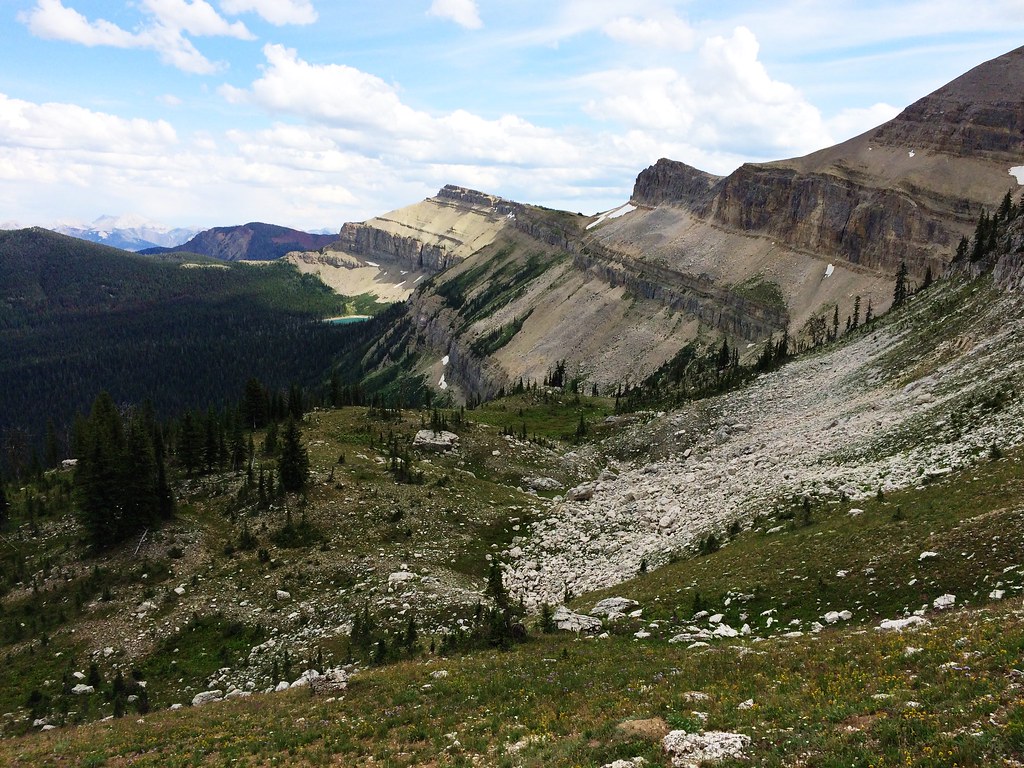
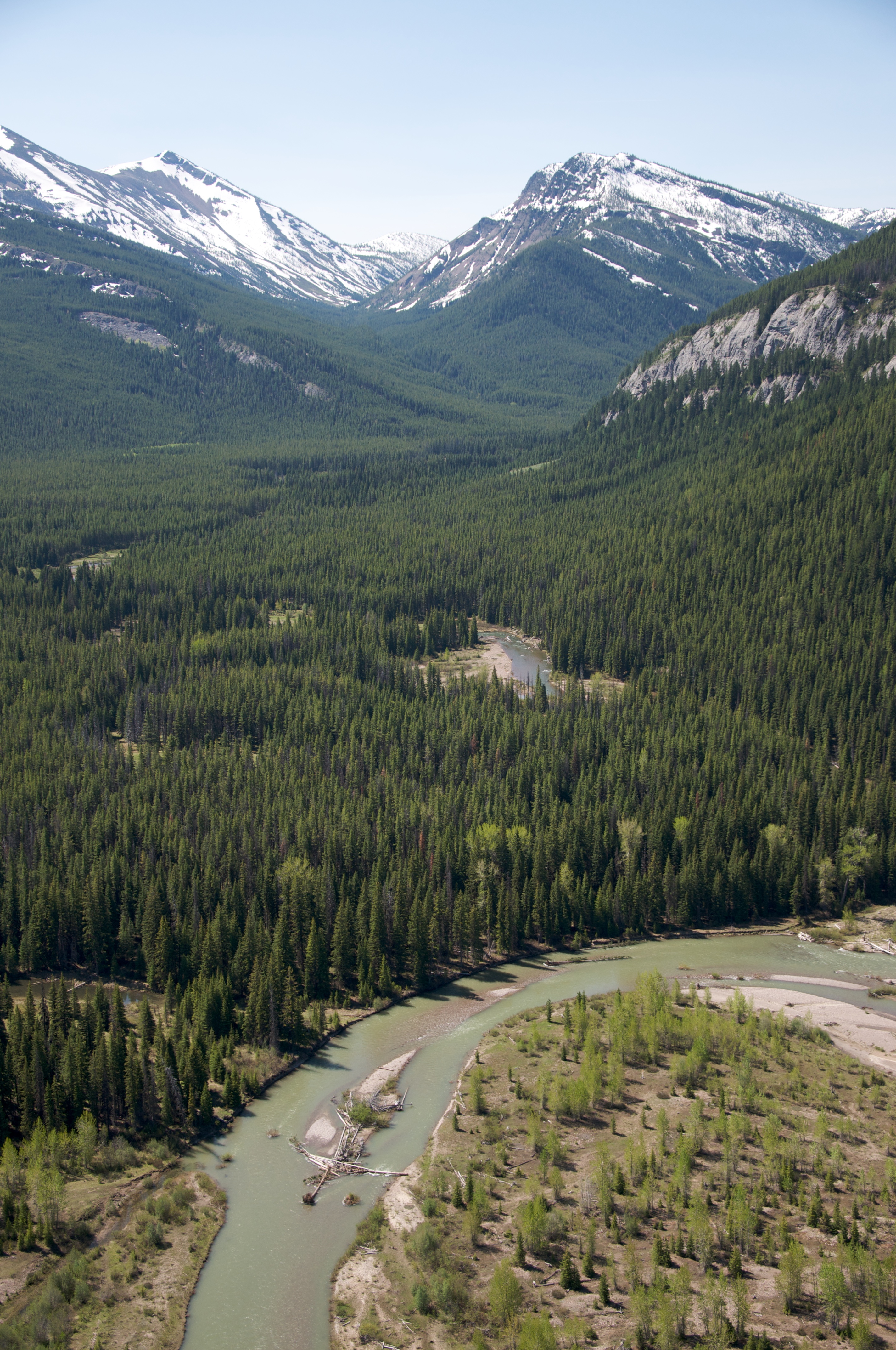
Up Switchback Pass during the 53-mile Run Across The Bob
Up Switchback Pass during the 53-mile Run Across The Bob
Up Switchback Pass during the 53-mile Run Across The Bob
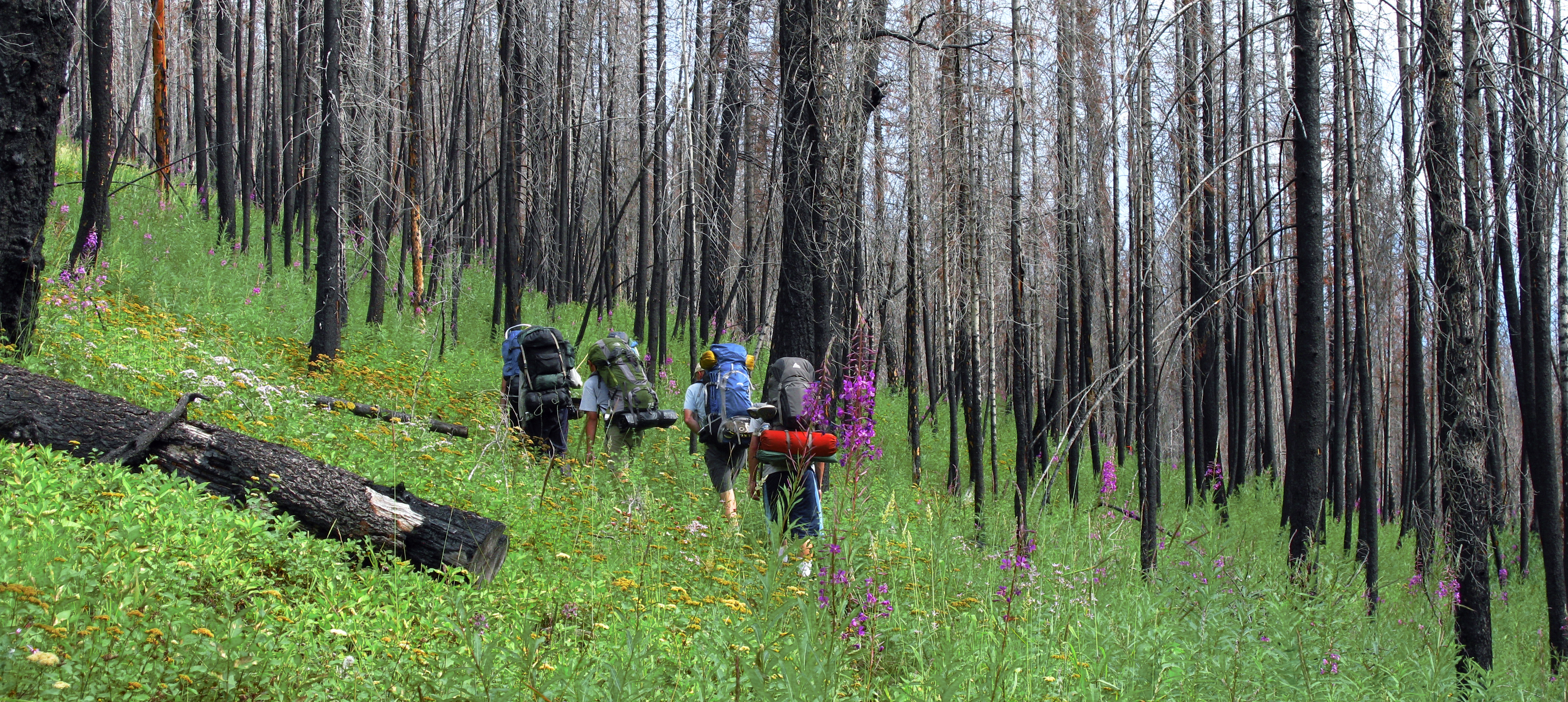
Remnants of the fire

Tent camping on a moonlight night in the Great Bear Wilderness area of Montana. This image was enhanced using Adobe Photoshop Lightroom and Adobe Photoshop CS5.<br/><br/>Learn more about my digital photography field workshops and Adobe Photoshop Lightroo
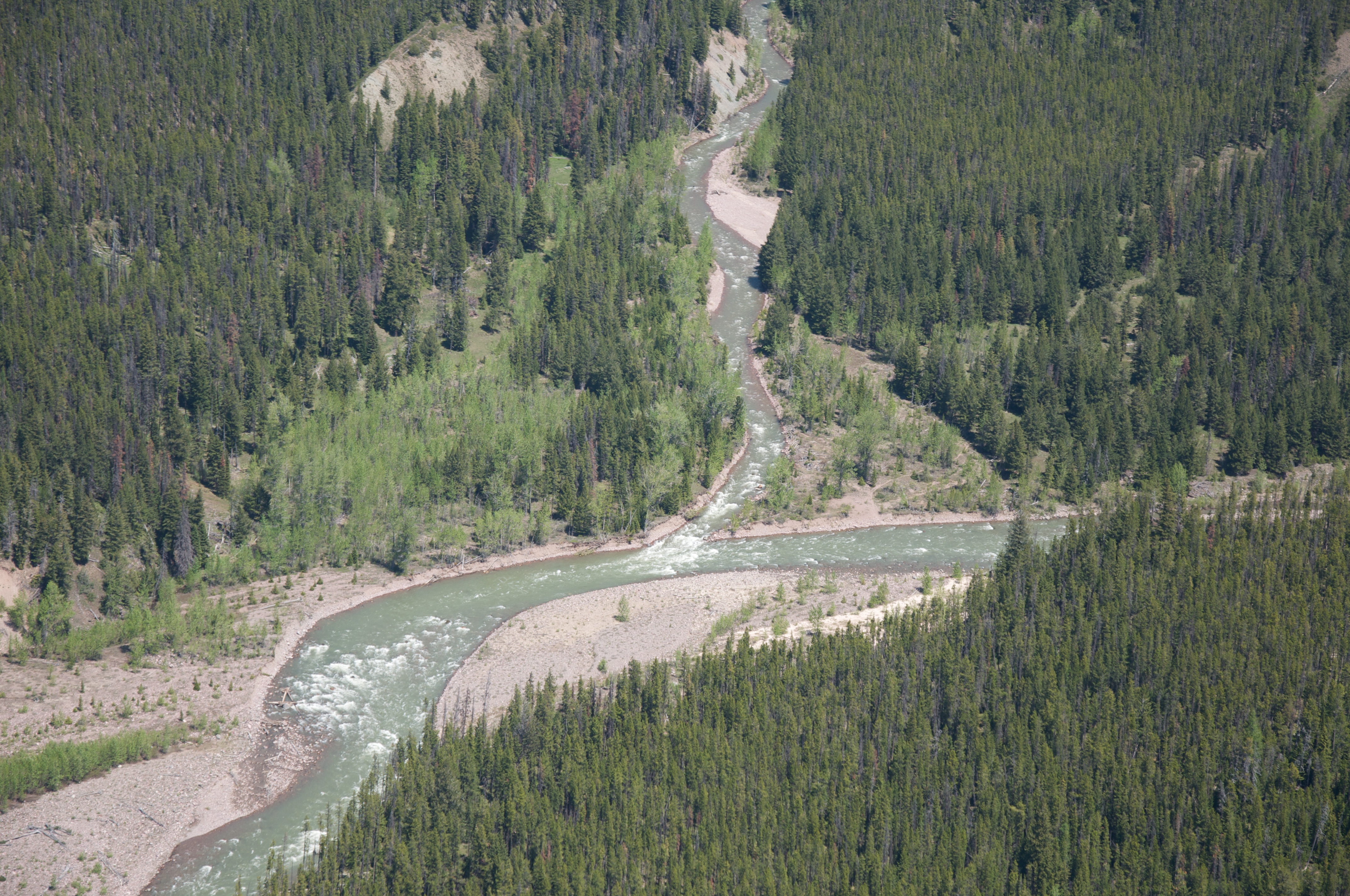
Confluence of Flathead River's North and Middle Fork
Over the Flathead River
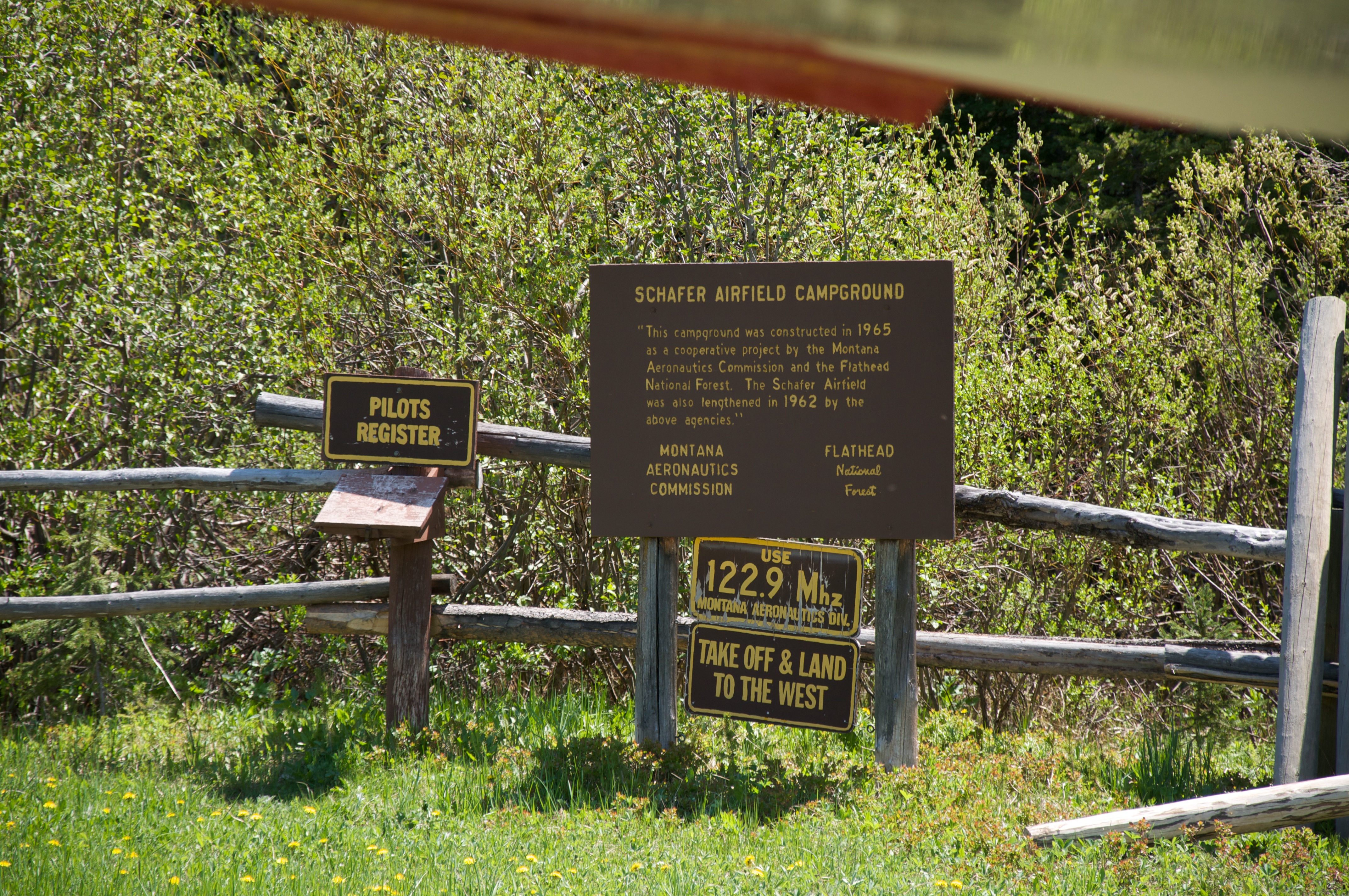
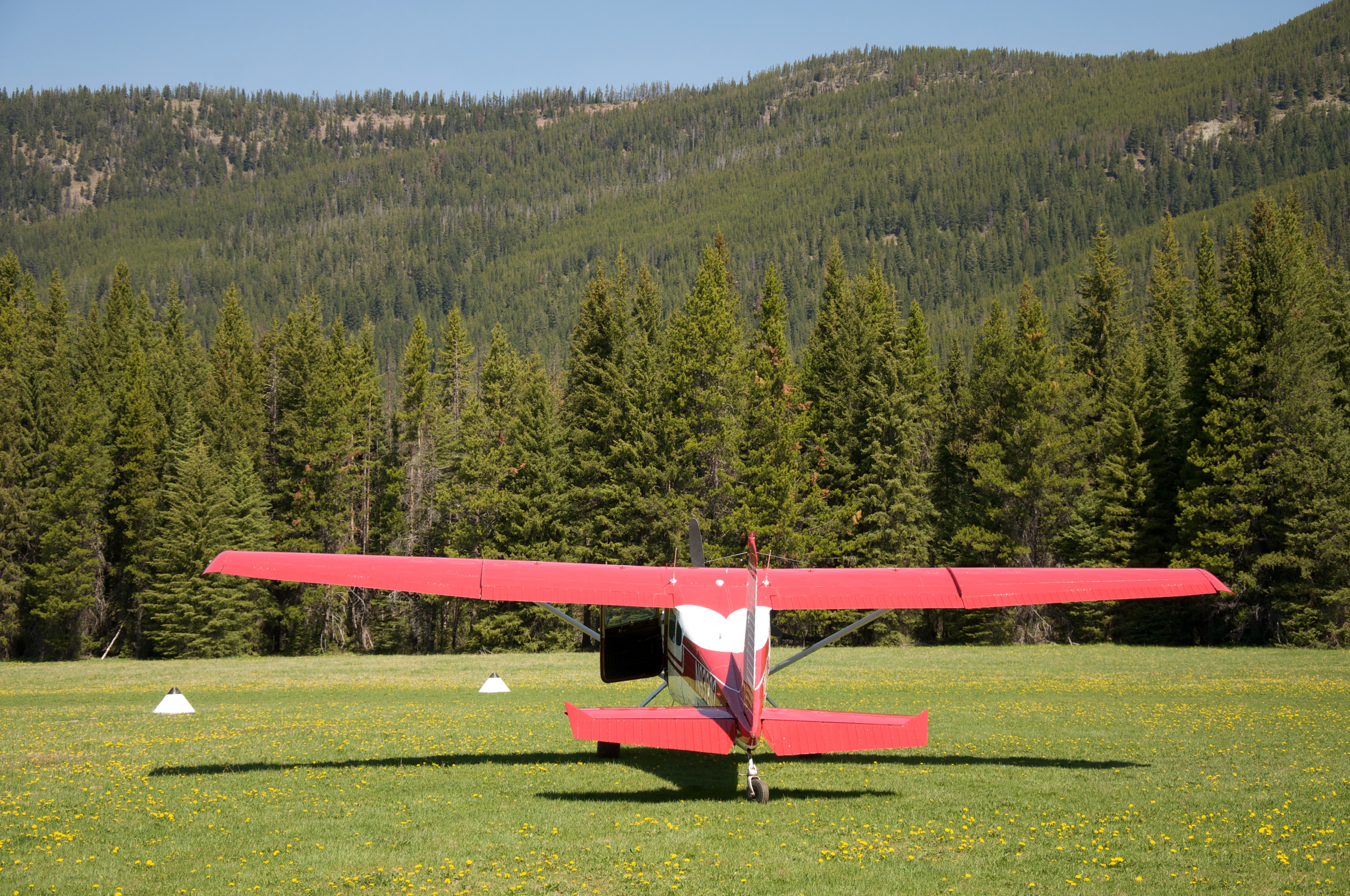
Schafer Airfield
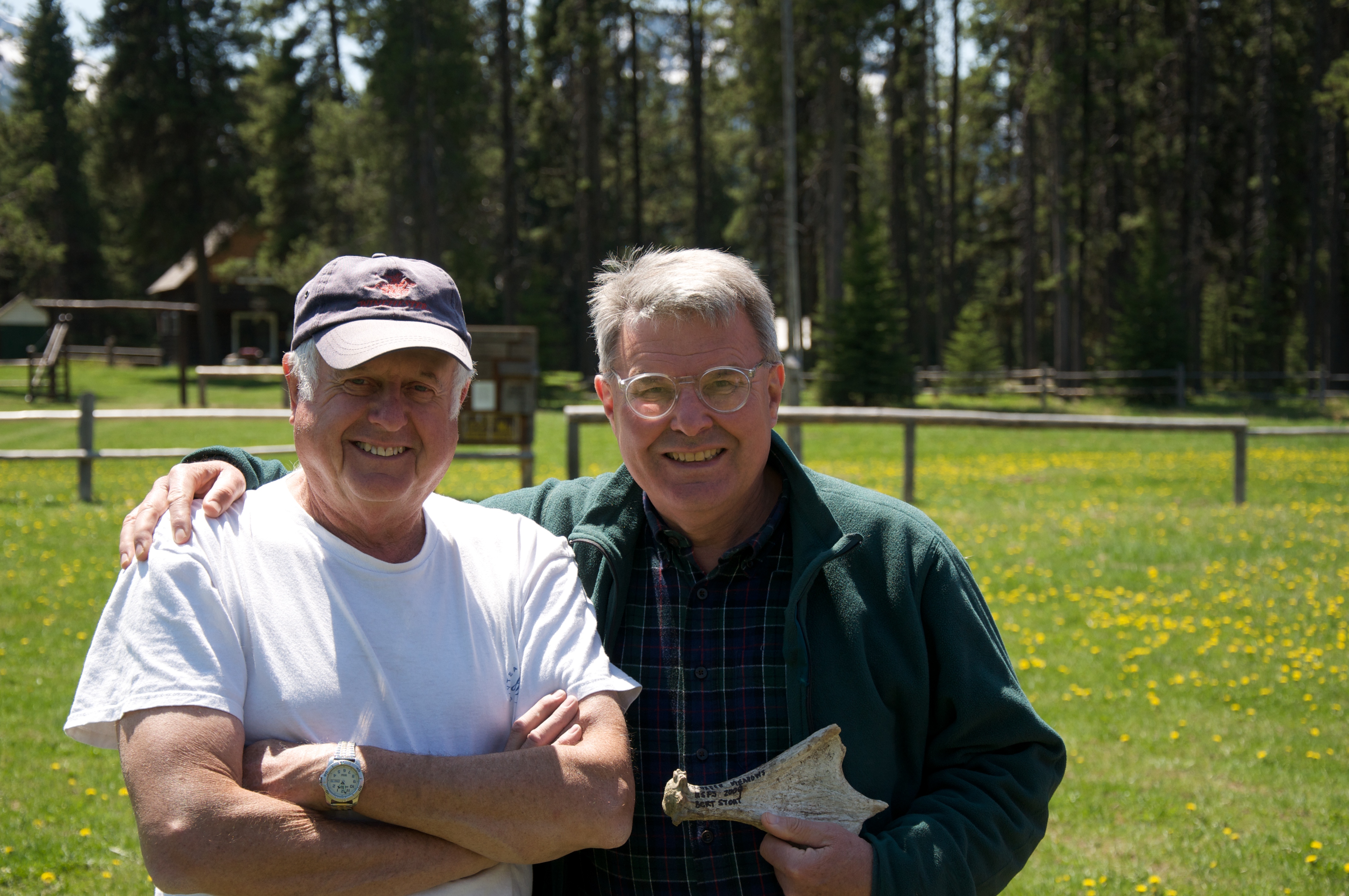
Bert and Dave
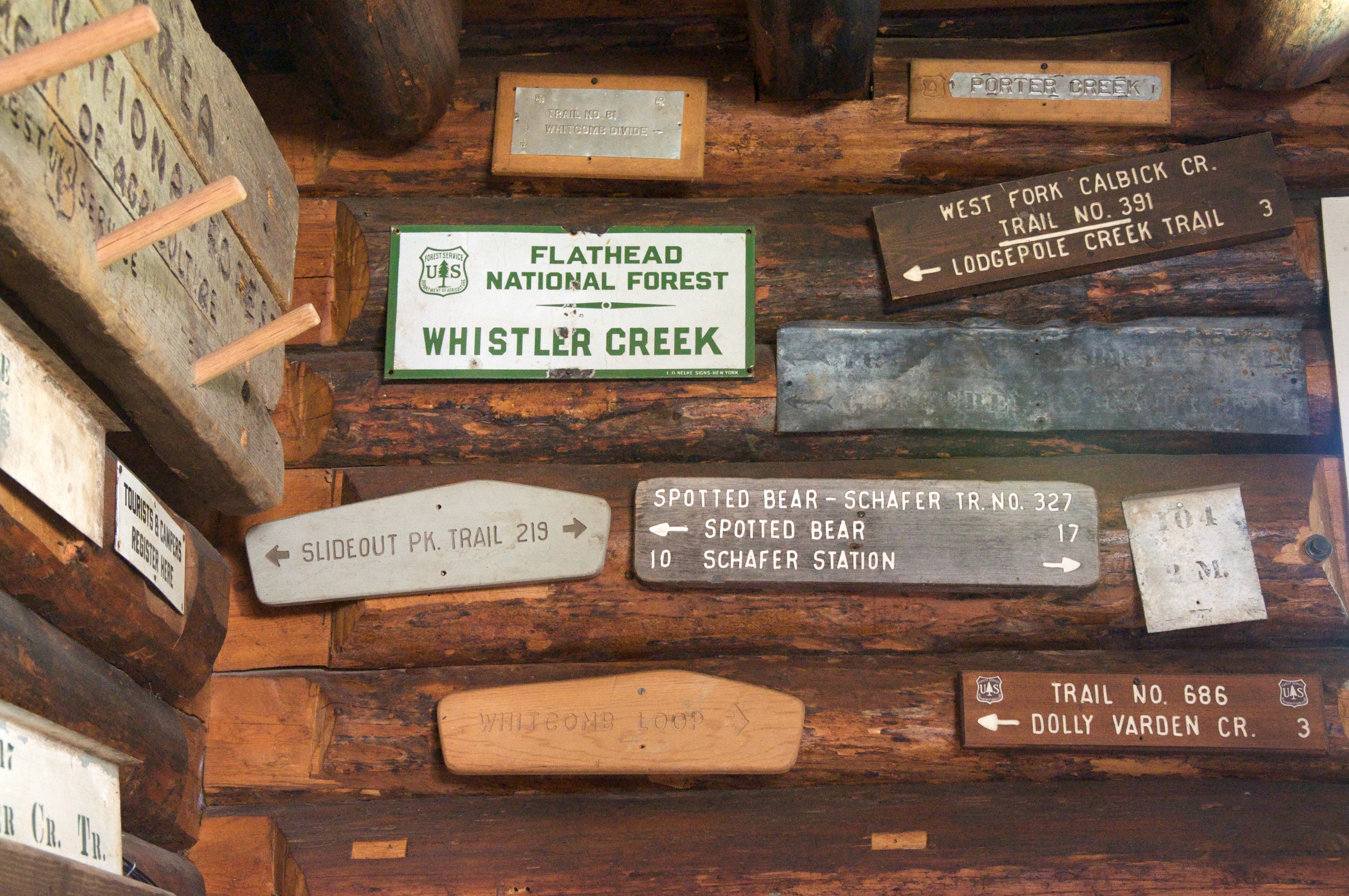
Vintage forest service signs
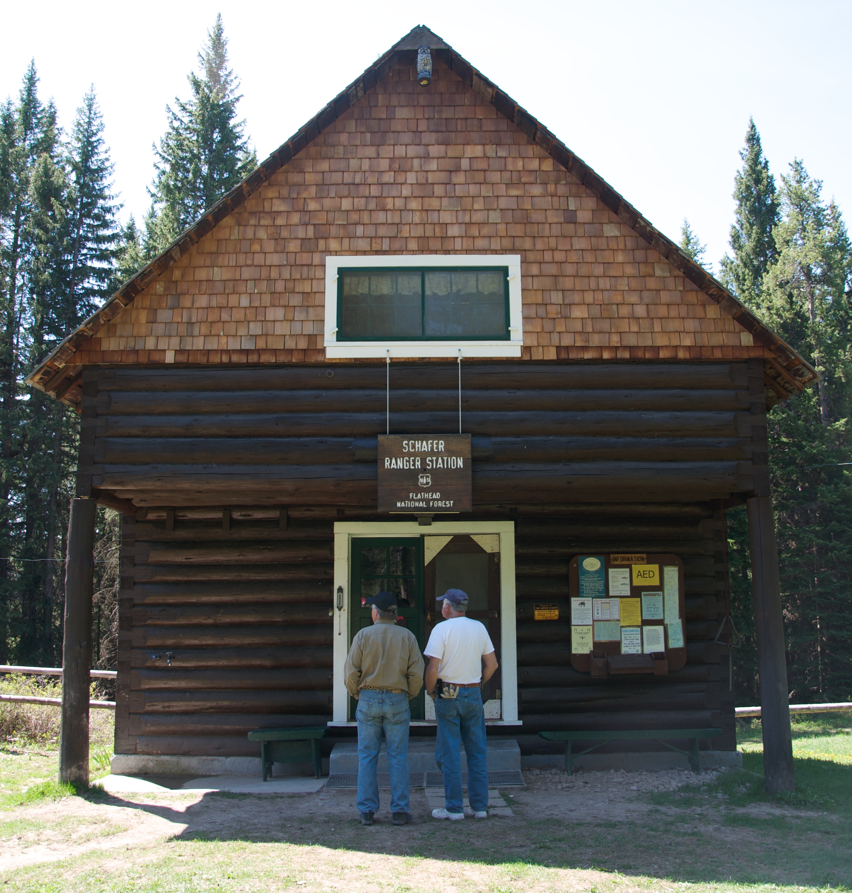
Schafer Ranger Station
Flathead National Forest - Schafer Ranger Station
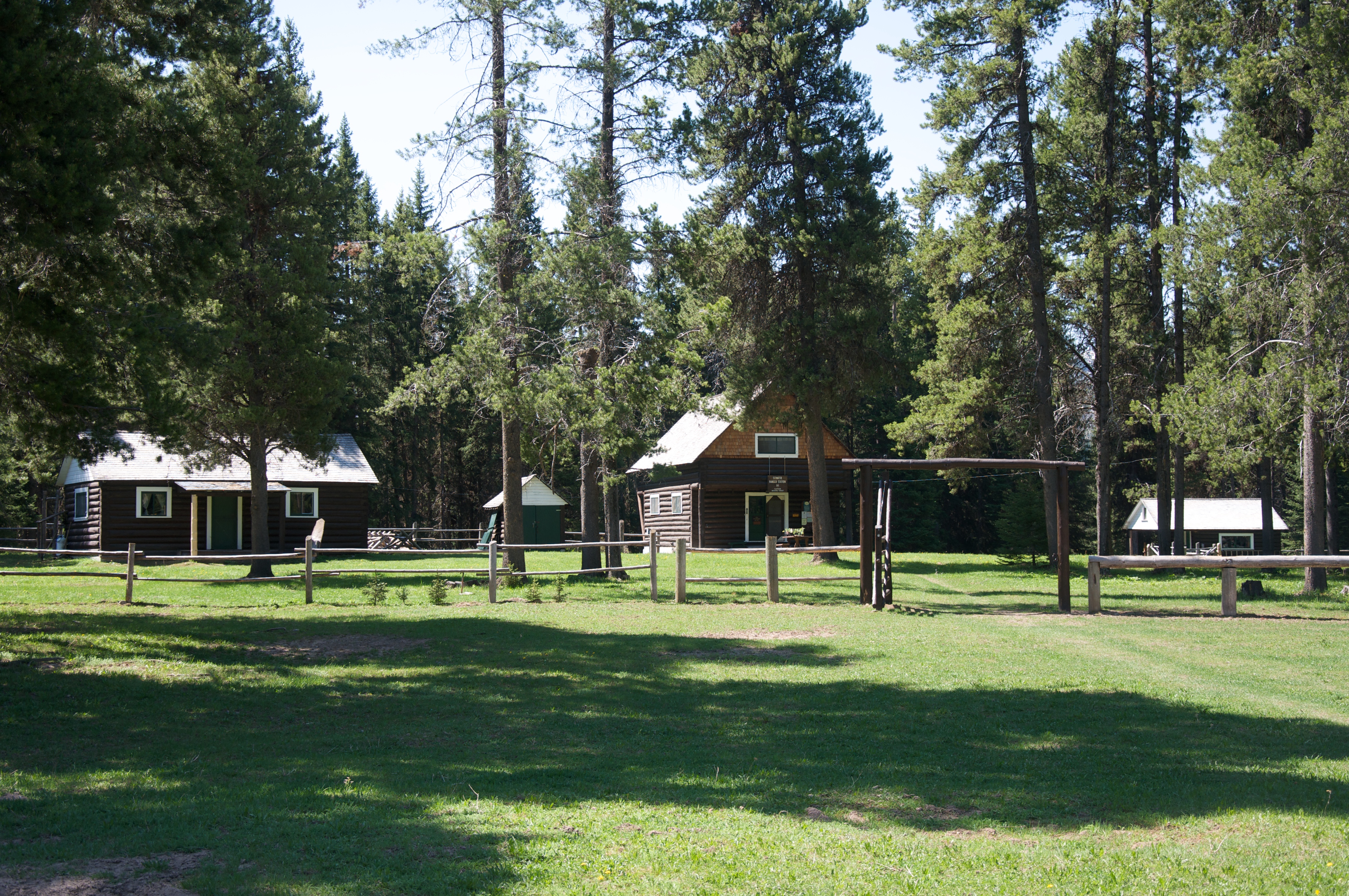
Schafer Meadows
Middle Fork of the Flathead River
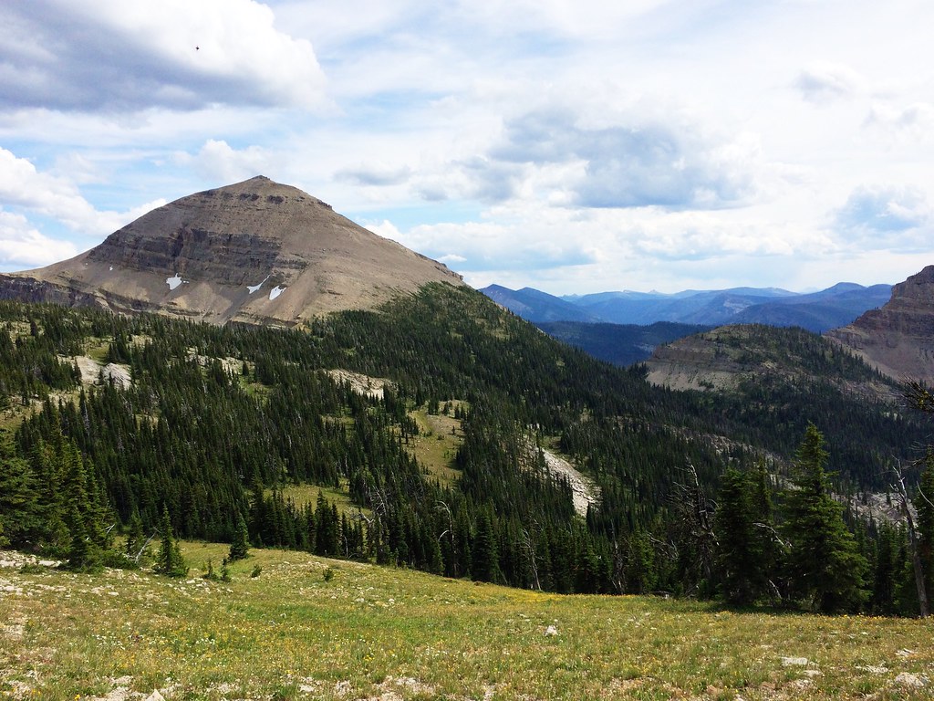
Somewhere in the Great Bear Wilderness
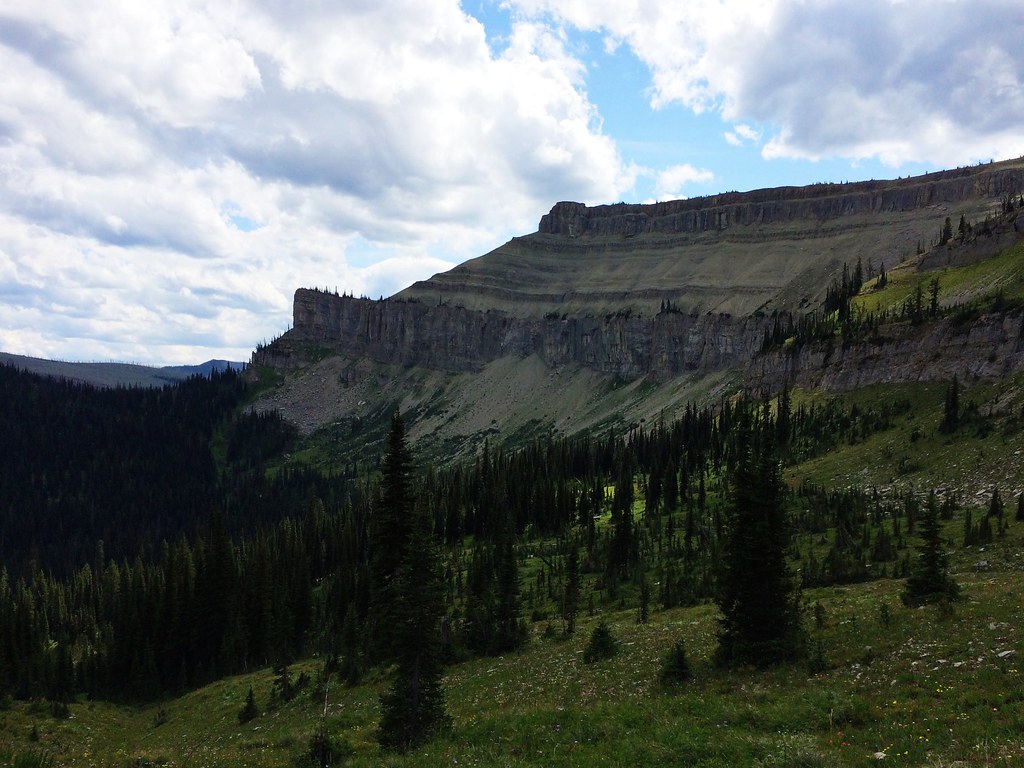
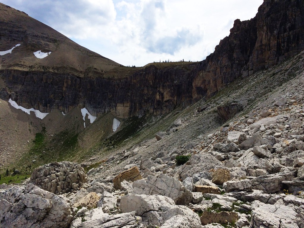
Along the North Wall during the 53-mile Run Across The Bob
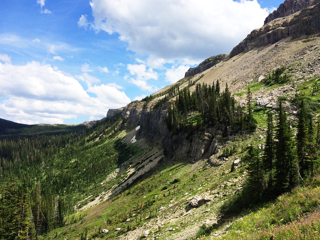
Up Switchback Pass during the 53-mile Run Across The Bob

Up Switchback Pass during the 53-mile Run Across The Bob
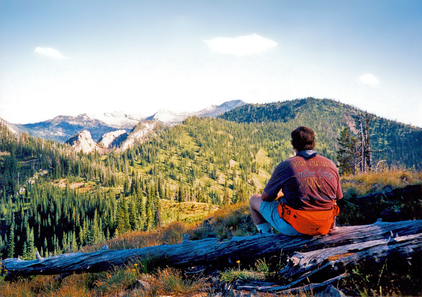
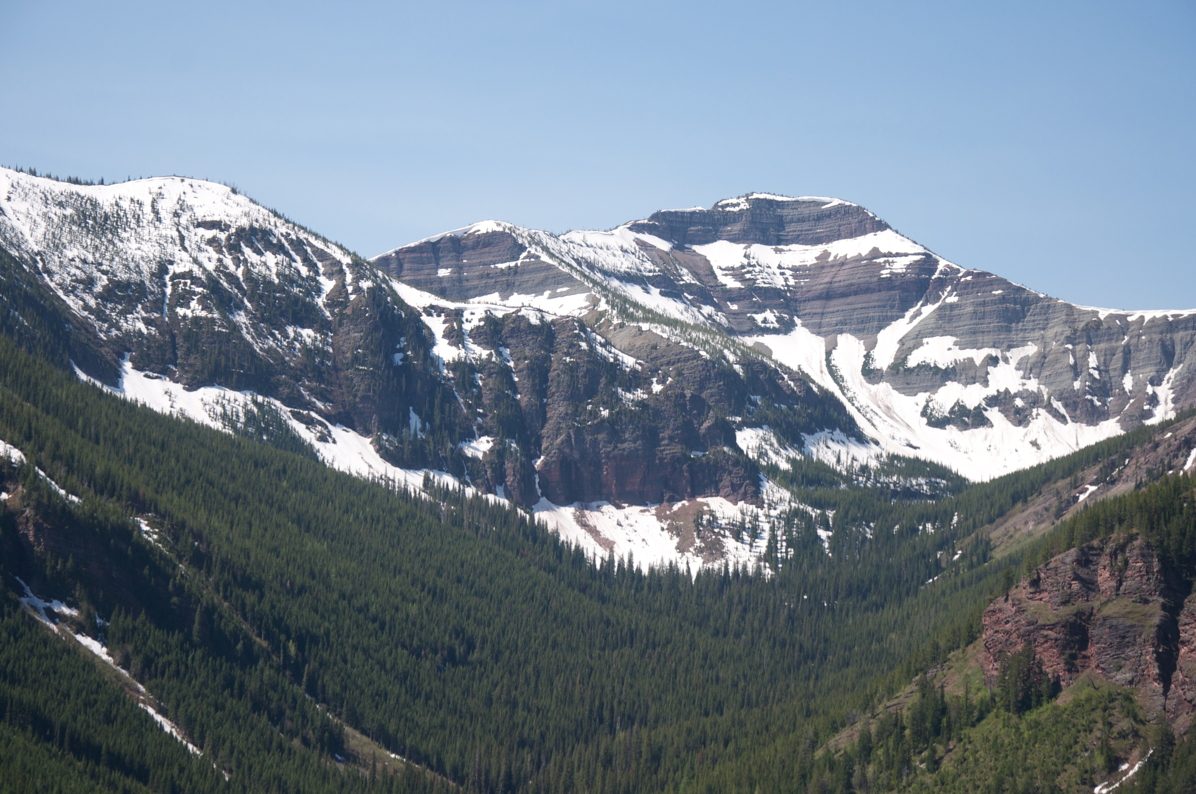
Harrison Ridge, Bob Marshall Wilderness, Montana
アメリカ合衆国 〒 モンタナ州 エルク・リッジの地図
別の場所を検索
近所の場所
アメリカ合衆国 〒 モンタナ州 アーガシー山
アメリカ合衆国 〒 モンタナ州 ディーン・リッジ
10 Hungry Horse Dr., Hungry Horse, MT アメリカ合衆国SILVERTIP CABIN
アメリカ合衆国 〒 モンタナ州 ライムストーン・ピーク
アメリカ合衆国 〒 モンタナ州 ケバン山
アメリカ合衆国 〒 モンタナ州 サージャント山
アメリカ合衆国 〒 モンタナ州 ウィットクーム・ピーク
アメリカ合衆国 〒 モンタナ州 ボウ山
アメリカ合衆国 〒 モンタナ州 アングル・ポイント
アメリカ合衆国 〒 モンタナ州 アイベックス山
アメリカ合衆国 〒 モンタナ州 ミッド山
アメリカ合衆国 〒 モンタナ州 ワイルドローズ山
アメリカ合衆国 〒 モンタナ州 シグナル山
アメリカ合衆国 モンタナ州 ビッグ・ロッジ山
アメリカ合衆国 〒 モンタナ州 ベント山
アメリカ合衆国 〒 モンタナ州 クレセント・クリフ
アメリカ合衆国 〒 モンタナ州 レッド・プルーム山
アメリカ合衆国 〒 モンタナ州 メイ山
アメリカ合衆国 〒 モンタナ州 ハーン・ピーク
アメリカ合衆国 〒 モンタナ州 ムーンライト・ピーク
最近の検索
- 日本、〒- 千葉県市原市辰巳台東4丁目13−4日の出日の入り時間
- ロシア 〒 カバルダ・バルカル共和国 チェゲムスコエ・ウシェリエ日の出日の入り時間
- Eastman Crescent, Newmarket, ON L3Y 5S3 カナダ日の出日の入り時間
- Shrewsbury Ave, Baton Rouge, LA アメリカ合衆国日の出日の入り時間
- インド 〒 ウッタル・プラデーシュ アリプール・ジータ・カラ日の出日の入り時間
- 台湾 Miaoli County, Tongxiao Township, 新埔里、通霄日落大道観景台日の出日の入り時間
- プエルトリコ 〒 メルセディタ日の出日の入り時間
- Reservoir Rd NW #, Washington, DC アメリカ合衆国日の出日の入り時間
- N Whyte Hardee Blvd, Hardeeville, SC, USA日の出日の入り時間
- ドイツ 〒 ウルム日の出日の入り時間