Coleman Hill Rd, Randle, WA アメリカ合衆国日の出日の入り時間
Location: アメリカ合衆国 > ワシントン州 > ルイス > アメリカ合衆国 〒 ワシントン州 ランドル >
時間帯:
America/Los_Angeles
現地時間:
2024-05-05 13:02:50
経度:
-121.9624197
緯度:
46.5363884
今日の日の出時刻:
05:44:11 AM
今日の日の入時刻:
08:24:38 PM
今日の日長:
14h 40m 27s
明日の日の出時刻:
05:42:46 AM
明日の日の入時刻:
08:25:55 PM
明日の日長:
14h 43m 9s
すべて表示する
| 日付 | 日出 | 日没 | 日長 |
|---|---|---|---|
| 2024年01月01日 | 07:51:42 AM | 04:31:45 PM | 8h 40m 3s |
| 2024年01月02日 | 07:51:39 AM | 04:32:43 PM | 8h 41m 4s |
| 2024年01月03日 | 07:51:34 AM | 04:33:44 PM | 8h 42m 10s |
| 2024年01月04日 | 07:51:26 AM | 04:34:46 PM | 8h 43m 20s |
| 2024年01月05日 | 07:51:15 AM | 04:35:50 PM | 8h 44m 35s |
| 2024年01月06日 | 07:51:01 AM | 04:36:56 PM | 8h 45m 55s |
| 2024年01月07日 | 07:50:45 AM | 04:38:04 PM | 8h 47m 19s |
| 2024年01月08日 | 07:50:26 AM | 04:39:13 PM | 8h 48m 47s |
| 2024年01月09日 | 07:50:04 AM | 04:40:24 PM | 8h 50m 20s |
| 2024年01月10日 | 07:49:39 AM | 04:41:37 PM | 8h 51m 58s |
| 2024年01月11日 | 07:49:12 AM | 04:42:51 PM | 8h 53m 39s |
| 2024年01月12日 | 07:48:42 AM | 04:44:06 PM | 8h 55m 24s |
| 2024年01月13日 | 07:48:10 AM | 04:45:23 PM | 8h 57m 13s |
| 2024年01月14日 | 07:47:35 AM | 04:46:41 PM | 8h 59m 6s |
| 2024年01月15日 | 07:46:58 AM | 04:48:00 PM | 9h 1m 2s |
| 2024年01月16日 | 07:46:18 AM | 04:49:21 PM | 9h 3m 3s |
| 2024年01月17日 | 07:45:35 AM | 04:50:42 PM | 9h 5m 7s |
| 2024年01月18日 | 07:44:50 AM | 04:52:04 PM | 9h 7m 14s |
| 2024年01月19日 | 07:44:03 AM | 04:53:28 PM | 9h 9m 25s |
| 2024年01月20日 | 07:43:13 AM | 04:54:52 PM | 9h 11m 39s |
| 2024年01月21日 | 07:42:21 AM | 04:56:17 PM | 9h 13m 56s |
| 2024年01月22日 | 07:41:27 AM | 04:57:43 PM | 9h 16m 16s |
| 2024年01月23日 | 07:40:30 AM | 04:59:10 PM | 9h 18m 40s |
| 2024年01月24日 | 07:39:32 AM | 05:00:37 PM | 9h 21m 5s |
| 2024年01月25日 | 07:38:31 AM | 05:02:05 PM | 9h 23m 34s |
| 2024年01月26日 | 07:37:28 AM | 05:03:33 PM | 9h 26m 5s |
| 2024年01月27日 | 07:36:23 AM | 05:05:02 PM | 9h 28m 39s |
| 2024年01月28日 | 07:35:15 AM | 05:06:31 PM | 9h 31m 16s |
| 2024年01月29日 | 07:34:06 AM | 05:08:01 PM | 9h 33m 55s |
| 2024年01月30日 | 07:32:55 AM | 05:09:30 PM | 9h 36m 35s |
| 2024年01月31日 | 07:31:42 AM | 05:11:01 PM | 9h 39m 19s |
| 2024年02月01日 | 07:30:27 AM | 05:12:31 PM | 9h 42m 4s |
| 2024年02月02日 | 07:29:10 AM | 05:14:02 PM | 9h 44m 52s |
| 2024年02月03日 | 07:27:52 AM | 05:15:32 PM | 9h 47m 40s |
| 2024年02月04日 | 07:26:31 AM | 05:17:03 PM | 9h 50m 32s |
| 2024年02月05日 | 07:25:09 AM | 05:18:34 PM | 9h 53m 25s |
| 2024年02月06日 | 07:23:46 AM | 05:20:05 PM | 9h 56m 19s |
| 2024年02月07日 | 07:22:21 AM | 05:21:36 PM | 9h 59m 15s |
| 2024年02月08日 | 07:20:54 AM | 05:23:07 PM | 10h 2m 13s |
| 2024年02月09日 | 07:19:26 AM | 05:24:38 PM | 10h 5m 12s |
| 2024年02月10日 | 07:17:56 AM | 05:26:09 PM | 10h 8m 13s |
| 2024年02月11日 | 07:16:25 AM | 05:27:40 PM | 10h 11m 15s |
| 2024年02月12日 | 07:14:52 AM | 05:29:11 PM | 10h 14m 19s |
| 2024年02月13日 | 07:13:18 AM | 05:30:41 PM | 10h 17m 23s |
| 2024年02月14日 | 07:11:43 AM | 05:32:11 PM | 10h 20m 28s |
| 2024年02月15日 | 07:10:06 AM | 05:33:42 PM | 10h 23m 36s |
| 2024年02月16日 | 07:08:28 AM | 05:35:12 PM | 10h 26m 44s |
| 2024年02月17日 | 07:06:49 AM | 05:36:41 PM | 10h 29m 52s |
| 2024年02月18日 | 07:05:09 AM | 05:38:11 PM | 10h 33m 2s |
| 2024年02月19日 | 07:03:28 AM | 05:39:40 PM | 10h 36m 12s |
| 2024年02月20日 | 07:01:46 AM | 05:41:09 PM | 10h 39m 23s |
| 2024年02月21日 | 07:00:02 AM | 05:42:38 PM | 10h 42m 36s |
| 2024年02月22日 | 06:58:18 AM | 05:44:07 PM | 10h 45m 49s |
| 2024年02月23日 | 06:56:33 AM | 05:45:35 PM | 10h 49m 2s |
| 2024年02月24日 | 06:54:47 AM | 05:47:03 PM | 10h 52m 16s |
| 2024年02月25日 | 06:53:00 AM | 05:48:31 PM | 10h 55m 31s |
| 2024年02月26日 | 06:51:12 AM | 05:49:58 PM | 10h 58m 46s |
| 2024年02月27日 | 06:49:23 AM | 05:51:26 PM | 11h 2m 3s |
| 2024年02月28日 | 06:47:33 AM | 05:52:53 PM | 11h 5m 20s |
| 2024年02月29日 | 06:45:43 AM | 05:54:19 PM | 11h 8m 36s |
| 2024年03月01日 | 06:43:52 AM | 05:55:46 PM | 11h 11m 54s |
| 2024年03月02日 | 06:42:01 AM | 05:57:12 PM | 11h 15m 11s |
| 2024年03月03日 | 06:40:08 AM | 05:58:38 PM | 11h 18m 30s |
| 2024年03月04日 | 06:38:16 AM | 06:00:03 PM | 11h 21m 47s |
| 2024年03月05日 | 06:36:22 AM | 06:01:28 PM | 11h 25m 6s |
| 2024年03月06日 | 06:34:28 AM | 06:02:53 PM | 11h 28m 25s |
| 2024年03月07日 | 06:32:34 AM | 06:04:18 PM | 11h 31m 44s |
| 2024年03月08日 | 06:30:39 AM | 06:05:43 PM | 11h 35m 4s |
| 2024年03月09日 | 06:28:44 AM | 06:07:07 PM | 11h 38m 23s |
| 2024年03月10日 | 07:26:53 AM | 07:08:28 PM | 11h 41m 35s |
| 2024年03月11日 | 07:24:57 AM | 07:09:51 PM | 11h 44m 54s |
| 2024年03月12日 | 07:23:00 AM | 07:11:15 PM | 11h 48m 15s |
| 2024年03月13日 | 07:21:04 AM | 07:12:38 PM | 11h 51m 34s |
| 2024年03月14日 | 07:19:07 AM | 07:14:02 PM | 11h 54m 55s |
| 2024年03月15日 | 07:17:10 AM | 07:15:25 PM | 11h 58m 15s |
| 2024年03月16日 | 07:15:12 AM | 07:16:47 PM | 12h 1m 35s |
| 2024年03月17日 | 07:13:15 AM | 07:18:10 PM | 12h 4m 55s |
| 2024年03月18日 | 07:11:17 AM | 07:19:33 PM | 12h 8m 16s |
| 2024年03月19日 | 07:09:19 AM | 07:20:55 PM | 12h 11m 36s |
| 2024年03月20日 | 07:07:21 AM | 07:22:17 PM | 12h 14m 56s |
| 2024年03月21日 | 07:05:23 AM | 07:23:39 PM | 12h 18m 16s |
| 2024年03月22日 | 07:03:25 AM | 07:25:01 PM | 12h 21m 36s |
| 2024年03月23日 | 07:01:27 AM | 07:26:23 PM | 12h 24m 56s |
| 2024年03月24日 | 06:59:29 AM | 07:27:45 PM | 12h 28m 16s |
| 2024年03月25日 | 06:57:32 AM | 07:29:06 PM | 12h 31m 34s |
| 2024年03月26日 | 06:55:34 AM | 07:30:28 PM | 12h 34m 54s |
| 2024年03月27日 | 06:53:36 AM | 07:31:49 PM | 12h 38m 13s |
| 2024年03月28日 | 06:51:39 AM | 07:33:10 PM | 12h 41m 31s |
| 2024年03月29日 | 06:49:42 AM | 07:34:32 PM | 12h 44m 50s |
| 2024年03月30日 | 06:47:45 AM | 07:35:53 PM | 12h 48m 8s |
| 2024年03月31日 | 06:45:48 AM | 07:37:14 PM | 12h 51m 26s |
| 2024年04月01日 | 06:43:51 AM | 07:38:35 PM | 12h 54m 44s |
| 2024年04月02日 | 06:41:55 AM | 07:39:57 PM | 12h 58m 2s |
| 2024年04月03日 | 06:39:59 AM | 07:41:18 PM | 13h 1m 19s |
| 2024年04月04日 | 06:38:04 AM | 07:42:39 PM | 13h 4m 35s |
| 2024年04月05日 | 06:36:09 AM | 07:44:00 PM | 13h 7m 51s |
| 2024年04月06日 | 06:34:15 AM | 07:45:21 PM | 13h 11m 6s |
| 2024年04月07日 | 06:32:21 AM | 07:46:42 PM | 13h 14m 21s |
| 2024年04月08日 | 06:30:27 AM | 07:48:03 PM | 13h 17m 36s |
| 2024年04月09日 | 06:28:34 AM | 07:49:24 PM | 13h 20m 50s |
| 2024年04月10日 | 06:26:42 AM | 07:50:45 PM | 13h 24m 3s |
| 2024年04月11日 | 06:24:50 AM | 07:52:06 PM | 13h 27m 16s |
| 2024年04月12日 | 06:22:59 AM | 07:53:27 PM | 13h 30m 28s |
| 2024年04月13日 | 06:21:08 AM | 07:54:48 PM | 13h 33m 40s |
| 2024年04月14日 | 06:19:19 AM | 07:56:09 PM | 13h 36m 50s |
| 2024年04月15日 | 06:17:30 AM | 07:57:30 PM | 13h 40m 0s |
| 2024年04月16日 | 06:15:42 AM | 07:58:51 PM | 13h 43m 9s |
| 2024年04月17日 | 06:13:54 AM | 08:00:12 PM | 13h 46m 18s |
| 2024年04月18日 | 06:12:08 AM | 08:01:32 PM | 13h 49m 24s |
| 2024年04月19日 | 06:10:22 AM | 08:02:53 PM | 13h 52m 31s |
| 2024年04月20日 | 06:08:37 AM | 08:04:14 PM | 13h 55m 37s |
| 2024年04月21日 | 06:06:54 AM | 08:05:35 PM | 13h 58m 41s |
| 2024年04月22日 | 06:05:11 AM | 08:06:55 PM | 14h 1m 44s |
| 2024年04月23日 | 06:03:29 AM | 08:08:16 PM | 14h 4m 47s |
| 2024年04月24日 | 06:01:49 AM | 08:09:36 PM | 14h 7m 47s |
| 2024年04月25日 | 06:00:09 AM | 08:10:57 PM | 14h 10m 48s |
| 2024年04月26日 | 05:58:31 AM | 08:12:17 PM | 14h 13m 46s |
| 2024年04月27日 | 05:56:53 AM | 08:13:37 PM | 14h 16m 44s |
| 2024年04月28日 | 05:55:17 AM | 08:14:57 PM | 14h 19m 40s |
| 2024年04月29日 | 05:53:43 AM | 08:16:16 PM | 14h 22m 33s |
| 2024年04月30日 | 05:52:09 AM | 08:17:36 PM | 14h 25m 27s |
| 2024年05月01日 | 05:50:37 AM | 08:18:55 PM | 14h 28m 18s |
| 2024年05月02日 | 05:49:06 AM | 08:20:14 PM | 14h 31m 8s |
| 2024年05月03日 | 05:47:37 AM | 08:21:32 PM | 14h 33m 55s |
| 2024年05月04日 | 05:46:09 AM | 08:22:51 PM | 14h 36m 42s |
| 2024年05月05日 | 05:44:43 AM | 08:24:09 PM | 14h 39m 26s |
| 2024年05月06日 | 05:43:18 AM | 08:25:26 PM | 14h 42m 8s |
| 2024年05月07日 | 05:41:54 AM | 08:26:43 PM | 14h 44m 49s |
| 2024年05月08日 | 05:40:33 AM | 08:28:00 PM | 14h 47m 27s |
| 2024年05月09日 | 05:39:13 AM | 08:29:16 PM | 14h 50m 3s |
| 2024年05月10日 | 05:37:54 AM | 08:30:32 PM | 14h 52m 38s |
| 2024年05月11日 | 05:36:37 AM | 08:31:47 PM | 14h 55m 10s |
| 2024年05月12日 | 05:35:23 AM | 08:33:01 PM | 14h 57m 38s |
| 2024年05月13日 | 05:34:09 AM | 08:34:15 PM | 15h 0m 6s |
| 2024年05月14日 | 05:32:58 AM | 08:35:28 PM | 15h 2m 30s |
| 2024年05月15日 | 05:31:49 AM | 08:36:40 PM | 15h 4m 51s |
| 2024年05月16日 | 05:30:41 AM | 08:37:52 PM | 15h 7m 11s |
| 2024年05月17日 | 05:29:35 AM | 08:39:02 PM | 15h 9m 27s |
| 2024年05月18日 | 05:28:32 AM | 08:40:12 PM | 15h 11m 40s |
| 2024年05月19日 | 05:27:30 AM | 08:41:21 PM | 15h 13m 51s |
| 2024年05月20日 | 05:26:31 AM | 08:42:29 PM | 15h 15m 58s |
| 2024年05月21日 | 05:25:33 AM | 08:43:36 PM | 15h 18m 3s |
| 2024年05月22日 | 05:24:38 AM | 08:44:42 PM | 15h 20m 4s |
| 2024年05月23日 | 05:23:45 AM | 08:45:46 PM | 15h 22m 1s |
| 2024年05月24日 | 05:22:54 AM | 08:46:50 PM | 15h 23m 56s |
| 2024年05月25日 | 05:22:05 AM | 08:47:52 PM | 15h 25m 47s |
| 2024年05月26日 | 05:21:18 AM | 08:48:53 PM | 15h 27m 35s |
| 2024年05月27日 | 05:20:34 AM | 08:49:52 PM | 15h 29m 18s |
| 2024年05月28日 | 05:19:52 AM | 08:50:51 PM | 15h 30m 59s |
| 2024年05月29日 | 05:19:12 AM | 08:51:47 PM | 15h 32m 35s |
| 2024年05月30日 | 05:18:35 AM | 08:52:42 PM | 15h 34m 7s |
| 2024年05月31日 | 05:18:00 AM | 08:53:36 PM | 15h 35m 36s |
| 2024年06月01日 | 05:17:27 AM | 08:54:28 PM | 15h 37m 1s |
| 2024年06月02日 | 05:16:57 AM | 08:55:18 PM | 15h 38m 21s |
| 2024年06月03日 | 05:16:29 AM | 08:56:07 PM | 15h 39m 38s |
| 2024年06月04日 | 05:16:04 AM | 08:56:54 PM | 15h 40m 50s |
| 2024年06月05日 | 05:15:41 AM | 08:57:39 PM | 15h 41m 58s |
| 2024年06月06日 | 05:15:21 AM | 08:58:22 PM | 15h 43m 1s |
| 2024年06月07日 | 05:15:03 AM | 08:59:03 PM | 15h 44m 0s |
| 2024年06月08日 | 05:14:47 AM | 08:59:42 PM | 15h 44m 55s |
| 2024年06月09日 | 05:14:34 AM | 09:00:20 PM | 15h 45m 46s |
| 2024年06月10日 | 05:14:23 AM | 09:00:55 PM | 15h 46m 32s |
| 2024年06月11日 | 05:14:15 AM | 09:01:28 PM | 15h 47m 13s |
| 2024年06月12日 | 05:14:10 AM | 09:01:59 PM | 15h 47m 49s |
| 2024年06月13日 | 05:14:06 AM | 09:02:27 PM | 15h 48m 21s |
| 2024年06月14日 | 05:14:06 AM | 09:02:54 PM | 15h 48m 48s |
| 2024年06月15日 | 05:14:07 AM | 09:03:18 PM | 15h 49m 11s |
| 2024年06月16日 | 05:14:12 AM | 09:03:40 PM | 15h 49m 28s |
| 2024年06月17日 | 05:14:18 AM | 09:03:59 PM | 15h 49m 41s |
| 2024年06月18日 | 05:14:27 AM | 09:04:17 PM | 15h 49m 50s |
| 2024年06月19日 | 05:14:38 AM | 09:04:31 PM | 15h 49m 53s |
| 2024年06月20日 | 05:14:52 AM | 09:04:44 PM | 15h 49m 52s |
| 2024年06月21日 | 05:15:08 AM | 09:04:54 PM | 15h 49m 46s |
| 2024年06月22日 | 05:15:27 AM | 09:05:01 PM | 15h 49m 34s |
| 2024年06月23日 | 05:15:47 AM | 09:05:06 PM | 15h 49m 19s |
| 2024年06月24日 | 05:16:10 AM | 09:05:09 PM | 15h 48m 59s |
| 2024年06月25日 | 05:16:35 AM | 09:05:09 PM | 15h 48m 34s |
| 2024年06月26日 | 05:17:02 AM | 09:05:07 PM | 15h 48m 5s |
| 2024年06月27日 | 05:17:32 AM | 09:05:02 PM | 15h 47m 30s |
| 2024年06月28日 | 05:18:03 AM | 09:04:54 PM | 15h 46m 51s |
| 2024年06月29日 | 05:18:37 AM | 09:04:44 PM | 15h 46m 7s |
| 2024年06月30日 | 05:19:12 AM | 09:04:32 PM | 15h 45m 20s |
| 2024年07月01日 | 05:19:50 AM | 09:04:17 PM | 15h 44m 27s |
| 2024年07月02日 | 05:20:29 AM | 09:03:59 PM | 15h 43m 30s |
| 2024年07月03日 | 05:21:10 AM | 09:03:39 PM | 15h 42m 29s |
| 2024年07月04日 | 05:21:53 AM | 09:03:17 PM | 15h 41m 24s |
| 2024年07月05日 | 05:22:38 AM | 09:02:52 PM | 15h 40m 14s |
| 2024年07月06日 | 05:23:25 AM | 09:02:24 PM | 15h 38m 59s |
| 2024年07月07日 | 05:24:13 AM | 09:01:54 PM | 15h 37m 41s |
| 2024年07月08日 | 05:25:03 AM | 09:01:22 PM | 15h 36m 19s |
| 2024年07月09日 | 05:25:54 AM | 09:00:47 PM | 15h 34m 53s |
| 2024年07月10日 | 05:26:47 AM | 09:00:10 PM | 15h 33m 23s |
| 2024年07月11日 | 05:27:41 AM | 08:59:30 PM | 15h 31m 49s |
| 2024年07月12日 | 05:28:37 AM | 08:58:48 PM | 15h 30m 11s |
| 2024年07月13日 | 05:29:34 AM | 08:58:04 PM | 15h 28m 30s |
| 2024年07月14日 | 05:30:32 AM | 08:57:17 PM | 15h 26m 45s |
| 2024年07月15日 | 05:31:32 AM | 08:56:29 PM | 15h 24m 57s |
| 2024年07月16日 | 05:32:33 AM | 08:55:38 PM | 15h 23m 5s |
| 2024年07月17日 | 05:33:35 AM | 08:54:44 PM | 15h 21m 9s |
| 2024年07月18日 | 05:34:38 AM | 08:53:49 PM | 15h 19m 11s |
| 2024年07月19日 | 05:35:42 AM | 08:52:51 PM | 15h 17m 9s |
| 2024年07月20日 | 05:36:47 AM | 08:51:52 PM | 15h 15m 5s |
| 2024年07月21日 | 05:37:53 AM | 08:50:50 PM | 15h 12m 57s |
| 2024年07月22日 | 05:39:00 AM | 08:49:46 PM | 15h 10m 46s |
| 2024年07月23日 | 05:40:07 AM | 08:48:40 PM | 15h 8m 33s |
| 2024年07月24日 | 05:41:16 AM | 08:47:32 PM | 15h 6m 16s |
| 2024年07月25日 | 05:42:25 AM | 08:46:23 PM | 15h 3m 58s |
| 2024年07月26日 | 05:43:35 AM | 08:45:11 PM | 15h 1m 36s |
| 2024年07月27日 | 05:44:46 AM | 08:43:57 PM | 14h 59m 11s |
| 2024年07月28日 | 05:45:57 AM | 08:42:42 PM | 14h 56m 45s |
| 2024年07月29日 | 05:47:08 AM | 08:41:25 PM | 14h 54m 17s |
| 2024年07月30日 | 05:48:21 AM | 08:40:06 PM | 14h 51m 45s |
| 2024年07月31日 | 05:49:33 AM | 08:38:46 PM | 14h 49m 13s |
| 2024年08月01日 | 05:50:46 AM | 08:37:24 PM | 14h 46m 38s |
| 2024年08月02日 | 05:52:00 AM | 08:36:00 PM | 14h 44m 0s |
| 2024年08月03日 | 05:53:14 AM | 08:34:34 PM | 14h 41m 20s |
| 2024年08月04日 | 05:54:28 AM | 08:33:07 PM | 14h 38m 39s |
| 2024年08月05日 | 05:55:43 AM | 08:31:39 PM | 14h 35m 56s |
| 2024年08月06日 | 05:56:58 AM | 08:30:09 PM | 14h 33m 11s |
| 2024年08月07日 | 05:58:13 AM | 08:28:38 PM | 14h 30m 25s |
| 2024年08月08日 | 05:59:28 AM | 08:27:05 PM | 14h 27m 37s |
| 2024年08月09日 | 06:00:44 AM | 08:25:31 PM | 14h 24m 47s |
| 2024年08月10日 | 06:02:00 AM | 08:23:55 PM | 14h 21m 55s |
| 2024年08月11日 | 06:03:16 AM | 08:22:19 PM | 14h 19m 3s |
| 2024年08月12日 | 06:04:32 AM | 08:20:41 PM | 14h 16m 9s |
| 2024年08月13日 | 06:05:48 AM | 08:19:02 PM | 14h 13m 14s |
| 2024年08月14日 | 06:07:04 AM | 08:17:21 PM | 14h 10m 17s |
| 2024年08月15日 | 06:08:21 AM | 08:15:40 PM | 14h 7m 19s |
| 2024年08月16日 | 06:09:37 AM | 08:13:57 PM | 14h 4m 20s |
| 2024年08月17日 | 06:10:54 AM | 08:12:14 PM | 14h 1m 20s |
| 2024年08月18日 | 06:12:10 AM | 08:10:29 PM | 13h 58m 19s |
| 2024年08月19日 | 06:13:27 AM | 08:08:44 PM | 13h 55m 17s |
| 2024年08月20日 | 06:14:43 AM | 08:06:57 PM | 13h 52m 14s |
| 2024年08月21日 | 06:16:00 AM | 08:05:10 PM | 13h 49m 10s |
| 2024年08月22日 | 06:17:17 AM | 08:03:21 PM | 13h 46m 4s |
| 2024年08月23日 | 06:18:33 AM | 08:01:32 PM | 13h 42m 59s |
| 2024年08月24日 | 06:19:50 AM | 07:59:42 PM | 13h 39m 52s |
| 2024年08月25日 | 06:21:06 AM | 07:57:51 PM | 13h 36m 45s |
| 2024年08月26日 | 06:22:23 AM | 07:56:00 PM | 13h 33m 37s |
| 2024年08月27日 | 06:23:39 AM | 07:54:08 PM | 13h 30m 29s |
| 2024年08月28日 | 06:24:56 AM | 07:52:15 PM | 13h 27m 19s |
| 2024年08月29日 | 06:26:12 AM | 07:50:21 PM | 13h 24m 9s |
| 2024年08月30日 | 06:27:29 AM | 07:48:27 PM | 13h 20m 58s |
| 2024年08月31日 | 06:28:45 AM | 07:46:32 PM | 13h 17m 47s |
| 2024年09月01日 | 06:30:02 AM | 07:44:37 PM | 13h 14m 35s |
| 2024年09月02日 | 06:31:18 AM | 07:42:41 PM | 13h 11m 23s |
| 2024年09月03日 | 06:32:34 AM | 07:40:45 PM | 13h 8m 11s |
| 2024年09月04日 | 06:33:51 AM | 07:38:48 PM | 13h 4m 57s |
| 2024年09月05日 | 06:35:07 AM | 07:36:51 PM | 13h 1m 44s |
| 2024年09月06日 | 06:36:24 AM | 07:34:54 PM | 12h 58m 30s |
| 2024年09月07日 | 06:37:40 AM | 07:32:56 PM | 12h 55m 16s |
| 2024年09月08日 | 06:38:56 AM | 07:30:58 PM | 12h 52m 2s |
| 2024年09月09日 | 06:40:13 AM | 07:28:59 PM | 12h 48m 46s |
| 2024年09月10日 | 06:41:29 AM | 07:27:01 PM | 12h 45m 32s |
| 2024年09月11日 | 06:42:46 AM | 07:25:02 PM | 12h 42m 16s |
| 2024年09月12日 | 06:44:02 AM | 07:23:02 PM | 12h 39m 0s |
| 2024年09月13日 | 06:45:19 AM | 07:21:03 PM | 12h 35m 44s |
| 2024年09月14日 | 06:46:35 AM | 07:19:03 PM | 12h 32m 28s |
| 2024年09月15日 | 06:47:52 AM | 07:17:04 PM | 12h 29m 12s |
| 2024年09月16日 | 06:49:09 AM | 07:15:04 PM | 12h 25m 55s |
| 2024年09月17日 | 06:50:26 AM | 07:13:04 PM | 12h 22m 38s |
| 2024年09月18日 | 06:51:43 AM | 07:11:05 PM | 12h 19m 22s |
| 2024年09月19日 | 06:53:00 AM | 07:09:05 PM | 12h 16m 5s |
| 2024年09月20日 | 06:54:17 AM | 07:07:05 PM | 12h 12m 48s |
| 2024年09月21日 | 06:55:35 AM | 07:05:05 PM | 12h 9m 30s |
| 2024年09月22日 | 06:56:52 AM | 07:03:06 PM | 12h 6m 14s |
| 2024年09月23日 | 06:58:10 AM | 07:01:06 PM | 12h 2m 56s |
| 2024年09月24日 | 06:59:28 AM | 06:59:07 PM | 11h 59m 39s |
| 2024年09月25日 | 07:00:46 AM | 06:57:08 PM | 11h 56m 22s |
| 2024年09月26日 | 07:02:04 AM | 06:55:09 PM | 11h 53m 5s |
| 2024年09月27日 | 07:03:22 AM | 06:53:10 PM | 11h 49m 48s |
| 2024年09月28日 | 07:04:41 AM | 06:51:12 PM | 11h 46m 31s |
| 2024年09月29日 | 07:06:00 AM | 06:49:14 PM | 11h 43m 14s |
| 2024年09月30日 | 07:07:19 AM | 06:47:16 PM | 11h 39m 57s |
| 2024年10月01日 | 07:08:38 AM | 06:45:19 PM | 11h 36m 41s |
| 2024年10月02日 | 07:09:58 AM | 06:43:22 PM | 11h 33m 24s |
| 2024年10月03日 | 07:11:18 AM | 06:41:26 PM | 11h 30m 8s |
| 2024年10月04日 | 07:12:38 AM | 06:39:30 PM | 11h 26m 52s |
| 2024年10月05日 | 07:13:58 AM | 06:37:34 PM | 11h 23m 36s |
| 2024年10月06日 | 07:15:19 AM | 06:35:39 PM | 11h 20m 20s |
| 2024年10月07日 | 07:16:40 AM | 06:33:45 PM | 11h 17m 5s |
| 2024年10月08日 | 07:18:01 AM | 06:31:51 PM | 11h 13m 50s |
| 2024年10月09日 | 07:19:23 AM | 06:29:58 PM | 11h 10m 35s |
| 2024年10月10日 | 07:20:44 AM | 06:28:05 PM | 11h 7m 21s |
| 2024年10月11日 | 07:22:06 AM | 06:26:14 PM | 11h 4m 8s |
| 2024年10月12日 | 07:23:29 AM | 06:24:23 PM | 11h 0m 54s |
| 2024年10月13日 | 07:24:51 AM | 06:22:32 PM | 10h 57m 41s |
| 2024年10月14日 | 07:26:15 AM | 06:20:43 PM | 10h 54m 28s |
| 2024年10月15日 | 07:27:38 AM | 06:18:54 PM | 10h 51m 16s |
| 2024年10月16日 | 07:29:01 AM | 06:17:06 PM | 10h 48m 5s |
| 2024年10月17日 | 07:30:25 AM | 06:15:20 PM | 10h 44m 55s |
| 2024年10月18日 | 07:31:50 AM | 06:13:34 PM | 10h 41m 44s |
| 2024年10月19日 | 07:33:14 AM | 06:11:49 PM | 10h 38m 35s |
| 2024年10月20日 | 07:34:39 AM | 06:10:05 PM | 10h 35m 26s |
| 2024年10月21日 | 07:36:04 AM | 06:08:22 PM | 10h 32m 18s |
| 2024年10月22日 | 07:37:29 AM | 06:06:41 PM | 10h 29m 12s |
| 2024年10月23日 | 07:38:55 AM | 06:05:00 PM | 10h 26m 5s |
| 2024年10月24日 | 07:40:21 AM | 06:03:21 PM | 10h 23m 0s |
| 2024年10月25日 | 07:41:47 AM | 06:01:43 PM | 10h 19m 56s |
| 2024年10月26日 | 07:43:13 AM | 06:00:06 PM | 10h 16m 53s |
| 2024年10月27日 | 07:44:39 AM | 05:58:30 PM | 10h 13m 51s |
| 2024年10月28日 | 07:46:06 AM | 05:56:56 PM | 10h 10m 50s |
| 2024年10月29日 | 07:47:33 AM | 05:55:23 PM | 10h 7m 50s |
| 2024年10月30日 | 07:49:00 AM | 05:53:52 PM | 10h 4m 52s |
| 2024年10月31日 | 07:50:27 AM | 05:52:22 PM | 10h 1m 55s |
| 2024年11月01日 | 07:51:54 AM | 05:50:54 PM | 9h 59m 0s |
| 2024年11月02日 | 07:53:22 AM | 05:49:27 PM | 9h 56m 5s |
| 2024年11月03日 | 06:54:53 AM | 04:47:58 PM | 9h 53m 5s |
| 2024年11月04日 | 06:56:20 AM | 04:46:35 PM | 9h 50m 15s |
| 2024年11月05日 | 06:57:47 AM | 04:45:13 PM | 9h 47m 26s |
| 2024年11月06日 | 06:59:14 AM | 04:43:53 PM | 9h 44m 39s |
| 2024年11月07日 | 07:00:42 AM | 04:42:34 PM | 9h 41m 52s |
| 2024年11月08日 | 07:02:09 AM | 04:41:18 PM | 9h 39m 9s |
| 2024年11月09日 | 07:03:35 AM | 04:40:03 PM | 9h 36m 28s |
| 2024年11月10日 | 07:05:02 AM | 04:38:51 PM | 9h 33m 49s |
| 2024年11月11日 | 07:06:28 AM | 04:37:40 PM | 9h 31m 12s |
| 2024年11月12日 | 07:07:55 AM | 04:36:31 PM | 9h 28m 36s |
| 2024年11月13日 | 07:09:20 AM | 04:35:24 PM | 9h 26m 4s |
| 2024年11月14日 | 07:10:46 AM | 04:34:20 PM | 9h 23m 34s |
| 2024年11月15日 | 07:12:11 AM | 04:33:17 PM | 9h 21m 6s |
| 2024年11月16日 | 07:13:35 AM | 04:32:17 PM | 9h 18m 42s |
| 2024年11月17日 | 07:14:59 AM | 04:31:19 PM | 9h 16m 20s |
| 2024年11月18日 | 07:16:22 AM | 04:30:23 PM | 9h 14m 1s |
| 2024年11月19日 | 07:17:45 AM | 04:29:29 PM | 9h 11m 44s |
| 2024年11月20日 | 07:19:06 AM | 04:28:38 PM | 9h 9m 32s |
| 2024年11月21日 | 07:20:27 AM | 04:27:49 PM | 9h 7m 22s |
| 2024年11月22日 | 07:21:48 AM | 04:27:03 PM | 9h 5m 15s |
| 2024年11月23日 | 07:23:07 AM | 04:26:19 PM | 9h 3m 12s |
| 2024年11月24日 | 07:24:25 AM | 04:25:37 PM | 9h 1m 12s |
| 2024年11月25日 | 07:25:43 AM | 04:24:58 PM | 8h 59m 15s |
| 2024年11月26日 | 07:26:59 AM | 04:24:22 PM | 8h 57m 23s |
| 2024年11月27日 | 07:28:14 AM | 04:23:48 PM | 8h 55m 34s |
| 2024年11月28日 | 07:29:28 AM | 04:23:17 PM | 8h 53m 49s |
| 2024年11月29日 | 07:30:40 AM | 04:22:48 PM | 8h 52m 8s |
| 2024年11月30日 | 07:31:51 AM | 04:22:22 PM | 8h 50m 31s |
| 2024年12月01日 | 07:33:01 AM | 04:21:59 PM | 8h 48m 58s |
| 2024年12月02日 | 07:34:09 AM | 04:21:39 PM | 8h 47m 30s |
| 2024年12月03日 | 07:35:15 AM | 04:21:21 PM | 8h 46m 6s |
| 2024年12月04日 | 07:36:20 AM | 04:21:06 PM | 8h 44m 46s |
| 2024年12月05日 | 07:37:23 AM | 04:20:54 PM | 8h 43m 31s |
| 2024年12月06日 | 07:38:25 AM | 04:20:44 PM | 8h 42m 19s |
| 2024年12月07日 | 07:39:24 AM | 04:20:38 PM | 8h 41m 14s |
| 2024年12月08日 | 07:40:22 AM | 04:20:34 PM | 8h 40m 12s |
| 2024年12月09日 | 07:41:18 AM | 04:20:33 PM | 8h 39m 15s |
| 2024年12月10日 | 07:42:11 AM | 04:20:35 PM | 8h 38m 24s |
| 2024年12月11日 | 07:43:03 AM | 04:20:39 PM | 8h 37m 36s |
| 2024年12月12日 | 07:43:52 AM | 04:20:46 PM | 8h 36m 54s |
| 2024年12月13日 | 07:44:39 AM | 04:20:57 PM | 8h 36m 18s |
| 2024年12月14日 | 07:45:24 AM | 04:21:10 PM | 8h 35m 46s |
| 2024年12月15日 | 07:46:07 AM | 04:21:25 PM | 8h 35m 18s |
| 2024年12月16日 | 07:46:47 AM | 04:21:44 PM | 8h 34m 57s |
| 2024年12月17日 | 07:47:25 AM | 04:22:05 PM | 8h 34m 40s |
| 2024年12月18日 | 07:48:00 AM | 04:22:29 PM | 8h 34m 29s |
| 2024年12月19日 | 07:48:33 AM | 04:22:56 PM | 8h 34m 23s |
| 2024年12月20日 | 07:49:04 AM | 04:23:25 PM | 8h 34m 21s |
| 2024年12月21日 | 07:49:31 AM | 04:23:57 PM | 8h 34m 26s |
| 2024年12月22日 | 07:49:57 AM | 04:24:31 PM | 8h 34m 34s |
| 2024年12月23日 | 07:50:19 AM | 04:25:08 PM | 8h 34m 49s |
| 2024年12月24日 | 07:50:39 AM | 04:25:48 PM | 8h 35m 9s |
| 2024年12月25日 | 07:50:56 AM | 04:26:30 PM | 8h 35m 34s |
| 2024年12月26日 | 07:51:11 AM | 04:27:14 PM | 8h 36m 3s |
| 2024年12月27日 | 07:51:22 AM | 04:28:01 PM | 8h 36m 39s |
| 2024年12月28日 | 07:51:31 AM | 04:28:50 PM | 8h 37m 19s |
| 2024年12月29日 | 07:51:38 AM | 04:29:42 PM | 8h 38m 4s |
| 2024年12月30日 | 07:51:41 AM | 04:30:35 PM | 8h 38m 54s |
写真
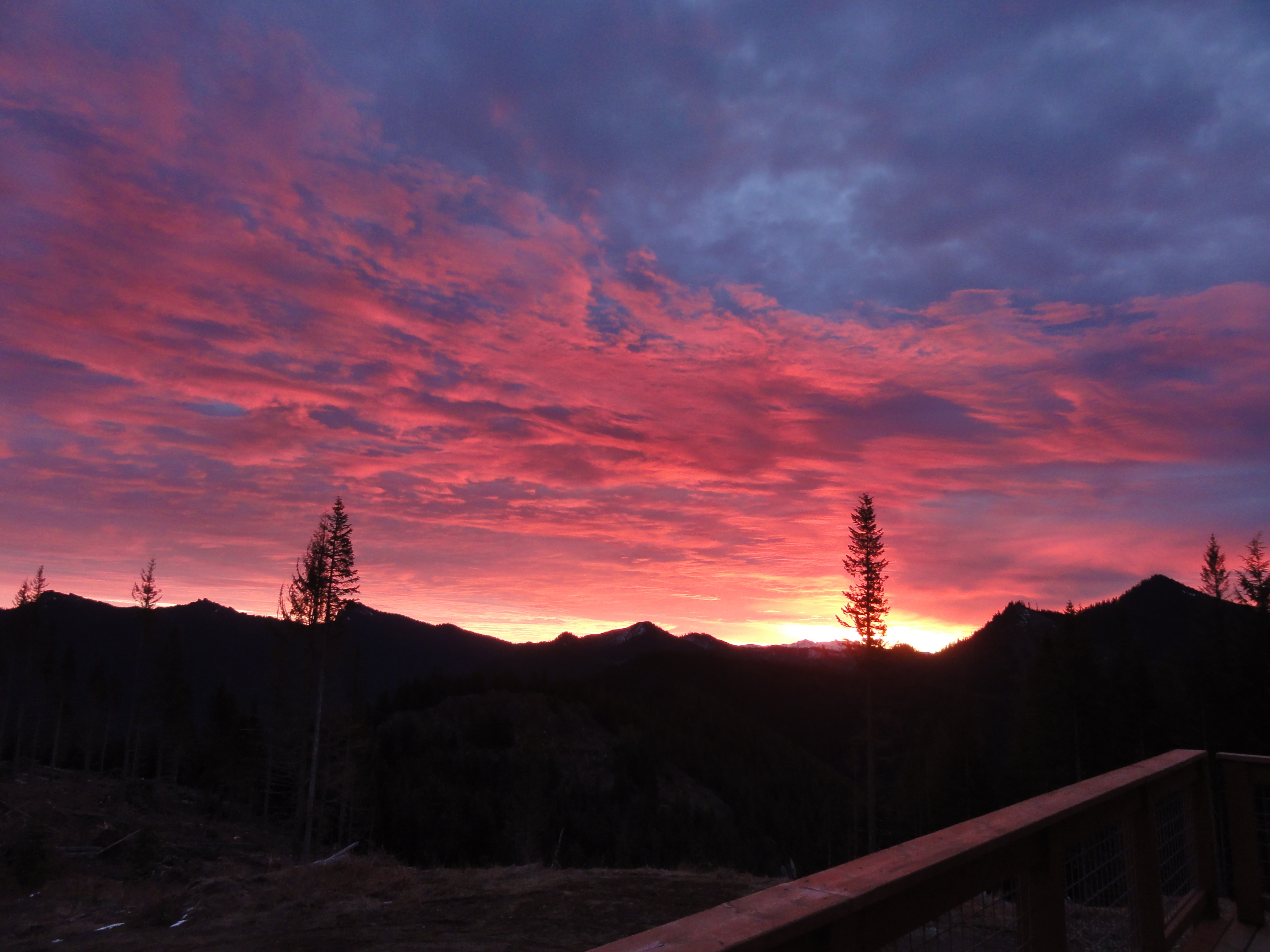
Morning Light
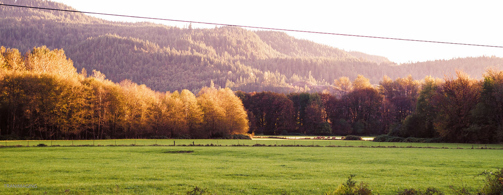
Orchard Sunset
Highway 12 (35)
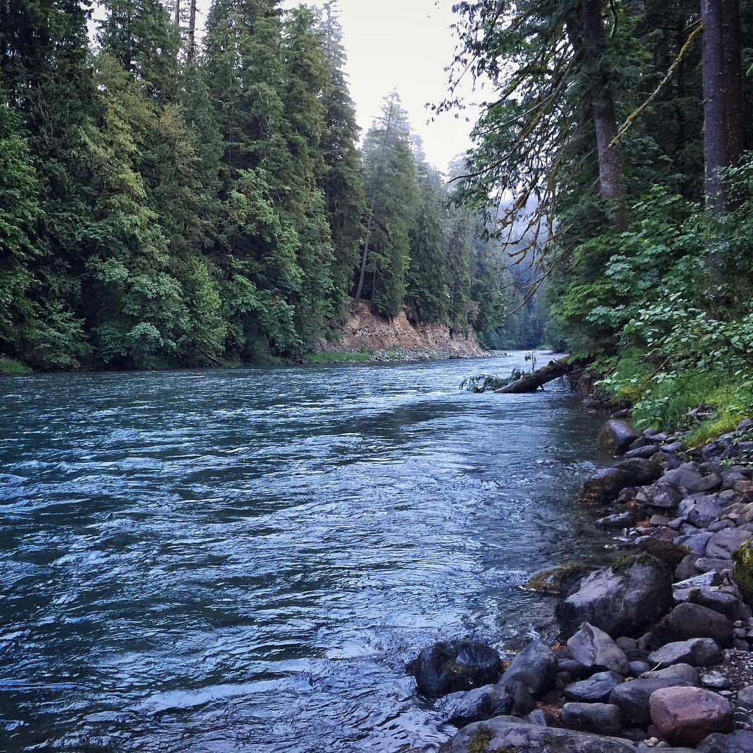
A view upstream of Iron Creek located in the Gifford Pinchot National Forest. #river #giffordpinchotnationalforest #wilderness #pnw

Achlys triphylla (Vanilla Leaf, Deer Foot)
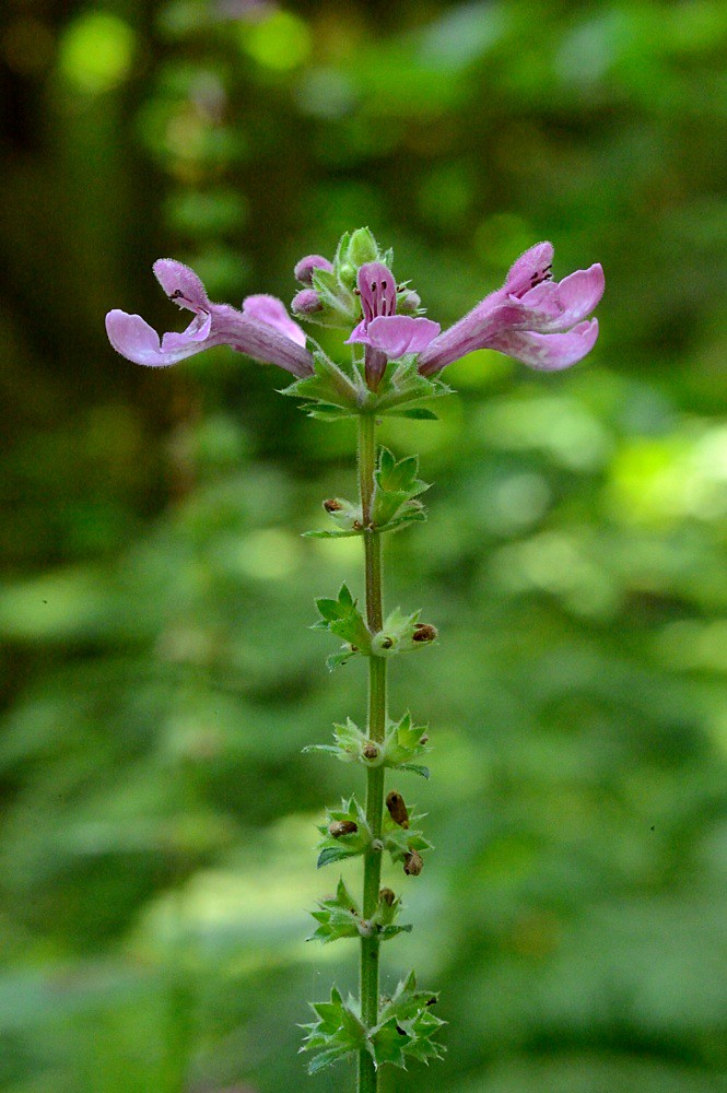
Stachys chamissonis var. cooleyae (Great Hedge-nettle)
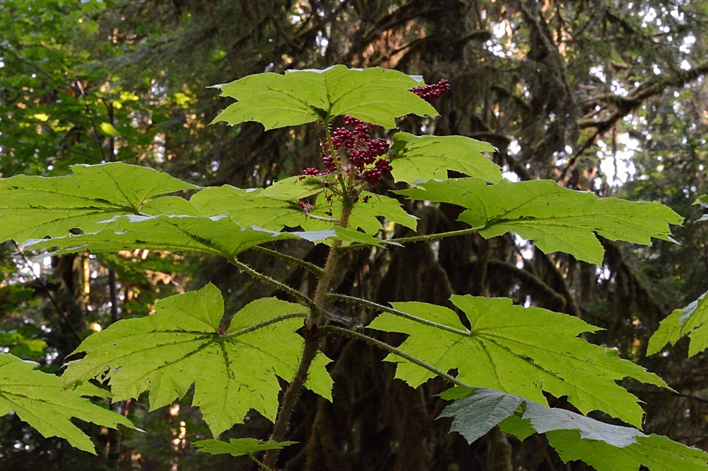
Oplopanax horridus (Devil's Club)
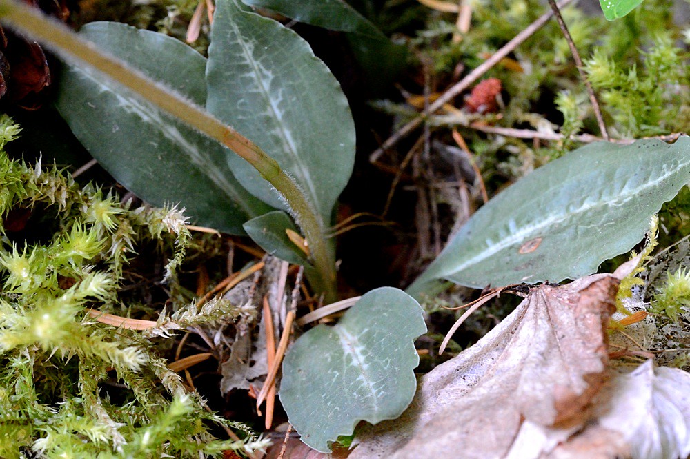
Goodyera oblongifolia (Rattlesnake Orchid) basal leaves
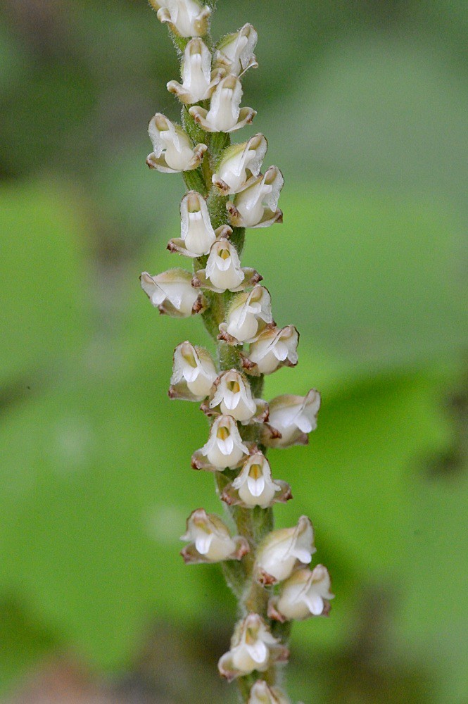
Goodyera oblongifolia (Rattlesnake Orchid)
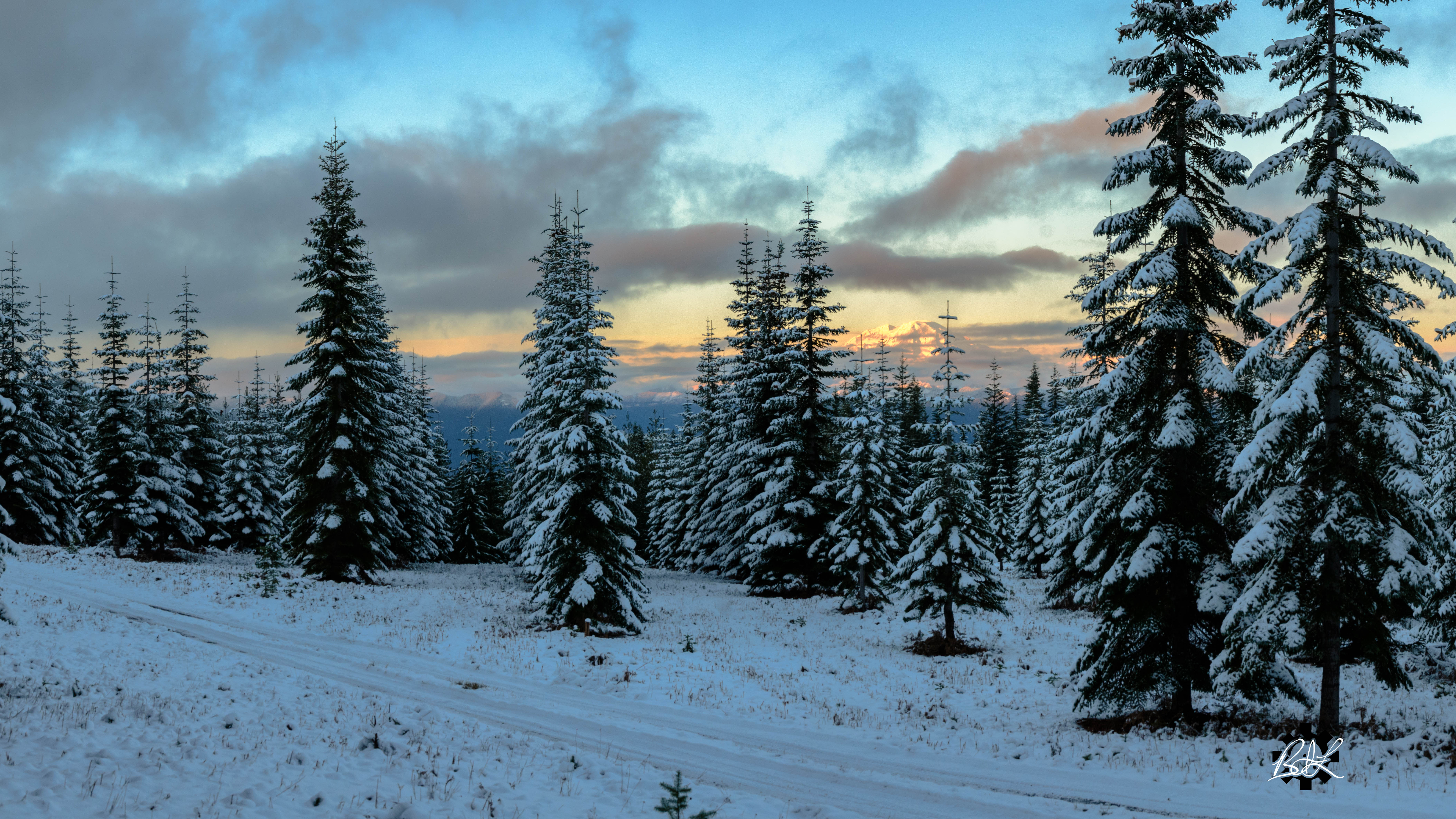
Mt Adams Fall
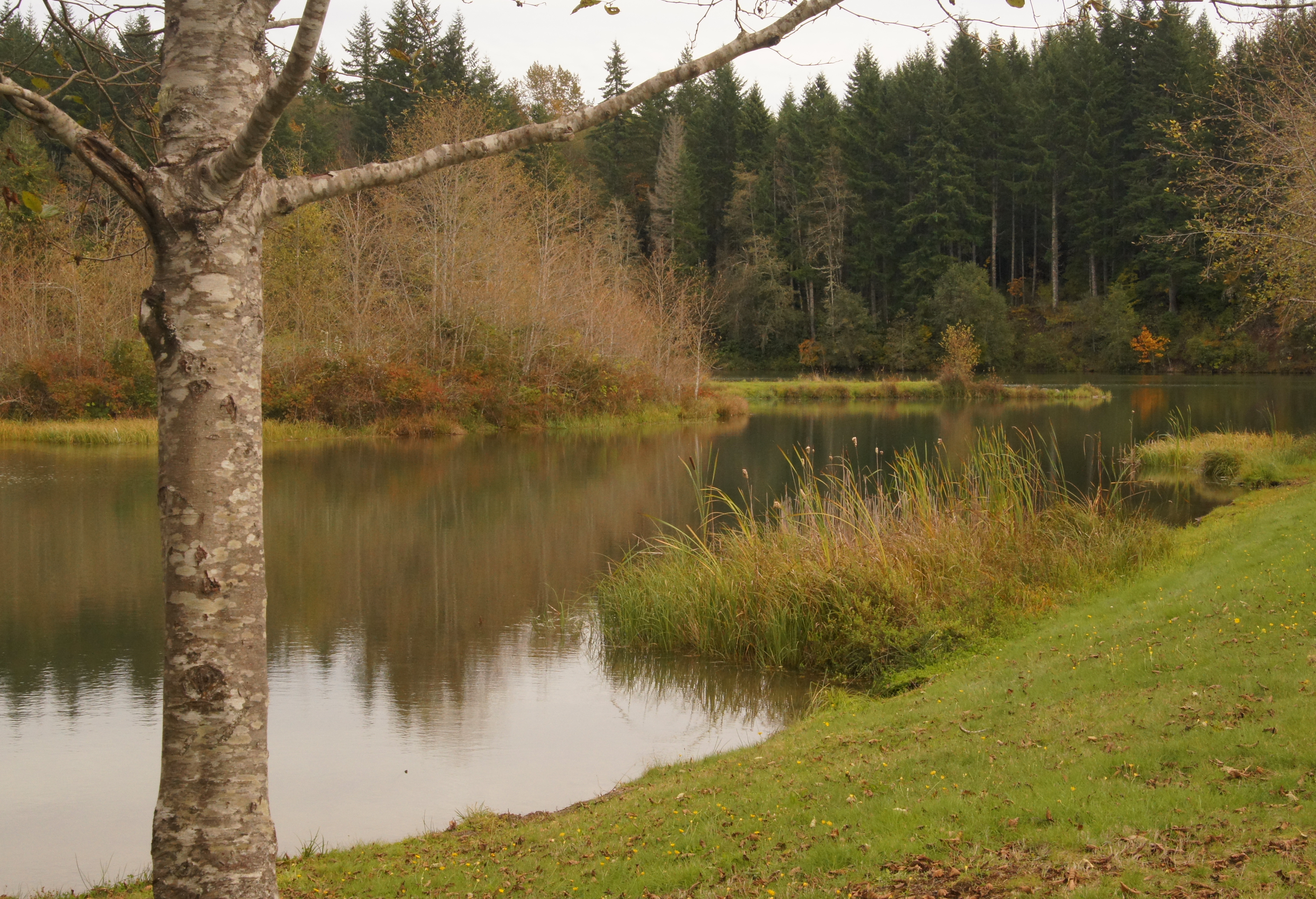
Gifford Pinchot National Forest
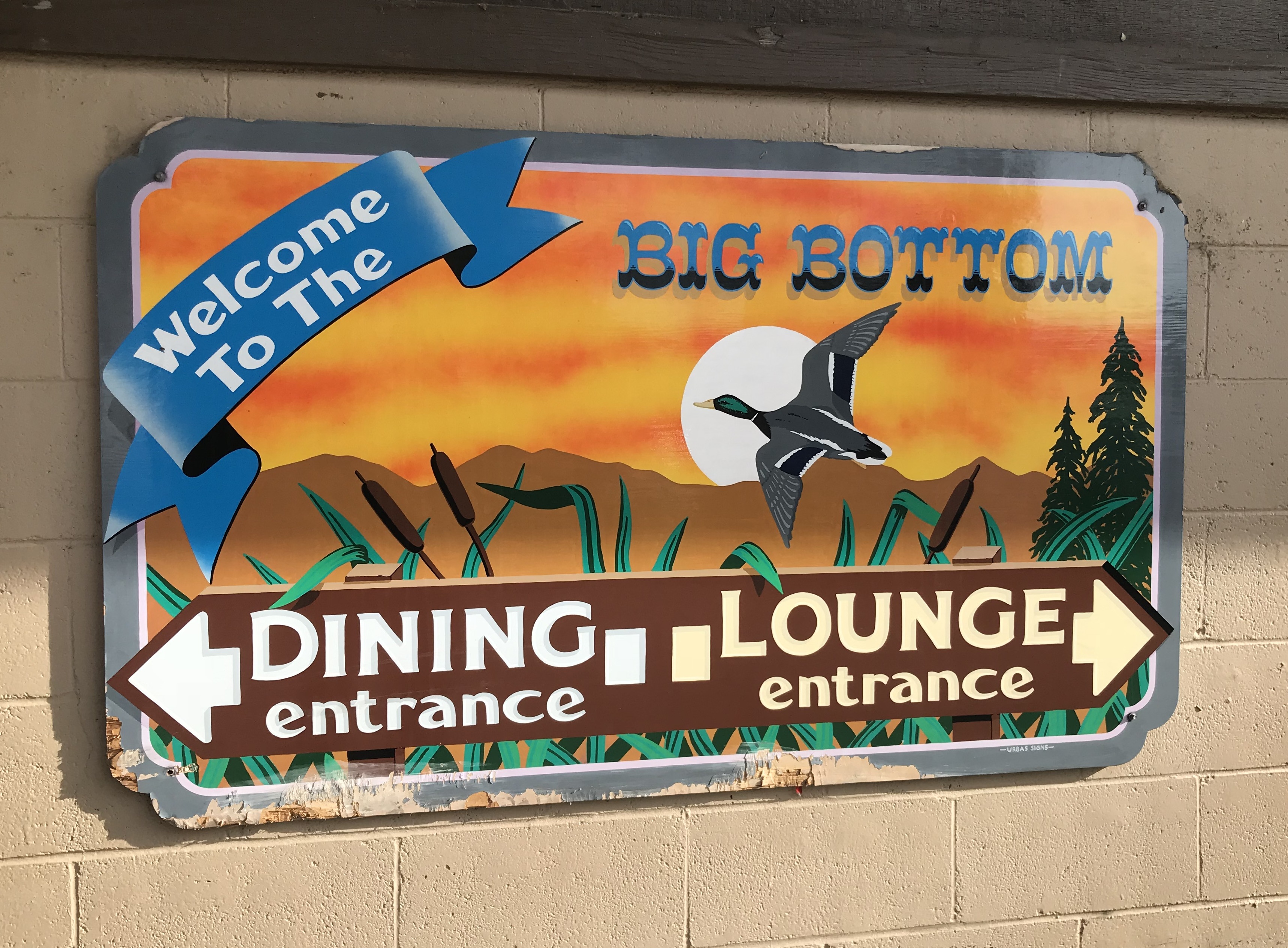
Big Bottom Bar & Grill, Randle, Washington
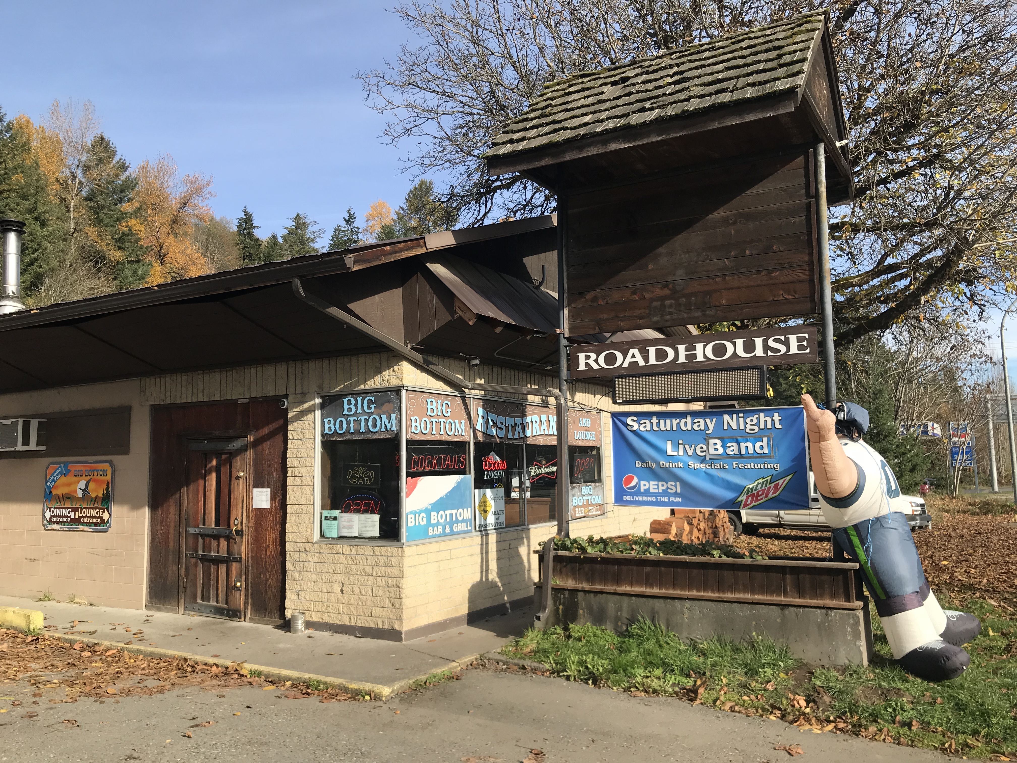
Big Bottom Bar & Grill, Randle, Washington
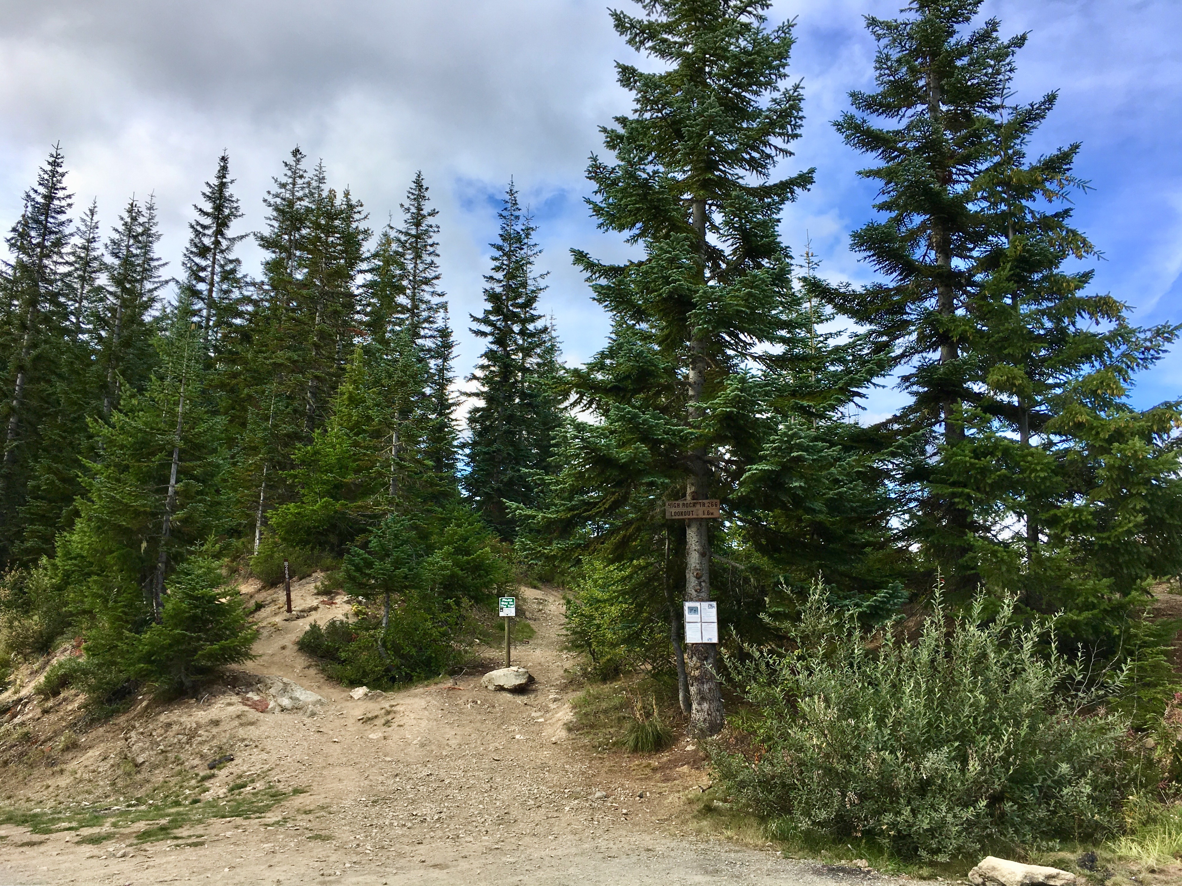
High Rock Hike
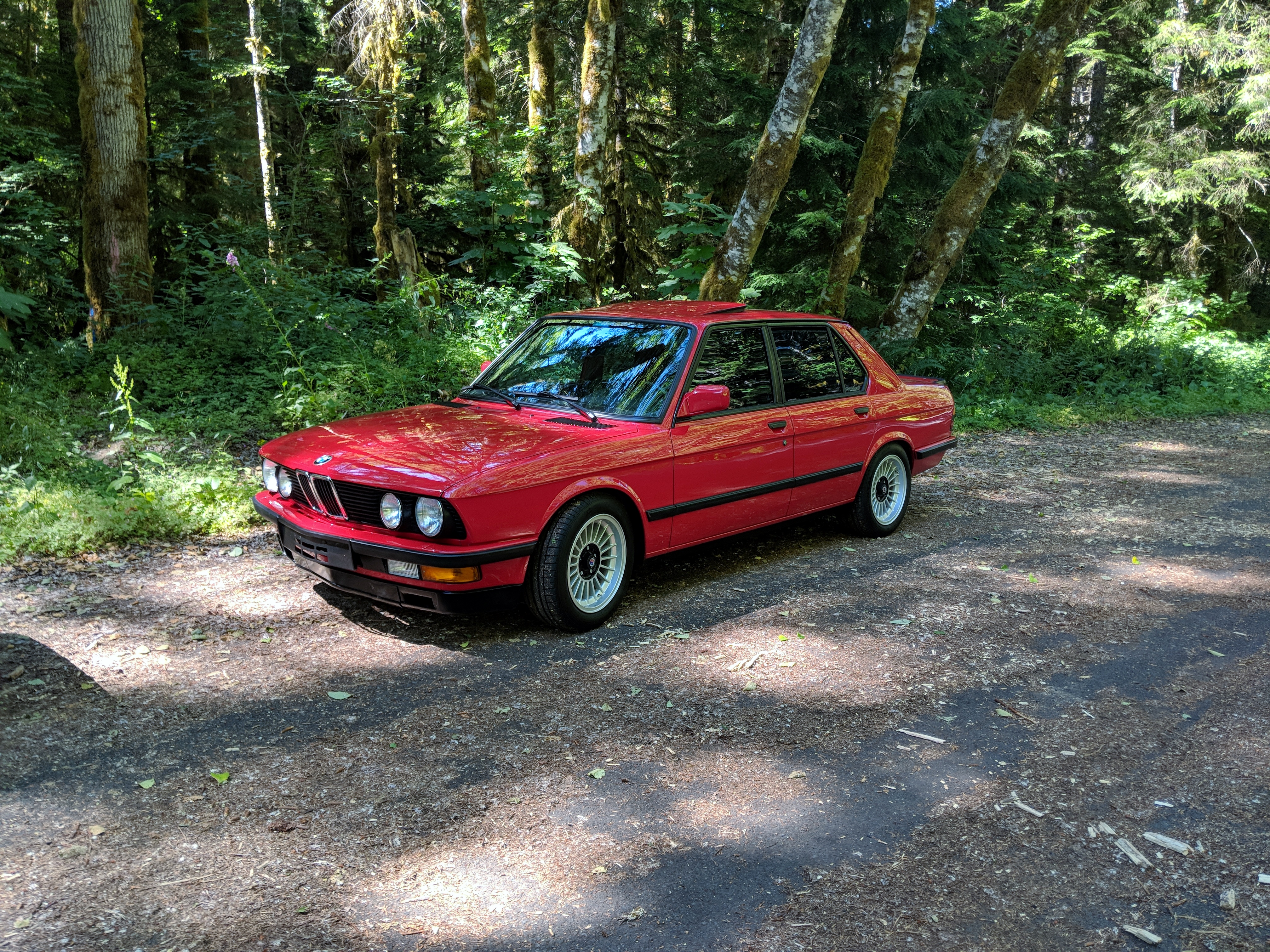
2018-07-20 14.57.36
Coleman Hill Rd, Randle, WA アメリカ合衆国の地図
別の場所を検索
近所の場所
Silverbrook Rd, Randle, WA アメリカ合衆国
アメリカ合衆国 〒 ワシントン州 ランドル
Boyd Rd, Mossyrock, WA アメリカ合衆国ボイド・ロード
WA-, Randle, WA アメリカ合衆国
WA-, Randle, WA アメリカ合衆国
Skinner Rd, Randle, WA アメリカ合衆国
Skinner Rd, Randle, WA アメリカ合衆国
US-12, Randle, WA アメリカ合衆国
Savio Rd, Randle, WA アメリカ合衆国
US-12, Naches, WA アメリカ合衆国
US-12, Randle, WA アメリカ合衆国
Cropsey Dr, Randle, WA アメリカ合衆国
Cropsey Dr, Randle, WA アメリカ合衆国
Cropsey Dr, Randle, WA アメリカ合衆国
Silverbrook Rd, Randle, WA アメリカ合衆国
Silverbrook Rd, Randle, WA アメリカ合衆国
Silverbrook Rd, Randle, WA アメリカ合衆国
Randle, WA アメリカ合衆国タワー・ロック・キャンプグランド
Dorlynes Ln, Glenoma, WA アメリカ合衆国
US-12, Glenoma, WA アメリカ合衆国
最近の検索
- Presidente Quintana & Emilio Mitre, Carlos Keen, Provincia de Buenos Aires, Argentina日の出日の入り時間
- Deep Gap Farm Rd E, Mill Spring, NC, USA日の出日の入り時間
- 中華人民共和国 広東省 仏山市 南海区 九江鎮日の出日の入り時間
- アメリカ合衆国 〒 カリフォルニア州 マウンテンビュー日の出日の入り時間
- 日本、〒- 北海道斜里郡斜里町朱円東天に続く道展望台日の出日の入り時間
- 海岸咖啡, No. 31號, Chaishan Ave, Gushan District, Kaohsiung City, Taiwan日の出日の入り時間
- Estates Loop, Priest River, ID アメリカ合衆国日の出日の入り時間
- Woodland Oak Pl, Thousand Oaks, CA アメリカ合衆国日の出日の入り時間
- Sarangdanda ネパール日の出日の入り時間
- 日本、〒- 宮城県塩竈市中の島日の出日の入り時間