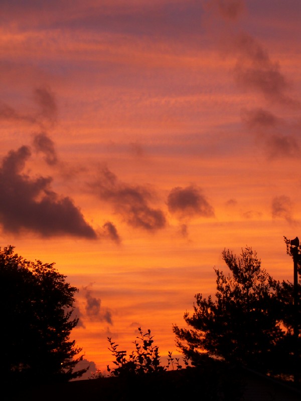
Burr Oak Rd, Glouster, OH アメリカ合衆国日の出日の入り時間
Location: アメリカ合衆国 > オハイオ州 > アセンズ > アメリカ合衆国 オハイオ州 トリンブル > アメリカ合衆国 〒 オハイオ州 グロースター >
時間帯:
America/New_York
現地時間:
2024-05-15 09:58:14
経度:
-82.06309
緯度:
39.551409
今日の日の出時刻:
06:13:07 AM
今日の日の入時刻:
08:36:07 PM
今日の日長:
14h 23m 0s
明日の日の出時刻:
06:12:16 AM
明日の日の入時刻:
08:37:02 PM
明日の日長:
14h 24m 46s
すべて表示する
| 日付 | 日出 | 日没 | 日長 |
|---|---|---|---|
| 2024年01月01日 | 07:48:43 AM | 05:15:19 PM | 9h 26m 36s |
| 2024年01月02日 | 07:48:49 AM | 05:16:09 PM | 9h 27m 20s |
| 2024年01月03日 | 07:48:52 AM | 05:17:01 PM | 9h 28m 9s |
| 2024年01月04日 | 07:48:53 AM | 05:17:54 PM | 9h 29m 1s |
| 2024年01月05日 | 07:48:52 AM | 05:18:48 PM | 9h 29m 56s |
| 2024年01月06日 | 07:48:49 AM | 05:19:44 PM | 9h 30m 55s |
| 2024年01月07日 | 07:48:43 AM | 05:20:41 PM | 9h 31m 58s |
| 2024年01月08日 | 07:48:36 AM | 05:21:39 PM | 9h 33m 3s |
| 2024年01月09日 | 07:48:26 AM | 05:22:39 PM | 9h 34m 13s |
| 2024年01月10日 | 07:48:14 AM | 05:23:39 PM | 9h 35m 25s |
| 2024年01月11日 | 07:48:00 AM | 05:24:40 PM | 9h 36m 40s |
| 2024年01月12日 | 07:47:43 AM | 05:25:43 PM | 9h 38m 0s |
| 2024年01月13日 | 07:47:25 AM | 05:26:46 PM | 9h 39m 21s |
| 2024年01月14日 | 07:47:04 AM | 05:27:50 PM | 9h 40m 46s |
| 2024年01月15日 | 07:46:41 AM | 05:28:55 PM | 9h 42m 14s |
| 2024年01月16日 | 07:46:17 AM | 05:30:01 PM | 9h 43m 44s |
| 2024年01月17日 | 07:45:50 AM | 05:31:07 PM | 9h 45m 17s |
| 2024年01月18日 | 07:45:21 AM | 05:32:14 PM | 9h 46m 53s |
| 2024年01月19日 | 07:44:49 AM | 05:33:21 PM | 9h 48m 32s |
| 2024年01月20日 | 07:44:16 AM | 05:34:29 PM | 9h 50m 13s |
| 2024年01月21日 | 07:43:41 AM | 05:35:38 PM | 9h 51m 57s |
| 2024年01月22日 | 07:43:04 AM | 05:36:47 PM | 9h 53m 43s |
| 2024年01月23日 | 07:42:25 AM | 05:37:56 PM | 9h 55m 31s |
| 2024年01月24日 | 07:41:44 AM | 05:39:06 PM | 9h 57m 22s |
| 2024年01月25日 | 07:41:01 AM | 05:40:16 PM | 9h 59m 15s |
| 2024年01月26日 | 07:40:17 AM | 05:41:26 PM | 10h 1m 9s |
| 2024年01月27日 | 07:39:30 AM | 05:42:37 PM | 10h 3m 7s |
| 2024年01月28日 | 07:38:42 AM | 05:43:48 PM | 10h 5m 6s |
| 2024年01月29日 | 07:37:52 AM | 05:44:59 PM | 10h 7m 7s |
| 2024年01月30日 | 07:37:00 AM | 05:46:10 PM | 10h 9m 10s |
| 2024年01月31日 | 07:36:06 AM | 05:47:21 PM | 10h 11m 15s |
| 2024年02月01日 | 07:35:11 AM | 05:48:32 PM | 10h 13m 21s |
| 2024年02月02日 | 07:34:14 AM | 05:49:43 PM | 10h 15m 29s |
| 2024年02月03日 | 07:33:15 AM | 05:50:54 PM | 10h 17m 39s |
| 2024年02月04日 | 07:32:15 AM | 05:52:05 PM | 10h 19m 50s |
| 2024年02月05日 | 07:31:14 AM | 05:53:16 PM | 10h 22m 2s |
| 2024年02月06日 | 07:30:10 AM | 05:54:27 PM | 10h 24m 17s |
| 2024年02月07日 | 07:29:06 AM | 05:55:38 PM | 10h 26m 32s |
| 2024年02月08日 | 07:28:00 AM | 05:56:49 PM | 10h 28m 49s |
| 2024年02月09日 | 07:26:52 AM | 05:57:59 PM | 10h 31m 7s |
| 2024年02月10日 | 07:25:43 AM | 05:59:10 PM | 10h 33m 27s |
| 2024年02月11日 | 07:24:33 AM | 06:00:20 PM | 10h 35m 47s |
| 2024年02月12日 | 07:23:21 AM | 06:01:30 PM | 10h 38m 9s |
| 2024年02月13日 | 07:22:09 AM | 06:02:40 PM | 10h 40m 31s |
| 2024年02月14日 | 07:20:55 AM | 06:03:49 PM | 10h 42m 54s |
| 2024年02月15日 | 07:19:39 AM | 06:04:58 PM | 10h 45m 19s |
| 2024年02月16日 | 07:18:23 AM | 06:06:07 PM | 10h 47m 44s |
| 2024年02月17日 | 07:17:05 AM | 06:07:16 PM | 10h 50m 11s |
| 2024年02月18日 | 07:15:47 AM | 06:08:24 PM | 10h 52m 37s |
| 2024年02月19日 | 07:14:27 AM | 06:09:33 PM | 10h 55m 6s |
| 2024年02月20日 | 07:13:06 AM | 06:10:40 PM | 10h 57m 34s |
| 2024年02月21日 | 07:11:45 AM | 06:11:48 PM | 11h 0m 3s |
| 2024年02月22日 | 07:10:22 AM | 06:12:55 PM | 11h 2m 33s |
| 2024年02月23日 | 07:08:58 AM | 06:14:02 PM | 11h 5m 4s |
| 2024年02月24日 | 07:07:34 AM | 06:15:09 PM | 11h 7m 35s |
| 2024年02月25日 | 07:06:09 AM | 06:16:15 PM | 11h 10m 6s |
| 2024年02月26日 | 07:04:42 AM | 06:17:21 PM | 11h 12m 39s |
| 2024年02月27日 | 07:03:15 AM | 06:18:27 PM | 11h 15m 12s |
| 2024年02月28日 | 07:01:48 AM | 06:19:32 PM | 11h 17m 44s |
| 2024年02月29日 | 07:00:19 AM | 06:20:37 PM | 11h 20m 18s |
| 2024年03月01日 | 06:58:50 AM | 06:21:42 PM | 11h 22m 52s |
| 2024年03月02日 | 06:57:20 AM | 06:22:46 PM | 11h 25m 26s |
| 2024年03月03日 | 06:55:50 AM | 06:23:51 PM | 11h 28m 1s |
| 2024年03月04日 | 06:54:19 AM | 06:24:54 PM | 11h 30m 35s |
| 2024年03月05日 | 06:52:48 AM | 06:25:58 PM | 11h 33m 10s |
| 2024年03月06日 | 06:51:15 AM | 06:27:01 PM | 11h 35m 46s |
| 2024年03月07日 | 06:49:43 AM | 06:28:05 PM | 11h 38m 22s |
| 2024年03月08日 | 06:48:10 AM | 06:29:07 PM | 11h 40m 57s |
| 2024年03月09日 | 06:46:36 AM | 06:30:10 PM | 11h 43m 34s |
| 2024年03月10日 | 07:45:06 AM | 07:31:10 PM | 11h 46m 4s |
| 2024年03月11日 | 07:43:32 AM | 07:32:12 PM | 11h 48m 40s |
| 2024年03月12日 | 07:41:58 AM | 07:33:14 PM | 11h 51m 16s |
| 2024年03月13日 | 07:40:23 AM | 07:34:15 PM | 11h 53m 52s |
| 2024年03月14日 | 07:38:48 AM | 07:35:17 PM | 11h 56m 29s |
| 2024年03月15日 | 07:37:12 AM | 07:36:18 PM | 11h 59m 6s |
| 2024年03月16日 | 07:35:37 AM | 07:37:19 PM | 12h 1m 42s |
| 2024年03月17日 | 07:34:01 AM | 07:38:20 PM | 12h 4m 19s |
| 2024年03月18日 | 07:32:25 AM | 07:39:21 PM | 12h 6m 56s |
| 2024年03月19日 | 07:30:49 AM | 07:40:22 PM | 12h 9m 33s |
| 2024年03月20日 | 07:29:13 AM | 07:41:22 PM | 12h 12m 9s |
| 2024年03月21日 | 07:27:37 AM | 07:42:22 PM | 12h 14m 45s |
| 2024年03月22日 | 07:26:00 AM | 07:43:23 PM | 12h 17m 23s |
| 2024年03月23日 | 07:24:24 AM | 07:44:23 PM | 12h 19m 59s |
| 2024年03月24日 | 07:22:48 AM | 07:45:23 PM | 12h 22m 35s |
| 2024年03月25日 | 07:21:12 AM | 07:46:23 PM | 12h 25m 11s |
| 2024年03月26日 | 07:19:36 AM | 07:47:22 PM | 12h 27m 46s |
| 2024年03月27日 | 07:18:00 AM | 07:48:22 PM | 12h 30m 22s |
| 2024年03月28日 | 07:16:24 AM | 07:49:22 PM | 12h 32m 58s |
| 2024年03月29日 | 07:14:49 AM | 07:50:22 PM | 12h 35m 33s |
| 2024年03月30日 | 07:13:13 AM | 07:51:21 PM | 12h 38m 8s |
| 2024年03月31日 | 07:11:38 AM | 07:52:21 PM | 12h 40m 43s |
| 2024年04月01日 | 07:10:03 AM | 07:53:20 PM | 12h 43m 17s |
| 2024年04月02日 | 07:08:29 AM | 07:54:20 PM | 12h 45m 51s |
| 2024年04月03日 | 07:06:54 AM | 07:55:19 PM | 12h 48m 25s |
| 2024年04月04日 | 07:05:20 AM | 07:56:19 PM | 12h 50m 59s |
| 2024年04月05日 | 07:03:47 AM | 07:57:18 PM | 12h 53m 31s |
| 2024年04月06日 | 07:02:14 AM | 07:58:18 PM | 12h 56m 4s |
| 2024年04月07日 | 07:00:41 AM | 07:59:17 PM | 12h 58m 36s |
| 2024年04月08日 | 06:59:09 AM | 08:00:17 PM | 13h 1m 8s |
| 2024年04月09日 | 06:57:37 AM | 08:01:16 PM | 13h 3m 39s |
| 2024年04月10日 | 06:56:06 AM | 08:02:16 PM | 13h 6m 10s |
| 2024年04月11日 | 06:54:36 AM | 08:03:15 PM | 13h 8m 39s |
| 2024年04月12日 | 06:53:06 AM | 08:04:15 PM | 13h 11m 9s |
| 2024年04月13日 | 06:51:37 AM | 08:05:15 PM | 13h 13m 38s |
| 2024年04月14日 | 06:50:08 AM | 08:06:14 PM | 13h 16m 6s |
| 2024年04月15日 | 06:48:40 AM | 08:07:14 PM | 13h 18m 34s |
| 2024年04月16日 | 06:47:13 AM | 08:08:14 PM | 13h 21m 1s |
| 2024年04月17日 | 06:45:47 AM | 08:09:14 PM | 13h 23m 27s |
| 2024年04月18日 | 06:44:21 AM | 08:10:13 PM | 13h 25m 52s |
| 2024年04月19日 | 06:42:56 AM | 08:11:13 PM | 13h 28m 17s |
| 2024年04月20日 | 06:41:32 AM | 08:12:13 PM | 13h 30m 41s |
| 2024年04月21日 | 06:40:09 AM | 08:13:13 PM | 13h 33m 4s |
| 2024年04月22日 | 06:38:47 AM | 08:14:12 PM | 13h 35m 25s |
| 2024年04月23日 | 06:37:26 AM | 08:15:12 PM | 13h 37m 46s |
| 2024年04月24日 | 06:36:06 AM | 08:16:12 PM | 13h 40m 6s |
| 2024年04月25日 | 06:34:47 AM | 08:17:12 PM | 13h 42m 25s |
| 2024年04月26日 | 06:33:28 AM | 08:18:11 PM | 13h 44m 43s |
| 2024年04月27日 | 06:32:11 AM | 08:19:11 PM | 13h 47m 0s |
| 2024年04月28日 | 06:30:55 AM | 08:20:11 PM | 13h 49m 16s |
| 2024年04月29日 | 06:29:40 AM | 08:21:10 PM | 13h 51m 30s |
| 2024年04月30日 | 06:28:27 AM | 08:22:10 PM | 13h 53m 43s |
| 2024年05月01日 | 06:27:14 AM | 08:23:09 PM | 13h 55m 55s |
| 2024年05月02日 | 06:26:03 AM | 08:24:08 PM | 13h 58m 5s |
| 2024年05月03日 | 06:24:53 AM | 08:25:07 PM | 14h 0m 14s |
| 2024年05月04日 | 06:23:44 AM | 08:26:06 PM | 14h 2m 22s |
| 2024年05月05日 | 06:22:37 AM | 08:27:05 PM | 14h 4m 28s |
| 2024年05月06日 | 06:21:31 AM | 08:28:03 PM | 14h 6m 32s |
| 2024年05月07日 | 06:20:26 AM | 08:29:01 PM | 14h 8m 35s |
| 2024年05月08日 | 06:19:23 AM | 08:29:59 PM | 14h 10m 36s |
| 2024年05月09日 | 06:18:21 AM | 08:30:57 PM | 14h 12m 36s |
| 2024年05月10日 | 06:17:20 AM | 08:31:54 PM | 14h 14m 34s |
| 2024年05月11日 | 06:16:22 AM | 08:32:51 PM | 14h 16m 29s |
| 2024年05月12日 | 06:15:24 AM | 08:33:48 PM | 14h 18m 24s |
| 2024年05月13日 | 06:14:28 AM | 08:34:44 PM | 14h 20m 16s |
| 2024年05月14日 | 06:13:34 AM | 08:35:40 PM | 14h 22m 6s |
| 2024年05月15日 | 06:12:41 AM | 08:36:35 PM | 14h 23m 54s |
| 2024年05月16日 | 06:11:50 AM | 08:37:30 PM | 14h 25m 40s |
| 2024年05月17日 | 06:11:01 AM | 08:38:24 PM | 14h 27m 23s |
| 2024年05月18日 | 06:10:13 AM | 08:39:18 PM | 14h 29m 5s |
| 2024年05月19日 | 06:09:27 AM | 08:40:11 PM | 14h 30m 44s |
| 2024年05月20日 | 06:08:43 AM | 08:41:03 PM | 14h 32m 20s |
| 2024年05月21日 | 06:08:00 AM | 08:41:55 PM | 14h 33m 55s |
| 2024年05月22日 | 06:07:19 AM | 08:42:46 PM | 14h 35m 27s |
| 2024年05月23日 | 06:06:40 AM | 08:43:36 PM | 14h 36m 56s |
| 2024年05月24日 | 06:06:03 AM | 08:44:26 PM | 14h 38m 23s |
| 2024年05月25日 | 06:05:28 AM | 08:45:14 PM | 14h 39m 46s |
| 2024年05月26日 | 06:04:54 AM | 08:46:02 PM | 14h 41m 8s |
| 2024年05月27日 | 06:04:22 AM | 08:46:49 PM | 14h 42m 27s |
| 2024年05月28日 | 06:03:52 AM | 08:47:35 PM | 14h 43m 43s |
| 2024年05月29日 | 06:03:24 AM | 08:48:20 PM | 14h 44m 56s |
| 2024年05月30日 | 06:02:58 AM | 08:49:03 PM | 14h 46m 5s |
| 2024年05月31日 | 06:02:34 AM | 08:49:46 PM | 14h 47m 12s |
| 2024年06月01日 | 06:02:11 AM | 08:50:28 PM | 14h 48m 17s |
| 2024年06月02日 | 06:01:51 AM | 08:51:08 PM | 14h 49m 17s |
| 2024年06月03日 | 06:01:32 AM | 08:51:47 PM | 14h 50m 15s |
| 2024年06月04日 | 06:01:16 AM | 08:52:25 PM | 14h 51m 9s |
| 2024年06月05日 | 06:01:01 AM | 08:53:02 PM | 14h 52m 1s |
| 2024年06月06日 | 06:00:48 AM | 08:53:37 PM | 14h 52m 49s |
| 2024年06月07日 | 06:00:37 AM | 08:54:11 PM | 14h 53m 34s |
| 2024年06月08日 | 06:00:28 AM | 08:54:44 PM | 14h 54m 16s |
| 2024年06月09日 | 06:00:21 AM | 08:55:15 PM | 14h 54m 54s |
| 2024年06月10日 | 06:00:16 AM | 08:55:45 PM | 14h 55m 29s |
| 2024年06月11日 | 06:00:13 AM | 08:56:13 PM | 14h 56m 0s |
| 2024年06月12日 | 06:00:11 AM | 08:56:39 PM | 14h 56m 28s |
| 2024年06月13日 | 06:00:12 AM | 08:57:04 PM | 14h 56m 52s |
| 2024年06月14日 | 06:00:14 AM | 08:57:28 PM | 14h 57m 14s |
| 2024年06月15日 | 06:00:18 AM | 08:57:49 PM | 14h 57m 31s |
| 2024年06月16日 | 06:00:24 AM | 08:58:09 PM | 14h 57m 45s |
| 2024年06月17日 | 06:00:32 AM | 08:58:28 PM | 14h 57m 56s |
| 2024年06月18日 | 06:00:42 AM | 08:58:44 PM | 14h 58m 2s |
| 2024年06月19日 | 06:00:53 AM | 08:58:59 PM | 14h 58m 6s |
| 2024年06月20日 | 06:01:06 AM | 08:59:12 PM | 14h 58m 6s |
| 2024年06月21日 | 06:01:21 AM | 08:59:23 PM | 14h 58m 2s |
| 2024年06月22日 | 06:01:38 AM | 08:59:32 PM | 14h 57m 54s |
| 2024年06月23日 | 06:01:56 AM | 08:59:40 PM | 14h 57m 44s |
| 2024年06月24日 | 06:02:16 AM | 08:59:46 PM | 14h 57m 30s |
| 2024年06月25日 | 06:02:37 AM | 08:59:49 PM | 14h 57m 12s |
| 2024年06月26日 | 06:03:00 AM | 08:59:51 PM | 14h 56m 51s |
| 2024年06月27日 | 06:03:25 AM | 08:59:51 PM | 14h 56m 26s |
| 2024年06月28日 | 06:03:51 AM | 08:59:49 PM | 14h 55m 58s |
| 2024年06月29日 | 06:04:18 AM | 08:59:45 PM | 14h 55m 27s |
| 2024年06月30日 | 06:04:47 AM | 08:59:39 PM | 14h 54m 52s |
| 2024年07月01日 | 06:05:18 AM | 08:59:31 PM | 14h 54m 13s |
| 2024年07月02日 | 06:05:50 AM | 08:59:21 PM | 14h 53m 31s |
| 2024年07月03日 | 06:06:23 AM | 08:59:10 PM | 14h 52m 47s |
| 2024年07月04日 | 06:06:57 AM | 08:58:56 PM | 14h 51m 59s |
| 2024年07月05日 | 06:07:33 AM | 08:58:40 PM | 14h 51m 7s |
| 2024年07月06日 | 06:08:10 AM | 08:58:23 PM | 14h 50m 13s |
| 2024年07月07日 | 06:08:48 AM | 08:58:03 PM | 14h 49m 15s |
| 2024年07月08日 | 06:09:27 AM | 08:57:42 PM | 14h 48m 15s |
| 2024年07月09日 | 06:10:07 AM | 08:57:18 PM | 14h 47m 11s |
| 2024年07月10日 | 06:10:49 AM | 08:56:53 PM | 14h 46m 4s |
| 2024年07月11日 | 06:11:31 AM | 08:56:25 PM | 14h 44m 54s |
| 2024年07月12日 | 06:12:14 AM | 08:55:56 PM | 14h 43m 42s |
| 2024年07月13日 | 06:12:58 AM | 08:55:25 PM | 14h 42m 27s |
| 2024年07月14日 | 06:13:44 AM | 08:54:52 PM | 14h 41m 8s |
| 2024年07月15日 | 06:14:30 AM | 08:54:17 PM | 14h 39m 47s |
| 2024年07月16日 | 06:15:16 AM | 08:53:40 PM | 14h 38m 24s |
| 2024年07月17日 | 06:16:04 AM | 08:53:02 PM | 14h 36m 58s |
| 2024年07月18日 | 06:16:52 AM | 08:52:21 PM | 14h 35m 29s |
| 2024年07月19日 | 06:17:41 AM | 08:51:39 PM | 14h 33m 58s |
| 2024年07月20日 | 06:18:30 AM | 08:50:55 PM | 14h 32m 25s |
| 2024年07月21日 | 06:19:21 AM | 08:50:10 PM | 14h 30m 49s |
| 2024年07月22日 | 06:20:11 AM | 08:49:22 PM | 14h 29m 11s |
| 2024年07月23日 | 06:21:03 AM | 08:48:33 PM | 14h 27m 30s |
| 2024年07月24日 | 06:21:55 AM | 08:47:42 PM | 14h 25m 47s |
| 2024年07月25日 | 06:22:47 AM | 08:46:50 PM | 14h 24m 3s |
| 2024年07月26日 | 06:23:39 AM | 08:45:55 PM | 14h 22m 16s |
| 2024年07月27日 | 06:24:33 AM | 08:45:00 PM | 14h 20m 27s |
| 2024年07月28日 | 06:25:26 AM | 08:44:02 PM | 14h 18m 36s |
| 2024年07月29日 | 06:26:20 AM | 08:43:03 PM | 14h 16m 43s |
| 2024年07月30日 | 06:27:14 AM | 08:42:03 PM | 14h 14m 49s |
| 2024年07月31日 | 06:28:08 AM | 08:41:01 PM | 14h 12m 53s |
| 2024年08月01日 | 06:29:03 AM | 08:39:58 PM | 14h 10m 55s |
| 2024年08月02日 | 06:29:58 AM | 08:38:53 PM | 14h 8m 55s |
| 2024年08月03日 | 06:30:53 AM | 08:37:47 PM | 14h 6m 54s |
| 2024年08月04日 | 06:31:48 AM | 08:36:39 PM | 14h 4m 51s |
| 2024年08月05日 | 06:32:44 AM | 08:35:30 PM | 14h 2m 46s |
| 2024年08月06日 | 06:33:39 AM | 08:34:20 PM | 14h 0m 41s |
| 2024年08月07日 | 06:34:35 AM | 08:33:08 PM | 13h 58m 33s |
| 2024年08月08日 | 06:35:31 AM | 08:31:55 PM | 13h 56m 24s |
| 2024年08月09日 | 06:36:27 AM | 08:30:41 PM | 13h 54m 14s |
| 2024年08月10日 | 06:37:23 AM | 08:29:26 PM | 13h 52m 3s |
| 2024年08月11日 | 06:38:19 AM | 08:28:09 PM | 13h 49m 50s |
| 2024年08月12日 | 06:39:15 AM | 08:26:52 PM | 13h 47m 37s |
| 2024年08月13日 | 06:40:11 AM | 08:25:33 PM | 13h 45m 22s |
| 2024年08月14日 | 06:41:07 AM | 08:24:13 PM | 13h 43m 6s |
| 2024年08月15日 | 06:42:03 AM | 08:22:52 PM | 13h 40m 49s |
| 2024年08月16日 | 06:42:59 AM | 08:21:30 PM | 13h 38m 31s |
| 2024年08月17日 | 06:43:55 AM | 08:20:07 PM | 13h 36m 12s |
| 2024年08月18日 | 06:44:51 AM | 08:18:44 PM | 13h 33m 53s |
| 2024年08月19日 | 06:45:47 AM | 08:17:19 PM | 13h 31m 32s |
| 2024年08月20日 | 06:46:43 AM | 08:15:53 PM | 13h 29m 10s |
| 2024年08月21日 | 06:47:38 AM | 08:14:27 PM | 13h 26m 49s |
| 2024年08月22日 | 06:48:34 AM | 08:12:59 PM | 13h 24m 25s |
| 2024年08月23日 | 06:49:30 AM | 08:11:31 PM | 13h 22m 1s |
| 2024年08月24日 | 06:50:26 AM | 08:10:02 PM | 13h 19m 36s |
| 2024年08月25日 | 06:51:21 AM | 08:08:33 PM | 13h 17m 12s |
| 2024年08月26日 | 06:52:17 AM | 08:07:02 PM | 13h 14m 45s |
| 2024年08月27日 | 06:53:12 AM | 08:05:31 PM | 13h 12m 19s |
| 2024年08月28日 | 06:54:08 AM | 08:04:00 PM | 13h 9m 52s |
| 2024年08月29日 | 06:55:03 AM | 08:02:28 PM | 13h 7m 25s |
| 2024年08月30日 | 06:55:59 AM | 08:00:55 PM | 13h 4m 56s |
| 2024年08月31日 | 06:56:54 AM | 07:59:21 PM | 13h 2m 27s |
| 2024年09月01日 | 06:57:49 AM | 07:57:47 PM | 12h 59m 58s |
| 2024年09月02日 | 06:58:44 AM | 07:56:13 PM | 12h 57m 29s |
| 2024年09月03日 | 06:59:39 AM | 07:54:38 PM | 12h 54m 59s |
| 2024年09月04日 | 07:00:35 AM | 07:53:03 PM | 12h 52m 28s |
| 2024年09月05日 | 07:01:30 AM | 07:51:27 PM | 12h 49m 57s |
| 2024年09月06日 | 07:02:25 AM | 07:49:51 PM | 12h 47m 26s |
| 2024年09月07日 | 07:03:20 AM | 07:48:14 PM | 12h 44m 54s |
| 2024年09月08日 | 07:04:15 AM | 07:46:37 PM | 12h 42m 22s |
| 2024年09月09日 | 07:05:10 AM | 07:45:00 PM | 12h 39m 50s |
| 2024年09月10日 | 07:06:05 AM | 07:43:23 PM | 12h 37m 18s |
| 2024年09月11日 | 07:07:00 AM | 07:41:45 PM | 12h 34m 45s |
| 2024年09月12日 | 07:07:56 AM | 07:40:07 PM | 12h 32m 11s |
| 2024年09月13日 | 07:08:51 AM | 07:38:29 PM | 12h 29m 38s |
| 2024年09月14日 | 07:09:46 AM | 07:36:51 PM | 12h 27m 5s |
| 2024年09月15日 | 07:10:41 AM | 07:35:13 PM | 12h 24m 32s |
| 2024年09月16日 | 07:11:37 AM | 07:33:35 PM | 12h 21m 58s |
| 2024年09月17日 | 07:12:32 AM | 07:31:57 PM | 12h 19m 25s |
| 2024年09月18日 | 07:13:28 AM | 07:30:18 PM | 12h 16m 50s |
| 2024年09月19日 | 07:14:23 AM | 07:28:40 PM | 12h 14m 17s |
| 2024年09月20日 | 07:15:19 AM | 07:27:01 PM | 12h 11m 42s |
| 2024年09月21日 | 07:16:15 AM | 07:25:23 PM | 12h 9m 8s |
| 2024年09月22日 | 07:17:11 AM | 07:23:45 PM | 12h 6m 34s |
| 2024年09月23日 | 07:18:08 AM | 07:22:07 PM | 12h 3m 59s |
| 2024年09月24日 | 07:19:04 AM | 07:20:29 PM | 12h 1m 25s |
| 2024年09月25日 | 07:20:01 AM | 07:18:51 PM | 11h 58m 50s |
| 2024年09月26日 | 07:20:57 AM | 07:17:14 PM | 11h 56m 17s |
| 2024年09月27日 | 07:21:54 AM | 07:15:37 PM | 11h 53m 43s |
| 2024年09月28日 | 07:22:51 AM | 07:14:00 PM | 11h 51m 9s |
| 2024年09月29日 | 07:23:49 AM | 07:12:23 PM | 11h 48m 34s |
| 2024年09月30日 | 07:24:46 AM | 07:10:46 PM | 11h 46m 0s |
| 2024年10月01日 | 07:25:44 AM | 07:09:10 PM | 11h 43m 26s |
| 2024年10月02日 | 07:26:42 AM | 07:07:35 PM | 11h 40m 53s |
| 2024年10月03日 | 07:27:41 AM | 07:06:00 PM | 11h 38m 19s |
| 2024年10月04日 | 07:28:39 AM | 07:04:25 PM | 11h 35m 46s |
| 2024年10月05日 | 07:29:38 AM | 07:02:51 PM | 11h 33m 13s |
| 2024年10月06日 | 07:30:37 AM | 07:01:17 PM | 11h 30m 40s |
| 2024年10月07日 | 07:31:37 AM | 06:59:44 PM | 11h 28m 7s |
| 2024年10月08日 | 07:32:37 AM | 06:58:11 PM | 11h 25m 34s |
| 2024年10月09日 | 07:33:37 AM | 06:56:39 PM | 11h 23m 2s |
| 2024年10月10日 | 07:34:37 AM | 06:55:08 PM | 11h 20m 31s |
| 2024年10月11日 | 07:35:38 AM | 06:53:37 PM | 11h 17m 59s |
| 2024年10月12日 | 07:36:39 AM | 06:52:08 PM | 11h 15m 29s |
| 2024年10月13日 | 07:37:40 AM | 06:50:38 PM | 11h 12m 58s |
| 2024年10月14日 | 07:38:42 AM | 06:49:10 PM | 11h 10m 28s |
| 2024年10月15日 | 07:39:44 AM | 06:47:42 PM | 11h 7m 58s |
| 2024年10月16日 | 07:40:46 AM | 06:46:16 PM | 11h 5m 30s |
| 2024年10月17日 | 07:41:49 AM | 06:44:50 PM | 11h 3m 1s |
| 2024年10月18日 | 07:42:52 AM | 06:43:25 PM | 11h 0m 33s |
| 2024年10月19日 | 07:43:55 AM | 06:42:01 PM | 10h 58m 6s |
| 2024年10月20日 | 07:44:59 AM | 06:40:38 PM | 10h 55m 39s |
| 2024年10月21日 | 07:46:03 AM | 06:39:16 PM | 10h 53m 13s |
| 2024年10月22日 | 07:47:07 AM | 06:37:55 PM | 10h 50m 48s |
| 2024年10月23日 | 07:48:12 AM | 06:36:35 PM | 10h 48m 23s |
| 2024年10月24日 | 07:49:17 AM | 06:35:16 PM | 10h 45m 59s |
| 2024年10月25日 | 07:50:22 AM | 06:33:58 PM | 10h 43m 36s |
| 2024年10月26日 | 07:51:28 AM | 06:32:42 PM | 10h 41m 14s |
| 2024年10月27日 | 07:52:33 AM | 06:31:27 PM | 10h 38m 54s |
| 2024年10月28日 | 07:53:39 AM | 06:30:13 PM | 10h 36m 34s |
| 2024年10月29日 | 07:54:46 AM | 06:29:00 PM | 10h 34m 14s |
| 2024年10月30日 | 07:55:52 AM | 06:27:49 PM | 10h 31m 57s |
| 2024年10月31日 | 07:56:59 AM | 06:26:39 PM | 10h 29m 40s |
| 2024年11月01日 | 07:58:06 AM | 06:25:30 PM | 10h 27m 24s |
| 2024年11月02日 | 07:59:14 AM | 06:24:23 PM | 10h 25m 9s |
| 2024年11月03日 | 07:00:24 AM | 05:23:14 PM | 10h 22m 50s |
| 2024年11月04日 | 07:01:31 AM | 05:22:10 PM | 10h 20m 39s |
| 2024年11月05日 | 07:02:39 AM | 05:21:08 PM | 10h 18m 29s |
| 2024年11月06日 | 07:03:47 AM | 05:20:07 PM | 10h 16m 20s |
| 2024年11月07日 | 07:04:55 AM | 05:19:07 PM | 10h 14m 12s |
| 2024年11月08日 | 07:06:03 AM | 05:18:09 PM | 10h 12m 6s |
| 2024年11月09日 | 07:07:11 AM | 05:17:13 PM | 10h 10m 2s |
| 2024年11月10日 | 07:08:19 AM | 05:16:19 PM | 10h 8m 0s |
| 2024年11月11日 | 07:09:27 AM | 05:15:26 PM | 10h 5m 59s |
| 2024年11月12日 | 07:10:35 AM | 05:14:35 PM | 10h 4m 0s |
| 2024年11月13日 | 07:11:42 AM | 05:13:46 PM | 10h 2m 4s |
| 2024年11月14日 | 07:12:50 AM | 05:12:59 PM | 10h 0m 9s |
| 2024年11月15日 | 07:13:58 AM | 05:12:13 PM | 9h 58m 15s |
| 2024年11月16日 | 07:15:05 AM | 05:11:30 PM | 9h 56m 25s |
| 2024年11月17日 | 07:16:12 AM | 05:10:48 PM | 9h 54m 36s |
| 2024年11月18日 | 07:17:18 AM | 05:10:08 PM | 9h 52m 50s |
| 2024年11月19日 | 07:18:25 AM | 05:09:31 PM | 9h 51m 6s |
| 2024年11月20日 | 07:19:31 AM | 05:08:55 PM | 9h 49m 24s |
| 2024年11月21日 | 07:20:36 AM | 05:08:21 PM | 9h 47m 45s |
| 2024年11月22日 | 07:21:41 AM | 05:07:50 PM | 9h 46m 9s |
| 2024年11月23日 | 07:22:46 AM | 05:07:20 PM | 9h 44m 34s |
| 2024年11月24日 | 07:23:50 AM | 05:06:53 PM | 9h 43m 3s |
| 2024年11月25日 | 07:24:53 AM | 05:06:27 PM | 9h 41m 34s |
| 2024年11月26日 | 07:25:56 AM | 05:06:04 PM | 9h 40m 8s |
| 2024年11月27日 | 07:26:57 AM | 05:05:43 PM | 9h 38m 46s |
| 2024年11月28日 | 07:27:59 AM | 05:05:24 PM | 9h 37m 25s |
| 2024年11月29日 | 07:28:59 AM | 05:05:07 PM | 9h 36m 8s |
| 2024年11月30日 | 07:29:58 AM | 05:04:53 PM | 9h 34m 55s |
| 2024年12月01日 | 07:30:57 AM | 05:04:41 PM | 9h 33m 44s |
| 2024年12月02日 | 07:31:54 AM | 05:04:31 PM | 9h 32m 37s |
| 2024年12月03日 | 07:32:50 AM | 05:04:23 PM | 9h 31m 33s |
| 2024年12月04日 | 07:33:46 AM | 05:04:17 PM | 9h 30m 31s |
| 2024年12月05日 | 07:34:40 AM | 05:04:14 PM | 9h 29m 34s |
| 2024年12月06日 | 07:35:33 AM | 05:04:13 PM | 9h 28m 40s |
| 2024年12月07日 | 07:36:24 AM | 05:04:14 PM | 9h 27m 50s |
| 2024年12月08日 | 07:37:14 AM | 05:04:17 PM | 9h 27m 3s |
| 2024年12月09日 | 07:38:03 AM | 05:04:22 PM | 9h 26m 19s |
| 2024年12月10日 | 07:38:51 AM | 05:04:30 PM | 9h 25m 39s |
| 2024年12月11日 | 07:39:37 AM | 05:04:40 PM | 9h 25m 3s |
| 2024年12月12日 | 07:40:21 AM | 05:04:52 PM | 9h 24m 31s |
| 2024年12月13日 | 07:41:04 AM | 05:05:07 PM | 9h 24m 3s |
| 2024年12月14日 | 07:41:46 AM | 05:05:23 PM | 9h 23m 37s |
| 2024年12月15日 | 07:42:25 AM | 05:05:42 PM | 9h 23m 17s |
| 2024年12月16日 | 07:43:03 AM | 05:06:02 PM | 9h 22m 59s |
| 2024年12月17日 | 07:43:39 AM | 05:06:25 PM | 9h 22m 46s |
| 2024年12月18日 | 07:44:14 AM | 05:06:50 PM | 9h 22m 36s |
| 2024年12月19日 | 07:44:46 AM | 05:07:17 PM | 9h 22m 31s |
| 2024年12月20日 | 07:45:17 AM | 05:07:46 PM | 9h 22m 29s |
| 2024年12月21日 | 07:45:46 AM | 05:08:17 PM | 9h 22m 31s |
| 2024年12月22日 | 07:46:12 AM | 05:08:50 PM | 9h 22m 38s |
| 2024年12月23日 | 07:46:37 AM | 05:09:25 PM | 9h 22m 48s |
| 2024年12月24日 | 07:47:00 AM | 05:10:01 PM | 9h 23m 1s |
| 2024年12月25日 | 07:47:21 AM | 05:10:40 PM | 9h 23m 19s |
| 2024年12月26日 | 07:47:40 AM | 05:11:20 PM | 9h 23m 40s |
| 2024年12月27日 | 07:47:56 AM | 05:12:02 PM | 9h 24m 6s |
| 2024年12月28日 | 07:48:11 AM | 05:12:46 PM | 9h 24m 35s |
| 2024年12月29日 | 07:48:23 AM | 05:13:31 PM | 9h 25m 8s |
| 2024年12月30日 | 07:48:33 AM | 05:14:18 PM | 9h 25m 45s |
写真
101_2314.jpg
Downhill From Here
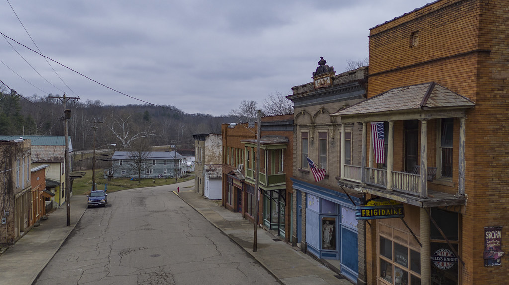
Downtown Shawnee
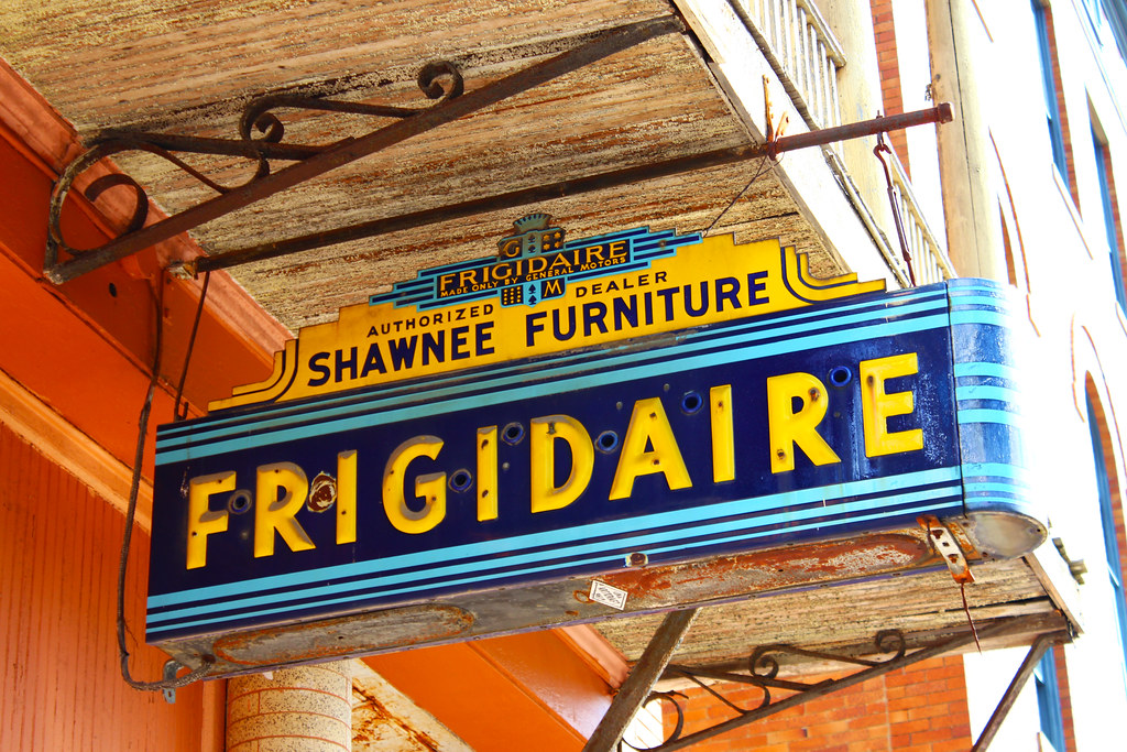
Shawnee Frigidaire Sign
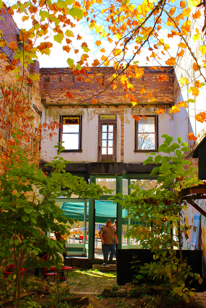
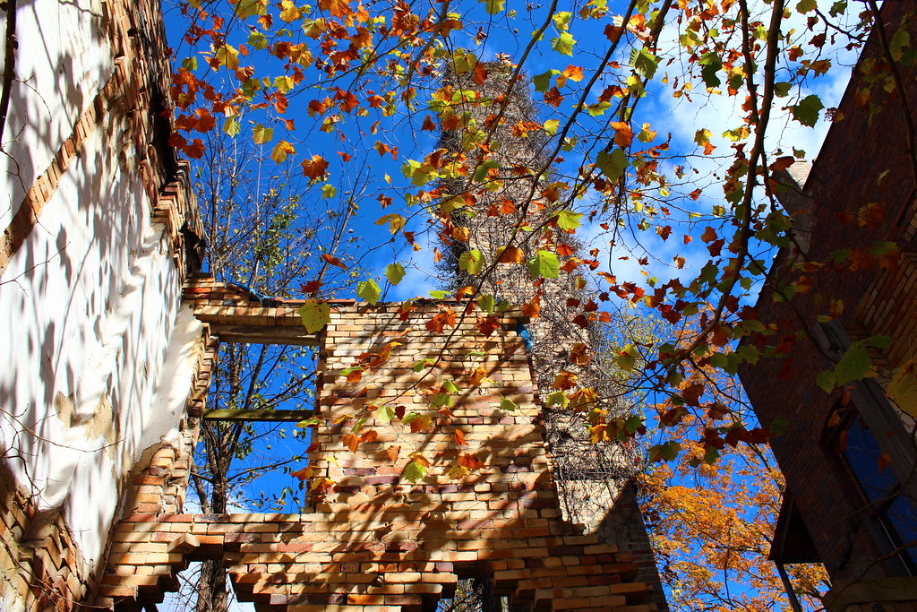
Between These 4 Walls
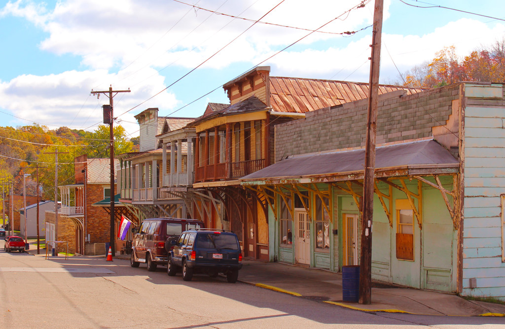
Autumn in Shawnee
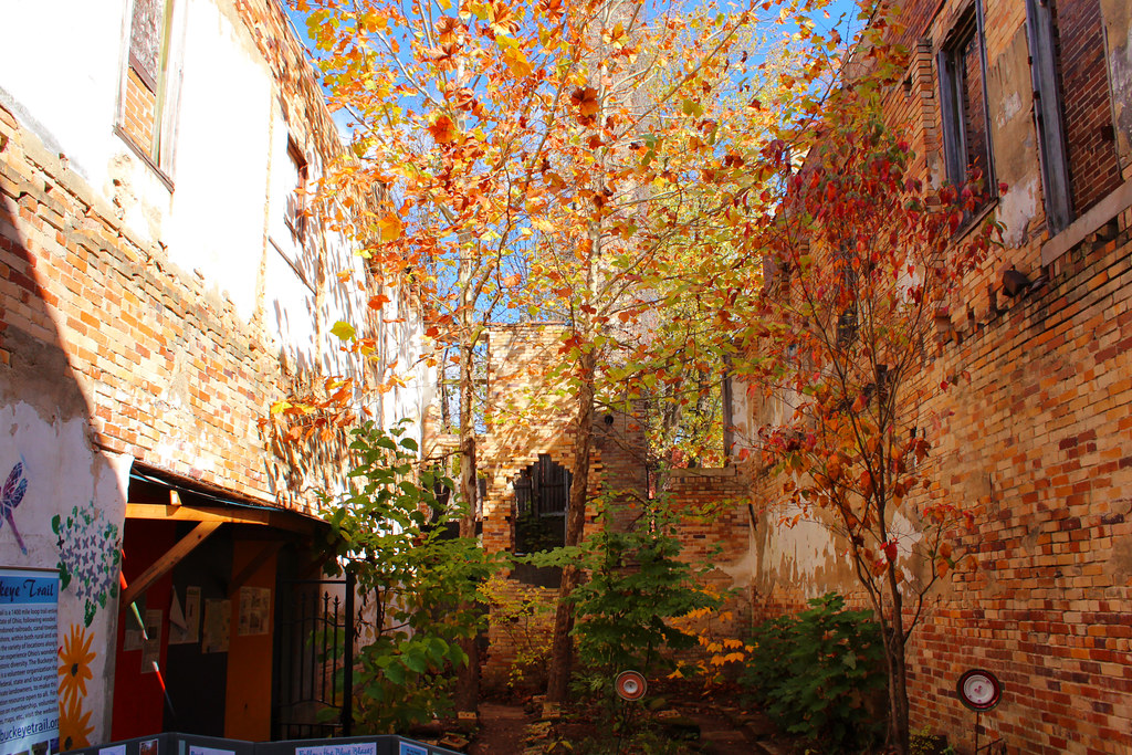
Shawnee Garden
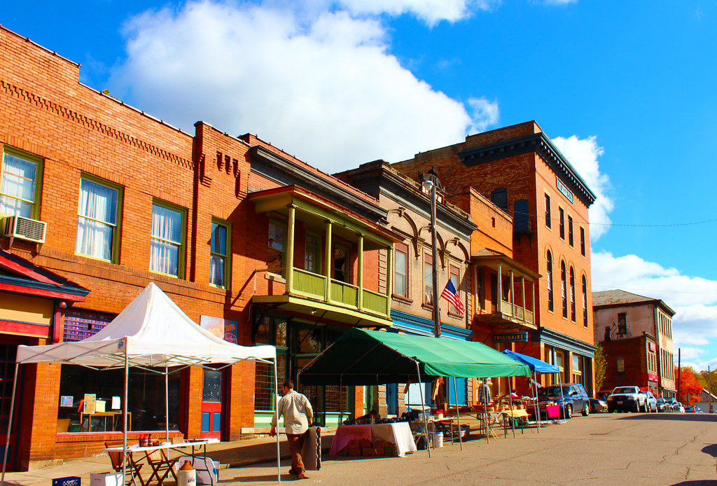
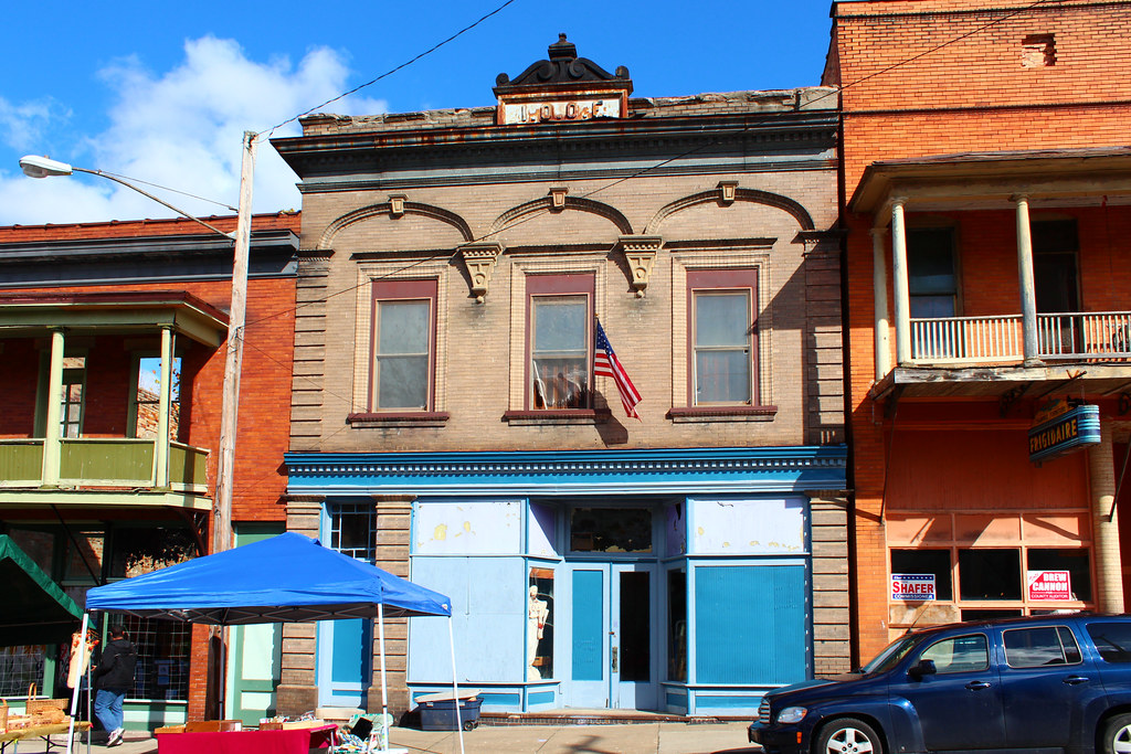
Main Street Shawnee
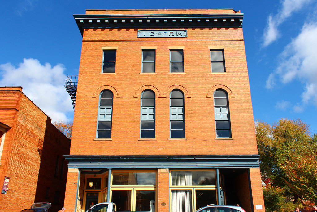
Shawnee Odd Fellows Lodge
Improved Order of Red Men Lodge

Main Street Shawnee
Main & 2nd

Burr Oak State Park
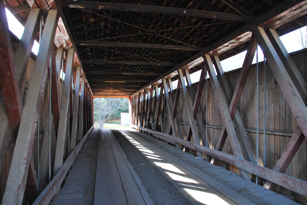
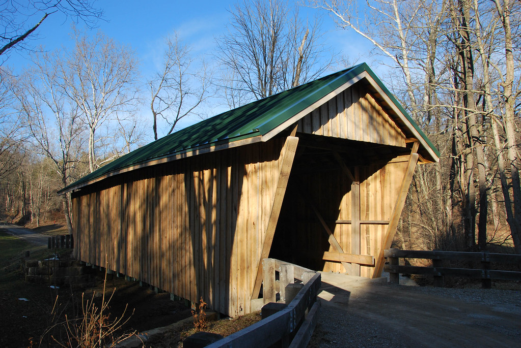
Kidwell Covered Bridge
Adams-San Toy Covered Bridge
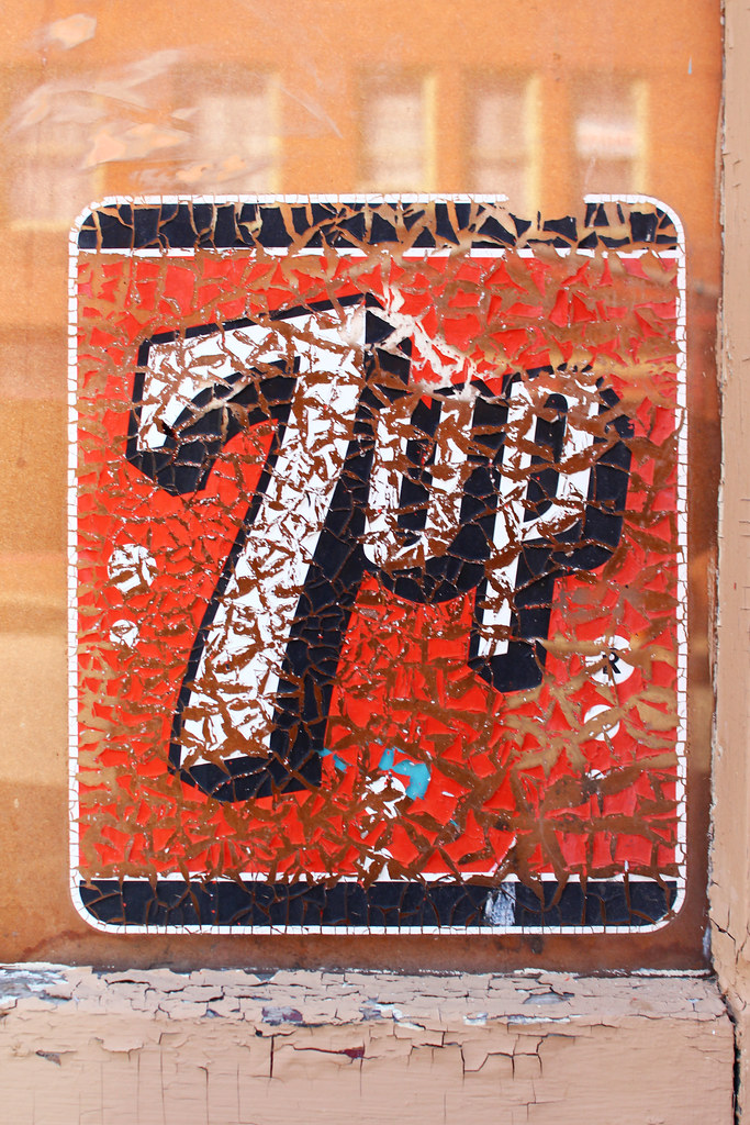
Make 7 Up Yours
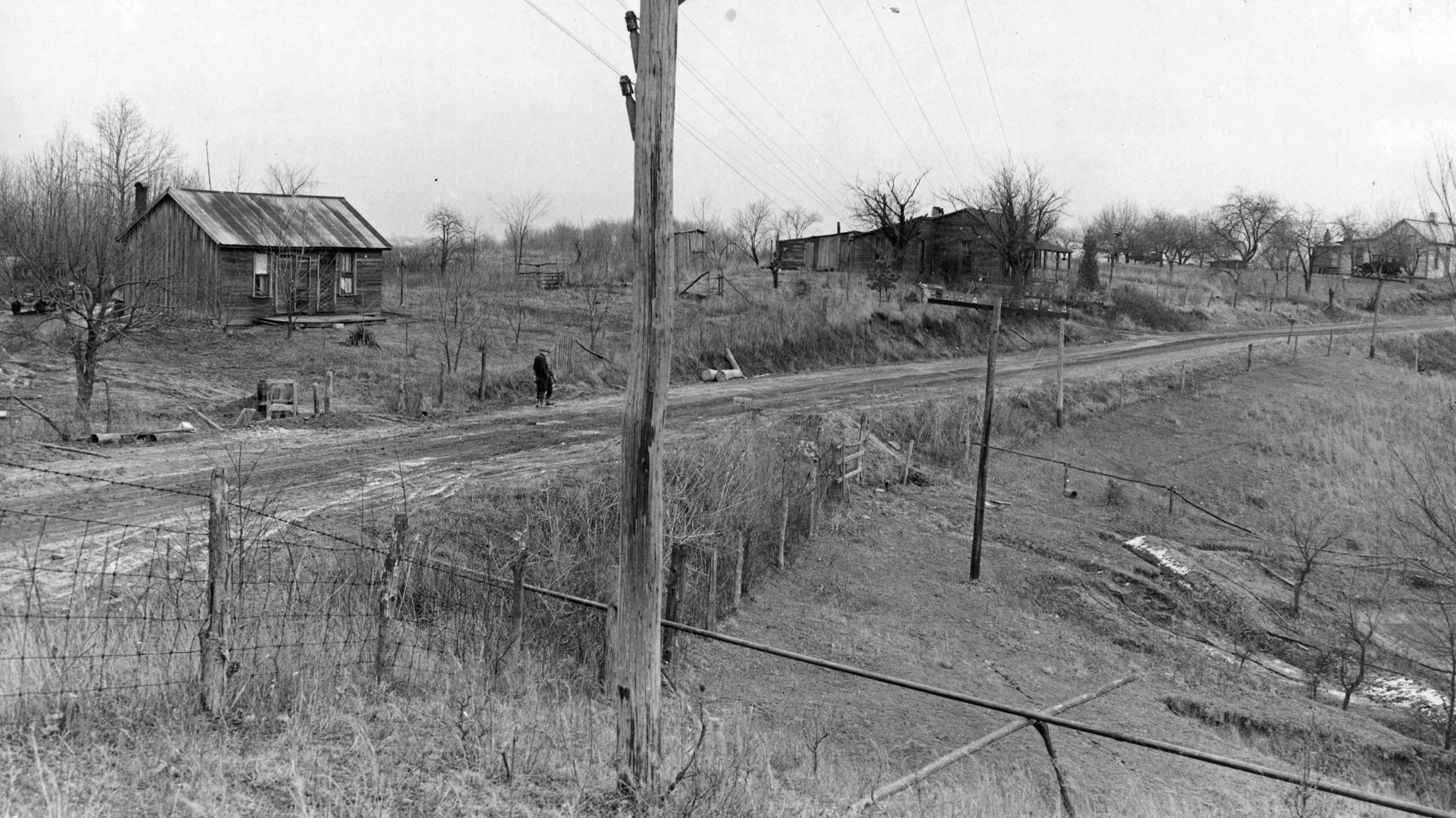
Andrews, Green, and Rush Houses — New Straitsville, Ohio
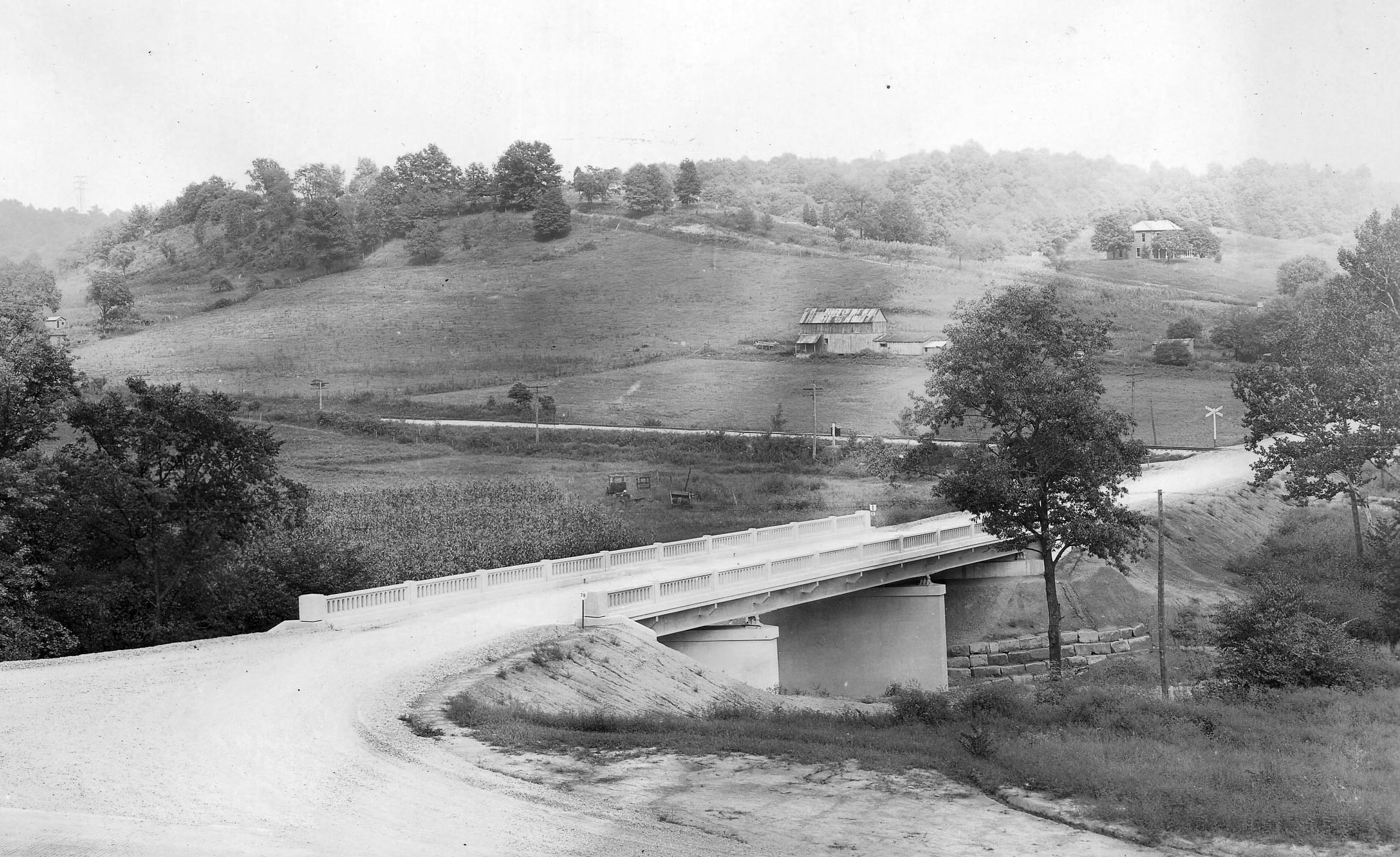
Bridge and Farm — Trimble Township, Athens County, Ohio
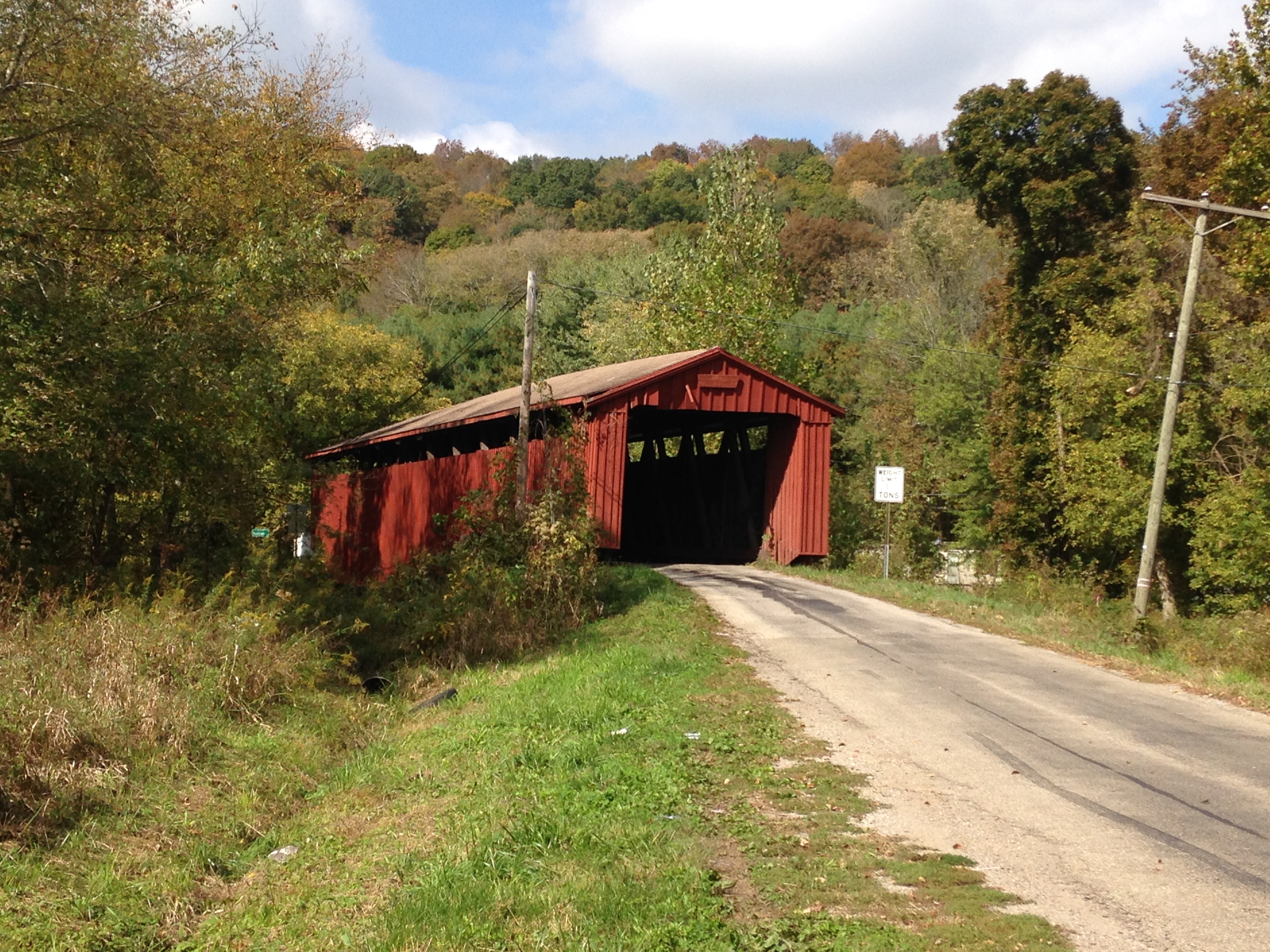
Kidwell Covered Bridge, Athens County, OH
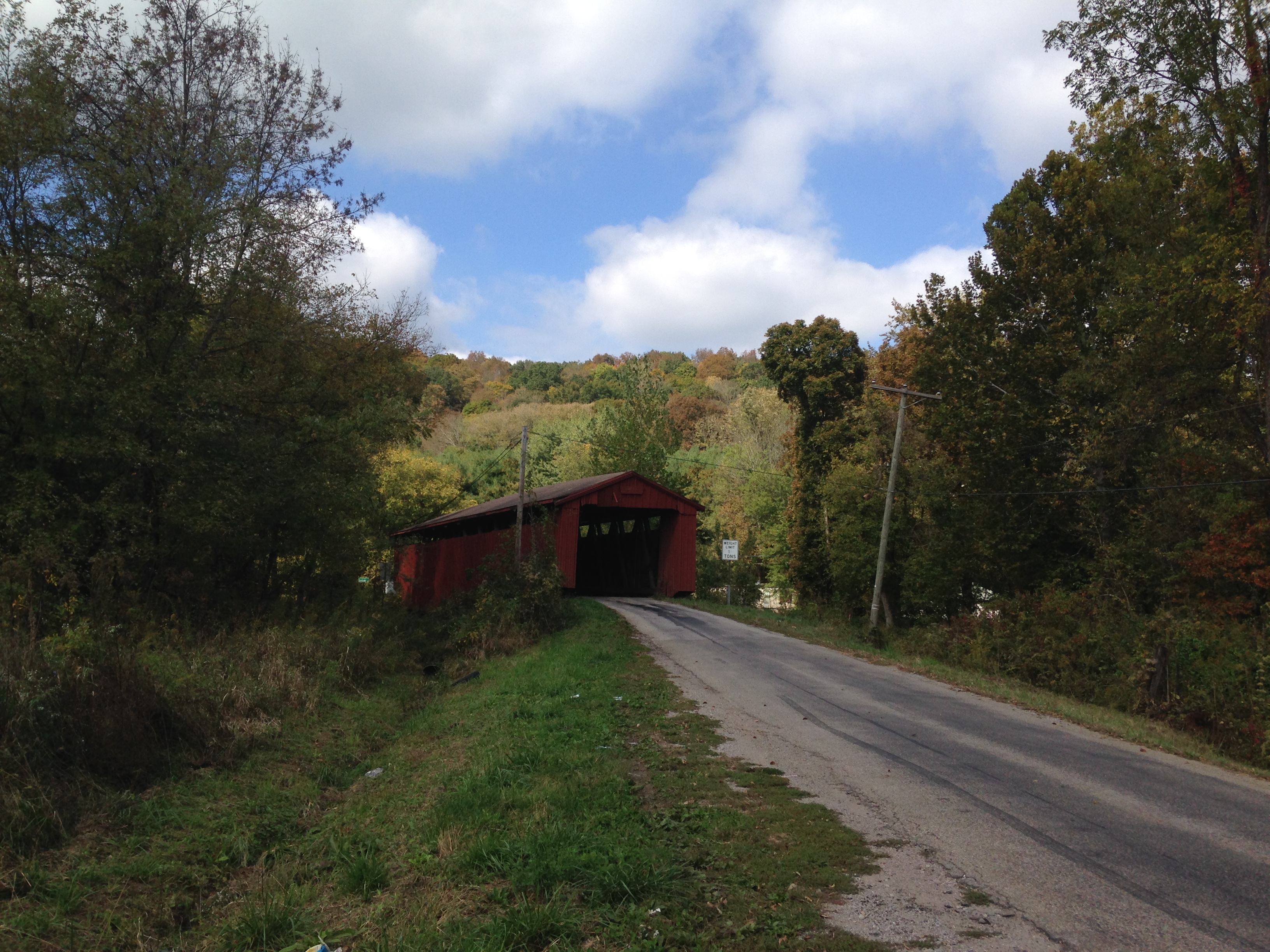
Kidwell Covered Bridge, Athens County, OH
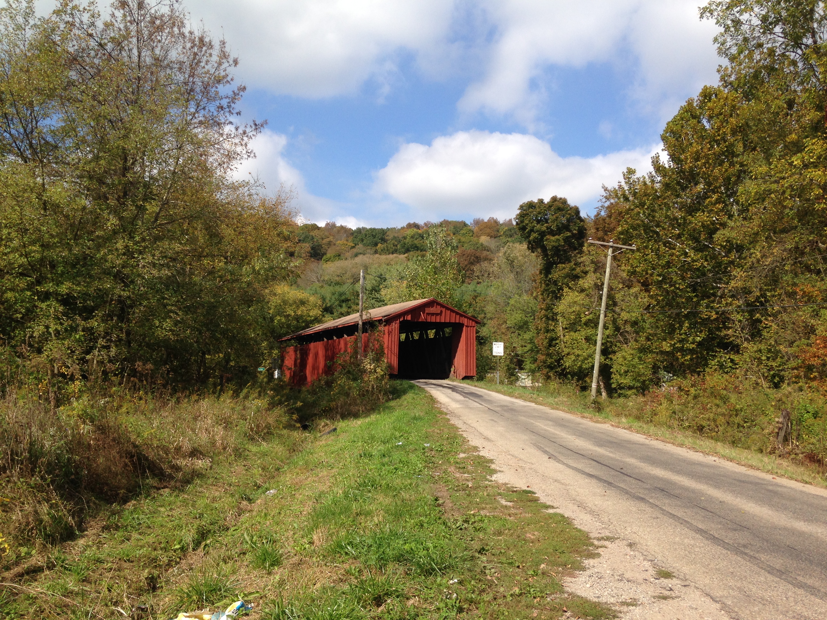
Kidwell Covered Bridge, Athens County, OH
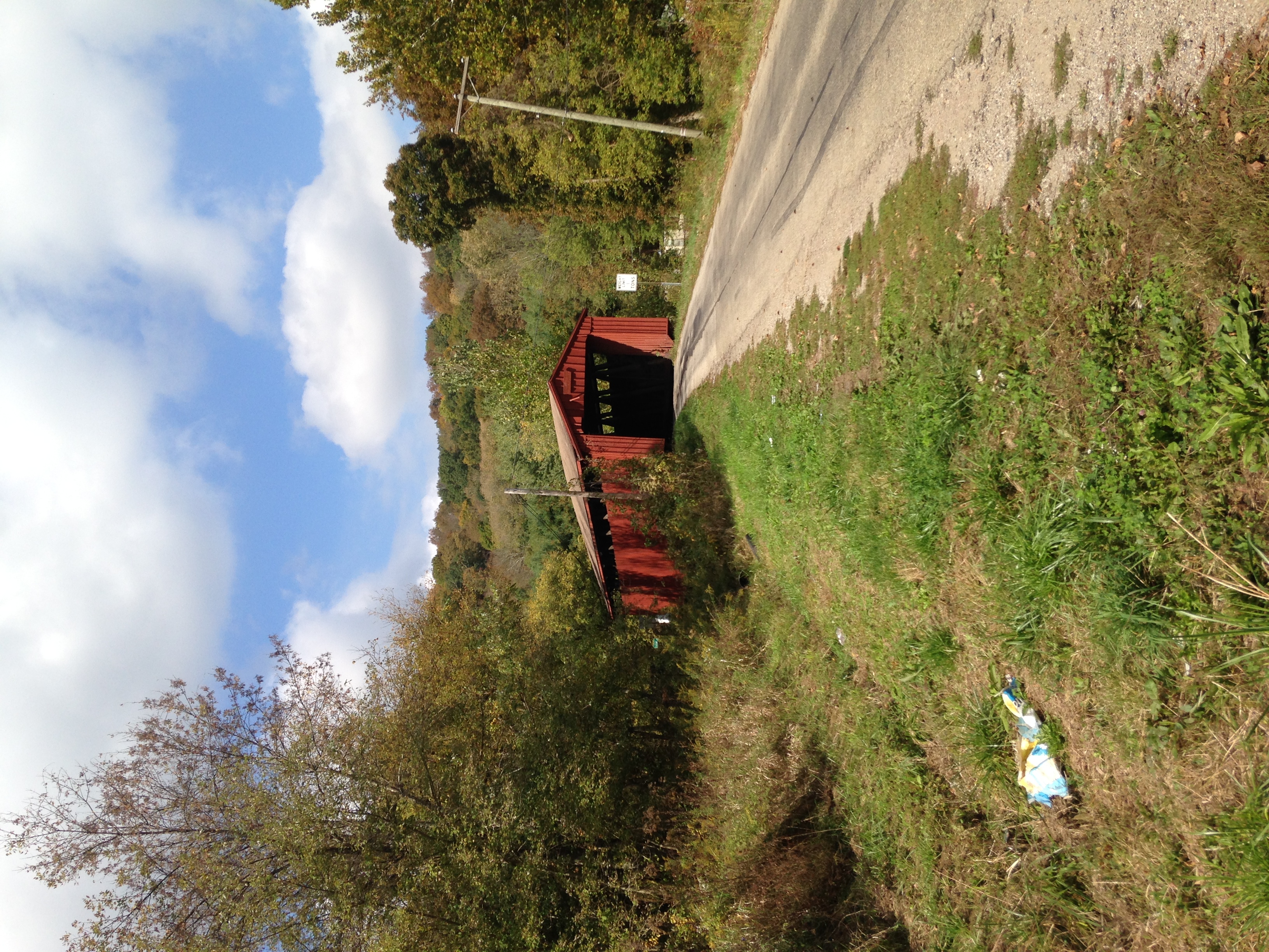
Kidwell Covered Bridge, Athens County, OH
Burr Oak Rd, Glouster, OH アメリカ合衆国の地図
別の場所を検索
近所の場所
Oakdale Rd, Glouster, OH アメリカ合衆国Oakdale Road
Moore Rd, Glouster, OH アメリカ合衆国
アメリカ合衆国 オハイオ州 トリンブル
アメリカ合衆国 〒 オハイオ州 グロースター
アメリカ合衆国 オハイオ州 モンロー
OH-78, Glouster, OH アメリカ合衆国
OH-78 Scenic, Malta, OH アメリカ合衆国
アメリカ合衆国 オハイオ州 ホーマー
Irish Ridge Rd SE, Corning, OH アメリカ合衆国
Township Rd SE, Corning, OH アメリカ合衆国
Pascal Rd, Malta, OH アメリカ合衆国
Pounds Rd, Chesterhill, OH アメリカ合衆国
アメリカ合衆国 オハイオ州 ユニオン
OH-, Malta, OH アメリカ合衆国
OH-, Chesterhill, OH アメリカ合衆国
OH-, Chesterhill, OH アメリカ合衆国
アメリカ合衆国 〒 オハイオ州 ミルフィールド
アメリカ合衆国 〒 オハイオ州 モーガンヴィル
Brandeberry Rd, Malta, OH アメリカ合衆国
アメリカ合衆国 オハイオ州 ベアーフィールド
最近の検索
- Lualaba, Democratic Republic of the Congo日の出日の入り時間
- A Pobra de Trives, Province of Ourense, Spain日の出日の入り時間
- Šodolovci, Croatia日の出日の入り時間
- ドイツ 〒 ピュンデリッヒ日の出日の入り時間
- Steamboat Island Road Northwest, Olympia, WA, USA日の出日の入り時間
- Kootenai Trail Rd, Bonners Ferry, ID アメリカ合衆国日の出日の入り時間
- スイス 〒 メッツォヴィコ=ヴィラ日の出日の入り時間
- 中華人民共和国 四川省 雅安市 宝興県 PPF6+WGM 達瓦更扎日の出日の入り時間
- Hickory Blvd, Bonita Springs, FL, USA日の出日の入り時間
- ナイジェリア 〒 ララグベン 2WWJ+4PJOgbosuware Health Centre日の出日の入り時間