Horas de salida y puesta de sol de Sugarloaf QLD, Australia
Location: Australia > Queensland > Southern Downs Regional >
Zona horaria:
Australia/Brisbane
Hora local:
2024-05-02 21:22:38
Longitud:
152.0244559
Latitud:
-28.6940676
Salida de sol de hoy:
06:19:49 AM
Puesta de sol de hoy:
05:17:54 PM
La duración del día hoy:
10h 58m 5s
Salida de sol de mañana:
06:20:24 AM
Puesta de sol de mañana:
05:17:06 PM
La duración del día mañana:
10h 56m 42s
Mostrar todas las fechas
| Fecha | Salida de sol | Puesta de sol | Duración del día |
|---|---|---|---|
| 01/01/2024 | 04:56:51 AM | 06:53:17 PM | 13h 56m 26s |
| 02/01/2024 | 04:57:32 AM | 06:53:32 PM | 13h 56m 0s |
| 03/01/2024 | 04:58:15 AM | 06:53:45 PM | 13h 55m 30s |
| 04/01/2024 | 04:58:58 AM | 06:53:57 PM | 13h 54m 59s |
| 05/01/2024 | 04:59:42 AM | 06:54:08 PM | 13h 54m 26s |
| 06/01/2024 | 05:00:27 AM | 06:54:17 PM | 13h 53m 50s |
| 07/01/2024 | 05:01:13 AM | 06:54:24 PM | 13h 53m 11s |
| 08/01/2024 | 05:01:59 AM | 06:54:29 PM | 13h 52m 30s |
| 09/01/2024 | 05:02:46 AM | 06:54:33 PM | 13h 51m 47s |
| 10/01/2024 | 05:03:34 AM | 06:54:36 PM | 13h 51m 2s |
| 11/01/2024 | 05:04:22 AM | 06:54:36 PM | 13h 50m 14s |
| 12/01/2024 | 05:05:10 AM | 06:54:35 PM | 13h 49m 25s |
| 13/01/2024 | 05:05:59 AM | 06:54:33 PM | 13h 48m 34s |
| 14/01/2024 | 05:06:48 AM | 06:54:28 PM | 13h 47m 40s |
| 15/01/2024 | 05:07:38 AM | 06:54:22 PM | 13h 46m 44s |
| 16/01/2024 | 05:08:28 AM | 06:54:15 PM | 13h 45m 47s |
| 17/01/2024 | 05:09:18 AM | 06:54:06 PM | 13h 44m 48s |
| 18/01/2024 | 05:10:09 AM | 06:53:55 PM | 13h 43m 46s |
| 19/01/2024 | 05:11:00 AM | 06:53:42 PM | 13h 42m 42s |
| 20/01/2024 | 05:11:51 AM | 06:53:28 PM | 13h 41m 37s |
| 21/01/2024 | 05:12:42 AM | 06:53:13 PM | 13h 40m 31s |
| 22/01/2024 | 05:13:33 AM | 06:52:55 PM | 13h 39m 22s |
| 23/01/2024 | 05:14:24 AM | 06:52:37 PM | 13h 38m 13s |
| 24/01/2024 | 05:15:15 AM | 06:52:16 PM | 13h 37m 1s |
| 25/01/2024 | 05:16:06 AM | 06:51:54 PM | 13h 35m 48s |
| 26/01/2024 | 05:16:58 AM | 06:51:31 PM | 13h 34m 33s |
| 27/01/2024 | 05:17:49 AM | 06:51:06 PM | 13h 33m 17s |
| 28/01/2024 | 05:18:40 AM | 06:50:39 PM | 13h 31m 59s |
| 29/01/2024 | 05:19:31 AM | 06:50:11 PM | 13h 30m 40s |
| 30/01/2024 | 05:20:21 AM | 06:49:41 PM | 13h 29m 20s |
| 31/01/2024 | 05:21:12 AM | 06:49:10 PM | 13h 27m 58s |
| 01/02/2024 | 05:22:02 AM | 06:48:38 PM | 13h 26m 36s |
| 02/02/2024 | 05:22:52 AM | 06:48:04 PM | 13h 25m 12s |
| 03/02/2024 | 05:23:42 AM | 06:47:29 PM | 13h 23m 47s |
| 04/02/2024 | 05:24:32 AM | 06:46:52 PM | 13h 22m 20s |
| 05/02/2024 | 05:25:21 AM | 06:46:14 PM | 13h 20m 53s |
| 06/02/2024 | 05:26:10 AM | 06:45:35 PM | 13h 19m 25s |
| 07/02/2024 | 05:26:59 AM | 06:44:55 PM | 13h 17m 56s |
| 08/02/2024 | 05:27:48 AM | 06:44:13 PM | 13h 16m 25s |
| 09/02/2024 | 05:28:36 AM | 06:43:30 PM | 13h 14m 54s |
| 10/02/2024 | 05:29:23 AM | 06:42:45 PM | 13h 13m 22s |
| 11/02/2024 | 05:30:11 AM | 06:42:00 PM | 13h 11m 49s |
| 12/02/2024 | 05:30:58 AM | 06:41:13 PM | 13h 10m 15s |
| 13/02/2024 | 05:31:44 AM | 06:40:26 PM | 13h 8m 42s |
| 14/02/2024 | 05:32:30 AM | 06:39:37 PM | 13h 7m 7s |
| 15/02/2024 | 05:33:16 AM | 06:38:47 PM | 13h 5m 31s |
| 16/02/2024 | 05:34:02 AM | 06:37:56 PM | 13h 3m 54s |
| 17/02/2024 | 05:34:47 AM | 06:37:04 PM | 13h 2m 17s |
| 18/02/2024 | 05:35:31 AM | 06:36:11 PM | 13h 0m 40s |
| 19/02/2024 | 05:36:15 AM | 06:35:17 PM | 12h 59m 2s |
| 20/02/2024 | 05:36:59 AM | 06:34:22 PM | 12h 57m 23s |
| 21/02/2024 | 05:37:42 AM | 06:33:26 PM | 12h 55m 44s |
| 22/02/2024 | 05:38:25 AM | 06:32:29 PM | 12h 54m 4s |
| 23/02/2024 | 05:39:08 AM | 06:31:32 PM | 12h 52m 24s |
| 24/02/2024 | 05:39:50 AM | 06:30:33 PM | 12h 50m 43s |
| 25/02/2024 | 05:40:32 AM | 06:29:34 PM | 12h 49m 2s |
| 26/02/2024 | 05:41:13 AM | 06:28:34 PM | 12h 47m 21s |
| 27/02/2024 | 05:41:54 AM | 06:27:33 PM | 12h 45m 39s |
| 28/02/2024 | 05:42:34 AM | 06:26:32 PM | 12h 43m 58s |
| 29/02/2024 | 05:43:14 AM | 06:25:30 PM | 12h 42m 16s |
| 01/03/2024 | 05:43:54 AM | 06:24:27 PM | 12h 40m 33s |
| 02/03/2024 | 05:44:33 AM | 06:23:24 PM | 12h 38m 51s |
| 03/03/2024 | 05:45:12 AM | 06:22:20 PM | 12h 37m 8s |
| 04/03/2024 | 05:45:51 AM | 06:21:15 PM | 12h 35m 24s |
| 05/03/2024 | 05:46:29 AM | 06:20:10 PM | 12h 33m 41s |
| 06/03/2024 | 05:47:07 AM | 06:19:04 PM | 12h 31m 57s |
| 07/03/2024 | 05:47:45 AM | 06:17:58 PM | 12h 30m 13s |
| 08/03/2024 | 05:48:22 AM | 06:16:52 PM | 12h 28m 30s |
| 09/03/2024 | 05:48:59 AM | 06:15:45 PM | 12h 26m 46s |
| 10/03/2024 | 05:49:35 AM | 06:14:38 PM | 12h 25m 3s |
| 11/03/2024 | 05:50:12 AM | 06:13:30 PM | 12h 23m 18s |
| 12/03/2024 | 05:50:48 AM | 06:12:22 PM | 12h 21m 34s |
| 13/03/2024 | 05:51:24 AM | 06:11:14 PM | 12h 19m 50s |
| 14/03/2024 | 05:51:59 AM | 06:10:05 PM | 12h 18m 6s |
| 15/03/2024 | 05:52:34 AM | 06:08:56 PM | 12h 16m 22s |
| 16/03/2024 | 05:53:09 AM | 06:07:47 PM | 12h 14m 38s |
| 17/03/2024 | 05:53:44 AM | 06:06:38 PM | 12h 12m 54s |
| 18/03/2024 | 05:54:19 AM | 06:05:28 PM | 12h 11m 9s |
| 19/03/2024 | 05:54:53 AM | 06:04:19 PM | 12h 9m 26s |
| 20/03/2024 | 05:55:28 AM | 06:03:09 PM | 12h 7m 41s |
| 21/03/2024 | 05:56:02 AM | 06:02:00 PM | 12h 5m 58s |
| 22/03/2024 | 05:56:36 AM | 06:00:50 PM | 12h 4m 14s |
| 23/03/2024 | 05:57:10 AM | 05:59:40 PM | 12h 2m 30s |
| 24/03/2024 | 05:57:43 AM | 05:58:30 PM | 12h 0m 47s |
| 25/03/2024 | 05:58:17 AM | 05:57:20 PM | 11h 59m 3s |
| 26/03/2024 | 05:58:50 AM | 05:56:11 PM | 11h 57m 21s |
| 27/03/2024 | 05:59:24 AM | 05:55:01 PM | 11h 55m 37s |
| 28/03/2024 | 05:59:57 AM | 05:53:52 PM | 11h 53m 55s |
| 29/03/2024 | 06:00:30 AM | 05:52:42 PM | 11h 52m 12s |
| 30/03/2024 | 06:01:03 AM | 05:51:33 PM | 11h 50m 30s |
| 31/03/2024 | 06:01:37 AM | 05:50:24 PM | 11h 48m 47s |
| 01/04/2024 | 06:02:10 AM | 05:49:15 PM | 11h 47m 5s |
| 02/04/2024 | 06:02:43 AM | 05:48:07 PM | 11h 45m 24s |
| 03/04/2024 | 06:03:16 AM | 05:46:59 PM | 11h 43m 43s |
| 04/04/2024 | 06:03:49 AM | 05:45:51 PM | 11h 42m 2s |
| 05/04/2024 | 06:04:22 AM | 05:44:43 PM | 11h 40m 21s |
| 06/04/2024 | 06:04:55 AM | 05:43:36 PM | 11h 38m 41s |
| 07/04/2024 | 06:05:28 AM | 05:42:29 PM | 11h 37m 1s |
| 08/04/2024 | 06:06:02 AM | 05:41:23 PM | 11h 35m 21s |
| 09/04/2024 | 06:06:35 AM | 05:40:17 PM | 11h 33m 42s |
| 10/04/2024 | 06:07:08 AM | 05:39:11 PM | 11h 32m 3s |
| 11/04/2024 | 06:07:42 AM | 05:38:06 PM | 11h 30m 24s |
| 12/04/2024 | 06:08:15 AM | 05:37:01 PM | 11h 28m 46s |
| 13/04/2024 | 06:08:49 AM | 05:35:57 PM | 11h 27m 8s |
| 14/04/2024 | 06:09:22 AM | 05:34:54 PM | 11h 25m 32s |
| 15/04/2024 | 06:09:56 AM | 05:33:51 PM | 11h 23m 55s |
| 16/04/2024 | 06:10:30 AM | 05:32:49 PM | 11h 22m 19s |
| 17/04/2024 | 06:11:04 AM | 05:31:47 PM | 11h 20m 43s |
| 18/04/2024 | 06:11:38 AM | 05:30:47 PM | 11h 19m 9s |
| 19/04/2024 | 06:12:12 AM | 05:29:46 PM | 11h 17m 34s |
| 20/04/2024 | 06:12:46 AM | 05:28:47 PM | 11h 16m 1s |
| 21/04/2024 | 06:13:21 AM | 05:27:48 PM | 11h 14m 27s |
| 22/04/2024 | 06:13:55 AM | 05:26:50 PM | 11h 12m 55s |
| 23/04/2024 | 06:14:30 AM | 05:25:53 PM | 11h 11m 23s |
| 24/04/2024 | 06:15:04 AM | 05:24:57 PM | 11h 9m 53s |
| 25/04/2024 | 06:15:39 AM | 05:24:01 PM | 11h 8m 22s |
| 26/04/2024 | 06:16:14 AM | 05:23:07 PM | 11h 6m 53s |
| 27/04/2024 | 06:16:49 AM | 05:22:13 PM | 11h 5m 24s |
| 28/04/2024 | 06:17:24 AM | 05:21:20 PM | 11h 3m 56s |
| 29/04/2024 | 06:18:00 AM | 05:20:28 PM | 11h 2m 28s |
| 30/04/2024 | 06:18:35 AM | 05:19:37 PM | 11h 1m 2s |
| 01/05/2024 | 06:19:10 AM | 05:18:47 PM | 10h 59m 37s |
| 02/05/2024 | 06:19:46 AM | 05:17:58 PM | 10h 58m 12s |
| 03/05/2024 | 06:20:21 AM | 05:17:10 PM | 10h 56m 49s |
| 04/05/2024 | 06:20:57 AM | 05:16:23 PM | 10h 55m 26s |
| 05/05/2024 | 06:21:33 AM | 05:15:38 PM | 10h 54m 5s |
| 06/05/2024 | 06:22:08 AM | 05:14:53 PM | 10h 52m 45s |
| 07/05/2024 | 06:22:44 AM | 05:14:09 PM | 10h 51m 25s |
| 08/05/2024 | 06:23:20 AM | 05:13:27 PM | 10h 50m 7s |
| 09/05/2024 | 06:23:56 AM | 05:12:45 PM | 10h 48m 49s |
| 10/05/2024 | 06:24:31 AM | 05:12:05 PM | 10h 47m 34s |
| 11/05/2024 | 06:25:07 AM | 05:11:26 PM | 10h 46m 19s |
| 12/05/2024 | 06:25:43 AM | 05:10:48 PM | 10h 45m 5s |
| 13/05/2024 | 06:26:18 AM | 05:10:11 PM | 10h 43m 53s |
| 14/05/2024 | 06:26:54 AM | 05:09:36 PM | 10h 42m 42s |
| 15/05/2024 | 06:27:29 AM | 05:09:02 PM | 10h 41m 33s |
| 16/05/2024 | 06:28:05 AM | 05:08:29 PM | 10h 40m 24s |
| 17/05/2024 | 06:28:40 AM | 05:07:57 PM | 10h 39m 17s |
| 18/05/2024 | 06:29:15 AM | 05:07:27 PM | 10h 38m 12s |
| 19/05/2024 | 06:29:50 AM | 05:06:57 PM | 10h 37m 7s |
| 20/05/2024 | 06:30:25 AM | 05:06:30 PM | 10h 36m 5s |
| 21/05/2024 | 06:30:59 AM | 05:06:03 PM | 10h 35m 4s |
| 22/05/2024 | 06:31:33 AM | 05:05:38 PM | 10h 34m 5s |
| 23/05/2024 | 06:32:07 AM | 05:05:14 PM | 10h 33m 7s |
| 24/05/2024 | 06:32:41 AM | 05:04:51 PM | 10h 32m 10s |
| 25/05/2024 | 06:33:14 AM | 05:04:30 PM | 10h 31m 16s |
| 26/05/2024 | 06:33:47 AM | 05:04:10 PM | 10h 30m 23s |
| 27/05/2024 | 06:34:19 AM | 05:03:51 PM | 10h 29m 32s |
| 28/05/2024 | 06:34:51 AM | 05:03:34 PM | 10h 28m 43s |
| 29/05/2024 | 06:35:23 AM | 05:03:18 PM | 10h 27m 55s |
| 30/05/2024 | 06:35:54 AM | 05:03:04 PM | 10h 27m 10s |
| 31/05/2024 | 06:36:25 AM | 05:02:50 PM | 10h 26m 25s |
| 01/06/2024 | 06:36:55 AM | 05:02:39 PM | 10h 25m 44s |
| 02/06/2024 | 06:37:24 AM | 05:02:28 PM | 10h 25m 4s |
| 03/06/2024 | 06:37:53 AM | 05:02:19 PM | 10h 24m 26s |
| 04/06/2024 | 06:38:22 AM | 05:02:11 PM | 10h 23m 49s |
| 05/06/2024 | 06:38:50 AM | 05:02:04 PM | 10h 23m 14s |
| 06/06/2024 | 06:39:17 AM | 05:01:59 PM | 10h 22m 42s |
| 07/06/2024 | 06:39:43 AM | 05:01:55 PM | 10h 22m 12s |
| 08/06/2024 | 06:40:08 AM | 05:01:53 PM | 10h 21m 45s |
| 09/06/2024 | 06:40:33 AM | 05:01:51 PM | 10h 21m 18s |
| 10/06/2024 | 06:40:57 AM | 05:01:51 PM | 10h 20m 54s |
| 11/06/2024 | 06:41:20 AM | 05:01:52 PM | 10h 20m 32s |
| 12/06/2024 | 06:41:43 AM | 05:01:55 PM | 10h 20m 12s |
| 13/06/2024 | 06:42:04 AM | 05:01:58 PM | 10h 19m 54s |
| 14/06/2024 | 06:42:25 AM | 05:02:03 PM | 10h 19m 38s |
| 15/06/2024 | 06:42:44 AM | 05:02:09 PM | 10h 19m 25s |
| 16/06/2024 | 06:43:03 AM | 05:02:17 PM | 10h 19m 14s |
| 17/06/2024 | 06:43:20 AM | 05:02:25 PM | 10h 19m 5s |
| 18/06/2024 | 06:43:37 AM | 05:02:35 PM | 10h 18m 58s |
| 19/06/2024 | 06:43:52 AM | 05:02:45 PM | 10h 18m 53s |
| 20/06/2024 | 06:44:07 AM | 05:02:57 PM | 10h 18m 50s |
| 21/06/2024 | 06:44:20 AM | 05:03:10 PM | 10h 18m 50s |
| 22/06/2024 | 06:44:32 AM | 05:03:24 PM | 10h 18m 52s |
| 23/06/2024 | 06:44:43 AM | 05:03:39 PM | 10h 18m 56s |
| 24/06/2024 | 06:44:53 AM | 05:03:55 PM | 10h 19m 2s |
| 25/06/2024 | 06:45:02 AM | 05:04:12 PM | 10h 19m 10s |
| 26/06/2024 | 06:45:09 AM | 05:04:29 PM | 10h 19m 20s |
| 27/06/2024 | 06:45:15 AM | 05:04:48 PM | 10h 19m 33s |
| 28/06/2024 | 06:45:20 AM | 05:05:08 PM | 10h 19m 48s |
| 29/06/2024 | 06:45:24 AM | 05:05:28 PM | 10h 20m 4s |
| 30/06/2024 | 06:45:26 AM | 05:05:50 PM | 10h 20m 24s |
| 01/07/2024 | 06:45:27 AM | 05:06:12 PM | 10h 20m 45s |
| 02/07/2024 | 06:45:27 AM | 05:06:35 PM | 10h 21m 8s |
| 03/07/2024 | 06:45:26 AM | 05:06:58 PM | 10h 21m 32s |
| 04/07/2024 | 06:45:23 AM | 05:07:23 PM | 10h 22m 0s |
| 05/07/2024 | 06:45:19 AM | 05:07:48 PM | 10h 22m 29s |
| 06/07/2024 | 06:45:13 AM | 05:08:14 PM | 10h 23m 1s |
| 07/07/2024 | 06:45:06 AM | 05:08:40 PM | 10h 23m 34s |
| 08/07/2024 | 06:44:58 AM | 05:09:07 PM | 10h 24m 9s |
| 09/07/2024 | 06:44:48 AM | 05:09:34 PM | 10h 24m 46s |
| 10/07/2024 | 06:44:37 AM | 05:10:02 PM | 10h 25m 25s |
| 11/07/2024 | 06:44:25 AM | 05:10:31 PM | 10h 26m 6s |
| 12/07/2024 | 06:44:11 AM | 05:11:00 PM | 10h 26m 49s |
| 13/07/2024 | 06:43:56 AM | 05:11:29 PM | 10h 27m 33s |
| 14/07/2024 | 06:43:39 AM | 05:11:59 PM | 10h 28m 20s |
| 15/07/2024 | 06:43:21 AM | 05:12:29 PM | 10h 29m 8s |
| 16/07/2024 | 06:43:02 AM | 05:13:00 PM | 10h 29m 58s |
| 17/07/2024 | 06:42:41 AM | 05:13:31 PM | 10h 30m 50s |
| 18/07/2024 | 06:42:19 AM | 05:14:02 PM | 10h 31m 43s |
| 19/07/2024 | 06:41:56 AM | 05:14:34 PM | 10h 32m 38s |
| 20/07/2024 | 06:41:31 AM | 05:15:06 PM | 10h 33m 35s |
| 21/07/2024 | 06:41:05 AM | 05:15:38 PM | 10h 34m 33s |
| 22/07/2024 | 06:40:37 AM | 05:16:10 PM | 10h 35m 33s |
| 23/07/2024 | 06:40:09 AM | 05:16:42 PM | 10h 36m 33s |
| 24/07/2024 | 06:39:39 AM | 05:17:15 PM | 10h 37m 36s |
| 25/07/2024 | 06:39:07 AM | 05:17:47 PM | 10h 38m 40s |
| 26/07/2024 | 06:38:34 AM | 05:18:20 PM | 10h 39m 46s |
| 27/07/2024 | 06:38:00 AM | 05:18:53 PM | 10h 40m 53s |
| 28/07/2024 | 06:37:25 AM | 05:19:26 PM | 10h 42m 1s |
| 29/07/2024 | 06:36:48 AM | 05:19:59 PM | 10h 43m 11s |
| 30/07/2024 | 06:36:11 AM | 05:20:32 PM | 10h 44m 21s |
| 31/07/2024 | 06:35:31 AM | 05:21:05 PM | 10h 45m 34s |
| 01/08/2024 | 06:34:51 AM | 05:21:38 PM | 10h 46m 47s |
| 02/08/2024 | 06:34:10 AM | 05:22:11 PM | 10h 48m 1s |
| 03/08/2024 | 06:33:27 AM | 05:22:44 PM | 10h 49m 17s |
| 04/08/2024 | 06:32:43 AM | 05:23:17 PM | 10h 50m 34s |
| 05/08/2024 | 06:31:58 AM | 05:23:50 PM | 10h 51m 52s |
| 06/08/2024 | 06:31:12 AM | 05:24:23 PM | 10h 53m 11s |
| 07/08/2024 | 06:30:25 AM | 05:24:55 PM | 10h 54m 30s |
| 08/08/2024 | 06:29:37 AM | 05:25:28 PM | 10h 55m 51s |
| 09/08/2024 | 06:28:47 AM | 05:26:01 PM | 10h 57m 14s |
| 10/08/2024 | 06:27:57 AM | 05:26:33 PM | 10h 58m 36s |
| 11/08/2024 | 06:27:06 AM | 05:27:05 PM | 10h 59m 59s |
| 12/08/2024 | 06:26:13 AM | 05:27:38 PM | 11h 1m 25s |
| 13/08/2024 | 06:25:20 AM | 05:28:10 PM | 11h 2m 50s |
| 14/08/2024 | 06:24:25 AM | 05:28:41 PM | 11h 4m 16s |
| 15/08/2024 | 06:23:30 AM | 05:29:13 PM | 11h 5m 43s |
| 16/08/2024 | 06:22:34 AM | 05:29:45 PM | 11h 7m 11s |
| 17/08/2024 | 06:21:37 AM | 05:30:16 PM | 11h 8m 39s |
| 18/08/2024 | 06:20:39 AM | 05:30:48 PM | 11h 10m 9s |
| 19/08/2024 | 06:19:40 AM | 05:31:19 PM | 11h 11m 39s |
| 20/08/2024 | 06:18:40 AM | 05:31:50 PM | 11h 13m 10s |
| 21/08/2024 | 06:17:40 AM | 05:32:21 PM | 11h 14m 41s |
| 22/08/2024 | 06:16:39 AM | 05:32:52 PM | 11h 16m 13s |
| 23/08/2024 | 06:15:37 AM | 05:33:22 PM | 11h 17m 45s |
| 24/08/2024 | 06:14:34 AM | 05:33:53 PM | 11h 19m 19s |
| 25/08/2024 | 06:13:31 AM | 05:34:23 PM | 11h 20m 52s |
| 26/08/2024 | 06:12:27 AM | 05:34:53 PM | 11h 22m 26s |
| 27/08/2024 | 06:11:22 AM | 05:35:23 PM | 11h 24m 1s |
| 28/08/2024 | 06:10:17 AM | 05:35:53 PM | 11h 25m 36s |
| 29/08/2024 | 06:09:11 AM | 05:36:23 PM | 11h 27m 12s |
| 30/08/2024 | 06:08:05 AM | 05:36:53 PM | 11h 28m 48s |
| 31/08/2024 | 06:06:58 AM | 05:37:22 PM | 11h 30m 24s |
| 01/09/2024 | 06:05:50 AM | 05:37:52 PM | 11h 32m 2s |
| 02/09/2024 | 06:04:42 AM | 05:38:21 PM | 11h 33m 39s |
| 03/09/2024 | 06:03:34 AM | 05:38:51 PM | 11h 35m 17s |
| 04/09/2024 | 06:02:25 AM | 05:39:20 PM | 11h 36m 55s |
| 05/09/2024 | 06:01:15 AM | 05:39:49 PM | 11h 38m 34s |
| 06/09/2024 | 06:00:06 AM | 05:40:18 PM | 11h 40m 12s |
| 07/09/2024 | 05:58:56 AM | 05:40:47 PM | 11h 41m 51s |
| 08/09/2024 | 05:57:45 AM | 05:41:16 PM | 11h 43m 31s |
| 09/09/2024 | 05:56:35 AM | 05:41:46 PM | 11h 45m 11s |
| 10/09/2024 | 05:55:24 AM | 05:42:15 PM | 11h 46m 51s |
| 11/09/2024 | 05:54:12 AM | 05:42:44 PM | 11h 48m 32s |
| 12/09/2024 | 05:53:01 AM | 05:43:13 PM | 11h 50m 12s |
| 13/09/2024 | 05:51:49 AM | 05:43:42 PM | 11h 51m 53s |
| 14/09/2024 | 05:50:37 AM | 05:44:11 PM | 11h 53m 34s |
| 15/09/2024 | 05:49:25 AM | 05:44:40 PM | 11h 55m 15s |
| 16/09/2024 | 05:48:13 AM | 05:45:09 PM | 11h 56m 56s |
| 17/09/2024 | 05:47:01 AM | 05:45:39 PM | 11h 58m 38s |
| 18/09/2024 | 05:45:49 AM | 05:46:08 PM | 12h 0m 19s |
| 19/09/2024 | 05:44:36 AM | 05:46:38 PM | 12h 2m 2s |
| 20/09/2024 | 05:43:24 AM | 05:47:07 PM | 12h 3m 43s |
| 21/09/2024 | 05:42:12 AM | 05:47:37 PM | 12h 5m 25s |
| 22/09/2024 | 05:40:59 AM | 05:48:07 PM | 12h 7m 8s |
| 23/09/2024 | 05:39:47 AM | 05:48:37 PM | 12h 8m 50s |
| 24/09/2024 | 05:38:35 AM | 05:49:07 PM | 12h 10m 32s |
| 25/09/2024 | 05:37:23 AM | 05:49:38 PM | 12h 12m 15s |
| 26/09/2024 | 05:36:11 AM | 05:50:08 PM | 12h 13m 57s |
| 27/09/2024 | 05:34:59 AM | 05:50:39 PM | 12h 15m 40s |
| 28/09/2024 | 05:33:48 AM | 05:51:10 PM | 12h 17m 22s |
| 29/09/2024 | 05:32:37 AM | 05:51:42 PM | 12h 19m 5s |
| 30/09/2024 | 05:31:26 AM | 05:52:13 PM | 12h 20m 47s |
| 01/10/2024 | 05:30:15 AM | 05:52:45 PM | 12h 22m 30s |
| 02/10/2024 | 05:29:04 AM | 05:53:17 PM | 12h 24m 13s |
| 03/10/2024 | 05:27:54 AM | 05:53:49 PM | 12h 25m 55s |
| 04/10/2024 | 05:26:45 AM | 05:54:22 PM | 12h 27m 37s |
| 05/10/2024 | 05:25:35 AM | 05:54:55 PM | 12h 29m 20s |
| 06/10/2024 | 05:24:27 AM | 05:55:28 PM | 12h 31m 1s |
| 07/10/2024 | 05:23:18 AM | 05:56:02 PM | 12h 32m 44s |
| 08/10/2024 | 05:22:10 AM | 05:56:36 PM | 12h 34m 26s |
| 09/10/2024 | 05:21:03 AM | 05:57:10 PM | 12h 36m 7s |
| 10/10/2024 | 05:19:56 AM | 05:57:45 PM | 12h 37m 49s |
| 11/10/2024 | 05:18:50 AM | 05:58:20 PM | 12h 39m 30s |
| 12/10/2024 | 05:17:44 AM | 05:58:56 PM | 12h 41m 12s |
| 13/10/2024 | 05:16:39 AM | 05:59:32 PM | 12h 42m 53s |
| 14/10/2024 | 05:15:35 AM | 06:00:08 PM | 12h 44m 33s |
| 15/10/2024 | 05:14:31 AM | 06:00:45 PM | 12h 46m 14s |
| 16/10/2024 | 05:13:28 AM | 06:01:22 PM | 12h 47m 54s |
| 17/10/2024 | 05:12:26 AM | 06:01:59 PM | 12h 49m 33s |
| 18/10/2024 | 05:11:25 AM | 06:02:37 PM | 12h 51m 12s |
| 19/10/2024 | 05:10:24 AM | 06:03:16 PM | 12h 52m 52s |
| 20/10/2024 | 05:09:24 AM | 06:03:54 PM | 12h 54m 30s |
| 21/10/2024 | 05:08:25 AM | 06:04:34 PM | 12h 56m 9s |
| 22/10/2024 | 05:07:27 AM | 06:05:13 PM | 12h 57m 46s |
| 23/10/2024 | 05:06:30 AM | 06:05:53 PM | 12h 59m 23s |
| 24/10/2024 | 05:05:34 AM | 06:06:34 PM | 13h 1m 0s |
| 25/10/2024 | 05:04:39 AM | 06:07:15 PM | 13h 2m 36s |
| 26/10/2024 | 05:03:45 AM | 06:07:57 PM | 13h 4m 12s |
| 27/10/2024 | 05:02:51 AM | 06:08:38 PM | 13h 5m 47s |
| 28/10/2024 | 05:01:59 AM | 06:09:21 PM | 13h 7m 22s |
| 29/10/2024 | 05:01:08 AM | 06:10:04 PM | 13h 8m 56s |
| 30/10/2024 | 05:00:18 AM | 06:10:47 PM | 13h 10m 29s |
| 31/10/2024 | 04:59:30 AM | 06:11:30 PM | 13h 12m 0s |
| 01/11/2024 | 04:58:42 AM | 06:12:14 PM | 13h 13m 32s |
| 02/11/2024 | 04:57:56 AM | 06:12:59 PM | 13h 15m 3s |
| 03/11/2024 | 04:57:11 AM | 06:13:44 PM | 13h 16m 33s |
| 04/11/2024 | 04:56:27 AM | 06:14:29 PM | 13h 18m 2s |
| 05/11/2024 | 04:55:44 AM | 06:15:15 PM | 13h 19m 31s |
| 06/11/2024 | 04:55:03 AM | 06:16:01 PM | 13h 20m 58s |
| 07/11/2024 | 04:54:23 AM | 06:16:47 PM | 13h 22m 24s |
| 08/11/2024 | 04:53:44 AM | 06:17:34 PM | 13h 23m 50s |
| 09/11/2024 | 04:53:07 AM | 06:18:20 PM | 13h 25m 13s |
| 10/11/2024 | 04:52:31 AM | 06:19:08 PM | 13h 26m 37s |
| 11/11/2024 | 04:51:56 AM | 06:19:55 PM | 13h 27m 59s |
| 12/11/2024 | 04:51:23 AM | 06:20:43 PM | 13h 29m 20s |
| 13/11/2024 | 04:50:52 AM | 06:21:31 PM | 13h 30m 39s |
| 14/11/2024 | 04:50:22 AM | 06:22:19 PM | 13h 31m 57s |
| 15/11/2024 | 04:49:53 AM | 06:23:08 PM | 13h 33m 15s |
| 16/11/2024 | 04:49:26 AM | 06:23:56 PM | 13h 34m 30s |
| 17/11/2024 | 04:49:01 AM | 06:24:45 PM | 13h 35m 44s |
| 18/11/2024 | 04:48:37 AM | 06:25:34 PM | 13h 36m 57s |
| 19/11/2024 | 04:48:15 AM | 06:26:22 PM | 13h 38m 7s |
| 20/11/2024 | 04:47:54 AM | 06:27:11 PM | 13h 39m 17s |
| 21/11/2024 | 04:47:35 AM | 06:28:00 PM | 13h 40m 25s |
| 22/11/2024 | 04:47:17 AM | 06:28:49 PM | 13h 41m 32s |
| 23/11/2024 | 04:47:02 AM | 06:29:38 PM | 13h 42m 36s |
| 24/11/2024 | 04:46:47 AM | 06:30:27 PM | 13h 43m 40s |
| 25/11/2024 | 04:46:35 AM | 06:31:15 PM | 13h 44m 40s |
| 26/11/2024 | 04:46:24 AM | 06:32:04 PM | 13h 45m 40s |
| 27/11/2024 | 04:46:15 AM | 06:32:52 PM | 13h 46m 37s |
| 28/11/2024 | 04:46:07 AM | 06:33:40 PM | 13h 47m 33s |
| 29/11/2024 | 04:46:01 AM | 06:34:28 PM | 13h 48m 27s |
| 30/11/2024 | 04:45:57 AM | 06:35:15 PM | 13h 49m 18s |
| 01/12/2024 | 04:45:55 AM | 06:36:02 PM | 13h 50m 7s |
| 02/12/2024 | 04:45:54 AM | 06:36:49 PM | 13h 50m 55s |
| 03/12/2024 | 04:45:55 AM | 06:37:35 PM | 13h 51m 40s |
| 04/12/2024 | 04:45:57 AM | 06:38:20 PM | 13h 52m 23s |
| 05/12/2024 | 04:46:01 AM | 06:39:05 PM | 13h 53m 4s |
| 06/12/2024 | 04:46:07 AM | 06:39:50 PM | 13h 53m 43s |
| 07/12/2024 | 04:46:15 AM | 06:40:34 PM | 13h 54m 19s |
| 08/12/2024 | 04:46:24 AM | 06:41:17 PM | 13h 54m 53s |
| 09/12/2024 | 04:46:35 AM | 06:42:00 PM | 13h 55m 25s |
| 10/12/2024 | 04:46:47 AM | 06:42:41 PM | 13h 55m 54s |
| 11/12/2024 | 04:47:01 AM | 06:43:22 PM | 13h 56m 21s |
| 12/12/2024 | 04:47:17 AM | 06:44:03 PM | 13h 56m 46s |
| 13/12/2024 | 04:47:34 AM | 06:44:42 PM | 13h 57m 8s |
| 14/12/2024 | 04:47:53 AM | 06:45:20 PM | 13h 57m 27s |
| 15/12/2024 | 04:48:13 AM | 06:45:58 PM | 13h 57m 45s |
| 16/12/2024 | 04:48:35 AM | 06:46:34 PM | 13h 57m 59s |
| 17/12/2024 | 04:48:58 AM | 06:47:09 PM | 13h 58m 11s |
| 18/12/2024 | 04:49:23 AM | 06:47:43 PM | 13h 58m 20s |
| 19/12/2024 | 04:49:49 AM | 06:48:16 PM | 13h 58m 27s |
| 20/12/2024 | 04:50:16 AM | 06:48:48 PM | 13h 58m 32s |
| 21/12/2024 | 04:50:45 AM | 06:49:19 PM | 13h 58m 34s |
| 22/12/2024 | 04:51:15 AM | 06:49:49 PM | 13h 58m 34s |
| 23/12/2024 | 04:51:47 AM | 06:50:17 PM | 13h 58m 30s |
| 24/12/2024 | 04:52:20 AM | 06:50:44 PM | 13h 58m 24s |
| 25/12/2024 | 04:52:54 AM | 06:51:09 PM | 13h 58m 15s |
| 26/12/2024 | 04:53:29 AM | 06:51:33 PM | 13h 58m 4s |
| 27/12/2024 | 04:54:05 AM | 06:51:56 PM | 13h 57m 51s |
| 28/12/2024 | 04:54:42 AM | 06:52:18 PM | 13h 57m 36s |
| 29/12/2024 | 04:55:21 AM | 06:52:38 PM | 13h 57m 17s |
| 30/12/2024 | 04:56:00 AM | 06:52:56 PM | 13h 56m 56s |
Fotos

The Granite Belt By Night

Sunset on the country road
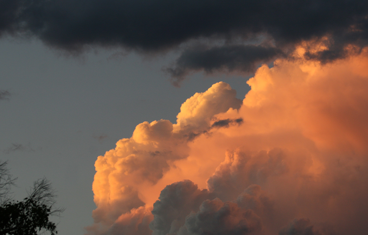
Storm at sunset

Storm at sunset

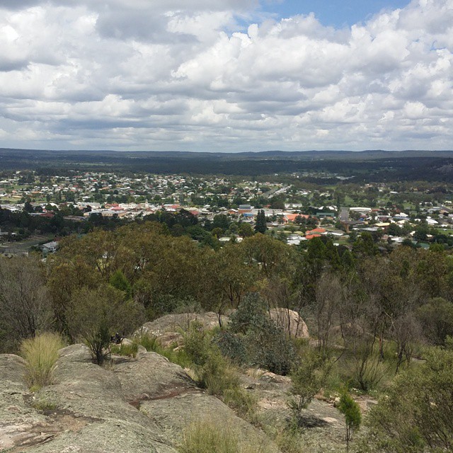
Stanthorpe from Mt Marlay Lookout

Lonely as a ....

Sunset fires at Stanthorpe

Snow covered landscape, looking towards Stanthorpe from Mount Marlay, 1925

Miners working at St. Leonard's Tin Mine, Sugarloaf Creek near Stanthorpe, ca. 1873

Eruption?
Views of Stanthorpe.
Mapa de Sugarloaf QLD, Australia
Buscar otro lugar
lugares en Sugarloaf QLD, Australia
Cypress Drive, Cypress Dr, Sugarloaf QLD, Australia
Sunrise Road, Sunrise Rd, Sugarloaf QLD, Australia
Brown Gully Road, Brown Gully Rd, Sugarloaf QLD, Australia
Lugares cercanos
Brown Gully Road, Brown Gully Rd, Sugarloaf QLD, Australia
Cypress Drive, Cypress Dr, Sugarloaf QLD, Australia
Sugarloaf Rd, Kyoomba QLD, Australia
Sunrise Road, Sunrise Rd, Sugarloaf QLD, Australia
Kyoomba QLD, Australia
Dalcouth Rd, Dalcouth QLD, Australia
Ruby Creek NSW, Australia
McKechnie Rd, Ruby Creek NSW, Australia
Stanthorpe QLD, Australia
Applethorpe QLD, Australia
McKechnie Rd, Ruby Creek NSW, Australia
Ellwood Rd, Applethorpe QLD, Australia
Glen Niven QLD, Australia
Ridge Rd, The Summit QLD, Australia
Maryland NSW, Australia
51 Francia Ln, Glen Aplin QLD, Australia
The Summit QLD, Australia
Glen Aplin QLD, Australia
13 Micale Ln, Glen Aplin QLD, Australia
Limberlost Rd, Fletcher QLD, Australia
Búsquedas recientes
- Horas de salida y puesta de sol de Groblershoop, Sudáfrica
- Horas de salida y puesta de sol de Petriti, Greece
- Horas de salida y puesta de sol de Chesaw Rd, Oroville, WA, EE. UU.
- Horas de salida y puesta de sol de N, Mt Pleasant, UT, USA
- Horas de salida y puesta de sol de Kawanecho Sasamado, Shimada, Shizuoka -, Japan
- Horas de salida y puesta de sol de 6 Rue Jules Ferry, Beausoleil, Francia
- Horas de salida y puesta de sol de Ochandiano, Vizcaya, España
- Horas de salida y puesta de sol de Sattva Horizon, 4JC6+G9P, Vinayak Nagar, Kattigenahalli, Bengaluru, Karnataka, India
- Horas de salida y puesta de sol de Mount Fuji, Kitayama, Fujinomiya, Shizuoka -, Japan
- Horas de salida y puesta de sol de Laurel Rd, Townsend, TN, USA