Horas de salida y puesta de sol de Stackpole Rd, Oysterville, WA, EE. UU.
Location: Estados Unidos > Washington > Condado de Pacific > Oysterville >
Zona horaria:
America/Los_Angeles
Hora local:
2024-05-01 16:32:34
Longitud:
-124.040093
Latitud:
46.5680679
Salida de sol de hoy:
05:58:16 AM
Puesta de sol de hoy:
08:27:49 PM
La duración del día hoy:
14h 29m 33s
Salida de sol de mañana:
05:56:46 AM
Puesta de sol de mañana:
08:29:07 PM
La duración del día mañana:
14h 32m 21s
Mostrar todas las fechas
| Fecha | Salida de sol | Puesta de sol | Duración del día |
|---|---|---|---|
| 01/01/2024 | 08:00:08 AM | 04:39:57 PM | 8h 39m 49s |
| 02/01/2024 | 08:00:05 AM | 04:40:55 PM | 8h 40m 50s |
| 03/01/2024 | 08:00:00 AM | 04:41:55 PM | 8h 41m 55s |
| 04/01/2024 | 07:59:51 AM | 04:42:58 PM | 8h 43m 7s |
| 05/01/2024 | 07:59:40 AM | 04:44:02 PM | 8h 44m 22s |
| 06/01/2024 | 07:59:27 AM | 04:45:08 PM | 8h 45m 41s |
| 07/01/2024 | 07:59:10 AM | 04:46:16 PM | 8h 47m 6s |
| 08/01/2024 | 07:58:51 AM | 04:47:25 PM | 8h 48m 34s |
| 09/01/2024 | 07:58:29 AM | 04:48:36 PM | 8h 50m 7s |
| 10/01/2024 | 07:58:05 AM | 04:49:49 PM | 8h 51m 44s |
| 11/01/2024 | 07:57:37 AM | 04:51:03 PM | 8h 53m 26s |
| 12/01/2024 | 07:57:07 AM | 04:52:18 PM | 8h 55m 11s |
| 13/01/2024 | 07:56:35 AM | 04:53:35 PM | 8h 57m 0s |
| 14/01/2024 | 07:56:00 AM | 04:54:53 PM | 8h 58m 53s |
| 15/01/2024 | 07:55:22 AM | 04:56:13 PM | 9h 0m 51s |
| 16/01/2024 | 07:54:42 AM | 04:57:33 PM | 9h 2m 51s |
| 17/01/2024 | 07:54:00 AM | 04:58:55 PM | 9h 4m 55s |
| 18/01/2024 | 07:53:15 AM | 05:00:17 PM | 9h 7m 2s |
| 19/01/2024 | 07:52:27 AM | 05:01:41 PM | 9h 9m 14s |
| 20/01/2024 | 07:51:38 AM | 05:03:05 PM | 9h 11m 27s |
| 21/01/2024 | 07:50:46 AM | 05:04:30 PM | 9h 13m 44s |
| 22/01/2024 | 07:49:51 AM | 05:05:56 PM | 9h 16m 5s |
| 23/01/2024 | 07:48:54 AM | 05:07:23 PM | 9h 18m 29s |
| 24/01/2024 | 07:47:56 AM | 05:08:50 PM | 9h 20m 54s |
| 25/01/2024 | 07:46:55 AM | 05:10:18 PM | 9h 23m 23s |
| 26/01/2024 | 07:45:51 AM | 05:11:47 PM | 9h 25m 56s |
| 27/01/2024 | 07:44:46 AM | 05:13:15 PM | 9h 28m 29s |
| 28/01/2024 | 07:43:39 AM | 05:14:45 PM | 9h 31m 6s |
| 29/01/2024 | 07:42:30 AM | 05:16:14 PM | 9h 33m 44s |
| 30/01/2024 | 07:41:18 AM | 05:17:44 PM | 9h 36m 26s |
| 31/01/2024 | 07:40:05 AM | 05:19:15 PM | 9h 39m 10s |
| 01/02/2024 | 07:38:50 AM | 05:20:45 PM | 9h 41m 55s |
| 02/02/2024 | 07:37:33 AM | 05:22:16 PM | 9h 44m 43s |
| 03/02/2024 | 07:36:15 AM | 05:23:47 PM | 9h 47m 32s |
| 04/02/2024 | 07:34:54 AM | 05:25:18 PM | 9h 50m 24s |
| 05/02/2024 | 07:33:32 AM | 05:26:49 PM | 9h 53m 17s |
| 06/02/2024 | 07:32:08 AM | 05:28:20 PM | 9h 56m 12s |
| 07/02/2024 | 07:30:43 AM | 05:29:51 PM | 9h 59m 8s |
| 08/02/2024 | 07:29:16 AM | 05:31:22 PM | 10h 2m 6s |
| 09/02/2024 | 07:27:48 AM | 05:32:53 PM | 10h 5m 5s |
| 10/02/2024 | 07:26:18 AM | 05:34:24 PM | 10h 8m 6s |
| 11/02/2024 | 07:24:46 AM | 05:35:55 PM | 10h 11m 9s |
| 12/02/2024 | 07:23:14 AM | 05:37:26 PM | 10h 14m 12s |
| 13/02/2024 | 07:21:40 AM | 05:38:57 PM | 10h 17m 17s |
| 14/02/2024 | 07:20:04 AM | 05:40:27 PM | 10h 20m 23s |
| 15/02/2024 | 07:18:28 AM | 05:41:57 PM | 10h 23m 29s |
| 16/02/2024 | 07:16:50 AM | 05:43:28 PM | 10h 26m 38s |
| 17/02/2024 | 07:15:11 AM | 05:44:57 PM | 10h 29m 46s |
| 18/02/2024 | 07:13:30 AM | 05:46:27 PM | 10h 32m 57s |
| 19/02/2024 | 07:11:49 AM | 05:47:57 PM | 10h 36m 8s |
| 20/02/2024 | 07:10:07 AM | 05:49:26 PM | 10h 39m 19s |
| 21/02/2024 | 07:08:23 AM | 05:50:55 PM | 10h 42m 32s |
| 22/02/2024 | 07:06:39 AM | 05:52:23 PM | 10h 45m 44s |
| 23/02/2024 | 07:04:53 AM | 05:53:52 PM | 10h 48m 59s |
| 24/02/2024 | 07:03:07 AM | 05:55:20 PM | 10h 52m 13s |
| 25/02/2024 | 07:01:20 AM | 05:56:48 PM | 10h 55m 28s |
| 26/02/2024 | 06:59:32 AM | 05:58:15 PM | 10h 58m 43s |
| 27/02/2024 | 06:57:43 AM | 05:59:43 PM | 11h 2m 0s |
| 28/02/2024 | 06:55:53 AM | 06:01:10 PM | 11h 5m 17s |
| 29/02/2024 | 06:54:03 AM | 06:02:37 PM | 11h 8m 34s |
| 01/03/2024 | 06:52:12 AM | 06:04:03 PM | 11h 11m 51s |
| 02/03/2024 | 06:50:20 AM | 06:05:29 PM | 11h 15m 9s |
| 03/03/2024 | 06:48:28 AM | 06:06:55 PM | 11h 18m 27s |
| 04/03/2024 | 06:46:35 AM | 06:08:21 PM | 11h 21m 46s |
| 05/03/2024 | 06:44:42 AM | 06:09:46 PM | 11h 25m 4s |
| 06/03/2024 | 06:42:47 AM | 06:11:11 PM | 11h 28m 24s |
| 07/03/2024 | 06:40:53 AM | 06:12:36 PM | 11h 31m 43s |
| 08/03/2024 | 06:38:58 AM | 06:14:01 PM | 11h 35m 3s |
| 09/03/2024 | 06:37:03 AM | 06:15:25 PM | 11h 38m 22s |
| 10/03/2024 | 07:35:12 AM | 07:16:46 PM | 11h 41m 34s |
| 11/03/2024 | 07:33:15 AM | 07:18:10 PM | 11h 44m 55s |
| 12/03/2024 | 07:31:19 AM | 07:19:34 PM | 11h 48m 15s |
| 13/03/2024 | 07:29:22 AM | 07:20:57 PM | 11h 51m 35s |
| 14/03/2024 | 07:27:25 AM | 07:22:20 PM | 11h 54m 55s |
| 15/03/2024 | 07:25:28 AM | 07:23:43 PM | 11h 58m 15s |
| 16/03/2024 | 07:23:30 AM | 07:25:06 PM | 12h 1m 36s |
| 17/03/2024 | 07:21:33 AM | 07:26:29 PM | 12h 4m 56s |
| 18/03/2024 | 07:19:35 AM | 07:27:52 PM | 12h 8m 17s |
| 19/03/2024 | 07:17:37 AM | 07:29:14 PM | 12h 11m 37s |
| 20/03/2024 | 07:15:39 AM | 07:30:36 PM | 12h 14m 57s |
| 21/03/2024 | 07:13:41 AM | 07:31:59 PM | 12h 18m 18s |
| 22/03/2024 | 07:11:43 AM | 07:33:21 PM | 12h 21m 38s |
| 23/03/2024 | 07:09:45 AM | 07:34:43 PM | 12h 24m 58s |
| 24/03/2024 | 07:07:47 AM | 07:36:04 PM | 12h 28m 17s |
| 25/03/2024 | 07:05:49 AM | 07:37:26 PM | 12h 31m 37s |
| 26/03/2024 | 07:03:51 AM | 07:38:48 PM | 12h 34m 57s |
| 27/03/2024 | 07:01:53 AM | 07:40:09 PM | 12h 38m 16s |
| 28/03/2024 | 06:59:56 AM | 07:41:31 PM | 12h 41m 35s |
| 29/03/2024 | 06:57:58 AM | 07:42:52 PM | 12h 44m 54s |
| 30/03/2024 | 06:56:01 AM | 07:44:14 PM | 12h 48m 13s |
| 31/03/2024 | 06:54:04 AM | 07:45:35 PM | 12h 51m 31s |
| 01/04/2024 | 06:52:08 AM | 07:46:56 PM | 12h 54m 48s |
| 02/04/2024 | 06:50:11 AM | 07:48:17 PM | 12h 58m 6s |
| 03/04/2024 | 06:48:16 AM | 07:49:39 PM | 13h 1m 23s |
| 04/04/2024 | 06:46:20 AM | 07:51:00 PM | 13h 4m 40s |
| 05/04/2024 | 06:44:25 AM | 07:52:21 PM | 13h 7m 56s |
| 06/04/2024 | 06:42:30 AM | 07:53:42 PM | 13h 11m 12s |
| 07/04/2024 | 06:40:36 AM | 07:55:03 PM | 13h 14m 27s |
| 08/04/2024 | 06:38:43 AM | 07:56:24 PM | 13h 17m 41s |
| 09/04/2024 | 06:36:50 AM | 07:57:46 PM | 13h 20m 56s |
| 10/04/2024 | 06:34:57 AM | 07:59:07 PM | 13h 24m 10s |
| 11/04/2024 | 06:33:05 AM | 08:00:28 PM | 13h 27m 23s |
| 12/04/2024 | 06:31:14 AM | 08:01:49 PM | 13h 30m 35s |
| 13/04/2024 | 06:29:23 AM | 08:03:10 PM | 13h 33m 47s |
| 14/04/2024 | 06:27:34 AM | 08:04:31 PM | 13h 36m 57s |
| 15/04/2024 | 06:25:45 AM | 08:05:52 PM | 13h 40m 7s |
| 16/04/2024 | 06:23:56 AM | 08:07:13 PM | 13h 43m 17s |
| 17/04/2024 | 06:22:09 AM | 08:08:34 PM | 13h 46m 25s |
| 18/04/2024 | 06:20:22 AM | 08:09:55 PM | 13h 49m 33s |
| 19/04/2024 | 06:18:36 AM | 08:11:16 PM | 13h 52m 40s |
| 20/04/2024 | 06:16:52 AM | 08:12:37 PM | 13h 55m 45s |
| 21/04/2024 | 06:15:08 AM | 08:13:58 PM | 13h 58m 50s |
| 22/04/2024 | 06:13:25 AM | 08:15:18 PM | 14h 1m 53s |
| 23/04/2024 | 06:11:43 AM | 08:16:39 PM | 14h 4m 56s |
| 24/04/2024 | 06:10:02 AM | 08:18:00 PM | 14h 7m 58s |
| 25/04/2024 | 06:08:23 AM | 08:19:20 PM | 14h 10m 57s |
| 26/04/2024 | 06:06:44 AM | 08:20:40 PM | 14h 13m 56s |
| 27/04/2024 | 06:05:07 AM | 08:22:00 PM | 14h 16m 53s |
| 28/04/2024 | 06:03:31 AM | 08:23:20 PM | 14h 19m 49s |
| 29/04/2024 | 06:01:56 AM | 08:24:40 PM | 14h 22m 44s |
| 30/04/2024 | 06:00:22 AM | 08:26:00 PM | 14h 25m 38s |
| 01/05/2024 | 05:58:50 AM | 08:27:19 PM | 14h 28m 29s |
| 02/05/2024 | 05:57:19 AM | 08:28:38 PM | 14h 31m 19s |
| 03/05/2024 | 05:55:50 AM | 08:29:57 PM | 14h 34m 7s |
| 04/05/2024 | 05:54:22 AM | 08:31:15 PM | 14h 36m 53s |
| 05/05/2024 | 05:52:55 AM | 08:32:33 PM | 14h 39m 38s |
| 06/05/2024 | 05:51:30 AM | 08:33:51 PM | 14h 42m 21s |
| 07/05/2024 | 05:50:07 AM | 08:35:08 PM | 14h 45m 1s |
| 08/05/2024 | 05:48:45 AM | 08:36:25 PM | 14h 47m 40s |
| 09/05/2024 | 05:47:25 AM | 08:37:41 PM | 14h 50m 16s |
| 10/05/2024 | 05:46:06 AM | 08:38:56 PM | 14h 52m 50s |
| 11/05/2024 | 05:44:50 AM | 08:40:12 PM | 14h 55m 22s |
| 12/05/2024 | 05:43:35 AM | 08:41:26 PM | 14h 57m 51s |
| 13/05/2024 | 05:42:21 AM | 08:42:40 PM | 15h 0m 19s |
| 14/05/2024 | 05:41:10 AM | 08:43:53 PM | 15h 2m 43s |
| 15/05/2024 | 05:40:01 AM | 08:45:06 PM | 15h 5m 5s |
| 16/05/2024 | 05:38:53 AM | 08:46:17 PM | 15h 7m 24s |
| 17/05/2024 | 05:37:47 AM | 08:47:28 PM | 15h 9m 41s |
| 18/05/2024 | 05:36:44 AM | 08:48:38 PM | 15h 11m 54s |
| 19/05/2024 | 05:35:42 AM | 08:49:47 PM | 15h 14m 5s |
| 20/05/2024 | 05:34:42 AM | 08:50:55 PM | 15h 16m 13s |
| 21/05/2024 | 05:33:45 AM | 08:52:02 PM | 15h 18m 17s |
| 22/05/2024 | 05:32:49 AM | 08:53:08 PM | 15h 20m 19s |
| 23/05/2024 | 05:31:56 AM | 08:54:12 PM | 15h 22m 16s |
| 24/05/2024 | 05:31:05 AM | 08:55:16 PM | 15h 24m 11s |
| 25/05/2024 | 05:30:16 AM | 08:56:18 PM | 15h 26m 2s |
| 26/05/2024 | 05:29:29 AM | 08:57:19 PM | 15h 27m 50s |
| 27/05/2024 | 05:28:45 AM | 08:58:19 PM | 15h 29m 34s |
| 28/05/2024 | 05:28:03 AM | 08:59:17 PM | 15h 31m 14s |
| 29/05/2024 | 05:27:23 AM | 09:00:14 PM | 15h 32m 51s |
| 30/05/2024 | 05:26:46 AM | 09:01:09 PM | 15h 34m 23s |
| 31/05/2024 | 05:26:11 AM | 09:02:03 PM | 15h 35m 52s |
| 01/06/2024 | 05:25:38 AM | 09:02:55 PM | 15h 37m 17s |
| 02/06/2024 | 05:25:08 AM | 09:03:45 PM | 15h 38m 37s |
| 03/06/2024 | 05:24:40 AM | 09:04:34 PM | 15h 39m 54s |
| 04/06/2024 | 05:24:15 AM | 09:05:21 PM | 15h 41m 6s |
| 05/06/2024 | 05:23:52 AM | 09:06:06 PM | 15h 42m 14s |
| 06/06/2024 | 05:23:31 AM | 09:06:49 PM | 15h 43m 18s |
| 07/06/2024 | 05:23:13 AM | 09:07:30 PM | 15h 44m 17s |
| 08/06/2024 | 05:22:58 AM | 09:08:09 PM | 15h 45m 11s |
| 09/06/2024 | 05:22:44 AM | 09:08:46 PM | 15h 46m 2s |
| 10/06/2024 | 05:22:34 AM | 09:09:22 PM | 15h 46m 48s |
| 11/06/2024 | 05:22:26 AM | 09:09:55 PM | 15h 47m 29s |
| 12/06/2024 | 05:22:20 AM | 09:10:25 PM | 15h 48m 5s |
| 13/06/2024 | 05:22:17 AM | 09:10:54 PM | 15h 48m 37s |
| 14/06/2024 | 05:22:16 AM | 09:11:21 PM | 15h 49m 5s |
| 15/06/2024 | 05:22:18 AM | 09:11:45 PM | 15h 49m 27s |
| 16/06/2024 | 05:22:22 AM | 09:12:07 PM | 15h 49m 45s |
| 17/06/2024 | 05:22:29 AM | 09:12:26 PM | 15h 49m 57s |
| 18/06/2024 | 05:22:38 AM | 09:12:43 PM | 15h 50m 5s |
| 19/06/2024 | 05:22:49 AM | 09:12:58 PM | 15h 50m 9s |
| 20/06/2024 | 05:23:03 AM | 09:13:11 PM | 15h 50m 8s |
| 21/06/2024 | 05:23:19 AM | 09:13:21 PM | 15h 50m 2s |
| 22/06/2024 | 05:23:37 AM | 09:13:28 PM | 15h 49m 51s |
| 23/06/2024 | 05:23:58 AM | 09:13:33 PM | 15h 49m 35s |
| 24/06/2024 | 05:24:21 AM | 09:13:36 PM | 15h 49m 15s |
| 25/06/2024 | 05:24:46 AM | 09:13:36 PM | 15h 48m 50s |
| 26/06/2024 | 05:25:13 AM | 09:13:33 PM | 15h 48m 20s |
| 27/06/2024 | 05:25:42 AM | 09:13:28 PM | 15h 47m 46s |
| 28/06/2024 | 05:26:14 AM | 09:13:21 PM | 15h 47m 7s |
| 29/06/2024 | 05:26:47 AM | 09:13:11 PM | 15h 46m 24s |
| 30/06/2024 | 05:27:23 AM | 09:12:58 PM | 15h 45m 35s |
| 01/07/2024 | 05:28:00 AM | 09:12:43 PM | 15h 44m 43s |
| 02/07/2024 | 05:28:40 AM | 09:12:26 PM | 15h 43m 46s |
| 03/07/2024 | 05:29:21 AM | 09:12:05 PM | 15h 42m 44s |
| 04/07/2024 | 05:30:04 AM | 09:11:43 PM | 15h 41m 39s |
| 05/07/2024 | 05:30:49 AM | 09:11:18 PM | 15h 40m 29s |
| 06/07/2024 | 05:31:36 AM | 09:10:50 PM | 15h 39m 14s |
| 07/07/2024 | 05:32:24 AM | 09:10:20 PM | 15h 37m 56s |
| 08/07/2024 | 05:33:14 AM | 09:09:48 PM | 15h 36m 34s |
| 09/07/2024 | 05:34:05 AM | 09:09:13 PM | 15h 35m 8s |
| 10/07/2024 | 05:34:58 AM | 09:08:36 PM | 15h 33m 38s |
| 11/07/2024 | 05:35:53 AM | 09:07:56 PM | 15h 32m 3s |
| 12/07/2024 | 05:36:49 AM | 09:07:14 PM | 15h 30m 25s |
| 13/07/2024 | 05:37:46 AM | 09:06:30 PM | 15h 28m 44s |
| 14/07/2024 | 05:38:44 AM | 09:05:43 PM | 15h 26m 59s |
| 15/07/2024 | 05:39:44 AM | 09:04:54 PM | 15h 25m 10s |
| 16/07/2024 | 05:40:45 AM | 09:04:03 PM | 15h 23m 18s |
| 17/07/2024 | 05:41:47 AM | 09:03:10 PM | 15h 21m 23s |
| 18/07/2024 | 05:42:50 AM | 09:02:14 PM | 15h 19m 24s |
| 19/07/2024 | 05:43:54 AM | 09:01:16 PM | 15h 17m 22s |
| 20/07/2024 | 05:44:59 AM | 09:00:17 PM | 15h 15m 18s |
| 21/07/2024 | 05:46:05 AM | 08:59:15 PM | 15h 13m 10s |
| 22/07/2024 | 05:47:12 AM | 08:58:11 PM | 15h 10m 59s |
| 23/07/2024 | 05:48:20 AM | 08:57:05 PM | 15h 8m 45s |
| 24/07/2024 | 05:49:29 AM | 08:55:57 PM | 15h 6m 28s |
| 25/07/2024 | 05:50:38 AM | 08:54:47 PM | 15h 4m 9s |
| 26/07/2024 | 05:51:48 AM | 08:53:35 PM | 15h 1m 47s |
| 27/07/2024 | 05:52:58 AM | 08:52:22 PM | 14h 59m 24s |
| 28/07/2024 | 05:54:10 AM | 08:51:06 PM | 14h 56m 56s |
| 29/07/2024 | 05:55:22 AM | 08:49:49 PM | 14h 54m 27s |
| 30/07/2024 | 05:56:34 AM | 08:48:30 PM | 14h 51m 56s |
| 31/07/2024 | 05:57:47 AM | 08:47:10 PM | 14h 49m 23s |
| 01/08/2024 | 05:59:00 AM | 08:45:47 PM | 14h 46m 47s |
| 02/08/2024 | 06:00:14 AM | 08:44:23 PM | 14h 44m 9s |
| 03/08/2024 | 06:01:28 AM | 08:42:58 PM | 14h 41m 30s |
| 04/08/2024 | 06:02:42 AM | 08:41:31 PM | 14h 38m 49s |
| 05/08/2024 | 06:03:57 AM | 08:40:02 PM | 14h 36m 5s |
| 06/08/2024 | 06:05:12 AM | 08:38:32 PM | 14h 33m 20s |
| 07/08/2024 | 06:06:27 AM | 08:37:01 PM | 14h 30m 34s |
| 08/08/2024 | 06:07:43 AM | 08:35:28 PM | 14h 27m 45s |
| 09/08/2024 | 06:08:58 AM | 08:33:54 PM | 14h 24m 56s |
| 10/08/2024 | 06:10:14 AM | 08:32:18 PM | 14h 22m 4s |
| 11/08/2024 | 06:11:30 AM | 08:30:41 PM | 14h 19m 11s |
| 12/08/2024 | 06:12:46 AM | 08:29:03 PM | 14h 16m 17s |
| 13/08/2024 | 06:14:03 AM | 08:27:24 PM | 14h 13m 21s |
| 14/08/2024 | 06:15:19 AM | 08:25:44 PM | 14h 10m 25s |
| 15/08/2024 | 06:16:36 AM | 08:24:02 PM | 14h 7m 26s |
| 16/08/2024 | 06:17:52 AM | 08:22:20 PM | 14h 4m 28s |
| 17/08/2024 | 06:19:09 AM | 08:20:36 PM | 14h 1m 27s |
| 18/08/2024 | 06:20:25 AM | 08:18:51 PM | 13h 58m 26s |
| 19/08/2024 | 06:21:42 AM | 08:17:05 PM | 13h 55m 23s |
| 20/08/2024 | 06:22:59 AM | 08:15:19 PM | 13h 52m 20s |
| 21/08/2024 | 06:24:15 AM | 08:13:31 PM | 13h 49m 16s |
| 22/08/2024 | 06:25:32 AM | 08:11:43 PM | 13h 46m 11s |
| 23/08/2024 | 06:26:49 AM | 08:09:53 PM | 13h 43m 4s |
| 24/08/2024 | 06:28:06 AM | 08:08:03 PM | 13h 39m 57s |
| 25/08/2024 | 06:29:22 AM | 08:06:13 PM | 13h 36m 51s |
| 26/08/2024 | 06:30:39 AM | 08:04:21 PM | 13h 33m 42s |
| 27/08/2024 | 06:31:56 AM | 08:02:29 PM | 13h 30m 33s |
| 28/08/2024 | 06:33:12 AM | 08:00:36 PM | 13h 27m 24s |
| 29/08/2024 | 06:34:29 AM | 07:58:42 PM | 13h 24m 13s |
| 30/08/2024 | 06:35:45 AM | 07:56:48 PM | 13h 21m 3s |
| 31/08/2024 | 06:37:02 AM | 07:54:53 PM | 13h 17m 51s |
| 01/09/2024 | 06:38:18 AM | 07:52:58 PM | 13h 14m 40s |
| 02/09/2024 | 06:39:35 AM | 07:51:02 PM | 13h 11m 27s |
| 03/09/2024 | 06:40:51 AM | 07:49:05 PM | 13h 8m 14s |
| 04/09/2024 | 06:42:08 AM | 07:47:08 PM | 13h 5m 0s |
| 05/09/2024 | 06:43:24 AM | 07:45:11 PM | 13h 1m 47s |
| 06/09/2024 | 06:44:41 AM | 07:43:14 PM | 12h 58m 33s |
| 07/09/2024 | 06:45:57 AM | 07:41:16 PM | 12h 55m 19s |
| 08/09/2024 | 06:47:14 AM | 07:39:17 PM | 12h 52m 3s |
| 09/09/2024 | 06:48:30 AM | 07:37:19 PM | 12h 48m 49s |
| 10/09/2024 | 06:49:47 AM | 07:35:20 PM | 12h 45m 33s |
| 11/09/2024 | 06:51:04 AM | 07:33:21 PM | 12h 42m 17s |
| 12/09/2024 | 06:52:20 AM | 07:31:21 PM | 12h 39m 1s |
| 13/09/2024 | 06:53:37 AM | 07:29:22 PM | 12h 35m 45s |
| 14/09/2024 | 06:54:54 AM | 07:27:22 PM | 12h 32m 28s |
| 15/09/2024 | 06:56:10 AM | 07:25:23 PM | 12h 29m 13s |
| 16/09/2024 | 06:57:27 AM | 07:23:23 PM | 12h 25m 56s |
| 17/09/2024 | 06:58:44 AM | 07:21:23 PM | 12h 22m 39s |
| 18/09/2024 | 07:00:02 AM | 07:19:23 PM | 12h 19m 21s |
| 19/09/2024 | 07:01:19 AM | 07:17:23 PM | 12h 16m 4s |
| 20/09/2024 | 07:02:36 AM | 07:15:23 PM | 12h 12m 47s |
| 21/09/2024 | 07:03:54 AM | 07:13:24 PM | 12h 9m 30s |
| 22/09/2024 | 07:05:11 AM | 07:11:24 PM | 12h 6m 13s |
| 23/09/2024 | 07:06:29 AM | 07:09:24 PM | 12h 2m 55s |
| 24/09/2024 | 07:07:47 AM | 07:07:25 PM | 11h 59m 38s |
| 25/09/2024 | 07:09:05 AM | 07:05:26 PM | 11h 56m 21s |
| 26/09/2024 | 07:10:24 AM | 07:03:27 PM | 11h 53m 3s |
| 27/09/2024 | 07:11:42 AM | 07:01:28 PM | 11h 49m 46s |
| 28/09/2024 | 07:13:01 AM | 06:59:29 PM | 11h 46m 28s |
| 29/09/2024 | 07:14:20 AM | 06:57:31 PM | 11h 43m 11s |
| 30/09/2024 | 07:15:39 AM | 06:55:34 PM | 11h 39m 55s |
| 01/10/2024 | 07:16:58 AM | 06:53:36 PM | 11h 36m 38s |
| 02/10/2024 | 07:18:18 AM | 06:51:39 PM | 11h 33m 21s |
| 03/10/2024 | 07:19:38 AM | 06:49:42 PM | 11h 30m 4s |
| 04/10/2024 | 07:20:58 AM | 06:47:46 PM | 11h 26m 48s |
| 05/10/2024 | 07:22:19 AM | 06:45:51 PM | 11h 23m 32s |
| 06/10/2024 | 07:23:39 AM | 06:43:56 PM | 11h 20m 17s |
| 07/10/2024 | 07:25:01 AM | 06:42:01 PM | 11h 17m 0s |
| 08/10/2024 | 07:26:22 AM | 06:40:07 PM | 11h 13m 45s |
| 09/10/2024 | 07:27:43 AM | 06:38:14 PM | 11h 10m 31s |
| 10/10/2024 | 07:29:05 AM | 06:36:21 PM | 11h 7m 16s |
| 11/10/2024 | 07:30:28 AM | 06:34:30 PM | 11h 4m 2s |
| 12/10/2024 | 07:31:50 AM | 06:32:38 PM | 11h 0m 48s |
| 13/10/2024 | 07:33:13 AM | 06:30:48 PM | 10h 57m 35s |
| 14/10/2024 | 07:34:36 AM | 06:28:58 PM | 10h 54m 22s |
| 15/10/2024 | 07:35:59 AM | 06:27:10 PM | 10h 51m 11s |
| 16/10/2024 | 07:37:23 AM | 06:25:22 PM | 10h 47m 59s |
| 17/10/2024 | 07:38:47 AM | 06:23:35 PM | 10h 44m 48s |
| 18/10/2024 | 07:40:11 AM | 06:21:49 PM | 10h 41m 38s |
| 19/10/2024 | 07:41:36 AM | 06:20:04 PM | 10h 38m 28s |
| 20/10/2024 | 07:43:01 AM | 06:18:20 PM | 10h 35m 19s |
| 21/10/2024 | 07:44:26 AM | 06:16:37 PM | 10h 32m 11s |
| 22/10/2024 | 07:45:52 AM | 06:14:55 PM | 10h 29m 3s |
| 23/10/2024 | 07:47:17 AM | 06:13:15 PM | 10h 25m 58s |
| 24/10/2024 | 07:48:43 AM | 06:11:35 PM | 10h 22m 52s |
| 25/10/2024 | 07:50:09 AM | 06:09:57 PM | 10h 19m 48s |
| 26/10/2024 | 07:51:36 AM | 06:08:20 PM | 10h 16m 44s |
| 27/10/2024 | 07:53:02 AM | 06:06:45 PM | 10h 13m 43s |
| 28/10/2024 | 07:54:29 AM | 06:05:10 PM | 10h 10m 41s |
| 29/10/2024 | 07:55:56 AM | 06:03:37 PM | 10h 7m 41s |
| 30/10/2024 | 07:57:23 AM | 06:02:06 PM | 10h 4m 43s |
| 31/10/2024 | 07:58:50 AM | 06:00:36 PM | 10h 1m 46s |
| 01/11/2024 | 08:00:18 AM | 05:59:08 PM | 9h 58m 50s |
| 02/11/2024 | 08:01:45 AM | 05:57:41 PM | 9h 55m 56s |
| 03/11/2024 | 07:03:16 AM | 04:56:12 PM | 9h 52m 56s |
| 04/11/2024 | 07:04:44 AM | 04:54:48 PM | 9h 50m 4s |
| 05/11/2024 | 07:06:11 AM | 04:53:26 PM | 9h 47m 15s |
| 06/11/2024 | 07:07:38 AM | 04:52:06 PM | 9h 44m 28s |
| 07/11/2024 | 07:09:06 AM | 04:50:48 PM | 9h 41m 42s |
| 08/11/2024 | 07:10:33 AM | 04:49:31 PM | 9h 38m 58s |
| 09/11/2024 | 07:12:00 AM | 04:48:16 PM | 9h 36m 16s |
| 10/11/2024 | 07:13:26 AM | 04:47:04 PM | 9h 33m 38s |
| 11/11/2024 | 07:14:53 AM | 04:45:53 PM | 9h 31m 0s |
| 12/11/2024 | 07:16:19 AM | 04:44:44 PM | 9h 28m 25s |
| 13/11/2024 | 07:17:45 AM | 04:43:37 PM | 9h 25m 52s |
| 14/11/2024 | 07:19:10 AM | 04:42:32 PM | 9h 23m 22s |
| 15/11/2024 | 07:20:35 AM | 04:41:30 PM | 9h 20m 55s |
| 16/11/2024 | 07:22:00 AM | 04:40:29 PM | 9h 18m 29s |
| 17/11/2024 | 07:23:24 AM | 04:39:31 PM | 9h 16m 7s |
| 18/11/2024 | 07:24:47 AM | 04:38:35 PM | 9h 13m 48s |
| 19/11/2024 | 07:26:10 AM | 04:37:42 PM | 9h 11m 32s |
| 20/11/2024 | 07:27:32 AM | 04:36:50 PM | 9h 9m 18s |
| 21/11/2024 | 07:28:53 AM | 04:36:01 PM | 9h 7m 8s |
| 22/11/2024 | 07:30:13 AM | 04:35:15 PM | 9h 5m 2s |
| 23/11/2024 | 07:31:32 AM | 04:34:31 PM | 9h 2m 59s |
| 24/11/2024 | 07:32:51 AM | 04:33:49 PM | 9h 0m 58s |
| 25/11/2024 | 07:34:08 AM | 04:33:10 PM | 8h 59m 2s |
| 26/11/2024 | 07:35:24 AM | 04:32:34 PM | 8h 57m 10s |
| 27/11/2024 | 07:36:39 AM | 04:32:00 PM | 8h 55m 21s |
| 28/11/2024 | 07:37:53 AM | 04:31:29 PM | 8h 53m 36s |
| 29/11/2024 | 07:39:06 AM | 04:31:00 PM | 8h 51m 54s |
| 30/11/2024 | 07:40:17 AM | 04:30:34 PM | 8h 50m 17s |
| 01/12/2024 | 07:41:27 AM | 04:30:11 PM | 8h 48m 44s |
| 02/12/2024 | 07:42:35 AM | 04:29:50 PM | 8h 47m 15s |
| 03/12/2024 | 07:43:41 AM | 04:29:32 PM | 8h 45m 51s |
| 04/12/2024 | 07:44:46 AM | 04:29:17 PM | 8h 44m 31s |
| 05/12/2024 | 07:45:50 AM | 04:29:05 PM | 8h 43m 15s |
| 06/12/2024 | 07:46:51 AM | 04:28:56 PM | 8h 42m 5s |
| 07/12/2024 | 07:47:51 AM | 04:28:49 PM | 8h 40m 58s |
| 08/12/2024 | 07:48:48 AM | 04:28:45 PM | 8h 39m 57s |
| 09/12/2024 | 07:49:44 AM | 04:28:44 PM | 8h 39m 0s |
| 10/12/2024 | 07:50:38 AM | 04:28:46 PM | 8h 38m 8s |
| 11/12/2024 | 07:51:29 AM | 04:28:50 PM | 8h 37m 21s |
| 12/12/2024 | 07:52:19 AM | 04:28:58 PM | 8h 36m 39s |
| 13/12/2024 | 07:53:06 AM | 04:29:08 PM | 8h 36m 2s |
| 14/12/2024 | 07:53:51 AM | 04:29:21 PM | 8h 35m 30s |
| 15/12/2024 | 07:54:33 AM | 04:29:37 PM | 8h 35m 4s |
| 16/12/2024 | 07:55:14 AM | 04:29:55 PM | 8h 34m 41s |
| 17/12/2024 | 07:55:51 AM | 04:30:16 PM | 8h 34m 25s |
| 18/12/2024 | 07:56:27 AM | 04:30:40 PM | 8h 34m 13s |
| 19/12/2024 | 07:57:00 AM | 04:31:07 PM | 8h 34m 7s |
| 20/12/2024 | 07:57:30 AM | 04:31:36 PM | 8h 34m 6s |
| 21/12/2024 | 07:57:58 AM | 04:32:08 PM | 8h 34m 10s |
| 22/12/2024 | 07:58:23 AM | 04:32:43 PM | 8h 34m 20s |
| 23/12/2024 | 07:58:45 AM | 04:33:20 PM | 8h 34m 35s |
| 24/12/2024 | 07:59:05 AM | 04:33:59 PM | 8h 34m 54s |
| 25/12/2024 | 07:59:22 AM | 04:34:41 PM | 8h 35m 19s |
| 26/12/2024 | 07:59:37 AM | 04:35:26 PM | 8h 35m 49s |
| 27/12/2024 | 07:59:49 AM | 04:36:13 PM | 8h 36m 24s |
| 28/12/2024 | 07:59:58 AM | 04:37:02 PM | 8h 37m 4s |
| 29/12/2024 | 08:00:04 AM | 04:37:53 PM | 8h 37m 49s |
| 30/12/2024 | 08:00:07 AM | 04:38:47 PM | 8h 38m 40s |
Fotos
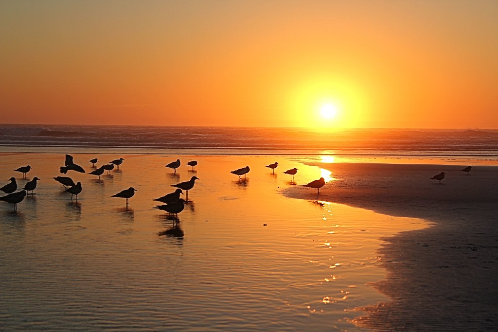
366/250 - 9/6/12 - Sunset on the Pacific Ocean!

366/245 - 9/1/12 - Almost gone!

Crescent Moonset

Ocean Park Sunset

Forest Path

Sunset Over the Pacific

Gorgeous Sunset

A hole in the water

327. 9/22 Candid Canine - Taking his evening walk to the beach!

Oysterville Church 1

365/247 - 9/3/12 Enjoying the last of nice summer evenings!

Long Beach Sunset

Ocean Park Sunset

Willapa Sunset

2013.03.16-17 - Pacific Coast

365/116 - 4/26/13 - Enjoying the sunset!

Blue Moon Sunset

Pacific Sunset

Sunset Biker

Sunset from the Washington Coast

Change of Weather

☀️ finally showed up the last day we were here. #PNW #sunrise #photooftheday #photography
Mapa de Stackpole Rd, Oysterville, WA, EE. UU.
Buscar otro lugar
Lugares cercanos
West Ln, Ocean Park, WA, EE. UU.
J Pl, Ocean Park, WA, EE. UU.
J Pl, Ocean Park, WA, EE. UU.
J Pl, Ocean Park, WA, EE. UU.
Oysterville Rd, Ocean Park, WA, EE. UU.
Oysterville, Washington, EE. UU.
G St, Ocean Park, WA, EE. UU.
G St, Ocean Park, WA, EE. UU.
Territory Rd, Oysterville, WA, EE. UU.
J Pl, Ocean Park, WA, EE. UU.
J Pl, Ocean Park, WA, EE. UU.
J Place, J Pl, Ocean Park, WA, EE. UU.
Sandridge Rd, Oysterville, WA, EE. UU.
I St, Ocean Park, WA, EE. UU.
G Street, G St, Ocean Park, WA, EE. UU.
st Pl, Ocean Park, WA, EE. UU.
Surfside Golf Course, J Pl, Ocean Park, WA, EE. UU.
J Pl, Ocean Park, WA, EE. UU.
Sandridge Rd, Oysterville, WA, EE. UU.
G St, Ocean Park, WA, EE. UU.
Búsquedas recientes
- Horas de salida y puesta de sol de 6 Rue Jules Ferry, Beausoleil, Francia
- Horas de salida y puesta de sol de Ochandiano, Vizcaya, España
- Horas de salida y puesta de sol de Sattva Horizon, 4JC6+G9P, Vinayak Nagar, Kattigenahalli, Bengaluru, Karnataka, India
- Horas de salida y puesta de sol de Mount Fuji, Kitayama, Fujinomiya, Shizuoka -, Japan
- Horas de salida y puesta de sol de Laurel Rd, Townsend, TN, USA
- Horas de salida y puesta de sol de Haibin South Road, China, Guang Dong Sheng, Shen Zhen Shi, Long Gang Qu, 海滨南路GFPQ+R9Q
- Horas de salida y puesta de sol de Redondo Ave, Long Beach, CA, USA
- Horas de salida y puesta de sol de Ulitsa Kalinina, 79, Rezh, Sverdlovskaya oblast', Rusia
- Horas de salida y puesta de sol de Leguwa, Nepal
- Horas de salida y puesta de sol de Shustino, Vladimir Oblast, Rusia