Horas de salida y puesta de sol de Piñon Hills, California, EE. UU.
Location: Estados Unidos > California > Condado de San Bernardino > Piñon Hills >
Zona horaria:
America/Los_Angeles
Hora local:
2024-04-28 02:24:43
Longitud:
-117.6317494
Latitud:
34.4340464
Salida de sol de hoy:
06:02:33 AM
Puesta de sol de hoy:
07:33:12 PM
La duración del día hoy:
13h 30m 39s
Salida de sol de mañana:
06:01:30 AM
Puesta de sol de mañana:
07:34:00 PM
La duración del día mañana:
13h 32m 30s
Mostrar todas las fechas
| Fecha | Salida de sol | Puesta de sol | Duración del día |
|---|---|---|---|
| 01/01/2024 | 06:57:06 AM | 04:51:41 PM | 9h 54m 35s |
| 02/01/2024 | 06:57:16 AM | 04:52:28 PM | 9h 55m 12s |
| 03/01/2024 | 06:57:23 AM | 04:53:15 PM | 9h 55m 52s |
| 04/01/2024 | 06:57:28 AM | 04:54:04 PM | 9h 56m 36s |
| 05/01/2024 | 06:57:32 AM | 04:54:53 PM | 9h 57m 21s |
| 06/01/2024 | 06:57:34 AM | 04:55:44 PM | 9h 58m 10s |
| 07/01/2024 | 06:57:34 AM | 04:56:35 PM | 9h 59m 1s |
| 08/01/2024 | 06:57:32 AM | 04:57:27 PM | 9h 59m 55s |
| 09/01/2024 | 06:57:28 AM | 04:58:21 PM | 10h 0m 53s |
| 10/01/2024 | 06:57:22 AM | 04:59:14 PM | 10h 1m 52s |
| 11/01/2024 | 06:57:15 AM | 05:00:09 PM | 10h 2m 54s |
| 12/01/2024 | 06:57:05 AM | 05:01:04 PM | 10h 3m 59s |
| 13/01/2024 | 06:56:54 AM | 05:02:00 PM | 10h 5m 6s |
| 14/01/2024 | 06:56:40 AM | 05:02:56 PM | 10h 6m 16s |
| 15/01/2024 | 06:56:25 AM | 05:03:53 PM | 10h 7m 28s |
| 16/01/2024 | 06:56:08 AM | 05:04:51 PM | 10h 8m 43s |
| 17/01/2024 | 06:55:49 AM | 05:05:49 PM | 10h 10m 0s |
| 18/01/2024 | 06:55:29 AM | 05:06:47 PM | 10h 11m 18s |
| 19/01/2024 | 06:55:06 AM | 05:07:46 PM | 10h 12m 40s |
| 20/01/2024 | 06:54:42 AM | 05:08:44 PM | 10h 14m 2s |
| 21/01/2024 | 06:54:16 AM | 05:09:44 PM | 10h 15m 28s |
| 22/01/2024 | 06:53:48 AM | 05:10:43 PM | 10h 16m 55s |
| 23/01/2024 | 06:53:18 AM | 05:11:43 PM | 10h 18m 25s |
| 24/01/2024 | 06:52:47 AM | 05:12:42 PM | 10h 19m 55s |
| 25/01/2024 | 06:52:14 AM | 05:13:42 PM | 10h 21m 28s |
| 26/01/2024 | 06:51:39 AM | 05:14:42 PM | 10h 23m 3s |
| 27/01/2024 | 06:51:03 AM | 05:15:42 PM | 10h 24m 39s |
| 28/01/2024 | 06:50:25 AM | 05:16:42 PM | 10h 26m 17s |
| 29/01/2024 | 06:49:45 AM | 05:17:42 PM | 10h 27m 57s |
| 30/01/2024 | 06:49:04 AM | 05:18:43 PM | 10h 29m 39s |
| 31/01/2024 | 06:48:21 AM | 05:19:42 PM | 10h 31m 21s |
| 01/02/2024 | 06:47:37 AM | 05:20:42 PM | 10h 33m 5s |
| 02/02/2024 | 06:46:51 AM | 05:21:42 PM | 10h 34m 51s |
| 03/02/2024 | 06:46:04 AM | 05:22:42 PM | 10h 36m 38s |
| 04/02/2024 | 06:45:15 AM | 05:23:41 PM | 10h 38m 26s |
| 05/02/2024 | 06:44:24 AM | 05:24:40 PM | 10h 40m 16s |
| 06/02/2024 | 06:43:33 AM | 05:25:39 PM | 10h 42m 6s |
| 07/02/2024 | 06:42:40 AM | 05:26:38 PM | 10h 43m 58s |
| 08/02/2024 | 06:41:45 AM | 05:27:37 PM | 10h 45m 52s |
| 09/02/2024 | 06:40:50 AM | 05:28:35 PM | 10h 47m 45s |
| 10/02/2024 | 06:39:53 AM | 05:29:33 PM | 10h 49m 40s |
| 11/02/2024 | 06:38:55 AM | 05:30:31 PM | 10h 51m 36s |
| 12/02/2024 | 06:37:55 AM | 05:31:29 PM | 10h 53m 34s |
| 13/02/2024 | 06:36:55 AM | 05:32:26 PM | 10h 55m 31s |
| 14/02/2024 | 06:35:53 AM | 05:33:23 PM | 10h 57m 30s |
| 15/02/2024 | 06:34:50 AM | 05:34:19 PM | 10h 59m 29s |
| 16/02/2024 | 06:33:46 AM | 05:35:16 PM | 11h 1m 30s |
| 17/02/2024 | 06:32:41 AM | 05:36:11 PM | 11h 3m 30s |
| 18/02/2024 | 06:31:35 AM | 05:37:07 PM | 11h 5m 32s |
| 19/02/2024 | 06:30:28 AM | 05:38:02 PM | 11h 7m 34s |
| 20/02/2024 | 06:29:19 AM | 05:38:57 PM | 11h 9m 38s |
| 21/02/2024 | 06:28:10 AM | 05:39:52 PM | 11h 11m 42s |
| 22/02/2024 | 06:27:00 AM | 05:40:46 PM | 11h 13m 46s |
| 23/02/2024 | 06:25:50 AM | 05:41:40 PM | 11h 15m 50s |
| 24/02/2024 | 06:24:38 AM | 05:42:33 PM | 11h 17m 55s |
| 25/02/2024 | 06:23:26 AM | 05:43:27 PM | 11h 20m 1s |
| 26/02/2024 | 06:22:12 AM | 05:44:19 PM | 11h 22m 7s |
| 27/02/2024 | 06:20:58 AM | 05:45:12 PM | 11h 24m 14s |
| 28/02/2024 | 06:19:44 AM | 05:46:04 PM | 11h 26m 20s |
| 29/02/2024 | 06:18:28 AM | 05:46:56 PM | 11h 28m 28s |
| 01/03/2024 | 06:17:12 AM | 05:47:47 PM | 11h 30m 35s |
| 02/03/2024 | 06:15:55 AM | 05:48:39 PM | 11h 32m 44s |
| 03/03/2024 | 06:14:38 AM | 05:49:30 PM | 11h 34m 52s |
| 04/03/2024 | 06:13:20 AM | 05:50:20 PM | 11h 37m 0s |
| 05/03/2024 | 06:12:02 AM | 05:51:11 PM | 11h 39m 9s |
| 06/03/2024 | 06:10:43 AM | 05:52:01 PM | 11h 41m 18s |
| 07/03/2024 | 06:09:23 AM | 05:52:50 PM | 11h 43m 27s |
| 08/03/2024 | 06:08:04 AM | 05:53:40 PM | 11h 45m 36s |
| 09/03/2024 | 06:06:43 AM | 05:54:29 PM | 11h 47m 46s |
| 10/03/2024 | 07:05:26 AM | 06:55:16 PM | 11h 49m 50s |
| 11/03/2024 | 07:04:05 AM | 06:56:05 PM | 11h 52m 0s |
| 12/03/2024 | 07:02:44 AM | 06:56:53 PM | 11h 54m 9s |
| 13/03/2024 | 07:01:22 AM | 06:57:42 PM | 11h 56m 20s |
| 14/03/2024 | 07:00:00 AM | 06:58:30 PM | 11h 58m 30s |
| 15/03/2024 | 06:58:38 AM | 06:59:18 PM | 12h 0m 40s |
| 16/03/2024 | 06:57:16 AM | 07:00:06 PM | 12h 2m 50s |
| 17/03/2024 | 06:55:53 AM | 07:00:53 PM | 12h 5m 0s |
| 18/03/2024 | 06:54:31 AM | 07:01:41 PM | 12h 7m 10s |
| 19/03/2024 | 06:53:08 AM | 07:02:28 PM | 12h 9m 20s |
| 20/03/2024 | 06:51:45 AM | 07:03:15 PM | 12h 11m 30s |
| 21/03/2024 | 06:50:22 AM | 07:04:02 PM | 12h 13m 40s |
| 22/03/2024 | 06:48:59 AM | 07:04:49 PM | 12h 15m 50s |
| 23/03/2024 | 06:47:36 AM | 07:05:36 PM | 12h 18m 0s |
| 24/03/2024 | 06:46:13 AM | 07:06:22 PM | 12h 20m 9s |
| 25/03/2024 | 06:44:50 AM | 07:07:09 PM | 12h 22m 19s |
| 26/03/2024 | 06:43:28 AM | 07:07:56 PM | 12h 24m 28s |
| 27/03/2024 | 06:42:05 AM | 07:08:42 PM | 12h 26m 37s |
| 28/03/2024 | 06:40:43 AM | 07:09:28 PM | 12h 28m 45s |
| 29/03/2024 | 06:39:20 AM | 07:10:15 PM | 12h 30m 55s |
| 30/03/2024 | 06:37:58 AM | 07:11:01 PM | 12h 33m 3s |
| 31/03/2024 | 06:36:36 AM | 07:11:48 PM | 12h 35m 12s |
| 01/04/2024 | 06:35:15 AM | 07:12:34 PM | 12h 37m 19s |
| 02/04/2024 | 06:33:53 AM | 07:13:20 PM | 12h 39m 27s |
| 03/04/2024 | 06:32:32 AM | 07:14:07 PM | 12h 41m 35s |
| 04/04/2024 | 06:31:11 AM | 07:14:53 PM | 12h 43m 42s |
| 05/04/2024 | 06:29:51 AM | 07:15:39 PM | 12h 45m 48s |
| 06/04/2024 | 06:28:31 AM | 07:16:26 PM | 12h 47m 55s |
| 07/04/2024 | 06:27:12 AM | 07:17:12 PM | 12h 50m 0s |
| 08/04/2024 | 06:25:53 AM | 07:17:59 PM | 12h 52m 6s |
| 09/04/2024 | 06:24:34 AM | 07:18:45 PM | 12h 54m 11s |
| 10/04/2024 | 06:23:16 AM | 07:19:32 PM | 12h 56m 16s |
| 11/04/2024 | 06:21:59 AM | 07:20:19 PM | 12h 58m 20s |
| 12/04/2024 | 06:20:42 AM | 07:21:06 PM | 13h 0m 24s |
| 13/04/2024 | 06:19:26 AM | 07:21:52 PM | 13h 2m 26s |
| 14/04/2024 | 06:18:10 AM | 07:22:39 PM | 13h 4m 29s |
| 15/04/2024 | 06:16:55 AM | 07:23:26 PM | 13h 6m 31s |
| 16/04/2024 | 06:15:41 AM | 07:24:13 PM | 13h 8m 32s |
| 17/04/2024 | 06:14:27 AM | 07:25:00 PM | 13h 10m 33s |
| 18/04/2024 | 06:13:14 AM | 07:25:47 PM | 13h 12m 33s |
| 19/04/2024 | 06:12:02 AM | 07:26:35 PM | 13h 14m 33s |
| 20/04/2024 | 06:10:51 AM | 07:27:22 PM | 13h 16m 31s |
| 21/04/2024 | 06:09:40 AM | 07:28:09 PM | 13h 18m 29s |
| 22/04/2024 | 06:08:31 AM | 07:28:57 PM | 13h 20m 26s |
| 23/04/2024 | 06:07:22 AM | 07:29:44 PM | 13h 22m 22s |
| 24/04/2024 | 06:06:15 AM | 07:30:32 PM | 13h 24m 17s |
| 25/04/2024 | 06:05:08 AM | 07:31:19 PM | 13h 26m 11s |
| 26/04/2024 | 06:04:02 AM | 07:32:07 PM | 13h 28m 5s |
| 27/04/2024 | 06:02:57 AM | 07:32:55 PM | 13h 29m 58s |
| 28/04/2024 | 06:01:53 AM | 07:33:42 PM | 13h 31m 49s |
| 29/04/2024 | 06:00:50 AM | 07:34:30 PM | 13h 33m 40s |
| 30/04/2024 | 05:59:49 AM | 07:35:17 PM | 13h 35m 28s |
| 01/05/2024 | 05:58:48 AM | 07:36:05 PM | 13h 37m 17s |
| 02/05/2024 | 05:57:49 AM | 07:36:53 PM | 13h 39m 4s |
| 03/05/2024 | 05:56:50 AM | 07:37:40 PM | 13h 40m 50s |
| 04/05/2024 | 05:55:53 AM | 07:38:28 PM | 13h 42m 35s |
| 05/05/2024 | 05:54:57 AM | 07:39:15 PM | 13h 44m 18s |
| 06/05/2024 | 05:54:03 AM | 07:40:02 PM | 13h 45m 59s |
| 07/05/2024 | 05:53:09 AM | 07:40:49 PM | 13h 47m 40s |
| 08/05/2024 | 05:52:17 AM | 07:41:37 PM | 13h 49m 20s |
| 09/05/2024 | 05:51:26 AM | 07:42:23 PM | 13h 50m 57s |
| 10/05/2024 | 05:50:37 AM | 07:43:10 PM | 13h 52m 33s |
| 11/05/2024 | 05:49:49 AM | 07:43:57 PM | 13h 54m 8s |
| 12/05/2024 | 05:49:02 AM | 07:44:43 PM | 13h 55m 41s |
| 13/05/2024 | 05:48:17 AM | 07:45:29 PM | 13h 57m 12s |
| 14/05/2024 | 05:47:33 AM | 07:46:15 PM | 13h 58m 42s |
| 15/05/2024 | 05:46:50 AM | 07:47:00 PM | 14h 0m 10s |
| 16/05/2024 | 05:46:09 AM | 07:47:45 PM | 14h 1m 36s |
| 17/05/2024 | 05:45:29 AM | 07:48:30 PM | 14h 3m 1s |
| 18/05/2024 | 05:44:51 AM | 07:49:14 PM | 14h 4m 23s |
| 19/05/2024 | 05:44:15 AM | 07:49:58 PM | 14h 5m 43s |
| 20/05/2024 | 05:43:39 AM | 07:50:41 PM | 14h 7m 2s |
| 21/05/2024 | 05:43:06 AM | 07:51:24 PM | 14h 8m 18s |
| 22/05/2024 | 05:42:34 AM | 07:52:07 PM | 14h 9m 33s |
| 23/05/2024 | 05:42:03 AM | 07:52:49 PM | 14h 10m 46s |
| 24/05/2024 | 05:41:34 AM | 07:53:30 PM | 14h 11m 56s |
| 25/05/2024 | 05:41:07 AM | 07:54:11 PM | 14h 13m 4s |
| 26/05/2024 | 05:40:41 AM | 07:54:51 PM | 14h 14m 10s |
| 27/05/2024 | 05:40:17 AM | 07:55:30 PM | 14h 15m 13s |
| 28/05/2024 | 05:39:55 AM | 07:56:09 PM | 14h 16m 14s |
| 29/05/2024 | 05:39:34 AM | 07:56:47 PM | 14h 17m 13s |
| 30/05/2024 | 05:39:15 AM | 07:57:24 PM | 14h 18m 9s |
| 31/05/2024 | 05:38:57 AM | 07:58:00 PM | 14h 19m 3s |
| 01/06/2024 | 05:38:41 AM | 07:58:36 PM | 14h 19m 55s |
| 02/06/2024 | 05:38:26 AM | 07:59:10 PM | 14h 20m 44s |
| 03/06/2024 | 05:38:14 AM | 07:59:44 PM | 14h 21m 30s |
| 04/06/2024 | 05:38:02 AM | 08:00:16 PM | 14h 22m 14s |
| 05/06/2024 | 05:37:53 AM | 08:00:48 PM | 14h 22m 55s |
| 06/06/2024 | 05:37:45 AM | 08:01:19 PM | 14h 23m 34s |
| 07/06/2024 | 05:37:39 AM | 08:01:48 PM | 14h 24m 9s |
| 08/06/2024 | 05:37:34 AM | 08:02:16 PM | 14h 24m 42s |
| 09/06/2024 | 05:37:31 AM | 08:02:44 PM | 14h 25m 13s |
| 10/06/2024 | 05:37:29 AM | 08:03:10 PM | 14h 25m 41s |
| 11/06/2024 | 05:37:29 AM | 08:03:35 PM | 14h 26m 6s |
| 12/06/2024 | 05:37:31 AM | 08:03:58 PM | 14h 26m 27s |
| 13/06/2024 | 05:37:34 AM | 08:04:21 PM | 14h 26m 47s |
| 14/06/2024 | 05:37:39 AM | 08:04:42 PM | 14h 27m 3s |
| 15/06/2024 | 05:37:45 AM | 08:05:01 PM | 14h 27m 16s |
| 16/06/2024 | 05:37:52 AM | 08:05:20 PM | 14h 27m 28s |
| 17/06/2024 | 05:38:02 AM | 08:05:37 PM | 14h 27m 35s |
| 18/06/2024 | 05:38:12 AM | 08:05:52 PM | 14h 27m 40s |
| 19/06/2024 | 05:38:24 AM | 08:06:07 PM | 14h 27m 43s |
| 20/06/2024 | 05:38:38 AM | 08:06:19 PM | 14h 27m 41s |
| 21/06/2024 | 05:38:52 AM | 08:06:30 PM | 14h 27m 38s |
| 22/06/2024 | 05:39:09 AM | 08:06:40 PM | 14h 27m 31s |
| 23/06/2024 | 05:39:26 AM | 08:06:48 PM | 14h 27m 22s |
| 24/06/2024 | 05:39:45 AM | 08:06:55 PM | 14h 27m 10s |
| 25/06/2024 | 05:40:05 AM | 08:07:00 PM | 14h 26m 55s |
| 26/06/2024 | 05:40:26 AM | 08:07:03 PM | 14h 26m 37s |
| 27/06/2024 | 05:40:49 AM | 08:07:05 PM | 14h 26m 16s |
| 28/06/2024 | 05:41:13 AM | 08:07:06 PM | 14h 25m 53s |
| 29/06/2024 | 05:41:37 AM | 08:07:04 PM | 14h 25m 27s |
| 30/06/2024 | 05:42:03 AM | 08:07:01 PM | 14h 24m 58s |
| 01/07/2024 | 05:42:30 AM | 08:06:57 PM | 14h 24m 27s |
| 02/07/2024 | 05:42:59 AM | 08:06:50 PM | 14h 23m 51s |
| 03/07/2024 | 05:43:28 AM | 08:06:42 PM | 14h 23m 14s |
| 04/07/2024 | 05:43:58 AM | 08:06:33 PM | 14h 22m 35s |
| 05/07/2024 | 05:44:29 AM | 08:06:22 PM | 14h 21m 53s |
| 06/07/2024 | 05:45:01 AM | 08:06:09 PM | 14h 21m 8s |
| 07/07/2024 | 05:45:34 AM | 08:05:54 PM | 14h 20m 20s |
| 08/07/2024 | 05:46:07 AM | 08:05:38 PM | 14h 19m 31s |
| 09/07/2024 | 05:46:42 AM | 08:05:20 PM | 14h 18m 38s |
| 10/07/2024 | 05:47:17 AM | 08:05:01 PM | 14h 17m 44s |
| 11/07/2024 | 05:47:53 AM | 08:04:39 PM | 14h 16m 46s |
| 12/07/2024 | 05:48:30 AM | 08:04:16 PM | 14h 15m 46s |
| 13/07/2024 | 05:49:07 AM | 08:03:52 PM | 14h 14m 45s |
| 14/07/2024 | 05:49:45 AM | 08:03:26 PM | 14h 13m 41s |
| 15/07/2024 | 05:50:24 AM | 08:02:58 PM | 14h 12m 34s |
| 16/07/2024 | 05:51:03 AM | 08:02:29 PM | 14h 11m 26s |
| 17/07/2024 | 05:51:43 AM | 08:01:58 PM | 14h 10m 15s |
| 18/07/2024 | 05:52:23 AM | 08:01:25 PM | 14h 9m 2s |
| 19/07/2024 | 05:53:04 AM | 08:00:51 PM | 14h 7m 47s |
| 20/07/2024 | 05:53:45 AM | 08:00:15 PM | 14h 6m 30s |
| 21/07/2024 | 05:54:26 AM | 07:59:38 PM | 14h 5m 12s |
| 22/07/2024 | 05:55:08 AM | 07:58:59 PM | 14h 3m 51s |
| 23/07/2024 | 05:55:50 AM | 07:58:19 PM | 14h 2m 29s |
| 24/07/2024 | 05:56:33 AM | 07:57:37 PM | 14h 1m 4s |
| 25/07/2024 | 05:57:15 AM | 07:56:54 PM | 13h 59m 39s |
| 26/07/2024 | 05:57:58 AM | 07:56:09 PM | 13h 58m 11s |
| 27/07/2024 | 05:58:42 AM | 07:55:23 PM | 13h 56m 41s |
| 28/07/2024 | 05:59:25 AM | 07:54:35 PM | 13h 55m 10s |
| 29/07/2024 | 06:00:09 AM | 07:53:46 PM | 13h 53m 37s |
| 30/07/2024 | 06:00:53 AM | 07:52:56 PM | 13h 52m 3s |
| 31/07/2024 | 06:01:37 AM | 07:52:04 PM | 13h 50m 27s |
| 01/08/2024 | 06:02:21 AM | 07:51:11 PM | 13h 48m 50s |
| 02/08/2024 | 06:03:05 AM | 07:50:16 PM | 13h 47m 11s |
| 03/08/2024 | 06:03:49 AM | 07:49:21 PM | 13h 45m 32s |
| 04/08/2024 | 06:04:33 AM | 07:48:24 PM | 13h 43m 51s |
| 05/08/2024 | 06:05:18 AM | 07:47:26 PM | 13h 42m 8s |
| 06/08/2024 | 06:06:02 AM | 07:46:26 PM | 13h 40m 24s |
| 07/08/2024 | 06:06:46 AM | 07:45:26 PM | 13h 38m 40s |
| 08/08/2024 | 06:07:31 AM | 07:44:24 PM | 13h 36m 53s |
| 09/08/2024 | 06:08:15 AM | 07:43:21 PM | 13h 35m 6s |
| 10/08/2024 | 06:09:00 AM | 07:42:17 PM | 13h 33m 17s |
| 11/08/2024 | 06:09:44 AM | 07:41:12 PM | 13h 31m 28s |
| 12/08/2024 | 06:10:28 AM | 07:40:06 PM | 13h 29m 38s |
| 13/08/2024 | 06:11:12 AM | 07:38:59 PM | 13h 27m 47s |
| 14/08/2024 | 06:11:56 AM | 07:37:51 PM | 13h 25m 55s |
| 15/08/2024 | 06:12:40 AM | 07:36:42 PM | 13h 24m 2s |
| 16/08/2024 | 06:13:24 AM | 07:35:32 PM | 13h 22m 8s |
| 17/08/2024 | 06:14:08 AM | 07:34:21 PM | 13h 20m 13s |
| 18/08/2024 | 06:14:52 AM | 07:33:09 PM | 13h 18m 17s |
| 19/08/2024 | 06:15:35 AM | 07:31:57 PM | 13h 16m 22s |
| 20/08/2024 | 06:16:19 AM | 07:30:43 PM | 13h 14m 24s |
| 21/08/2024 | 06:17:02 AM | 07:29:29 PM | 13h 12m 27s |
| 22/08/2024 | 06:17:46 AM | 07:28:14 PM | 13h 10m 28s |
| 23/08/2024 | 06:18:29 AM | 07:26:58 PM | 13h 8m 29s |
| 24/08/2024 | 06:19:12 AM | 07:25:41 PM | 13h 6m 29s |
| 25/08/2024 | 06:19:55 AM | 07:24:24 PM | 13h 4m 29s |
| 26/08/2024 | 06:20:38 AM | 07:23:06 PM | 13h 2m 28s |
| 27/08/2024 | 06:21:21 AM | 07:21:48 PM | 13h 0m 27s |
| 28/08/2024 | 06:22:04 AM | 07:20:29 PM | 12h 58m 25s |
| 29/08/2024 | 06:22:46 AM | 07:19:09 PM | 12h 56m 23s |
| 30/08/2024 | 06:23:29 AM | 07:17:49 PM | 12h 54m 20s |
| 31/08/2024 | 06:24:12 AM | 07:16:28 PM | 12h 52m 16s |
| 01/09/2024 | 06:24:54 AM | 07:15:07 PM | 12h 50m 13s |
| 02/09/2024 | 06:25:36 AM | 07:13:45 PM | 12h 48m 9s |
| 03/09/2024 | 06:26:19 AM | 07:12:23 PM | 12h 46m 4s |
| 04/09/2024 | 06:27:01 AM | 07:11:00 PM | 12h 43m 59s |
| 05/09/2024 | 06:27:43 AM | 07:09:37 PM | 12h 41m 54s |
| 06/09/2024 | 06:28:25 AM | 07:08:14 PM | 12h 39m 49s |
| 07/09/2024 | 06:29:07 AM | 07:06:50 PM | 12h 37m 43s |
| 08/09/2024 | 06:29:49 AM | 07:05:26 PM | 12h 35m 37s |
| 09/09/2024 | 06:30:32 AM | 07:04:02 PM | 12h 33m 30s |
| 10/09/2024 | 06:31:14 AM | 07:02:38 PM | 12h 31m 24s |
| 11/09/2024 | 06:31:56 AM | 07:01:13 PM | 12h 29m 17s |
| 12/09/2024 | 06:32:38 AM | 06:59:48 PM | 12h 27m 10s |
| 13/09/2024 | 06:33:20 AM | 06:58:23 PM | 12h 25m 3s |
| 14/09/2024 | 06:34:02 AM | 06:56:58 PM | 12h 22m 56s |
| 15/09/2024 | 06:34:45 AM | 06:55:33 PM | 12h 20m 48s |
| 16/09/2024 | 06:35:27 AM | 06:54:08 PM | 12h 18m 41s |
| 17/09/2024 | 06:36:09 AM | 06:52:43 PM | 12h 16m 34s |
| 18/09/2024 | 06:36:52 AM | 06:51:17 PM | 12h 14m 25s |
| 19/09/2024 | 06:37:35 AM | 06:49:52 PM | 12h 12m 17s |
| 20/09/2024 | 06:38:17 AM | 06:48:27 PM | 12h 10m 10s |
| 21/09/2024 | 06:39:00 AM | 06:47:02 PM | 12h 8m 2s |
| 22/09/2024 | 06:39:43 AM | 06:45:37 PM | 12h 5m 54s |
| 23/09/2024 | 06:40:26 AM | 06:44:12 PM | 12h 3m 46s |
| 24/09/2024 | 06:41:10 AM | 06:42:47 PM | 12h 1m 37s |
| 25/09/2024 | 06:41:53 AM | 06:41:22 PM | 11h 59m 29s |
| 26/09/2024 | 06:42:37 AM | 06:39:58 PM | 11h 57m 21s |
| 27/09/2024 | 06:43:21 AM | 06:38:34 PM | 11h 55m 13s |
| 28/09/2024 | 06:44:05 AM | 06:37:10 PM | 11h 53m 5s |
| 29/09/2024 | 06:44:49 AM | 06:35:47 PM | 11h 50m 58s |
| 30/09/2024 | 06:45:34 AM | 06:34:23 PM | 11h 48m 49s |
| 01/10/2024 | 06:46:19 AM | 06:33:01 PM | 11h 46m 42s |
| 02/10/2024 | 06:47:04 AM | 06:31:38 PM | 11h 44m 34s |
| 03/10/2024 | 06:47:49 AM | 06:30:16 PM | 11h 42m 27s |
| 04/10/2024 | 06:48:35 AM | 06:28:55 PM | 11h 40m 20s |
| 05/10/2024 | 06:49:20 AM | 06:27:34 PM | 11h 38m 14s |
| 06/10/2024 | 06:50:07 AM | 06:26:13 PM | 11h 36m 6s |
| 07/10/2024 | 06:50:53 AM | 06:24:53 PM | 11h 34m 0s |
| 08/10/2024 | 06:51:40 AM | 06:23:34 PM | 11h 31m 54s |
| 09/10/2024 | 06:52:27 AM | 06:22:15 PM | 11h 29m 48s |
| 10/10/2024 | 06:53:15 AM | 06:20:57 PM | 11h 27m 42s |
| 11/10/2024 | 06:54:02 AM | 06:19:39 PM | 11h 25m 37s |
| 12/10/2024 | 06:54:51 AM | 06:18:22 PM | 11h 23m 31s |
| 13/10/2024 | 06:55:39 AM | 06:17:06 PM | 11h 21m 27s |
| 14/10/2024 | 06:56:28 AM | 06:15:51 PM | 11h 19m 23s |
| 15/10/2024 | 06:57:17 AM | 06:14:36 PM | 11h 17m 19s |
| 16/10/2024 | 06:58:07 AM | 06:13:23 PM | 11h 15m 16s |
| 17/10/2024 | 06:58:57 AM | 06:12:10 PM | 11h 13m 13s |
| 18/10/2024 | 06:59:47 AM | 06:10:58 PM | 11h 11m 11s |
| 19/10/2024 | 07:00:38 AM | 06:09:47 PM | 11h 9m 9s |
| 20/10/2024 | 07:01:29 AM | 06:08:37 PM | 11h 7m 8s |
| 21/10/2024 | 07:02:20 AM | 06:07:27 PM | 11h 5m 7s |
| 22/10/2024 | 07:03:12 AM | 06:06:19 PM | 11h 3m 7s |
| 23/10/2024 | 07:04:04 AM | 06:05:12 PM | 11h 1m 8s |
| 24/10/2024 | 07:04:57 AM | 06:04:06 PM | 10h 59m 9s |
| 25/10/2024 | 07:05:50 AM | 06:03:01 PM | 10h 57m 11s |
| 26/10/2024 | 07:06:43 AM | 06:01:57 PM | 10h 55m 14s |
| 27/10/2024 | 07:07:36 AM | 06:00:55 PM | 10h 53m 19s |
| 28/10/2024 | 07:08:30 AM | 05:59:53 PM | 10h 51m 23s |
| 29/10/2024 | 07:09:25 AM | 05:58:53 PM | 10h 49m 28s |
| 30/10/2024 | 07:10:19 AM | 05:57:54 PM | 10h 47m 35s |
| 31/10/2024 | 07:11:14 AM | 05:56:56 PM | 10h 45m 42s |
| 01/11/2024 | 07:12:09 AM | 05:56:00 PM | 10h 43m 51s |
| 02/11/2024 | 07:13:05 AM | 05:55:05 PM | 10h 42m 0s |
| 03/11/2024 | 06:14:03 AM | 04:54:09 PM | 10h 40m 6s |
| 04/11/2024 | 06:14:59 AM | 04:53:17 PM | 10h 38m 18s |
| 05/11/2024 | 06:15:55 AM | 04:52:26 PM | 10h 36m 31s |
| 06/11/2024 | 06:16:51 AM | 04:51:37 PM | 10h 34m 46s |
| 07/11/2024 | 06:17:48 AM | 04:50:49 PM | 10h 33m 1s |
| 08/11/2024 | 06:18:45 AM | 04:50:03 PM | 10h 31m 18s |
| 09/11/2024 | 06:19:42 AM | 04:49:18 PM | 10h 29m 36s |
| 10/11/2024 | 06:20:39 AM | 04:48:35 PM | 10h 27m 56s |
| 11/11/2024 | 06:21:36 AM | 04:47:53 PM | 10h 26m 17s |
| 12/11/2024 | 06:22:33 AM | 04:47:13 PM | 10h 24m 40s |
| 13/11/2024 | 06:23:31 AM | 04:46:35 PM | 10h 23m 4s |
| 14/11/2024 | 06:24:28 AM | 04:45:58 PM | 10h 21m 30s |
| 15/11/2024 | 06:25:25 AM | 04:45:24 PM | 10h 19m 59s |
| 16/11/2024 | 06:26:22 AM | 04:44:50 PM | 10h 18m 28s |
| 17/11/2024 | 06:27:20 AM | 04:44:19 PM | 10h 16m 59s |
| 18/11/2024 | 06:28:17 AM | 04:43:49 PM | 10h 15m 32s |
| 19/11/2024 | 06:29:13 AM | 04:43:21 PM | 10h 14m 8s |
| 20/11/2024 | 06:30:10 AM | 04:42:55 PM | 10h 12m 45s |
| 21/11/2024 | 06:31:06 AM | 04:42:31 PM | 10h 11m 25s |
| 22/11/2024 | 06:32:03 AM | 04:42:09 PM | 10h 10m 6s |
| 23/11/2024 | 06:32:58 AM | 04:41:48 PM | 10h 8m 50s |
| 24/11/2024 | 06:33:54 AM | 04:41:30 PM | 10h 7m 36s |
| 25/11/2024 | 06:34:49 AM | 04:41:13 PM | 10h 6m 24s |
| 26/11/2024 | 06:35:44 AM | 04:40:58 PM | 10h 5m 14s |
| 27/11/2024 | 06:36:38 AM | 04:40:45 PM | 10h 4m 7s |
| 28/11/2024 | 06:37:31 AM | 04:40:34 PM | 10h 3m 3s |
| 29/11/2024 | 06:38:24 AM | 04:40:25 PM | 10h 2m 1s |
| 30/11/2024 | 06:39:17 AM | 04:40:17 PM | 10h 1m 0s |
| 01/12/2024 | 06:40:08 AM | 04:40:12 PM | 10h 0m 4s |
| 02/12/2024 | 06:40:59 AM | 04:40:09 PM | 9h 59m 10s |
| 03/12/2024 | 06:41:50 AM | 04:40:07 PM | 9h 58m 17s |
| 04/12/2024 | 06:42:39 AM | 04:40:08 PM | 9h 57m 29s |
| 05/12/2024 | 06:43:28 AM | 04:40:10 PM | 9h 56m 42s |
| 06/12/2024 | 06:44:15 AM | 04:40:14 PM | 9h 55m 59s |
| 07/12/2024 | 06:45:02 AM | 04:40:21 PM | 9h 55m 19s |
| 08/12/2024 | 06:45:48 AM | 04:40:29 PM | 9h 54m 41s |
| 09/12/2024 | 06:46:32 AM | 04:40:39 PM | 9h 54m 7s |
| 10/12/2024 | 06:47:16 AM | 04:40:51 PM | 9h 53m 35s |
| 11/12/2024 | 06:47:58 AM | 04:41:04 PM | 9h 53m 6s |
| 12/12/2024 | 06:48:39 AM | 04:41:20 PM | 9h 52m 41s |
| 13/12/2024 | 06:49:19 AM | 04:41:37 PM | 9h 52m 18s |
| 14/12/2024 | 06:49:58 AM | 04:41:56 PM | 9h 51m 58s |
| 15/12/2024 | 06:50:35 AM | 04:42:17 PM | 9h 51m 42s |
| 16/12/2024 | 06:51:11 AM | 04:42:40 PM | 9h 51m 29s |
| 17/12/2024 | 06:51:46 AM | 04:43:05 PM | 9h 51m 19s |
| 18/12/2024 | 06:52:19 AM | 04:43:31 PM | 9h 51m 12s |
| 19/12/2024 | 06:52:51 AM | 04:43:59 PM | 9h 51m 8s |
| 20/12/2024 | 06:53:21 AM | 04:44:28 PM | 9h 51m 7s |
| 21/12/2024 | 06:53:50 AM | 04:44:59 PM | 9h 51m 9s |
| 22/12/2024 | 06:54:17 AM | 04:45:32 PM | 9h 51m 15s |
| 23/12/2024 | 06:54:42 AM | 04:46:06 PM | 9h 51m 24s |
| 24/12/2024 | 06:55:06 AM | 04:46:42 PM | 9h 51m 36s |
| 25/12/2024 | 06:55:28 AM | 04:47:19 PM | 9h 51m 51s |
| 26/12/2024 | 06:55:48 AM | 04:47:57 PM | 9h 52m 9s |
| 27/12/2024 | 06:56:07 AM | 04:48:37 PM | 9h 52m 30s |
| 28/12/2024 | 06:56:24 AM | 04:49:19 PM | 9h 52m 55s |
| 29/12/2024 | 06:56:39 AM | 04:50:01 PM | 9h 53m 22s |
| 30/12/2024 | 06:56:52 AM | 04:50:45 PM | 9h 53m 53s |
Fotos

Pearblossom Highway Sunset

Riding The Storm Out

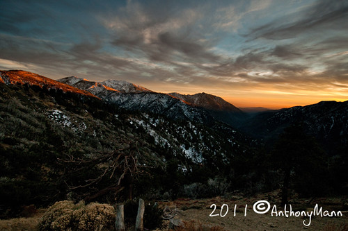
San Gabriel Sunset

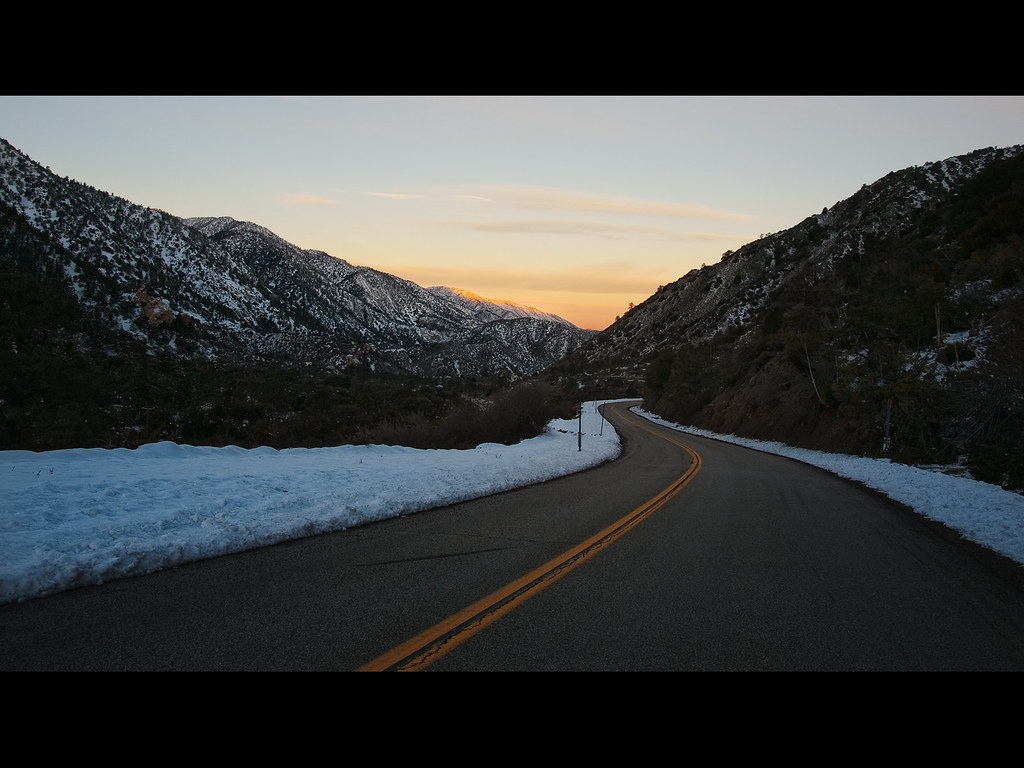
Sunset over the San Gabriel and Pleasant View Ridge Wilderness Areas

Mount Baden-Powell

East Blue Ridge sunset

Table Mountain

Windermere Incident - 8/11/2012

Fire! on the Mountain
Sunset on Dawson Peak and Pine Mountain Ridge

Inspiration Point

PXL_20230428_023052561.MP

Orange Clouds Over Mt. Baden-Powell

Sweet Dreams

PXL_20230428_023051811.MP

Setting Sun

Sunset on the Mountain

Sierra Nevada from Circle Mountain

Chasing the son w/ @emmvelasquez and I think we won! #sunset #wrightwood #photolife #sunchasers

PXL_20230428_023057821.MP

Above the clouds

Many a memory...

Dome sunrise

Snowy Sunrise
Canyon Light

Desert View
Mapa de Piñon Hills, California, EE. UU.
Buscar otro lugar
Lugares cercanos
United States Postal Service, Oasis Rd, Pinon Hills, CA, EE. UU.
Piñon Hills, California, EE. UU.
Green Rd, Pinon Hills, CA, EE. UU.
Desert View Rd, Pinon Hills, CA, EE. UU.
Trinity Rd, Pinon Hills, CA, EE. UU.
Juniper Rd, Pinon Hills, CA, EE. UU.
Arrowhead Dr, Pinon Hills, CA, EE. UU.
Trinity Rd, Phelan, CA, EE. UU.
Snowline Joint Unified School District, CA, EE. UU.
Sheep Creek Rd, Phelan, CA, EE. UU.
Phelan, CA, EE. UU.
Riggins Rd, Phelan, CA, EE. UU.
Riggins Rd, Phelan, CA, EE. UU.
Mountain View Avenue, Mountain View Ave, Wrightwood, CA, EE. UU.
CA-18, Phelan, CA, EE. UU.
Swallow Hill Dr, Llano, CA, EE. UU.
Cardinal Rd, Wrightwood, CA, EE. UU.
Logwood Dr, Llano, CA, EE. UU.
Wrightwood, California, EE. UU.
Wrightwood Guest Ranch, 78 Big Pines Hwy, Wrightwood, CA, EE. UU.
Búsquedas recientes
- Horas de salida y puesta de sol de 大下港, Sekizenoge, Imabari, Ehime -, Japan
- Horas de salida y puesta de sol de Oge port Ferry Terminal, -1 Sekizenōge, Imabari, Ehime -, Japan
- Horas de salida y puesta de sol de San Telmo, Cdad. Autónoma de Buenos Aires, Argentina
- Horas de salida y puesta de sol de Congressional Dr, Stevensville, MD, USA
- Horas de salida y puesta de sol de Papingo 04, Grecia
- Horas de salida y puesta de sol de Pagonija rock, Kranto 7-oji g. 8"N, Kaunas, Lituania
- Horas de salida y puesta de sol de Co Rd 87, Jamestown, CO, USA
- Horas de salida y puesta de sol de Tenjo, Cundinamarca, Colombia
- Horas de salida y puesta de sol de -1 Gosho, Ichihara, Chiba -, Japón
- Horas de salida y puesta de sol de -, Japón