Horas de salida y puesta de sol de Old Rd, West Point, CA, EE. UU.
Location: Estados Unidos > California > Condado de Calaveras > West Point >
Zona horaria:
America/Los_Angeles
Hora local:
2024-05-02 16:19:28
Longitud:
-120.432901
Latitud:
38.429194
Salida de sol de hoy:
06:01:06 AM
Puesta de sol de hoy:
07:55:56 PM
La duración del día hoy:
13h 54m 50s
Salida de sol de mañana:
06:00:00 AM
Puesta de sol de mañana:
07:56:52 PM
La duración del día mañana:
13h 56m 52s
Mostrar todas las fechas
| Fecha | Salida de sol | Puesta de sol | Duración del día |
|---|---|---|---|
| 01/01/2024 | 07:18:59 AM | 04:52:13 PM | 9h 33m 14s |
| 02/01/2024 | 07:19:05 AM | 04:53:03 PM | 9h 33m 58s |
| 03/01/2024 | 07:19:09 AM | 04:53:54 PM | 9h 34m 45s |
| 04/01/2024 | 07:19:11 AM | 04:54:46 PM | 9h 35m 35s |
| 05/01/2024 | 07:19:11 AM | 04:55:40 PM | 9h 36m 29s |
| 06/01/2024 | 07:19:08 AM | 04:56:34 PM | 9h 37m 26s |
| 07/01/2024 | 07:19:04 AM | 04:57:30 PM | 9h 38m 26s |
| 08/01/2024 | 07:18:57 AM | 04:58:27 PM | 9h 39m 30s |
| 09/01/2024 | 07:18:48 AM | 04:59:25 PM | 9h 40m 37s |
| 10/01/2024 | 07:18:37 AM | 05:00:24 PM | 9h 41m 47s |
| 11/01/2024 | 07:18:24 AM | 05:01:24 PM | 9h 43m 0s |
| 12/01/2024 | 07:18:09 AM | 05:02:25 PM | 9h 44m 16s |
| 13/01/2024 | 07:17:52 AM | 05:03:27 PM | 9h 45m 35s |
| 14/01/2024 | 07:17:32 AM | 05:04:29 PM | 9h 46m 57s |
| 15/01/2024 | 07:17:11 AM | 05:05:32 PM | 9h 48m 21s |
| 16/01/2024 | 07:16:48 AM | 05:06:36 PM | 9h 49m 48s |
| 17/01/2024 | 07:16:22 AM | 05:07:41 PM | 9h 51m 19s |
| 18/01/2024 | 07:15:55 AM | 05:08:46 PM | 9h 52m 51s |
| 19/01/2024 | 07:15:25 AM | 05:09:51 PM | 9h 54m 26s |
| 20/01/2024 | 07:14:54 AM | 05:10:57 PM | 9h 56m 3s |
| 21/01/2024 | 07:14:21 AM | 05:12:04 PM | 9h 57m 43s |
| 22/01/2024 | 07:13:45 AM | 05:13:10 PM | 9h 59m 25s |
| 23/01/2024 | 07:13:08 AM | 05:14:18 PM | 10h 1m 10s |
| 24/01/2024 | 07:12:29 AM | 05:15:25 PM | 10h 2m 56s |
| 25/01/2024 | 07:11:48 AM | 05:16:33 PM | 10h 4m 45s |
| 26/01/2024 | 07:11:06 AM | 05:17:41 PM | 10h 6m 35s |
| 27/01/2024 | 07:10:21 AM | 05:18:49 PM | 10h 8m 28s |
| 28/01/2024 | 07:09:35 AM | 05:19:57 PM | 10h 10m 22s |
| 29/01/2024 | 07:08:47 AM | 05:21:06 PM | 10h 12m 19s |
| 30/01/2024 | 07:07:57 AM | 05:22:14 PM | 10h 14m 17s |
| 31/01/2024 | 07:07:06 AM | 05:23:22 PM | 10h 16m 16s |
| 01/02/2024 | 07:06:13 AM | 05:24:31 PM | 10h 18m 18s |
| 02/02/2024 | 07:05:18 AM | 05:25:40 PM | 10h 20m 22s |
| 03/02/2024 | 07:04:22 AM | 05:26:48 PM | 10h 22m 26s |
| 04/02/2024 | 07:03:24 AM | 05:27:56 PM | 10h 24m 32s |
| 05/02/2024 | 07:02:25 AM | 05:29:05 PM | 10h 26m 40s |
| 06/02/2024 | 07:01:24 AM | 05:30:13 PM | 10h 28m 49s |
| 07/02/2024 | 07:00:22 AM | 05:31:21 PM | 10h 30m 59s |
| 08/02/2024 | 06:59:18 AM | 05:32:29 PM | 10h 33m 11s |
| 09/02/2024 | 06:58:13 AM | 05:33:36 PM | 10h 35m 23s |
| 10/02/2024 | 06:57:07 AM | 05:34:44 PM | 10h 37m 37s |
| 11/02/2024 | 06:55:59 AM | 05:35:51 PM | 10h 39m 52s |
| 12/02/2024 | 06:54:50 AM | 05:36:58 PM | 10h 42m 8s |
| 13/02/2024 | 06:53:40 AM | 05:38:05 PM | 10h 44m 25s |
| 14/02/2024 | 06:52:29 AM | 05:39:11 PM | 10h 46m 42s |
| 15/02/2024 | 06:51:16 AM | 05:40:18 PM | 10h 49m 2s |
| 16/02/2024 | 06:50:02 AM | 05:41:24 PM | 10h 51m 22s |
| 17/02/2024 | 06:48:47 AM | 05:42:29 PM | 10h 53m 42s |
| 18/02/2024 | 06:47:32 AM | 05:43:35 PM | 10h 56m 3s |
| 19/02/2024 | 06:46:15 AM | 05:44:40 PM | 10h 58m 25s |
| 20/02/2024 | 06:44:57 AM | 05:45:44 PM | 11h 0m 47s |
| 21/02/2024 | 06:43:38 AM | 05:46:49 PM | 11h 3m 11s |
| 22/02/2024 | 06:42:18 AM | 05:47:53 PM | 11h 5m 35s |
| 23/02/2024 | 06:40:57 AM | 05:48:57 PM | 11h 8m 0s |
| 24/02/2024 | 06:39:35 AM | 05:50:00 PM | 11h 10m 25s |
| 25/02/2024 | 06:38:13 AM | 05:51:04 PM | 11h 12m 51s |
| 26/02/2024 | 06:36:49 AM | 05:52:07 PM | 11h 15m 18s |
| 27/02/2024 | 06:35:25 AM | 05:53:09 PM | 11h 17m 44s |
| 28/02/2024 | 06:34:01 AM | 05:54:11 PM | 11h 20m 10s |
| 29/02/2024 | 06:32:35 AM | 05:55:13 PM | 11h 22m 38s |
| 01/03/2024 | 06:31:09 AM | 05:56:15 PM | 11h 25m 6s |
| 02/03/2024 | 06:29:42 AM | 05:57:16 PM | 11h 27m 34s |
| 03/03/2024 | 06:28:14 AM | 05:58:17 PM | 11h 30m 3s |
| 04/03/2024 | 06:26:46 AM | 05:59:18 PM | 11h 32m 32s |
| 05/03/2024 | 06:25:18 AM | 06:00:19 PM | 11h 35m 1s |
| 06/03/2024 | 06:23:49 AM | 06:01:19 PM | 11h 37m 30s |
| 07/03/2024 | 06:22:19 AM | 06:02:19 PM | 11h 40m 0s |
| 08/03/2024 | 06:20:49 AM | 06:03:19 PM | 11h 42m 30s |
| 09/03/2024 | 06:19:19 AM | 06:04:18 PM | 11h 44m 59s |
| 10/03/2024 | 07:17:51 AM | 07:05:15 PM | 11h 47m 24s |
| 11/03/2024 | 07:16:20 AM | 07:06:14 PM | 11h 49m 54s |
| 12/03/2024 | 07:14:49 AM | 07:07:13 PM | 11h 52m 24s |
| 13/03/2024 | 07:13:17 AM | 07:08:11 PM | 11h 54m 54s |
| 14/03/2024 | 07:11:45 AM | 07:09:10 PM | 11h 57m 25s |
| 15/03/2024 | 07:10:12 AM | 07:10:08 PM | 11h 59m 56s |
| 16/03/2024 | 07:08:40 AM | 07:11:06 PM | 12h 2m 26s |
| 17/03/2024 | 07:07:07 AM | 07:12:04 PM | 12h 4m 57s |
| 18/03/2024 | 07:05:34 AM | 07:13:01 PM | 12h 7m 27s |
| 19/03/2024 | 07:04:01 AM | 07:13:59 PM | 12h 9m 58s |
| 20/03/2024 | 07:02:28 AM | 07:14:56 PM | 12h 12m 28s |
| 21/03/2024 | 07:00:55 AM | 07:15:53 PM | 12h 14m 58s |
| 22/03/2024 | 06:59:22 AM | 07:16:50 PM | 12h 17m 28s |
| 23/03/2024 | 06:57:49 AM | 07:17:47 PM | 12h 19m 58s |
| 24/03/2024 | 06:56:16 AM | 07:18:44 PM | 12h 22m 28s |
| 25/03/2024 | 06:54:43 AM | 07:19:41 PM | 12h 24m 58s |
| 26/03/2024 | 06:53:10 AM | 07:20:38 PM | 12h 27m 28s |
| 27/03/2024 | 06:51:37 AM | 07:21:35 PM | 12h 29m 58s |
| 28/03/2024 | 06:50:04 AM | 07:22:31 PM | 12h 32m 27s |
| 29/03/2024 | 06:48:32 AM | 07:23:28 PM | 12h 34m 56s |
| 30/03/2024 | 06:46:59 AM | 07:24:24 PM | 12h 37m 25s |
| 31/03/2024 | 06:45:27 AM | 07:25:21 PM | 12h 39m 54s |
| 01/04/2024 | 06:43:56 AM | 07:26:17 PM | 12h 42m 21s |
| 02/04/2024 | 06:42:24 AM | 07:27:14 PM | 12h 44m 50s |
| 03/04/2024 | 06:40:53 AM | 07:28:10 PM | 12h 47m 17s |
| 04/04/2024 | 06:39:22 AM | 07:29:07 PM | 12h 49m 45s |
| 05/04/2024 | 06:37:52 AM | 07:30:03 PM | 12h 52m 11s |
| 06/04/2024 | 06:36:22 AM | 07:31:00 PM | 12h 54m 38s |
| 07/04/2024 | 06:34:52 AM | 07:31:56 PM | 12h 57m 4s |
| 08/04/2024 | 06:33:23 AM | 07:32:53 PM | 12h 59m 30s |
| 09/04/2024 | 06:31:55 AM | 07:33:49 PM | 13h 1m 54s |
| 10/04/2024 | 06:30:27 AM | 07:34:46 PM | 13h 4m 19s |
| 11/04/2024 | 06:29:00 AM | 07:35:42 PM | 13h 6m 42s |
| 12/04/2024 | 06:27:33 AM | 07:36:39 PM | 13h 9m 6s |
| 13/04/2024 | 06:26:07 AM | 07:37:36 PM | 13h 11m 29s |
| 14/04/2024 | 06:24:41 AM | 07:38:32 PM | 13h 13m 51s |
| 15/04/2024 | 06:23:16 AM | 07:39:29 PM | 13h 16m 13s |
| 16/04/2024 | 06:21:52 AM | 07:40:26 PM | 13h 18m 34s |
| 17/04/2024 | 06:20:29 AM | 07:41:23 PM | 13h 20m 54s |
| 18/04/2024 | 06:19:07 AM | 07:42:19 PM | 13h 23m 12s |
| 19/04/2024 | 06:17:45 AM | 07:43:16 PM | 13h 25m 31s |
| 20/04/2024 | 06:16:24 AM | 07:44:13 PM | 13h 27m 49s |
| 21/04/2024 | 06:15:04 AM | 07:45:10 PM | 13h 30m 6s |
| 22/04/2024 | 06:13:45 AM | 07:46:07 PM | 13h 32m 22s |
| 23/04/2024 | 06:12:27 AM | 07:47:04 PM | 13h 34m 37s |
| 24/04/2024 | 06:11:10 AM | 07:48:01 PM | 13h 36m 51s |
| 25/04/2024 | 06:09:54 AM | 07:48:58 PM | 13h 39m 4s |
| 26/04/2024 | 06:08:39 AM | 07:49:55 PM | 13h 41m 16s |
| 27/04/2024 | 06:07:25 AM | 07:50:51 PM | 13h 43m 26s |
| 28/04/2024 | 06:06:12 AM | 07:51:48 PM | 13h 45m 36s |
| 29/04/2024 | 06:05:00 AM | 07:52:45 PM | 13h 47m 45s |
| 30/04/2024 | 06:03:49 AM | 07:53:42 PM | 13h 49m 53s |
| 01/05/2024 | 06:02:40 AM | 07:54:38 PM | 13h 51m 58s |
| 02/05/2024 | 06:01:31 AM | 07:55:34 PM | 13h 54m 3s |
| 03/05/2024 | 06:00:24 AM | 07:56:31 PM | 13h 56m 7s |
| 04/05/2024 | 05:59:19 AM | 07:57:27 PM | 13h 58m 8s |
| 05/05/2024 | 05:58:14 AM | 07:58:23 PM | 14h 0m 9s |
| 06/05/2024 | 05:57:11 AM | 07:59:19 PM | 14h 2m 8s |
| 07/05/2024 | 05:56:09 AM | 08:00:14 PM | 14h 4m 5s |
| 08/05/2024 | 05:55:09 AM | 08:01:10 PM | 14h 6m 1s |
| 09/05/2024 | 05:54:10 AM | 08:02:05 PM | 14h 7m 55s |
| 10/05/2024 | 05:53:12 AM | 08:02:59 PM | 14h 9m 47s |
| 11/05/2024 | 05:52:16 AM | 08:03:54 PM | 14h 11m 38s |
| 12/05/2024 | 05:51:21 AM | 08:04:48 PM | 14h 13m 27s |
| 13/05/2024 | 05:50:28 AM | 08:05:42 PM | 14h 15m 14s |
| 14/05/2024 | 05:49:37 AM | 08:06:35 PM | 14h 16m 58s |
| 15/05/2024 | 05:48:47 AM | 08:07:28 PM | 14h 18m 41s |
| 16/05/2024 | 05:47:58 AM | 08:08:20 PM | 14h 20m 22s |
| 17/05/2024 | 05:47:11 AM | 08:09:12 PM | 14h 22m 1s |
| 18/05/2024 | 05:46:26 AM | 08:10:04 PM | 14h 23m 38s |
| 19/05/2024 | 05:45:43 AM | 08:10:54 PM | 14h 25m 11s |
| 20/05/2024 | 05:45:01 AM | 08:11:45 PM | 14h 26m 44s |
| 21/05/2024 | 05:44:21 AM | 08:12:34 PM | 14h 28m 13s |
| 22/05/2024 | 05:43:42 AM | 08:13:23 PM | 14h 29m 41s |
| 23/05/2024 | 05:43:06 AM | 08:14:11 PM | 14h 31m 5s |
| 24/05/2024 | 05:42:31 AM | 08:14:59 PM | 14h 32m 28s |
| 25/05/2024 | 05:41:57 AM | 08:15:45 PM | 14h 33m 48s |
| 26/05/2024 | 05:41:26 AM | 08:16:31 PM | 14h 35m 5s |
| 27/05/2024 | 05:40:56 AM | 08:17:16 PM | 14h 36m 20s |
| 28/05/2024 | 05:40:29 AM | 08:18:00 PM | 14h 37m 31s |
| 29/05/2024 | 05:40:03 AM | 08:18:43 PM | 14h 38m 40s |
| 30/05/2024 | 05:39:38 AM | 08:19:25 PM | 14h 39m 47s |
| 31/05/2024 | 05:39:16 AM | 08:20:06 PM | 14h 40m 50s |
| 01/06/2024 | 05:38:55 AM | 08:20:46 PM | 14h 41m 51s |
| 02/06/2024 | 05:38:37 AM | 08:21:25 PM | 14h 42m 48s |
| 03/06/2024 | 05:38:20 AM | 08:22:02 PM | 14h 43m 42s |
| 04/06/2024 | 05:38:05 AM | 08:22:39 PM | 14h 44m 34s |
| 05/06/2024 | 05:37:52 AM | 08:23:14 PM | 14h 45m 22s |
| 06/06/2024 | 05:37:40 AM | 08:23:48 PM | 14h 46m 8s |
| 07/06/2024 | 05:37:31 AM | 08:24:21 PM | 14h 46m 50s |
| 08/06/2024 | 05:37:23 AM | 08:24:52 PM | 14h 47m 29s |
| 09/06/2024 | 05:37:17 AM | 08:25:22 PM | 14h 48m 5s |
| 10/06/2024 | 05:37:13 AM | 08:25:50 PM | 14h 48m 37s |
| 11/06/2024 | 05:37:11 AM | 08:26:17 PM | 14h 49m 6s |
| 12/06/2024 | 05:37:11 AM | 08:26:43 PM | 14h 49m 32s |
| 13/06/2024 | 05:37:12 AM | 08:27:07 PM | 14h 49m 55s |
| 14/06/2024 | 05:37:16 AM | 08:27:29 PM | 14h 50m 13s |
| 15/06/2024 | 05:37:21 AM | 08:27:50 PM | 14h 50m 29s |
| 16/06/2024 | 05:37:27 AM | 08:28:10 PM | 14h 50m 43s |
| 17/06/2024 | 05:37:36 AM | 08:28:27 PM | 14h 50m 51s |
| 18/06/2024 | 05:37:46 AM | 08:28:43 PM | 14h 50m 57s |
| 19/06/2024 | 05:37:58 AM | 08:28:58 PM | 14h 51m 0s |
| 20/06/2024 | 05:38:11 AM | 08:29:10 PM | 14h 50m 59s |
| 21/06/2024 | 05:38:26 AM | 08:29:21 PM | 14h 50m 55s |
| 22/06/2024 | 05:38:43 AM | 08:29:30 PM | 14h 50m 47s |
| 23/06/2024 | 05:39:02 AM | 08:29:38 PM | 14h 50m 36s |
| 24/06/2024 | 05:39:21 AM | 08:29:43 PM | 14h 50m 22s |
| 25/06/2024 | 05:39:43 AM | 08:29:47 PM | 14h 50m 4s |
| 26/06/2024 | 05:40:06 AM | 08:29:49 PM | 14h 49m 43s |
| 27/06/2024 | 05:40:30 AM | 08:29:49 PM | 14h 49m 19s |
| 28/06/2024 | 05:40:56 AM | 08:29:47 PM | 14h 48m 51s |
| 29/06/2024 | 05:41:23 AM | 08:29:43 PM | 14h 48m 20s |
| 30/06/2024 | 05:41:52 AM | 08:29:38 PM | 14h 47m 46s |
| 01/07/2024 | 05:42:22 AM | 08:29:30 PM | 14h 47m 8s |
| 02/07/2024 | 05:42:53 AM | 08:29:21 PM | 14h 46m 28s |
| 03/07/2024 | 05:43:25 AM | 08:29:10 PM | 14h 45m 45s |
| 04/07/2024 | 05:43:59 AM | 08:28:57 PM | 14h 44m 58s |
| 05/07/2024 | 05:44:34 AM | 08:28:42 PM | 14h 44m 8s |
| 06/07/2024 | 05:45:09 AM | 08:28:25 PM | 14h 43m 16s |
| 07/07/2024 | 05:45:46 AM | 08:28:06 PM | 14h 42m 20s |
| 08/07/2024 | 05:46:25 AM | 08:27:46 PM | 14h 41m 21s |
| 09/07/2024 | 05:47:04 AM | 08:27:23 PM | 14h 40m 19s |
| 10/07/2024 | 05:47:44 AM | 08:26:59 PM | 14h 39m 15s |
| 11/07/2024 | 05:48:25 AM | 08:26:32 PM | 14h 38m 7s |
| 12/07/2024 | 05:49:07 AM | 08:26:04 PM | 14h 36m 57s |
| 13/07/2024 | 05:49:49 AM | 08:25:34 PM | 14h 35m 45s |
| 14/07/2024 | 05:50:33 AM | 08:25:03 PM | 14h 34m 30s |
| 15/07/2024 | 05:51:17 AM | 08:24:29 PM | 14h 33m 12s |
| 16/07/2024 | 05:52:02 AM | 08:23:54 PM | 14h 31m 52s |
| 17/07/2024 | 05:52:48 AM | 08:23:17 PM | 14h 30m 29s |
| 18/07/2024 | 05:53:35 AM | 08:22:38 PM | 14h 29m 3s |
| 19/07/2024 | 05:54:22 AM | 08:21:57 PM | 14h 27m 35s |
| 20/07/2024 | 05:55:09 AM | 08:21:15 PM | 14h 26m 6s |
| 21/07/2024 | 05:55:58 AM | 08:20:31 PM | 14h 24m 33s |
| 22/07/2024 | 05:56:46 AM | 08:19:45 PM | 14h 22m 59s |
| 23/07/2024 | 05:57:36 AM | 08:18:58 PM | 14h 21m 22s |
| 24/07/2024 | 05:58:25 AM | 08:18:09 PM | 14h 19m 44s |
| 25/07/2024 | 05:59:15 AM | 08:17:18 PM | 14h 18m 3s |
| 26/07/2024 | 06:00:06 AM | 08:16:26 PM | 14h 16m 20s |
| 27/07/2024 | 06:00:57 AM | 08:15:32 PM | 14h 14m 35s |
| 28/07/2024 | 06:01:48 AM | 08:14:37 PM | 14h 12m 49s |
| 29/07/2024 | 06:02:39 AM | 08:13:40 PM | 14h 11m 1s |
| 30/07/2024 | 06:03:31 AM | 08:12:42 PM | 14h 9m 11s |
| 31/07/2024 | 06:04:23 AM | 08:11:42 PM | 14h 7m 19s |
| 01/08/2024 | 06:05:15 AM | 08:10:41 PM | 14h 5m 26s |
| 02/08/2024 | 06:06:08 AM | 08:09:38 PM | 14h 3m 30s |
| 03/08/2024 | 06:07:00 AM | 08:08:34 PM | 14h 1m 34s |
| 04/08/2024 | 06:07:53 AM | 08:07:29 PM | 13h 59m 36s |
| 05/08/2024 | 06:08:46 AM | 08:06:22 PM | 13h 57m 36s |
| 06/08/2024 | 06:09:39 AM | 08:05:14 PM | 13h 55m 35s |
| 07/08/2024 | 06:10:32 AM | 08:04:05 PM | 13h 53m 33s |
| 08/08/2024 | 06:11:25 AM | 08:02:54 PM | 13h 51m 29s |
| 09/08/2024 | 06:12:18 AM | 08:01:42 PM | 13h 49m 24s |
| 10/08/2024 | 06:13:12 AM | 08:00:30 PM | 13h 47m 18s |
| 11/08/2024 | 06:14:05 AM | 07:59:16 PM | 13h 45m 11s |
| 12/08/2024 | 06:14:58 AM | 07:58:00 PM | 13h 43m 2s |
| 13/08/2024 | 06:15:51 AM | 07:56:44 PM | 13h 40m 53s |
| 14/08/2024 | 06:16:45 AM | 07:55:27 PM | 13h 38m 42s |
| 15/08/2024 | 06:17:38 AM | 07:54:09 PM | 13h 36m 31s |
| 16/08/2024 | 06:18:31 AM | 07:52:49 PM | 13h 34m 18s |
| 17/08/2024 | 06:19:24 AM | 07:51:29 PM | 13h 32m 5s |
| 18/08/2024 | 06:20:17 AM | 07:50:08 PM | 13h 29m 51s |
| 19/08/2024 | 06:21:10 AM | 07:48:46 PM | 13h 27m 36s |
| 20/08/2024 | 06:22:03 AM | 07:47:23 PM | 13h 25m 20s |
| 21/08/2024 | 06:22:56 AM | 07:45:59 PM | 13h 23m 3s |
| 22/08/2024 | 06:23:49 AM | 07:44:34 PM | 13h 20m 45s |
| 23/08/2024 | 06:24:42 AM | 07:43:09 PM | 13h 18m 27s |
| 24/08/2024 | 06:25:35 AM | 07:41:43 PM | 13h 16m 8s |
| 25/08/2024 | 06:26:28 AM | 07:40:16 PM | 13h 13m 48s |
| 26/08/2024 | 06:27:20 AM | 07:38:48 PM | 13h 11m 28s |
| 27/08/2024 | 06:28:13 AM | 07:37:20 PM | 13h 9m 7s |
| 28/08/2024 | 06:29:05 AM | 07:35:51 PM | 13h 6m 46s |
| 29/08/2024 | 06:29:58 AM | 07:34:22 PM | 13h 4m 24s |
| 30/08/2024 | 06:30:50 AM | 07:32:52 PM | 13h 2m 2s |
| 31/08/2024 | 06:31:42 AM | 07:31:21 PM | 12h 59m 39s |
| 01/09/2024 | 06:32:35 AM | 07:29:50 PM | 12h 57m 15s |
| 02/09/2024 | 06:33:27 AM | 07:28:19 PM | 12h 54m 52s |
| 03/09/2024 | 06:34:19 AM | 07:26:47 PM | 12h 52m 28s |
| 04/09/2024 | 06:35:11 AM | 07:25:14 PM | 12h 50m 3s |
| 05/09/2024 | 06:36:03 AM | 07:23:41 PM | 12h 47m 38s |
| 06/09/2024 | 06:36:55 AM | 07:22:08 PM | 12h 45m 13s |
| 07/09/2024 | 06:37:48 AM | 07:20:34 PM | 12h 42m 46s |
| 08/09/2024 | 06:38:40 AM | 07:19:01 PM | 12h 40m 21s |
| 09/09/2024 | 06:39:32 AM | 07:17:26 PM | 12h 37m 54s |
| 10/09/2024 | 06:40:24 AM | 07:15:52 PM | 12h 35m 28s |
| 11/09/2024 | 06:41:16 AM | 07:14:17 PM | 12h 33m 1s |
| 12/09/2024 | 06:42:08 AM | 07:12:42 PM | 12h 30m 34s |
| 13/09/2024 | 06:43:00 AM | 07:11:08 PM | 12h 28m 8s |
| 14/09/2024 | 06:43:53 AM | 07:09:32 PM | 12h 25m 39s |
| 15/09/2024 | 06:44:45 AM | 07:07:57 PM | 12h 23m 12s |
| 16/09/2024 | 06:45:37 AM | 07:06:22 PM | 12h 20m 45s |
| 17/09/2024 | 06:46:30 AM | 07:04:47 PM | 12h 18m 17s |
| 18/09/2024 | 06:47:22 AM | 07:03:11 PM | 12h 15m 49s |
| 19/09/2024 | 06:48:15 AM | 07:01:36 PM | 12h 13m 21s |
| 20/09/2024 | 06:49:08 AM | 07:00:01 PM | 12h 10m 53s |
| 21/09/2024 | 06:50:01 AM | 06:58:25 PM | 12h 8m 24s |
| 22/09/2024 | 06:50:54 AM | 06:56:50 PM | 12h 5m 56s |
| 23/09/2024 | 06:51:47 AM | 06:55:15 PM | 12h 3m 28s |
| 24/09/2024 | 06:52:41 AM | 06:53:40 PM | 12h 0m 59s |
| 25/09/2024 | 06:53:34 AM | 06:52:06 PM | 11h 58m 32s |
| 26/09/2024 | 06:54:28 AM | 06:50:31 PM | 11h 56m 3s |
| 27/09/2024 | 06:55:22 AM | 06:48:57 PM | 11h 53m 35s |
| 28/09/2024 | 06:56:16 AM | 06:47:23 PM | 11h 51m 7s |
| 29/09/2024 | 06:57:10 AM | 06:45:50 PM | 11h 48m 40s |
| 30/09/2024 | 06:58:05 AM | 06:44:16 PM | 11h 46m 11s |
| 01/10/2024 | 06:59:00 AM | 06:42:44 PM | 11h 43m 44s |
| 02/10/2024 | 06:59:55 AM | 06:41:11 PM | 11h 41m 16s |
| 03/10/2024 | 07:00:50 AM | 06:39:39 PM | 11h 38m 49s |
| 04/10/2024 | 07:01:46 AM | 06:38:07 PM | 11h 36m 21s |
| 05/10/2024 | 07:02:42 AM | 06:36:36 PM | 11h 33m 54s |
| 06/10/2024 | 07:03:38 AM | 06:35:06 PM | 11h 31m 28s |
| 07/10/2024 | 07:04:35 AM | 06:33:36 PM | 11h 29m 1s |
| 08/10/2024 | 07:05:32 AM | 06:32:06 PM | 11h 26m 34s |
| 09/10/2024 | 07:06:29 AM | 06:30:38 PM | 11h 24m 9s |
| 10/10/2024 | 07:07:26 AM | 06:29:09 PM | 11h 21m 43s |
| 11/10/2024 | 07:08:24 AM | 06:27:42 PM | 11h 19m 18s |
| 12/10/2024 | 07:09:22 AM | 06:26:15 PM | 11h 16m 53s |
| 13/10/2024 | 07:10:21 AM | 06:24:49 PM | 11h 14m 28s |
| 14/10/2024 | 07:11:19 AM | 06:23:24 PM | 11h 12m 5s |
| 15/10/2024 | 07:12:18 AM | 06:22:00 PM | 11h 9m 42s |
| 16/10/2024 | 07:13:18 AM | 06:20:36 PM | 11h 7m 18s |
| 17/10/2024 | 07:14:18 AM | 06:19:13 PM | 11h 4m 55s |
| 18/10/2024 | 07:15:18 AM | 06:17:52 PM | 11h 2m 34s |
| 19/10/2024 | 07:16:18 AM | 06:16:31 PM | 11h 0m 13s |
| 20/10/2024 | 07:17:19 AM | 06:15:11 PM | 10h 57m 52s |
| 21/10/2024 | 07:18:20 AM | 06:13:52 PM | 10h 55m 32s |
| 22/10/2024 | 07:19:22 AM | 06:12:34 PM | 10h 53m 12s |
| 23/10/2024 | 07:20:23 AM | 06:11:17 PM | 10h 50m 54s |
| 24/10/2024 | 07:21:26 AM | 06:10:02 PM | 10h 48m 36s |
| 25/10/2024 | 07:22:28 AM | 06:08:47 PM | 10h 46m 19s |
| 26/10/2024 | 07:23:31 AM | 06:07:34 PM | 10h 44m 3s |
| 27/10/2024 | 07:24:34 AM | 06:06:22 PM | 10h 41m 48s |
| 28/10/2024 | 07:25:37 AM | 06:05:11 PM | 10h 39m 34s |
| 29/10/2024 | 07:26:41 AM | 06:04:02 PM | 10h 37m 21s |
| 30/10/2024 | 07:27:45 AM | 06:02:53 PM | 10h 35m 8s |
| 31/10/2024 | 07:28:49 AM | 06:01:46 PM | 10h 32m 57s |
| 01/11/2024 | 07:29:53 AM | 06:00:41 PM | 10h 30m 48s |
| 02/11/2024 | 07:30:57 AM | 05:59:37 PM | 10h 28m 40s |
| 03/11/2024 | 06:32:05 AM | 04:58:32 PM | 10h 26m 27s |
| 04/11/2024 | 06:33:10 AM | 04:57:30 PM | 10h 24m 20s |
| 05/11/2024 | 06:34:15 AM | 04:56:31 PM | 10h 22m 16s |
| 06/11/2024 | 06:35:20 AM | 04:55:33 PM | 10h 20m 13s |
| 07/11/2024 | 06:36:25 AM | 04:54:36 PM | 10h 18m 11s |
| 08/11/2024 | 06:37:31 AM | 04:53:42 PM | 10h 16m 11s |
| 09/11/2024 | 06:38:36 AM | 04:52:48 PM | 10h 14m 12s |
| 10/11/2024 | 06:39:42 AM | 04:51:57 PM | 10h 12m 15s |
| 11/11/2024 | 06:40:47 AM | 04:51:07 PM | 10h 10m 20s |
| 12/11/2024 | 06:41:52 AM | 04:50:19 PM | 10h 8m 27s |
| 13/11/2024 | 06:42:58 AM | 04:49:33 PM | 10h 6m 35s |
| 14/11/2024 | 06:44:03 AM | 04:48:48 PM | 10h 4m 45s |
| 15/11/2024 | 06:45:08 AM | 04:48:06 PM | 10h 2m 58s |
| 16/11/2024 | 06:46:13 AM | 04:47:25 PM | 10h 1m 12s |
| 17/11/2024 | 06:47:17 AM | 04:46:46 PM | 9h 59m 29s |
| 18/11/2024 | 06:48:22 AM | 04:46:09 PM | 9h 57m 47s |
| 19/11/2024 | 06:49:26 AM | 04:45:34 PM | 9h 56m 8s |
| 20/11/2024 | 06:50:29 AM | 04:45:01 PM | 9h 54m 32s |
| 21/11/2024 | 06:51:33 AM | 04:44:30 PM | 9h 52m 57s |
| 22/11/2024 | 06:52:36 AM | 04:44:01 PM | 9h 51m 25s |
| 23/11/2024 | 06:53:38 AM | 04:43:34 PM | 9h 49m 56s |
| 24/11/2024 | 06:54:40 AM | 04:43:09 PM | 9h 48m 29s |
| 25/11/2024 | 06:55:41 AM | 04:42:46 PM | 9h 47m 5s |
| 26/11/2024 | 06:56:42 AM | 04:42:25 PM | 9h 45m 43s |
| 27/11/2024 | 06:57:41 AM | 04:42:06 PM | 9h 44m 25s |
| 28/11/2024 | 06:58:41 AM | 04:41:49 PM | 9h 43m 8s |
| 29/11/2024 | 06:59:39 AM | 04:41:35 PM | 9h 41m 56s |
| 30/11/2024 | 07:00:37 AM | 04:41:22 PM | 9h 40m 45s |
| 01/12/2024 | 07:01:33 AM | 04:41:12 PM | 9h 39m 39s |
| 02/12/2024 | 07:02:29 AM | 04:41:04 PM | 9h 38m 35s |
| 03/12/2024 | 07:03:24 AM | 04:40:58 PM | 9h 37m 34s |
| 04/12/2024 | 07:04:17 AM | 04:40:54 PM | 9h 36m 37s |
| 05/12/2024 | 07:05:10 AM | 04:40:53 PM | 9h 35m 43s |
| 06/12/2024 | 07:06:01 AM | 04:40:53 PM | 9h 34m 52s |
| 07/12/2024 | 07:06:52 AM | 04:40:56 PM | 9h 34m 4s |
| 08/12/2024 | 07:07:40 AM | 04:41:01 PM | 9h 33m 21s |
| 09/12/2024 | 07:08:28 AM | 04:41:08 PM | 9h 32m 40s |
| 10/12/2024 | 07:09:14 AM | 04:41:17 PM | 9h 32m 3s |
| 11/12/2024 | 07:09:59 AM | 04:41:28 PM | 9h 31m 29s |
| 12/12/2024 | 07:10:43 AM | 04:41:42 PM | 9h 30m 59s |
| 13/12/2024 | 07:11:25 AM | 04:41:57 PM | 9h 30m 32s |
| 14/12/2024 | 07:12:05 AM | 04:42:14 PM | 9h 30m 9s |
| 15/12/2024 | 07:12:44 AM | 04:42:34 PM | 9h 29m 50s |
| 16/12/2024 | 07:13:21 AM | 04:42:56 PM | 9h 29m 35s |
| 17/12/2024 | 07:13:56 AM | 04:43:19 PM | 9h 29m 23s |
| 18/12/2024 | 07:14:30 AM | 04:43:45 PM | 9h 29m 15s |
| 19/12/2024 | 07:15:02 AM | 04:44:12 PM | 9h 29m 10s |
| 20/12/2024 | 07:15:32 AM | 04:44:42 PM | 9h 29m 10s |
| 21/12/2024 | 07:16:01 AM | 04:45:13 PM | 9h 29m 12s |
| 22/12/2024 | 07:16:27 AM | 04:45:46 PM | 9h 29m 19s |
| 23/12/2024 | 07:16:52 AM | 04:46:21 PM | 9h 29m 29s |
| 24/12/2024 | 07:17:15 AM | 04:46:58 PM | 9h 29m 43s |
| 25/12/2024 | 07:17:35 AM | 04:47:36 PM | 9h 30m 1s |
| 26/12/2024 | 07:17:54 AM | 04:48:17 PM | 9h 30m 23s |
| 27/12/2024 | 07:18:11 AM | 04:48:58 PM | 9h 30m 47s |
| 28/12/2024 | 07:18:26 AM | 04:49:42 PM | 9h 31m 16s |
| 29/12/2024 | 07:18:38 AM | 04:50:27 PM | 9h 31m 49s |
| 30/12/2024 | 07:18:49 AM | 04:51:13 PM | 9h 32m 24s |
Fotos

Good Night God!

Carson Pass Sunset
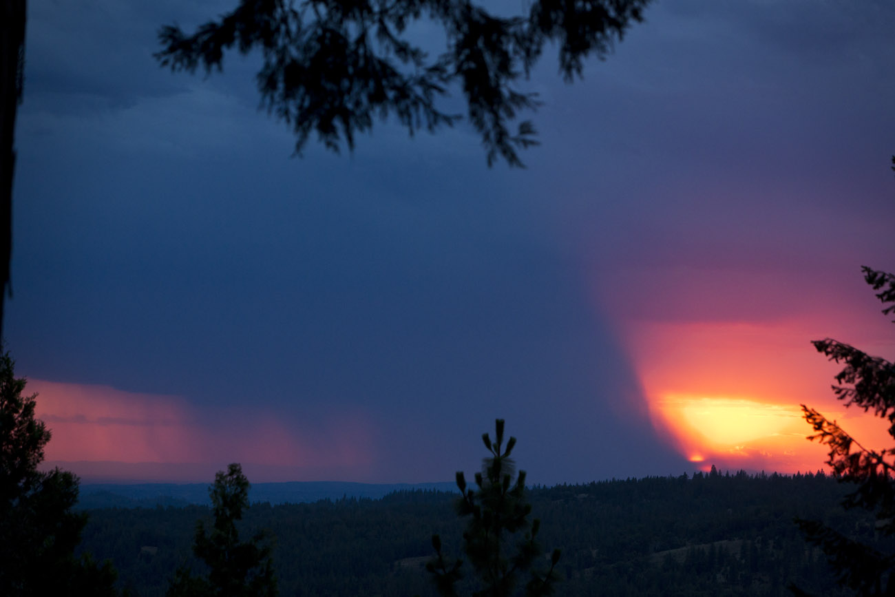
Sacramento deluge
#sunset #nature #mountains #pioneer
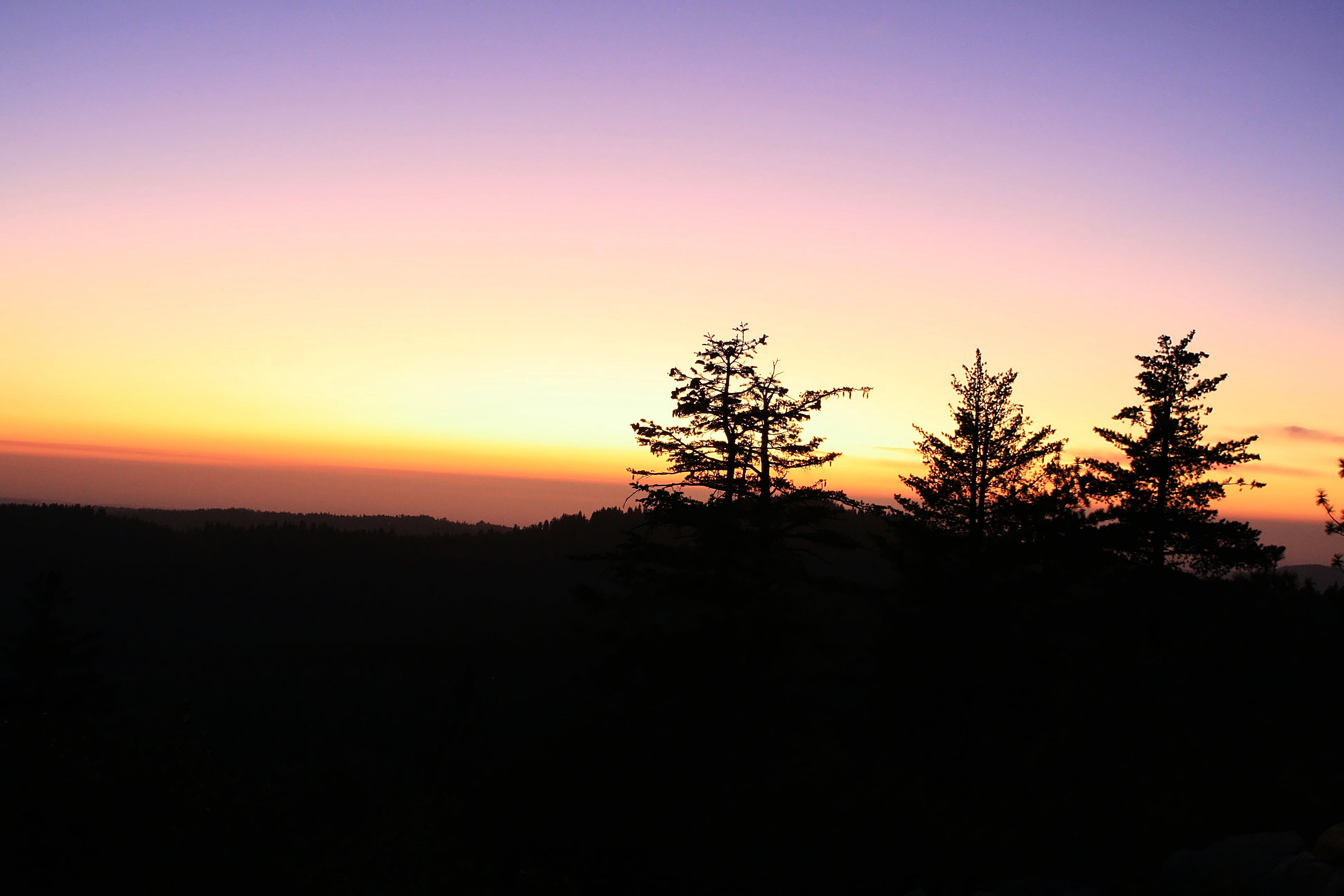
Magical Sunset

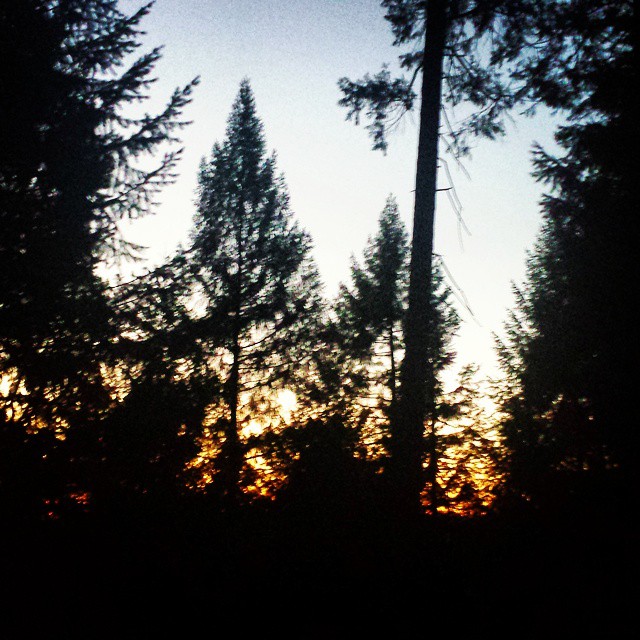
Sunrise through the trees in Amador County

Sunrise through the trees in Amador County

Sunrise through the trees in Amador County

Sunrise through the trees in Amador County

Sunrise through the trees in Amador County

Sunrise Behind the Trees Amador County

Sunrise through the trees in Amador County

Sunrise through the trees in Amador County

Sunrise through the trees in Amador County

Sunrise through the trees in Amador County

Sunrise through the trees in Amador County

Sunrise through the trees in Amador County

Sunrise through the trees in Amador County
Mapa de Old Rd, West Point, CA, EE. UU.
Buscar otro lugar
Lugares cercanos
Lili Valley Cir, West Point, CA, EE. UU.
Lily Valley Cir, West Point, CA, EE. UU.
Bailey Ridge Rd, Wilseyville, CA, EE. UU.
Tree Ln, West Point, CA, EE. UU.
Tree Lane, Tree Ln, West Point, CA, EE. UU.
Bald Mountain Rd, West Point, CA, EE. UU.
Eganoff Ln, Wilseyville, CA, EE. UU.
Blue Mountain Rd, Wilseyville, CA, EE. UU.
Camp Lodestar United Methodist, Blue Mountain Rd, Wilseyville, CA, EE. UU.
Robinville Dr, West Point, CA, EE. UU.
Gold Trail, Wilseyville, CA, EE. UU.
Gold Trail, Wilseyville, CA, EE. UU.
Hidden Valley Rd, West Point, CA, EE. UU.
Bald Mountain Rd, West Point, CA, EE. UU.
Skull Flat Rd, West Point, CA, EE. UU.
Carolyn Ct, Pioneer, CA, EE. UU.
Hidden Valley Rd, West Point, CA, EE. UU.
Susan Ln, Pioneer, CA, EE. UU.
Blue Mountain Rd, Wilseyville, CA, EE. UU.
McKenzie Drive, McKenzie Dr, California, EE. UU.
Búsquedas recientes
- Horas de salida y puesta de sol de Pu Ngaol Community Meeting Hall, HWHM+3X7, Krong Saen Monourom, Cambodia
- Horas de salida y puesta de sol de Pantai Cermin, batu 10, Jalan Pantai, Port Dickson, Melaka, Malasia
- Horas de salida y puesta de sol de Groblershoop, Sudáfrica
- Horas de salida y puesta de sol de Petriti, Greece
- Horas de salida y puesta de sol de Chesaw Rd, Oroville, WA, EE. UU.
- Horas de salida y puesta de sol de N, Mt Pleasant, UT, USA
- Horas de salida y puesta de sol de Kawanecho Sasamado, Shimada, Shizuoka -, Japan
- Horas de salida y puesta de sol de 6 Rue Jules Ferry, Beausoleil, Francia
- Horas de salida y puesta de sol de Ochandiano, Vizcaya, España
- Horas de salida y puesta de sol de Sattva Horizon, 4JC6+G9P, Vinayak Nagar, Kattigenahalli, Bengaluru, Karnataka, India