Horas de salida y puesta de sol de Kanyam, Ilam, Mechi Hwy, Suryodaya, Nepal
Location: Nepal > Eastern Region > Zona de Mechi > Suryodaya >
Zona horaria:
Asia/Katmandu
Hora local:
2024-04-29 20:03:07
Longitud:
88.0814481
Latitud:
26.8669271
Salida de sol de hoy:
05:15:29 AM
Puesta de sol de hoy:
06:24:27 PM
La duración del día hoy:
13h 8m 58s
Salida de sol de mañana:
05:14:41 AM
Puesta de sol de mañana:
06:25:00 PM
La duración del día mañana:
13h 10m 19s
Mostrar todas las fechas
| Fecha | Salida de sol | Puesta de sol | Duración del día |
|---|---|---|---|
| 01/01/2024 | 06:41:28 AM | 05:10:33 PM | 10h 29m 5s |
| 02/01/2024 | 06:41:44 AM | 05:11:13 PM | 10h 29m 29s |
| 03/01/2024 | 06:41:58 AM | 05:11:55 PM | 10h 29m 57s |
| 04/01/2024 | 06:42:11 AM | 05:12:37 PM | 10h 30m 26s |
| 05/01/2024 | 06:42:23 AM | 05:13:19 PM | 10h 30m 56s |
| 06/01/2024 | 06:42:33 AM | 05:14:02 PM | 10h 31m 29s |
| 07/01/2024 | 06:42:42 AM | 05:14:46 PM | 10h 32m 4s |
| 08/01/2024 | 06:42:49 AM | 05:15:30 PM | 10h 32m 41s |
| 09/01/2024 | 06:42:55 AM | 05:16:15 PM | 10h 33m 20s |
| 10/01/2024 | 06:42:59 AM | 05:17:00 PM | 10h 34m 1s |
| 11/01/2024 | 06:43:02 AM | 05:17:46 PM | 10h 34m 44s |
| 12/01/2024 | 06:43:03 AM | 05:18:32 PM | 10h 35m 29s |
| 13/01/2024 | 06:43:02 AM | 05:19:18 PM | 10h 36m 16s |
| 14/01/2024 | 06:43:00 AM | 05:20:05 PM | 10h 37m 5s |
| 15/01/2024 | 06:42:57 AM | 05:20:51 PM | 10h 37m 54s |
| 16/01/2024 | 06:42:52 AM | 05:21:38 PM | 10h 38m 46s |
| 17/01/2024 | 06:42:45 AM | 05:22:26 PM | 10h 39m 41s |
| 18/01/2024 | 06:42:37 AM | 05:23:13 PM | 10h 40m 36s |
| 19/01/2024 | 06:42:27 AM | 05:24:01 PM | 10h 41m 34s |
| 20/01/2024 | 06:42:16 AM | 05:24:48 PM | 10h 42m 32s |
| 21/01/2024 | 06:42:03 AM | 05:25:36 PM | 10h 43m 33s |
| 22/01/2024 | 06:41:49 AM | 05:26:23 PM | 10h 44m 34s |
| 23/01/2024 | 06:41:33 AM | 05:27:11 PM | 10h 45m 38s |
| 24/01/2024 | 06:41:16 AM | 05:27:58 PM | 10h 46m 42s |
| 25/01/2024 | 06:40:57 AM | 05:28:46 PM | 10h 47m 49s |
| 26/01/2024 | 06:40:37 AM | 05:29:33 PM | 10h 48m 56s |
| 27/01/2024 | 06:40:15 AM | 05:30:20 PM | 10h 50m 5s |
| 28/01/2024 | 06:39:52 AM | 05:31:07 PM | 10h 51m 15s |
| 29/01/2024 | 06:39:28 AM | 05:31:54 PM | 10h 52m 26s |
| 30/01/2024 | 06:39:02 AM | 05:32:41 PM | 10h 53m 39s |
| 31/01/2024 | 06:38:34 AM | 05:33:27 PM | 10h 54m 53s |
| 01/02/2024 | 06:38:06 AM | 05:34:13 PM | 10h 56m 7s |
| 02/02/2024 | 06:37:35 AM | 05:34:59 PM | 10h 57m 24s |
| 03/02/2024 | 06:37:04 AM | 05:35:45 PM | 10h 58m 41s |
| 04/02/2024 | 06:36:31 AM | 05:36:30 PM | 10h 59m 59s |
| 05/02/2024 | 06:35:57 AM | 05:37:15 PM | 11h 1m 18s |
| 06/02/2024 | 06:35:22 AM | 05:38:00 PM | 11h 2m 38s |
| 07/02/2024 | 06:34:45 AM | 05:38:44 PM | 11h 3m 59s |
| 08/02/2024 | 06:34:07 AM | 05:39:28 PM | 11h 5m 21s |
| 09/02/2024 | 06:33:28 AM | 05:40:11 PM | 11h 6m 43s |
| 10/02/2024 | 06:32:48 AM | 05:40:55 PM | 11h 8m 7s |
| 11/02/2024 | 06:32:06 AM | 05:41:37 PM | 11h 9m 31s |
| 12/02/2024 | 06:31:24 AM | 05:42:20 PM | 11h 10m 56s |
| 13/02/2024 | 06:30:40 AM | 05:43:02 PM | 11h 12m 22s |
| 14/02/2024 | 06:29:55 AM | 05:43:43 PM | 11h 13m 48s |
| 15/02/2024 | 06:29:09 AM | 05:44:25 PM | 11h 15m 16s |
| 16/02/2024 | 06:28:22 AM | 05:45:05 PM | 11h 16m 43s |
| 17/02/2024 | 06:27:35 AM | 05:45:46 PM | 11h 18m 11s |
| 18/02/2024 | 06:26:46 AM | 05:46:26 PM | 11h 19m 40s |
| 19/02/2024 | 06:25:56 AM | 05:47:05 PM | 11h 21m 9s |
| 20/02/2024 | 06:25:05 AM | 05:47:44 PM | 11h 22m 39s |
| 21/02/2024 | 06:24:13 AM | 05:48:23 PM | 11h 24m 10s |
| 22/02/2024 | 06:23:21 AM | 05:49:01 PM | 11h 25m 40s |
| 23/02/2024 | 06:22:27 AM | 05:49:39 PM | 11h 27m 12s |
| 24/02/2024 | 06:21:33 AM | 05:50:17 PM | 11h 28m 44s |
| 25/02/2024 | 06:20:38 AM | 05:50:54 PM | 11h 30m 16s |
| 26/02/2024 | 06:19:42 AM | 05:51:30 PM | 11h 31m 48s |
| 27/02/2024 | 06:18:46 AM | 05:52:07 PM | 11h 33m 21s |
| 28/02/2024 | 06:17:48 AM | 05:52:43 PM | 11h 34m 55s |
| 29/02/2024 | 06:16:50 AM | 05:53:18 PM | 11h 36m 28s |
| 01/03/2024 | 06:15:52 AM | 05:53:53 PM | 11h 38m 1s |
| 02/03/2024 | 06:14:52 AM | 05:54:28 PM | 11h 39m 36s |
| 03/03/2024 | 06:13:53 AM | 05:55:03 PM | 11h 41m 10s |
| 04/03/2024 | 06:12:52 AM | 05:55:37 PM | 11h 42m 45s |
| 05/03/2024 | 06:11:51 AM | 05:56:11 PM | 11h 44m 20s |
| 06/03/2024 | 06:10:50 AM | 05:56:44 PM | 11h 45m 54s |
| 07/03/2024 | 06:09:48 AM | 05:57:17 PM | 11h 47m 29s |
| 08/03/2024 | 06:08:45 AM | 05:57:50 PM | 11h 49m 5s |
| 09/03/2024 | 06:07:43 AM | 05:58:23 PM | 11h 50m 40s |
| 10/03/2024 | 06:06:39 AM | 05:58:55 PM | 11h 52m 16s |
| 11/03/2024 | 06:05:36 AM | 05:59:27 PM | 11h 53m 51s |
| 12/03/2024 | 06:04:32 AM | 05:59:59 PM | 11h 55m 27s |
| 13/03/2024 | 06:03:27 AM | 06:00:31 PM | 11h 57m 4s |
| 14/03/2024 | 06:02:23 AM | 06:01:02 PM | 11h 58m 39s |
| 15/03/2024 | 06:01:18 AM | 06:01:33 PM | 12h 0m 15s |
| 16/03/2024 | 06:00:13 AM | 06:02:04 PM | 12h 1m 51s |
| 17/03/2024 | 05:59:07 AM | 06:02:35 PM | 12h 3m 28s |
| 18/03/2024 | 05:58:02 AM | 06:03:06 PM | 12h 5m 4s |
| 19/03/2024 | 05:56:56 AM | 06:03:36 PM | 12h 6m 40s |
| 20/03/2024 | 05:55:51 AM | 06:04:06 PM | 12h 8m 15s |
| 21/03/2024 | 05:54:45 AM | 06:04:37 PM | 12h 9m 52s |
| 22/03/2024 | 05:53:39 AM | 06:05:07 PM | 12h 11m 28s |
| 23/03/2024 | 05:52:33 AM | 06:05:37 PM | 12h 13m 4s |
| 24/03/2024 | 05:51:27 AM | 06:06:06 PM | 12h 14m 39s |
| 25/03/2024 | 05:50:21 AM | 06:06:36 PM | 12h 16m 15s |
| 26/03/2024 | 05:49:15 AM | 06:07:06 PM | 12h 17m 51s |
| 27/03/2024 | 05:48:09 AM | 06:07:36 PM | 12h 19m 27s |
| 28/03/2024 | 05:47:03 AM | 06:08:05 PM | 12h 21m 2s |
| 29/03/2024 | 05:45:57 AM | 06:08:35 PM | 12h 22m 38s |
| 30/03/2024 | 05:44:52 AM | 06:09:04 PM | 12h 24m 12s |
| 31/03/2024 | 05:43:47 AM | 06:09:34 PM | 12h 25m 47s |
| 01/04/2024 | 05:42:41 AM | 06:10:04 PM | 12h 27m 23s |
| 02/04/2024 | 05:41:37 AM | 06:10:33 PM | 12h 28m 56s |
| 03/04/2024 | 05:40:32 AM | 06:11:03 PM | 12h 30m 31s |
| 04/04/2024 | 05:39:27 AM | 06:11:33 PM | 12h 32m 6s |
| 05/04/2024 | 05:38:23 AM | 06:12:02 PM | 12h 33m 39s |
| 06/04/2024 | 05:37:20 AM | 06:12:32 PM | 12h 35m 12s |
| 07/04/2024 | 05:36:16 AM | 06:13:02 PM | 12h 36m 46s |
| 08/04/2024 | 05:35:13 AM | 06:13:32 PM | 12h 38m 19s |
| 09/04/2024 | 05:34:11 AM | 06:14:02 PM | 12h 39m 51s |
| 10/04/2024 | 05:33:08 AM | 06:14:32 PM | 12h 41m 24s |
| 11/04/2024 | 05:32:07 AM | 06:15:02 PM | 12h 42m 55s |
| 12/04/2024 | 05:31:06 AM | 06:15:33 PM | 12h 44m 27s |
| 13/04/2024 | 05:30:05 AM | 06:16:03 PM | 12h 45m 58s |
| 14/04/2024 | 05:29:05 AM | 06:16:34 PM | 12h 47m 29s |
| 15/04/2024 | 05:28:05 AM | 06:17:05 PM | 12h 49m 0s |
| 16/04/2024 | 05:27:06 AM | 06:17:35 PM | 12h 50m 29s |
| 17/04/2024 | 05:26:08 AM | 06:18:06 PM | 12h 51m 58s |
| 18/04/2024 | 05:25:10 AM | 06:18:38 PM | 12h 53m 28s |
| 19/04/2024 | 05:24:13 AM | 06:19:09 PM | 12h 54m 56s |
| 20/04/2024 | 05:23:17 AM | 06:19:40 PM | 12h 56m 23s |
| 21/04/2024 | 05:22:21 AM | 06:20:12 PM | 12h 57m 51s |
| 22/04/2024 | 05:21:26 AM | 06:20:44 PM | 12h 59m 18s |
| 23/04/2024 | 05:20:32 AM | 06:21:16 PM | 13h 0m 44s |
| 24/04/2024 | 05:19:39 AM | 06:21:48 PM | 13h 2m 9s |
| 25/04/2024 | 05:18:46 AM | 06:22:20 PM | 13h 3m 34s |
| 26/04/2024 | 05:17:54 AM | 06:22:52 PM | 13h 4m 58s |
| 27/04/2024 | 05:17:04 AM | 06:23:25 PM | 13h 6m 21s |
| 28/04/2024 | 05:16:14 AM | 06:23:57 PM | 13h 7m 43s |
| 29/04/2024 | 05:15:24 AM | 06:24:30 PM | 13h 9m 6s |
| 30/04/2024 | 05:14:36 AM | 06:25:03 PM | 13h 10m 27s |
| 01/05/2024 | 05:13:49 AM | 06:25:36 PM | 13h 11m 47s |
| 02/05/2024 | 05:13:03 AM | 06:26:09 PM | 13h 13m 6s |
| 03/05/2024 | 05:12:18 AM | 06:26:43 PM | 13h 14m 25s |
| 04/05/2024 | 05:11:33 AM | 06:27:16 PM | 13h 15m 43s |
| 05/05/2024 | 05:10:50 AM | 06:27:49 PM | 13h 16m 59s |
| 06/05/2024 | 05:10:08 AM | 06:28:23 PM | 13h 18m 15s |
| 07/05/2024 | 05:09:27 AM | 06:28:57 PM | 13h 19m 30s |
| 08/05/2024 | 05:08:47 AM | 06:29:30 PM | 13h 20m 43s |
| 09/05/2024 | 05:08:08 AM | 06:30:04 PM | 13h 21m 56s |
| 10/05/2024 | 05:07:30 AM | 06:30:38 PM | 13h 23m 8s |
| 11/05/2024 | 05:06:54 AM | 06:31:11 PM | 13h 24m 17s |
| 12/05/2024 | 05:06:18 AM | 06:31:45 PM | 13h 25m 27s |
| 13/05/2024 | 05:05:44 AM | 06:32:19 PM | 13h 26m 35s |
| 14/05/2024 | 05:05:10 AM | 06:32:52 PM | 13h 27m 42s |
| 15/05/2024 | 05:04:39 AM | 06:33:26 PM | 13h 28m 47s |
| 16/05/2024 | 05:04:08 AM | 06:34:00 PM | 13h 29m 52s |
| 17/05/2024 | 05:03:38 AM | 06:34:33 PM | 13h 30m 55s |
| 18/05/2024 | 05:03:10 AM | 06:35:06 PM | 13h 31m 56s |
| 19/05/2024 | 05:02:43 AM | 06:35:39 PM | 13h 32m 56s |
| 20/05/2024 | 05:02:17 AM | 06:36:12 PM | 13h 33m 55s |
| 21/05/2024 | 05:01:52 AM | 06:36:45 PM | 13h 34m 53s |
| 22/05/2024 | 05:01:29 AM | 06:37:18 PM | 13h 35m 49s |
| 23/05/2024 | 05:01:07 AM | 06:37:50 PM | 13h 36m 43s |
| 24/05/2024 | 05:00:46 AM | 06:38:22 PM | 13h 37m 36s |
| 25/05/2024 | 05:00:27 AM | 06:38:54 PM | 13h 38m 27s |
| 26/05/2024 | 05:00:09 AM | 06:39:25 PM | 13h 39m 16s |
| 27/05/2024 | 04:59:52 AM | 06:39:56 PM | 13h 40m 4s |
| 28/05/2024 | 04:59:36 AM | 06:40:27 PM | 13h 40m 51s |
| 29/05/2024 | 04:59:22 AM | 06:40:58 PM | 13h 41m 36s |
| 30/05/2024 | 04:59:09 AM | 06:41:27 PM | 13h 42m 18s |
| 31/05/2024 | 04:58:57 AM | 06:41:57 PM | 13h 43m 0s |
| 01/06/2024 | 04:58:47 AM | 06:42:26 PM | 13h 43m 39s |
| 02/06/2024 | 04:58:38 AM | 06:42:54 PM | 13h 44m 16s |
| 03/06/2024 | 04:58:30 AM | 06:43:22 PM | 13h 44m 52s |
| 04/06/2024 | 04:58:24 AM | 06:43:49 PM | 13h 45m 25s |
| 05/06/2024 | 04:58:18 AM | 06:44:16 PM | 13h 45m 58s |
| 06/06/2024 | 04:58:14 AM | 06:44:42 PM | 13h 46m 28s |
| 07/06/2024 | 04:58:11 AM | 06:45:07 PM | 13h 46m 56s |
| 08/06/2024 | 04:58:10 AM | 06:45:32 PM | 13h 47m 22s |
| 09/06/2024 | 04:58:10 AM | 06:45:56 PM | 13h 47m 46s |
| 10/06/2024 | 04:58:11 AM | 06:46:19 PM | 13h 48m 8s |
| 11/06/2024 | 04:58:13 AM | 06:46:41 PM | 13h 48m 28s |
| 12/06/2024 | 04:58:16 AM | 06:47:03 PM | 13h 48m 47s |
| 13/06/2024 | 04:58:21 AM | 06:47:24 PM | 13h 49m 3s |
| 14/06/2024 | 04:58:26 AM | 06:47:43 PM | 13h 49m 17s |
| 15/06/2024 | 04:58:33 AM | 06:48:02 PM | 13h 49m 29s |
| 16/06/2024 | 04:58:41 AM | 06:48:20 PM | 13h 49m 39s |
| 17/06/2024 | 04:58:50 AM | 06:48:37 PM | 13h 49m 47s |
| 18/06/2024 | 04:59:00 AM | 06:48:53 PM | 13h 49m 53s |
| 19/06/2024 | 04:59:11 AM | 06:49:08 PM | 13h 49m 57s |
| 20/06/2024 | 04:59:24 AM | 06:49:22 PM | 13h 49m 58s |
| 21/06/2024 | 04:59:37 AM | 06:49:35 PM | 13h 49m 58s |
| 22/06/2024 | 04:59:51 AM | 06:49:47 PM | 13h 49m 56s |
| 23/06/2024 | 05:00:06 AM | 06:49:58 PM | 13h 49m 52s |
| 24/06/2024 | 05:00:22 AM | 06:50:07 PM | 13h 49m 45s |
| 25/06/2024 | 05:00:39 AM | 06:50:16 PM | 13h 49m 37s |
| 26/06/2024 | 05:00:57 AM | 06:50:23 PM | 13h 49m 26s |
| 27/06/2024 | 05:01:16 AM | 06:50:29 PM | 13h 49m 13s |
| 28/06/2024 | 05:01:36 AM | 06:50:34 PM | 13h 48m 58s |
| 29/06/2024 | 05:01:56 AM | 06:50:37 PM | 13h 48m 41s |
| 30/06/2024 | 05:02:17 AM | 06:50:40 PM | 13h 48m 23s |
| 01/07/2024 | 05:02:39 AM | 06:50:41 PM | 13h 48m 2s |
| 02/07/2024 | 05:03:02 AM | 06:50:41 PM | 13h 47m 39s |
| 03/07/2024 | 05:03:25 AM | 06:50:39 PM | 13h 47m 14s |
| 04/07/2024 | 05:03:49 AM | 06:50:37 PM | 13h 46m 48s |
| 05/07/2024 | 05:04:14 AM | 06:50:33 PM | 13h 46m 19s |
| 06/07/2024 | 05:04:39 AM | 06:50:27 PM | 13h 45m 48s |
| 07/07/2024 | 05:05:05 AM | 06:50:21 PM | 13h 45m 16s |
| 08/07/2024 | 05:05:31 AM | 06:50:13 PM | 13h 44m 42s |
| 09/07/2024 | 05:05:58 AM | 06:50:04 PM | 13h 44m 6s |
| 10/07/2024 | 05:06:25 AM | 06:49:53 PM | 13h 43m 28s |
| 11/07/2024 | 05:06:53 AM | 06:49:41 PM | 13h 42m 48s |
| 12/07/2024 | 05:07:21 AM | 06:49:28 PM | 13h 42m 7s |
| 13/07/2024 | 05:07:49 AM | 06:49:14 PM | 13h 41m 25s |
| 14/07/2024 | 05:08:18 AM | 06:48:58 PM | 13h 40m 40s |
| 15/07/2024 | 05:08:47 AM | 06:48:40 PM | 13h 39m 53s |
| 16/07/2024 | 05:09:17 AM | 06:48:22 PM | 13h 39m 5s |
| 17/07/2024 | 05:09:46 AM | 06:48:02 PM | 13h 38m 16s |
| 18/07/2024 | 05:10:16 AM | 06:47:41 PM | 13h 37m 25s |
| 19/07/2024 | 05:10:47 AM | 06:47:18 PM | 13h 36m 31s |
| 20/07/2024 | 05:11:17 AM | 06:46:54 PM | 13h 35m 37s |
| 21/07/2024 | 05:11:48 AM | 06:46:29 PM | 13h 34m 41s |
| 22/07/2024 | 05:12:19 AM | 06:46:03 PM | 13h 33m 44s |
| 23/07/2024 | 05:12:49 AM | 06:45:35 PM | 13h 32m 46s |
| 24/07/2024 | 05:13:20 AM | 06:45:06 PM | 13h 31m 46s |
| 25/07/2024 | 05:13:51 AM | 06:44:36 PM | 13h 30m 45s |
| 26/07/2024 | 05:14:23 AM | 06:44:04 PM | 13h 29m 41s |
| 27/07/2024 | 05:14:54 AM | 06:43:31 PM | 13h 28m 37s |
| 28/07/2024 | 05:15:25 AM | 06:42:57 PM | 13h 27m 32s |
| 29/07/2024 | 05:15:56 AM | 06:42:22 PM | 13h 26m 26s |
| 30/07/2024 | 05:16:27 AM | 06:41:46 PM | 13h 25m 19s |
| 31/07/2024 | 05:16:58 AM | 06:41:08 PM | 13h 24m 10s |
| 01/08/2024 | 05:17:29 AM | 06:40:30 PM | 13h 23m 1s |
| 02/08/2024 | 05:18:00 AM | 06:39:50 PM | 13h 21m 50s |
| 03/08/2024 | 05:18:31 AM | 06:39:09 PM | 13h 20m 38s |
| 04/08/2024 | 05:19:02 AM | 06:38:26 PM | 13h 19m 24s |
| 05/08/2024 | 05:19:33 AM | 06:37:43 PM | 13h 18m 10s |
| 06/08/2024 | 05:20:04 AM | 06:36:59 PM | 13h 16m 55s |
| 07/08/2024 | 05:20:34 AM | 06:36:14 PM | 13h 15m 40s |
| 08/08/2024 | 05:21:04 AM | 06:35:27 PM | 13h 14m 23s |
| 09/08/2024 | 05:21:35 AM | 06:34:40 PM | 13h 13m 5s |
| 10/08/2024 | 05:22:05 AM | 06:33:51 PM | 13h 11m 46s |
| 11/08/2024 | 05:22:35 AM | 06:33:02 PM | 13h 10m 27s |
| 12/08/2024 | 05:23:04 AM | 06:32:11 PM | 13h 9m 7s |
| 13/08/2024 | 05:23:34 AM | 06:31:20 PM | 13h 7m 46s |
| 14/08/2024 | 05:24:03 AM | 06:30:28 PM | 13h 6m 25s |
| 15/08/2024 | 05:24:33 AM | 06:29:35 PM | 13h 5m 2s |
| 16/08/2024 | 05:25:02 AM | 06:28:41 PM | 13h 3m 39s |
| 17/08/2024 | 05:25:30 AM | 06:27:46 PM | 13h 2m 16s |
| 18/08/2024 | 05:25:59 AM | 06:26:51 PM | 13h 0m 52s |
| 19/08/2024 | 05:26:28 AM | 06:25:54 PM | 12h 59m 26s |
| 20/08/2024 | 05:26:56 AM | 06:24:57 PM | 12h 58m 1s |
| 21/08/2024 | 05:27:24 AM | 06:23:59 PM | 12h 56m 35s |
| 22/08/2024 | 05:27:52 AM | 06:23:00 PM | 12h 55m 8s |
| 23/08/2024 | 05:28:20 AM | 06:22:01 PM | 12h 53m 41s |
| 24/08/2024 | 05:28:47 AM | 06:21:01 PM | 12h 52m 14s |
| 25/08/2024 | 05:29:14 AM | 06:20:00 PM | 12h 50m 46s |
| 26/08/2024 | 05:29:42 AM | 06:18:59 PM | 12h 49m 17s |
| 27/08/2024 | 05:30:09 AM | 06:17:57 PM | 12h 47m 48s |
| 28/08/2024 | 05:30:36 AM | 06:16:54 PM | 12h 46m 18s |
| 29/08/2024 | 05:31:02 AM | 06:15:51 PM | 12h 44m 49s |
| 30/08/2024 | 05:31:29 AM | 06:14:48 PM | 12h 43m 19s |
| 31/08/2024 | 05:31:55 AM | 06:13:44 PM | 12h 41m 49s |
| 01/09/2024 | 05:32:22 AM | 06:12:39 PM | 12h 40m 17s |
| 02/09/2024 | 05:32:48 AM | 06:11:34 PM | 12h 38m 46s |
| 03/09/2024 | 05:33:14 AM | 06:10:29 PM | 12h 37m 15s |
| 04/09/2024 | 05:33:40 AM | 06:09:23 PM | 12h 35m 43s |
| 05/09/2024 | 05:34:06 AM | 06:08:17 PM | 12h 34m 11s |
| 06/09/2024 | 05:34:32 AM | 06:07:10 PM | 12h 32m 38s |
| 07/09/2024 | 05:34:58 AM | 06:06:04 PM | 12h 31m 6s |
| 08/09/2024 | 05:35:23 AM | 06:04:56 PM | 12h 29m 33s |
| 09/09/2024 | 05:35:49 AM | 06:03:49 PM | 12h 28m 0s |
| 10/09/2024 | 05:36:14 AM | 06:02:41 PM | 12h 26m 27s |
| 11/09/2024 | 05:36:40 AM | 06:01:33 PM | 12h 24m 53s |
| 12/09/2024 | 05:37:06 AM | 06:00:25 PM | 12h 23m 19s |
| 13/09/2024 | 05:37:31 AM | 05:59:17 PM | 12h 21m 46s |
| 14/09/2024 | 05:37:57 AM | 05:58:09 PM | 12h 20m 12s |
| 15/09/2024 | 05:38:22 AM | 05:57:00 PM | 12h 18m 38s |
| 16/09/2024 | 05:38:48 AM | 05:55:52 PM | 12h 17m 4s |
| 17/09/2024 | 05:39:14 AM | 05:54:43 PM | 12h 15m 29s |
| 18/09/2024 | 05:39:39 AM | 05:53:35 PM | 12h 13m 56s |
| 19/09/2024 | 05:40:05 AM | 05:52:26 PM | 12h 12m 21s |
| 20/09/2024 | 05:40:31 AM | 05:51:18 PM | 12h 10m 47s |
| 21/09/2024 | 05:40:57 AM | 05:50:09 PM | 12h 9m 12s |
| 22/09/2024 | 05:41:23 AM | 05:49:01 PM | 12h 7m 38s |
| 23/09/2024 | 05:41:50 AM | 05:47:52 PM | 12h 6m 2s |
| 24/09/2024 | 05:42:16 AM | 05:46:44 PM | 12h 4m 28s |
| 25/09/2024 | 05:42:43 AM | 05:45:36 PM | 12h 2m 53s |
| 26/09/2024 | 05:43:09 AM | 05:44:28 PM | 12h 1m 19s |
| 27/09/2024 | 05:43:36 AM | 05:43:20 PM | 11h 59m 44s |
| 28/09/2024 | 05:44:03 AM | 05:42:13 PM | 11h 58m 10s |
| 29/09/2024 | 05:44:31 AM | 05:41:06 PM | 11h 56m 35s |
| 30/09/2024 | 05:44:58 AM | 05:39:59 PM | 11h 55m 1s |
| 01/10/2024 | 05:45:26 AM | 05:38:53 PM | 11h 53m 27s |
| 02/10/2024 | 05:45:54 AM | 05:37:46 PM | 11h 51m 52s |
| 03/10/2024 | 05:46:23 AM | 05:36:41 PM | 11h 50m 18s |
| 04/10/2024 | 05:46:51 AM | 05:35:35 PM | 11h 48m 44s |
| 05/10/2024 | 05:47:20 AM | 05:34:30 PM | 11h 47m 10s |
| 06/10/2024 | 05:47:49 AM | 05:33:26 PM | 11h 45m 37s |
| 07/10/2024 | 05:48:19 AM | 05:32:22 PM | 11h 44m 3s |
| 08/10/2024 | 05:48:49 AM | 05:31:18 PM | 11h 42m 29s |
| 09/10/2024 | 05:49:19 AM | 05:30:16 PM | 11h 40m 57s |
| 10/10/2024 | 05:49:50 AM | 05:29:13 PM | 11h 39m 23s |
| 11/10/2024 | 05:50:21 AM | 05:28:11 PM | 11h 37m 50s |
| 12/10/2024 | 05:50:52 AM | 05:27:10 PM | 11h 36m 18s |
| 13/10/2024 | 05:51:24 AM | 05:26:10 PM | 11h 34m 46s |
| 14/10/2024 | 05:51:56 AM | 05:25:10 PM | 11h 33m 14s |
| 15/10/2024 | 05:52:28 AM | 05:24:11 PM | 11h 31m 43s |
| 16/10/2024 | 05:53:01 AM | 05:23:13 PM | 11h 30m 12s |
| 17/10/2024 | 05:53:34 AM | 05:22:15 PM | 11h 28m 41s |
| 18/10/2024 | 05:54:08 AM | 05:21:18 PM | 11h 27m 10s |
| 19/10/2024 | 05:54:42 AM | 05:20:23 PM | 11h 25m 41s |
| 20/10/2024 | 05:55:17 AM | 05:19:27 PM | 11h 24m 10s |
| 21/10/2024 | 05:55:52 AM | 05:18:33 PM | 11h 22m 41s |
| 22/10/2024 | 05:56:27 AM | 05:17:40 PM | 11h 21m 13s |
| 23/10/2024 | 05:57:03 AM | 05:16:48 PM | 11h 19m 45s |
| 24/10/2024 | 05:57:39 AM | 05:15:56 PM | 11h 18m 17s |
| 25/10/2024 | 05:58:16 AM | 05:15:06 PM | 11h 16m 50s |
| 26/10/2024 | 05:58:53 AM | 05:14:16 PM | 11h 15m 23s |
| 27/10/2024 | 05:59:31 AM | 05:13:28 PM | 11h 13m 57s |
| 28/10/2024 | 06:00:09 AM | 05:12:41 PM | 11h 12m 32s |
| 29/10/2024 | 06:00:48 AM | 05:11:54 PM | 11h 11m 6s |
| 30/10/2024 | 06:01:27 AM | 05:11:09 PM | 11h 9m 42s |
| 31/10/2024 | 06:02:06 AM | 05:10:25 PM | 11h 8m 19s |
| 01/11/2024 | 06:02:46 AM | 05:09:43 PM | 11h 6m 57s |
| 02/11/2024 | 06:03:26 AM | 05:09:01 PM | 11h 5m 35s |
| 03/11/2024 | 06:04:07 AM | 05:08:21 PM | 11h 4m 14s |
| 04/11/2024 | 06:04:48 AM | 05:07:41 PM | 11h 2m 53s |
| 05/11/2024 | 06:05:29 AM | 05:07:04 PM | 11h 1m 35s |
| 06/11/2024 | 06:06:11 AM | 05:06:27 PM | 11h 0m 16s |
| 07/11/2024 | 06:06:53 AM | 05:05:52 PM | 10h 58m 59s |
| 08/11/2024 | 06:07:36 AM | 05:05:18 PM | 10h 57m 42s |
| 09/11/2024 | 06:08:19 AM | 05:04:45 PM | 10h 56m 26s |
| 10/11/2024 | 06:09:02 AM | 05:04:14 PM | 10h 55m 12s |
| 11/11/2024 | 06:09:45 AM | 05:03:44 PM | 10h 53m 59s |
| 12/11/2024 | 06:10:29 AM | 05:03:16 PM | 10h 52m 47s |
| 13/11/2024 | 06:11:13 AM | 05:02:49 PM | 10h 51m 36s |
| 14/11/2024 | 06:11:57 AM | 05:02:23 PM | 10h 50m 26s |
| 15/11/2024 | 06:12:42 AM | 05:01:59 PM | 10h 49m 17s |
| 16/11/2024 | 06:13:27 AM | 05:01:36 PM | 10h 48m 9s |
| 17/11/2024 | 06:14:12 AM | 05:01:15 PM | 10h 47m 3s |
| 18/11/2024 | 06:14:57 AM | 05:00:56 PM | 10h 45m 59s |
| 19/11/2024 | 06:15:42 AM | 05:00:38 PM | 10h 44m 56s |
| 20/11/2024 | 06:16:27 AM | 05:00:21 PM | 10h 43m 54s |
| 21/11/2024 | 06:17:13 AM | 05:00:06 PM | 10h 42m 53s |
| 22/11/2024 | 06:17:58 AM | 04:59:53 PM | 10h 41m 55s |
| 23/11/2024 | 06:18:43 AM | 04:59:41 PM | 10h 40m 58s |
| 24/11/2024 | 06:19:29 AM | 04:59:30 PM | 10h 40m 1s |
| 25/11/2024 | 06:20:14 AM | 04:59:22 PM | 10h 39m 8s |
| 26/11/2024 | 06:20:59 AM | 04:59:14 PM | 10h 38m 15s |
| 27/11/2024 | 06:21:45 AM | 04:59:09 PM | 10h 37m 24s |
| 28/11/2024 | 06:22:30 AM | 04:59:05 PM | 10h 36m 35s |
| 29/11/2024 | 06:23:14 AM | 04:59:02 PM | 10h 35m 48s |
| 30/11/2024 | 06:23:59 AM | 04:59:01 PM | 10h 35m 2s |
| 01/12/2024 | 06:24:43 AM | 04:59:02 PM | 10h 34m 19s |
| 02/12/2024 | 06:25:27 AM | 04:59:04 PM | 10h 33m 37s |
| 03/12/2024 | 06:26:11 AM | 04:59:08 PM | 10h 32m 57s |
| 04/12/2024 | 06:26:54 AM | 04:59:14 PM | 10h 32m 20s |
| 05/12/2024 | 06:27:36 AM | 04:59:21 PM | 10h 31m 45s |
| 06/12/2024 | 06:28:19 AM | 04:59:29 PM | 10h 31m 10s |
| 07/12/2024 | 06:29:00 AM | 04:59:39 PM | 10h 30m 39s |
| 08/12/2024 | 06:29:42 AM | 04:59:51 PM | 10h 30m 9s |
| 09/12/2024 | 06:30:22 AM | 05:00:04 PM | 10h 29m 42s |
| 10/12/2024 | 06:31:02 AM | 05:00:19 PM | 10h 29m 17s |
| 11/12/2024 | 06:31:41 AM | 05:00:35 PM | 10h 28m 54s |
| 12/12/2024 | 06:32:20 AM | 05:00:52 PM | 10h 28m 32s |
| 13/12/2024 | 06:32:58 AM | 05:01:11 PM | 10h 28m 13s |
| 14/12/2024 | 06:33:35 AM | 05:01:31 PM | 10h 27m 56s |
| 15/12/2024 | 06:34:11 AM | 05:01:53 PM | 10h 27m 42s |
| 16/12/2024 | 06:34:46 AM | 05:02:16 PM | 10h 27m 30s |
| 17/12/2024 | 06:35:20 AM | 05:02:41 PM | 10h 27m 21s |
| 18/12/2024 | 06:35:54 AM | 05:03:06 PM | 10h 27m 12s |
| 19/12/2024 | 06:36:26 AM | 05:03:33 PM | 10h 27m 7s |
| 20/12/2024 | 06:36:57 AM | 05:04:01 PM | 10h 27m 4s |
| 21/12/2024 | 06:37:27 AM | 05:04:31 PM | 10h 27m 4s |
| 22/12/2024 | 06:37:57 AM | 05:05:01 PM | 10h 27m 4s |
| 23/12/2024 | 06:38:25 AM | 05:05:33 PM | 10h 27m 8s |
| 24/12/2024 | 06:38:51 AM | 05:06:06 PM | 10h 27m 15s |
| 25/12/2024 | 06:39:17 AM | 05:06:40 PM | 10h 27m 23s |
| 26/12/2024 | 06:39:41 AM | 05:07:15 PM | 10h 27m 34s |
| 27/12/2024 | 06:40:04 AM | 05:07:51 PM | 10h 27m 47s |
| 28/12/2024 | 06:40:26 AM | 05:08:27 PM | 10h 28m 1s |
| 29/12/2024 | 06:40:47 AM | 05:09:05 PM | 10h 28m 18s |
| 30/12/2024 | 06:41:06 AM | 05:09:44 PM | 10h 28m 38s |
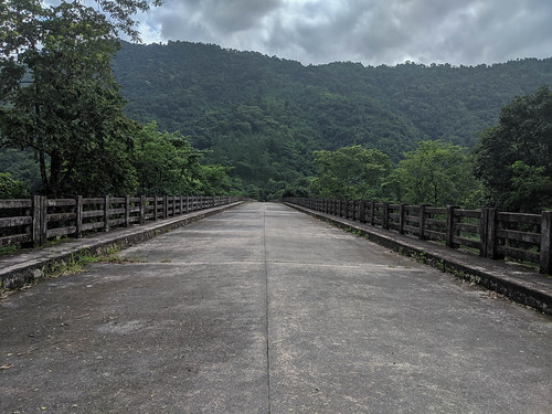
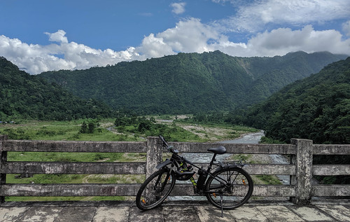
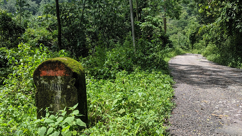
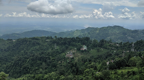
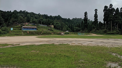
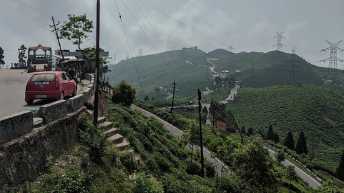
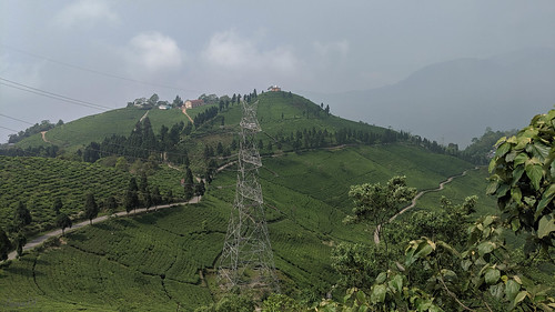
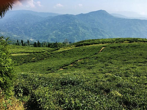
Fotos
Mapa de Kanyam, Ilam, Mechi Hwy, Suryodaya, Nepal
Buscar otro lugar
Lugares cercanos
Kanyam, Nepal
Suryodaya, Nepal
Fikkal, Suryodaya, Nepal
Rishi Road, Rishi Rd, Okaity Tea Garden, West Bengal, India
Rishi Road, Rishi Rd, पशुपतिनगर, West Bengal, India
Mirik Bazar, Unnamed Road, Mirik, West Bengal, India
Mirik, West Bengal, India
Mane Bhanjang, West Bengal, India
Majua, West Bengal, India
Budhabare, Nepal
Zona de Mechi, Nepal
Ilam, Nepal
Sukhia Pokhari, West Bengal, India
Summit Hotel, Ilam, Nepal
Tea Garden restaurant, Unnamed Road, ईलाम, Nepal
Ilam, Nepal
Unnamed Road, Kacel Tea Garden, West Bengal, India
Sandakphu, Nepal
Ghoom, West Bengal, India
Puwa Khola, Maipokhari, Nepal
Búsquedas recientes
- Horas de salida y puesta de sol de Leguwa, Nepal
- Horas de salida y puesta de sol de Shustino, Vladimir Oblast, Russia
- Horas de salida y puesta de sol de Lampiasi St, Sarasota, FL, USA
- Horas de salida y puesta de sol de Japón, 〒- Toyama, Kubomotomachi, 12−31 APAガーデンコート稲荷
- Horas de salida y puesta de sol de Jialuohu, Datong Township, Yilan County, Taiwán
- Horas de salida y puesta de sol de 大下港, Sekizenoge, Imabari, Prefectura de Ehime -, Japón
- Horas de salida y puesta de sol de Oge port Ferry Terminal, -1 Sekizenōge, Imabari, Ehime -, Japón
- Horas de salida y puesta de sol de San Telmo, Cdad. Autónoma de Buenos Aires, Argentina
- Horas de salida y puesta de sol de Congressional Dr, Stevensville, MD, USA
- Horas de salida y puesta de sol de Papingo 04, Grecia


