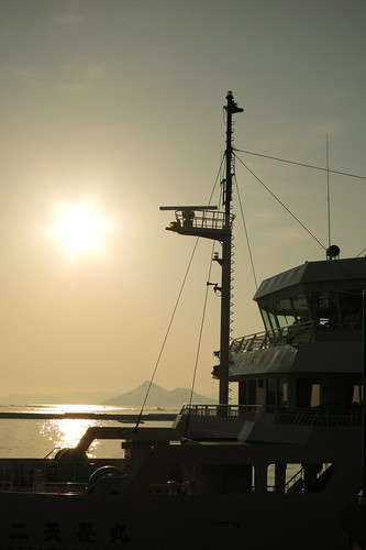
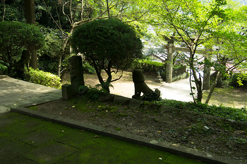
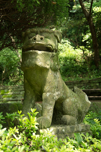
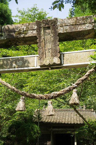
Horas de salida y puesta de sol de Kamihira, Kawauramachi Miyanokawachi, Amakusa, Prefectura de Kumamoto -, Japón
Location: Japón > Prefectura de Kumamoto > Amakusa > Kawauramachi Miyanokawachi >
Zona horaria:
Asia/Tokyo
Hora local:
2024-04-27 21:57:18
Longitud:
130.1322
Latitud:
32.286488
Salida de sol de hoy:
05:36:33 AM
Puesta de sol de hoy:
06:57:35 PM
La duración del día hoy:
13h 21m 2s
Salida de sol de mañana:
05:35:32 AM
Puesta de sol de mañana:
06:58:18 PM
La duración del día mañana:
13h 22m 46s
Mostrar todas las fechas
| Fecha | Salida de sol | Puesta de sol | Duración del día |
|---|---|---|---|
| 01/01/2024 | 07:20:28 AM | 05:24:54 PM | 10h 4m 26s |
| 02/01/2024 | 07:20:42 AM | 05:25:37 PM | 10h 4m 55s |
| 03/01/2024 | 07:20:53 AM | 05:26:21 PM | 10h 5m 28s |
| 04/01/2024 | 07:21:03 AM | 05:27:07 PM | 10h 6m 4s |
| 05/01/2024 | 07:21:11 AM | 05:27:53 PM | 10h 6m 42s |
| 06/01/2024 | 07:21:17 AM | 05:28:41 PM | 10h 7m 24s |
| 07/01/2024 | 07:21:22 AM | 05:29:29 PM | 10h 8m 7s |
| 08/01/2024 | 07:21:24 AM | 05:30:18 PM | 10h 8m 54s |
| 09/01/2024 | 07:21:25 AM | 05:31:07 PM | 10h 9m 42s |
| 10/01/2024 | 07:21:25 AM | 05:31:58 PM | 10h 10m 33s |
| 11/01/2024 | 07:21:22 AM | 05:32:49 PM | 10h 11m 27s |
| 12/01/2024 | 07:21:18 AM | 05:33:41 PM | 10h 12m 23s |
| 13/01/2024 | 07:21:12 AM | 05:34:33 PM | 10h 13m 21s |
| 14/01/2024 | 07:21:04 AM | 05:35:26 PM | 10h 14m 22s |
| 15/01/2024 | 07:20:54 AM | 05:36:19 PM | 10h 15m 25s |
| 16/01/2024 | 07:20:43 AM | 05:37:13 PM | 10h 16m 30s |
| 17/01/2024 | 07:20:29 AM | 05:38:07 PM | 10h 17m 38s |
| 18/01/2024 | 07:20:15 AM | 05:39:01 PM | 10h 18m 46s |
| 19/01/2024 | 07:19:58 AM | 05:39:56 PM | 10h 19m 58s |
| 20/01/2024 | 07:19:39 AM | 05:40:51 PM | 10h 21m 12s |
| 21/01/2024 | 07:19:19 AM | 05:41:47 PM | 10h 22m 28s |
| 22/01/2024 | 07:18:57 AM | 05:42:42 PM | 10h 23m 45s |
| 23/01/2024 | 07:18:34 AM | 05:43:38 PM | 10h 25m 4s |
| 24/01/2024 | 07:18:09 AM | 05:44:34 PM | 10h 26m 25s |
| 25/01/2024 | 07:17:42 AM | 05:45:30 PM | 10h 27m 48s |
| 26/01/2024 | 07:17:13 AM | 05:46:26 PM | 10h 29m 13s |
| 27/01/2024 | 07:16:43 AM | 05:47:22 PM | 10h 30m 39s |
| 28/01/2024 | 07:16:11 AM | 05:48:18 PM | 10h 32m 7s |
| 29/01/2024 | 07:15:38 AM | 05:49:14 PM | 10h 33m 36s |
| 30/01/2024 | 07:15:03 AM | 05:50:10 PM | 10h 35m 7s |
| 31/01/2024 | 07:14:26 AM | 05:51:06 PM | 10h 36m 40s |
| 01/02/2024 | 07:13:48 AM | 05:52:02 PM | 10h 38m 14s |
| 02/02/2024 | 07:13:09 AM | 05:52:58 PM | 10h 39m 49s |
| 03/02/2024 | 07:12:28 AM | 05:53:53 PM | 10h 41m 25s |
| 04/02/2024 | 07:11:45 AM | 05:54:49 PM | 10h 43m 4s |
| 05/02/2024 | 07:11:01 AM | 05:55:44 PM | 10h 44m 43s |
| 06/02/2024 | 07:10:16 AM | 05:56:39 PM | 10h 46m 23s |
| 07/02/2024 | 07:09:30 AM | 05:57:33 PM | 10h 48m 3s |
| 08/02/2024 | 07:08:42 AM | 05:58:28 PM | 10h 49m 46s |
| 09/02/2024 | 07:07:52 AM | 05:59:22 PM | 10h 51m 30s |
| 10/02/2024 | 07:07:02 AM | 06:00:16 PM | 10h 53m 14s |
| 11/02/2024 | 07:06:10 AM | 06:01:09 PM | 10h 54m 59s |
| 12/02/2024 | 07:05:17 AM | 06:02:03 PM | 10h 56m 46s |
| 13/02/2024 | 07:04:23 AM | 06:02:55 PM | 10h 58m 32s |
| 14/02/2024 | 07:03:27 AM | 06:03:48 PM | 11h 0m 21s |
| 15/02/2024 | 07:02:31 AM | 06:04:40 PM | 11h 2m 9s |
| 16/02/2024 | 07:01:33 AM | 06:05:32 PM | 11h 3m 59s |
| 17/02/2024 | 07:00:34 AM | 06:06:24 PM | 11h 5m 50s |
| 18/02/2024 | 06:59:34 AM | 06:07:15 PM | 11h 7m 41s |
| 19/02/2024 | 06:58:33 AM | 06:08:06 PM | 11h 9m 33s |
| 20/02/2024 | 06:57:32 AM | 06:08:56 PM | 11h 11m 24s |
| 21/02/2024 | 06:56:29 AM | 06:09:47 PM | 11h 13m 18s |
| 22/02/2024 | 06:55:25 AM | 06:10:36 PM | 11h 15m 11s |
| 23/02/2024 | 06:54:20 AM | 06:11:26 PM | 11h 17m 6s |
| 24/02/2024 | 06:53:15 AM | 06:12:15 PM | 11h 19m 0s |
| 25/02/2024 | 06:52:08 AM | 06:13:04 PM | 11h 20m 56s |
| 26/02/2024 | 06:51:01 AM | 06:13:52 PM | 11h 22m 51s |
| 27/02/2024 | 06:49:53 AM | 06:14:40 PM | 11h 24m 47s |
| 28/02/2024 | 06:48:45 AM | 06:15:28 PM | 11h 26m 43s |
| 29/02/2024 | 06:47:35 AM | 06:16:15 PM | 11h 28m 40s |
| 01/03/2024 | 06:46:25 AM | 06:17:02 PM | 11h 30m 37s |
| 02/03/2024 | 06:45:14 AM | 06:17:48 PM | 11h 32m 34s |
| 03/03/2024 | 06:44:03 AM | 06:18:35 PM | 11h 34m 32s |
| 04/03/2024 | 06:42:51 AM | 06:19:21 PM | 11h 36m 30s |
| 05/03/2024 | 06:41:38 AM | 06:20:06 PM | 11h 38m 28s |
| 06/03/2024 | 06:40:25 AM | 06:20:52 PM | 11h 40m 27s |
| 07/03/2024 | 06:39:11 AM | 06:21:37 PM | 11h 42m 26s |
| 08/03/2024 | 06:37:57 AM | 06:22:22 PM | 11h 44m 25s |
| 09/03/2024 | 06:36:43 AM | 06:23:06 PM | 11h 46m 23s |
| 10/03/2024 | 06:35:28 AM | 06:23:50 PM | 11h 48m 22s |
| 11/03/2024 | 06:34:12 AM | 06:24:34 PM | 11h 50m 22s |
| 12/03/2024 | 06:32:56 AM | 06:25:18 PM | 11h 52m 22s |
| 13/03/2024 | 06:31:40 AM | 06:26:02 PM | 11h 54m 22s |
| 14/03/2024 | 06:30:24 AM | 06:26:45 PM | 11h 56m 21s |
| 15/03/2024 | 06:29:07 AM | 06:27:28 PM | 11h 58m 21s |
| 16/03/2024 | 06:27:50 AM | 06:28:11 PM | 12h 0m 21s |
| 17/03/2024 | 06:26:33 AM | 06:28:54 PM | 12h 2m 21s |
| 18/03/2024 | 06:25:16 AM | 06:29:36 PM | 12h 4m 20s |
| 19/03/2024 | 06:23:58 AM | 06:30:19 PM | 12h 6m 21s |
| 20/03/2024 | 06:22:41 AM | 06:31:01 PM | 12h 8m 20s |
| 21/03/2024 | 06:21:23 AM | 06:31:43 PM | 12h 10m 20s |
| 22/03/2024 | 06:20:05 AM | 06:32:25 PM | 12h 12m 20s |
| 23/03/2024 | 06:18:47 AM | 06:33:07 PM | 12h 14m 20s |
| 24/03/2024 | 06:17:29 AM | 06:33:49 PM | 12h 16m 20s |
| 25/03/2024 | 06:16:12 AM | 06:34:30 PM | 12h 18m 18s |
| 26/03/2024 | 06:14:54 AM | 06:35:12 PM | 12h 20m 18s |
| 27/03/2024 | 06:13:36 AM | 06:35:53 PM | 12h 22m 17s |
| 28/03/2024 | 06:12:18 AM | 06:36:35 PM | 12h 24m 17s |
| 29/03/2024 | 06:11:01 AM | 06:37:16 PM | 12h 26m 15s |
| 30/03/2024 | 06:09:44 AM | 06:37:57 PM | 12h 28m 13s |
| 31/03/2024 | 06:08:26 AM | 06:38:39 PM | 12h 30m 13s |
| 01/04/2024 | 06:07:10 AM | 06:39:20 PM | 12h 32m 10s |
| 02/04/2024 | 06:05:53 AM | 06:40:01 PM | 12h 34m 8s |
| 03/04/2024 | 06:04:36 AM | 06:40:43 PM | 12h 36m 7s |
| 04/04/2024 | 06:03:20 AM | 06:41:24 PM | 12h 38m 4s |
| 05/04/2024 | 06:02:04 AM | 06:42:06 PM | 12h 40m 2s |
| 06/04/2024 | 06:00:49 AM | 06:42:47 PM | 12h 41m 58s |
| 07/04/2024 | 05:59:34 AM | 06:43:28 PM | 12h 43m 54s |
| 08/04/2024 | 05:58:19 AM | 06:44:10 PM | 12h 45m 51s |
| 09/04/2024 | 05:57:05 AM | 06:44:51 PM | 12h 47m 46s |
| 10/04/2024 | 05:55:51 AM | 06:45:33 PM | 12h 49m 42s |
| 11/04/2024 | 05:54:38 AM | 06:46:15 PM | 12h 51m 37s |
| 12/04/2024 | 05:53:25 AM | 06:46:56 PM | 12h 53m 31s |
| 13/04/2024 | 05:52:13 AM | 06:47:38 PM | 12h 55m 25s |
| 14/04/2024 | 05:51:01 AM | 06:48:20 PM | 12h 57m 19s |
| 15/04/2024 | 05:49:50 AM | 06:49:02 PM | 12h 59m 12s |
| 16/04/2024 | 05:48:40 AM | 06:49:44 PM | 13h 1m 4s |
| 17/04/2024 | 05:47:30 AM | 06:50:26 PM | 13h 2m 56s |
| 18/04/2024 | 05:46:21 AM | 06:51:09 PM | 13h 4m 48s |
| 19/04/2024 | 05:45:13 AM | 06:51:51 PM | 13h 6m 38s |
| 20/04/2024 | 05:44:06 AM | 06:52:33 PM | 13h 8m 27s |
| 21/04/2024 | 05:42:59 AM | 06:53:16 PM | 13h 10m 17s |
| 22/04/2024 | 05:41:53 AM | 06:53:59 PM | 13h 12m 6s |
| 23/04/2024 | 05:40:48 AM | 06:54:41 PM | 13h 13m 53s |
| 24/04/2024 | 05:39:43 AM | 06:55:24 PM | 13h 15m 41s |
| 25/04/2024 | 05:38:40 AM | 06:56:07 PM | 13h 17m 27s |
| 26/04/2024 | 05:37:37 AM | 06:56:50 PM | 13h 19m 13s |
| 27/04/2024 | 05:36:36 AM | 06:57:33 PM | 13h 20m 57s |
| 28/04/2024 | 05:35:35 AM | 06:58:16 PM | 13h 22m 41s |
| 29/04/2024 | 05:34:35 AM | 06:58:59 PM | 13h 24m 24s |
| 30/04/2024 | 05:33:37 AM | 06:59:42 PM | 13h 26m 5s |
| 01/05/2024 | 05:32:39 AM | 07:00:25 PM | 13h 27m 46s |
| 02/05/2024 | 05:31:42 AM | 07:01:09 PM | 13h 29m 27s |
| 03/05/2024 | 05:30:47 AM | 07:01:52 PM | 13h 31m 5s |
| 04/05/2024 | 05:29:53 AM | 07:02:35 PM | 13h 32m 42s |
| 05/05/2024 | 05:28:59 AM | 07:03:18 PM | 13h 34m 19s |
| 06/05/2024 | 05:28:07 AM | 07:04:02 PM | 13h 35m 55s |
| 07/05/2024 | 05:27:16 AM | 07:04:45 PM | 13h 37m 29s |
| 08/05/2024 | 05:26:27 AM | 07:05:28 PM | 13h 39m 1s |
| 09/05/2024 | 05:25:38 AM | 07:06:11 PM | 13h 40m 33s |
| 10/05/2024 | 05:24:51 AM | 07:06:54 PM | 13h 42m 3s |
| 11/05/2024 | 05:24:05 AM | 07:07:36 PM | 13h 43m 31s |
| 12/05/2024 | 05:23:20 AM | 07:08:19 PM | 13h 44m 59s |
| 13/05/2024 | 05:22:37 AM | 07:09:02 PM | 13h 46m 25s |
| 14/05/2024 | 05:21:54 AM | 07:09:44 PM | 13h 47m 50s |
| 15/05/2024 | 05:21:14 AM | 07:10:26 PM | 13h 49m 12s |
| 16/05/2024 | 05:20:34 AM | 07:11:08 PM | 13h 50m 34s |
| 17/05/2024 | 05:19:56 AM | 07:11:49 PM | 13h 51m 53s |
| 18/05/2024 | 05:19:20 AM | 07:12:31 PM | 13h 53m 11s |
| 19/05/2024 | 05:18:44 AM | 07:13:12 PM | 13h 54m 28s |
| 20/05/2024 | 05:18:11 AM | 07:13:53 PM | 13h 55m 42s |
| 21/05/2024 | 05:17:38 AM | 07:14:33 PM | 13h 56m 55s |
| 22/05/2024 | 05:17:07 AM | 07:15:13 PM | 13h 58m 6s |
| 23/05/2024 | 05:16:38 AM | 07:15:52 PM | 13h 59m 14s |
| 24/05/2024 | 05:16:10 AM | 07:16:31 PM | 14h 0m 21s |
| 25/05/2024 | 05:15:43 AM | 07:17:10 PM | 14h 1m 27s |
| 26/05/2024 | 05:15:18 AM | 07:17:48 PM | 14h 2m 30s |
| 27/05/2024 | 05:14:55 AM | 07:18:25 PM | 14h 3m 30s |
| 28/05/2024 | 05:14:33 AM | 07:19:02 PM | 14h 4m 29s |
| 29/05/2024 | 05:14:12 AM | 07:19:39 PM | 14h 5m 27s |
| 30/05/2024 | 05:13:53 AM | 07:20:14 PM | 14h 6m 21s |
| 31/05/2024 | 05:13:36 AM | 07:20:49 PM | 14h 7m 13s |
| 01/06/2024 | 05:13:20 AM | 07:21:24 PM | 14h 8m 4s |
| 02/06/2024 | 05:13:06 AM | 07:21:57 PM | 14h 8m 51s |
| 03/06/2024 | 05:12:53 AM | 07:22:30 PM | 14h 9m 37s |
| 04/06/2024 | 05:12:41 AM | 07:23:02 PM | 14h 10m 21s |
| 05/06/2024 | 05:12:32 AM | 07:23:33 PM | 14h 11m 1s |
| 06/06/2024 | 05:12:23 AM | 07:24:03 PM | 14h 11m 40s |
| 07/06/2024 | 05:12:16 AM | 07:24:32 PM | 14h 12m 16s |
| 08/06/2024 | 05:12:11 AM | 07:25:01 PM | 14h 12m 50s |
| 09/06/2024 | 05:12:07 AM | 07:25:28 PM | 14h 13m 21s |
| 10/06/2024 | 05:12:05 AM | 07:25:54 PM | 14h 13m 49s |
| 11/06/2024 | 05:12:04 AM | 07:26:20 PM | 14h 14m 16s |
| 12/06/2024 | 05:12:04 AM | 07:26:44 PM | 14h 14m 40s |
| 13/06/2024 | 05:12:06 AM | 07:27:07 PM | 14h 15m 1s |
| 14/06/2024 | 05:12:10 AM | 07:27:29 PM | 14h 15m 19s |
| 15/06/2024 | 05:12:15 AM | 07:27:50 PM | 14h 15m 35s |
| 16/06/2024 | 05:12:21 AM | 07:28:09 PM | 14h 15m 48s |
| 17/06/2024 | 05:12:29 AM | 07:28:28 PM | 14h 15m 59s |
| 18/06/2024 | 05:12:38 AM | 07:28:45 PM | 14h 16m 7s |
| 19/06/2024 | 05:12:48 AM | 07:29:01 PM | 14h 16m 13s |
| 20/06/2024 | 05:13:00 AM | 07:29:15 PM | 14h 16m 15s |
| 21/06/2024 | 05:13:13 AM | 07:29:28 PM | 14h 16m 15s |
| 22/06/2024 | 05:13:27 AM | 07:29:40 PM | 14h 16m 13s |
| 23/06/2024 | 05:13:42 AM | 07:29:51 PM | 14h 16m 9s |
| 24/06/2024 | 05:13:59 AM | 07:30:00 PM | 14h 16m 1s |
| 25/06/2024 | 05:14:17 AM | 07:30:07 PM | 14h 15m 50s |
| 26/06/2024 | 05:14:36 AM | 07:30:14 PM | 14h 15m 38s |
| 27/06/2024 | 05:14:56 AM | 07:30:18 PM | 14h 15m 22s |
| 28/06/2024 | 05:15:17 AM | 07:30:22 PM | 14h 15m 5s |
| 29/06/2024 | 05:15:40 AM | 07:30:23 PM | 14h 14m 43s |
| 30/06/2024 | 05:16:03 AM | 07:30:24 PM | 14h 14m 21s |
| 01/07/2024 | 05:16:27 AM | 07:30:22 PM | 14h 13m 55s |
| 02/07/2024 | 05:16:53 AM | 07:30:20 PM | 14h 13m 27s |
| 03/07/2024 | 05:17:19 AM | 07:30:15 PM | 14h 12m 56s |
| 04/07/2024 | 05:17:46 AM | 07:30:10 PM | 14h 12m 24s |
| 05/07/2024 | 05:18:15 AM | 07:30:02 PM | 14h 11m 47s |
| 06/07/2024 | 05:18:43 AM | 07:29:53 PM | 14h 11m 10s |
| 07/07/2024 | 05:19:13 AM | 07:29:43 PM | 14h 10m 30s |
| 08/07/2024 | 05:19:44 AM | 07:29:31 PM | 14h 9m 47s |
| 09/07/2024 | 05:20:15 AM | 07:29:17 PM | 14h 9m 2s |
| 10/07/2024 | 05:20:47 AM | 07:29:02 PM | 14h 8m 15s |
| 11/07/2024 | 05:21:20 AM | 07:28:46 PM | 14h 7m 26s |
| 12/07/2024 | 05:21:53 AM | 07:28:27 PM | 14h 6m 34s |
| 13/07/2024 | 05:22:27 AM | 07:28:08 PM | 14h 5m 41s |
| 14/07/2024 | 05:23:02 AM | 07:27:46 PM | 14h 4m 44s |
| 15/07/2024 | 05:23:37 AM | 07:27:23 PM | 14h 3m 46s |
| 16/07/2024 | 05:24:13 AM | 07:26:59 PM | 14h 2m 46s |
| 17/07/2024 | 05:24:49 AM | 07:26:33 PM | 14h 1m 44s |
| 18/07/2024 | 05:25:25 AM | 07:26:05 PM | 14h 0m 40s |
| 19/07/2024 | 05:26:02 AM | 07:25:36 PM | 13h 59m 34s |
| 20/07/2024 | 05:26:40 AM | 07:25:06 PM | 13h 58m 26s |
| 21/07/2024 | 05:27:17 AM | 07:24:34 PM | 13h 57m 17s |
| 22/07/2024 | 05:27:56 AM | 07:24:00 PM | 13h 56m 4s |
| 23/07/2024 | 05:28:34 AM | 07:23:25 PM | 13h 54m 51s |
| 24/07/2024 | 05:29:13 AM | 07:22:49 PM | 13h 53m 36s |
| 25/07/2024 | 05:29:52 AM | 07:22:11 PM | 13h 52m 19s |
| 26/07/2024 | 05:30:31 AM | 07:21:32 PM | 13h 51m 1s |
| 27/07/2024 | 05:31:10 AM | 07:20:51 PM | 13h 49m 41s |
| 28/07/2024 | 05:31:50 AM | 07:20:09 PM | 13h 48m 19s |
| 29/07/2024 | 05:32:29 AM | 07:19:26 PM | 13h 46m 57s |
| 30/07/2024 | 05:33:09 AM | 07:18:41 PM | 13h 45m 32s |
| 31/07/2024 | 05:33:49 AM | 07:17:55 PM | 13h 44m 6s |
| 01/08/2024 | 05:34:29 AM | 07:17:08 PM | 13h 42m 39s |
| 02/08/2024 | 05:35:09 AM | 07:16:19 PM | 13h 41m 10s |
| 03/08/2024 | 05:35:49 AM | 07:15:29 PM | 13h 39m 40s |
| 04/08/2024 | 05:36:29 AM | 07:14:38 PM | 13h 38m 9s |
| 05/08/2024 | 05:37:10 AM | 07:13:46 PM | 13h 36m 36s |
| 06/08/2024 | 05:37:50 AM | 07:12:52 PM | 13h 35m 2s |
| 07/08/2024 | 05:38:30 AM | 07:11:57 PM | 13h 33m 27s |
| 08/08/2024 | 05:39:10 AM | 07:11:01 PM | 13h 31m 51s |
| 09/08/2024 | 05:39:50 AM | 07:10:04 PM | 13h 30m 14s |
| 10/08/2024 | 05:40:30 AM | 07:09:06 PM | 13h 28m 36s |
| 11/08/2024 | 05:41:10 AM | 07:08:07 PM | 13h 26m 57s |
| 12/08/2024 | 05:41:50 AM | 07:07:07 PM | 13h 25m 17s |
| 13/08/2024 | 05:42:30 AM | 07:06:06 PM | 13h 23m 36s |
| 14/08/2024 | 05:43:10 AM | 07:05:03 PM | 13h 21m 53s |
| 15/08/2024 | 05:43:49 AM | 07:04:00 PM | 13h 20m 11s |
| 16/08/2024 | 05:44:29 AM | 07:02:56 PM | 13h 18m 27s |
| 17/08/2024 | 05:45:08 AM | 07:01:51 PM | 13h 16m 43s |
| 18/08/2024 | 05:45:47 AM | 07:00:45 PM | 13h 14m 58s |
| 19/08/2024 | 05:46:26 AM | 06:59:38 PM | 13h 13m 12s |
| 20/08/2024 | 05:47:06 AM | 06:58:30 PM | 13h 11m 24s |
| 21/08/2024 | 05:47:44 AM | 06:57:22 PM | 13h 9m 38s |
| 22/08/2024 | 05:48:23 AM | 06:56:12 PM | 13h 7m 49s |
| 23/08/2024 | 05:49:02 AM | 06:55:02 PM | 13h 6m 0s |
| 24/08/2024 | 05:49:40 AM | 06:53:51 PM | 13h 4m 11s |
| 25/08/2024 | 05:50:19 AM | 06:52:40 PM | 13h 2m 21s |
| 26/08/2024 | 05:50:57 AM | 06:51:28 PM | 13h 0m 31s |
| 27/08/2024 | 05:51:35 AM | 06:50:15 PM | 12h 58m 40s |
| 28/08/2024 | 05:52:13 AM | 06:49:01 PM | 12h 56m 48s |
| 29/08/2024 | 05:52:51 AM | 06:47:47 PM | 12h 54m 56s |
| 30/08/2024 | 05:53:29 AM | 06:46:33 PM | 12h 53m 4s |
| 31/08/2024 | 05:54:07 AM | 06:45:17 PM | 12h 51m 10s |
| 01/09/2024 | 05:54:45 AM | 06:44:02 PM | 12h 49m 17s |
| 02/09/2024 | 05:55:22 AM | 06:42:45 PM | 12h 47m 23s |
| 03/09/2024 | 05:56:00 AM | 06:41:29 PM | 12h 45m 29s |
| 04/09/2024 | 05:56:37 AM | 06:40:12 PM | 12h 43m 35s |
| 05/09/2024 | 05:57:15 AM | 06:38:54 PM | 12h 41m 39s |
| 06/09/2024 | 05:57:52 AM | 06:37:36 PM | 12h 39m 44s |
| 07/09/2024 | 05:58:29 AM | 06:36:18 PM | 12h 37m 49s |
| 08/09/2024 | 05:59:06 AM | 06:35:00 PM | 12h 35m 54s |
| 09/09/2024 | 05:59:43 AM | 06:33:41 PM | 12h 33m 58s |
| 10/09/2024 | 06:00:21 AM | 06:32:22 PM | 12h 32m 1s |
| 11/09/2024 | 06:00:58 AM | 06:31:02 PM | 12h 30m 4s |
| 12/09/2024 | 06:01:35 AM | 06:29:43 PM | 12h 28m 8s |
| 13/09/2024 | 06:02:12 AM | 06:28:23 PM | 12h 26m 11s |
| 14/09/2024 | 06:02:49 AM | 06:27:03 PM | 12h 24m 14s |
| 15/09/2024 | 06:03:26 AM | 06:25:43 PM | 12h 22m 17s |
| 16/09/2024 | 06:04:04 AM | 06:24:23 PM | 12h 20m 19s |
| 17/09/2024 | 06:04:41 AM | 06:23:02 PM | 12h 18m 21s |
| 18/09/2024 | 06:05:18 AM | 06:21:42 PM | 12h 16m 24s |
| 19/09/2024 | 06:05:56 AM | 06:20:22 PM | 12h 14m 26s |
| 20/09/2024 | 06:06:33 AM | 06:19:02 PM | 12h 12m 29s |
| 21/09/2024 | 06:07:11 AM | 06:17:41 PM | 12h 10m 30s |
| 22/09/2024 | 06:07:49 AM | 06:16:21 PM | 12h 8m 32s |
| 23/09/2024 | 06:08:27 AM | 06:15:01 PM | 12h 6m 34s |
| 24/09/2024 | 06:09:05 AM | 06:13:41 PM | 12h 4m 36s |
| 25/09/2024 | 06:09:43 AM | 06:12:21 PM | 12h 2m 38s |
| 26/09/2024 | 06:10:22 AM | 06:11:02 PM | 12h 0m 40s |
| 27/09/2024 | 06:11:00 AM | 06:09:42 PM | 11h 58m 42s |
| 28/09/2024 | 06:11:39 AM | 06:08:23 PM | 11h 56m 44s |
| 29/09/2024 | 06:12:18 AM | 06:07:04 PM | 11h 54m 46s |
| 30/09/2024 | 06:12:57 AM | 06:05:46 PM | 11h 52m 49s |
| 01/10/2024 | 06:13:37 AM | 06:04:27 PM | 11h 50m 50s |
| 02/10/2024 | 06:14:16 AM | 06:03:10 PM | 11h 48m 54s |
| 03/10/2024 | 06:14:56 AM | 06:01:52 PM | 11h 46m 56s |
| 04/10/2024 | 06:15:37 AM | 06:00:35 PM | 11h 44m 58s |
| 05/10/2024 | 06:16:17 AM | 05:59:18 PM | 11h 43m 1s |
| 06/10/2024 | 06:16:58 AM | 05:58:02 PM | 11h 41m 4s |
| 07/10/2024 | 06:17:39 AM | 05:56:46 PM | 11h 39m 7s |
| 08/10/2024 | 06:18:20 AM | 05:55:31 PM | 11h 37m 11s |
| 09/10/2024 | 06:19:02 AM | 05:54:16 PM | 11h 35m 14s |
| 10/10/2024 | 06:19:44 AM | 05:53:02 PM | 11h 33m 18s |
| 11/10/2024 | 06:20:27 AM | 05:51:49 PM | 11h 31m 22s |
| 12/10/2024 | 06:21:09 AM | 05:50:36 PM | 11h 29m 27s |
| 13/10/2024 | 06:21:52 AM | 05:49:24 PM | 11h 27m 32s |
| 14/10/2024 | 06:22:36 AM | 05:48:13 PM | 11h 25m 37s |
| 15/10/2024 | 06:23:20 AM | 05:47:02 PM | 11h 23m 42s |
| 16/10/2024 | 06:24:04 AM | 05:45:52 PM | 11h 21m 48s |
| 17/10/2024 | 06:24:48 AM | 05:44:43 PM | 11h 19m 55s |
| 18/10/2024 | 06:25:33 AM | 05:43:34 PM | 11h 18m 1s |
| 19/10/2024 | 06:26:19 AM | 05:42:27 PM | 11h 16m 8s |
| 20/10/2024 | 06:27:04 AM | 05:41:20 PM | 11h 14m 16s |
| 21/10/2024 | 06:27:50 AM | 05:40:15 PM | 11h 12m 25s |
| 22/10/2024 | 06:28:37 AM | 05:39:10 PM | 11h 10m 33s |
| 23/10/2024 | 06:29:24 AM | 05:38:06 PM | 11h 8m 42s |
| 24/10/2024 | 06:30:11 AM | 05:37:04 PM | 11h 6m 53s |
| 25/10/2024 | 06:30:59 AM | 05:36:02 PM | 11h 5m 3s |
| 26/10/2024 | 06:31:47 AM | 05:35:01 PM | 11h 3m 14s |
| 27/10/2024 | 06:32:35 AM | 05:34:02 PM | 11h 1m 27s |
| 28/10/2024 | 06:33:24 AM | 05:33:04 PM | 10h 59m 40s |
| 29/10/2024 | 06:34:13 AM | 05:32:06 PM | 10h 57m 53s |
| 30/10/2024 | 06:35:03 AM | 05:31:10 PM | 10h 56m 7s |
| 31/10/2024 | 06:35:53 AM | 05:30:15 PM | 10h 54m 22s |
| 01/11/2024 | 06:36:43 AM | 05:29:22 PM | 10h 52m 39s |
| 02/11/2024 | 06:37:33 AM | 05:28:29 PM | 10h 50m 56s |
| 03/11/2024 | 06:38:24 AM | 05:27:38 PM | 10h 49m 14s |
| 04/11/2024 | 06:39:15 AM | 05:26:49 PM | 10h 47m 34s |
| 05/11/2024 | 06:40:07 AM | 05:26:00 PM | 10h 45m 53s |
| 06/11/2024 | 06:40:59 AM | 05:25:13 PM | 10h 44m 14s |
| 07/11/2024 | 06:41:51 AM | 05:24:28 PM | 10h 42m 37s |
| 08/11/2024 | 06:42:43 AM | 05:23:44 PM | 10h 41m 1s |
| 09/11/2024 | 06:43:36 AM | 05:23:01 PM | 10h 39m 25s |
| 10/11/2024 | 06:44:28 AM | 05:22:20 PM | 10h 37m 52s |
| 11/11/2024 | 06:45:21 AM | 05:21:40 PM | 10h 36m 19s |
| 12/11/2024 | 06:46:14 AM | 05:21:02 PM | 10h 34m 48s |
| 13/11/2024 | 06:47:07 AM | 05:20:26 PM | 10h 33m 19s |
| 14/11/2024 | 06:48:01 AM | 05:19:51 PM | 10h 31m 50s |
| 15/11/2024 | 06:48:54 AM | 05:19:17 PM | 10h 30m 23s |
| 16/11/2024 | 06:49:48 AM | 05:18:45 PM | 10h 28m 57s |
| 17/11/2024 | 06:50:41 AM | 05:18:15 PM | 10h 27m 34s |
| 18/11/2024 | 06:51:35 AM | 05:17:47 PM | 10h 26m 12s |
| 19/11/2024 | 06:52:28 AM | 05:17:20 PM | 10h 24m 52s |
| 20/11/2024 | 06:53:21 AM | 05:16:55 PM | 10h 23m 34s |
| 21/11/2024 | 06:54:15 AM | 05:16:32 PM | 10h 22m 17s |
| 22/11/2024 | 06:55:08 AM | 05:16:10 PM | 10h 21m 2s |
| 23/11/2024 | 06:56:01 AM | 05:15:50 PM | 10h 19m 49s |
| 24/11/2024 | 06:56:53 AM | 05:15:32 PM | 10h 18m 39s |
| 25/11/2024 | 06:57:46 AM | 05:15:16 PM | 10h 17m 30s |
| 26/11/2024 | 06:58:38 AM | 05:15:02 PM | 10h 16m 24s |
| 27/11/2024 | 06:59:30 AM | 05:14:49 PM | 10h 15m 19s |
| 28/11/2024 | 07:00:22 AM | 05:14:38 PM | 10h 14m 16s |
| 29/11/2024 | 07:01:13 AM | 05:14:29 PM | 10h 13m 16s |
| 30/11/2024 | 07:02:03 AM | 05:14:22 PM | 10h 12m 19s |
| 01/12/2024 | 07:02:53 AM | 05:14:16 PM | 10h 11m 23s |
| 02/12/2024 | 07:03:43 AM | 05:14:12 PM | 10h 10m 29s |
| 03/12/2024 | 07:04:32 AM | 05:14:11 PM | 10h 9m 39s |
| 04/12/2024 | 07:05:20 AM | 05:14:11 PM | 10h 8m 51s |
| 05/12/2024 | 07:06:08 AM | 05:14:12 PM | 10h 8m 4s |
| 06/12/2024 | 07:06:55 AM | 05:14:16 PM | 10h 7m 21s |
| 07/12/2024 | 07:07:41 AM | 05:14:22 PM | 10h 6m 41s |
| 08/12/2024 | 07:08:26 AM | 05:14:29 PM | 10h 6m 3s |
| 09/12/2024 | 07:09:11 AM | 05:14:38 PM | 10h 5m 27s |
| 10/12/2024 | 07:09:54 AM | 05:14:48 PM | 10h 4m 54s |
| 11/12/2024 | 07:10:37 AM | 05:15:01 PM | 10h 4m 24s |
| 12/12/2024 | 07:11:18 AM | 05:15:15 PM | 10h 3m 57s |
| 13/12/2024 | 07:11:59 AM | 05:15:31 PM | 10h 3m 32s |
| 14/12/2024 | 07:12:38 AM | 05:15:49 PM | 10h 3m 11s |
| 15/12/2024 | 07:13:17 AM | 05:16:08 PM | 10h 2m 51s |
| 16/12/2024 | 07:13:54 AM | 05:16:29 PM | 10h 2m 35s |
| 17/12/2024 | 07:14:30 AM | 05:16:52 PM | 10h 2m 22s |
| 18/12/2024 | 07:15:04 AM | 05:17:16 PM | 10h 2m 12s |
| 19/12/2024 | 07:15:38 AM | 05:17:42 PM | 10h 2m 4s |
| 20/12/2024 | 07:16:10 AM | 05:18:10 PM | 10h 2m 0s |
| 21/12/2024 | 07:16:40 AM | 05:18:38 PM | 10h 1m 58s |
| 22/12/2024 | 07:17:10 AM | 05:19:09 PM | 10h 1m 59s |
| 23/12/2024 | 07:17:37 AM | 05:19:41 PM | 10h 2m 4s |
| 24/12/2024 | 07:18:04 AM | 05:20:14 PM | 10h 2m 10s |
| 25/12/2024 | 07:18:29 AM | 05:20:49 PM | 10h 2m 20s |
| 26/12/2024 | 07:18:52 AM | 05:21:25 PM | 10h 2m 33s |
| 27/12/2024 | 07:19:14 AM | 05:22:02 PM | 10h 2m 48s |
| 28/12/2024 | 07:19:34 AM | 05:22:40 PM | 10h 3m 6s |
| 29/12/2024 | 07:19:53 AM | 05:23:20 PM | 10h 3m 27s |
| 30/12/2024 | 07:20:09 AM | 05:24:01 PM | 10h 3m 52s |
Fotos
Mapa de Kamihira, Kawauramachi Miyanokawachi, Amakusa, Prefectura de Kumamoto -, Japón
Buscar otro lugar
Lugares cercanos
Kawauramachi Miyanokawachi, Amakusa, Kumamoto -, Japón
Shinwamachi Nakada, Amakusa-shi, Kumamoto-ken -, Japón
Hirao, Nagashima, Izumi District, Kagoshima, Japón
Nagashima, Izumi District, Kagoshima Prefecture, Japón
Takanosu, Nagashima-chō, Izumi-gun, Kagoshima-ken -, Japón
Kawauramachi Sakitsu, Amakusa, Kumamoto -, Japón
Urasoko, Nagashima-chō, Izumi-gun, Kagoshima-ken -, Japón
Izumi District, Kagoshima Prefecture, Japón
カトリック﨑津教会, Japón, 〒- Kumamoto-ken, Amakusa-shi, 河浦町﨑津539
Kawauramachi Imatomi, Amakusa, Kumamoto -, Japón
Nagashima Island, Nagashima, Izumi District, Kagoshima Prefecture, Japón
Onikimachi, Amakusa, Kumamoto Prefecture -, Japón
黒石海岸, Japón, 〒- Kumamoto-ken, Amakusa-shi, 熊本県天草市牛深町
Ushibukamachi, Amakusa, Kumamoto Prefecture -, Japón
Amakusamachi Oe, Amakusa, Kumamoto -, Japón
-15 Ushibukamachi, Amakusa-shi, Kumamoto-ken -, Japón
Ushibukamachi, Amakusa-shi, Kumamoto-ken -, Japón
小森海岸, Japón, 〒- Kumamoto-ken, Amakusa-shi, Ushibukamachi, 熊本県天草市牛深町
Wakimoto, Akune-shi, Kagoshima-ken -, Japón
Wakimoto, Akune-shi, Kagoshima-ken -, Japón
Búsquedas recientes
- Horas de salida y puesta de sol de Congressional Dr, Stevensville, MD, USA
- Horas de salida y puesta de sol de Papingo 04, Grecia
- Horas de salida y puesta de sol de Pagonija rock, Kranto 7-oji g. 8"N, Kaunas, Lituania
- Horas de salida y puesta de sol de Co Rd 87, Jamestown, CO, USA
- Horas de salida y puesta de sol de Tenjo, Cundinamarca, Colombia
- Horas de salida y puesta de sol de -1 Gosho, Ichihara, Chiba -, Japan
- Horas de salida y puesta de sol de -, Japón
- Horas de salida y puesta de sol de Spaceport America, Co Rd A, Truth or Consequences, NM, USA
- Horas de salida y puesta de sol de Warwick, Rhode Island, EE. UU.
- Horas de salida y puesta de sol de Moriyama House, 3-chōme-21-21 Nishikamata, Ota City, Tokyo -, Japón


