Horas de salida y puesta de sol de Imnaha, Oregón, EE. UU.
Location: Estados Unidos > Oregón > Condado de Wallowa >
Zona horaria:
America/Los_Angeles
Hora local:
2024-05-18 16:21:45
Longitud:
-116.8332066
Latitud:
45.5593227
Salida de sol de hoy:
05:10:58 AM
Puesta de sol de hoy:
08:16:46 PM
La duración del día hoy:
15h 5m 48s
Salida de sol de mañana:
05:10:00 AM
Puesta de sol de mañana:
08:17:52 PM
La duración del día mañana:
15h 7m 52s
Mostrar todas las fechas
| Fecha | Salida de sol | Puesta de sol | Duración del día |
|---|---|---|---|
| 01/01/2024 | 07:27:31 AM | 04:14:53 PM | 8h 47m 22s |
| 02/01/2024 | 07:27:30 AM | 04:15:50 PM | 8h 48m 20s |
| 03/01/2024 | 07:27:26 AM | 04:16:49 PM | 8h 49m 23s |
| 04/01/2024 | 07:27:19 AM | 04:17:50 PM | 8h 50m 31s |
| 05/01/2024 | 07:27:09 AM | 04:18:53 PM | 8h 51m 44s |
| 06/01/2024 | 07:26:57 AM | 04:19:57 PM | 8h 53m 0s |
| 07/01/2024 | 07:26:43 AM | 04:21:03 PM | 8h 54m 20s |
| 08/01/2024 | 07:26:25 AM | 04:22:10 PM | 8h 55m 45s |
| 09/01/2024 | 07:26:05 AM | 04:23:20 PM | 8h 57m 15s |
| 10/01/2024 | 07:25:43 AM | 04:24:30 PM | 8h 58m 47s |
| 11/01/2024 | 07:25:18 AM | 04:25:42 PM | 9h 0m 24s |
| 12/01/2024 | 07:24:50 AM | 04:26:56 PM | 9h 2m 6s |
| 13/01/2024 | 07:24:20 AM | 04:28:10 PM | 9h 3m 50s |
| 14/01/2024 | 07:23:47 AM | 04:29:26 PM | 9h 5m 39s |
| 15/01/2024 | 07:23:12 AM | 04:30:43 PM | 9h 7m 31s |
| 16/01/2024 | 07:22:35 AM | 04:32:01 PM | 9h 9m 26s |
| 17/01/2024 | 07:21:55 AM | 04:33:20 PM | 9h 11m 25s |
| 18/01/2024 | 07:21:12 AM | 04:34:40 PM | 9h 13m 28s |
| 19/01/2024 | 07:20:27 AM | 04:36:01 PM | 9h 15m 34s |
| 20/01/2024 | 07:19:40 AM | 04:37:23 PM | 9h 17m 43s |
| 21/01/2024 | 07:18:51 AM | 04:38:45 PM | 9h 19m 54s |
| 22/01/2024 | 07:18:00 AM | 04:40:08 PM | 9h 22m 8s |
| 23/01/2024 | 07:17:06 AM | 04:41:32 PM | 9h 24m 26s |
| 24/01/2024 | 07:16:10 AM | 04:42:56 PM | 9h 26m 46s |
| 25/01/2024 | 07:15:12 AM | 04:44:21 PM | 9h 29m 9s |
| 26/01/2024 | 07:14:11 AM | 04:45:47 PM | 9h 31m 36s |
| 27/01/2024 | 07:13:09 AM | 04:47:13 PM | 9h 34m 4s |
| 28/01/2024 | 07:12:05 AM | 04:48:39 PM | 9h 36m 34s |
| 29/01/2024 | 07:10:59 AM | 04:50:05 PM | 9h 39m 6s |
| 30/01/2024 | 07:09:51 AM | 04:51:32 PM | 9h 41m 41s |
| 31/01/2024 | 07:08:41 AM | 04:53:00 PM | 9h 44m 19s |
| 01/02/2024 | 07:07:29 AM | 04:54:27 PM | 9h 46m 58s |
| 02/02/2024 | 07:06:15 AM | 04:55:54 PM | 9h 49m 39s |
| 03/02/2024 | 07:05:00 AM | 04:57:22 PM | 9h 52m 22s |
| 04/02/2024 | 07:03:43 AM | 04:58:50 PM | 9h 55m 7s |
| 05/02/2024 | 07:02:24 AM | 05:00:18 PM | 9h 57m 54s |
| 06/02/2024 | 07:01:03 AM | 05:01:46 PM | 10h 0m 43s |
| 07/02/2024 | 06:59:41 AM | 05:03:13 PM | 10h 3m 32s |
| 08/02/2024 | 06:58:18 AM | 05:04:41 PM | 10h 6m 23s |
| 09/02/2024 | 06:56:53 AM | 05:06:09 PM | 10h 9m 16s |
| 10/02/2024 | 06:55:26 AM | 05:07:37 PM | 10h 12m 11s |
| 11/02/2024 | 06:53:58 AM | 05:09:04 PM | 10h 15m 6s |
| 12/02/2024 | 06:52:29 AM | 05:10:32 PM | 10h 18m 3s |
| 13/02/2024 | 06:50:58 AM | 05:11:59 PM | 10h 21m 1s |
| 14/02/2024 | 06:49:26 AM | 05:13:26 PM | 10h 24m 0s |
| 15/02/2024 | 06:47:53 AM | 05:14:53 PM | 10h 27m 0s |
| 16/02/2024 | 06:46:19 AM | 05:16:20 PM | 10h 30m 1s |
| 17/02/2024 | 06:44:43 AM | 05:17:46 PM | 10h 33m 3s |
| 18/02/2024 | 06:43:06 AM | 05:19:12 PM | 10h 36m 6s |
| 19/02/2024 | 06:41:28 AM | 05:20:38 PM | 10h 39m 10s |
| 20/02/2024 | 06:39:49 AM | 05:22:04 PM | 10h 42m 15s |
| 21/02/2024 | 06:38:09 AM | 05:23:30 PM | 10h 45m 21s |
| 22/02/2024 | 06:36:28 AM | 05:24:55 PM | 10h 48m 27s |
| 23/02/2024 | 06:34:46 AM | 05:26:20 PM | 10h 51m 34s |
| 24/02/2024 | 06:33:04 AM | 05:27:45 PM | 10h 54m 41s |
| 25/02/2024 | 06:31:20 AM | 05:29:09 PM | 10h 57m 49s |
| 26/02/2024 | 06:29:35 AM | 05:30:33 PM | 11h 0m 58s |
| 27/02/2024 | 06:27:50 AM | 05:31:57 PM | 11h 4m 7s |
| 28/02/2024 | 06:26:04 AM | 05:33:21 PM | 11h 7m 17s |
| 29/02/2024 | 06:24:17 AM | 05:34:44 PM | 11h 10m 27s |
| 01/03/2024 | 06:22:29 AM | 05:36:07 PM | 11h 13m 38s |
| 02/03/2024 | 06:20:41 AM | 05:37:30 PM | 11h 16m 49s |
| 03/03/2024 | 06:18:52 AM | 05:38:52 PM | 11h 20m 0s |
| 04/03/2024 | 06:17:03 AM | 05:40:14 PM | 11h 23m 11s |
| 05/03/2024 | 06:15:13 AM | 05:41:36 PM | 11h 26m 23s |
| 06/03/2024 | 06:13:22 AM | 05:42:58 PM | 11h 29m 36s |
| 07/03/2024 | 06:11:31 AM | 05:44:19 PM | 11h 32m 48s |
| 08/03/2024 | 06:09:40 AM | 05:45:40 PM | 11h 36m 0s |
| 09/03/2024 | 06:07:48 AM | 05:47:01 PM | 11h 39m 13s |
| 10/03/2024 | 07:06:00 AM | 06:48:19 PM | 11h 42m 19s |
| 11/03/2024 | 07:04:07 AM | 06:49:39 PM | 11h 45m 32s |
| 12/03/2024 | 07:02:14 AM | 06:50:59 PM | 11h 48m 45s |
| 13/03/2024 | 07:00:21 AM | 06:52:19 PM | 11h 51m 58s |
| 14/03/2024 | 06:58:28 AM | 06:53:39 PM | 11h 55m 11s |
| 15/03/2024 | 06:56:34 AM | 06:54:59 PM | 11h 58m 25s |
| 16/03/2024 | 06:54:40 AM | 06:56:18 PM | 12h 1m 38s |
| 17/03/2024 | 06:52:45 AM | 06:57:38 PM | 12h 4m 53s |
| 18/03/2024 | 06:50:51 AM | 06:58:57 PM | 12h 8m 6s |
| 19/03/2024 | 06:48:57 AM | 07:00:16 PM | 12h 11m 19s |
| 20/03/2024 | 06:47:02 AM | 07:01:35 PM | 12h 14m 33s |
| 21/03/2024 | 06:45:08 AM | 07:02:53 PM | 12h 17m 45s |
| 22/03/2024 | 06:43:13 AM | 07:04:12 PM | 12h 20m 59s |
| 23/03/2024 | 06:41:18 AM | 07:05:30 PM | 12h 24m 12s |
| 24/03/2024 | 06:39:24 AM | 07:06:49 PM | 12h 27m 25s |
| 25/03/2024 | 06:37:29 AM | 07:08:07 PM | 12h 30m 38s |
| 26/03/2024 | 06:35:35 AM | 07:09:25 PM | 12h 33m 50s |
| 27/03/2024 | 06:33:41 AM | 07:10:43 PM | 12h 37m 2s |
| 28/03/2024 | 06:31:47 AM | 07:12:01 PM | 12h 40m 14s |
| 29/03/2024 | 06:29:53 AM | 07:13:19 PM | 12h 43m 26s |
| 30/03/2024 | 06:27:59 AM | 07:14:37 PM | 12h 46m 38s |
| 31/03/2024 | 06:26:06 AM | 07:15:55 PM | 12h 49m 49s |
| 01/04/2024 | 06:24:13 AM | 07:17:13 PM | 12h 53m 0s |
| 02/04/2024 | 06:22:20 AM | 07:18:31 PM | 12h 56m 11s |
| 03/04/2024 | 06:20:27 AM | 07:19:48 PM | 12h 59m 21s |
| 04/04/2024 | 06:18:35 AM | 07:21:06 PM | 13h 2m 31s |
| 05/04/2024 | 06:16:44 AM | 07:22:24 PM | 13h 5m 40s |
| 06/04/2024 | 06:14:52 AM | 07:23:41 PM | 13h 8m 49s |
| 07/04/2024 | 06:13:02 AM | 07:24:59 PM | 13h 11m 57s |
| 08/04/2024 | 06:11:12 AM | 07:26:17 PM | 13h 15m 5s |
| 09/04/2024 | 06:09:22 AM | 07:27:34 PM | 13h 18m 12s |
| 10/04/2024 | 06:07:33 AM | 07:28:52 PM | 13h 21m 19s |
| 11/04/2024 | 06:05:45 AM | 07:30:10 PM | 13h 24m 25s |
| 12/04/2024 | 06:03:57 AM | 07:31:27 PM | 13h 27m 30s |
| 13/04/2024 | 06:02:10 AM | 07:32:45 PM | 13h 30m 35s |
| 14/04/2024 | 06:00:23 AM | 07:34:03 PM | 13h 33m 40s |
| 15/04/2024 | 05:58:38 AM | 07:35:20 PM | 13h 36m 42s |
| 16/04/2024 | 05:56:53 AM | 07:36:38 PM | 13h 39m 45s |
| 17/04/2024 | 05:55:09 AM | 07:37:56 PM | 13h 42m 47s |
| 18/04/2024 | 05:53:25 AM | 07:39:13 PM | 13h 45m 48s |
| 19/04/2024 | 05:51:43 AM | 07:40:31 PM | 13h 48m 48s |
| 20/04/2024 | 05:50:02 AM | 07:41:48 PM | 13h 51m 46s |
| 21/04/2024 | 05:48:21 AM | 07:43:06 PM | 13h 54m 45s |
| 22/04/2024 | 05:46:42 AM | 07:44:23 PM | 13h 57m 41s |
| 23/04/2024 | 05:45:03 AM | 07:45:40 PM | 14h 0m 37s |
| 24/04/2024 | 05:43:26 AM | 07:46:57 PM | 14h 3m 31s |
| 25/04/2024 | 05:41:49 AM | 07:48:14 PM | 14h 6m 25s |
| 26/04/2024 | 05:40:14 AM | 07:49:31 PM | 14h 9m 17s |
| 27/04/2024 | 05:38:40 AM | 07:50:48 PM | 14h 12m 8s |
| 28/04/2024 | 05:37:07 AM | 07:52:05 PM | 14h 14m 58s |
| 29/04/2024 | 05:35:36 AM | 07:53:21 PM | 14h 17m 45s |
| 30/04/2024 | 05:34:06 AM | 07:54:37 PM | 14h 20m 31s |
| 01/05/2024 | 05:32:37 AM | 07:55:53 PM | 14h 23m 16s |
| 02/05/2024 | 05:31:09 AM | 07:57:09 PM | 14h 26m 0s |
| 03/05/2024 | 05:29:43 AM | 07:58:25 PM | 14h 28m 42s |
| 04/05/2024 | 05:28:18 AM | 07:59:40 PM | 14h 31m 22s |
| 05/05/2024 | 05:26:54 AM | 08:00:55 PM | 14h 34m 1s |
| 06/05/2024 | 05:25:33 AM | 08:02:09 PM | 14h 36m 36s |
| 07/05/2024 | 05:24:12 AM | 08:03:23 PM | 14h 39m 11s |
| 08/05/2024 | 05:22:54 AM | 08:04:37 PM | 14h 41m 43s |
| 09/05/2024 | 05:21:36 AM | 08:05:50 PM | 14h 44m 14s |
| 10/05/2024 | 05:20:21 AM | 08:07:03 PM | 14h 46m 42s |
| 11/05/2024 | 05:19:07 AM | 08:08:15 PM | 14h 49m 8s |
| 12/05/2024 | 05:17:55 AM | 08:09:27 PM | 14h 51m 32s |
| 13/05/2024 | 05:16:45 AM | 08:10:37 PM | 14h 53m 52s |
| 14/05/2024 | 05:15:36 AM | 08:11:48 PM | 14h 56m 12s |
| 15/05/2024 | 05:14:29 AM | 08:12:57 PM | 14h 58m 28s |
| 16/05/2024 | 05:13:25 AM | 08:14:06 PM | 15h 0m 41s |
| 17/05/2024 | 05:12:22 AM | 08:15:14 PM | 15h 2m 52s |
| 18/05/2024 | 05:11:21 AM | 08:16:21 PM | 15h 5m 0s |
| 19/05/2024 | 05:10:22 AM | 08:17:28 PM | 15h 7m 6s |
| 20/05/2024 | 05:09:25 AM | 08:18:33 PM | 15h 9m 8s |
| 21/05/2024 | 05:08:30 AM | 08:19:37 PM | 15h 11m 7s |
| 22/05/2024 | 05:07:37 AM | 08:20:41 PM | 15h 13m 4s |
| 23/05/2024 | 05:06:46 AM | 08:21:43 PM | 15h 14m 57s |
| 24/05/2024 | 05:05:57 AM | 08:22:44 PM | 15h 16m 47s |
| 25/05/2024 | 05:05:10 AM | 08:23:44 PM | 15h 18m 34s |
| 26/05/2024 | 05:04:26 AM | 08:24:43 PM | 15h 20m 17s |
| 27/05/2024 | 05:03:44 AM | 08:25:40 PM | 15h 21m 56s |
| 28/05/2024 | 05:03:04 AM | 08:26:37 PM | 15h 23m 33s |
| 29/05/2024 | 05:02:26 AM | 08:27:31 PM | 15h 25m 5s |
| 30/05/2024 | 05:01:50 AM | 08:28:25 PM | 15h 26m 35s |
| 31/05/2024 | 05:01:17 AM | 08:29:16 PM | 15h 27m 59s |
| 01/06/2024 | 05:00:46 AM | 08:30:07 PM | 15h 29m 21s |
| 02/06/2024 | 05:00:18 AM | 08:30:55 PM | 15h 30m 37s |
| 03/06/2024 | 04:59:52 AM | 08:31:42 PM | 15h 31m 50s |
| 04/06/2024 | 04:59:28 AM | 08:32:28 PM | 15h 33m 0s |
| 05/06/2024 | 04:59:06 AM | 08:33:11 PM | 15h 34m 5s |
| 06/06/2024 | 04:58:47 AM | 08:33:53 PM | 15h 35m 6s |
| 07/06/2024 | 04:58:30 AM | 08:34:33 PM | 15h 36m 3s |
| 08/06/2024 | 04:58:16 AM | 08:35:11 PM | 15h 36m 55s |
| 09/06/2024 | 04:58:04 AM | 08:35:47 PM | 15h 37m 43s |
| 10/06/2024 | 04:57:54 AM | 08:36:22 PM | 15h 38m 28s |
| 11/06/2024 | 04:57:47 AM | 08:36:54 PM | 15h 39m 7s |
| 12/06/2024 | 04:57:42 AM | 08:37:24 PM | 15h 39m 42s |
| 13/06/2024 | 04:57:39 AM | 08:37:52 PM | 15h 40m 13s |
| 14/06/2024 | 04:57:39 AM | 08:38:18 PM | 15h 40m 39s |
| 15/06/2024 | 04:57:41 AM | 08:38:42 PM | 15h 41m 1s |
| 16/06/2024 | 04:57:46 AM | 08:39:03 PM | 15h 41m 17s |
| 17/06/2024 | 04:57:53 AM | 08:39:22 PM | 15h 41m 29s |
| 18/06/2024 | 04:58:02 AM | 08:39:39 PM | 15h 41m 37s |
| 19/06/2024 | 04:58:13 AM | 08:39:54 PM | 15h 41m 41s |
| 20/06/2024 | 04:58:27 AM | 08:40:07 PM | 15h 41m 40s |
| 21/06/2024 | 04:58:43 AM | 08:40:17 PM | 15h 41m 34s |
| 22/06/2024 | 04:59:01 AM | 08:40:25 PM | 15h 41m 24s |
| 23/06/2024 | 04:59:21 AM | 08:40:30 PM | 15h 41m 9s |
| 24/06/2024 | 04:59:43 AM | 08:40:33 PM | 15h 40m 50s |
| 25/06/2024 | 05:00:08 AM | 08:40:34 PM | 15h 40m 26s |
| 26/06/2024 | 05:00:34 AM | 08:40:32 PM | 15h 39m 58s |
| 27/06/2024 | 05:01:03 AM | 08:40:28 PM | 15h 39m 25s |
| 28/06/2024 | 05:01:34 AM | 08:40:21 PM | 15h 38m 47s |
| 29/06/2024 | 05:02:06 AM | 08:40:12 PM | 15h 38m 6s |
| 30/06/2024 | 05:02:41 AM | 08:40:01 PM | 15h 37m 20s |
| 01/07/2024 | 05:03:17 AM | 08:39:47 PM | 15h 36m 30s |
| 02/07/2024 | 05:03:55 AM | 08:39:31 PM | 15h 35m 36s |
| 03/07/2024 | 05:04:35 AM | 08:39:12 PM | 15h 34m 37s |
| 04/07/2024 | 05:05:17 AM | 08:38:51 PM | 15h 33m 34s |
| 05/07/2024 | 05:06:00 AM | 08:38:27 PM | 15h 32m 27s |
| 06/07/2024 | 05:06:45 AM | 08:38:01 PM | 15h 31m 16s |
| 07/07/2024 | 05:07:32 AM | 08:37:33 PM | 15h 30m 1s |
| 08/07/2024 | 05:08:20 AM | 08:37:02 PM | 15h 28m 42s |
| 09/07/2024 | 05:09:09 AM | 08:36:29 PM | 15h 27m 20s |
| 10/07/2024 | 05:10:00 AM | 08:35:54 PM | 15h 25m 54s |
| 11/07/2024 | 05:10:53 AM | 08:35:16 PM | 15h 24m 23s |
| 12/07/2024 | 05:11:46 AM | 08:34:37 PM | 15h 22m 51s |
| 13/07/2024 | 05:12:41 AM | 08:33:54 PM | 15h 21m 13s |
| 14/07/2024 | 05:13:38 AM | 08:33:10 PM | 15h 19m 32s |
| 15/07/2024 | 05:14:35 AM | 08:32:23 PM | 15h 17m 48s |
| 16/07/2024 | 05:15:34 AM | 08:31:35 PM | 15h 16m 1s |
| 17/07/2024 | 05:16:33 AM | 08:30:44 PM | 15h 14m 11s |
| 18/07/2024 | 05:17:34 AM | 08:29:51 PM | 15h 12m 17s |
| 19/07/2024 | 05:18:35 AM | 08:28:56 PM | 15h 10m 21s |
| 20/07/2024 | 05:19:38 AM | 08:27:58 PM | 15h 8m 20s |
| 21/07/2024 | 05:20:41 AM | 08:26:59 PM | 15h 6m 18s |
| 22/07/2024 | 05:21:46 AM | 08:25:58 PM | 15h 4m 12s |
| 23/07/2024 | 05:22:51 AM | 08:24:55 PM | 15h 2m 4s |
| 24/07/2024 | 05:23:57 AM | 08:23:50 PM | 14h 59m 53s |
| 25/07/2024 | 05:25:03 AM | 08:22:43 PM | 14h 57m 40s |
| 26/07/2024 | 05:26:10 AM | 08:21:34 PM | 14h 55m 24s |
| 27/07/2024 | 05:27:18 AM | 08:20:23 PM | 14h 53m 5s |
| 28/07/2024 | 05:28:26 AM | 08:19:11 PM | 14h 50m 45s |
| 29/07/2024 | 05:29:35 AM | 08:17:57 PM | 14h 48m 22s |
| 30/07/2024 | 05:30:44 AM | 08:16:41 PM | 14h 45m 57s |
| 31/07/2024 | 05:31:54 AM | 08:15:23 PM | 14h 43m 29s |
| 01/08/2024 | 05:33:04 AM | 08:14:04 PM | 14h 41m 0s |
| 02/08/2024 | 05:34:15 AM | 08:12:43 PM | 14h 38m 28s |
| 03/08/2024 | 05:35:26 AM | 08:11:21 PM | 14h 35m 55s |
| 04/08/2024 | 05:36:37 AM | 08:09:57 PM | 14h 33m 20s |
| 05/08/2024 | 05:37:49 AM | 08:08:31 PM | 14h 30m 42s |
| 06/08/2024 | 05:39:01 AM | 08:07:05 PM | 14h 28m 4s |
| 07/08/2024 | 05:40:13 AM | 08:05:36 PM | 14h 25m 23s |
| 08/08/2024 | 05:41:25 AM | 08:04:07 PM | 14h 22m 42s |
| 09/08/2024 | 05:42:37 AM | 08:02:36 PM | 14h 19m 59s |
| 10/08/2024 | 05:43:50 AM | 08:01:04 PM | 14h 17m 14s |
| 11/08/2024 | 05:45:03 AM | 07:59:30 PM | 14h 14m 27s |
| 12/08/2024 | 05:46:16 AM | 07:57:55 PM | 14h 11m 39s |
| 13/08/2024 | 05:47:29 AM | 07:56:19 PM | 14h 8m 50s |
| 14/08/2024 | 05:48:42 AM | 07:54:42 PM | 14h 6m 0s |
| 15/08/2024 | 05:49:55 AM | 07:53:04 PM | 14h 3m 9s |
| 16/08/2024 | 05:51:08 AM | 07:51:25 PM | 14h 0m 17s |
| 17/08/2024 | 05:52:21 AM | 07:49:44 PM | 13h 57m 23s |
| 18/08/2024 | 05:53:35 AM | 07:48:03 PM | 13h 54m 28s |
| 19/08/2024 | 05:54:48 AM | 07:46:21 PM | 13h 51m 33s |
| 20/08/2024 | 05:56:01 AM | 07:44:37 PM | 13h 48m 36s |
| 21/08/2024 | 05:57:15 AM | 07:42:53 PM | 13h 45m 38s |
| 22/08/2024 | 05:58:28 AM | 07:41:08 PM | 13h 42m 40s |
| 23/08/2024 | 05:59:41 AM | 07:39:22 PM | 13h 39m 41s |
| 24/08/2024 | 06:00:55 AM | 07:37:36 PM | 13h 36m 41s |
| 25/08/2024 | 06:02:08 AM | 07:35:48 PM | 13h 33m 40s |
| 26/08/2024 | 06:03:21 AM | 07:34:00 PM | 13h 30m 39s |
| 27/08/2024 | 06:04:35 AM | 07:32:11 PM | 13h 27m 36s |
| 28/08/2024 | 06:05:48 AM | 07:30:21 PM | 13h 24m 33s |
| 29/08/2024 | 06:07:01 AM | 07:28:31 PM | 13h 21m 30s |
| 30/08/2024 | 06:08:14 AM | 07:26:40 PM | 13h 18m 26s |
| 31/08/2024 | 06:09:27 AM | 07:24:49 PM | 13h 15m 22s |
| 01/09/2024 | 06:10:40 AM | 07:22:57 PM | 13h 12m 17s |
| 02/09/2024 | 06:11:54 AM | 07:21:04 PM | 13h 9m 10s |
| 03/09/2024 | 06:13:07 AM | 07:19:11 PM | 13h 6m 4s |
| 04/09/2024 | 06:14:20 AM | 07:17:18 PM | 13h 2m 58s |
| 05/09/2024 | 06:15:33 AM | 07:15:24 PM | 12h 59m 51s |
| 06/09/2024 | 06:16:46 AM | 07:13:30 PM | 12h 56m 44s |
| 07/09/2024 | 06:17:59 AM | 07:11:36 PM | 12h 53m 37s |
| 08/09/2024 | 06:19:12 AM | 07:09:41 PM | 12h 50m 29s |
| 09/09/2024 | 06:20:25 AM | 07:07:45 PM | 12h 47m 20s |
| 10/09/2024 | 06:21:38 AM | 07:05:50 PM | 12h 44m 12s |
| 11/09/2024 | 06:22:52 AM | 07:03:54 PM | 12h 41m 2s |
| 12/09/2024 | 06:24:05 AM | 07:01:58 PM | 12h 37m 53s |
| 13/09/2024 | 06:25:18 AM | 07:00:02 PM | 12h 34m 44s |
| 14/09/2024 | 06:26:31 AM | 06:58:06 PM | 12h 31m 35s |
| 15/09/2024 | 06:27:45 AM | 06:56:10 PM | 12h 28m 25s |
| 16/09/2024 | 06:28:58 AM | 06:54:13 PM | 12h 25m 15s |
| 17/09/2024 | 06:30:12 AM | 06:52:17 PM | 12h 22m 5s |
| 18/09/2024 | 06:31:26 AM | 06:50:20 PM | 12h 18m 54s |
| 19/09/2024 | 06:32:39 AM | 06:48:24 PM | 12h 15m 45s |
| 20/09/2024 | 06:33:53 AM | 06:46:28 PM | 12h 12m 35s |
| 21/09/2024 | 06:35:07 AM | 06:44:31 PM | 12h 9m 24s |
| 22/09/2024 | 06:36:22 AM | 06:42:35 PM | 12h 6m 13s |
| 23/09/2024 | 06:37:36 AM | 06:40:39 PM | 12h 3m 3s |
| 24/09/2024 | 06:38:51 AM | 06:38:43 PM | 11h 59m 52s |
| 25/09/2024 | 06:40:05 AM | 06:36:47 PM | 11h 56m 42s |
| 26/09/2024 | 06:41:20 AM | 06:34:51 PM | 11h 53m 31s |
| 27/09/2024 | 06:42:35 AM | 06:32:56 PM | 11h 50m 21s |
| 28/09/2024 | 06:43:51 AM | 06:31:01 PM | 11h 47m 10s |
| 29/09/2024 | 06:45:06 AM | 06:29:06 PM | 11h 44m 0s |
| 30/09/2024 | 06:46:22 AM | 06:27:12 PM | 11h 40m 50s |
| 01/10/2024 | 06:47:38 AM | 06:25:18 PM | 11h 37m 40s |
| 02/10/2024 | 06:48:54 AM | 06:23:24 PM | 11h 34m 30s |
| 03/10/2024 | 06:50:11 AM | 06:21:31 PM | 11h 31m 20s |
| 04/10/2024 | 06:51:28 AM | 06:19:38 PM | 11h 28m 10s |
| 05/10/2024 | 06:52:45 AM | 06:17:46 PM | 11h 25m 1s |
| 06/10/2024 | 06:54:02 AM | 06:15:55 PM | 11h 21m 53s |
| 07/10/2024 | 06:55:20 AM | 06:14:04 PM | 11h 18m 44s |
| 08/10/2024 | 06:56:37 AM | 06:12:13 PM | 11h 15m 36s |
| 09/10/2024 | 06:57:56 AM | 06:10:23 PM | 11h 12m 27s |
| 10/10/2024 | 06:59:14 AM | 06:08:34 PM | 11h 9m 20s |
| 11/10/2024 | 07:00:33 AM | 06:06:45 PM | 11h 6m 12s |
| 12/10/2024 | 07:01:52 AM | 06:04:58 PM | 11h 3m 6s |
| 13/10/2024 | 07:03:11 AM | 06:03:11 PM | 11h 0m 0s |
| 14/10/2024 | 07:04:31 AM | 06:01:25 PM | 10h 56m 54s |
| 15/10/2024 | 07:05:51 AM | 05:59:39 PM | 10h 53m 48s |
| 16/10/2024 | 07:07:11 AM | 05:57:55 PM | 10h 50m 44s |
| 17/10/2024 | 07:08:32 AM | 05:56:11 PM | 10h 47m 39s |
| 18/10/2024 | 07:09:53 AM | 05:54:29 PM | 10h 44m 36s |
| 19/10/2024 | 07:11:14 AM | 05:52:47 PM | 10h 41m 33s |
| 20/10/2024 | 07:12:36 AM | 05:51:06 PM | 10h 38m 30s |
| 21/10/2024 | 07:13:57 AM | 05:49:27 PM | 10h 35m 30s |
| 22/10/2024 | 07:15:20 AM | 05:47:49 PM | 10h 32m 29s |
| 23/10/2024 | 07:16:42 AM | 05:46:11 PM | 10h 29m 29s |
| 24/10/2024 | 07:18:04 AM | 05:44:35 PM | 10h 26m 31s |
| 25/10/2024 | 07:19:27 AM | 05:43:00 PM | 10h 23m 33s |
| 26/10/2024 | 07:20:50 AM | 05:41:27 PM | 10h 20m 37s |
| 27/10/2024 | 07:22:14 AM | 05:39:54 PM | 10h 17m 40s |
| 28/10/2024 | 07:23:37 AM | 05:38:23 PM | 10h 14m 46s |
| 29/10/2024 | 07:25:01 AM | 05:36:54 PM | 10h 11m 53s |
| 30/10/2024 | 07:26:24 AM | 05:35:26 PM | 10h 9m 2s |
| 31/10/2024 | 07:27:48 AM | 05:33:59 PM | 10h 6m 11s |
| 01/11/2024 | 07:29:12 AM | 05:32:34 PM | 10h 3m 22s |
| 02/11/2024 | 07:30:37 AM | 05:31:10 PM | 10h 0m 33s |
| 03/11/2024 | 06:32:04 AM | 04:29:44 PM | 9h 57m 40s |
| 04/11/2024 | 06:33:28 AM | 04:28:24 PM | 9h 54m 56s |
| 05/11/2024 | 06:34:53 AM | 04:27:05 PM | 9h 52m 12s |
| 06/11/2024 | 06:36:17 AM | 04:25:48 PM | 9h 49m 31s |
| 07/11/2024 | 06:37:41 AM | 04:24:33 PM | 9h 46m 52s |
| 08/11/2024 | 06:39:05 AM | 04:23:19 PM | 9h 44m 14s |
| 09/11/2024 | 06:40:29 AM | 04:22:08 PM | 9h 41m 39s |
| 10/11/2024 | 06:41:53 AM | 04:20:58 PM | 9h 39m 5s |
| 11/11/2024 | 06:43:16 AM | 04:19:50 PM | 9h 36m 34s |
| 12/11/2024 | 06:44:39 AM | 04:18:44 PM | 9h 34m 5s |
| 13/11/2024 | 06:46:02 AM | 04:17:40 PM | 9h 31m 38s |
| 14/11/2024 | 06:47:25 AM | 04:16:38 PM | 9h 29m 13s |
| 15/11/2024 | 06:48:47 AM | 04:15:39 PM | 9h 26m 52s |
| 16/11/2024 | 06:50:08 AM | 04:14:41 PM | 9h 24m 33s |
| 17/11/2024 | 06:51:30 AM | 04:13:46 PM | 9h 22m 16s |
| 18/11/2024 | 06:52:50 AM | 04:12:52 PM | 9h 20m 2s |
| 19/11/2024 | 06:54:10 AM | 04:12:01 PM | 9h 17m 51s |
| 20/11/2024 | 06:55:29 AM | 04:11:13 PM | 9h 15m 44s |
| 21/11/2024 | 06:56:48 AM | 04:10:26 PM | 9h 13m 38s |
| 22/11/2024 | 06:58:06 AM | 04:09:42 PM | 9h 11m 36s |
| 23/11/2024 | 06:59:23 AM | 04:09:01 PM | 9h 9m 38s |
| 24/11/2024 | 07:00:39 AM | 04:08:22 PM | 9h 7m 43s |
| 25/11/2024 | 07:01:54 AM | 04:07:45 PM | 9h 5m 51s |
| 26/11/2024 | 07:03:08 AM | 04:07:11 PM | 9h 4m 3s |
| 27/11/2024 | 07:04:20 AM | 04:06:39 PM | 9h 2m 19s |
| 28/11/2024 | 07:05:32 AM | 04:06:10 PM | 9h 0m 38s |
| 29/11/2024 | 07:06:43 AM | 04:05:43 PM | 8h 59m 0s |
| 30/11/2024 | 07:07:52 AM | 04:05:19 PM | 8h 57m 27s |
| 01/12/2024 | 07:09:00 AM | 04:04:58 PM | 8h 55m 58s |
| 02/12/2024 | 07:10:06 AM | 04:04:39 PM | 8h 54m 33s |
| 03/12/2024 | 07:11:11 AM | 04:04:23 PM | 8h 53m 12s |
| 04/12/2024 | 07:12:14 AM | 04:04:09 PM | 8h 51m 55s |
| 05/12/2024 | 07:13:16 AM | 04:03:59 PM | 8h 50m 43s |
| 06/12/2024 | 07:14:16 AM | 04:03:51 PM | 8h 49m 35s |
| 07/12/2024 | 07:15:14 AM | 04:03:45 PM | 8h 48m 31s |
| 08/12/2024 | 07:16:10 AM | 04:03:43 PM | 8h 47m 33s |
| 09/12/2024 | 07:17:05 AM | 04:03:43 PM | 8h 46m 38s |
| 10/12/2024 | 07:17:58 AM | 04:03:45 PM | 8h 45m 47s |
| 11/12/2024 | 07:18:48 AM | 04:03:51 PM | 8h 45m 3s |
| 12/12/2024 | 07:19:37 AM | 04:03:59 PM | 8h 44m 22s |
| 13/12/2024 | 07:20:23 AM | 04:04:10 PM | 8h 43m 47s |
| 14/12/2024 | 07:21:07 AM | 04:04:24 PM | 8h 43m 17s |
| 15/12/2024 | 07:21:50 AM | 04:04:40 PM | 8h 42m 50s |
| 16/12/2024 | 07:22:29 AM | 04:04:59 PM | 8h 42m 30s |
| 17/12/2024 | 07:23:07 AM | 04:05:20 PM | 8h 42m 13s |
| 18/12/2024 | 07:23:42 AM | 04:05:44 PM | 8h 42m 2s |
| 19/12/2024 | 07:24:15 AM | 04:06:11 PM | 8h 41m 56s |
| 20/12/2024 | 07:24:45 AM | 04:06:40 PM | 8h 41m 55s |
| 21/12/2024 | 07:25:13 AM | 04:07:12 PM | 8h 41m 59s |
| 22/12/2024 | 07:25:39 AM | 04:07:47 PM | 8h 42m 8s |
| 23/12/2024 | 07:26:01 AM | 04:08:23 PM | 8h 42m 22s |
| 24/12/2024 | 07:26:22 AM | 04:09:02 PM | 8h 42m 40s |
| 25/12/2024 | 07:26:39 AM | 04:09:44 PM | 8h 43m 5s |
| 26/12/2024 | 07:26:55 AM | 04:10:28 PM | 8h 43m 33s |
| 27/12/2024 | 07:27:07 AM | 04:11:14 PM | 8h 44m 7s |
| 28/12/2024 | 07:27:17 AM | 04:12:02 PM | 8h 44m 45s |
| 29/12/2024 | 07:27:24 AM | 04:12:52 PM | 8h 45m 28s |
| 30/12/2024 | 07:27:29 AM | 04:13:45 PM | 8h 46m 16s |
Fotos
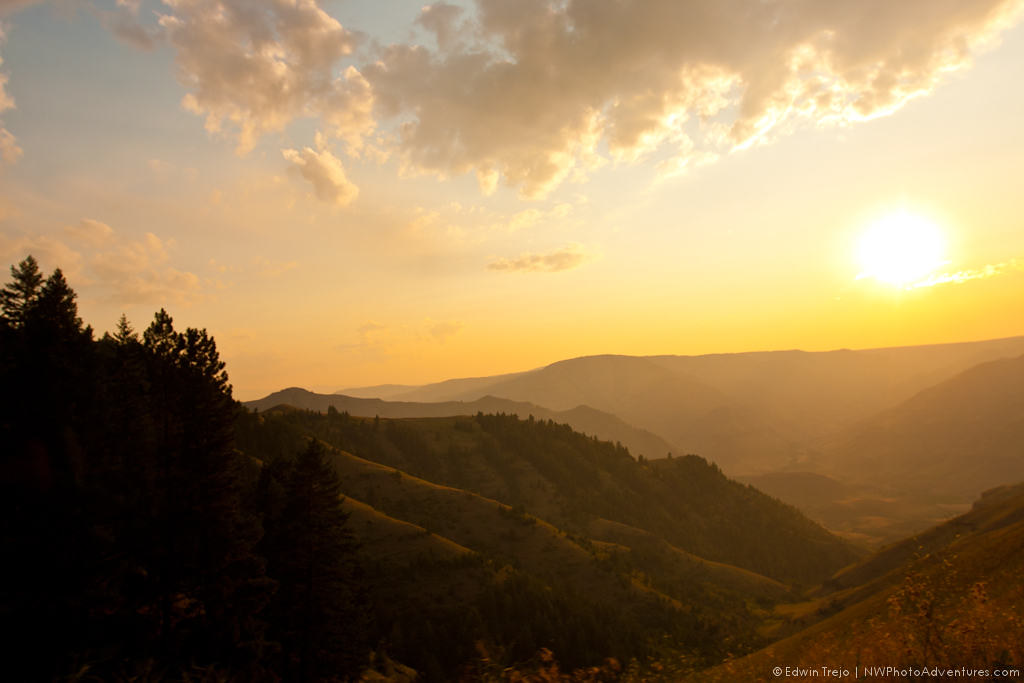
HatPoint, OR 0867a

Also from 5-mile Point
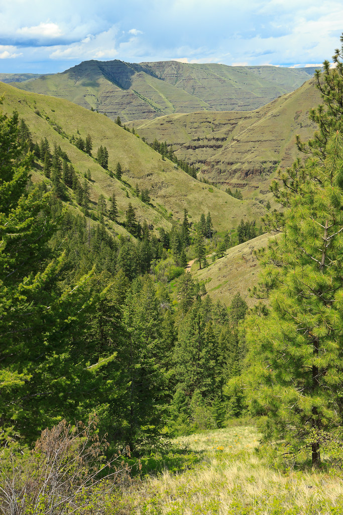
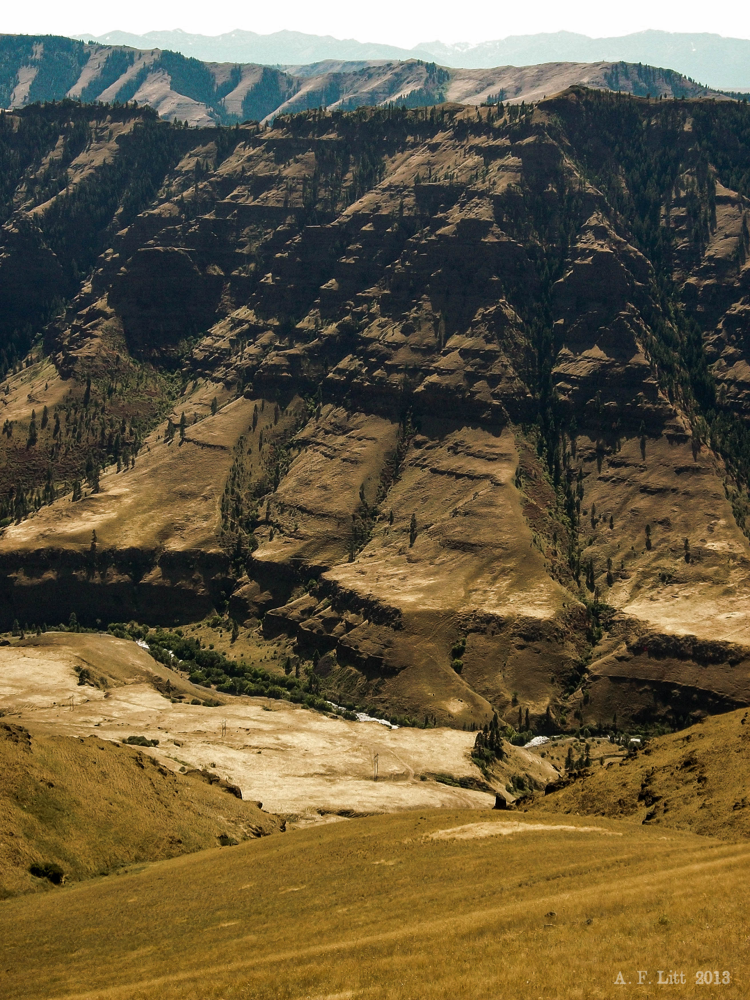
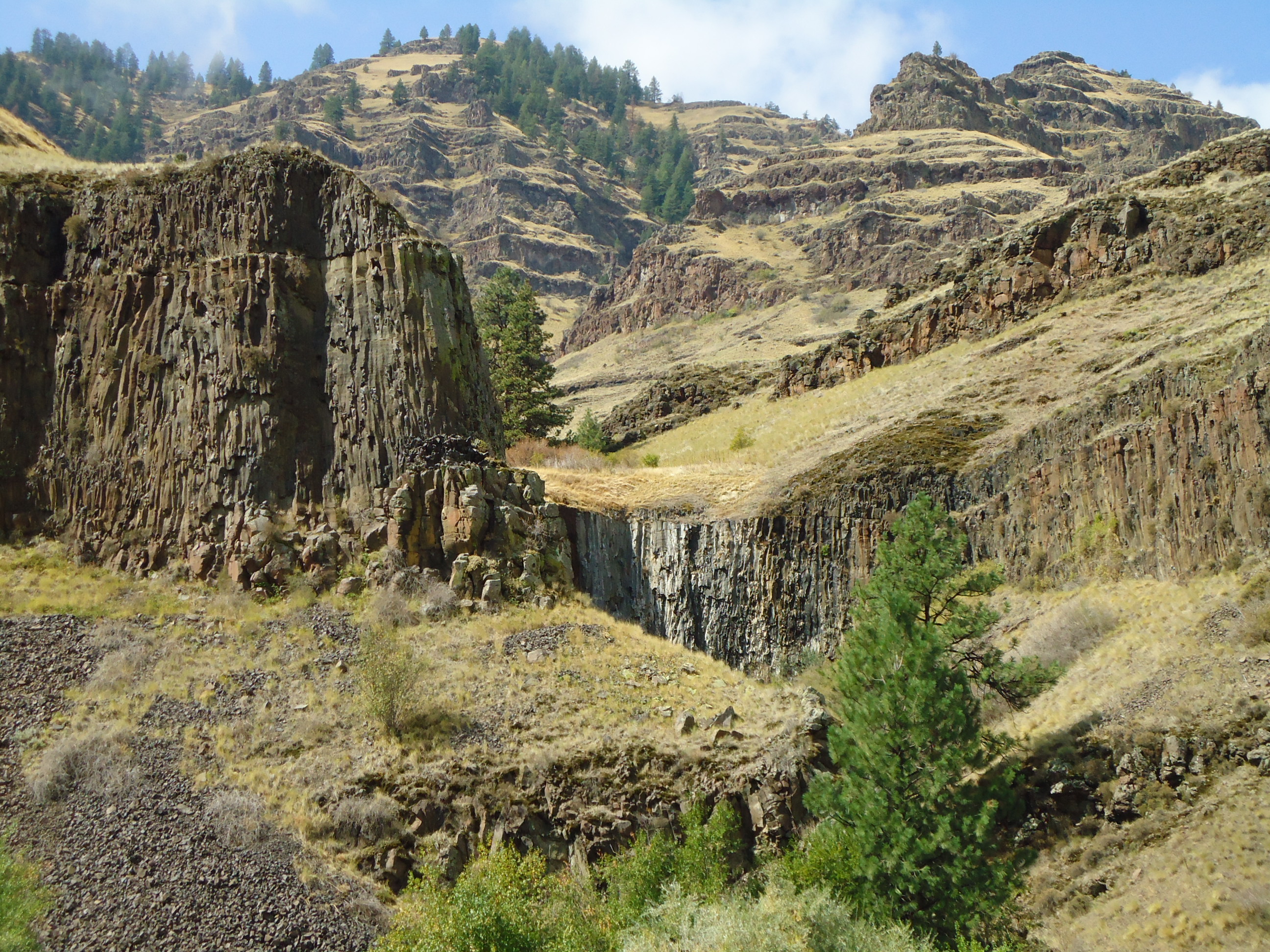
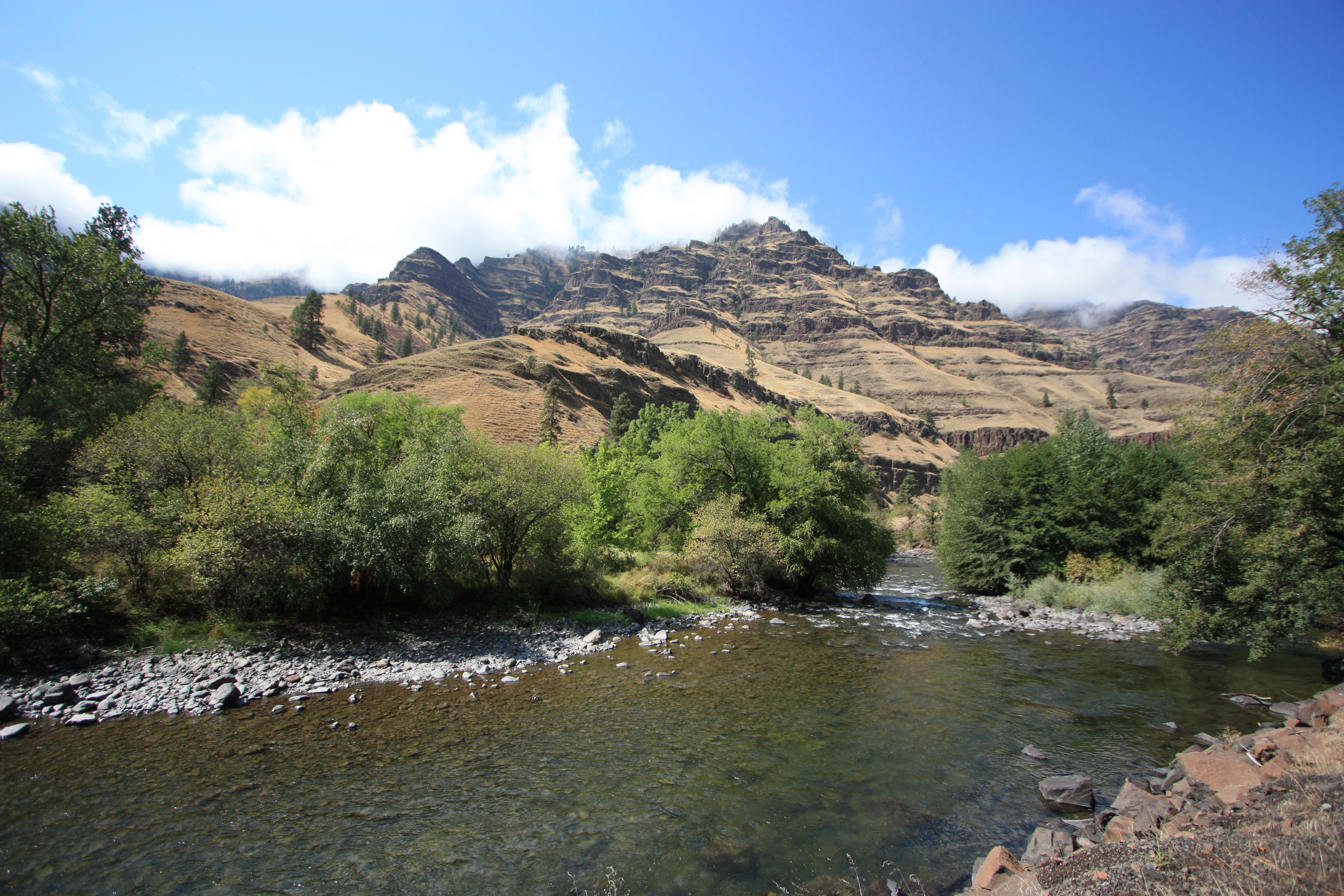
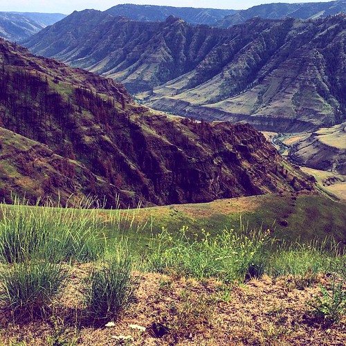
The Imhaha Gorge
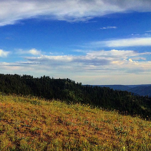
zumwalt prairie. wallowa county. oregon.
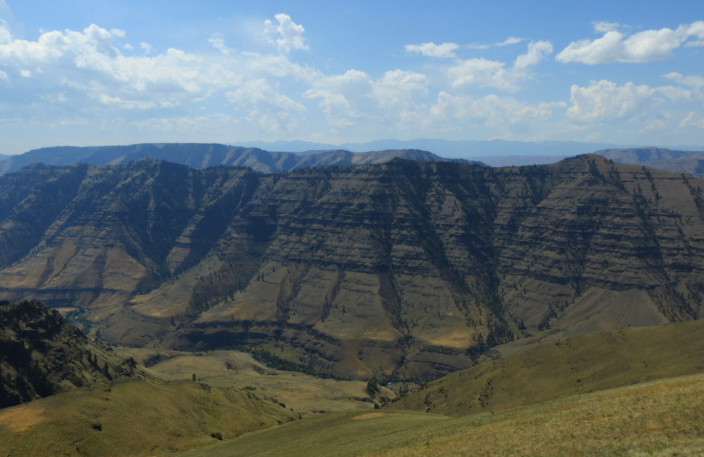
Imnaha Canyon in the Afternoon
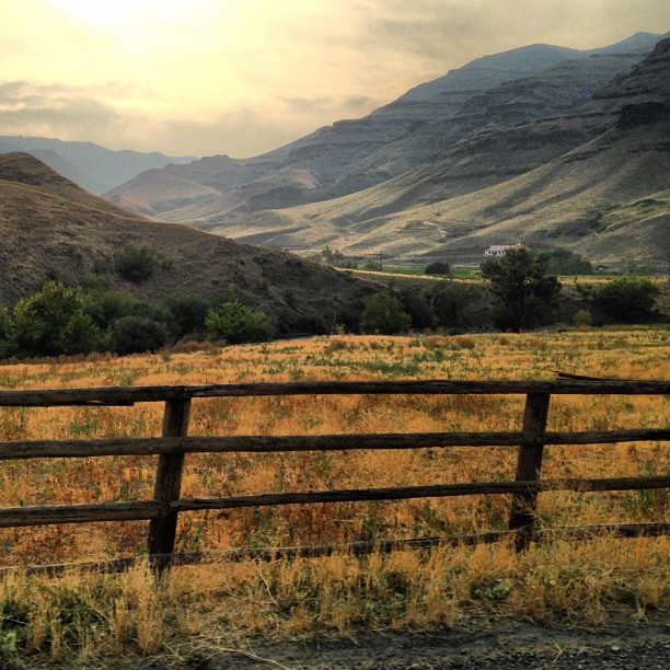
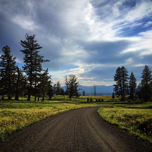
Outside Imnaha, OR

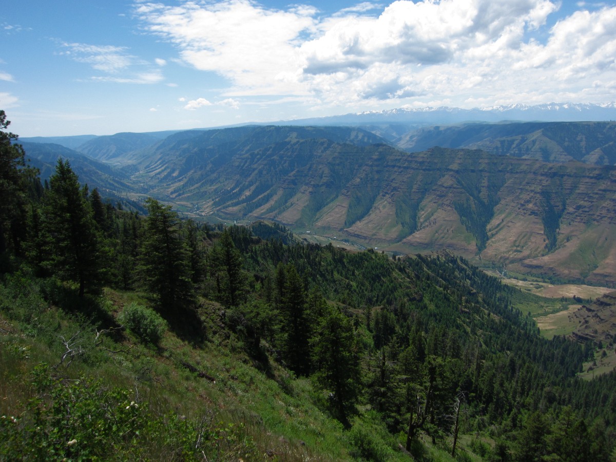
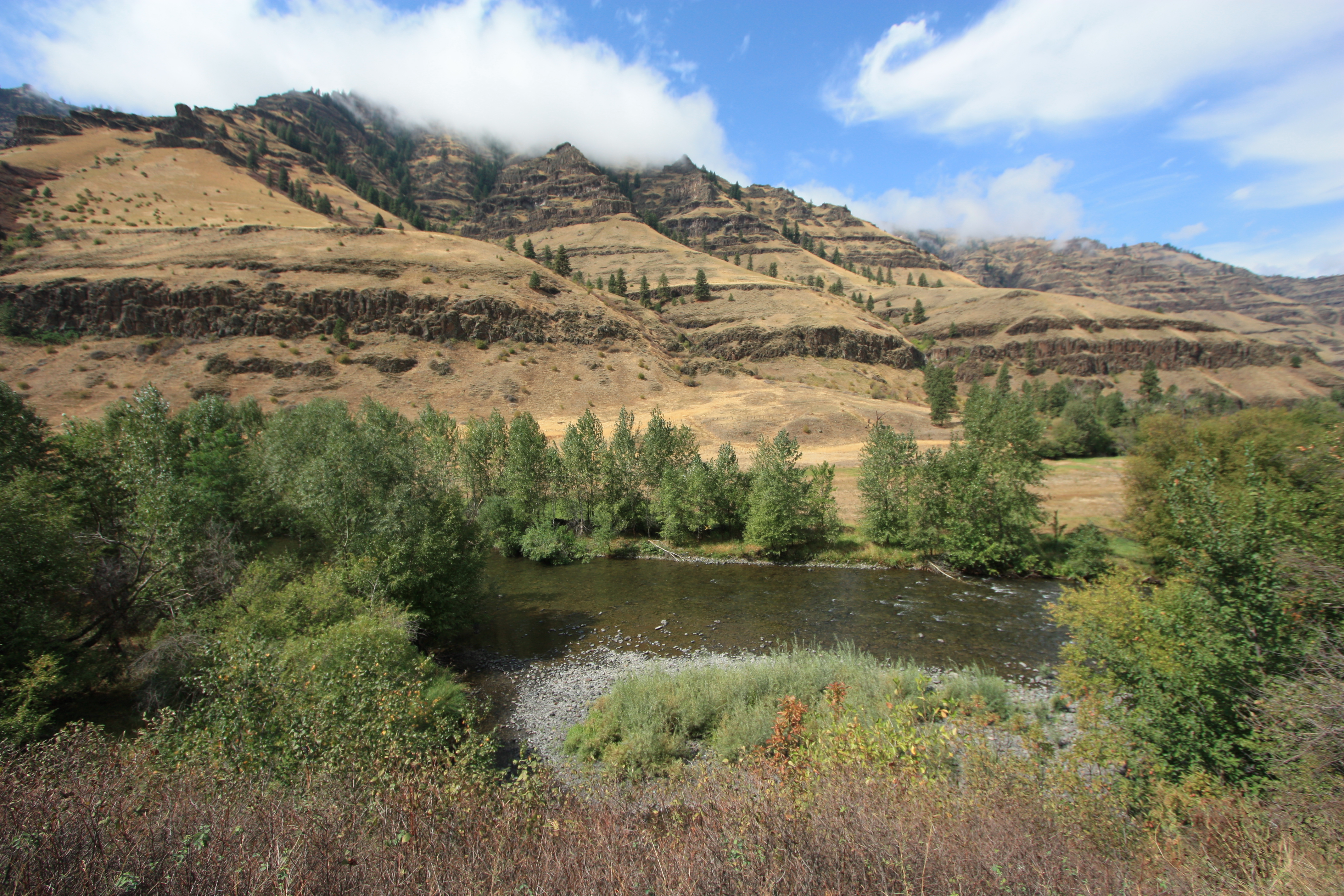
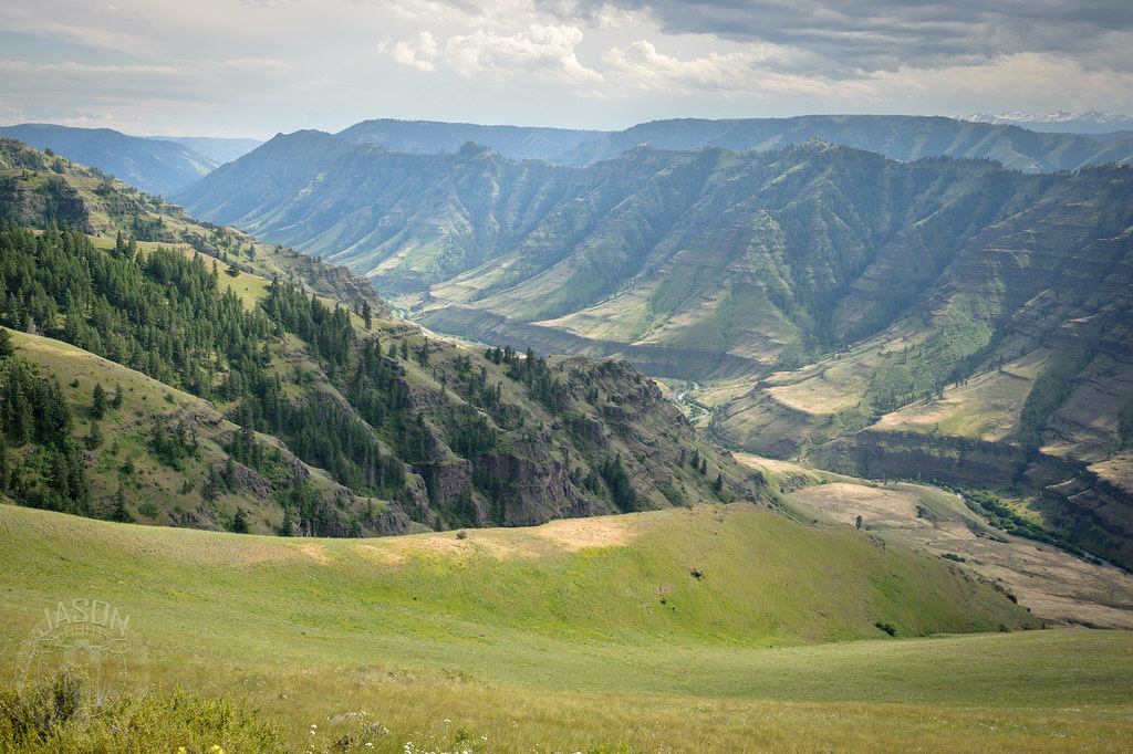
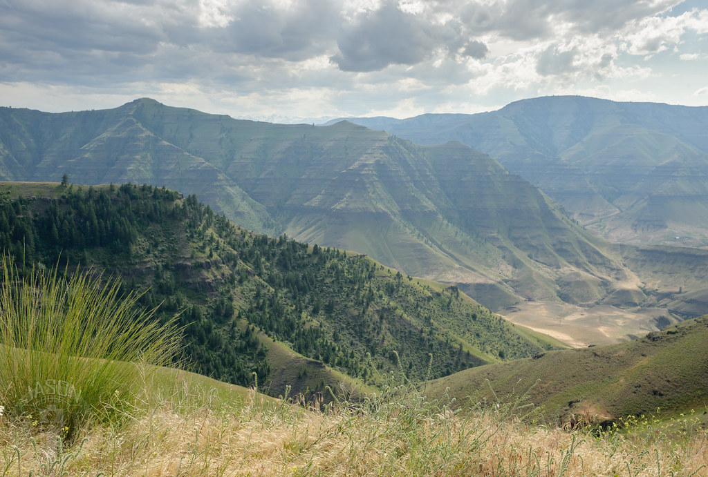
Imnaha River Valley
Imnaha River Valley
Imnaha River Valley

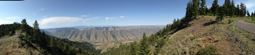
Imnaha River Valley panorama
Imnaha River Valley
worth it
Imnaha River Valley
At the edge of Hat Point Road

That Surprise Photo on a Bad Hair Day!

Landscapes of the Imnaha!

Purple Flower
Hat Point Road Panorama (#2)
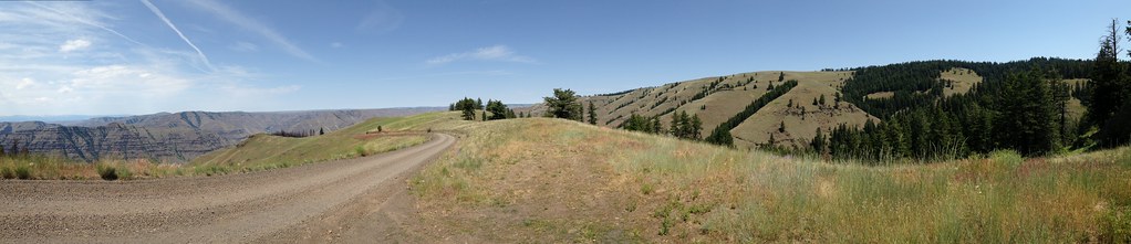
Hat Point Road Panorama (#4)
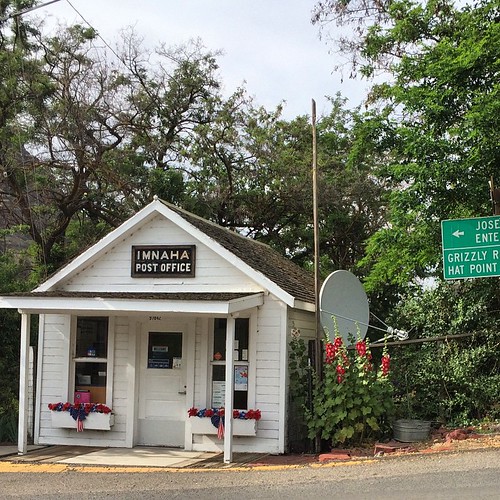
Imnaha, gateway to Grizzly Hat Point
Imnaha Valley
The Road to Hell ('s Canyon)
Wild flowers
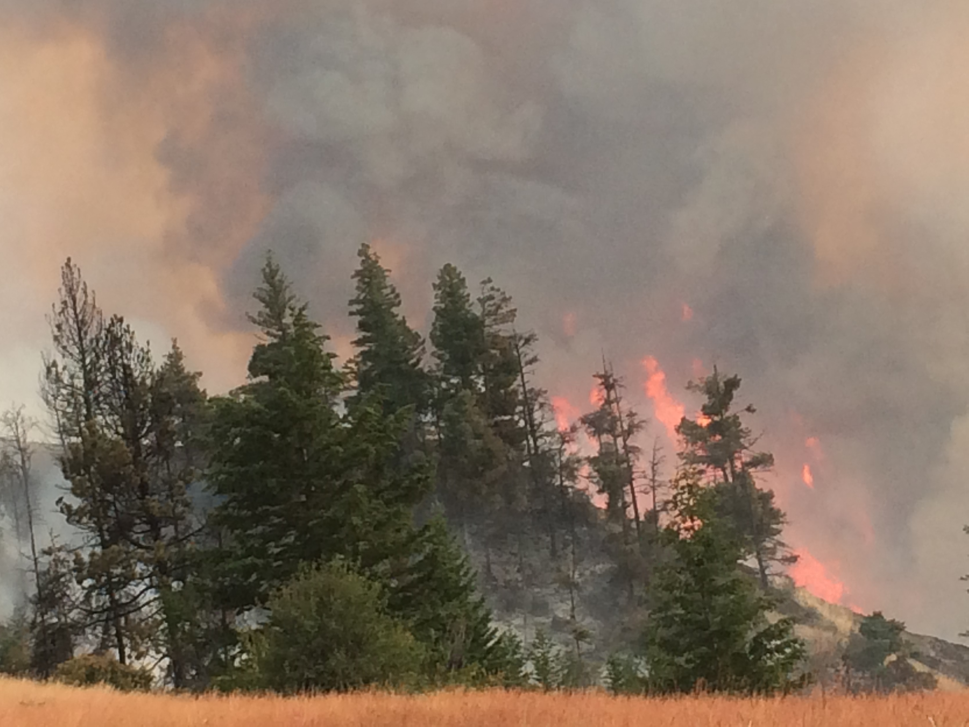
Five Mile Fire
Mapa de Imnaha, Oregón, EE. UU.
Buscar otro lugar
lugares en Imnaha, Oregón, EE. UU.
Lugares cercanos
Hells Canyon National Recreation Area, U.S. 95, Riggins, OR, EE. UU.
Condado de Wallowa, Oregón, EE. UU.
River Canyon Rd, Imnaha, OR, EE. UU.
Klages Road, Klages Rd, Joseph, OR, EE. UU.
Elk Mt Rd, Joseph, OR, EE. UU.
Joseph Creek Road, Joseph Creek Rd, Enterprise, OR, EE. UU.
Cache Creek Ranch, Joseph, OR, EE. UU.
Joseph, Oregón, EE. UU.
Wallowa Lake, Oregón, EE. UU.
Old Ski Run Rd, Joseph, OR, EE. UU.
Enterprise, Oregón, EE. UU.
Wallowa Lake State Park, Lake State Park, Joseph, OR, EE. UU.
Reavis Ln, Enterprise, OR, EE. UU.
Zaza Rd, Lewiston, ID, EE. UU.
Rogersburg, WA, EE. UU.
Heller Bar, Snake River Rd, Asotin, WA, EE. UU.
Flora, Oregón, EE. UU.
Lostine, Oregón, EE. UU.
Elizabeth St, Lostine, OR, EE. UU.
Lostine, Oregón, EE. UU.
Búsquedas recientes
- Horas de salida y puesta de sol de Eldorado do Sul - RS, Brazil
- Horas de salida y puesta de sol de Eldorado do Sul - Parque Eldorado, Eldorado do Sul - RS, -, Brasil
- Horas de salida y puesta de sol de Granada, Meta, Colombia
- Horas de salida y puesta de sol de Narhe, Pune, Maharashtra, India
- Horas de salida y puesta de sol de Sri Bintang Hill Trail, Jalan 11/36, Taman Sri Bintang, Kuala Lumpur, Wilayah Persekutuan Kuala Lump
- Horas de salida y puesta de sol de Portón Kaminarimon, 2-chōme-3-1 Asakusa, Taito City, Tokyo -, Japón
- Horas de salida y puesta de sol de Yoshiumicho Minamiura, Imabari, Ehime -, Japan
- Horas de salida y puesta de sol de Kippen, Stirling FK8, Reino Unido
- Horas de salida y puesta de sol de Fleur de Chine Hotel Sun Moon Lake, No. 23號, Zhongzheng Rd, Yuchi Township, Nantou County, Taiwan
- Horas de salida y puesta de sol de -16 Kitamuraakagawa, Iwamizawa, Hokkaido -, Japón