Horas de salida y puesta de sol de Grape Rough Rd, Oneida, TN, EE. UU.
Location: Estados Unidos > Tennessee > Condado de Scott > Oneida >
Zona horaria:
America/New_York
Hora local:
2024-05-18 00:42:54
Longitud:
-84.499946
Latitud:
36.537064
Salida de sol de hoy:
06:27:54 AM
Puesta de sol de hoy:
08:41:03 PM
La duración del día hoy:
14h 13m 9s
Salida de sol de mañana:
06:27:13 AM
Puesta de sol de mañana:
08:41:51 PM
La duración del día mañana:
14h 14m 38s
Mostrar todas las fechas
| Fecha | Salida de sol | Puesta de sol | Duración del día |
|---|---|---|---|
| 01/01/2024 | 07:50:01 AM | 05:33:31 PM | 9h 43m 30s |
| 02/01/2024 | 07:50:09 AM | 05:34:19 PM | 9h 44m 10s |
| 03/01/2024 | 07:50:15 AM | 05:35:08 PM | 9h 44m 53s |
| 04/01/2024 | 07:50:19 AM | 05:35:58 PM | 9h 45m 39s |
| 05/01/2024 | 07:50:21 AM | 05:36:50 PM | 9h 46m 29s |
| 06/01/2024 | 07:50:21 AM | 05:37:42 PM | 9h 47m 21s |
| 07/01/2024 | 07:50:19 AM | 05:38:36 PM | 9h 48m 17s |
| 08/01/2024 | 07:50:15 AM | 05:39:30 PM | 9h 49m 15s |
| 09/01/2024 | 07:50:09 AM | 05:40:25 PM | 9h 50m 16s |
| 10/01/2024 | 07:50:01 AM | 05:41:22 PM | 9h 51m 21s |
| 11/01/2024 | 07:49:51 AM | 05:42:19 PM | 9h 52m 28s |
| 12/01/2024 | 07:49:39 AM | 05:43:17 PM | 9h 53m 38s |
| 13/01/2024 | 07:49:25 AM | 05:44:15 PM | 9h 54m 50s |
| 14/01/2024 | 07:49:10 AM | 05:45:15 PM | 9h 56m 5s |
| 15/01/2024 | 07:48:52 AM | 05:46:15 PM | 9h 57m 23s |
| 16/01/2024 | 07:48:32 AM | 05:47:15 PM | 9h 58m 43s |
| 17/01/2024 | 07:48:10 AM | 05:48:16 PM | 10h 0m 6s |
| 18/01/2024 | 07:47:46 AM | 05:49:18 PM | 10h 1m 32s |
| 19/01/2024 | 07:47:21 AM | 05:50:20 PM | 10h 2m 59s |
| 20/01/2024 | 07:46:53 AM | 05:51:22 PM | 10h 4m 29s |
| 21/01/2024 | 07:46:24 AM | 05:52:25 PM | 10h 6m 1s |
| 22/01/2024 | 07:45:53 AM | 05:53:28 PM | 10h 7m 35s |
| 23/01/2024 | 07:45:20 AM | 05:54:32 PM | 10h 9m 12s |
| 24/01/2024 | 07:44:45 AM | 05:55:35 PM | 10h 10m 50s |
| 25/01/2024 | 07:44:08 AM | 05:56:39 PM | 10h 12m 31s |
| 26/01/2024 | 07:43:30 AM | 05:57:43 PM | 10h 14m 13s |
| 27/01/2024 | 07:42:50 AM | 05:58:47 PM | 10h 15m 57s |
| 28/01/2024 | 07:42:08 AM | 05:59:52 PM | 10h 17m 44s |
| 29/01/2024 | 07:41:24 AM | 06:00:56 PM | 10h 19m 32s |
| 30/01/2024 | 07:40:39 AM | 06:02:00 PM | 10h 21m 21s |
| 31/01/2024 | 07:39:52 AM | 06:03:05 PM | 10h 23m 13s |
| 01/02/2024 | 07:39:04 AM | 06:04:09 PM | 10h 25m 5s |
| 02/02/2024 | 07:38:14 AM | 06:05:13 PM | 10h 26m 59s |
| 03/02/2024 | 07:37:22 AM | 06:06:17 PM | 10h 28m 55s |
| 04/02/2024 | 07:36:29 AM | 06:07:21 PM | 10h 30m 52s |
| 05/02/2024 | 07:35:35 AM | 06:08:25 PM | 10h 32m 50s |
| 06/02/2024 | 07:34:39 AM | 06:09:29 PM | 10h 34m 50s |
| 07/02/2024 | 07:33:41 AM | 06:10:33 PM | 10h 36m 52s |
| 08/02/2024 | 07:32:42 AM | 06:11:36 PM | 10h 38m 54s |
| 09/02/2024 | 07:31:42 AM | 06:12:39 PM | 10h 40m 57s |
| 10/02/2024 | 07:30:41 AM | 06:13:42 PM | 10h 43m 1s |
| 11/02/2024 | 07:29:38 AM | 06:14:45 PM | 10h 45m 7s |
| 12/02/2024 | 07:28:34 AM | 06:15:47 PM | 10h 47m 13s |
| 13/02/2024 | 07:27:29 AM | 06:16:49 PM | 10h 49m 20s |
| 14/02/2024 | 07:26:22 AM | 06:17:51 PM | 10h 51m 29s |
| 15/02/2024 | 07:25:15 AM | 06:18:53 PM | 10h 53m 38s |
| 16/02/2024 | 07:24:06 AM | 06:19:54 PM | 10h 55m 48s |
| 17/02/2024 | 07:22:56 AM | 06:20:55 PM | 10h 57m 59s |
| 18/02/2024 | 07:21:45 AM | 06:21:56 PM | 11h 0m 11s |
| 19/02/2024 | 07:20:33 AM | 06:22:56 PM | 11h 2m 23s |
| 20/02/2024 | 07:19:20 AM | 06:23:56 PM | 11h 4m 36s |
| 21/02/2024 | 07:18:06 AM | 06:24:56 PM | 11h 6m 50s |
| 22/02/2024 | 07:16:51 AM | 06:25:55 PM | 11h 9m 4s |
| 23/02/2024 | 07:15:36 AM | 06:26:54 PM | 11h 11m 18s |
| 24/02/2024 | 07:14:19 AM | 06:27:53 PM | 11h 13m 34s |
| 25/02/2024 | 07:13:02 AM | 06:28:51 PM | 11h 15m 49s |
| 26/02/2024 | 07:11:43 AM | 06:29:49 PM | 11h 18m 6s |
| 27/02/2024 | 07:10:24 AM | 06:30:47 PM | 11h 20m 23s |
| 28/02/2024 | 07:09:05 AM | 06:31:45 PM | 11h 22m 40s |
| 29/02/2024 | 07:07:44 AM | 06:32:42 PM | 11h 24m 58s |
| 01/03/2024 | 07:06:23 AM | 06:33:39 PM | 11h 27m 16s |
| 02/03/2024 | 07:05:01 AM | 06:34:35 PM | 11h 29m 34s |
| 03/03/2024 | 07:03:39 AM | 06:35:31 PM | 11h 31m 52s |
| 04/03/2024 | 07:02:16 AM | 06:36:27 PM | 11h 34m 11s |
| 05/03/2024 | 07:00:52 AM | 06:37:23 PM | 11h 36m 31s |
| 06/03/2024 | 06:59:28 AM | 06:38:18 PM | 11h 38m 50s |
| 07/03/2024 | 06:58:04 AM | 06:39:13 PM | 11h 41m 9s |
| 08/03/2024 | 06:56:39 AM | 06:40:08 PM | 11h 43m 29s |
| 09/03/2024 | 06:55:13 AM | 06:41:03 PM | 11h 45m 50s |
| 10/03/2024 | 07:53:51 AM | 07:41:55 PM | 11h 48m 4s |
| 11/03/2024 | 07:52:25 AM | 07:42:49 PM | 11h 50m 24s |
| 12/03/2024 | 07:50:58 AM | 07:43:42 PM | 11h 52m 44s |
| 13/03/2024 | 07:49:32 AM | 07:44:36 PM | 11h 55m 4s |
| 14/03/2024 | 07:48:05 AM | 07:45:30 PM | 11h 57m 25s |
| 15/03/2024 | 07:46:37 AM | 07:46:23 PM | 11h 59m 46s |
| 16/03/2024 | 07:45:10 AM | 07:47:16 PM | 12h 2m 6s |
| 17/03/2024 | 07:43:42 AM | 07:48:09 PM | 12h 4m 27s |
| 18/03/2024 | 07:42:14 AM | 07:49:01 PM | 12h 6m 47s |
| 19/03/2024 | 07:40:46 AM | 07:49:54 PM | 12h 9m 8s |
| 20/03/2024 | 07:39:18 AM | 07:50:46 PM | 12h 11m 28s |
| 21/03/2024 | 07:37:50 AM | 07:51:39 PM | 12h 13m 49s |
| 22/03/2024 | 07:36:22 AM | 07:52:31 PM | 12h 16m 9s |
| 23/03/2024 | 07:34:54 AM | 07:53:23 PM | 12h 18m 29s |
| 24/03/2024 | 07:33:25 AM | 07:54:15 PM | 12h 20m 50s |
| 25/03/2024 | 07:31:57 AM | 07:55:07 PM | 12h 23m 10s |
| 26/03/2024 | 07:30:29 AM | 07:55:59 PM | 12h 25m 30s |
| 27/03/2024 | 07:29:01 AM | 07:56:50 PM | 12h 27m 49s |
| 28/03/2024 | 07:27:34 AM | 07:57:42 PM | 12h 30m 8s |
| 29/03/2024 | 07:26:06 AM | 07:58:34 PM | 12h 32m 28s |
| 30/03/2024 | 07:24:39 AM | 07:59:25 PM | 12h 34m 46s |
| 31/03/2024 | 07:23:11 AM | 08:00:17 PM | 12h 37m 6s |
| 01/04/2024 | 07:21:45 AM | 08:01:08 PM | 12h 39m 23s |
| 02/04/2024 | 07:20:18 AM | 08:02:00 PM | 12h 41m 42s |
| 03/04/2024 | 07:18:52 AM | 08:02:51 PM | 12h 43m 59s |
| 04/04/2024 | 07:17:26 AM | 08:03:43 PM | 12h 46m 17s |
| 05/04/2024 | 07:16:00 AM | 08:04:34 PM | 12h 48m 34s |
| 06/04/2024 | 07:14:35 AM | 08:05:26 PM | 12h 50m 51s |
| 07/04/2024 | 07:13:10 AM | 08:06:18 PM | 12h 53m 8s |
| 08/04/2024 | 07:11:46 AM | 08:07:09 PM | 12h 55m 23s |
| 09/04/2024 | 07:10:22 AM | 08:08:01 PM | 12h 57m 39s |
| 10/04/2024 | 07:08:59 AM | 08:08:53 PM | 12h 59m 54s |
| 11/04/2024 | 07:07:36 AM | 08:09:44 PM | 13h 2m 8s |
| 12/04/2024 | 07:06:14 AM | 08:10:36 PM | 13h 4m 22s |
| 13/04/2024 | 07:04:53 AM | 08:11:28 PM | 13h 6m 35s |
| 14/04/2024 | 07:03:32 AM | 08:12:20 PM | 13h 8m 48s |
| 15/04/2024 | 07:02:12 AM | 08:13:12 PM | 13h 11m 0s |
| 16/04/2024 | 07:00:52 AM | 08:14:04 PM | 13h 13m 12s |
| 17/04/2024 | 06:59:34 AM | 08:14:56 PM | 13h 15m 22s |
| 18/04/2024 | 06:58:16 AM | 08:15:48 PM | 13h 17m 32s |
| 19/04/2024 | 06:56:59 AM | 08:16:40 PM | 13h 19m 41s |
| 20/04/2024 | 06:55:42 AM | 08:17:32 PM | 13h 21m 50s |
| 21/04/2024 | 06:54:27 AM | 08:18:25 PM | 13h 23m 58s |
| 22/04/2024 | 06:53:12 AM | 08:19:17 PM | 13h 26m 5s |
| 23/04/2024 | 06:51:58 AM | 08:20:09 PM | 13h 28m 11s |
| 24/04/2024 | 06:50:46 AM | 08:21:02 PM | 13h 30m 16s |
| 25/04/2024 | 06:49:34 AM | 08:21:54 PM | 13h 32m 20s |
| 26/04/2024 | 06:48:23 AM | 08:22:46 PM | 13h 34m 23s |
| 27/04/2024 | 06:47:13 AM | 08:23:39 PM | 13h 36m 26s |
| 28/04/2024 | 06:46:05 AM | 08:24:31 PM | 13h 38m 26s |
| 29/04/2024 | 06:44:57 AM | 08:25:23 PM | 13h 40m 26s |
| 30/04/2024 | 06:43:50 AM | 08:26:15 PM | 13h 42m 25s |
| 01/05/2024 | 06:42:45 AM | 08:27:08 PM | 13h 44m 23s |
| 02/05/2024 | 06:41:41 AM | 08:28:00 PM | 13h 46m 19s |
| 03/05/2024 | 06:40:38 AM | 08:28:52 PM | 13h 48m 14s |
| 04/05/2024 | 06:39:36 AM | 08:29:44 PM | 13h 50m 8s |
| 05/05/2024 | 06:38:35 AM | 08:30:36 PM | 13h 52m 1s |
| 06/05/2024 | 06:37:36 AM | 08:31:27 PM | 13h 53m 51s |
| 07/05/2024 | 06:36:38 AM | 08:32:19 PM | 13h 55m 41s |
| 08/05/2024 | 06:35:42 AM | 08:33:10 PM | 13h 57m 28s |
| 09/05/2024 | 06:34:46 AM | 08:34:01 PM | 13h 59m 15s |
| 10/05/2024 | 06:33:52 AM | 08:34:52 PM | 14h 1m 0s |
| 11/05/2024 | 06:33:00 AM | 08:35:43 PM | 14h 2m 43s |
| 12/05/2024 | 06:32:09 AM | 08:36:33 PM | 14h 4m 24s |
| 13/05/2024 | 06:31:19 AM | 08:37:23 PM | 14h 6m 4s |
| 14/05/2024 | 06:30:31 AM | 08:38:13 PM | 14h 7m 42s |
| 15/05/2024 | 06:29:44 AM | 08:39:02 PM | 14h 9m 18s |
| 16/05/2024 | 06:28:59 AM | 08:39:51 PM | 14h 10m 52s |
| 17/05/2024 | 06:28:15 AM | 08:40:39 PM | 14h 12m 24s |
| 18/05/2024 | 06:27:33 AM | 08:41:27 PM | 14h 13m 54s |
| 19/05/2024 | 06:26:53 AM | 08:42:15 PM | 14h 15m 22s |
| 20/05/2024 | 06:26:14 AM | 08:43:02 PM | 14h 16m 48s |
| 21/05/2024 | 06:25:37 AM | 08:43:48 PM | 14h 18m 11s |
| 22/05/2024 | 06:25:01 AM | 08:44:34 PM | 14h 19m 33s |
| 23/05/2024 | 06:24:27 AM | 08:45:19 PM | 14h 20m 52s |
| 24/05/2024 | 06:23:55 AM | 08:46:04 PM | 14h 22m 9s |
| 25/05/2024 | 06:23:24 AM | 08:46:48 PM | 14h 23m 24s |
| 26/05/2024 | 06:22:55 AM | 08:47:31 PM | 14h 24m 36s |
| 27/05/2024 | 06:22:28 AM | 08:48:13 PM | 14h 25m 45s |
| 28/05/2024 | 06:22:02 AM | 08:48:55 PM | 14h 26m 53s |
| 29/05/2024 | 06:21:38 AM | 08:49:35 PM | 14h 27m 57s |
| 30/05/2024 | 06:21:16 AM | 08:50:15 PM | 14h 28m 59s |
| 31/05/2024 | 06:20:56 AM | 08:50:54 PM | 14h 29m 58s |
| 01/06/2024 | 06:20:37 AM | 08:51:32 PM | 14h 30m 55s |
| 02/06/2024 | 06:20:20 AM | 08:52:09 PM | 14h 31m 49s |
| 03/06/2024 | 06:20:05 AM | 08:52:45 PM | 14h 32m 40s |
| 04/06/2024 | 06:19:51 AM | 08:53:20 PM | 14h 33m 29s |
| 05/06/2024 | 06:19:39 AM | 08:53:53 PM | 14h 34m 14s |
| 06/06/2024 | 06:19:29 AM | 08:54:26 PM | 14h 34m 57s |
| 07/06/2024 | 06:19:21 AM | 08:54:57 PM | 14h 35m 36s |
| 08/06/2024 | 06:19:14 AM | 08:55:27 PM | 14h 36m 13s |
| 09/06/2024 | 06:19:10 AM | 08:55:56 PM | 14h 36m 46s |
| 10/06/2024 | 06:19:06 AM | 08:56:24 PM | 14h 37m 18s |
| 11/06/2024 | 06:19:05 AM | 08:56:50 PM | 14h 37m 45s |
| 12/06/2024 | 06:19:05 AM | 08:57:15 PM | 14h 38m 10s |
| 13/06/2024 | 06:19:07 AM | 08:57:39 PM | 14h 38m 32s |
| 14/06/2024 | 06:19:11 AM | 08:58:01 PM | 14h 38m 50s |
| 15/06/2024 | 06:19:16 AM | 08:58:21 PM | 14h 39m 5s |
| 16/06/2024 | 06:19:23 AM | 08:58:41 PM | 14h 39m 18s |
| 17/06/2024 | 06:19:31 AM | 08:58:58 PM | 14h 39m 27s |
| 18/06/2024 | 06:19:41 AM | 08:59:14 PM | 14h 39m 33s |
| 19/06/2024 | 06:19:53 AM | 08:59:29 PM | 14h 39m 36s |
| 20/06/2024 | 06:20:06 AM | 08:59:42 PM | 14h 39m 36s |
| 21/06/2024 | 06:20:21 AM | 08:59:53 PM | 14h 39m 32s |
| 22/06/2024 | 06:20:37 AM | 09:00:03 PM | 14h 39m 26s |
| 23/06/2024 | 06:20:54 AM | 09:00:11 PM | 14h 39m 17s |
| 24/06/2024 | 06:21:13 AM | 09:00:18 PM | 14h 39m 5s |
| 25/06/2024 | 06:21:34 AM | 09:00:22 PM | 14h 38m 48s |
| 26/06/2024 | 06:21:56 AM | 09:00:25 PM | 14h 38m 29s |
| 27/06/2024 | 06:22:19 AM | 09:00:27 PM | 14h 38m 8s |
| 28/06/2024 | 06:22:43 AM | 09:00:26 PM | 14h 37m 43s |
| 29/06/2024 | 06:23:09 AM | 09:00:24 PM | 14h 37m 15s |
| 30/06/2024 | 06:23:36 AM | 09:00:20 PM | 14h 36m 44s |
| 01/07/2024 | 06:24:04 AM | 09:00:15 PM | 14h 36m 11s |
| 02/07/2024 | 06:24:34 AM | 09:00:07 PM | 14h 35m 33s |
| 03/07/2024 | 06:25:04 AM | 08:59:58 PM | 14h 34m 54s |
| 04/07/2024 | 06:25:36 AM | 08:59:47 PM | 14h 34m 11s |
| 05/07/2024 | 06:26:09 AM | 08:59:34 PM | 14h 33m 25s |
| 06/07/2024 | 06:26:42 AM | 08:59:20 PM | 14h 32m 38s |
| 07/07/2024 | 06:27:17 AM | 08:59:04 PM | 14h 31m 47s |
| 08/07/2024 | 06:27:53 AM | 08:58:46 PM | 14h 30m 53s |
| 09/07/2024 | 06:28:29 AM | 08:58:26 PM | 14h 29m 57s |
| 10/07/2024 | 06:29:07 AM | 08:58:04 PM | 14h 28m 57s |
| 11/07/2024 | 06:29:45 AM | 08:57:41 PM | 14h 27m 56s |
| 12/07/2024 | 06:30:25 AM | 08:57:16 PM | 14h 26m 51s |
| 13/07/2024 | 06:31:04 AM | 08:56:49 PM | 14h 25m 45s |
| 14/07/2024 | 06:31:45 AM | 08:56:20 PM | 14h 24m 35s |
| 15/07/2024 | 06:32:26 AM | 08:55:50 PM | 14h 23m 24s |
| 16/07/2024 | 06:33:09 AM | 08:55:18 PM | 14h 22m 9s |
| 17/07/2024 | 06:33:51 AM | 08:54:44 PM | 14h 20m 53s |
| 18/07/2024 | 06:34:34 AM | 08:54:09 PM | 14h 19m 35s |
| 19/07/2024 | 06:35:18 AM | 08:53:32 PM | 14h 18m 14s |
| 20/07/2024 | 06:36:03 AM | 08:52:53 PM | 14h 16m 50s |
| 21/07/2024 | 06:36:47 AM | 08:52:13 PM | 14h 15m 26s |
| 22/07/2024 | 06:37:33 AM | 08:51:31 PM | 14h 13m 58s |
| 23/07/2024 | 06:38:18 AM | 08:50:47 PM | 14h 12m 29s |
| 24/07/2024 | 06:39:04 AM | 08:50:02 PM | 14h 10m 58s |
| 25/07/2024 | 06:39:51 AM | 08:49:15 PM | 14h 9m 24s |
| 26/07/2024 | 06:40:38 AM | 08:48:27 PM | 14h 7m 49s |
| 27/07/2024 | 06:41:25 AM | 08:47:37 PM | 14h 6m 12s |
| 28/07/2024 | 06:42:12 AM | 08:46:46 PM | 14h 4m 34s |
| 29/07/2024 | 06:43:00 AM | 08:45:53 PM | 14h 2m 53s |
| 30/07/2024 | 06:43:47 AM | 08:44:59 PM | 14h 1m 12s |
| 31/07/2024 | 06:44:35 AM | 08:44:04 PM | 13h 59m 29s |
| 01/08/2024 | 06:45:24 AM | 08:43:07 PM | 13h 57m 43s |
| 02/08/2024 | 06:46:12 AM | 08:42:08 PM | 13h 55m 56s |
| 03/08/2024 | 06:47:00 AM | 08:41:09 PM | 13h 54m 9s |
| 04/08/2024 | 06:47:49 AM | 08:40:08 PM | 13h 52m 19s |
| 05/08/2024 | 06:48:38 AM | 08:39:06 PM | 13h 50m 28s |
| 06/08/2024 | 06:49:26 AM | 08:38:02 PM | 13h 48m 36s |
| 07/08/2024 | 06:50:15 AM | 08:36:57 PM | 13h 46m 42s |
| 08/08/2024 | 06:51:04 AM | 08:35:51 PM | 13h 44m 47s |
| 09/08/2024 | 06:51:53 AM | 08:34:44 PM | 13h 42m 51s |
| 10/08/2024 | 06:52:42 AM | 08:33:36 PM | 13h 40m 54s |
| 11/08/2024 | 06:53:31 AM | 08:32:27 PM | 13h 38m 56s |
| 12/08/2024 | 06:54:20 AM | 08:31:16 PM | 13h 36m 56s |
| 13/08/2024 | 06:55:08 AM | 08:30:05 PM | 13h 34m 57s |
| 14/08/2024 | 06:55:57 AM | 08:28:52 PM | 13h 32m 55s |
| 15/08/2024 | 06:56:46 AM | 08:27:39 PM | 13h 30m 53s |
| 16/08/2024 | 06:57:35 AM | 08:26:24 PM | 13h 28m 49s |
| 17/08/2024 | 06:58:23 AM | 08:25:09 PM | 13h 26m 46s |
| 18/08/2024 | 06:59:12 AM | 08:23:52 PM | 13h 24m 40s |
| 19/08/2024 | 07:00:00 AM | 08:22:35 PM | 13h 22m 35s |
| 20/08/2024 | 07:00:49 AM | 08:21:17 PM | 13h 20m 28s |
| 21/08/2024 | 07:01:37 AM | 08:19:58 PM | 13h 18m 21s |
| 22/08/2024 | 07:02:25 AM | 08:18:38 PM | 13h 16m 13s |
| 23/08/2024 | 07:03:13 AM | 08:17:17 PM | 13h 14m 4s |
| 24/08/2024 | 07:04:02 AM | 08:15:56 PM | 13h 11m 54s |
| 25/08/2024 | 07:04:50 AM | 08:14:34 PM | 13h 9m 44s |
| 26/08/2024 | 07:05:37 AM | 08:13:11 PM | 13h 7m 34s |
| 27/08/2024 | 07:06:25 AM | 08:11:48 PM | 13h 5m 23s |
| 28/08/2024 | 07:07:13 AM | 08:10:24 PM | 13h 3m 11s |
| 29/08/2024 | 07:08:01 AM | 08:08:59 PM | 13h 0m 58s |
| 30/08/2024 | 07:08:48 AM | 08:07:34 PM | 12h 58m 46s |
| 31/08/2024 | 07:09:36 AM | 08:06:09 PM | 12h 56m 33s |
| 01/09/2024 | 07:10:23 AM | 08:04:42 PM | 12h 54m 19s |
| 02/09/2024 | 07:11:11 AM | 08:03:16 PM | 12h 52m 5s |
| 03/09/2024 | 07:11:58 AM | 08:01:49 PM | 12h 49m 51s |
| 04/09/2024 | 07:12:46 AM | 08:00:21 PM | 12h 47m 35s |
| 05/09/2024 | 07:13:33 AM | 07:58:53 PM | 12h 45m 20s |
| 06/09/2024 | 07:14:20 AM | 07:57:25 PM | 12h 43m 5s |
| 07/09/2024 | 07:15:07 AM | 07:55:56 PM | 12h 40m 49s |
| 08/09/2024 | 07:15:55 AM | 07:54:27 PM | 12h 38m 32s |
| 09/09/2024 | 07:16:42 AM | 07:52:58 PM | 12h 36m 16s |
| 10/09/2024 | 07:17:29 AM | 07:51:28 PM | 12h 33m 59s |
| 11/09/2024 | 07:18:16 AM | 07:49:59 PM | 12h 31m 43s |
| 12/09/2024 | 07:19:04 AM | 07:48:29 PM | 12h 29m 25s |
| 13/09/2024 | 07:19:51 AM | 07:46:59 PM | 12h 27m 8s |
| 14/09/2024 | 07:20:38 AM | 07:45:29 PM | 12h 24m 51s |
| 15/09/2024 | 07:21:26 AM | 07:43:58 PM | 12h 22m 32s |
| 16/09/2024 | 07:22:13 AM | 07:42:28 PM | 12h 20m 15s |
| 17/09/2024 | 07:23:01 AM | 07:40:57 PM | 12h 17m 56s |
| 18/09/2024 | 07:23:48 AM | 07:39:27 PM | 12h 15m 39s |
| 19/09/2024 | 07:24:36 AM | 07:37:56 PM | 12h 13m 20s |
| 20/09/2024 | 07:25:24 AM | 07:36:26 PM | 12h 11m 2s |
| 21/09/2024 | 07:26:12 AM | 07:34:56 PM | 12h 8m 44s |
| 22/09/2024 | 07:27:00 AM | 07:33:25 PM | 12h 6m 25s |
| 23/09/2024 | 07:27:49 AM | 07:31:55 PM | 12h 4m 6s |
| 24/09/2024 | 07:28:37 AM | 07:30:25 PM | 12h 1m 48s |
| 25/09/2024 | 07:29:26 AM | 07:28:56 PM | 11h 59m 30s |
| 26/09/2024 | 07:30:14 AM | 07:27:26 PM | 11h 57m 12s |
| 27/09/2024 | 07:31:03 AM | 07:25:57 PM | 11h 54m 54s |
| 28/09/2024 | 07:31:53 AM | 07:24:28 PM | 11h 52m 35s |
| 29/09/2024 | 07:32:42 AM | 07:22:59 PM | 11h 50m 17s |
| 30/09/2024 | 07:33:32 AM | 07:21:30 PM | 11h 47m 58s |
| 01/10/2024 | 07:34:22 AM | 07:20:02 PM | 11h 45m 40s |
| 02/10/2024 | 07:35:12 AM | 07:18:35 PM | 11h 43m 23s |
| 03/10/2024 | 07:36:02 AM | 07:17:07 PM | 11h 41m 5s |
| 04/10/2024 | 07:36:53 AM | 07:15:41 PM | 11h 38m 48s |
| 05/10/2024 | 07:37:44 AM | 07:14:14 PM | 11h 36m 30s |
| 06/10/2024 | 07:38:35 AM | 07:12:49 PM | 11h 34m 14s |
| 07/10/2024 | 07:39:27 AM | 07:11:23 PM | 11h 31m 56s |
| 08/10/2024 | 07:40:19 AM | 07:09:59 PM | 11h 29m 40s |
| 09/10/2024 | 07:41:11 AM | 07:08:35 PM | 11h 27m 24s |
| 10/10/2024 | 07:42:04 AM | 07:07:11 PM | 11h 25m 7s |
| 11/10/2024 | 07:42:56 AM | 07:05:48 PM | 11h 22m 52s |
| 12/10/2024 | 07:43:50 AM | 07:04:26 PM | 11h 20m 36s |
| 13/10/2024 | 07:44:43 AM | 07:03:05 PM | 11h 18m 22s |
| 14/10/2024 | 07:45:37 AM | 07:01:44 PM | 11h 16m 7s |
| 15/10/2024 | 07:46:31 AM | 07:00:25 PM | 11h 13m 54s |
| 16/10/2024 | 07:47:26 AM | 06:59:06 PM | 11h 11m 40s |
| 17/10/2024 | 07:48:21 AM | 06:57:47 PM | 11h 9m 26s |
| 18/10/2024 | 07:49:16 AM | 06:56:30 PM | 11h 7m 14s |
| 19/10/2024 | 07:50:12 AM | 06:55:14 PM | 11h 5m 2s |
| 20/10/2024 | 07:51:08 AM | 06:53:59 PM | 11h 2m 51s |
| 21/10/2024 | 07:52:04 AM | 06:52:44 PM | 11h 0m 40s |
| 22/10/2024 | 07:53:01 AM | 06:51:31 PM | 10h 58m 30s |
| 23/10/2024 | 07:53:58 AM | 06:50:19 PM | 10h 56m 21s |
| 24/10/2024 | 07:54:55 AM | 06:49:07 PM | 10h 54m 12s |
| 25/10/2024 | 07:55:53 AM | 06:47:57 PM | 10h 52m 4s |
| 26/10/2024 | 07:56:51 AM | 06:46:48 PM | 10h 49m 57s |
| 27/10/2024 | 07:57:49 AM | 06:45:41 PM | 10h 47m 52s |
| 28/10/2024 | 07:58:48 AM | 06:44:34 PM | 10h 45m 46s |
| 29/10/2024 | 07:59:47 AM | 06:43:29 PM | 10h 43m 42s |
| 30/10/2024 | 08:00:46 AM | 06:42:25 PM | 10h 41m 39s |
| 31/10/2024 | 08:01:45 AM | 06:41:22 PM | 10h 39m 37s |
| 01/11/2024 | 08:02:45 AM | 06:40:21 PM | 10h 37m 36s |
| 02/11/2024 | 08:03:45 AM | 06:39:21 PM | 10h 35m 36s |
| 03/11/2024 | 07:04:48 AM | 05:38:20 PM | 10h 33m 32s |
| 04/11/2024 | 07:05:49 AM | 05:37:23 PM | 10h 31m 34s |
| 05/11/2024 | 07:06:49 AM | 05:36:27 PM | 10h 29m 38s |
| 06/11/2024 | 07:07:50 AM | 05:35:33 PM | 10h 27m 43s |
| 07/11/2024 | 07:08:51 AM | 05:34:41 PM | 10h 25m 50s |
| 08/11/2024 | 07:09:52 AM | 05:33:50 PM | 10h 23m 58s |
| 09/11/2024 | 07:10:54 AM | 05:33:00 PM | 10h 22m 6s |
| 10/11/2024 | 07:11:55 AM | 05:32:12 PM | 10h 20m 17s |
| 11/11/2024 | 07:12:56 AM | 05:31:26 PM | 10h 18m 30s |
| 12/11/2024 | 07:13:58 AM | 05:30:42 PM | 10h 16m 44s |
| 13/11/2024 | 07:14:59 AM | 05:29:59 PM | 10h 15m 0s |
| 14/11/2024 | 07:16:00 AM | 05:29:18 PM | 10h 13m 18s |
| 15/11/2024 | 07:17:02 AM | 05:28:39 PM | 10h 11m 37s |
| 16/11/2024 | 07:18:03 AM | 05:28:01 PM | 10h 9m 58s |
| 17/11/2024 | 07:19:04 AM | 05:27:26 PM | 10h 8m 22s |
| 18/11/2024 | 07:20:05 AM | 05:26:52 PM | 10h 6m 47s |
| 19/11/2024 | 07:21:05 AM | 05:26:20 PM | 10h 5m 15s |
| 20/11/2024 | 07:22:06 AM | 05:25:50 PM | 10h 3m 44s |
| 21/11/2024 | 07:23:06 AM | 05:25:22 PM | 10h 2m 16s |
| 22/11/2024 | 07:24:05 AM | 05:24:56 PM | 10h 0m 51s |
| 23/11/2024 | 07:25:04 AM | 05:24:31 PM | 9h 59m 27s |
| 24/11/2024 | 07:26:03 AM | 05:24:09 PM | 9h 58m 6s |
| 25/11/2024 | 07:27:02 AM | 05:23:49 PM | 9h 56m 47s |
| 26/11/2024 | 07:27:59 AM | 05:23:30 PM | 9h 55m 31s |
| 27/11/2024 | 07:28:57 AM | 05:23:14 PM | 9h 54m 17s |
| 28/11/2024 | 07:29:53 AM | 05:22:59 PM | 9h 53m 6s |
| 29/11/2024 | 07:30:49 AM | 05:22:47 PM | 9h 51m 58s |
| 30/11/2024 | 07:31:44 AM | 05:22:37 PM | 9h 50m 53s |
| 01/12/2024 | 07:32:39 AM | 05:22:29 PM | 9h 49m 50s |
| 02/12/2024 | 07:33:32 AM | 05:22:22 PM | 9h 48m 50s |
| 03/12/2024 | 07:34:25 AM | 05:22:18 PM | 9h 47m 53s |
| 04/12/2024 | 07:35:17 AM | 05:22:16 PM | 9h 46m 59s |
| 05/12/2024 | 07:36:08 AM | 05:22:16 PM | 9h 46m 8s |
| 06/12/2024 | 07:36:57 AM | 05:22:18 PM | 9h 45m 21s |
| 07/12/2024 | 07:37:46 AM | 05:22:22 PM | 9h 44m 36s |
| 08/12/2024 | 07:38:34 AM | 05:22:28 PM | 9h 43m 54s |
| 09/12/2024 | 07:39:20 AM | 05:22:36 PM | 9h 43m 16s |
| 10/12/2024 | 07:40:05 AM | 05:22:46 PM | 9h 42m 41s |
| 11/12/2024 | 07:40:49 AM | 05:22:58 PM | 9h 42m 9s |
| 12/12/2024 | 07:41:32 AM | 05:23:12 PM | 9h 41m 40s |
| 13/12/2024 | 07:42:13 AM | 05:23:28 PM | 9h 41m 15s |
| 14/12/2024 | 07:42:53 AM | 05:23:46 PM | 9h 40m 53s |
| 15/12/2024 | 07:43:31 AM | 05:24:06 PM | 9h 40m 35s |
| 16/12/2024 | 07:44:08 AM | 05:24:27 PM | 9h 40m 19s |
| 17/12/2024 | 07:44:44 AM | 05:24:51 PM | 9h 40m 7s |
| 18/12/2024 | 07:45:18 AM | 05:25:16 PM | 9h 39m 58s |
| 19/12/2024 | 07:45:50 AM | 05:25:44 PM | 9h 39m 54s |
| 20/12/2024 | 07:46:20 AM | 05:26:13 PM | 9h 39m 53s |
| 21/12/2024 | 07:46:49 AM | 05:26:43 PM | 9h 39m 54s |
| 22/12/2024 | 07:47:16 AM | 05:27:16 PM | 9h 40m 0s |
| 23/12/2024 | 07:47:42 AM | 05:27:50 PM | 9h 40m 8s |
| 24/12/2024 | 07:48:05 AM | 05:28:26 PM | 9h 40m 21s |
| 25/12/2024 | 07:48:27 AM | 05:29:04 PM | 9h 40m 37s |
| 26/12/2024 | 07:48:47 AM | 05:29:43 PM | 9h 40m 56s |
| 27/12/2024 | 07:49:05 AM | 05:30:23 PM | 9h 41m 18s |
| 28/12/2024 | 07:49:21 AM | 05:31:05 PM | 9h 41m 44s |
| 29/12/2024 | 07:49:36 AM | 05:31:49 PM | 9h 42m 13s |
| 30/12/2024 | 07:49:48 AM | 05:32:33 PM | 9h 42m 45s |
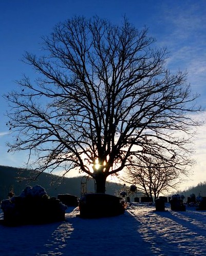
Fotos
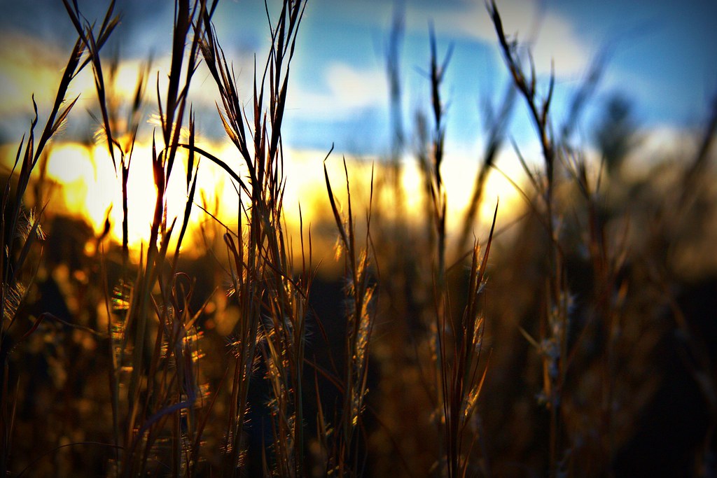
End of a great day!

Spring has sprung

Spring has sprung 2

Special Place
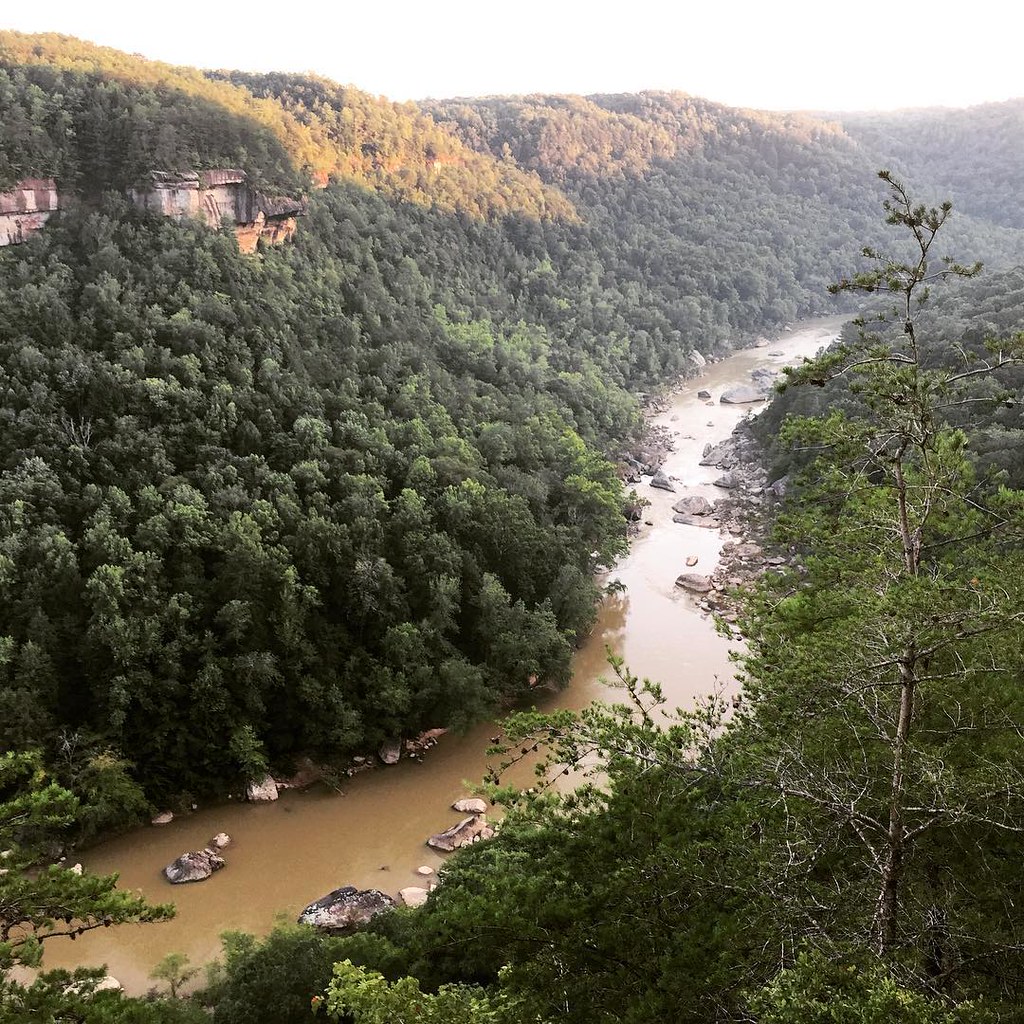
I return to creating #photographs for the #hillClimber series with a weekend trip to the Big South Fork National River and Recreation Area in the #Appalachians in #Tennessee and #Kentucky. We planned a multi-hour #timelapse of the sunset at the Devil's Ju
Sunrise
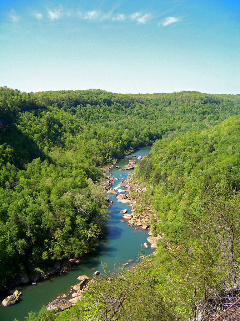
The Devil's Jump Overlook

The View From The Devil's Jump
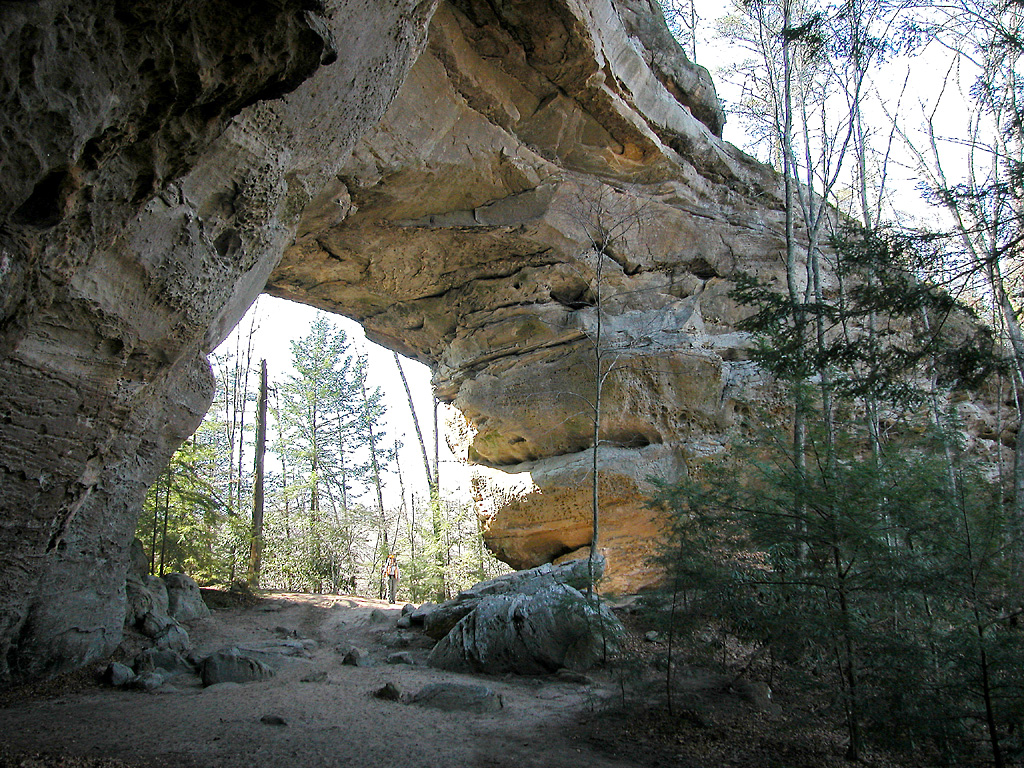
South Twin Arch - Big South Fork National River and Recreation Area
NS 229, Revilo,KY 3/16/2017
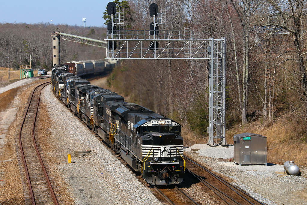
NS 111, Revilo,KY 3/16/2017

Lithic scraper.
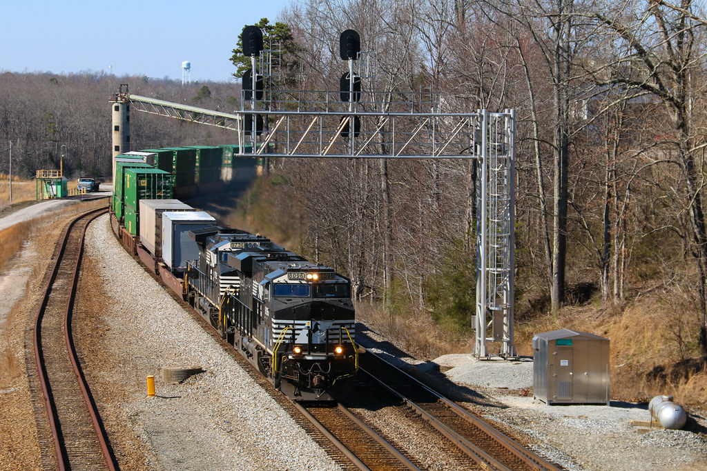
NS 951, Winfield,TN 10/5/2016

NS 951, Winfield,TN 10/5/2016

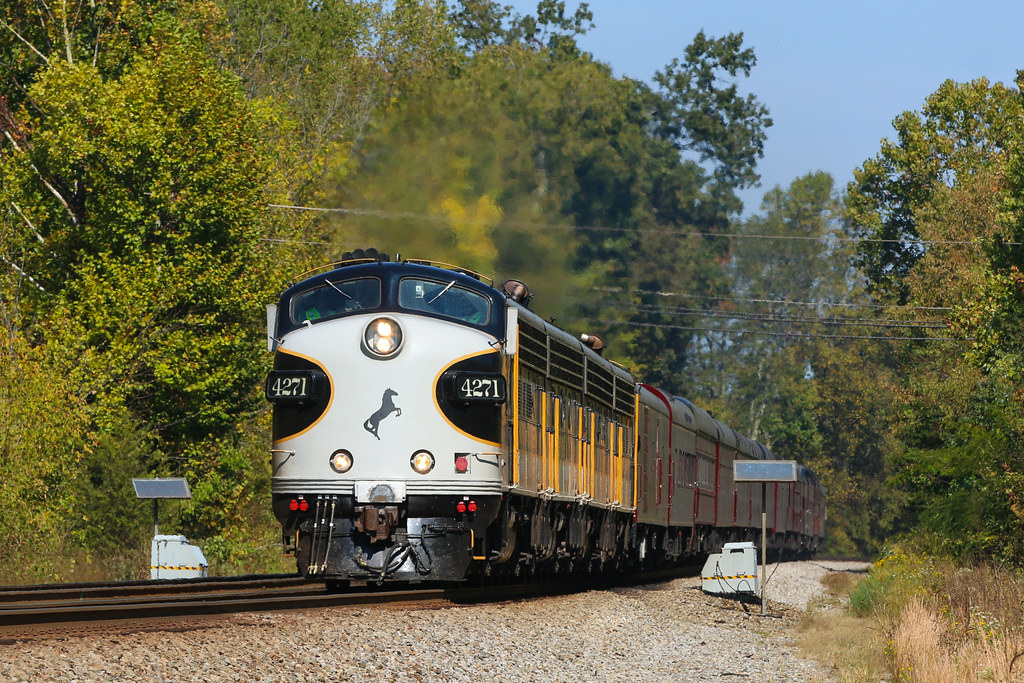
UP 4515, Pine Knot, KY
NS 143 at Revilo , KY
NS 175 with UP power at Revilo, KY
Mapa de Grape Rough Rd, Oneida, TN, EE. UU.
Buscar otro lugar
Lugares cercanos
Forest Ln, Oneida, TN, EE. UU.
Oneida, Tennessee, EE. UU.
Buffalo Rd, Oneida, TN, EE. UU.
Winfield, Tennessee, EE. UU.
Chance Private Drive, Oneida, TN, EE. UU.
Hunter St, Helenwood, TN, EE. UU.
Cherry Fork Rd, Helenwood, TN, EE. UU.
Shug Mountain, Tennessee, EE. UU.
Samuel Cross Rd, Oneida, TN, EE. UU.
Coopertown Rd, Oneida, TN, EE. UU.
Logan Ln, Oneida, TN, EE. UU.
Helenwood, Tennessee, EE. UU.
John J Smith Rd, Oneida, TN, EE. UU.
O and W Rd, Oneida, TN, EE. UU.
John J Smith Road, John J Smith Rd, Oneida, TN, EE. UU.
Wilderness Trail, Oneida, TN, EE. UU.
BrimstoneⓇ, Baker Hwy, Huntsville, TN, EE. UU.
Scott Hwy, Huntsville, TN, EE. UU.
Huntsville, Tennessee, EE. UU.
Bear Hollow Road, Bear Hollow Rd, Oneida, TN, EE. UU.
Búsquedas recientes
- Horas de salida y puesta de sol de Yoshiumicho Minamiura, Imabari, Ehime -, Japan
- Horas de salida y puesta de sol de Kippen, Stirling FK8, Reino Unido
- Horas de salida y puesta de sol de Fleur de Chine Hotel Sun Moon Lake, No. 23號, Zhongzheng Rd, Yuchi Township, Nantou County, Taiwan
- Horas de salida y puesta de sol de -16 Kitamuraakagawa, Iwamizawa, Hokkaido -, Japón
- Horas de salida y puesta de sol de 55 Cassick Valley Rd, Wellfleet, MA, EE. UU.
- Horas de salida y puesta de sol de 高尾山口駅, Takaomachi, Hachiōji, Tokio -, Japón
- Horas de salida y puesta de sol de Somanouchicho, Tenri, Nara -, Japón
- Horas de salida y puesta de sol de Kota Ternate Utara, Ternate City, North Maluku, Indonesia
- Horas de salida y puesta de sol de Zhongzheng South Road, Zhongzheng S Rd, Sanchong District, New Taipei City, Taiwán
- Horas de salida y puesta de sol de Lualaba, República Democrática del Congo