Horas de salida y puesta de sol de Galton Range, Montana, EE. UU.
Location: Estados Unidos > Montana > Condado de Lincoln > Eureka >
Zona horaria:
America/Denver
Hora local:
2024-04-28 21:50:33
Longitud:
-114.9166668
Latitud:
48.9666667
Salida de sol de hoy:
06:20:16 AM
Puesta de sol de hoy:
08:53:30 PM
La duración del día hoy:
14h 33m 14s
Salida de sol de mañana:
06:18:33 AM
Puesta de sol de mañana:
08:54:58 PM
La duración del día mañana:
14h 36m 25s
Mostrar todas las fechas
| Fecha | Salida de sol | Puesta de sol | Duración del día |
|---|---|---|---|
| 01/01/2024 | 08:33:23 AM | 04:53:39 PM | 8h 20m 16s |
| 02/01/2024 | 08:33:17 AM | 04:54:41 PM | 8h 21m 24s |
| 03/01/2024 | 08:33:08 AM | 04:55:44 PM | 8h 22m 36s |
| 04/01/2024 | 08:32:56 AM | 04:56:50 PM | 8h 23m 54s |
| 05/01/2024 | 08:32:41 AM | 04:57:59 PM | 8h 25m 18s |
| 06/01/2024 | 08:32:23 AM | 04:59:09 PM | 8h 26m 46s |
| 07/01/2024 | 08:32:02 AM | 05:00:21 PM | 8h 28m 19s |
| 08/01/2024 | 08:31:38 AM | 05:01:35 PM | 8h 29m 57s |
| 09/01/2024 | 08:31:11 AM | 05:02:51 PM | 8h 31m 40s |
| 10/01/2024 | 08:30:42 AM | 05:04:09 PM | 8h 33m 27s |
| 11/01/2024 | 08:30:09 AM | 05:05:29 PM | 8h 35m 20s |
| 12/01/2024 | 08:29:34 AM | 05:06:50 PM | 8h 37m 16s |
| 13/01/2024 | 08:28:56 AM | 05:08:12 PM | 8h 39m 16s |
| 14/01/2024 | 08:28:15 AM | 05:09:36 PM | 8h 41m 21s |
| 15/01/2024 | 08:27:31 AM | 05:11:02 PM | 8h 43m 31s |
| 16/01/2024 | 08:26:45 AM | 05:12:29 PM | 8h 45m 44s |
| 17/01/2024 | 08:25:56 AM | 05:13:57 PM | 8h 48m 1s |
| 18/01/2024 | 08:25:05 AM | 05:15:26 PM | 8h 50m 21s |
| 19/01/2024 | 08:24:11 AM | 05:16:56 PM | 8h 52m 45s |
| 20/01/2024 | 08:23:14 AM | 05:18:27 PM | 8h 55m 13s |
| 21/01/2024 | 08:22:15 AM | 05:20:00 PM | 8h 57m 45s |
| 22/01/2024 | 08:21:14 AM | 05:21:33 PM | 9h 0m 19s |
| 23/01/2024 | 08:20:10 AM | 05:23:07 PM | 9h 2m 57s |
| 24/01/2024 | 08:19:04 AM | 05:24:41 PM | 9h 5m 37s |
| 25/01/2024 | 08:17:55 AM | 05:26:17 PM | 9h 8m 22s |
| 26/01/2024 | 08:16:44 AM | 05:27:53 PM | 9h 11m 9s |
| 27/01/2024 | 08:15:32 AM | 05:29:29 PM | 9h 13m 57s |
| 28/01/2024 | 08:14:17 AM | 05:31:06 PM | 9h 16m 49s |
| 29/01/2024 | 08:12:59 AM | 05:32:44 PM | 9h 19m 45s |
| 30/01/2024 | 08:11:40 AM | 05:34:22 PM | 9h 22m 42s |
| 31/01/2024 | 08:10:19 AM | 05:36:00 PM | 9h 25m 41s |
| 01/02/2024 | 08:08:56 AM | 05:37:39 PM | 9h 28m 43s |
| 02/02/2024 | 08:07:31 AM | 05:39:18 PM | 9h 31m 47s |
| 03/02/2024 | 08:06:04 AM | 05:40:57 PM | 9h 34m 53s |
| 04/02/2024 | 08:04:36 AM | 05:42:36 PM | 9h 38m 0s |
| 05/02/2024 | 08:03:06 AM | 05:44:16 PM | 9h 41m 10s |
| 06/02/2024 | 08:01:33 AM | 05:45:55 PM | 9h 44m 22s |
| 07/02/2024 | 08:00:00 AM | 05:47:35 PM | 9h 47m 35s |
| 08/02/2024 | 07:58:24 AM | 05:49:14 PM | 9h 50m 50s |
| 09/02/2024 | 07:56:48 AM | 05:50:54 PM | 9h 54m 6s |
| 10/02/2024 | 07:55:09 AM | 05:52:34 PM | 9h 57m 25s |
| 11/02/2024 | 07:53:29 AM | 05:54:13 PM | 10h 0m 44s |
| 12/02/2024 | 07:51:48 AM | 05:55:52 PM | 10h 4m 4s |
| 13/02/2024 | 07:50:06 AM | 05:57:32 PM | 10h 7m 26s |
| 14/02/2024 | 07:48:22 AM | 05:59:11 PM | 10h 10m 49s |
| 15/02/2024 | 07:46:36 AM | 06:00:50 PM | 10h 14m 14s |
| 16/02/2024 | 07:44:50 AM | 06:02:29 PM | 10h 17m 39s |
| 17/02/2024 | 07:43:02 AM | 06:04:07 PM | 10h 21m 5s |
| 18/02/2024 | 07:41:13 AM | 06:05:46 PM | 10h 24m 33s |
| 19/02/2024 | 07:39:23 AM | 06:07:24 PM | 10h 28m 1s |
| 20/02/2024 | 07:37:32 AM | 06:09:02 PM | 10h 31m 30s |
| 21/02/2024 | 07:35:40 AM | 06:10:40 PM | 10h 35m 0s |
| 22/02/2024 | 07:33:47 AM | 06:12:17 PM | 10h 38m 30s |
| 23/02/2024 | 07:31:53 AM | 06:13:54 PM | 10h 42m 1s |
| 24/02/2024 | 07:29:58 AM | 06:15:31 PM | 10h 45m 33s |
| 25/02/2024 | 07:28:02 AM | 06:17:08 PM | 10h 49m 6s |
| 26/02/2024 | 07:26:05 AM | 06:18:45 PM | 10h 52m 40s |
| 27/02/2024 | 07:24:07 AM | 06:20:21 PM | 10h 56m 14s |
| 28/02/2024 | 07:22:09 AM | 06:21:57 PM | 10h 59m 48s |
| 29/02/2024 | 07:20:10 AM | 06:23:32 PM | 11h 3m 22s |
| 01/03/2024 | 07:18:10 AM | 06:25:07 PM | 11h 6m 57s |
| 02/03/2024 | 07:16:10 AM | 06:26:42 PM | 11h 10m 32s |
| 03/03/2024 | 07:14:08 AM | 06:28:17 PM | 11h 14m 9s |
| 04/03/2024 | 07:12:07 AM | 06:29:52 PM | 11h 17m 45s |
| 05/03/2024 | 07:10:04 AM | 06:31:26 PM | 11h 21m 22s |
| 06/03/2024 | 07:08:02 AM | 06:33:00 PM | 11h 24m 58s |
| 07/03/2024 | 07:05:58 AM | 06:34:34 PM | 11h 28m 36s |
| 08/03/2024 | 07:03:55 AM | 06:36:07 PM | 11h 32m 12s |
| 09/03/2024 | 07:01:50 AM | 06:37:40 PM | 11h 35m 50s |
| 10/03/2024 | 07:59:51 AM | 07:39:09 PM | 11h 39m 18s |
| 11/03/2024 | 07:57:46 AM | 07:40:42 PM | 11h 42m 56s |
| 12/03/2024 | 07:55:41 AM | 07:42:15 PM | 11h 46m 34s |
| 13/03/2024 | 07:53:35 AM | 07:43:47 PM | 11h 50m 12s |
| 14/03/2024 | 07:51:29 AM | 07:45:19 PM | 11h 53m 50s |
| 15/03/2024 | 07:49:23 AM | 07:46:51 PM | 11h 57m 28s |
| 16/03/2024 | 07:47:17 AM | 07:48:23 PM | 12h 1m 6s |
| 17/03/2024 | 07:45:10 AM | 07:49:54 PM | 12h 4m 44s |
| 18/03/2024 | 07:43:04 AM | 07:51:26 PM | 12h 8m 22s |
| 19/03/2024 | 07:40:57 AM | 07:52:57 PM | 12h 12m 0s |
| 20/03/2024 | 07:38:50 AM | 07:54:28 PM | 12h 15m 38s |
| 21/03/2024 | 07:36:43 AM | 07:55:59 PM | 12h 19m 16s |
| 22/03/2024 | 07:34:37 AM | 07:57:30 PM | 12h 22m 53s |
| 23/03/2024 | 07:32:30 AM | 07:59:01 PM | 12h 26m 31s |
| 24/03/2024 | 07:30:23 AM | 08:00:31 PM | 12h 30m 8s |
| 25/03/2024 | 07:28:16 AM | 08:02:02 PM | 12h 33m 46s |
| 26/03/2024 | 07:26:10 AM | 08:03:32 PM | 12h 37m 22s |
| 27/03/2024 | 07:24:03 AM | 08:05:03 PM | 12h 41m 0s |
| 28/03/2024 | 07:21:57 AM | 08:06:33 PM | 12h 44m 36s |
| 29/03/2024 | 07:19:50 AM | 08:08:03 PM | 12h 48m 13s |
| 30/03/2024 | 07:17:45 AM | 08:09:33 PM | 12h 51m 48s |
| 31/03/2024 | 07:15:39 AM | 08:11:03 PM | 12h 55m 24s |
| 01/04/2024 | 07:13:34 AM | 08:12:33 PM | 12h 58m 59s |
| 02/04/2024 | 07:11:28 AM | 08:14:03 PM | 13h 2m 35s |
| 03/04/2024 | 07:09:24 AM | 08:15:34 PM | 13h 6m 10s |
| 04/04/2024 | 07:07:19 AM | 08:17:03 PM | 13h 9m 44s |
| 05/04/2024 | 07:05:16 AM | 08:18:33 PM | 13h 13m 17s |
| 06/04/2024 | 07:03:12 AM | 08:20:03 PM | 13h 16m 51s |
| 07/04/2024 | 07:01:09 AM | 08:21:33 PM | 13h 20m 24s |
| 08/04/2024 | 06:59:07 AM | 08:23:03 PM | 13h 23m 56s |
| 09/04/2024 | 06:57:05 AM | 08:24:33 PM | 13h 27m 28s |
| 10/04/2024 | 06:55:03 AM | 08:26:03 PM | 13h 31m 0s |
| 11/04/2024 | 06:53:03 AM | 08:27:33 PM | 13h 34m 30s |
| 12/04/2024 | 06:51:03 AM | 08:29:03 PM | 13h 38m 0s |
| 13/04/2024 | 06:49:03 AM | 08:30:33 PM | 13h 41m 30s |
| 14/04/2024 | 06:47:05 AM | 08:32:03 PM | 13h 44m 58s |
| 15/04/2024 | 06:45:07 AM | 08:33:32 PM | 13h 48m 25s |
| 16/04/2024 | 06:43:10 AM | 08:35:02 PM | 13h 51m 52s |
| 17/04/2024 | 06:41:13 AM | 08:36:32 PM | 13h 55m 19s |
| 18/04/2024 | 06:39:18 AM | 08:38:02 PM | 13h 58m 44s |
| 19/04/2024 | 06:37:24 AM | 08:39:31 PM | 14h 2m 7s |
| 20/04/2024 | 06:35:30 AM | 08:41:01 PM | 14h 5m 31s |
| 21/04/2024 | 06:33:37 AM | 08:42:30 PM | 14h 8m 53s |
| 22/04/2024 | 06:31:46 AM | 08:44:00 PM | 14h 12m 14s |
| 23/04/2024 | 06:29:55 AM | 08:45:29 PM | 14h 15m 34s |
| 24/04/2024 | 06:28:06 AM | 08:46:58 PM | 14h 18m 52s |
| 25/04/2024 | 06:26:17 AM | 08:48:27 PM | 14h 22m 10s |
| 26/04/2024 | 06:24:30 AM | 08:49:56 PM | 14h 25m 26s |
| 27/04/2024 | 06:22:44 AM | 08:51:25 PM | 14h 28m 41s |
| 28/04/2024 | 06:20:59 AM | 08:52:53 PM | 14h 31m 54s |
| 29/04/2024 | 06:19:16 AM | 08:54:22 PM | 14h 35m 6s |
| 30/04/2024 | 06:17:34 AM | 08:55:50 PM | 14h 38m 16s |
| 01/05/2024 | 06:15:53 AM | 08:57:17 PM | 14h 41m 24s |
| 02/05/2024 | 06:14:14 AM | 08:58:45 PM | 14h 44m 31s |
| 03/05/2024 | 06:12:36 AM | 09:00:12 PM | 14h 47m 36s |
| 04/05/2024 | 06:11:00 AM | 09:01:39 PM | 14h 50m 39s |
| 05/05/2024 | 06:09:25 AM | 09:03:05 PM | 14h 53m 40s |
| 06/05/2024 | 06:07:51 AM | 09:04:31 PM | 14h 56m 40s |
| 07/05/2024 | 06:06:20 AM | 09:05:56 PM | 14h 59m 36s |
| 08/05/2024 | 06:04:50 AM | 09:07:21 PM | 15h 2m 31s |
| 09/05/2024 | 06:03:21 AM | 09:08:45 PM | 15h 5m 24s |
| 10/05/2024 | 06:01:55 AM | 09:10:09 PM | 15h 8m 14s |
| 11/05/2024 | 06:00:30 AM | 09:11:32 PM | 15h 11m 2s |
| 12/05/2024 | 05:59:07 AM | 09:12:54 PM | 15h 13m 47s |
| 13/05/2024 | 05:57:46 AM | 09:14:16 PM | 15h 16m 30s |
| 14/05/2024 | 05:56:27 AM | 09:15:37 PM | 15h 19m 10s |
| 15/05/2024 | 05:55:10 AM | 09:16:57 PM | 15h 21m 47s |
| 16/05/2024 | 05:53:55 AM | 09:18:16 PM | 15h 24m 21s |
| 17/05/2024 | 05:52:42 AM | 09:19:34 PM | 15h 26m 52s |
| 18/05/2024 | 05:51:31 AM | 09:20:51 PM | 15h 29m 20s |
| 19/05/2024 | 05:50:22 AM | 09:22:07 PM | 15h 31m 45s |
| 20/05/2024 | 05:49:15 AM | 09:23:22 PM | 15h 34m 7s |
| 21/05/2024 | 05:48:11 AM | 09:24:36 PM | 15h 36m 25s |
| 22/05/2024 | 05:47:09 AM | 09:25:48 PM | 15h 38m 39s |
| 23/05/2024 | 05:46:09 AM | 09:27:00 PM | 15h 40m 51s |
| 24/05/2024 | 05:45:11 AM | 09:28:09 PM | 15h 42m 58s |
| 25/05/2024 | 05:44:16 AM | 09:29:18 PM | 15h 45m 2s |
| 26/05/2024 | 05:43:23 AM | 09:30:25 PM | 15h 47m 2s |
| 27/05/2024 | 05:42:33 AM | 09:31:31 PM | 15h 48m 58s |
| 28/05/2024 | 05:41:45 AM | 09:32:35 PM | 15h 50m 50s |
| 29/05/2024 | 05:41:00 AM | 09:33:37 PM | 15h 52m 37s |
| 30/05/2024 | 05:40:17 AM | 09:34:37 PM | 15h 54m 20s |
| 31/05/2024 | 05:39:37 AM | 09:35:36 PM | 15h 55m 59s |
| 01/06/2024 | 05:38:59 AM | 09:36:33 PM | 15h 57m 34s |
| 02/06/2024 | 05:38:24 AM | 09:37:28 PM | 15h 59m 4s |
| 03/06/2024 | 05:37:52 AM | 09:38:21 PM | 16h 0m 29s |
| 04/06/2024 | 05:37:22 AM | 09:39:13 PM | 16h 1m 51s |
| 05/06/2024 | 05:36:55 AM | 09:40:02 PM | 16h 3m 7s |
| 06/06/2024 | 05:36:30 AM | 09:40:49 PM | 16h 4m 19s |
| 07/06/2024 | 05:36:09 AM | 09:41:34 PM | 16h 5m 25s |
| 08/06/2024 | 05:35:50 AM | 09:42:16 PM | 16h 6m 26s |
| 09/06/2024 | 05:35:34 AM | 09:42:56 PM | 16h 7m 22s |
| 10/06/2024 | 05:35:20 AM | 09:43:34 PM | 16h 8m 14s |
| 11/06/2024 | 05:35:09 AM | 09:44:10 PM | 16h 9m 1s |
| 12/06/2024 | 05:35:01 AM | 09:44:43 PM | 16h 9m 42s |
| 13/06/2024 | 05:34:56 AM | 09:45:14 PM | 16h 10m 18s |
| 14/06/2024 | 05:34:54 AM | 09:45:42 PM | 16h 10m 48s |
| 15/06/2024 | 05:34:54 AM | 09:46:08 PM | 16h 11m 14s |
| 16/06/2024 | 05:34:57 AM | 09:46:31 PM | 16h 11m 34s |
| 17/06/2024 | 05:35:02 AM | 09:46:51 PM | 16h 11m 49s |
| 18/06/2024 | 05:35:11 AM | 09:47:09 PM | 16h 11m 58s |
| 19/06/2024 | 05:35:22 AM | 09:47:24 PM | 16h 12m 2s |
| 20/06/2024 | 05:35:35 AM | 09:47:37 PM | 16h 12m 2s |
| 21/06/2024 | 05:35:52 AM | 09:47:47 PM | 16h 11m 55s |
| 22/06/2024 | 05:36:10 AM | 09:47:54 PM | 16h 11m 44s |
| 23/06/2024 | 05:36:32 AM | 09:47:58 PM | 16h 11m 26s |
| 24/06/2024 | 05:36:56 AM | 09:48:00 PM | 16h 11m 4s |
| 25/06/2024 | 05:37:22 AM | 09:47:58 PM | 16h 10m 36s |
| 26/06/2024 | 05:37:51 AM | 09:47:54 PM | 16h 10m 3s |
| 27/06/2024 | 05:38:22 AM | 09:47:48 PM | 16h 9m 26s |
| 28/06/2024 | 05:38:56 AM | 09:47:38 PM | 16h 8m 42s |
| 29/06/2024 | 05:39:32 AM | 09:47:26 PM | 16h 7m 54s |
| 30/06/2024 | 05:40:10 AM | 09:47:10 PM | 16h 7m 0s |
| 01/07/2024 | 05:40:50 AM | 09:46:52 PM | 16h 6m 2s |
| 02/07/2024 | 05:41:33 AM | 09:46:32 PM | 16h 4m 59s |
| 03/07/2024 | 05:42:18 AM | 09:46:08 PM | 16h 3m 50s |
| 04/07/2024 | 05:43:04 AM | 09:45:42 PM | 16h 2m 38s |
| 05/07/2024 | 05:43:53 AM | 09:45:13 PM | 16h 1m 20s |
| 06/07/2024 | 05:44:44 AM | 09:44:42 PM | 15h 59m 58s |
| 07/07/2024 | 05:45:37 AM | 09:44:07 PM | 15h 58m 30s |
| 08/07/2024 | 05:46:31 AM | 09:43:30 PM | 15h 56m 59s |
| 09/07/2024 | 05:47:27 AM | 09:42:51 PM | 15h 55m 24s |
| 10/07/2024 | 05:48:25 AM | 09:42:08 PM | 15h 53m 43s |
| 11/07/2024 | 05:49:25 AM | 09:41:24 PM | 15h 51m 59s |
| 12/07/2024 | 05:50:26 AM | 09:40:36 PM | 15h 50m 10s |
| 13/07/2024 | 05:51:29 AM | 09:39:46 PM | 15h 48m 17s |
| 14/07/2024 | 05:52:33 AM | 09:38:54 PM | 15h 46m 21s |
| 15/07/2024 | 05:53:39 AM | 09:37:59 PM | 15h 44m 20s |
| 16/07/2024 | 05:54:46 AM | 09:37:02 PM | 15h 42m 16s |
| 17/07/2024 | 05:55:54 AM | 09:36:03 PM | 15h 40m 9s |
| 18/07/2024 | 05:57:04 AM | 09:35:01 PM | 15h 37m 57s |
| 19/07/2024 | 05:58:14 AM | 09:33:57 PM | 15h 35m 43s |
| 20/07/2024 | 05:59:26 AM | 09:32:50 PM | 15h 33m 24s |
| 21/07/2024 | 06:00:39 AM | 09:31:42 PM | 15h 31m 3s |
| 22/07/2024 | 06:01:53 AM | 09:30:31 PM | 15h 28m 38s |
| 23/07/2024 | 06:03:08 AM | 09:29:18 PM | 15h 26m 10s |
| 24/07/2024 | 06:04:23 AM | 09:28:03 PM | 15h 23m 40s |
| 25/07/2024 | 06:05:40 AM | 09:26:46 PM | 15h 21m 6s |
| 26/07/2024 | 06:06:57 AM | 09:25:27 PM | 15h 18m 30s |
| 27/07/2024 | 06:08:15 AM | 09:24:06 PM | 15h 15m 51s |
| 28/07/2024 | 06:09:34 AM | 09:22:43 PM | 15h 13m 9s |
| 29/07/2024 | 06:10:54 AM | 09:21:18 PM | 15h 10m 24s |
| 30/07/2024 | 06:12:14 AM | 09:19:52 PM | 15h 7m 38s |
| 31/07/2024 | 06:13:35 AM | 09:18:23 PM | 15h 4m 48s |
| 01/08/2024 | 06:14:56 AM | 09:16:53 PM | 15h 1m 57s |
| 02/08/2024 | 06:16:17 AM | 09:15:21 PM | 14h 59m 4s |
| 03/08/2024 | 06:17:39 AM | 09:13:48 PM | 14h 56m 9s |
| 04/08/2024 | 06:19:02 AM | 09:12:13 PM | 14h 53m 11s |
| 05/08/2024 | 06:20:25 AM | 09:10:36 PM | 14h 50m 11s |
| 06/08/2024 | 06:21:48 AM | 09:08:58 PM | 14h 47m 10s |
| 07/08/2024 | 06:23:12 AM | 09:07:18 PM | 14h 44m 6s |
| 08/08/2024 | 06:24:35 AM | 09:05:37 PM | 14h 41m 2s |
| 09/08/2024 | 06:25:59 AM | 09:03:55 PM | 14h 37m 56s |
| 10/08/2024 | 06:27:24 AM | 09:02:11 PM | 14h 34m 47s |
| 11/08/2024 | 06:28:48 AM | 09:00:26 PM | 14h 31m 38s |
| 12/08/2024 | 06:30:13 AM | 08:58:39 PM | 14h 28m 26s |
| 13/08/2024 | 06:31:37 AM | 08:56:52 PM | 14h 25m 15s |
| 14/08/2024 | 06:33:02 AM | 08:55:03 PM | 14h 22m 1s |
| 15/08/2024 | 06:34:27 AM | 08:53:13 PM | 14h 18m 46s |
| 16/08/2024 | 06:35:52 AM | 08:51:22 PM | 14h 15m 30s |
| 17/08/2024 | 06:37:18 AM | 08:49:30 PM | 14h 12m 12s |
| 18/08/2024 | 06:38:43 AM | 08:47:36 PM | 14h 8m 53s |
| 19/08/2024 | 06:40:08 AM | 08:45:42 PM | 14h 5m 34s |
| 20/08/2024 | 06:41:33 AM | 08:43:47 PM | 14h 2m 14s |
| 21/08/2024 | 06:42:59 AM | 08:41:51 PM | 13h 58m 52s |
| 22/08/2024 | 06:44:24 AM | 08:39:54 PM | 13h 55m 30s |
| 23/08/2024 | 06:45:49 AM | 08:37:56 PM | 13h 52m 7s |
| 24/08/2024 | 06:47:15 AM | 08:35:57 PM | 13h 48m 42s |
| 25/08/2024 | 06:48:40 AM | 08:33:58 PM | 13h 45m 18s |
| 26/08/2024 | 06:50:05 AM | 08:31:58 PM | 13h 41m 53s |
| 27/08/2024 | 06:51:31 AM | 08:29:57 PM | 13h 38m 26s |
| 28/08/2024 | 06:52:56 AM | 08:27:55 PM | 13h 34m 59s |
| 29/08/2024 | 06:54:21 AM | 08:25:53 PM | 13h 31m 32s |
| 30/08/2024 | 06:55:46 AM | 08:23:50 PM | 13h 28m 4s |
| 31/08/2024 | 06:57:12 AM | 08:21:47 PM | 13h 24m 35s |
| 01/09/2024 | 06:58:37 AM | 08:19:43 PM | 13h 21m 6s |
| 02/09/2024 | 07:00:02 AM | 08:17:38 PM | 13h 17m 36s |
| 03/09/2024 | 07:01:27 AM | 08:15:33 PM | 13h 14m 6s |
| 04/09/2024 | 07:02:52 AM | 08:13:28 PM | 13h 10m 36s |
| 05/09/2024 | 07:04:17 AM | 08:11:22 PM | 13h 7m 5s |
| 06/09/2024 | 07:05:43 AM | 08:09:15 PM | 13h 3m 32s |
| 07/09/2024 | 07:07:08 AM | 08:07:09 PM | 13h 0m 1s |
| 08/09/2024 | 07:08:33 AM | 08:05:02 PM | 12h 56m 29s |
| 09/09/2024 | 07:09:58 AM | 08:02:55 PM | 12h 52m 57s |
| 10/09/2024 | 07:11:23 AM | 08:00:47 PM | 12h 49m 24s |
| 11/09/2024 | 07:12:49 AM | 07:58:39 PM | 12h 45m 50s |
| 12/09/2024 | 07:14:14 AM | 07:56:31 PM | 12h 42m 17s |
| 13/09/2024 | 07:15:39 AM | 07:54:23 PM | 12h 38m 44s |
| 14/09/2024 | 07:17:05 AM | 07:52:15 PM | 12h 35m 10s |
| 15/09/2024 | 07:18:30 AM | 07:50:07 PM | 12h 31m 37s |
| 16/09/2024 | 07:19:56 AM | 07:47:58 PM | 12h 28m 2s |
| 17/09/2024 | 07:21:21 AM | 07:45:50 PM | 12h 24m 29s |
| 18/09/2024 | 07:22:47 AM | 07:43:41 PM | 12h 20m 54s |
| 19/09/2024 | 07:24:13 AM | 07:41:32 PM | 12h 17m 19s |
| 20/09/2024 | 07:25:39 AM | 07:39:24 PM | 12h 13m 45s |
| 21/09/2024 | 07:27:05 AM | 07:37:15 PM | 12h 10m 10s |
| 22/09/2024 | 07:28:32 AM | 07:35:07 PM | 12h 6m 35s |
| 23/09/2024 | 07:29:58 AM | 07:32:59 PM | 12h 3m 1s |
| 24/09/2024 | 07:31:25 AM | 07:30:51 PM | 11h 59m 26s |
| 25/09/2024 | 07:32:51 AM | 07:28:43 PM | 11h 55m 52s |
| 26/09/2024 | 07:34:18 AM | 07:26:35 PM | 11h 52m 17s |
| 27/09/2024 | 07:35:46 AM | 07:24:28 PM | 11h 48m 42s |
| 28/09/2024 | 07:37:13 AM | 07:22:21 PM | 11h 45m 8s |
| 29/09/2024 | 07:38:41 AM | 07:20:14 PM | 11h 41m 33s |
| 30/09/2024 | 07:40:09 AM | 07:18:07 PM | 11h 37m 58s |
| 01/10/2024 | 07:41:37 AM | 07:16:01 PM | 11h 34m 24s |
| 02/10/2024 | 07:43:05 AM | 07:13:55 PM | 11h 30m 50s |
| 03/10/2024 | 07:44:34 AM | 07:11:50 PM | 11h 27m 16s |
| 04/10/2024 | 07:46:02 AM | 07:09:45 PM | 11h 23m 43s |
| 05/10/2024 | 07:47:32 AM | 07:07:41 PM | 11h 20m 9s |
| 06/10/2024 | 07:49:01 AM | 07:05:37 PM | 11h 16m 36s |
| 07/10/2024 | 07:50:31 AM | 07:03:34 PM | 11h 13m 3s |
| 08/10/2024 | 07:52:01 AM | 07:01:31 PM | 11h 9m 30s |
| 09/10/2024 | 07:53:31 AM | 06:59:29 PM | 11h 5m 58s |
| 10/10/2024 | 07:55:01 AM | 06:57:28 PM | 11h 2m 27s |
| 11/10/2024 | 07:56:32 AM | 06:55:28 PM | 10h 58m 56s |
| 12/10/2024 | 07:58:03 AM | 06:53:28 PM | 10h 55m 25s |
| 13/10/2024 | 07:59:35 AM | 06:51:29 PM | 10h 51m 54s |
| 14/10/2024 | 08:01:07 AM | 06:49:30 PM | 10h 48m 23s |
| 15/10/2024 | 08:02:39 AM | 06:47:33 PM | 10h 44m 54s |
| 16/10/2024 | 08:04:11 AM | 06:45:36 PM | 10h 41m 25s |
| 17/10/2024 | 08:05:44 AM | 06:43:41 PM | 10h 37m 57s |
| 18/10/2024 | 08:07:17 AM | 06:41:46 PM | 10h 34m 29s |
| 19/10/2024 | 08:08:50 AM | 06:39:52 PM | 10h 31m 2s |
| 20/10/2024 | 08:10:24 AM | 06:38:00 PM | 10h 27m 36s |
| 21/10/2024 | 08:11:57 AM | 06:36:08 PM | 10h 24m 11s |
| 22/10/2024 | 08:13:31 AM | 06:34:17 PM | 10h 20m 46s |
| 23/10/2024 | 08:15:06 AM | 06:32:28 PM | 10h 17m 22s |
| 24/10/2024 | 08:16:40 AM | 06:30:40 PM | 10h 14m 0s |
| 25/10/2024 | 08:18:15 AM | 06:28:53 PM | 10h 10m 38s |
| 26/10/2024 | 08:19:50 AM | 06:27:08 PM | 10h 7m 18s |
| 27/10/2024 | 08:21:25 AM | 06:25:23 PM | 10h 3m 58s |
| 28/10/2024 | 08:23:00 AM | 06:23:40 PM | 10h 0m 40s |
| 29/10/2024 | 08:24:36 AM | 06:21:59 PM | 9h 57m 23s |
| 30/10/2024 | 08:26:11 AM | 06:20:19 PM | 9h 54m 8s |
| 31/10/2024 | 08:27:47 AM | 06:18:40 PM | 9h 50m 53s |
| 01/11/2024 | 08:29:23 AM | 06:17:03 PM | 9h 47m 40s |
| 02/11/2024 | 08:30:58 AM | 06:15:28 PM | 9h 44m 30s |
| 03/11/2024 | 07:32:38 AM | 05:13:50 PM | 9h 41m 12s |
| 04/11/2024 | 07:34:14 AM | 05:12:19 PM | 9h 38m 5s |
| 05/11/2024 | 07:35:49 AM | 05:10:48 PM | 9h 34m 59s |
| 06/11/2024 | 07:37:25 AM | 05:09:20 PM | 9h 31m 55s |
| 07/11/2024 | 07:39:00 AM | 05:07:53 PM | 9h 28m 53s |
| 08/11/2024 | 07:40:35 AM | 05:06:28 PM | 9h 25m 53s |
| 09/11/2024 | 07:42:10 AM | 05:05:06 PM | 9h 22m 56s |
| 10/11/2024 | 07:43:45 AM | 05:03:45 PM | 9h 20m 0s |
| 11/11/2024 | 07:45:19 AM | 05:02:26 PM | 9h 17m 7s |
| 12/11/2024 | 07:46:53 AM | 05:01:09 PM | 9h 14m 16s |
| 13/11/2024 | 07:48:27 AM | 04:59:55 PM | 9h 11m 28s |
| 14/11/2024 | 07:50:00 AM | 04:58:42 PM | 9h 8m 42s |
| 15/11/2024 | 07:51:33 AM | 04:57:32 PM | 9h 5m 59s |
| 16/11/2024 | 07:53:04 AM | 04:56:24 PM | 9h 3m 20s |
| 17/11/2024 | 07:54:36 AM | 04:55:18 PM | 9h 0m 42s |
| 18/11/2024 | 07:56:06 AM | 04:54:15 PM | 8h 58m 9s |
| 19/11/2024 | 07:57:36 AM | 04:53:14 PM | 8h 55m 38s |
| 20/11/2024 | 07:59:05 AM | 04:52:16 PM | 8h 53m 11s |
| 21/11/2024 | 08:00:33 AM | 04:51:20 PM | 8h 50m 47s |
| 22/11/2024 | 08:02:00 AM | 04:50:27 PM | 8h 48m 27s |
| 23/11/2024 | 08:03:26 AM | 04:49:36 PM | 8h 46m 10s |
| 24/11/2024 | 08:04:51 AM | 04:48:48 PM | 8h 43m 57s |
| 25/11/2024 | 08:06:14 AM | 04:48:02 PM | 8h 41m 48s |
| 26/11/2024 | 08:07:37 AM | 04:47:20 PM | 8h 39m 43s |
| 27/11/2024 | 08:08:58 AM | 04:46:40 PM | 8h 37m 42s |
| 28/11/2024 | 08:10:17 AM | 04:46:03 PM | 8h 35m 46s |
| 29/11/2024 | 08:11:35 AM | 04:45:28 PM | 8h 33m 53s |
| 30/11/2024 | 08:12:52 AM | 04:44:57 PM | 8h 32m 5s |
| 01/12/2024 | 08:14:07 AM | 04:44:28 PM | 8h 30m 21s |
| 02/12/2024 | 08:15:20 AM | 04:44:03 PM | 8h 28m 43s |
| 03/12/2024 | 08:16:31 AM | 04:43:40 PM | 8h 27m 9s |
| 04/12/2024 | 08:17:40 AM | 04:43:21 PM | 8h 25m 41s |
| 05/12/2024 | 08:18:48 AM | 04:43:04 PM | 8h 24m 16s |
| 06/12/2024 | 08:19:53 AM | 04:42:50 PM | 8h 22m 57s |
| 07/12/2024 | 08:20:57 AM | 04:42:40 PM | 8h 21m 43s |
| 08/12/2024 | 08:21:58 AM | 04:42:32 PM | 8h 20m 34s |
| 09/12/2024 | 08:22:57 AM | 04:42:28 PM | 8h 19m 31s |
| 10/12/2024 | 08:23:54 AM | 04:42:27 PM | 8h 18m 33s |
| 11/12/2024 | 08:24:48 AM | 04:42:28 PM | 8h 17m 40s |
| 12/12/2024 | 08:25:40 AM | 04:42:33 PM | 8h 16m 53s |
| 13/12/2024 | 08:26:30 AM | 04:42:41 PM | 8h 16m 11s |
| 14/12/2024 | 08:27:16 AM | 04:42:52 PM | 8h 15m 36s |
| 15/12/2024 | 08:28:01 AM | 04:43:06 PM | 8h 15m 5s |
| 16/12/2024 | 08:28:42 AM | 04:43:23 PM | 8h 14m 41s |
| 17/12/2024 | 08:29:21 AM | 04:43:43 PM | 8h 14m 22s |
| 18/12/2024 | 08:29:58 AM | 04:44:06 PM | 8h 14m 8s |
| 19/12/2024 | 08:30:31 AM | 04:44:32 PM | 8h 14m 1s |
| 20/12/2024 | 08:31:02 AM | 04:45:01 PM | 8h 13m 59s |
| 21/12/2024 | 08:31:29 AM | 04:45:33 PM | 8h 14m 4s |
| 22/12/2024 | 08:31:54 AM | 04:46:08 PM | 8h 14m 14s |
| 23/12/2024 | 08:32:16 AM | 04:46:46 PM | 8h 14m 30s |
| 24/12/2024 | 08:32:35 AM | 04:47:26 PM | 8h 14m 51s |
| 25/12/2024 | 08:32:51 AM | 04:48:10 PM | 8h 15m 19s |
| 26/12/2024 | 08:33:04 AM | 04:48:56 PM | 8h 15m 52s |
| 27/12/2024 | 08:33:14 AM | 04:49:44 PM | 8h 16m 30s |
| 28/12/2024 | 08:33:21 AM | 04:50:36 PM | 8h 17m 15s |
| 29/12/2024 | 08:33:25 AM | 04:51:29 PM | 8h 18m 4s |
| 30/12/2024 | 08:33:26 AM | 04:52:26 PM | 8h 19m 0s |
Fotos

Sunset in Montana

Upper Wolverine Lake

Stormy clouds

Turtle Lake sunset
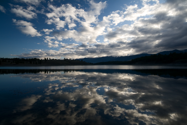
Sophie Lake at sunrise

A hazy afternoon view of Mt. Wam Lookout from the Pacific Northwest Trail in the Ten Lakes Scenic Area, Kootenai National Forest in Northwest Montana

Crossing into Canada...

Road Trip
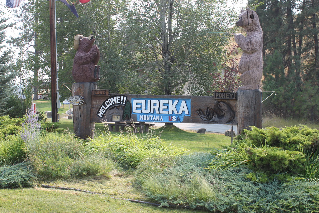
Eureka (Montana)

Eureka, Montana 59917

Big Therriault Lake trail, Kootenai National Forest

Big Therriault Lake, Kootenai National Forest

Big Therriault Lake panorama

Pacific Northwest National Scenic Trail near Stahl Peak

trail near Big Therriault Lake

trail winding along the shore of Big Therriault Lake

Big Therriault Lake panorama, Kootenai National Forest

Clouds moving in over Little Therriault Lake, Kootenai National Forest
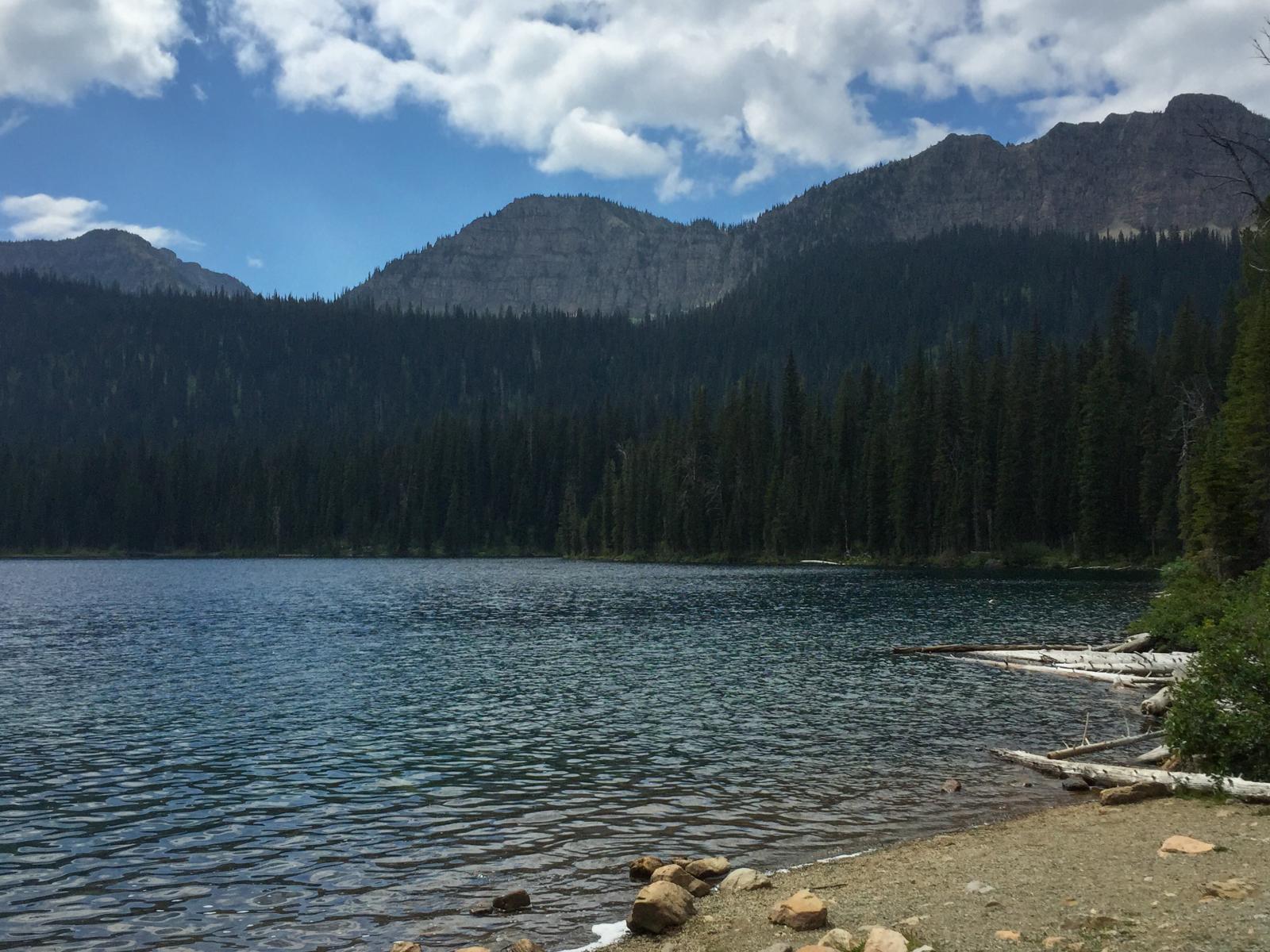
picnic area along Big Therriault Lake, Kootenai National Forest

Lake Koocanusa from the Pacific Northwest Trail near the Canadian border

Pacific Northwest National Scenic Trail sign on the bridge over Grave Creek, Kootenai National Forest

Lake Koocanusa panorama from the Pacific Northwest Trail near the Canadian border

Weasel Lake

Weasel Lake

Starting to rain...

Found some guys doing the Tour Divide.

Montana isn't so bad looking. This is just south of the Roosville border crossing, on the way to Eureka, MT. #GDMTBR

On the way to Eureka, MT looking for a place for the night. #GDMTBR
Mapa de Galton Range, Montana, EE. UU.
Buscar otro lugar
Lugares cercanos
Poorman Mountain, Montana, EE. UU.
Little Therriault Lake Campground, Eureka, MT, Estados Unidos
Ksanka Peak, Montana, EE. UU.
Saint Clair Peak, St Clair Peak, Montana, EE. UU.
Independence Peak, Montana, EE. UU.
Eureka, Montana, EE. UU.
Stahl Peak, Montana, EE. UU.
Gould Rd, Eureka, MT, EE. UU.
Mount Wam, Mt Wam, Montana, EE. UU.
Costich Lake Dr, Eureka, MT, EE. UU.
Indian Springs Ranch, 77 Indian Springs Rd, Eureka, MT, EE. UU.
Vukonich Ln, Eureka, MT, EE. UU.
Eureka, Montana, EE. UU.
Couldrey Ridge, East Kootenay A, BC V0B, Canadá
Fortine, Montana, EE. UU.
1st St N, Fortine, MT, EE. UU.
Grasmere, BC V0B, Canadá
Review Mountain North, Montana, EE. UU.
Tuchuck Mountain, Montana, EE. UU.
Review Mountain South, Montana, EE. UU.
Búsquedas recientes
- Horas de salida y puesta de sol de Lampiasi St, Sarasota, FL, USA
- Horas de salida y puesta de sol de Japón, 〒- Toyama, Kubomotomachi, 12−31 APAガーデンコート稲荷
- Horas de salida y puesta de sol de Jialuohu, Datong Township, Yilan County, Taiwán
- Horas de salida y puesta de sol de 大下港, Sekizenoge, Imabari, Prefectura de Ehime -, Japón
- Horas de salida y puesta de sol de Oge port Ferry Terminal, -1 Sekizenōge, Imabari, Ehime -, Japón
- Horas de salida y puesta de sol de San Telmo, Cdad. Autónoma de Buenos Aires, Argentina
- Horas de salida y puesta de sol de Congressional Dr, Stevensville, MD, USA
- Horas de salida y puesta de sol de Papingo 04, Grecia
- Horas de salida y puesta de sol de Pagonija rock, Kranto 7-oji g. 8"N, Kaunas, Lituania
- Horas de salida y puesta de sol de Co Rd 87, Jamestown, CO, EE. UU.