Horas de salida y puesta de sol de Bridge Point Trail, Suffolk, VA, EE. UU.
Location: Estados Unidos > Virginia > Suffolk >
Zona horaria:
America/New_York
Hora local:
2024-05-17 14:11:06
Longitud:
-76.5446521
Latitud:
36.8505393
Salida de sol de hoy:
05:55:21 AM
Puesta de sol de hoy:
08:09:58 PM
La duración del día hoy:
14h 14m 37s
Salida de sol de mañana:
05:54:39 AM
Puesta de sol de mañana:
08:10:46 PM
La duración del día mañana:
14h 16m 7s
Mostrar todas las fechas
| Fecha | Salida de sol | Puesta de sol | Duración del día |
|---|---|---|---|
| 01/01/2024 | 07:19:02 AM | 05:00:50 PM | 9h 41m 48s |
| 02/01/2024 | 07:19:10 AM | 05:01:38 PM | 9h 42m 28s |
| 03/01/2024 | 07:19:16 AM | 05:02:28 PM | 9h 43m 12s |
| 04/01/2024 | 07:19:19 AM | 05:03:18 PM | 9h 43m 59s |
| 05/01/2024 | 07:19:21 AM | 05:04:10 PM | 9h 44m 49s |
| 06/01/2024 | 07:19:21 AM | 05:05:02 PM | 9h 45m 41s |
| 07/01/2024 | 07:19:19 AM | 05:05:56 PM | 9h 46m 37s |
| 08/01/2024 | 07:19:14 AM | 05:06:51 PM | 9h 47m 37s |
| 09/01/2024 | 07:19:08 AM | 05:07:47 PM | 9h 48m 39s |
| 10/01/2024 | 07:19:00 AM | 05:08:43 PM | 9h 49m 43s |
| 11/01/2024 | 07:18:50 AM | 05:09:41 PM | 9h 50m 51s |
| 12/01/2024 | 07:18:37 AM | 05:10:39 PM | 9h 52m 2s |
| 13/01/2024 | 07:18:23 AM | 05:11:38 PM | 9h 53m 15s |
| 14/01/2024 | 07:18:07 AM | 05:12:38 PM | 9h 54m 31s |
| 15/01/2024 | 07:17:48 AM | 05:13:39 PM | 9h 55m 51s |
| 16/01/2024 | 07:17:28 AM | 05:14:40 PM | 9h 57m 12s |
| 17/01/2024 | 07:17:06 AM | 05:15:41 PM | 9h 58m 35s |
| 18/01/2024 | 07:16:42 AM | 05:16:43 PM | 10h 0m 1s |
| 19/01/2024 | 07:16:15 AM | 05:17:46 PM | 10h 1m 31s |
| 20/01/2024 | 07:15:47 AM | 05:18:49 PM | 10h 3m 2s |
| 21/01/2024 | 07:15:18 AM | 05:19:52 PM | 10h 4m 34s |
| 22/01/2024 | 07:14:46 AM | 05:20:56 PM | 10h 6m 10s |
| 23/01/2024 | 07:14:12 AM | 05:22:00 PM | 10h 7m 48s |
| 24/01/2024 | 07:13:37 AM | 05:23:04 PM | 10h 9m 27s |
| 25/01/2024 | 07:13:00 AM | 05:24:09 PM | 10h 11m 9s |
| 26/01/2024 | 07:12:21 AM | 05:25:13 PM | 10h 12m 52s |
| 27/01/2024 | 07:11:40 AM | 05:26:18 PM | 10h 14m 38s |
| 28/01/2024 | 07:10:57 AM | 05:27:23 PM | 10h 16m 26s |
| 29/01/2024 | 07:10:13 AM | 05:28:28 PM | 10h 18m 15s |
| 30/01/2024 | 07:09:27 AM | 05:29:33 PM | 10h 20m 6s |
| 31/01/2024 | 07:08:40 AM | 05:30:38 PM | 10h 21m 58s |
| 01/02/2024 | 07:07:51 AM | 05:31:43 PM | 10h 23m 52s |
| 02/02/2024 | 07:07:00 AM | 05:32:48 PM | 10h 25m 48s |
| 03/02/2024 | 07:06:08 AM | 05:33:53 PM | 10h 27m 45s |
| 04/02/2024 | 07:05:14 AM | 05:34:57 PM | 10h 29m 43s |
| 05/02/2024 | 07:04:19 AM | 05:36:02 PM | 10h 31m 43s |
| 06/02/2024 | 07:03:22 AM | 05:37:07 PM | 10h 33m 45s |
| 07/02/2024 | 07:02:24 AM | 05:38:11 PM | 10h 35m 47s |
| 08/02/2024 | 07:01:25 AM | 05:39:15 PM | 10h 37m 50s |
| 09/02/2024 | 07:00:24 AM | 05:40:19 PM | 10h 39m 55s |
| 10/02/2024 | 06:59:22 AM | 05:41:23 PM | 10h 42m 1s |
| 11/02/2024 | 06:58:18 AM | 05:42:26 PM | 10h 44m 8s |
| 12/02/2024 | 06:57:13 AM | 05:43:29 PM | 10h 46m 16s |
| 13/02/2024 | 06:56:07 AM | 05:44:32 PM | 10h 48m 25s |
| 14/02/2024 | 06:55:00 AM | 05:45:35 PM | 10h 50m 35s |
| 15/02/2024 | 06:53:52 AM | 05:46:37 PM | 10h 52m 45s |
| 16/02/2024 | 06:52:42 AM | 05:47:39 PM | 10h 54m 57s |
| 17/02/2024 | 06:51:32 AM | 05:48:41 PM | 10h 57m 9s |
| 18/02/2024 | 06:50:20 AM | 05:49:42 PM | 10h 59m 22s |
| 19/02/2024 | 06:49:07 AM | 05:50:44 PM | 11h 1m 37s |
| 20/02/2024 | 06:47:54 AM | 05:51:44 PM | 11h 3m 50s |
| 21/02/2024 | 06:46:39 AM | 05:52:45 PM | 11h 6m 6s |
| 22/02/2024 | 06:45:23 AM | 05:53:45 PM | 11h 8m 22s |
| 23/02/2024 | 06:44:07 AM | 05:54:45 PM | 11h 10m 38s |
| 24/02/2024 | 06:42:50 AM | 05:55:44 PM | 11h 12m 54s |
| 25/02/2024 | 06:41:31 AM | 05:56:44 PM | 11h 15m 13s |
| 26/02/2024 | 06:40:12 AM | 05:57:43 PM | 11h 17m 31s |
| 27/02/2024 | 06:38:52 AM | 05:58:41 PM | 11h 19m 49s |
| 28/02/2024 | 06:37:32 AM | 05:59:39 PM | 11h 22m 7s |
| 29/02/2024 | 06:36:11 AM | 06:00:37 PM | 11h 24m 26s |
| 01/03/2024 | 06:34:49 AM | 06:01:35 PM | 11h 26m 46s |
| 02/03/2024 | 06:33:26 AM | 06:02:32 PM | 11h 29m 6s |
| 03/03/2024 | 06:32:03 AM | 06:03:29 PM | 11h 31m 26s |
| 04/03/2024 | 06:30:39 AM | 06:04:26 PM | 11h 33m 47s |
| 05/03/2024 | 06:29:15 AM | 06:05:22 PM | 11h 36m 7s |
| 06/03/2024 | 06:27:50 AM | 06:06:18 PM | 11h 38m 28s |
| 07/03/2024 | 06:26:25 AM | 06:07:14 PM | 11h 40m 49s |
| 08/03/2024 | 06:24:59 AM | 06:08:10 PM | 11h 43m 11s |
| 09/03/2024 | 06:23:33 AM | 06:09:05 PM | 11h 45m 32s |
| 10/03/2024 | 07:22:10 AM | 07:09:58 PM | 11h 47m 48s |
| 11/03/2024 | 07:20:43 AM | 07:10:53 PM | 11h 50m 10s |
| 12/03/2024 | 07:19:16 AM | 07:11:48 PM | 11h 52m 32s |
| 13/03/2024 | 07:17:48 AM | 07:12:42 PM | 11h 54m 54s |
| 14/03/2024 | 07:16:20 AM | 07:13:36 PM | 11h 57m 16s |
| 15/03/2024 | 07:14:52 AM | 07:14:30 PM | 11h 59m 38s |
| 16/03/2024 | 07:13:24 AM | 07:15:24 PM | 12h 2m 0s |
| 17/03/2024 | 07:11:55 AM | 07:16:18 PM | 12h 4m 23s |
| 18/03/2024 | 07:10:26 AM | 07:17:11 PM | 12h 6m 45s |
| 19/03/2024 | 07:08:58 AM | 07:18:05 PM | 12h 9m 7s |
| 20/03/2024 | 07:07:29 AM | 07:18:58 PM | 12h 11m 29s |
| 21/03/2024 | 07:06:00 AM | 07:19:51 PM | 12h 13m 51s |
| 22/03/2024 | 07:04:31 AM | 07:20:44 PM | 12h 16m 13s |
| 23/03/2024 | 07:03:02 AM | 07:21:37 PM | 12h 18m 35s |
| 24/03/2024 | 07:01:33 AM | 07:22:30 PM | 12h 20m 57s |
| 25/03/2024 | 07:00:04 AM | 07:23:22 PM | 12h 23m 18s |
| 26/03/2024 | 06:58:35 AM | 07:24:15 PM | 12h 25m 40s |
| 27/03/2024 | 06:57:06 AM | 07:25:08 PM | 12h 28m 2s |
| 28/03/2024 | 06:55:38 AM | 07:26:00 PM | 12h 30m 22s |
| 29/03/2024 | 06:54:09 AM | 07:26:52 PM | 12h 32m 43s |
| 30/03/2024 | 06:52:41 AM | 07:27:45 PM | 12h 35m 4s |
| 31/03/2024 | 06:51:13 AM | 07:28:37 PM | 12h 37m 24s |
| 01/04/2024 | 06:49:46 AM | 07:29:30 PM | 12h 39m 44s |
| 02/04/2024 | 06:48:18 AM | 07:30:22 PM | 12h 42m 4s |
| 03/04/2024 | 06:46:51 AM | 07:31:14 PM | 12h 44m 23s |
| 04/04/2024 | 06:45:24 AM | 07:32:07 PM | 12h 46m 43s |
| 05/04/2024 | 06:43:58 AM | 07:32:59 PM | 12h 49m 1s |
| 06/04/2024 | 06:42:32 AM | 07:33:51 PM | 12h 51m 19s |
| 07/04/2024 | 06:41:06 AM | 07:34:44 PM | 12h 53m 38s |
| 08/04/2024 | 06:39:41 AM | 07:35:36 PM | 12h 55m 55s |
| 09/04/2024 | 06:38:17 AM | 07:36:29 PM | 12h 58m 12s |
| 10/04/2024 | 06:36:53 AM | 07:37:21 PM | 13h 0m 28s |
| 11/04/2024 | 06:35:29 AM | 07:38:14 PM | 13h 2m 45s |
| 12/04/2024 | 06:34:06 AM | 07:39:06 PM | 13h 5m 0s |
| 13/04/2024 | 06:32:44 AM | 07:39:59 PM | 13h 7m 15s |
| 14/04/2024 | 06:31:23 AM | 07:40:52 PM | 13h 9m 29s |
| 15/04/2024 | 06:30:02 AM | 07:41:44 PM | 13h 11m 42s |
| 16/04/2024 | 06:28:41 AM | 07:42:37 PM | 13h 13m 56s |
| 17/04/2024 | 06:27:22 AM | 07:43:30 PM | 13h 16m 8s |
| 18/04/2024 | 06:26:03 AM | 07:44:23 PM | 13h 18m 20s |
| 19/04/2024 | 06:24:45 AM | 07:45:16 PM | 13h 20m 31s |
| 20/04/2024 | 06:23:28 AM | 07:46:09 PM | 13h 22m 41s |
| 21/04/2024 | 06:22:12 AM | 07:47:02 PM | 13h 24m 50s |
| 22/04/2024 | 06:20:57 AM | 07:47:55 PM | 13h 26m 58s |
| 23/04/2024 | 06:19:42 AM | 07:48:48 PM | 13h 29m 6s |
| 24/04/2024 | 06:18:29 AM | 07:49:41 PM | 13h 31m 12s |
| 25/04/2024 | 06:17:16 AM | 07:50:34 PM | 13h 33m 18s |
| 26/04/2024 | 06:16:04 AM | 07:51:27 PM | 13h 35m 23s |
| 27/04/2024 | 06:14:54 AM | 07:52:20 PM | 13h 37m 26s |
| 28/04/2024 | 06:13:44 AM | 07:53:13 PM | 13h 39m 29s |
| 29/04/2024 | 06:12:36 AM | 07:54:06 PM | 13h 41m 30s |
| 30/04/2024 | 06:11:29 AM | 07:54:59 PM | 13h 43m 30s |
| 01/05/2024 | 06:10:23 AM | 07:55:52 PM | 13h 45m 29s |
| 02/05/2024 | 06:09:18 AM | 07:56:45 PM | 13h 47m 27s |
| 03/05/2024 | 06:08:14 AM | 07:57:37 PM | 13h 49m 23s |
| 04/05/2024 | 06:07:11 AM | 07:58:30 PM | 13h 51m 19s |
| 05/05/2024 | 06:06:10 AM | 07:59:22 PM | 13h 53m 12s |
| 06/05/2024 | 06:05:10 AM | 08:00:15 PM | 13h 55m 5s |
| 07/05/2024 | 06:04:12 AM | 08:01:07 PM | 13h 56m 55s |
| 08/05/2024 | 06:03:14 AM | 08:01:59 PM | 13h 58m 45s |
| 09/05/2024 | 06:02:18 AM | 08:02:51 PM | 14h 0m 33s |
| 10/05/2024 | 06:01:24 AM | 08:03:42 PM | 14h 2m 18s |
| 11/05/2024 | 06:00:30 AM | 08:04:33 PM | 14h 4m 3s |
| 12/05/2024 | 05:59:39 AM | 08:05:24 PM | 14h 5m 45s |
| 13/05/2024 | 05:58:48 AM | 08:06:15 PM | 14h 7m 27s |
| 14/05/2024 | 05:58:00 AM | 08:07:05 PM | 14h 9m 5s |
| 15/05/2024 | 05:57:12 AM | 08:07:55 PM | 14h 10m 43s |
| 16/05/2024 | 05:56:26 AM | 08:08:45 PM | 14h 12m 19s |
| 17/05/2024 | 05:55:42 AM | 08:09:34 PM | 14h 13m 52s |
| 18/05/2024 | 05:55:00 AM | 08:10:22 PM | 14h 15m 22s |
| 19/05/2024 | 05:54:19 AM | 08:11:10 PM | 14h 16m 51s |
| 20/05/2024 | 05:53:39 AM | 08:11:58 PM | 14h 18m 19s |
| 21/05/2024 | 05:53:01 AM | 08:12:45 PM | 14h 19m 44s |
| 22/05/2024 | 05:52:25 AM | 08:13:31 PM | 14h 21m 6s |
| 23/05/2024 | 05:51:50 AM | 08:14:17 PM | 14h 22m 27s |
| 24/05/2024 | 05:51:18 AM | 08:15:02 PM | 14h 23m 44s |
| 25/05/2024 | 05:50:46 AM | 08:15:46 PM | 14h 25m 0s |
| 26/05/2024 | 05:50:17 AM | 08:16:30 PM | 14h 26m 13s |
| 27/05/2024 | 05:49:49 AM | 08:17:13 PM | 14h 27m 24s |
| 28/05/2024 | 05:49:23 AM | 08:17:55 PM | 14h 28m 32s |
| 29/05/2024 | 05:48:59 AM | 08:18:36 PM | 14h 29m 37s |
| 30/05/2024 | 05:48:36 AM | 08:19:16 PM | 14h 30m 40s |
| 31/05/2024 | 05:48:15 AM | 08:19:55 PM | 14h 31m 40s |
| 01/06/2024 | 05:47:56 AM | 08:20:34 PM | 14h 32m 38s |
| 02/06/2024 | 05:47:39 AM | 08:21:11 PM | 14h 33m 32s |
| 03/06/2024 | 05:47:23 AM | 08:21:47 PM | 14h 34m 24s |
| 04/06/2024 | 05:47:09 AM | 08:22:22 PM | 14h 35m 13s |
| 05/06/2024 | 05:46:57 AM | 08:22:56 PM | 14h 35m 59s |
| 06/06/2024 | 05:46:47 AM | 08:23:29 PM | 14h 36m 42s |
| 07/06/2024 | 05:46:38 AM | 08:24:01 PM | 14h 37m 23s |
| 08/06/2024 | 05:46:31 AM | 08:24:31 PM | 14h 38m 0s |
| 09/06/2024 | 05:46:26 AM | 08:25:01 PM | 14h 38m 35s |
| 10/06/2024 | 05:46:23 AM | 08:25:28 PM | 14h 39m 5s |
| 11/06/2024 | 05:46:21 AM | 08:25:55 PM | 14h 39m 34s |
| 12/06/2024 | 05:46:21 AM | 08:26:20 PM | 14h 39m 59s |
| 13/06/2024 | 05:46:23 AM | 08:26:44 PM | 14h 40m 21s |
| 14/06/2024 | 05:46:26 AM | 08:27:06 PM | 14h 40m 40s |
| 15/06/2024 | 05:46:31 AM | 08:27:27 PM | 14h 40m 56s |
| 16/06/2024 | 05:46:38 AM | 08:27:46 PM | 14h 41m 8s |
| 17/06/2024 | 05:46:47 AM | 08:28:04 PM | 14h 41m 17s |
| 18/06/2024 | 05:46:57 AM | 08:28:20 PM | 14h 41m 23s |
| 19/06/2024 | 05:47:08 AM | 08:28:35 PM | 14h 41m 27s |
| 20/06/2024 | 05:47:21 AM | 08:28:48 PM | 14h 41m 27s |
| 21/06/2024 | 05:47:36 AM | 08:28:59 PM | 14h 41m 23s |
| 22/06/2024 | 05:47:52 AM | 08:29:09 PM | 14h 41m 17s |
| 23/06/2024 | 05:48:10 AM | 08:29:17 PM | 14h 41m 7s |
| 24/06/2024 | 05:48:29 AM | 08:29:23 PM | 14h 40m 54s |
| 25/06/2024 | 05:48:49 AM | 08:29:28 PM | 14h 40m 39s |
| 26/06/2024 | 05:49:11 AM | 08:29:31 PM | 14h 40m 20s |
| 27/06/2024 | 05:49:34 AM | 08:29:32 PM | 14h 39m 58s |
| 28/06/2024 | 05:49:59 AM | 08:29:32 PM | 14h 39m 33s |
| 29/06/2024 | 05:50:25 AM | 08:29:29 PM | 14h 39m 4s |
| 30/06/2024 | 05:50:52 AM | 08:29:25 PM | 14h 38m 33s |
| 01/07/2024 | 05:51:21 AM | 08:29:20 PM | 14h 37m 59s |
| 02/07/2024 | 05:51:50 AM | 08:29:12 PM | 14h 37m 22s |
| 03/07/2024 | 05:52:21 AM | 08:29:03 PM | 14h 36m 42s |
| 04/07/2024 | 05:52:53 AM | 08:28:51 PM | 14h 35m 58s |
| 05/07/2024 | 05:53:26 AM | 08:28:38 PM | 14h 35m 12s |
| 06/07/2024 | 05:54:00 AM | 08:28:24 PM | 14h 34m 24s |
| 07/07/2024 | 05:54:35 AM | 08:28:07 PM | 14h 33m 32s |
| 08/07/2024 | 05:55:11 AM | 08:27:49 PM | 14h 32m 38s |
| 09/07/2024 | 05:55:48 AM | 08:27:28 PM | 14h 31m 40s |
| 10/07/2024 | 05:56:26 AM | 08:27:06 PM | 14h 30m 40s |
| 11/07/2024 | 05:57:04 AM | 08:26:43 PM | 14h 29m 39s |
| 12/07/2024 | 05:57:44 AM | 08:26:17 PM | 14h 28m 33s |
| 13/07/2024 | 05:58:24 AM | 08:25:50 PM | 14h 27m 26s |
| 14/07/2024 | 05:59:05 AM | 08:25:21 PM | 14h 26m 16s |
| 15/07/2024 | 05:59:47 AM | 08:24:50 PM | 14h 25m 3s |
| 16/07/2024 | 06:00:30 AM | 08:24:18 PM | 14h 23m 48s |
| 17/07/2024 | 06:01:13 AM | 08:23:44 PM | 14h 22m 31s |
| 18/07/2024 | 06:01:57 AM | 08:23:08 PM | 14h 21m 11s |
| 19/07/2024 | 06:02:41 AM | 08:22:30 PM | 14h 19m 49s |
| 20/07/2024 | 06:03:26 AM | 08:21:51 PM | 14h 18m 25s |
| 21/07/2024 | 06:04:11 AM | 08:21:10 PM | 14h 16m 59s |
| 22/07/2024 | 06:04:57 AM | 08:20:28 PM | 14h 15m 31s |
| 23/07/2024 | 06:05:43 AM | 08:19:44 PM | 14h 14m 1s |
| 24/07/2024 | 06:06:30 AM | 08:18:58 PM | 14h 12m 28s |
| 25/07/2024 | 06:07:17 AM | 08:18:11 PM | 14h 10m 54s |
| 26/07/2024 | 06:08:04 AM | 08:17:22 PM | 14h 9m 18s |
| 27/07/2024 | 06:08:52 AM | 08:16:32 PM | 14h 7m 40s |
| 28/07/2024 | 06:09:40 AM | 08:15:40 PM | 14h 6m 0s |
| 29/07/2024 | 06:10:28 AM | 08:14:47 PM | 14h 4m 19s |
| 30/07/2024 | 06:11:16 AM | 08:13:52 PM | 14h 2m 36s |
| 31/07/2024 | 06:12:05 AM | 08:12:56 PM | 14h 0m 51s |
| 01/08/2024 | 06:12:54 AM | 08:11:58 PM | 13h 59m 4s |
| 02/08/2024 | 06:13:43 AM | 08:10:59 PM | 13h 57m 16s |
| 03/08/2024 | 06:14:32 AM | 08:09:59 PM | 13h 55m 27s |
| 04/08/2024 | 06:15:21 AM | 08:08:57 PM | 13h 53m 36s |
| 05/08/2024 | 06:16:10 AM | 08:07:54 PM | 13h 51m 44s |
| 06/08/2024 | 06:17:00 AM | 08:06:50 PM | 13h 49m 50s |
| 07/08/2024 | 06:17:49 AM | 08:05:45 PM | 13h 47m 56s |
| 08/08/2024 | 06:18:39 AM | 08:04:38 PM | 13h 45m 59s |
| 09/08/2024 | 06:19:28 AM | 08:03:31 PM | 13h 44m 3s |
| 10/08/2024 | 06:20:18 AM | 08:02:22 PM | 13h 42m 4s |
| 11/08/2024 | 06:21:08 AM | 08:01:12 PM | 13h 40m 4s |
| 12/08/2024 | 06:21:57 AM | 08:00:00 PM | 13h 38m 3s |
| 13/08/2024 | 06:22:47 AM | 07:58:48 PM | 13h 36m 1s |
| 14/08/2024 | 06:23:36 AM | 07:57:35 PM | 13h 33m 59s |
| 15/08/2024 | 06:24:26 AM | 07:56:21 PM | 13h 31m 55s |
| 16/08/2024 | 06:25:15 AM | 07:55:05 PM | 13h 29m 50s |
| 17/08/2024 | 06:26:05 AM | 07:53:49 PM | 13h 27m 44s |
| 18/08/2024 | 06:26:54 AM | 07:52:32 PM | 13h 25m 38s |
| 19/08/2024 | 06:27:43 AM | 07:51:14 PM | 13h 23m 31s |
| 20/08/2024 | 06:28:32 AM | 07:49:55 PM | 13h 21m 23s |
| 21/08/2024 | 06:29:21 AM | 07:48:36 PM | 13h 19m 15s |
| 22/08/2024 | 06:30:10 AM | 07:47:15 PM | 13h 17m 5s |
| 23/08/2024 | 06:30:59 AM | 07:45:54 PM | 13h 14m 55s |
| 24/08/2024 | 06:31:48 AM | 07:44:32 PM | 13h 12m 44s |
| 25/08/2024 | 06:32:37 AM | 07:43:09 PM | 13h 10m 32s |
| 26/08/2024 | 06:33:26 AM | 07:41:45 PM | 13h 8m 19s |
| 27/08/2024 | 06:34:14 AM | 07:40:21 PM | 13h 6m 7s |
| 28/08/2024 | 06:35:03 AM | 07:38:57 PM | 13h 3m 54s |
| 29/08/2024 | 06:35:51 AM | 07:37:31 PM | 13h 1m 40s |
| 30/08/2024 | 06:36:40 AM | 07:36:05 PM | 12h 59m 25s |
| 31/08/2024 | 06:37:28 AM | 07:34:39 PM | 12h 57m 11s |
| 01/09/2024 | 06:38:16 AM | 07:33:12 PM | 12h 54m 56s |
| 02/09/2024 | 06:39:04 AM | 07:31:45 PM | 12h 52m 41s |
| 03/09/2024 | 06:39:52 AM | 07:30:17 PM | 12h 50m 25s |
| 04/09/2024 | 06:40:41 AM | 07:28:48 PM | 12h 48m 7s |
| 05/09/2024 | 06:41:29 AM | 07:27:20 PM | 12h 45m 51s |
| 06/09/2024 | 06:42:17 AM | 07:25:50 PM | 12h 43m 33s |
| 07/09/2024 | 06:43:05 AM | 07:24:21 PM | 12h 41m 16s |
| 08/09/2024 | 06:43:53 AM | 07:22:51 PM | 12h 38m 58s |
| 09/09/2024 | 06:44:41 AM | 07:21:21 PM | 12h 36m 40s |
| 10/09/2024 | 06:45:29 AM | 07:19:51 PM | 12h 34m 22s |
| 11/09/2024 | 06:46:17 AM | 07:18:21 PM | 12h 32m 4s |
| 12/09/2024 | 06:47:05 AM | 07:16:50 PM | 12h 29m 45s |
| 13/09/2024 | 06:47:53 AM | 07:15:19 PM | 12h 27m 26s |
| 14/09/2024 | 06:48:41 AM | 07:13:48 PM | 12h 25m 7s |
| 15/09/2024 | 06:49:29 AM | 07:12:17 PM | 12h 22m 48s |
| 16/09/2024 | 06:50:18 AM | 07:10:46 PM | 12h 20m 28s |
| 17/09/2024 | 06:51:06 AM | 07:09:14 PM | 12h 18m 8s |
| 18/09/2024 | 06:51:55 AM | 07:07:43 PM | 12h 15m 48s |
| 19/09/2024 | 06:52:43 AM | 07:06:12 PM | 12h 13m 29s |
| 20/09/2024 | 06:53:32 AM | 07:04:41 PM | 12h 11m 9s |
| 21/09/2024 | 06:54:21 AM | 07:03:10 PM | 12h 8m 49s |
| 22/09/2024 | 06:55:10 AM | 07:01:39 PM | 12h 6m 29s |
| 23/09/2024 | 06:55:59 AM | 07:00:08 PM | 12h 4m 9s |
| 24/09/2024 | 06:56:48 AM | 06:58:37 PM | 12h 1m 49s |
| 25/09/2024 | 06:57:37 AM | 06:57:06 PM | 11h 59m 29s |
| 26/09/2024 | 06:58:27 AM | 06:55:36 PM | 11h 57m 9s |
| 27/09/2024 | 06:59:17 AM | 06:54:06 PM | 11h 54m 49s |
| 28/09/2024 | 07:00:07 AM | 06:52:36 PM | 11h 52m 29s |
| 29/09/2024 | 07:00:57 AM | 06:51:06 PM | 11h 50m 9s |
| 30/09/2024 | 07:01:47 AM | 06:49:37 PM | 11h 47m 50s |
| 01/10/2024 | 07:02:38 AM | 06:48:08 PM | 11h 45m 30s |
| 02/10/2024 | 07:03:29 AM | 06:46:40 PM | 11h 43m 11s |
| 03/10/2024 | 07:04:20 AM | 06:45:12 PM | 11h 40m 52s |
| 04/10/2024 | 07:05:12 AM | 06:43:44 PM | 11h 38m 32s |
| 05/10/2024 | 07:06:04 AM | 06:42:17 PM | 11h 36m 13s |
| 06/10/2024 | 07:06:56 AM | 06:40:50 PM | 11h 33m 54s |
| 07/10/2024 | 07:07:48 AM | 06:39:24 PM | 11h 31m 36s |
| 08/10/2024 | 07:08:41 AM | 06:37:59 PM | 11h 29m 18s |
| 09/10/2024 | 07:09:34 AM | 06:36:34 PM | 11h 27m 0s |
| 10/10/2024 | 07:10:27 AM | 06:35:10 PM | 11h 24m 43s |
| 11/10/2024 | 07:11:21 AM | 06:33:46 PM | 11h 22m 25s |
| 12/10/2024 | 07:12:15 AM | 06:32:23 PM | 11h 20m 8s |
| 13/10/2024 | 07:13:09 AM | 06:31:01 PM | 11h 17m 52s |
| 14/10/2024 | 07:14:04 AM | 06:29:40 PM | 11h 15m 36s |
| 15/10/2024 | 07:14:59 AM | 06:28:19 PM | 11h 13m 20s |
| 16/10/2024 | 07:15:54 AM | 06:26:59 PM | 11h 11m 5s |
| 17/10/2024 | 07:16:50 AM | 06:25:41 PM | 11h 8m 51s |
| 18/10/2024 | 07:17:46 AM | 06:24:23 PM | 11h 6m 37s |
| 19/10/2024 | 07:18:42 AM | 06:23:05 PM | 11h 4m 23s |
| 20/10/2024 | 07:19:39 AM | 06:21:49 PM | 11h 2m 10s |
| 21/10/2024 | 07:20:36 AM | 06:20:34 PM | 10h 59m 58s |
| 22/10/2024 | 07:21:33 AM | 06:19:20 PM | 10h 57m 47s |
| 23/10/2024 | 07:22:31 AM | 06:18:07 PM | 10h 55m 36s |
| 24/10/2024 | 07:23:29 AM | 06:16:55 PM | 10h 53m 26s |
| 25/10/2024 | 07:24:28 AM | 06:15:44 PM | 10h 51m 16s |
| 26/10/2024 | 07:25:26 AM | 06:14:34 PM | 10h 49m 8s |
| 27/10/2024 | 07:26:25 AM | 06:13:26 PM | 10h 47m 1s |
| 28/10/2024 | 07:27:25 AM | 06:12:19 PM | 10h 44m 54s |
| 29/10/2024 | 07:28:25 AM | 06:11:13 PM | 10h 42m 48s |
| 30/10/2024 | 07:29:25 AM | 06:10:08 PM | 10h 40m 43s |
| 31/10/2024 | 07:30:25 AM | 06:09:04 PM | 10h 38m 39s |
| 01/11/2024 | 07:31:25 AM | 06:08:02 PM | 10h 36m 37s |
| 02/11/2024 | 07:32:26 AM | 06:07:01 PM | 10h 34m 35s |
| 03/11/2024 | 06:33:30 AM | 05:06:00 PM | 10h 32m 30s |
| 04/11/2024 | 06:34:31 AM | 05:05:02 PM | 10h 30m 31s |
| 05/11/2024 | 06:35:32 AM | 05:04:06 PM | 10h 28m 34s |
| 06/11/2024 | 06:36:34 AM | 05:03:11 PM | 10h 26m 37s |
| 07/11/2024 | 06:37:36 AM | 05:02:17 PM | 10h 24m 41s |
| 08/11/2024 | 06:38:37 AM | 05:01:26 PM | 10h 22m 49s |
| 09/11/2024 | 06:39:39 AM | 05:00:36 PM | 10h 20m 57s |
| 10/11/2024 | 06:40:41 AM | 04:59:47 PM | 10h 19m 6s |
| 11/11/2024 | 06:41:43 AM | 04:59:00 PM | 10h 17m 17s |
| 12/11/2024 | 06:42:45 AM | 04:58:15 PM | 10h 15m 30s |
| 13/11/2024 | 06:43:47 AM | 04:57:32 PM | 10h 13m 45s |
| 14/11/2024 | 06:44:49 AM | 04:56:50 PM | 10h 12m 1s |
| 15/11/2024 | 06:45:51 AM | 04:56:10 PM | 10h 10m 19s |
| 16/11/2024 | 06:46:53 AM | 04:55:32 PM | 10h 8m 39s |
| 17/11/2024 | 06:47:55 AM | 04:54:56 PM | 10h 7m 1s |
| 18/11/2024 | 06:48:56 AM | 04:54:21 PM | 10h 5m 25s |
| 19/11/2024 | 06:49:57 AM | 04:53:49 PM | 10h 3m 52s |
| 20/11/2024 | 06:50:58 AM | 04:53:18 PM | 10h 2m 20s |
| 21/11/2024 | 06:51:59 AM | 04:52:50 PM | 10h 0m 51s |
| 22/11/2024 | 06:52:59 AM | 04:52:23 PM | 9h 59m 24s |
| 23/11/2024 | 06:53:58 AM | 04:51:58 PM | 9h 58m 0s |
| 24/11/2024 | 06:54:58 AM | 04:51:35 PM | 9h 56m 37s |
| 25/11/2024 | 06:55:57 AM | 04:51:14 PM | 9h 55m 17s |
| 26/11/2024 | 06:56:55 AM | 04:50:55 PM | 9h 54m 0s |
| 27/11/2024 | 06:57:53 AM | 04:50:38 PM | 9h 52m 45s |
| 28/11/2024 | 06:58:50 AM | 04:50:23 PM | 9h 51m 33s |
| 29/11/2024 | 06:59:46 AM | 04:50:11 PM | 9h 50m 25s |
| 30/11/2024 | 07:00:42 AM | 04:50:00 PM | 9h 49m 18s |
| 01/12/2024 | 07:01:36 AM | 04:49:51 PM | 9h 48m 15s |
| 02/12/2024 | 07:02:30 AM | 04:49:45 PM | 9h 47m 15s |
| 03/12/2024 | 07:03:23 AM | 04:49:40 PM | 9h 46m 17s |
| 04/12/2024 | 07:04:16 AM | 04:49:37 PM | 9h 45m 21s |
| 05/12/2024 | 07:05:07 AM | 04:49:37 PM | 9h 44m 30s |
| 06/12/2024 | 07:05:57 AM | 04:49:38 PM | 9h 43m 41s |
| 07/12/2024 | 07:06:46 AM | 04:49:42 PM | 9h 42m 56s |
| 08/12/2024 | 07:07:34 AM | 04:49:48 PM | 9h 42m 14s |
| 09/12/2024 | 07:08:21 AM | 04:49:56 PM | 9h 41m 35s |
| 10/12/2024 | 07:09:06 AM | 04:50:05 PM | 9h 40m 59s |
| 11/12/2024 | 07:09:50 AM | 04:50:17 PM | 9h 40m 27s |
| 12/12/2024 | 07:10:33 AM | 04:50:31 PM | 9h 39m 58s |
| 13/12/2024 | 07:11:14 AM | 04:50:47 PM | 9h 39m 33s |
| 14/12/2024 | 07:11:55 AM | 04:51:04 PM | 9h 39m 9s |
| 15/12/2024 | 07:12:33 AM | 04:51:24 PM | 9h 38m 51s |
| 16/12/2024 | 07:13:10 AM | 04:51:46 PM | 9h 38m 36s |
| 17/12/2024 | 07:13:46 AM | 04:52:09 PM | 9h 38m 23s |
| 18/12/2024 | 07:14:20 AM | 04:52:34 PM | 9h 38m 14s |
| 19/12/2024 | 07:14:52 AM | 04:53:02 PM | 9h 38m 10s |
| 20/12/2024 | 07:15:22 AM | 04:53:31 PM | 9h 38m 9s |
| 21/12/2024 | 07:15:51 AM | 04:54:01 PM | 9h 38m 10s |
| 22/12/2024 | 07:16:18 AM | 04:54:34 PM | 9h 38m 16s |
| 23/12/2024 | 07:16:44 AM | 04:55:08 PM | 9h 38m 24s |
| 24/12/2024 | 07:17:07 AM | 04:55:44 PM | 9h 38m 37s |
| 25/12/2024 | 07:17:29 AM | 04:56:22 PM | 9h 38m 53s |
| 26/12/2024 | 07:17:49 AM | 04:57:01 PM | 9h 39m 12s |
| 27/12/2024 | 07:18:07 AM | 04:57:41 PM | 9h 39m 34s |
| 28/12/2024 | 07:18:23 AM | 04:58:24 PM | 9h 40m 1s |
| 29/12/2024 | 07:18:37 AM | 04:59:07 PM | 9h 40m 30s |
| 30/12/2024 | 07:18:49 AM | 04:59:52 PM | 9h 41m 3s |
Fotos

the pastel sunset

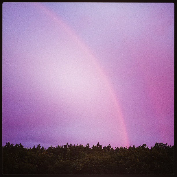
Suffolk Shower and Rainbow

Lake Burnt Mills

Captain Chuck A Muck Restaurant Aug 4 2014-2

The Path Ahead

Sleepy Hole Park in Suffolk, Va.

Sleepy Hole Park in Suffolk, Va.

Sleepy Hole Park in Suffolk, Va.

Sleepy Hole Park in Suffolk, Va.

Sleepy Hole Park in Suffolk, Va.

Sleepy Hole Park in Suffolk, Va.

Sleepy Hole Park in Suffolk, Va.

Sky over Western Branch of Elizabeth River this morning_9-8-10

Christmas Moon

This storm gave way to an amazing sunset.
A sunset and a rainbow!

Slipping Away

Bennett's Creek (VA)

Red. Tree. Sky.

140/365: Friday, May 20, 2011: Sunset, James River, Suffolk, Virginia

Sunset over the James River from the Monitor-Merrimac Memorial Bridge-Tunnel

319/365: Tuesday, November 15, 2011: Sunrise drive over James River, Virginia
Mapa de Bridge Point Trail, Suffolk, VA, EE. UU.
Buscar otro lugar
Lugares cercanos
Michael Dr, Suffolk, VA, EE. UU.
Kings Hwy, Suffolk, VA, EE. UU.
Kendal Way, Suffolk, VA, EE. UU.
Harbor Rd, Suffolk, VA, EE. UU.
Brittany Ln, Suffolk, VA, EE. UU.
N Nansemond Dr, Suffolk, VA, EE. UU.
Riverfront Dr, Suffolk, VA, EE. UU.
Sherwood Place, Sherwood Pl, Suffolk, VA, EE. UU.
Settlers Landing Rd, Suffolk, VA, EE. UU.
Wonderland Dr, Suffolk, VA, EE. UU.
Blue Stem Ct, Suffolk, VA, EE. UU.
Kelso St, Suffolk, VA, EE. UU.
Carlisle Ct, Suffolk, VA, EE. UU.
Carlisle Ct, Suffolk, VA, EE. UU.
Longview Dr, Windsor, VA, EE. UU.
Kings Reach, Suffolk, VA, EE. UU.
Hillpoint Blvd, Suffolk, VA, EE. UU.
Woodland Trail, Suffolk, VA, EE. UU.
Godwin Blvd, Suffolk, VA, EE. UU.
Nottingham Boulevard, Nottingham Blvd, Suffolk, VA, EE. UU.
Búsquedas recientes
- Horas de salida y puesta de sol de Fleur de Chine Hotel Sun Moon Lake, No. 23號, Zhongzheng Rd, Yuchi Township, Nantou County, Taiwan
- Horas de salida y puesta de sol de -16 Kitamuraakagawa, Iwamizawa, Hokkaido -, Japón
- Horas de salida y puesta de sol de 55 Cassick Valley Rd, Wellfleet, MA, EE. UU.
- Horas de salida y puesta de sol de 高尾山口駅, Takaomachi, Hachiōji, Tokio -, Japón
- Horas de salida y puesta de sol de Somanouchicho, Tenri, Nara -, Japón
- Horas de salida y puesta de sol de Kota Ternate Utara, Ternate City, North Maluku, Indonesia
- Horas de salida y puesta de sol de Zhongzheng South Road, Zhongzheng S Rd, Sanchong District, New Taipei City, Taiwán
- Horas de salida y puesta de sol de Lualaba, República Democrática del Congo
- Horas de salida y puesta de sol de Puebla de Trives, Ourense, España
- Horas de salida y puesta de sol de Šodolovci, Croacia