Tylers Cove Is, Crisfield, MD, USA Sonnenaufgang Sonnenuntergang Zeiten
Location: USA > Maryland > Somerset County > 12 >
Zeitzone:
America/New_York
Ortszeit:
2024-05-01 10:11:02
Länge:
-75.855191
Breite:
37.936136
Sonnenaufgang Heute:
06:06:09 AM
Sonnenuntergang Heute:
07:54:41 PM
Tageslänge heute:
13h 48m 32s
Sonnenaufgang morgen:
06:05:01 AM
Sonnenuntergang Morgen:
07:55:36 PM
Tageslänge von morgen:
13h 50m 35s
Alle Termine anzeigen
| Datum | Sonnenaufgang | Sonnenuntergang | Tageslänge |
|---|---|---|---|
| 2024-01-01 | 07:19:16 AM | 04:55:06 PM | 9h 35m 50s |
| 2024-01-02 | 07:19:23 AM | 04:55:55 PM | 9h 36m 32s |
| 2024-01-03 | 07:19:27 AM | 04:56:45 PM | 9h 37m 18s |
| 2024-01-04 | 07:19:30 AM | 04:57:36 PM | 9h 38m 6s |
| 2024-01-05 | 07:19:31 AM | 04:58:29 PM | 9h 38m 58s |
| 2024-01-06 | 07:19:29 AM | 04:59:23 PM | 9h 39m 54s |
| 2024-01-07 | 07:19:26 AM | 05:00:18 PM | 9h 40m 52s |
| 2024-01-08 | 07:19:20 AM | 05:01:14 PM | 9h 41m 54s |
| 2024-01-09 | 07:19:13 AM | 05:02:11 PM | 9h 42m 58s |
| 2024-01-10 | 07:19:03 AM | 05:03:09 PM | 9h 44m 6s |
| 2024-01-11 | 07:18:51 AM | 05:04:08 PM | 9h 45m 17s |
| 2024-01-12 | 07:18:37 AM | 05:05:08 PM | 9h 46m 31s |
| 2024-01-13 | 07:18:21 AM | 05:06:09 PM | 9h 47m 48s |
| 2024-01-14 | 07:18:03 AM | 05:07:10 PM | 9h 49m 7s |
| 2024-01-15 | 07:17:43 AM | 05:08:13 PM | 9h 50m 30s |
| 2024-01-16 | 07:17:21 AM | 05:09:15 PM | 9h 51m 54s |
| 2024-01-17 | 07:16:57 AM | 05:10:19 PM | 9h 53m 22s |
| 2024-01-18 | 07:16:31 AM | 05:11:23 PM | 9h 54m 52s |
| 2024-01-19 | 07:16:03 AM | 05:12:27 PM | 9h 56m 24s |
| 2024-01-20 | 07:15:33 AM | 05:13:32 PM | 9h 57m 59s |
| 2024-01-21 | 07:15:01 AM | 05:14:38 PM | 9h 59m 37s |
| 2024-01-22 | 07:14:27 AM | 05:15:43 PM | 10h 1m 16s |
| 2024-01-23 | 07:13:52 AM | 05:16:50 PM | 10h 2m 58s |
| 2024-01-24 | 07:13:14 AM | 05:17:56 PM | 10h 4m 42s |
| 2024-01-25 | 07:12:35 AM | 05:19:03 PM | 10h 6m 28s |
| 2024-01-26 | 07:11:53 AM | 05:20:09 PM | 10h 8m 16s |
| 2024-01-27 | 07:11:10 AM | 05:21:16 PM | 10h 10m 6s |
| 2024-01-28 | 07:10:26 AM | 05:22:24 PM | 10h 11m 58s |
| 2024-01-29 | 07:09:39 AM | 05:23:31 PM | 10h 13m 52s |
| 2024-01-30 | 07:08:51 AM | 05:24:38 PM | 10h 15m 47s |
| 2024-01-31 | 07:08:01 AM | 05:25:46 PM | 10h 17m 45s |
| 2024-02-01 | 07:07:10 AM | 05:26:53 PM | 10h 19m 43s |
| 2024-02-02 | 07:06:17 AM | 05:28:00 PM | 10h 21m 43s |
| 2024-02-03 | 07:05:22 AM | 05:29:08 PM | 10h 23m 46s |
| 2024-02-04 | 07:04:26 AM | 05:30:15 PM | 10h 25m 49s |
| 2024-02-05 | 07:03:28 AM | 05:31:22 PM | 10h 27m 54s |
| 2024-02-06 | 07:02:29 AM | 05:32:29 PM | 10h 30m 0s |
| 2024-02-07 | 07:01:28 AM | 05:33:36 PM | 10h 32m 8s |
| 2024-02-08 | 07:00:26 AM | 05:34:43 PM | 10h 34m 17s |
| 2024-02-09 | 06:59:23 AM | 05:35:49 PM | 10h 36m 26s |
| 2024-02-10 | 06:58:18 AM | 05:36:55 PM | 10h 38m 37s |
| 2024-02-11 | 06:57:12 AM | 05:38:02 PM | 10h 40m 50s |
| 2024-02-12 | 06:56:04 AM | 05:39:07 PM | 10h 43m 3s |
| 2024-02-13 | 06:54:56 AM | 05:40:13 PM | 10h 45m 17s |
| 2024-02-14 | 06:53:46 AM | 05:41:18 PM | 10h 47m 32s |
| 2024-02-15 | 06:52:35 AM | 05:42:23 PM | 10h 49m 48s |
| 2024-02-16 | 06:51:22 AM | 05:43:28 PM | 10h 52m 6s |
| 2024-02-17 | 06:50:09 AM | 05:44:33 PM | 10h 54m 24s |
| 2024-02-18 | 06:48:55 AM | 05:45:37 PM | 10h 56m 42s |
| 2024-02-19 | 06:47:39 AM | 05:46:41 PM | 10h 59m 2s |
| 2024-02-20 | 06:46:23 AM | 05:47:44 PM | 11h 1m 21s |
| 2024-02-21 | 06:45:05 AM | 05:48:48 PM | 11h 3m 43s |
| 2024-02-22 | 06:43:47 AM | 05:49:51 PM | 11h 6m 4s |
| 2024-02-23 | 06:42:28 AM | 05:50:53 PM | 11h 8m 25s |
| 2024-02-24 | 06:41:08 AM | 05:51:55 PM | 11h 10m 47s |
| 2024-02-25 | 06:39:47 AM | 05:52:57 PM | 11h 13m 10s |
| 2024-02-26 | 06:38:25 AM | 05:53:59 PM | 11h 15m 34s |
| 2024-02-27 | 06:37:02 AM | 05:55:00 PM | 11h 17m 58s |
| 2024-02-28 | 06:35:39 AM | 05:56:02 PM | 11h 20m 23s |
| 2024-02-29 | 06:34:15 AM | 05:57:02 PM | 11h 22m 47s |
| 2024-03-01 | 06:32:50 AM | 05:58:03 PM | 11h 25m 13s |
| 2024-03-02 | 06:31:25 AM | 05:59:03 PM | 11h 27m 38s |
| 2024-03-03 | 06:29:59 AM | 06:00:03 PM | 11h 30m 4s |
| 2024-03-04 | 06:28:32 AM | 06:01:02 PM | 11h 32m 30s |
| 2024-03-05 | 06:27:05 AM | 06:02:01 PM | 11h 34m 56s |
| 2024-03-06 | 06:25:37 AM | 06:03:00 PM | 11h 37m 23s |
| 2024-03-07 | 06:24:09 AM | 06:03:59 PM | 11h 39m 50s |
| 2024-03-08 | 06:22:40 AM | 06:04:58 PM | 11h 42m 18s |
| 2024-03-09 | 06:21:11 AM | 06:05:56 PM | 11h 44m 45s |
| 2024-03-10 | 07:19:46 AM | 07:06:51 PM | 11h 47m 5s |
| 2024-03-11 | 07:18:16 AM | 07:07:49 PM | 11h 49m 33s |
| 2024-03-12 | 07:16:46 AM | 07:08:47 PM | 11h 52m 1s |
| 2024-03-13 | 07:15:15 AM | 07:09:44 PM | 11h 54m 29s |
| 2024-03-14 | 07:13:45 AM | 07:10:41 PM | 11h 56m 56s |
| 2024-03-15 | 07:12:14 AM | 07:11:38 PM | 11h 59m 24s |
| 2024-03-16 | 07:10:42 AM | 07:12:35 PM | 12h 1m 53s |
| 2024-03-17 | 07:09:11 AM | 07:13:31 PM | 12h 4m 20s |
| 2024-03-18 | 07:07:39 AM | 07:14:27 PM | 12h 6m 48s |
| 2024-03-19 | 07:06:08 AM | 07:15:24 PM | 12h 9m 16s |
| 2024-03-20 | 07:04:36 AM | 07:16:20 PM | 12h 11m 44s |
| 2024-03-21 | 07:03:04 AM | 07:17:16 PM | 12h 14m 12s |
| 2024-03-22 | 07:01:32 AM | 07:18:11 PM | 12h 16m 39s |
| 2024-03-23 | 07:00:01 AM | 07:19:07 PM | 12h 19m 6s |
| 2024-03-24 | 06:58:29 AM | 07:20:03 PM | 12h 21m 34s |
| 2024-03-25 | 06:56:57 AM | 07:20:58 PM | 12h 24m 1s |
| 2024-03-26 | 06:55:25 AM | 07:21:54 PM | 12h 26m 29s |
| 2024-03-27 | 06:53:54 AM | 07:22:49 PM | 12h 28m 55s |
| 2024-03-28 | 06:52:22 AM | 07:23:44 PM | 12h 31m 22s |
| 2024-03-29 | 06:50:51 AM | 07:24:40 PM | 12h 33m 49s |
| 2024-03-30 | 06:49:20 AM | 07:25:35 PM | 12h 36m 15s |
| 2024-03-31 | 06:47:49 AM | 07:26:30 PM | 12h 38m 41s |
| 2024-04-01 | 06:46:19 AM | 07:27:25 PM | 12h 41m 6s |
| 2024-04-02 | 06:44:49 AM | 07:28:20 PM | 12h 43m 31s |
| 2024-04-03 | 06:43:19 AM | 07:29:16 PM | 12h 45m 57s |
| 2024-04-04 | 06:41:49 AM | 07:30:11 PM | 12h 48m 22s |
| 2024-04-05 | 06:40:20 AM | 07:31:06 PM | 12h 50m 46s |
| 2024-04-06 | 06:38:51 AM | 07:32:01 PM | 12h 53m 10s |
| 2024-04-07 | 06:37:23 AM | 07:32:56 PM | 12h 55m 33s |
| 2024-04-08 | 06:35:55 AM | 07:33:52 PM | 12h 57m 57s |
| 2024-04-09 | 06:34:28 AM | 07:34:47 PM | 13h 0m 19s |
| 2024-04-10 | 06:33:01 AM | 07:35:42 PM | 13h 2m 41s |
| 2024-04-11 | 06:31:35 AM | 07:36:37 PM | 13h 5m 2s |
| 2024-04-12 | 06:30:09 AM | 07:37:33 PM | 13h 7m 24s |
| 2024-04-13 | 06:28:44 AM | 07:38:28 PM | 13h 9m 44s |
| 2024-04-14 | 06:27:20 AM | 07:39:23 PM | 13h 12m 3s |
| 2024-04-15 | 06:25:56 AM | 07:40:19 PM | 13h 14m 23s |
| 2024-04-16 | 06:24:33 AM | 07:41:14 PM | 13h 16m 41s |
| 2024-04-17 | 06:23:11 AM | 07:42:10 PM | 13h 18m 59s |
| 2024-04-18 | 06:21:50 AM | 07:43:06 PM | 13h 21m 16s |
| 2024-04-19 | 06:20:29 AM | 07:44:01 PM | 13h 23m 32s |
| 2024-04-20 | 06:19:09 AM | 07:44:57 PM | 13h 25m 48s |
| 2024-04-21 | 06:17:50 AM | 07:45:52 PM | 13h 28m 2s |
| 2024-04-22 | 06:16:32 AM | 07:46:48 PM | 13h 30m 16s |
| 2024-04-23 | 06:15:15 AM | 07:47:44 PM | 13h 32m 29s |
| 2024-04-24 | 06:13:59 AM | 07:48:39 PM | 13h 34m 40s |
| 2024-04-25 | 06:12:44 AM | 07:49:35 PM | 13h 36m 51s |
| 2024-04-26 | 06:11:30 AM | 07:50:31 PM | 13h 39m 1s |
| 2024-04-27 | 06:10:16 AM | 07:51:26 PM | 13h 41m 10s |
| 2024-04-28 | 06:09:04 AM | 07:52:22 PM | 13h 43m 18s |
| 2024-04-29 | 06:07:53 AM | 07:53:18 PM | 13h 45m 25s |
| 2024-04-30 | 06:06:44 AM | 07:54:13 PM | 13h 47m 29s |
| 2024-05-01 | 06:05:35 AM | 07:55:09 PM | 13h 49m 34s |
| 2024-05-02 | 06:04:28 AM | 07:56:04 PM | 13h 51m 36s |
| 2024-05-03 | 06:03:21 AM | 07:56:59 PM | 13h 53m 38s |
| 2024-05-04 | 06:02:16 AM | 07:57:54 PM | 13h 55m 38s |
| 2024-05-05 | 06:01:13 AM | 07:58:49 PM | 13h 57m 36s |
| 2024-05-06 | 06:00:10 AM | 07:59:44 PM | 13h 59m 34s |
| 2024-05-07 | 05:59:09 AM | 08:00:38 PM | 14h 1m 29s |
| 2024-05-08 | 05:58:10 AM | 08:01:32 PM | 14h 3m 22s |
| 2024-05-09 | 05:57:11 AM | 08:02:27 PM | 14h 5m 16s |
| 2024-05-10 | 05:56:15 AM | 08:03:20 PM | 14h 7m 5s |
| 2024-05-11 | 05:55:19 AM | 08:04:14 PM | 14h 8m 55s |
| 2024-05-12 | 05:54:25 AM | 08:05:07 PM | 14h 10m 42s |
| 2024-05-13 | 05:53:33 AM | 08:06:00 PM | 14h 12m 27s |
| 2024-05-14 | 05:52:42 AM | 08:06:52 PM | 14h 14m 10s |
| 2024-05-15 | 05:51:52 AM | 08:07:44 PM | 14h 15m 52s |
| 2024-05-16 | 05:51:04 AM | 08:08:36 PM | 14h 17m 32s |
| 2024-05-17 | 05:50:18 AM | 08:09:27 PM | 14h 19m 9s |
| 2024-05-18 | 05:49:34 AM | 08:10:17 PM | 14h 20m 43s |
| 2024-05-19 | 05:48:50 AM | 08:11:07 PM | 14h 22m 17s |
| 2024-05-20 | 05:48:09 AM | 08:11:57 PM | 14h 23m 48s |
| 2024-05-21 | 05:47:29 AM | 08:12:46 PM | 14h 25m 17s |
| 2024-05-22 | 05:46:51 AM | 08:13:34 PM | 14h 26m 43s |
| 2024-05-23 | 05:46:15 AM | 08:14:21 PM | 14h 28m 6s |
| 2024-05-24 | 05:45:40 AM | 08:15:08 PM | 14h 29m 28s |
| 2024-05-25 | 05:45:08 AM | 08:15:54 PM | 14h 30m 46s |
| 2024-05-26 | 05:44:36 AM | 08:16:39 PM | 14h 32m 3s |
| 2024-05-27 | 05:44:07 AM | 08:17:24 PM | 14h 33m 17s |
| 2024-05-28 | 05:43:40 AM | 08:18:07 PM | 14h 34m 27s |
| 2024-05-29 | 05:43:14 AM | 08:18:50 PM | 14h 35m 36s |
| 2024-05-30 | 05:42:50 AM | 08:19:32 PM | 14h 36m 42s |
| 2024-05-31 | 05:42:28 AM | 08:20:12 PM | 14h 37m 44s |
| 2024-06-01 | 05:42:07 AM | 08:20:52 PM | 14h 38m 45s |
| 2024-06-02 | 05:41:49 AM | 08:21:30 PM | 14h 39m 41s |
| 2024-06-03 | 05:41:32 AM | 08:22:08 PM | 14h 40m 36s |
| 2024-06-04 | 05:41:17 AM | 08:22:44 PM | 14h 41m 27s |
| 2024-06-05 | 05:41:04 AM | 08:23:19 PM | 14h 42m 15s |
| 2024-06-06 | 05:40:52 AM | 08:23:53 PM | 14h 43m 1s |
| 2024-06-07 | 05:40:43 AM | 08:24:25 PM | 14h 43m 42s |
| 2024-06-08 | 05:40:35 AM | 08:24:57 PM | 14h 44m 22s |
| 2024-06-09 | 05:40:29 AM | 08:25:27 PM | 14h 44m 58s |
| 2024-06-10 | 05:40:25 AM | 08:25:55 PM | 14h 45m 30s |
| 2024-06-11 | 05:40:23 AM | 08:26:22 PM | 14h 45m 59s |
| 2024-06-12 | 05:40:22 AM | 08:26:48 PM | 14h 46m 26s |
| 2024-06-13 | 05:40:24 AM | 08:27:12 PM | 14h 46m 48s |
| 2024-06-14 | 05:40:27 AM | 08:27:35 PM | 14h 47m 8s |
| 2024-06-15 | 05:40:31 AM | 08:27:56 PM | 14h 47m 25s |
| 2024-06-16 | 05:40:38 AM | 08:28:16 PM | 14h 47m 38s |
| 2024-06-17 | 05:40:46 AM | 08:28:34 PM | 14h 47m 48s |
| 2024-06-18 | 05:40:56 AM | 08:28:50 PM | 14h 47m 54s |
| 2024-06-19 | 05:41:07 AM | 08:29:05 PM | 14h 47m 58s |
| 2024-06-20 | 05:41:20 AM | 08:29:18 PM | 14h 47m 58s |
| 2024-06-21 | 05:41:35 AM | 08:29:29 PM | 14h 47m 54s |
| 2024-06-22 | 05:41:51 AM | 08:29:39 PM | 14h 47m 48s |
| 2024-06-23 | 05:42:09 AM | 08:29:46 PM | 14h 47m 37s |
| 2024-06-24 | 05:42:28 AM | 08:29:53 PM | 14h 47m 25s |
| 2024-06-25 | 05:42:49 AM | 08:29:57 PM | 14h 47m 8s |
| 2024-06-26 | 05:43:12 AM | 08:29:59 PM | 14h 46m 47s |
| 2024-06-27 | 05:43:35 AM | 08:30:00 PM | 14h 46m 25s |
| 2024-06-28 | 05:44:01 AM | 08:29:59 PM | 14h 45m 58s |
| 2024-06-29 | 05:44:27 AM | 08:29:56 PM | 14h 45m 29s |
| 2024-06-30 | 05:44:55 AM | 08:29:51 PM | 14h 44m 56s |
| 2024-07-01 | 05:45:24 AM | 08:29:45 PM | 14h 44m 21s |
| 2024-07-02 | 05:45:55 AM | 08:29:36 PM | 14h 43m 41s |
| 2024-07-03 | 05:46:26 AM | 08:29:26 PM | 14h 43m 0s |
| 2024-07-04 | 05:46:59 AM | 08:29:14 PM | 14h 42m 15s |
| 2024-07-05 | 05:47:33 AM | 08:29:00 PM | 14h 41m 27s |
| 2024-07-06 | 05:48:08 AM | 08:28:44 PM | 14h 40m 36s |
| 2024-07-07 | 05:48:45 AM | 08:28:26 PM | 14h 39m 41s |
| 2024-07-08 | 05:49:22 AM | 08:28:07 PM | 14h 38m 45s |
| 2024-07-09 | 05:50:00 AM | 08:27:45 PM | 14h 37m 45s |
| 2024-07-10 | 05:50:39 AM | 08:27:22 PM | 14h 36m 43s |
| 2024-07-11 | 05:51:19 AM | 08:26:57 PM | 14h 35m 38s |
| 2024-07-12 | 05:52:00 AM | 08:26:30 PM | 14h 34m 30s |
| 2024-07-13 | 05:52:42 AM | 08:26:01 PM | 14h 33m 19s |
| 2024-07-14 | 05:53:25 AM | 08:25:31 PM | 14h 32m 6s |
| 2024-07-15 | 05:54:08 AM | 08:24:58 PM | 14h 30m 50s |
| 2024-07-16 | 05:54:52 AM | 08:24:24 PM | 14h 29m 32s |
| 2024-07-17 | 05:55:37 AM | 08:23:48 PM | 14h 28m 11s |
| 2024-07-18 | 05:56:23 AM | 08:23:11 PM | 14h 26m 48s |
| 2024-07-19 | 05:57:09 AM | 08:22:31 PM | 14h 25m 22s |
| 2024-07-20 | 05:57:55 AM | 08:21:50 PM | 14h 23m 55s |
| 2024-07-21 | 05:58:43 AM | 08:21:08 PM | 14h 22m 25s |
| 2024-07-22 | 05:59:30 AM | 08:20:23 PM | 14h 20m 53s |
| 2024-07-23 | 06:00:19 AM | 08:19:37 PM | 14h 19m 18s |
| 2024-07-24 | 06:01:07 AM | 08:18:49 PM | 14h 17m 42s |
| 2024-07-25 | 06:01:56 AM | 08:18:00 PM | 14h 16m 4s |
| 2024-07-26 | 06:02:46 AM | 08:17:09 PM | 14h 14m 23s |
| 2024-07-27 | 06:03:36 AM | 08:16:17 PM | 14h 12m 41s |
| 2024-07-28 | 06:04:26 AM | 08:15:23 PM | 14h 10m 57s |
| 2024-07-29 | 06:05:16 AM | 08:14:28 PM | 14h 9m 12s |
| 2024-07-30 | 06:06:07 AM | 08:13:31 PM | 14h 7m 24s |
| 2024-07-31 | 06:06:58 AM | 08:12:32 PM | 14h 5m 34s |
| 2024-08-01 | 06:07:49 AM | 08:11:32 PM | 14h 3m 43s |
| 2024-08-02 | 06:08:40 AM | 08:10:31 PM | 14h 1m 51s |
| 2024-08-03 | 06:09:31 AM | 08:09:29 PM | 13h 59m 58s |
| 2024-08-04 | 06:10:23 AM | 08:08:25 PM | 13h 58m 2s |
| 2024-08-05 | 06:11:15 AM | 08:07:19 PM | 13h 56m 4s |
| 2024-08-06 | 06:12:07 AM | 08:06:13 PM | 13h 54m 6s |
| 2024-08-07 | 06:12:58 AM | 08:05:05 PM | 13h 52m 7s |
| 2024-08-08 | 06:13:50 AM | 08:03:56 PM | 13h 50m 6s |
| 2024-08-09 | 06:14:42 AM | 08:02:46 PM | 13h 48m 4s |
| 2024-08-10 | 06:15:35 AM | 08:01:34 PM | 13h 45m 59s |
| 2024-08-11 | 06:16:27 AM | 08:00:22 PM | 13h 43m 55s |
| 2024-08-12 | 06:17:19 AM | 07:59:08 PM | 13h 41m 49s |
| 2024-08-13 | 06:18:11 AM | 07:57:53 PM | 13h 39m 42s |
| 2024-08-14 | 06:19:03 AM | 07:56:37 PM | 13h 37m 34s |
| 2024-08-15 | 06:19:55 AM | 07:55:21 PM | 13h 35m 26s |
| 2024-08-16 | 06:20:47 AM | 07:54:03 PM | 13h 33m 16s |
| 2024-08-17 | 06:21:39 AM | 07:52:44 PM | 13h 31m 5s |
| 2024-08-18 | 06:22:31 AM | 07:51:24 PM | 13h 28m 53s |
| 2024-08-19 | 06:23:23 AM | 07:50:04 PM | 13h 26m 41s |
| 2024-08-20 | 06:24:14 AM | 07:48:42 PM | 13h 24m 28s |
| 2024-08-21 | 06:25:06 AM | 07:47:20 PM | 13h 22m 14s |
| 2024-08-22 | 06:25:58 AM | 07:45:57 PM | 13h 19m 59s |
| 2024-08-23 | 06:26:49 AM | 07:44:33 PM | 13h 17m 44s |
| 2024-08-24 | 06:27:41 AM | 07:43:08 PM | 13h 15m 27s |
| 2024-08-25 | 06:28:32 AM | 07:41:42 PM | 13h 13m 10s |
| 2024-08-26 | 06:29:24 AM | 07:40:16 PM | 13h 10m 52s |
| 2024-08-27 | 06:30:15 AM | 07:38:49 PM | 13h 8m 34s |
| 2024-08-28 | 06:31:06 AM | 07:37:22 PM | 13h 6m 16s |
| 2024-08-29 | 06:31:58 AM | 07:35:54 PM | 13h 3m 56s |
| 2024-08-30 | 06:32:49 AM | 07:34:25 PM | 13h 1m 36s |
| 2024-08-31 | 06:33:40 AM | 07:32:56 PM | 12h 59m 16s |
| 2024-09-01 | 06:34:31 AM | 07:31:26 PM | 12h 56m 55s |
| 2024-09-02 | 06:35:22 AM | 07:29:56 PM | 12h 54m 34s |
| 2024-09-03 | 06:36:13 AM | 07:28:26 PM | 12h 52m 13s |
| 2024-09-04 | 06:37:04 AM | 07:26:55 PM | 12h 49m 51s |
| 2024-09-05 | 06:37:54 AM | 07:25:23 PM | 12h 47m 29s |
| 2024-09-06 | 06:38:45 AM | 07:23:51 PM | 12h 45m 6s |
| 2024-09-07 | 06:39:36 AM | 07:22:19 PM | 12h 42m 43s |
| 2024-09-08 | 06:40:27 AM | 07:20:46 PM | 12h 40m 19s |
| 2024-09-09 | 06:41:18 AM | 07:19:14 PM | 12h 37m 56s |
| 2024-09-10 | 06:42:08 AM | 07:17:41 PM | 12h 35m 33s |
| 2024-09-11 | 06:42:59 AM | 07:16:07 PM | 12h 33m 8s |
| 2024-09-12 | 06:43:50 AM | 07:14:34 PM | 12h 30m 44s |
| 2024-09-13 | 06:44:41 AM | 07:13:00 PM | 12h 28m 19s |
| 2024-09-14 | 06:45:32 AM | 07:11:26 PM | 12h 25m 54s |
| 2024-09-15 | 06:46:23 AM | 07:09:52 PM | 12h 23m 29s |
| 2024-09-16 | 06:47:14 AM | 07:08:19 PM | 12h 21m 5s |
| 2024-09-17 | 06:48:05 AM | 07:06:44 PM | 12h 18m 39s |
| 2024-09-18 | 06:48:56 AM | 07:05:10 PM | 12h 16m 14s |
| 2024-09-19 | 06:49:48 AM | 07:03:36 PM | 12h 13m 48s |
| 2024-09-20 | 06:50:39 AM | 07:02:02 PM | 12h 11m 23s |
| 2024-09-21 | 06:51:31 AM | 07:00:28 PM | 12h 8m 57s |
| 2024-09-22 | 06:52:23 AM | 06:58:55 PM | 12h 6m 32s |
| 2024-09-23 | 06:53:15 AM | 06:57:21 PM | 12h 4m 6s |
| 2024-09-24 | 06:54:07 AM | 06:55:47 PM | 12h 1m 40s |
| 2024-09-25 | 06:54:59 AM | 06:54:14 PM | 11h 59m 15s |
| 2024-09-26 | 06:55:51 AM | 06:52:41 PM | 11h 56m 50s |
| 2024-09-27 | 06:56:44 AM | 06:51:08 PM | 11h 54m 24s |
| 2024-09-28 | 06:57:37 AM | 06:49:35 PM | 11h 51m 58s |
| 2024-09-29 | 06:58:30 AM | 06:48:03 PM | 11h 49m 33s |
| 2024-09-30 | 06:59:23 AM | 06:46:31 PM | 11h 47m 8s |
| 2024-10-01 | 07:00:17 AM | 06:44:59 PM | 11h 44m 42s |
| 2024-10-02 | 07:01:10 AM | 06:43:28 PM | 11h 42m 18s |
| 2024-10-03 | 07:02:04 AM | 06:41:57 PM | 11h 39m 53s |
| 2024-10-04 | 07:02:59 AM | 06:40:26 PM | 11h 37m 27s |
| 2024-10-05 | 07:03:53 AM | 06:38:57 PM | 11h 35m 4s |
| 2024-10-06 | 07:04:48 AM | 06:37:27 PM | 11h 32m 39s |
| 2024-10-07 | 07:05:43 AM | 06:35:58 PM | 11h 30m 15s |
| 2024-10-08 | 07:06:39 AM | 06:34:30 PM | 11h 27m 51s |
| 2024-10-09 | 07:07:34 AM | 06:33:02 PM | 11h 25m 28s |
| 2024-10-10 | 07:08:30 AM | 06:31:35 PM | 11h 23m 5s |
| 2024-10-11 | 07:09:27 AM | 06:30:09 PM | 11h 20m 42s |
| 2024-10-12 | 07:10:24 AM | 06:28:43 PM | 11h 18m 19s |
| 2024-10-13 | 07:11:21 AM | 06:27:18 PM | 11h 15m 57s |
| 2024-10-14 | 07:12:18 AM | 06:25:54 PM | 11h 13m 36s |
| 2024-10-15 | 07:13:16 AM | 06:24:31 PM | 11h 11m 15s |
| 2024-10-16 | 07:14:14 AM | 06:23:08 PM | 11h 8m 54s |
| 2024-10-17 | 07:15:12 AM | 06:21:47 PM | 11h 6m 35s |
| 2024-10-18 | 07:16:11 AM | 06:20:26 PM | 11h 4m 15s |
| 2024-10-19 | 07:17:10 AM | 06:19:06 PM | 11h 1m 56s |
| 2024-10-20 | 07:18:10 AM | 06:17:47 PM | 10h 59m 37s |
| 2024-10-21 | 07:19:09 AM | 06:16:30 PM | 10h 57m 21s |
| 2024-10-22 | 07:20:10 AM | 06:15:13 PM | 10h 55m 3s |
| 2024-10-23 | 07:21:10 AM | 06:13:57 PM | 10h 52m 47s |
| 2024-10-24 | 07:22:11 AM | 06:12:42 PM | 10h 50m 31s |
| 2024-10-25 | 07:23:12 AM | 06:11:29 PM | 10h 48m 17s |
| 2024-10-26 | 07:24:13 AM | 06:10:16 PM | 10h 46m 3s |
| 2024-10-27 | 07:25:15 AM | 06:09:05 PM | 10h 43m 50s |
| 2024-10-28 | 07:26:17 AM | 06:07:55 PM | 10h 41m 38s |
| 2024-10-29 | 07:27:20 AM | 06:06:47 PM | 10h 39m 27s |
| 2024-10-30 | 07:28:22 AM | 06:05:39 PM | 10h 37m 17s |
| 2024-10-31 | 07:29:25 AM | 06:04:33 PM | 10h 35m 8s |
| 2024-11-01 | 07:30:28 AM | 06:03:29 PM | 10h 33m 1s |
| 2024-11-02 | 07:31:31 AM | 06:02:25 PM | 10h 30m 54s |
| 2024-11-03 | 06:32:37 AM | 05:01:21 PM | 10h 28m 44s |
| 2024-11-04 | 06:33:41 AM | 05:00:21 PM | 10h 26m 40s |
| 2024-11-05 | 06:34:45 AM | 04:59:22 PM | 10h 24m 37s |
| 2024-11-06 | 06:35:49 AM | 04:58:25 PM | 10h 22m 36s |
| 2024-11-07 | 06:36:53 AM | 04:57:29 PM | 10h 20m 36s |
| 2024-11-08 | 06:37:57 AM | 04:56:35 PM | 10h 18m 38s |
| 2024-11-09 | 06:39:02 AM | 04:55:42 PM | 10h 16m 40s |
| 2024-11-10 | 06:40:06 AM | 04:54:51 PM | 10h 14m 45s |
| 2024-11-11 | 06:41:10 AM | 04:54:02 PM | 10h 12m 52s |
| 2024-11-12 | 06:42:15 AM | 04:53:15 PM | 10h 11m 0s |
| 2024-11-13 | 06:43:19 AM | 04:52:29 PM | 10h 9m 10s |
| 2024-11-14 | 06:44:23 AM | 04:51:45 PM | 10h 7m 22s |
| 2024-11-15 | 06:45:27 AM | 04:51:03 PM | 10h 5m 36s |
| 2024-11-16 | 06:46:31 AM | 04:50:23 PM | 10h 3m 52s |
| 2024-11-17 | 06:47:35 AM | 04:49:45 PM | 10h 2m 10s |
| 2024-11-18 | 06:48:38 AM | 04:49:08 PM | 10h 0m 30s |
| 2024-11-19 | 06:49:41 AM | 04:48:34 PM | 9h 58m 53s |
| 2024-11-20 | 06:50:44 AM | 04:48:01 PM | 9h 57m 17s |
| 2024-11-21 | 06:51:47 AM | 04:47:30 PM | 9h 55m 43s |
| 2024-11-22 | 06:52:49 AM | 04:47:01 PM | 9h 54m 12s |
| 2024-11-23 | 06:53:51 AM | 04:46:35 PM | 9h 52m 44s |
| 2024-11-24 | 06:54:52 AM | 04:46:10 PM | 9h 51m 18s |
| 2024-11-25 | 06:55:52 AM | 04:45:47 PM | 9h 49m 55s |
| 2024-11-26 | 06:56:52 AM | 04:45:27 PM | 9h 48m 35s |
| 2024-11-27 | 06:57:51 AM | 04:45:08 PM | 9h 47m 17s |
| 2024-11-28 | 06:58:50 AM | 04:44:52 PM | 9h 46m 2s |
| 2024-11-29 | 06:59:48 AM | 04:44:38 PM | 9h 44m 50s |
| 2024-11-30 | 07:00:45 AM | 04:44:25 PM | 9h 43m 40s |
| 2024-12-01 | 07:01:41 AM | 04:44:15 PM | 9h 42m 34s |
| 2024-12-02 | 07:02:37 AM | 04:44:07 PM | 9h 41m 30s |
| 2024-12-03 | 07:03:31 AM | 04:44:01 PM | 9h 40m 30s |
| 2024-12-04 | 07:04:24 AM | 04:43:58 PM | 9h 39m 34s |
| 2024-12-05 | 07:05:17 AM | 04:43:56 PM | 9h 38m 39s |
| 2024-12-06 | 07:06:08 AM | 04:43:56 PM | 9h 37m 48s |
| 2024-12-07 | 07:06:58 AM | 04:43:59 PM | 9h 37m 1s |
| 2024-12-08 | 07:07:47 AM | 04:44:04 PM | 9h 36m 17s |
| 2024-12-09 | 07:08:34 AM | 04:44:11 PM | 9h 35m 37s |
| 2024-12-10 | 07:09:21 AM | 04:44:20 PM | 9h 34m 59s |
| 2024-12-11 | 07:10:05 AM | 04:44:31 PM | 9h 34m 26s |
| 2024-12-12 | 07:10:49 AM | 04:44:44 PM | 9h 33m 55s |
| 2024-12-13 | 07:11:31 AM | 04:44:59 PM | 9h 33m 28s |
| 2024-12-14 | 07:12:12 AM | 04:45:16 PM | 9h 33m 4s |
| 2024-12-15 | 07:12:51 AM | 04:45:35 PM | 9h 32m 44s |
| 2024-12-16 | 07:13:28 AM | 04:45:57 PM | 9h 32m 29s |
| 2024-12-17 | 07:14:04 AM | 04:46:20 PM | 9h 32m 16s |
| 2024-12-18 | 07:14:38 AM | 04:46:45 PM | 9h 32m 7s |
| 2024-12-19 | 07:15:10 AM | 04:47:12 PM | 9h 32m 2s |
| 2024-12-20 | 07:15:41 AM | 04:47:41 PM | 9h 32m 0s |
| 2024-12-21 | 07:16:10 AM | 04:48:12 PM | 9h 32m 2s |
| 2024-12-22 | 07:16:37 AM | 04:48:45 PM | 9h 32m 8s |
| 2024-12-23 | 07:17:02 AM | 04:49:19 PM | 9h 32m 17s |
| 2024-12-24 | 07:17:25 AM | 04:49:55 PM | 9h 32m 30s |
| 2024-12-25 | 07:17:47 AM | 04:50:33 PM | 9h 32m 46s |
| 2024-12-26 | 07:18:06 AM | 04:51:13 PM | 9h 33m 7s |
| 2024-12-27 | 07:18:24 AM | 04:51:54 PM | 9h 33m 30s |
| 2024-12-28 | 07:18:39 AM | 04:52:37 PM | 9h 33m 58s |
| 2024-12-29 | 07:18:53 AM | 04:53:21 PM | 9h 34m 28s |
| 2024-12-30 | 07:19:04 AM | 04:54:07 PM | 9h 35m 3s |
Fotos

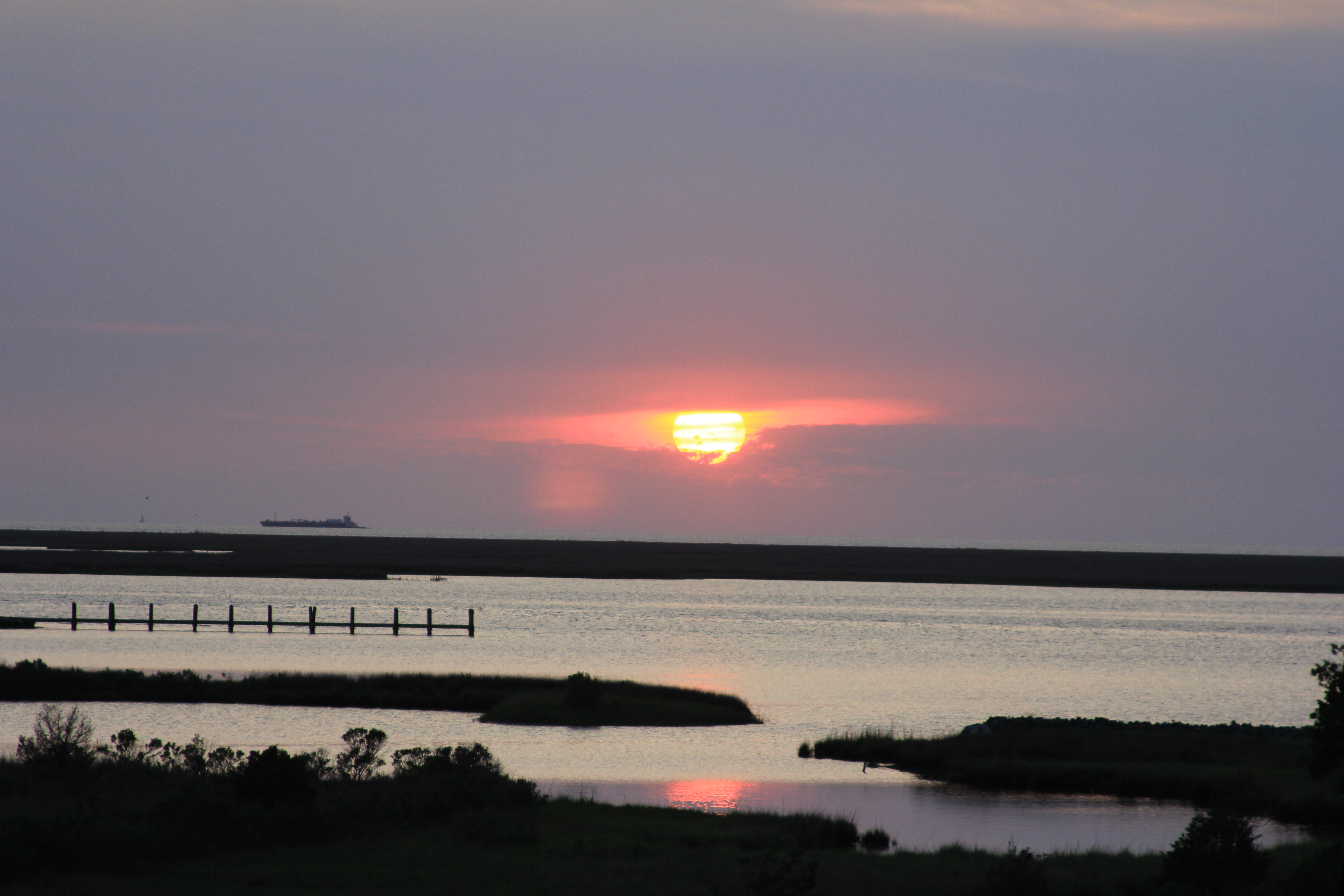
Small Boat Harbor Sunset in Crisfield, MD
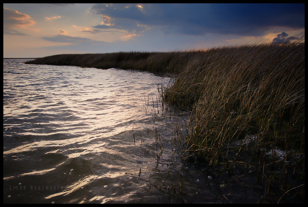
Ward Creek

2014-04-26 19.18.48
Long Point Shadows
Crisfeild Sun Salutation
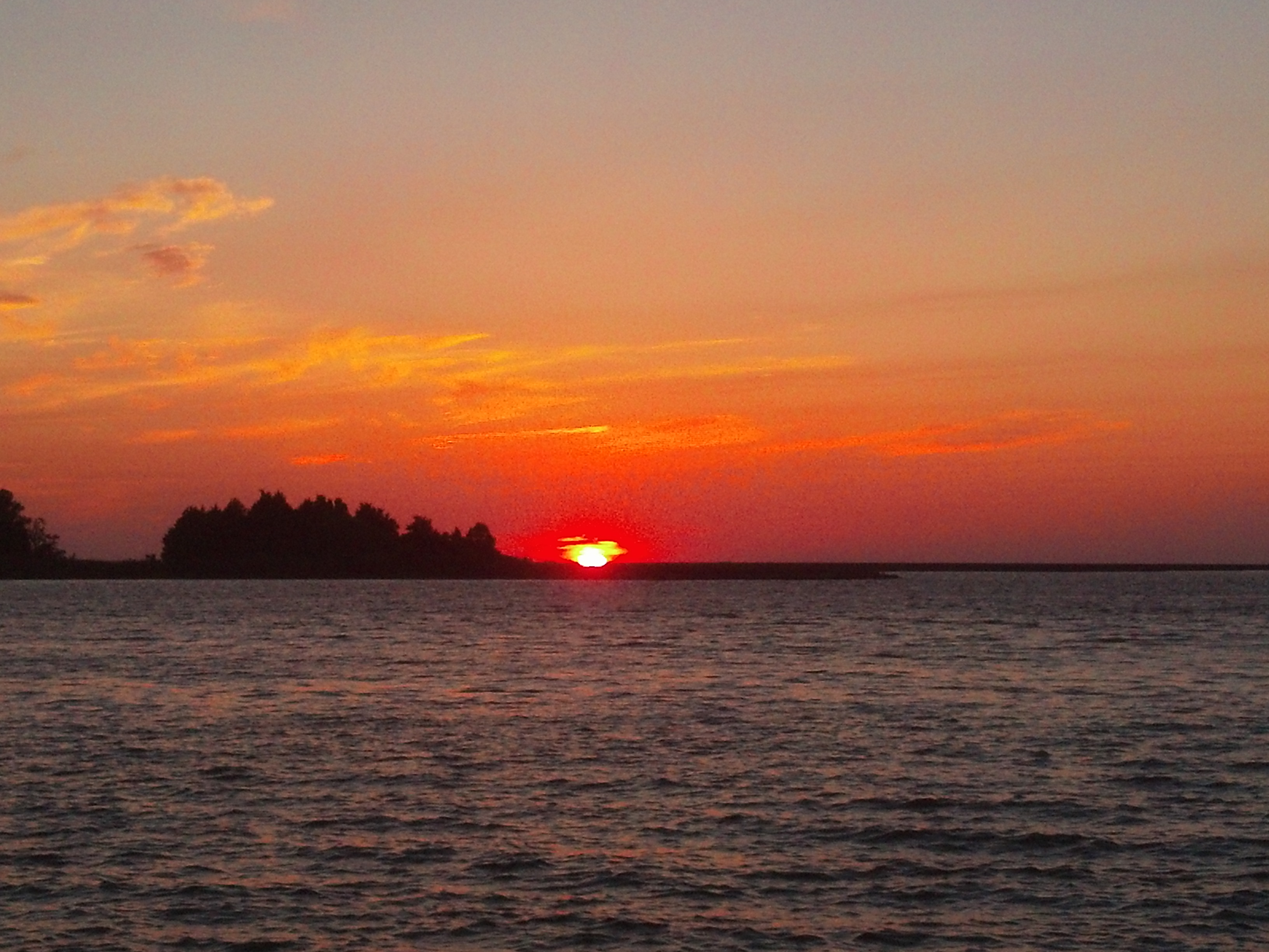
Crisfeild Sun Salutation
Watching birds at sunset
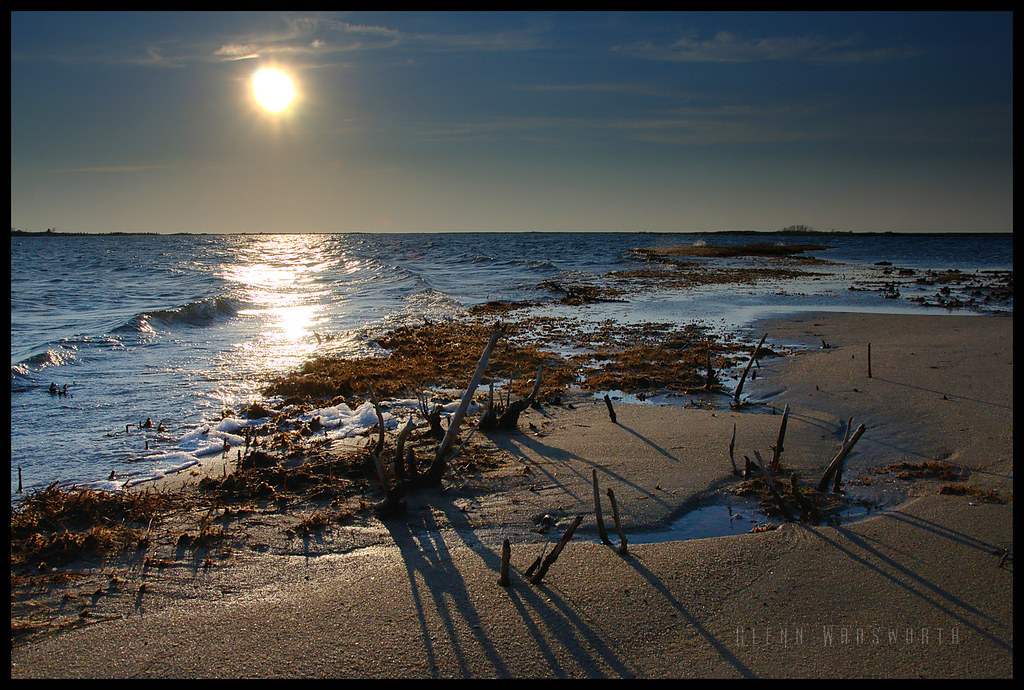
Sunset at Jane's Island

Port Isobel, Va.

Port Isobel, Va.
Tylers Cove Is, Crisfield, MD, USA Karte
Suchen Sie einen anderen Ort
Nahe Plätze
12, Asbury, MD, USA
Byrdtown Rd, Crisfield, MD, USA
Ape Hole Rd, Crisfield, MD, USA
Saxis Rd, Saxis, VA, USA
Saxis, VA, USA
6, VA, USA
4, VA, USA
Crystal Beach Rd, Onancock, VA, USA
Crystal Beach Rd, Onancock, VA, USA
Allen Ln, Onancock, VA, USA
Southside Rd, Onancock, VA, USA
Anns Cove Rd, Bloxom, VA, USA
Accomack County, Virginia, USA
Big Rd, Bloxom, VA, USA
8 Mt Prospect Ave, Onancock, VA, USA
Onancock, Virginia, USA
Tarkill Rd, Onancock, VA, USA
9 Liberty St, Onancock, VA, USA
15 Church St, Onancock, VA, USA
Liberty Street, Liberty St, Onancock, VA, USA
Letzte Suche
- 6 Rue Jules Ferry, Beausoleil, Frankreich Sonnenaufgang Sonnenuntergang Zeiten
- Otxandio, Biscay, Spain Sonnenaufgang Sonnenuntergang Zeiten
- Sattva Horizon, 4JC6+G9P, Vinayak Nagar, Kattigenahalli, Bengaluru, Karnataka, Indien Sonnenaufgang Sonnenuntergang Zeiten
- 富士山, Kitayama, Fujinomiya, Präfektur Shizuoka -, Japan Sonnenaufgang Sonnenuntergang Zeiten
- Laurel Rd, Townsend, TN, USA Sonnenaufgang Sonnenuntergang Zeiten
- Haibin South Road, China, Guang Dong Sheng, Shen Zhen Shi, Long Gang Qu, 海滨南路GFPQ+R9Q Sonnenaufgang Sonnenuntergang Zeiten
- Redondo Ave, Long Beach, CA, USA Sonnenaufgang Sonnenuntergang Zeiten
- Ulitsa Kalinina, 79, Rezh, Sverdlovskaya oblast', Russia Sonnenaufgang Sonnenuntergang Zeiten
- Leguwa, Nepal Sonnenaufgang Sonnenuntergang Zeiten
- Shustino, Vladimir Oblast, Russland Sonnenaufgang Sonnenuntergang Zeiten