Tom Meadows Road, Tom Meadows Rd, Kentucky, USA Sonnenaufgang Sonnenuntergang Zeiten
Location: USA > Kentucky > McCreary County > Strunk >
Zeitzone:
America/New_York
Ortszeit:
2024-05-14 21:58:46
Länge:
-84.4555939
Breite:
36.644827
Sonnenaufgang Heute:
06:29:42 AM
Sonnenuntergang Heute:
08:38:41 PM
Tageslänge heute:
14h 8m 59s
Sonnenaufgang morgen:
06:28:56 AM
Sonnenuntergang Morgen:
08:39:31 PM
Tageslänge von morgen:
14h 10m 35s
Alle Termine anzeigen
| Datum | Sonnenaufgang | Sonnenuntergang | Tageslänge |
|---|---|---|---|
| 2024-01-01 | 07:50:08 AM | 05:33:03 PM | 9h 42m 55s |
| 2024-01-02 | 07:50:15 AM | 05:33:51 PM | 9h 43m 36s |
| 2024-01-03 | 07:50:21 AM | 05:34:40 PM | 9h 44m 19s |
| 2024-01-04 | 07:50:25 AM | 05:35:31 PM | 9h 45m 6s |
| 2024-01-05 | 07:50:27 AM | 05:36:22 PM | 9h 45m 55s |
| 2024-01-06 | 07:50:27 AM | 05:37:15 PM | 9h 46m 48s |
| 2024-01-07 | 07:50:25 AM | 05:38:08 PM | 9h 47m 43s |
| 2024-01-08 | 07:50:21 AM | 05:39:03 PM | 9h 48m 42s |
| 2024-01-09 | 07:50:15 AM | 05:39:58 PM | 9h 49m 43s |
| 2024-01-10 | 07:50:07 AM | 05:40:55 PM | 9h 50m 48s |
| 2024-01-11 | 07:49:57 AM | 05:41:52 PM | 9h 51m 55s |
| 2024-01-12 | 07:49:45 AM | 05:42:50 PM | 9h 53m 5s |
| 2024-01-13 | 07:49:31 AM | 05:43:49 PM | 9h 54m 18s |
| 2024-01-14 | 07:49:15 AM | 05:44:48 PM | 9h 55m 33s |
| 2024-01-15 | 07:48:57 AM | 05:45:48 PM | 9h 56m 51s |
| 2024-01-16 | 07:48:37 AM | 05:46:49 PM | 9h 58m 12s |
| 2024-01-17 | 07:48:15 AM | 05:47:50 PM | 9h 59m 35s |
| 2024-01-18 | 07:47:51 AM | 05:48:52 PM | 10h 1m 1s |
| 2024-01-19 | 07:47:25 AM | 05:49:54 PM | 10h 2m 29s |
| 2024-01-20 | 07:46:57 AM | 05:50:57 PM | 10h 4m 0s |
| 2024-01-21 | 07:46:28 AM | 05:52:00 PM | 10h 5m 32s |
| 2024-01-22 | 07:45:56 AM | 05:53:03 PM | 10h 7m 7s |
| 2024-01-23 | 07:45:23 AM | 05:54:07 PM | 10h 8m 44s |
| 2024-01-24 | 07:44:48 AM | 05:55:11 PM | 10h 10m 23s |
| 2024-01-25 | 07:44:11 AM | 05:56:15 PM | 10h 12m 4s |
| 2024-01-26 | 07:43:33 AM | 05:57:19 PM | 10h 13m 46s |
| 2024-01-27 | 07:42:52 AM | 05:58:24 PM | 10h 15m 32s |
| 2024-01-28 | 07:42:10 AM | 05:59:28 PM | 10h 17m 18s |
| 2024-01-29 | 07:41:26 AM | 06:00:33 PM | 10h 19m 7s |
| 2024-01-30 | 07:40:41 AM | 06:01:37 PM | 10h 20m 56s |
| 2024-01-31 | 07:39:54 AM | 06:02:42 PM | 10h 22m 48s |
| 2024-02-01 | 07:39:05 AM | 06:03:46 PM | 10h 24m 41s |
| 2024-02-02 | 07:38:15 AM | 06:04:51 PM | 10h 26m 36s |
| 2024-02-03 | 07:37:23 AM | 06:05:55 PM | 10h 28m 32s |
| 2024-02-04 | 07:36:30 AM | 06:06:59 PM | 10h 30m 29s |
| 2024-02-05 | 07:35:35 AM | 06:08:03 PM | 10h 32m 28s |
| 2024-02-06 | 07:34:39 AM | 06:09:07 PM | 10h 34m 28s |
| 2024-02-07 | 07:33:41 AM | 06:10:11 PM | 10h 36m 30s |
| 2024-02-08 | 07:32:42 AM | 06:11:15 PM | 10h 38m 33s |
| 2024-02-09 | 07:31:42 AM | 06:12:18 PM | 10h 40m 36s |
| 2024-02-10 | 07:30:40 AM | 06:13:21 PM | 10h 42m 41s |
| 2024-02-11 | 07:29:37 AM | 06:14:24 PM | 10h 44m 47s |
| 2024-02-12 | 07:28:33 AM | 06:15:27 PM | 10h 46m 54s |
| 2024-02-13 | 07:27:27 AM | 06:16:30 PM | 10h 49m 3s |
| 2024-02-14 | 07:26:20 AM | 06:17:32 PM | 10h 51m 12s |
| 2024-02-15 | 07:25:12 AM | 06:18:34 PM | 10h 53m 22s |
| 2024-02-16 | 07:24:03 AM | 06:19:35 PM | 10h 55m 32s |
| 2024-02-17 | 07:22:53 AM | 06:20:36 PM | 10h 57m 43s |
| 2024-02-18 | 07:21:42 AM | 06:21:37 PM | 10h 59m 55s |
| 2024-02-19 | 07:20:30 AM | 06:22:38 PM | 11h 2m 8s |
| 2024-02-20 | 07:19:17 AM | 06:23:38 PM | 11h 4m 21s |
| 2024-02-21 | 07:18:03 AM | 06:24:38 PM | 11h 6m 35s |
| 2024-02-22 | 07:16:48 AM | 06:25:38 PM | 11h 8m 50s |
| 2024-02-23 | 07:15:32 AM | 06:26:37 PM | 11h 11m 5s |
| 2024-02-24 | 07:14:15 AM | 06:27:36 PM | 11h 13m 21s |
| 2024-02-25 | 07:12:57 AM | 06:28:35 PM | 11h 15m 38s |
| 2024-02-26 | 07:11:38 AM | 06:29:33 PM | 11h 17m 55s |
| 2024-02-27 | 07:10:19 AM | 06:30:31 PM | 11h 20m 12s |
| 2024-02-28 | 07:08:59 AM | 06:31:29 PM | 11h 22m 30s |
| 2024-02-29 | 07:07:38 AM | 06:32:26 PM | 11h 24m 48s |
| 2024-03-01 | 07:06:17 AM | 06:33:23 PM | 11h 27m 6s |
| 2024-03-02 | 07:04:55 AM | 06:34:20 PM | 11h 29m 25s |
| 2024-03-03 | 07:03:32 AM | 06:35:17 PM | 11h 31m 45s |
| 2024-03-04 | 07:02:09 AM | 06:36:13 PM | 11h 34m 4s |
| 2024-03-05 | 07:00:45 AM | 06:37:09 PM | 11h 36m 24s |
| 2024-03-06 | 06:59:21 AM | 06:38:04 PM | 11h 38m 43s |
| 2024-03-07 | 06:57:56 AM | 06:39:00 PM | 11h 41m 4s |
| 2024-03-08 | 06:56:31 AM | 06:39:55 PM | 11h 43m 24s |
| 2024-03-09 | 06:55:05 AM | 06:40:50 PM | 11h 45m 45s |
| 2024-03-10 | 07:53:43 AM | 07:41:42 PM | 11h 47m 59s |
| 2024-03-11 | 07:52:16 AM | 07:42:36 PM | 11h 50m 20s |
| 2024-03-12 | 07:50:49 AM | 07:43:30 PM | 11h 52m 41s |
| 2024-03-13 | 07:49:22 AM | 07:44:24 PM | 11h 55m 2s |
| 2024-03-14 | 07:47:55 AM | 07:45:18 PM | 11h 57m 23s |
| 2024-03-15 | 07:46:27 AM | 07:46:11 PM | 11h 59m 44s |
| 2024-03-16 | 07:45:00 AM | 07:47:05 PM | 12h 2m 5s |
| 2024-03-17 | 07:43:32 AM | 07:47:58 PM | 12h 4m 26s |
| 2024-03-18 | 07:42:03 AM | 07:48:51 PM | 12h 6m 48s |
| 2024-03-19 | 07:40:35 AM | 07:49:44 PM | 12h 9m 9s |
| 2024-03-20 | 07:39:07 AM | 07:50:36 PM | 12h 11m 29s |
| 2024-03-21 | 07:37:38 AM | 07:51:29 PM | 12h 13m 51s |
| 2024-03-22 | 07:36:10 AM | 07:52:21 PM | 12h 16m 11s |
| 2024-03-23 | 07:34:41 AM | 07:53:14 PM | 12h 18m 33s |
| 2024-03-24 | 07:33:13 AM | 07:54:06 PM | 12h 20m 53s |
| 2024-03-25 | 07:31:45 AM | 07:54:58 PM | 12h 23m 13s |
| 2024-03-26 | 07:30:16 AM | 07:55:50 PM | 12h 25m 34s |
| 2024-03-27 | 07:28:48 AM | 07:56:42 PM | 12h 27m 54s |
| 2024-03-28 | 07:27:20 AM | 07:57:34 PM | 12h 30m 14s |
| 2024-03-29 | 07:25:52 AM | 07:58:26 PM | 12h 32m 34s |
| 2024-03-30 | 07:24:25 AM | 07:59:18 PM | 12h 34m 53s |
| 2024-03-31 | 07:22:57 AM | 08:00:10 PM | 12h 37m 13s |
| 2024-04-01 | 07:21:30 AM | 08:01:02 PM | 12h 39m 32s |
| 2024-04-02 | 07:20:03 AM | 08:01:53 PM | 12h 41m 50s |
| 2024-04-03 | 07:18:36 AM | 08:02:45 PM | 12h 44m 9s |
| 2024-04-04 | 07:17:10 AM | 08:03:37 PM | 12h 46m 27s |
| 2024-04-05 | 07:15:44 AM | 08:04:29 PM | 12h 48m 45s |
| 2024-04-06 | 07:14:19 AM | 08:05:21 PM | 12h 51m 2s |
| 2024-04-07 | 07:12:54 AM | 08:06:13 PM | 12h 53m 19s |
| 2024-04-08 | 07:11:29 AM | 08:07:05 PM | 12h 55m 36s |
| 2024-04-09 | 07:10:05 AM | 08:07:57 PM | 12h 57m 52s |
| 2024-04-10 | 07:08:42 AM | 08:08:49 PM | 13h 0m 7s |
| 2024-04-11 | 07:07:19 AM | 08:09:41 PM | 13h 2m 22s |
| 2024-04-12 | 07:05:57 AM | 08:10:33 PM | 13h 4m 36s |
| 2024-04-13 | 07:04:35 AM | 08:11:25 PM | 13h 6m 50s |
| 2024-04-14 | 07:03:14 AM | 08:12:17 PM | 13h 9m 3s |
| 2024-04-15 | 07:01:53 AM | 08:13:09 PM | 13h 11m 16s |
| 2024-04-16 | 07:00:34 AM | 08:14:01 PM | 13h 13m 27s |
| 2024-04-17 | 06:59:15 AM | 08:14:54 PM | 13h 15m 39s |
| 2024-04-18 | 06:57:57 AM | 08:15:46 PM | 13h 17m 49s |
| 2024-04-19 | 06:56:39 AM | 08:16:38 PM | 13h 19m 59s |
| 2024-04-20 | 06:55:23 AM | 08:17:31 PM | 13h 22m 8s |
| 2024-04-21 | 06:54:07 AM | 08:18:23 PM | 13h 24m 16s |
| 2024-04-22 | 06:52:52 AM | 08:19:16 PM | 13h 26m 24s |
| 2024-04-23 | 06:51:38 AM | 08:20:09 PM | 13h 28m 31s |
| 2024-04-24 | 06:50:25 AM | 08:21:01 PM | 13h 30m 36s |
| 2024-04-25 | 06:49:13 AM | 08:21:54 PM | 13h 32m 41s |
| 2024-04-26 | 06:48:02 AM | 08:22:46 PM | 13h 34m 44s |
| 2024-04-27 | 06:46:52 AM | 08:23:39 PM | 13h 36m 47s |
| 2024-04-28 | 06:45:43 AM | 08:24:31 PM | 13h 38m 48s |
| 2024-04-29 | 06:44:35 AM | 08:25:24 PM | 13h 40m 49s |
| 2024-04-30 | 06:43:28 AM | 08:26:16 PM | 13h 42m 48s |
| 2024-05-01 | 06:42:23 AM | 08:27:09 PM | 13h 44m 46s |
| 2024-05-02 | 06:41:18 AM | 08:28:01 PM | 13h 46m 43s |
| 2024-05-03 | 06:40:15 AM | 08:28:53 PM | 13h 48m 38s |
| 2024-05-04 | 06:39:13 AM | 08:29:46 PM | 13h 50m 33s |
| 2024-05-05 | 06:38:12 AM | 08:30:38 PM | 13h 52m 26s |
| 2024-05-06 | 06:37:13 AM | 08:31:30 PM | 13h 54m 17s |
| 2024-05-07 | 06:36:14 AM | 08:32:21 PM | 13h 56m 7s |
| 2024-05-08 | 06:35:17 AM | 08:33:13 PM | 13h 57m 56s |
| 2024-05-09 | 06:34:22 AM | 08:34:04 PM | 13h 59m 42s |
| 2024-05-10 | 06:33:28 AM | 08:34:55 PM | 14h 1m 27s |
| 2024-05-11 | 06:32:35 AM | 08:35:46 PM | 14h 3m 11s |
| 2024-05-12 | 06:31:44 AM | 08:36:37 PM | 14h 4m 53s |
| 2024-05-13 | 06:30:54 AM | 08:37:27 PM | 14h 6m 33s |
| 2024-05-14 | 06:30:05 AM | 08:38:17 PM | 14h 8m 12s |
| 2024-05-15 | 06:29:19 AM | 08:39:06 PM | 14h 9m 47s |
| 2024-05-16 | 06:28:33 AM | 08:39:55 PM | 14h 11m 22s |
| 2024-05-17 | 06:27:49 AM | 08:40:44 PM | 14h 12m 55s |
| 2024-05-18 | 06:27:07 AM | 08:41:32 PM | 14h 14m 25s |
| 2024-05-19 | 06:26:26 AM | 08:42:20 PM | 14h 15m 54s |
| 2024-05-20 | 06:25:47 AM | 08:43:07 PM | 14h 17m 20s |
| 2024-05-21 | 06:25:10 AM | 08:43:54 PM | 14h 18m 44s |
| 2024-05-22 | 06:24:34 AM | 08:44:40 PM | 14h 20m 6s |
| 2024-05-23 | 06:24:00 AM | 08:45:25 PM | 14h 21m 25s |
| 2024-05-24 | 06:23:27 AM | 08:46:10 PM | 14h 22m 43s |
| 2024-05-25 | 06:22:57 AM | 08:46:54 PM | 14h 23m 57s |
| 2024-05-26 | 06:22:27 AM | 08:47:37 PM | 14h 25m 10s |
| 2024-05-27 | 06:22:00 AM | 08:48:20 PM | 14h 26m 20s |
| 2024-05-28 | 06:21:34 AM | 08:49:01 PM | 14h 27m 27s |
| 2024-05-29 | 06:21:10 AM | 08:49:42 PM | 14h 28m 32s |
| 2024-05-30 | 06:20:48 AM | 08:50:22 PM | 14h 29m 34s |
| 2024-05-31 | 06:20:27 AM | 08:51:01 PM | 14h 30m 34s |
| 2024-06-01 | 06:20:08 AM | 08:51:39 PM | 14h 31m 31s |
| 2024-06-02 | 06:19:51 AM | 08:52:16 PM | 14h 32m 25s |
| 2024-06-03 | 06:19:36 AM | 08:52:52 PM | 14h 33m 16s |
| 2024-06-04 | 06:19:22 AM | 08:53:27 PM | 14h 34m 5s |
| 2024-06-05 | 06:19:11 AM | 08:54:01 PM | 14h 34m 50s |
| 2024-06-06 | 06:19:00 AM | 08:54:34 PM | 14h 35m 34s |
| 2024-06-07 | 06:18:52 AM | 08:55:05 PM | 14h 36m 13s |
| 2024-06-08 | 06:18:45 AM | 08:55:35 PM | 14h 36m 50s |
| 2024-06-09 | 06:18:40 AM | 08:56:04 PM | 14h 37m 24s |
| 2024-06-10 | 06:18:37 AM | 08:56:32 PM | 14h 37m 55s |
| 2024-06-11 | 06:18:36 AM | 08:56:58 PM | 14h 38m 22s |
| 2024-06-12 | 06:18:36 AM | 08:57:23 PM | 14h 38m 47s |
| 2024-06-13 | 06:18:38 AM | 08:57:47 PM | 14h 39m 9s |
| 2024-06-14 | 06:18:41 AM | 08:58:09 PM | 14h 39m 28s |
| 2024-06-15 | 06:18:46 AM | 08:58:30 PM | 14h 39m 44s |
| 2024-06-16 | 06:18:53 AM | 08:58:49 PM | 14h 39m 56s |
| 2024-06-17 | 06:19:02 AM | 08:59:07 PM | 14h 40m 5s |
| 2024-06-18 | 06:19:12 AM | 08:59:23 PM | 14h 40m 11s |
| 2024-06-19 | 06:19:23 AM | 08:59:37 PM | 14h 40m 14s |
| 2024-06-20 | 06:19:36 AM | 08:59:50 PM | 14h 40m 14s |
| 2024-06-21 | 06:19:51 AM | 09:00:02 PM | 14h 40m 11s |
| 2024-06-22 | 06:20:07 AM | 09:00:11 PM | 14h 40m 4s |
| 2024-06-23 | 06:20:25 AM | 09:00:19 PM | 14h 39m 54s |
| 2024-06-24 | 06:20:44 AM | 09:00:26 PM | 14h 39m 42s |
| 2024-06-25 | 06:21:04 AM | 09:00:31 PM | 14h 39m 27s |
| 2024-06-26 | 06:21:26 AM | 09:00:34 PM | 14h 39m 8s |
| 2024-06-27 | 06:21:49 AM | 09:00:35 PM | 14h 38m 46s |
| 2024-06-28 | 06:22:14 AM | 09:00:34 PM | 14h 38m 20s |
| 2024-06-29 | 06:22:40 AM | 09:00:32 PM | 14h 37m 52s |
| 2024-06-30 | 06:23:07 AM | 09:00:28 PM | 14h 37m 21s |
| 2024-07-01 | 06:23:35 AM | 09:00:23 PM | 14h 36m 48s |
| 2024-07-02 | 06:24:05 AM | 09:00:15 PM | 14h 36m 10s |
| 2024-07-03 | 06:24:35 AM | 09:00:06 PM | 14h 35m 31s |
| 2024-07-04 | 06:25:07 AM | 08:59:55 PM | 14h 34m 48s |
| 2024-07-05 | 06:25:40 AM | 08:59:42 PM | 14h 34m 2s |
| 2024-07-06 | 06:26:14 AM | 08:59:27 PM | 14h 33m 13s |
| 2024-07-07 | 06:26:49 AM | 08:59:11 PM | 14h 32m 22s |
| 2024-07-08 | 06:27:24 AM | 08:58:53 PM | 14h 31m 29s |
| 2024-07-09 | 06:28:01 AM | 08:58:33 PM | 14h 30m 32s |
| 2024-07-10 | 06:28:39 AM | 08:58:11 PM | 14h 29m 32s |
| 2024-07-11 | 06:29:17 AM | 08:57:48 PM | 14h 28m 31s |
| 2024-07-12 | 06:29:57 AM | 08:57:22 PM | 14h 27m 25s |
| 2024-07-13 | 06:30:37 AM | 08:56:55 PM | 14h 26m 18s |
| 2024-07-14 | 06:31:18 AM | 08:56:27 PM | 14h 25m 9s |
| 2024-07-15 | 06:31:59 AM | 08:55:56 PM | 14h 23m 57s |
| 2024-07-16 | 06:32:41 AM | 08:55:24 PM | 14h 22m 43s |
| 2024-07-17 | 06:33:24 AM | 08:54:50 PM | 14h 21m 26s |
| 2024-07-18 | 06:34:07 AM | 08:54:14 PM | 14h 20m 7s |
| 2024-07-19 | 06:34:51 AM | 08:53:37 PM | 14h 18m 46s |
| 2024-07-20 | 06:35:36 AM | 08:52:58 PM | 14h 17m 22s |
| 2024-07-21 | 06:36:21 AM | 08:52:18 PM | 14h 15m 57s |
| 2024-07-22 | 06:37:06 AM | 08:51:36 PM | 14h 14m 30s |
| 2024-07-23 | 06:37:52 AM | 08:50:52 PM | 14h 13m 0s |
| 2024-07-24 | 06:38:39 AM | 08:50:06 PM | 14h 11m 27s |
| 2024-07-25 | 06:39:25 AM | 08:49:20 PM | 14h 9m 55s |
| 2024-07-26 | 06:40:12 AM | 08:48:31 PM | 14h 8m 19s |
| 2024-07-27 | 06:40:59 AM | 08:47:41 PM | 14h 6m 42s |
| 2024-07-28 | 06:41:47 AM | 08:46:50 PM | 14h 5m 3s |
| 2024-07-29 | 06:42:35 AM | 08:45:57 PM | 14h 3m 22s |
| 2024-07-30 | 06:43:23 AM | 08:45:02 PM | 14h 1m 39s |
| 2024-07-31 | 06:44:11 AM | 08:44:07 PM | 13h 59m 56s |
| 2024-08-01 | 06:44:59 AM | 08:43:10 PM | 13h 58m 11s |
| 2024-08-02 | 06:45:48 AM | 08:42:11 PM | 13h 56m 23s |
| 2024-08-03 | 06:46:37 AM | 08:41:11 PM | 13h 54m 34s |
| 2024-08-04 | 06:47:25 AM | 08:40:10 PM | 13h 52m 45s |
| 2024-08-05 | 06:48:14 AM | 08:39:08 PM | 13h 50m 54s |
| 2024-08-06 | 06:49:03 AM | 08:38:04 PM | 13h 49m 1s |
| 2024-08-07 | 06:49:52 AM | 08:36:59 PM | 13h 47m 7s |
| 2024-08-08 | 06:50:41 AM | 08:35:53 PM | 13h 45m 12s |
| 2024-08-09 | 06:51:31 AM | 08:34:45 PM | 13h 43m 14s |
| 2024-08-10 | 06:52:20 AM | 08:33:37 PM | 13h 41m 17s |
| 2024-08-11 | 06:53:09 AM | 08:32:27 PM | 13h 39m 18s |
| 2024-08-12 | 06:53:58 AM | 08:31:17 PM | 13h 37m 19s |
| 2024-08-13 | 06:54:47 AM | 08:30:05 PM | 13h 35m 18s |
| 2024-08-14 | 06:55:36 AM | 08:28:52 PM | 13h 33m 16s |
| 2024-08-15 | 06:56:25 AM | 08:27:38 PM | 13h 31m 13s |
| 2024-08-16 | 06:57:14 AM | 08:26:23 PM | 13h 29m 9s |
| 2024-08-17 | 06:58:03 AM | 08:25:08 PM | 13h 27m 5s |
| 2024-08-18 | 06:58:52 AM | 08:23:51 PM | 13h 24m 59s |
| 2024-08-19 | 06:59:40 AM | 08:22:33 PM | 13h 22m 53s |
| 2024-08-20 | 07:00:29 AM | 08:21:15 PM | 13h 20m 46s |
| 2024-08-21 | 07:01:18 AM | 08:19:56 PM | 13h 18m 38s |
| 2024-08-22 | 07:02:06 AM | 08:18:36 PM | 13h 16m 30s |
| 2024-08-23 | 07:02:55 AM | 08:17:15 PM | 13h 14m 20s |
| 2024-08-24 | 07:03:43 AM | 08:15:53 PM | 13h 12m 10s |
| 2024-08-25 | 07:04:31 AM | 08:14:31 PM | 13h 10m 0s |
| 2024-08-26 | 07:05:19 AM | 08:13:08 PM | 13h 7m 49s |
| 2024-08-27 | 07:06:08 AM | 08:11:45 PM | 13h 5m 37s |
| 2024-08-28 | 07:06:56 AM | 08:10:20 PM | 13h 3m 24s |
| 2024-08-29 | 07:07:43 AM | 08:08:55 PM | 13h 1m 12s |
| 2024-08-30 | 07:08:31 AM | 08:07:30 PM | 12h 58m 59s |
| 2024-08-31 | 07:09:19 AM | 08:06:04 PM | 12h 56m 45s |
| 2024-09-01 | 07:10:07 AM | 08:04:38 PM | 12h 54m 31s |
| 2024-09-02 | 07:10:55 AM | 08:03:11 PM | 12h 52m 16s |
| 2024-09-03 | 07:11:42 AM | 08:01:43 PM | 12h 50m 1s |
| 2024-09-04 | 07:12:30 AM | 08:00:15 PM | 12h 47m 45s |
| 2024-09-05 | 07:13:17 AM | 07:58:47 PM | 12h 45m 30s |
| 2024-09-06 | 07:14:05 AM | 07:57:19 PM | 12h 43m 14s |
| 2024-09-07 | 07:14:52 AM | 07:55:50 PM | 12h 40m 58s |
| 2024-09-08 | 07:15:40 AM | 07:54:20 PM | 12h 38m 40s |
| 2024-09-09 | 07:16:27 AM | 07:52:51 PM | 12h 36m 24s |
| 2024-09-10 | 07:17:15 AM | 07:51:21 PM | 12h 34m 6s |
| 2024-09-11 | 07:18:03 AM | 07:49:51 PM | 12h 31m 48s |
| 2024-09-12 | 07:18:50 AM | 07:48:21 PM | 12h 29m 31s |
| 2024-09-13 | 07:19:38 AM | 07:46:51 PM | 12h 27m 13s |
| 2024-09-14 | 07:20:25 AM | 07:45:20 PM | 12h 24m 55s |
| 2024-09-15 | 07:21:13 AM | 07:43:50 PM | 12h 22m 37s |
| 2024-09-16 | 07:22:01 AM | 07:42:19 PM | 12h 20m 18s |
| 2024-09-17 | 07:22:49 AM | 07:40:48 PM | 12h 17m 59s |
| 2024-09-18 | 07:23:37 AM | 07:39:17 PM | 12h 15m 40s |
| 2024-09-19 | 07:24:25 AM | 07:37:47 PM | 12h 13m 22s |
| 2024-09-20 | 07:25:13 AM | 07:36:16 PM | 12h 11m 3s |
| 2024-09-21 | 07:26:01 AM | 07:34:45 PM | 12h 8m 44s |
| 2024-09-22 | 07:26:49 AM | 07:33:15 PM | 12h 6m 26s |
| 2024-09-23 | 07:27:38 AM | 07:31:45 PM | 12h 4m 7s |
| 2024-09-24 | 07:28:27 AM | 07:30:14 PM | 12h 1m 47s |
| 2024-09-25 | 07:29:16 AM | 07:28:44 PM | 11h 59m 28s |
| 2024-09-26 | 07:30:05 AM | 07:27:14 PM | 11h 57m 9s |
| 2024-09-27 | 07:30:54 AM | 07:25:45 PM | 11h 54m 51s |
| 2024-09-28 | 07:31:44 AM | 07:24:15 PM | 11h 52m 31s |
| 2024-09-29 | 07:32:33 AM | 07:22:46 PM | 11h 50m 13s |
| 2024-09-30 | 07:33:23 AM | 07:21:18 PM | 11h 47m 55s |
| 2024-10-01 | 07:34:13 AM | 07:19:49 PM | 11h 45m 36s |
| 2024-10-02 | 07:35:04 AM | 07:18:21 PM | 11h 43m 17s |
| 2024-10-03 | 07:35:55 AM | 07:16:54 PM | 11h 40m 59s |
| 2024-10-04 | 07:36:46 AM | 07:15:27 PM | 11h 38m 41s |
| 2024-10-05 | 07:37:37 AM | 07:14:00 PM | 11h 36m 23s |
| 2024-10-06 | 07:38:28 AM | 07:12:34 PM | 11h 34m 6s |
| 2024-10-07 | 07:39:20 AM | 07:11:09 PM | 11h 31m 49s |
| 2024-10-08 | 07:40:12 AM | 07:09:44 PM | 11h 29m 32s |
| 2024-10-09 | 07:41:05 AM | 07:08:19 PM | 11h 27m 14s |
| 2024-10-10 | 07:41:58 AM | 07:06:56 PM | 11h 24m 58s |
| 2024-10-11 | 07:42:51 AM | 07:05:33 PM | 11h 22m 42s |
| 2024-10-12 | 07:43:44 AM | 07:04:10 PM | 11h 20m 26s |
| 2024-10-13 | 07:44:38 AM | 07:02:49 PM | 11h 18m 11s |
| 2024-10-14 | 07:45:32 AM | 07:01:28 PM | 11h 15m 56s |
| 2024-10-15 | 07:46:27 AM | 07:00:08 PM | 11h 13m 41s |
| 2024-10-16 | 07:47:21 AM | 06:58:49 PM | 11h 11m 28s |
| 2024-10-17 | 07:48:17 AM | 06:57:30 PM | 11h 9m 13s |
| 2024-10-18 | 07:49:12 AM | 06:56:13 PM | 11h 7m 1s |
| 2024-10-19 | 07:50:08 AM | 06:54:56 PM | 11h 4m 48s |
| 2024-10-20 | 07:51:04 AM | 06:53:41 PM | 11h 2m 37s |
| 2024-10-21 | 07:52:01 AM | 06:52:26 PM | 11h 0m 25s |
| 2024-10-22 | 07:52:58 AM | 06:51:12 PM | 10h 58m 14s |
| 2024-10-23 | 07:53:55 AM | 06:50:00 PM | 10h 56m 5s |
| 2024-10-24 | 07:54:53 AM | 06:48:48 PM | 10h 53m 55s |
| 2024-10-25 | 07:55:51 AM | 06:47:38 PM | 10h 51m 47s |
| 2024-10-26 | 07:56:49 AM | 06:46:29 PM | 10h 49m 40s |
| 2024-10-27 | 07:57:48 AM | 06:45:21 PM | 10h 47m 33s |
| 2024-10-28 | 07:58:47 AM | 06:44:14 PM | 10h 45m 27s |
| 2024-10-29 | 07:59:46 AM | 06:43:08 PM | 10h 43m 22s |
| 2024-10-30 | 08:00:45 AM | 06:42:04 PM | 10h 41m 19s |
| 2024-10-31 | 08:01:45 AM | 06:41:01 PM | 10h 39m 16s |
| 2024-11-01 | 08:02:45 AM | 06:40:00 PM | 10h 37m 15s |
| 2024-11-02 | 08:03:45 AM | 06:38:59 PM | 10h 35m 14s |
| 2024-11-03 | 07:04:49 AM | 05:37:58 PM | 10h 33m 9s |
| 2024-11-04 | 07:05:49 AM | 05:37:01 PM | 10h 31m 12s |
| 2024-11-05 | 07:06:50 AM | 05:36:05 PM | 10h 29m 15s |
| 2024-11-06 | 07:07:51 AM | 05:35:11 PM | 10h 27m 20s |
| 2024-11-07 | 07:08:53 AM | 05:34:18 PM | 10h 25m 25s |
| 2024-11-08 | 07:09:54 AM | 05:33:27 PM | 10h 23m 33s |
| 2024-11-09 | 07:10:55 AM | 05:32:37 PM | 10h 21m 42s |
| 2024-11-10 | 07:11:57 AM | 05:31:49 PM | 10h 19m 52s |
| 2024-11-11 | 07:12:59 AM | 05:31:03 PM | 10h 18m 4s |
| 2024-11-12 | 07:14:00 AM | 05:30:18 PM | 10h 16m 18s |
| 2024-11-13 | 07:15:02 AM | 05:29:35 PM | 10h 14m 33s |
| 2024-11-14 | 07:16:03 AM | 05:28:54 PM | 10h 12m 51s |
| 2024-11-15 | 07:17:05 AM | 05:28:14 PM | 10h 11m 9s |
| 2024-11-16 | 07:18:06 AM | 05:27:37 PM | 10h 9m 31s |
| 2024-11-17 | 07:19:07 AM | 05:27:01 PM | 10h 7m 54s |
| 2024-11-18 | 07:20:08 AM | 05:26:27 PM | 10h 6m 19s |
| 2024-11-19 | 07:21:09 AM | 05:25:55 PM | 10h 4m 46s |
| 2024-11-20 | 07:22:10 AM | 05:25:25 PM | 10h 3m 15s |
| 2024-11-21 | 07:23:10 AM | 05:24:56 PM | 10h 1m 46s |
| 2024-11-22 | 07:24:10 AM | 05:24:30 PM | 10h 0m 20s |
| 2024-11-23 | 07:25:09 AM | 05:24:05 PM | 9h 58m 56s |
| 2024-11-24 | 07:26:08 AM | 05:23:43 PM | 9h 57m 35s |
| 2024-11-25 | 07:27:07 AM | 05:23:22 PM | 9h 56m 15s |
| 2024-11-26 | 07:28:04 AM | 05:23:04 PM | 9h 55m 0s |
| 2024-11-27 | 07:29:02 AM | 05:22:47 PM | 9h 53m 45s |
| 2024-11-28 | 07:29:59 AM | 05:22:33 PM | 9h 52m 34s |
| 2024-11-29 | 07:30:55 AM | 05:22:20 PM | 9h 51m 25s |
| 2024-11-30 | 07:31:50 AM | 05:22:10 PM | 9h 50m 20s |
| 2024-12-01 | 07:32:45 AM | 05:22:01 PM | 9h 49m 16s |
| 2024-12-02 | 07:33:38 AM | 05:21:55 PM | 9h 48m 17s |
| 2024-12-03 | 07:34:31 AM | 05:21:51 PM | 9h 47m 20s |
| 2024-12-04 | 07:35:23 AM | 05:21:48 PM | 9h 46m 25s |
| 2024-12-05 | 07:36:14 AM | 05:21:48 PM | 9h 45m 34s |
| 2024-12-06 | 07:37:04 AM | 05:21:50 PM | 9h 44m 46s |
| 2024-12-07 | 07:37:53 AM | 05:21:54 PM | 9h 44m 1s |
| 2024-12-08 | 07:38:40 AM | 05:22:00 PM | 9h 43m 20s |
| 2024-12-09 | 07:39:27 AM | 05:22:08 PM | 9h 42m 41s |
| 2024-12-10 | 07:40:12 AM | 05:22:18 PM | 9h 42m 6s |
| 2024-12-11 | 07:40:56 AM | 05:22:30 PM | 9h 41m 34s |
| 2024-12-12 | 07:41:39 AM | 05:22:44 PM | 9h 41m 5s |
| 2024-12-13 | 07:42:20 AM | 05:22:59 PM | 9h 40m 39s |
| 2024-12-14 | 07:43:00 AM | 05:23:17 PM | 9h 40m 17s |
| 2024-12-15 | 07:43:39 AM | 05:23:37 PM | 9h 39m 58s |
| 2024-12-16 | 07:44:15 AM | 05:23:59 PM | 9h 39m 44s |
| 2024-12-17 | 07:44:51 AM | 05:24:22 PM | 9h 39m 31s |
| 2024-12-18 | 07:45:25 AM | 05:24:48 PM | 9h 39m 23s |
| 2024-12-19 | 07:45:57 AM | 05:25:15 PM | 9h 39m 18s |
| 2024-12-20 | 07:46:27 AM | 05:25:44 PM | 9h 39m 17s |
| 2024-12-21 | 07:46:56 AM | 05:26:15 PM | 9h 39m 19s |
| 2024-12-22 | 07:47:23 AM | 05:26:48 PM | 9h 39m 25s |
| 2024-12-23 | 07:47:49 AM | 05:27:22 PM | 9h 39m 33s |
| 2024-12-24 | 07:48:12 AM | 05:27:58 PM | 9h 39m 46s |
| 2024-12-25 | 07:48:34 AM | 05:28:35 PM | 9h 40m 1s |
| 2024-12-26 | 07:48:54 AM | 05:29:14 PM | 9h 40m 20s |
| 2024-12-27 | 07:49:12 AM | 05:29:55 PM | 9h 40m 43s |
| 2024-12-28 | 07:49:28 AM | 05:30:37 PM | 9h 41m 9s |
| 2024-12-29 | 07:49:43 AM | 05:31:20 PM | 9h 41m 37s |
| 2024-12-30 | 07:49:55 AM | 05:32:05 PM | 9h 42m 10s |
Fotos
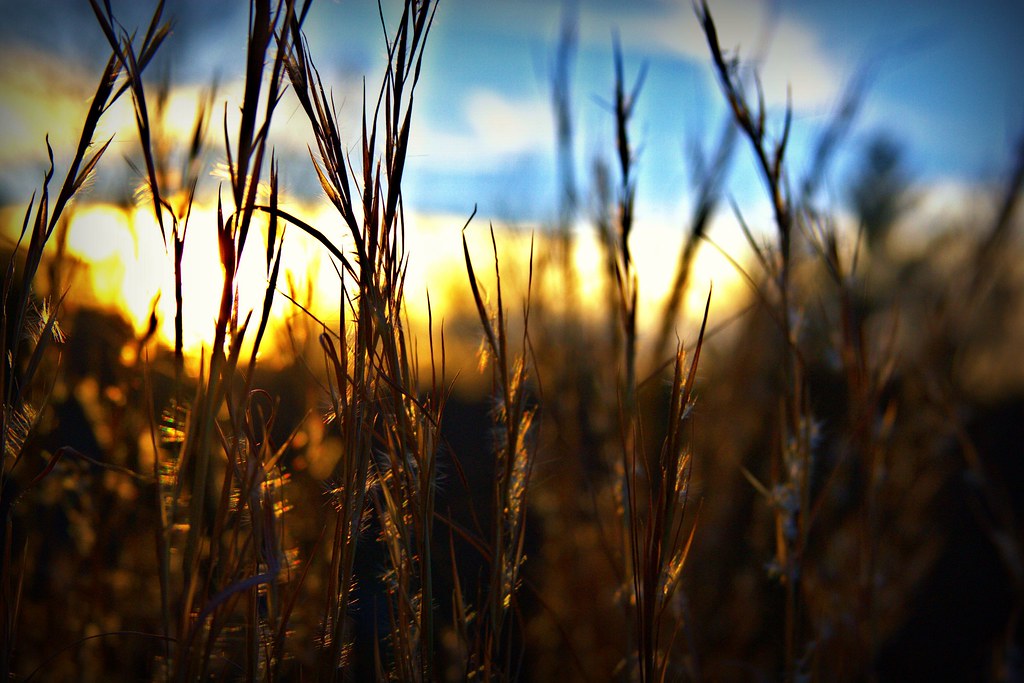
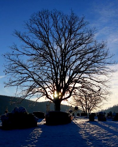
End of a great day!

Spring has sprung

Special Place
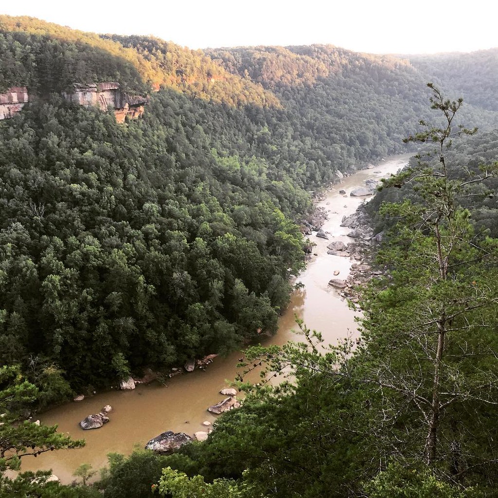
I return to creating #photographs for the #hillClimber series with a weekend trip to the Big South Fork National River and Recreation Area in the #Appalachians in #Tennessee and #Kentucky. We planned a multi-hour #timelapse of the sunset at the Devil's Ju
Sunrise
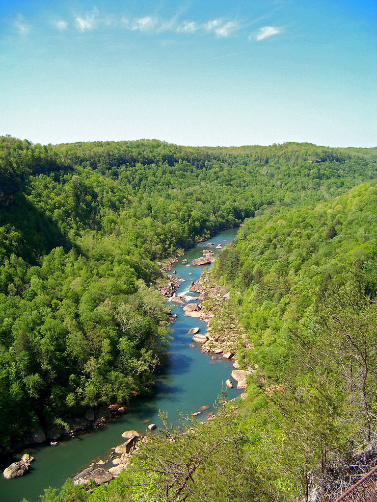
The Devil's Jump Overlook

Kentucky & Tennessee Railway - Rock Creek, McCreary County, Kentucky

Yahoo Falls from inside

Yahoo Falls

2018 10-17 1732 NS SD60E-7026 N/B Winfield, TN

2018 10-14 1853-4 NS-CNJ SD70ACe-1071 S/B Oneida, TN

NS OCS- Winfield, TN

NS OCS- Revelo, KY

The Jewel of Yamacraw

The Jewel of Yamacraw

Stearns, KY

McCreary County Foam Footage

Out of Oneida

DSCF4126, #127, Pine Knot, KY, 10-17-2018
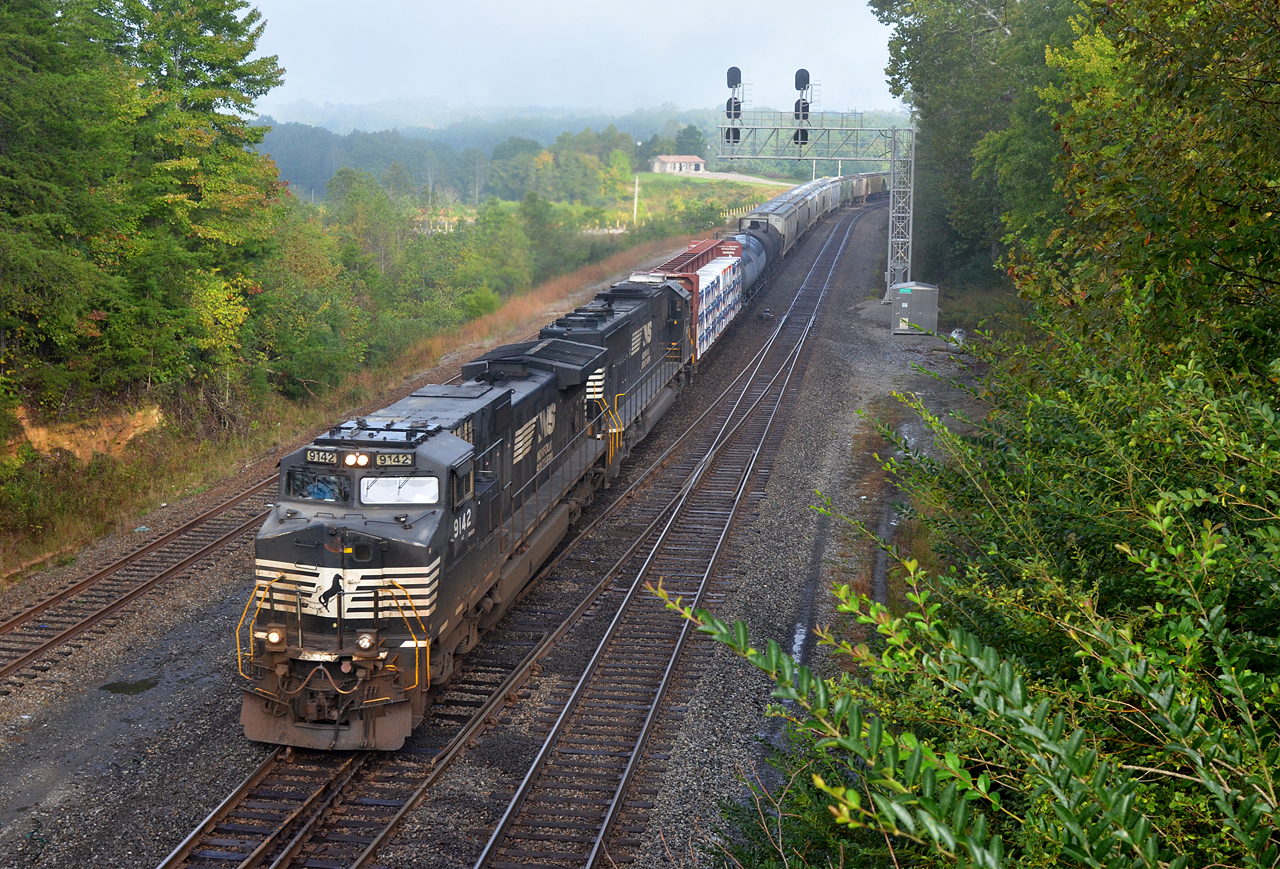
2018 10-17 0941-4 NS C40-9W-9142 S/B 127 Revilo-Stearns, KY

2018 10-14 1608 NS MOW, Winfield, TN

2018 10-14 1736-4 NS C40-9W-9073 S/B Winfield, TN

2018 10-14 1800-4 CNJ-NS SD70ACe-1071 S/B Winfield, TN
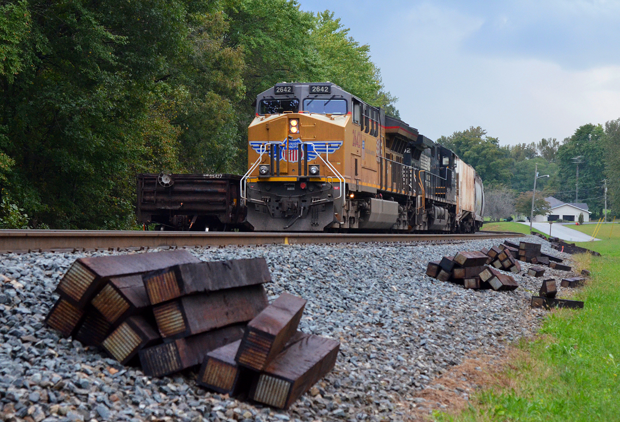
2018 10-14 1831-1 UP ET44AH-2642 N/B on NS Oneida, TN
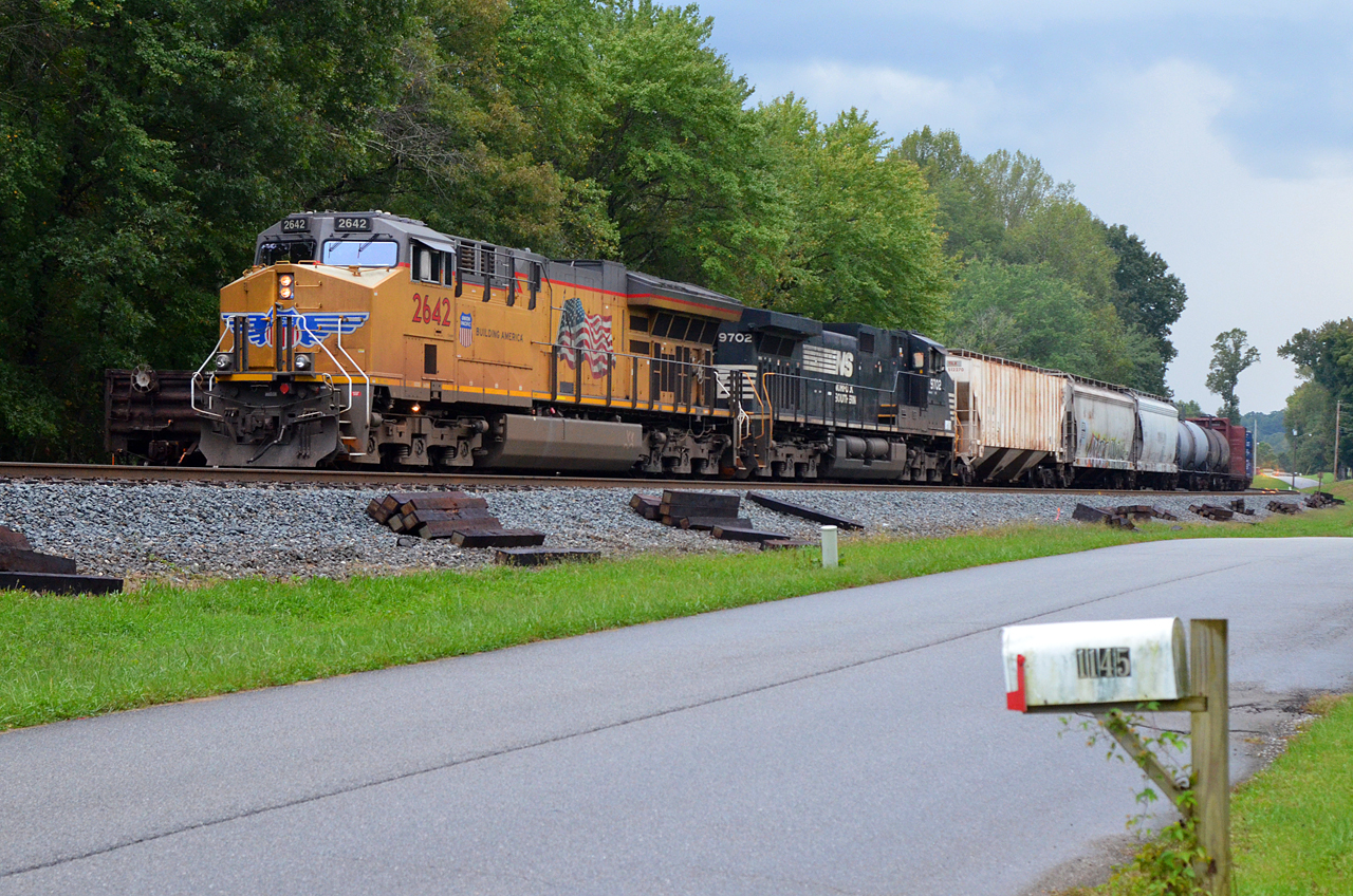
2018 10-14 1832 UP ET44AH-2642 N/B on NS Oneida, TN

2018 10-14 1846 CNJ-NS SD70ACe-1071 S/B Oneida, TN

2018 10-14 1849 NS-CNJ SD70ACe-1071 S/B Oneida, TN

Devils Jump KY
Tom Meadows Road, Tom Meadows Rd, Kentucky, USA Karte
Suchen Sie einen anderen Ort
Nahe Plätze
Pine Knot, KY, USA
Strunk, KY, USA
Scott Hwy, Winfield, TN, USA
McCreary County, Kentucky, USA
Stearns, KY, USA
Leamond Richmond Rd, Pine Knot, KY, USA
Whitley City, Kentucky, USA
Ridge Road, Ridge Rd, Kentucky, USA
56 Cr-, Burnside, KY, USA
Burnside, KY, USA
Alton Rd, Burnside, KY, USA
Lizzie Sharp Road, Lizzie Sharp Rd, Monticello, KY, USA
General Burnside State Park, US-27, Burnside, KY, USA
Burnett Hollow Rd, Monticello, KY, USA
Burnside, KY, USA
Lizzie Sharp, Pall Mall, TN, USA
Bronston, KY, USA
Cooper Power Plant Road, Cooper Power Plant Rd, Kentucky, USA
Taylor Cir, Bronston, KY, USA
45 Dogwood Trail, Somerset, KY, USA
Letzte Suche
- Steamboat Island Road Northwest, Olympia, WA, USA Sonnenaufgang Sonnenuntergang Zeiten
- Kootenai Trail Rd, Bonners Ferry, ID, USA Sonnenaufgang Sonnenuntergang Zeiten
- Mezzovico-Vira, Schweiz Sonnenaufgang Sonnenuntergang Zeiten
- Dawa Gengzha, PPF6+WGM, Baoxing, Ya’an, Sichuan, China Sonnenaufgang Sonnenuntergang Zeiten
- Hickory Blvd, Bonita Springs, FL, USA Sonnenaufgang Sonnenuntergang Zeiten
- Ogbosuware Health Centre, 2WWJ+4PJ, Lalagbene, Bayelsa, Nigeria Sonnenaufgang Sonnenuntergang Zeiten
- Caesar Park Kenting, No. 6號, Kending Rd, Hengchun Township, Pingtung County, Taiwan Sonnenaufgang Sonnenuntergang Zeiten
- Hadiya, Äthiopien Sonnenaufgang Sonnenuntergang Zeiten
- Hosaina, Ethiopia Sonnenaufgang Sonnenuntergang Zeiten
- Necochea, Provinz Buenos Aires, Argentinien Sonnenaufgang Sonnenuntergang Zeiten