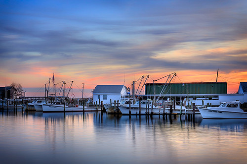
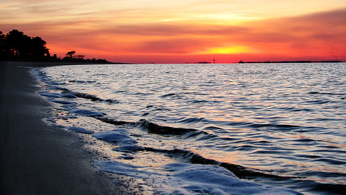
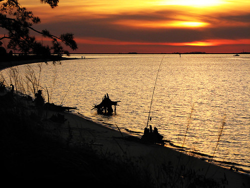
Harrison Point Rd, Deal Island Historic District, MD, USA Sonnenaufgang Sonnenuntergang Zeiten
Location: USA > Maryland > Somerset County > 9 > Chance >
Zeitzone:
America/New_York
Ortszeit:
2024-05-10 10:28:28
Länge:
-75.949685
Breite:
38.174431
Sonnenaufgang Heute:
05:56:34 AM
Sonnenuntergang Heute:
08:03:48 PM
Tageslänge heute:
14h 7m 14s
Sonnenaufgang morgen:
05:55:37 AM
Sonnenuntergang Morgen:
08:04:42 PM
Tageslänge von morgen:
14h 9m 5s
Alle Termine anzeigen
| Datum | Sonnenaufgang | Sonnenuntergang | Tageslänge |
|---|---|---|---|
| 2024-01-01 | 07:20:18 AM | 04:54:48 PM | 9h 34m 30s |
| 2024-01-02 | 07:20:25 AM | 04:55:37 PM | 9h 35m 12s |
| 2024-01-03 | 07:20:30 AM | 04:56:28 PM | 9h 35m 58s |
| 2024-01-04 | 07:20:32 AM | 04:57:20 PM | 9h 36m 48s |
| 2024-01-05 | 07:20:33 AM | 04:58:13 PM | 9h 37m 40s |
| 2024-01-06 | 07:20:31 AM | 04:59:07 PM | 9h 38m 36s |
| 2024-01-07 | 07:20:27 AM | 05:00:02 PM | 9h 39m 35s |
| 2024-01-08 | 07:20:21 AM | 05:00:58 PM | 9h 40m 37s |
| 2024-01-09 | 07:20:13 AM | 05:01:56 PM | 9h 41m 43s |
| 2024-01-10 | 07:20:03 AM | 05:02:54 PM | 9h 42m 51s |
| 2024-01-11 | 07:19:51 AM | 05:03:54 PM | 9h 44m 3s |
| 2024-01-12 | 07:19:37 AM | 05:04:54 PM | 9h 45m 17s |
| 2024-01-13 | 07:19:21 AM | 05:05:55 PM | 9h 46m 34s |
| 2024-01-14 | 07:19:02 AM | 05:06:57 PM | 9h 47m 55s |
| 2024-01-15 | 07:18:42 AM | 05:07:59 PM | 9h 49m 17s |
| 2024-01-16 | 07:18:19 AM | 05:09:03 PM | 9h 50m 44s |
| 2024-01-17 | 07:17:55 AM | 05:10:06 PM | 9h 52m 11s |
| 2024-01-18 | 07:17:28 AM | 05:11:11 PM | 9h 53m 43s |
| 2024-01-19 | 07:17:00 AM | 05:12:16 PM | 9h 55m 16s |
| 2024-01-20 | 07:16:30 AM | 05:13:21 PM | 9h 56m 51s |
| 2024-01-21 | 07:15:57 AM | 05:14:27 PM | 9h 58m 30s |
| 2024-01-22 | 07:15:23 AM | 05:15:33 PM | 10h 0m 10s |
| 2024-01-23 | 07:14:47 AM | 05:16:40 PM | 10h 1m 53s |
| 2024-01-24 | 07:14:09 AM | 05:17:47 PM | 10h 3m 38s |
| 2024-01-25 | 07:13:29 AM | 05:18:54 PM | 10h 5m 25s |
| 2024-01-26 | 07:12:47 AM | 05:20:01 PM | 10h 7m 14s |
| 2024-01-27 | 07:12:04 AM | 05:21:09 PM | 10h 9m 5s |
| 2024-01-28 | 07:11:18 AM | 05:22:16 PM | 10h 10m 58s |
| 2024-01-29 | 07:10:31 AM | 05:23:24 PM | 10h 12m 53s |
| 2024-01-30 | 07:09:43 AM | 05:24:32 PM | 10h 14m 49s |
| 2024-01-31 | 07:08:52 AM | 05:25:40 PM | 10h 16m 48s |
| 2024-02-01 | 07:08:00 AM | 05:26:48 PM | 10h 18m 48s |
| 2024-02-02 | 07:07:07 AM | 05:27:56 PM | 10h 20m 49s |
| 2024-02-03 | 07:06:11 AM | 05:29:04 PM | 10h 22m 53s |
| 2024-02-04 | 07:05:15 AM | 05:30:12 PM | 10h 24m 57s |
| 2024-02-05 | 07:04:16 AM | 05:31:19 PM | 10h 27m 3s |
| 2024-02-06 | 07:03:16 AM | 05:32:27 PM | 10h 29m 11s |
| 2024-02-07 | 07:02:15 AM | 05:33:34 PM | 10h 31m 19s |
| 2024-02-08 | 07:01:13 AM | 05:34:42 PM | 10h 33m 29s |
| 2024-02-09 | 07:00:08 AM | 05:35:49 PM | 10h 35m 41s |
| 2024-02-10 | 06:59:03 AM | 05:36:55 PM | 10h 37m 52s |
| 2024-02-11 | 06:57:56 AM | 05:38:02 PM | 10h 40m 6s |
| 2024-02-12 | 06:56:48 AM | 05:39:09 PM | 10h 42m 21s |
| 2024-02-13 | 06:55:39 AM | 05:40:15 PM | 10h 44m 36s |
| 2024-02-14 | 06:54:29 AM | 05:41:21 PM | 10h 46m 52s |
| 2024-02-15 | 06:53:17 AM | 05:42:26 PM | 10h 49m 9s |
| 2024-02-16 | 06:52:04 AM | 05:43:32 PM | 10h 51m 28s |
| 2024-02-17 | 06:50:50 AM | 05:44:37 PM | 10h 53m 47s |
| 2024-02-18 | 06:49:35 AM | 05:45:42 PM | 10h 56m 7s |
| 2024-02-19 | 06:48:19 AM | 05:46:46 PM | 10h 58m 27s |
| 2024-02-20 | 06:47:02 AM | 05:47:50 PM | 11h 0m 48s |
| 2024-02-21 | 06:45:44 AM | 05:48:54 PM | 11h 3m 10s |
| 2024-02-22 | 06:44:25 AM | 05:49:58 PM | 11h 5m 33s |
| 2024-02-23 | 06:43:05 AM | 05:51:01 PM | 11h 7m 56s |
| 2024-02-24 | 06:41:44 AM | 05:52:04 PM | 11h 10m 20s |
| 2024-02-25 | 06:40:23 AM | 05:53:07 PM | 11h 12m 44s |
| 2024-02-26 | 06:39:00 AM | 05:54:09 PM | 11h 15m 9s |
| 2024-02-27 | 06:37:37 AM | 05:55:11 PM | 11h 17m 34s |
| 2024-02-28 | 06:36:13 AM | 05:56:13 PM | 11h 20m 0s |
| 2024-02-29 | 06:34:48 AM | 05:57:14 PM | 11h 22m 26s |
| 2024-03-01 | 06:33:23 AM | 05:58:15 PM | 11h 24m 52s |
| 2024-03-02 | 06:31:57 AM | 05:59:16 PM | 11h 27m 19s |
| 2024-03-03 | 06:30:30 AM | 06:00:16 PM | 11h 29m 46s |
| 2024-03-04 | 06:29:03 AM | 06:01:16 PM | 11h 32m 13s |
| 2024-03-05 | 06:27:35 AM | 06:02:16 PM | 11h 34m 41s |
| 2024-03-06 | 06:26:07 AM | 06:03:16 PM | 11h 37m 9s |
| 2024-03-07 | 06:24:38 AM | 06:04:15 PM | 11h 39m 37s |
| 2024-03-08 | 06:23:09 AM | 06:05:14 PM | 11h 42m 5s |
| 2024-03-09 | 06:21:39 AM | 06:06:13 PM | 11h 44m 34s |
| 2024-03-10 | 07:20:13 AM | 07:07:09 PM | 11h 46m 56s |
| 2024-03-11 | 07:18:43 AM | 07:08:08 PM | 11h 49m 25s |
| 2024-03-12 | 07:17:12 AM | 07:09:06 PM | 11h 51m 54s |
| 2024-03-13 | 07:15:41 AM | 07:10:04 PM | 11h 54m 23s |
| 2024-03-14 | 07:14:09 AM | 07:11:01 PM | 11h 56m 52s |
| 2024-03-15 | 07:12:38 AM | 07:11:59 PM | 11h 59m 21s |
| 2024-03-16 | 07:11:06 AM | 07:12:56 PM | 12h 1m 50s |
| 2024-03-17 | 07:09:34 AM | 07:13:53 PM | 12h 4m 19s |
| 2024-03-18 | 07:08:02 AM | 07:14:50 PM | 12h 6m 48s |
| 2024-03-19 | 07:06:29 AM | 07:15:47 PM | 12h 9m 18s |
| 2024-03-20 | 07:04:57 AM | 07:16:44 PM | 12h 11m 47s |
| 2024-03-21 | 07:03:25 AM | 07:17:41 PM | 12h 14m 16s |
| 2024-03-22 | 07:01:52 AM | 07:18:37 PM | 12h 16m 45s |
| 2024-03-23 | 07:00:20 AM | 07:19:33 PM | 12h 19m 13s |
| 2024-03-24 | 06:58:47 AM | 07:20:30 PM | 12h 21m 43s |
| 2024-03-25 | 06:57:15 AM | 07:21:26 PM | 12h 24m 11s |
| 2024-03-26 | 06:55:43 AM | 07:22:22 PM | 12h 26m 39s |
| 2024-03-27 | 06:54:10 AM | 07:23:18 PM | 12h 29m 8s |
| 2024-03-28 | 06:52:38 AM | 07:24:14 PM | 12h 31m 36s |
| 2024-03-29 | 06:51:07 AM | 07:25:10 PM | 12h 34m 3s |
| 2024-03-30 | 06:49:35 AM | 07:26:06 PM | 12h 36m 31s |
| 2024-03-31 | 06:48:03 AM | 07:27:01 PM | 12h 38m 58s |
| 2024-04-01 | 06:46:32 AM | 07:27:57 PM | 12h 41m 25s |
| 2024-04-02 | 06:45:01 AM | 07:28:53 PM | 12h 43m 52s |
| 2024-04-03 | 06:43:31 AM | 07:29:49 PM | 12h 46m 18s |
| 2024-04-04 | 06:42:01 AM | 07:30:45 PM | 12h 48m 44s |
| 2024-04-05 | 06:40:31 AM | 07:31:40 PM | 12h 51m 9s |
| 2024-04-06 | 06:39:02 AM | 07:32:36 PM | 12h 53m 34s |
| 2024-04-07 | 06:37:33 AM | 07:33:32 PM | 12h 55m 59s |
| 2024-04-08 | 06:36:04 AM | 07:34:28 PM | 12h 58m 24s |
| 2024-04-09 | 06:34:36 AM | 07:35:24 PM | 13h 0m 48s |
| 2024-04-10 | 06:33:09 AM | 07:36:20 PM | 13h 3m 11s |
| 2024-04-11 | 06:31:42 AM | 07:37:16 PM | 13h 5m 34s |
| 2024-04-12 | 06:30:16 AM | 07:38:11 PM | 13h 7m 55s |
| 2024-04-13 | 06:28:50 AM | 07:39:07 PM | 13h 10m 17s |
| 2024-04-14 | 06:27:25 AM | 07:40:03 PM | 13h 12m 38s |
| 2024-04-15 | 06:26:01 AM | 07:41:00 PM | 13h 14m 59s |
| 2024-04-16 | 06:24:37 AM | 07:41:56 PM | 13h 17m 19s |
| 2024-04-17 | 06:23:14 AM | 07:42:52 PM | 13h 19m 38s |
| 2024-04-18 | 06:21:52 AM | 07:43:48 PM | 13h 21m 56s |
| 2024-04-19 | 06:20:31 AM | 07:44:44 PM | 13h 24m 13s |
| 2024-04-20 | 06:19:11 AM | 07:45:40 PM | 13h 26m 29s |
| 2024-04-21 | 06:17:51 AM | 07:46:37 PM | 13h 28m 46s |
| 2024-04-22 | 06:16:33 AM | 07:47:33 PM | 13h 31m 0s |
| 2024-04-23 | 06:15:15 AM | 07:48:29 PM | 13h 33m 14s |
| 2024-04-24 | 06:13:58 AM | 07:49:26 PM | 13h 35m 28s |
| 2024-04-25 | 06:12:42 AM | 07:50:22 PM | 13h 37m 40s |
| 2024-04-26 | 06:11:28 AM | 07:51:18 PM | 13h 39m 50s |
| 2024-04-27 | 06:10:14 AM | 07:52:14 PM | 13h 42m 0s |
| 2024-04-28 | 06:09:01 AM | 07:53:10 PM | 13h 44m 9s |
| 2024-04-29 | 06:07:50 AM | 07:54:07 PM | 13h 46m 17s |
| 2024-04-30 | 06:06:40 AM | 07:55:03 PM | 13h 48m 23s |
| 2024-05-01 | 06:05:30 AM | 07:55:59 PM | 13h 50m 29s |
| 2024-05-02 | 06:04:22 AM | 07:56:54 PM | 13h 52m 32s |
| 2024-05-03 | 06:03:16 AM | 07:57:50 PM | 13h 54m 34s |
| 2024-05-04 | 06:02:10 AM | 07:58:46 PM | 13h 56m 36s |
| 2024-05-05 | 06:01:06 AM | 07:59:41 PM | 13h 58m 35s |
| 2024-05-06 | 06:00:03 AM | 08:00:36 PM | 14h 0m 33s |
| 2024-05-07 | 05:59:01 AM | 08:01:32 PM | 14h 2m 31s |
| 2024-05-08 | 05:58:01 AM | 08:02:26 PM | 14h 4m 25s |
| 2024-05-09 | 05:57:02 AM | 08:03:21 PM | 14h 6m 19s |
| 2024-05-10 | 05:56:05 AM | 08:04:15 PM | 14h 8m 10s |
| 2024-05-11 | 05:55:09 AM | 08:05:09 PM | 14h 10m 0s |
| 2024-05-12 | 05:54:15 AM | 08:06:03 PM | 14h 11m 48s |
| 2024-05-13 | 05:53:22 AM | 08:06:56 PM | 14h 13m 34s |
| 2024-05-14 | 05:52:30 AM | 08:07:49 PM | 14h 15m 19s |
| 2024-05-15 | 05:51:40 AM | 08:08:42 PM | 14h 17m 2s |
| 2024-05-16 | 05:50:52 AM | 08:09:34 PM | 14h 18m 42s |
| 2024-05-17 | 05:50:05 AM | 08:10:25 PM | 14h 20m 20s |
| 2024-05-18 | 05:49:20 AM | 08:11:16 PM | 14h 21m 56s |
| 2024-05-19 | 05:48:37 AM | 08:12:07 PM | 14h 23m 30s |
| 2024-05-20 | 05:47:55 AM | 08:12:56 PM | 14h 25m 1s |
| 2024-05-21 | 05:47:15 AM | 08:13:46 PM | 14h 26m 31s |
| 2024-05-22 | 05:46:36 AM | 08:14:34 PM | 14h 27m 58s |
| 2024-05-23 | 05:46:00 AM | 08:15:22 PM | 14h 29m 22s |
| 2024-05-24 | 05:45:25 AM | 08:16:09 PM | 14h 30m 44s |
| 2024-05-25 | 05:44:51 AM | 08:16:56 PM | 14h 32m 5s |
| 2024-05-26 | 05:44:20 AM | 08:17:41 PM | 14h 33m 21s |
| 2024-05-27 | 05:43:50 AM | 08:18:26 PM | 14h 34m 36s |
| 2024-05-28 | 05:43:22 AM | 08:19:10 PM | 14h 35m 48s |
| 2024-05-29 | 05:42:56 AM | 08:19:53 PM | 14h 36m 57s |
| 2024-05-30 | 05:42:32 AM | 08:20:35 PM | 14h 38m 3s |
| 2024-05-31 | 05:42:09 AM | 08:21:16 PM | 14h 39m 7s |
| 2024-06-01 | 05:41:49 AM | 08:21:56 PM | 14h 40m 7s |
| 2024-06-02 | 05:41:30 AM | 08:22:34 PM | 14h 41m 4s |
| 2024-06-03 | 05:41:13 AM | 08:23:12 PM | 14h 41m 59s |
| 2024-06-04 | 05:40:58 AM | 08:23:49 PM | 14h 42m 51s |
| 2024-06-05 | 05:40:44 AM | 08:24:24 PM | 14h 43m 40s |
| 2024-06-06 | 05:40:33 AM | 08:24:58 PM | 14h 44m 25s |
| 2024-06-07 | 05:40:23 AM | 08:25:31 PM | 14h 45m 8s |
| 2024-06-08 | 05:40:15 AM | 08:26:02 PM | 14h 45m 47s |
| 2024-06-09 | 05:40:09 AM | 08:26:32 PM | 14h 46m 23s |
| 2024-06-10 | 05:40:05 AM | 08:27:01 PM | 14h 46m 56s |
| 2024-06-11 | 05:40:02 AM | 08:27:28 PM | 14h 47m 26s |
| 2024-06-12 | 05:40:02 AM | 08:27:54 PM | 14h 47m 52s |
| 2024-06-13 | 05:40:03 AM | 08:28:18 PM | 14h 48m 15s |
| 2024-06-14 | 05:40:06 AM | 08:28:41 PM | 14h 48m 35s |
| 2024-06-15 | 05:40:10 AM | 08:29:02 PM | 14h 48m 52s |
| 2024-06-16 | 05:40:17 AM | 08:29:22 PM | 14h 49m 5s |
| 2024-06-17 | 05:40:25 AM | 08:29:40 PM | 14h 49m 15s |
| 2024-06-18 | 05:40:34 AM | 08:29:56 PM | 14h 49m 22s |
| 2024-06-19 | 05:40:46 AM | 08:30:11 PM | 14h 49m 25s |
| 2024-06-20 | 05:40:59 AM | 08:30:24 PM | 14h 49m 25s |
| 2024-06-21 | 05:41:14 AM | 08:30:35 PM | 14h 49m 21s |
| 2024-06-22 | 05:41:30 AM | 08:30:45 PM | 14h 49m 15s |
| 2024-06-23 | 05:41:48 AM | 08:30:53 PM | 14h 49m 5s |
| 2024-06-24 | 05:42:07 AM | 08:30:59 PM | 14h 48m 52s |
| 2024-06-25 | 05:42:28 AM | 08:31:03 PM | 14h 48m 35s |
| 2024-06-26 | 05:42:51 AM | 08:31:06 PM | 14h 48m 15s |
| 2024-06-27 | 05:43:15 AM | 08:31:06 PM | 14h 47m 51s |
| 2024-06-28 | 05:43:40 AM | 08:31:05 PM | 14h 47m 25s |
| 2024-06-29 | 05:44:07 AM | 08:31:02 PM | 14h 46m 55s |
| 2024-06-30 | 05:44:35 AM | 08:30:57 PM | 14h 46m 22s |
| 2024-07-01 | 05:45:04 AM | 08:30:50 PM | 14h 45m 46s |
| 2024-07-02 | 05:45:35 AM | 08:30:42 PM | 14h 45m 7s |
| 2024-07-03 | 05:46:07 AM | 08:30:31 PM | 14h 44m 24s |
| 2024-07-04 | 05:46:40 AM | 08:30:19 PM | 14h 43m 39s |
| 2024-07-05 | 05:47:14 AM | 08:30:05 PM | 14h 42m 51s |
| 2024-07-06 | 05:47:49 AM | 08:29:48 PM | 14h 41m 59s |
| 2024-07-07 | 05:48:26 AM | 08:29:30 PM | 14h 41m 4s |
| 2024-07-08 | 05:49:03 AM | 08:29:11 PM | 14h 40m 8s |
| 2024-07-09 | 05:49:42 AM | 08:28:49 PM | 14h 39m 7s |
| 2024-07-10 | 05:50:21 AM | 08:28:25 PM | 14h 38m 4s |
| 2024-07-11 | 05:51:02 AM | 08:28:00 PM | 14h 36m 58s |
| 2024-07-12 | 05:51:43 AM | 08:27:33 PM | 14h 35m 50s |
| 2024-07-13 | 05:52:25 AM | 08:27:03 PM | 14h 34m 38s |
| 2024-07-14 | 05:53:08 AM | 08:26:33 PM | 14h 33m 25s |
| 2024-07-15 | 05:53:52 AM | 08:26:00 PM | 14h 32m 8s |
| 2024-07-16 | 05:54:37 AM | 08:25:25 PM | 14h 30m 48s |
| 2024-07-17 | 05:55:22 AM | 08:24:49 PM | 14h 29m 27s |
| 2024-07-18 | 05:56:08 AM | 08:24:11 PM | 14h 28m 3s |
| 2024-07-19 | 05:56:54 AM | 08:23:31 PM | 14h 26m 37s |
| 2024-07-20 | 05:57:41 AM | 08:22:50 PM | 14h 25m 9s |
| 2024-07-21 | 05:58:29 AM | 08:22:07 PM | 14h 23m 38s |
| 2024-07-22 | 05:59:17 AM | 08:21:22 PM | 14h 22m 5s |
| 2024-07-23 | 06:00:06 AM | 08:20:35 PM | 14h 20m 29s |
| 2024-07-24 | 06:00:55 AM | 08:19:47 PM | 14h 18m 52s |
| 2024-07-25 | 06:01:44 AM | 08:18:58 PM | 14h 17m 14s |
| 2024-07-26 | 06:02:34 AM | 08:18:06 PM | 14h 15m 32s |
| 2024-07-27 | 06:03:24 AM | 08:17:13 PM | 14h 13m 49s |
| 2024-07-28 | 06:04:15 AM | 08:16:19 PM | 14h 12m 4s |
| 2024-07-29 | 06:05:06 AM | 08:15:23 PM | 14h 10m 17s |
| 2024-07-30 | 06:05:57 AM | 08:14:26 PM | 14h 8m 29s |
| 2024-07-31 | 06:06:48 AM | 08:13:27 PM | 14h 6m 39s |
| 2024-08-01 | 06:07:40 AM | 08:12:26 PM | 14h 4m 46s |
| 2024-08-02 | 06:08:32 AM | 08:11:25 PM | 14h 2m 53s |
| 2024-08-03 | 06:09:24 AM | 08:10:21 PM | 14h 0m 57s |
| 2024-08-04 | 06:10:16 AM | 08:09:17 PM | 13h 59m 1s |
| 2024-08-05 | 06:11:08 AM | 08:08:11 PM | 13h 57m 3s |
| 2024-08-06 | 06:12:01 AM | 08:07:04 PM | 13h 55m 3s |
| 2024-08-07 | 06:12:53 AM | 08:05:56 PM | 13h 53m 3s |
| 2024-08-08 | 06:13:46 AM | 08:04:46 PM | 13h 51m 0s |
| 2024-08-09 | 06:14:38 AM | 08:03:35 PM | 13h 48m 57s |
| 2024-08-10 | 06:15:31 AM | 08:02:23 PM | 13h 46m 52s |
| 2024-08-11 | 06:16:23 AM | 08:01:10 PM | 13h 44m 47s |
| 2024-08-12 | 06:17:16 AM | 07:59:56 PM | 13h 42m 40s |
| 2024-08-13 | 06:18:09 AM | 07:58:41 PM | 13h 40m 32s |
| 2024-08-14 | 06:19:01 AM | 07:57:24 PM | 13h 38m 23s |
| 2024-08-15 | 06:19:54 AM | 07:56:07 PM | 13h 36m 13s |
| 2024-08-16 | 06:20:47 AM | 07:54:48 PM | 13h 34m 1s |
| 2024-08-17 | 06:21:39 AM | 07:53:29 PM | 13h 31m 50s |
| 2024-08-18 | 06:22:32 AM | 07:52:09 PM | 13h 29m 37s |
| 2024-08-19 | 06:23:24 AM | 07:50:48 PM | 13h 27m 24s |
| 2024-08-20 | 06:24:17 AM | 07:49:25 PM | 13h 25m 8s |
| 2024-08-21 | 06:25:09 AM | 07:48:02 PM | 13h 22m 53s |
| 2024-08-22 | 06:26:01 AM | 07:46:39 PM | 13h 20m 38s |
| 2024-08-23 | 06:26:53 AM | 07:45:14 PM | 13h 18m 21s |
| 2024-08-24 | 06:27:45 AM | 07:43:49 PM | 13h 16m 4s |
| 2024-08-25 | 06:28:38 AM | 07:42:23 PM | 13h 13m 45s |
| 2024-08-26 | 06:29:30 AM | 07:40:56 PM | 13h 11m 26s |
| 2024-08-27 | 06:30:21 AM | 07:39:29 PM | 13h 9m 8s |
| 2024-08-28 | 06:31:13 AM | 07:38:01 PM | 13h 6m 48s |
| 2024-08-29 | 06:32:05 AM | 07:36:32 PM | 13h 4m 27s |
| 2024-08-30 | 06:32:57 AM | 07:35:03 PM | 13h 2m 6s |
| 2024-08-31 | 06:33:49 AM | 07:33:33 PM | 12h 59m 44s |
| 2024-09-01 | 06:34:40 AM | 07:32:02 PM | 12h 57m 22s |
| 2024-09-02 | 06:35:32 AM | 07:30:32 PM | 12h 55m 0s |
| 2024-09-03 | 06:36:23 AM | 07:29:00 PM | 12h 52m 37s |
| 2024-09-04 | 06:37:15 AM | 07:27:29 PM | 12h 50m 14s |
| 2024-09-05 | 06:38:06 AM | 07:25:57 PM | 12h 47m 51s |
| 2024-09-06 | 06:38:58 AM | 07:24:24 PM | 12h 45m 26s |
| 2024-09-07 | 06:39:49 AM | 07:22:51 PM | 12h 43m 2s |
| 2024-09-08 | 06:40:40 AM | 07:21:18 PM | 12h 40m 38s |
| 2024-09-09 | 06:41:32 AM | 07:19:45 PM | 12h 38m 13s |
| 2024-09-10 | 06:42:23 AM | 07:18:11 PM | 12h 35m 48s |
| 2024-09-11 | 06:43:15 AM | 07:16:37 PM | 12h 33m 22s |
| 2024-09-12 | 06:44:06 AM | 07:15:03 PM | 12h 30m 57s |
| 2024-09-13 | 06:44:58 AM | 07:13:29 PM | 12h 28m 31s |
| 2024-09-14 | 06:45:49 AM | 07:11:54 PM | 12h 26m 5s |
| 2024-09-15 | 06:46:41 AM | 07:10:20 PM | 12h 23m 39s |
| 2024-09-16 | 06:47:33 AM | 07:08:45 PM | 12h 21m 12s |
| 2024-09-17 | 06:48:24 AM | 07:07:11 PM | 12h 18m 47s |
| 2024-09-18 | 06:49:16 AM | 07:05:36 PM | 12h 16m 20s |
| 2024-09-19 | 06:50:08 AM | 07:04:01 PM | 12h 13m 53s |
| 2024-09-20 | 06:51:00 AM | 07:02:27 PM | 12h 11m 27s |
| 2024-09-21 | 06:51:53 AM | 07:00:52 PM | 12h 8m 59s |
| 2024-09-22 | 06:52:45 AM | 06:59:18 PM | 12h 6m 33s |
| 2024-09-23 | 06:53:38 AM | 06:57:43 PM | 12h 4m 5s |
| 2024-09-24 | 06:54:30 AM | 06:56:09 PM | 12h 1m 39s |
| 2024-09-25 | 06:55:23 AM | 06:54:35 PM | 11h 59m 12s |
| 2024-09-26 | 06:56:16 AM | 06:53:01 PM | 11h 56m 45s |
| 2024-09-27 | 06:57:09 AM | 06:51:28 PM | 11h 54m 19s |
| 2024-09-28 | 06:58:03 AM | 06:49:54 PM | 11h 51m 51s |
| 2024-09-29 | 06:58:57 AM | 06:48:21 PM | 11h 49m 24s |
| 2024-09-30 | 06:59:50 AM | 06:46:49 PM | 11h 46m 59s |
| 2024-10-01 | 07:00:45 AM | 06:45:16 PM | 11h 44m 31s |
| 2024-10-02 | 07:01:39 AM | 06:43:44 PM | 11h 42m 5s |
| 2024-10-03 | 07:02:34 AM | 06:42:13 PM | 11h 39m 39s |
| 2024-10-04 | 07:03:29 AM | 06:40:42 PM | 11h 37m 13s |
| 2024-10-05 | 07:04:24 AM | 06:39:11 PM | 11h 34m 47s |
| 2024-10-06 | 07:05:19 AM | 06:37:41 PM | 11h 32m 22s |
| 2024-10-07 | 07:06:15 AM | 06:36:12 PM | 11h 29m 57s |
| 2024-10-08 | 07:07:11 AM | 06:34:43 PM | 11h 27m 32s |
| 2024-10-09 | 07:08:07 AM | 06:33:15 PM | 11h 25m 8s |
| 2024-10-10 | 07:09:04 AM | 06:31:47 PM | 11h 22m 43s |
| 2024-10-11 | 07:10:01 AM | 06:30:20 PM | 11h 20m 19s |
| 2024-10-12 | 07:10:59 AM | 06:28:54 PM | 11h 17m 55s |
| 2024-10-13 | 07:11:56 AM | 06:27:28 PM | 11h 15m 32s |
| 2024-10-14 | 07:12:54 AM | 06:26:04 PM | 11h 13m 10s |
| 2024-10-15 | 07:13:53 AM | 06:24:40 PM | 11h 10m 47s |
| 2024-10-16 | 07:14:51 AM | 06:23:16 PM | 11h 8m 25s |
| 2024-10-17 | 07:15:50 AM | 06:21:54 PM | 11h 6m 4s |
| 2024-10-18 | 07:16:50 AM | 06:20:33 PM | 11h 3m 43s |
| 2024-10-19 | 07:17:49 AM | 06:19:12 PM | 11h 1m 23s |
| 2024-10-20 | 07:18:49 AM | 06:17:53 PM | 10h 59m 4s |
| 2024-10-21 | 07:19:50 AM | 06:16:35 PM | 10h 56m 45s |
| 2024-10-22 | 07:20:51 AM | 06:15:17 PM | 10h 54m 26s |
| 2024-10-23 | 07:21:52 AM | 06:14:01 PM | 10h 52m 9s |
| 2024-10-24 | 07:22:53 AM | 06:12:46 PM | 10h 49m 53s |
| 2024-10-25 | 07:23:55 AM | 06:11:31 PM | 10h 47m 36s |
| 2024-10-26 | 07:24:57 AM | 06:10:18 PM | 10h 45m 21s |
| 2024-10-27 | 07:25:59 AM | 06:09:07 PM | 10h 43m 8s |
| 2024-10-28 | 07:27:02 AM | 06:07:56 PM | 10h 40m 54s |
| 2024-10-29 | 07:28:05 AM | 06:06:47 PM | 10h 38m 42s |
| 2024-10-30 | 07:29:08 AM | 06:05:39 PM | 10h 36m 31s |
| 2024-10-31 | 07:30:11 AM | 06:04:32 PM | 10h 34m 21s |
| 2024-11-01 | 07:31:15 AM | 06:03:27 PM | 10h 32m 12s |
| 2024-11-02 | 07:32:19 AM | 06:02:23 PM | 10h 30m 4s |
| 2024-11-03 | 06:33:26 AM | 05:01:18 PM | 10h 27m 52s |
| 2024-11-04 | 06:34:30 AM | 05:00:17 PM | 10h 25m 47s |
| 2024-11-05 | 06:35:34 AM | 04:59:18 PM | 10h 23m 44s |
| 2024-11-06 | 06:36:39 AM | 04:58:20 PM | 10h 21m 41s |
| 2024-11-07 | 06:37:43 AM | 04:57:24 PM | 10h 19m 41s |
| 2024-11-08 | 06:38:48 AM | 04:56:29 PM | 10h 17m 41s |
| 2024-11-09 | 06:39:53 AM | 04:55:36 PM | 10h 15m 43s |
| 2024-11-10 | 06:40:58 AM | 04:54:45 PM | 10h 13m 47s |
| 2024-11-11 | 06:42:03 AM | 04:53:55 PM | 10h 11m 52s |
| 2024-11-12 | 06:43:08 AM | 04:53:07 PM | 10h 9m 59s |
| 2024-11-13 | 06:44:12 AM | 04:52:21 PM | 10h 8m 9s |
| 2024-11-14 | 06:45:17 AM | 04:51:37 PM | 10h 6m 20s |
| 2024-11-15 | 06:46:22 AM | 04:50:54 PM | 10h 4m 32s |
| 2024-11-16 | 06:47:26 AM | 04:50:13 PM | 10h 2m 47s |
| 2024-11-17 | 06:48:30 AM | 04:49:35 PM | 10h 1m 5s |
| 2024-11-18 | 06:49:34 AM | 04:48:58 PM | 9h 59m 24s |
| 2024-11-19 | 06:50:38 AM | 04:48:23 PM | 9h 57m 45s |
| 2024-11-20 | 06:51:41 AM | 04:47:50 PM | 9h 56m 9s |
| 2024-11-21 | 06:52:44 AM | 04:47:18 PM | 9h 54m 34s |
| 2024-11-22 | 06:53:46 AM | 04:46:49 PM | 9h 53m 3s |
| 2024-11-23 | 06:54:48 AM | 04:46:22 PM | 9h 51m 34s |
| 2024-11-24 | 06:55:50 AM | 04:45:57 PM | 9h 50m 7s |
| 2024-11-25 | 06:56:51 AM | 04:45:34 PM | 9h 48m 43s |
| 2024-11-26 | 06:57:51 AM | 04:45:13 PM | 9h 47m 22s |
| 2024-11-27 | 06:58:51 AM | 04:44:54 PM | 9h 46m 3s |
| 2024-11-28 | 06:59:50 AM | 04:44:37 PM | 9h 44m 47s |
| 2024-11-29 | 07:00:48 AM | 04:44:23 PM | 9h 43m 35s |
| 2024-11-30 | 07:01:46 AM | 04:44:10 PM | 9h 42m 24s |
| 2024-12-01 | 07:02:42 AM | 04:44:00 PM | 9h 41m 18s |
| 2024-12-02 | 07:03:38 AM | 04:43:51 PM | 9h 40m 13s |
| 2024-12-03 | 07:04:32 AM | 04:43:45 PM | 9h 39m 13s |
| 2024-12-04 | 07:05:26 AM | 04:43:41 PM | 9h 38m 15s |
| 2024-12-05 | 07:06:19 AM | 04:43:39 PM | 9h 37m 20s |
| 2024-12-06 | 07:07:10 AM | 04:43:40 PM | 9h 36m 30s |
| 2024-12-07 | 07:08:00 AM | 04:43:42 PM | 9h 35m 42s |
| 2024-12-08 | 07:08:49 AM | 04:43:47 PM | 9h 34m 58s |
| 2024-12-09 | 07:09:37 AM | 04:43:53 PM | 9h 34m 16s |
| 2024-12-10 | 07:10:24 AM | 04:44:02 PM | 9h 33m 38s |
| 2024-12-11 | 07:11:09 AM | 04:44:13 PM | 9h 33m 4s |
| 2024-12-12 | 07:11:52 AM | 04:44:26 PM | 9h 32m 34s |
| 2024-12-13 | 07:12:35 AM | 04:44:41 PM | 9h 32m 6s |
| 2024-12-14 | 07:13:15 AM | 04:44:58 PM | 9h 31m 43s |
| 2024-12-15 | 07:13:54 AM | 04:45:17 PM | 9h 31m 23s |
| 2024-12-16 | 07:14:32 AM | 04:45:38 PM | 9h 31m 6s |
| 2024-12-17 | 07:15:08 AM | 04:46:02 PM | 9h 30m 54s |
| 2024-12-18 | 07:15:42 AM | 04:46:27 PM | 9h 30m 45s |
| 2024-12-19 | 07:16:14 AM | 04:46:54 PM | 9h 30m 40s |
| 2024-12-20 | 07:16:45 AM | 04:47:23 PM | 9h 30m 38s |
| 2024-12-21 | 07:17:14 AM | 04:47:53 PM | 9h 30m 39s |
| 2024-12-22 | 07:17:41 AM | 04:48:26 PM | 9h 30m 45s |
| 2024-12-23 | 07:18:06 AM | 04:49:01 PM | 9h 30m 55s |
| 2024-12-24 | 07:18:29 AM | 04:49:37 PM | 9h 31m 8s |
| 2024-12-25 | 07:18:50 AM | 04:50:15 PM | 9h 31m 25s |
| 2024-12-26 | 07:19:10 AM | 04:50:54 PM | 9h 31m 44s |
| 2024-12-27 | 07:19:27 AM | 04:51:36 PM | 9h 32m 9s |
| 2024-12-28 | 07:19:42 AM | 04:52:19 PM | 9h 32m 37s |
| 2024-12-29 | 07:19:56 AM | 04:53:03 PM | 9h 33m 7s |
| 2024-12-30 | 07:20:07 AM | 04:53:49 PM | 9h 33m 42s |
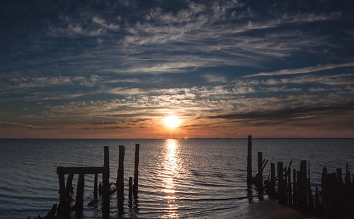
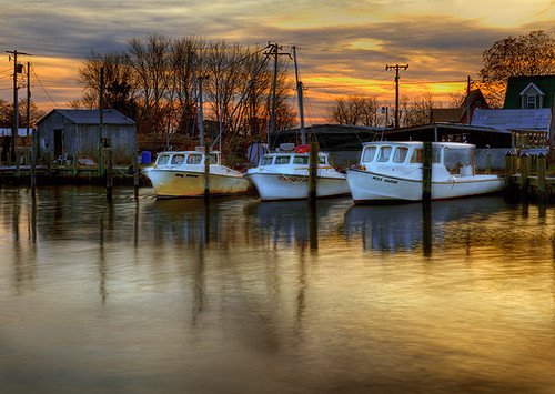
Fotos
Harrison Point Rd, Deal Island Historic District, MD, USA Karte
Suchen Sie einen anderen Ort
Nahe Plätze
Harrison Point Road, Harrison Point Rd, Chance, MD, USA
Chance, MD, USA
Deal Island, MD, USA
Deal Island Rd, Deal Island, MD, USA
9, Tangier, MD, USA
Custom House Rd, Deal Island, MD, USA
14, Deal Island, MD, USA
18, Elliott, MD, USA
Crocheron, MD, USA
Phillps Gunning Club Rd, Crocheron, MD, USA
Bishops Head Rd, Crocheron, MD, USA
10, Straits, MD, USA
Elliott Island Rd, Vienna, MD, USA
Elliott Island Rd, Vienna, MD, USA
Wingate Bishops Head Rd, Wingate, MD, USA
Toddville, MD, USA
Toddville Rd, Toddville, MD, USA
10, Smith Island, MD, USA
Caleb Jones Rd, Ewell, MD, USA
Ewell, Smith Island, MD, USA
Letzte Suche
- Moresby Island, North Coast, BC V0T, Canada Sonnenaufgang Sonnenuntergang Zeiten
- Aliağa, Samurlu, Aliağa/Izmir, Türkei Sonnenaufgang Sonnenuntergang Zeiten
- Taiwan, 台南市安南區幸福里 Sonnenaufgang Sonnenuntergang Zeiten
- Lane 55, Guo'an Street & Guo'an Street, Lane 55, Guo'an St & Guo'an St, Annan District, Tainan City, Sonnenaufgang Sonnenuntergang Zeiten
- Kariega, South Africa Sonnenaufgang Sonnenuntergang Zeiten
- Brooks Lp, Spearfish, SD, USA Sonnenaufgang Sonnenuntergang Zeiten
- Via Buonarroti, 26, Roma RM, Italien Sonnenaufgang Sonnenuntergang Zeiten
- Jais St - Wadi Shehah - Ras al Khaimah - United Arab Emirates Sonnenaufgang Sonnenuntergang Zeiten
- Benagil, Carvoeiro, Portugal Sonnenaufgang Sonnenuntergang Zeiten
- W Prive Cir, Delray Beach, FL, USA Sonnenaufgang Sonnenuntergang Zeiten
